DW101-237 Day Two.qxp_Layout 1 23/04/2021 11:30 Page 151
470 England & Wales. Moll (Herman), The South part of Great Britain called England and Wales..., Philip Overton, circa 1715, engraved map with contemporary outline colouring on two conjoined sheets, large uncoloured allegorical cartouche, old folds, narrow margins, 610 x 980mm
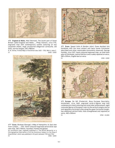
472 Essex. Speed (John & Norden John), Essex devided into Hundreds with the most antient and fayre towne Colchester described and other memorable monuments observed, George Humble, circa 1627, hand-coloured engraved map, an inset town plan of Colchester, central fold torn and crudely repaired on verso, 385 x 510mm, English text on verso
R. W. Shirley. Printed Maps of the British Isles 1650 - 1750. Moll 6, state 2. (1) £200 - £300
(1)
£100 - £200
473 Europe. De Wit (Frederick), Nova Europae Descriptio, Amsterdam, circa 1660, engraved carte-a-figures map with contemporary hand colouring and some later enhancement, eight costumed figures of European rulers to the vertical margins and six oval vignettes of principal cities along the upper horizontal margin, two additional vertical folds, folds strengthened and repaired on verso, 440 x 555mm (1)
471* Essex. Bickham (George), A Map of Hampshire. N. East view from London..., 1752, hand-coloured engraved aerial birds-eye view map, 260 x 155mm, mounted, framed and glazed An uncommon map, originally published in ‘The British Monarchy or a Chrongraphical Description of all the Dominions Subject to the King of Great Britain’ which was published in 25 parts between 1743 and 1754. (1) £100 - £200
151
£700 - £1,000