263 Western Hemisphere. Un-attributed map, n.d., c.1780, uncoloured map on a hemispheral projection, allegorical vignettes in each corner, backed with archival tissue, 300 x 300mm, together with Tirion (Isaak), Land-Kaart van het Eiland en de Volkplanting can Cayenne aan de Kust van Zuid-Amerika, c.1766,uncoloured engraved map, inset town plan of Cayenne, old folds, 365 x 420mm (2)
£100-150
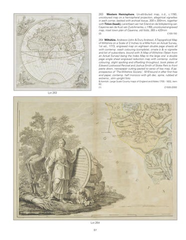
264 Wiltshire. Andrews (John & Dury Andrew), A Topograhical Map of Wiltshire on a Scale of 2 Inches to a Mile from an Actual Survey, 1st ed., 1773, engraved map on eighteen double page sheets all with contemp. wash colouring (complete), ornate b & w vignette and list of subscribers, bound with ‘A Map of Wiltshire (Taken from an Actual Survey) being the Index Map to the large one’ a double page single sheet engraved reduction map with contemp. outline colouring, slight spotting and offsetting throughout, book plates of Edward Lockwood Percival and Joshua Smith of Stoke Park to front paste down, newspaper cutting pasted to verso of key map, 8 pp. prospectus of ‘The Wiltshire Society’, 1819 bound in after first free end paper, contemp. half morocco with gilt dec. spine, rubbed at extrems., slim upright folio B.Kentish. Large Scale County maps of England and Wales 1705 - 1832, item 62. (1) £1500-2000
Lot 263
Lot 264 67