events in the cockpit and the passenger cabin could be linked to controllers and authorities on the ground through secure satellite connections. This data would be integrated with aircraft intent and performance data as well as air traffic, weather and terrain data. The CIN would instantly and simultaneously provide the
New flight plans could be issued to the aircraft that are already airborne to assist in a safe and orderly response to the crisis. The CIN could also be used to add another layer of safety to the flying experience by enabling system-wide
a change in an aircraft's intended route, altitude, speed or other indicators. Controllers will be able to represent graphically an aircraft's trajectory in real time, enabling them to project its future position accurately up to forty minutes in advance. This will make potential conflicts much easier to spot and resolve while
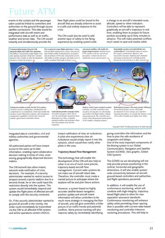
~t'\\' s,·st<'lll l(',·eraµ,rs lliµ,ht p:.lth d:Ha. Linking .\dv;rnccd satellites will l•rrnhlt.•thl' \mbo,ml llight m:magcml.'.'nt-.y:-.tL'm:-:ultr:.1-pr1.;ci:-,c l:1rgcst imprcn·emt•nts. Sat1.·llitc-b;1s1..·d 1ng1..•11lcr \\ i1h Ill'\\' n1~r:uion:1I The ahility to tlyn:unit_.allyrcplan nights cv1..·n and rdiabk satellite l·ommunicaliun. navi£atio11. alh.·r airpla111.• <.k-parturcwill protl.'.'ct:-chcduk• anti ,.urvcill:mcc (C:\'Sl d:ua: and ground sysh.'IH:-, pnx:cdun.::-.will pro, i<lc.: the.:mn-.t in1cgrity when wca1hcr or mh1..·r dc.-v,·lopmcnls will cnabk air tr;tffo.:managers ;md tli£lll i.:rcw:-. \0 :-ignilic:1111:-y:-tl'll\cap:1t·i1ygain,. 1/m.-:;1tcn to n::-,tric:tthe airspal'l' .
Common lnfornrntion NNwork will inkgrak llighl and tr:.,ffil· flow pl;11111ing.
c~s.
Dc11endahll' on-timl' :1rri,·:.1lsc)willlhis new sysh:m cklin-r'! A di:-.t·iplint.·tl cndc.1n1r 1-ud1 a:-
1his requires pcrforma11ccobjcc1ivc:-and 11k':1:-11r;1hlt· nu1ro111c:-. Sopl1i:-tit·a1cd,i111ula1ion ant.I uniqut· llllkkling tonb will hdp ljuantify
.,.,..,,.,
Enhanced :n·iatio11 sernrity fur lht• 21sl t·cntury. Avia1iunM.·t·urityi:-un1.krgoinga fund:1mcnt:dand
lh·dtsigm•d
comprrht·n,i\'l' rt·-cxa111ina1ion.whid1 mu~t induth: tlh..' 1.ook-ahl'ad permits strah.•gi(' art ion. air:-p;1t·c.: ,y:-tcn1. Dc1cc1io11. rc~pon:;c.:111d ro11:-cquc1Kc t\ir 1r:1ffir 111:111:tga:will he ahlc h1 \'icw the aircrafl path. dcpk1t·d in thrt't' mana~cmcnt c:1pabilitic:- will provide a il:·1yeredi dt'fc1lM.' a,g:1in:-.1 known and fulurt· threat,. Ji1111.."ll:'!i011~O\'Cr lil\11.'.lo itkntify p<llcnli:il ronllicts and antkip:.itc what' and whr:n air.,p;1t·e111:1ybl!t.'Ollll.' ctmgc:-rc-d
Current!:·. air 1rafli1;co111rollc-1·, ll':.1d, ain.:.-r:11"1 :1:-.lllO\'ill~ dCll:-.Oil :I n;11 di~pl;1y. t·:1d1 l;1hkd with !light number. :iltitudc. and ground ~P'-'l!ll.Tiu: controlkr mu~I t'rt·atc a llm:t'•tlirnl'n:-.ion:il mc.:111:.t! picture of tht· t·ompkx. d1.1nging :1ir:-pa<.·i.:.
:iir!iipan.• ,,ill l'r('.llC ~rl'atcr cllidcnl'_\' :1ir:-p:tL't• :,.('t'tnr:-will t'nabk· dl.'wlupmt'lll llf nlllrl' ,1r,1h:gil·. k:-, rc1x:1i1iw operating prcx.·cdurl'S. A:-a rc:-ult. tht' air:-pal't' ,y:-lt'J ,,ill hi.:ahk 10 handk more- !1igh1:-.more :-..ifl'I~. RL":-.ll'lll'tured
Copyright CO2001 Tho Boorng Company. All rights reserve
integrated data to controllers, civil and military authorities and governmental agencies. All authorized parties will have instant access to the same up-to-date information, enabling rapid collaborative decision making in times of crisis, even among geographically dispersed decision makers. The CIN beinwill also allow instant, network-wide notification of crisis decisions. For example, if a security administrator wanted to restrict access to airspace around a sports stadium due to a terrorist threat, he or she could input the restriction directly into the system. The system would immediately respond and update the flight plans of affected aircraft to comply with the security constraint. Or, if the security administrator wanted to ground all aircraft in the vicinity, the order could immediately be transmitted via the CIN to all affected ATM centers and airline operations centers (AOCs).
THECONTROLLER
instant notification of clear air turbulence. A pilot who experiences clear air turbulence would simply report it into the network, which would then notify other pilots in the area.
Trajectory-Based Flow Management The technology that will enable the development of the CIN will also help to usher in an era of much more precise, trajectory-based aircraft flow management. Current radar systems do not make use of aircraft intent data. Therefore, the controller must create a mental picture to anticipate where the airplane will be and plan future actions. However, a system based on highly accurate satellite-based navigation, position update and aircraft intent information will allow controllers to be much more strategic in managing the flow of aircraft, and will give controllers a fuller picture of air traffic trends and potential conflicts. More precise tracking will also improve safety by immediately identifying
giving controllers the information and the time to plan the safe avoidance of congestion and delays. One of the most important components of the Boeing system is our Global Communication, Navigation and Satellite System (GCNSS). (See graphic, Global CNS System) The GCNSS we are developing will not only provide precise positioning in the vertical, horizontal and geographic dimensions, it will also enable systemwide connectivity between all aircraft, ground-based controllers and authorities, and flight operations personnel. In addition, it will enable the use of conformance monitoring, which will combine with high-integrity, trajectorybased flight plans to allow for new separation assurance standards. Conformance monitoring will enhance safety while permitting closer spacing than is possible with current radar-based monitoring and controller-intensive vectoring procedures. This will help to
31