24 minute read
TRAVEL AND ExpLORATION | LOTS 1-59


1 ANSON, GEORGE, BARON ANSON A Voyage Round the World, in the Years MDCCXL, I, II, III, IV. London: John and Paul Knapton, 1748.
8vo, original 3/4 calf over marbled boards. Fourth edition. Complete with three fold-out maps and charts. Upper board detached; boards rubbed and worn; bookplate tipped to front pastedown; scattered foxing; maps repaired at folds. $200-400
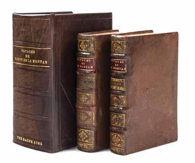
2 LA HONTAN, BARON Voyages Du Baron De La Hontan dans L’Amerique Septentrionale... The Hague: Jonas L’Honore, 1705.
2 vols. Small 8vo, full speckled calf, rebacked, gilttooled and -lettered spines, titles printed in red and black. Housed in custom blind-stamped calf clamshell case, green cloth chemise. Complete with 28 engraved plates including frontispieces and two large folding maps. The two large folding maps show the Great Lakes regions, as drawn by the author himself, illustrating early settlements, forts, and Native American territories, as well as a geographically inaccurate depiction of the Great Lakes and surrounding topography that impacted and confused future generations of explorers.
Lahontan came to New France in 1683 as captain of a regiment which he led in expeditions against the Iroquois. He traveled west in 1687 with Duluth and was given command of Fort St. Joseph on the St. Clair River. He left this post in 1688, venturing further west by the Fox-Wisconsin portage and reached the upper Mississippi. His work is considered one of the first comprehensive descriptions of the western part of the continent.
Bookplate tipped to verso of title page, both vols.; scattered spotting; previous owner’s ex-libris to title pages; darkening to some leaves.
Literature: Alden & Landis 703/88 and 704/87; Greenly 342-3; Sabin 38635, 38636, 38638. $1,500-2,500
2

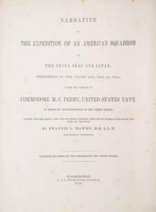
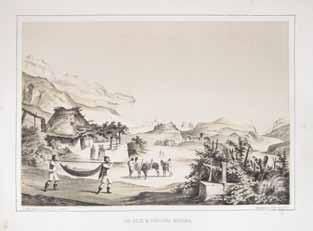
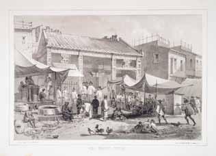
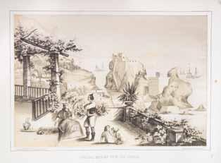
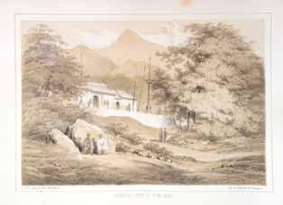
3 3 PERRY, COMMODORE MATTHEW CALBRAITH Narrative of the Expedition of an American Squadron to the China Seas and Japan, Performed in the Years 1852, 1853, and 1854, Under the Command of Commodore M.C. Perry, United States Navy... Washington: A.O.P. Nicholson, 1856.
3 vols. 4to, original blind-stamped blue cloth, giltlettered spines. First edition. With numerous in-text illustrations, 17 (of 25) maps, and 131 (of 139) plates, (not including the suppressed “Bath House” plate). Wear and fading to boards and spines; hinges starting; some leaves detached from backstrip, vol. 1; intermittent foxing; offsetting from plates; tears to some folding maps. $800-1,200
4
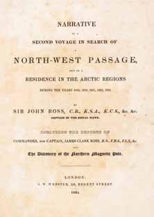
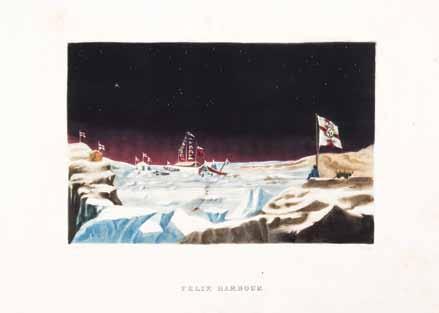
4 ROSS, JOHN, SIR Narrative of a Second Voyage in Search of a NorthWest Passage, and of a Residence in the Arctic Regions During the Years 1829, 1830, 1831, 1832, 1833. London: A.W. Webster, 1835.
4to, original 3/4 brown calf over cloth, gilt-lettered spine. First edition, large paper issue. Complete with 30 plates, maps and charts (nine hand-colored), including large fold-out chart with hand-coloring. Rubbing to boards; inner hinges cracked; previous owner’s pen ex-libris to front pastedown; foxing throughout; light offsetting from some text leaves; some marginal tears to folding chart. $500-700
5* WALKER, SIR HOVENDEN A Journal: or Full Account of the Late Expedition to Canada. London: D. Browne, 1720.
8vo, rebound by Zaehnsdorf in full mottled calf, gilttooled and -lettered spine. First edition of Walker’s account “of his unfortunate 1711 expedition against Canada, which operated from Boston and was of New England instigation. Having distinguished himself in the West Indies, he was placed in command of the naval forces. Ill fortune attended the enterprise, eight transports being cast away and nearly 900 soldiers drowned...The expedition was a total failure” (Lande). Leaves darkened; few light brown spots. Property from the Collection of Dr. James Milgram, Lake Forest, Illinois
Literature: Lande, 886. $800-1,200
5
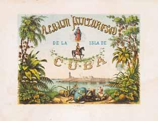
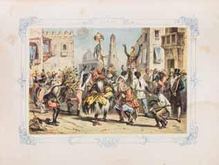
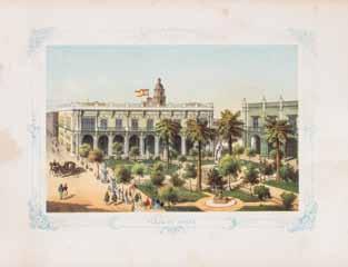
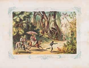
6 6 (CUBA) Album pintoresco de la Isla de Cuba. [Havana:] B. May, n.d. [c. 1850.]
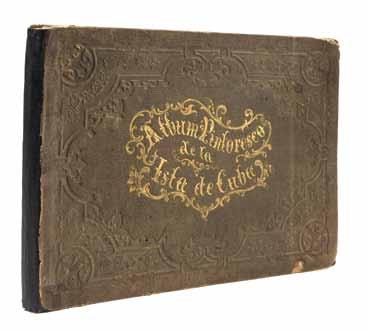
Oblong 4to, original blind and gilt-stamped green cloth. Complete with color lithographed title, fold-out map, fold-out plan, and 27 color lithographed plates. Wear and soiling to boards; backstrip detached from text block; folding plates with repaired tears to folds; intermittent foxing; light dampstain to lower third of most plates.
Literature: Lande, 886. $2,000-4,000
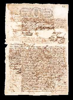
7 (CUBA) A group of six manuscript documents relating to the purchase and employment of Chinese slaves in Cuba, 1842-1872. $400-600
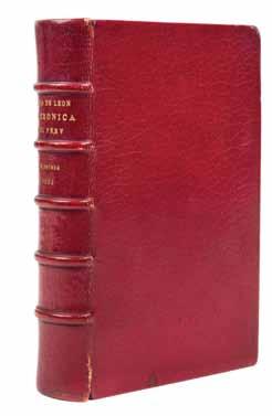
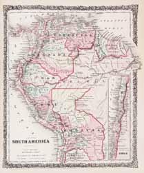
8 (PERU) CIEZA DE LEON Parte Primera de la chronica del Peru... Antwerp: En casa de Iuan Steelsio, 1554.
8vo, rebound in full red morocco, gilt-lettered spine, gilt-inner dentelles. Second or third edition (first edition, 1553). Title page with woodcut device, woodcut head-pieces throughout. Minor wear to boards at hinges. $600-800

8 7

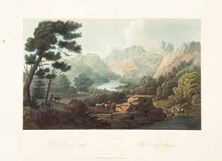
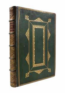
9 9* (NORWAY) (BOYDELL) EDY, JOHN WILLIAM Boydell’s Picturesque Views and Scenery of Norway. London: W. Bulmer [for] Messrs. Boydell and Co., [1820]
Vol. 1 (of 2) only. Folio, 3/4 red cloth over marbled boards, gilt-lettered spine. Large paper edition. Complete with 40 full-page hand-colored engraved plates with accompanying text leaves. “The most important colour plate book on Norway.” (Tooley) Originally published in eight parts between September 1811 and January 1820, and first sold in two volumes with two title-pages, before being issued in one. Abbey states that the two-volume edition was on larger paper, approximately 18-1/2 or 19 inches tall in trimmed copies, compared to the 151/2 inch height of the single-volume copy. Rubbing to boards; ends bumped; moderate foxing; some soiling and dampstaining to some leaves; offsetting from plates; some leaves trimmed. Property from the Collection of Dr. Barbara Isaacs, Rockville, Maryland
Literature: Abbey Travel 254; Tooley 103 (2-volume edition). $6,000-8,000


10 (HOLLAND) Holland. Illustrated by Nico Jungman. Text by Beatrix Jungman. London: Adam and Charles Black, 1904.
4to, publisher’s ornately illustrated covers. Edition deluxe, limited to 300 copies, of which this is 147, signed by the illustrator. Rubbing and staining to boards; hinges tender. $50-100
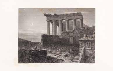
11 (GREECE) WILLIAMS, HUGH W. Select Views in Greece, with Classical Illustrations. London: Longman, Rees, Orme, Brown, and Green, 1829.
2 vols. in one. Folio, gilt-stamped green morocco, gilt-tooled and -lettered spine, red leather spine label, gilt-inner dentelles, a.e.g. First edition in book form. Complete with 64 engraved plates. Minor wear to boards; scattered foxing heaviest at margins on some plates; offsetting from some plates. $300-500
12 (MIDDLE EAST) EBERS, G. Egypt: Descriptive, Historical, and Picturesque. Translated from the German by Clara Bell. London, Paris and New York: Cassell, 1884.
2 vols. Folio, publisher’s gilt-pictorial brown morocco, a.e.g. First English edition, profusely illustrated throughout in black and white. Wear and fraying to boards at edges; backstrip beginning to detach from text block, both vols. $100-200
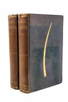
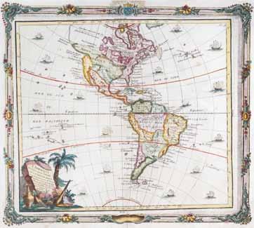
13* (MIDDLE EAST) DOUGHTY, CHARLES M. Travels in Arabia Deserta. London and Boston: Philip Lee Warner and Jonathan Cape, 1921.
2 vols. 8vo, original pictorially gilt-stamped green cloth. Second edition. With half-titles, photogravure portrait, plates and plans, some folding, and foldout linen-backed color map in pocket at rear of vol. 1. Spines darkened and ends frayed; boards faded; scattered foxing; hinges starting. Property from the Estate of Barbara Maggos, Alton, Illinois $200-400
11
13
14
15
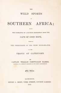
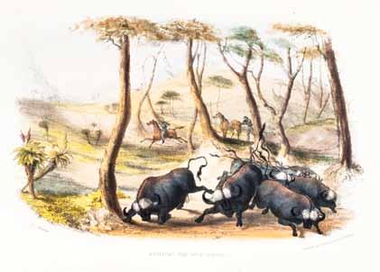
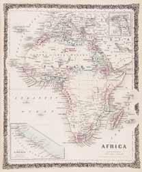
14 HARRIS, WILLIAM CORNWALLIS The Wild Sports of Southern Africa. London: Henry G. Bohn, 1852.
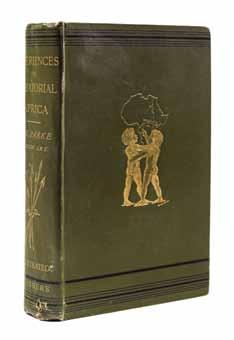
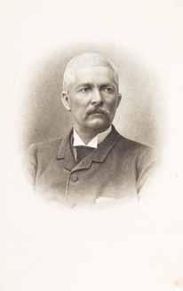
8vo, full contemporary calf, rebacked, retaining original spine and gilt-lettered spine label, marbled endpapers, a.e.g. Fifth edition. Complete with color frontispiece, title page, 24 plates, and fold-out map. W.J. Holliday, Jr. Copy, with his bookplate to front pastedown and his signature to verso of frontispiece. Hinges reinforced; some light spotting; otherwise fine. $300-500 15 PARKE, THOMAS HEAZLE My Personal Experiences in Equatorial Africa as Medical Officer of the Emin Pasha Relief Expedition. New York: Charles Scribner’s Sons, 1891.
8vo, original gilt-stamped green calf, gilt-lettered spine. First edition. Illustrated throughout with plates, folding map in pocket at rear. Minor soiling to boards; ends bumped; hinges starting; few brown spots. $200-400 16* SCHWEINFRUTH, GEORG The Heart of Africa. New York: Harper & Brothers, 1874.
2 vols. 8vo, gilt-stamped green cloth, gilt-lettered spines. Illustrated throughout with woodcut engravings and maps, some folding. Edgewear; scattered brown spots. Property from the Collection of Dr. James Milgram, Lake Forest, Illinois $100-200
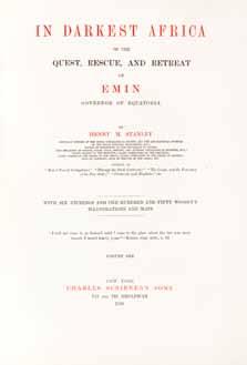
17* STANLEY, HENRY M. In Darkest Africa, or the Quest, Rescue, and Retreat of Emin, Governor of Equatoria. London: Charles Scribner’s Sons, 1890.
2 vols. 4to, 3/4 brown morocco over giltstamped vellum, gilt-lettered spines. First edition. Demy Quarto Edition de Luxe, number 136 of 250 copies. Signed by Stanley on the limitation page, vol. 1. Complete with two portrait frontispieces, six maps and plans (four fold out, two linen-backed), six signed etchings by G. Montbard, and 40 mounted plates on India paper. Soiling to vellum and rubbing to spines and edges; minor toning to extremities of leaves, scattered foxing. Property from the Estate of Barbara Maggos, Alton, Illinois $2,000-4,000
18* STANLEY, HENRY M. In Darkest Africa, or the Quest, Rescue, and Retreat of Emin, Governor of Equatoria. New York: Charles Scribner’s Sons, 1890.
2 vols. 8vo, original gilt pictorial green cloth with inset silhouette of Africa. First American trade edition. Profusely illustrated with wood-engravings and plates, steel-engraved frontispiece portraits, and three folding maps in rear pockets. Rubbing to boards; ends bumped; hinges starting. Property from the Collection of Dr. James Milgram, Lake Forest, Illinois $200-400


17
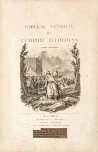
19 19* [MOURADJA D’OHSSON (IGNACE DE)] Tableau general de L’Empire Othoman. Tome Premier. Paris: De L’Imprimerie de Monsieur, 1787.
Vol. 1 (of 3) only. Folio, 3/4 red calf over cloth, giltlettered spine. Engraved title and 21 (of 25) sheets of engraved plates (four double-page or fold-out). Boards rubbed and faded; bookplate tipped to front pastedown; moderate foxing; light offsetting from plates; later typed captions pasted to title page and plates. Property from the Collection of Dr. Barbara Isaacs, Rockville, Maryland $1,000-2,000
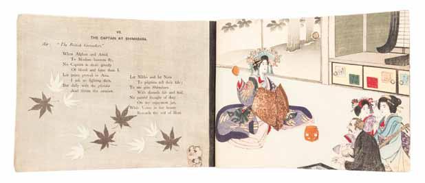
20* EDWARDS, OSMAN Residential Rhymes. Tokyo: T. Hasegawa, n.d. [c. 1900]
Oblong 4to, 22 original color woodblock prints on crepe paper, including front and rear covers. A rare crepe paper book depicting scenes of Europeans in various roles such as: The Minister at Chiuzenji, The Merchant at Yokohama, The Journalist at Kobe, The Professor in Nirvana, etc. Light soiling and edgewear to covers. Property from the Collection of Dr. James Milgram, Lake Forest, Illinois $400-600

20
23
21* KNOX, THOMAS W. Overland Through Asia. Pictures of Siberian, Chinese, and Tartar Life. Hartford, Conn.: American Publishing, 1871.
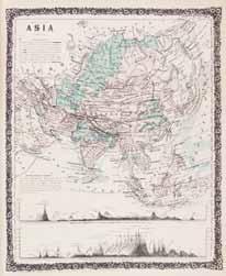
8vo, original brown cloth stamped in blind and gilt. Numerous illustrations throughout. Wear and soiling to boards; hinges starting. Property from the Collection of Dr. James Milgram, Lake Forest, Illinois $80-120
22 NIEUHOF, JOHAN A group of 16 loose etchings from Legatio Batavica ad magnum Tartariae chamum Sungteium, modernum Sinae imperatorem... Amsterdam, 1668. 8 5/8 x 13 1/8 inches each. $200-400
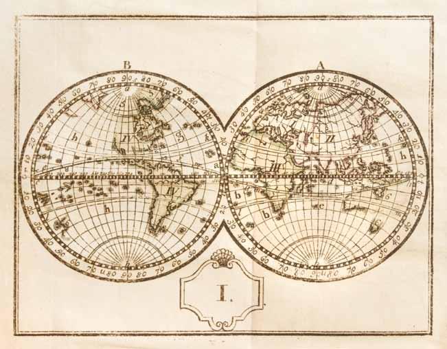
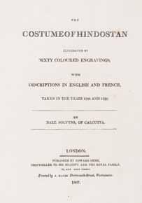
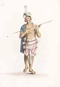
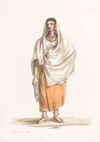
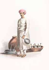
23 SOLVYNS, FRANS BALTASAR The Costume of Hindostan. London: Edward Orme, 1807.
Folio, dark green straight-grain morocco, with foliate border in gilt to boards, gilt-stamped and -lettered spine, text in French and English. Complete with 60 hand-colored stipple-engraved plates with accompanying explanatory text. Rubbing and some scuffing to boards; two bookplates tipped to front pastedown; scattered brown spots; light offsetting from some plates; few text leaves detached. $1,000-2,000
24 SOUTHGATE, HORATIO Narrative of a Tour Through Armenia, Kurdistan, Persia and Mesopotamia... New York: D. Appleton, 1840.
2 vols. 8vo, rebound in 3/4 brown lizard skin over calf, gilt-stamped and -lettered spines. First edition. Complete with five plates, folding map, and engraved plan. Dampstaining to foot of spine, vol. 1, affecting all leaves; intermittent foxing. $300-500

26
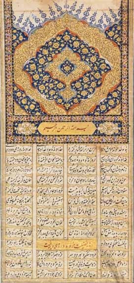
25* (ILLUMINATED MANUSCRIPT, PERSIAN) An illuminated Persian manuscript, possibly a Qur’an, nineteenth-century, with two leaves heightened in gilt. Small 8vo, blind-stamped folding case. Property from the Collection of Dr. James Milgram, Lake Forest, Illinois $200-400
26 (ILLUMINATED MANUSCRIPT, PERSIAN) An illuminated manuscript, Persian, approximately 600 pages, leaves heightened in gilt, some handcolored, c. nineteenth-century. 4to, quarter black morocco over decorative cloth inlaid with decorative floriated wooden boards. Housed in silk floral embroidered satchel with three button enclosures. Leaves detached from backstrip and disbound. $300-500 27* (COPTIC BIBLE) 43 leaves on bark, hand-written text, in Ge’ez, in black and red ink, bound accordion style, c. nineteenth-century. 8vo, wooden boards, with braided strap. Property from the Collection of Dr. James Milgram, Lake Forest, Illinois $200-400
28* (QUR’AN) A nineteenth-century Qur’an. 8vo, gilt-stamped green straight-grain morocco. Housed in calf slipcase. Property from the Collection of Dr. James Milgram, Lake Forest, Illinois $100-200 29* (SEAFARING) A group of four books pertaining to life as a mariner.
The Pirates Own Book... New York: A. & C.B. Edwards, 1842. 8vo, original blind-stamped brown cloth, gilt-stamped and -lettered spine. With engraved frontispiece, extra-engraved title and numerous engravings throughout. Boards worn; foxing. Shipwrecks and Disasters at Sea. Philadelphia: Jesper Hardin, 1850. 8vo, blind-stamped blue cloth, giltstamped spine. Engraved plates. Boards worn and soiled; foxing. Dibdin Sea Songs. London: Henry G. Bohn, 1850. 8vo, blind-stamped blue cloth, spine gilt. Illustrated. Foxing throughout. Ocean Scenes, or the Perils and Beauties of the Deep... New York: Leavitt & Allen, (1847). Engravings throughout. Boards rubbed and faded; foxing. Property from the Collection of Dr. James Milgram, Lake Forest, Illinois $100-200
30* HEALY, CAPT. M.A. Report of the Cruise of the Revenue Marine Steamer Corwin in the Arctic Ocean in the Year 1884. Washington: Government Printing Office, 1889.
4to, 3/4 brown morocco over marbled boards, gilt-lettered spine. Numerous black and white photographic reproductions throughout. Upper board detached; boards worn. Property from the Collection of Dr. James Milgram, Lake Forest, Illinois $80-120

31 (SWIGERT, JACK) APOLLO 13 Autographed document signed by the crew of the Apollo 13 Mission (“Fred Haise,” “James Lovell” and “Ken Mattingly”). Program for the dedication of a bronze sculpture of John L. “Jack” Swigert, presented at the United States Capitol, Washington, D.C., May 22, 1997, after Swigert’s death. Ken Mattingly was the original command module pilot of the mission, but was replaced by John Swigert days before the launch due to exposure to the measles. Additionally signed by sculptor Mark Lundeen, Colorado politician Dennis Gallagher and NASA Flight Director Gene Kranz. Property from the Gregory A. Raymer Collection $300-500
32 EARHART, AMELIA 20 Hrs. 40 Min. Our Flight in the Friendship. New York: G.P. Putnam’s Sons, 1928.
8vo, original gilt-lettered red cloth, later dust jacket. First Trade edition. Signed by Earhart on card tipped to f.f.e.p. Ends bumped; hinges starting. $800-1,200
33* EARHART, AMELIA The Fun of It: Random Records of My Own Flying. New York: Brewer, Warren & Putnam, 1932.
8vo, original brown cloth, dust jacket. Third printing. Signed by Earhart in pencil on the f.f.e.p. Dust jacket worn and marginally chipped; leaves toned. Property from the Collection of Dr. James Milgram, Lake Forest, Illinois $100-200
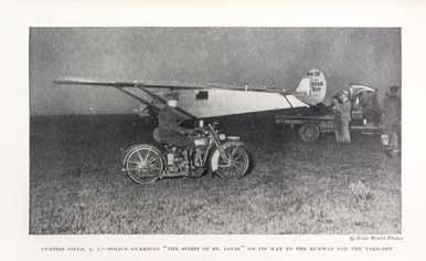
34* LINDBERGH, CHARLES WE. New York and London: G.P. Putnam’s Sons, 1927.
8vo, original pictorially gilt-stamped and -lettered blue cloth, dust jacket, original pictorial slipcase. Signed by Lindbergh on the frontispiece, with an original color illustration by Clayton Knight tipped in to front. With an original Charles Lindbergh postcard laid-in. Wear to slipcase; dust jacket chipped at edges; f.f.e.p. inscribed in an illegible hand (Johnny Green?); hinges starting. Property from the Collection of Dr. James Milgram, Lake Forest, Illinois $300-500
35
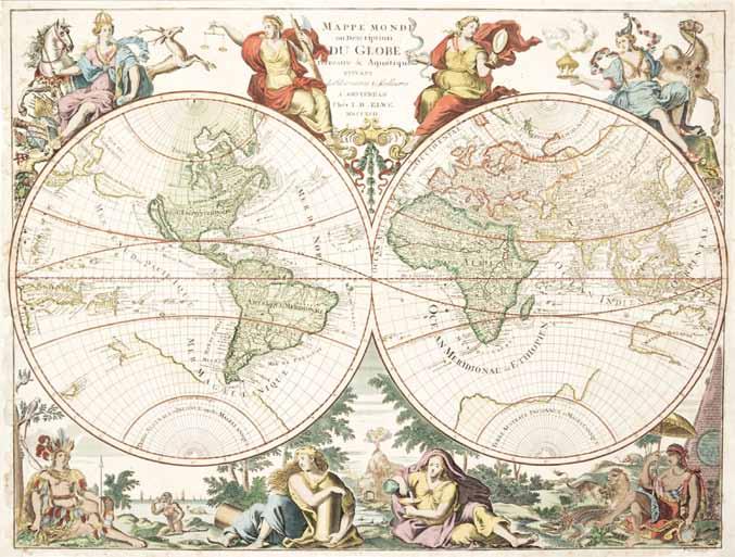
35 (MAP) (JAILLOT) ELWE, J. Mappe Monde, ou Description du Globe Terrestre & Aquatique. Amsterdam, 1792. Double-page engraved map with hand-coloring by Elwe after Jaillot’s map of 1694, with each continent allegorically represented by a woman in the margins and various indigenous flora and fauna elaborately illustrated in the borders. 18 3/4 x 25 3/4 inches. $2,000-4,000
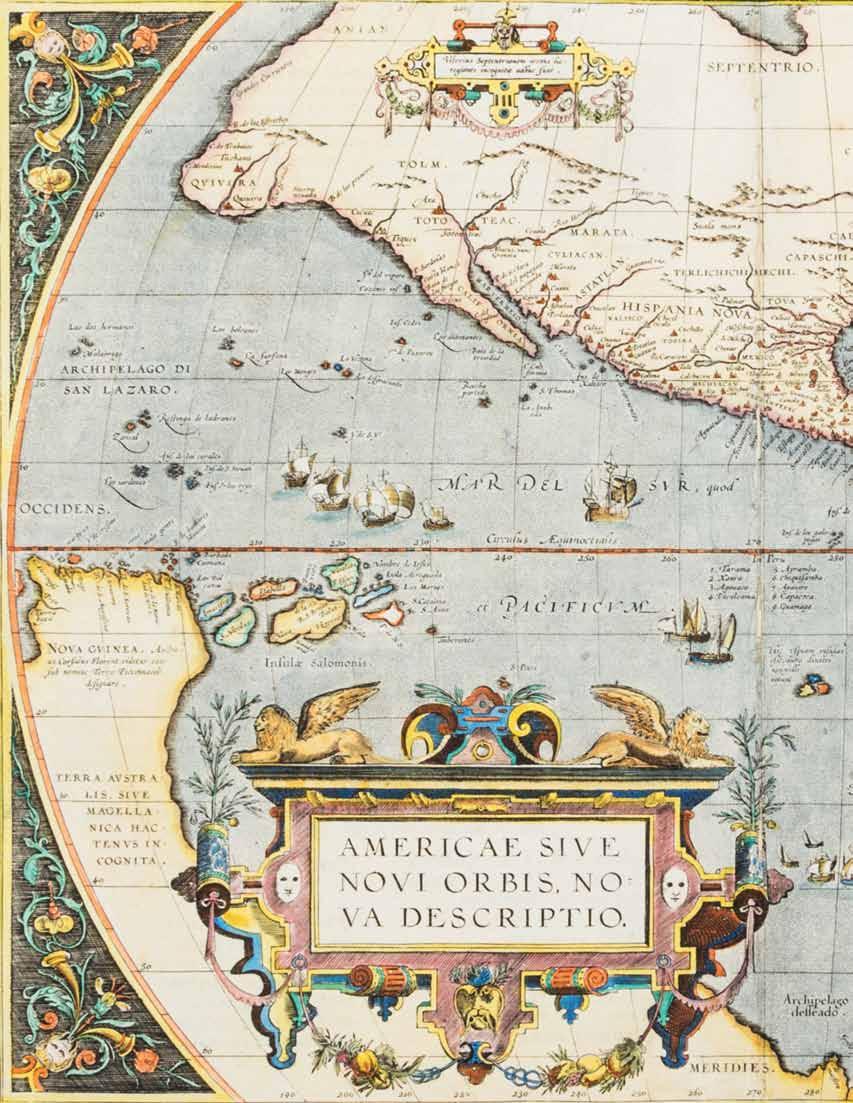
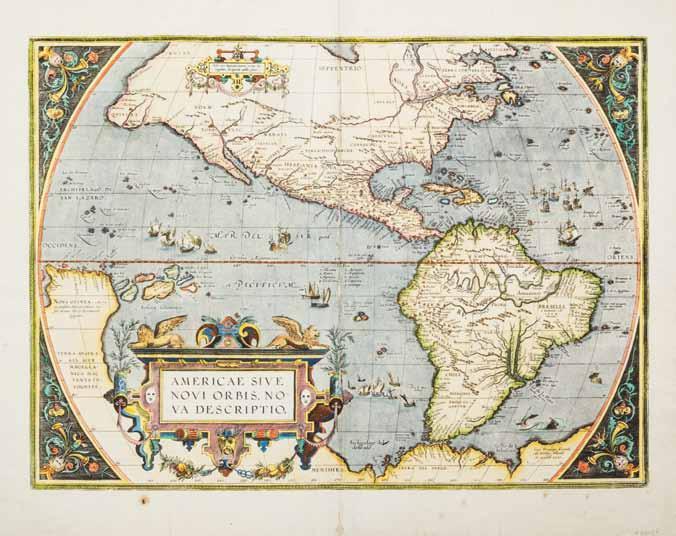
36 (MAP) ORTELIUS, ABRAHAM Americae Sive Novi Orbis, Nova Descriptio. Antwerp, 1579. Double-page engraved map with hand-coloring. Latin text to verso. Map of the Americas with decorative cartouche and borders. First published in the Theatrum Orbis Terrarum. 16 3/4 x 17 1/4 inches. $2,000-4,000
36
37 (MAP) WELLS, EDWARD A New Map of the Terraqueous Globe According to the Ancient Discoveries and Most General Divisions of it into Continents and Oceans. Oxford, 1700. Double-page engraved map with hand-coloring. Double-hemisphere map of the world, dedicated to William, Duke of Gloucester, depicting California as an island, an incomplete New Holland attached to N. Guinea, a partial New Zealand coast line, and no Southern continent. With annotations in North and South America, including a suggestion that the Americas may have been the lost continent of Atlantis, dedication vignette to lower center with depiction of William of Gloucester with his tutor under the tree at lower right corner. Framed and matted. 18 x 21 1/8 inches. $800-1,200

37
38
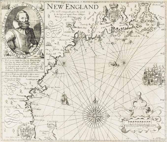
38* (MAP) SMITH, JOHN New England. [London, 1614] Double-page engraved map of New England after John Smith’s map of the New England coast. Later state. This “is the foundation map of New England cartography, the one that gave it its name and the first devoted to the region” (Burden) With inset portrait vignette of Smith to upper left corner. Laid to board. Framed and matted. 11 1/4 x 14 inches visible. Property from the Collection of Fred M. Levin, Chicago, Illinois
Literature: Burden, 227. $800-1,200
40
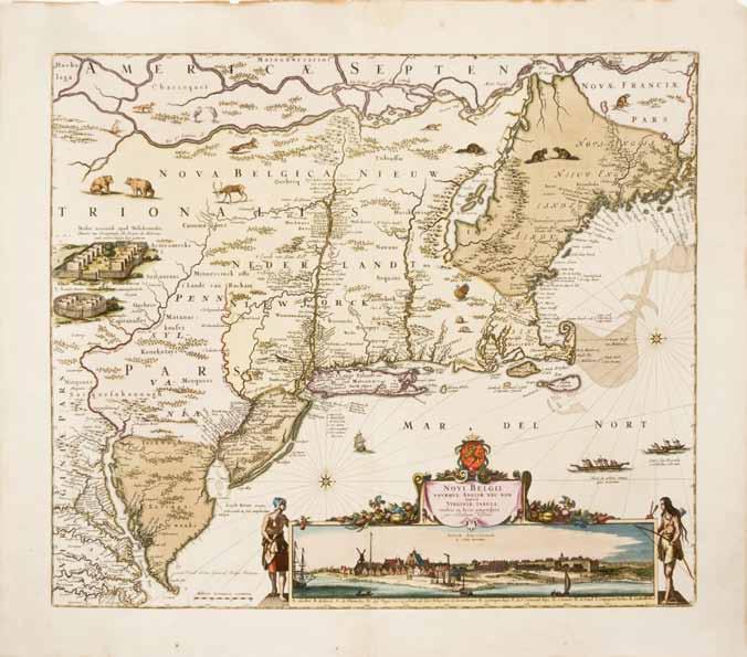
39 (MAP) UNITED STATES BUREAU OF TOPOGRAPHICAL ENGINEERS A Map of The Extremity of Cape Cod Including the Townships of Provincetown, Truro: with A Chart of Their Sea Coast and of Cape Cod Harbour, State of Massachusetts. Executed under the Direction of Major J.D. Graham U.S. Top. Engr. During portions of the years 1833, ‘34 & 35. Washington, DC, 1836. Large four-sheet engraved map of Cape Cod based on surveys conducted by the Topographical Engineers in 1833-1835. Sheets not attached. Sheets 32 x 37 inches each. $400-600 40 (MAP) VISSCHER, NICHOLAUS Novi Belgii Novaeque Angliae Nec Non partis Virginiae Tabula multis in locis emendata… Amsterdam, 1684. Double-page engraved map with hand-coloring. Important map of the Northeast after Jansson’s map of 1651. With inset view of New Amsterdam, the third known engraved view of New York. With inset vignette of Fort Kasimer on the left. 21 3/4 x 25 inches. $3,000-5,000
41* (MAP) BRION DE LA TOUR, L. Amerique dressee pour l’etude de la geographie... Paris, 1764. Double-page engraved map with handcoloring of North and South America, with California as a Peninsula, Texas as “Nouvelle Mexique,” and the Pacific Northwest as “Albion.” With decorative cartouche and decorative border. Framed. Lacking glass. Size visible 11 x 12 1/4 inches. Property from the Estate of Wilton Jaffee, Jr., Aspen, Colorado $200-400
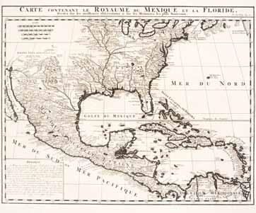
42 (MAP) CHATELAIN, HENRI Carte Contenant le Royaume Du Mexique et La Floride, Dressez sur les meilleurs observations & sur les Memoires les plus Nouveaux. Amsterdam, 1719. Double-page engraved map of Texas, Florida, the Gulf Coast, and Central America. Based upon De L’Isle’s map of the region. 17 1/2 x 20 3/4 inches. $300-500
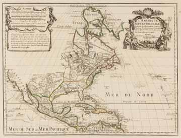
43* (MAP) DELISLE, GUILLAUME L’Amerique Septentrionale. Paris, 1700 [1708]. Double-page engraved map, hand-colored in outline. Though dated 1700, this is the 1708 reissue of De l’Isle’s 1700 map of North America with “sur le Quai de L’Horloge” in the cartouche and Renard’s imprint erased in the plate. This map is the first to show the Sargossa Sea; it is “a foundation map...[with] the Great Lakes based on Coronelli showing the French strong points at Tadousac, Quebec, Fort Sorel, Montreal & Fort Frontenac.... In this map De l’Isle corrected longitude positions and was the first to revert to a peninsula form for California. He stops his western coast at Cape Mendocin” (Tooley). Framed and matted. 21 1/2 x 29 5/8 inches. Property from the Estate of John C. Stevens, Muscatine, Iowa
Literature: Tooley, 19, #30; Wagner, NW Coast, 459. $500-700
41
42
44
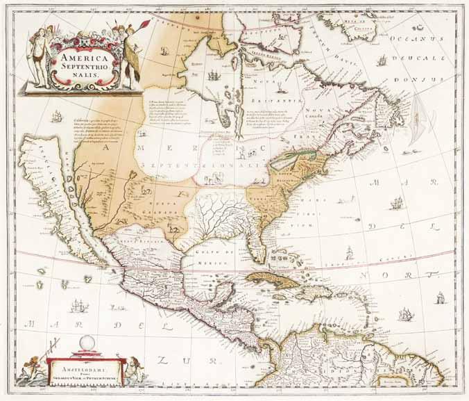
44 (MAP) HONDIUS, HENRICUS America Septentrionalis. Amsterdam, n.d. [1641] Double-page hand-colored engraved map of North America. This map is the first atlas map to show North America only, and the single most influential map in perpetuating the myth of California as an island (Burden). With decorative cartouche flanked by Native American figures to upper left corner, and illustrations of numerous ships and sea creatures, and native animal wildlife. Framed and matted. 20 3/4 x 24 1/8 inches.
Literature: Burden, I: 245. $3,000-5,000
45 (MAP) JANSSON, JAN America Noviter Delineata. Amsterdam, [1644] Doublepage engraved map with hand-coloring, Latin text to verso. Depicting North and South America with inset of the South Pole. After Hondius’ map of 1618. 19 1/2 x 23 1/4 inches. $1,500-2,500
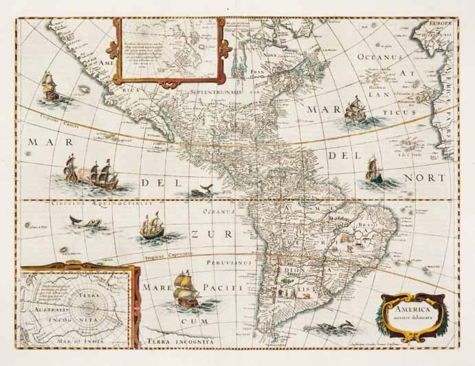
45
46* (MAP) MUNSTER, SEBASTIAN Novae Insulae. [Basel, 1572] Woodcut engraved map. Latin text to verso. First printed map of the American continents linking North and South America. The map depicts a fine example of the false sea of Verrazzano and Japan as the island “Zapangi.” Property from the Collection of Fred M. Levin, Chicago, Illinois
Literature: Schwartz and Ehrenberg, p. 45. $2,000-4,000
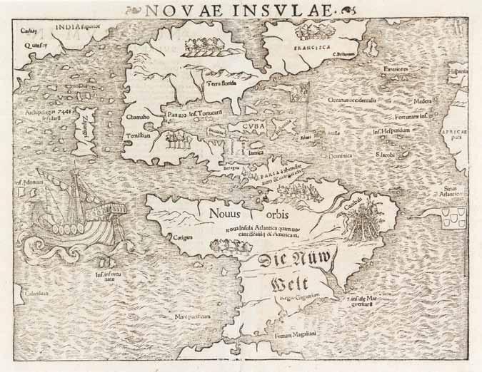
46
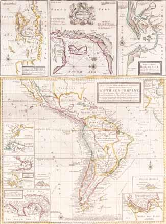
47 (MAP) MOLL, HERMAN A new & exact map of the coast, countries and islands within the limits of ye South Sea Company, from ye River Aranoca to Tierra del Fuego, and from there through ye South Sea to ye north port of California, &c. London, 1711. Large two-sheet engraved map with hand-coloring in outline of the territories of the South Sea Company, with 12 small inset maps. Framed and matted. 22 1/2 x 29 1/4 inches. $600-800
48 (MAP) FINLEY, ANTHONY Mexico. Philadelphia, 1824. Copper-engraved map with hand-coloring. 10 1/4 x 13 1/2 inches. $200-400
49 (MAP) SPEED, JOHN Cumberland and the Ancient Citie Carlile Described with Many Memorable Antiquities Therein Found Observed. [London, 1611] Double-page engraved map with hand-coloring. English text to verso. Framed and matted. 17 x 22 inches. $100-200
50 (MAP) MERCATOR, GERARD Tuscia. Double-page engraved map with handcoloring of Tuscany and the surrounding regions from Mercator’s Cosmographia. French text to verso. 16 1/2 x 21 1/8 inches. $300-500
47

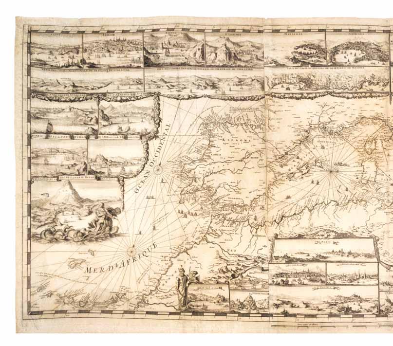
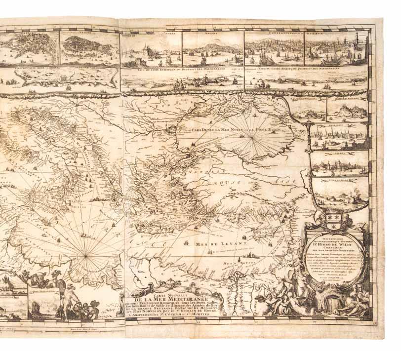
51 (MAP) (MORTIER, PIERRE) DE HOOGHE, ROMEYN DE Carte Nouvelle de la Mer Mediterranee ou sont exactement remarques tous les ports, golfes, rochers, banks, de sable &c… Amsterdam: Pierre Mortier, c. 1694. Engraved map on three sheets depicting the Mediterranean Sea and surrounding coast line, with 38 insets of major ports and cities of the Mediterranean and large decorative cartouche to lower right corner. One of the most elaborate maps from the Neptune Francois, which “was the most expensive sea-atlas ever published in Amsterdam in the 17th century. Its charts are larger and more lavishly decorated than those of any preceding book of its kind…” (Koeman) 25 x 57 inches.
Literature: Koeman M. Mor., 7. $15,000-20,000
51
52
54
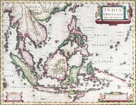
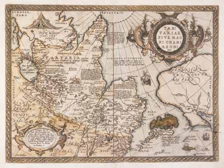
52 (MAP) JANSSON, JAN Indiae Orientalis nova descriptio. Amsterdam, 1634. Double-page engraved map, hand-colored in outline. French text to verso. Early map of the East Indies and Southeast Asia. This is the first map to show the discoveries of the ship the Duyfken in New Guinea (Duyfkens Eylant). With decorative cartouche flanked by native warriors, and scale cartouche flanked by sea nymphs. Framed and matted. 18 7/8 x 22 1/2 inches. $800-1,200 54 (MAP) ORTELIUS, ABRAHAM Tartariae Sive Magni Chami Regni. [Antwerp: Plantin, 1598] Copper-engraved map, with some hand-coloring in wash and outline, with two large cartouches. Latin text to verso. Map shows Tartary and China, an uncommon projection of Japan and an early depiction, possibly one of the first, of California, labelled “C. Californio.” Framed and matted. Frame lacking glass. 17 1/4 x 23 3/4 inches. $600-800
55 (ATLAS, LEVASSEUR, VICTOR) BRUE, ADRIEN HUBERT Atlas de geographie moderne physique et politique contenant les cartes generales et particulieres de toutes les parties du monde... Paris: Charles Delagrave, 1875.
Folio, full green morocco stamped in blind and gilt with “Institut Geographique de Paris” crest to upper board, gilt-stamped and -lettered spine. Complete with 50 color engraved maps, most double-page, one fold-out. Rubbing to boards; inner-hinges starting; scattered foxing; toning to extremities of some leaves. $300-500
56 (ATLAS) CLARKE & CO. The Universal Atlas of Modern Geography, Compiled from the Latest and Most Authentic Sources, and Including All the Recent Geographical and Nautical Discoveries Throughout the World. New York: R. Yorke Clarke, 1848.
Folio, 3/4 navy blue morocco over gilt-lettered cloth. Complete with 31 engraved maps on 29 plates, handcolored in outline. Wear and fading to boards; first map threatening to detach from backstrip; toning to edges of leaves. $400-600
55

56
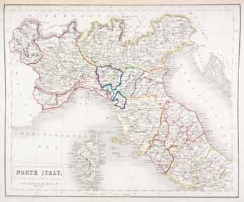
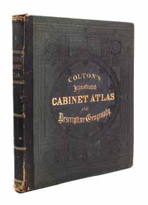
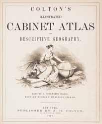
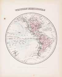
57 (ATLAS) COLTON, G.W. Colton’s Illustrated Cabinet Atlas and Descriptive Geography. New York: J.H. Colton, 1862.
Folio, original quarter morocco over blind-stamped, gilt-lettered blue-green cloth. Complete with engraved frontispiece and 47 sheets of maps, mostly hand-colored. Rubbing to boards at spine; inner hinges cracked; intermittent foxing. $1,000-2,000
57
58 (ATLAS) MARTINEAU, M.A. Nouvel Atlas Illustre. Paris: Direction et Administration, 1898.
Folio, full gilt-stamped and -lettered brown morocco, gilt-lettered spine. With 62 double-page engraved maps with hand-coloring. Wear and rubbing to boards; hinges starting; toning to extremities of leaves. $300-500
59 (ATLAS) VAZQUEZ, FRANCISCO, trans. Atlas Elementar. Metodo nuevo, breve, facil y demonstrativo para aprender la Geografia... Madrid: Pantaleon Aznar, 1786.
2 vols. in one. 8vo, full calf, gilt-lettered spine. First Spanish edition. Complete with 24 hand-colored fold-out maps and charts. Minor wear to boards; evidence of removal of sticker from base of spine; 1-inch trimmed from right edge of title page; light offsetting from plates; scattered brownspotting. Property from the Collection of the Clerics of St. Viator, Arlington Heights, Illinois $400-600

59