CONTENT
NURTURED URBANISM

Portfolio Link:

swap dams
in collaboration with James Grote Course: Thesis Studio, University of Michigan
Instructor: Ana Morcillo Pallarés, Ph. D. Awarded, Sensibility for Group Project
swap dams critically examines the Glen Canyon Dam as an emblem of extractive infrastructure, proposing a speculative roadmap for its decommissioning and the redistribution of its materials. By conceptualizing the dam as a quarry, the thesis explores the potential for repurposing its concrete into dimensional blocks for climateadaptive interventions, including seawalls and fire-resistant barriers. The decommissioning process, envisioned as a gradual excavation, introduces evolving spatial conditions within the structure, transforming it into a modern ruin that fosters new forms of human interaction. Drawing on historical construction methods and the works of influential artists such as Richard Serra and Carlo Scarpa, the project investigates how the creation of voids within the dam can engage with issues of scale, light, compression, and spatial experience. Ultimately, this proposal serves as an experimental framework for rethinking the obsolescence of large-scale infrastructure, offering a synthesis of sustainability, architectural discourse, and critical engagement with environmental challenges.
GLEN RECREATION
Grand Canyon National Park
Lake Mead National Recreation Area
Zion National Park
Bryce Canyon National Park
Capitol Reef National Park
GLEN CANYON DAM
HOOVER DAM
GLEN CANYON NATIONAL RECREATION AREA
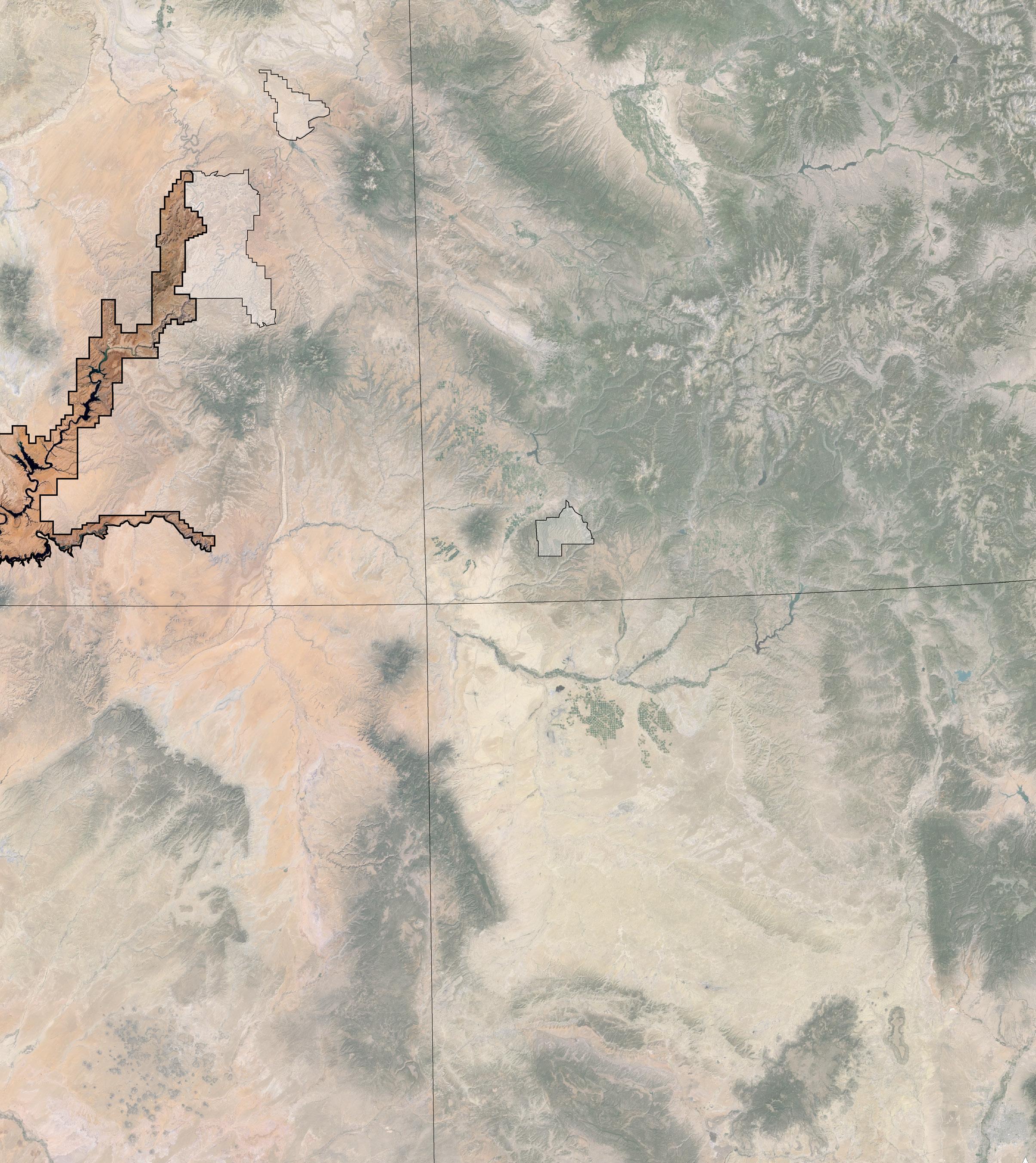
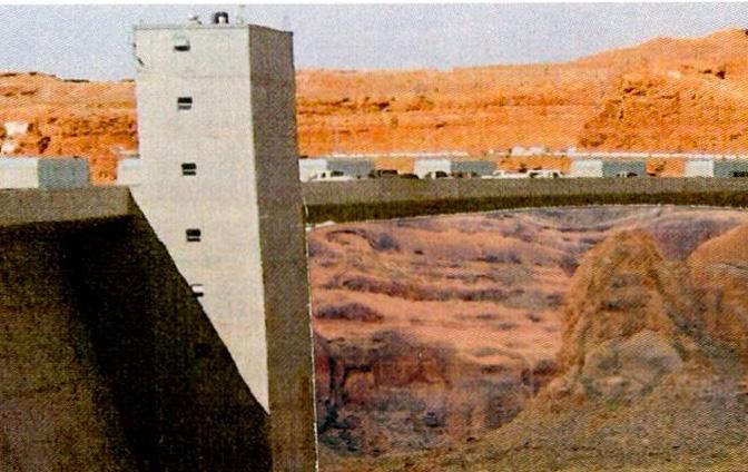
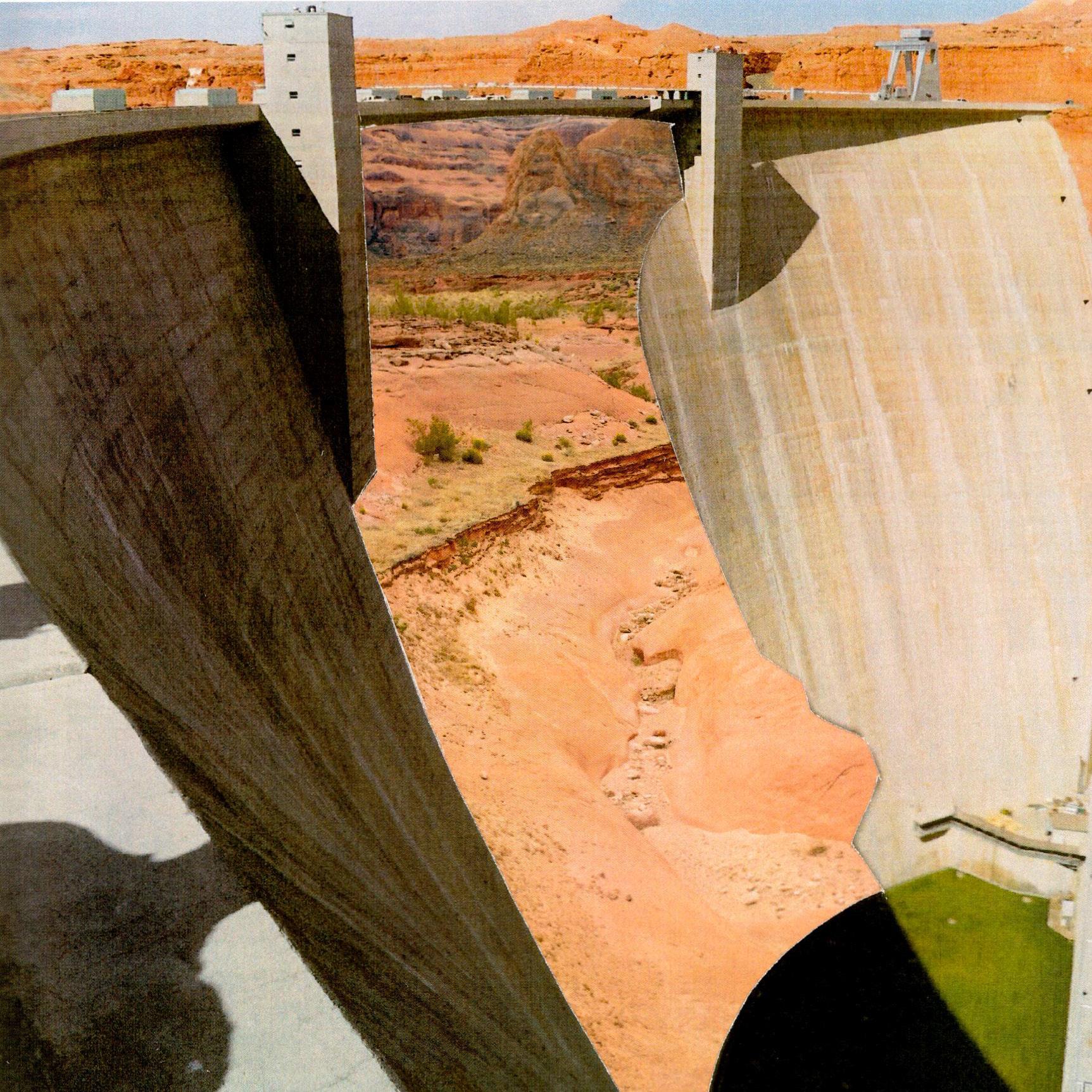
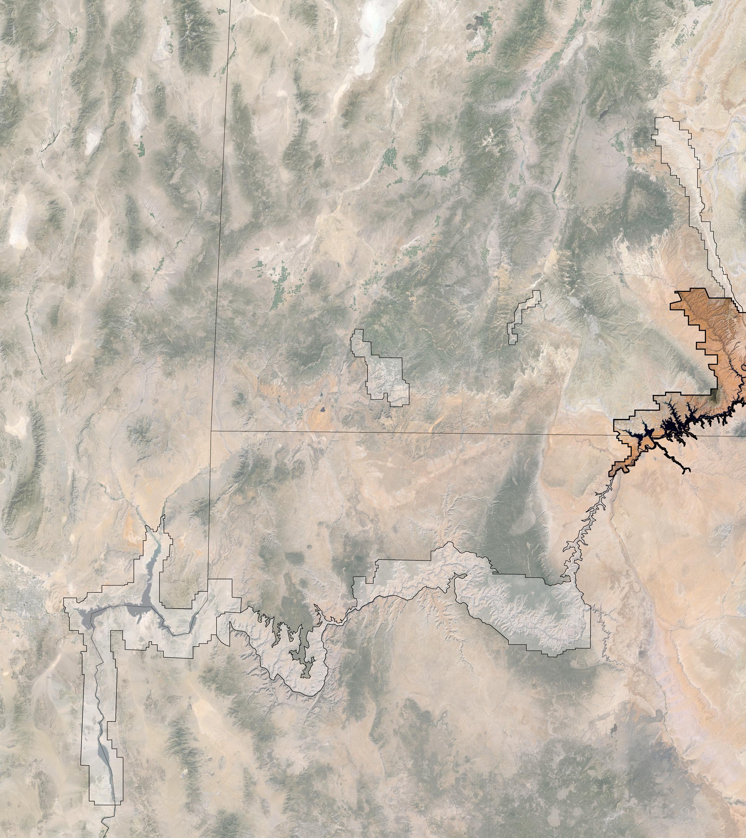
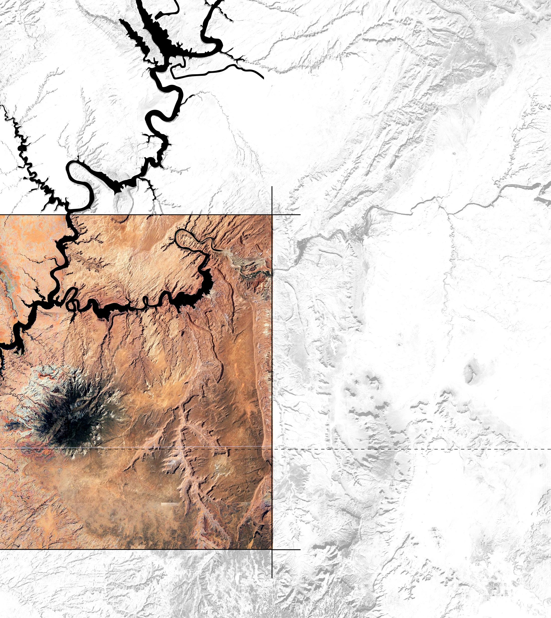
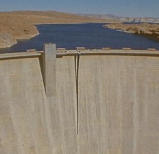
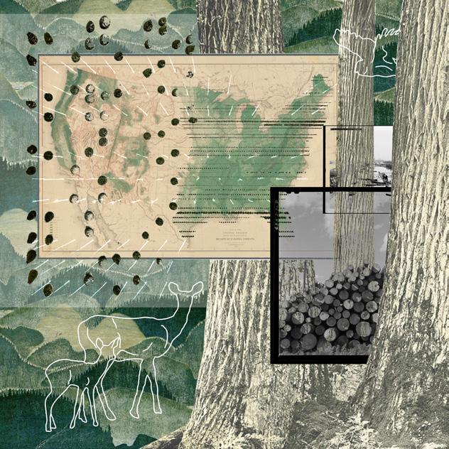
Glen Canyon Dam, located on the Colorado River near the ArizonaUtah border, is part of a heavily dammed system, including the Hoover Dam downstream. Adjacent to several National Parks, it is surrounded by notable landmarks such as Rainbow Bridge and Antelope Canyon. The dam flooded 185 miles of Glen Canyon, submerging ecosystems and archaeological sites, while its reservoir, Lake Powell, holds 25 million acre-feet of water. The second largest by maximum water capacity in the US. The structure rises 583 feet above bedrock, spans 1,500 feet, and contains 4.9 million cubic yards of concrete, enough to build a highway from Phoenix to Chicago.
Mesa Verde National Park
Site Analysis
GLEN CANYON DAM
6 hydroelectric concrete-arch dam
6 completed in 1966
6 length: 1,560 feet
6 height: 710 feet
6 volume of concrete (dam only): 3,750,000 cubic meters
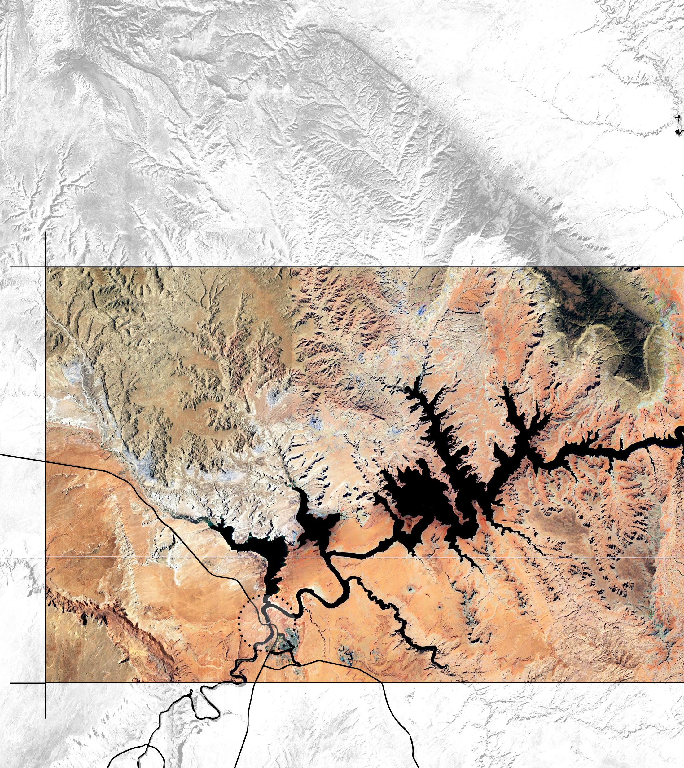
DAM RESERVOIR
6 a.k.a. Lake Powell
6 2nd largest reservoir by maximum water capacity in the US
6 flooded area: 25 million acre-feet
6 total volume: 3.0001×10¹⁰ m3
6 max length: 185.8 miles
6 max width: 25 miles
6 max depth: 600 feet
ARIZONA
UTAH
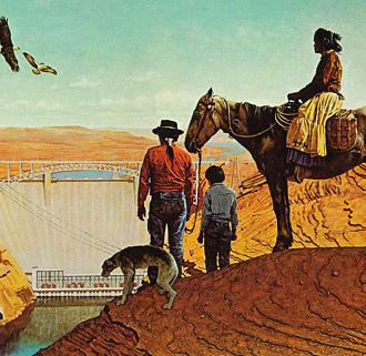
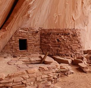
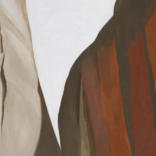
The Glen Canyon Dam has long served as a cultural and environmental flashpoint, inspiring artists like Georgia O’Keeffe while drawing sharp criticism from environmentalist Edward Abbey. Originally constructed to control flooding and address water scarcity under the Colorado River Compact, the dam’s utility has been jeopardized by ongoing droughts in 2022 and 2023, which drastically lowered Lake Powell’s water levels. These conditions threaten the dam’s ability to generate power or operate its aging infrastructure, prompting an urgent need to speculate on its future and eventual obsolescence.
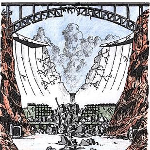
This thesis proposes a speculative roadmap for decommissioning the dam, merging processes of unbuilding and reassembly. By reinterpreting historical extraction methods, it envisions the systematic deconstruction and redistribution of the dam’s material into dimensional concrete blocks. Excavation is conceptualized as a temporal transformation, treating the site as a quarry while adapting existing construction techniques for unbuilding. This approach reframes the dam as both a resource to combat the climate crisis and a catalyst for rethinking energy paradigms, exploring how dismantling such a monumental structure can foster a more sustainable future.
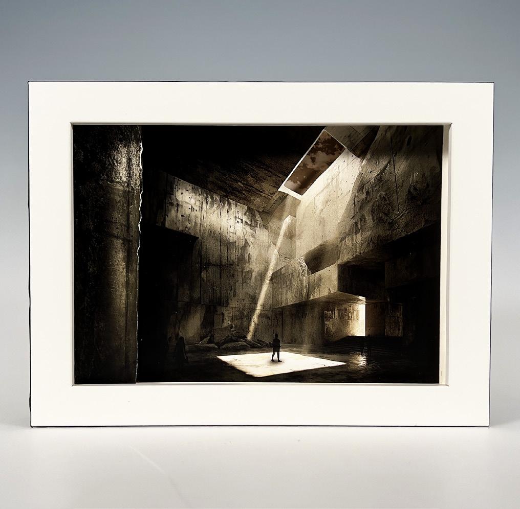
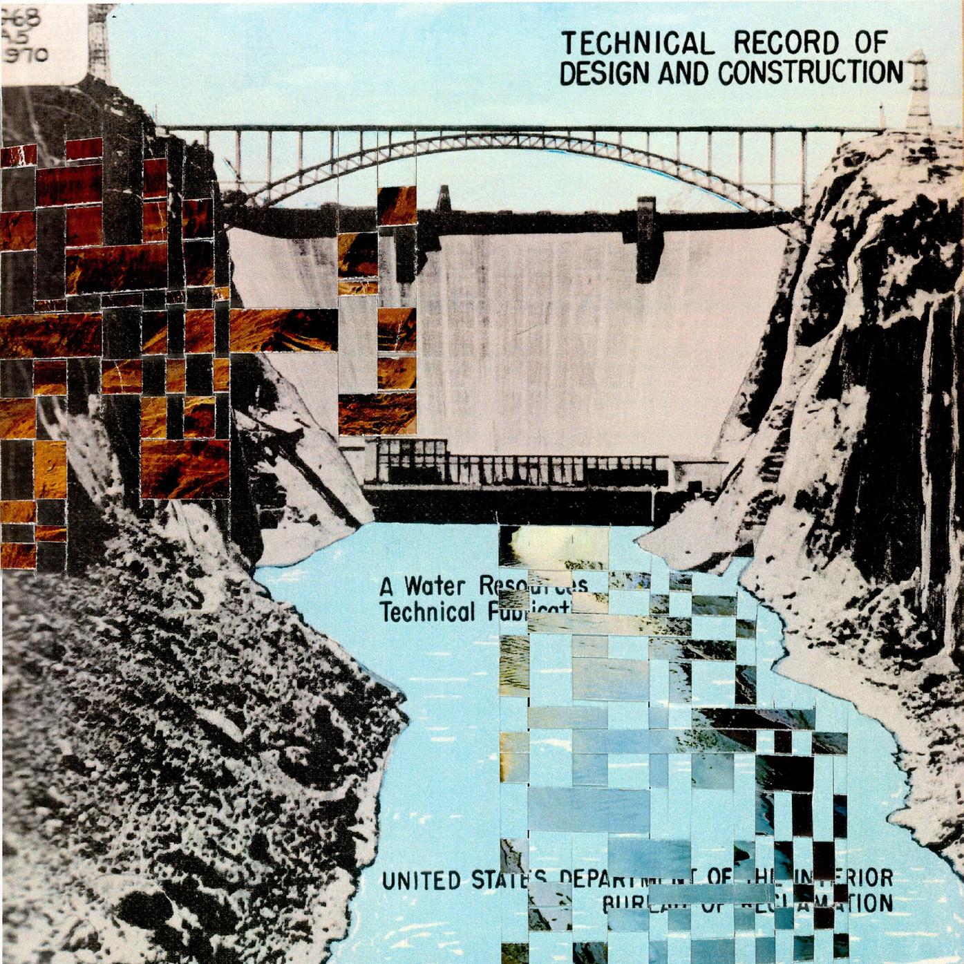
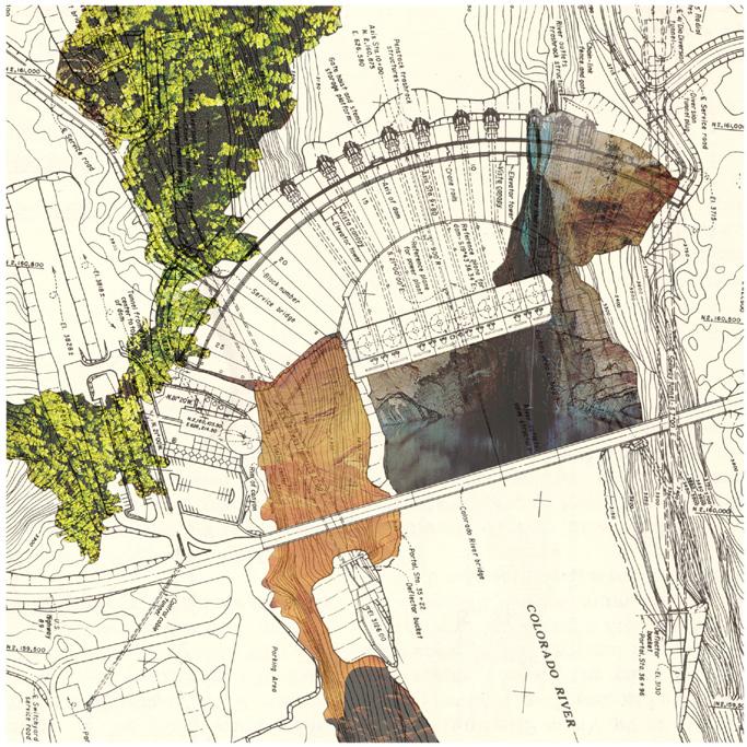
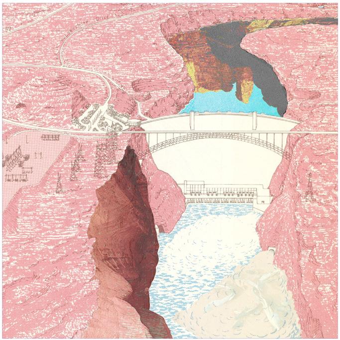
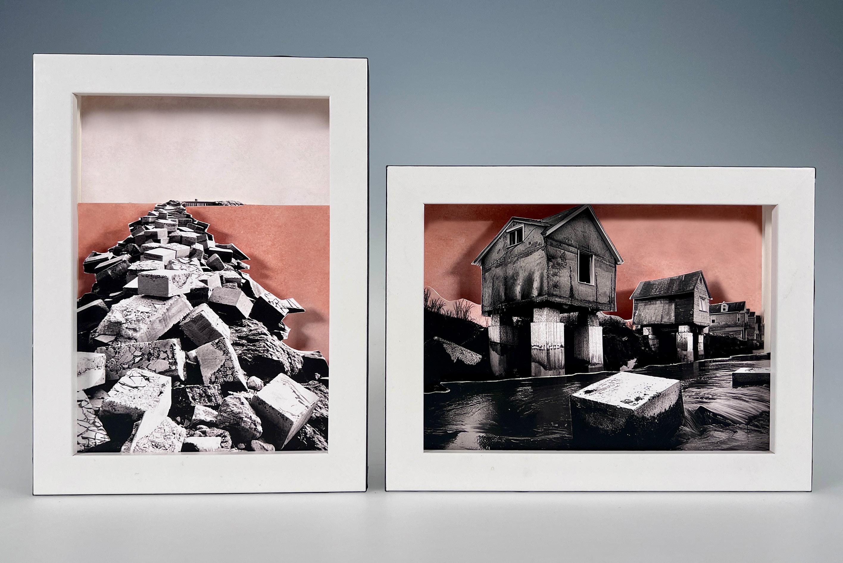
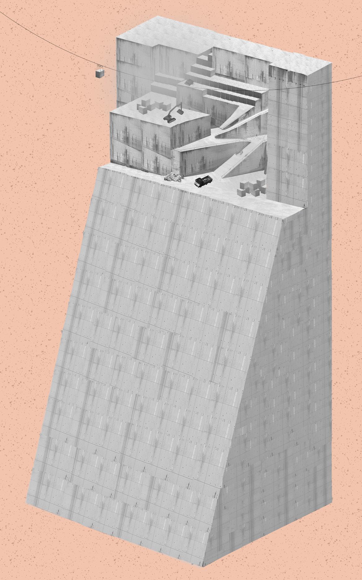
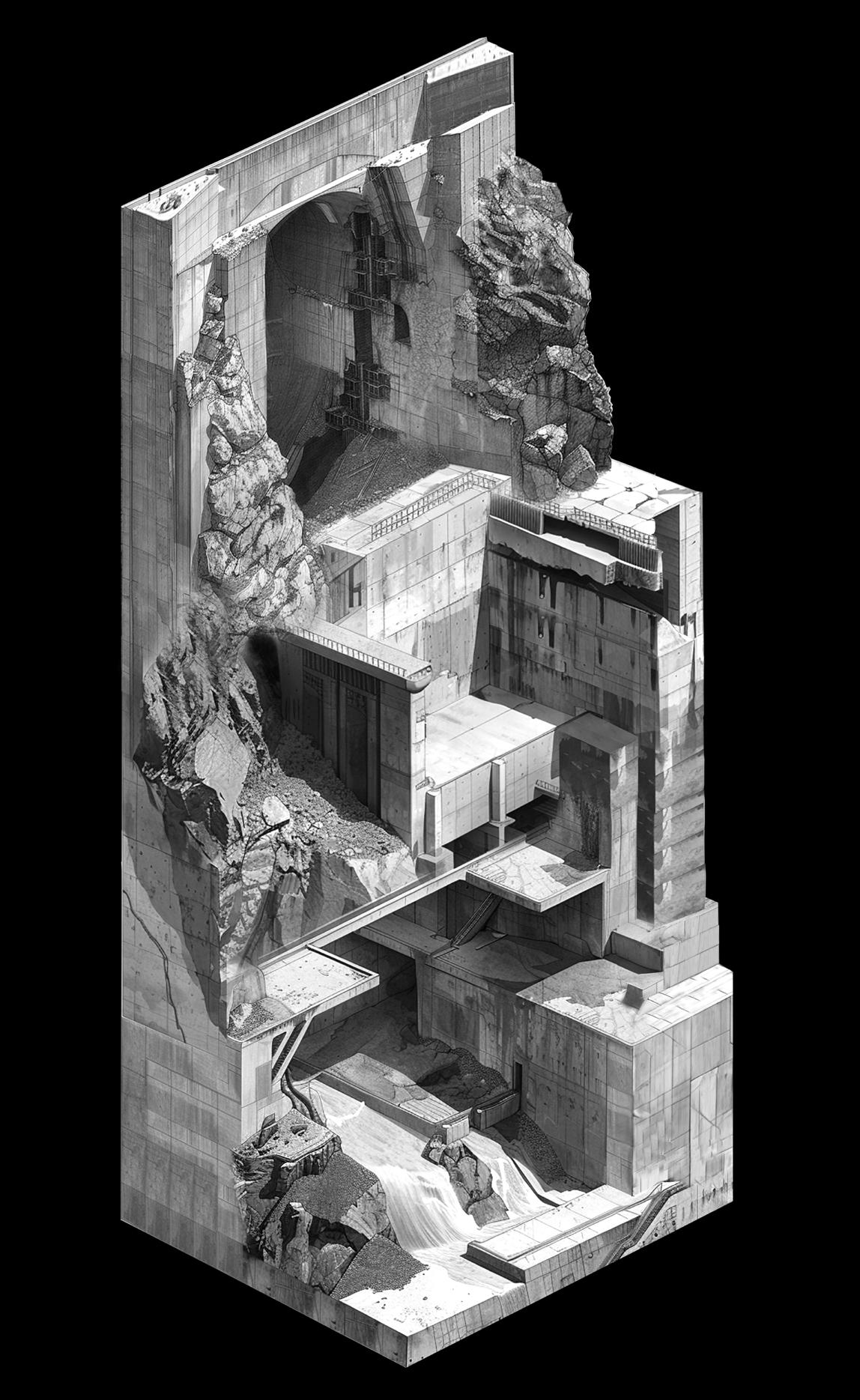
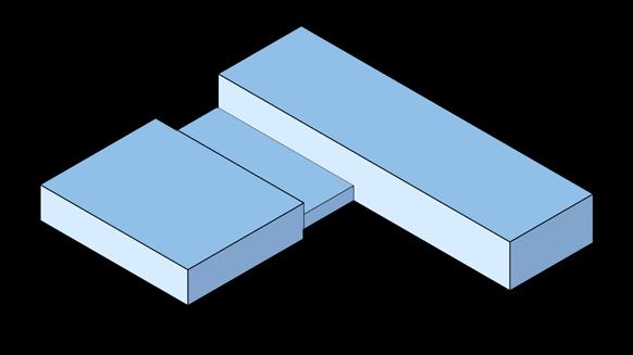
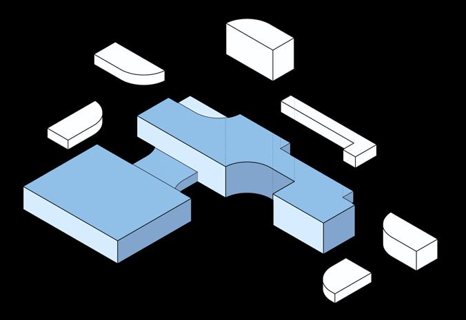
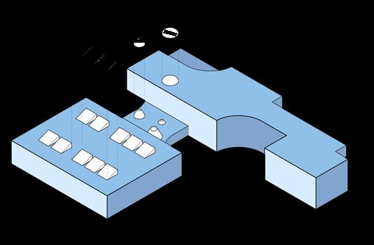
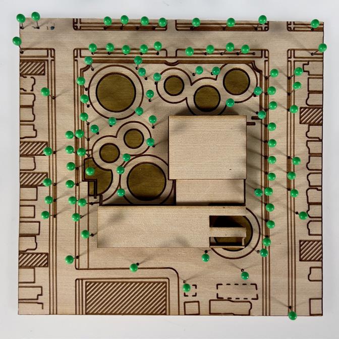
Previous Page + Left: 3-D dioramas depicting where the excavated blocks might be placed to help combat climate change: jetties used to protect eroding shorelines, pillars lifting houses in flood zones. As the blocks are extracted from the site new spaces are formed within and on the dam.
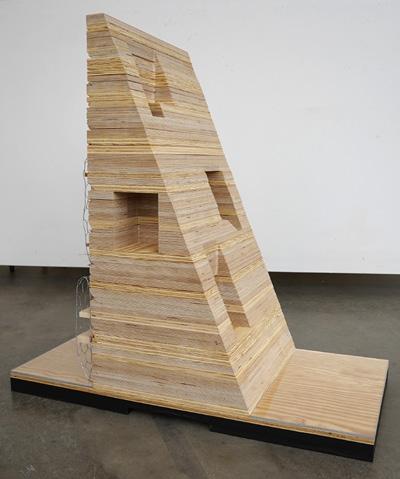
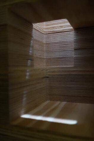
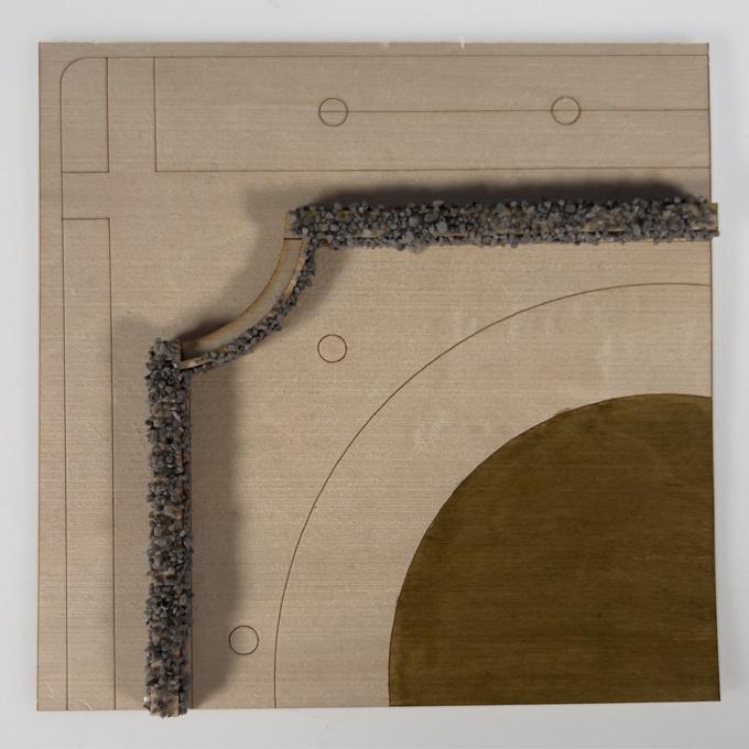
Above: A physical chunk model of the center of the dam, depicting the newly formed excavated spaces within the dam.
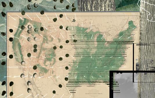
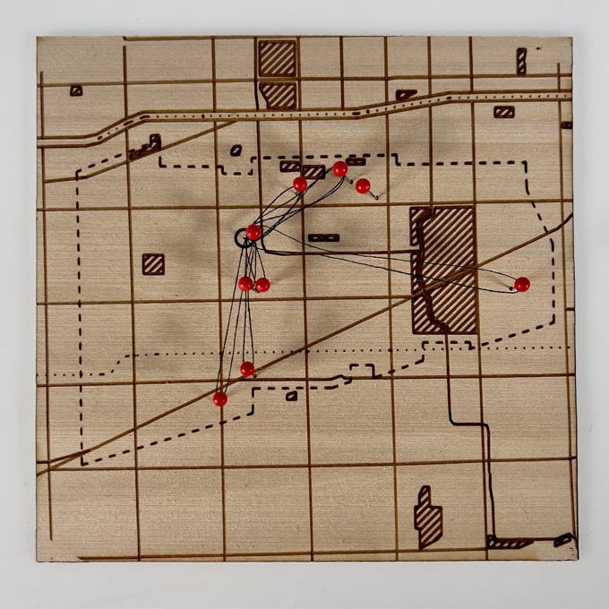
Below: Thesis installation of dioramas, dam model, digital presentation and supporting research artifacts. The thick black line is the Colorado River, with the dams indicated by 3-D triangles markers. The left shows a roadmap of where the excavated material goes. The right, new surreal places created by the removal of the material.
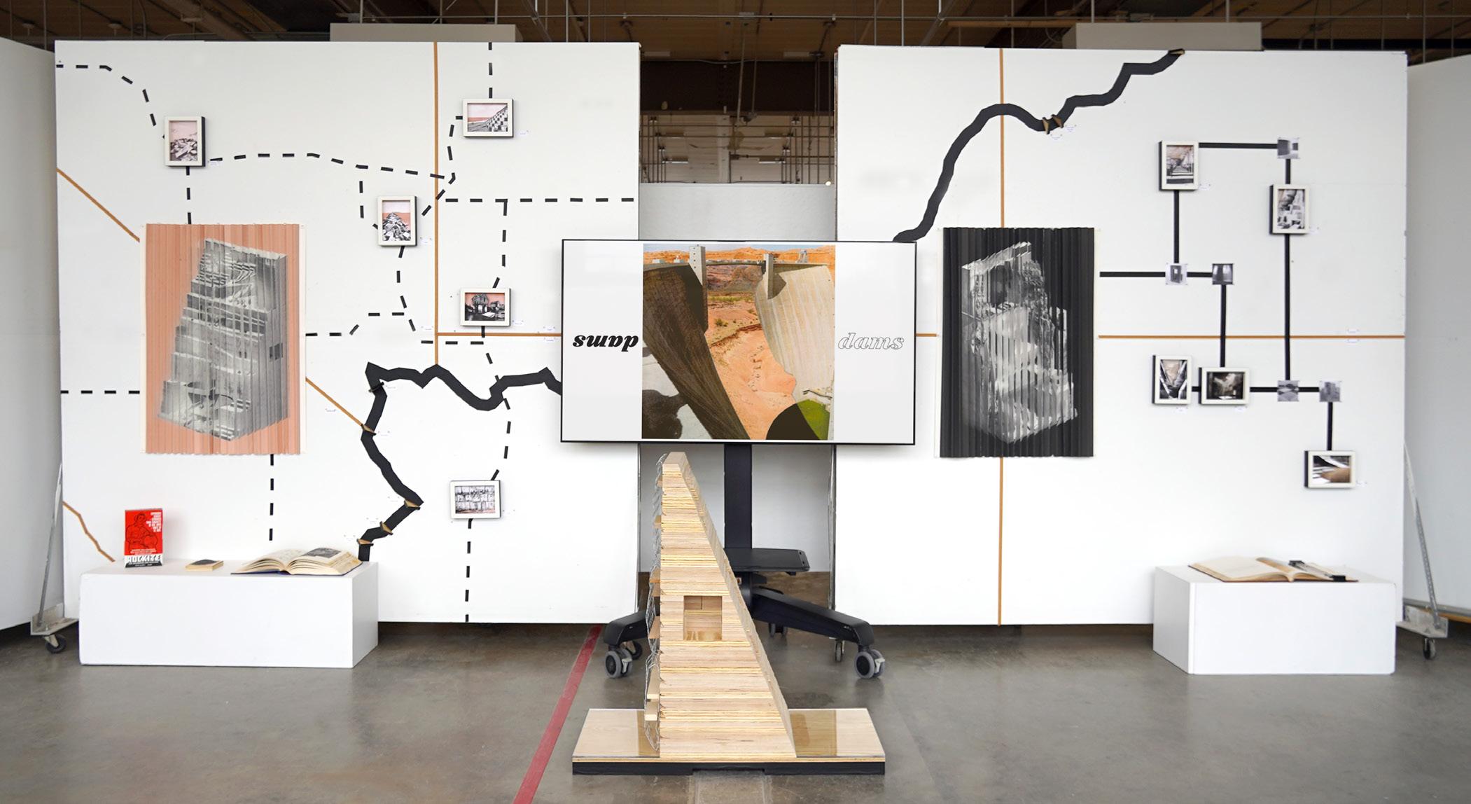
Our research explored mining techniques and architectural uses of block forms, drawing inspiration from Richard Serra, Carl Andre, and Carlo Scarpa. Speculating on future site conditions, we envisioned excavation occurring on both sides of the dam, represented through axonometric drawings illustrating its transformation after 5 and 50 years. Mimicking stone quarrying, the dam would be dismantled into 4’x5’x10’ blocks, producing ~73,000 blocks. The excavation process, if continuous, would take 10 years, paralleling the original construction time.
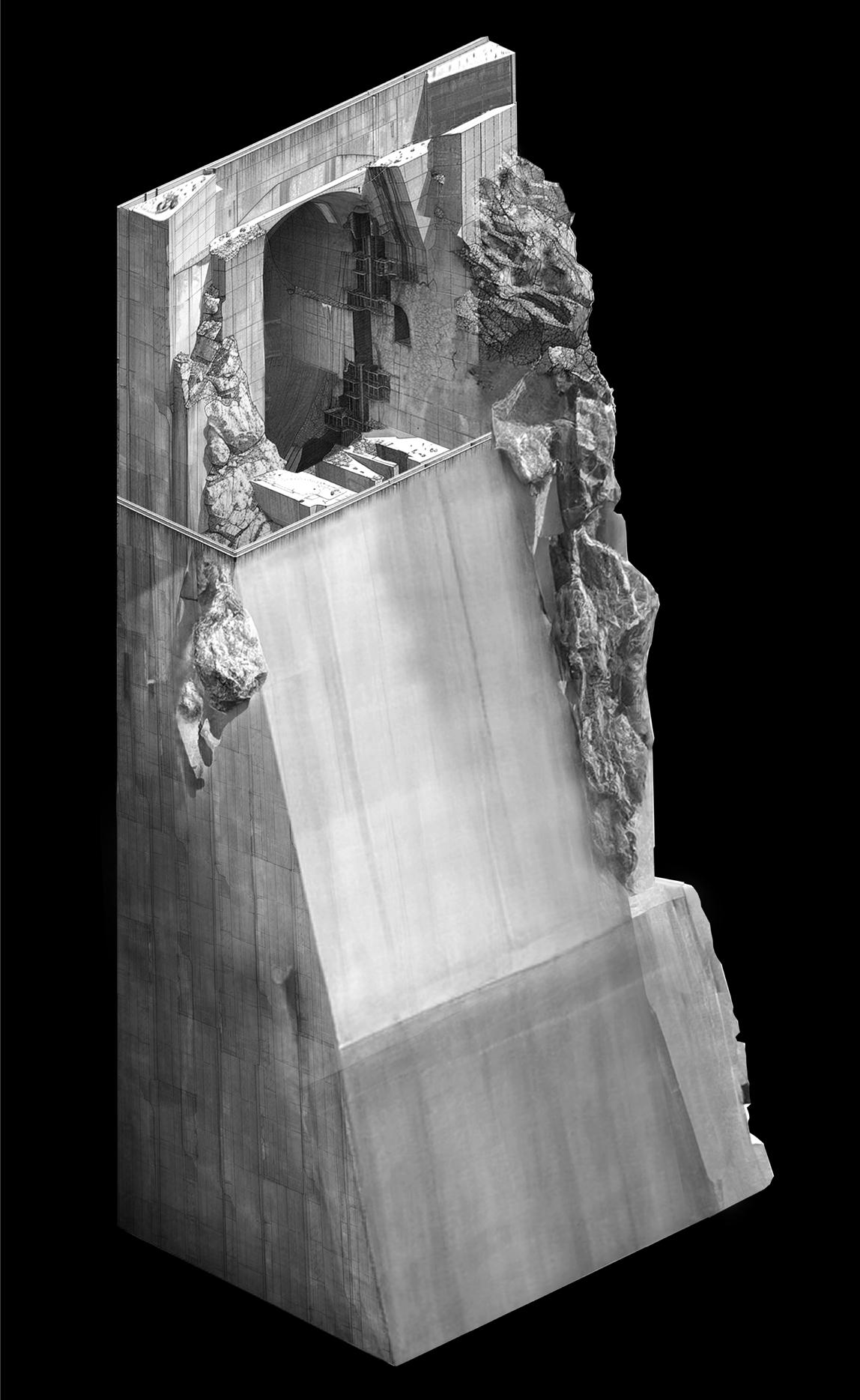
YEAR 5
YEAR 50
Nurtured Urbanisms
Course: Propositions Studio, University of Michigan
Instructor: Claudia Wigger Fall 2023
“I’m not a scientist. What I know is what you know, and everybody in this room knows, that went through the normal K through 12, the world used to be a lot colder. It got a lot warmer before we were ever burning, uh, extracted, uh, net extracted carbon. And we don’t know what man’s impact is. We don’t know how to affect it.”
Rep. Darrell Issa
The San Diego Union-Tribune 12 January 2020
“Global temperatures have not risen in 15 years.”
Sen. Bill Cassidy a debate in Shreveport, LA Fall 2014
“People are not affecting climate change. You’re going to tell me that back in the Ice Age, how much taxes did people pay and how many changes did governments make to melt the ice?” Greene began. “The climate is going to continue to change. And there is no reason to just open up our borders and allow everyone in and continue to funnel over $50 billion or however many billions of dollars or trillions of dollars to foreign countries all over the world simply because they don’t like the climate change.”
Rep. Marjorie Taylor Greene Congressional Meeting 26 April 2023
“The Green New Deal and the environment, which they say may affect(s) us in 300 years, is all that is talked about...They say the ocean will rise one-eighth of an inch over the next 200 to 300 years, but don’t worry about nuclear weapons that can take out entire countries.”
Former President Donald Trump 15 April 2022
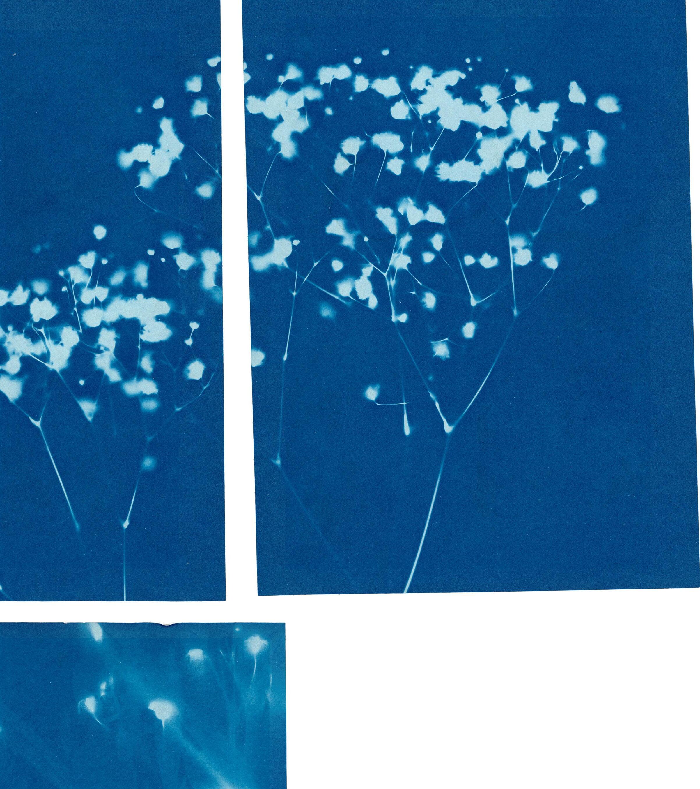
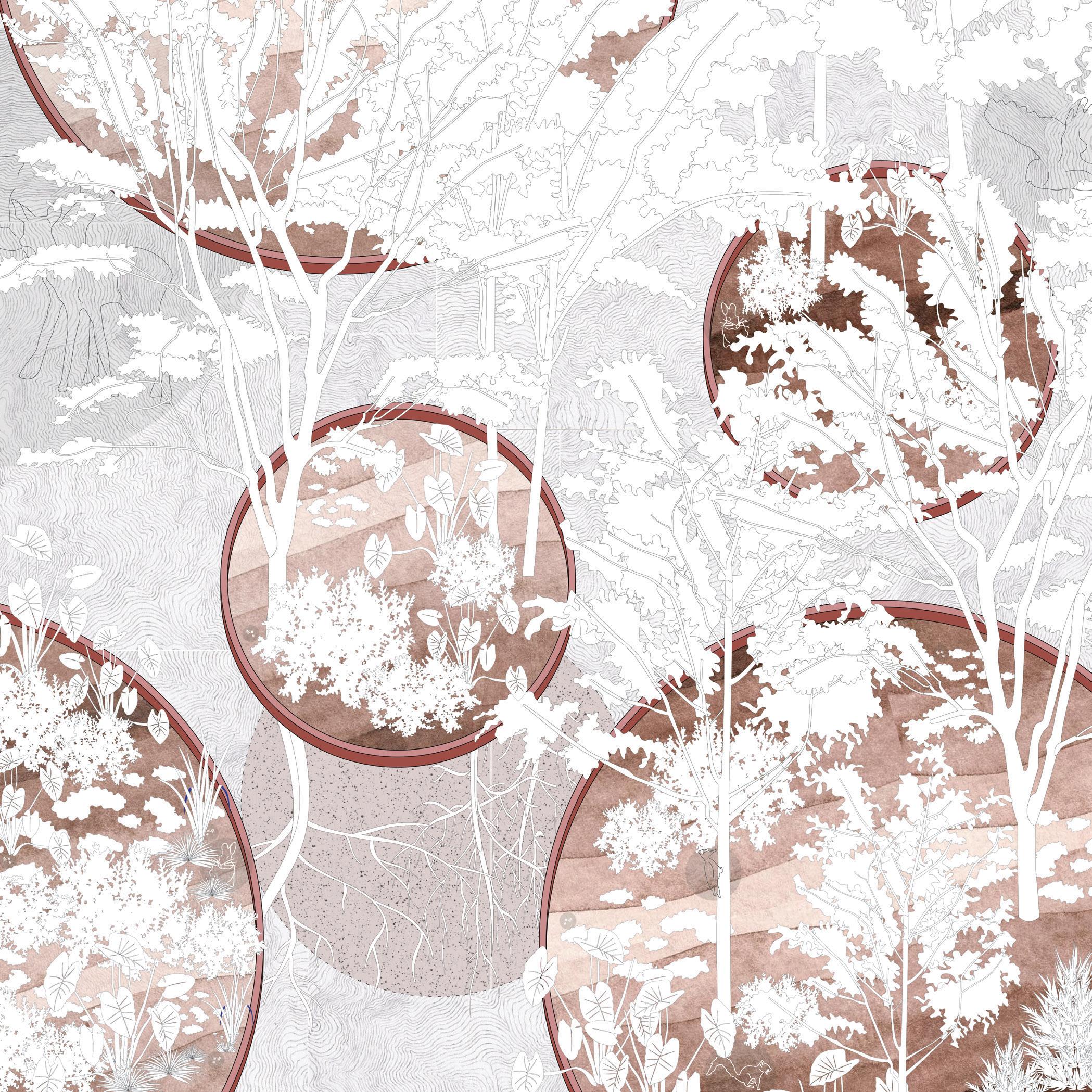
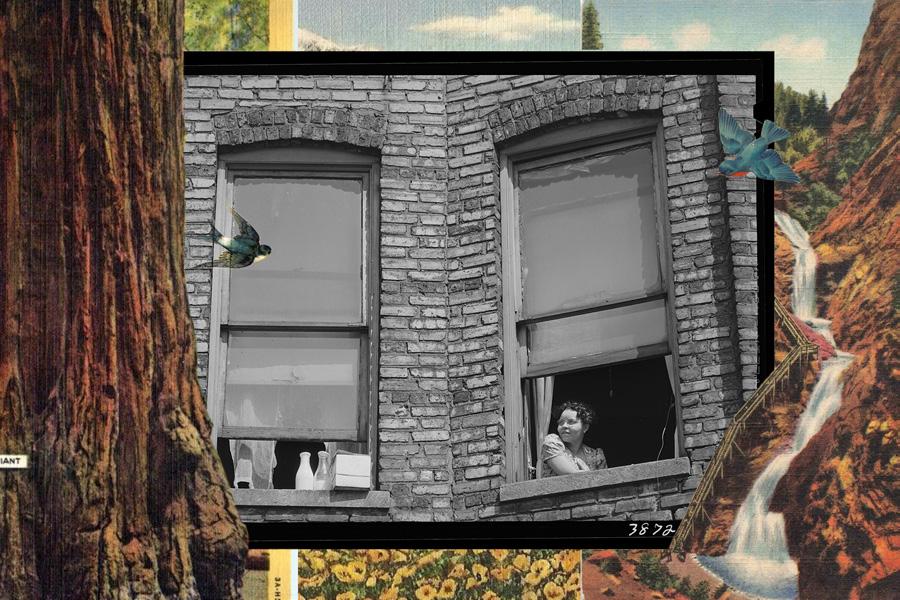
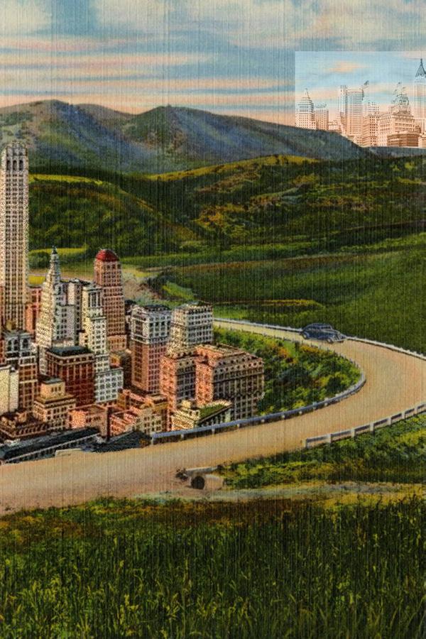
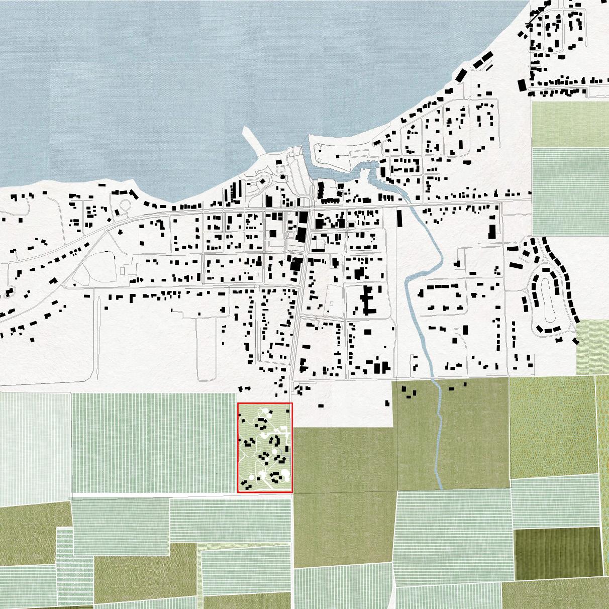
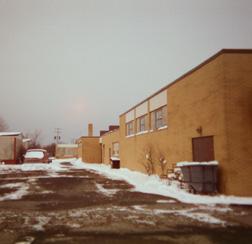
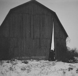
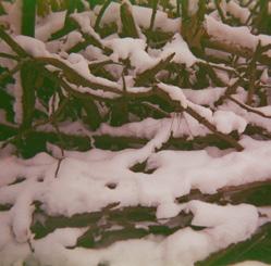
This studio explored ‘shadows’ as a key element in architectural and urban space-making. As an introduction to the material, performative and atmospheric aspects of shadows were visualized through postcards. Addressing the political implications of climate change, redacted poems transformed rhetoric from climate-denying U.S. officials, ‘casting shadows’ that shifted denial into acceptance and concern.

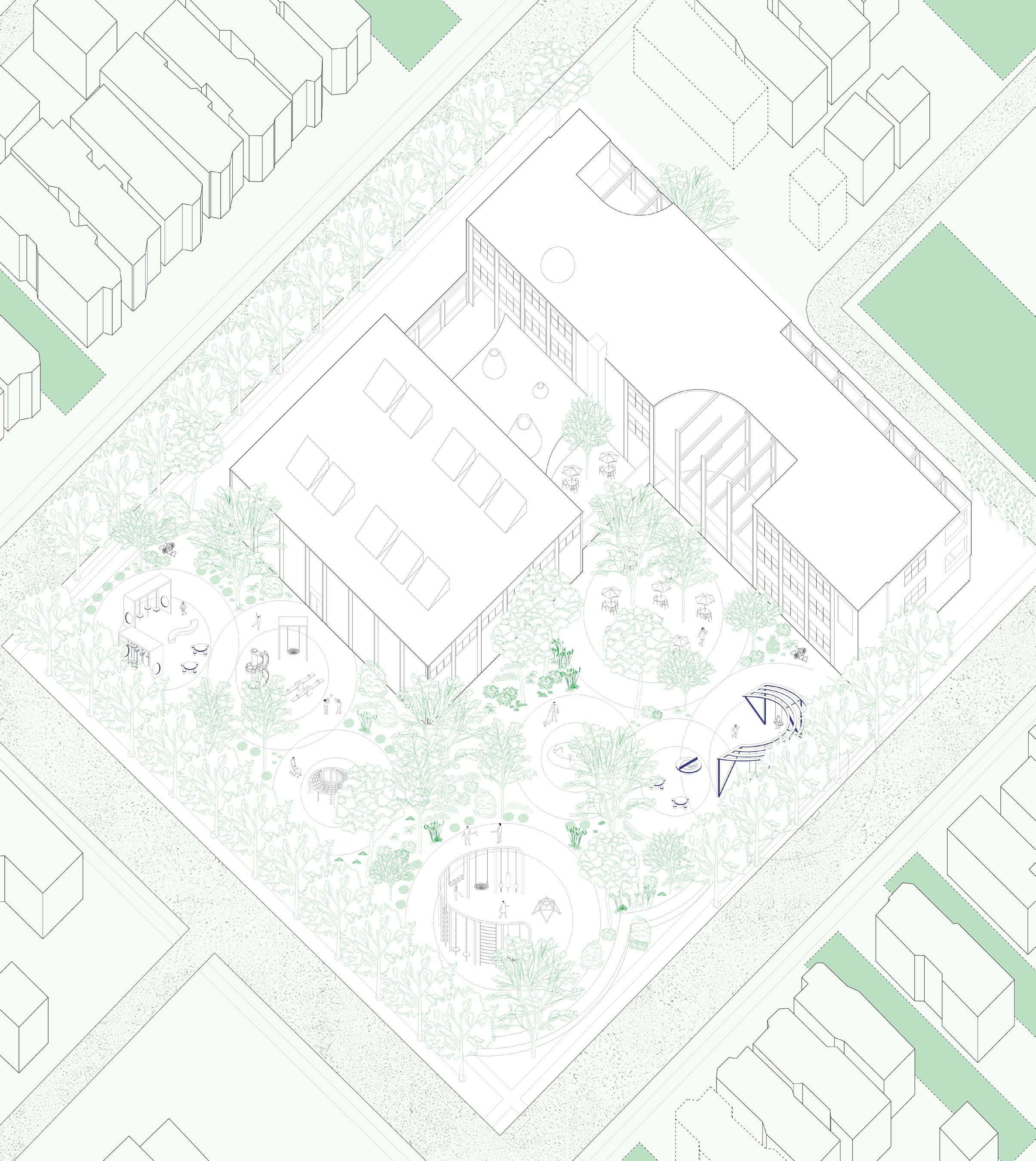
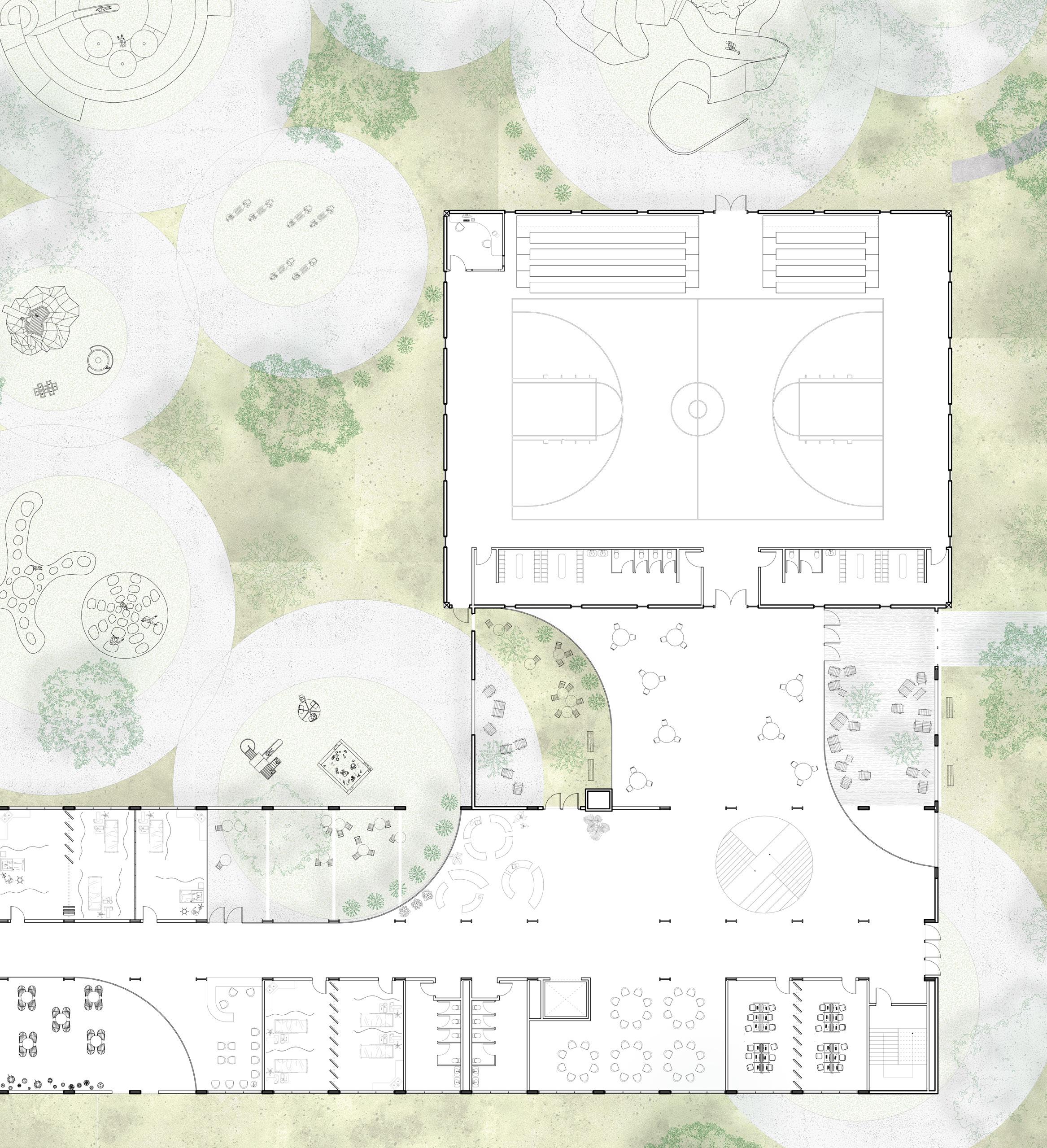
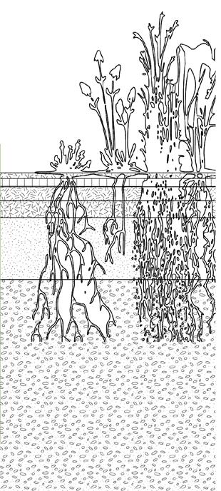
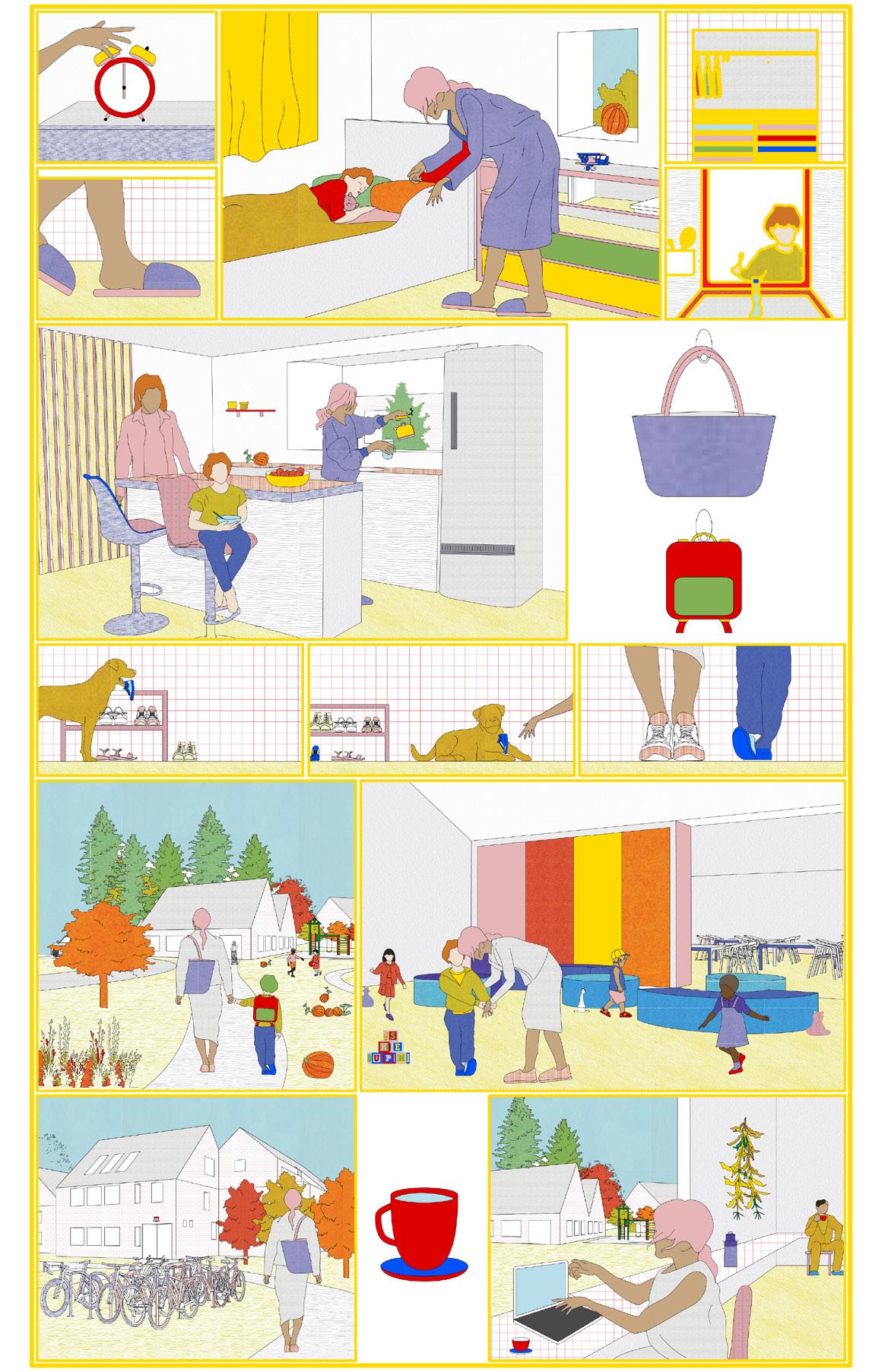
In June 2013, Chicago witnessed the largest mass school closure in U.S. history, with 50 schools, including Henson Elementary in North Lawndale, shutting down. Over a decade later, the Henson Elementary building remains vacant, owned by the city, and has fallen into disrepair, a common issue in urban areas across the U.S. This project proposes a reimagining of dormant urban buildings, transforming the site into a micro-forest by removing sealed surfaces, and reintroducing a medical center, community center, and recreational gym.


The design incorporates flexible interior spaces that can adapt over time to the evolving needs of the residents, while the addition of curtain windows and skylights allows natural light and air to permeate the building. To address the community’s preference for non-residential use, the landscape is transformed into a tree-focused playscape, introducing micro-forestry and enhancing local biodiversity by linking the space to nearby abandoned lots with native plants.
BUILDING FORM BUILDING ALTERATIONS
NEIGHBORHOOD
Key neighborhood buildings in relationship to Henson Elementary School.
TREE DIAGRAM
Aligning with city goals tree canopy was increased from 8% to ~30%.
GABION FENCE
The site will utilize the torn up asphalt to fill a gabion fence along the perimeter, doubling as a ‘shadow’ of the former site.
SITE Henson Elementary ORIGINAL
Molds, Mycelium + Bioplastics
Course: Biomaterials for Designers, University of Michigan
Instructor: Glen Wilcox Fall 2023
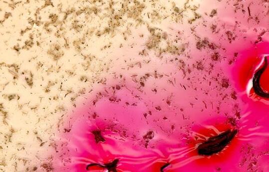
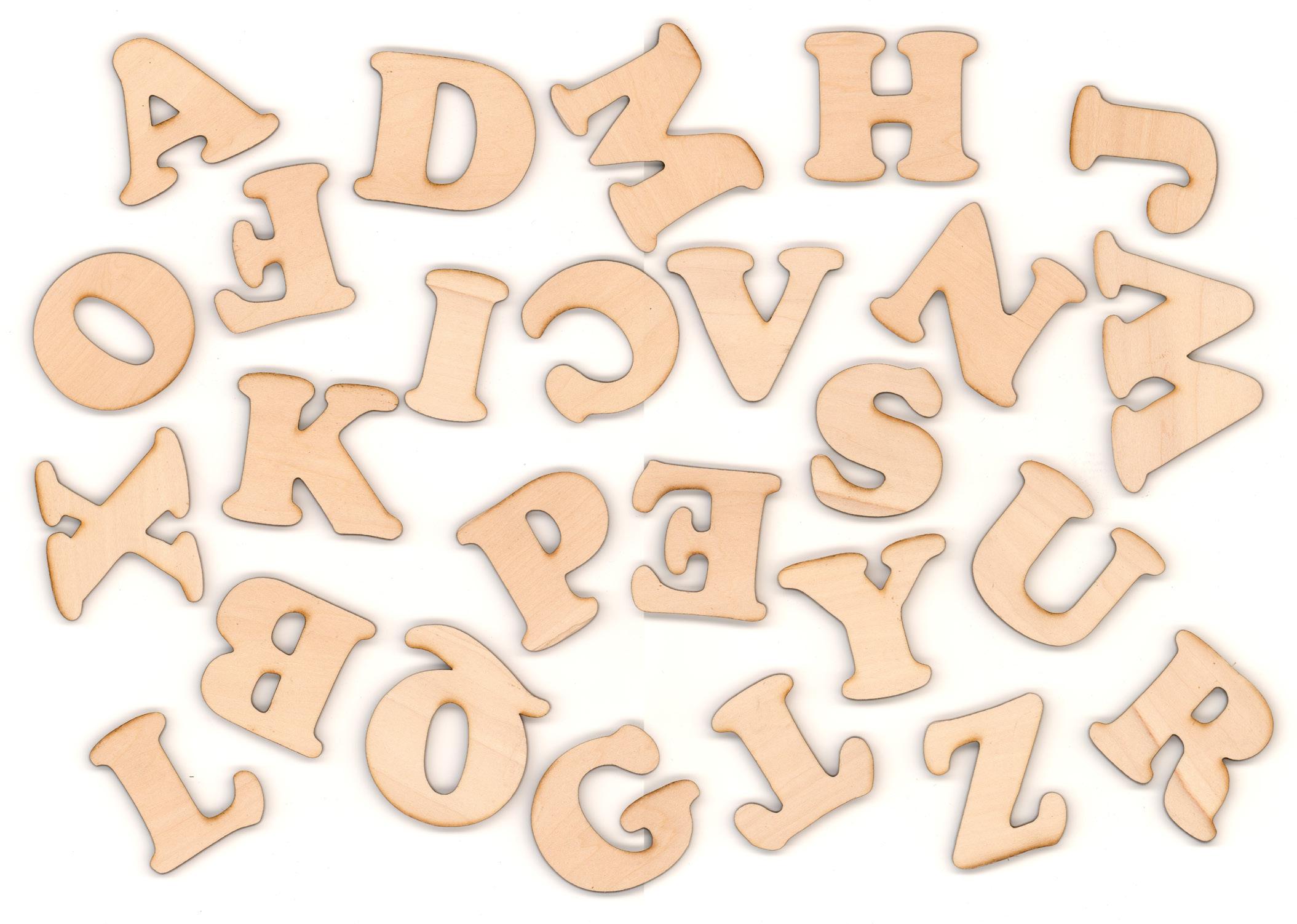
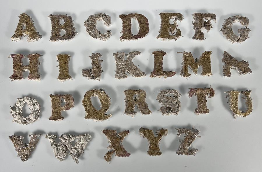
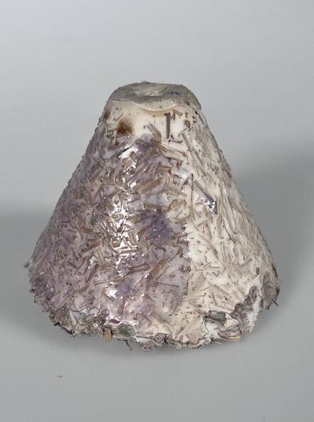
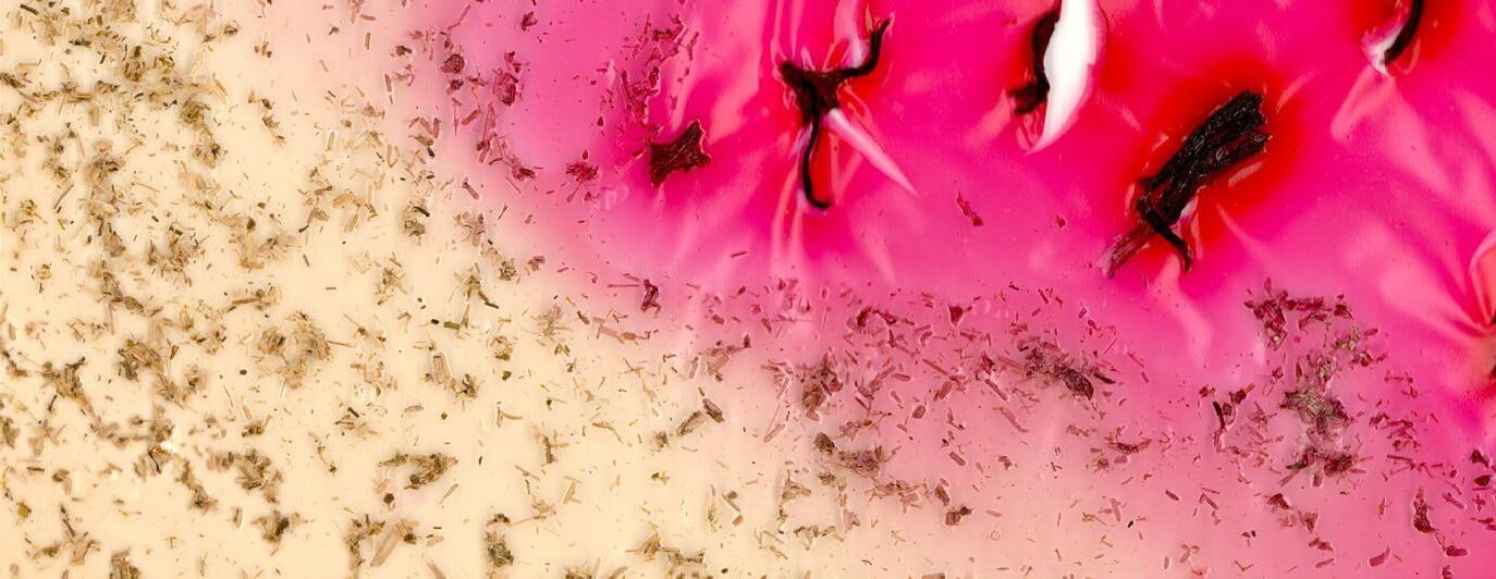
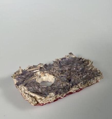
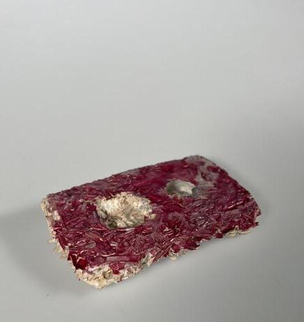
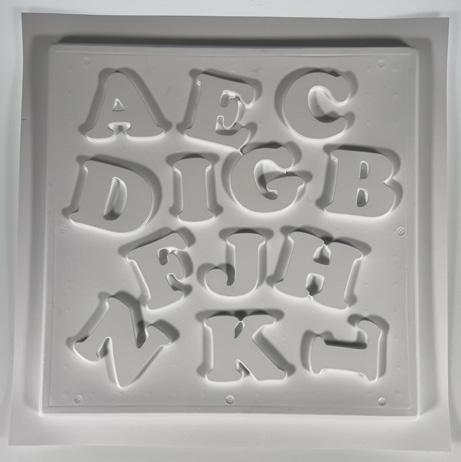
This course aimed to explore the use of bio-based and found materials in the design and construction of functional objects. My project focused on creating bio-based materials for children, who are continuous learners. Using plastic alphabet refrigerator magnets as a reference, I sought to recreate these objects with mycelium as the primary material. To add color, the mycelium was coated in plant-based dyed bioplastics. I tested various fonts and sizes, ultimately selecting Cooper Black with 2.5” letters. Molds were created by vacuum-sealing balsa wood cutouts. Initial mycelium growth was unsuccessful, likely due to contamination during molding, but the final cast showed growth, though the letters were fragile. I coated them in three bioplastics, using water-based dyes from butterfly pea flower, hibiscus, and chamomile. The final colors were less vibrant than initial tests, likely due to moisture retention in the mycelium. While the letters were prototypes, they demonstrate the potential of mycelium as a new material for children.


Farm to Form to Frame
in collaboration with Deanna Baris + Sophie Pacelko Course: Collectives Studio, University of Michigan
Instructors: Jonathan Rule + Kathy Velikov
Student Showcase 2023 - Collectives Studio Winner
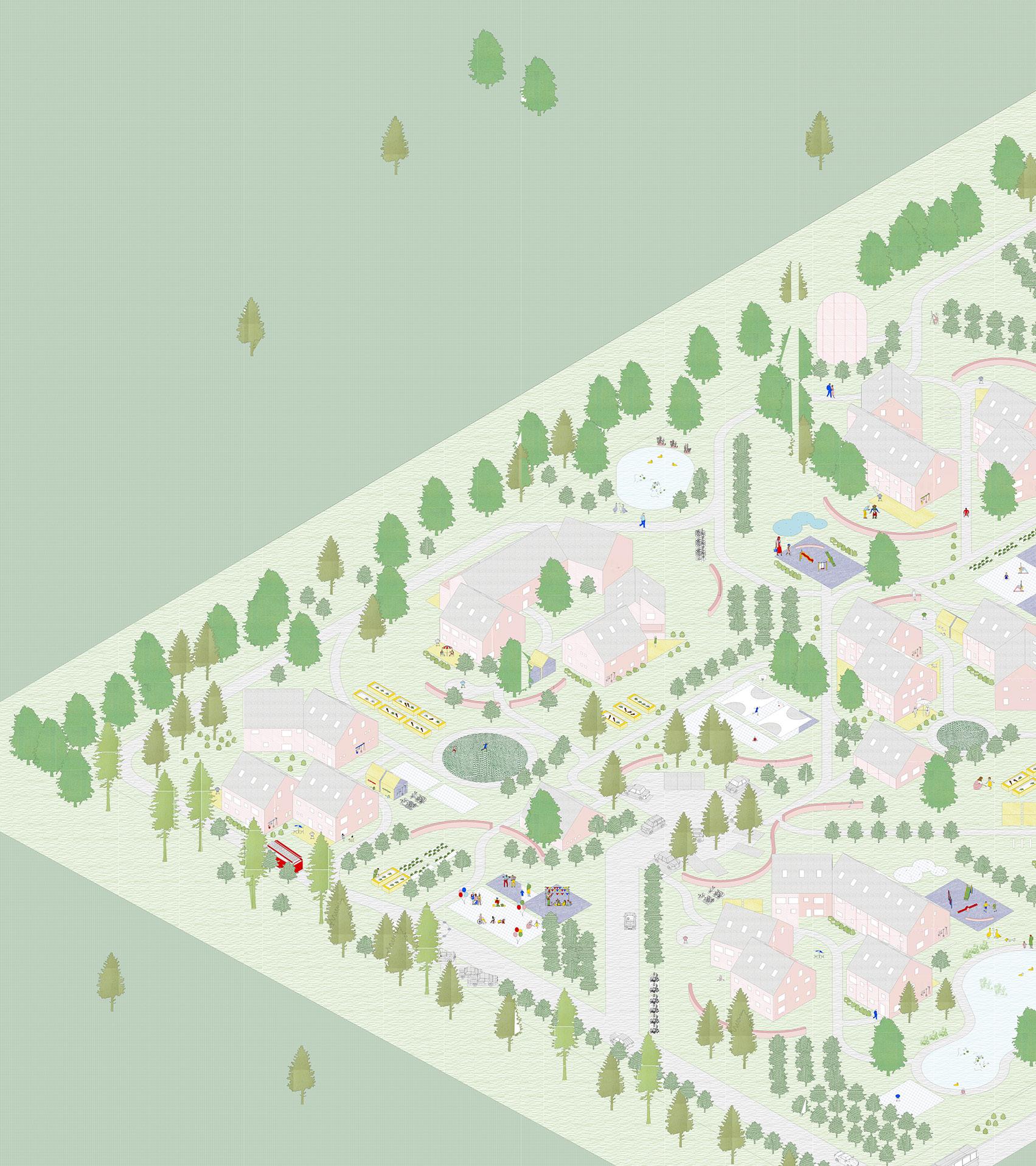
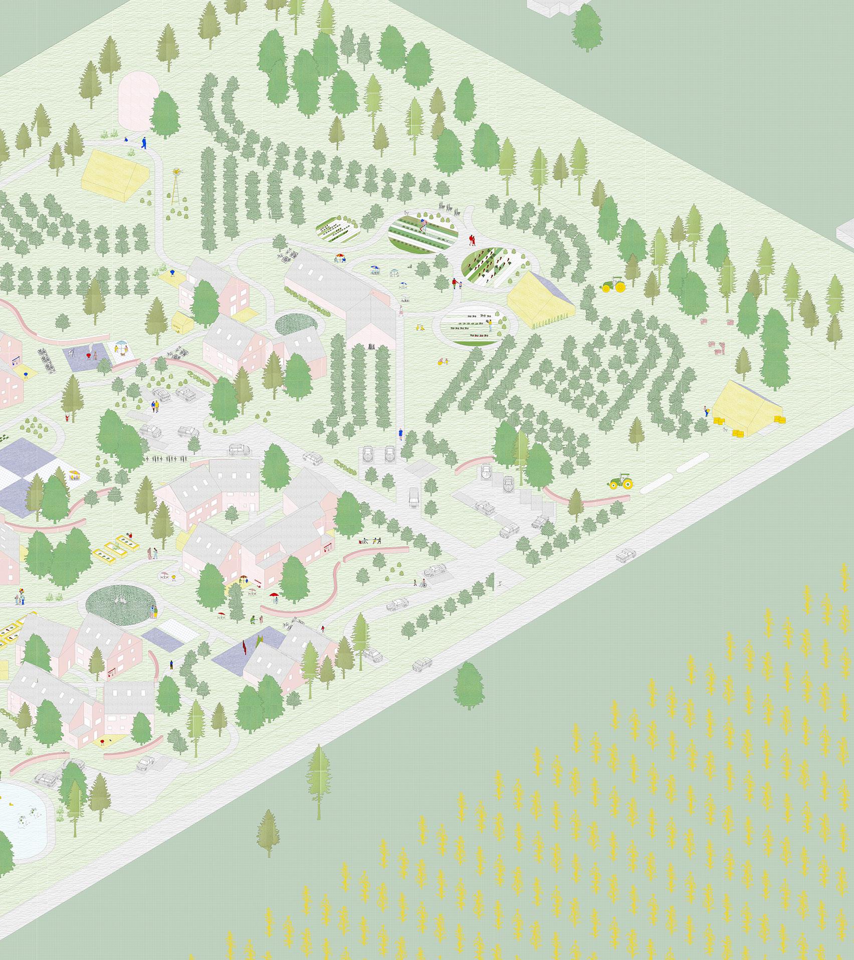
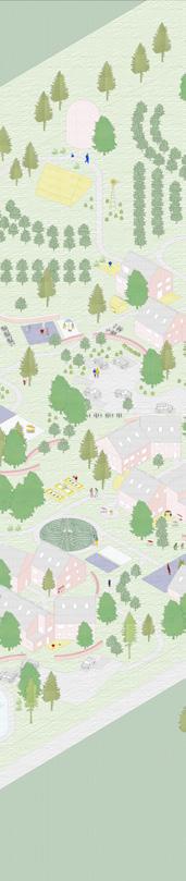
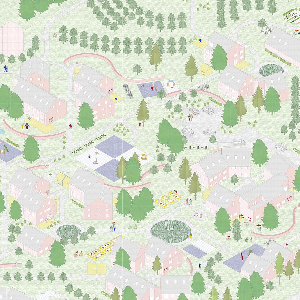
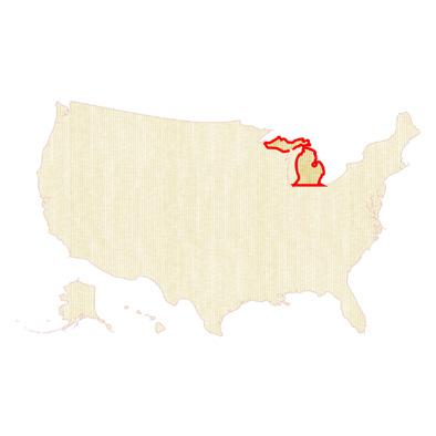
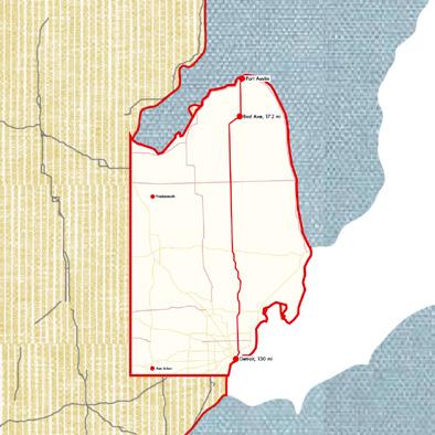
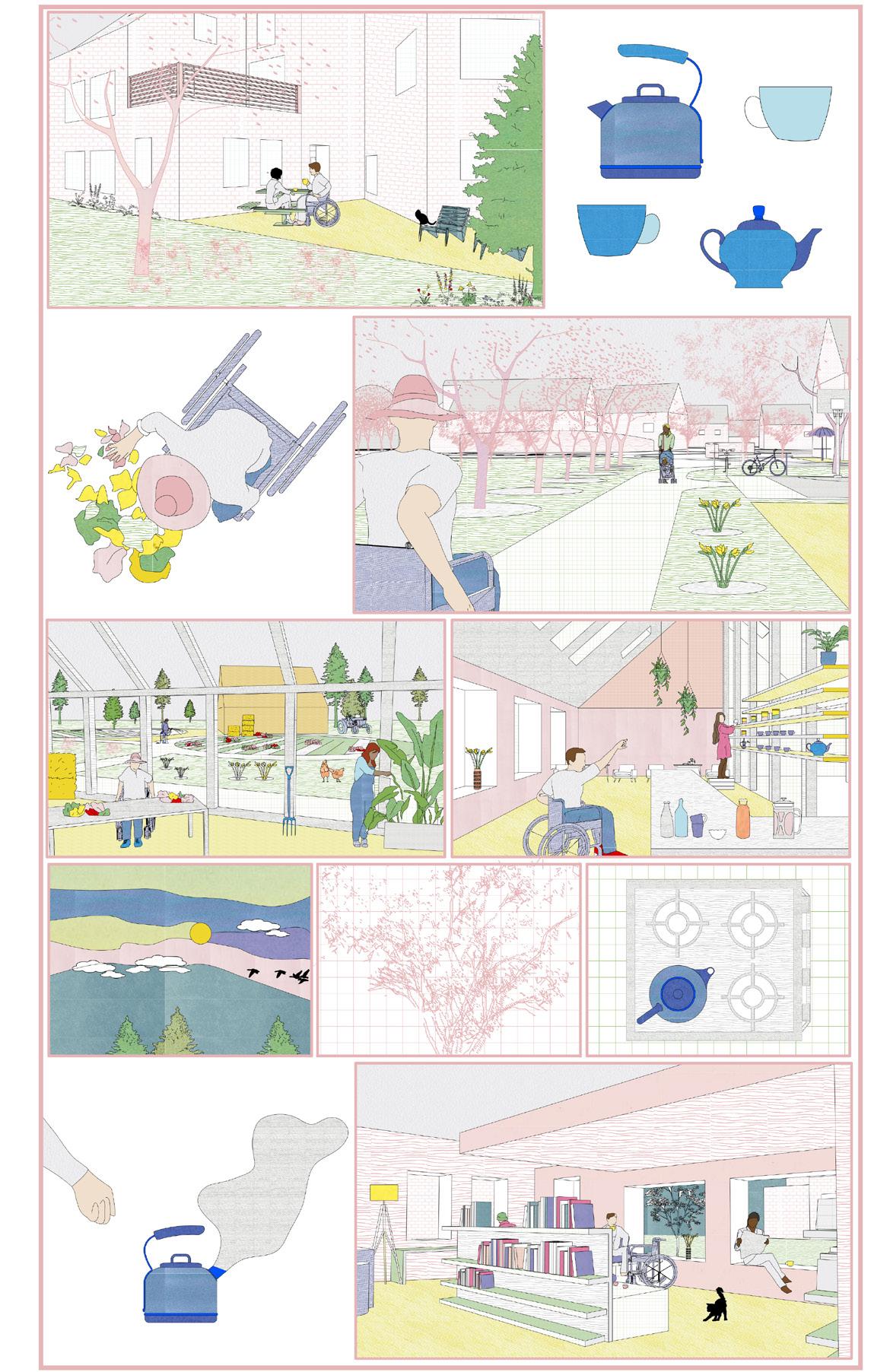
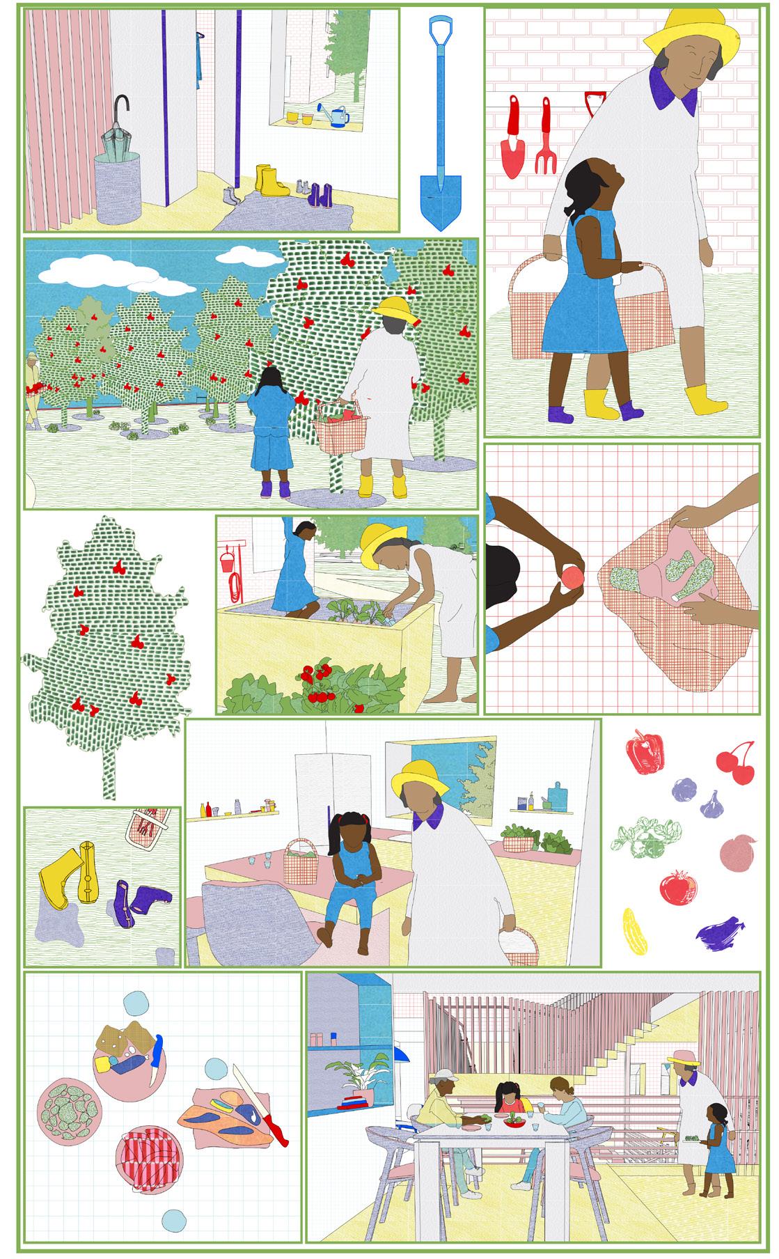
Farm to Form to Frame is a straw-insulated housing development located in Port Austin, Michigan, aimed at serving aging populations, families, and climate refugees. With Port Austin’s permanent population increasingly aging, the project addresses a pressing need for housing that fosters intergenerational living, enabling older residents to reside in close proximity to their families. This proposal envisions a mixed-use micro-village that combines residential, agricultural, and community spaces to promote sustainable living, enhance access to local produce, and create a walkable, dense residential environment. In addition to housing, the site program includes a farm, tea house, flexible small-business spaces, daycare, gym, and an indoor pool. The northwest corner of the property is designated for an art barn, providing a venue for the region’s ongoing public art and placemaking initiatives.
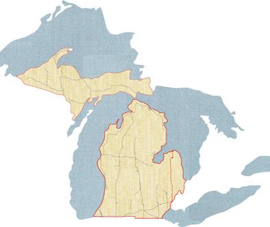


The Southern Peninsula of Michigan is home to many native flora and fauna and the thumb region has a rich diversity of plant species. The area was predominately a white pine forest prior to clearing the land for agricultural. The soil reports show where the woodland species would have existed on the site. Some trees currently on the site, unidentified to us, are most likely white pines but also hold a mix of deciduous and evergreen trees.
GRINDSTONE LOAM
Most of these soils are cultivated. Corn, beans, small grains, and sugar beets are the principal crops. Consists of very deep, moderately well drained soils that are moderately deep to dense till. Grindstone soils formed in loamy till on till plains and moraines.
SHEBEON LOAM
Consists of very deep, somewhat poorly drained soils that are moderately deep to dense till. Shebeon soils formed in loamy till on wave-worked till plains, water-lain moraines, and moraines.
DEERTON VARIANT GRAVELLY LOAMY SAND
Most areas of the Deerton soils are used for woodland, with mixed northern hardwoods being the dominant forest type. Consists of well drained soils moderately deep to weathered sandstone or sandstone. They formed in sandy outwash beach deposits or sandy residuum from the sandstone.
The site development aims to reforest with native plants, using evergreens as windbreaks and deciduous trees for summer shade and winter light.
Native Shrubs:
Gray dogwood - Cornus foemina
Serviceberry - Amelanchier arborea
Carolina rose - Rosa Carolina
Native Trees:
Sugar maple - Acer saccharum
White birch - Betula papyrifera
White ash - Fraxinus americana
Black cherry - Prunus serotina
Beech - Fagus grandifolia
The 17-acre site was analyzed by soil type to guide planting and building placement. The predominately loam soil supports small-scale, diverse farming integral to the project’s goals. Soil analysis also informs foundation choices and program locations. With only 1% of Port Austin’s 495,258 acres certified organic and nearly 60% tilled land exposed to high winds, mitigating soil erosion and pollution is crucial for community health.
The site includes 2.5 acres reserved for gardens and approximately 600 semidwarf fruit trees, spaced for tractor access. These trees yield an estimated 180,000 pounds of fruit annually, with a harvest calendar showcasing the seasonal produce grown on-site.

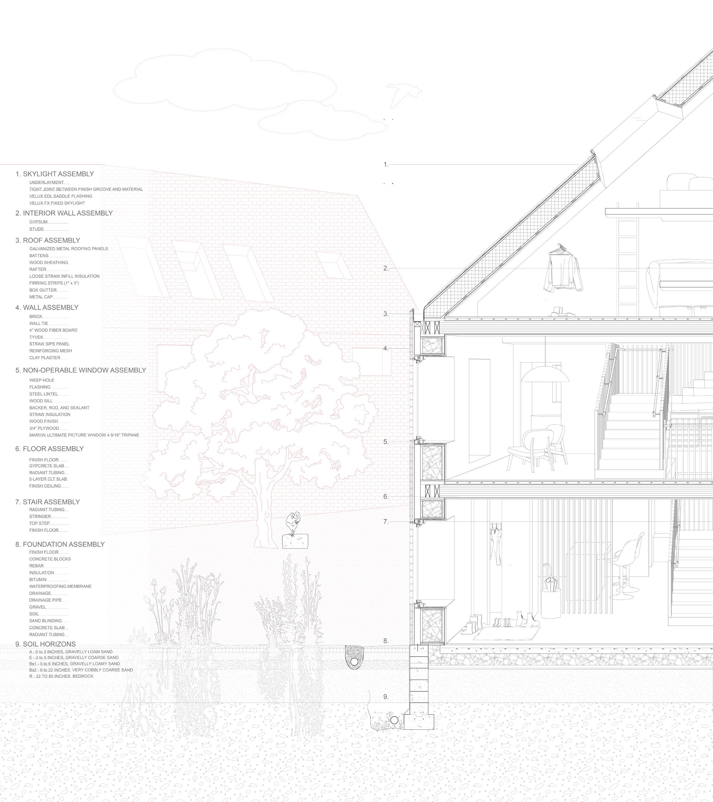
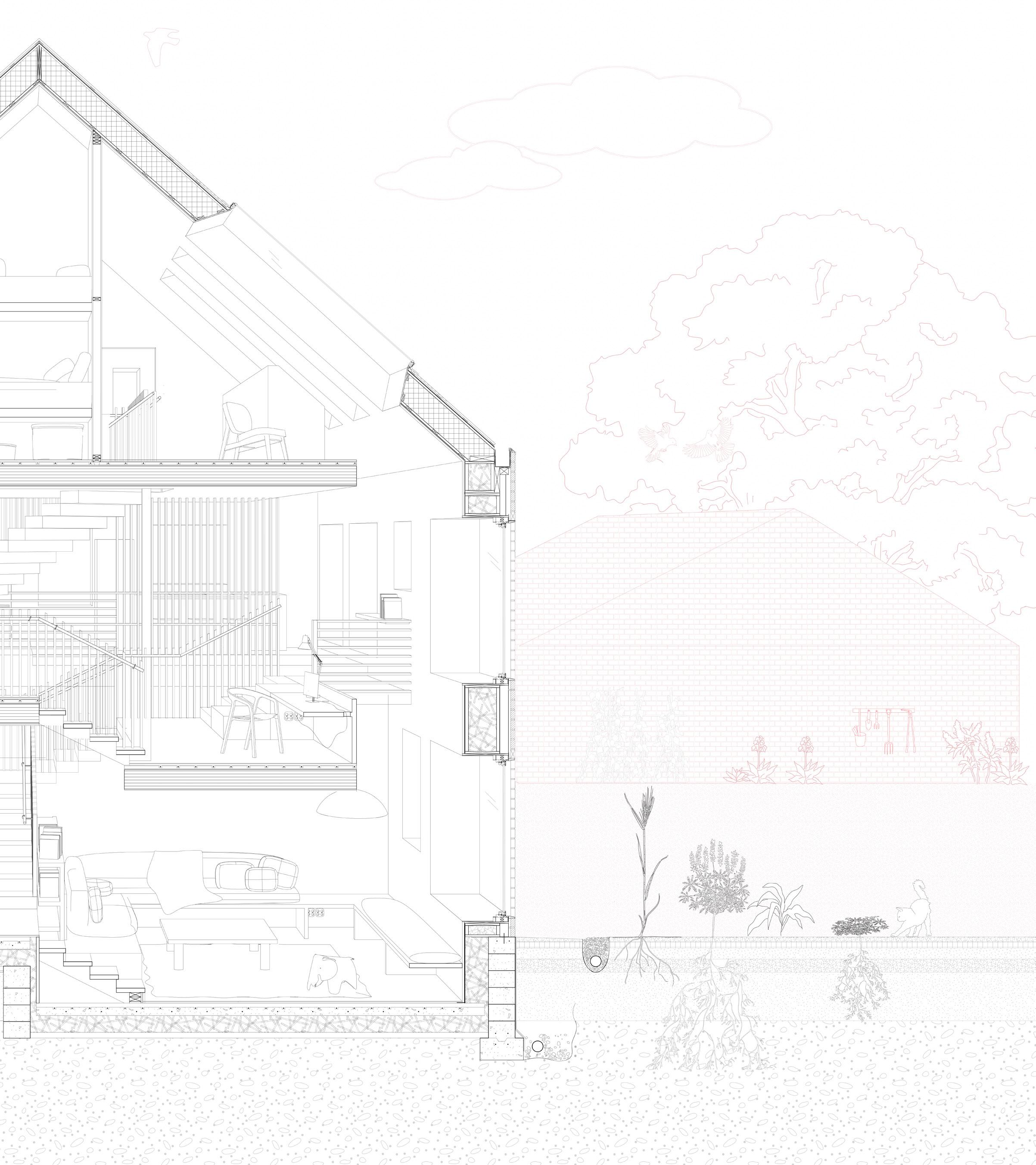
Straw Bale Structurally Integrated Panels
Native Floral + Fauna Vegetables + Fruit Trees
The project features 45 total units, organized into four building clusters derived from 36’ x 36’ modules rotated at 15- and 45-degree angles, accommodating up to 206 residents. Unit types include ADA-accessible ground-level units and multi-story split-level configurations, offering nine layouts from studios to four bedrooms. Constructed using SIPs with locally sourced straw bale insulation, the buildings achieve low energy loads with no mechanical cooling and minimal heating needs, while thick walls create opportunities for built-in seating, tables, and storage. Surrounding the housing are orchards and gardens planted with native species, which seamlessly blend into the rural landscape while fostering a sense of ecological harmony.
9 UNIT TYPES
STUDIO SILO (X2) STUDIO GABLE (X2) 1-BED ACCESSIBLE (X5)
2-BED
3-BED

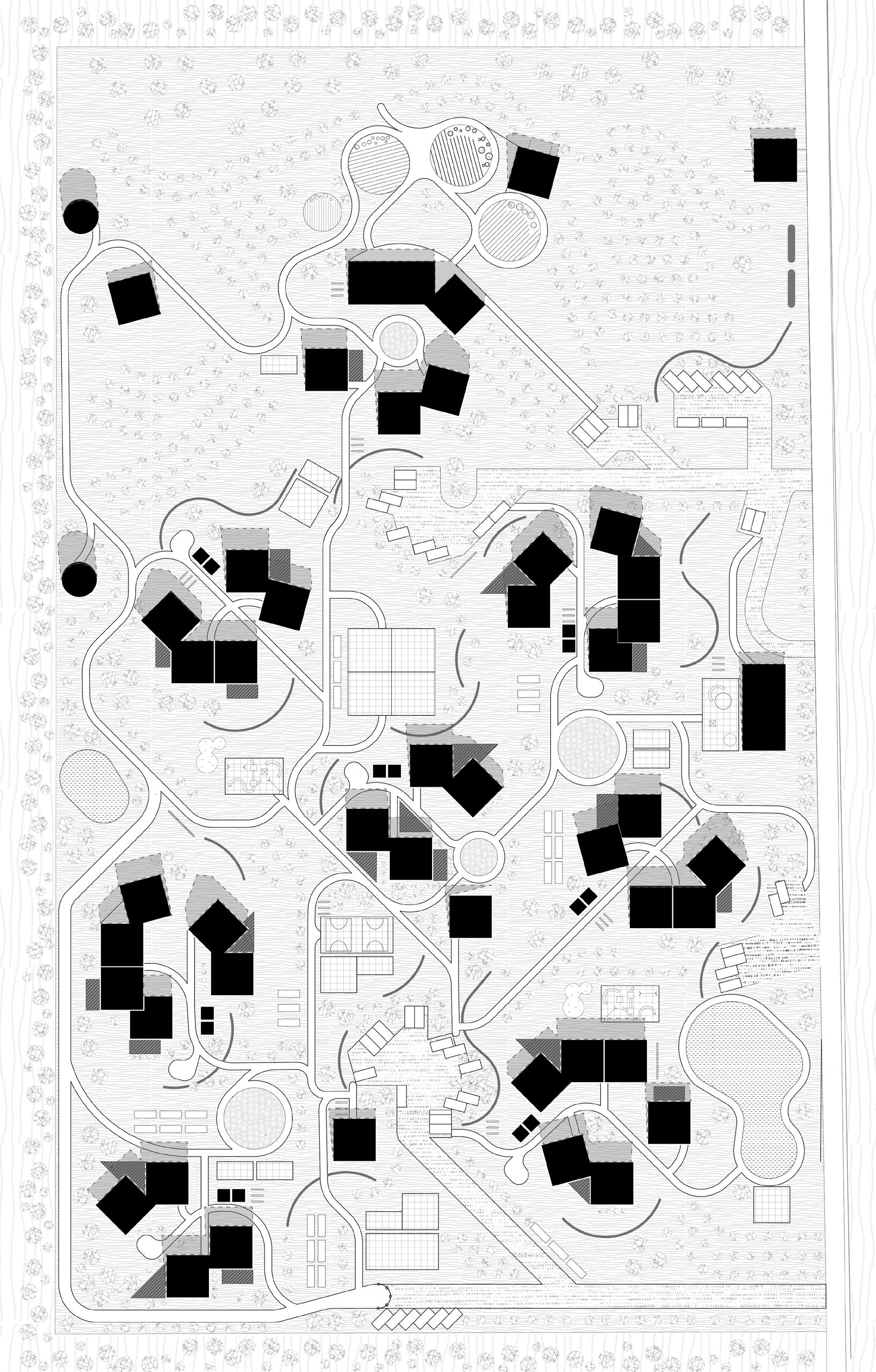


FARMING
TEA SHOP BARN HOUSING
PARKING COFFEE
SCHOOL
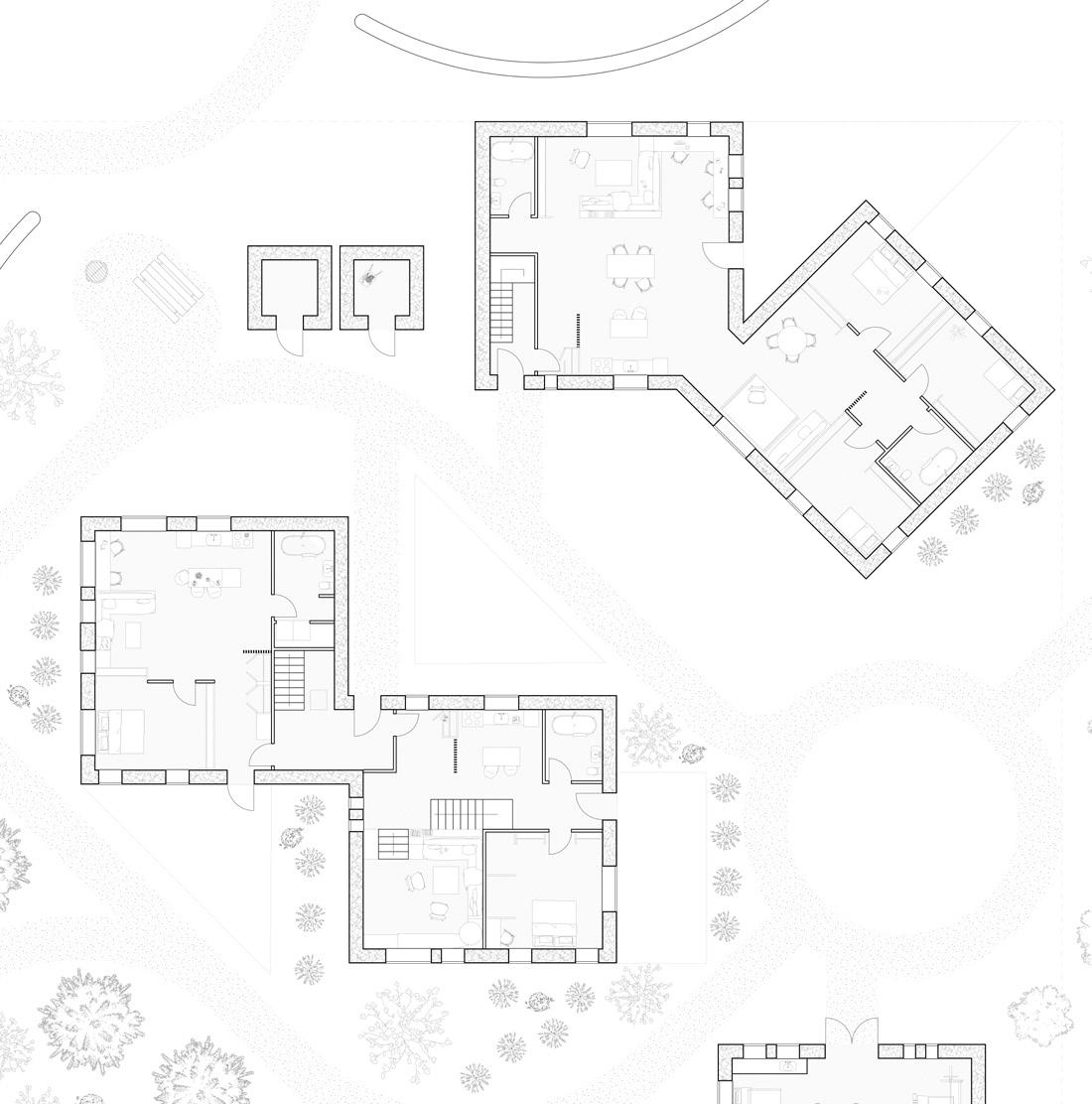
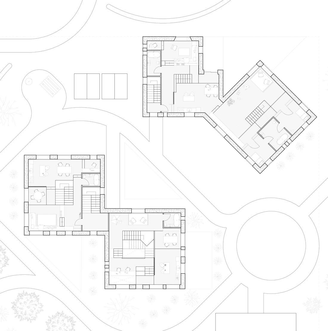
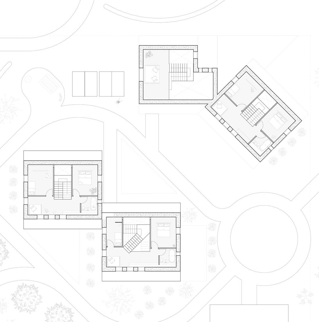
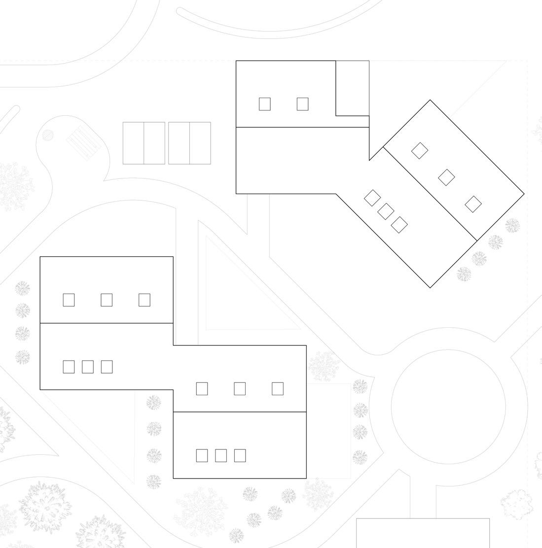
Floor plans for central block cluster (highlighted in the red dashed box on site plan) showing the following: 1-Bed Accessible, 2-Bed Split Level, 3-Bed Split Level, 3-Bed Accessible and 4-Bed Split Level
L1 - FALL
L2 - WINTER
L3 - SPRING
L4 - SUMMER
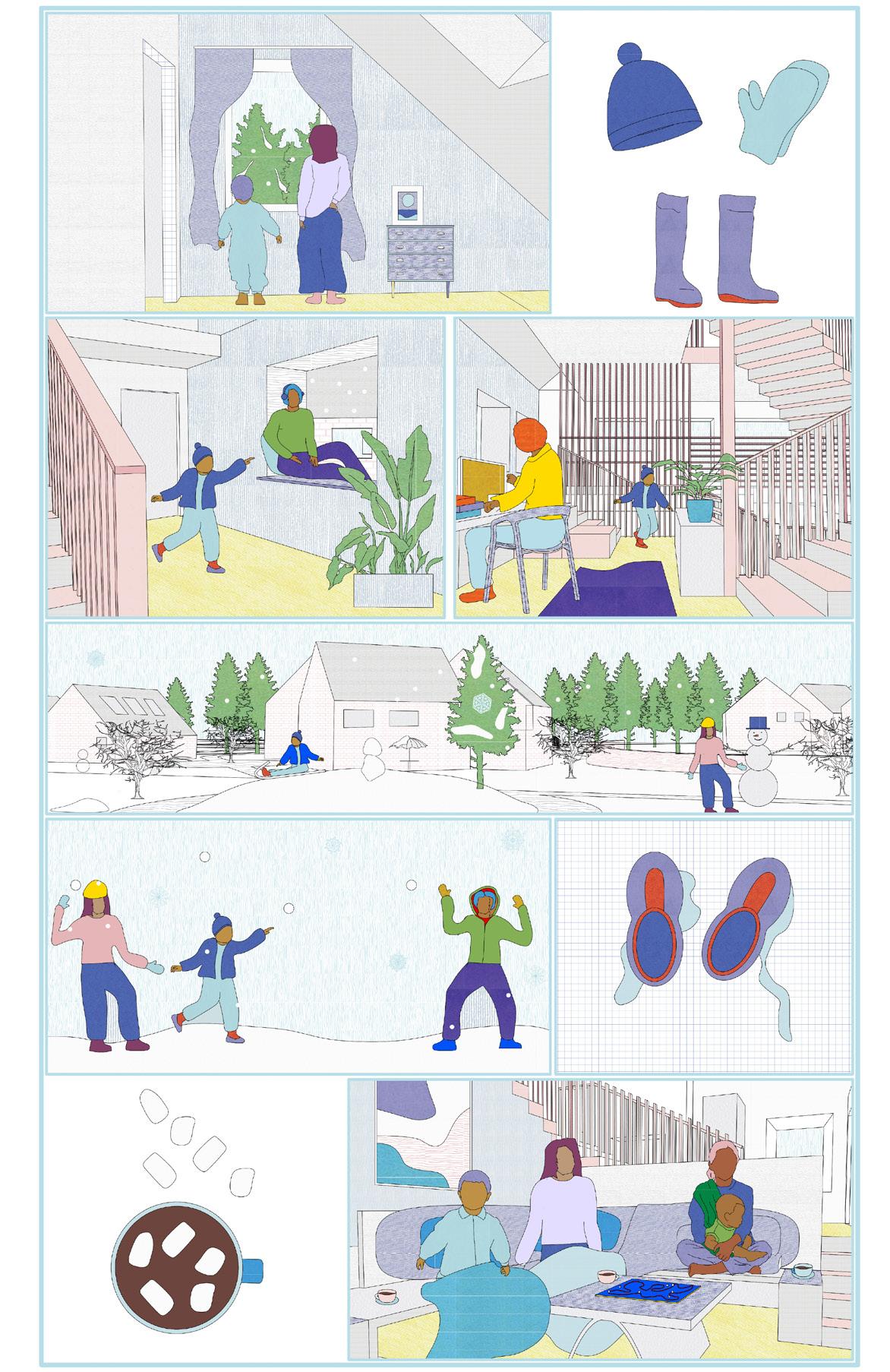
FALL WINTER
SPRING
SUMMER