1 minute read
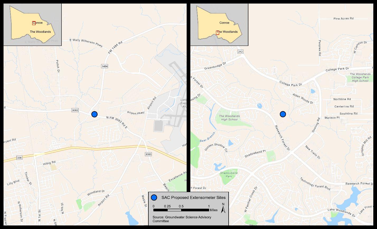
Figure 5 Close-Up of SAC Proposed Extensometer Sites


Figure 5 Close-Up of SAC Proposed Extensometer Sites
The key questions that the proposed GPS network, InSAR data analysis, and extensometer installation are trying to answer are the extent of subsidence in Montgomery County and the extent or susceptibility of the Jasper to compaction and subsidence. Figures 6 and 7 show aquifer unit thicknesses for the areas of The Woodlands and Conroe, respectively. There is some concern that there is compaction in the Burkeville, which would be important to assess for an overall discussion of subsidence in Montgomery County. One option for the extensometer installation is to anchor at the bottom of the Burkeville; this placement would still isolate the Jasper aquifer. If the extensometer is based in the Burkeville, it becomes a question of measuring water levels at that site and what depth interval to screen. There are some areas in the region where there are productive layers at multiple water levels, particularly in the Evangeline. There are relatively few water levels that have been measured in Burkeville. This depth would increase the cost of installation but would provide important water-level data.
Advertisement


