1 minute read
Figure 6 Diagram for Concept of Woodlands Extensometer Site, USGS diagram


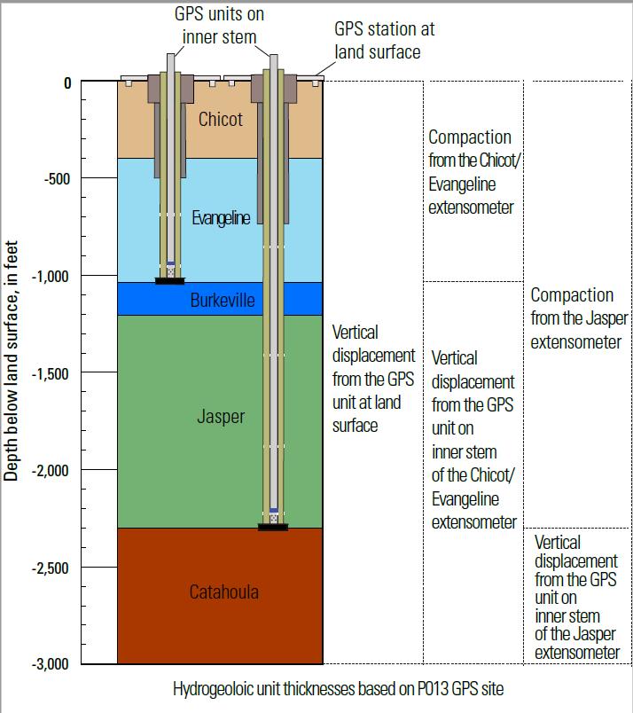
Figure 6 Diagram for Concept of Woodlands Extensometer Site, USGS diagram
The proposed extensometers sites would be used to determine compaction in specific hydrogeologic units. The SAC recommends co-located extensometers anchored in the strata of the Evangeline and Jasper Aquifers (Figure 6) paired with onsite monitoring wells screened in multiple hydrogeologic units. Placement of the GPS sensors on the inner stem will enable monitoring of subsidence in relation to the altitude of the anchor depth of theextensometer. There would be three GPS units proposed; one mounted on each inner extensometer stem, and one at land surface (preexisting at the proposed sites). The paired GPS network and extensometer installations would provide important data regarding the extent of aquifer compaction and associated subsidence in Montgomery County at the suggested locations.
Advertisement


