Learn in English

Learn in English

Publishing coordination
LUIS PINO GARCÍA
Editor
MARÍA PRIOR VENEGAS
MARINA TEMPRANO BENÍTEZ
Cover design
ALEGRÍA S. GONZÁLEZ
Inside design
ALEGRÍA S. GONZÁLEZ
ULISES PÉREZ
Layout
JORGE TORVISCO
Translator
SCOTT A. SINGER
Illustrations
JOSÉ MARÍA RUEDA DELGADO
Picture editing
REYES GORDO LÓPEZ
Maps
DEPARTAMENTO DE CARTOGRAFÍA DE ANAYA EDUCACIÓN
Photographs
ARCHIVO ANAYA (6X6 PRODUCCIÓN FOTOGRÁFICA; CANDEL, C.; COSANO, P.; HERNÁNDEZ MOYA, B.; LEIVA, Á.; LEZAMA, D.; LUCAS, J.; MARTIN, J.; MARTÍN, J.A.; REDONDO, M.; RIVERA JOVE, V.; RUIZ PASTOR, L.; STEEL, M.; SÁNCHEZ, J.; VALLS, R.), ACI (BRIDGEMAN; CPA MEDIA PTE LTD/ALAMY; FABELDIER LOOMAN/ALAMY; GB LANMAS/ALAMY; INCAMERASTOCK/ALAMY; LUCIANO QUEIROZ/ALAMY; M RAMÍREZ/ALAMY; NORTH WIND PICTURE ARCHIVES/ALAMY; ROCKLIGHTS/STOCKIMO/ALAMY; ROGER CRACKNELL 01_CLASSIC/ALAMY; SCIENCE HISTORY IMAGES/ALAMY; TEO MORENO MORENO/ALAMY; THE PICTURE ART COLLECTION/ALAMY; TRAVELSCAPE IMAGES/ALAMY; WORLD HISTORY ARCHIVE/ALAMY), ALAMY / CORDON PRESS (AGTRAVEL; CPA MEDIA PTE LTD; DMITRIY MOROZ; FUNKYFOOD LONDON - PAUL WILLIAMS; WHPICS), ALBUM ARCHIVO FOTOGRÁFICO (AKG-IMAGES/NIMATALLAH; ANTONIO MUÑOZ/EFE; APACHES ENTERTAINMENT; DE AGOSTINI/G. DAGLI ORTI; ERICH LESSING; JULIO MUÑOZ/EFE; PEPE TORRES/ EFE; PRISMA; SCIENCE SOURCE; SFGP; WARNER BROS.), CORDON PRESS (UNIVERSAL/ COURTESY EVERETT COLLECTION), GETTY IMAGES (DEA PICTURE LIBRARY; HERITAGE IMAGES; IAN FORSYTH; ISMAEL ADNAN YAQOOB/ANADOLU AGENCY; SCOTT PETERSON; SEPIA TIMES; UNIVERSAL IMAGES GROUP), JOSÉ ÁNGEL GRAU FERNÁNDEZ, PHOTOAISA (P. ROTGER), THE METROPOLITAN MUSEUM OF ART (ROGERS FUND, 1929), 123 RF AND CONTRIBUTORS.
@ ALGAIDA EDITORES, S. A. 2024. Avda. San Francisco Javier, 22. Edif. Hermes, 5.ª, 3-8. 41018 Sevilla.
ISBN
BILINGUAL EDITION: 978-84-9189-794-1
LEARN IN ENGLISH: 978-84-9189-561-9
Legal deposit
SE 817-2024
All rights reserved. The contents of this publication are protected by law, which establishes prison sentences and / or fines, as well as the corresponding compensation for damages, for those who copy, plagiarise, distribute or publicly disseminate in part or in whole, a literary, artistic or scientific publication, or who transform, perform or produce it artistically in any format or through any channel, without prior permission. This publication may only be copied, distributed, publicly disseminated or transformed with the permission of the authors, save where otherwise provided by law. If you need to photocopy or scan any part of this publication, please contact CEDRO (Centro Español de Derechos Reprográficos, www.cedro.org).
This work may contain links to external sources and websites (hyperlinks) that Algaida does not edit, monitor, oversee and/or maintain, and over which the company has no control whatsoever; thus, Algaida expressly declines any liability pertaining to such sources and websites.
The following have collaborated in preparing this work
NATALIA ARAGÓN VERDUGO
MANUEL CARRIÓN ROJAS
ANTONIO RODRIGO MUÑOZ
HÉCTOR ROJO LETÓN
JOSÉ LAGÓSTENA GUTIÉRREZ
ÓSCAR ARNULFO GONZÁLEZ BARRADA
SARA FERNÁNDEZ DÍAZ
INMACULADA GAVIRA VALLEJO
ARANTXA MARTIALAY MARTÍNEZ
FRANCISCO BERMEJO LAGUNA
Adapted by MARINA ROBLES MORICHE
MARÍA DE LA LUZ MALDONADO RODRÍGUEZ
DIEGO RELAÑO JIMÉNEZ
JOSÉ CARLOS PÉREZ MORALES
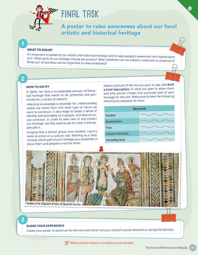
All of the activities in this book that require writing should be completed in the student's notebook.
This project is in line with the UN and Agenda 2030 Sustainable Development Objectives (SDO). Many activities and tasks have been designed to promote cooperative teamwork.
Other tasks in this textbook provide learning opportunities based on problem-solving. Our educacional materials are edited with a commitment to fostering and promoting equality among all and respect for diversity.
The contents of this book and the working procedures have been selected and prepared taking into account criteria of care, protection and conservation of the environment.
PAPEL
The themes are located on the left pages. In the central column all content is adapted to the linguistic level. In the margins there are diagrams, maps, photographs, graphics and illustrations. The most important words are highlighted in bold.
On the right pages you will find all the activities related to the themes located on the left page. The proposed activities follow the CLIL (AICLE) methodology.
The five skills are worked on: reading, listening, speaking, writing and conversation. In addition, you will find different tasks, a proposal of different learning situations.
Each unit ends with three sections:
• Grammar in Geography and History: you will find a grammar rule with a proposal of activities to apply grammar to specific contents.
• 10 Questions: summary of the main ideas organised in questions and answers.
• Final task: a group of activities to apply and consolidate what you have learned.
What's in your digital book?
Extra global resources
• Online dictionary
• Reference websites
• Museums
• International institutions
• Media
Digitised version of Learn in English with all the units and sections.
All the audio recordings related to the activities.
Links to online dictionaries and reference web pages.
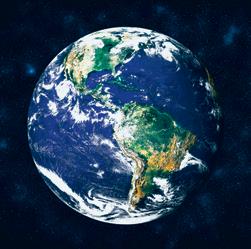
It is the science that studies the Earth’s surface, as well as human beings’ relationship with the physical environment.
Physical Geography studies natural landscapes (relief, climate, hydrography...). Human Geography focuses on human landscapes (demography, economics and politics).
This term refers to the Earth’s surface, where physical and human elements interact. It is constantly changing and varies according to location. Characteristics:


DEMARCATED
The space is limited and boundaries can be established to work within it.


INTERCONNECTED
Geographical information can be:
TRACEABLE
It
z Quantitative, if it works with numbers and statistics. For example, the average temperature, the number of inhabitants in a city, etc.
z Qualitative, if it is based on non-numerical data, for example, the type of relief, or the type of tourism in a country.
In turn, the sources of information may be:
z Primary, if information comes from a researcher’s direct observations (field work). Some measurement tools are: anemometer, pluviometer, barometer, hypsometer, surveyor, seismograph, etc.
z Secondary, if the information is derived from other research. For example, graphs, statistics or maps.
1 Work in pairs and discuss these questions before reading the unit. Write your conclusions.
a) What is geography?
b) What tools are used to obtain geographical data?
c) What are parallels and meridians?
2 Field work is an essential instrument in Geography during the first stage of research. What type of information and data can we collect through field work?
3 Search for information about the following measuring instruments and match them with their function in your notebook.
1. Anemometer a) It measures the height of the trees.
2. Pluviometer b) It measures the magnitude of an earthquake.
3. Barometer c) It measures the amount of precipitation.
4. Hypsometer d) It measures atmospheric pressure.
5. Surveyor e) It measures speed of the wind.
6. Seismograph f) It measures horizontal and vertical angles and lets us know the terrain.
4 Read these sentences and choose the correct term from each pair in your notebook.
a) Geography/Geology is the science that studies the Earth’s surface.
b) Geography/Geology is the science that also studies human beings’ relationship with the physical environment.
c) Physical/Human geography studies natural landscapes.
d) Physical/Human geography focuses on human landscapes.
e) The natural/human landscape refers to relief, climate, hydrography, etc; while the natural/human landscape refers to demography, economics and politics.
f) Geographical space refers to the Earth’s surface where physical and human elements repel/interact.
g) Geographical space is constantly changing/moving and varies according to location.
h) Quantitative/Qualitative geographical information works with numbers and statistics.
i) Quantitative/Qualitative geographical information is based on non-numerical data.
j) Tools/Sources of information are primary/secondary if the information comes from a researcher’s direct observations, or primary/secondary if they are derived from other research.
k) Some measurement tools/sources are: anemometer, pluviometer, barometer, hypsometer, surveyor, seismograph, etc.
l) Some examples of primary/secondary tools/sources of information are graphs, statistics or maps.
Humans are continually questioning their environment. Until the end of the 20th century, many questions were often answered by searching through encyclopaedias. However, with the arrival of the Internet, information became more plentiful and easier to access. It is no longer necessary to search as much; you simply need to ask Artificial Intelligence. However, is all the information and data on the web reliable? Let’s practice with geographer Marie Tharp.

A. Search for information using an Internet search engine. Enter a key word or phrase about the topic you want to research. So me examples: climate change, any conflict happening at the moment, a topic trending in Spain.
B. Select information, which can be obtained from the digital press, reputable blogs or websites, national or international institutions, etc. It is necessary to verify the information
C. After reading the information, attempt to understand and summarise it. Quote references to web sources used
D. Rate the information by answering the following questions in your notebook : a) Would you add any steps to this process?
b) Was the information true?
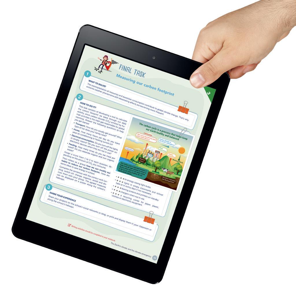
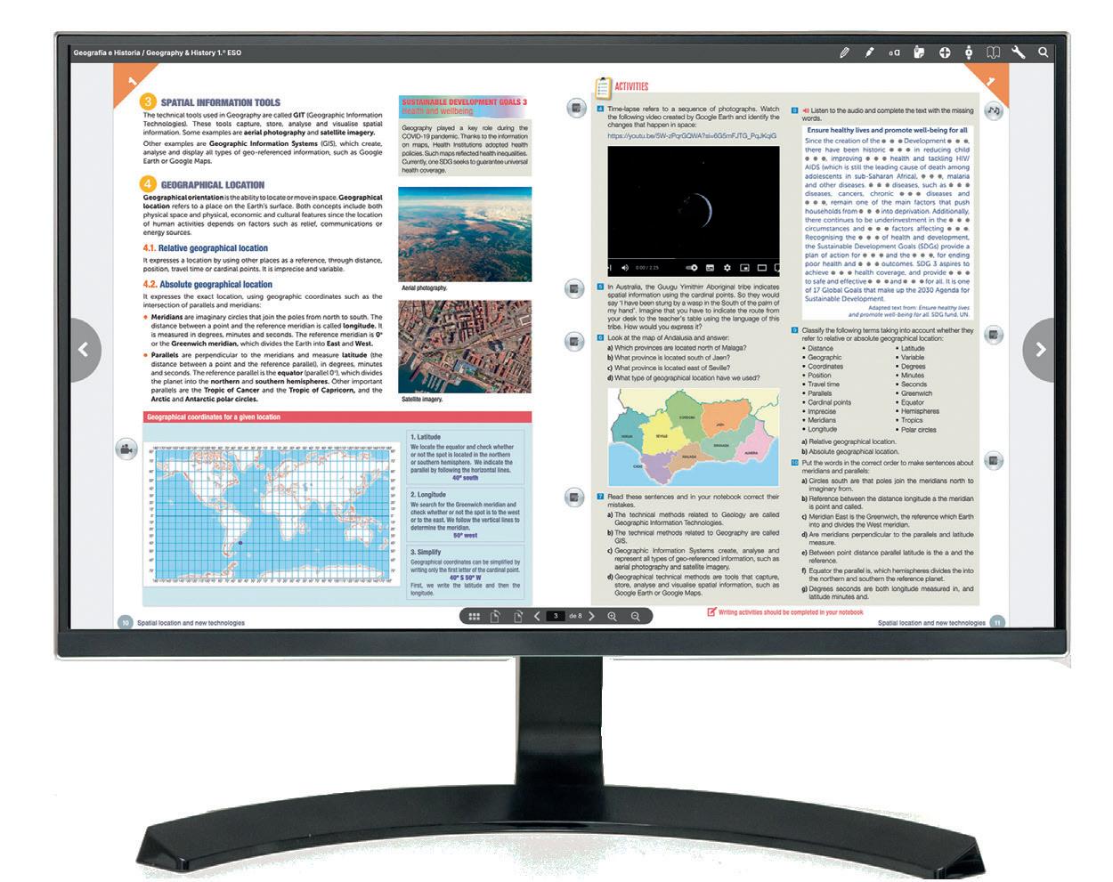
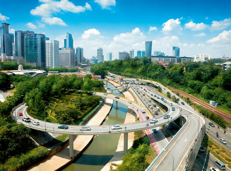
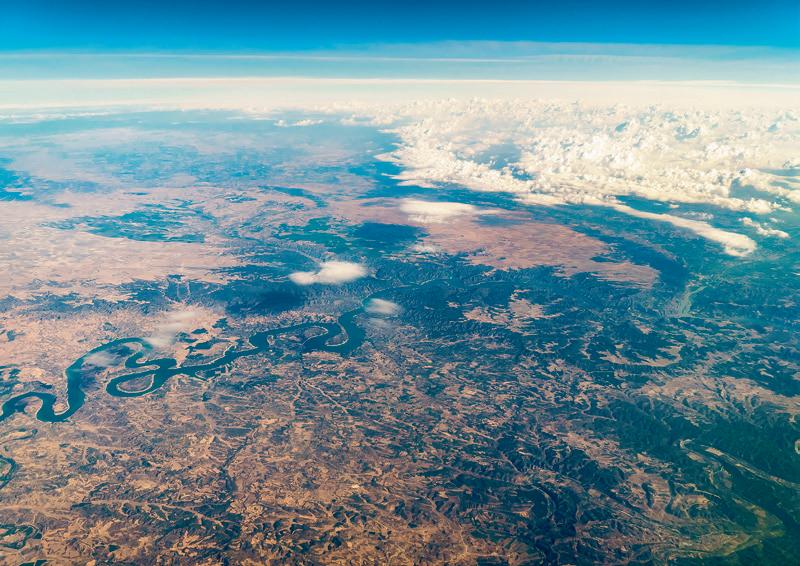
The technical tools used in Geography are called GIT (Geographic Information Technologies). These tools capture, store, analyse and visualise spatial information. Some examples are aerial photography and satellite imagery.
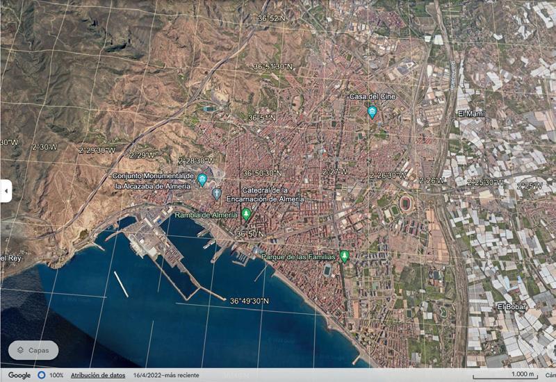
Other examples are Geographic Information Systems (GIS), which create, analyse and display all types of geo-referenced information, such as Google Earth or Google Maps.
Geographical orientation is the ability to locate or move in space. Geographical location refers to a place on the Earth’s surface. Both concepts include both physical space and physical, economic and cultural features since the location of human activities depends on factors such as relief, communications or energy sources.
It expresses a location by using other places as a reference, through distance, position, travel time or cardinal points. It is imprecise and variable.
It expresses the exact location, using geographic coordinates such as the intersection of parallels and meridians:
z Meridians are imaginary circles that join the poles from north to south. The distance between a point and the reference meridian is called longitude. It is measured in degrees, minutes and seconds. The reference meridian is 0 o or the Greenwich meridian, which divides the Earth into East and West.
z Parallels are perpendicular to the meridians and measure latitude (the distance between a point and the reference parallel), in degrees, minutes and seconds. The reference parallel is the equator (parallel 0 o ), which divides the planet into the northern and southern hemispheres. Other important parallels are the Tropic of Cancer and the Tropic of Capricorn, and the Arctic and Antarctic polar circles.

Geography played a key role during the COVID-19 pandemic. Thanks to the information on maps, health institutions adopted health policies. Such maps reflected health inequalities. Currently, one SDG seeks to guarantee universal health coverage.
Aerial photography.
Satellite imagery.
We locate the equator and check whether or not the spot is located in the northern or southern hemisphere. We indicate the parallel by following the horizontal lines.
40º south
We search for the Greenwich meridian and check whether or not the spot is to the west or to the east. We follow the vertical lines to determine the meridian.
50º west
3. Simplify
Geographical coordinates can be simplified by writing only the first letter of the cardinal point.
40º S 50º W
First, we write the latitude and then the longitude.
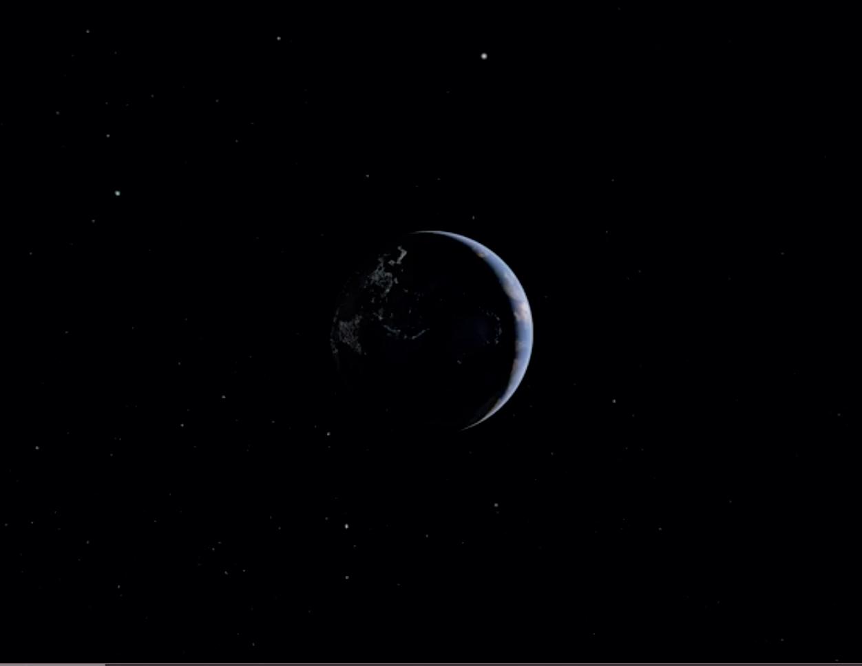
5 Time-lapse refers to a sequence of photographs. Watch the following video created on Google Earth and identify the changes that happen in space: https://youtu.be/5W-zPqrGQWA?si=6G5mFJTG_PqJKqiG
6 In Australia, the Guugu Yimithirr Aboriginal tribe indicates spatial information using the cardinal points. So they would say ‘I have been stung by a wasp in the South of the palm of my hand’. Imagine that you have to indicate the route from your desk to the teacher’s table using the language of this tribe. How would you express it?
7 Look at the map of Andalusia and answer:
a) Which provinces are located north of Málaga?
b) What province is located south of Jaén?
c) What province is located east of Seville?
d) What type of geographical location have we used?
9 2 Listen to the audio recording and complete the text with the missing words.
Ensure healthy lives and promote well-being for all Since the creation of the Development , there have been historic in reducing child , improving health and tackling HIV/AIDS (which is still the leading cause of death among adolescents in sub-Saharan Africa), , malaria and other diseases. diseases, such as diseases, cancers, chronic diseases and , remain one of the main factors that push households from into deprivation. Additionally, there continues to be underinvestment in the circumstances and factors affecting . Recognising the of health and development, the Sustainable Development Goals (SDGs) provide a plan of action for and the , for ending poor health and outcomes. SDG 3 aspires to achieve health coverage, and provide to safe and effective and for all. It is one of 17 Global Goals that make up the 2030 Agenda for Sustainable Development.
Adapted text from: Ensure healthy lives and promote well-being for all. SDG fund, UN.
10 Classify the following terms taking into account whether they refer to relative or absolute geographical location:
• Distance.
• Geographic.
• Coordinates.
• Position. Travel time. Parallels. Cardinal points. Imprecise. Meridians. Longitude.
• Latitude.
• Variable.
• Degrees.
• Minutes.


8 Read these sentences and in your notebook correct their mistakes.
• Seconds.
• Greenwich.
• Equator.
• Hemispheres.
• Tropics.
• Polar circles.

a) The technical methods related to Geology are called Geo graphic Information Technologies.
b) The technical methods related to Geography are called GIS.
Put the words in the correct order to make sentences about circles south are that poles join the meridians north to imreference between the distance longitude a the meridian is meridian East is the Greenwich, the reference which Earth are meridians perpendicular to the parallels and latitude between point distance parallel latitude is the a and the


c) Geographic Information Systems create, analyse and represent all types of geo-referenced information, such as aerial photography and satellite imagery.
d) Geographical technical methods are tools that capture, store, analyse and visualise spatial information, such as Google Earth or Google Maps.
Vf) equator the parallel is, which hemispheres divides the into the northern and southern the reference planet
g) degrees seconds are both longitude measured in, and latitude minutes and
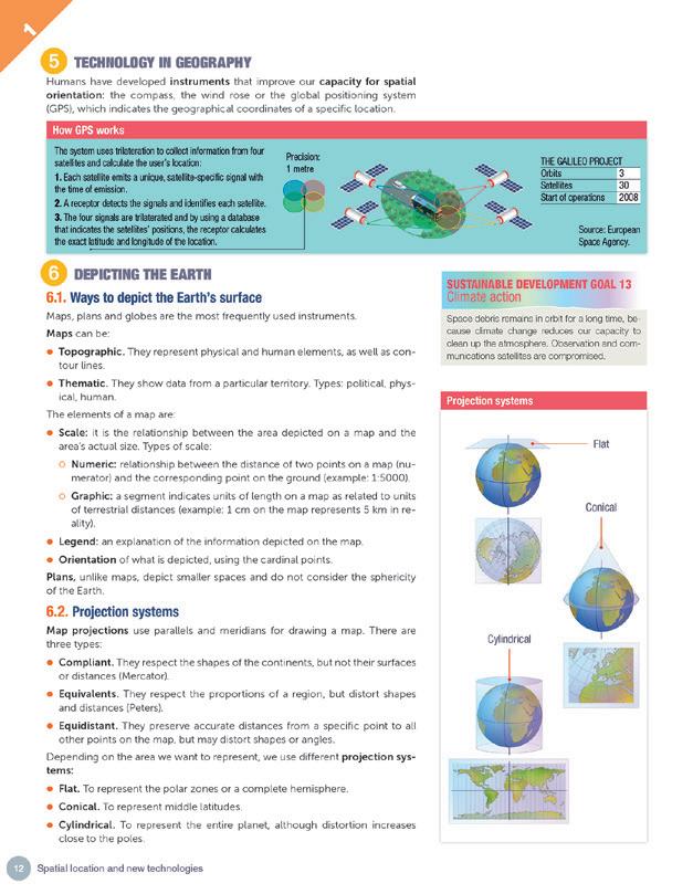
Humans have developed instruments that improve our capacity for spatial orientation: the compass, the wind rose or the global positioning system (GPS), which indicates the geographical coordinates of a specific location.
How GPS works
The system uses trilateration to collect information from four satellites and calculate the user’s location:
1. Each satellite emits a unique, satellite-speci c signal with the time of emission.
2. A receptor detects the signals and identi es each satellite.
3. The four signals are trilaterated and by using a database that indicates the satellites’ positions, the receptor calculates the exact latitude and longitude of the location.
Precision: 1 metre
Maps, plans and globes are the most frequently used instruments. Maps can be:
z Topographic. They represent physical and human elements, as well as contour lines.
z Thematic. They show data from a particular territory. Types: political, physical, human.
The elements of a map are:
z Scale: it is the relationship between the area depicted on a map and the area’s actual size. Types of scale:
z Numeric: relationship between the distance of two points on a map (numerator) and the corresponding point on the ground (example: 1:5000).
z Graphic: a segment indicates units of length on a map as related to units of terrestrial distances (example: 1 cm on the map represents 5 km in reality).
z Legend: an explanation of the information depicted on the map.
z Orientation of what is depicted, using the cardinal points. Plans, unlike maps, depict smaller spaces and do not consider the sphericity of the Earth.
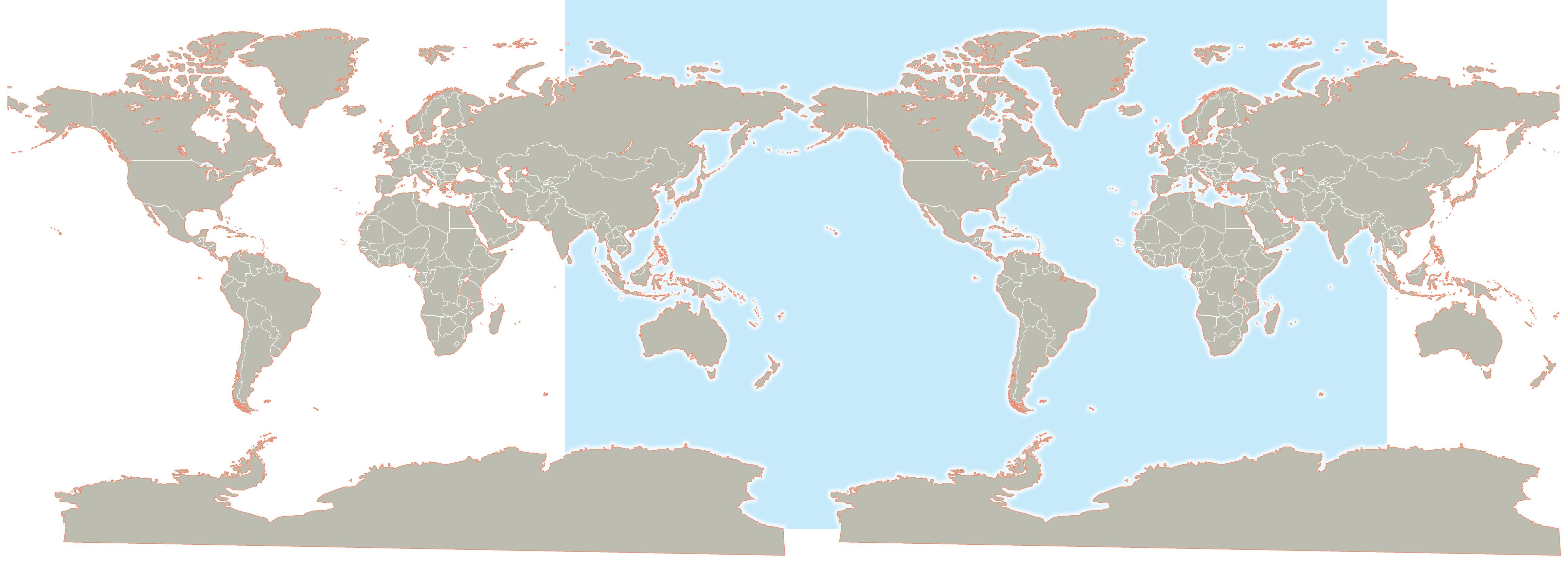
Map projections use parallels and meridians for drawing a map. There are three types:
z Compliant. They respect the shapes of the continents, but not their surfaces or distances (Mercator).
z Equivalents. They respect the proportions of a region, but distort shapes and distances (Peters).
z Equidistant. They preserve accurate distances from a specific point to all other points on the map, but may distort shapes or angles.
Depending on the area we want to represent, we use different projection systems:
z Flat. To represent the polar zones or a complete hemisphere.
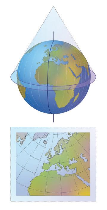
z Conical. To represent middle latitudes.
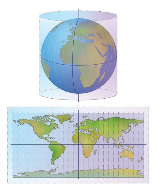
z Cylindrical. To represent the entire planet, although distortion increases close to the poles.
THE GALILEO PROJECT
Orbits 3
Satellites 30
Start of operations 2008
Source: European Space Agency.
13
Space debris remains in orbit for a long time, because climate change reduces our capacity to clean up the atmosphere. Observation and communications satellites are compromised.
Projection systems
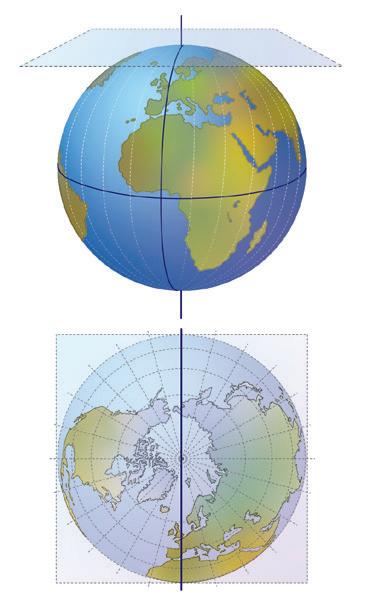
Cylindrical Flat
Conical
12 Read the following text and complete it with the missing terms: fourth, intersection, second, three, trilateration, signals, radius, location, triangulation, distance, four GPS works through a technique called to calculate location (not to be confused with , which is used to measure angles, not distances). Satellites send , and a GPS interpreter device on or near the Earth’s surface receives them. To calculate the location, it must be able to read the signal from at least satellites. Each satellite completes two orbits of the Earth in 24 hours and sends back information. GPS calculates the to the satellite, through a circle of a certain . When we add a satellite, it creates a second circle, and the is reduced to one of the two points where the circles converge. With a third satellite, the location of the device can be definitively determined, as the device is at the of the circles. As the device moves, due to the Earth’s rotation, the radius (distance to the satellite) changes. To correct this effect, information from a satellite is used.
Adapted text from geotab.com
13 Read the description about the types of map projections and match them to the correct projection style.
a) They respect the continents shapes, but not their surface or distance (Example: Mercator).
b) They respect the proportions of regions, but distort shapes and distances (Example: Peters).
c) They preserve accurate distances from a specific point to all other points on the map, but may distort shapes or angles.
1. Equidistant
2. Compliant
3. Equivalents
14 In your notebook complete the sentences with the missing words.
a) The most used instruments to represent the Earth’s surface include maps, plans and .
b) maps show data from a territory. Types: political, physical, human.
c) A scale shows the relationship between the distance of two points on the map and the corresponding one in reality.
d) The is the relationship between the representation and its actual size.
e) The orientation of what is depicted is indicated using the points.
f) Plans represent small spaces and do not consider the of the Earth.
g) Topographic maps represent the physical and human elements, as well as lines.
h) The elements of a are its scale, legend and orientation.
i) A scale is represented by a segment that indicates units of length on the map, related to units of terrestrial distances.
15 Read the areas we want to represent and indicate the projection system we should use in each case:
a) We want to represent the polar zones or a complete hemisphere.
b) We want to represent middle latitudes.
c) We want to represent the entire planet, although distortion increases close to the poles.
16 Satellites have become part of our daily life. They do not only serve for geolocation or for communications, but they are also basic for financial transactions, control flight traffic or provide support to areas that have suffered a natural disaster. What would happen if satellites stopped working one day? In pairs, imagine different situations and develop a solution for each of them.
In recent years, microplastic pollution has become an increasingly threatening problem for ocean ecosystems. With only 9 % of plastics being successfully recycled, many end up in oceans where they break down into small particles less than 5 millimeters in length known as microplastics. These microplastics pose a threat to ocean wildlife, since many sea creatures are harmed by accidentally consuming them. Microplastics also end up contaminating human water and food supply.
ESA and NASA satellites help track macroplastics and microplastics in the oceans. To locate them, they use a technique that studies the light reflected in water, since plastics leave a ‘unique footprint’. They are carried by currents and accumulate in areas called ‘plastic islands’.
Adapted text from NTRS - NASA. Cleaning up the coasts
VA.
Rea d the text and complete the following table
Projects Types of plastic Technique used
B. Wha t effect do marine currents have on plastics?
C. Write a 10-line report on how plastics affect living beings in the oceans and the food chain.
We use the infinitive of the verb. In the 3rd person singular (he, she, it - or a name) we put an -s or an -es at the end of the infinitive.
We use the auxiliary verb do/does + not (contracted forms: don’t/doesn’t).
Affirmative sentences
z I play with a ball.
z You play with a ball.
z He / She / It plays with a ball.
z We play with a ball.
z You play with a ball.
z They play with a ball.
Negative sentences
z I do not play with a ball.
z You do not play with a ball.
z He / She / It does not play with a ball.
z We do not play with a ball.
z You do not play with a ball.
z They do not play with a ball.
1 What is Geography?
Geography is the science that studies the Earth’s surface, as well as human beings’ relationship with the physical environment.
2 What tools does it use?
ICT, photography, remote sensing, Geographic Information Systems, Google Earth and Google Maps.
3 What is geographical location? What are the two types of geographical locations?
It is the location of a point on the Earth’s surface. It can be relative when it uses other places as a reference, or absolute when it expresses the exact location.
4 What are meridians?
They are imaginary lines of longitude around the Earth that join the poles from north to south. The reference meridian is the Greenwhich meridian.
5 What do meridians measure?
Meridians mesure longitude, which is the distance between any point on the Earth’s surface and the Greenwich meridian.
1 Complete the sentences using the correct form of the present simple.
a) Geography (to be) the science that (to study) the Earth’s surface, as well as human beings’ relationship with the physical environment.
b) Physical Geography (to study) natural landscapes (relief, climate, hydrography...).
c) Human Geography (to focus) on human landscapes (demography, economics and politics).
d) Plans (to represent) small spaces and (to consider, negative) the sphericity of the Earth.
2 Some of the following sentences contain mistakes in the use of the present simple. Correct them:
a) When I want to represent the polar zones or a complete hemisphere, I use a flat projection system.
b) When she want to represent middle latitudes, she use a conical projection system.
c) When we want to represent the entire planet, we do not use a flat projection system.
d) When we want to represent the entire planet, we does not use a flat projection system.
e) When we want to represent the entire planet, we use a cylindrical projection system, although distortion increase close to the poles.
6 What are parallels?
They are imaginary lines of latitude, drawn from east to west. The reference parallel is the equator.
7 What do parallels measure?
Parallels measure latitude, which is the distance between any point on Earth and the Equator.
8 What is GPS?
It means Global Positioning System. It indicates the geographical coordinates of a specific location to help us determine geographical coordinates.
9 What is a map? What types of maps are there?
They are graphic depictions of a surface. Depending on the type of information they depict, maps can be classified into topographic and thematic maps.
10 What geographic projections are there?
Depending on the area we want to represent, we use different projection systems: flat (to represent a complete hemisphere), conical (to represent middle lattitudes) and cylindrical (to represent the entire planet).

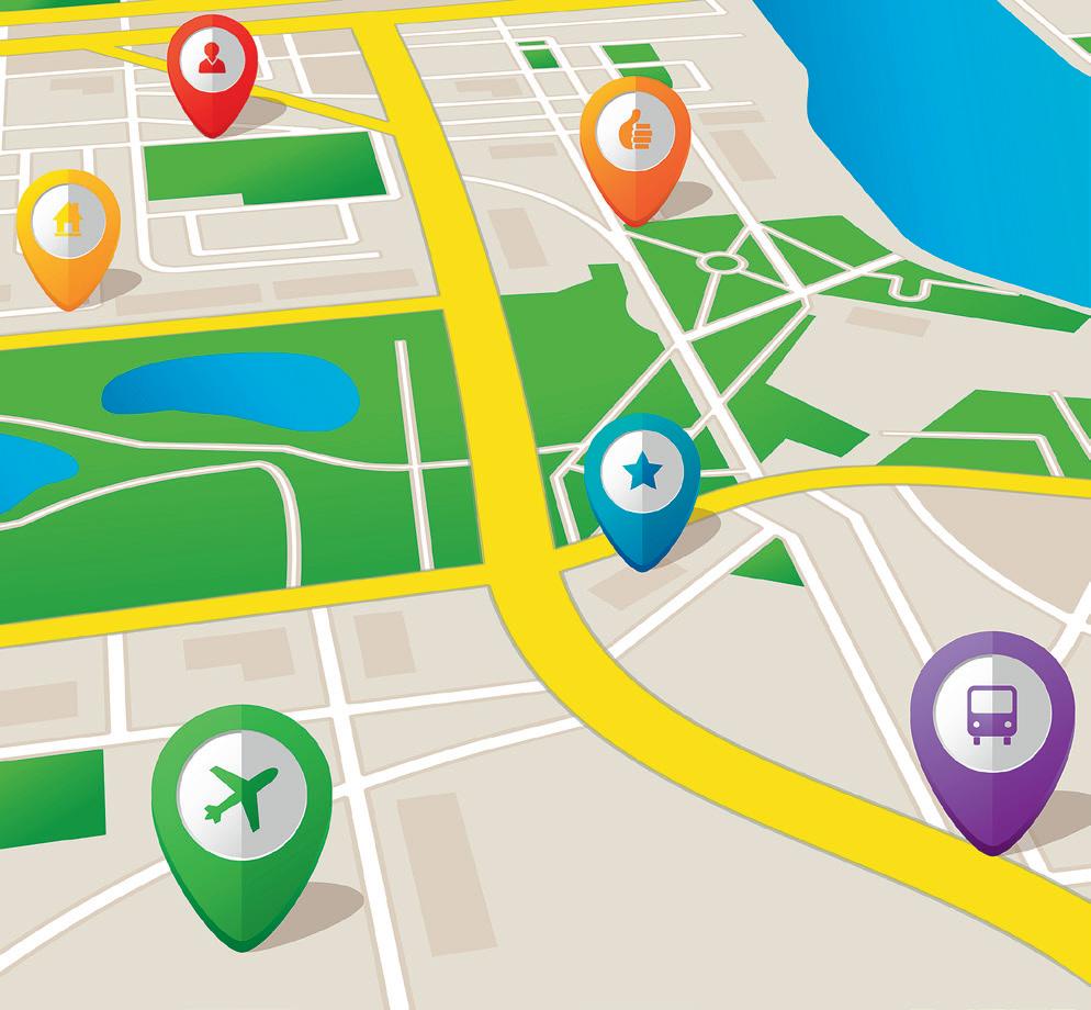
We are going to create a map or a plan using Mapchart or Google My Maps.
Your plan or map should include geographical coordinates and photographs/videos (which will be displayed when you click on the reference icon). Students can choose their own theme for the plan or map, for example ‘last host cities of the Olympic Games’.
Choose a city that previously hosted the Olympic Games and use Google Maps to locate that city’s train station and Olympic stadium. Then, write in your notebook the streets you would need to take to get from one place to the other. Don’t forget to mention any important buildings or structures that you would have to cross along the way.
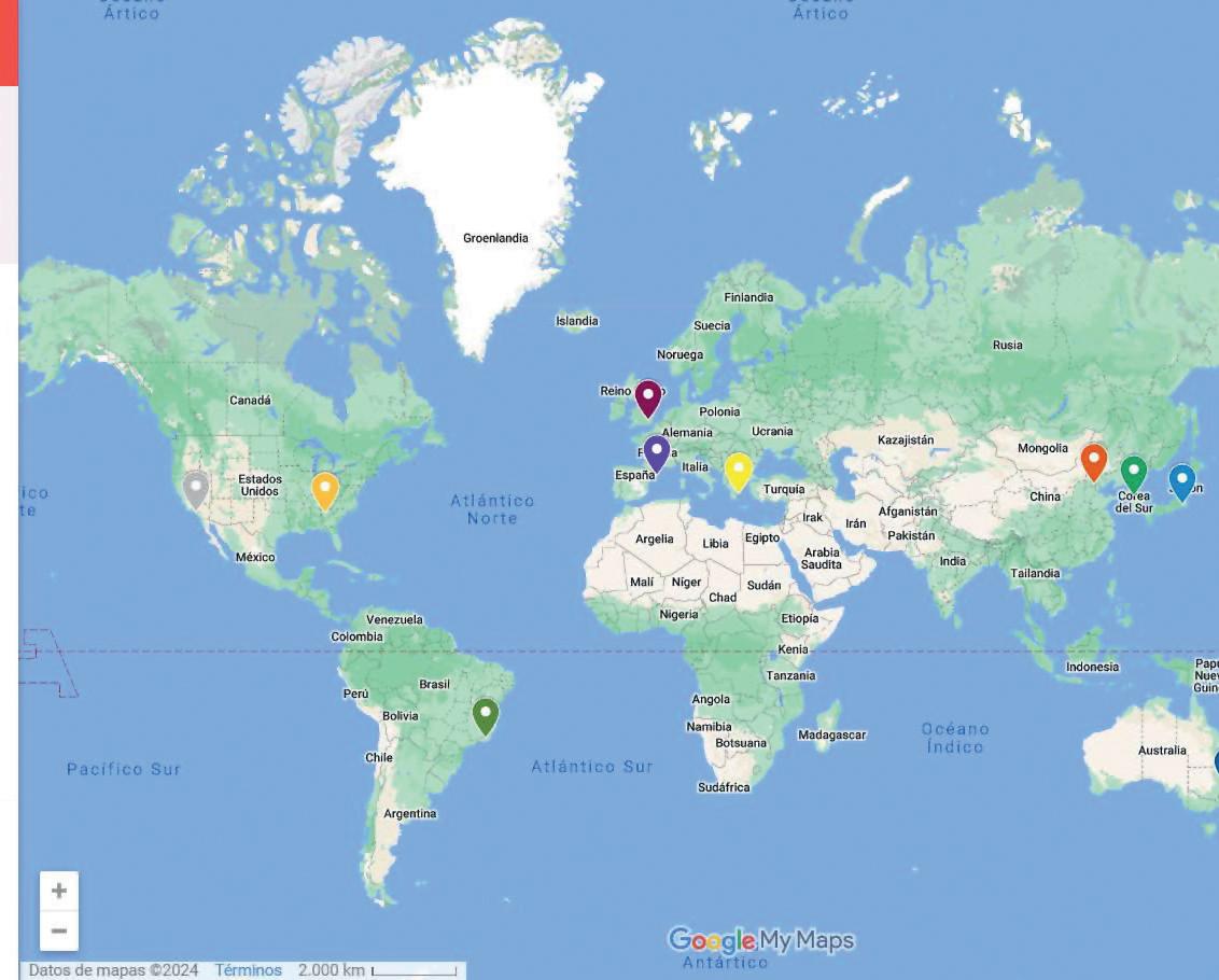
Share your projects on the school’s social networks or blog; or print and display them in your classroom or along the school’s hallways.
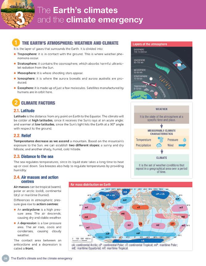
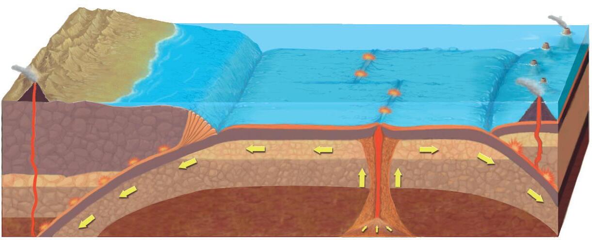
We can divide the internal structure of the Earth into layers, based on two criteria: chemical composition (geochemical model); or state and behaviour of the materials contained in a particular layer (geodynamic model).
The lithosphere is divided into tectonic plates, which float on the asthenosphere. They collide with each other and fracture, causing changes in the relief and seismic movements, which propagate from the hypocentre (ground zero of the earthquake) through waves. The epicentre is the vertical projection of the hypocentre on the surface. Earthquakes are measured by:
It measures the magnitude (energy) of earthquakes. The scale goes from 0 to 9.
It expresses from 1 to 12 the local effects and damage of an earthquake, based on observable data that can be subjective.
Relief refers to the shape of the Earth’s crust in a giv en area.
z Tectonic plate movement (coming together, separating or sliding) causes the materials in the Earth’s surface to break up or fold. These move ments cause faults, mountain range folds, plains or depressions.
z Volcanic activity (volcanism) causes the release of magma from the mantle because the tectonic plates separate or one plate sinks beneath another. This can create mountains, plains, islands or ocean ridges.
Geochemical model (chemical composition)
Dynamic model (dynamic behaviour)
External geological agents (temperature, precipitation, wind, ice, surface and underground runoff, the sea, living beings and especially, humans) can lead to a number of external geological processes:
z Erosion or destruction of relief.
z Slippage of eroded materials to lower areas.
z Sedimentation or material deposits.
1 Work in pairs and discuss these questions before reading the unit. Write down your conclusions in your notebook.
a) Why do you think the continents seem to fit together like the pieces of a puzzle?
b) What is the relief like in your area and what are its main components?
c) What rivers exist in your area and how are they used?
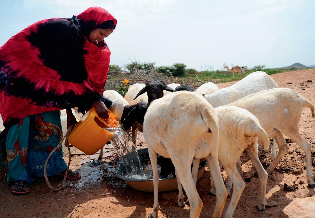
d) Why is it important to save water? What measures can you take personally to reduce water consumption?
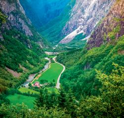
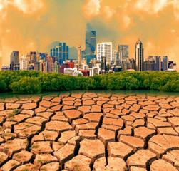
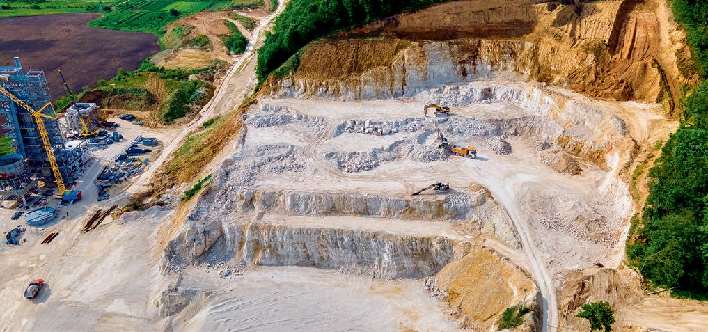
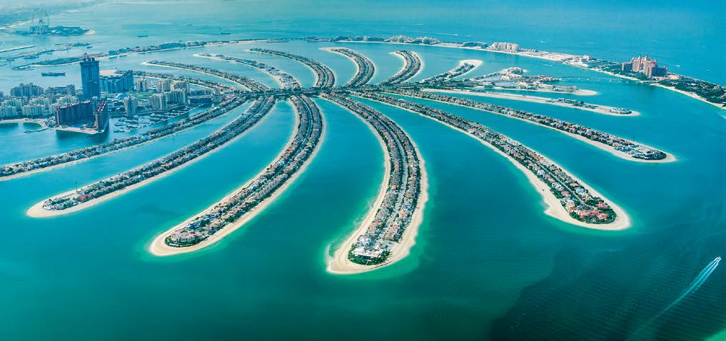
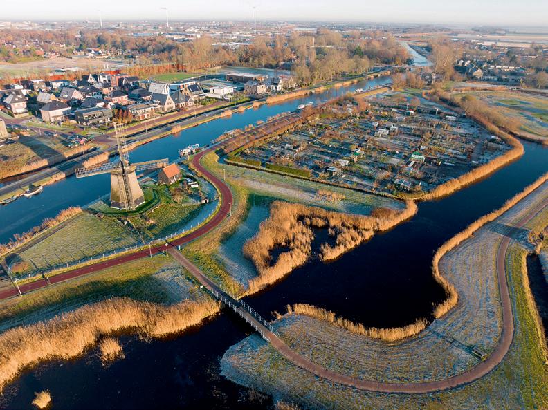
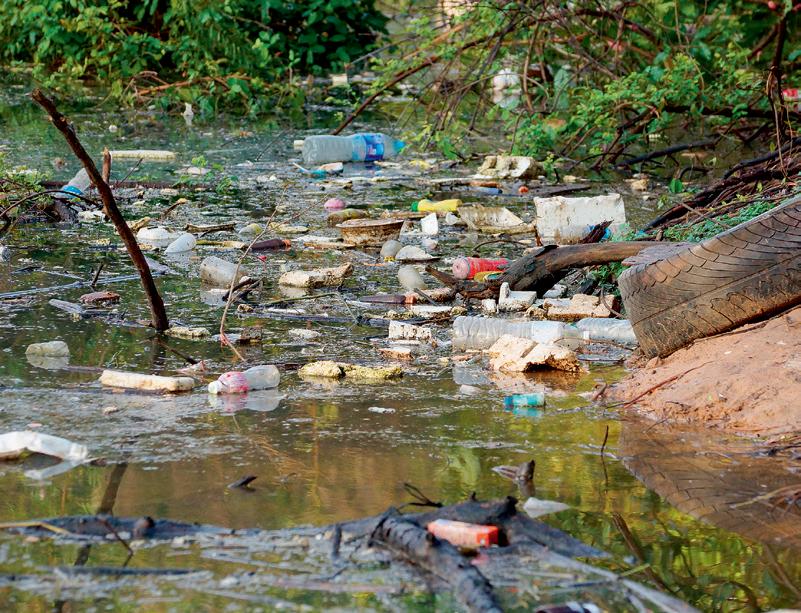
2 Look at these images and answer the questions in your notebook.
a) What do both images have in common?
b) How are they different from a natural landscape?
c) What other factors can alter the relief of an area?
d) Are there areas around you where humans have altered the relief of the land?
An earthquake is produced by a sudden release of energy accumulated in the Earth's crust in the form of waves that propagate in all directions. The point on the surface above the focus is called the epicentre. Waves expand from it, causing the ground to vibrate. The closer to the surface, the greater the vibration. If this occurs in the sea, the vibrations cause tsunamis. The Atlantic coast of Andalusia is susceptible to tsunamis. Do you know what to do in the event of a major earthquake or tsunami?
3 In September 2021 the Cumbre Vieja volcano erupted on the island of La Palma, and continued for 85 days. Complete the text in your notebook on the damage caused by this volcano using these words: energy, natural, eruption, dangers, structures, jobs, spectacle, homes.
The of the Cumbre Vieja is presently the longest since 1712. According to the Volcanology Institute, the being released is equivalent to 35.9 times the energy needs of the entire Canary Island archipelago. Much of this energy has ended up destroying manmade on La Palma. Many residents lost their . Hundreds have lost their . The numbers don’t reflect the full breadth of this tragedy. The natural should not eclipse the the residents have had to face.
4 Read the definitions for the layers of the Earth’s internal structure and then determine their names.
a) It extends from 2,900 to 6,378 kilometres deep. It is made up of metals. It is molten on the outside and solid on the inside. It is responsible for the Earth’s magnetic field.
b) It is formed by semi-molten materials, in the outermost part of the mantle.
c) It is divided into plates, which move over the asthenosphere.
d) It corresponds to the Earth’s core.
e) It is mainly made up of silicates, and it extends from 670 to 2,900 kilometres deep. It is divided into two parts.
f) Viscous layer that mostly corresponds to the Earth’s mantle.
g) It is the outermost and thinnest layer, formed by rocks. It can be divided between the continental area (35 km average thickness) and the oceanic area (between 8 and 10 km thick).
A.First of all it is cru cial to recognise the first signs of a tsunami. Complete the following sentences to find out what they are using these words: roar, fall, tsunamis, ocean, strangely, earthquake
1. are generally preceded by a strong
2. You may hear a like an airplane coming from the
3. Waves may behave . For example, there may be a rapid rise or of the water level along the shore.
B.
Now that we know the first signs, it is very important to know what to do if a tsunami is coming. Place these words in order to discover the protocols.
1. not for Do official an to evacuate warning wait tsunami
2. as as you can the at 3 kilometres coastline; inland far away Go least from
3. to reach least metres sea 30 Try at above areas level
4. for a to the Never come in look waves watch place
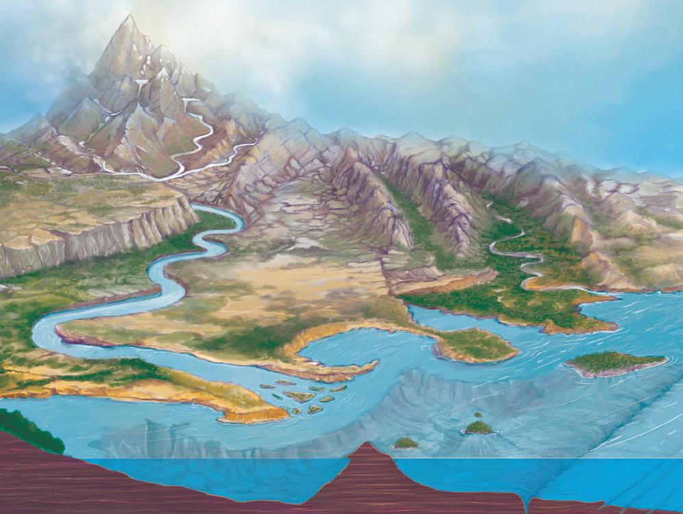
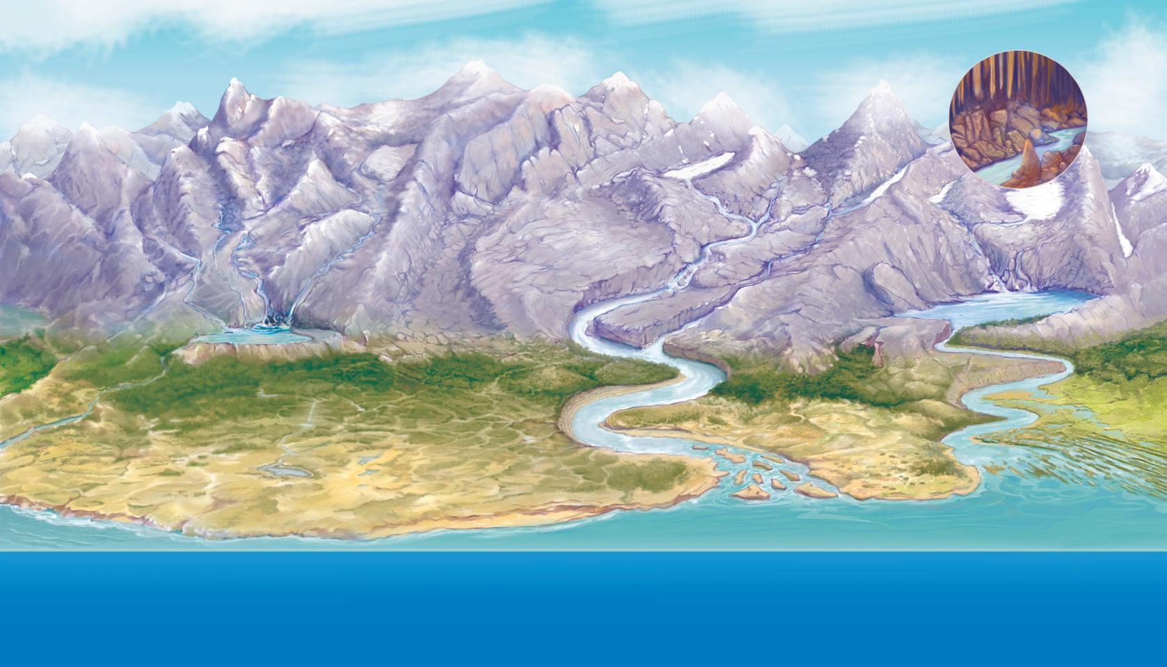
Continental relief
z Plains are flat areas found in lowlands.
z Plateaus are large, flat, elevated surfaces, resulting from the erosion of ancient mountains.
z Mountains are high elevations. They are grouped into ranges or ridges.
z Basins are areas of low relief in comparison to the land around them.
z Valleys are elongated depressions on the Earth’s surface.
z Depressions are plains below sea level that have filled over the centuries to form valleys.
Oceanic relief
Ridges
Ranges
Plateau Plain
Continental shelf
z The continental shelf is the seabed close to the coast. The continental slope joins the continental shelf and the deeper areas of the oceans.
z Abyssal plains are large plains found at depths of 4,000 meters or more.
z Oceanic ridges are underwater mountains that extend along the seabed. Sometimes they reach the ocean surface and form islands.
z Ocean trenches are very deep underwater depressions.
Coastal relief
z Beaches, made of sand, stones or gravel, are found along the shores of oceans and seas.
z Capes are landmasses that jut into the sea.
z Gulfs or bays are inlets of the sea along the coast.
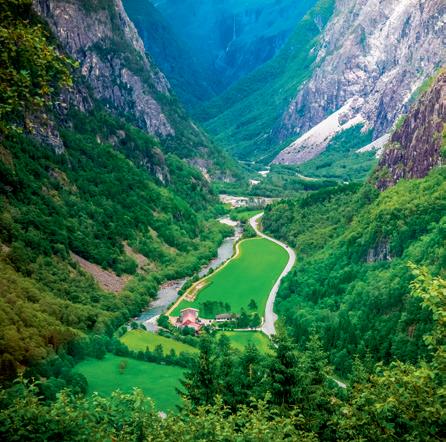
z Fjords are narrow valleys with steep sides created by advancing glaciers.
z Estuaries are the wide part of a river where it joins the sea.
z Peninsulas are landmasses mostly surrounded by water and connected to land by an isthmus.
z Islands are landmasses surrounded by water. Archipelagos are groups of islands.
Continents are large landmasses that separated long ago from an original continent called Pangea. Today’s continents are: Europe, Asia, America, Africa, Oceania and Antartica.
The Earth’s relief is made up of many different elements. There are ancient mountains (Ural Mountains; Appalachian Mountain Range); young mountains and great mountain ranges (Himalayas in Asia). We also encounter plains and plateaus (European Plain); great depressions and valleys (Rift Valley); peninsulas (Arabian Peninsula); archipelagos and islands.
European relief can be divided into three large groups: elevated plateaus, plains and chains of mountains and volcanoes.
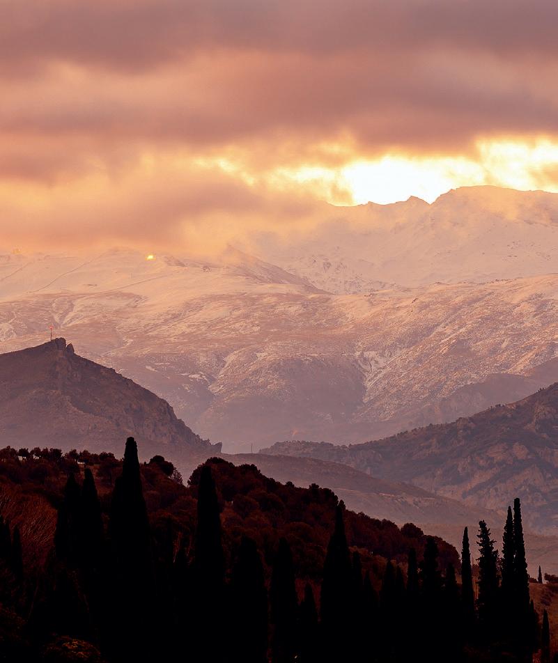
Spain’s relief is organised around the Central plateau. There are two big depressions and several mountain ranges along the Cantabrian and the Mediterranean coasts. The Balearic archipelago rises out of an extension of the peninsular mountain ranges. However, the Canary Islands are of volcanic origin.
The Guadalquivir depression is framed between two mountain ranges, the most important of which is the Sierra Nevada. The Andalusian coast extends from Ayamonte (Huelva) to San Juan de los Terreros (Almería).
Cape
Valley
Bay Island Isthmus
Continental slope Abyssal plain
Underwater ridge Ocean trench
5 Many sites in Asia’s Himalayan Mountain range have become overcrowded as a result of tourism. In your notebook, transcribe the text and choose the correct option in each case. Then answer the question: What challenges are the Himalayas facing due to tourism?
Nepal is home to the most popular/natural Himalayan peaks. However, there’s a high death rate among climbers due to avalanches, sickness and exhaustion. Himalayan glaciers are melting twice as fast than before. The weather has become more accurate/erratic, which means the usual historical patterns cannot/ can be used for making predictions. Consequently, climbing has become much more dangerous due to the unpredictability of the tourism/weather. The climbing industry has generated fierce competition among agencies. Base camps are overcrowded and many tourists’ lack/great of experience makes these mountain expeditions even more complicated. Trash is accumulating/recycling and camps are not structured to receive as many tourists as they do every year.
Adapted from: By travel + Leisure. The Himalayas: an ever more dangerous adventure destination. 2022.
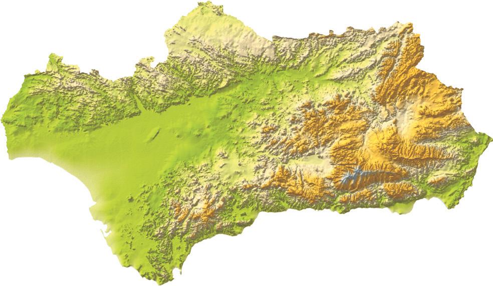
6 Look at the following map of the relief in Andalusia and locate the following formations on it: Sierra de Aracena, Sierra Morena, Sub-Baetic Mountain Range, Penibaetic Mountain Range, Sierra de Grazalema, Sierra Nevada, Cape of Gata, Gulf of Cadiz, Punta de Tarifa, Gulf of Almeria, Sierra de Cazorla, Sierra de Segura.
8 Select the correct term in each sentence about continental landforms.
a) Plains/Plateaus are flat areas found in lowlands.
b) Plains/Plateaus are large, flat, elevated surfaces, resulting from the erosion of ancient mountains.
c) Mountains/Depressions are high elevations.
d) Mountains/Depressions are plains below sea level.
9 Complete the following sentences about coastal relief and landforms using the terms you will find in the word search.
a) can be made of sand, stones or gravel, and are found along the of oceans and seas.
b) are landmasses that jut into the
c) or bays are inlets of the sea along the
d) are the wide part of a river where it joins the sea.
e) are landmasses surrounded by water, and connected to land by an
f) are landmasses surrounded by water. An is a group of islands.


7 Complete the following sentences about oceanic relief using the following terms: seabed, ridges, shelf, continental, underwater, slope, islands, abyssal, trenches, depths, coast.
a) The continental is the seabed close to the
b) The continental joins the shelf and the deeper areas of the oceans.
c) The plains are large plains found at of 4,000 meters or more.
d) Oceanic are underwater mountains that extend along the . Sometimes they reach the ocean surface and form
e) Ocean are very deep depressions.
10 2 Listen to the audio recording and complete the text.
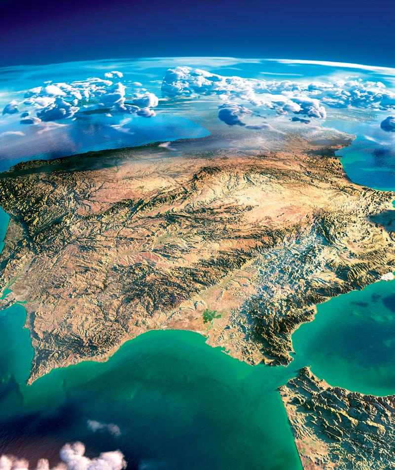
Spain is characterised by its natural , which is a result of its varied and contrasting conditions. The Iberian Peninsula’s major are located on the outer edges of its elevated Central The of the Peninsula is 7,905 km in length.
Spain’s Islands rise out of the mountain range and the Catalan-Coastal mountain range. There are main islands: Mallorca, Ibiza, Formentera and Menorca. Only Mallorca (with its Sierra de Tramontana mountains) has elevated
In contrast, the Canary Islands are of origin, and include islands: Lanzarote, Fuerteventura, Tenerife, El Hierro, Gran Canaria, La Gomera and La Palma. The Canary , with the exception of Lanzarote and Fuerteventura, can reach significant (with Teide volcano in Tenerife).
The term hydrosphere refers to all the waters on the Earth’s surface. The stages of the water cycle are: ➏
Water cycle
Condensation:
The water cycle is the way water moves from the Earth’s surface to the air and back again. It involves four main processes:
This is when water vapor in the air cools down and turns into tiny droplets, forming clouds.
Transpiration: This is when plants release water vapor into the air through tiny openings in their leaves, called stomata.
Precipitation: This is when water droplets in the clouds get big and heavy enough to fall back to the ground as rain, snow, hail, or sleet.
Evaporation: This is when the sun heats up water in rivers, lakes, and oceans, turning it into water vapor, or steam.
In the water cycle, water is constantly moving and changing form. The water cycle helps to provide fresh water for plants and animals to drink, and it helps to regulate the Earth’s temperature by distributing heat energy.
6.1. Marine waters
They have high salinity levels and make up 97.5 % of the planet’s water (oceans and seas). They experience tides, waves and marine currents and provide a wide range of resources.
6.2. Continental waters
They have low salinity levels and are found in rivers, lakes, glaciers and groundwater. They supply fresh water to people for agriculture, livestock, leisure or energy generation.
Continental waters
Threats to the water supply force us to adopt urgent measures for water conservation.
• Don’t leave the water running when not in use, for example, while brushing your teeth.
• Each minute consumes 5 litres of water.
• Wash only full loads of dirty laundry.
• Don’t use a full washing cycle for individual garments.
• Don’t turn on the dishwashing machine until it's completely full.
• Pour only water down the drain.
• Never dispose of paint, leftover oil or chemical products in the kitchen sink.
11 Are the following statements true or false? Correct the false ones in your notebook.
a) Continental waters have low salinity levels.
b) Continental waters account for most of the planet’s hydrography.
c) A river bend is the channel through which a river flows.
d) When lakes are large in size, they are called lagoons.
e) Groundwater is also called phreatic water.
12 Match the following terms about the water cycle with their definitions.
a) Evaporation
b) Condensation
c) Precipitation
d) Infiltration
e) Surface runoff
1. Water that falls and is absorbed by the soil, becoming groundwater.
2. Water that falls to the Earth’s surface in liquid (rain) or solid (hail or snow) form.
3. Change of water from a liquid to a gaseous state.
4. Movement of water over land surfaces in the form of rivers, lakes, etc.
5. Change of water from a gaseous to a liquid state.
13 Do the following statements correspond to marine or continental waters?
a) They have high salinity levels.
b) They have low salinity levels.
c) They make up 97 % of the planet’s waters.
d) They are found in oceans and seas.
e) They are found in rivers, lakes, glaciers and groundwater.
f) They experience tides, waves and marine currents.
g) They provide fresh water for agriculture, livestock, leisure or energy generation.
h) They provide a wide range of resources.
14 2 Listen to the audio recording. Are the following statements true or false? Correct the false ones.
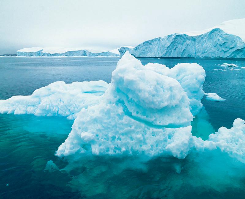
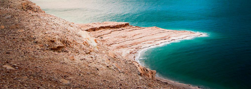
a) The Dead Sea is a river.
b) It occupies the deepest part of a depression crossed by the Jordan river.
c) It is 800 kilometres long.
d) Its water has three times more salt than normal seas and oceans.
e) You can float in it without any effort.
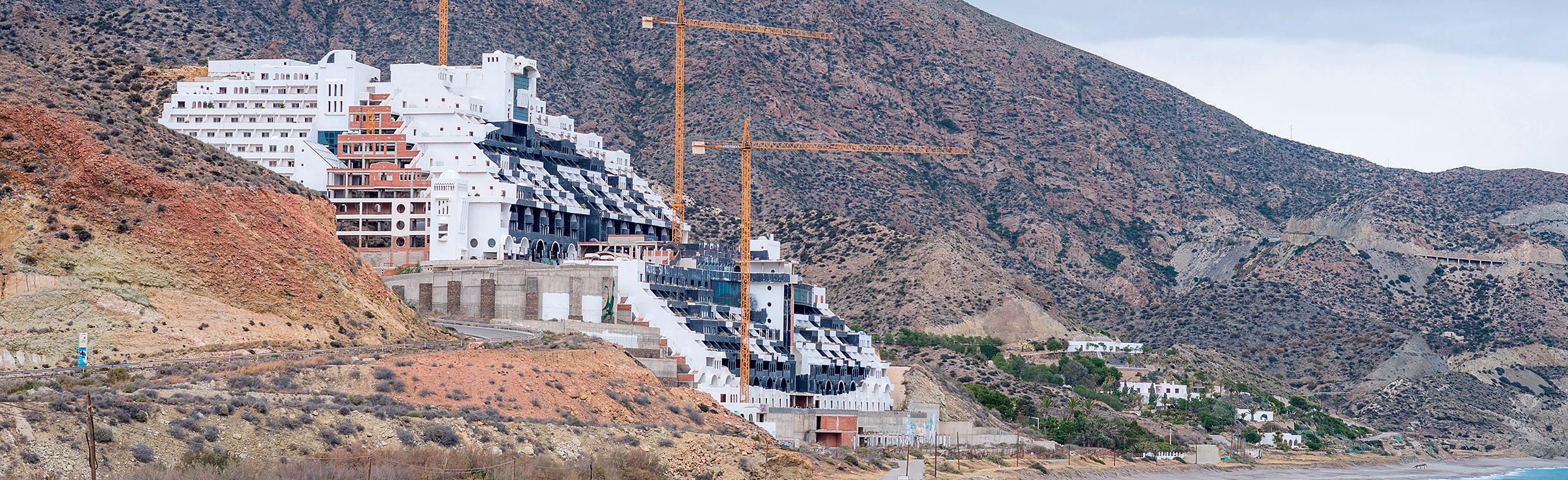
Water pollution is one of the big problems facing us as a society. More than half of the garbage abandoned along the Andalusian coast are plastics. Ecologists in Action have been putting ‘black flags’ along coastal areas and beaches for fifteen years to signal high pollution levels. Granada, Cádiz and Almería received ten black flags due to plastic pollution, invasive occupation of the coastline or poor conservation of coastal areas.
Text adapted from: La opinion de Málaga and Diario 20 minutos.
A. Read the text. Why do beaches receive black flags?
B.
S tudy the case of the Algarrobico hotel and summarise it in a brief report in your notebook. You can add pictures or press articles.
C.
P ropose measures that could be taken to avoid these situations.
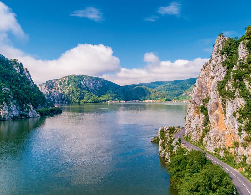
The Amazon, Nile, Mississippi, and Ganges are four of the most important rivers in the world.
The longest rivers in Europe are: the Volga, Danube, Ural, Dnieper and Don. There are eight main rivers in Spain: the Miño, Ebro, Duero, Tajo, Júcar, Guadiana, Segura and Guadalquivir.
In Andalusia, we can divide rivers into two groups:
z Rivers along the Atlantic slope (the longest rivers): Guadalquivir, Genil, Guadalete, Guadiana, Piedras, Odiel, Tinto and Barbate.
z Rivers along the Mediterranean slope (shorter and intermittent): Guadiaro, Guadalhorce, Guadalmedina, Guadalfeo, Andarax and Almanzora.
Human activity has had a big impact on the environment over the course of history.
Humans have modified the Earth’s relief. This process accelerated during the Industrial Revolution and has increased ever since. Humans impact relief in the following ways:
z Human settlements, which have expanded due to population growth.
z Transportation infrastructure, which alters landforms, the course of rivers and river mouths.
z Agriculture, which modifies the land to increase crop production.
z Livestock raising and industrial activities, which often destroy natural areas.
z Tourism, which contributes to water and soil pollution and depletes aquifers.
All these activities also contribute to climate change, which results in the melting of the poles, heat waves, droughts and acidification, thus disturbing the delicate balance of the Earth’s ecosystems. Overexploitation of marine resources increases pressure on an already degraded ocean environment. Another alarming issue is urban wastewater.
Many associations are focused on protecting and preserving the continental water supply, which is impacted by human activity. They include: WWF (World Wildlife Fund), Greenpeace and The Nature Conservancy.
Some efforts we can all make to mitigate these problems include:
z Reduce resource overexploitation and waste by recycling and reusing materials.
z Stop altering the relief of the land.
z Reduce chemical use.
z Halt urban speculation.
z Promote environmental awareness and education.
Clean water and sanitation. Guaranteeing sustainable water management and sanitation for all.
The primary goals of this SDG are to raise awareness about the following situations:
• Only 0.5 % of water is suitable for drinking and agriculture.
• Millions of people still lack access to drinking water, sanitation or general hygiene.
• Water use efficiency has increased, but water stress and water scarcity remain a problem in many parts of the world. Conflicts and climate change compound these challenges.
15 2 Listen to the audio recording about the Aral Sea and fill in the blanks with the correct words. Then, answer the questions:
The desiccation of the Aral Sea is one of the worst environmental disasters in history. Between and 1960, the government of the former Soviet Union started building a canal that would take from the River Amu Darya and other rivers that flow into the Aral Sea. The purpose of the canal was to a vast expanse of cotton crops in the region. As a result of the project, the Aral Sea now occupies of its original area and it retains only a quarter of its former volume.
The desiccation has made the winters and more extreme and increased the number of droughts. Also, the use of fertilisers and ended up polluting the air and groundwater. There have also been serious consequences for the of the population: the region has the highest infant mortality rate in the whole country and illnesses like bronchitis, anaemia, hepatitis and respiratory and eye-related diseases have
Text adapted from Isabel Coixet’s documentary, ‘Aral: The Lost Sea’ for the We Are Water foundation.
a) Use the map included in the appendices to locate the Aral Sea.
b) What was the cause of the Aral Sea’s desiccation?
c) What was the environmental impact of the sea’s desiccation? What are the health consequences?
16 Many Spanish rivers have low water levels in summer. Explain what this means and why it occurs in the summer.
17 Match the following words with their definitions.
a) Pollution
b) Acid rain
c) Deforestation
d) Erosion
1. The process in which fertile land is transformed into desert, normally as a result of drought.
2. The removal of forests or trees from land that is then used for other purposes.
3. The contamination of the environment as a consequence of human action.
4. The loss of soil, sometimes as a result of natural causes such as flooding. Human activity is accelerating this process.
18 Search for the names of at least two of the world’s main rivers, another two in Europe, and at least four in Spain.
19 Classify these rivers in Andalusia, based on whether they belong to the Atlantic slope or the Mediterranean slope: Guadiaro, Guadalhorce, Guadalquivir, Guadalmedina, Genil, Guadalete, Guadiana, Guadalfeo, Andarax, Piedras, Odiel, Almanzora, Tinto, Barbate.
20 Complete the text with the following words: awareness, human, marine, action, plastic, water, carbon, worldwide, vital, plastic, corals, life, oxygen.
The UN has issued a call to to take better care of the seas and the oceans and has expressed concern over pollution, which has increased tenfold over the past 40 years. According to the UN, every year, 8 million tonnes of plastic are thrown into the and this comes at a price: almost half of all living have perished.
The UN made this appeal coinciding with World Oceans Day, which is celebrated every June 8th since 2008, with the aim of raising the public’s regarding the consequences that activity has for the oceans and implementing a movement to take better care of them.
pollution entails great risk for human , since it depletes large amounts of plankton, which is responsible for 70 % of marine production. Furthermore, the oceans absorb large amounts of dioxide; around 30 % of what we humans produce. Thus, the oceans are for tackling another of today’s major problems: global warming.
21 Are these statements true or false? Correct the false ones.
a) The Genil, Tinto and Almanzora are Andalusian rivers.
b) There is a wet Spain along the Mediterranean coast and inland.
c) Navia and Nalón are examples of Atlantic watershed rivers.
d) In general, Spanish rivers are very long.
e) Mediterranean watershed rivers are short and shallow, except for the Ebro.
22 The Great Pacific Garbage Patch (GPGP) is the largest of the five offshore plastic accumulation zones in the world’s oceans. These plastics have been thrown away by people and end up in the ocean, and the amount of litter continues to grow because many plastics do not decompose. Complete the sentences to learn about actions to reduce waste in the seas: reduce, clean-up, recycle, spread, support, avoid.
a) your use of single-use plastics.
b) properly.
e) Desertification
f) Waste
5. Caused by emissions of sulphur dioxide and nitrogen oxide which react with the water molecules in the atmosphere to produce acids.
6. Unwanted or unusable material, substances or by-products.
c) Participate in (or organise) a beach or river
d) single-use plastic bags, take-out containers and bottles.
e) the word: stay informed on issues related to plastic pollution and help make others aware of the problem.
f) organisations that address the issue of plastic pollution.
We use linking words to connect ideas:
z and/also/too, to link similar ideas.
z but, to link contrasting ideas.
z like/such as, to give examples.
z due to, to explain a cause or reason.
We use sequencers to order ideas:
z First, second…
z Then, after that, before that…
z Next, finally…
1 Complete the text with the correct linking word in each case. Humans have had a negative impact on relief rivers. Many human activities pollute water deplete aquifers. Construction projects transportation infrastructure has modified many landforms. Humans have modified the course of rivers , varying their natural course. , climate change disturbs the delicate balance of ecosystems.
2 Read the sentences, each contain one linking word that is used incorrectly. Locate it and replace it with the correct one.
a) Some measures are designed to protect the relief but rivers.
b) But, we need to reduce resource overexploitation and waste.
c) We can help by recycling and reusing materials next.
d) Like, we should also promote environmental education.
1 How is the internal structure of the Earth divided?
According to the geochemical model: the core, the mantle and the crust. According to the geodynamic model: the endosphere, the mesosphere, the asthenosphere and the lithosphere.
2 How is relief formed and destroyed?
The crust is broken up into blocks called tectonic plates. Their movement causes the breaking up or folding of the Earth’s surface materials. Erosive agents (temperature, water, ice, wind, plants, trees and human beings) produce the erosion and fragmentation of the Earth’s surface.
3 What are the main elements of relief?
Continental relief is made up of plains, mountains, basins, valleys, and plateaus. The main features of oceanic relief are continental shelves, continental slopes, abyssal plains, ocean ridges and ocean trenches.
4 What is the coastline?
It is the interface between the continental and marine relief and includes beaches, capes, gulfs, estuaries, fjords, peninsulas, islands, and archipelagos.
5 What are the major features of relief in Spain?
The relief of the Iberian Peninsula is organised around the Central Meseta. We find the Central System and the Montes de Toledo. The Galician-Leonese Massif, Cantabrian Mountain Range, Iberian System and Sierra Morena border it. The Basque Mountains, Pyrenees, Coastal-Catalan System and Baetic Mountain Range on the periphery, and two depressions along the rivers Ebro and Guadalquivir. There are two archipelagos: The Canary Islands and the Balearic Islands.
6 What is the hydrosphere and how is water distributed on Earth?
The hydrosphere refers to all the Earth’s waters. Salt water represents most of the planet’s resources; while fresh water (inland waters: rivers, lakes, glaciers and groundwater) represents only 2.5 % of the total.
7 What is the water cycle?
The water cycle is the continuous movement of water on, above and below the surface of the Earth. It involves different processes: evaporation, transpiration, condensation and precipitation.
8 What are the characteristics of marine and inland waters?
Marine waters are saline and are found in oceans and seas. These are in constant movement due to tides, sea currents and waves. Inland waters are found in the continental regions of the planet. They are made up of rivers, lakes, groundwater and glaciers.
9 What are the oceans and the main rivers of the world?
Oceans are large bodies of salt water that separate the continents. They include: the Atlantic, Pacific, Indian, Arctic and Southern. Some of the most important rivers are: in the world, the Amazon, Nile, Mississippi and Ganges; in Europe, the Volga, Danube, and Rhine; in Spain, the Tagus, Duero, Ebro, Guadalquivir and Guadiana.
10 Are relief and the natural environment affected by human activities?
Yes, they are vulnerable to human impact and require protective measures.
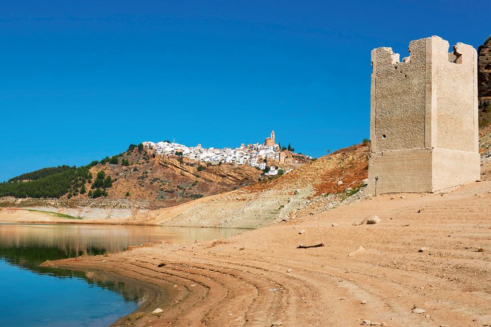
Water is essential for life, but 80 % of the world population faces problems of scarcity due to climate change, demographic pressure and human activities. Andalusia is one of the affected regions for all these reasons and also due to its geographical location and climate. That’s why there are organisations whose mission is to ensure the storage, distribution and quality of water: they are known as Hydrographic Demarcations, and are made up of Hydrographic Confederations and Water Agencies.
Search for information from the official organisations mentioned above regarding the current water situation in Andalusia, and compare it to the situation in the rest of the country.
‘The Junta de Andalucía launches new measures to combat drought [...]. The measures range from strengthening boreholes, portable desalination plants, increasing the percentage of regenerated water, improvements in reservoir intakes and transporting water in boats. The Ministry of the Environment considers such a measure to be a last resort and hopes that other measures already in place will resolve this situation.’
Adapted from El Diario de Sevilla (December, 2023).
To analyse the impact that drought can have on agriculture and other key sectors, conduct a survey in your area about water consumption habits, and ask questions about shower time, dishwasher or washing machine use, types of appliances (efficient or not), car cleaning, watering the garden, etc. Then, prepare a report detailing your analysis and conclusions. You can use images or graphs.
In class, the best reports will be selected to share on social networks, or along the school’s hallways. You can also collaborate with other school departments such as the Biology Department.
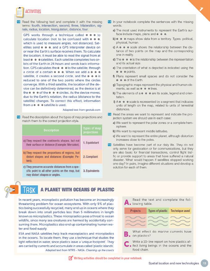
The Roman Empire was the most important in all of Antiquity. In its heyday, it spread completely across the Mediterranean. It began in the city of Rome, on the Italian peninsula. Several peoples arrived and coexisted in this territory, particularly Etruscans, Italics and Greeks.
2.1. The Monarchy (753-509 BC)
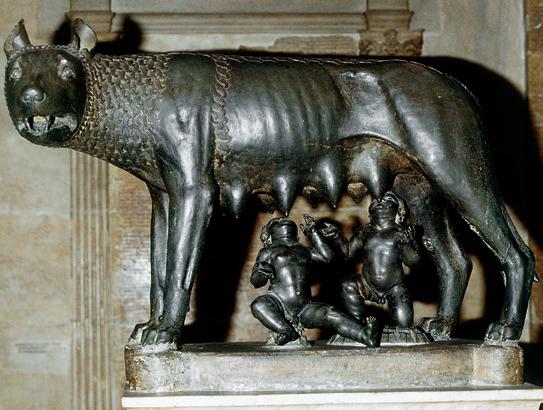
The Romans belonged to the Italian branch of the Latin people and lived in the centre of what is present-day Italy. According to legend, Rome was founded by the twins Romulus and Remus in 753 BC. During this period, it was ruled by a King (the highest religious and military leader), a Senate (made up of the chiefs of the tribes who inhabited Rome) and an Assembly or Comitia, which elected the king. This period ended with the overthrow of the last king and the proclamation of the Republic in 509 BC.
2.2. The Republic (509-27 BC)
Rome became the most powerful state in the Mediterranean world.
During this period, the Romans conquered a vast territory. Rome relied on a very well-equipped and organised army. But in the 1st century BC Rome faced problems such as corruption and economic crises. Civil wars among military leaders were common: after the killing of the most important general, Julius Caesar, his grand-nephew, Augustus, became the first Roman emperor.
All power was centred on the Emperor. He commanded the army, acted as chief priest and directed politics. There were two stages:
z The Early Empire. For 200 years it was at its largest, safest and richest. The em perors defended the frontiers, built roads and constructed public buildings. These two centuries are also known as the man Peace or Pax Romana.
z The Late Empire. In the 3rd century AD, the Roman Empire entered a political, economic and social crisis, with wide spread disease and barbarian invasions. Theodosius divided the Empire into two parts in 395 AD to better defend it. The western capital was in Rome and the eastern capital was Constantinople. Germanic tribes ended up destroying the Western Roman Empire in 476 AD. Meanwhile, the Eastern part of the Roman Empire became the Byzantine Empire, which survived until 1453.
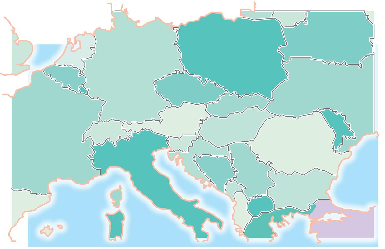
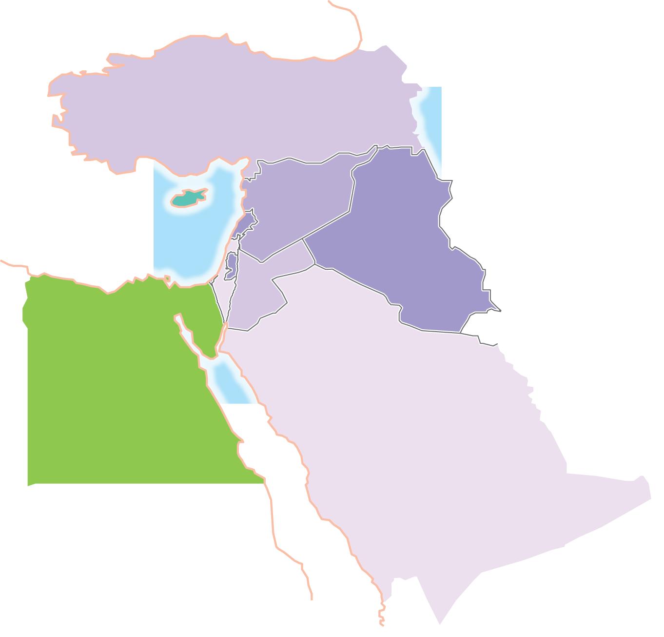
The Roman Empire at its greatest
BRITANNIA
Magistrates
Senate
Assembly or Comitia
They were chosen trough elections. They had various functions. The two most important were called consuls.
A council of citizens from the most important families, and former magistrates. Its function was to advise the magistrates and lead the state.
It was made up of all Roman citizens. They passed the laws and elected the magistrates.
Mare Germanicum
GERMANIA
SICILY AQUITANIA
MAURETANIA
ITALY
MESOPOTAMIA
JUDEA
ARABIA
AFRICA
EGYPT


Territory conquered after the Third Punic War Conquests before Caesar Conquests under Caesar Conquests under Augustus

Maximum expansion under Trajan
Provinces at the time of Trajan
Maximum extent of the Empire under Trajan
Theodosius’ Division
1 Link each event to the year in which it occurred. Then order them chronologically on a timeline.
a) Foundation of Rome
b) Beginning of the Empire
c) End of the Monarchy
1. 509 BC
2. 753 BC
3. 476 AD
d) Fall of the Western Roman Empire 4. 27 BC
2 Match the sentences with the following political offices of the Roman Republic: consuls, praetors, censors, senate, assemblies, plebeian tribunes.
a) They were the most important magistrates of all. They ruled the State and commanded the army.
b) It represented the most prestigious institution of the Roman Republic. It was made up of former magistrates, and they advised the new magistrates. They also decided on matters of war and peace.
c) They were responsible for administering justice.
d) They were plebeians and defended the rights of the common people.
e) It was elected by the citizens. It elected the magistrates and passed laws.
f) They were in charge of collecting taxes, registering the names and numbers of all citizens and overseeing public morality.
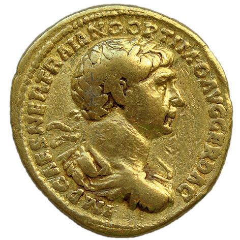
3 2 Listen to the audio recording about the first emperor, Augustus, and complete the text with the missing words.
Augustus founded the Roman . He was born in 63 BC and although his birth name was originally Octavius, it was later changed to Octavian. His parents belonged to very families, and he was the grand-nephew of Rome’s ruler, Julius Caesar, who, having no son of his own, made Octavian his heir and adopted son. Once Octavian became a man, he got involved in the politics of Rome and soon joined his uncle Caesar in battle.
When on March 15th, 44 BC, Julius Caesar was , Octavian began to gather political support in the Roman as well as military support from Caesar’s . Then, Octavian allied with two other very powerful , Marc Antony and Lepidus, to control Rome by forming a triumvirate. But eventually, they ended up each other for power. Finally, Octavian defeated Marc Antony and became the and of Rome in 27 BC. The Senate gave him the title of Augustus. After many years of civil in the final years of the , Augustus brought peace to the land and began to rebuild much of the city and the empire. He built many roads, buildings, and . He also strengthened the and conquered much of the land around the Mediterranean Sea. Under Augustus’ rule, Rome once again experienced peace and . Augustus ruled up until his death in 14 AD. The 8th of the year is called August in his honour.
4 Read the following text about the Roman army and answer the questions in your notebook.
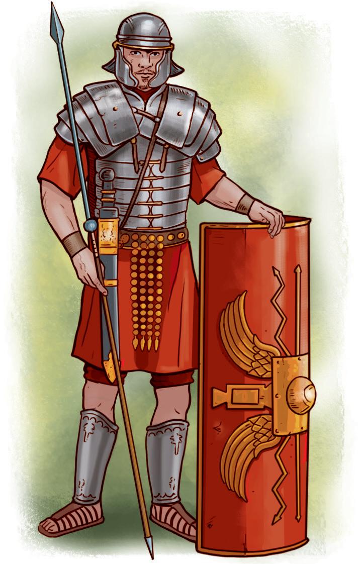
The Roman army was one of the most successful armies in history. Most of it was made up of legions, which were infantry divisions of around 5,400 men. The soldiers in the legions were all Roman citizens. Originally, all citizens had to go to war (it was compulsory), but later on, military service became voluntary. The soldiers signed a contract for twenty years. At the end of this contract they were generally awarded with land and/or a large sum of money. This was how the army always managed to have skilled and able soldiers. There were also non-citizen soldiers who joined the auxiliary troops –especially the cavalry– and were awarded Roman citizenship at the end of 25 years of service.
a) The main division of the Roman army was around 5,400 soldiers. What was this division called?
b) How long did the Roman soldiers sign up for?
c) What did soldiers receive after leaving the army?
d) Who were the auxiliary soldiers in the Roman army?
e) What did the auxiliary soldiers get at the end of their military service?
5 Write questions for the following answers. Look at the underlined words to help you.
a) According to legend, Rome was founded by the twins Romulus and Remus.
b) The Roman Republic was proclaimed in 509 BC
c) From 27 BC to 476 AD Rome was an Empire
d) Emperor Theodosius divided it into two parts in 395 AD.
e) Germanic tribes destroyed the Western Roman Empire in 476 AD.
f) The Eastern part of the Roman Empire became the Byzantine Empire and survived until 1453
There were two large social groups throughout most of Roman history:
z Patricians. A rich, powerful minority who descended from the first inhabitants of the city.
z Plebeians. A majority of the population (foreigners, poor peasants, craftsmen, freedmen (libertos) and traders). They enjoyed limited political and civil rights.
The right to obtain the Roman citizenship was extended to all free inhabitants of the Empire by Emperor Caracalla’s edict in 212 AD. As of that point society was divided into citizens and non-citizens (foreigners and slaves). The latter had no political rights.
Rome was a slave society. Slaves made up a large chunk of the population. They had no property, possessions or rights. They were normally prisoners of war or children of slaves. They usually did all agricultural or domestic tasks for the citizens. Slaves who were set free became freedmen.
Freeborn women were considered citizens, but had very few rights. They could not vote or hold political office. Roman women were educated until the age of 12, when they were considered old enough to get married.
Roman families were relatively small due to the high infant mortality rate. Roman citizens also adopted children to ensure having offspring. They would marry in private ceremonies and divorce was also very common.
Roman children were educated until puberty. Schools were mixed until the age of 12. Religious holidays determined days off from school.
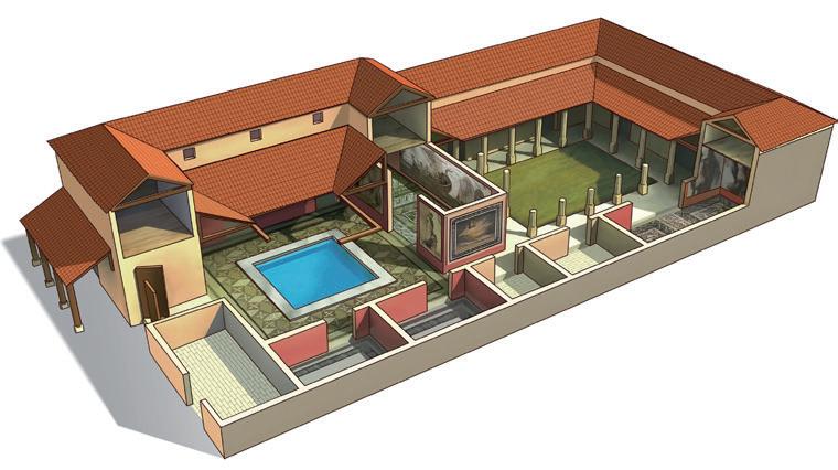
Men wore tunics and togas, but slaves and poor people only wore tunics. Women wore tunics and cloaks. They took great care of their appearance and what they ate. The most important room of the house was the triclinium (formal dining room).
Roman cities were designed according to a regular layout. The most important avenues were the cardo, which extended from south to north, and the decumanus, from east to west. In the centre was the forum. There were different types of homes: the insulae, a multi-storey flat rented to poor people; the slums, very small rooms; the domus, large homes owned by wealthy families; and the villae, agricultural farms belonging to wealthy families.
Agriculture was the main economic activity under the Republic. It was based on the cultivation of olive trees, grapevines, cereals, fruit and vegetables. The Romans expanded the use of new techniques (ploughs and tools, irrigation systems, mills) and new crops (several types of fruit trees). Livestock farming was based on the breeding of horses, sheep, donkeys, mules and pigs.
Arts and crafts flourished. Mining experienced significant development during the Imperial Era, due to high demand for metals to make coins and tools.
Trade was fostered by domestic peace, safe maritime routes, an extensive road network and the use of coins.
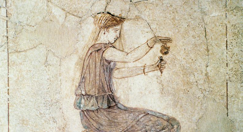
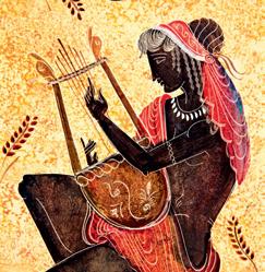
In the year 195 BC, a women’s protest in Rome achieved the repeal of the lex oppia, which established heavy taxes on products commonly used by women. Furthermore, this unfair law established certain restrictions on movement for women.
Roman woman applying perfume from a flask. Fresco painting at the National Roman Museum, Baths Museum, Rome.
Sections of a domus
A Roman city: Augusta Emerita
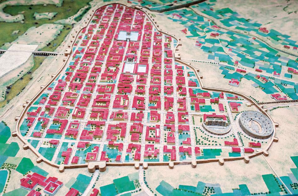
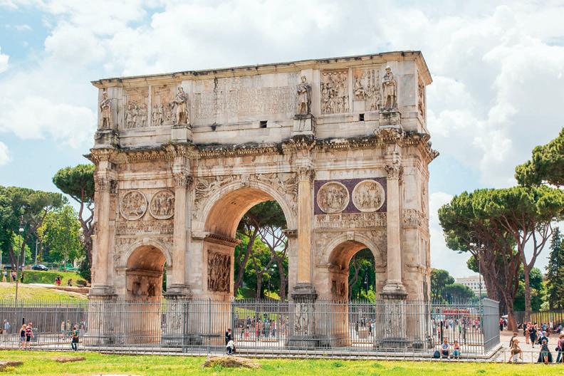
➊ Arch of Trajan to commemorate military triumphs.
➋ Bridge.
➌ Decumanus.
➍ Cardo
➎ Aqueduct. It carries water to the city.
➏ Temple of the Provincial Forum.
➐ Temple of Diana
➑ Forum. Located at the city centre, it is surrounded by public buildings and shops
➒ Theatre.
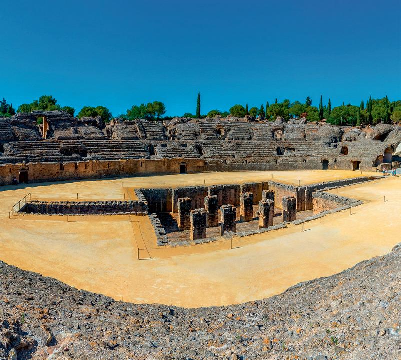
❿ Amphitheatre, where games and gladiator fights are held.
⓫ Wall. It surrounds the city.
6 Complete the following diagram about social classes in Rome. Match the words with the correct social classes: soldiers, slaves, citizens, women and freeborn, and freedmen.
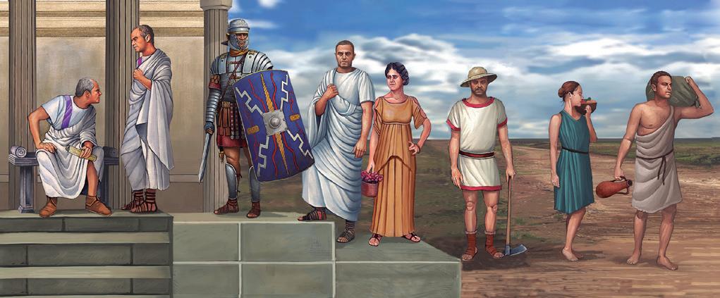
a) b) c) d) e)
7 Read the following sentences about Roman society and complete them with the following words. Some words can be used twice: slaves, freedmen, inhabitants, women, patricians, rights, plebeians.
a) During the Roman Republic citizens were divided between the rich and powerful and the poorer and less influential
b) were completely subjected to their owners and had no political .
c) Slaves who were set free became
d) Roman had very few rights and could not vote or hold political office.
e) The number of gradually decreased as the wars of conquest ended.
f) All the free of the Empire became Roman citizens thanks to Emperor Caracalla’s edict in 212 AD.
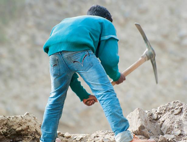
Around 20-30 % of the Roman population were slaves. On several occasions the slaves of Rome joined together and rebelled in a quest for freedom. When we discuss slavery we tend to only think about the world’s ancient civilisations, but slavery unfortunately persists today. Presently there are over 50 million people living as slaves across the globe.
Source: www.endslaverynow.com.
8 Study the map of the city of Emerita Augusta and answer the following questions:
a) Where are the public buildings and shops located?
b) What architectural element surrounds the entire city?
c) In which buildings are public performances and shows held?
d) What structures are located outside the city wall?
e) What is the city city named today?
9 Match the two parts of the sentences to form five statements about the Roman economy.
a) In Rome, most of the work
1. was concentrated in large properties or villae
b) During the Republic 2. helped improve mining.
c) Most of the land
d) Trade improved
e) The introduction of new techniques and tools
3. because of peace, an extensive transportation network, and the use of coins.
4. was done by slaves.
5. agriculture was the most important economic activity.
10 Answer the following questions about cities and housing in Rome:
a) How were Roman cities designed?
b) What were the two main streets of the city?
c) Where did the wealthy Roman people live?
d) What were the insulae?
e) What were the slums like?
A.
Wha t does being a slave today entail? Explain it in your own words . Th en find three similarities and three differences bet ween slavery in Rome and nowadays.
B. Investigate and match the type of slavery with its definition
a) Domestic servitude
b) Sex trafficking
c) Forced labour
d) Bonded labour
e) Child labour
f) Forced marriage
C.1. Individuals compelled to work in order to repay a debt and unable to leave until it is repaid. The most common form of enslavement.
2. Women and children who are forced to marry another person without their consent or against their will.
3. Any enslavement —whether forced labour, domestic servitude, bonded labour or sex trafficking— of a child.
4. Employees working in private homes are forced or coerced into serving and/or fraudulently convinced that they have no option to leave.
5. Women, men or children who are forced into the commercial sex industry and held against their will by force, fraud or coercion.
6. Humans forced to work under the threat of violence and for no pay. They are exploited to create a product for commercial sale.
Deb ate . Wha t can we do to eliminate the problem of modern slavery? Do you think it’s possible to end slavery today? Debate the issue with your classmates and write down at least one measure that could be taken to end each type of slavery.
The Romans gradually incorporated contributions from the conquered territories into their own culture. Their own greatest contributions were their language, Latin (many European languages are based on it), and law Roman political institutions.
Architecture and art
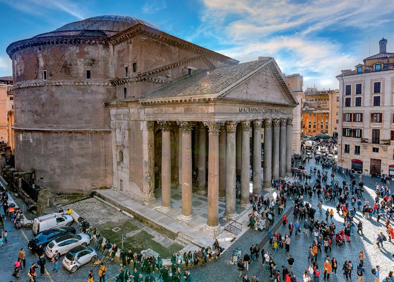
Roman art was initially influenced by Etruscan and Greek art. Roman architecture was useful and practical, and at the same time based on large-scale monuments designed to project Roman power and greatness.
They used stone, brick and concrete in their buildings, which they normally covered with slabs of marble for a richer appearance. It was common to use arches, vaults and domes to cover the buildings.
The main religious building was the temple. Roads, aqueducts, bridges, thermae or public baths, theatres, amphitheatres and circuses were some of the structures that stood out the most in Roman civil architecture. Triumphal arches and commemorative columns paid homage to famous victories or emperors.
The Romans excelled at creating sculpture, especially busts (with very realistic features) and historical reliefs. The most commonly used materials were bronze and marble.
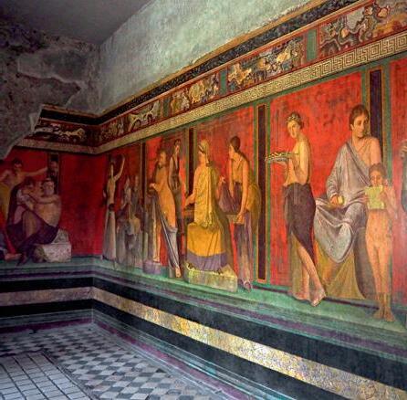
Paintings and mosaics were used to decorate villae and domus. Mythological scenes, animals and landscapes were represented in them.
Roman society was polytheistic and assimilated the gods and beliefs of the peoples they conquered. The most important gods formed the Capitoline Triad (Jupiter, Juno and Minerva). Public worship took place outdoors on altars where the priests performed sacrifices, while the statues of the gods were kept in temples. The emperors were deified when they died and received official worship.
The household gods protected the family and the home and were worshiped at a small altar called a lararium. Certain important sites and people were purported to have their own protective spirits or genies.
In the 1 st century AD a new religion, founded by Jesus Christ, appeared. Its followers were persecuted because of their refusal to worship the emperor. Some emperors sent Christians to their death battling wild beasts (‘thrown to the lions’). Christianity was later legalised and converted into the only official religion by Emperor Theodosius in 395 AD, while paganism was banned.
Romanisation was the process through which conquered peoples adapted to the Roman language, culture and way of life. The main factors were:
z The use of Latin as a common language.
z The existence of an Imperial army.
z The use of the same currency.
z The construction of a transportation network.
z The adoption of the same laws.
z The establishment of new cities.
Hispania was one of the most Romanised areas. It was the birthplace of emperors Trajan, Hadrian and Theodosius, philosopher Seneca and authors Lucan and Martial.
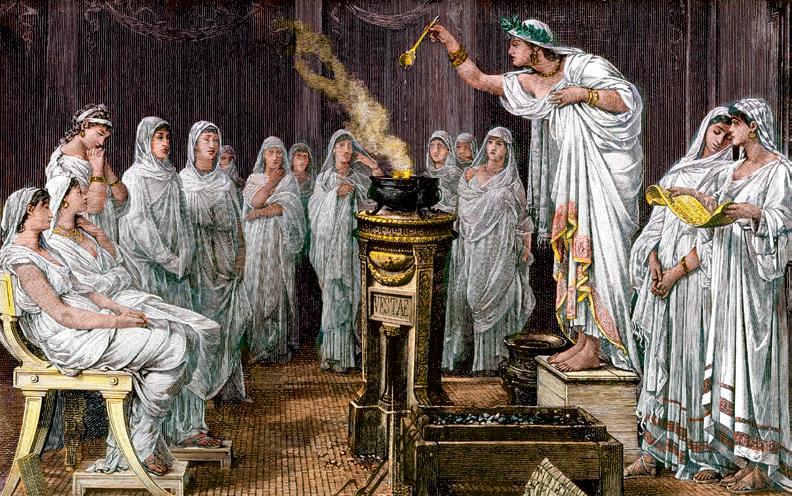
Vestals were six priestesses consecrated to the goddess of fire. The Romans thought that the security and peace of the city depended on their existence and well-being.
11 Answer the following questions about Roman art:
a) Which earlier civilisation had the most influence on the art of Ancient Rome?
b) What were the basic characteristics of Roman architecture?
c) What art forms did the Romans excel in?
d) How did the Romans transport water over long distances?
e) Where were paintings and mosaics usually exhibited?
f) What themes often appeared in Roman mosaics and paintings?
12 Read this text about Roman buildings and fill in the gaps using the following words: buildings, domes, slabs, stone, marble, brick, vaults, arches, concrete.
The Romans used , and in their buildings, which they usually covered with of for a richer appearance. It was common to use , and to cover the
13 Which of the following statements about Christianity in Rome is true? Correct the false ones in your notebook.
a) Christianity appeared in the 5th century AD.
b) Christians were persecuted because of their refusal to worship the emperor.
c) Christians persecuted the Roman emperors and killed them.
d) Christianity was converted into the official religion of the Roman Empire by Emperor Theodosius in 395 AD.
e) After the switch to Christianity, the old Roman religion –paganism– was allowed.
14 Match the Roman names of the gods with their functions.
a) Jupiter 1. The goddess of the hearth, the home, and domestic life.
b) Juno 2. Goddess of agriculture.
c) Minerva 3. Messenger of the gods.
d) Neptune 4. Goddess of hunting.
e) Vesta 5. The god of thunder and the sky. King of the gods and men.
f) Pluto 6. God of the sea, rivers and lakes.
g) Ceres 7. God of wine.
h) Venus 8. God of war.
i) Apollo 9. God of fire and blacksmith.
j) Diana 10. God of the dead.
k) Mars 11. Goddess of marriage and queen of the gods.
l) Vulcan 12. God of arts, light and reason.
m) Mercury 13. Goddess of wisdom.
n) Bacchus 14. Goddess of love and beauty.
15 Read the sentences below about public buildings and complete them in your notebook using these words: amphitheatre, circus, triumphal arch, temple, thermae, aqueducts, basilica, theatre.
a) The Romans attended plays at the
b) Water was brought to cities through
c) The was the most important religious building, the place where the statue of a god was kept.
d) Gladiator fights and naumachias (naval battles) were held at the
e) The was the place where justice was administered and business was conducted.
f) The public baths were located in the .
g) To watch chariot races you had to go to the
h) The was a commemorative monument.
16 Read the text on Romanisation and answer the questions in your notebook.
During the Empire, Roman law and institutions, social norms, language, culture, and religion spread to most territories under Roman rule. This process is known as Romanisation. It was particularly intense in the western provinces (Gaul, Britannia and Hispania). The process was based on the establishment of cities and military camps, from which soldiers and officials expanded Roman culture.
The richest people in the occupied territories were encouraged by their conquerers to quickly adopt the Roman way of life and to become models for the rest of their community.
Rome spread its language (Latin) and its laws over the conquered peoples. Today many of the languages spoken in Europe and other areas of the globe, such as Spanish, Italian or French, come from Latin.
The Romans also built a large network of roads and maritime routes to connect the provinces with the capital. Temples, aqueducts, thermae, theatres and other buildings were constructed throughout the Empire. They are considered to be engineering masterpieces because many of them are still standing today.
a) Which features of Roman civilisation spread to most of the Empire as a result of Romanisation?
b) In which provinces was the Romanisation process particularly intense?
c) After the Romans conquered a territory, how did they start the process of Romanisation?
d) Which social class among the conquered peoples was initially targeted to spread Roman culture?
e) What was the name of the Roman language?
f) What are the main Romance languages? Include more languages than just those appearing in the text.
g) How were the provinces connected to the capital?
h) Have you ever visited a Roman building in your country? Write a short description of one you’ve visited.
We use still to say that an action is continuing. It can be used in negative sentences, before the negative.
z It’s 12 o’clock and he is still studying.
z It’s 12 o’clock and he still hasn’t finished. We use yet in negative sentences and questions. It means: until now. It goes after the verb.
z It’s 12 o’clock and he hasn’t finished yet.
We use already to say that something happened sooner than expected.
z It’s 12 o’clock and he has already finished.
1 Complete this dialogue between two soldiers in the Roman army. Fill in the gaps using still, yet and already.
a) How much time do you have left to finish your military service, Lucius?
1 When did Roman civilisation emerge?
According to legend, Rome was founded by the twins Romulus and Remus in 753 BC. The Romans were a Latin-speaking people, and they were initially influenced by the the Etruscans and the Greeks.
2 What are the main periods into which Roman history is divided?
The Monarchy, when kings ruled the country; the Republic, when Rome achieved considerable expansion; and the Imperial era, when all power was concentrated in the Emperor.
3 What institutions ruled Rome during the Monarchy and the Republic?
During the Monarchy, Rome was governed by a king, helped by the Senate and the Assemblies or Comitia. The Republic switched the king for several magistrates as rulers and maintained the Senate and the Comitia
4 How did the Empire evolve until its fall?
During the Early Empire, Roman civilisation reached its maximum expansion (Pax Romana). During the Late Empire there were political, economic and social crises and Barbarian invasions. Theodosius divided the Empire into two parts in 395 AD to better defend it.
5 What activities was the Roman economy based on during the Republic and the Empire?
Agriculture was the main activity. Trade and handcraft production increased. Mining developed significantly under the Empire. Most of the workforce was made up of slaves.
b) I have finished it a week ago, Arturius! As a Roman citizen I served for 20 years. But my brother Caius hasn’t finished it . He has 2 years left.
c) Well, I have to serve until next year. I have not received my citizenship , but shortly I’ll have the same rights as you! Anyway, will you be staying in this province?
d) I am living here, Arturius, but in two months time I will receive a farm as payment in Dacia. Long live Rome and Emperor Trajan!
2 Complete the sentences about the Cornelius family with adverbs that make sense:
a) Gaia, have you finished your homework ?
b) Yes, mother, I have finished it !
c) And you, Publius, have you reviewed your Greek lessons with your tutor?
d) No, mother, I'm reciting my lesson. Greek is a really difficult language!
e) Publius, you know that as a member of a Patrician family, you have to be fluent in Greek, but you haven't learnt it
6 How many social groups were there in Rome?
There were two large social groups: the patricians, a rich, powerful minority who descended from the first inhabitants, and the plebeians, who made up the majority of the population and enjoyed some political and civil rights. Roman citizenship was extended to all free inhabitants of the Empire in 212 AD.
7 Describe the influences and development of Roman art. Roman art was initially influenced by Etruscan and Greek art. After the conquests, a blend of Greek and Roman art expanded throughout the Empire. The Romans excelled at creating busts, and historical reliefs made out of bronze and marble. Painting and mosaics were also developed within the decorative arts.
8 What were the characteristics of Roman architecture?
It was useful and practical, and used large-scale monuments to project their power. They used stone, brick and concrete which they normally covered with marble. The main religious building was the temple.
9 What was religion in Rome like?
They were polytheistic and assimilated the gods of the peoples they conquered. Public worship took place at outdoor altars, while the statues of the gods were kept in temples. The household gods protected the family. Christianity became the official religion in 395 AD.
10 What does Romanisation mean?
It is the process of adaptation of the conquered peoples to the Roman language, culture, social norms and way of life. Hispania was one of the most Romanised areas.
The Mediterranean was the route along which customs, knowledge and technology were exchanged over the course of numerous civilisations’ growth and development. All the countries that surround the Mediterranean Sea are known for their contributions to global civilisation. However, the Mediterranean today is often associated with serious problems such as immigration, destruction of the sea’s resources and marine life, crowded costal populations, intense pollution…
Match the following images to a fact, an event or information that is relevant to our own history. What do they all have in common with Roman civilisation?
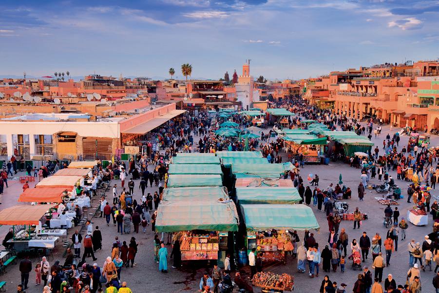
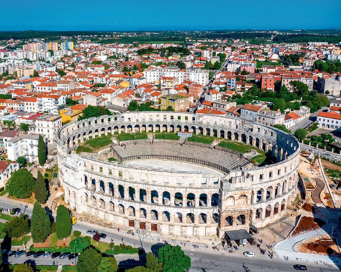
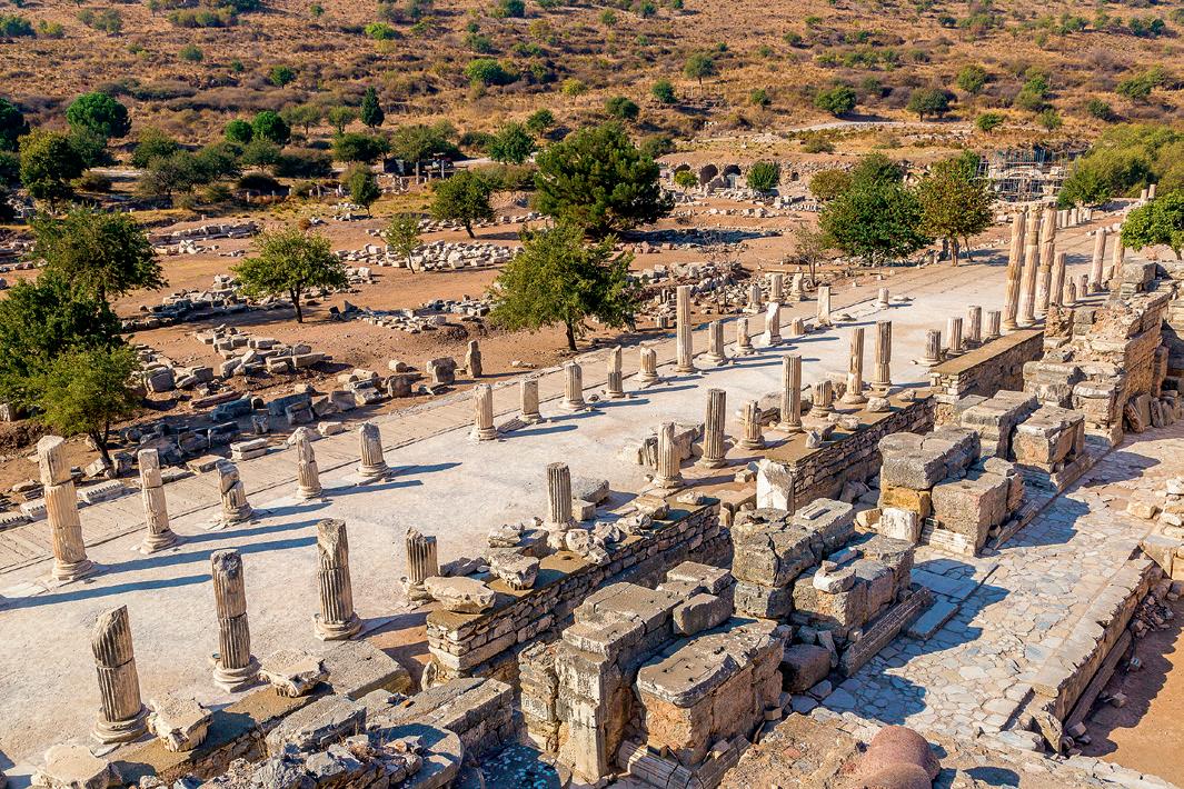
Imagine that you are living in the 3rd century in Italica and that you are descended from Patrician families. You would like to organise a trip with friends through various cities. Work in groups and use the Internet to develop an itinerary using the means of transportation available during that period to discover at least 3 sites of cultural interest. It may help you to first answer the following questions:
• What means of transportation are available?
• What routes can I follow?
• What cities were important at the time?
• Will any wars keep me from following my itineraries?
Design a presentation with images of the places you’ve visited and indicate which three facts, buildings or cultural customs you enjoyed the most in each city.
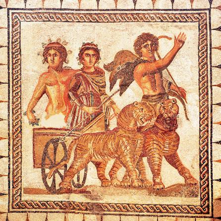
In the first millennium BC, the Iberian Peninsula was home to two different cultures. The Iberians were located in the east and the south. They interacted with Phoenicians, Greeks and Carthaginians. They were a warrior society ruled by warlords and organised into tribes. Their agriculture-based economy was focused on wheat, vineyards and olive tree cultivation. Trade with other civilisations introduced them to money and writing. They incinerated their dead at necropoli. Their religious beliefs were linked to war and nature.
The Celts arrived on the Peninsula through the Pyrenees. They settled in the north and the west. Theirs was a warrior society and they lived within castros or fortified areas. They were organised into clans that included aristocrats, freedmen and slaves. Their economy was based on agriculture, livestock and the plough.
They had no contact with the peoples who inhabited the Mediterranean. They developed a fertility cult. They didn’t produce much art.
Tartessian civilisation emerged in the Guadalquivir and Guadiana river valleys. They had contact with the Phoenicians and the Greeks who, in turn, influenced their society and culture. Although no remains of cities have been discovered, it is thought that their economic development enabled them to establish ban settlements. Their society was hierarchical economy was based on mineral mining, agriculture, livestock, fishing
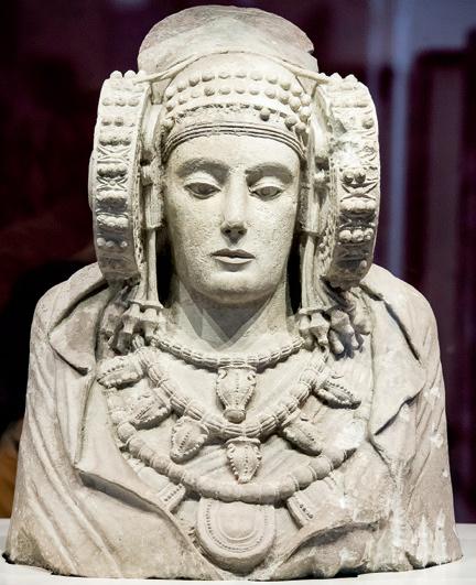
The Lady of Elche is an Iberian sculpture from the 4th century BC. It represents a woman with idealised features. The figure is wearing an elaborate headdress, necklaces, and a cloak displaying ornamental designs. It was discovered in 1897 in La Alcudia (Elche).
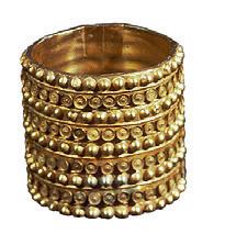
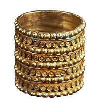
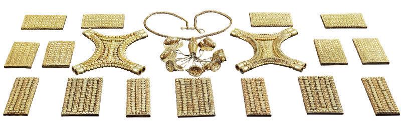
Colonisation and the Mediterranean trade
Gold Copper Oil Cereals
Tin Wine Silver Wood Trade routes

Massalia
Nikaia Rhode Emporion
Hemeroskopeion
Malaka Abdera
Gadir
Olbia
Istros
Pantikepeion
Dioskourias
Byzantium
Amisos
Leucas Posidonia
Panormus
Crotone Alalia
Ebussus Siracuse
Tingis Carthage
AFRICA
Caralis Leptis
Phoenicia
Sparta
Euhesperides Cirene
Phoenician colonisation area Greek Greek colonisation area
Focea
Corinth Rhodes Athens Olynthos
Chalkedon
ASIA MINOR
Miletus
Naucratis Pafos

EGYPT


1 Are these sentences true or false? Correct the false ones.
a) The Iberians developed an agriculture-based economy and trade.
b) Art flourished under the Celts. One notable example is the Lady of Elche.
c) Tartessian culture had no contact with other civilisations.
d) The Phoenicians founded colonies like Rhodes and Ampurias.
2 Complete the text with the following words: Greeks, Sagunto, coin-based, Rome, Carthaginians, Phoenicians, Hannibal, colonies, cultural, writing, Iberia.
The , traders from the eastern Mediterranean, founded Gadir and established in the south and southeast of the Peninsula.
The , rivals of the Phoenicians, arrived from the north, founding colonies such as Emporion. They exerted considerable influence, spread their money and system, and called the colonised region
The displaced the Phoenicians and competed with the Romans for control of the Mediterranean. They founded the colony of Baria (Almería). , a Carthaginian leader, planned to conquer starting from the Iberian Peninsula and attacked along his route.
3 Read the document by Herodotus about Tartessos, examine the colonisation map and answer the questions below:
‘The Phocians were the first Greeks to undertake long distance navigation. They discovered the Adriatic and Tyrrhenian Seas, Iberia and Tartessos. [...] Upon their arrival at Tartessos, they became good friends with the king of the Tartessians [...] Arganthonios, who ruled over Tartessos for 80 years and lived for a total of 120’.
Herodotus, The Histories.
a) Where did the Phocians live?
b) What places were discovered according to the text?
c) Is this text credible? Explain your answer.
4 Write in your notebook which Pre-roman people each sentence refers to.
a) They incinerated their dead at necropoli.
b) They founded colonies such as Ibiza and Almería.
c) They had trading centres throughout the eastern Mediterranean.
d) They settled in the northern and western areas of the Iberian Peninsula.
e) They developed a hierarchical society with an aristocratic elite.
f) They exerted considerable cultural influence.
5 Set a timeline in your notebook and place the following periods or events on it, remembering to specify the dates.
a) Birth of emperor Theodosius either in Coca (Segovia) or Italica.
b) First confrontation between Romans against Celts and Lusitanians.
c) The Phoenicians arrive on the Iberian Peninsula.
d) Siege of Sagunto by Hannibal and Roman disembarkment in Ampurias.
e) Cantabrian and Asturian Wars against the Romans.
f) Christianity arrives in Hispania.
g) Birth of emperor Hadrian in Italica.
h) Emergence of the Tartessian civilisation.
i) Initial Greek colonisation on the Iberian Peninsula.
j) Assassination of the leader of the Lusitanian people, Viriathus.
k) Roman conquest of Numantia.
l) Birth of emperor Trajan in Italica.
‘Throughout Antiquity, various civilisations have fought for territory and as they fought, property was destroyed along with the monuments that had been built by the defeated peoples. Unfortunately in the 21 st century, this continues to occur. In 2015, within the context of the Syrian Civil War, the archeological remains of the city of Palmyra, a UNESCO World Heritage Site, were destroyed. Temples, funerary towers and a Triumphal Arch in the desert that dated back more than 2,000 years were destroyed by explosives at the hands of jihadists, who considered sanctuaries and statues symbols of idolatry. The UNESCO condemned the destruction and designated it a war crime.’
BBC World, 7 October 2015
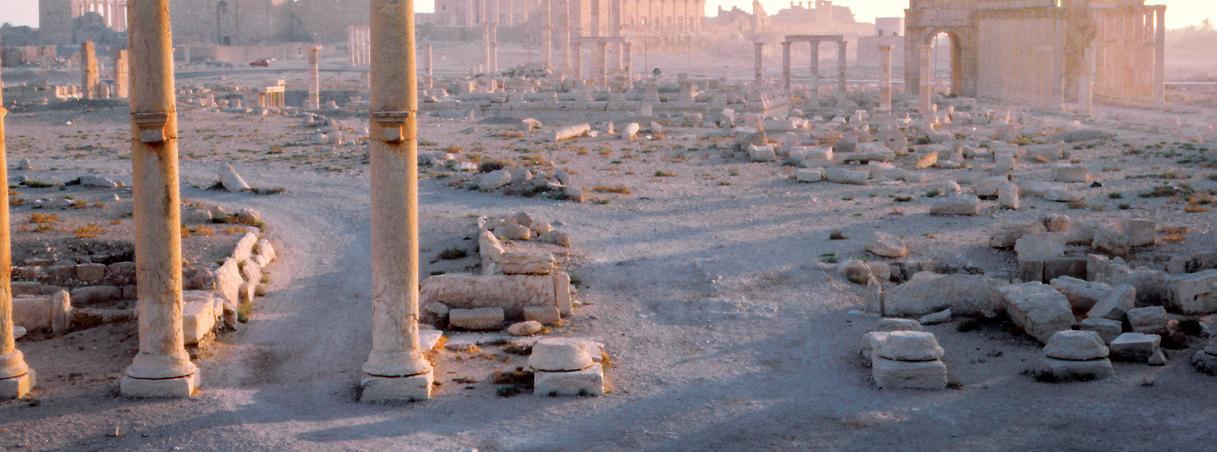
A. Read the text and answer the following questions: What was destroyed? Who destroyed the archaeological remains? Which cultural institution condemned this act?
B. Look up the list of UNESCO World Heritage Sites online and summarise the most important features of Palmyra’s cultural heritage.
The Romans arrived on the Iberian Peninsula in the 3rd century BC, then spread out and and ruled over it until the 5th century AD, through a process known as Romanisation.
Rome fought the Carthaginian invasion led by Hannibal, who sought to invade the Iberian Peninsula, conquered the Mediterranean coast and expelled the Carthaginians.
The Romans consolidated their dominion over the occupied territories and conquered the inland areas. They fought against the Lusitanians and the Celtiberians. Two major Roman successes were the battle of Numantia and the occupation of the Balearic Islands.
Under Augustus, the Romans completed their conquest of the north, and fought the Galicians, Cantabrians and Asturians in the Cantabrian and Asturian Wars. They consolidated Roman domination of the entire Iberian Peninsula.
Cardo Maximus Amphitheatre Wall
Domus of the planetarium
Large bathhouse
Nova urbs
Temple of Trajan Small bathhouse
Decumanus maximus
Domus exedra
Temple of Isis
Domus of Neptune
Domus of the birds
Domus of the Rhodium patio
Domus of Hilas
Domus of the Venus mosaic
Circus Theatre
Forum
Vetus urbs
Cardo maximus
The city of Italica (Santiponce, Seville) was founded in 206 BC as a colonia for Roman soldiers injured during the Second Punic War. It was originally a colony, but under Julius Caesar it received city status, thanks to the support it lent Caesar in his civil war against Pompey. During Octavian Augustus’ reign as emperor, Italica was allowed to produce coins. Three major emperors were born in Italica: Hadrian, Trajan and Theodosius. In the present day, one can still visit the city’s well-preserved artistic and historical heritage.
The Romanisation of the Iberian Peninsula, as the result of military conquests, encompassed political, cultural, social and economic influences. The process was particularly intense along the Mediterranean and helped contribute to Roman unification and territorial integrity.
The consequences of the Romanisation process were:
z A new system of political and territorial organisation: various provinces were established in the Peninsula. The last to be established was the province of Balearica.
z The founding of cities like Emerita Augusta, Corduba and Tarraco.
z The construction of a network of roads and bridges to connect cities and the Empire.
z The gradual substitution of vernacular languages by Latin, which is the root of modern languages like Portuguese, Castilian Spanish, Galician and Catalan.
z The implantation of Roman law, the basis of modern Western law.
z The expansion of the cult of Roman deities and eventually, Roman Catholicism.
z The creation of coins displaying Latin inscriptions and the Emperor’s face, consolidating the presence of the Roman Empire in peoples’ daily lives.
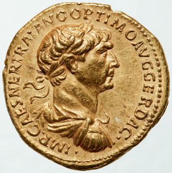
Coins have been a key tool for propaganda over the course of history. In Rome, they made it possible to broadcast images of the rulers and their families throughout the Empire. Each coin is a living document that contributes historical, economic, social and artistic information.
Image of Trajan, an emperor born in Italica.
Until just a few years ago, we didn’t know how garum was prepared. We also didn’t know that it was prepared outside the cities, that it contained brine and that it was left in the sun for weeks. A study conducted by a team of researchers from the Universities of Cádiz and Seville explained what types of fish were consumed in Rome, mainly tuna and anchovies. In Roman times, the demand for fish never led to overexploitation of marine resources. Nowadays, things are quite different as a result of modern demand for fish products.
Do some research on what garum is and how modern canned fish products help to keep the industry alive along the coasts of Cádiz.
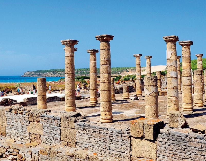
6 Examine the cities on the map of Roman Hispania and, using Internet, complete the following table in your notebook.
Lucus Asturum
Brigantium
Iria Flavia
Bracara Augusta
ATLANTIC
OCEAN Cantabrian Sea
Flavióbriga Gigia
Conimbriga Scalabis Ossonoba Lucus Augusti

Legio VII Asturica Augusta
Pallantia
Virovesca Calagurris
lulobrigensium
Caesar Augusta Pompaelo Iacca Osca Barcino Ilerda Tarraco Emporiom Ebussus
a) They could participate in political and events, do housework, play music, dance and also be
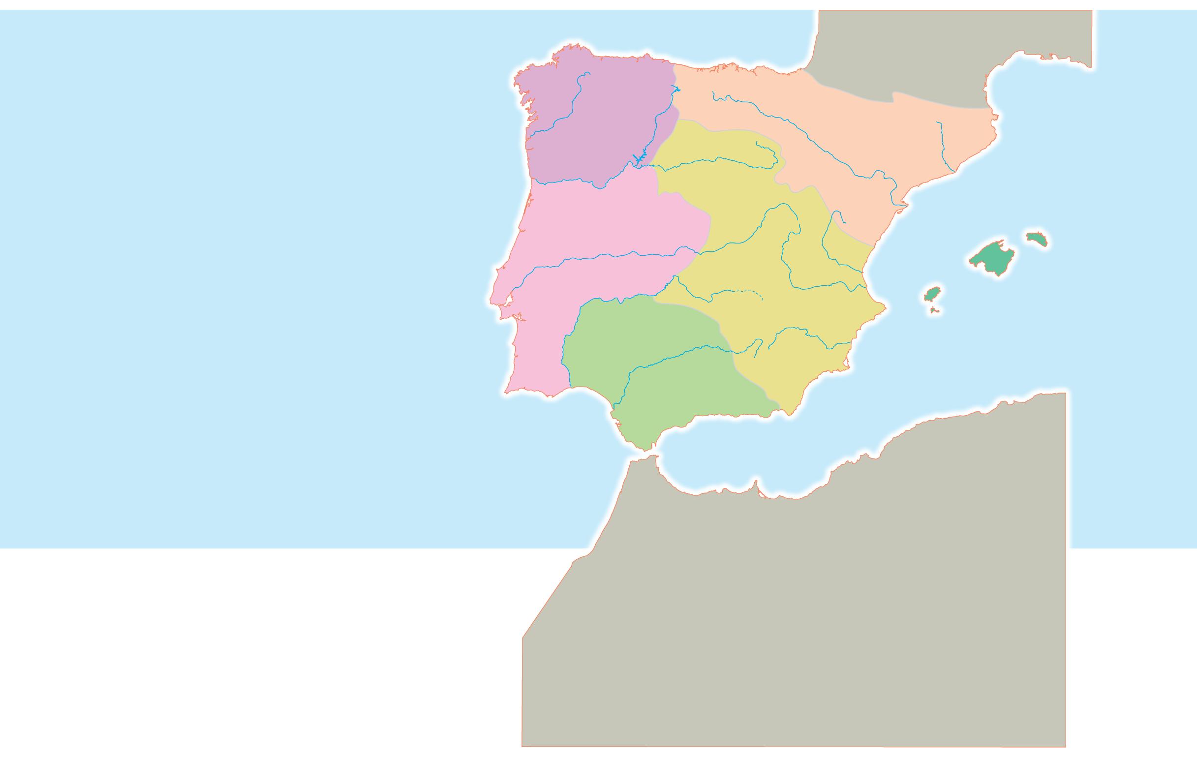
Lucus Augusti
Tarraco
Toletum Corduba Bilbilis
Emerita Augusta Gerunda
Hispalis Salmantica
7 Read the following text about the Iberian woman’s place in society and complete the sentences bellow.
The Iberian woman played a fundamental role in society. She could participate in different religious, political and social events just like men. In her daily life she engaged in agriculture, crafts (especially weaving) and housework. Upper-class women had important privileges and were richly dressed and adorned with jewels and beads. In some Iberian relief art we can see women playing music and dancing. There were also women priests. When they died, they were buried according to the same ritual as men, although they were buried with different funerary objects.
They were not allowed to fight in , be buried with , or occupy political office.
They could participate in festivities.
They could be according to the same ritual as men.
In your workbook, match each event/concept with the correct stage of Romanisation and date:
Celtiberian resistance
Expulsion of the Carthaginians
Battles with the Asturians
Conquest of Numantia
Consolidation of Roman dominance on the Iberian Peninsula
1. First stage 2. Second stage 5. Third stage
A. 1st century BC
B. 2nd century BC
C. 3rd century BC
9 2 Listen to the audio recording and choose the correct answers:
a) What have coins been used for throughout history? Propaganda / Governing.
b) How were coins used by Roman rulers? To broadcast their images across the Empire / For exclusively commercial purposes.
c) How does the author of the article define coins in terms of their historical, economic or social significance? As living historical documents / As funerary objects.
10 Complete the following sentences about how Romanisation occurred using these words: bridges, vernacular, integrity, law, coins, cities, cults.
a) Political and territorial
b) Founding of
c) Construction of road networks and .
d) Substitution of languages by Latin.
e) Implantation of Roman
f) Through the expansion of to Roman deities and, later on, through Roman Catholicism.
g) Creation of .
11 2 Listen carefully to the audio recording about the Lusitanian commander Viriathus and answer the questions.
a) Write his full name.
b) To which group of people did he belong?
c) What was his occupation?
d) Why did he become so famous during the Roman conquest?
e) When did he die?
f) How did he die?
Rome imposed its social model on Hispania. The population was divided into two main groups:
z Free citizens. Here we could find:
z Privileged Roman citizens, or patricians, with large land holdings and control of public offices.
z Well-off group of citizens born in Hispania, made up of farm villa owners, artisans and wealthy merchants.
z The plebeians, who represented most free citizens and who often worked for the privileged classes.
z Slaves. They lacked freedom and political or civil rights and were subject to the absolute authority of their masters. They were used in different types of work such as mining, agriculture and domestic tasks.
There was sharp legal and economic inequality between the two groups. In an intermediate position were the freedmen. They were slaves who had managed to earn their freedom.
Women mostly lacked the same rights as men and were legally dependent on men. They did not participate in political life and received less education. People were employed in a wide range of professional activities. Many were small farmers, specialised artisans, mineworkers, and domestic labourers serving wealthy households.
Once the Romans realised that peninsular resources could be a major source of wealth, they fostered economic growth in Hispania. They integrated the economy into the Empire’s trade routes. They also introduced the following innovations:
Agriculture
Mining
The use of fertilisers, irrigation and the Roman plough. The main crops were wheat, grapevines and olive trees, and the products were exported to Rome.
They improved extraction techniques. They operated silver, gold, iron, copper and mercury mines.
Fishing They developed the salted fish industry. They produced garum and salt.
The acquisition of Hispania represented a major contribution to the economy of the Roman Empire, and generated significant economic growth thanks to efficient resource exploitation and improvements in production.
Peninsular cities still host a number of buildings and Roman engineering works: da, Segobriga), amphitheatres ducts (Segovia, Almuñécar), bridges, walls, arches more, the homes of wealthy Romans were dec orated with sculptures, reliefs, mosaics paintings. Hispania also witnessed the birth of prominent figures such as Seneca, Lucan, Mar tial, Quintilian and Pomponius Mela, all of whom made contributions to Roman culture.
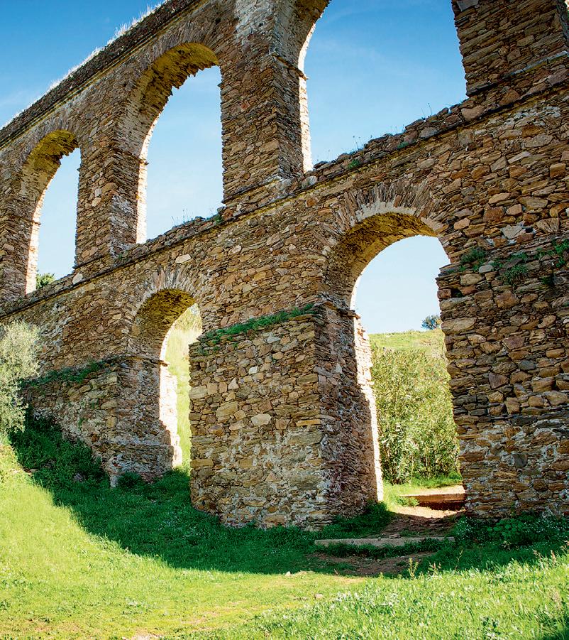
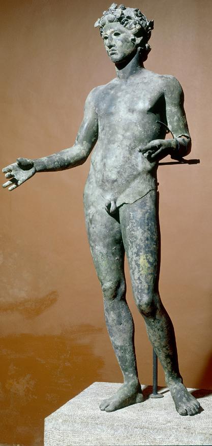
Youth from Antequera (Málaga).
Lucus Asturum
Cantabrian Sea Brigantium
Iria Flavia Conimbriga
Bracara Augusta
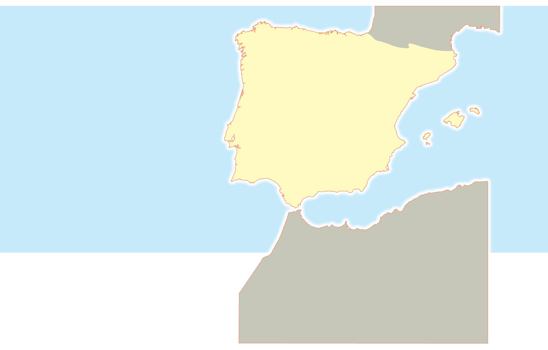
Bilbilis Uxama Cauca Clunia Salmantica Intercatia Septimanca Pallantia Legio VII Asturica Augusta Flaviobriga Gigia Virovesca Calagurris
Numantia
Occilis Segontia
Caesar Augusta Pompaelo Iacca
Osca Barcino Ilerda Tarraco Emporiom
Complutum
Toletum Norba
Emerita Augusta
Olisipo Onuba
Scalabis Ossonoba Lucus Augusti
Pax Julia Italica Corduba Hispalis Gades Abdera Malaca Acci
Castulo Carthago Nova Ilici Lucentum Dertosa
Saguntum Segobriga
Dianium

12 Complete the following sentences with the correct words.
a) Privileged Roman citizens had large land holdings and controlled political offices; they were also known as
.
b) Slaves in ancient Rome lacked and political or civil and were subject to the absolute authority of their masters.
c) Most citizens were known as
d) were legally dependent on
13 Match the following terms in your notebook and write a sentence with each pair of words:
a) Agriculture 1. Gold
b) Mining 2. Coins
c) Fishing 3. Garum
d) Trade 4. Grapevines
14 Identify the type of Roman building displayed in the following photographs.
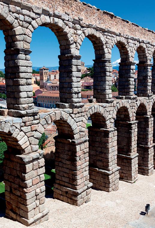
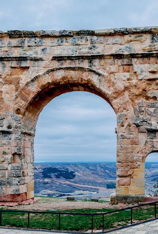
15 Match these Roman structures with their descriptions.
a) Theatre at Mérida
b) Aqueduct of Segovia
1. A memorial built on the Via Augusta. It has a round arch and is decorated with false pilasters topped by Corinthian capitals.
2. It is one of the best preserved Roman monuments and is still used today. It has capacity for 6,000 spectators. It is decorated with statues and different coloured marbles.
c) Amphitheatre at Italica
d) Alcántara Bridge

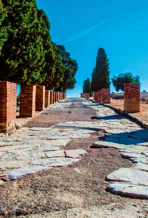
e) Temple of Diana in Mérida
3. It surrounds the historic centre of the city. It is 2,266 metres long and has 85 towers. It had five gates and a 4 metre deep moat.
4. It is one of the greatest engineering achievements of the Roman world. It stands over the River Tagus and has six arches and five pillars. It was built in honour of Emperor Trajan.
5. It was built in the forum of the city during the reign of Augustus. It is surrounded by columns and has a rectangular floor plan. It is the only well-preserved religious building from the Roman period in the area.
f) Arch of Berà (Tarragona)
g) The city walls of Lugo
6. It was built during the reign of Emperor Trajan and is 17 kilometres long. Its arches are of different heights and there was a channel along the top for transporting water.
7. It was one of the biggest in the Roman Empire. It had capacity for 25,000 spectators. Under the central area there were galleries for different shows. It was built during Hadrian’s time.
16 Are the following statements true or false? Correct the false ones in your notebook.
a) Privileged Roman citizens often worked for privileged groups.
b) Freedmen were slaves who had managed to earn their freedom.
c) The well-off group of citizens born in Hispania was made up of military personnel and soldiers.
17 Put the words into the right order to form sentences:
a) number agriculture developed were in a of techniques innovative
b) key a fishing activity was
c) the use trade favoured coins by was of
d) networks territory the were used conquer to road
We use:
z at for the time of day: at five o’clock; at 11.45; at midnight; at lunchtime; at sunset etc.
or in these expressions: at night; at Christmas; at the moment; at present; at the same time.
z on for days and dates or specific moments in a day: on Friday(s); on 16 May 2009; on Christmas Day; on my birthday; on Friday morning(s).
z in for longer periods (for example: months/years/ seasons): in October; in 1998; in the 18th century; in (the) winter; in the 1990s; in the Middle Ages; in the past; in (the) future.
or in these expressions: in the morning(s); in the afternoon(s); in the evening(s).
We do not use at/on/in before last/next/this/every.
1 Which areas of the Iberian Peninsula were settled by the Celts?
Celtic peoples occupied the Ebro Valley, Central Plain and the northeast.
2 What were the Iberians’ main economic activities?
The Iberians’ economy was based on agriculture, livestock, mining, metallurgy and trade with the colonisers.
3 What were the differences between the Iberians and the Celts in terms of writing and coins?
As opposed to the Celts, the Iberians used writing and coins.
4 Which peoples influenced Tartessos civilisation as it developed?
Tartessos was influenced by the Greeks and the Phoenicians. Phoenicians and Greeks exchanged manufactured goods for metals with the Tartessians, which helped the latter to develop.
5 What was the colonisation model used by the Phoenicians on the Iberian Peninsula?
The Phoenicians used the factory model for production and trade with other Phoenician colonies and the peoples of the Peninsula.
1 Choose the correct option in each case:
a) In/At the first millennium BC, Phoenicians, Greeks, and Carthaginians arrived on the Iberian Peninsula.
b) In the 1st century BC, Octavian, later known as Augustus, played a crucial role on/in the third stage of the Roman conquest of the north, and faced fierce resistance from Galicians, Cantabrians, and Asturians on/in the Cantabrian Wars.
c) Hannibal, the Carthaginian leader, planned to conquer Rome starting from the Iberian Peninsula, and attacked Sagunto on/in his route.
d) The Romans achieved significant success consolidating their rule at/in the second stage of the Roman conquest of the Iberian Peninsula in the 2nd century BC.
2 Place the words in order and choose appropriate prepositions to form sentences:
a) first millennium BC / Iberians / peninsula
b) Cádiz / Phoenicians / 1100 BC
c) Rome / Hannibal / conquest / Wednesday
d) Circus shows / 9 p.m. / held
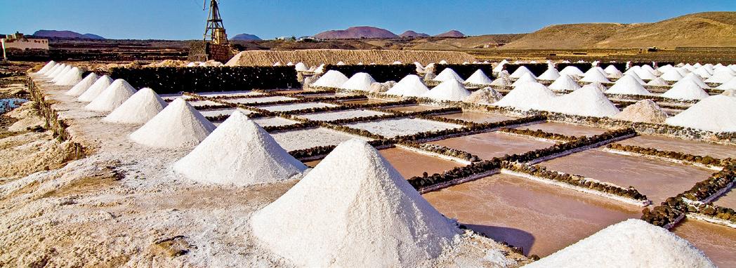
6 From which Greek colony did Greek colonisers arrive on the Iberian Peninsula?
The Greek colonisers arrived on the Iberian Peninsula from Masalia (Marseille).
7 How and when did the Romans initiate their conquest of the Iberian Peninsula?
The Romans initiated their conquest by fighting off the Carthaginian threat in what is known as the first stage of Romanisation (3rd century BC).
8 What were the three stages of the Roman conquest of the Iberian Peninsula?
The stages were: the conquest of the east and the south (3rd century BC); the conquest of the inland areas (2nd century BC); and the complete conquest of the Peninsula following the defeat of the Galicians, Cantabrians, and Asturians (1st century BC).
9 What did the process of Romanisation involve on the Iberian Peninsula?
Romanisation involved the assimilation of Roman cultural, political, and economic customs through the administration of the territory, the army, the founding of cities, and the expansion of Latin and Roman law.
10 How was Hispano-Roman society divided?
Hispano-Roman society was divided between free citizens (privileged classes and plebeians) and slaves.
It’s important to preserve our artistic and historical heritage and to raise people’s awareness and appreciation of it. What parts of our heritage should we protect? What initiatives can we citizens undertake to preserve it? What sort of activities can be organised to raise awareness?
In Spain, we have a considerable amount of historical heritage that needs to be protected and preserved for a variety of reasons.
Historical knowledge is essential for understanding where we come from and what type of future we want to construct. It also helps to foster a sense of identity and belonging to a people, and favours social cohesion. In order to take care of and protect our heritage, we first need to get to know it and appreciate it.
Imagine that a school group from another country were to arrive on a cultural visit. Working as a class, choose which part of your heritage you would like to show them and prepare a visit for them.
Select a picture of the site you plan to use, and draft a brief description of what you plan to show them and why you’ve chosen that particular part of your heritage for the visit. Make sure to have the following information available for them.
Monument
Location
Opening times
Price
Contact information
Interesting facts
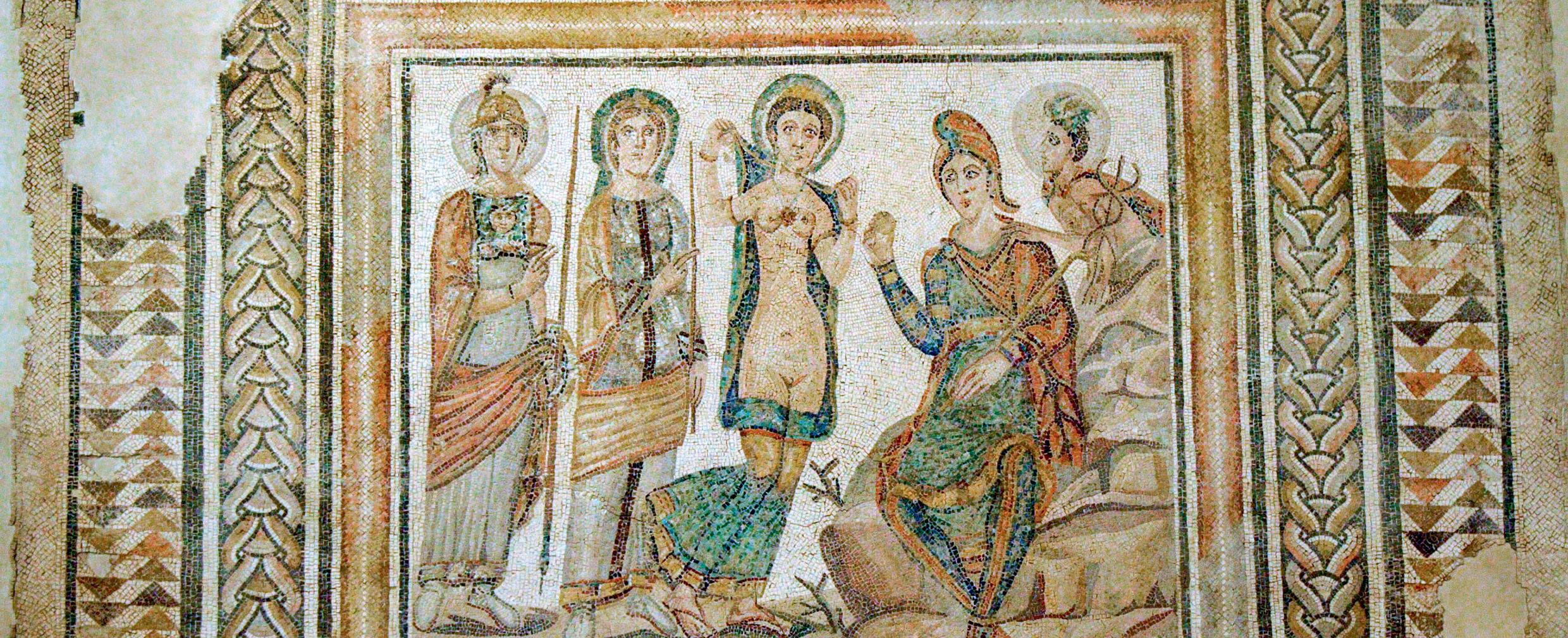
Create your poster or brochure for the visit and share it on your school’s social networks or along the hallways.
Tenerife
Teide
Odiel Ardi l a Tinto
GUADIANA G U A D I A N A
TAGUS Guadalete lineG abaJ l nó reuzA Cigüela Guadalope
Mulhacén 3 478
Guadalimar Guadalén senobroC
A n d a r a x F ardes Baza
0 100 200 km
Lake National boundary
River Summit

Guadalentí n
La Sagra 2 381
Bañuela 1 323
S E G U R A J udnáal A l m a n z o r a
M u n od
J Ú C A R lehcataM razébmeB Zújar
SOUTHERN SUB-PLATEAU
Las Villuercas 1 601
Almanzor 2 592
Tié tar Alagó n E s gueva Adaja Alberche adeugÁ
Jarama

Ull a S i l MIÑ O
Range Tramuntana CA N T A B R I A N R A N G E I B E R I A N ETSYS M C E N T R A L SYST E M S I E R R A M O R E N A PENI B A E T I C R A N G E SUB B A E T I C R A N G E P Y R E N E E S
MGalician assif Cabeza de Manzaneda 1 778
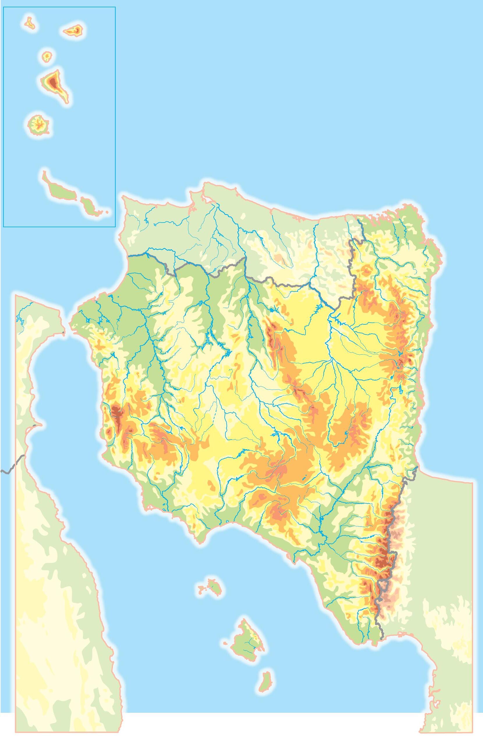
TAGUS OJAT aSol r
T e r a
Pisuerga Tajuña A l m o n et
Henares semroT
Esla
NORTHERN SUB-PLATEAU
Jaló n
Teleno 2 188
Esla Cea
Tol e d o M o u n t a i n s aB s que uoM n t ains
Tamb re Eo Narcea nólaN
M e r a ORUOD
AIRUT jiMsera
Jiloca Arlanzó n ogibrÓ
Moncayo 2 313
Gállego
DOURO nóirraC saP Aragó n ORBE Huerva Martín
Cinca
Noguera R. NogueraP . Segre Segre
Catalan coastal range
Ter tagerbolL
Turó
Fluviá Mts .of L e ó n
Arga aosadiB nóivreN aracnáZ GUADALQU I V I R leirbaC
Torre Cerredo 2 648
Aneto 3 404
BASQUE COUNTRY
Sea
Cantabrian
PRINCIPALITY OF ASTURIAS
CANTABRIA
REGIONAL COMMUNITY OF NAVARRA
Girona
CATALONIA
Lleida
Barcelona
Barcelona
Palma de Mallorca
BALEARIC ISLANDS
FRANCE ALGERIA MOROCCO ANDORRA PORTUGAL GALICIA
Santander
Vitoria- Gasteiz
Pamplona
Huesca
Palencia Burgos Bizkaia Alava Gipuzkoa
Oviedo
Lugo
Coruña
Santiago
Leon
Logroño
LA RIOJA
CASTILE-LEÓN
Zamora
Zaragoza
Soria
Zaragoza
Valladolid
Valladolid
Segovia
ARAGON
Tarragona Granada
Castellon
Teruel
VALENCIAN COMMUNITY
Valencia
Valencia
Guadalajara Cuenca
COMMUNITY OF MADRID
Salamanca Avila
Ourense Pontevedra
Madrid
Toledo
Toledo
Cáceres
CASTILE-LA MANCHA
EXTREMADURA
Albacete
Alicante
Murcia
REGION OF MURCIA
Málaga Jaén Almería Ciudad Real
Cordoba
Mérida
ANDALUSIA
Seville
Badajoz Huelva
Seville
AUTONOMOUS CITY OF CEUTA
Cádiz
AUTONOMOUS CITY OF MELILLA

COMMUNITY OF CANARIAS
Las Palmas de Gran Canaria
Santa Cruz de Tenerife
Las Palmas
Santa Cruz de Tenerife


Tyumen
Chelyabinsk
Yekaterinburg
Perm
BarentsSea
FINLAND
NaberezhnyeChelny
Izhevsk
Samara Ufa
Orenburg
Tolyatti
Kazan
NizhnyNovgodd
Yaroslavl Ulyanovsk
Saint Petersburg
TALLINN
ESTONIA
Gotland Aland Islands
Penza
Voronezh
Ryazan Tula Lipetsk
MOSCOW
Astrakhan
Volgograd Kharkov
Rostov
Donetsk
Makhachkala

Greenland(DENMARK)
LATVIA


LITHUANIA
Baltic Sea
Öland
Saratov CHISINAU
UKRAINE
WARSAW
Zaporizhia Krasnodar
Sea of Azov
Odessa
MOLDOVA
CYPRUS
Rhodes
BELGRADE BUCHAREST
AegeanSea
REPUBLIC OF NORTHMACEDONIA
Crete
Ionian Sea
ICELAND
SWEDEN NORWAY
OSLO
DENMARK
North Sea
Faroe Islands(DEN.)
Shetland Islands
Orkney Islands
Hebrides
Glasgow COPENHAGEN

HUNGARY
Hamburg
NETHERLANDS
Leeds
Manchester
DUBLIN
UNITEDKINGDOM IRELAND
Birmingham
LONDON
GERMANY
DortmundDüsseldorf
Cologne
BRUSSELS
Frankfurt Nuremberg
Munich Lyon Milan PRAGUE
BELGIUM
SWITZERLAND
PARIS
FRANCE
Toulouse
AdriaticSea
Sicily
Tyrrhenian Sea
MALTA
Corsica
ANDORRA-LA-VELLA
Zaragoza
Barcelona
Sardinia
BalearicIslands
Cantabrian
MADRID
Seville Malaga

MadeiraIslands
CanaryIslands


Prince Patrick I.
Borden I.
Ellef Ringnes I. Axel Heiberg I.
Sverdrup Islands
Queen Elizabeth Islands
Melville I. Devon Island Bathurst I. Banks I.
Victoria Island
Aleutian Islands
Vancouver I. Alexander Arch. Queen Charlotte Is.
Hawaiian Islands

Elevation (m)
More than 5 000
From 4,000 to 5,000
From 3,000 to 4,000
From 2,000 to 3,000
From 1,000 to 2,000
From 500 to 1,000
From 200 to 500
From 0 to 200
Below sea level
Prince of Wales I.
Ellesmere Island
Southampton I. Somerset I.
Baf n Island
Greenland
Labrador Peninsula
Missouri Plateau
Mexican Plateau
Cuba
Laurentian Plateau Guiana Highlands
Galapagos Islands
Newfoundland
British Isles Iceland
Ireland
Great Britain
Azores
Madeira Is.
Canary Is.
Cape Verde Islands

Malvinas or Falkland Islands
Tierra del Fuego
South Georgia
Atlas M
Sahel Niger Basin
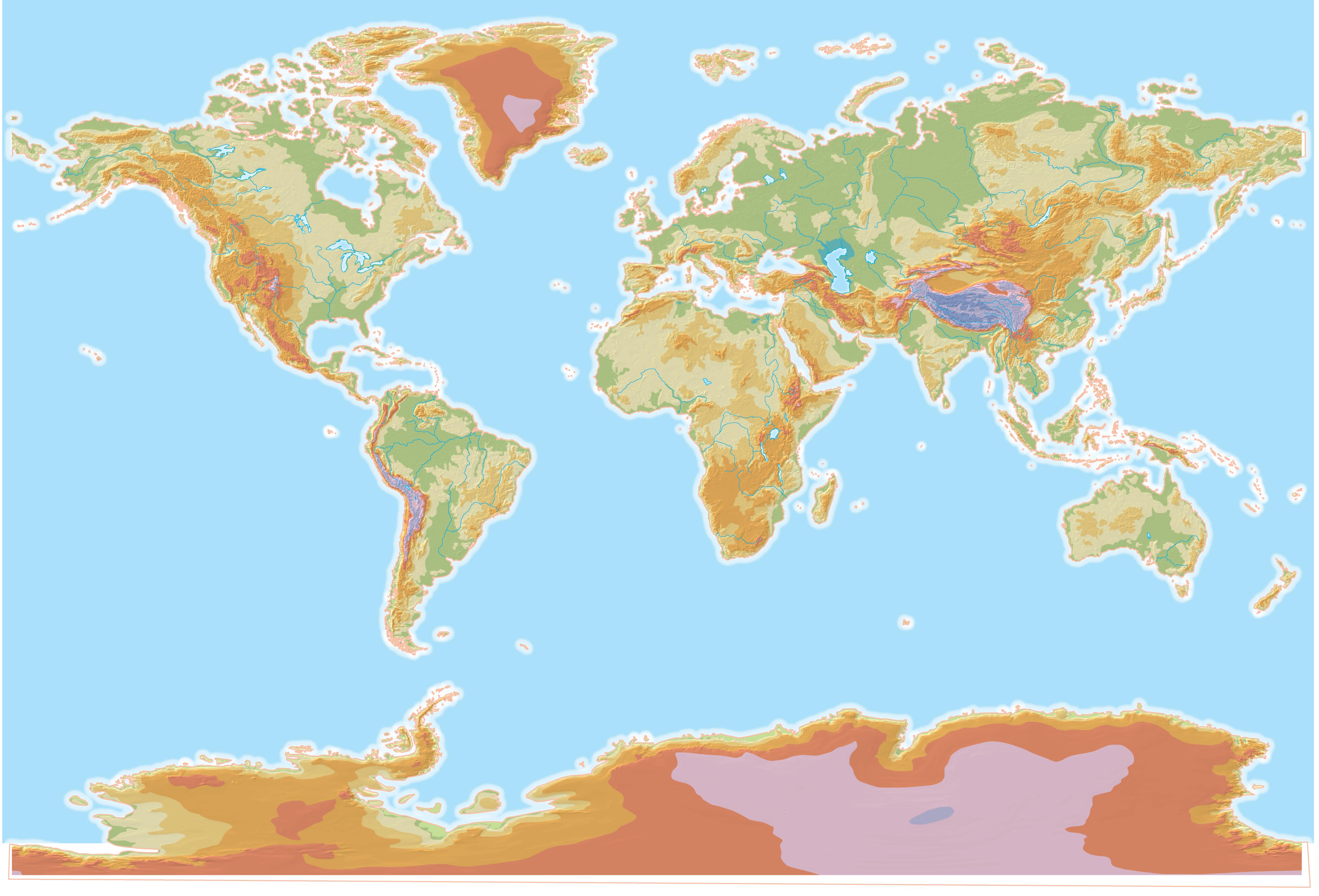
Svalbard
Nova Zembla
Barents Sea
North Sea Norwegian Sea
G r e a
Kara Sea
Yamal
Laptev Sea
Scandinavian Peninsula Peninsula
Kola Peninsula
a n Plain Russian Plain
Pechora Tobol
Western Siberian Plain
Lena Angara
Balkan Peninsula
Mediterranean Sea
Sahara Libyan Desert Nubian Desert
Ahaggar Mts. Tibesti Mts. Massif Central Marra Mts.
Elbrus 5 642
Black Sea Red Sea
Euphrates Tigri s
Syr Darya
Pen. Korean Pen. Gydan Peninsula
East Siberian Sea
Kolyma Lowland
Kolyma
Sahel Congo Basin Chad Basin Niger Basin
Arabian Peninsula
Thar Desert DesertKarakum
Benué Ganges AmuDarya
Ubangui
Bié Plateau
Katanga Plateau
Na mi b Desert Nile
G.ofAden PersianG.
Arabian Sea Aral Sea
TaklaDesertMakan
Indo-Gangetic Plain
Gobi Desert
Iarr wa ddy Salween Xi Jiang HuangHe
Yangtze
North China Plain
Taymyr Peninsula Lena River Delta Somali Pen.
Deccan Peninsula
Kenya 5 199
Kilimanjaro 5 895
Stanovoy Mountains
Plain
Lena Vilyuy Aldan Amur Mekong
East China Sea
Sea of Japan/ East Sea
Kyushu
Sea of Okhotsk Bering Sea
Sakhalin Honshu
Japanese Archipelago
Kamchatka Peninsula
Indochinese peninsula Malacca Peninsula
South China Sea Philippine Sea
Gulf of Guinea Bay of Bengal Gulf of Carpentaria
Kalahari Desert
Niger Orange
Mozambique Channel
Darling Indus
Great Victoria Desert
Puncak Jaya 5 030
Tasmania Aleutian Islands KurilIs.
Coral Sea
Great Artesian Basin
Murray
Tasman Sea
Kerguelen
Enderby Land
Queen Maud Land
American Plateau
Wilkes Land
Arctic Circle
The states of the world
Capitals (no. of inhabitants)
over 5 million between 2 and 5 million between 1 million and 2 million between 500,000 and 1 million between 100,000 and 500,000 between 50,0000 and 100,000 less than 50,000
UNITED STATES
BELIZE
HAITI
Borders
Continents
* Some States or cities may have a partial recognition.
0 1500 3000 4500 km
Africa
America
Asia
Europe
Oceania
SPAIN
DOMINICAN REP. PUERTO RICO SAINT KITTS AND NEVIS ANTIGUA & BARBUDA
DOMINICA
SANTA LUCÍA
ST. VINCENT AND THE GRENADINES
BARBADOS
GRENADA
TRINIDAD AND TOBAGO
SENEGAL
GUINEA-BISSAU
SIERRA LEONE
GUINEA
BURKINA FASO
TOGO
& PRINCIPE
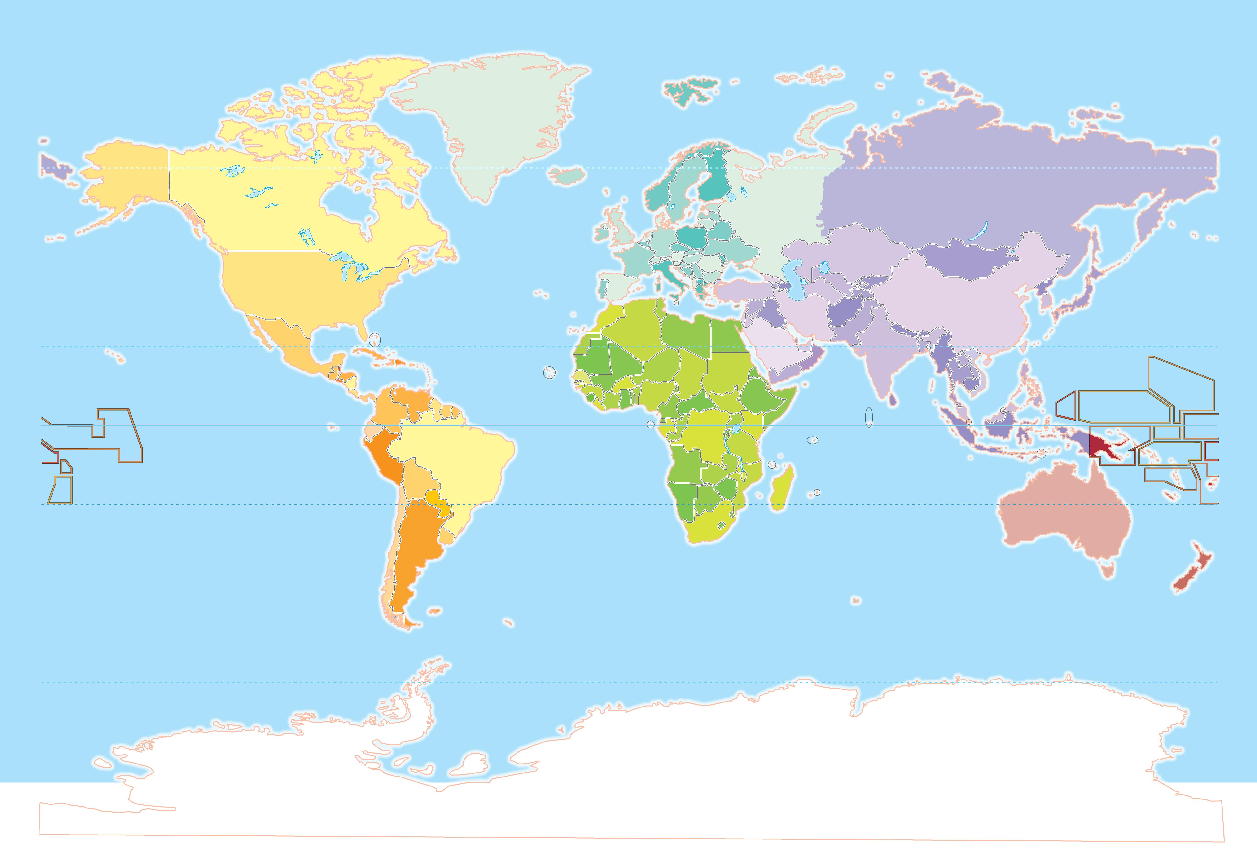
Tropic of Capricorn Antarctic Circle

DENMARK
SWEDEN CYPRUS
TURKEY IRAQ UKRAINE
GEORGIA ARMENIA
KAZAKHSTAN
UZBEKISTAN
AZERBAIJAN
IRAN
LIBYA DJIBOUTI
TAJIKISTAN
PAKISTAN
SUDAN SOUTH SUDAN* CHAD SAUDI ARABIA YEMEN OMAN UNITED ARAB EMIRATES NIGER
NEPAL
ALGERIA MALDIVES
RWANDA
BANGLADESH
MYANMAR CAMBODIA
LAOS
NORWAY THAILAND INDONESIA SRI LANKA
SEYCHELLES
BURUNDI
TANZANIA
MOZAMBIQUE
SWAZILAND
SOUTH AFRICA
MAURITIUS MONGOLIA SINGAPORE
SOUTH KOREA
PHILIPPINES
BRUNEI
MICRONESIA
PAPUA NEW GUINEA ANGOLA
EAST TIMOR
AUSTRALIA
MARSHALL ISLANDS
SOLOMON ISLANDS
MADAGASCAR NEW ZEALAND