September 2010 Gartcosh / Gartloch Study
3.3 Green Network Connections and Linkagaes The study area is well served by road and rail links. For pedestrians, cyclist and horse-riders there exists a unique opportunity to access natural open space in relatively close proximity to an urban environment. The existing connections and linkages within the study area are show on Figure 3. The weaknesses inherit in the baseline situation include: ∙∙
Proximity to the motorway and railway lines which present physical barriers to non-motorised user groups
∙∙
Lack of information/awareness of path infrastructure leading to underutilisation of network
∙∙
Gaps in provision of footpath linkages between communities and access to green network
∙∙
Inconsistent quality of path network with many footpaths overgrown, unkempt and underused.
∙∙
Negative perceptions toward the existing path network, which is seen as unsafe.
Opportunities exist to increase linkages between communities, use the green network to support local businesses and to enhance the qualitative experience for residents. In addition to providing new linkages between proposed development areas, existing communities and the green network, there is scope to raise the area-wide perception of the core path network and access routes by a programme of physical improvements including surfacing, lighting and signing of routes.
3.3.1 Existing Study Area Connections Within the Glasgow City Council study area, there exists the beginning of good inclusive access for a variety of user groups (namely cyclists, pedestrians and horse riders). Provision exists, outwith the study area in local walking and cycling routes around Hogganfield Park to the west, which tie into the Core Path Network at Cardowan Moss and Frankfield Moss. Access points to this natural resource are restricted from housing at Craigend to a few low key entrances. Frustratingly access to the open countryside to the north of this area is curtailed by fencing at residential development. The Core Path Network and Local Cycle Route extends along the north west boundary of the study area before following the line of the A80 and providing connections between the two local authority areas with Stepps, Garnkirk, Muirhead and Moodiesburn. The Core Path Network extends south of the
study area beyond the M8 corridor, providing linkages primarily between the communities of Cranhill, Queenslie and to the east, Barlanark, with the neighbouring communities of Garthamlock and Easterhouse. There exists a well used network of other pedestrian routes around Auchinlea Park, Provanhall Grounds and the western edge of Easterhouse which eventually connect into the study area at West Maryston. The quality of footpath provision is varied with some tarmac surfaces in the urban fringe areas and some more simply surfaced footpaths (hoggin, hardcore) routes within the areas of semi natural open space and Mosses. The quality of access points is inconsistent, with some including entrance features and signage and others requiring local knowledge to be aware of their existance. Overall, provision of area wide directional and informative signage is quite poor. There are no National Cycle Routes within or connecting to the study area.
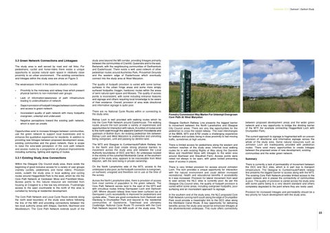
Forestry Commission Way Marker For Unkempt Overgrown Core Path At West Maryston
Bishop Loch is well provided with walking routes which tie into the Core Path Network around Easterhouse. The walking routes around the loch provide a variety of experiences and opportunities for interaction with nature. A number of routes exist to the north east through the adjacent Gartloch Woodlands and upstream of Bothlin Burn. An existing pedestrian link between Bishop Loch and West Maryston is unattractive and uninviting being overgrown, unlit and passing by derelict land.
Glasgow Gartloch Railway Line presents the biggest barrier to movement between the North Lanarkshire and Glasgow City Council areas. There are very few opportunities for the pedestrian to cross the raised railway. The road interchanges of the B806, M73 and A752 create a challenging experience for walkers and cyclists, being in close proximity to fast moving traffic, sometimes at high volume.
The M73 and Glasgow to Cumbernauld/Falkirk Railway line to the North and East create strong physical barriers to movement across the study area and between the Local Authority boundaries of GCC and NLC. An underpass located in the vicinity of the culverted Monklands Canal, at the southern edge of the study area, appears to be inaccessible from West Maryton, with the land being in private ownership.
There is limited access for pedestrians along the western and northern reaches of the study area. Informal local walking routes tie in with existing Rights of Way along the Garnkirk Moss and Heathfield Moss with linkages to the wider area around Muirhead and Glaudhall Farm. Access points were noted not always to be open, with gates locked preventing ease of access in places.
On the North Lanarkshire side of the M73, access to the underpass is also poor, as the footpath connection is overgrown, un-surfaced, unsigned and therefore not in use at the time of the survey.
There is very limited provision for access around Johnston Loch. The loch provides a unique opportunity for interaction with the natural environment and could deliver increased recreational, health and educational benefits if accessibility to it was increased. Provision for lateral movement from west to east across the NLC sites is currently poor. As per the Glasgow City Council sites, the quality of footpath provision is varied within some areas, including overgrown footpaths, poor surfacing and an inconsistent approach to signage.
Across the North Lanarkshire sites, there is provision of access from most centres of population to the green network. The Core Path Network serves land to the east of the M73 well with circuitous routes linking Garnqueen Loch and Gartcosh LNR. Where disused railway lines have been surfaced (as at Garnqueen Loch) accessibility is improved for pedestrians and cyclists alike. There are good connections from Gartcosh and Glenboig to Drumpellier Park and beyond to the residential communities of Gartsherrie, Townhead and ultimately Coatbridge. National Cycle Route 75 connects with the Core Path Network beyond the A89 south of the study area. The
In the southern end of the study area, the NLC proposed Core Path Network running north south along the edge of Drumpellier Park could provide a meaningful link to the GCC sites along the Monkland Canal Route. A key opportunity for delivering benefits across the study area would be enhanced linkages at the aforementioned underpass. This route offers connectivity
between proposed development areas and the wider green network and a key opportunity to bridge the dividing barrier of the M73 (for example connecting Hogganfield Loch with Drumpellier Park). The current approach to signage is fragmented with an uneven provision of directional and informative signage across the whole of the study area. Some natural resources such as Johnston Loch are inadequately provided with pedestrian routes. There exist many opportunities to create linkages between the proposed areas of new development, existing communities and the wider green network. Summary There is currently a lack of permeability of movement between the GCC and NLC sites, which is in part due to transport infrastructure. The Glasgow to Cumbernauld/Falkirk railway line presents the biggest barrier to access along with the M73. The existing Core Path Network provides limited access to the green network and in places the connectivity of communities is poor. The quality of provision is varied across the study area with some paths being to a very decent standard and others completely degraded to the point where they are rarely used. Provision for increased linkages and permeability should be a key priority for future development with the study area.
23