ENGINEER RESEARCH AND DEVELOPMENT CENTER PHOTO
seafloor morphology. FRF Duck also features a 1,840-foot research pier, specialized amphibious vehicles, and custom-built instrumentation that does everything from measuring waves with radar to capturing changes in water conditions across the Currituck Sound. It is a permanent base of operations for physical and biological studies of the coastal environment. Data is constantly collected to measure waves, currents, and seafloor morphology – especially during storms. The facility was established in 1977 on a former U.S. Navy rocket and bombing range, providing site conditions needed for coastal engineering and observation and enabling the Corps of Engineers to maintain a continuous record of data gathered from the field. Since the 1980s, experts have converged on FRF Duck for large, collaborative field experiments. Eventually these gatherings drew more than 100 students, faculty, and researchers, transforming Duck from a sparsely manned research outpost to a hub of the coastal science community. “The Field Research Facility is really a gem of the Coastal and Hydraulics Laboratory,” said Dr. Jane Smith, senior research scientist at ERDC in Vicksburg, Mississippi. “The big field experiments like SUPERDUCK and SandyDuck were a great opportunity to get in the field for a few weeks, collect data, and develop models collaboratively. It brought the coastal research community together.” Over her 34 years as a researcher, Smith has seen the contributions of FRF Duck make a positive impact. “The biggest contribution is the long-term record of wave and coastal processes collected there. You can’t go to a conference without hearing researchers say, ‘We used data from Duck.’ That 40-year record doesn’t exist anywhere else,” Smith said. “We also discovered shear waves at Duck, and learned a lot about natural and nature-based features: how dunes evolve, and how they protect the coasts.” “In 2013, the FRF was reorganized to better collaborate with the coastal researchers at the Coastal Hydraulics Laboratory in Vicksburg and enhance research capabilities,” said Jeff Waters, supervisory research scientist and branch chief at FRF Duck. “Another goal of the reorganization was to develop tools and technology built upon the Corps’ long-term investment at Duck.” The team at Duck grew accordingly, and now is home to a larger team of 24 research scientists, engineers, and support staff. One of the first efforts after reorganization was to make the wealth of knowledge at Duck more accessible to researchers worldwide.
KNOWLEDGE MANAGEMENT With 40 years’ worth of varying types of data, one of the first challenges the team at Duck took on after reorganizing was the Field Research Facility’s Data Integration Framework. “We decided early on we wanted to improve access to data,” said Michael Forte, research physical scientist at FRF Duck. “We’ve been collecting all kinds of data sets here – wave, wind, currents, tide, beach morphology, radar, LIDAR [Light Detection and Ranging] – so over the years, you can imagine data formats change, with different quality assurance, quality controls, and storage types.”
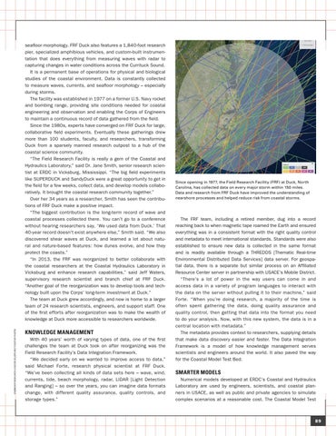
Since opening in 1977, the Field Research Facility (FRF) at Duck, North Carolina, has collected data on every major storm within 150 miles. Data and research from FRF Duck have improved the understanding of nearshore processes and helped reduce risk from coastal storms.
The FRF team, including a retired member, dug into a record reaching back to when magnetic tape roamed the Earth and ensured everything was in a consistent format with the right quality control and metadata to meet international standards. Standards were also established to ensure new data is collected in the same format and is readily available through a THREDDS [Thematic Real-time Environmental Distributed Data Services] data server. For geospatial data, there is a separate but similar process on an Affiliated Resource Center server in partnership with USACE’s Mobile District. “There’s a lot of power in the way users can come in and access data in a variety of program languages to interact with the data on the server without pulling it to their machine,” said Forte. “When you’re doing research, a majority of the time is often spent gathering the data, doing quality assurance and quality control, then getting that data into the format you need to do your analysis. Now, with this new system, the data is in a central location with metadata.” The metadata provides context to researchers, supplying details that make data discovery easier and faster. The Data Integration Framework is a model of how knowledge management serves scientists and engineers around the world. It also paved the way for the Coastal Model Test Bed.
SMARTER MODELS Numerical models developed at ERDC’s Coastal and Hydraulics Laboratory are used by engineers, scientists, and coastal planners in USACE, as well as public and private agencies to simulate complex scenarios at a reasonable cost. The Coastal Model Test
89