1 minute read
Defining Metro Atlanta


This report discusses the market from the metro level down to specific neighborhoods. Here’s how we define the geographies referenced throughout the report:
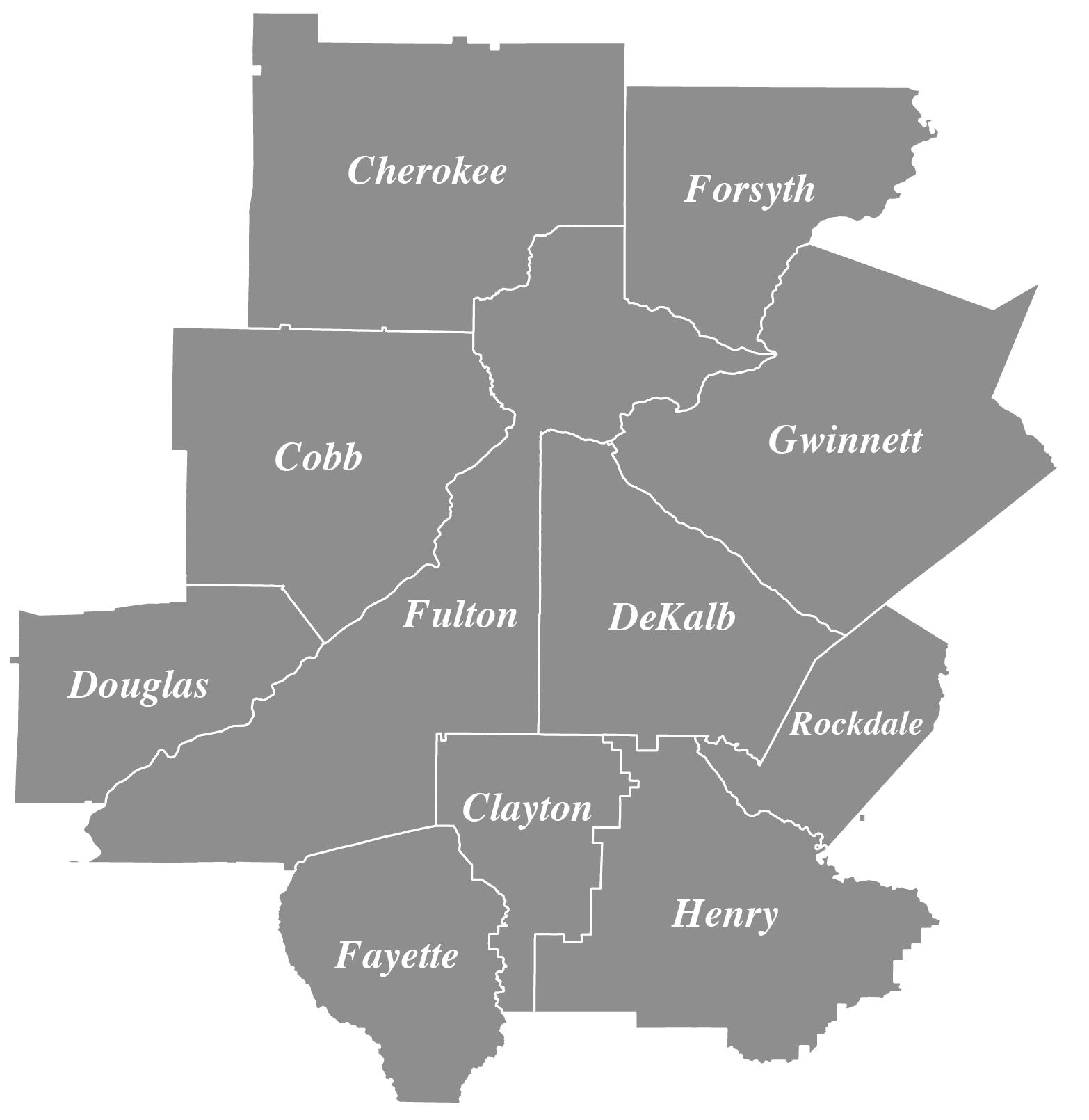
Metro Atlanta
This 11-county area includes Cherokee, Clayton, Cobb, DeKalb, Douglas, Fayette, Forsyth, Fulton, Gwinnett, Henry, and Rockdale Counties. Some of our data sources use the term “Greater Atlanta Area” to refer to this same geography.
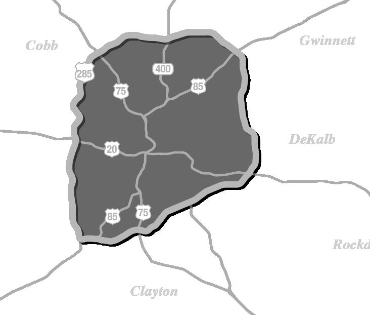
Inside the Perimeter (ITP)
Interstate 285 (I-285) forms a ring around Atlanta known as The Perimeter. Neighborhoods inside the perimeter are called “ITP.” This includes most of the City of Atlanta and nearby places like Brookhaven, part of Sandy Springs, Chamblee, Vinings, East Point, College Park, Hapeville, and Decatur.
Outside the Perimeter (OTP)
Neighborhoods and cities outside the I-285 perimeter are “OTP.” This area covers most of suburban Atlanta.
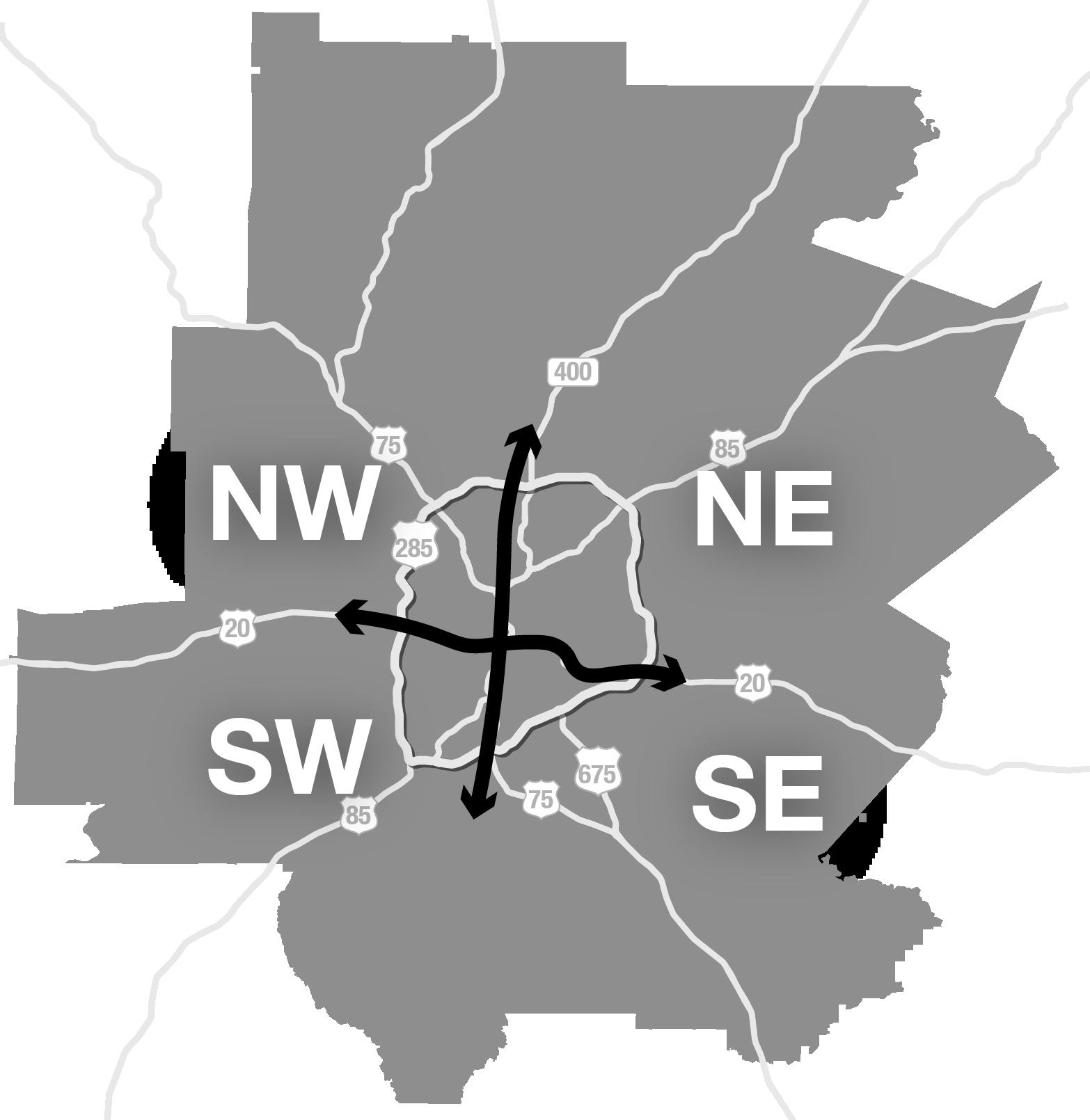
NW, SW, NE, & SE Quadrants
The four quadrants of Atlanta are a way to organize the city by subareas. They are delineated by major streets in the center of the city. Peachtree Street runs north-south and generally aligns with where Interstates 75 and 85 (I75/85) run outside of the center of the city. This line distinguishes “west” from “east” neighborhoods. Interstate 20 (I-20) runs east-west through the metro just south of Downtown. It delineates the “north” part of the metro from the “south” part.
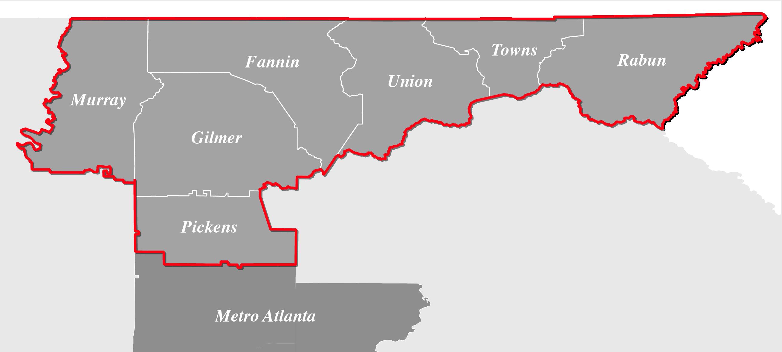
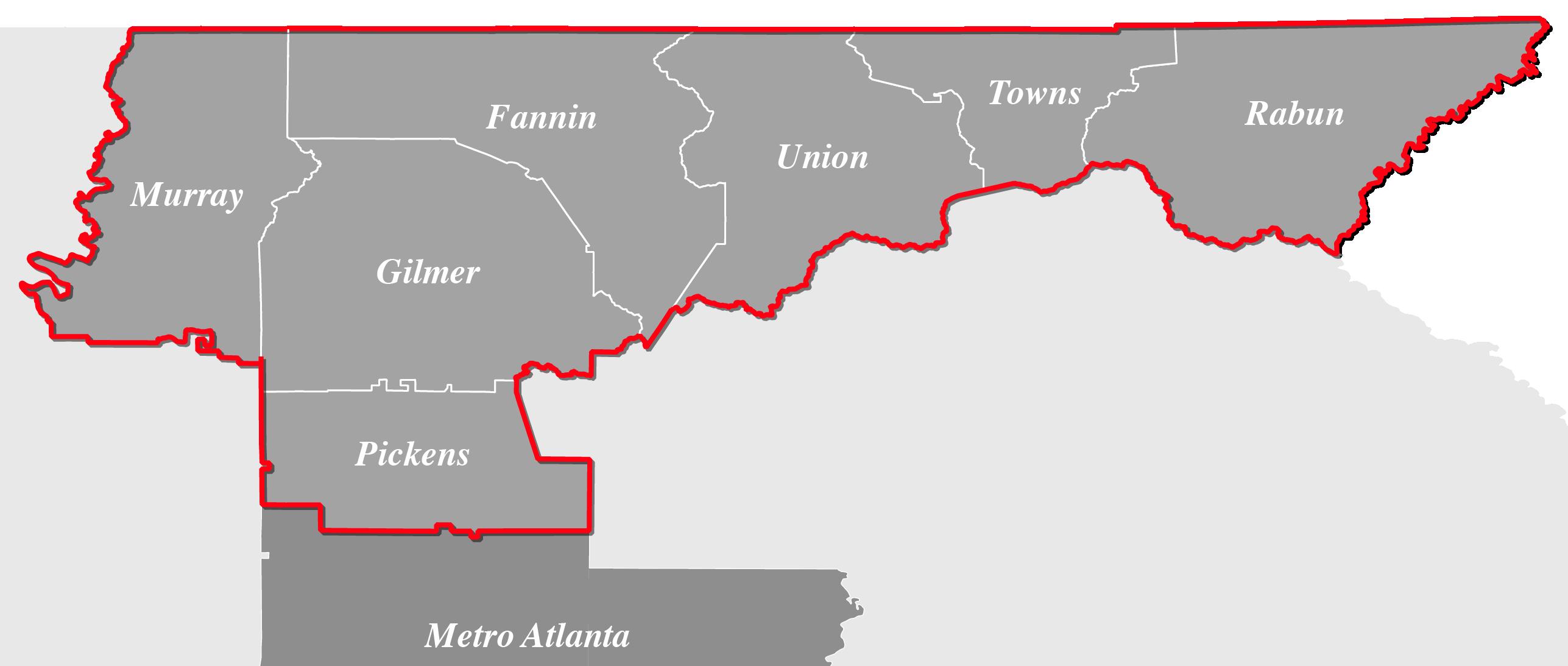
North Georgia
The North Georgia market has close ties to Metro Atlanta as a nearby escape to nature, surrounded by the hills and mountains. It includes places like Blue Ridge, Ellijay, and Helen in Clay, Fannin, Gilmer, Murray, Pickens, Rabun, Towns, and Union Counties.