
OVERVIEW
This Capability Statement outlines the Reality Capture Services offered by ESO Surveyors, including high-value case studies of completed projects where Reality Capture was employed. ESO Surveyors takes pride in being a pioneer in Australia, frequently investing in cutting-edge technologies. By leveraging the fastest and most accurate tools available, we deliver exceptional results for our clients. Additionally, ESO Surveyors commits to continuous and comprehensive training for all staff to maintain high standards of service.
Reality Capture involves the digital representation of built structures and natural environments. Based on the specific needs of the client, Reality Capture data can be delivered in various 3D formats. This data serves as a crucial foundation for design development and enables comparisons with other data sets for comprehensive analysis.
At ESO Surveyors, each of our Reality Capture Technology solutions can be used in combination with others to deliver comprehensive results tailored to the specific needs of any project . This integrated approach allows us to leverage the strengths of various technologies to ensure optimal accuracy, efficiency, and depth of data.
To aid in selecting the right tools for each project, ESO Surveyors Reality Capture specialists have developed a unique rating system. This Key categorises our technology solutions based on four key metrics:
accuracy, speed, versatility, and volume of data.
These metrics were established using feedback from our Digital and Spatial Managers, gathered after extensive field use of the technologies, as well as a detailed analysis of their technical specifications.
The overall rating serves as a general guideline only. This is to help clients understand the capabilities of each technology. We recommend contacting an ESO Surveyors Digital and Spatial Team member for specific, project-based recommendations. Contact details can be found on page 16.


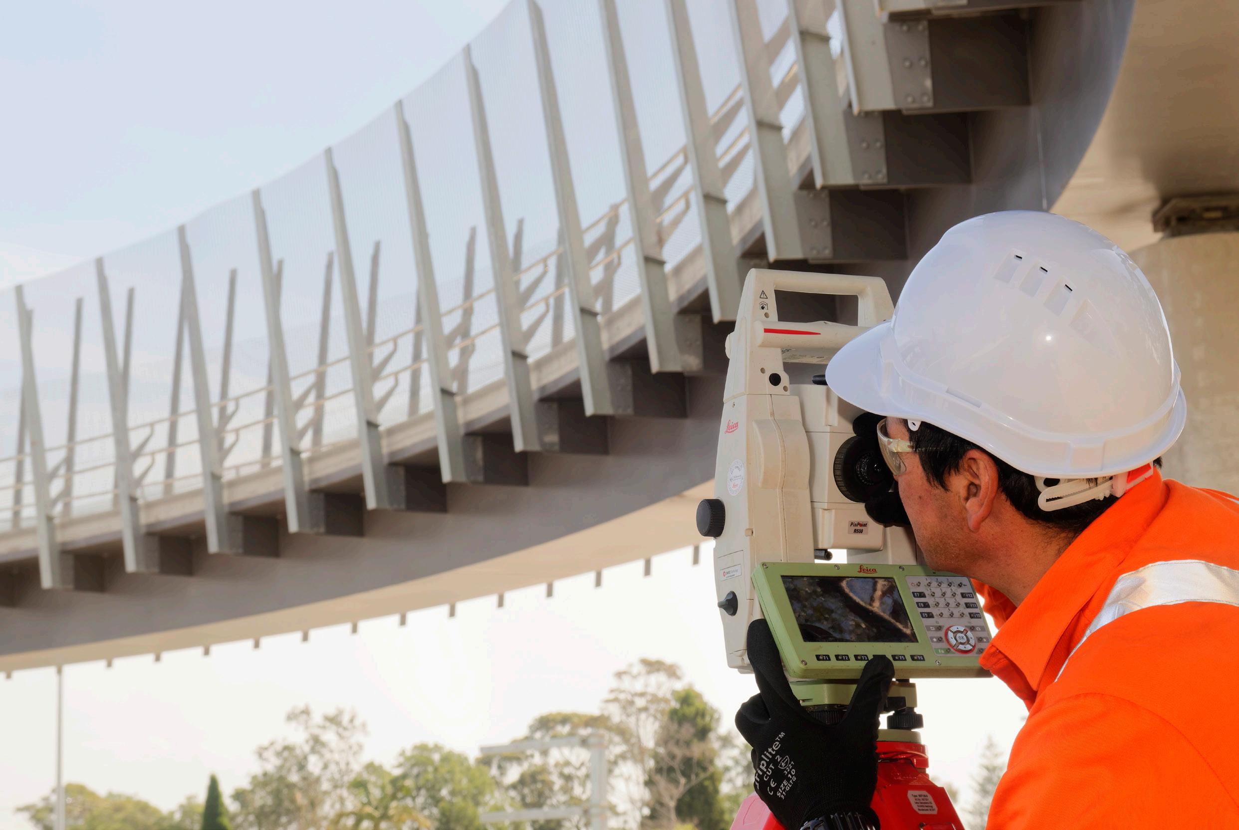
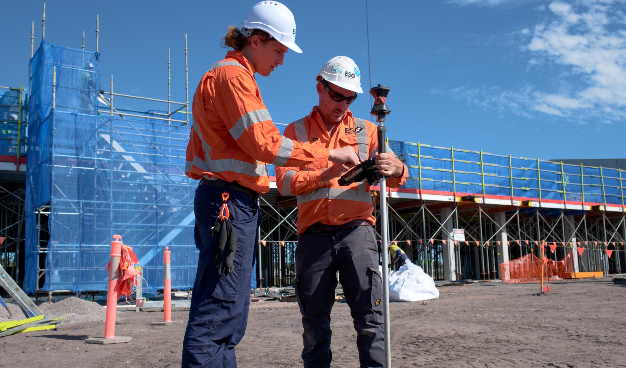
1. TOTAL STATION & GNSS
ESO Surveyors uses Robotic Total Stations to collect data where project specifications demand the highest accuracy of Reality Capture.
This traditional method of Reality Capture is enhanced by incorporating the use of additional technologies. Tilt Poles automatically compensate for verticality, speeding up the rate of capture.
ESO Surveyors typically uses GNSS to complement the data collected by Total Station to efficiently cover large areas which require a lower order of accuracy. GNSS allows ESO Surveyors to gather data across the entire site quickly, saving time and resources.
By combining the detailed data from Total Station with the broad coverage of GNSS, ESO Surveyors provides clients with a highly accurate picture of the entire project area.

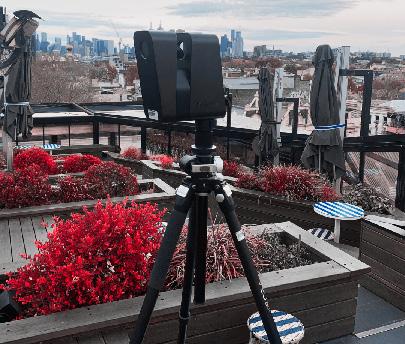
2. TERRESTRIAL LASER SCANNING
ESO Surveyors owns and operates a number of TLS systems that provide comprehensive and cost-effective solutions for:
• Data capture as a prelude to design, and
• Work-as-executed data of constructed elements for the purposes of design comparison or record.
ESO Surveyors use Z+F Imager 5016, Riegl VZ–400i or the Leica RTC 360 hardware depending on the type of project.
All systems are versatile in application, with the Riegl VZ-400i also able to be vehicle-mounted. ESO Surveyors’ TLS surveys are based on accurately installed survey control prior to the scan to ensure the greatest integrity of the scan data.

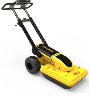
3. STOP & GO LASER SCANNING
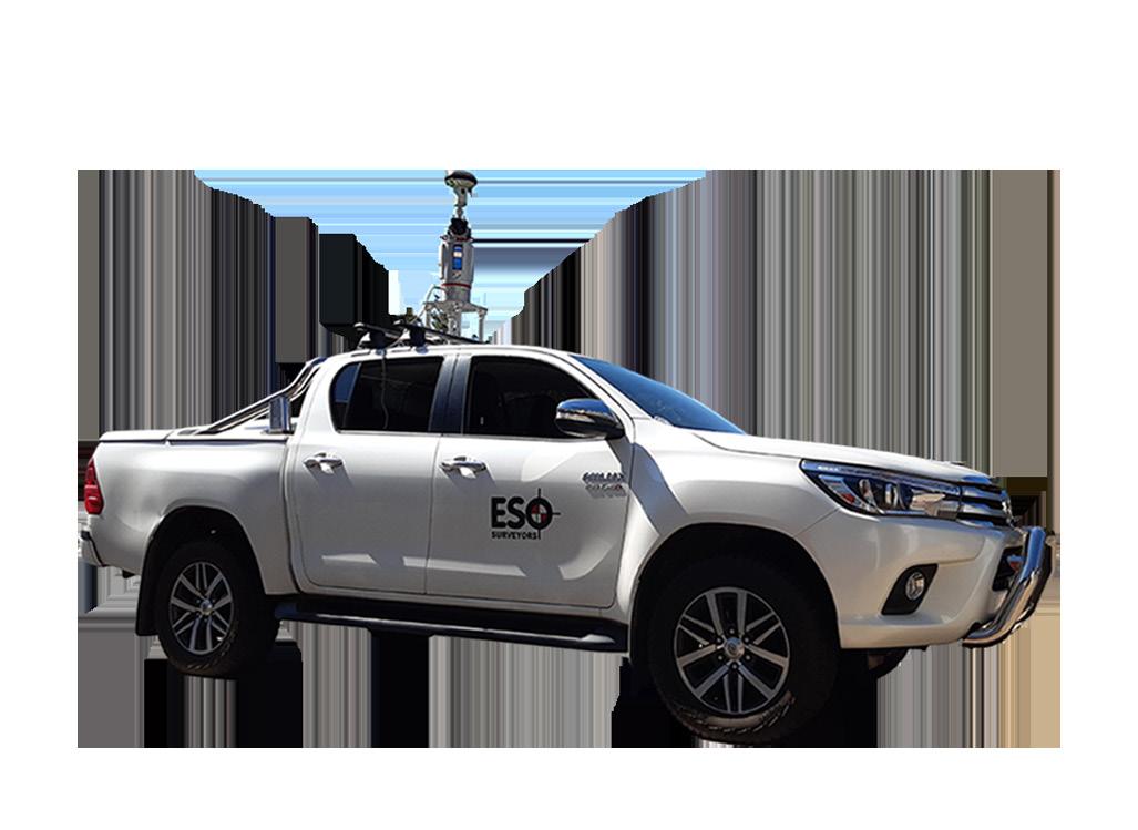
ESO Surveyors uses vehicle-mounted Stop & Go Laser Scanning to collect 3D data rapidly and safely.
Vehicle-mounted Stop & Go Laser Scanning is an efficient and safe method for collecting precise 3D spatial data over large or complex areas.
By mounting a high-precision laser scanner on a vehicle equipped with GPS and an Inertial Measurement Unit (IMU), this technique allows for detailed data collection at designated stops, where the scanner captures 360-degree views of the environment.
The data from multiple stop points is seamlessly integrated to create accurate, georeferenced 3D models. This approach offers significant advantages, including rapid data acquisition, reduced exposure to hazards by keeping operators inside the vehicle, and cost efficiency due to minimized field time.
It is widely used for applications such as infrastructure surveys, urban mapping, environmental studies, and asset management, making it an ideal choice for projects requiring high accuracy and safety in dynamic or challenging environments.
This method of laser scanning offers clients speed, versatility, and reliability which make it an invaluable tool for modern surveying needs.


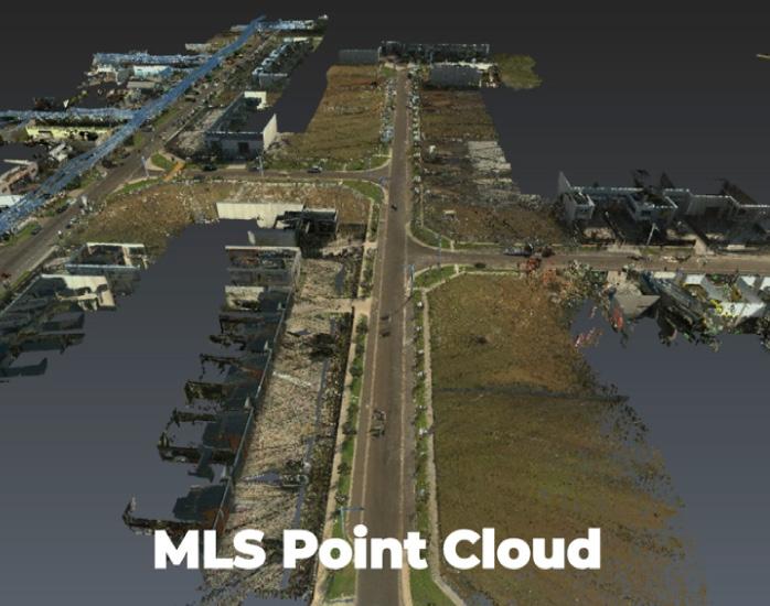
4. MOBILE LASER SCANNING (MLS)
At ESO Surveyors the goal of Mobile Laser Scanning is the rapid recording of 3D data of large areas.
As the name suggests, vehicle mounted MLS can capture 3D data “on the go”. Where 3D data is required over significant distances at a lower accuracy than TLS or Stop & Go, then MLS is the Reality Capture solution.
This system will eliminate any interruption to traffic and collect 3D data at a rapid rate.
The output data can be used to assist with the early stages of civil design or planning as well as providing a record of existing surfaces and structures for dilapidation purposes.
ESO Surveyors uses the Mobile SLAM Mapping solution when a greater rate of capture is required compared to TLS but the environment is not suitable for car-mounted devices.
ESO Surveyors leverage Simultaneous Localisation and Mapping (SLAM) technology to enhance the precision and efficiency of clients’ projects. Utilising cutting-edge mobile mapping systems like the new NavVis VLX 3.
In March 2024, ESO Surveyors integrated the NavVis VLX 3 Mobile Mapping System into operations, marking a significant milestone in our technological advancement.
The acquisition of the NavVis system enables ESO Surveyors to penetrate new market segments, thanks to its enhanced capabilities. One of the standout features of the NavVis VLX 3 is its speed, boasting acquisition rates up to six times faster than traditional Terrestrial Laser Scanning (TLS) methods.
Additionally, the system’s innovative Control Point capture functionality streamlines field operations by eliminating the need for target scans, thereby saving valuable time.
The NavVis VLX 3 system is versatile, with applications spanning various domains such as indoor mapping and modelling, construction documentation and monitoring, facility management and asset documentation, architectural and engineering design, historical preservation, and virtual tours and marketing.
This advanced tool positions ESO Surveyors at the forefront of efficient and comprehensive data capture, catering to a broad spectrum of industry needs.

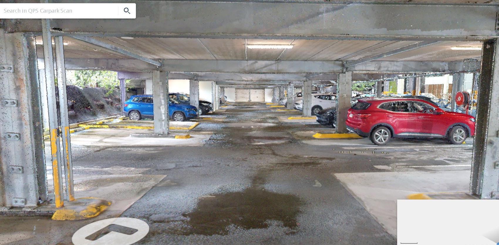
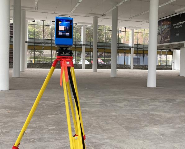
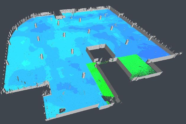
Example of NavVis VLX Carpark Scan:
6. RPAS / DRONE SURVEYS
ESO Surveyors is a ReOC certified business with all our pilots being qualified surveyors. It is ESO Surveyors’ standard practice to have at least one pilot on each of our infrastructure construction projects.
As part of our continued involvement in large infrastructure projects, ESO Surveyors conducts routine UAV surveys of project surfaces. The resultant terrain models are used to calculate volume changes or stockpile volumes for client payment claims.
We process flight data using the best, fit for purpose, software on the market, PIX 4D. The processing and reporting can be either performed off-site, by our data specialists in each state office, or on site if the project requires.
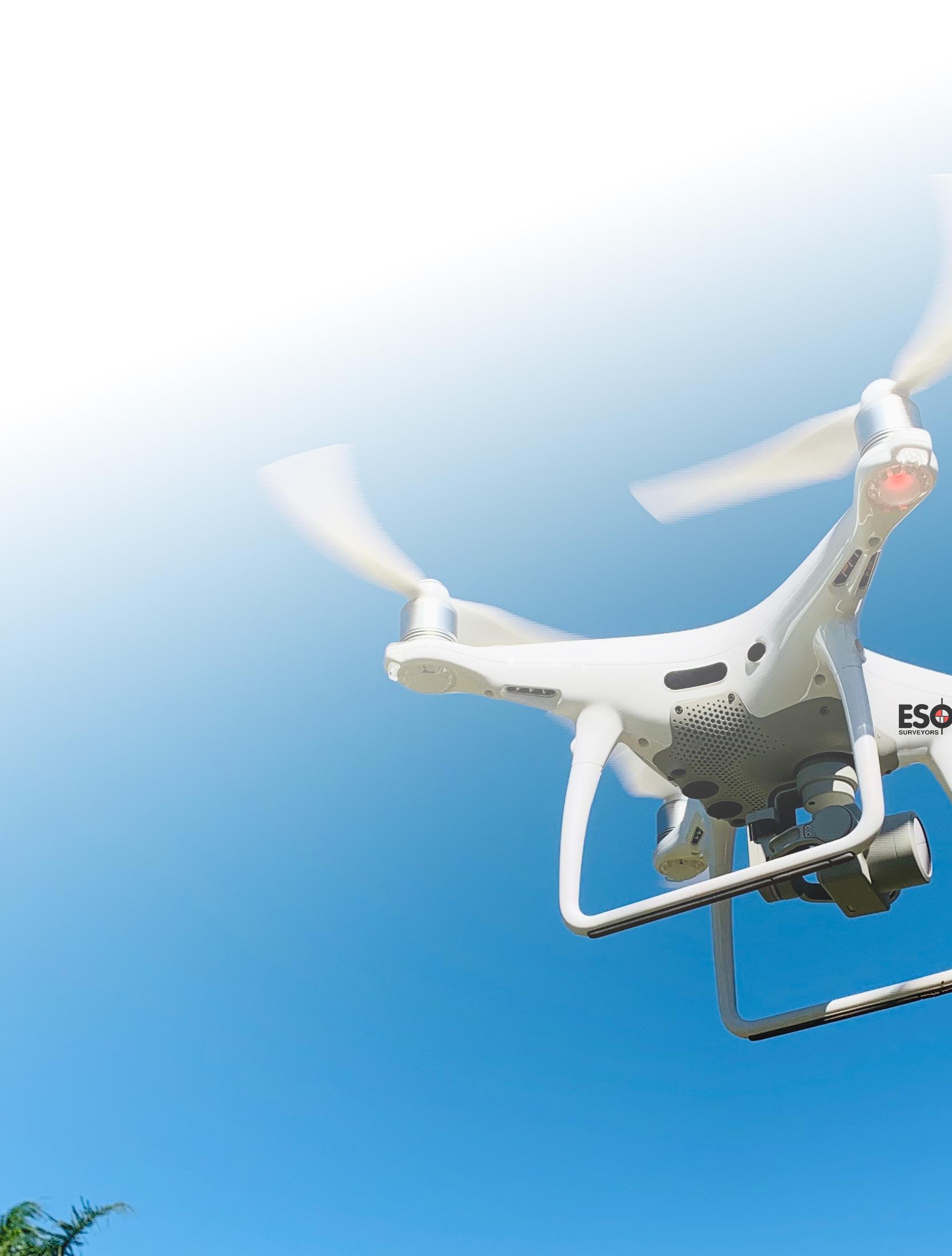
ESO Surveyors owns and operates a range of multi-rotor and fixed-wing drones. The type used will depend on our client’s specific data requirements and geography of the site.
UAV data can be used to accurately create digital terrain models, provide volumes for end-of-month and to obtain high-resolution imagery.

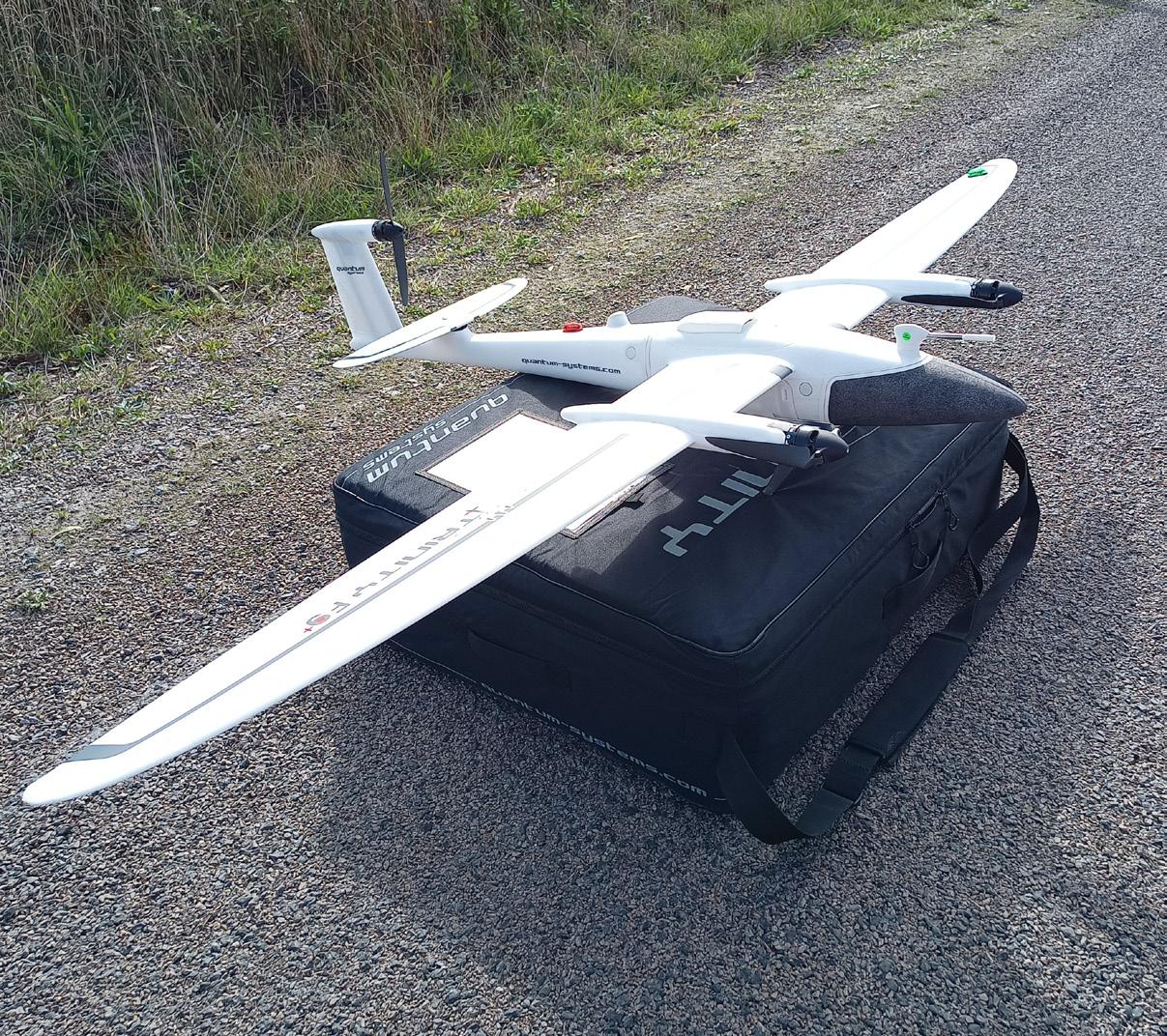

Trinity F90+ Fixed Wing Drone:

7. EML & GPR
ESO Surveyors employ both Electromagnetic Locators (EML) and GroundPenetrating Radar (GPR) technologies as non-invasive methods to detect and map subsurface utilities and structures.
EML is particularly effective for locating metallic utilities, such as pipes and cables, by detecting electromagnetic fields emitted by these conductive materials. GPR, on the other hand, uses electromagnetic waves to image the subsurface, enabling the detection of both metallic and non-metallic utilities.
By integrating EML and GPR technologies, ESO Surveyors enhance the accuracy and comprehensiveness of subsurface investigations. This combined approach allows for:
• Precise location of underground utilities and pipes, regardless of material composition.
• Comprehensive mapping of subsurface features, including sinkholes and voids.
• Accurate assessment of pavement and foundation thickness.
• Detection of buried objects, such as archaeological remains or hazardous materials.
Utilising both EML and GPR provides a more complete understanding of the subsurface environment, ensuring efficient and safe project execution. This dual-method approach is particularly beneficial in complex scenarios where relying on a single technology might lead to incomplete or inaccurate results.

USE OF MULTIPLE TECHNOLOGIES
At ESO Surveyors, each of our Reality Capture Technology solutions can be used in combination with others to deliver comprehensive results tailored to the specific needs of any project . This integrated approach allows us to leverage the strengths of various technologies to ensure optimal accuracy, efficiency, and depth of data. The below case study is one example of this.
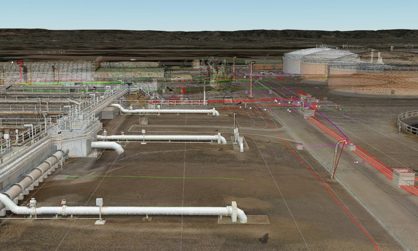
CASE STUDY
Bolivar, SA
Objective:
ESO Surveyors was engaged to conduct a comprehensive Reality Capture survey of the Bolivar Wastewater Treatment Plant. The project had two primary objectives:
1. To provide the various stakeholders involved in the refurbishment of the Bolivar Wastewater Treatment Plant with a comprehensive data set on one easy to use viewing platform.
2. To ensure the collection of large-scale, accurate data across the entire site, establishing a reliable data source for future decision-making. This would serve as a foundation for future refurbishments and upgrades.
To meet these objectives, ESO Surveyors needed to implement a solution that could accommodate extensive and precise data collection, while converting the information into an easyto-understand format for multiple stakeholders on a unified platform.
Deliverables included:
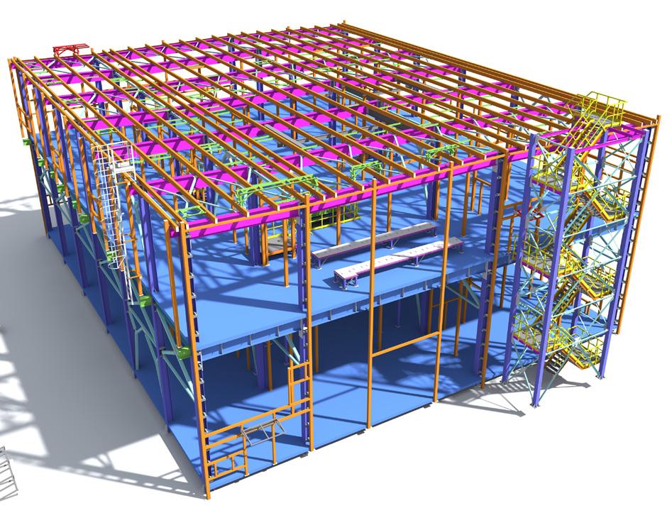
• A 3D underground services model, featuring accurate pipe depths, diameters, and detailed 3D pit chambers.
• A BIM model of structures and pipework to LOD 300.
• CAD topographic feature survey.
• Point cloud data.
• 360° panoramic photo walk-throughs.
Methodology:
The project began with a control survey to georeference all Reality Capture data. This process involved traversing, levelling, GPS localisation, and scan target measurements.
To capture point cloud data for most external areas, ESO Surveyors used the Riegl VZ400-i for Stop-Go Scanning, mounted on a vehicle.
For maximum accuracy in capturing specific areas of internal pipework, the same scanner was also deployed on a tripod indoors (Typical Terrestrial Laser Scanning – TLS).
Mobile SLAM mapping was carried out using the NavVis VLX3, particularly effective for capturing complex structural areas that were challenging to access with (TLS). This included crowded machinery rooms and tank rooftops, where the scanner’s mobility ensured comprehensive data collection from all angles.
Both scanners also captured 360° panoramic imagery, which was “stitched” together to create a realistic site walk-through. For underground services, a combination of Electro-Magnetic Location (EML), Ground-Penetrating Radar (GPR), RTK GNSS, and total station methods were used to capture depth, diameter, and quantity of pipes at all locations. This rigorous approach allowed for the creation of a detailed and reliable 3D model of the underground infrastructure.
The point cloud data was used to model the pipework and structures in Revit, producing a BIM model to LOD 300 in key areas of the site. A full topographic feature survey was extracted from the point cloud in CAD format, which was then used to create terrain surface and contours.
Timeline and Process:
Fieldwork was completed over 4 days:
• 1 day for control,
• 1 day for scanning, and
• 2 days for services.
All data processing and quality assurance checks were completed in 8 days.
Discoveries and Results:
Integrating static and mobile scanning methods presented some challenges, but both datasets seamlessly merged on the viewing platform. Although there were significant differences in point cloud colour, these were adjusted for consistency.
The capture of underground services was subject to on-site challenges, such as heavy clay soil affecting the ground-penetrating radar and oversized chamber lids requiring additional manpower. Despite these obstacles, the rigorous data capture process ensured all necessary details were accurately modelled.
The final 3D services model exceeded expectations, with the quality of the field data directly influencing the accuracy of the results. As always, an accurate and extensive control survey played a crucial role in unifying all elements of the project, especially in the tight machine room spaces where establishing control was most challenging.
Conclusion:
This project demonstrated that multiple Reality Capture datasets could be successfully integrated and displayed on a single viewing platform, with significant decrease in onsite time compared to traditional surveying methods. While there were minor delays and difficulties, these challenges provided valuable insights for future projects.
The use of different Reality Capture methods proved beneficial in providing different solutions to the various site challenges. By consolidating all datasets into one viewing platform, ESO Surveyors ensured that all stakeholders received maximum utility of the Reality Capture data.

ADDITIONAL TECHNOLOGY
Access to smarter, faster and more efficient technology means staying one step ahead. Your project output becomes more efficient and you save money. Below are additional Reality Capture technologies used by ESO Surveyors.
PRO 3 LIDAR CAMERA
The Pro 3 Lidar Camera creates comprehensive and immersive 3D walkthroughs of interiors. These systems are particularly useful for dilapidation surveying and documenting of confined or complex spaces and allow stakeholders to revisit the condition of an area virtually at any time, offering a more in-depth record than photos or videos alone.
The Pro 3 Lidar Camera offers easier navigation of defects compared to other dilapidation surveying techniques.
The data is loaded up into an online platform that enables our clients to virtually navigate through their site. Measurements can also be extracted by the viewer from the platform.
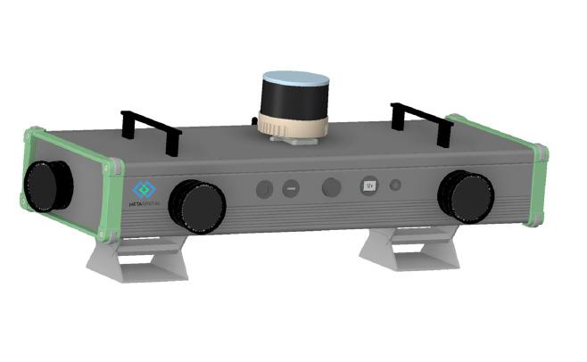
ECHO QUAD MOBILE PHOTOGRAMMETRY SYSTEM
By combining spatial information (like 3D models, maps, or geographic locations) with relevant metadata (such as timestamps, descriptive notes, measurements, and condition assessments), MetaSpatial solutions offer a powerful way to track, analyse, and manage Reality Capture and Dilapidation data.
ESO Surveyors use the Echo Quad Photogrammetry Camera solution to capture imagery at speeds of up to 100km p/hr without any motion blur or distortion due to the global shutter technology.
This solution makes it perfect for capturing hundreds of kilometres of road surface in a fraction of the time in comparison to traditional methods. Our team also have the ability to leverage AI to automatically detect cracks in the surface and categorise the size of the cracks based on the project requirements.
ESO SURVEYORS DIGITAL & SPATIAL TEAM


Wayne Davison | Digital & Spatial Manager New South Wales
w.davison@esosurveyors.com.au 0459 666 268
Ryan Kent | Digital & Spatial Manager Victoria
r.kent@esosurveyors.com.au 0455 200 717
Adam Skapin | State Manager Queensland
a.skapin@esosurveyors.com.au 0425 300 024
Simon Altman | Digital & Spatial Manager South Australia
s.altman@esosurveyors.com.au 0408 631 533
ADDITIONAL RESOURCES:
For additional resources and supporting case studies, please reach out to one of ESO Surveyors’ Digital & Spatial Managers.