
3 minute read
WILDERNESS AT PLAY

from Esha Sodhi Portfolio
by esha.sodhi

In collaboration with Nishi Praveen Kumar
DES 302 STUDIO | Threshold | Led by Fionn Byrne | SPRING 2023 BRIEF | Envision alternative futures for Cumberland Point and the Brunette River through landforms, movement of water, and impact of collaborative species.
Advertisement
CONTRIBUTION conceptual and schematic design isometric drawings biodiversity research diagramming physical model detail drawings illustrator photoshop rhino physical modelling hand drawing
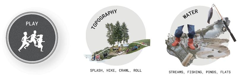
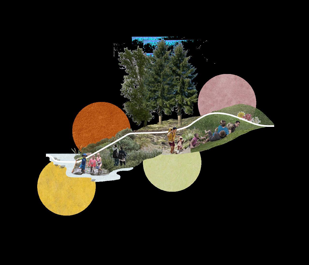
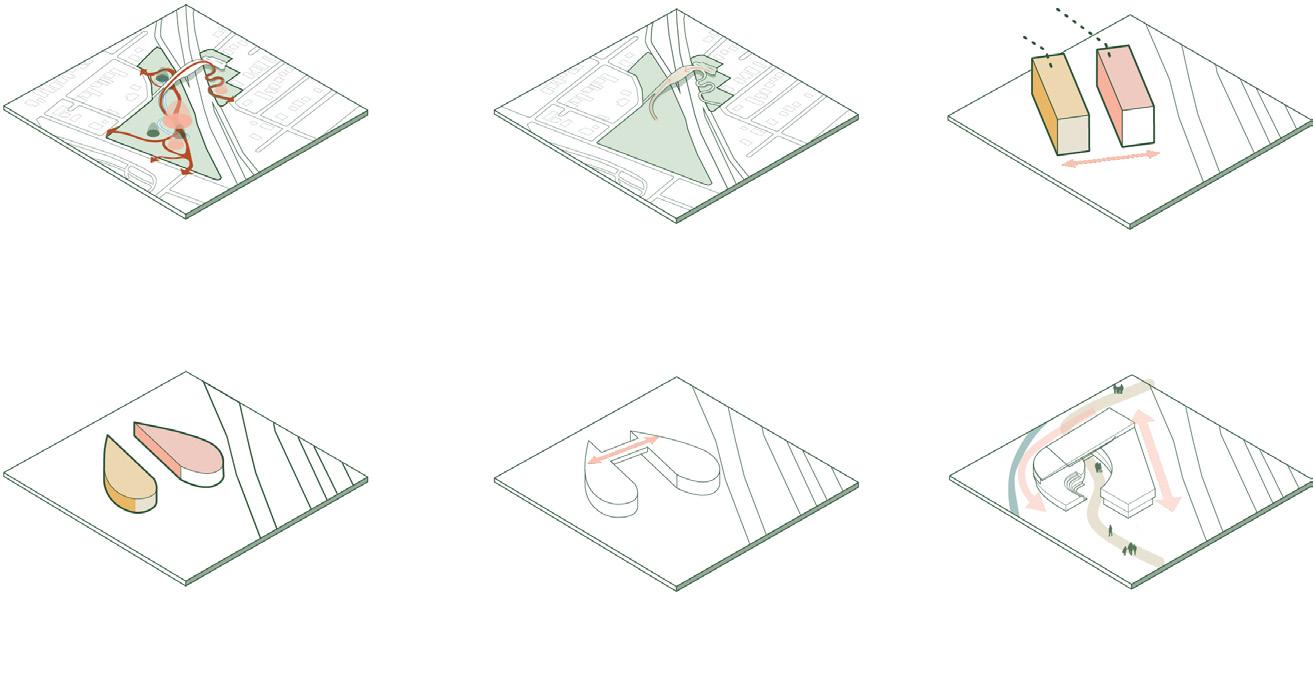
Urbanity has separated wilderness from people, and outdoor opportunities are hard to come by daily. These experiences are essential for people to grow empathy towards natural systems and coexist with other diverse ways of life. Cumberland Point, New Westminster historically has supported industrial practices and the vacant lot is at the ecological crucial convergence of the Brunette and Fraser River. The Brunette-Fraser Regional Greenway is a local opportunity that can be expanded on to provide an everyday access to multiple British Columbia natural landscapes and ecozones. Through dismantling the logbin wall and creating a riparian edge, the Wilderness At Play invites species of all kind to connect with the water and foster a space reciprocity through play.
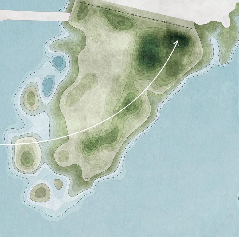
WATERSHED & ITS SUPPORTED SPECIES

the convergence of the brunette river, the fraser river, and regional greenway establishes the site as an important interaction site between wilderness and people

Design Principles
BEAVER
HERON
COYOTE
SPOTTED FROG
OWL
MUSKRAT
BLACK-TAILED DEER
MALLARD DUCK
RED-TAILED HAWK
PAINTED TURTLE
CHUM SALMON
STEELHEAD TROUT fostering a sense of empathy for the landscape through play, adventure, ecological awareness


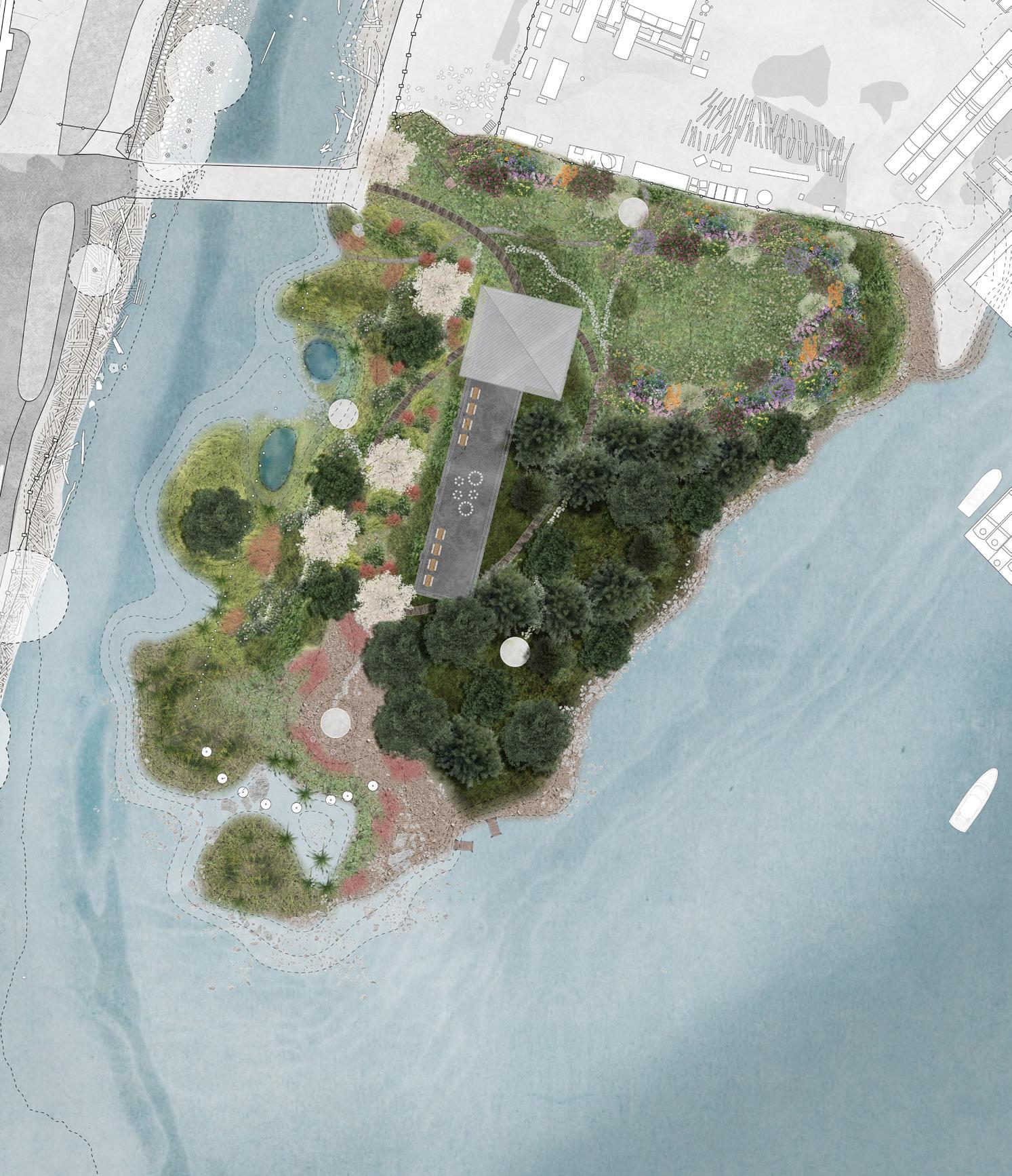
Site Plan
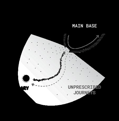

the paths encourage children to circulate through and break off the main path to visit secondary bases and explore the ecozones
Site Strategy
the strategy addresses the need for >30m riparian buffer to support the brunette river’s ecology while integrating human uses through the landscape
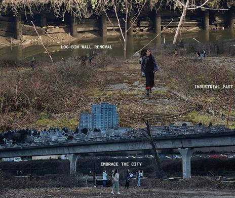
BEFORE AND AFTER
WETLAND

TIDAL FLATS
TO TOP OF THE BANK STREAM
FOREST UPSTREAM RIVER
MEADOW HILLSIDE OPEN SPACE the removal of the 4m tall logbin wall on the west side is crucial to create a riparian buffer habitat
Biodiversity Mapping
interconnected riparian zones through feeding and shelter connections between plant and animal species
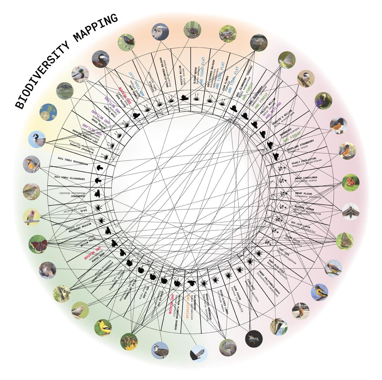
SAMPLE ECOZONE SPECIES [TIDAL FLATS] creating environments for all levels of the riparian buffer

RECIPROCITY THROUGH PLAY lifetime of integrated wilderness


MEADOW PLAY AGE 4 daycares
MEADOW school

ECOLOGY FIELD TRIP AGE 6 greenway users
GREENWAY STROLL AGE 10
RIVER RESTORATION AGE 16

FUTURE ADVENTURES AGE 30
FOREST WETLANDS TIDAL FLATS


In collaboration with the 2022 UBC NOMAS DESIGN TEAM Alyssa C., Bridget B., Cedric L., Cynthia S., Deryck B., Ellen M., Heather B., Hellen C., Joud S., Miucci Y., Sinnie C., Soha H., Vivian K.
enCORE Barbara G. Laurie Student Design Competition 2022 | National Organization of Minority Architects

CONTRIBUTION conceptual and schematic design context research rhino renders diagramming revit photoshop illustrator 24
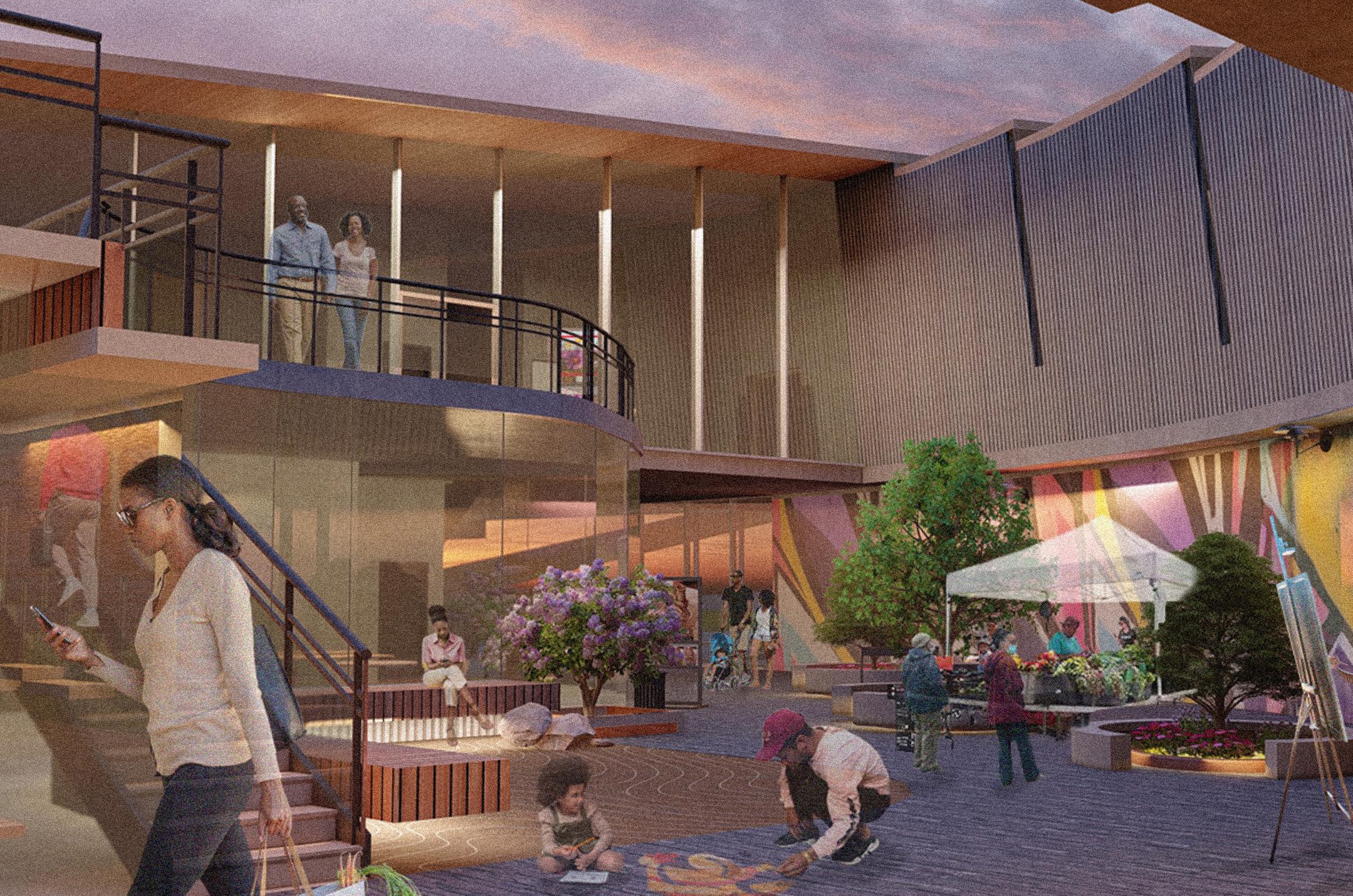
As a product of redlining initiatives, the I-40 bifurcated and displaced many African American residents in the Northern Nashville neighbourhood. enCORE reclaims the sense of place for the community by replacing the existing pedestrian bridge with a new one that actively serves as a connection between Hadley Park, Pearl-Cohn High School, HBCUs, and Jefferson St. The creation of this educational and cultural hub rekindles broken communities, tying together the past, present, and future in its site design. The project includes rain gardens, an auditorium, exhibition spaces, and a student center, with the central courtyard mirroring the I-40, re-interpreting the divide as a community gathering hub. This site considers both social and environmental sustainability in its intervention, acknowledging that placemaking is never stagnant and continuously changes with its people.
SITE northern nashville divided by the I-40
AND
CENTER
GARDEN
POND
SITING STRATEGIES rezoning the site and rebridging the displacement caused by the I-40 and within the community


INTERWEAVING paths run through gathering points around the museum, student center, and library
HEART SHAPE streamlining facades to parallel the added bioswale and I-40
RECONNECTING bridge itself as an extension of the land over the I-40
SPLITTING THE PROGRAMMING in order to maximize the space given for each section of the cultural center
MAINTAINING A CONNECTION maximize the space for each section of the cultural center
RESPONDING TO ADJACENCIES healing the split with bridges, paths, and glass courtyards
STUDENT CENTRE + MUSEUM PROGRAMMING giving community agency over their space


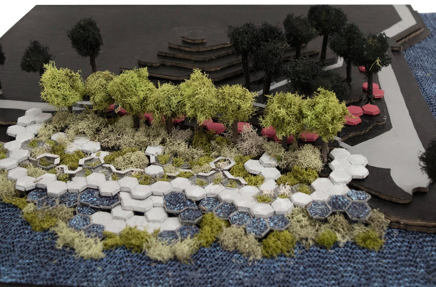
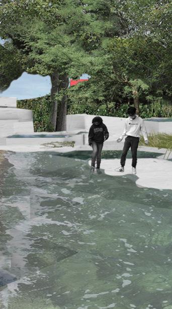
Sign Of The Tides
In collaboration with Kate Bonnell
DES 201 STUDIO | On The Edge | Led by Arthur Leung | WINTER 2021 BRIEF | Addressing sea level rise on the edge of False Creek
CONTRIBUTION
Without visual and physical changes to a user’s routine, the impending consequences of climate change can be ignored. SIGN OF THE TIDES creates an experiential intertidal environment that influences users’ consciousness of climate change while simultaneously creating a new learning environment along the shoreline. Located at Ron Basford Park, users can interact with the new biodiversity welcomed within the tidal pools and develop a meaningful relationship with the water’s edge. The bottommost walkway sits at mean water level meaning that during high tide the area becomes flooded with water and is unusable. The red gathering mounds indicate where that water will be in 50 years. The impact happens in ten, twenty, and thirty years when the path gradually becomes less and less accessible, and users visually watch that change over time and see the impacts of climate change affect the habitat.
Context
ron basford park, southeast end of granville island along the false creek
INTERVENTION DESIGN components in relation to sea level rise projections

REMOVE DETAIL SECTION IF NOT SURING
2100 Estimated High Tide (3.5 m)
Record Extreme High Water (2.5 m)
2021 Mean Sea Level (0.0m)


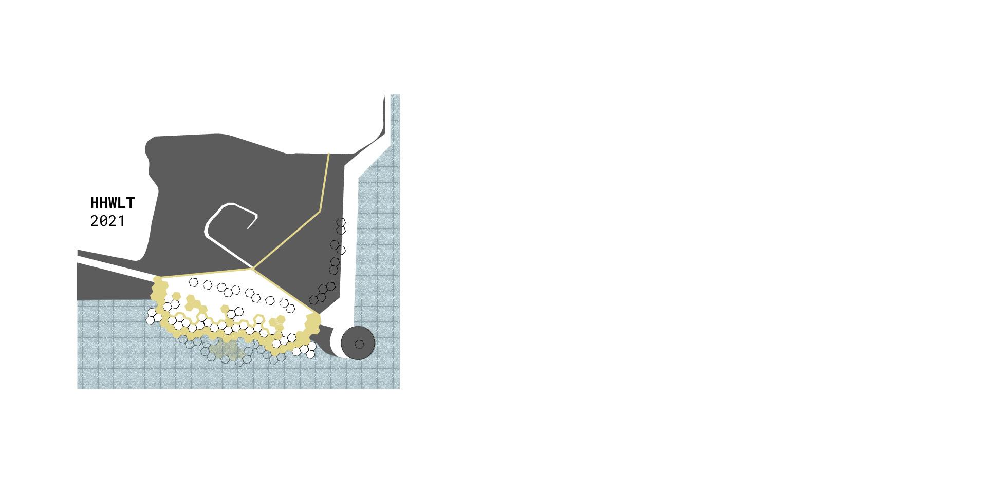


EST 2100 HIGH WATER LEVEL the red mounds indicating 100 year water levels offer reflection moments when the water levels have disrupted their sea wall path


