Volume 35: Issue 1 January, 2024
LINES &
POINTS
www.plsw.org
THE EQUALITY STATE SURVEYOR
P r o f e s s i o n a l L and S ur ve yor s of Wyom ing
Lines & Points (Vol. 35: No. 1)
1|Page
Volume 35: Issue 1 January, 2024
LINES &
POINTS
www.plsw.org
President President Elect Secretary/Treasurer
Doug Boyd, PLS Cody Schatz, PELS
Area Director
John Lee, PLS Wyoming Delegate
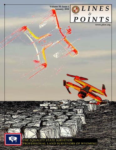
Terrestrial scans of a WYDOT drone. Compsite Photo by Mike Flaim, PELS
THE EQUALITY STATE SURVEYOR
P r of e s s i on al l an d s ur v e yor s of W yom i n g
John “Jack” Studley, PLS Cotton Jones, PLS
On The Cover
January 2024
CONTENTS Page 3
PRESIDENT’S MESSAGE
Page 4
announcements
Page 5
State of Wyoming-Senate file no. sf0017 Plane Coordinates System-Amendments
Page 7
Chasing Railroad Spirals: 18??-1930’s
by: Herbert W. Stoughton, PhD, PE, PLS, CP
Page 9
Publications Committee
Committee Chair-Chief Editor
Steven “Dennis” Dawson, PLS dennieandbarb@gmail.com
Designer
Michael Flaim, PELS mike.flaim@bresnan.net
Treasurer & Advertising
John “Jack” Studley, PLS jklz0318@gmail.com
Circulation Copy Editor
Joel Ebner, PLS jvebner@bresnan.net Herbert W. Stoughton, PhD, PELS, CP hws.geod.engr@gmail.com
Website
Sonja “Suzie” Sparks, PLS sasparks7@gmail.com
Emeritus Member
Pete Hutchison, PELS petehpels@gmail.com
PLSW (Professional Land Surveyors of Wyoming; PO Box 8, Cheyenne, WY 82003) is a statewide organization of Land Surveyors registered to practice in the Equality State of Wyoming. PLSW is dedicated to improving the technical, legal, and business aspects of surveying in the State of Wyoming. PLSW is affiliated with the National Society of Professional Surveyors (NSPS) and the Western Federation of Professional Land Surveyors (WestFed). Lines and Points is published by the Professional Land Surveyors of Wyoming. Lines and Points is not copyrighted and permission is hereby granted to reprint articles with appropriate credit. The Professional Land Surveyors of Wyoming assume no responsibility for statements made or opinions expressed in this publication. The articles and opinions as put forth in this journal are not necessarily those of PLSW or the Editorial staff of this journal.
Affidavits of Correction by: Geno Ferrero, PLS
Page 12
Model Law Section 110.20 Current with Proposed Changes
Page 15
Model Rule Section 210.25 Proposed by the Surveying/GIS Work Group
Page 17
Thoughts on Professional Practice and Education Article 5: Removing Examination Pre-requisites by: Knud E. Hermansen
•Jennifer Dibona - That CAD Girl •Jason Dysthe - Frontier Precision Inc. •John Baffert - Surv-KAP, LLC •Kelly Goff - Underground Consulting Solutions •Susan Hall - Trimble •Tim Klaben - Berntsen International Inc. •Troy Langston - Monsen Engineering
Advertising Information Digital-ready, full-color advertising with payment should be mailed to Lines & Points, P.O. Box 8, Cheyenne, WY 82003. Advertising rates are as follows: Year Issue Full Page $810 $210 Half Page $540 $140 Quarter Page $310 $80 Business Card $40 $10 Employment Free Free Special Rates apply for PLSW Chapters and cover placements. For more information please contact Jack Studley.
Page|2
Lines & Points (Vol. 35: No. 1)
is heading up the Surveying Program. PRESIDENT’S MESSAGE Studley If you would like to make a presentation please contact him, I am certain he is looking for good presentations to fill time slots.
The Western Regional Survey Conference is scheduled for March 23 - 26 for those interested. 2023 has wound It will be taking place at the Horseshoe Hotel down and I hope and Casino, Las Vegas, NV. This is an excellent this finds you all opportunity to network with other professionals wrapped up from last and pick up a few credits at the same time. year’s endeavors and PLSW will be supporting the 2024 Western looking forward to Planner Conference which will be taking place new projects in 2024. on August 7th – 10th in Cheyenne. This is an This year’s fall tech was once again a success. opportunity for surveyors in Wyoming to work This is in no small part due to Bill Fehringer and with the planners. Surveyors are a link for his crew’s continued efforts. Thank you, Bill, for Planners to learn what has happened in the past making these Technical Sessions consistently some and how it might influence an area in the future. of the best organized and productive gatherings We are a resource that often is forgotten during available to Wyoming Surveyors. the planning process. My hope that this type As a part of the Fall Tech session, PLSW always of participation and support can foster better sponsors a silent auction and raffle. The funds relations between our disciplines. If you would generated by these endeavors are utilized to like to make a presentation, please feel free to support the scholarship fund. The silent auction reach out to me. and raffle were some of the most successful in My goal and challenge to all of the membership recent history. I would like to give Chris Hamilton is to find or recruit young people into our a big shout out for once again organizing that fund raiser and to all the contributors and members profession. If you have a chance to impact a who bought items and tickets. You generated young person either through a summer job, a high over $3000 that can be utilized to support the next school job shadowing program or youth program then please do. generation of Land Surveyors! Best Wishes to all, As we move into 2024 surveyors in Wyoming are lucky to have multiple opportunities for continuing education and professional development. WES will once again be taking place in February. Jack
Doug Boyd, PLS President, Professional Land Surveyors of Wyoming.
Lines and Points Article Rotation Submission Schedule By Chapter Responsible Chapter First Call Date Last Call Date Publication Date
Southwest Chapter Northeast Chapter Northwest Chapter West Chapter Central Chapter South Central Chapter Southeast Chapter
THANK YOU! (see “Affidavits of Correction” in this Issue) March 1 March 15 April 1, 2024 June 1 June 15 July 1, 2024 September 1 September 15 October 1, 2024 December 1 December 15, 2024 January 1, 2025 March 1 March 15 April 1, 2025 June 1 June 15 July 1, 2025
As the Board of Directors discussed, any four page article (with pictures) may be from within the particular chapter membership (survey stories, or technical experiences) or after acquiring permission to use an article from another professional society publication or which provides information of interest to the PLSW members. The Board also approved assigning the responsibility for the article development and submission to each chapter’s vice president. If a Chapter does not provide an article that same Chapter shall be obligated to provide an article for the next publish date.
3|Page
January 2024
The Bureau of Land Management -Land Survey Job Announcement The following announcement: Land Surveyor, GS-1373-7/9/11 FPL: 11, located in Rawlins and/or Worland, Wyoming has been set to open on Thursday, January 4, 2024 The announcement number is WYDE24-12261169-ERW, or you may access the job announcement through the following link: https://www.usajobs.gov/GetJob/ ViewDetails/768764500 This position is open to: Career transition (CTAP, ICTAP, RPL), The public, Veterans NOTE - This announcement will be open from: Thursday, January 4, 2024 to Thursday, January 18, 2024*** Incentives: The BLM may use certain incentives currently offered by the Federal Government to attract high quality applicants Relocation expenses: Are not authorized Here are a few reminders to pass along to any interested applicants so they don’t inadvertently disqualify themselves from further consideration: • Resumes should also include a month/year and hours per week worked, along with their relevant work experience underneath each period of employment. Their resume should contain enough details regarding their work experience for us to determine whether they have the specialized experience or not.
• If they have current or prior federal service, they should list the grade levels. If this is left out, it won’t necessarily get them rated out, but it may help them get rated in easier. Submitting copies of their SF-50’s showing their current grade and series is also helpful OR if they were previously in the series, they should submit those SF-50’s too. • They MUST submit ALL required documentation prior to the announcement closing. All documents must be legible. Sometimes the documents submitted are blurry and really hard to read, or the file is corrupt, and we can’t access their documents. We do NOT accept late documents. Please Note: The ABOVE information and much more can be found on the HELP section of the USAjobs site. It goes more into detail regarding the federal hiring process, proper resume format and covers some of what I’ve listed above in more detail. https://www. usajobs.gov/Help/ Please let me know if you have additional questions or concerns. Thank you, Emanuel Williams Human Resources Specialist Bureau of Land Management Phone: (307) 775-6030
Page|4
Lines & Points (Vol. 35: No. 1)
The following reflects the version of the bill text at the time of publication. For current edits please seehttps://wyoleg.gov/Legislation/2024/SF0017 2024 STATE OF WYOMING 24LSO-0247 SENATE FILE NO. SF0017 Plane coordinates system-amendments. Sponsored by: Joint Transportation, Highways & Military Affairs Interim Committee A BILL for AN ACT relating to the plane coordinates system; updating the plane coordinates system for Wyoming; providing for the use of other datums, systems and networks for the system; providing definitions; making conforming amendments; repealing provisions related to obsolete coordinate standards; and providing for an effective date. Be It Enacted by the Legislature of the State of Wyoming: known and designated as the “Wyoming Plane Coordinate System.” NAD 1983.” The Wyoming Section 1. W.S. 34‑25‑109 is created to read: Plane Coordinate System shall be named, and in any land description in which it is used it shall 34‑25‑109. Definitions. be designated, the “Wyoming Plane Coordinate (a) As used in this chapter: System” and the zone used shall be specified. (i) “Metadata” means data that 34‑25‑102. Designation of coordinates. describes other data including utilized geodetic reference system data, applicable epoch, statement or The plane coordinates of a point on the earth’s surface, to be used in expressing the position or relative accuracy data and date of observation data; location of such point in the appropriate zone of (ii) “NGS” means the national ocean this system, shall consist of two (2) linear distances, service’s national geodetic survey of the national expressed in feet and decimals of a foot, or meters oceanic and atmospheric administration, United to the nearest millimeter and decimals of a meter. States department of commerce or its successor; One (1) of these distances, to be known as the “east (iii) “NSRS” means the national x‑coordinate” or “east‑coordinate,” shall give the spatial reference system or its successor; position in an distance east and‑west direction of (iv) “Wyoming Plane Coordinate the Y axis; the other, to be known as the “north System” means the system of plane coordinates y‑coordinate” or “north‑coordinate,” shall give under this chapter that is identical to the state the position in a north‑and‑south direction. These plane coordinate system as defined for the state of coordinates shall depend upon and conform to the coordinates, on the Wyoming Coordinate System Wyoming by NGS. NAD 1983 of the National Geodetic Survey, or Section 2. W.S. 34‑25‑101(a), 34‑25‑102, its successors, within the state of Wyoming, as 34‑25‑103 and 34‑25‑105 through 34‑25‑108 are those coordinates have been determined by the amended to read: survey. distance north of the X axis. The Y axis of any zone shall be parallel with the central 34‑25‑101. System of plane coordinates adopted. meridian of that zone. The X axis of any zone (a) The system most recent version of the shall be at right angles to the central meridian of state plane coordinates which coordinate system that zone. One (1) foot shall equal three thousand for the state of Wyoming that has been established forty‑eight ten‑thousandths (0.3048) of one (1) by the office of National Geodetic Survey, or its meter and shall be used as the standard unit of successors NGS, based on the NSRS for defining measurement for the Wyoming Plane Coordinate and stating the positions or locations of points System. The official geodetic datums to which on the surface of the earth within the state of geodetic coordinates are referenced within the Wyoming is adopted and hereafter shall be state of Wyoming including latitude, longitude, 5|Page
January 2024
34‑25‑107. Description in other ellipsoid height, orthometric height or dynamic height shall be defined by the NSRS. Height is the surveys; conflicts. coordinate value of the vertical elements of the Wherever coordinates based on the Wyoming NSRS expressed in feet and identified as ellipsoid Plane Coordinate System NAD 1983 are used height or orthometric height. to describe any tract of land which in the same 34‑25‑103. Land extending into other zones. document is also described by reference to any subdivision, line or corner of the United States When any tract of land to be defined by a single public land surveys, the description by plane description extends from one (1) zone into a coordinates shall be construed as supplemental second of the coordinate other zones, specified in W.S. 34‑25‑101, the positions of all the points on its to the basic description of such the subdivision, boundaries may shall be referred to either of the line or corner contained in the official plats two (2) as only one (1) of the zones, and the zone and field notes filed of record, and in the event which is used shall be specifically named in the of any conflict, the description by reference to description and the metadata of the observations the subdivision, line or corner of the United States public land surveys shall prevail over the shall be included in the description. description by plane coordinates. Every recorded 34‑25‑105. Recording coordinates. map, survey or conveyance, or other instrument No Coordinates based on the Wyoming Plane affecting title to real property which delineates, Coordinate System, NAD 1983, purporting to describes or refers to such property or any part define the position of a point on a land boundary, thereof by reference to coordinates based upon shall may be presented to be recorded in any public the Wyoming Plane Coordinate System NAD 1983 land records or deed records in the office of a county shall also describe the property by reference and clerk. unless a record and report of survey of the tie to a controlling corner monument of the United actual survey to establish the plane coordinates States public land surveys, if applicable. of the point has been filed with the county 34‑25‑108. Application. surveyor, the county engineer or the county clerk (a) Nothing contained in this chapter shall and in conformity with the standards prescribed in W.S. 34‑25‑104. When acceptable satellite require any purchaser or mortgagee to rely on a survey techniques are employed, a minimum of description, any part of which depends exclusively two (2) independent observing sessions shall be upon the Wyoming Plane Coordinate System. executed and shall agree to not less than one (1) NAD 1983. part in one hundred thousand (100,000) of the (b) The provisions of this chapter shall not distance between the points. The procedures and be construed to: results shall conform with the standards in W.S. 34‑25‑104. The method and source for establishing (i) Prohibit the appropriate use of coordinates shall be described in the land or deed other datums, other geodetic reference networks record. In all instances where reference has been or systems or other plane coordinate systems; made to coordinates in land surveys or deeds, the (ii) Require the revision of any combined factors shall be stated for the survey survey, deed, record or other document prepared lines used in computing ground distances and or recorded before July 1, 2024 that uses the areas and the metadata of observations shall be Wyoming Coordinate System NAD 1983 or any included in the record. other coordinate system previously authorized under this chapter. 34‑25‑106. Reference to system on maps. The use of the term “Wyoming Plane Coordinate Section 3. W.S. 34‑25‑101(b) and 34‑25‑104 System” NAD 1983” on any map, report of survey or are repealed. other document, shall be limited to plane coordinates Section 4. This act is effective July 1, 2024. based on the Wyoming Plane Coordinate System NAD 1983 as defined in this chapter. (END) Page|6
Lines & Points (Vol. 35: No. 1)
Chasing Railroad Spirals: 18?? - 1930’s Herbert W. Stoughton Ph.D., P.E., P.L.S., C.P.
Early in my education career I was introduced to railroad surveying, particularly, alignments, circular curves, superelevation, and transition spirals. Unfortunately, by the 1960’s there was very little new railroad construction, and minor projects in realignments and maintenance. Therefore, the emphasis in transportation courses to address surveying was nearly eliminated. It was the era of design and construction of President Dwight David Eisenhower’s Inter-State Highway System, where the emphasis migrated toward highway transition spirals. In some cases the highway spirals were a “spin-off” of the railroad spiral, but a significant portion of the highway spiral geometry was developed based upon the unique characteristics of the alignments and automobile and freight vehicles. In the last three decades, there has been a new interest in railroad spirals abroad, as old railroads were being upgraded and realigned. In the United States, there has been a small contingent of surveyors and railroad surveyors having a deep technical interest in track alignment retracements. This initiated in me a new interest for the elusive railroad transition spiral. The Englishman William Gravatt (inventor of the Dumpy Level) coined the first English language technical name of a transition curve/ spiral as “curve of sines” (c. 1830). Around the mid-nineteenth century William John Macquorn Rankine authored a major engineering handbook which was a standard civil engineering reference on both sides of the Atlantic Ocean. In 1861, the only public explanation of the curve was written by Gravatt, but the mathematics (contained therein) was nearly nonexistent. From what I can discover, it was used on only one or two railroads, and probably the only actual“mathematics of layout” would be discovered in the original engineering drawings and field notes! A decade after Gravatt’s efforts, another Englishman, William Froude, introduced another transition curve which seemed to work for the slow speed (velocity) trains traveling during that era, but no publication of his mathematical presentation was found before 1861. I gather it was an acceptable geometry, and may have been used on several railroads in the 7|Page
British Isles. Although the American and British railroad engineering communities exchanged technical, design, and construction information, there is little in the American literature indicating that Gravatt’s and Froude’s curves were known or used until identified in the engineering handbook authored by William John Macquorn Rankine (mentioned above), and then did not gain wide acceptance. Another nineteenth century English transition curve was developed by the eminent English engineer Wilfrid Airy (son of George Biddell Airy, Astronomer Royal). The American engineering community had a parallel effort. One of the initial approaches was authored by Stephen Harriman Long (U.S. Topographic Engineer). Besides being a well know mapping explorer (Long’s Peak, Colorado), he spent a considerable portion of his professional career designing and building engineering works and railroads, and wrote about railroad surveying and location. I have not been able to locate a copy (even a photo reproduction is satisfactory) of his writings. In 1837, Samuel W. Mifflin and James C. Nagle published works and are frequently referenced in later railroad engineering works. The next major U.S. contribution was written by C.S. Cross (1855), followed by a major work written by John Benjamin Henck and a lesser known work by William Findlay Shunk, both in 1866. Henck was a prominent railroad engineer designing and building railroads and his book was a standard reference for over three decades. While Rankine’s work was a standard reference in the U.S., John Cresson Trautwine wrote a parallel tome addressing American engineering railroad practice. It would eventually replace Rankine in the U.S., partially because of the type and magnitude of some of the engineering projects being designed and constructed in the U.S. after the American Civil War. Revised/updated editions of Trautwine’s handbook would be authored by his son - John, Jr.; and his grandson John, 3d. (the last being 1937). In the early 1890’s, Charles Lee Crandall, Walter Gordon Fox, Calvin Frank Allen, and Edwin E. Woodman authored major works addressing transition curves. In the same decade, civil engineering works by James C.
January 2024
Nagle, Daniel Carhart, and Conway R. Howard provided significant information concerning railroad engineering. A book published in the 1880’s on railroad location and economics, would be reprinted for decades. Then, in the 1920’s, Professor Grant was commissioned by the publisher to revise the work to address the general subject of engineering economics. The engineering economics treatise today known as ‘Grant and Iverson’, was direct successor to a book addressing railroad engineering and economics.
Although I do not personally know the number of railroads designed, constructed, and operated in the U.S., it probably numbers between fifty and one hundred fifty. This problem affects a ‘serious historical researcher’ attempting to find “abstract geometrical information” archives. I have found in recent decades (about four!) that the historical monitoring staffers have been low-paid (with no professional/technical education) individuals, being the custodians of the records/files, and having no intellectual clue as to the merits of the The first three decades of the twentieth century information. I found this characteristic in the witnessed a deluge of works: Philetus Harvey director of at least one major regional museum Philbrick (1901); Arthur Newell Talbot (1901); (employing a professional museum staff) related to historical American engineering, and in the staffs of Reuben Stewart Henderson (1906); Frederick the offices/divisions of historical records of major Augustus Smith (1906); John R. Stephens (1906); corporations. Although the pertinent historical Norman Benjamin Kellogg (1907); Charles Lee information/data are available, we lack those Crandall and Fred Asa Barnes (1913); Walter individuals who understand and appreciate our Loring Webb (1914 and earlier); Lee Perkins (1915); objectives and goals. It is particularly frustrating and Thomas Felix Hickerson (1926) authored when the researcher resides afar from the source significant works. Also, a number of the late of the potential information, and the supporting nineteenth century writers continued to updated travel/research expenses are unavailable to and published their earlier works and produce minimally support valid investigations. new contributions. Besides the works published in book form, the number of technical papers appearing in a wide range of engineering publications number over one hundred. The list of authors included many of the major practitioners of railroad engineering of the last four decades of the nineteenth century. Since the beginning of the twentieth century there has been an effort to have a “standardized” transition curve. The result has been the AREMA spiral. Some railroads have adopted this configuration, but because many of the existing railroad alignments have a “pretransition curve” history, which seemed to work successfully, there has been some reluctance to convert to the new system. Also, the modern railroad systems (corporate assemblages) of smaller nineteenth railroad systems, etc., have embedded within each local railroad system a set of geometrical technology (alignments, circular curves, transition spirals and associated track configurations). My research, although informal and probably considered unscientific, indicates that it is extremely difficult to locate the historical information required to recreate the fundamental mathematics of the geometry they employed. Page|8
Lines & Points (Vol. 35: No. 1)
Affidavits of Correction
property. Title insurance is designed to protect the property owner and the lender against losses that By: Geno Ferrero, PLS may arise from issues with the property’s title. If there are significant errors or discrepancies in An affidavit of correction is a legal document used the land description, it can create uncertainty or to rectify errors or inaccuracies in previously filed disputes about the property’s boundaries, which documents, typically related to important records may result in a title insurance company being like deeds, titles, or official certificates. It is a sworn unwilling to provide coverage. Title insurance companies conduct thorough statement made by the person who originally filed the incorrect document, or sometimes by a notary title searches to identify any potential issues or other authorized individual, confirming the with the property’s title, including errors in legal error and providing the corrected information. descriptions, boundary disputes, or unresolved They can apply to boundary descriptions in real claims. If they discover a substantial error or estate documents. If there is an error in a boundary discrepancy that poses a significant risk to the description on a property deed, for example, property’s ownership, they may either refuse to the original author of the legal description an issue a policy or require that the error is corrected authorized individual can use an affidavit of before providing coverage. correction to rectify the mistake. To address such issues, property owners often need to correct the errors in the land description Here’s how it typically works: through legal means, such as filing an affidavit of 1. Identify the Error: First, the party seeking correction or a corrective deed, to provide a clear correction must identify the specific error in the and accurate legal description of the property. boundary description. This could be a mistake in measurements, boundary markers, or other Once the correction is made, the title insurance company may then be willing to issue a policy, details related to the property boundaries. assuming all other title-related issues are resolved 2. Prepare the Affidavit: An affidavit of as well. correction is drafted, which includes a sworn Land surveyors assist in the title insurance statement that acknowledges the error and provides the corrected boundary description. It process by providing accurate boundary should be signed by the person who made the information, identifying potential encumbrances, and helping to resolve boundary disputes. Title error or, if applicable, a notary public. insurance companies will request the surveyor 3. Record the Affidavit: The corrected or company that prepared the erroneous legal affidavit is typically attached to the original deed description and request an affidavit of correction or filed with the appropriate land records office, to address the patent or latent ambiguities found depending on local regulations. This recording within the legal description or plat. makes the correction part of the official property Filing an affidavit of correction typically involves records. the following steps: By using an affidavit of correction for boundary 1. Prepare the Affidavit: Draft an affidavit descriptions, property owners can maintain the of correction that clearly identifies the document accuracy of their property records and avoid potential disputes or confusion over property needing correction, describes the error, and boundaries. Keep in mind that the specific provides the corrected information. Include a procedures and requirements for correcting sworn statement that attests to the accuracy of the boundary descriptions can vary by jurisdiction, so correction. it’s essential to consult with legal professionals or 2. Notarize the Affidavit: The affidavit often local authorities for guidance. needs to be notarized. This involves taking the Errors in a land description can potentially prevent title insurance companies from insuring a 9|Page
document to a notary public, who will witness the signing and affix their official seal.
January 2024
3. Check Local Requirements: Be aware of 5. Inaccurate Corrections: Making incorrect your jurisdiction’s specific rules and requirements corrections in the affidavit may compound the for filing affidavits of correction. Local rules can problem, leading to further errors in property vary, so consult with a legal professional or the records. relevant government agency to ensure you follow 6. Inadequate Title Insurance: If there are the correct procedure. unresolved issues, title insurance companies may 4. Submit the Affidavit: File the affidavit of be hesitant to provide coverage, which can be a correction with the appropriate government office or agency responsible for maintaining the records risk when buying or selling the property.
7. Public Record: Once filed, the affidavit of related to the document in question. This might be a county clerk’s office, a land records office, correction becomes a public record, making the or another relevant authority, depending on the correction and associated details accessible to nature of the document. anyone. This can affect your property’s privacy. 5. Pay Fees: Some jurisdictions require the To mitigate these risks, it’s essential to work payment of a filing fee when submitting an with legal professionals, such as attorneys or title affidavit of correction. Be prepared to cover any companies, who are experienced in real estate applicable fees. matters. They can ensure that the affidavit is 6. Attach to Original Document: The corrected prepared correctly, meets legal requirements, affidavit is often attached to the original document and helps resolve any errors without introducing that contains the error. It becomes part of the new issues. Additionally, communicating with all official record associated with that document. relevant parties and interested parties can help 7. Notify Interested Parties: It’s a good prevent disputes and misunderstandings related practice to inform any interested parties, such as to the correction. other parties named in the document or affected An affidavit of correction should contain specific by the correction, of the filing. This helps ensure that everyone involved is aware of the correction. elements to make it a legally valid and effective 8. Keep Copies: Always retain a copy of document. While the exact requirements can vary the affidavit for your records, and if necessary, by jurisdiction, here are the typical elements that provide copies to any relevant parties or entities. should be included: 1. Title: Begin the affidavit with a clear and Preparing an affidavit of correction involves certain risks, and it’s essential to be aware of descriptive title, such as “Affidavit of Correction.” potential issues: 2. Affiant’s Statement: Include a sworn 1. Legal Requirements: If the affidavit is not prepared correctly or does not meet the legal requirements of your jurisdiction, it may be invalid, and the correction may not be legally recognized. 2. Recording Delays: The process of preparing and filing an affidavit of correction can be timeconsuming, leading to delays in resolving the error or in subsequent property transactions. 3. Property Disputes: The correction may affect neighboring property owners or other interested parties who could dispute the changes, potentially leading to legal conflicts. 4. Costs: There can be costs associated with notarization, filing fees, and legal assistance, especially if disputes arise.
statement, often beginning with language like “I, [Name of Affiant], do solemnly affirm under penalty of perjury…” The affiant is the person making the correction, and they should confirm the accuracy of the correction. 3. Affiant’s Credentials: Include credentials that show the subsequent statements are credible. Additional information such as reasons for familiarity with property may be included. If correcting errors of retired or deceased individuals, such statement may be made. 4. Introduction: Include introductory language that identifies the document you are correcting, such as the document’s title, recording date, and any relevant details. Page|10
Lines & Points (Vol. 35: No. 1)
5. Reference to Original Document: Provide clear references to the original document, including its type, date, and any identifying information that helps link the correction to the original. 6. Statement of Error: Clearly state the error or inaccuracy in the original document, providing a detailed description of what needs correction. 7. Corrected Information: Present the accurate and corrected information. Ensure that the new information is clear and unambiguous.
where the notary public certifies the affiant’s identity and the authenticity of their signature. Please note that the specific requirements for an affidavit of correction can vary by jurisdiction and the type of document being corrected. It’s advisable to consult with legal professionals or the appropriate government office to ensure that your affidavit of correction complies with local regulations and serves its intended purpose.
In conclusion, affidavits of correction serve 8. Recording Information: Include details as vital instruments in rectifying errors within about where and when the affidavit will be filed legal documents, particularly those concerning or recorded, such as the county and state where it property titles, deeds, and certificates. These sworn statements play a crucial role in ensuring will be submitted. the accuracy of official records. By acknowledging 9. Ending Statement: Statement of “Further, and correcting errors, these affidavits contribute Affiant saith not.”, or similar statements, notify the to the integrity of property records. However, it reader that not further statements are forthcoming. is imperative to navigate the process carefully, 10. Signature: The affiant must sign and date adhering to jurisdiction-specific regulations the affidavit, typically in the presence of a notary and seeking legal guidance when necessary. public if notarization is required. Ultimately, affidavits of correction play a pivotal 11. Notary Acknowledgment: If required by role in maintaining the precision and reliability of law, the affidavit should be notarized. This means documents prepared or corrected by professional it should include a notary acknowledgment section land surveyors.
■ Digital Aerial Photography ■ Topographic Mapping
■ LIDAR
■ Mobile Mapping
■ Orthorectified Imagery
40 West Oakland Avenue, Salt Lake City, UT 84115 · PHONE: 801-487-3273 · Fax: 801-487-3313
11|Page
January 2024
Attached is the latest version of the language for your review and consideration. Please send comments/ questions/suggestions to me and/or info@nsps.us.com by Wednesday, January 31st and I will forward them to the review committee. Thanks, Timothy W. Burch, PLS Executive Director, NSPS tim.burch@nsps.us.com
Model Law Section 110.20 - Showing
current with proposed changes
B. Professional Surveyor (Professional Land Surveyor, Professional Surveyor and Mapper, Geomatics Professional, or equivalent term) 1. Professional Surveyor—The term “Professional Surveyor,” as used in this Act, shall mean an individual who has been duly licensed as a professional surveyor by the board established under this Act and who is a professional specialist in the technique of measuring land, educated in the basic principles of mathematics, the related physical and applied sciences, and the relevant requirements of law for adequate evidence and all requisite to surveying of real property, and engaged in the practice of surveying as herein defined. 2. Professional Surveyor, Retired—The term “Professional Surveyor, Retired,” as used in this Act, shall mean an individual who has been duly licensed as a professional surveyor by the board and who chooses to relinquish or not to renew a license and who applies to and is approved by the board to be granted the use of the title “Professional Surveyor, Retired.” 3. Surveyor Intern—The term “Surveyor Intern,” as used in this Act, shall mean an individual who has been duly certified as a surveyor intern by the board. 4. Practice of Surveying— a. The term “Practice of Surveying,” as used in this Act, shall mean providing, or offering to provide, professional services using such sciences as, but not limited to, mathematics, geodesy, and photogrammetry, and relevant aspects of the law, involving both BOTH: 1. the making of geometric measurements and gathering related information pertaining to the physical or legal features of the earth, improvements on the earth, the space above, on, or below the earth AND
2. providing, utilizing, or developing the same into surveying products such as graphics, data, maps, plans, reports, descriptions, or projects. deliverables, the purpose of which is to establish a legal basis for the reported locations, shapes, positions, and sizes. Professional services include acts of consultation, investigation, testimony evaluation, expert technical testimony, planning, mapping, assembling, and interpreting gathered measurements and information related to any one or more of the following: i. Determining by measurement the configuration or contour of the earth’s surface or the position of fixed objects thereon ii. Determining by performing geodetic surveys the size and shape of the earth or the position of any point on the earth iii. Performing an original or retracement survey Locating, relocating, establishing, reestablishing, or retracing property lines or boundaries of any tract of land, road, right of way, or easement iv. Making any survey for the division, subdivision, or consolidation of any tract(s) of land v. Locating or laying out alignments, positions, or elevations for the design and construction of fixed works with sufficient accuracy and precision to be relied upon for the provision of architectural and engineering services related to fixed works. vi. Determining, by the use of principles of surveying, the position for any survey monument (boundary or nonboundary) or reference point; establishing or replacing any such monument or reference point. vii. Creating, preparing, or modifying electronic, computerized, or other data, relative to the performance of the activities in items a–f i-vi above viii. Applying surveying measurement and mapping techniques for the elucidation of questions before courts of law and equity (forensic surveys) relating to items i-vii above. b. An individual shall be construed to practice surveying, within the meaning and intent of this Act, if he or she does any of the following: Page|12
Lines & Points (Vol. 35: No. 1)
1. Engages in or holds himself or herself out as able and entitled to practicesurveying 2. Represents himself or herself to be a professional surveyor by verbal claim, sign, advertisement, letterhead, or card or in any other way 3. Through the use of some other title, implies that he or she is a professional surveyor or licensed under this act c. Unlicensed persons who hold certification from the GIS Certification Institute, the American Society of Photogrammetry and Remote Sensing or substantially similar certification as approved by the Board may provide the services and products described above in 4.a.i., 4.a.ii., and 4.a.vii., as it applies to 4.a.i. and 4.a.ii., provided such services and products include: 1. Disclaimers of use clearly indicating that they: i. Are NOT intended to be used as a surveying deliverable. ii. Are NOT suitable for legal and cadastral purposes. iii. Cannot be presumed to have sufficient accuracy and precision to be relied upon for the provision of architectural and engineering services related to fixed works. 2. Metadata must be included in a digital format that is easily accessible and readable by users of the digital geographic data, and clearly affixed to the printed copies of such data. Metadata should include the method of compilation, geographic reference frame (i.e., coordinate or linear reference system), data source(s), and creation date(s), accuracy, precision, creator, owner, and point of contact, for the services or products. d. The use of photogrammetric methods or similar remote sensing technology to perform those parts of the practice of surveying as defined in 4.a.i. and 4.a.ii., and 4.a.vii. as to the activities in items 4.a.i. and 4.a.ii. of this section may be per-formed only under the direct control and supervision of a professional surveyor or professional photogrammetrist who maintains a current title of “Certified Photo-grammetrist” from a national scientific organization having a process for certifying photogrammetrists. 5. Inactive Status—Licensees who are not engaged in surveying practice that requires 13|Page
licensure in this jurisdiction may be granted inactive status. No licensee granted inactive status may practice or offer to practice surveying in this jurisdiction unless otherwise exempted in this Act. C. Board—The term “Board,” as used in this Act, shall mean the jurisdiction board of licensure for professional engineers and professional surveyors, hereinafter provided by this Act. D. Jurisdiction—The term “Jurisdiction,” as used in this Act, shall mean a state, the District of Columbia, or any territory, commonwealth, or possession of the United States that issues licenses to practice and regulates the practice of engineering and/or surveying within its legal boundaries. E. Responsible Charge—The term “Responsible Charge,” as used in this Act, shall mean direct control and personal supervision of engineering or surveying work, as the case may be. F. Rules of Professional Conduct—The term “Rules of Professional Conduct,” as used in this Act, shall mean those rules of professional conduct, if any, promulgated by the board as authorized by this Act. G. Firm—The term “Firm,” as used in this Act, shall mean any form of business or entity other than an individual operating as a sole proprietorship under his or her own name. H. Managing Agent—The term “Managing Agent,” as used in this Act, shall mean an individual who is licensed under this Act and who has been designated pursuant to Section 160.20 of this Act by the firm. I. Rules—The term “Rules,” as used in this Act, shall mean those rules and regulations adopted pursuant to Section 120.60 A, Board Powers, of this Act. J. Signature—The term “Signature,” as used in this Act, shall be in accordance with the Rules. K. Seal—The term “Seal,” as used in this Act, shall mean a symbol, image, or list of information. L. Licensee—The term “Licensee,” as used in this Act, shall mean a professional engineer or a professional surveyor. M. Person—The term “Person,” as used in this Act, shall mean an individual or firm. N. Authoritative—The term “Authoritative,” as used in this Act or Rules promulgated under this Act, shall mean being presented as legally reliant, trustworthy, and competent when used
January 2024
to describe products, processes, applications, or data resulting from the practice of surveying surveying deliverables. O. Disciplinary Action—The term “Disciplinary Action,” as used in this Act, shall mean any final written decision or settlement taken against an individual or firm by a licensing board based upon a violation of the board’s laws and rules. P. Positional accuracy—The extent to which horizontal and vertical information on a map or in a digital database matches true or accepted values that are relative to the earth’s surface or other reference datum Q. Georeferenced—Being referenced, measured, or described in spatial terms relative to the earth’s surface or other reference datum R. Surveying deliverables—Any authoritative maps, graphics, database, plans, reports, descriptions, applications, projects or other similar electronic or printed deliverable that shows the authoritative location of features or coordinate systems. Surveying deliverables provide spatial information to a level of positional accuracy, whether that accuracy is stated, regulated, or implied products, resulting from the practice of surveying
as defined in Section B.4 of this Act, and fit for the intended use of the surveying service(s) provided. S. Original Survey - The term “Original Survey” as used in this Act, shall mean performing a boundary survey for purposes of locating, on the ground and describing the location of, an interest in real property that has not been previously described in a document or documents conveying an interest in that real property. The term includes the subdivision of a section or portions of a section of land under common ownership in the United States Public Land Survey System, where no such subdivision has been previously conducted on the ground. T. Retracement Survey - The term “Retracement Survey” as used in this Act, shall mean performing a boundary survey of real property that has been previously described in a document or documents conveying an interest in that real property by applying the appropriate boundary law principles governed by the facts and evidence found in the course of performing the survey. The term includes retracing the lines and corners of a previous original survey of real property.
THE LANDMARK NAME IN SURVEY PRODUCTS Exceptional Customer Service
• REBAR & PIPE CAPS • CONCRETE MARKERS • SURVEY MONUMENTS • SECTIONAL ROD MONUMENTS • ACCESS COVERS • WASHERS & NAILS • SUBSURFACE MAGNETICS • STAMPING TOOLS • SURVEY TOOLS & ACCESSORIES
CALL OR ORDER ONLINE!
520- 622- 6011 • 800- 445-5320 • FAX 520-792-2030 • SURV-KAP.COM Page|14
Lines & Points (Vol. 35: No. 1)
[ Model Rule Section 210.25 - THIS
MODEL RULE SECTION IS TO BE INCLUDED AS A PART OF THE MODEL LAW AS ORIGINALLY PROPOSED BY THE SURVEYING/GIS WORK GROUP WHEN THEY WERE ORIGINALLY WRITTEN.]
Inclusions and Exclusions to the Practice of Surveying UA. Activities Included within the Practice of Surveying Activities that must be accomplished by or under the responsible charge of a professional surveyor (unless specifically exempted in subsection VB of this section or as otherwise provided for in Section B.4.c. of this Act) include, but are not limited to, the following: 1. The creation of maps or georeferenced databases representing authoritative locations for boundaries, the location of fixed works, or topography. This includes maps and georeferenced databases prepared by any person or government agency where that data is provided to the public as a surveying deliverable. 2. Original data acquisition, or the resolution of conflicts between multiple data sources, when used for the authoritative location of features within the following data themes: geodetic control, orthoimagery, elevation and hydrographic, fixed works, private and public boundaries, and cadastral information 3. Certification of positional accuracy of maps or measured survey data 4. Adjustment or authoritative interpretation of raw survey data 5. Geographic Information System (GIS)based parcel or cadastral mapping used for authoritative boundary definition purposes wherein land title or development rights for individual parcels are, or may be, affected 6. Authoritative interpretation of maps, deeds, and other land title documents to resolve conflicting data elements 7. Acquisition of field data required to authoritatively position fixed works or cadastral data relative to geodetic control 15|Page
8. Analysis, adjustment or transformation of cadastral data of the parcel layers with respect to the geodetic control layer within a GIS resulting in the affirmation of positional accuracy VB. Activities Excluded from the Practice of Surveying A distinction must be made in the use of electronic systems between making or documenting original measurements in the creation of surveying deliverables, versus the copying, interpretation, or representation of those measurements in such systems. Further, a distinction must be made according to the intent, use, or purpose of measurements derived from electronic systems to determine an authoritative location versus the use of those measurements as a reference for planning, infrastructure management, and general information. The following items are not to be included as activities within the definition of the practice of surveying: 1. The creation of general maps a. Prepared by private firms or government agencies for use as guides to motorists, boaters, aviators, or pedestrians b. Prepared for publication in a gazetteer or atlas as an educational tool or reference publication c. Prepared for or by education institutions for use in the curriculum of any course of study d. Produced by any electronic or print media firm as an illustrative guide to the geographic location of any event e. Prepared by laypersons for conversational or illustrative purposes. This includes advertising material and users guides. 2. The transcription incorporation of previously produced survey data and/or georeferenced data into a GIS or LIS by manual or electronic means, and the maintenance thereof, provided the incorporated data are clearly not intended to indicate the authoritative location of property boundaries, the shape or contour of the earth, or fixed works. Incorporated data must include appropriate metadata describing, at a minimum, that it cannot be used as a survey deliverable.
January 2024
3. The transcription incorporation of public record data, without modification except for graphical purposes, into a GIS- or LIS-based cadastre (tax maps and associated records) by manual or electronic means, and the maintenance of that cadastre, provided the data are clearly not intended to authoritatively represent property boundaries as they were surveyed. This includes tax maps and zoning maps. 4. The preparation of any document by any federal government agency that does not define real property boundaries. This includes civilian and military versions of quadrangle topographic maps, military maps, satellite imagery, and other such documents. 5. The incorporation or use of documents or databases prepared by any federal agency into a GIS/LIS, including but not limited to federal census and demographic data, quadrangle topographic maps, and military maps 6. Inventory maps or databases created by any organization, in either hard-copy or electronic form, of physical features, facilities,
or infrastructure that are wholly contained within properties to which they have rights or for which they have management responsibility. The distribution of these maps or databases outside the organization must contain appropriate metadata describing, at a minimum, the accuracy, method of compilation, data sources and dates, and disclaimers of use clearly indicating that the data are not intended to be used as a surveying deliverable. 7. Maps and databases depicting the distribution of natural resources or phenomena prepared by foresters, geologists, soil scientists, geophysicists, biologists, archeologists, historians, or other persons qualified to document such data 8. Maps and georeferenced databases depicting physical features and events prepared by any government agency where the access to that data is restricted by statute. This includes georeferenced data generated by law enforcement agencies involving crime statistics and criminal activities.
Custom Survey Markers & Monuments • Signs & Witness Posts • Flagging & Targets • Nails & Washers
SURVEY MARKING Custom Survey Markers & Monuments • Signs & Witness Posts • Flagging & Targets • Nails & Washers
™
877-686-8561 l www.berntsen.com Page|16
Lines & Points (Vol. 35: No. 1)
Thoughts on Professional Practice and Education Article 5: Removing Examination Pre-requisites by Knud E. Hermansen, P.L.S., P.E., Ph.D., Esq. This is the fifth article I have prepared in the series offering thoughts on professional practice and education. In this article, I wish to discuss the timing of professional exams. In particular, I wish to advocate allowing an applicant to take their licensing exams before obtaining any required experience. There are two common models of examination sequence found in the United States. The first model, that appears to be most common at the present time, requires the applicant take the professional surveyor exam and state specific exam after the experience requirements have been met. The second model is to permit an applicant to take all three exams at or near graduation and before meeting minimum qualifications. There was a third model that may still be present in some states. The third model was to require the experience first then allow the applicant for licensing to take all the exams within a short window of time. When I was first licensed almost fifty years ago, I took the first exam one day and the second exam the very next day. In this article, I would like to advocate that states allow an applicant to take the exams on sequential days at or near graduation. I offer two reasons for my position. For my first reason, I would suggest that taking the professional exams near graduation is the best time in life’s journey to schedule and have time to take the exams. By the time the graduate achieves the pre-requisite experience for licensure, they are often married – perhaps with young children, involved in community activities, and have a full employment commitment. It is difficult to find time to study or even take time off from work for testing. College breaks are usually far less stressful and a less busy time than the hectic and stressful work schedule a graduate will encounter after graduation. To emphasize this, let me remind surveyors that as a full-time student in college, the student could count on two to three weeks off at Christmas, one week off during Thanksgiving, and a one or two-week spring break. College breaks were known well in advance, allowing for professional test scheduling. 17|Page
Once the graduate is employed, vacation time or personal days must often be used for testing. Time off from work must often be scheduled in advance and authorized only when work allows. While college can be stressful, the stress of college often pales in comparison to balancing family responsibility, home, and work commitments. The second reason for allowing all tests while in college or shortly after graduation is the extent of retained surveying knowledge. Broad knowledge of surveying is usually at a maximum retention just before or soon after graduation. Therefore, the best chance to pass all three exams with minimum study is at or near graduation. Some would argue that testing the graduate on knowledge retention after the graduate has some experience is a reasonable procedure to protect the public’s safety. Perhaps this statement is true. Yet, on that basis, all licensed surveyors should be periodically tested from time to time to insure knowledge retention after the passage of time. I suspect there are very few licensed surveyors that would advocate that they be subject to periodic retesting to ensure knowledge retention. Having given my opinion, I now offer advice by suggesting professional societies encourage statute or rule changes allowing all exams be taken soon or at graduation. Of course, the soonto-be graduate has another option. The student can apply to test in a state that does allow all testing at or near graduation. The applicant does not need to journey to a particular state since NCEES offers the same exams at testing centers throughout the United States. Perhaps the applicant would have to delay taking the state specific exam until they are eligible for licensing within that state. Of course, the one hurdle that may arise from this recommendation is a state that will not accept the NCEES test score for an exam taken before experience was achieved. I know of at least one state that will not accept the PE exam score if the PE exam was taken before experience was met. I know this does not make much sense but bureaucracies and their rules often do not make sense. † Other books and articles by Knud can be found at https://umaine.edu/svt/faculty/hermansen-articles/
January 2024
The Trimble® X12 Scanning System unites the best of both worlds with industry-leading hardware and Trimble’s powerful, ultra-efficient Trimble Perspective software for guaranteed peak performance. No more complicated workflows. No complex registration process. No compromises in accuracy, speed, range, or imaging.
PRODUCTS | TRAINING | REPAIR | RENTALS | TECHNICAL SERVICES
LEARN MORE www.frontierprecision.com/product/trimble-x12
Page|18
LINES AND POINTS P.O. BOX 8 CHEYENNE, WY 82003
Please Recycle