2017 ANNUAL REPORT The Climate Science Imperative: Leading the Pursuit for Answers and Global Solutions
CONTENTS
Letter From Our Director
4
The Climate Science Imperative: Leading the Pursuit of New Knowledge for Global Solutions
6
The Ocean’s Mighty and Microscopic “Unseen Majority”
10
The Way We Were: Climate and Human Evolution
16
Collateral Consequences: Climate Change and the Arabian Sea
22
Understanding Antarctica: New Discovery
28
Greenland’s Green Past
34
Profile: Robin Bell
40
Mumbai’s Measured Risk
42
Profile: Adam Sobel
48
What Lies Beneath: Earthquake and Tsunami Risk off Alaska
50
Solving Climate Science’s Big Data Paradox
56
Education and Outreach
60
Awards and Honors
64
Development
66
Financials
68
Our Donors
70
STRATEGIC INITIATIVES
CLIMATE & LIFE
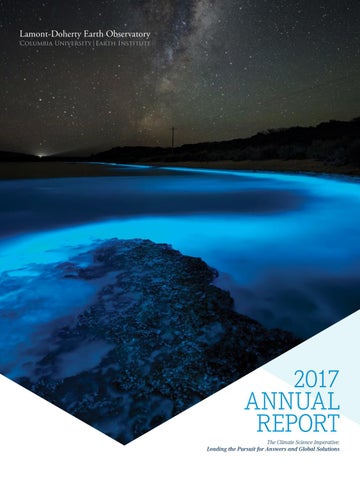
Cover: Bioluminescence (Jonathan Esling). This page: Visiting PhD student Brandon Grahm, Greenland Summer 2017 (Jason Briner)
REAL-TIME EARTH
ANTICIPATING EARTHQUAKES
CHANGING ICE, CHANGING COASTLINES
Lamont-Doherty Earth Observatory | Columbia University | 2017 Annual Report
EXTREME WEATHER & CLIMATE
LETTER FROM OUR DIRECTOR
Dear Friends, The past year has been one in which Earth’s climate has been much in the news. Hurricanes Harvey, Irma, and Maria and this year’s wildfire season in California have reminded us of the power of weather and climate extremes to threaten lives and devastate infrastructure. From the continuing loss of ice from the great ice sheets of Greenland and Antarctica to more frequent flooding of coastal areas, and from changes in rainfall patterns and the frequency and severity of droughts to warming and acidification of the world’s oceans, the effects of climate change can be felt by all plants and animals on the planet, from the largest mammals to the tiniest microbes.
Your contributions lead directly to improved understanding of our planet’s past and present, and enhance our ability to address the urgent environmental challenges ahead for all of us. We deeply appreciate the generosity of our donors and the scientific progress their gifts make possible.
Understanding Earth’s climate, how it has varied in the past, what factors influence both natural variability and global change, and what can be expected in the future on global to local scales is a topic of paramount importance to humanity. And it is a topic for which Columbia University and Lamont-Doherty Earth Observatory in particular have expertise of exceptional breadth and depth. Highlights of the year’s research at the Observatory described in this report illustrate these themes well. As part of Lamont’s Center for Climate and Life, Sonya Dyhrman and her group are elucidating with genomic and other molecular tools the function of and interactions among the microbes at the base of the marine food web, as well as the changes that can be expected to marine life in a warming world. Joaquim Goes and his group are studying the remarkable dinoflagellate Noctiluca scintillans, an invasive species that is outcompeting the native diatoms and other phytoplankton that once
anchored the base of the food web In the Arabian Sea. Kevin Uno and his colleagues are examining the isotopic signatures of buried biomarkers and fossil teeth in eastern Africa from the past several tens of millions of years, searching for signatures of past climate change on the evolution of vegetation and the diets of the region’s mammals, including the ancestors of modern humans. The pace of climate change is particularly rapid near Earth’s poles, and Lamont’s Initiative on Changing Ice, Changing Coastlines spans both polar regions. This past year, Robin Bell and Jonathan Kingslake showed that surface meltwater drainage systems on the Antarctic ice sheets and ice shelves are more widespread in the austral summer than previously appreciated, but determining whether such systems stabilize or destabilize the ice shelves will require more work. Joerg Schaefer, Gisela Winckler, and colleagues, from measurements of cosmogenic nuclides in bedrock recovered from the bottom of a 3-km-long ice core in central Greenland, deduced that Greenland must have been essentially ice free for substantial periods during the last Ice Age, a result suggesting that the Greenland ice sheet is more vulnerable to regional warming than previously thought. Progress continued apace on Lamont’s other strategic initiatives as well. As part of Lamont’s and Columbia University’s Initiative on Extreme Weather and Climate, Adam Sobel is leading a multi-disciplinary team studying the likelihood and impact of a major tropical cyclone that makes landfall in the vicinity of Mumbai, India, a coastal city of low elevation and dense population that has not seen a cyclone landfall since the 19th century. Under Lamont’s Anticipating Earthquakes Initiative, Anne Bécel and others deduced, from seismic images of the fault structure of the Alaska subduction zone acquired from the research vessel Marcus G. Langseth, that a segment of the plate boundary without a recent large earthquake has strong structural similarities to the site of the great tsunamigenic Tohoku, Japan, earthquake of 2011, suggesting that the tsunami risk in Alaska and other regions may have been underappreciated. As part of Lamont’s Real-Time Earth Initiative, Ryan Abernathey is leading the multi-institutional Pangeo project, which aims through new software to give climate scientists access to the rapidly expanding set of climate models of ever improving resolution and increasing size. The scientific progress described in this report and the many additional examples of new scientific findings by Lamont scientists this past year are enabled, in part, by the many friends, alumni, and staff who support our research and educational programs. Your contributions lead directly to improved understanding of our planet’s past and present, and enhance our ability to address the urgent environmental challenges ahead for all of us. We deeply appreciate the generosity of our donors and the scientific progress their gifts make possible. For another year, thank you for your support.
Sean C. Solomon Director
4
Lamont-Doherty Earth Observatory | Columbia University
2017 Annual Report
5
Fuchs Expedition 2016 to raise climate awareness. Apusiaajik Island, Eastern Greenland (Iain Rudkin @ www.iainrudkin.com)
6
The Climate Science Imperative:
A Global Commitment
Leading the Pursuit of New Knowledge for Global Solutions
This year has marked a time of heightened attention to climate change and fueled many of the questions that drive research at Lamont-Doherty. Concerns about climate change, sea-level rise, and extreme weather events, have shaped the public discourse. A combination of highly publicized scientific discoveries about climate change’s implications and a surge of political discussion thrust climate into headlines, spurring robust conversation, widespread media coverage, and two citizen marches on Washington. Understanding the biology, chemistry, geology, and physics of the Earth forms the scientific backbone for understanding climate change and the Earth’s response to change. This is where LamontDoherty Earth Observatory’s great strengths meet the world’s great need.
Lamont-Doherty Earth Observatory | Columbia University
Columbia University has been and continues to be the world leader in climate science. Lamont, which is home to the greatest breadth of Earth science research and largest concentration of Earth scientists of any academic institution in the nation, forms the core of Columbia’s climate research work. Lamont’s scientists seek to understand Earth’s future by analyzing the past history of climate change
recorded in ice cores, tree rings, glaciers, corals, land and ocean sediments and other natural archives. Lamont is home to pioneers in the use of technology, including underwater vehicles, aircraft, drones, and satellites, and operates the Marcus G. Langseth, an oceanographic research ship able to collect critical measurements, samples, and real time data world-wide. This unique range and depth of scientific investigation sets Columbia University’s climate response capacities apart. Today, with the growing body of evidence and information about the impact of climate change on myriad aspects of life on Earth, Lamont’s contribution to creating global solutions has never been more crucial, and more exciting.
2017 Annual Report
7
Expeditions and Discoveries In these pages you will learn how our scientists are seeking to define ramifications of the discovery of widespread water streaming across Antarctica; developing risk models to prepare Mumbai for extreme weather events; developing new technology to understand what is driving a planktonlike species to rapidly invade the Arabian Sea food chain, threatening fisheries that sustain more than 150 million people living at the sea’s edge; and investigating the microscopic organisms that exert mighty impact on our oceans and planet. Read on to find out more about how Lamont has been and continues to develop solutions to the world’s climate challenges, illuminating Earth’s complex dimensions, and producing new discoveries, breakthroughs, and the promise of transformational solutions. The RV Palmer off the coast of the West Antarctic Peninsula (Sonya Dyhrman)
From left to right: Lamont’s Nicolás Young in Greenland (Brandon Grahm). Sonya Dyhrman (right) working with students in Antarctica (Sonya Dyhrman). US Air National Guard C130 Hercules, picking up field crew from Raven Camp on the Greenland Ice Sheet after completing a field trip aimed at understanding surface melt in the accumulation zone of the ice sheet (Regine Hock, University of Alaska Fairbanks). Scientists from Lamont-Doherty
8
Lamont-Doherty Earth Observatory | Columbia University
prioritize conveying their work to a public audience, and strive to spark scientific understanding and curiosity in everyone, particularly children (María D. Hernández Limón). Matthew Harke (center) doing a “net tow” off the back of the RV Neil Armstrong in the Western North Atlantic (Bethany Jenkins). Deploying a CTD (oceanography instrument) off the side of the RV Palmer off the coast of the West Antarctic Peninsula (Sonya Dyhrman).
2017 Annual Report
9
CLIMATE & LIFE
The Ocean’s Mighty and Microscopic “Unseen Majority” The global ocean covers the majority of the planet and is essential to humanity’s survival, providing food and capturing and storing huge amounts of carbon dioxide from the atmosphere. As vast a role as the sea plays, its health and future depend on the tiny organisms that can’t be seen without a microscope. Questions about what makes these ocean microbes grow and thrive drive Sonya Dyhrman, a biogeoscientist at Columbia University’s LamontDoherty Earth Observatory, and her team as they travel throughout the world, sampling sea water, isolating microbes, and manipulating their environments during experiments, both aboard ships and back in the lab. “The unseen microbial world underpins fisheries, climate, and the very function of ocean ecosystems, and we want to know how those ecosystems are going to shift in the future,” explains Dyhrman.
10
“The unseen microbial world underpins fisheries, climate, and the very function of ocean ecosystems, and we want to know how those ecosystems are going to shift in the future” Micrograph of colonies of cynobacteria called trichdesmium. (Abigail Heithoff)
2017 Annual Report
11
CLIMATE & LIFE
In the ocean, microbes capture solar energy, catalyze key biogeochemical transformations of important elements, produce and consume greenhouse gases, and comprise the base of the marine food web. Dyhrman’s research seeks to understand the ocean’s ecosystem processes by studying a legion of creatures, most too small for the human eye to see. These are the tiny microbes called phytoplankton that roil beneath the ocean’s surface, taking in carbon dioxide and producing oxygen.
Below: Sonya Dyhrman at the microscope (Tom Kleindinst)
Of particular urgency are questions about what will happen to photosynthetic microbes or phytoplankton as the oceans warm, carbon dioxide levels in ocean water rise, and the nutrients on which they rely become scarce. These phytoplankton trap carbon dioxide and help it to travel to the bottom of the ocean. Carbon carried to depths is estimated to be on the same order of magnitude as the yearly global emissions from fossil fuel burning. Scientists estimate that since the Industrial Revolution the ocean has absorbed about half of the carbon dioxide emitted into the atmosphere from human activity, but scientists are not able to predict how the ocean carbon cycle will change in the future. How do you study what you can’t see? Dyhrman has been addressing this challenge using a new generation of tools that were born out of the human genome project. Her group uses genomic methods to track millions of DNA and RNA strands, and with that information reconstruct which microbes are present and what they are doing. This approach leverages a newly created database of millions of phytoplankton RNA strands contributed by scientists from labs around the world, with support from the Gordon and Betty Moore Foundation.
Fluorescent Micrograph of a population of diatoms (Sonya Dyhrman)
Fluorescent Micrograph of diatom chain (Sonya Dyhrman)
“We observed that diatoms can turn over their genetic machinery more quickly and more efficiently than other groups of phytoplankton” A recent study (http://www.pnas.org/content/ early/2015/10/09/1518165112.abstract) utilizing these genomic approaches focused on the activity of phytoplankton in the North Pacific, particularly diatoms, which create glass shells from silica and are important for sinking carbon deep into the oceans. Her group simulated blooms in phytoplankton communities and found that the diatoms stood apart for their rapid and large response to increases in nutrients. “We observed that diatoms can turn over their genetic machinery more quickly and more efficiently than other groups of phytoplankton,” Dyhrman notes. “This understanding will allow us to better predict how diatoms will react to changing ocean conditions.” Dyhrman adds that this study would not have been possible a few years ago, without recent and ongoing advances in genomic tools. Above: Micrograph of dinoflagellate, showing chlorophyll (reddish orange) within a cell (Sonya Dyhrman)
12
Lamont-Doherty Earth Observatory | Columbia University
2017 Annual Report
13
CLIMATE & LIFE
Off the coast of Hawaii, there is a large region of ocean trapped by currents known as the North Pacific Subtropical Gyre. This sequestered water forms an ecosystem that tends to be low in resources, such as nitrogen and phosphorus. It is a kind of ocean desert compared with coastal ecosystems that are nutrient rich. Here, the Dyhrman lab is taking part in an ongoing, collaborative effort known as the Study on Ocean Processes and Ecology, or SCOPE. The study, funded by a multi-million-dollar grant provided by the Simons Foundation, engages scientific partners around the world.
sunlit surface. The Dyhrman team ran experiments to understand how the upwelling of deep water, competition, and cooperation between microbes controls the growth of phytoplankton.
During the summer of 2017, the Dyhrman lab took part in a three-week ocean cruise to study an area of the North Pacific Subtropical Gyre where ocean currents create swirling features with diameters five times the length of Manhattan, called mesoscale eddies. The aim was to identify how mesoscale eddies shape the microbial ecosystem of the gyre. Eddies alter microbial dynamics by bringing nutrient-rich deep water up or by pushing it down away from the
This study, and the Dyhrman lab’s continuing investigations, provide crucial data to better predict how phytoplankton and their ability to take up carbon dioxide will respond to ocean changes in the future. The warmer the ocean becomes, the less water rises from deeper down, meaning that fewer resources will be brought to the surface water where phytoplankton live. Meanwhile, carbon dioxide levels in the atmosphere and ocean are rising.
“Microbes here can exist off of little more than sunlight and gasses in the air,” according to researcher Gwenn Hennon. “Marine microbes are expert recyclers, rapidly scavenging the precious little nitrogen and phosphorus fertilizers in the surface ocean. Some of these microbes can even take nitrogen directly from the air to use as fertilizer.”
re n t
Below: Sonya Dyhrman (center) mentors two researchers on the use of molecular approaches to understand photosynthetic marine microbes (Elizabeth Orchard)
ASIA
O
o hi s ya
r u C
s A la
Current ka
NORTH AMERICA
Below right: Scientists Matt Harke (left) and Bethany Jenkins (right) filter large volumes of water, in excess of 60 liters per sample, to collect phytoplankton for molecular techniques to investigate how phytoplankton, specifically diatoms, use nutrient resources (Stephanie Anderson (URI)
“If we want to know how much carbon dioxide is going to be captured by the ocean…we need to know what those microbes are doing.”
Scientists deploy a CTD, an oceanographic instrument for measuring conductivity, temperature and depth. The CTD consists of a rosette of bottles that can be triggered, manually or by computer, to close and capture water at pre-defined depths. This allows scientists to generate a map, or profile, of the biology and chemistry at different ocean depths (Sheean Haley)
Cu
Ca
HAWAII
N
o rt h
li f o r n i a
NORTH PACIFIC GYRE
Below left: Scientists Ben Van Mooy (left) and Matt Harke (right) collect phytoplankton from a site in the North Atlantic Ocean in May 2017. Phytoplankton were collected with a plankton net, deployed and dragged through the water by hand (Bethany Jenkins)
r r e nt
h Pacific C Nor t urrent
“If we want to know how much carbon dioxide is going to be captured by the ocean and shunted to the deep ocean and out of the atmosphere, we need to know what those microbes are doing,” says Dyhrman. “Half of the carbon fixation occurring around the globe is happening in our oceans,” she adds. Learning how ocean microbes interact with the environment is a crucial part of understanding our planet’s climate system.
Eq uato rial Counter Current urrent ter C n u o Equatorial C
14
Lamont-Doherty Earth Observatory | Columbia University
2017 Annual Report
15
CLIMATE & LIFE A view of the Turkwel River before it flows into Lake Turkana. Lake Turkana is the largest desert lake on Earth (Kevin Uno)
The Way We Were:
Climate and Human Evolution The story of human evolution is rooted in eastern Africa, where hominins, ancestral species directly related to humans, first appeared. A remote desert region around northwest Kenya’s Lake Turkana is the source of many important early human fossils and artifacts. This region is where Lamont-Doherty Earth Observatory paleoecologist and geochemist Kevin Uno has been collecting fossils and sediments, searching for evidence about the climate, vegetation, animals, and water available to our ancestors millions of years ago. Among Uno’s goals is to understand the role of climate in human evolution. “People are curious about how we as humans got here. I am trying to understand what role climatic change played in the evolution of our species,” said Uno. His early findings give us new information about the genesis of human life and raise fascinating new questions.
In a study released in June 2016, Uno and a team from Lamont, including geochemist Pratigya Polissar and paleoclimatologist Peter deMenocal, provided a 24-million-year record of vegetation trends in eastern Africa. The record lends weight to the idea that humans developed key traits – flexible diets, large brains, complex social structures, and the ability to walk and run on two legs – while adapting to the spread of open grasslands. The findings strongly suggest that between 24 million and 10 million years ago, long before any direct human ancestors appeared, there were few grasses and woodlands presumably dominated. Then, with an apparent shift in climate, grasses began to appear. The study shows that the trend continued through all known human evolution, leading to a dominance of grasses by a few million years ago. “The entire evolution of our lineage has involved us living and working in or near grasslands,” said Uno. This year, Uno participated in field expeditions to the Turkana Basin region on both the eastern and western sides of Lake Turkana. He and his team sought to learn more about how climate has varied during the past five million years.
16
Lamont-Doherty Earth Observatory | Columbia University
“People are curious about how we as humans got here. I am trying to understand what role climatic change played in the evolution of our species”
2017 Annual Report
17
CLIMATE & LIFE
“I wanted to go to the fossil hominin sites and see if we could use organic geochemistry tools, which is something we really had never done before. We want to learn new things about the climate, vegetation, and environmental context of our ancestors,” said Uno. The discovery of 3.3 million-year-old stone tools – the oldest in the world – led Uno to search for clues about the environmental context of early humans as they crafted and worked with these tools. Below: Research team crossing the Turkwel River en route to a fossil locality (Kevin Uno). Opposite page from left to right: Oldest stone tool site in the world, Lomekwi 3. Samples have been analyzed to characterize the environment of the earliest tool makers. Kevin Uno in the field. (Kevin Uno)
To reconstruct ancient habitats, Uno and his colleagues draw information from two sources: leaf waxes of plants that lived millions of years ago and are now preserved in fossil soils, and ancient mammal teeth, such as those from elephants and hippopotamuses. Chemical and isotopic analysis of those materials in laboratories at Lamont enables
scientists to discern the plants, animals, and water sources that were available in the ecosystem for these animals to eat and drink. “Teeth are unique because they form anywhere from a year to ten years in big animals, and that’s like a little data logger or time capsule from millions of years ago,” said Uno. His early analysis indicates that changing rainfall patterns, from one to two rainy seasons per year, may have had a significant effect on the vegetation and animals.
“I’m trying to understand the evolution of the modern system of two rainy seasons per year. When it’s really hot, as it is in eastern Africa, water matters. You add rain and things get green and animals are happy, whereas long dry spells are very challenging for them. How did hominins cope with changes in the availability of their food sources? That’s one of the questions I’m working on by analyzing teeth.” By tracing the biomarkers on ancient plant waxes, Uno gets a broader perspective on the vegetation history of the region.
“A big question to me is, how long has the two rainy season mode of operation been in existence?” Uno’s preliminary data points to a single annual rainy season around 3.5 million years ago.
“I wanted to go to the fossil hominin sites and see if we could use organic geochemistry tools, which is something we really had never done before. We want to learn new things about the climate, vegetation, and environmental context of our ancestors”
18
Lamont-Doherty Earth Observatory | Columbia University
2017 Annual Report
19
CLIMATE & LIFE
“If you look at isotopes in teeth, they’ve been filtered through the dietary choices of the animal. But with the plant wax biomarkers, you’re looking at actual remnants of ancient plants, and they record the entire landscape. They are preserved for millions of years because these waxy coatings on leaves are made up of saturated hydrocarbons, which are very tough to break down.” Climate is a key factor determining the types of vegetation that can grow in an ecosystem. By recreating the plant foods and habitat available at a given time, it is possible to learn about changes that occurred during important transitions in the evolution of humans. Of particular interest to Uno is a time period known as the Pliocene epoch, which was the last time Earth experienced atmospheric CO2 levels as high as they are today. Then CO2 levels were at about 400 parts-per-million (ppm), and that is approximately where they are right now. The Pliocene occurred between 5.3 and 2.6 million years ago, a time span when many mammals and birds evolved into roughly modern forms and when early hominins first appeared. Uno explains that of all the Turkana Basin fossils believed to be from the Pliocene, less than one percent are from hominins. Scientists believe that finding indicates that few hominins inhabited Earth compared with other animals. They have also discovered a variety of hominin species. “Over the last five years we have found there was a much higher diversity of hominins in the Pliocene, five to six species more than originally thought,” said Uno. It has been impossible to determine which are our direct ancestors. “It’s been like looking for a needle in a haystack.”
“I find it fascinating that our hominin ancestors were so low in abundance, perhaps just tens or hundreds of thousands, but now there are 7.5 billion of us. It’s hard to imagine this, but for a long time, hominins were not the dominant species on the Earth as we are today,” said Uno. Exploring the environmental context of the Pliocene epoch will help tell the story of who these hominins were, why there were distinct species, and possibly how and why one form led to the evolution of modern humans. “Today we are heading into a warmer world, one with more severe weather and whole host of other challenges that our societies will face. It’s important to pause and take a look back from where we came.” Uno notes, “The hallmark of modern humans is that we are so adaptable. It’s a wonderful thing about our species.”
“Today we are heading into a warmer world, one with more severe weather and whole host of other challenges that our societies will face. It’s important to pause and take a look back from where we came.”
As painstaking as Uno’s research is, profoundly important questions drive his work. Opposite page: Uno (far right) and colleagues after a long day in the field on the eastern shore of Lake Turkana (David Braun)
20
Lamont-Doherty Earth Observatory | Columbia University
2017 Annual Report
21
CLIMATE & LIFE Maldives-Blue Sand, Arabian Sea (Wei Hung He)
Collateral Consequences:
Climate Change and the Arabian Sea By night they glimmer, lighting up the surf of the Arabian Sea a phosphorescent blue. By day they appear as a thick, slimy, malodorous green blanket over the ocean. Nicknamed “sea sparkle” for their nocturnal appearance, these unusual plankton-like species are silently taking over the base of the regional food chain and threatening fisheries that sustain 150 million people. They are Noctiluca scintillans, a dinoflagellate that were all but unheard of in the Arabian Sea 20 years ago, but they are now demonstrating a unique capacity to survive, thrive, and force out diatoms, the planktonic species that traditionally support the Arabian Sea food web. Typically, diatoms are gobbled up by small sea animals, or zooplankton, which are in turn eaten by larger fish and sea creatures. Noctiluca has short-circuited this system.
22
Lamont-Doherty Earth Observatory | Columbia University
These 1-millimeter-sized creatures have tail-like flagella, which enable them to move around as well as gather and eat other microscopic plankton (living or dead). The flagella also allow the organisms to swim up to the light, drawing energy that nourishes thousands of green algae, or “endosymbionts,” living within Noctiluca’s globular, transparent cells. This dual mode of obtaining food and energy for growth and survival gives the species an edge over diatoms and other phytoplankton, which survive on sunlight and photosynthesis alone. The blooms first appeared in the late 1990s. Since then they have grown and spread, creating destruction and alarm in their stinky green wake. “This is probably one of the most dramatic changes that we have seen that’s related to climate change,” said Lamont-Doherty Earth Observatory oceanographer Joaquim Goes. “We are seeing Noctiluca in Southeast Asia, off the coasts of Thailand and Vietnam, and as far south as the Seychelles, and
everywhere it blooms it is becoming a problem. It harms water quality and causes a lot of fish mortality,” said Goes.
“This is probably one of the most dramatic changes that we have seen that’s related to climate change”
2017 Annual Report
23
CLIMATE & LIFE
Blooms of Noctiluca Scintillans in the northern Arabian Sea, seen by satellites form space (Norman Kuring/NASA)
Goes and Lamont oceanographer Helga do Rosario Gomes are among a team of researchers who have been studying this organism for the past 15 years. They recently teamed up with Lamont’s Ryan Abernathey, a physical oceanographer, and Columbia Data Science Institute’s Tony Jebara, a computer scientist, to use hydrodynamic models and machine learning techniques to study the evolution of Noctiluca blooms in the Arabian Sea, visible in daily images captured by NASA satellites. Satellite technology as well as field and ongoing
24
Lamont-Doherty Earth Observatory | Columbia University
laboratory experiments have enabled scientists to link the algae to higher concentrations of CO2 and lower levels of O2 in the Arabian Sea, changes that are driven by climate change and shrinking of the glaciers and snow cover in the Himalayas. “We have evidence to show that snowcaps have been diminishing considerably since the late 1990s, exactly the time Noctiluca began appearing,” Goes said.
“We have evidence to show that snowcaps have been diminishing considerably since the late 1990s, exactly the time Noctiluca began appearing.”
As snow retreats from the Himalaya-Tibetan plateau, the Indian subcontinent has grown hotter in summer compared with the Arabian Sea, causing the summer monsoon winds blowing toward India to strengthen. Stronger winds bring up more nutrients off the coasts of Somalia, Yemen, and Oman; Goes and his collaborators estimate that this change has triggered a ~350 percent increase in phytoplankton between 1997 and 2004. “This nutrient-rich water comes to the surface and causes a huge bloom of normal phytoplankton – one would expect this to be good for fisheries,” Goes remarks. The problem is that the Arabian Sea has become over productive, and zooplankton that feed on phytoplankton cannot keep pace.
2017 Annual Report
25
CLIMATE & LIFE
As a result, these phytoplankton are uneaten and die of other causes. Bacteria then act upon them, consuming oxygen from the water in the process. Falling oxygen levels have favored Noctiluca in its competition with diatoms and other phytoplankton. Unlike diatoms, Noctiluca thrive in low-oxygen water. The impact of the spreading blooms is vast and growing, especially in Oman, where locals have depended on artisanal fishing for centuries as their major source of protein. Thick blooms reduce visibility, making it difficult for divers to repair ships underwater. They clog the intake pipes of the desalinization plants that produce up to 90 percent of the country’s fresh water, affect the intake waters for refineries, and are a deterrent to tourists who come to Oman for rest and recreation. “It’s affecting every facet of industry, tourism as well,” Goes said. The viscous green muck discourages swimming.
Above: Dr. Ed Buskey holding beaker. Noctiluca, a single cell mixotrophic dinoflagellate hosts thousand of tiny photosynthesizing endosymbionts (Joaquim Goes/ Lamont). Right: Single cells of the 1mm Noctiluca collected from the Arabian Sea (Joaquim Goes/Lamont). Opposite page: Waves colored dark green by a large Noctiluca bloom washing off a pristine beach near Muscat, Oman (Joaquim Goes/ Lamont)
26
These impacts have imparted an urgency to Noctiluca research. Among the priority projects, NASA has provided Goes and his colleagues nearly one million dollars to develop decision support for Oman. The study partners scientists from Lamont, the Ministry of Agriculture and Fisheries Wealth, the Marine Sciences and Fisheries Centre, and Sultan Qaboos University to build upon previous NASA-funded efforts to develop a Decision and Information System for the Coastal waters of Oman (DISCO). With remote sensing and modeling information, DISCO will provide decision makers and stakeholders in Oman tools to manage coastal resources. For example, with enough warning the aquaculture industry can mobilize in advance of an outbreak, moving fishery cages to “safer” regions before Noctiluca invade. Local bodies, such as the Ministry of Agricultural and Fisheries Wealth in Oman and the Sultan Qaboos Cultural Centre, are also partnering to understand and develop strategies to mitigate and arrest the spread of Noctiluca.
Lamont-Doherty Earth Observatory | Columbia University
To dive deeper into an understanding of Noctiluca, Goes turned to renowned nanoscientist Ken Shepard, Lau Family Professor of Electrical Engineering and Biomedical Engineering at the Columbia School of Engineering and Applied Science. Shepard has been leading breakthrough research using extremely small microchips, known as nanochips. Together, Goes and Shepard and their teams are experimenting with the Noctiluca culture and plan to insert electronic microchips into the food and central chambers of the organism by either “microinjection” or “feeding” them directly to the Nocticula. Once implanted, the chip will give researchers a chance to monitor how this organism routinely functions and how it responds to different changes in environmental conditions.
Efforts to understand Noctiluca in order to control the spread of these blooms are leading Goes and his team to probe the intracellular environment of the organism to fathom how it functions, thriving in oxygen-deprived environments, conditions that stunt and kill most other creatures. They want to know why, when all other organisms die, Noctiluca survive.
“Noctiluca is a huge problem. I’ve been to different parts of the world, as far north as the Arctic, and down to the Antarctic, but I’ve never seen anything like this. This is the most rapid and striking shift in the marine biosphere that has taken place in the last 15 years, and it’s affecting the Arabian Sea ecosystem severely,” said Goes. Each year the bloom occupies an area thrice the size of Texas. This is huge by any standards. If CO2 levels in Earth’s atmosphere continue to rise, these blooms could become even more widespread, affecting millions more people.
“This organism is unique. It survived in our lab for about two and a half years without any nutrients. It’s a new branch of food web dynamics”
Through their studies, they hope to stop the seemingly unstoppable. Studying live culture in the lab, Goes and Gomes work with a team of undergraduate and high school interns to understand what causes the endosymbiont population within Noctiluca to thrive. They have seen that the Noctiluca is able to use its flagellum to pick food directly or create a vortex around the cell, drawing food into the organism’s food chamber, where enzymes eventually break down the food and release ammonia, urea waste, and CO2 into the chamber that houses the endosymbionts. Aspects of the organism’s metabolic processes remain a puzzle. Specifically, researchers want to know how the endosymbiont organisms manage to survive in the small environment within Noctiluca and what process makes the Noctiluca extraordinarily resilient even under conditions that are hostile for other plankton. “This organism is unique. It survived in our lab for about two and a half years without any nutrients. It’s a new branch of food web dynamics.” said Goes.
2017 Annual Report
27
CHANGING ICE, CHANGING COASTLINES
Antarctica ice sheet (Adobe Stock)
Understanding Antarctica:
New Discovery
Thousands of meters of ice cover Antarctica. The fate of its ice sheets has a direct impact on the Earth’s populations, because when land-based ice melts, it raises sea level, and that can threaten coastal communities and economies. The Antarctic Ice Sheet is large enough to raise worldwide sea level by more than 60 meters if melted completely. If just part of that ice – the West Antarctic Ice Sheet – were to melt into the ocean, it would raise global sea level by 6 meters. As important as Antarctica and its ice are to the rest of the planet, there is still much unknown about the continent. This year, Lamont-Doherty Earth Observatory’s polar scientists working within the Changing Ice, Changing Coastlines initiative completed the world’s first Antarctica-wide hydrological survey, and this project yielded an important discovery: an extensive drainage system of water flowing over parts of Antarctica’s ice. While researchers already knew that surface drainage features exist, they assumed they were confined mainly to Antarctica’s fastest-warming, most northerly regions.
28
Lamont-Doherty Earth Observatory | Columbia University
“This research hopefully gives people a new sense of urgency in that there’s a whole collection of interesting processes going on upon the surface of Antarctica that we hadn’t known about”
2017 Annual Report
29
CHANGING ICE, CHANGING COASTLINES
Above: Meltwater ponds and flows over ice near Amery Ice Shelf, East Antarctica, Jan 6th 2016 (NASA-Landsat8). Opposite page clockwise from top left: Jonathan Kingslake on fieldwork on the Antarctic Ice Sheet (J. Kingslake). Melting ice, Antarctica (Adobe Stock); Meltwater ponding on George VI Ice Shelf, Antarctic Peninsula, Jan 12th 2003 (NASA-Landsat 7)
30
The Lamont team demonstrated that these surface waters are both widespread and dynamic, streaming across the surface of the continent. “This research hopefully gives people a new sense of urgency in that there’s a whole collection of interesting and potentially important processes going on upon the surface of Antarctica that we hadn’t known about,” said Lamont glaciologist Jonathan Kingslake.
Lamont-Doherty Earth Observatory | Columbia University
In 2010, when Kingslake was still a Ph.D. student, he happened upon hints of this important discovery while studying Antarctica’s surface on Google Earth. Zooming in on the high-resolution imagery, he glimpsed streaming water and ponds in areas that scientists would not expect them. The finding became a chapter in his thesis.
Kingslake and colleagues systematically cataloged images of surface water in photos taken from military aircraft from 1947 onward and satellite imagery from 1973 on. They discovered nearly 700 seasonal systems of interconnected ponds, channels, and braided streams fringing the continent on all sides. Some run as far as 75 miles, with ponds up to several miles wide. The drainage systems start as far south as 375 miles from the South Pole, and at 4,300 feet above sea level, where large volumes of liquid water were generally thought to be extremely rare.
“When I got here to Lamont, I had the chance to research further,” said Kingslake.
Scientists want to know, with the warming projected for the next century, if these systems might influence the great ice shelves that ring the continent. Some researchers are concerned the ice shelves could collapse. Ice shelves jut out over the ocean from the massive ice sheets covering the continent and are important for Ice Sheet stability. Should the buttressing effect of the ice shelves be removed, seaward flow of the ice sheets would likely accelerate, markedly increasing the rate of sea-level rise.
“Ice is dynamic and complex, and we don’t have the data yet.”
2017 Annual Report
31
CHANGING ICE, CHANGING COASTLINES
In 1995 and 2002, two of Antarctic Peninsula’s ice shelves (Larsen A and B) suddenly disintegrated into the ocean within weeks. The glaciers the ice shelves had held back started flowing at eight times their previous speed. Scientists now suspect that pooling of water was at work; liquid water is thought to be capable of triggering ice-shelf collapse by flowing down into and enlarging fractures in the ice. Antarctica is already losing ice as a result of these and other processes, but the direct effects of meltwater are generally thought to be restricted to the most northerly, warmest parts of Antarctica. The concern among glaciologists is that this geographic pattern could change in the future. An accompanying study led by the lead scientist for Lamont’s Changing Ice, Changing Coastlines initiative, polar geophysicist Robin Bell, found that longtime drainage on West Antarctica’s Nansen Ice Shelf may actually be helping keep the shelf intact. The elaborate river-like system on the 30-mile-long shelf was first observed in 1909 by a team from the expedition led by British explorer Ernest Shackleton. Aerial imaging and remote sensing since then show that it has remained remarkably stable, efficiently draining excess meltwater during summer through a series of deep sinkholes and a roaring 400-foot-wide waterfall at the ocean’s edge.
“It could develop this way in other places, or things could just devolve into giant slush puddles,” said Bell. “Ice is dynamic and complex, and we don’t have the data yet.” “We want to know if this water moving across the surface plays a role in making ice shelves vulnerable to collapse. Does water moving across the surface like a river system constitute an important process? Given that we see the water moving hundreds of kilometers, there’s a good possibility that it could turn out to be significant. We just don’t know,” said Kingslake. To accurately determine how the ice sheet will react to the streaming water, researchers plan to take a closer look at the system. Understanding the drainage of water across ice shelves and how it impacts ice shelf dynamics is the focus of multiple research projects now in the planning stage. “We’ve added another thing to the list of processes that we need to understand,” said Kingslake.
Melting ice
Pooling of surface water enlargeing fractures in the ice shelf
“liquid water is thought to be capable of triggering ice-shelf collapse by flowing down into and enlarging fractures in the ice.”
Calved icebergs
Water level Grounding line
32
Lamont-Doherty Earth Observatory | Columbia University
This page: Antarctica Larsen C ice shelf rift, November 2016 (John Sonntag, NASA-GSFC)
2017 Annual Report
33
CHANGING ICE, CHANGING COASTLINES 34
Greenland (Jason Briner)
Greenland’s Green Past
Lamont-Doherty Earth Observatory | Columbia University
A combination of processes determines future sea level rise: thermal expansion of the oceans (the seas swell when water warms); the melting of the ice sheets that cover Greenland in the extreme north and Antarctica in the extreme south; and mountain glacier retreat, the melting of glacial ice on Earth’s mountain ranges. Projections of sea-level rise by the end of this century hover between two and three feet, but many, including predictions compiled and synthesized by the Intergovernmental Panel on Climate Change, do not take Greenland into account. For decades, scientists believed that the Greenland Ice Sheet is relatively stable compared with the vulnerable West Antarctic Ice Sheet. Two Lamont scientists questioned this assumption about Greenland’s ice and wanted to take a much closer look.
To find answers, Lamont geochemists and climate scientists Joerg Schaefer and Gisela Winckler needed to obtain a portion of what is one of Earth’s rarest geologic samples, the only bit of bedrock yet retrieved from the base of the Greenland Ice Sheet, drilled from nearly two miles below the summit of the ice sheet and into the bedrock more than two decades ago.
2017 Annual Report
35
CHANGING ICE, CHANGING COASTLINES
Gisela Winckler and Joerg Schaefer (Jason Briner)
“It is the most expensive piece of rock ever retrieved on Earth”
“It is the most expensive piece of rock ever retrieved on Earth,” said Schaefer. The National Ice Core Laboratory in Lakewood, Colorado, where the core is archived granted the scientists a small portion to subject to geochemical analysis.
Both Schaefer and Winckler specialize in an analytical process that dates samples with cosmogenic nuclides, isotopes produced by tiny particles from outer space that constantly bombard the planet. Specific isotopes are characteristic of exposure to the open sky. Winckler and Schaefer posited that if they could access the surface of Greenland that lies beneath the ice sheet, they could test for the presence of these isotopes and thereby illuminate the history of Greenland’s ice cover, giving scientists a clearer picture of its stability. What they discovered upends aspects of the world’s understanding of polar ice and its impact on the future of the planet. “The two nuclides we analyzed clearly told us the bedrock that sits underneath the summit of Greenland was exposed for a substantial amount of time,” Schaefer explained. “This simple measurement gets rid of the idea that Greenland is a stable ice cube,” said Schaefer. “The fact that we measured a certain amount of these cosmogenic nuclides means this whole thing was open to the sky. All of the ice was gone,” said Winckler.
36
Lamont-Doherty Earth Observatory | Columbia University
Their analysis shows that Greenland was deglaciated for extended periods during the Pleistocene epoch (from 2.6 million years ago to 11,700 years ago), on the basis of their measurements of cosmic-rayproduced beryllium and aluminum isotopes in the bedrock core. Within the rock, the scientists found traces of radioactive beryllium-10 and aluminum-26. The isotopes decay at known rates, and since they cannot be created if the rock is covered with ice, their abundance can be tied to the time when the rocks were exposed. Modelers agree that the region where the core was taken would be one of the last to melt were the ice sheet to disappear. The authors thus concluded that the ice sheet must have been down to less than 10 percent of its current mass when this site was ice-free.
2017 Annual Report
37
CHANGING ICE, CHANGING COASTLINES
“Unfortunately, this makes the Greenland ice sheet look highly unstable,” said Schaefer. “If we lost it during periods of natural forcing, we may lose it again.” With human-induced warming now well underway, loss of Greenland ice has approximately doubled since the 1990s; during the last four years, by some estimates, it shed more than a trillion tons. Jeff Severinghaus, a paleoclimatologist at the Scripps Institution of Oceanography who was not involved in the study, called the evidence “very direct and incontrovertible.” The study “challenges some prevailing thought on the stability of the ice sheet in the face of anthropogenic warming,”
he said. “We can now reject some of the lowest sea-level projections, because the models underpinning them assume continuous ice cover during the last million years.” Scientists disagree about which potential forces might tip the Greenland ice into quick decline. These could include water percolating from the surface to lubricate the ice sheet’s base, or massive ice streams discharging icebergs into the ocean. “That’s the big worry, not today or tomorrow, but that there could be something in the system that is
catastrophic. All of a sudden, not gradual, and then the ice is breaking up,” said Winckler. “Our study steered the entire research field away from the idea that Greenland is a stable ice cube to, ‘oh, my God, Greenland is not stable,’” said Schaefer. “We are missing something big.” These findings will inform new models of Greenland’s ice. Winckler and Schaefer say their next step is to obtain funding to do a more comprehensive study of the bedrock beneath the ice, to develop a more detailed picture of the past, present, and future of the Greenland Ice Sheet.
“Our study steered the entire research field away from the idea that Greenland is a stable ice cube to, ‘oh, my God, Greenland is not stable”
Greenland (Jason Briner)
38
Lamont-Doherty Earth Observatory | Columbia University
2017 Annual Report
39
PROFILE: ROBIN BELL 40
Lamont polar explorer Robin Bell’s office is nest-like, feathered with a welcoming clutter of photographs, drawings, and other mementos of a career marked by pioneering travel to the literal ends of the Earth. At her desk, Bell appears comfortably at home, often tucking bare feet beneath her to sit cross-legged on her office chair as she hovers over the images on her computer screen. Bell, a 1989 graduate of the Columbia Graduate School of Arts and Sciences, is one of the world’s leading polar investigators and has been tracking ice for thirty years. She has coordinated ten expeditions to Antarctica and Greenland. And although she took her first expedition to Antarctica back in the 1980s, there is nothing routine about her approach. Ask about the near completion of the landmark Rosetta-Ice project she is currently leading, and Bell radiates excitement. The study, named for the enigmatic stone containing a decree written in three languages that led to the decoding of Egyptian hieroglyphics, is a large multidisciplinary and multi-institutional endeavor with several major goals tied to different parts of the ice shelf system. Bell and her colleagues developed this research enterprise to monitor and map the world’s largest block of floating ice. For two years, the Rosetta-Ice team has been flying over Antarctica’s Ross Ice Shelf, assembling an unprecedented view of its structure and hints of how that structure has been changing over time. Rosetta will fly for the last time this fall, but the project’s scientific legacy will continue to thrive for years to come.
Lamont-Doherty Earth Observatory | Columbia University
Once completed, the Rosetta-Ice Project will be a critical milestone in climate science.
Robin Bell: In Her Own Words
“These data are going to be the basis for people to understand how ice shelves work for decades,” said Bell. “People are going to be able to go back and measure the ice exactly where we flew to see changes. It’s going to become a benchmark dataset. It’s a beautiful thing.”
Q: Where did you grow up? What are some of your earliest memories?
Her excitement about Rosetta and the resulting dataset are indicative of Bell’s commitment to her science. Bell leads research on ice sheets, plate tectonics, and river systems, and heads up the development of technology to monitor our changing planet. As chair of the National Academy of Sciences Polar Research Board, she was instrumental in launching International Polar Year 2007-2008, a major multinational push to study the polar regions. In 2016, Bell was elected by her peers to be president-elect of the American Geophysical Union (AGU). The professional scientific organization has more than 65,000 members in 139 countries. Its Fall Meeting is the premier opportunity each year for scientists from across disciplines to share their latest research and develop new collaborations. Bell assumes the presidency in 2019, the 100th anniversary of the AGU. The honor of being selected to lead AGU is the latest in a thriving, extraordinary career.
I grew up in a small city in New Hampshire with lots of snow. I spent summers on Nantucket with my great aunt, who routinely picked up and drove to Alaska in her VW camper with her lifelong companion Liz and her dogs Q: Were you an avid science student as a child? I loved Jacques Cousteau and learned to scuba dive very early. I also loved chasing and marking toads in my backyard, and I went into hidden ice caves in New Hampshire with my dad who kept maps of all sorts of things. I still have his New Hampshire maps on a bookshelf in my office. Q: Were either of your parents scientists? My dad was a lawyer but collected maps. He always had U.S. Geological Survey topographic maps in a book in the car, long before you could buy them everywhere. My mom was an occupational therapist. I’m not sure the doors were open to her to be a scientist. Q: Did you always want to be a scientist? Ha! My family wanted me to be a lawyer. Q: What is the most exciting aspect of your work? I love the wonder of understanding our world and how much there is to discover. Q: What do you hope to accomplish as president of the AGU? The AGU is the leading group of scientists studying Earth and space science in the world. I will be president during the 100th anniversary, which I see as a chance to reflect but also to look forward. I want to work to help us communicate the wonder of our science and how it matters to our everyday lives. The AGU is leading the way to making science work better, for example, by addressing issues of harassment and bullying. I hope to help the AGU serve as a model of how science should be a fair and open place. Q: How concerned are you about the future of our planet? I am concerned, but I believe if we recognize the beauty of our home planet we can work together to make it a sustainable place to live. Q: If you could communicate one idea to the entire world, what would it be? I would urge everyone to discover how our planet works and to explore its beauty. Together we can work to make a [sustainable] home for us all.
2017 Annual Report
41
EXTREME WEATHER & CLIMATE
Mumbai’s Measured Risk Mumbai, India, a coastal city on the Arabian Sea where tropical cyclones have been relatively rare, is the focus of a leading-edge study underway by the LamontDoherty Earth Observatory’s Initiative on Extreme Weather and Climate. Professor Adam Sobel is initiative director and conceptualized the Mumbai project to assess the city’s risk of experiencing a tropical cyclone. “While several cyclones did strike the city during the 17th, 18th, and 19th centuries, Mumbai’s more recent history has not seen a significant cyclone landfall. But recent history is not an adequate guide to the future where extreme weather events are concerned. Just ask any resident of New York City,” said Sobel. Sobel, the author of a critically acclaimed book about Superstorm Sandy, points out that the catastrophic flooding that accompanied the landfall of Sandy in 2012 had also seemed a remote possibility. New York before Sandy had experienced no severe impacts from a hurricane landfall since 1821.
42
“But having Sandy still fresh in our minds helps to motivate this [Mumbai] project.” The decision to focus specifically on Mumbai grew out of a conversation with world-renowned novelist Amitav Ghosh. Mr. Ghosh reached out after reading Dr. Sobel’s book about Superstorm Sandy, “Storm Surge: Hurricane Sandy, Our Changing Climate, and Extreme Weather of the Past and Future.” “Amitav contacted me about the possibility of a Mumbai cyclone,” said Sobel. And his inquiry opened up the question and became the impetus for the research.
2017 Annual Report
43
EXTREME WEATHER & CLIMATE
Unique Vulnerabilities
Predicting the Unpredictable
Sobel says if a serious cyclone were to strike Mumbai, the results could be catastrophic because the city is very low-lying and heavily developed right to the shore.
The core of the research relies on novel models, developed at Lamont, to study both tropical cyclone probability and the physics of storm surge. These computer models project risks far into the future. Climate change is part of the calculation.
“That’s exactly the recipe for an awful disaster: high vulnerability and low awareness of the risk. Emergency planning is crucial.” Sobel proposed the “Storm surge risk to Mumbai” project early last year and secured support from the Global Innovation Fund for a small project. Mumbai’s physical characteristics expose the city and its residents to great harm should a cyclone make landfall. Mumbai’s low-lying coastal geography, infrastructure, and dense population make it vulnerable to cyclone-driven storm surge and catastrophic flooding. The city is largely built on reclaimed land and would be severely flooded by a storm surge of a few meters’ height, such as even a moderately severe cyclone could produce. Dr. Kyle Mandli, a Columbia University Assistant Professor and a member of the research team, has performed preliminary simulations showing that the depth and shape of the ocean bottom offshore appear conducive to such a surge. Recent development of the city has been rapid and has removed much of the natural capital, such as coastal mangroves and floodplains, which would historically have offered protection.
“That’s exactly the recipe for an awful disaster: high vulnerability and low awareness of the risk. Emergency planning is crucial.”
Top: Outside of Haji Ali Dargah Mosque in Mumbai (Suzana Camargo). Above: Off the coast of Worli, southern Mumbai (Suzana Camargo)
Lamont-Doherty Earth Observatory | Columbia University
27 Most Intense Synthetic Tracks
20°N
“Our preliminary assessment indicates that the city currently has all the ingredients in place for a truly awful disaster. This prospect motivates the need for a proper, quantitative, scientific assessment of this risk, which is the goal of the research component of our project,” said Sobel.
The project is also exploring the impacts of climate change and sea-level rise. Since the sea would start at a higher level if a storm strikes, the resulting storm surge would cause a deeper flood than it would have done in the past when local sea level was lower.
44
30°N
To measure the risk, Sobel and the research team, including Lamont Research Professor Suzana Camargo, Associate Research Scientist Chia-Ying Lee, Professors Kyle Mandli and Michael Tippett from the Department of Applied Physics and Applied Mathematics, and researcher Zachary Burt from the Mailman School of Public Health, are working first to calculate the probability of an intense tropical cyclone making landfall in Mumbai. Second, they are gauging the storm surge and total flood level that would result from a tropical cyclone landfall. Both steps are carried out for a range of possible tracks, intensities, and sizes of the tropical cyclones, to properly characterize the risk in a probabilistic way. Because tropical cyclones are not simulated well in global climate models, the tropical cyclone calculation requires a specialized model for “downscaling” – that is, simulating tropical cyclones given information about the large-scale climate. Researchers generate a large set of synthetic tropical cyclones from which they can estimate the probability of landfalls that are too rare to be well represented in the historical record. Sobel and colleagues have developed a prototype tropical downscaling model, which is unique and also “open source,” or available to the public and other researchers. The team will compare their simulation to another, currently available, model so they can compare the two models for a better estimate.
10°N
10°N 50°E
60°E
“I anticipate by the end of two years we will have a risk assessment of the probability of a cyclone and estimates of the flooding threat. However, we are now expanding the scope of the project to explore the potential economic and health impacts of flooding.” Dr. Sobel has begun seeking additional funding and exploring scientific collaborations in order to continue this direction of research.
70°E
Above: 27 Most Intense Synthetic Tracks
“Our preliminary assessment indicates that the city currently has all the ingredients in place for a truly awful disaster”
2017 Annual Report
45
EXTREME WEATHER & CLIMATE
Partners in Problem-Solving
Right: Initiative team meets with Columbia U alumni Matias Echanove, co-director of Urbz Research Institute (Suzana Camargo). Below: Mumbai/India 29 August 2017 (Shutterstock)
The study is a collaboration with the Columbia Global Center in Mumbai. The Mumbai site is one of eight Columbia University Global Centers. At each Center, the university seeks to form collaborations with regional communities and scholars to explore solutions to the world’s biggest problems. Mumbai Global Center Director Ravina Aggarwal has embraced the Lamont project as an opportunity to raise awareness about Mumbai’s extreme weather risk.
“Even though cyclones may not be seen as the imminent threat in a city that is resource-crunched and does need to make choices, the study enables people who care about climate to come together. The potential of the planning for avoiding disaster at various intervals becomes stronger,” said Aggarwal. The project also aligns with a newly launched university priority, Columbia World Projects, or CWP, which is committed to harnessing the power of the University to have the greatest possible impact on global problems. Dr. Sobel said, “We’re coming from here where we have a global university but have been informed by our own local disaster.” By advancing this work before Mumbai faces the reality of what could happen if a tropical cyclone hits, Mumbai will have the information and insightful strategies to save property and lives.
46
Lamont-Doherty Earth Observatory | Columbia University
Infared satellite image showing the west coast of India (in yellow) and the clouds from a Tropical Cyclone “03A” (NOAA)
2017 Annual Report
47
PROFILE: ADAM SOBEL
“They would ask if we should build sea walls around the New York Harbor and if the city could’ve done more to be better prepared. I didn’t have ready answers to these questions. The tremendous interest the public showed in our work was very motivating and inspired me to work on areas of great public impact,” said Sobel. The Mumbai project (see page 42) is one of the products of this exploration.
“Sandy changed my life in profound ways,” says Adam Sobel. Sobel is the founding director of Columbia University’s Initiative on Extreme Weather and Climate, a cross-disciplinary collaboration among a variety of units, research groups, and individuals across the university that is centered at Lamont. In October 2012, when Superstorm Sandy struck, Sobel, a leading scientist in the study of extreme weather and climate, became a magnet for media. “When you talk to the media about an event that’s just happened, it’s very different from writing a scientific paper. The questions they ask are not always tuned to one’s expertise.” Sobel found that among the broad range of questions were many that involved speculative scenarios.
48
Lamont-Doherty Earth Observatory | Columbia University
Today, five years after Sandy, Sobel has given many lectures and written a highly regarded book, Storm Surge: Hurricane Sandy, Our Changing Climate, and Extreme Weather of the Past and Future. As recent hurricanes Harvey, Irma, and Maria delivered destruction to parts of the world, Sobel was again called upon to explain to the media the climate dynamics influencing each storm’s size and path. As Sobel’s work continues to grow in significance and urgency, one of his key priorities continues to be educating the public about the present and imminent dangers of extreme weather, climate change, and sea level rise. “Worldwide, people worry about an increased risk from tropical cyclones. The latest models suggest the total number of tropical cyclones, globally, is likely to go down, but the same models predict with greater confidence that these storms will all get a bit stronger. And while scientists are still debating whether we can see those changes yet, we know sea level is rising, and that is a serious concern.”
Adam Sobel: In His Own Words Q: What led you to pursue a research career? I first wanted to be a musician and tried for a couple years, supporting myself by working as a sound engineer and on TV and radio ads in a commercial studio. I eventually decided to give up and go back to school. I thought I'd go to graduate school to study physics, but my wife (girlfriend at the time) gave me the idea of pursuing meteorology and, though she didn't try particularly hard to convince me, I eventually came to see it her way. Q: What is the most challenging aspect of your work? From a science point of view, the biggest challenge in working on understanding and predicting extreme weather events is the lack of historical data sets. During 30, 50, or even 100 years of data, there are very few really big extremes to reference. Q: How concerned are you about the future of climate research? In the long term, I think climate research will be OK, because the current climate denial won't be sustainable forever, and our work will come to be seen as essential. In the short term, I’m very concerned. Q: What concerns you the most about the state of the planet? Climate change is essentially irreversible. Due to the carbon already in the atmosphere, we will see temperatures rise even more. Exceeding 2 degrees Celsius warming seems almost inevitable now. I am especially concerned that this will cause major crises — environmental, public health, economic — in poor tropical countries especially, leading to famine, mass migrations, and wars. Although my focus is on hurricanes and other "quick" disasters, these large-scale, systemic risks are what scare me the most. Q: What do you want everyone to know about extreme weather? 1. Not all extreme weather events are influenced the same way. Heat waves and heavy rain events are definitely getting more frequent and intense globally, and we can already see that clearly in the data. Cold snaps are becoming less intense. 2. As important as it is to understand to what extent a given event was influenced by climate change, sometimes I think we focus too much on that. Can we prove that the climate change signal was already an important part of a specific storm today? That's debatable, and a cutting-edge research question.
2017 Annual Report
49
ANTICIPATING EARTHQUAKES Kodiak Island, Alaska (Matthias Delescluse)
What Lies Beneath:
Earthquake and Tsunami Risk off Alaska 50
Lamont-Doherty Earth Observatory | Columbia University
Along the southern coast of Alaska, from Prince William Sound to Attu Island in the far western Aleutians, lies an area that has endured frequent earthquakes and tsunamis in the near past. It is the Alaska-Aleutian subduction zone. Those who monitor, model, and respond to earthquakes and tsunamis know the destructive power of the so-called Aleutian megathrust. Subduction zones are plate tectonic boundaries where two plates converge along a deep-sea trench and one plate is thrust beneath the other, a process that can trigger earthquakes and volcanic eruptions. The risk for communities around the edges of the Pacific Ocean is believed to be especially high, as the ocean basin is surrounded on nearly all sides by subduction zones. The world’s largest earthquakes occur at the interfaces between two converging plates.
Between 1938 and 1965, a series of large megathrust earthquakes shattered nearly the entire length of the Alaska-Aleutian subduction zone. According to researchers, one section of the plate boundary zone remained intact, a “seismic gap” known as the Shumagin Gap. Scientists have long questioned why that section has not ruptured in the recent past and whether it might be at risk of generating a tsunamigenic earthquake in the near future.
2017 Annual Report
51
ANTICIPATING EARTHQUAKES
Below from left to right: R/V Marcus G. Langseth offshore Sand Point, Alaska (Lamont Doherty Earth Observatory). Japan (Tohoku) tsunami, March 11, 2011; Maximum wave amplitudes; (NOAA). Tsunami aftermath; Fukushima Japan (Adobe Stock)
52
In 2011, while performing seafloor mapping and subsurface seismic imaging of the area’s tectonic plates from the R/V Marcus G. Langseth, LamontDoherty Earth Observatory seismologist Anne Bécel and her team found new evidence indicating that the Shumagin Gap could indeed pose this danger. The Langseth, which is operated by Lamont’s Office of Marine Operations, serves as the national marine seismic research facility for the United States academic research community. The vessel’s unique seismic technology, which provides both two-dimensional and threedimensional images of Earth's structure miles below the seafloor, revealed tectonic features off the Alaskan coast similar to those that generated the great 2011 Tohoku, Japan, earthquake and tsunami, which led to the deaths of more than 15,000 people, displaced more than 220,000, and triggered the meltdown of three nuclear reactors.
Lamont-Doherty Earth Observatory | Columbia University
In the aftermath of that event, as emergency responders and relief workers from throughout the world rushed to Japan, geologists seized a rare opportunity to study these phenomena closely and to explore how and why the tsunami from this earthquake was so large and devastating. What scientists have learned from Japan’s tragedy informed Bécel and her team, pointing them to recognize specific geologic structures under the seafloor south of Alaska that, they say, signal potential for a major tsunami in this area. Their discovery “suggests this part of Alaska is particularly prone to tsunami generation,” said Bécel. “The possibility that such features are widespread is of global significance,” because many more subduction zone regions may be sources of damaging tsunamis than had been realized.
“The possibility that such features are widespread is of global significance” Moreover, the influence of a large tsunami can be felt over a wide area. Tsunamis generated along the Shumagin segment of the Alaska-Aleutian subduction zone, according to Bécel, could hit more southerly portions of the North American coast, Hawaii, and coastal areas in other parts of the Pacific.
Tsunamis occur when large areas of the seafloor change depth during a great earthquake. Some plate boundary faults become stuck for decades or centuries, and stresses build until a large segment of the fault suddenly slips. This sudden slip produces a large earthquake, and the ocean floor may move up or down like a released spring. That motion transfers to the overlying water, creating a surface wave. The 2011 Japan tsunami was surprisingly large, because much of it was produced by sudden slip on a shallow “creeping” part of the plate boundary along which the plates had been thought to slip steadily and to release stress in a manner that should prevent the largest earthquakes. But researchers are now recognizing that creeping segments of subduction zone boundaries may not always work that way. Off Japan, part of the leading edge of the overriding plate had become somewhat detached from the main mass. When the 2011 quake dislodged this detached wedge, it jumped, unleashing a wave that topped 130 feet in places. The telltale sign of danger, in retrospect, is a steeply inclined fault beneath the seafloor that demarcated the landward side of the detached block’s boundary. The fault had been known to exist, but no one had understood what it meant.
2017 Annual Report
53
ANTICIPATING EARTHQUAKES
NOR TH AME RICA
PAC IF IC
Shumagin Gap
500 km
Lamont researchers, who published their study earlier this year, found a system of faults in the Shumagin Gap similar to that in the Tohoku region. The Shumagin Gap is a creeping segment of the Alaska-Aleutian subduction zone located near the end of the Alaska Peninsula some 600 miles from Anchorage. The Lamont team used seismic imaging technology to penetrate deep beneath the seafloor with powerful sound pulses. From an analysis of the recorded waves, they created CAT-scan-like images of the fault systems marking this subduction zone, including a newly mapped fault that is inclined steeply toward land, intersects the seafloor between the trench and the coast, and stretches more or less parallel to land.
54
Lamont-Doherty Earth Observatory | Columbia University
Bécel and her team were the first to detect that the steeply inclined fault continues to more than 30 km depth where the Pacific plate pushes against the North American plate. If slip on the plate interface during a quake increases stress in the overriding plate, movement on the steeply inclined fault could produce a change in seafloor depth over a large area and generate a potentially destructive tsunami. “With that big fault there, that outer part of the overriding plate could move independently and make a tsunami a lot more effective,” said Lamont-Doherty seismologist Donna Shillington. “You get a lot more vertical motion if the part that moves is close to the seafloor surface.” A rough analogy: imagine snapping off a small piece of a dinner plate, laying the two pieces together on a table and pounding the table from below; the smaller piece will probably jump higher than if the plate were whole, because there is less holding it down.
Scientists who have long studied the Alaska-Aleutian subduction zone say the fact that a fault system similar to that at Tohoku exists in the Shumagin Gap is a critical advance for seismic hazard analysis in Alaska. It also raises the possibility of more potentially catastrophic fault configurations along subduction zones in other parts of the world. No existing technology can anticipate a tsunami before it strikes. The historical record, which typically informs risk probability models, is scant. Russians living in the Shumagin region in 1788 documented a tsunami and earthquake, but that is the only record seismologists have of this type of disaster in the immediate area. In the absence of strong historic data, Bécel and other researchers cannot develop a timeline for the generation of the next tsunami. Instead the best that seismologists can do is map Earth’s tectonic plates to understand what kind of earthquakes and tsunamis may be possible, even if we cannot predict with certainty when they will occur.
“With that big fault there, that outer part of the overriding plate could move independently and make a tsunami a lot more effective” Above: Image showing the location of the Shumagin gap and the rupture areas of past earthquakes in Alaska over the last century
2017 Annual Report
55
REAL-TIME EARTH
Solving Climate Science’s Big Data Paradox
Researchers at the Lamont-Doherty Earth Observatory draw upon many types of scientific platforms, from the seafloor to space, that track real-time measurements as they work to understand myriad processes that govern climate change. Earth system models (ESMs), numerical simulations of the interactions among the ocean, atmosphere, land, cryosphere, and biosphere, are among the most informative tools with which to interrogate such data sets and address questions on global and regional climate.
dedicated to expanding our capability to develop new observation systems that take advantage of these models as well to interpret data produced by a growing array of satellites, cabled observatories, and autonomous airborne and underwater vehicles. This initiative works to collect, manage, and analyze all resulting geoscience data.
However, as the information gathering that supports the growth of ESMs has become more sophisticated, the technology needed to process, analyze, and visualize these data has not evolved at the same rate. This disconnect has created a paradoxical crisis in climate science: the better the models become, the harder it is to use them for research. Lamont’s Real-Time Earth initiative is
56
Lamont-Doherty Earth Observatory | Columbia University
2017 Annual Report
57
REAL-TIME EARTH
PANGEO
Opposite page: A growing array of satellites, cabled observatories, and autonomous airborne and underwater vehicles access a huge flood of digital, real-time data
During the summer of 2017, Real-Time Earth researchers were part of a team that received a $1.2 million grant from the National Science Foundation (NSF) to deepen and expand upon the initiative. In collaboration with the National Center for Atmospheric Research (NCAR) and Anaconda – a private software company and leader in the emerging field of data science – the group will develop an innovative software system called “Pangeo,” which aims to help climate scientists confront Big Data challenges. “Pangeo: An Open Source Big Data Climate Science Platform” is a project designed to give climate scientists the tools they need to access and use the explosive growth in the size of climate datasets. The Pangeo project is a communitydriven effort that emerged out of a workshop held at Columbia University in November 2016. The goal of Pangeo is to integrate a suite of open-source software packages in the Python programming
58
Lamont-Doherty Earth Observatory | Columbia University
“Earth’s climate system is experiencing unprecedented change as anthropogenic greenhouse emissions continue to perturb the global energy balance” language, including Xarray and Dask, to produce a comprehensive toolkit for analysis of climate datasets. This toolkit will enhance the Data Science aspect of EarthCube, an NSF program designed to develop cyberinfrastructure to meet the current and future requirements of geoscientists.
The need for a new, integrated approach to ESM data has never been more urgent, said Lamont physical oceanographer Ryan Abernathey, leader of the Pangeo project. “Earth’s climate system is experiencing unprecedented change as anthropogenic greenhouse emissions continue to perturb the global energy balance. Understanding and forecasting the nature of this change, and its impact on human welfare, is both a profound scientific challenge and an urgent societal problem,” said Abernathey. “While other scientific fields are able to conduct laboratory experiments to better understand complex phenomena, climate scientists only have one planet to observe. That’s why climate simulations, and the data they produce, are growing ever more vital to our planet.” Together, with NCAR and Anaconda, Lamont will develop this transformational software to help researchers access a world of information and
to more easily analyze immense data sets, applying these powerful tools to important problems in climate science. The emerging importance of Big Data in scientific research is also a major theme of Columbia’s Data Science Institute. Both Abernathey and Pangeo collaborator Gavin Schmidt are members of the Data Science Institute and participate in the institute’s working group on Frontiers in Computing Systems. “The fact is that understanding the Earth system is fundamentally now a Big Data problem,” said Schmidt, director of the NASA Goddard Institute for Space Studies. “There is a tremendous amount of information that is currently unavailable to us because of the limitations of bandwidth, storage, and computing capacity. Pangeo is going to be working hard to change that.”
“The fact is that understanding the Earth system is fundamentally now a Big Data problem”
2017 Annual Report
59
EDUCATION Climate scientist Erin Coughlan teaches students about decisionmaking and humanitarian preparedness in extreme weather events at Girls in Science & Engineering Day at the Intrepid Sea, Air, and Space Museum
Lamont’s commitment to world-class leadership in Earth science extends to educating a diverse audience.
60
Lamont-Doherty Earth Observatory | Columbia University
To the graduate students who learn by working alongside our scientists, to high school students and teachers who participate in summer fieldwork programs and workshops, and to community members who attend our public talks and participate in science events, we are dedicated to expanding knowledge about our planet, sparking wonder, and inspiring deeper study and connection. Lamont’s Office of Education and Outreach (E&O) focuses on furthering strategic growth in Science, Technology, Engineering, and Mathematics (STEM) education. The newly established E&O Office
leverages innovative science, pedagogical research, administrative and operational capabilities, and enthusiasm for learning. The office uses a cross-disciplinary approach to engage, train, and prepare the next generation of students to understand and practice the pursuit of new scientific knowledge. During fiscal year 2017, the E&O Office focused on informal education efforts by (1) leading novel educational research projects and contributing to existing pedagogy in STEM education at the K-16 levels; (2) facilitating and expanding our ongoing student and teacher research experience programs on campus; (3) strengthening professional development opportunities; and (4) creating and developing new curricula and programs for students.
2017 Annual Report
61
EDUCATION
From left to right: High school summer students experience hands on research (LDEO E&O Office). Lamont researcher Brad Linsley with students getting ready for final presentations (Kimberly Martineau)
The E&O Office is conducting research supported by two National Science Foundation (NSF) awards to advance STEM learning at the middle and high school levels. The first grant, funded under NSF’s Cultivating Cultures for Ethical STEM initiative, focuses on how research experiences in formal and informal learning environments can facilitate the development of moral and ethical maturity at the high school level. The second NSF grant is for implementing a pilot project focused on broadening participation in STEM fields through the use of a collective impact model funded under the Inclusion across the Nation of Communities of Learners of Underrepresented Discoverers in Engineering and Science (INCLUDES) initiative. The office continues to manage and expand on school and summer research experiences for high school juniors and seniors. A strong infrastructure is now in place to support and manage the success of these programs, and scientists are seeing benefits of offering student research experience opportunities on campus. Through growing partnerships with the New York City Department of Education (NYC DOE), we are
62
Lamont-Doherty Earth Observatory | Columbia University
now offering professional development workshops in the Earth sciences. These workshops have been conducted either as individual sessions through the school year or as three-day intensive activities in the summer. These workshops have been well subscribed and have provided NYC DOE groups with rigorous learning experiences centered on Lamont’s latest research and challenged the educators to translate these new findings into classroom offerings. We have also targeted the creation of new collaborative programs with a variety of educational organizations, from the School of Professional Studies at Columbia University to individual schools and school networks locally, nationally, and internationally. The emphasis in these programs is on linking the scientific findings from research being conducted at Lamont to meet the demands of educational institutions that are working to improve science literacy for future generations. A corollary goal is to ensure that Lamont has a diverse and wellfunded portfolio of tailored programs for different organizations that allows us to contribute our innovative science for educational purposes.
Department of Earth and Environmental Sciences
This fall, DEES welcomed 20 new graduate students from three different countries. Many of our new and continuing graduate students were recipients of prestigious fellowships this year. Among them:
Much of our formal education is managed through Columbia University’s Department of Earth and Environmental Sciences (DEES), which the National Research Council in 2010 named as the best Earth science Ph.D. program in the country, a ranking that reflects Lamont’s exceptional people, resources, and affiliated programs. Globally, U.S. News & World Report in 2017 ranked Columbia #4 for geoscience programs. The students in DEES bring enthusiasm and innovative ideas, lend fresh energy to our investigations, and help inspire future research.
• Three new recipients of National Science Foundation Graduate Research Fellowships, funded by a program designed to recognize and support outstanding graduate students who are pursuing research-based degrees. Fellows benefit from a three-year stipend, along with an education allowance for tuition and fees and opportunities for international research and professional development. • Three recipients of Earth and Space Science Fellowships from the National Aeronautics and Space Administration (NASA). The purpose of these fellowships is to ensure continued training in disciplines that contribute to NASA’s scientific goals. The fellowship is for one year, renewable for an additional two. • One recipient of a Schlanger fellowship, a grant from the U.S. Science Support Program of the International Ocean Discovery Program that funds a year of Ph.D. research in Ocean Sciences. • One recipient of a National Defense Science and Engineering Graduate Fellowship from the Department of Defense, which provides a stipend and full tuition for 3 years and allows additional research opportunities at one or more of the National Laboratories. • One recipient of a Fulbright Fellowship, which supports a year of academic study, research, and/or the teaching of English abroad in more than 120 countries.
2017 Annual Report
63
AWARDS & HONORS
Awards and Honors Lamont-Doherty Earth Observatory is home to the broadest concentration of Earth scientists in U.S. academia, with more than 500 faculty, postdoctoral researchers, and graduate students. The Observatory hosts 11 members of the National Academy of Sciences; two National Medal of Science recipients; two MacArthur “genius grant” winners; the first female winner of the Geological Society of London’s Wollaston Medal, Maureen Raymo; and the President-elect of the American Geophysical Union (AGU), Robin Bell. Robert F. Anderson and two Lamont colleagues, Robin Bell and Kirsten Lehnert, were elected to leadership positions at AGU last year. Anderson is currently serving as the President-elect of AGU’s Ocean Sciences Section. A chemical oceanographer, Anderson is a Ewing Lamont Research Professor and co-founder of GEOTRACES, an international program studying the marine biogeochemical cycles of trace elements and their isotopes.
Robin E. Bell, an alumna of Lamont and the Department of Earth and Environmental Sciences, is one of the world’s leading polar geophysicists. As chair of the National Academy of Sciences Polar Research Board, she was instrumental in launching International Polar Year 2007-2008, a major multinational push to study the polar regions. In 2016, Bell was elected by her peers to be Presidentelect of AGU. With more than 65,000 members in 139 countries, AGU is the largest professional society of Earth and space scientists in the world. Its Fall Meeting is the premier opportunity each year for scientists from across all geoscience disciplines to share their latest research and develop new collaborations. Bell will assume the presidency in 2019, the 100th anniversary of AGU’s founding. Kerstin A. Lehnert, a geochemist and Doherty Senior Research Scientist at Lamont, received the Outstanding Contributions in Geoinformatics Award for 2017 from the Geological Society of America. The award is given each year in recognition of distinguished contributions to the geosciences through the application and promotion of geoinformatics. In 2016, Lehnert was elected to AGU’s Board of Directors.
Mark A. Cane, the G. Unger Vetlesen Professor Emeritus of Earth and Climate Sciences, was awarded the 2017 Vetlesen Prize for achievement in Earth sciences for his lead role in identifying the tropical atmosphere-ocean system that controls the El Niño–Southern Oscillation and its global impacts. In synergy with colleague and co-recipient S. George Philander of Princeton University, Cane showed that El Niño is just one manifestation of a persistently unstable balance of Pacific Ocean weather that swings seesaw-like between extremes. The Vetlesen Prize is awarded biannually for “scientific achievement resulting in a clearer understanding of the Earth, its history, or its relation to the universe.” Lucia Gualtieri, a postdoctoral research scientist at Lamont, was selected this year to receive the Keiiti Aki Young Scientist Award from AGU’s Seismology Section. The award recognizes the scientific contributions of a young scientist each year in the field of seismology. Gualtieri’s recent research has focused on the seismic noise field, seismic signals from landslides, and more generally the interaction of the atmosphere and oceans with the solid Earth.
64
Lamont-Doherty Earth Observatory | Columbia University
Yael Kiro, an Associate Research Scientist at Lamont, received the Prof. Rafi Freund Award from the Israel Geological Society. The award, named for a former professor at the Hebrew University of Jerusalem, is given to recognize outstanding papers in the geological sciences published over the past three years. Kiro was lauded for two papers published last year and this on the analysis of sediments cored from the floor of the Dead Sea. She and co-authors, including Steven Goldstein and Yochanan Kushnir, showed that during the warm period preceding the last ice age, the amount of fresh water entering the Dead Sea watershed was as low as ~20 percent that of today. Her work points to greater stress on fresh water supplies in this area in the future. Steven L. Goldstein, Higgins Professor of Earth and Environmental Sciences and Associate Director of Lamont’s Geochemistry Division, added to a long list of achievements this year when he was elected a 2017 Geochemical Fellow by The Geochemistry Society and the European Association of Geochemistry. Goldstein’s research encompasses ocean circulation, chemical oceanography, and mantle geochemistry. Einat Lev, a Lamont Assistant Research Professor, leads Lamont’s physical volcanology group, which seeks to understand the physical processes influencing the nature and impact of volcanic eruptions. Earlier this year, Lev received an Early Career Development (CAREER) Award from the National Science Foundation. Jerry F. McManus, paleoclimatologist and Professor of Earth and Environmental Sciences, received the 2016 Dansgaard Award from AGU's Paleoceanography and Paleoclimatology Focus Group. According to the citation, “since he received his Ph.D., Jerry McManus has led a global effort to understand the influence of past climate change on the world’s oceans…Jerry has had an enormous influence on the field of paleoclimatology and paleoceanography, and his insights into the mechanisms of natural climate variability on orbital to millennial timescales are of great relevance to the understanding of current anthropogenic climate change.”
Francesco Muschitiello, Lamont Postdoctoral Fellow, received the Outstanding Early Career Scientist Award this year from the Division on Climate: Past, Present and Future of the European Geosciences Union. Muschitiello uses a variety of isotopic and molecular tracers to study paleoclimate, particularly intervals of abrupt climate change. His research focuses on the mechanisms behind rapid transitions in the climate system to create predictability for future climate change. Heather M. Savage. a Lamont Associate Research Professor, was honored this past year with the 2016 Mineral and Rock Physics Early Career Award from AGU’s Mineral and Rock Physics Focus Group. Savage leads Lamont’s Rock Mechanics Laboratory. Her research encompasses rock friction, dynamic earthquake triggering, and the structure and properties of faults, placing her and her work at the forefront of rock physics. Adam H. Sobel, founding director of the Columbia University initiative on Extreme Weather and Climate, was elected to the Council of the American Meteorological Society as a representative of the Academic Sector. Sobel studies atmospheric and climate dynamics, tropical meteorology, and extreme weather and climate. Lamont and other partner organizations in the Hudson River Environmental Conditions Observing System (HRECOS) network received a Conservation Achievement Award from the New York State Department of Environmental Conservation earlier this year.
2017 Annual Report
65
DEVELOPMENT Development Lamont-Doherty’s research and education initiatives are funded through a combination of public and private support. It is through the extraordinary generosity of friends, alumni, and staff that we are able to advance Lamont’s contribution to the scientific knowledge needed to understand the changes affecting our planet and to make wise choices for a more sustainable future. Every gift helps, and every donor becomes a partner with a crucial role in helping us to uncover the complexities of the Earth system and develop approaches that can lead to a better quality of life for future generations. We received several remarkable gifts during the past year. Among them, the Gordon and Betty Moore Foundation donated $3.79 million, including $3.76 million to support research that couples state-ofthe-art geophysical observations from unmanned aerial systems (UAS) with a community-engaged research approach to bridge scientific and indigenous understanding of sea ice change in the Alaskan Arctic. The Old York Foundation, donated $1 million for
66
Lamont-Doherty Earth Observatory | Columbia University
Lamont’s Changing Ice, Changing Coastlines initiative to support measurements and analysis of Antarctic change with implications for global sea level and innovative approaches to communicate change in our communities. Jerome Paros contributed $1 million for Lamont’s Anticipating Earthquake initiative to support the development and testing of new and improved geophysical instrumentation. We are deeply appreciative of the continued generosity of the G. Unger Vetlesen Foundation, which provided $761,000 during fiscal year 2017. The Foundation’s decades of support have enabled the Observatory to recruit and retain key members of our staff who lead pioneering research programs and increase our understanding of the processes that govern the workings of our planet, particularly in the broad field of climate science. We also acknowledge with gratitude the generosity of The Henry L. & Grace Doherty Charitable Foundation, American Chemical Society, The Brinson Foundation,
Comer Science and Education Foundation, Hudson River Foundation, The Pinkerton Foundation, Riverkeeper, Schlumberger Foundation and The World Surf League for their continued support, and we extend our thanks for the funding received from the Paul M. Angell Family Foundation.
Advisory Board
Alumni Board
The Lamont Advisory Board is comprised of 17 community leaders, donors, loyal friends, and alumni who are committed to our mission to generate fundamental, actionable knowledge about the origin, evolution, and future of the natural world. The Board meets quarterly and provides advice and support to the Observatory. Sarah E. Johnson, a film producer and philanthropist, continued her leadership as chair of the Advisory Board in 2017.
Lamont’s Alumni Board, led by Greg Mountain (’81), is made up of former graduate students, researchers, and staff who strive to promote the welfare of Lamont by acting as advocates and supporters of the Observatory’s mission. Members play an important role in fostering communication and interaction among Lamont alumni. We encourage alumni to connect with us and experience the value of maintaining ties across miles and years, whether at our annual Alumni Reception at the American Geophysical Union Fall Meeting each December or on visits to our campus.
Please sign up for our e-newsletter to receive updates about our research and educational activities. You may reach us at development@ldeo.columbia.edu For a list of all of our generous supporters this past year, please see page 70.
2017 Annual Report
67
FINANCIALS
Statement of Activities Sources of revenue
FY'16 FY'17
National Science Foundation
42,088
42,037
National Oceanic and Atmospheric Administration
2,050
1,215
National Aeronautics and Space Administration
4,130
4,824
National Institute of Environmental Health and Safety
Uses of Revenue
FY'16 FY'17
Research Expenses
42,247
Instruction and Research Support
44,076
General and Financial Administration
4,485
4,106
Operation and Maintenance of Plant
5,216
4,741
Equipment
3,369
2,657
Other Instruction-Related
8,807
9,710
Information Technology
783
817
External Affairs and Fundraising
660
1,022
1,641
661
741
1,087
1,097
54
154
1,162
1,273
Debt Service
1,401
1,405
Miscellaneous Federal Funds
900
646
Indirect Uses
7,426
9,652
Environmental Protection Agency
257
242
Office of Naval Research New York State Department of Energy
Total Government Grants Direct & Indirect
Total Uses of Revenue Net Operating Gain/(Loss)
54,128 53,870
Capital Expenses
1,235
2,936
(607)
(457)
3,548
4,205
Subtotal Non-Operating Expenses
(607)
(457)
Gifts
1,932
4,223
Beginning Fund Balance
8,816
9,444
Endowment Income
9,020
9,018
Ending Fund Balance
9,444 11,923
515
586
6,486
9,220
Indirect Sources* Total Non-Government Sources
13% Indirect Uses
56% Research Expenses
1% External Affairs and Fundraising 1% Information Technology 12% Other Instruction-Related
4% Equipment 6% Operation and Maintenance of Plant
5% General and Financial Administration
74,394 78,186
Private Grants
Miscellaneous
2% Debt Service
—
1,738
U.S. Geological Survey
Breakdown of Revenue Uses
21,501 27,252
Total Sources 75,629 81,122 * There were several small errors in the FY16 Annual Report which have been corrected.
68
Lamont-Doherty Earth Observatory | Columbia University
2017 Annual Report
69
David W. Cooke Deborah Coplin 9W Filling Station Inc. Vernon F. Cormier Mark and Polina Adelson Peter H. Crawford Warren and Mary Adis Joseph G. Daines Jr. Robert S. Agatston Patricia A. Daly, OP James J. Alberino and Tuula Navid Scott Dardashti Pasola-Alberino Irene C. Davis Katherine Alcorn Milly Dawson Peter F. Almasi George L. De Coster Suzanne Altshuler The Delta Air Lines American Endowment Foundation Foundation Ryan and CloEve Demmer Rockne and Eva Anderson Fred Devan Alexander Anesko Victor Joseph Di Venere Anonymous (2) and Renee J. Blumstein Sandhya Asirvatham Olivier Dung Do Ngoc Emil S. Bahary Muawia and Nimat Barazangi Patricia Donovan Wen-xuan Du Anna Barranca-Burke Philip W. Ehrlich Marilyn Barton Robert Eisenstadt Matthew C. Baum Randall W. Erickson Ruth Beckman Michael Neil Evans Matthew Benson Elizabeth Carly Finch Robert C. Berenbroick Jim Fishbein Richard L. Berger Michael F. Forlenza Ellen Berman Nicholas and Barbara Fowler Birdz Trust Charles J. Franck Werner Bischoff Mary Carol M. Frier Edward and Eleanor Bloom Judith Kohlbach Fulton Marvin and Laura Bolotsky Naira Gagoulachvili The Braewold Fund James B. Gaherty J. Ernest and Rebecca Herman Galberd Breeding, Jr. Edward A. Garvey Hannes and Mary Ann Jennifer Genrich Brueckner Alice H. Gerard Douglas Brusa Hans and Gloria Gesell Peter R. Buseck Edward F. Gillis Elliot S. Cafritz Samuel Wilton Goldberg Steven C. Cande Glenn and Elizabeth Ross S. Cann Goldman Philip and Brigitte Elizabeth Goodman Carmichael Google, Inc. Tim Carroll Noah J. Green Steven R. Carson Ronald I. Greenberg Damon A. Chaky Paul J. and Muriel S. Grim Charles Chan Russ Grimaldi William Chase Thomas J. Guglielmo Eric D. Chasser Rimas Viktoras Gulbinas Ta-Wei Chen and Nan Yu Maureen Anne Gupta Richard L. Chiaramonte David and Sandra Haas Chicago Bridge & Iron Company Evan Boswell Hamilton George L. Choy Douglas E. Hammond Louis Cizek, Jr. Judith Hand Daniel M. Cohen Luc Hardy Jonathan E. and Cynthia L. Ryan Hart Cohen Timothy B. Harwood John D. Colgan, Jr. Sean Michael Higgins Robert B. Cook Ann Elizabeth Holmes Up to $499
OUR DONORS
Our Donors We are grateful to the many friends and alumni who sustain our research and educational endeavors through their financial contributions. Annual giving is critical to the advancement of our mission, the stability and ongoing operations of the Observatory, and the maintenance and stewardship of our campus. The following gifts were made to Lamont between July 1, 2016 and June 30, 2017. With appreciation, we acknowledge the generosity of the following.
Gordon and Betty Moore Foundation Old York Foundation Jerome M. Paros The G. Unger Vetlesen Foundation World Surf League Pure Foundation
Gapstone LLC Jeffrey S. Gould Frank and Joanne Gumper The JCT Foundation Max Kade Foundation, Inc. Arthur Lerner-Lam Florentin J-M. R. Maurrasse Terry A. Plank Londa Weisman
$100,000 to $499,000
$5,000 to $9,999
Walter R. Brown George and Wendy David The Henry L. & Grace Doherty Charitable Fdn. Paul M. Angell Family Foundation Todd C. Sandoz
Dennis M. Adler and Robin Aronow Anonymous (2) Paul B. Barton, Jr. Global Climate Change Foundation Marco DeAngelis Amelia Estelle Prounis William and Judith Ryan St. James Trust Kevin T. Uno Verizon Foundation Jane Wells
$500,000 +
$50,000 to $99,000 American Chemical Society Botwinick-Wolfensohn Foundation, Inc. The Brinson Foundation Comer Science and Education Foundation Hudson River Fdn for Science & Environmental Research The Pinkerton Foundation Riverkeeper, Inc. Schlumberger Foundation, Inc $10,000 to $49,999 Chevron John Peter de Neufville
70
Lamont-Doherty Earth Observatory | Columbia University
$1,000 to $4,999 Alliance Bernstein O. Roger Anderson Denis and Catherine Andreuzzi Anonymous (2) The Atkinson Family Foundation David and Robbie Bent Robert Buchanan Kathleen Callahan
Millard F. Coffin Dorothy Cutting Emmanuel and Jenna de Buretel Peter B. deMenocal Jishu Deng and Yuan Yuan H. James Dorman Double H, LLC Evolving Earth Foundation Exxon Mobil Corporation Andrew Forman and Ana Reyes Raymond Forman John Kendrick Hall Ellen M. Herron Holly Hodder Lawrence L. Hope Stanley Jacobs William and Pat Larrabee Aaron J. Lebovitz and Donna T. Myers Katherine LeMieux-Rodman Kenneth and Jeanne LevyChurch Lawrence R. Lynn and Wendy Epstein-Lynn Jens Molbak Peter H. Molnar Gregory and Carol Mountain MRB Foundation Cary L. Mrozowski Stephen A. Myers National Philanthropic Trust Orange and Rockland Utilities, Inc. Virginia McConn Oversby and Lars Werme
James H. and Virginia E. Robertson Sean and Pamela Solomon Stanley W. Stillman Yongjun Su and Xiong Wen Andrew B. Taylor $500 to $999 Michael and Barbara Amdurer Anonymous Malcolm A. Borg John V. Byrne Mark and Barbara Cane George S. Clark Bruce L. Deck Peter and Pauline Eschweiler Andre Henrique Moscal Fiorotto, Esq. Rosalie Frost Rong Fu Joseph P. D. Hull, Jr. Kevin M. Jones and Mohi Kumar Peter B. Kelemen Richard Kuczkowski and Jean Mia Leo John McGinnis and Lana Billeaud Payette Associates, Inc. Ruth & Jack Glantz Family Foundation, Inc. John R. Toggweiler Howard Worzel Youxue Zhang
Benjamin D. Holmes Joanna Hootnick Therese Horn Richard L. Horton and Mary Ann Lambert Samantha Hsu Sylvia Humphrey Mei Hunkins Harriet Joyce Hyams IBM International Foundation Robert D. Jacobi Jefferies & Company, Inc. Lynn J. Jehle William M. Jordan Anna Bedsole Jump Stephen P. Kaluzny Wendy Ann Kambestad Fred and Whitney Keen Paul Keenan Lydia V. Kesler Nadia Irene Kihiczak George W. Kipphut Dalia Kirschbaum Julia Knight Daniel and Lois Kobal Swetha Kodali Joe Kuniaki Ozaki John Tsung-Fen and Marilyn Kuo Stephen and Audrey Kurtz James Laatsch Amando and Eleanor Langella Daniel and Lynn Lehrfeld Gavin Lemley Laura C. Leonard Anyi Li Xinfeng Liang Jo Chiu-Fang Lin Robert Lopez James D. Lowell Cassandra Ludington Robert and Marcia Lupton Virginia M. Maher Susanna E. Maiztegui Marvin H. Malater Maurice Malin Sanne Manders Glenna Marra Stephen Marshak Rachel Marzen Audrey A. Massa Farhana Mather Maria Toni Mazzarino Arthur and Annette McGarr Estelle K. Meislich James and Dorothy Mellett Marian V. Mellin
Regina M. Mendez Peter J. Michael and Rebecca P. Roe Rebecca Miller George and Sylvia Miller Shri L. Mishra Linda L. Moeller David Moelling Martin W. Molloy Stacy L. Morford Emily B. Morris Joseph B. Morris Russell Muller Terese Nehrbauer Herbert and Teruko Neuwalder Karen Northrop Frank E. Nothaft Suzanne Bridget O'Connell Peter and Susi Orbanowski Martin Lars Ake Oredsson Robert A. and Martha Page Michael and Nancy Passow Amelia Nell Paukert Michael R. and Renee Perfit David Peterson Richard N. Pierson Jr. Lucille Posner Richard C. and Denise Quittmeyer Emma Clare Rainforth Robert and Beatrice Rasmussen G. Carleton Ray Carol A. Raymond William S. Reeburgh Barbara Rhodes Michael J. Rodriques and Renee Aubry William D. Romaine Seth Rosenberg Jay B. Rosenstein Rose's Soft Serve, LLC Allen Rosso William F. and Virginia C. Ruddiman Andrew Russakoff Gray Russell Martyn Ryan Richard A. Ryder Christine Irene Sacks Saint Ann's School Rita T. Salemo Constance A. Sancetta Christopher Sanders Marc L. Sbar Robert C. Schneider and Regina M. Mullahy Thomas Payne Schweitzer
Charles P. Seel Guenther Seidel B. Alan and Lynne Seidler Kathleen Semergieff Patrice M. Serret-Mehmel V. Eugene Shahan Mark F. Sherry Donna J. Shillington Shari Siegel Suzanna Leigh Silverstein John H. Sindt Jason E. Smerdon Kirti N. Srikant Venkatesh Srinivas Joseph N. Stennett and Margaret A. Winslow Connelly M. Stokes-Buckles Oscar Strongin Ingrid Tamm Mollie Tewksbury Wayne C. and Barbara A.Thoen Don and Mary Tobin Lt. Howard S. Tom Sara Tompkins Susan Kopp Townsley Raleigh and Catherine Tozer Harry G. Twitchell Linda Ury Greenberg Michael and Xenia Valitzky Stacey L. Vassallo Valerie Vivian Xuejin Wang Robert and Gloria Weber Ellen Weeks John F. Wehmiller and Paula Lawrence-Wehmiller Stephen H. Weinstein Robert Went William and Shirley Wilcox Alicia Williams Arthur Winoker Ann Hewitt Worthington Yan Yan John Yuehan Yang Wen-Chi Cathy Yang Xiaojun Yuan Seymour and Audrey Zubkoff
We have made every effort to ensure this listing of gift contributors is complete, and we apologize for any errors or omissions. To report corrections, please email staceyv@LDEO.columbia.edu.
2017 Annual Report
71
61 Route 9W Palisades, NY 10964
ldeo.columbia.edu
Š 2017 by The Trustees of Columbia University, Lamont -Doherty Earth Observatory. All rights reserved.