10 minute read
PROBLEM THREE: URBAN DESIGN FAVORS CARS


URBAN DEVELOPMENT FAVORS CARS
The physical environments of cities throughout the country have been developed with cars in mind. Our existing mobility infrastructure disregards traffic safety, walkability, bikeability, density, and environmental sustainability in service of personal vehicles, and the dominance of the automobile will continue to disconnect streetscapes from a future of community-focused and environmentally sustainable transportation networks. Small-scale design decisions play an outsized role in affecting how travelers can experience a city; many facets of urban life are impaired by the omnipresence of cars and their dedicated infrastructure. Until alternative modes of transportation such as walking, biking, and public transit can be supported by human-scale and community-scale physical changes to cityscapes, communities and natural environments will continue to suffer. How can we implement comprehensive and inclusive planning and design policy measures at the scale necessary to affect these physical changes in cities across the country?
Advertisement
Streets and street systems are
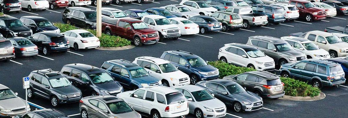
designed for cars. For decades, transportation planners have emphasized the importance of “level of service,” i.e. a road’s capacity for vehicle travel. Their fixation on maximizing this capacity has created new travel lanes to accomodate more cars and has widened existing lanes to accommodate higher travel speeds. 56 Furthermore, the very management of these transportation systems prioritizes cars: software is often optimized for car travel and seeks to reduce car traffic delays without considering pedestrian travel. 57 When vehicles are not moving, however—which for cars, according to Donald Shoup’s calculations, is estimated to be about 95% of the time—they have to be parked somewhere. 58 As noted above, parking requirements tied to development and construction have perpetuated a cycle of car usage, and so too has curbside parking under the domain of municipal governments. Philadelphia alone has over two million parking spaces, leaving about 1.25 parking spaces for every resident of the city across all ages. 59 With the majority of the right-of-way dedicated to cars, there isn’t much space left for other road users.
Designing for cars risks the health and safety of all types of road users—but especially for the most
vulnerable travelers. After the 1993 repeal of the U.S. federal government’s National Maximum Speed Limit (NMSL), nearly all states increased their own maximum speed limits, which led to tens of thousands more traffic fatalities. Each 5-mile-per-hour speed limit increase was responsible, on average, for an 8.5% increase in interstate or freeway fatalities and a 2.8% increase on other roads. 60 A researcher with the Insurance Institute for Highway Safety concluded that in 2017 alone, 5.2% of traffic deaths—or a total of 1,934 deaths—could have been avoided had the national limit remained at its 1993 level of 65 mph. 61 Issues of traffic safety are felt disproportionately by bicyclists and pedestrians, who planners and policy-makers have failed to prioritize. The per-trip likelihood of a pedestrian being killed in a car crash is 50% greater than that of a car occupant, a massive inequality between modes of transportation. 62 Between 2005 and 2014, over 46,000 people were struck and killed by cars, 63 and just in 2017, that number was around 6,000—or roughly one life lost every 88 minutes—according to the National Highway Traffic Safety Administration. 64 Faster car traffic makes sharing the right-of-way more dangerous, but even on less busy roads with lower average speeds, other dangers pose threats to vulnerable road users. Curbside parking severely limits the line of sight for drivers looking to proceed through an intersection as well as for pedestrians looking to cross, and protected areas like bike lanes or extended curbs are often subordinate to the needs of cars. Dedicated bike lanes— particularly protected lanes that offer riders an extra buffer from car traffic—remain few and far between in many American cities, 65 and even when they do exist, they are frequently blocked by distracted pedestrians, mounds of snow cleared from adjacent car lanes, parked cars, and idling delivery vehicles. Public infrastructure should be sufficient enough to ensure everyone’s safe and comfortable travel.
Problems are magnified for communities of color, for whom traffic safety is a much greater
threat. Pedestrians of color face more dangerous conditions than do their white counterparts. In Louisiana, for example, a person of color is nine times more likely to be killed walking than is a white person. 66 Such racial disparities affect drivers as well, giving rise to the term “driving while black,” which refers to black drivers’ increased chances of being pulled over by police compared to white drivers. In 2018, black drivers in Missouri were 76% more likely to be pulled over than expected given their proportion of the state’s population and were 91% more likely to be pulled over than a white driver. 67 In several states, these traffic stops are more likely to lead to being searched, ticketed, and arrested for black Americans. 68 Because in the United States black, Hispanic, and Native Americans/ Alaskans are considerably more likely to be killed by police force, such traffic stops become life-and-death situations.
Communities are beleaguered with low walkability and low density.
The poor maintenance and operation of transit networks discourage the public from using them, and the design and planning of physical spaces have kept walking, rolling, and biking dangerous and unappealing. In places like Houston, the construction of a
23
sidewalk can even be denied by that property owner, further disincentivizing walking. 69 In a country where car travel is incentivized and prioritized, the development of our cities and towns has progressed with this reality in mind. Zoning regulations and the development projects they support have long avoided considerations of public transit access and walkability, instead intensifying the influence of the automobile and distancing residential communities from commercial areas and places of employment. In 2016, roughly 3 of every 4 Americans traveled to work alone in a personal vehicle, which added approximately 12 million cars to the road. 70 When density and mixed-use are not priorities in planning communities, needs and destinations can often only be reached via car.
The environmental and social consequences of these design and planning problems are
too serious to ignore. Fossil-fuel based vehicles obviously contribute harmful emissions to global climate patterns, but the infrastructure that supports them also contributes to more local environmental damage. During precipitation events, impermeable surfaces like paved roads, parking lots, and sidewalks all interrupt the flow of stormwater, which mixes with the chemicals and pesticides that have settled on these surfaces before reaching a sewer drain, dirt patch, or waterway. In cities such as Philadelphia, which have combined sewer systems in which the same pipes end up carrying stormwater and household sewage, this type of problem can be especially problematic. Intense precipitation events can overwhelm the sewer pipes and lead to untreated sewage being released into nearby waterways. 71 In one year alone, Philadelphia’s sewers can empty 13 billion gallons of the hazardous mixture into waterways. 72 The limited incorporation of permeable soil and planted areas into the design of our cities can overburden these systems, but such an approach also contributes to the higher air temperatures experienced in cities through a phenomenon known as the urban heat island effect. 73 More developed areas often suffer from a higher average temperature, which is compounded by air pollutants’ greenhouse gas effects. These paved, plantless streetscapes also may simply be uninviting and hot, which further facilitates car dependency. These problems also mostly affect low-income communities and communities of color, which are also the communities least prepared to cope with poor transit access, environmental degradation, and heat waves.
Thoughtful and innovative design solutions can be implemented to prioritize the health of communities and their natural
environments. A more inclusive urban planning and design in critical to addressing socioeconomic inequality and environmental degradation. Three important and interrelated ideas are propelling efforts to reclaim communities for all travelers:
1. Complete Streets are streetscapes “designed and operated to enable safe use and support mobility for all users.”
74 By utilizing a systems approach to mobility that values all road users and all elements of road use more equitably, Complete Streets reshape how people can move within and along their streets. The National Association of City Transportation Officials (NACTO) maintains a guide outlining essential considerations and ideas for the physical development of streets. Their catalog of interventions highlights ways to mitigate death and injury, encourage less carbon-intensive travel, and support communities by encouraging walking. 75 For example, protected bike lanes will help bicyclists feel safer, keep sidewalks free of fast-moving bikes, and increase drivers’ comfort behind the wheel. 76 Curb extensions, which can be combined in different patterns at different points in the street, expand pedestrian space and narrow car travel space for the safety of pedestrians. “Road diets,” or the reduction of through lanes along a stretch of road, are a related tactic that seeks to improve traffic safety and recapture space for alternative infrastructures, such as greenspace for stormwater management. 77

2. Vision Zero is an international movement to reduce traffic deaths through engineering, education, and
enforcement. Advocates call for safer roadway management and physical design, information campaigns for driver awareness, and traffic monitoring by police to reduce noncompliance. Vision Zero represents a shift in the urgency of this activism: community members, policy-makers, and planners “are no longer viewing the U.S. pandemic of traffic deaths and injuries as inevitable ‘accidents,’ but instead as preventable crashes constituting a public health crisis.” 78
3. Transit-oriented development (TOD) is an approach to planning and construction that prioritizes transit use and walkability/
bikeability to achieve density. 79 TOD projects include mixed-use designs, which concentrate land use for working, shopping, and living all into a small area in order to reduce the need to travel far in the first place. Alongside considerations of transportation are the inclusion of affordable housing, the passage of complementary zoning changes, growth of nearby businesses, and conservation of land through dense development.

These comprehensive “smart growth” strategies will allow cities to reshape their built environments to prepare for coming
challenges. As the effects of climate crisis intensify, so too does the importance of protecting cities’ fragile communities and natural environments. Elements of the above solutions provide cities with the tools necessary to transform existing public infrastructure and ensure that future development is held to standards of high safety, inclusivity, accessibility, and sustainability. Resilience in the face of impending climate emergencies will be crucial for the survival of communities, urban and otherwise.