1 minute read
IMAGEABILITY CONTENTS


CUF Is...
Far from its beginnings as a neighborhood. Impressions today illustrate a distinctly new experience defined by the University of Cincinnati, with little similar to the 19th century foundation.
Advertisement
This Imageability map gives a more in-depth view of CUF than the Impression maps, and identifies common districts found in the neighborhood based on demographic and function. The most frequent districts are classified under two parameters; students, and permanent residents.
Legend
-Major Path
-Minor Path
-Car Dominated Path
-Major Edge
-Minor Edge
-Major Node
-Minor Node
-Major Landmark
-Minor Landmark
-Functional District
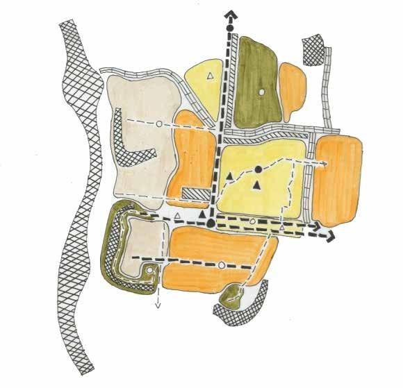
-Student Dominated District
-Traditional Residential District
-Park District
Being present on the streets during different times of the day the direction of people’s movement is felt to be in two distinct directions.
Close to UC people make short commutes but at a high density and people living in the periphery make trips outside CUF to other neighborhoods
CUF Commute Waves

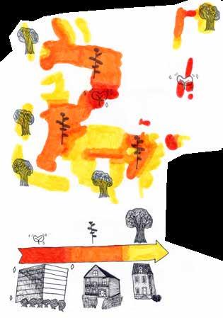
The Rivers of CUF illustrates the narrative of the university’s influence over the rest of the neighborhood. Like rivers, the university carves its will into the landscape of CUF without much resistance; spreading its buildings and student body out to every fringe of the neighborhood.
CUF: Houses and History
Many of CUF’s houses are small and compact, indicative of the neighborhood’s rich history when the cheapest and most practical homes for working class people were these homes.