4 minute read
to create a high-quality public realm to support an education district


Advertisement
inter-city
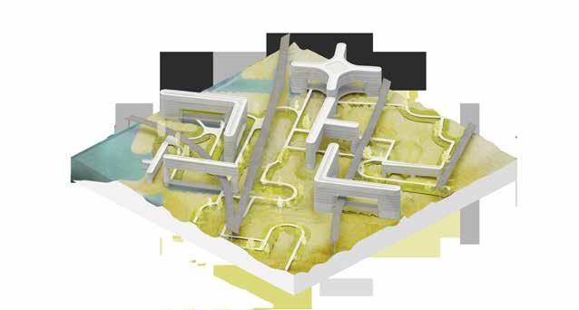
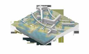
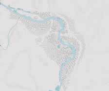
m.arch 2 arch 700: senior research studio i instructor: alberto de salvatierra through the re-design of a large parcel of the city at approximately 7.5 km2. The performative qualities of plants were used as an inspiration for the design. Just as many plants have multiple defense mechanisms - providing multiple routes of survival for themselves - so too does the city. Using a collection of parts to create a patterned and highly articulated landscape creates both barriers and new fluvial networks for the river. Urban settlement and agricultural areas are interspersed throughout the city, blurring the lines of traditional land use planning and creating more localized supply chains that will sustain citizens. Through these strategies, the city allows urbanites to have a connection to their food and to the landscape. By using landscape as a foundational design driver, the Bow River is transformed into an intriguing, dynamic, and temporal element of the city; rather than an obstacle or a force of destruction.
Despite the disastrous effects of the 2005 flooding of the Bow River, the current urban form of the city of Calgary is still ill-equipped to receive the river’s next inevitable flood. INTER-CITY speculates on the potential of using landscape design as a driver for flood mitigation, urban form, and urban agriculture


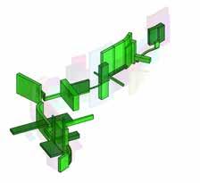
high risk of flooding 13 origin shapes
low risk of flooding
indentation with ridgebarrier with pool islands and jetties barrier with pool indentation with ridgeregular barrier extrusionextrusion with ridge poolsextrusion with moatterraced extrusion
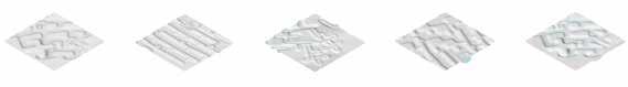
landform genealogy tree
resultant genealogies


alana kerr, brennan black, dustin dodd, faezeh yousefi, john baziuk, jonathan monfries, vijul shah
m.arch 2 arch 700: senior research studio i instructors: dustin couzens and michael rivest
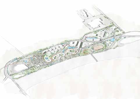
High Level City is a masterplan exploring an alternate method of city organization. As a studio, we explored concepts of hyper density and diversity in relation to the immediate context of Edmonton’s High Level Line. The area surrounding this underutilized rail corridor is dense and urban and split at the midway point by the North Saskatchewan River Valley. As a starting point to think about the High Level Line we came to two key conclusions about the line: 1. High Level Line is a circulation and transportation corridor connecting North &
South Central Edmonton. Circulation and connectivity must be lateral as well as linear. 2. The High Level Line is composed of fixed spaces. A network of spots, locations, parks, shops, etc.
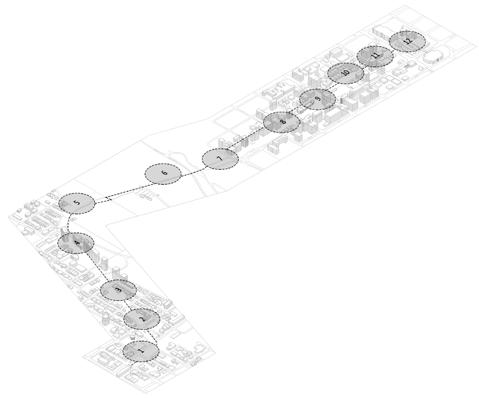
Ultimately, we came to understand this masterplan as the development of a deeply networked and integrated area of diverse programming, a city within the larger city. We developed rules as the basis of the organizing logic of the masterplan, and applied them to the formation of micro districts along the line. The colossal volumes of the city within a city concept represent a change in the way that we traditionally approach urbanization, rethinking the organization of space and the growth of cities.

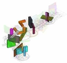
1. Whyte Avenue 2. Farmer’s Market 3. Strathcona Residences 4. 109 St & 89 Ave Int 5. Entrance to Bridge 6. High Level Line Bridge 7. Ezio Faraone Park 8. 109 St & 99 Ave Int 9. 100 Avenue 10. Jasper Avenue 11. Senior Residences 12. University Gateway


Aerial view
TsuuT’ina Reserve145
TsuuT’ina Administration office
TsuuT’ina Trail (Ring
City of Calgary
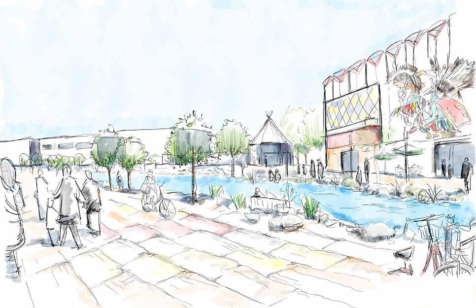
The Tsuut’ina Nation has been developing strategic sections of their land building an economic basis, workplaces and business opportunities for Nation members and neighbors alike. After signing Treaty 7, the current Tsuut’ina Reserve neighboring Calgary was established in 1877 and has been home to the Nation for several generations now. The proposed design incorporates elements from Tsuut’ina culture and facilitates the required infrastructure for economic growth. Mixed-use low rise development integrated with blue and green infrastructure is to support people centric urban spaces where everything is reachable withing 10 minutes of walk.
kuniya
anil yadav
m.plan 2 plan 616: urban design studio instructors: dr. fabian neuhaus and hal eagletail