PUTAH CREEK RIPARIAN RESTORATION PROJECT
 CYNTHIA BUI
[Medium Scale]


CYNTHIA BUI
[Medium Scale]

CLASS: LDA 120 - Advanced Computer Graphics
INSTRUCTOR: Victoria Mohr
LOCATION: Davis, CA
AREA: 37 Acres
SOFTWARE: GIS - RHINO - PHOTOSHOP - ILLUSTRATOR
YEAR: Winter Quarter 2023
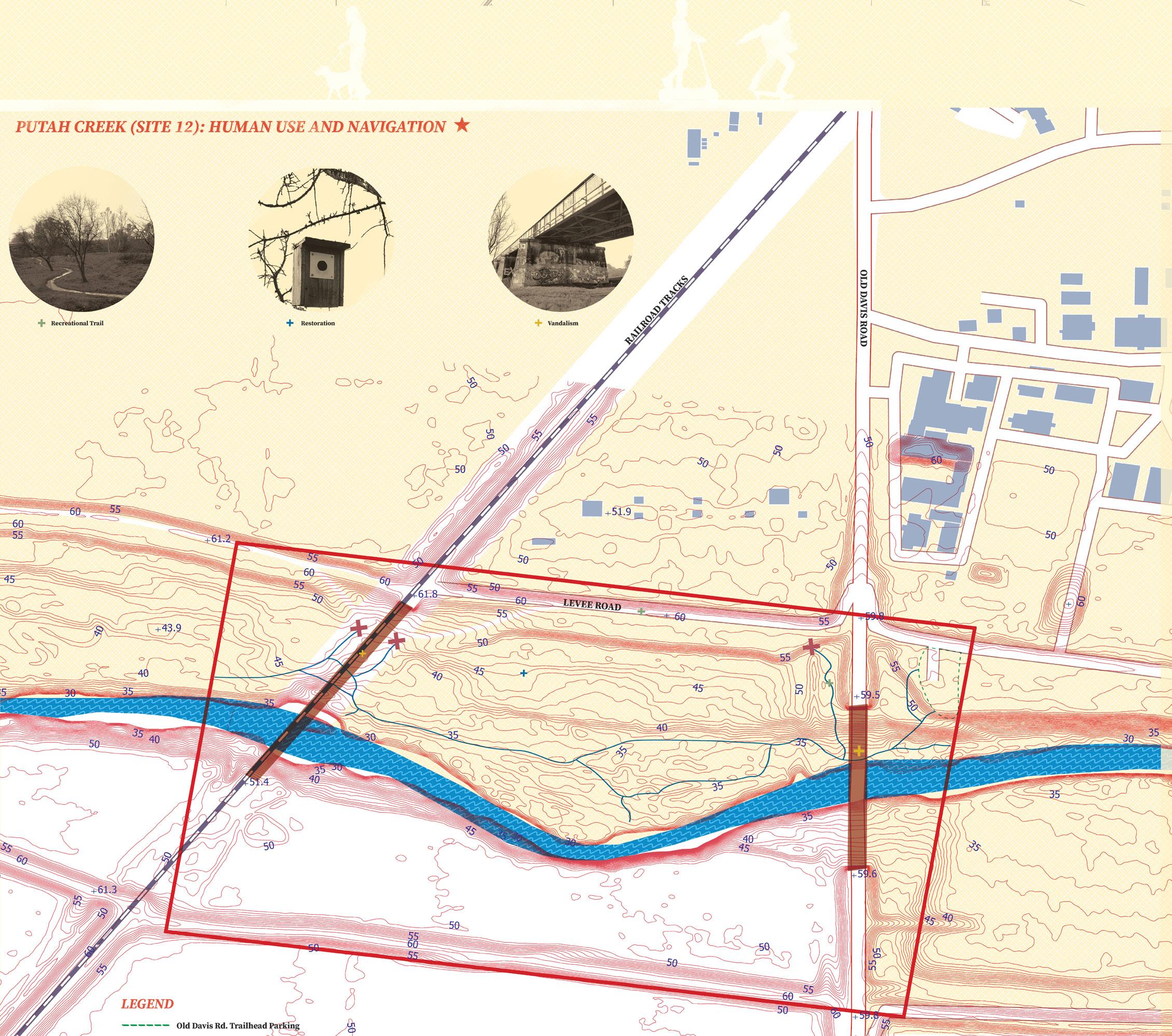


Putah Creek use to be home to an expansive riparian habitat that would extend for a mile. Nowadays, it is difficult for riparian habitats to form along the creek because of the lack of flooding. Minimal flooding is caused by steep embankments that confine the channel. My individual proposal tries to remedy the issue by flattening the surrounding area to increase the size of the floodplain. More frequent and wider inundation will will allow for riparian habitats to florish. Additionally, a side channel and backwater areas are to be added so that more of the floodplain is in close contact with water.
Another issue that plagues Putah creek is the oversized channel. These large channels creates pools of stagnant water. This plan proposes narrower channels to promote better water circulation and movement.


My final project was in collaboration with Julianna Steel, Sophia Stoffels, and Elizandra Medina. Our main objectives were to improve the ecological health of the site and encourage recreational use. We proposed a narrower, more sinuous channel with side channels and surrounding wetlands. Different channel forms promote biodiversity and varying vegetation habitats. Additionally, the flood plain is flattened to encourage more intense and frequent flooding to help widen the riparian corridor.

Recreational features we propose include small gravel beaches, a dirt trail, and an ADA compliant trail with multiple observation decks along the south side of the creek. We hope to encourage more people to use Putah Creek and to create an inclusive space that is accessible to all.

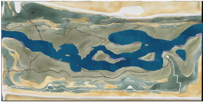
FLOODING DIAGRAMS
2-Year Flood
5-Year Flood
22-Year Flood
64-Year Flood