
William Collins’ dream of knowledge for all began with the publication of his first book in 1819. Aself-educated mill worker,henot only enriched millions of lives, but also founded aflourishing publishing house. Today, staying true to this spirit, Collins books are packed with inspiration, innovation and practical expertise. They place you at the centre of aworld of possibility and give you exactly what you need to explore it.
Collins. Freedom to teach
Published by Collins
An imprint of HarperCollinsPublishers Ltd
Westerhill Road
Bishopbriggs
Glasgow G64 2QT www.harpercollins.co.uk
Collins® is aregistered trademark of HarperCollinsPublishers Ltd
Browse the complete Collins catalogue at www.collinseducation.com
First edition 2015
©HarperCollinsPublishers Limited 2015
Maps ©Collins Bartholomew Ltd 2015
10 9 8 7 6
ISBN 978-0-00-741116-0
David Weatherly,Nicholas Sheehan and Rebecca Kitchen assert their moral rights to be identified as the authors of this work
All rights reserved. No part of this publication may be reproduced, stored in aretrieval system, or transmitted, in any form or by any means, electronic, mechanical, photocopying, recording or otherwise without the prior permission in writing of the publisher and copyright owners.
The contents of this publication are believed correct at the time of printing. Nevertheless the publisher can accept no responsibility for errors or omissions, changes in the detail given or for any expense or loss thereby caused.
HarperCollins does not warrant that any website mentioned in this title will be provided uninterrupted, that any website will be error free, that defects will be corrected, or that the website or the server that makes it available are free of viruses or bugs. For full terms and conditions please refer to the site terms provided on the website.
Acatalogue record for this book is available from the British Library
Typeset, designed, edited and proofread by Palimpsest Book Production Ltd, Falkirk, Stirlingshire
Cover designs by Angela English
Printed and bound by CPI Group (UK) Ltd, Croydon, CR0 4YY
The mapping in this publication is generated from Collins Bartholomew digital databases. Collins Bartholomew,the UK’sleading independent geographical information supplier,can provide adigital, custom, and premium mapping service to avariety of markets.
For further information:
Tel: +44 (0)208 307 4515 e-mail: collinsbartholomew@harpercollins.co.uk
Visit our websites at: www.collins.co.uk or www.collinsbartholomew.com
If you would like to comment on any aspect of this book, please contact us at the above address or online. e-mail: collinsmaps@harpercollins.co.uk
4 About this book
From Eratosthenes to Ebola: why geographers old and new still ask the same questions
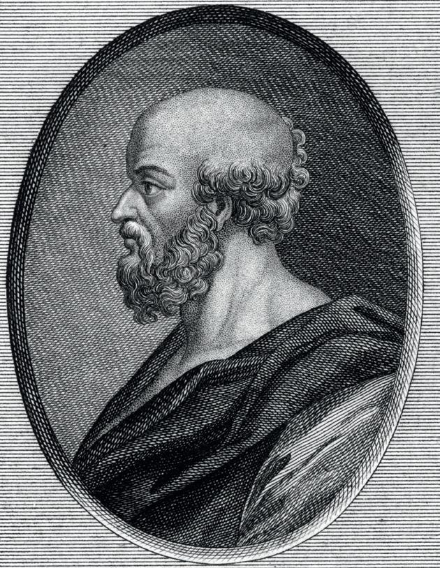
Meet Eratosthenes, the so-called ‘father of geography’. Eratosthenes lived in Greece about 2200 years ago and is reputed to be the first person in the world to have used the word ‘geography’ and to call himself a ‘geographer’. Youcould say that he invented geography –well, at least the study of the subject –which you are continuing happily with today.Amongst other things, Eratosthenes calculated the angle of tilt of the earth’saxis and managed to measure the circumference of the world to an amazing degree of accuracy.
Eratosthenes asked and investigated the same questions that geographers pose today,such as:
• Where are things located in the world?
• Why are they located where they are?
• How are people interacting with the environments in which they live?
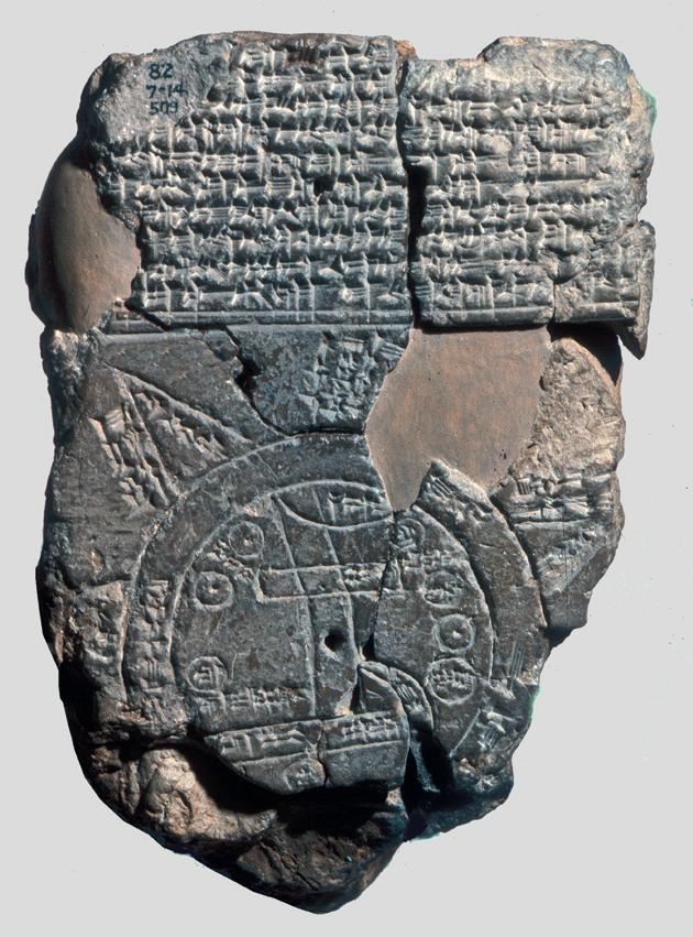
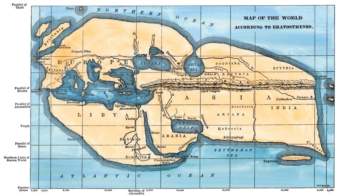
Incredibly,one of the first depictions of the ‘known world’ was drawn onto the side of aclay tablet by people living in the city of Babylon –inwhat is now the country of Iraq –about 300 years before Eratosthenes, the first geographer, was born. Modern geographers have analysed this ancient map and compared it with the current environment around Sippar,where it was found. The city of Babylon is at the centre of the engraving with seven other cities shown by small circles around it. The two larger outer circles almost certainly enclose an area of sea or ocean as they are labelled ‘river of bitter water’, whilst the two parallel lines at the bottom represent large marshland areas. The Zagros range of mountains is shown by two curved lines coming from the northeast and three named islands are shown as triangles just beyond the outer ring depicting the salt water.One of these islands is considered to be so far away and inaccessible that it has been evocatively named ‘beyond the flight of birds’.
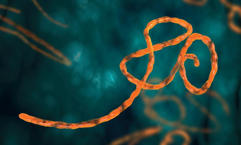
Today,specialist medical geographers are working alongside epidemiologists using computer modelling, Geographic Information Systems (GIS) and remote sensing to understand the factors determining the global distribution and spread of the Ebola virus. Geographers are needed because the origin and diffusion of infectious diseases are always associated with geographical factors such as place and location. Other factors that geographers consider when studying the geographical aspects of health and disease include environmental conditions, such as levels of heat and humidity,aswell as the nature of population movements across an increasingly globalised world. Because geographers analyse people–environment relationships, their skills are proving invaluable in tracking the spread of Ebola and recommending ways in which the disease can be managed effectively around the world.
‘Infectiousdiseasescan spread fastand far, andcharting acarrier’s movements is akey element of epidemiology.Anold medical truism is that a patient’sown story about their lifestyle is eighty percent of the diagnosis.Today that includesgeography morethanever.’
Lydia Breunig, a geographer and Director of Special Projects, University of Arizona jj


Although 2300 years separates Eratosthenes and modern day geographers like you, the questions we ask about the world and the manner in which we investigate them remain unchanged. In this book, we invite you to investigate another seven questions about the geography of the modern world, each of which will immerse you in the understanding of people–environment relationships –the very essence of the subject.
These enquiries will invite you to think about: why having too few people in acountry can be just as problematic as having too many; the things that affect where we choose to live; how we can best face up to the challenge of river flooding and sea level rise as weather patterns change because of global warming; whether exploiting any resource can ever be sustainable; how places go about recovering from devastating natural events; and where you might find a corrie (that’sthe feature of glacial erosion rather than the British television soap opera).
As you ask questions and make sense of the world around you, we hope also that from time to time you might feel a connection between you and Eratosthenes, stretching back over two millennia.
Maybe you will end up like Eratosthenes, with acrater on the moon named after you for being afamous geographer –or, more likely,a currently undiscovered moon orbiting a yet-to-be-glimpsed planet. Eratosthenes would not recognise much of the world of today but he would be reassured that geographers are asking exactly the same questions of it as he did. People and the environments in which they live and upon which they depend may change over time, but the spirit and purpose of geography always remains the same.
South Korea
Wher ei nt he world will your enquiries take you?
Russia
China
Japan
United States of America
Arctic Ocean
Laos
Brunei
Singapore
New Zealand
Australia
India
United Kingdom
France
Greece Bulgaria Romania


Frozen landscapes
Do corries really prefer north facing slopes?
Ice covers vast areas of the world today; about 5% of the world’swater is frozen and covers approximately 10% of the total land area. These areas exist at high latitudes –the Arctic in the north and Antarctica in the south –and high altitudes –mountain ranges such as the Himalayas and Andes, for example. However,this has not always been the case.
If we go back in time and look at mean global temperature over the last 150,000 years, we can see that it has fluctuated between 15.5°C and 11°C. Today,our temperatures are at the higher end of this range; we are living in what is called an interglacial period. If we look at temperatures 20,000 years ago we can see they are at the bottom of this range. This is known as a glacial period (or what some people call an Ice Age), where ice covers more of the earth’ssurface and extends to lower latitudes and altitudes. This means that during the last glacial period, much of northern Europe, including the UK, was covered in ice which was hundreds of metres thick. However,the earth has not seen just one glacial period. During the Pleistocene (a geological period of time which started 2.6 million years ago and ended approximately 11,700 years ago) there have been about twenty glacial–interglacial cycles.


Amap of ice coverage in the world in summer
Amap of maximum extent ice coverage in Europe
1.1 How does ice erode the landscape?
Ice behaves in away which makes it avery powerful agent of erosion which has helped to shape the landscape of Britain over tens of thousands of years. The ice in aglacier is so thick and heavy that ahuge amount of pressure is exerted at the base and this melts the bottom couple of centimetres.
Youcan see this process in the picture of the glacier cross section (Figure A) –the bottom layer (which is about 20 cm) is more transparent than the layer above because it is in the process of melting. This meltwater reduces friction between the ice and the rock below so that the ice flows downhill like afrozen river.
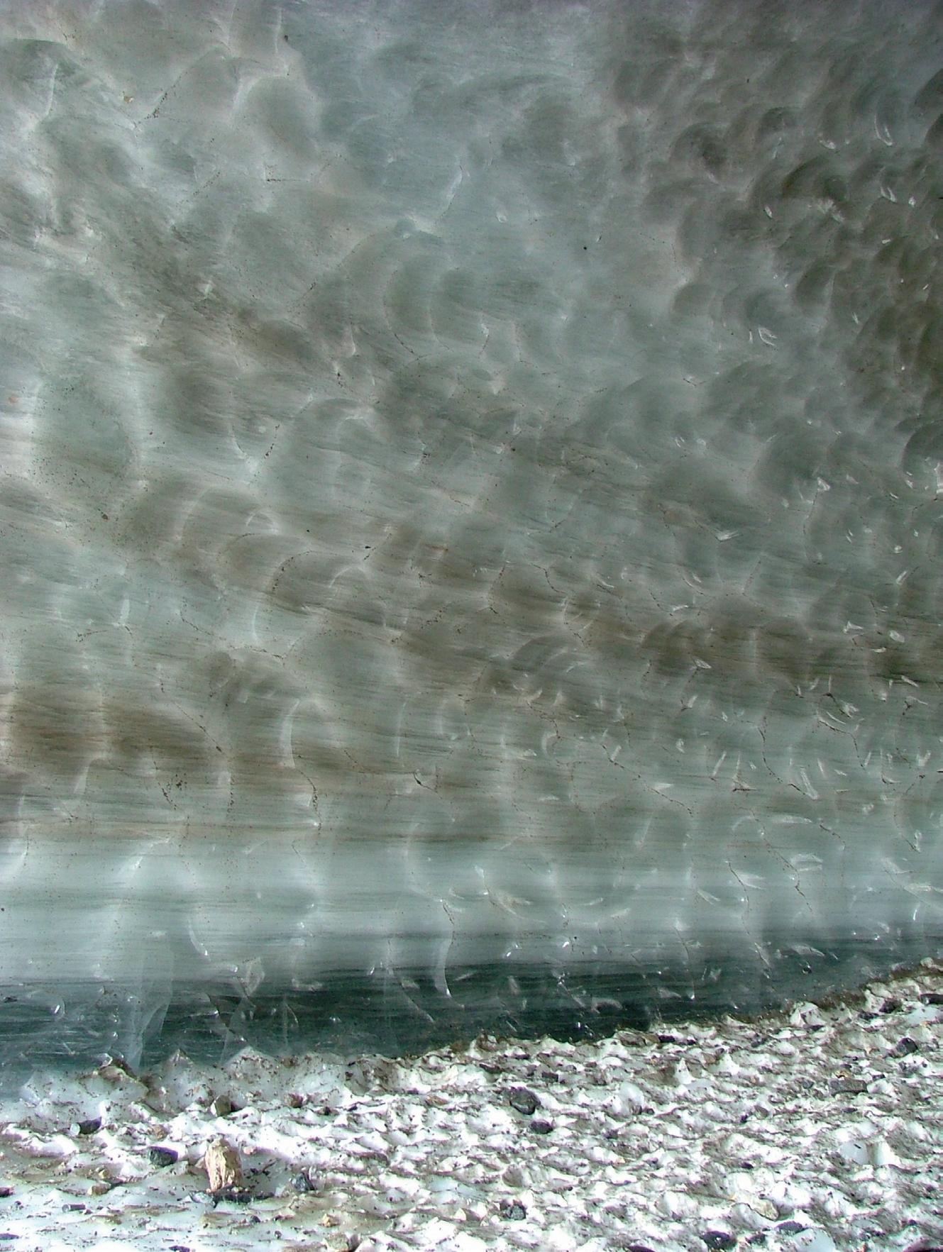
Contrary to what you might think, glaciers are not made of pure, frozen water like giant ice cubes. They have ahuge amount of debris embedded within them of varying sizes. The sheer scale of the glacier means that it can carry a mixture of tiny particles and huge rocks the size of your classroom! So, instead, it is better to think of aglacier as a giant ice cube with sand and stones frozen into it. As the glacier flows over the landscape it erodes by two different methods: abrasion and plucking.

