
Hayling Island Display

March 2024 Seafront Services Event
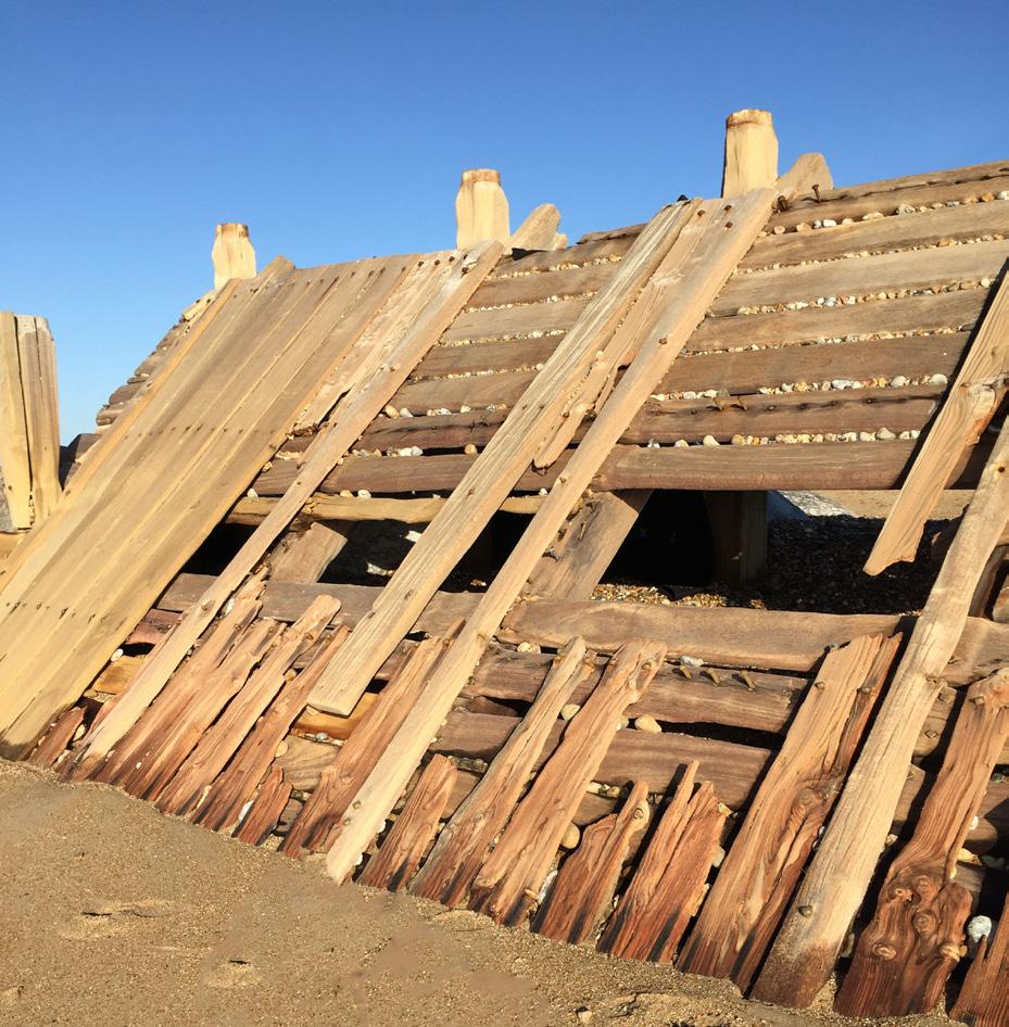
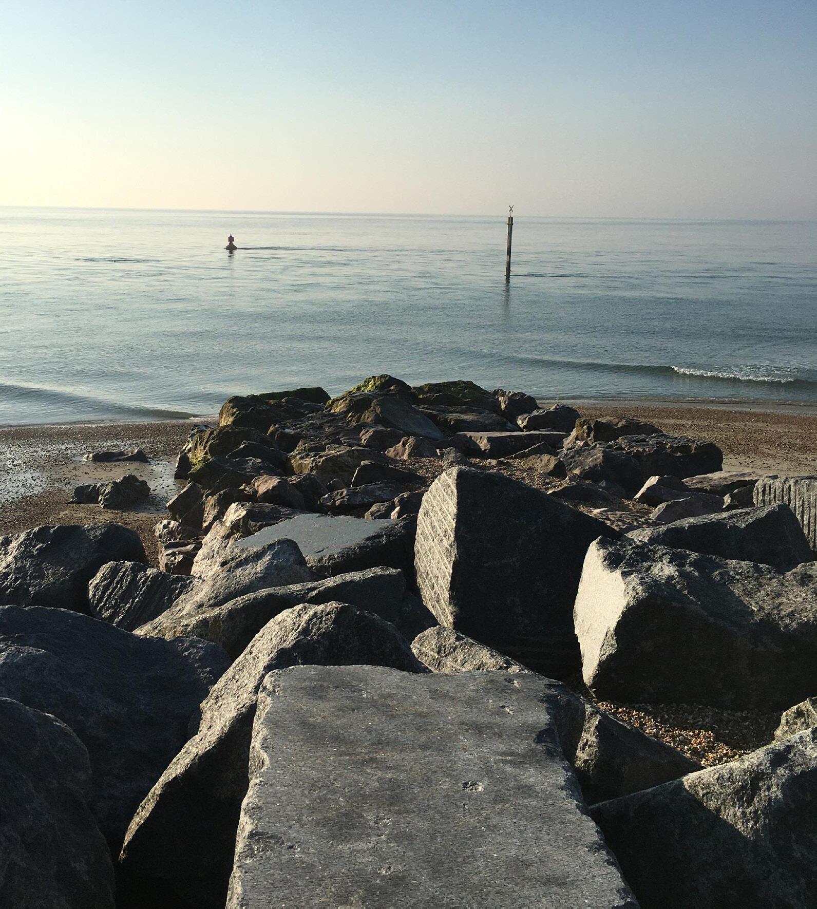
Materials
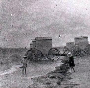

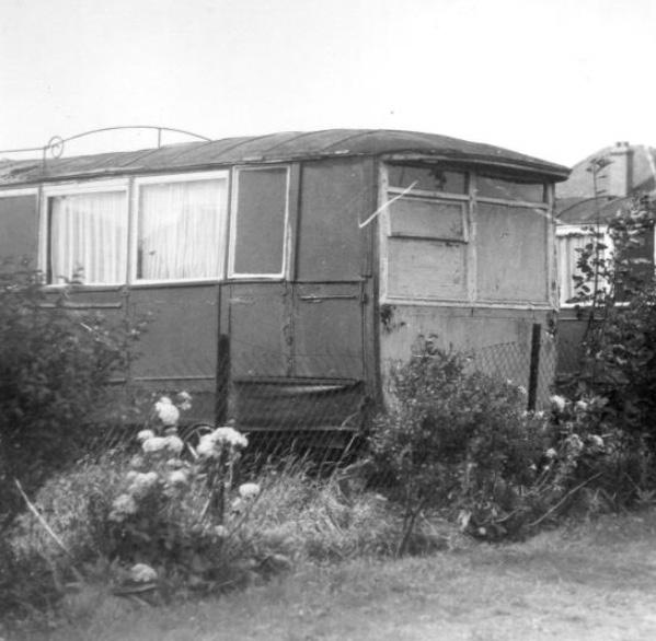
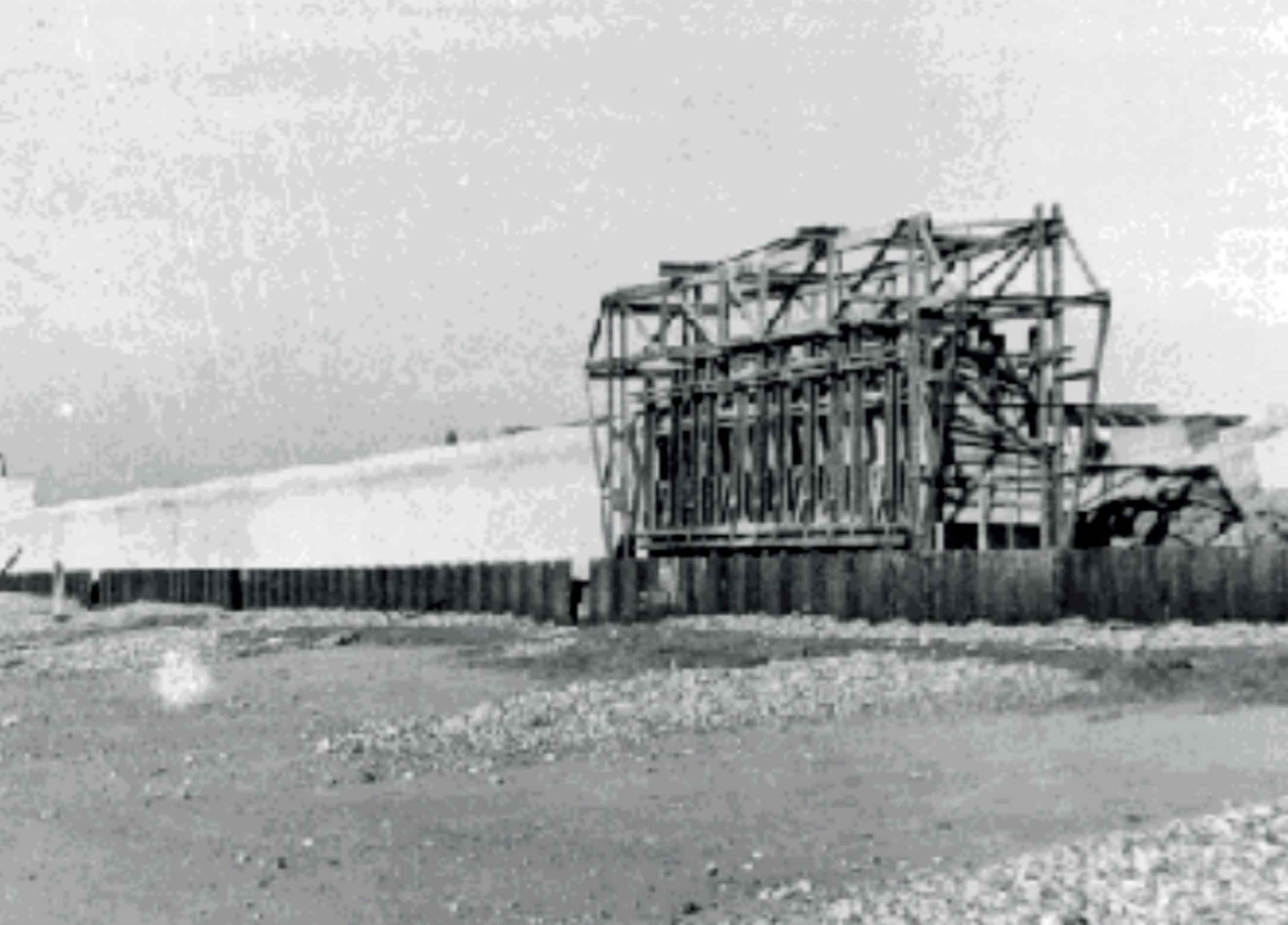
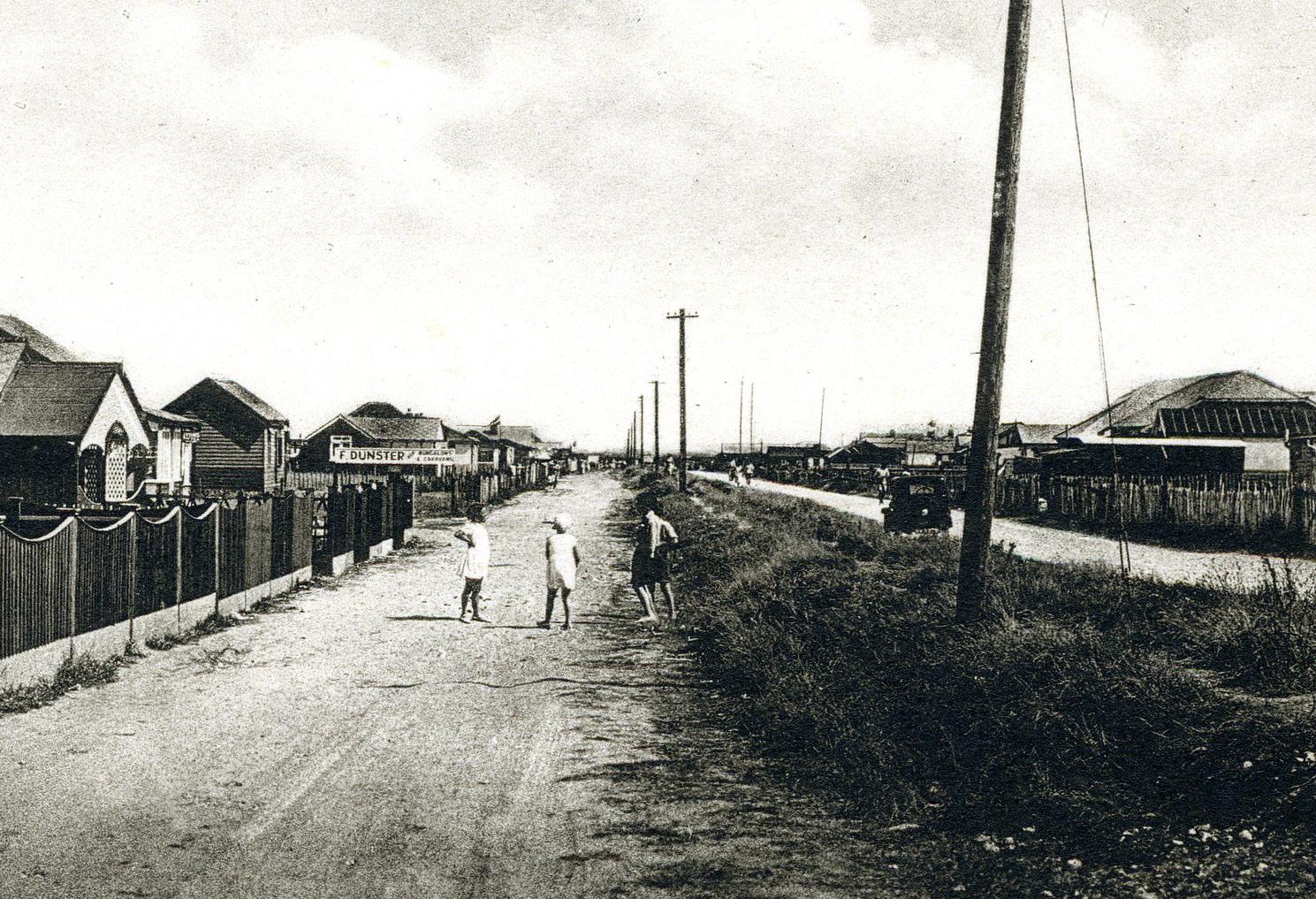

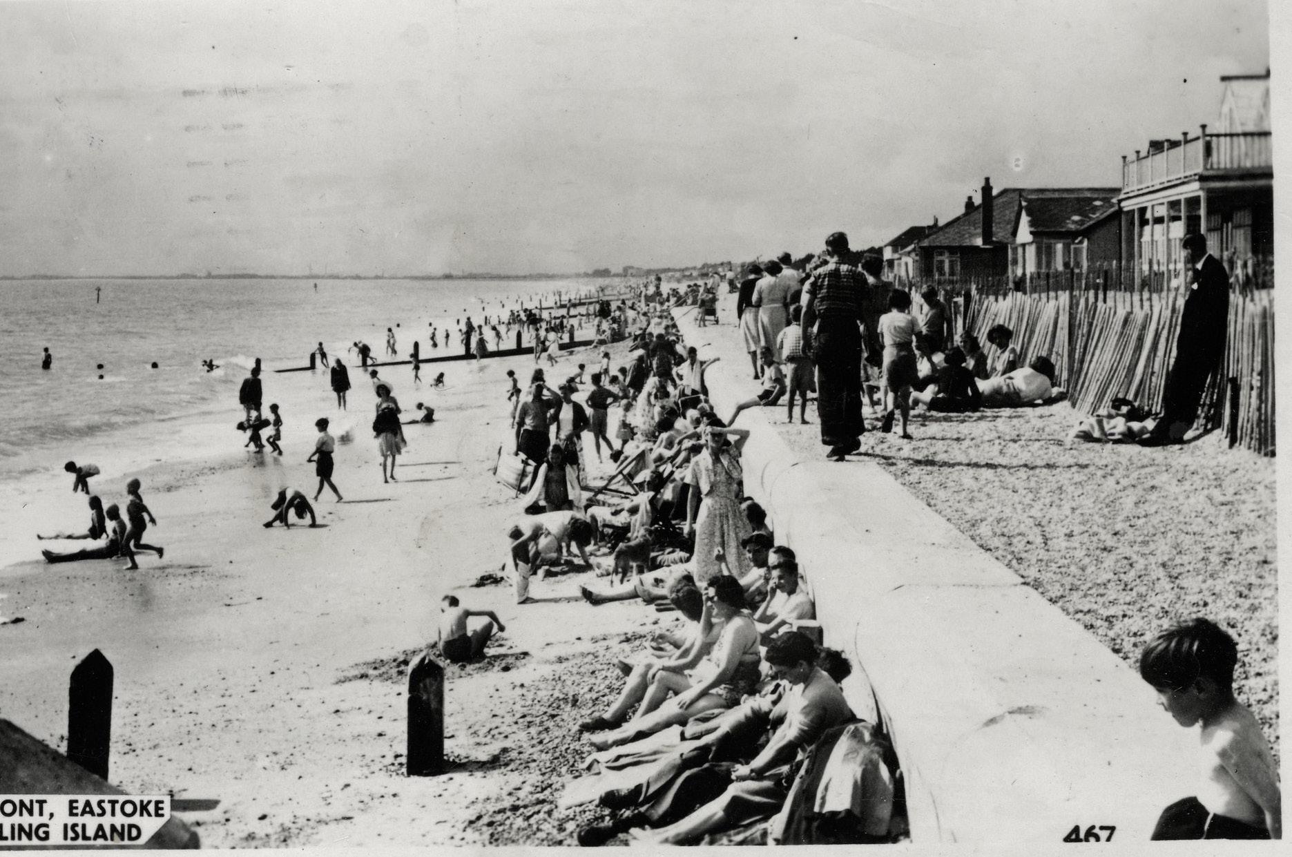
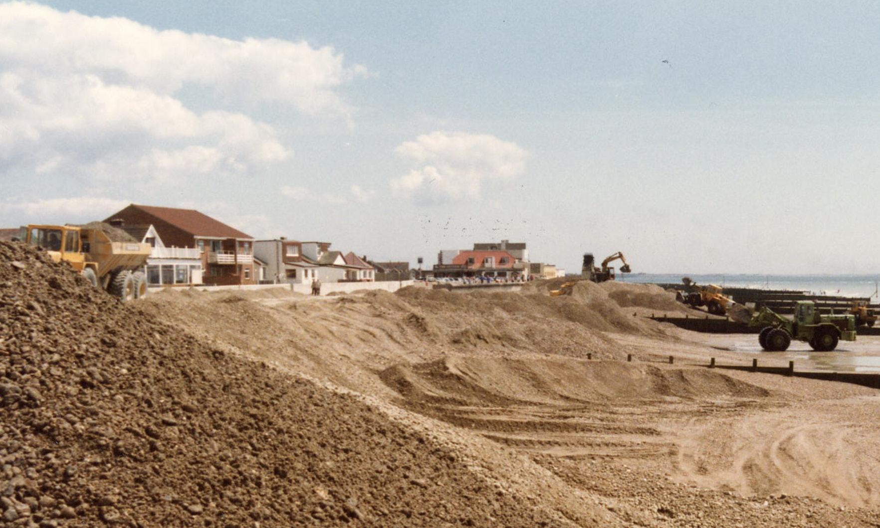

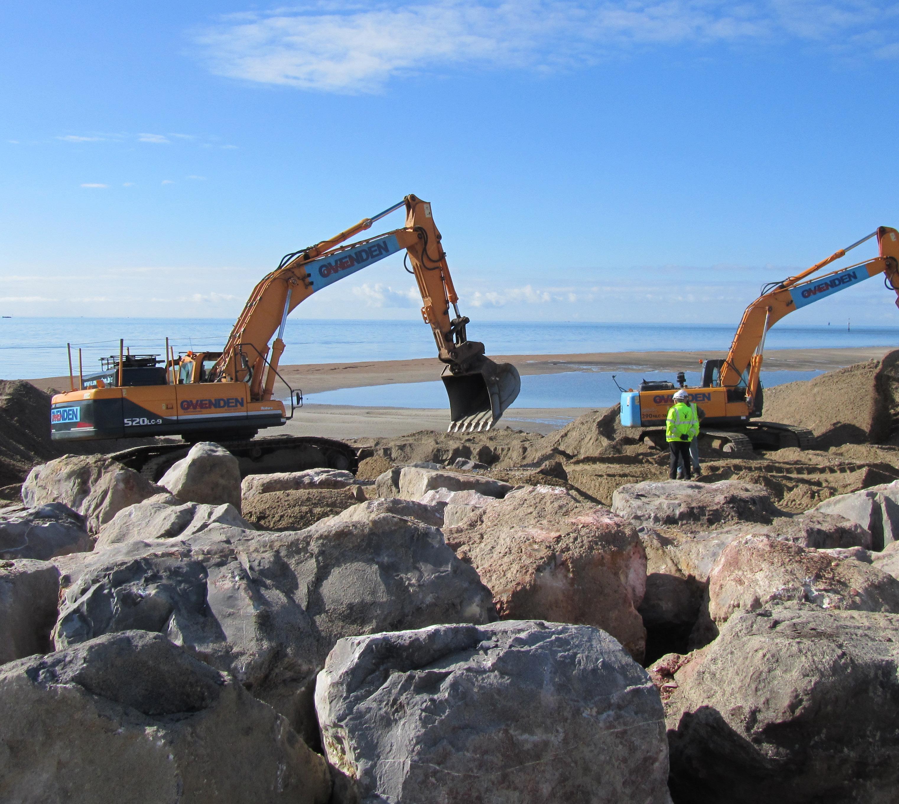
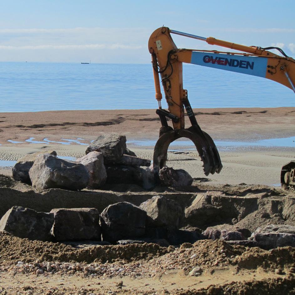
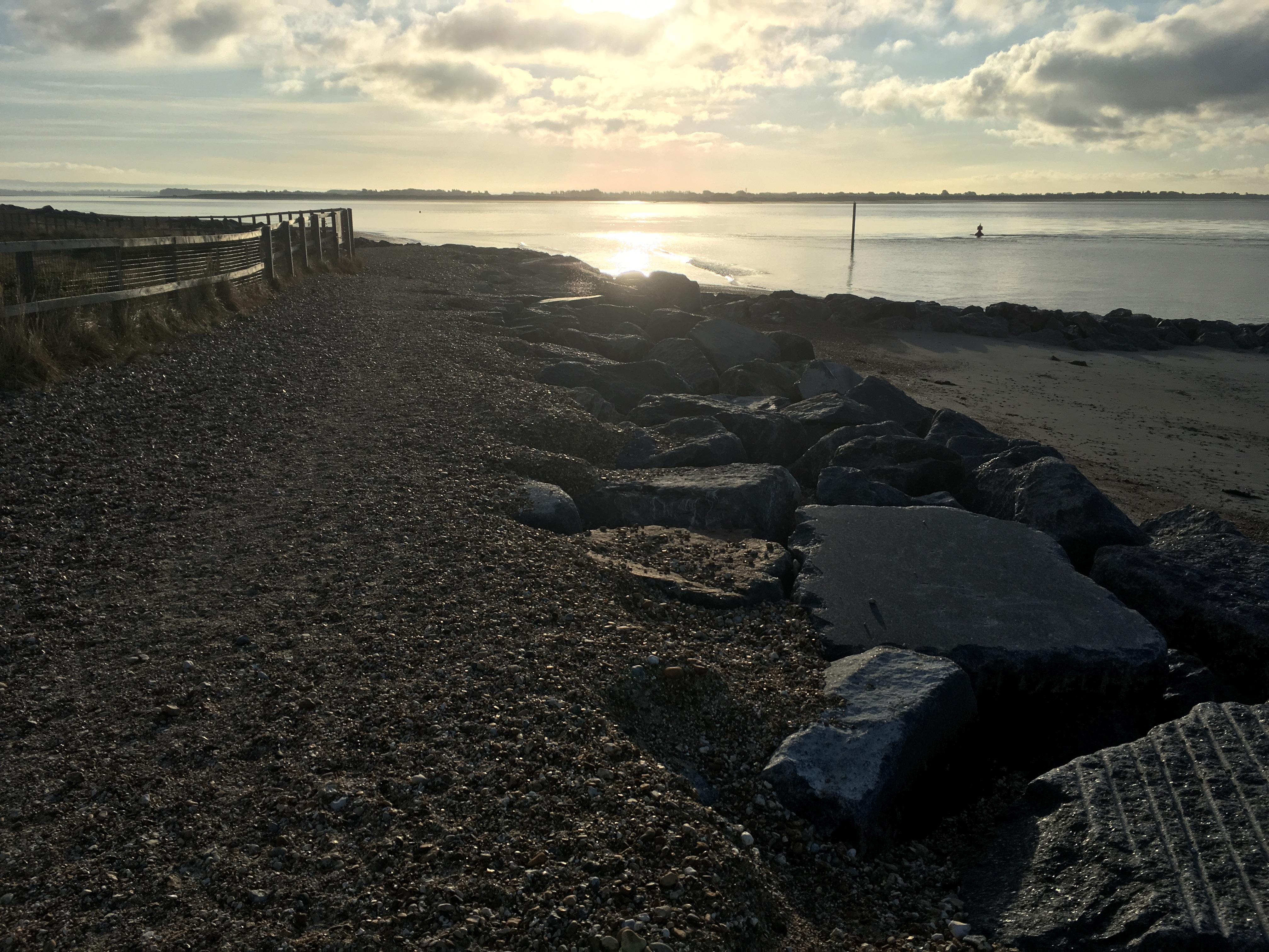


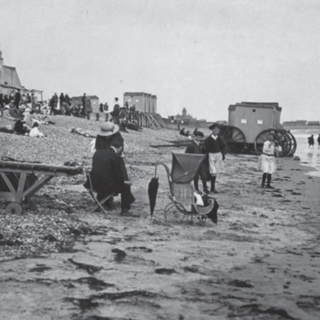
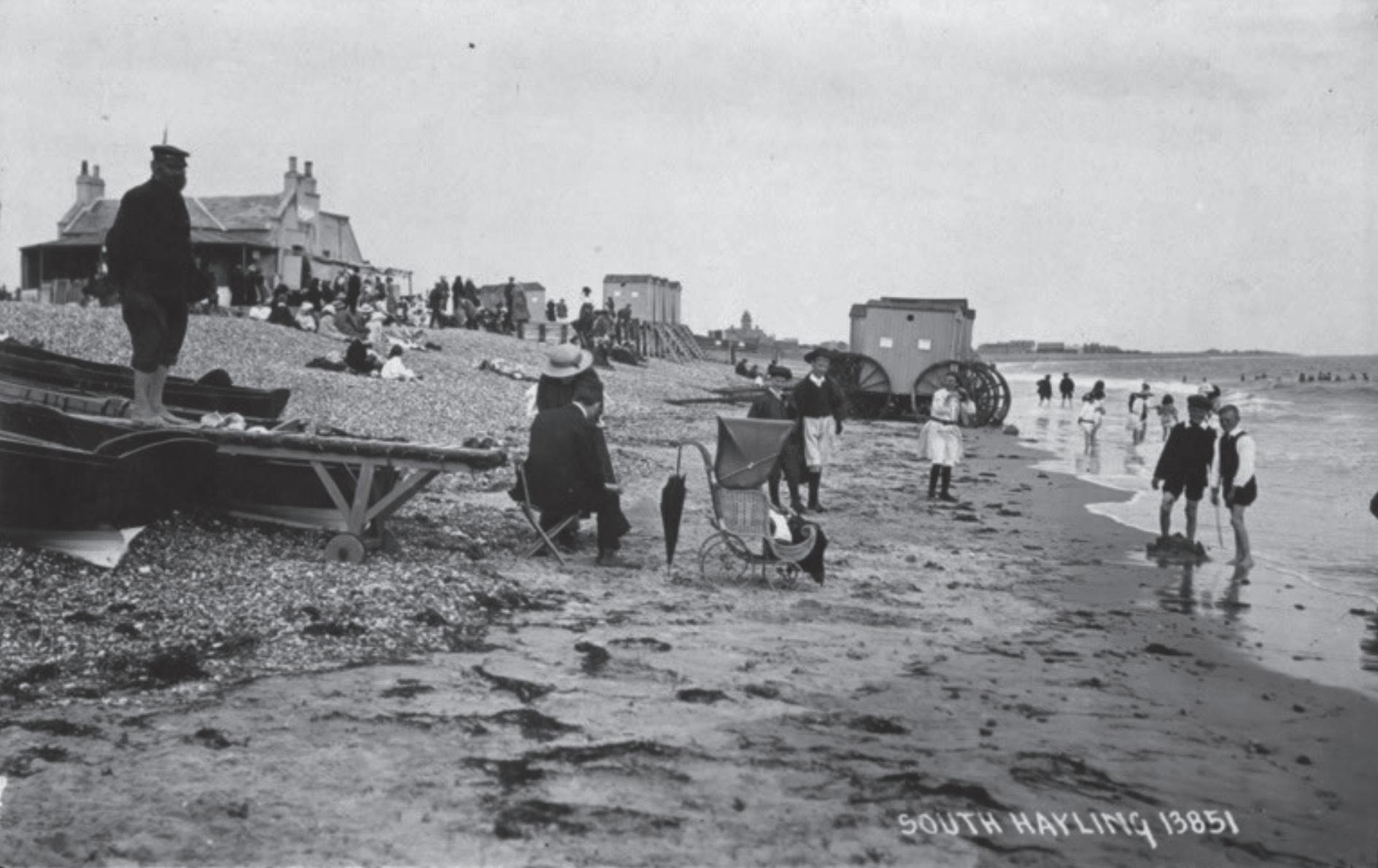
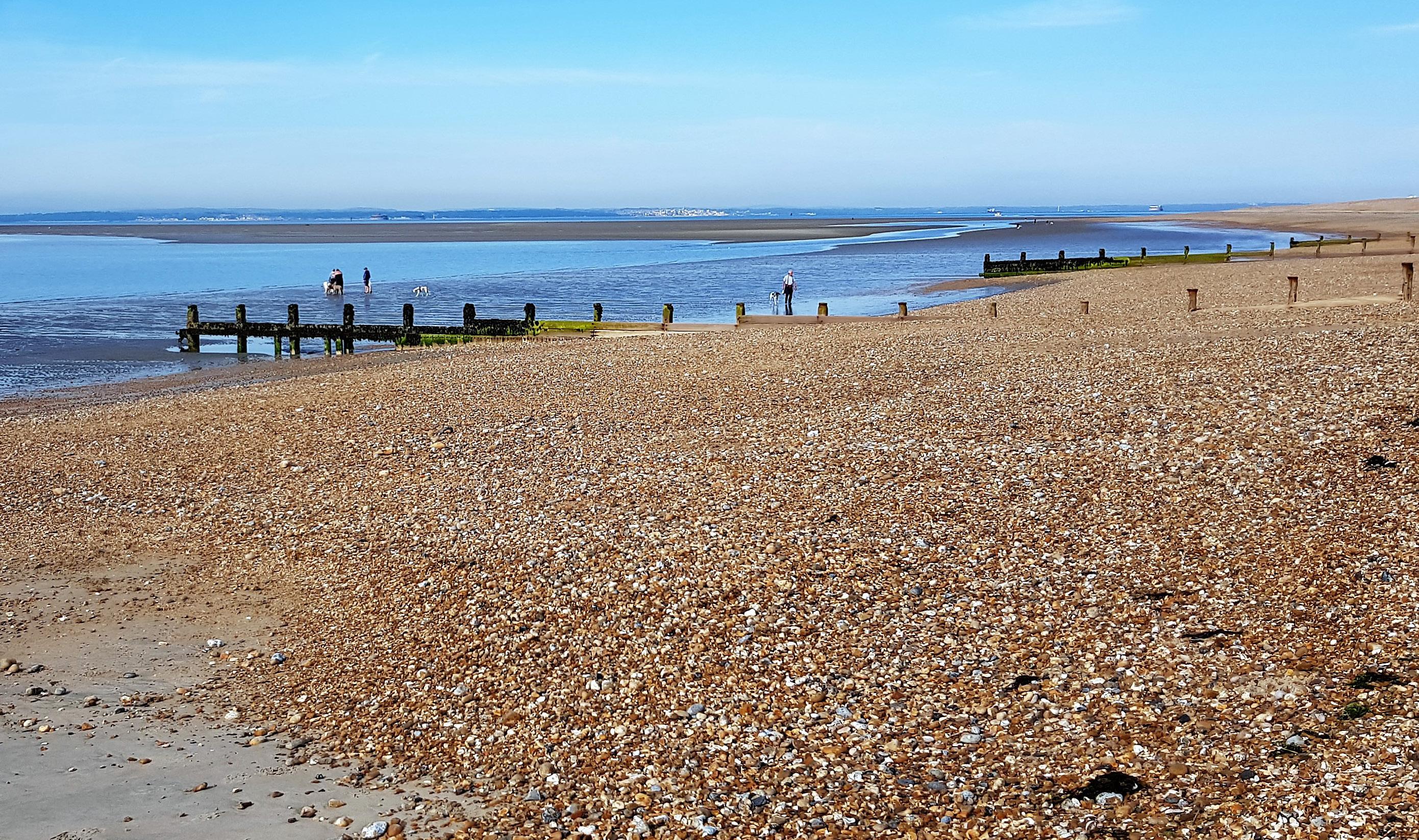
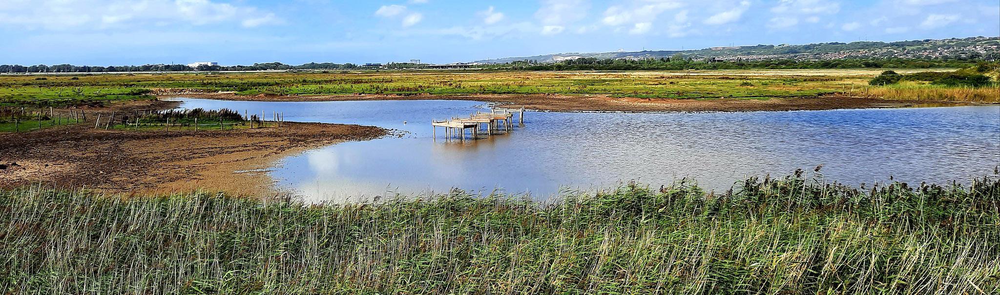
2010s 1960s 1940s 1900s 1800s In the 1800’s, Eastoke peninsula was almost an island, with beach shingle reaching into the creek, the only habitation being at Eastoke Farm. The land was mainly used for sheep farming and salt production, with the Eastoke Salterns situated on the north-east corner until the 1870’s 1800s During the early 1900’s, disused train carriages were placed along the beach from Eastoke Corner as a cheap form of housing. In the 1920’s property development began on the Eastoke peninsula, joined by a road to the rest of the island. The southern half of the peninsula was mostly developed by the late 1930’s 1900s In the 1940’s during WWII, Hayling’s population trebled as holiday camps, hotels and large houses were requisitioned for military use. After the war, development sites at Eastoke could be bought for very little cost, leading to the development of an ad-hock town and the Eastoke frontage became a residential area. Construction of the first sea defence to protect properties and the beach began in 1947 1940s By the 1960’s, Eastoke had become a popular beach and holiday destination. Visitors arrived in their thousands. The seawall was in place with a rough path as a promenade and a wooden, ‘Zig Zag’ style sea defence was constructed at Eastoke Corner to keep the shingle inside the bays. These were replaced in the early 1970’s by the straight groynes we see today. 1960s In 2013, Eastoke residents witnessed the arrival of approx 25,000 tonnes of Larvic Granite from Norway. The granite was to form rock groynes and revetments at Eastoke Point. This provided flood protection for many properties situated on the eastern peninsula and the important habitats within the Sandy Point Nature Reserve. 2010s Present, annual beach management operations involving recycling as well as importing material continue along the Eastoke frontage. This activity helps maintain beach levels which reduces the impact of storm waves. 2020s South Hayling Eastoke Beach History In the 1980’s, after many events of large waves washing over the seawall, causing extreme flooding and significant damage to nearby properties, Havant Borough Council took action to reduce the risk of flooding and completed the first beach replenishment using 500,000m of shingle. 1980s havant.gov.uk coastalpartners.org.uk Acknowledgements: photo and info: Visit England website: https://www.southernbell.co.uk/carriage-history Eastoke history photo from a booklet C/O Ralph Cousins (Borough of Havant History Booklet No. 90) 1940s photo from a booklet C/O Ralph Cousins (Borough of Havant History Booklet No. 90) 1960s background photo: https://www.flickr.com/photos/-phraser-/ 1980s 2020s
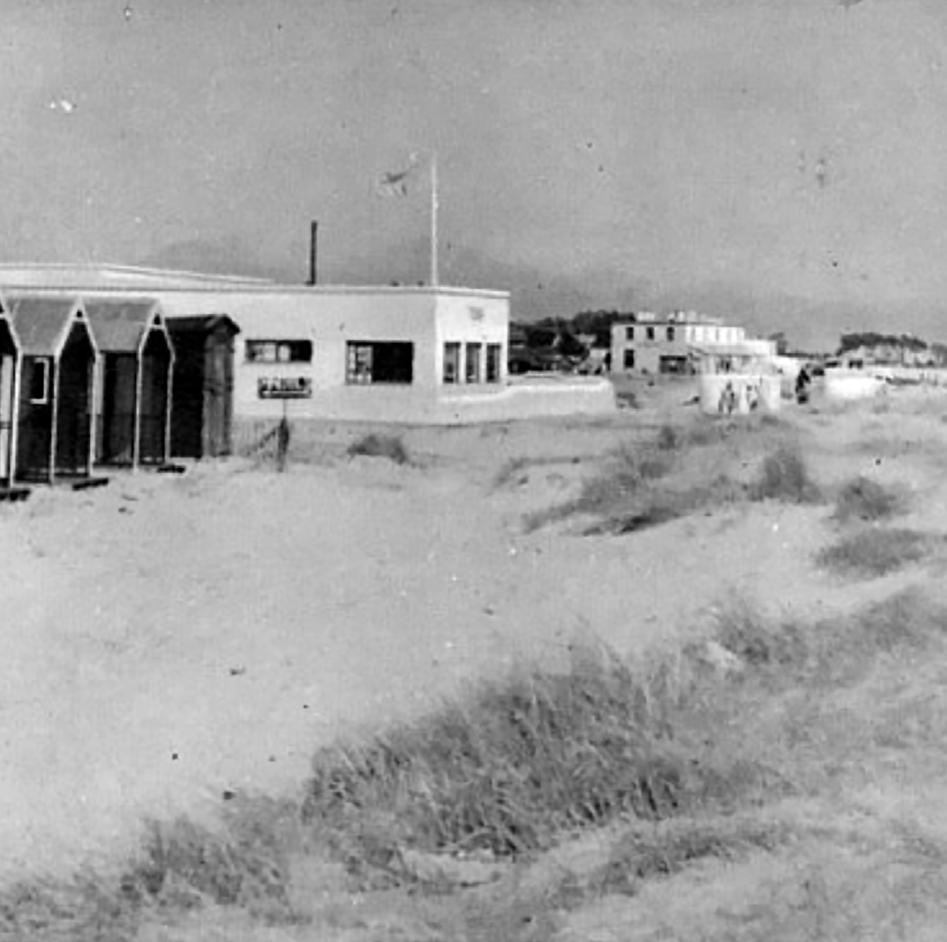

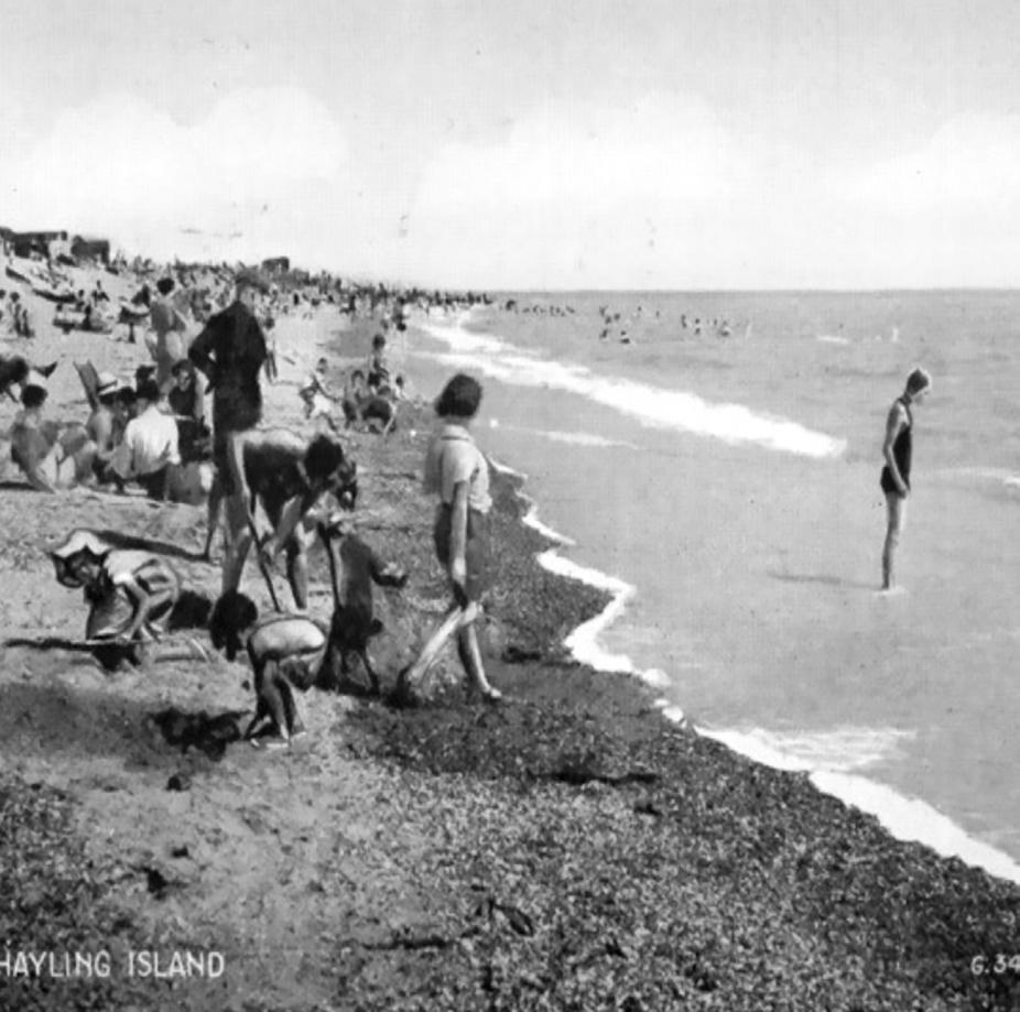
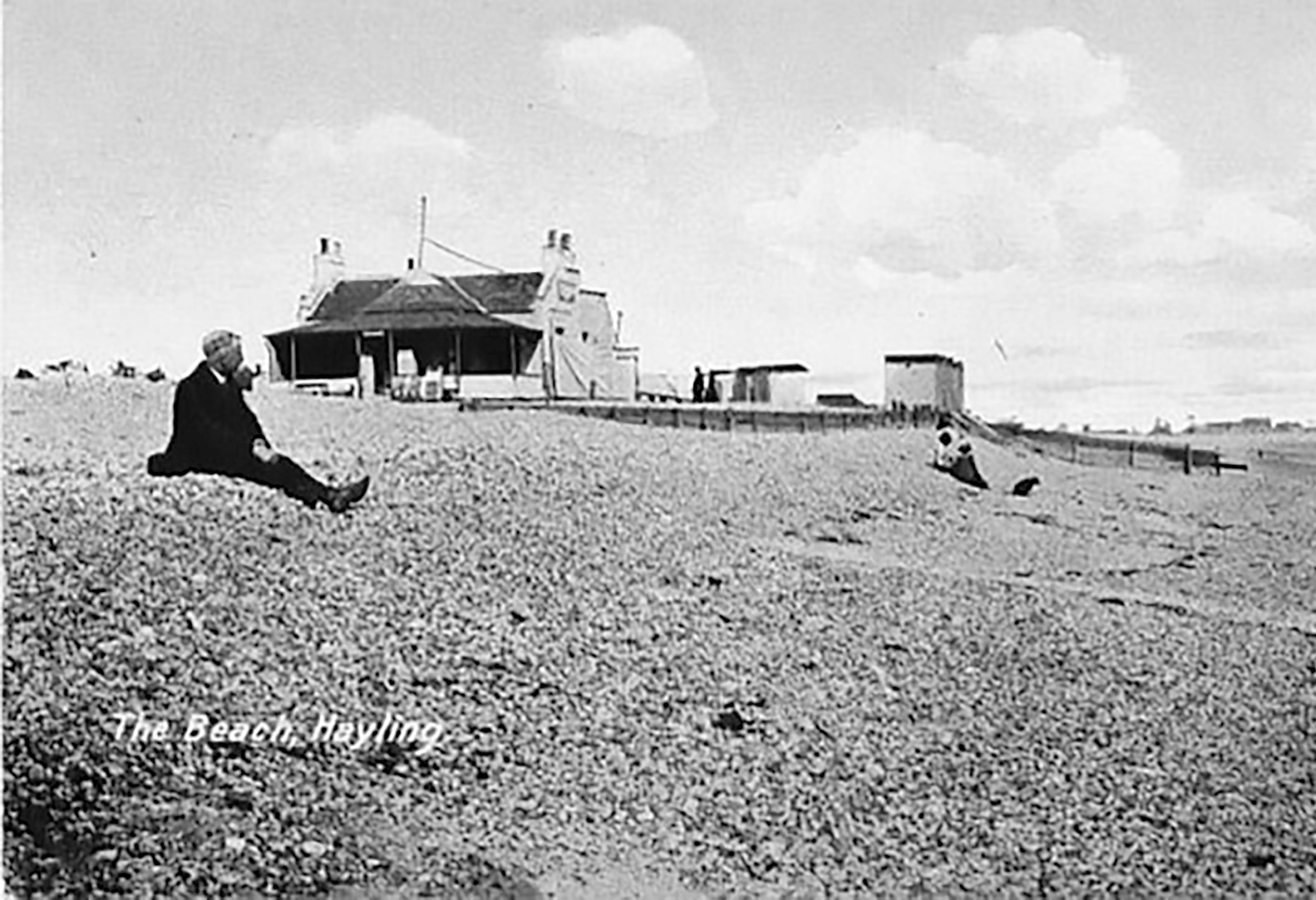
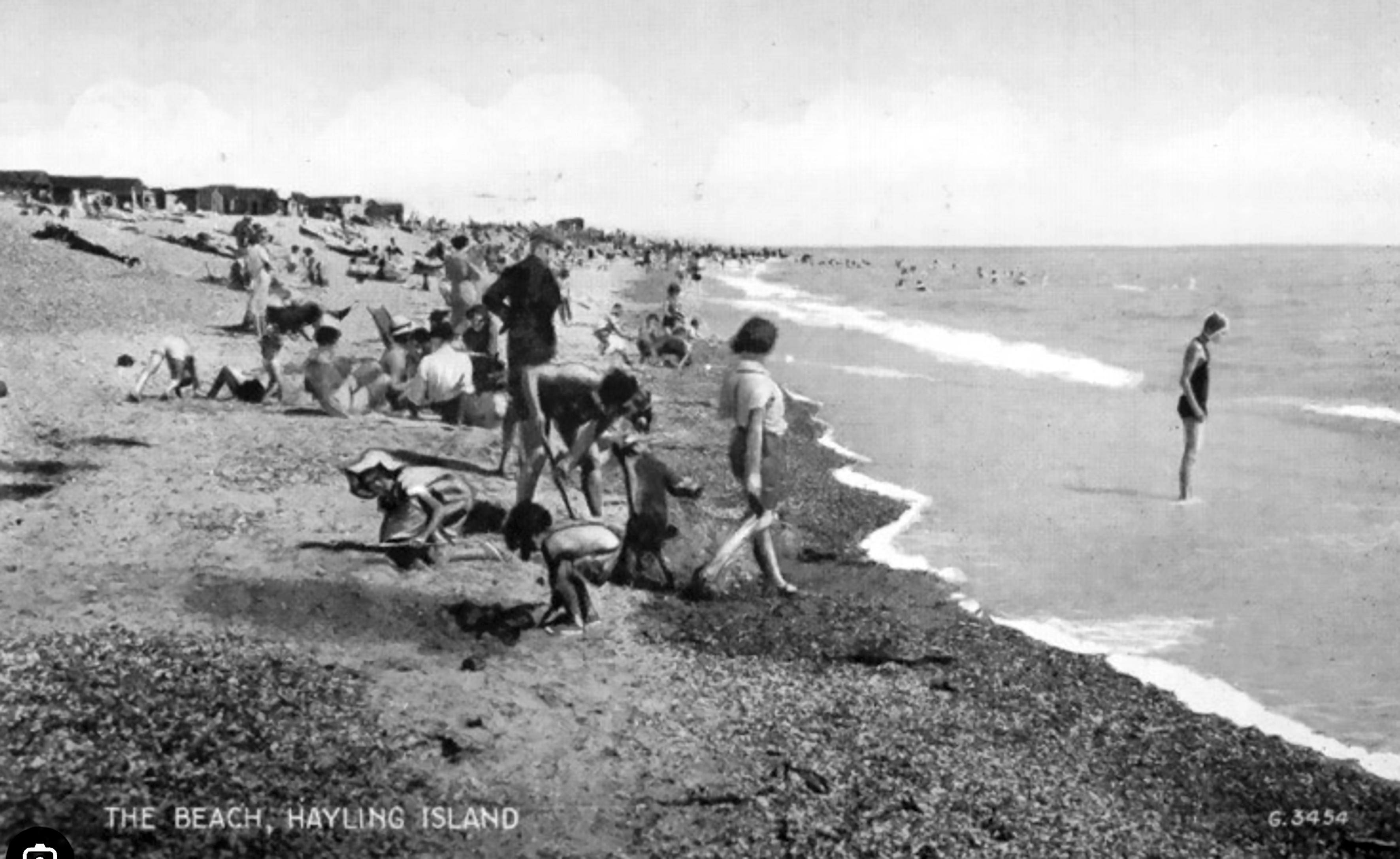
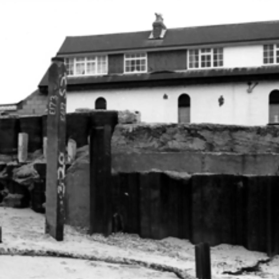

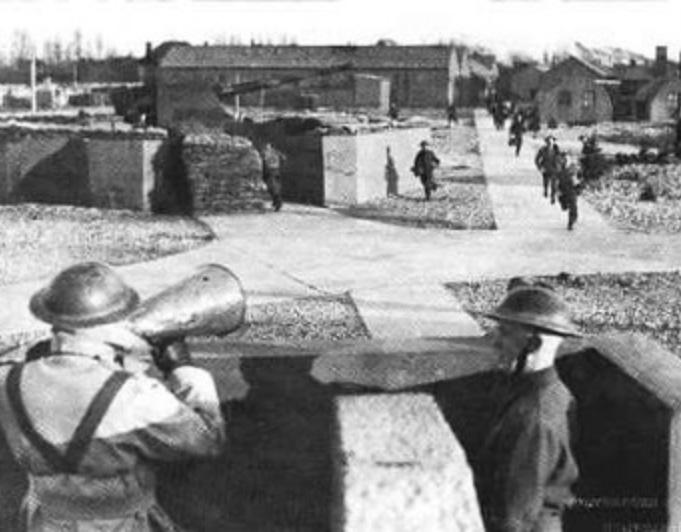
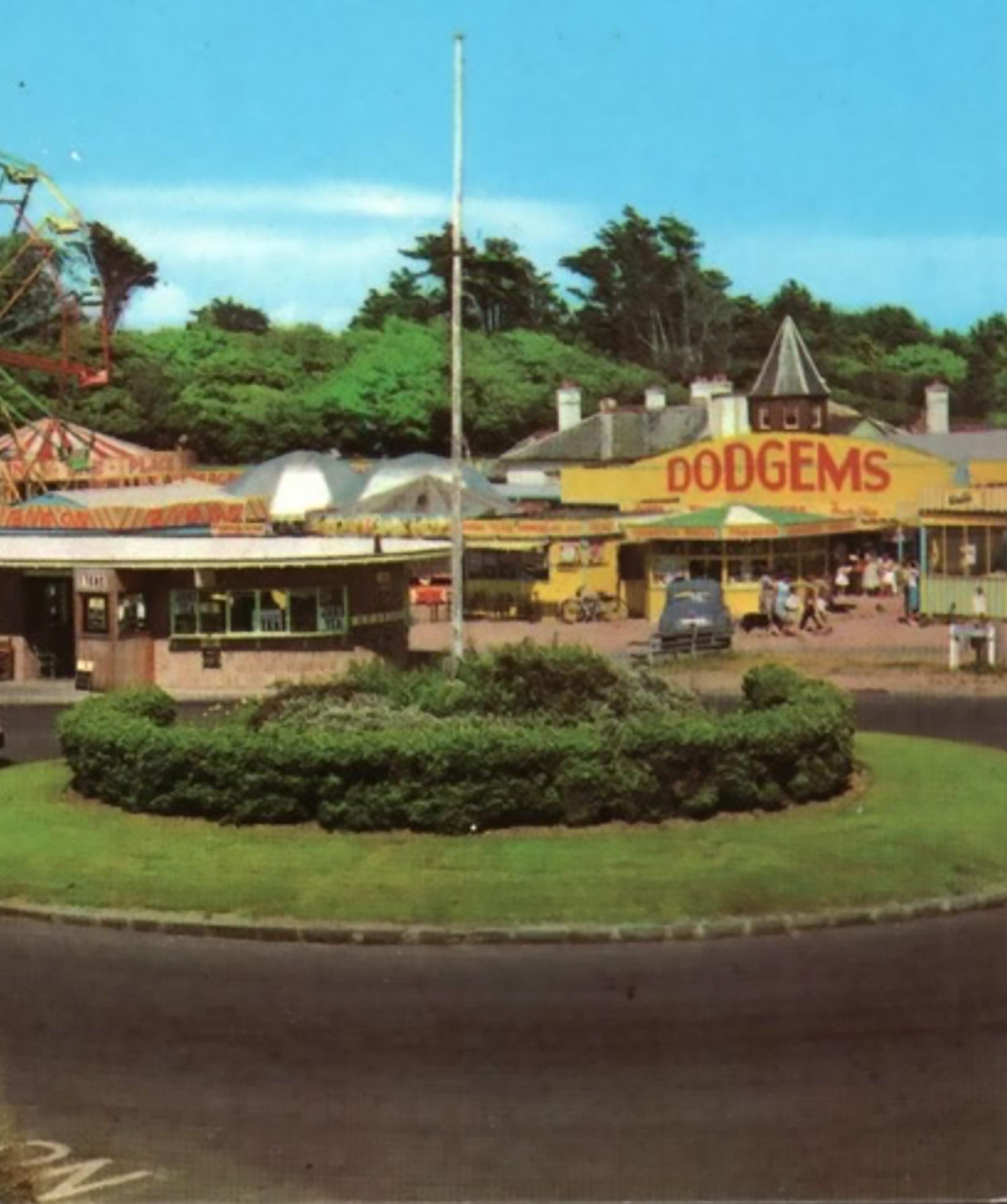

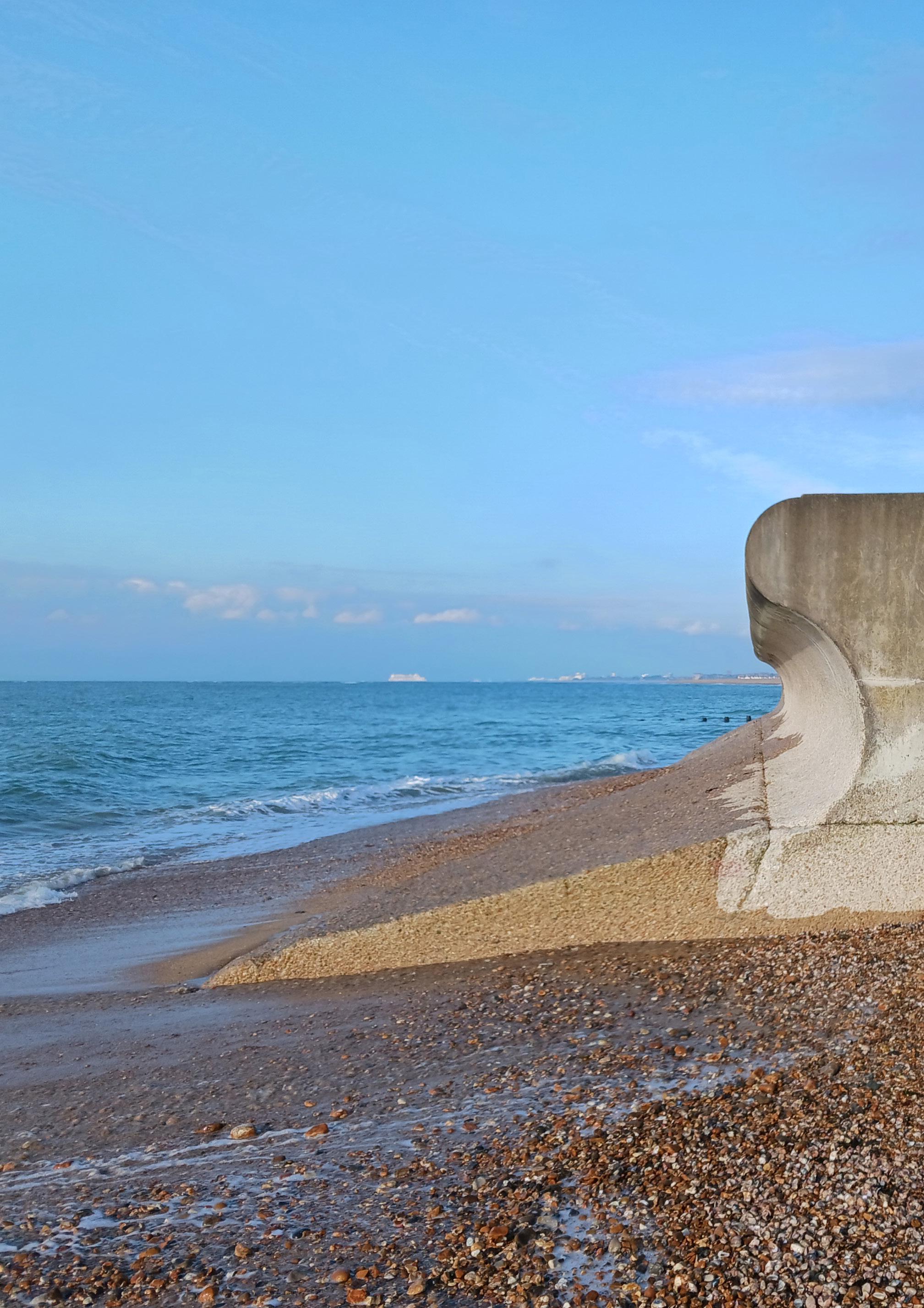
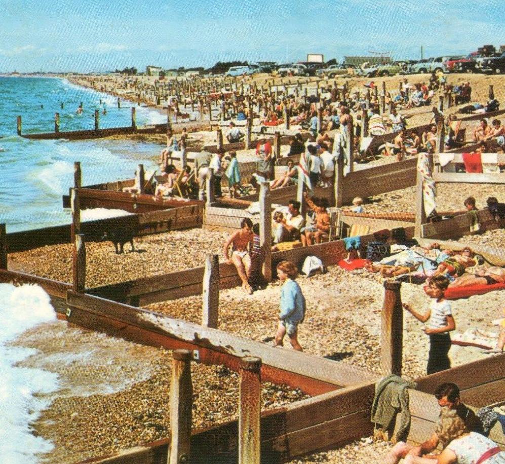
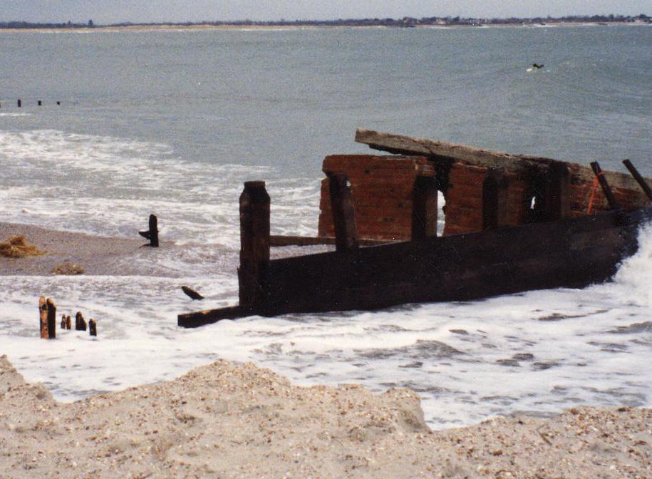
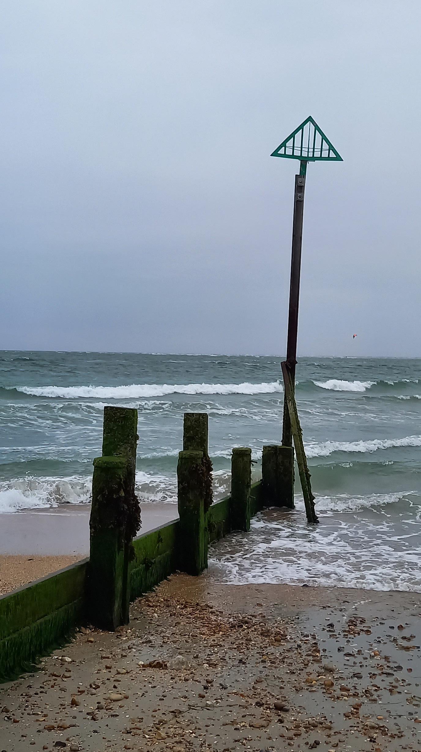
1970s 2000s 1960s 1950s 1940s 1930s 1930s 1800s The West Beach area of Hayling Island seafront has been a tourist destination for many years. Originally a holiday spot for the well-off who wished to enjoy the medicinal benefits of sea water and fresh air. The beach even boasted a seawater bathhouse during the 1820s, built shortly after the island was made more accessible by the opening of the new bridge. In 1867, a railway from Havant to Hayling Island opened to passengers. 1800s In September 1865 the first RNLI Lifeboat Station was opened at West Beach. The lifeboat service at Hayling operated for 59 years until its closure in May 1924. The original building is still standing, although not in its original form: it is now used as a public house and restaurant called the Inn on the Beach. In 1914, a new lifeboat station was built two miles to the east of the original, where it could house a new, larger lifeboat. 1920s Hayling Island was discovered by the masses in the 1930’s, when the popularity of the motor car made travelling here more convenient. The Island grew in popularity as a holiday destination with the attractions of safe, mixed sand and shingle beaches, a warm climate and frequent travelling country fairs. 1930s As well as being a place of fun, West Beach served a more serious role in the 1940s. Taken over by the Royal Navy in 1939, the area served as a barracks for the armed forces for the duration of WWII. The population trebled on Hayling Island as holiday camps, hotels and large houses were all requisitioned for military use. 1940s In the 1960s, the popularity of Hayling Island as a holiday destination increased. The former Victorian Lifeboat Station had a concrete seawall added to its foundations. This structure began to disrupt the flow of beach material, eventually causing erosion of the natural position of the coastline. 1963 also saw the closure of the Hayling Billy Line after almost a 100 years in service.
s In 1976, timber revetments were constructed west of Inn on the Beach to reverse the recent erosion and stabilise the coast. The structure was predicted to last for 20 - 30 years. 1970s In 2012, following over 40 years of service, a section of the timber revetment came to the end of its functioning life and was removed for saftey. A further section was taken out in 2020 2000s South Hayling West Beach History In 1950, Hayling Island had a population of over 5,500, which continued to grow rapidly along with the leisure and tourism industry. The opening of a new concrete bridge in September 1956 allowed cars and heavier delivery vehicles to drive onto the island, increasing the popularity of South Hayling as an attractive holiday destination. In 1958 Hayling Island witnessed the invention of Windsurfing when Peter Chilvers assembled his first board combined with a sail. 1950s havant.gov.uk coastalpartners.org.uk Acknowledgements: photo: The Hayling Site https://hayling.co.uk/history/beachlands/ https://jbarchive. co.uk/products/ha-4897-south-hayling-hampshire 1940s text: https://www.discoverhayling.co.uk/single-post/2016/09/15/an-island-at-war 1930s photo: bit.ly/3Ie4leJ 1960s photo: https://hayling.co.uk/history/the-beach/
1960

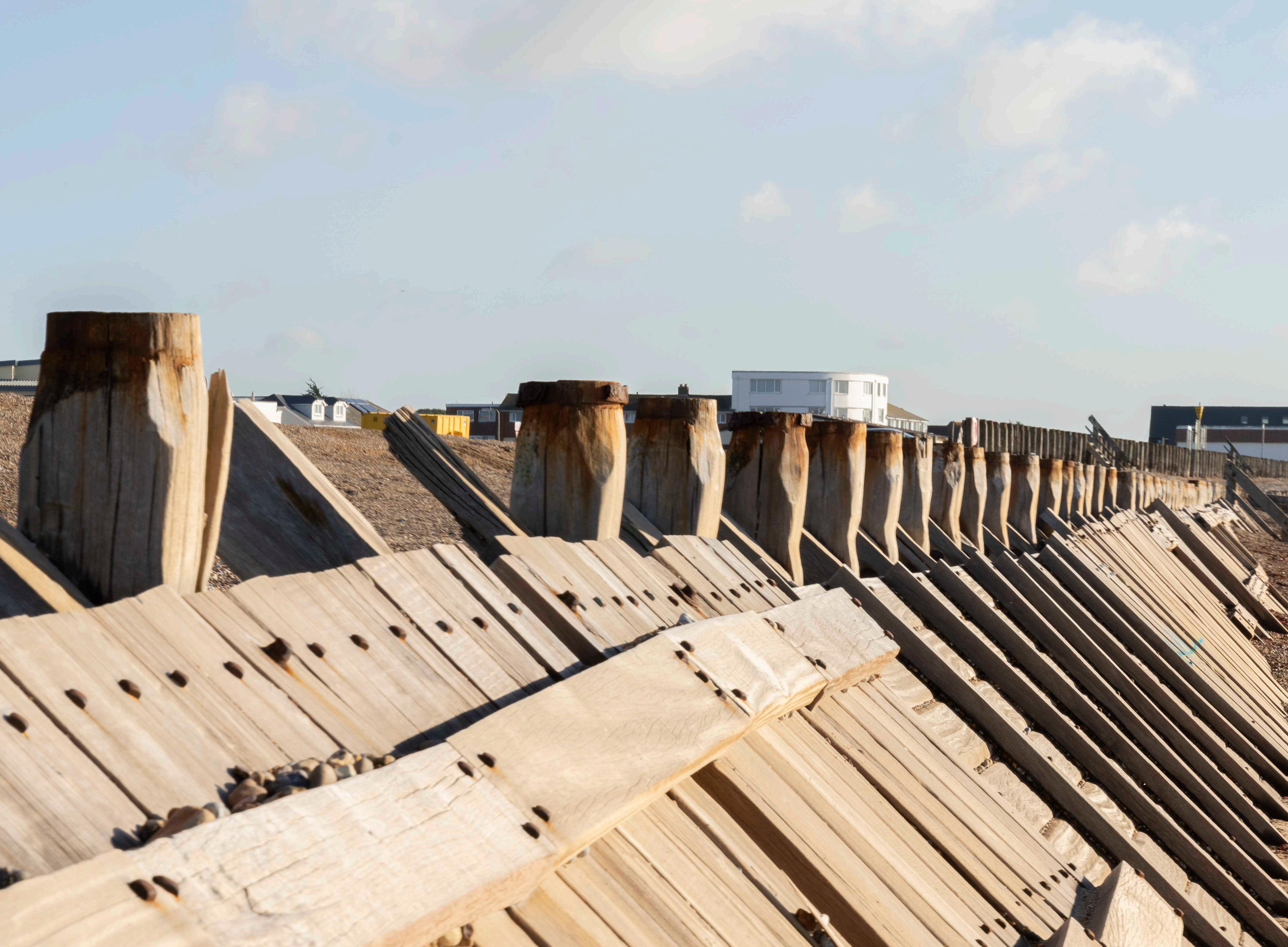
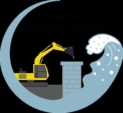
Maintaining Coastal Defences

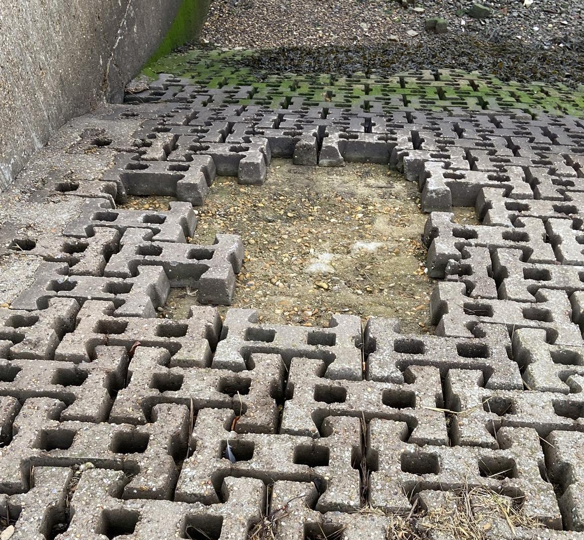
Structures that help manage coastal flood and erosion risk are known as assets. Assets come in a variety of forms; some examples are flood gates, walls, revetments, and groynes.
Across the Coastal Partners region, assets vary greatly in age, condition and design. Some are council-owned, others are private or belong to the Environment Agency.
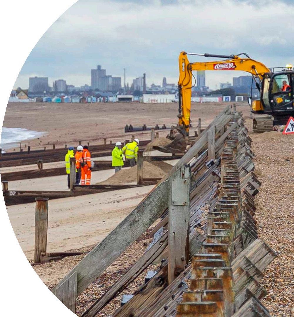
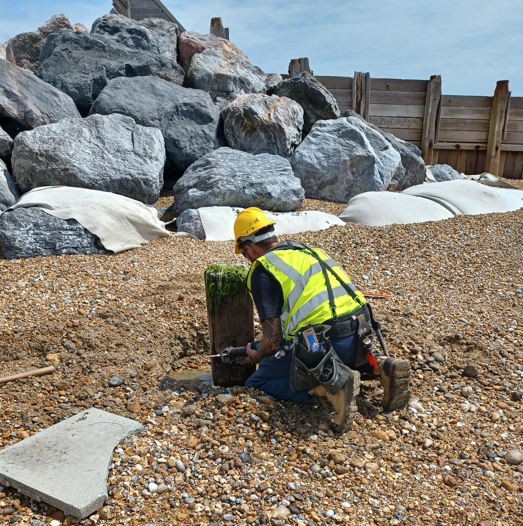
Our new assets require little service, but older structures require more attention. We manage existing assets through routine inspections and maintenance using a risk-based approach. Sites in poor condition are visited more frequently than those in a good state of repair.
When our assets need restoring, we plan the appropriate maintenance and carry this out through our trusted network of suppliers. Our budgets, are limited and under increasing pressure.
If the structures need to be replaced, they are designed with the future effects of climate change in mind. If they are no longer required, they are removed in line with the agreed policy.
When privately owned coastal assets need repairing or replacing, we advise the owners and encourage them to make the required changes.

coastalpartners.org.uk

Erosion Risk In a Changing Climate
How is climate change considered in coastal management?
‘Climate change’ refers to a change in global or regional climate patterns in relation to increased greenhouse gas emissions.
The effects of climate change are significant and include extreme heatwaves, droughts, and sea level rise. For coastal management, climate change is forecast to result in increased flooding and erosion through sea level rise and an increase in extreme storm events.

Coastal Partners take estimates of future sea level rise from the latest Environment Agency guidance which is based on UK Climate Projections 2018. All our coastal management practices adopt the highest emissions scenario for the design of coastal schemes, which estimates a 1-1.4m metre rise in sea levels in 100 years time. We are also required to account for extreme events and changes in storm surges using the latest national guidance, along with a 10% increase in wave heights given the increased storminess climate change brings.
What are ‘bimodal’ waves and why are they significant?
Bi-modal waves are created when wind waves combine with Atlantic swell waves. When the two interact, the result is a high-energy environment which can cause significant damage through wave overtopping of beaches and coastal defences. Bi-modal waves are not a new phenomenon, although as our climate changes, they are becoming more common, along with the frequency of long period swell events.
On South Hayling, managing the risk from bimodal and swell waves is a challenge. Working alongside HR Wallingford, who are industry experts, Coastal Partners are leading the way to better understand the impact of these events on our coast. Through collaborating with the Environment Agency, we hope more refined design tools will be developed to benefit schemes across the country where bimodal and swell waves exist.
coastalpartners.org.uk
havant.gov.uk
Flood & Coastal
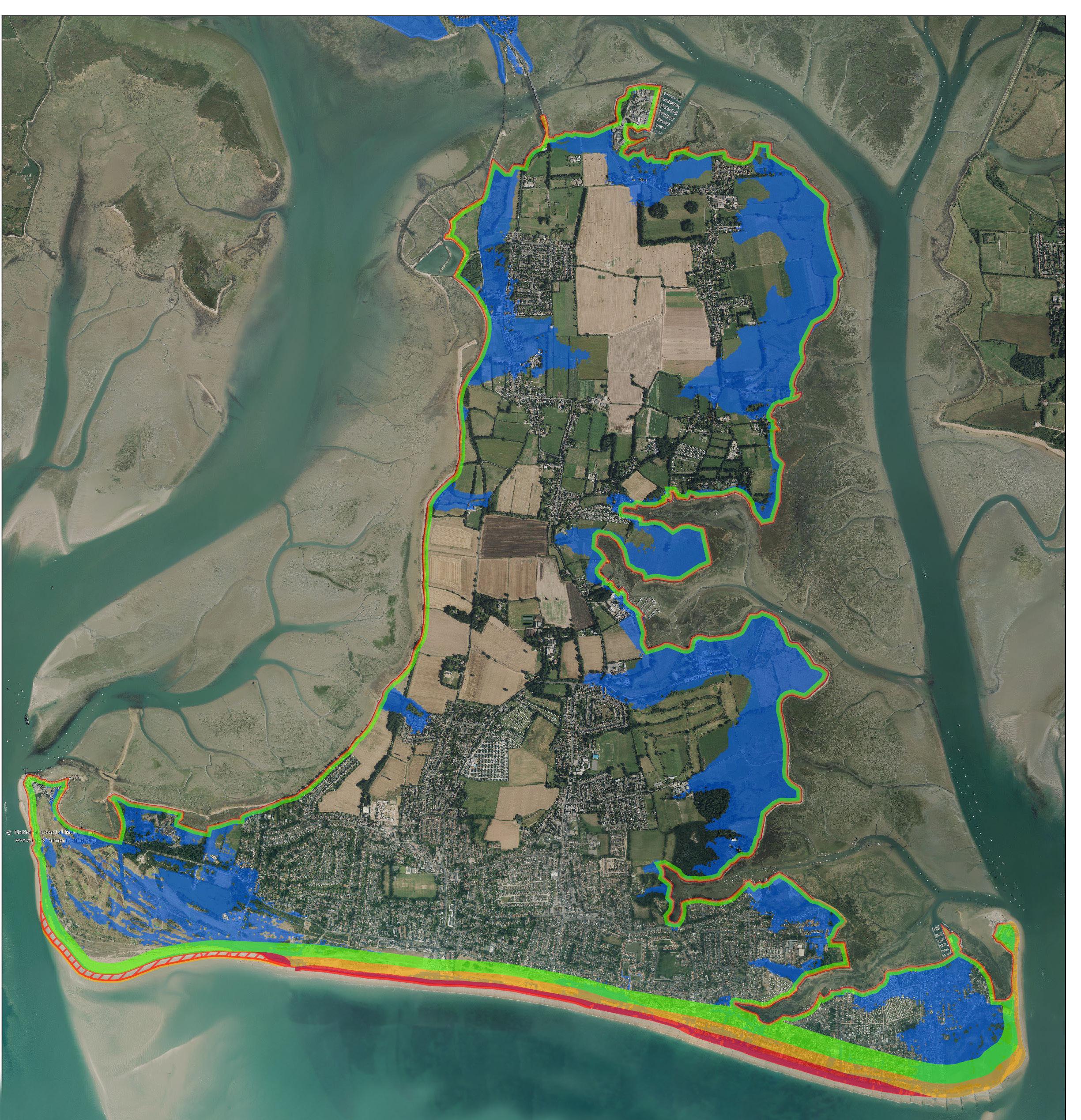
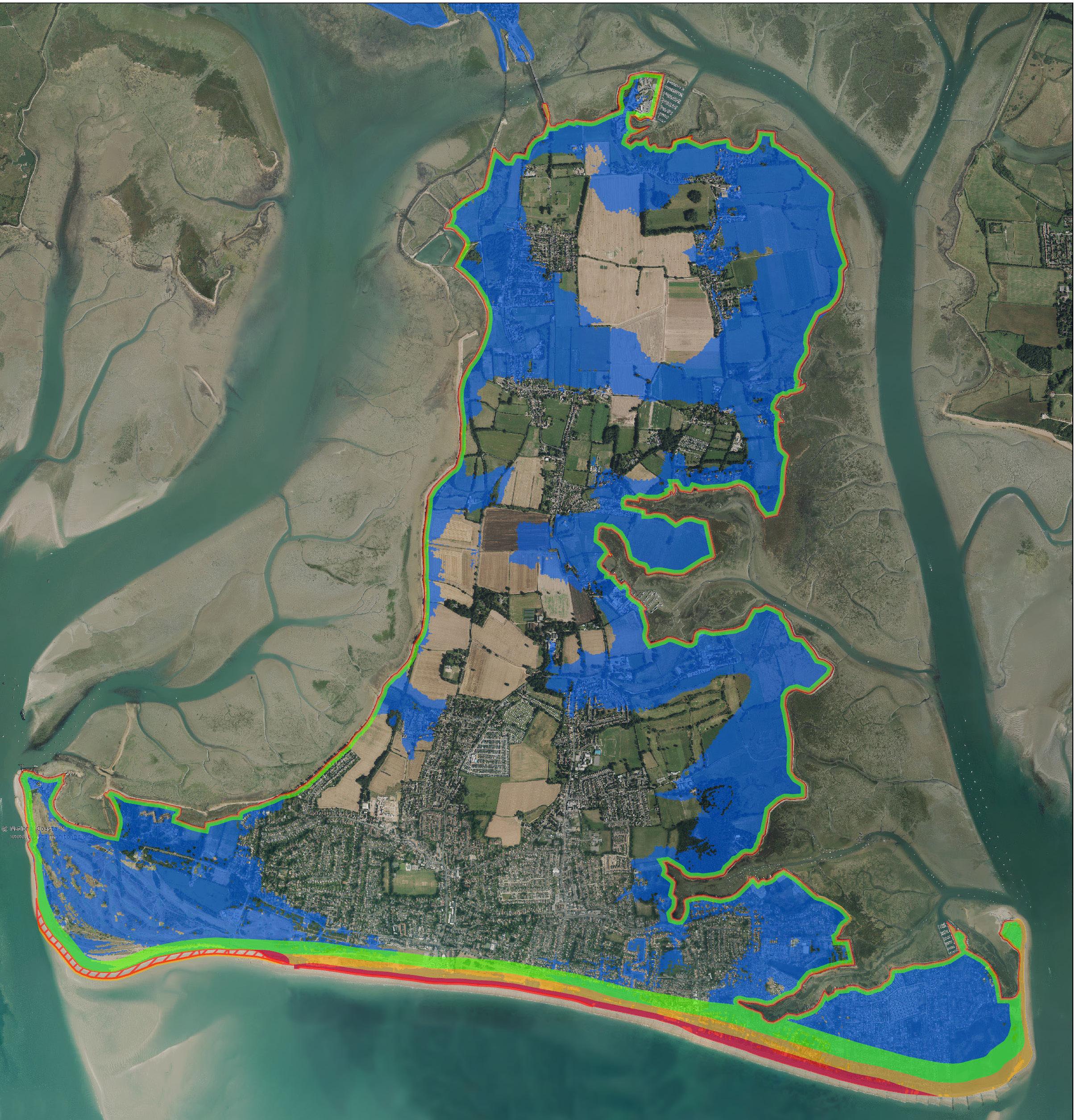
Wind Wave (5 second) Swell Wave (15 second) Bi-modal waves COPYRIGHT: Aerial Photography [2016]: Image Courtesy STRATEGY EROSION ZONES (Do nothing) Indicative erosion zone (0-20 years) Indicative erosion zone (20-50 years) Indicative erosion zone (50-100 years) Indicative accretion zone (0-20 years) Indicative accretion zone (20-50 years) 1 in 200 year, Do Nothing scenario with wave overtopping in year 2120 2020 2120 FLOOD AND COASTAL EROSION RISK ON HAYLING IF NOTHING IS DONE
1860 1890 1920 1950 1980 2010 GLOBAL TEMPERATURE CHANGE (1850 - 2022) Re-creation of a graphic by Ed Hawkins, National Centre for Atmospheric Science, University of Reading Bi-modal Waves graphic by Uwe Dornbusch at the Agency STRATEGY EROSION ZONES (Do nothing) Indicative erosion zone (0-20 years) Indicative erosion zone (20-50 years) Indicative erosion zone (50-100 years) Indicative accretion zone (0-20 years) Indicative accretion zone (20-50 years) 1 in 200 year, Do Nothing scenario with wave overtopping in year 2020 COPYRIGHT: Aerial Photography [2016]: Image Courtesy

Responding to Coastal Flooding
What is coastal flooding?
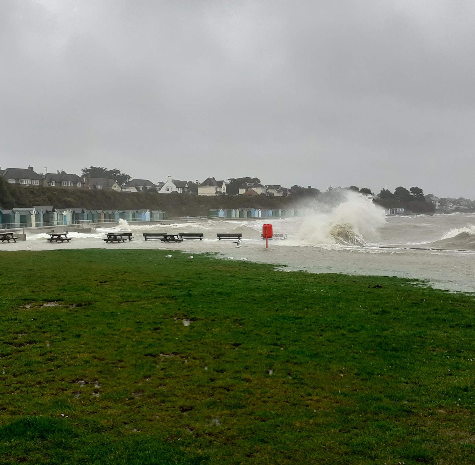
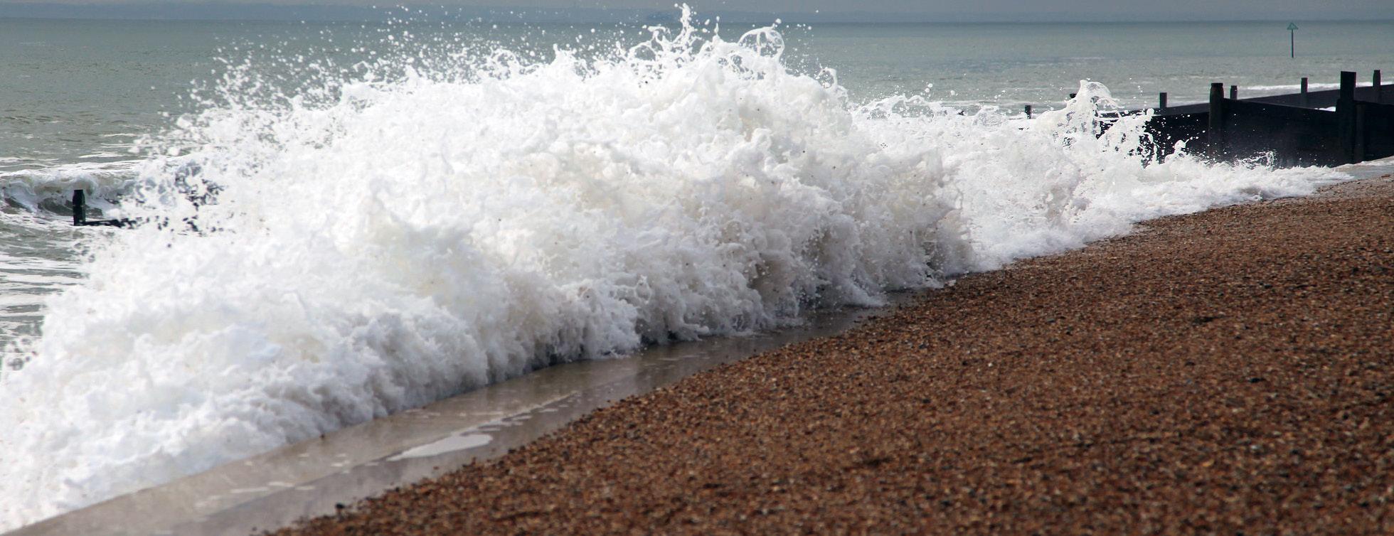
Coastal flooding is when extreme weather conditions influence tide levels. Low air pressure sometimes leads to an increase in tide heights over predicted levels. This is known as a tidal surge Deep low air pressure can also cause higher windspeeds, generating larger waves with more destructive energy.
Strong onshore wind can push waves up onto the beach, whereas strong offshore wind can make waves steeper and higher.
What happens if Coastal Flooding is predicted?
If extreme high tides and significant weather events are predicted, our Coastal Incident Officers (CIOs) will help co-ordinate the necessary coastal flood response.
CIOs are volunteers that are on call 365 days a year, 24 hours a day. They work closely with the Environment Agency (EA) to monitor weather and water level forecasts, providing technical assistance for coastal issues across our five partner authorities.
How do we know when to monitor the coast for possible flooding?
The EA uses a flood forecasting service to notify CIOs of potential flood events. The CIO will then work with Local Authority Emergency Planning Teams to advise on the response required. The CIO monitors the condition of the beaches and sea defences before a possible event and assesses whether further action is needed.
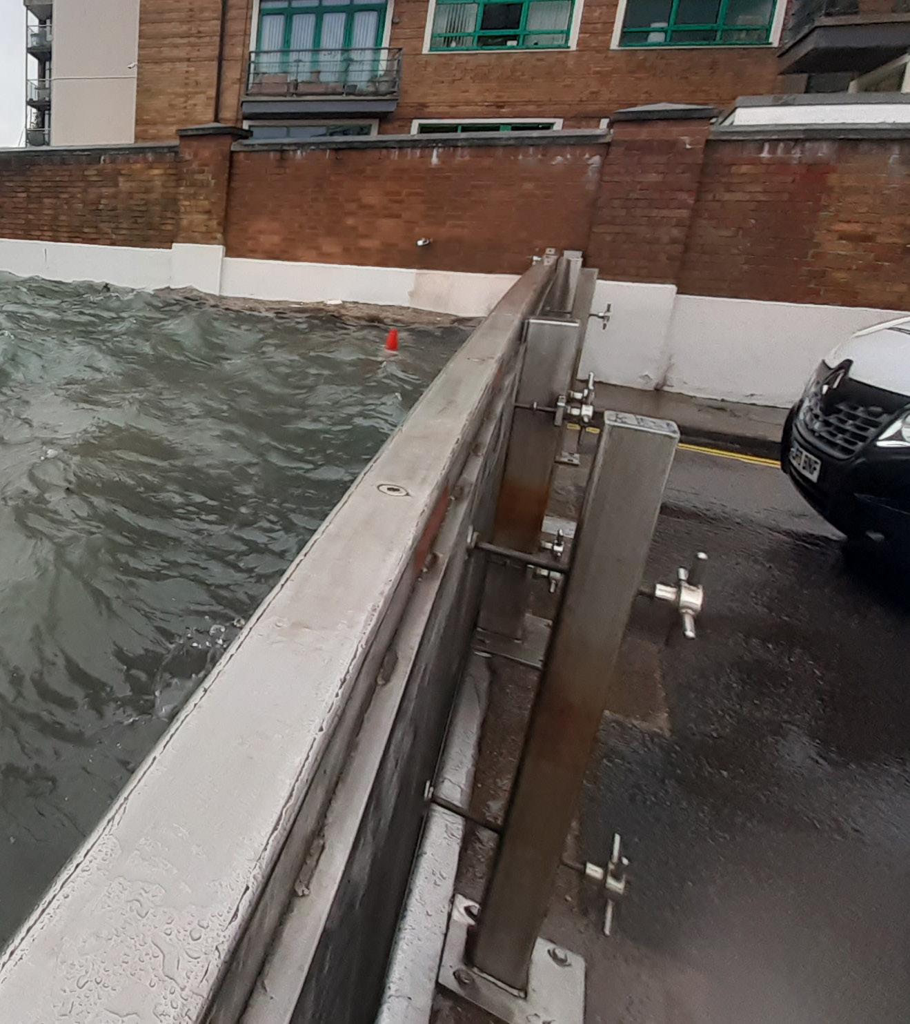
FloodControlEquipmentAcross ourRegion
Fareham
How can you prepare for a flood?
Even though we work hard to reduce flood risk it is important that landowners take the necessary steps to prepare for flooding events.
Check your EA flood risk:
Sign up for free flood alerts:

coastalpartners.org.uk
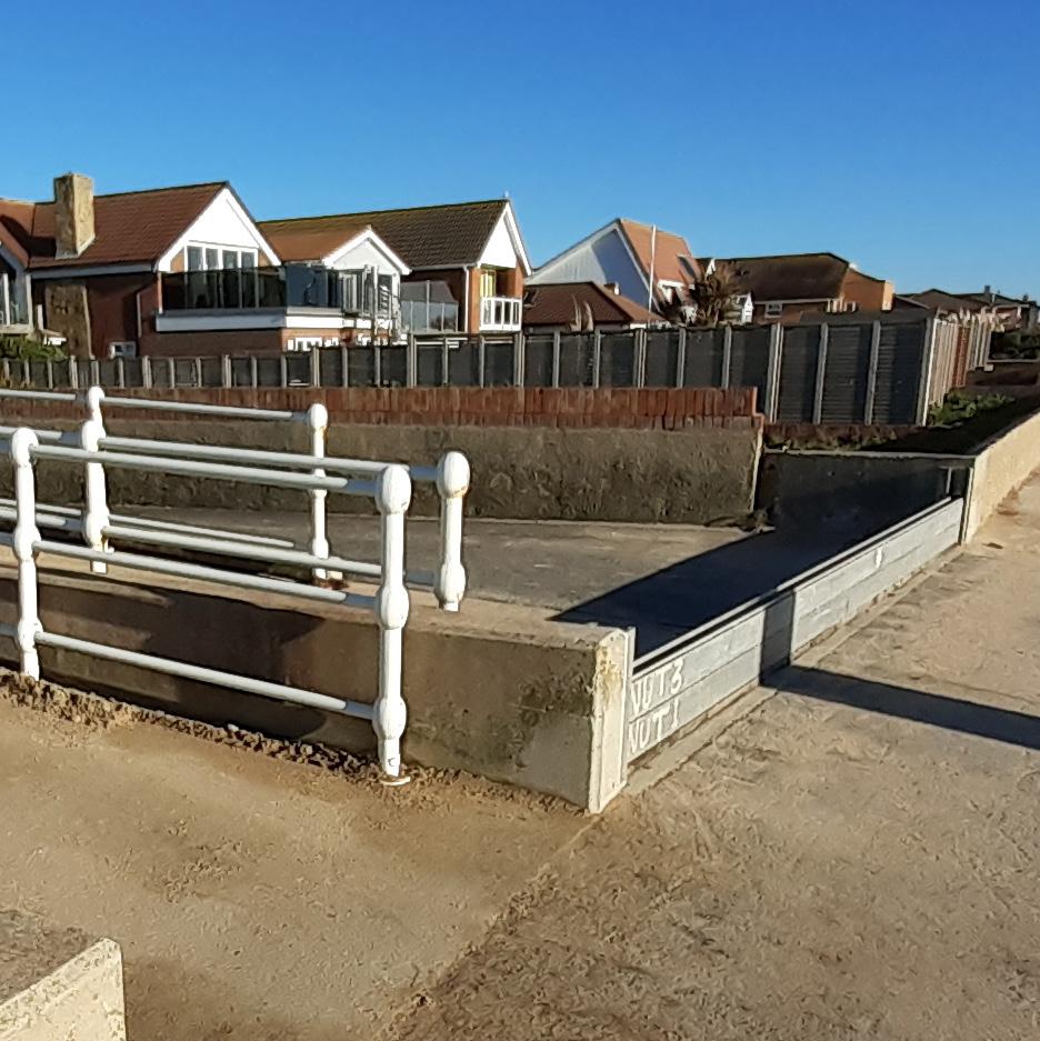
Eastoke, Hayling Island There are 9 areas across Eastoke beach in South Hayling that have a series of wooden or aluminium boards. All of these boards will be installed for the winter period to provide protection during large storms. They help contain and control the flow of water from the back of the beach into the drainage system. Selsey, Chichester A total of 8 flood boards in place for the winter months at Selsey. Should these gates need to be closed at any other time, our local resident groups and onsite contractors to ensure that the right level of protection is provided along the eastern Selsey coastline. Old Portsmouth There are 17 sites where flood gates and removable flood boards have been built into structures around Old Portsmouth and Southsea. When a response is needed, the CIO instructs onsite teams to close specific flood gates or install flood boards based on the forecast tidal levels. A full closure can take up to 5 hours to complete and will protect much of Old Portsmouth from high water levels.
For more details, visit our website: and Gosport Local emergency planners lead the response for Fareham and Gosport. We advise on whether additional property level protection such as sandbags should be implemented within the more vulnerable communities.
Coastal Flooding
Who’s Responsible?
The past century has seen a significant rise in sea levels, putting more than 1.9 million people in England at risk of coastal erosion and flooding.
When there is coastal flooding, several organisations and individuals have a responsibility to take action.
The Department for Environment, Food and Rural Affairs (Defra) has the overall policy responsibility for flood and coastal erosion risk management in England.
Under the Coast Protection Act
1949 and Land Drainage Act 1991 Local Authorities and the Environment Agency (EA) have permissive powers to carry out work to reduce the risk of erosion and flooding by the sea.
In spite of this, it is not a legal obligation for Local Authorities to carry out coastal protection work.
The Local Authority delivers coastal protection projects using permissive powers where it is in the public interest. The proposed works must provide:
• A clear economic benefit.
• A practical engineering solution which can be achieved.
• A solution which meets Environmental legislation.
Private land owners have ultimate responsibility for protecting their own property from flooding and erosion.
They must act within statutory planning regulations and other applicable legislation.
, have overall strategic oversight of flood and coastal erosion risk management in England. It also provides and operates Flood Warning systems.

coastalpartners.org.uk
Photo by Keith Lawlor LRPS
Funding Flood & Coastal Erosion Risk Management
The cost of projects which reduce the risk of flooding or erosion can run into the millions of pounds.
Since every scheme is unique, it takes careful planning, designing, and material selection to provide workable solutions that manage the power of the sea.
Local Authorities (LA’s) are not required by law to carry out coastal protection work or maintain defences. However, where there are significant public benefits, they can take steps to try and secure government funding for coastal protection projects.
Defra Grant in Aid (GiA) is government funding that can be accessed by Local Authorities through a well-evidenced business case. Competition for funds is high and Defra primarily prioritises funding towards projects which protect the highest numbers of properties and reduce risk to life. Funding is also made available for projects which help to improve the natural environment.
West Beach, South West Hayling There
Eastoke, South East Hayling The

coastalpartners.org.uk
South Hayling Beach Management Plan in place along Hayling Seafront has historically been funded via Defra GiA. This is because of the high risk of flooding and erosion to homes and property in this area. This funding is specifically for the movement of shingle. Routine maintenance costs of seawalls and the groynes must be funded by Borough Council
havant.gov.uk
are fewer homes here and a more natural environment which is important for amenity. New or replacement defences at West Beach would require significant funding and would be ineligible for Defra GiA Landowners may choose to fund maintenance and replacement of their own sea defences, to protect their land.
Managing Eastoke’s Risk of Flooding

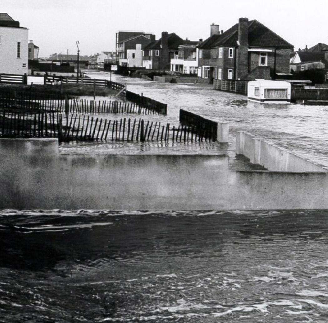
Eastoke is an exposed coastal location that has always been vulnerable to flooding. When homes were built there in the 1920’s the flood risk wasn’t fully understood and prepared for.
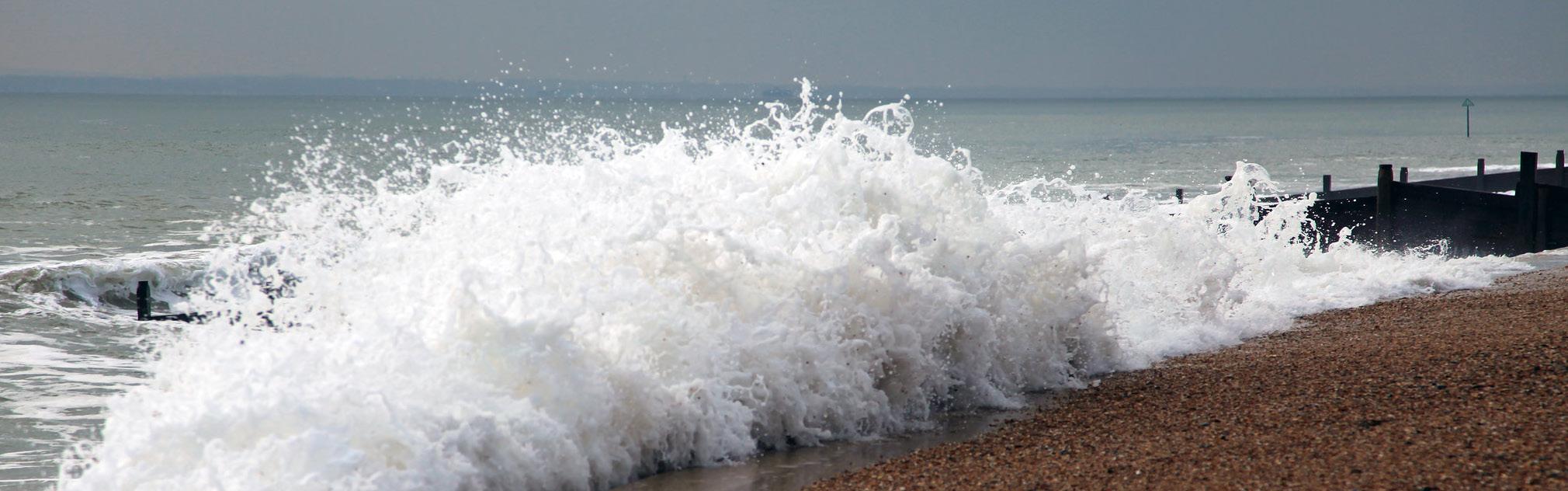
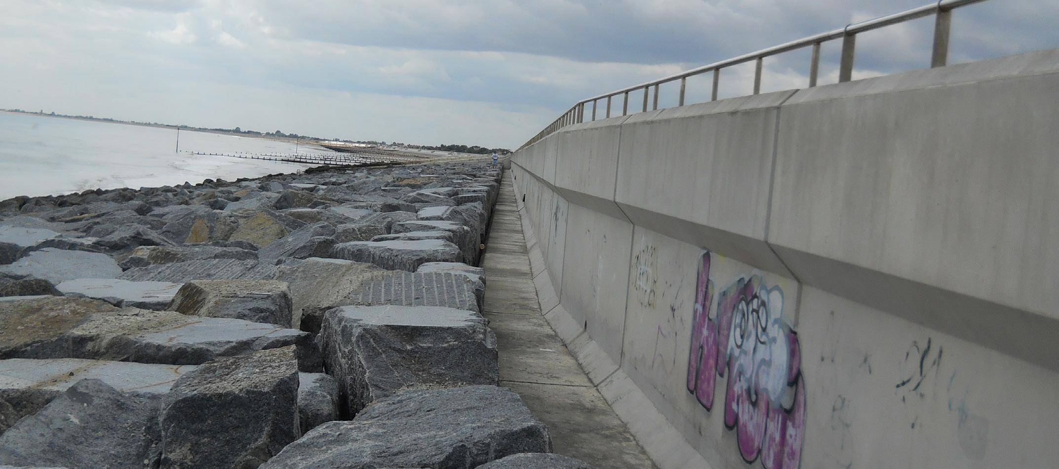
In 1947, the first flood defence seawalls were constructed at Eastoke, with limited success. In 1985, these flood defences were enhanced by building and maintaining a wide shingle beach in front of them. This has resulted in a consistent and reliable reduction of flooding in the area.
The benefits of a shingle beach at Eastoke
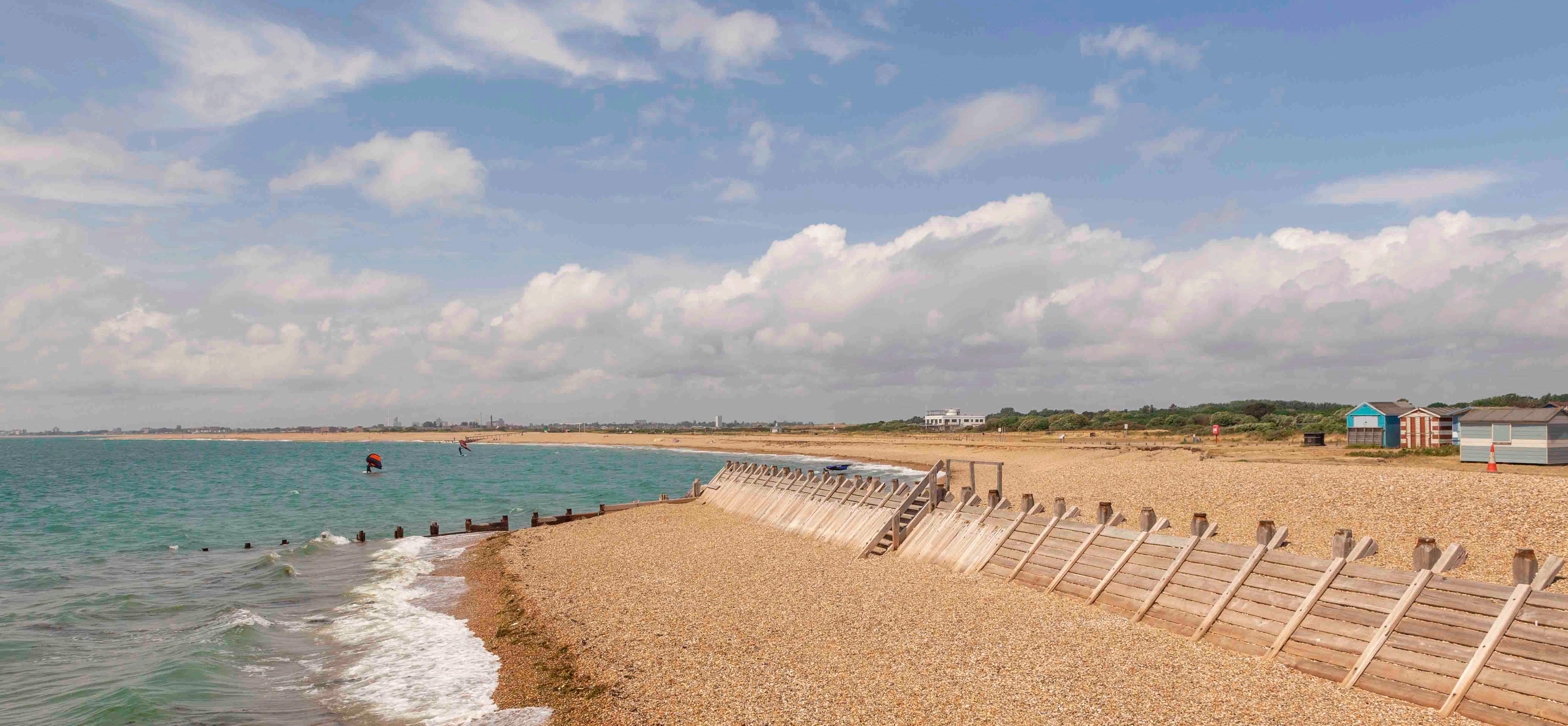
The coastal management policy for Eastoke is ‘Hold the Line’, which means the existing coastal defences are maintained and protected. If this were to change to a ‘Do Nothing’ policy, the beach would be washed away to Gunner Point by storms, uncovering the existing seawall and increasing the risk of flooding to the area.
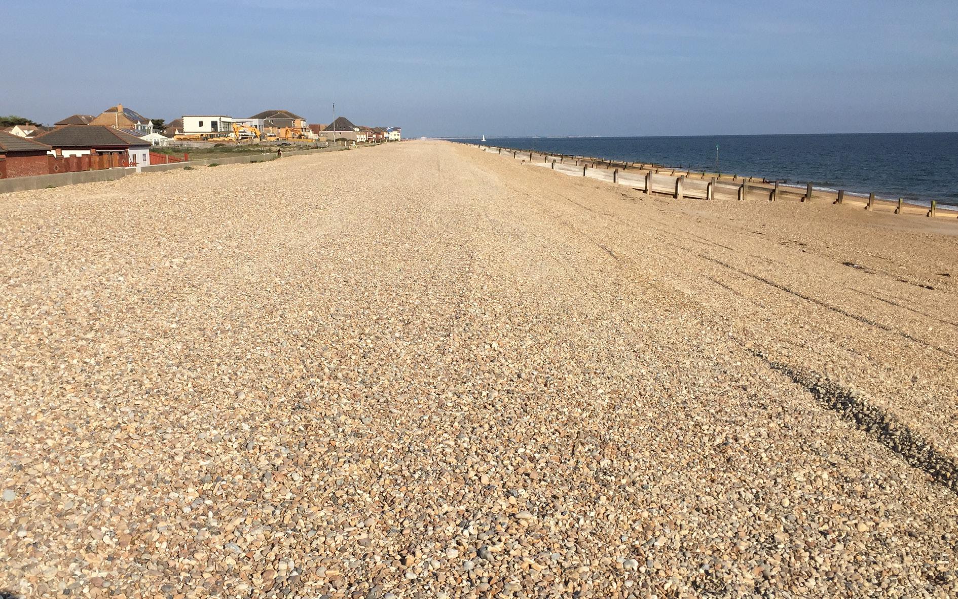
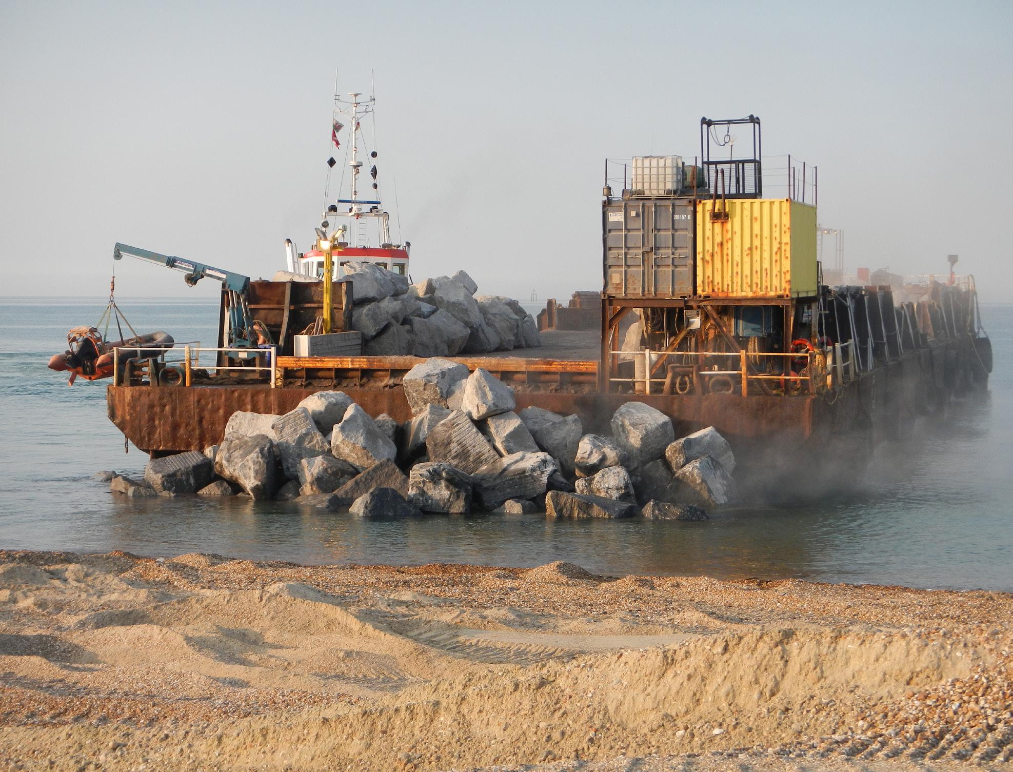
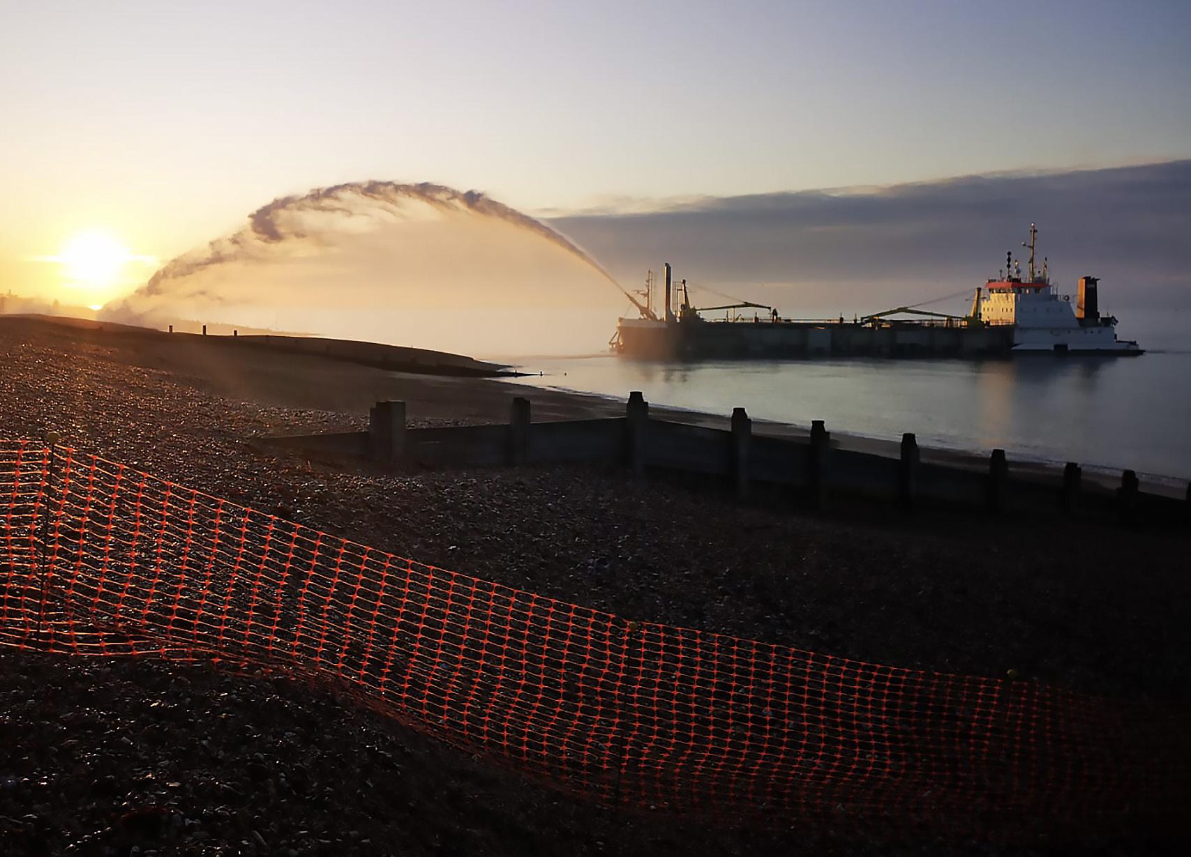
The process of returning the washed away shingle to maintain a healthy beach is the main component of South Hayling’s Beach Management Plan (BMP). The BMP ensures that the beach absorbs energy from the force of storm waves, which helps to reduce flooding and coastline erosion.
The shingle beach not only disperses the power of storm waves, it also reduces the requirement for a high wall which would block sea views and beach access.
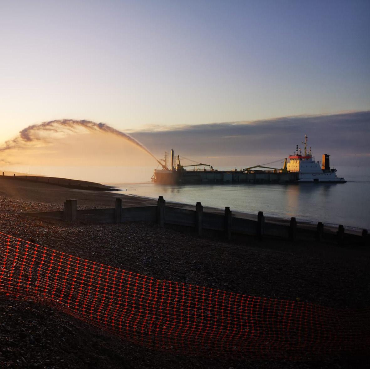
Funding and planning beach management
We plan our beach management replenishment work ahead of the stormy winter period and the busy summer period. We appreciate these works can lead to noise and disruption to seafront residents and beach users, and we do our best to minimise this. The seafront has several environmental designations, and we work sensitively to avoid harm to these features.

coastalpartners.org.uk havant.gov.uk
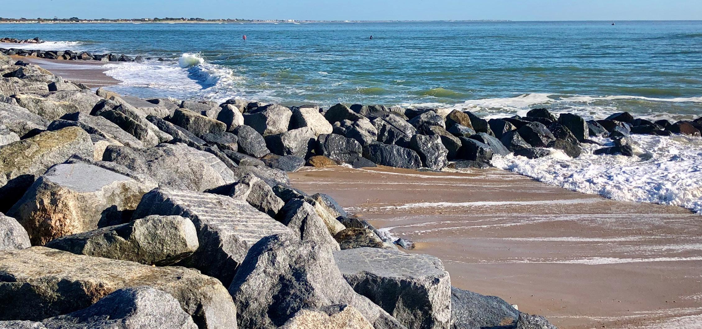
The sea wall at Dymchurch in Kent. Defences like this can obstruct coastal views and block access to the beach.


VISION:
Environmental Partnerships
Three Harbours Partnership
We envisage a healthy and thriving environment where restored and connected sea and landscape are resilient to a new climate reality, enabling people and nature to adapt and flourish - together.
MISSION:
To help nature thrive across Chichester, Langstone and Pagham Harbours, through the expertise, network and resource of the partnership.


VISION:
Our long-term vision is to protect and restore at least 30 per cent of the Solent’s seascape, tipping the balance from a degraded state to a naturally expanding, connected and productive ecosystem. By restoring and connecting the Solent’s seascape, we will provide nature-based solutions to many of the issues currently affecting it and people who depend on it, as well as helping to fight the impacts of climate change.

VISION:
Chichester Harbour Protection & Recovery Of Nature
Our vision for Chichester Harbour in 2050, is a harbour that is functioning naturally as a healthy and thriving ecosystem, with its network of diverse coastal habitats rich in wildlife, increasing biodiversity that is resilient to environmental and anthropogenic pressures, maximising ecosystem services benefits and supporting nature recovery for generations to come.
HOW:
This vision will be achieved through a partnership, collaborating with communities, businesses, landowners, farmers, public bodies, academia, industry and NGOs, all working together through innovative ways to create a harbour where nature and people thrive in harmony.


coastalpartners.org.uk
Seamus Pond - Farlington Marshes Langstone Harbour, by Geni Chichester Harbour, by Amanda Pagham Harbour by Norton Priory Coastal Vegetation, by Amanda Spartina Saltmarsh, by Amanda Ringed Plover, by Terry Codlin Ringed Plover Nest, by Terry Codlin Seagrass, Solent Seascape Project Redshank by Roger Common Terns by Wez Smith RSPB
Solent Seascape Project
Scan for more information Scan for more information Scan for more information

Hayling Island Coastal Management Strategy
We began by looking at the baseline situation today, and used modelling to understand the coastal flood and erosion risks now and in the future with climate change. We have explored different ways to manage Hayling Island’s coast, engaging with stakeholders, and using economic, technical, social and environmental criteria, have selected a suite of leading coastal management options for the island.
We are updating the draft Strategy to include adaptation pathways to allow us more flexibility to manage risks and adapt to changing conditions over time. These pathways will be included in the updated Strategy later this year.
A Timeline of Events:
2010
2020
North Solent Shoreline Management Plan
2010
START OF THE JOURNEY
Hayling Island Funding & Implementation Strategy
2019
Identified the need for a coastal management strategy for Hayling Island
HAYLING ISLAND COASTAL MANAGEMENT STRATEGY
What will the Strategy deliver?
The Strategy will:
• Guide how Hayling Island’s coastal frontages may be sustainably managed for the next 100 years.
• Consider the effects of predicted climate change, including sea level rise.
• Identify where, when and broadly what type of works are needed in the short term to manage the risks of coastal flooding and erosion and what they may cost.
• Consider where we can make space for nature.
• Incorporate adaptation strategies.
2024
2024+
How is the Strategy Funded?
The Strategy is funded by Flood Defence Grant in Aid, managed by the Environment Agency, in conjunction with Havant Borough Council Community Infrastructure Levy.
FINAL STRATEGY, APPROVAL AND ADOPTION


SUBJECT
FUNDING, IMPLEMENT
TO
STRATEGY RECOMMENDATIONS
Defence Schemes/ Beach Management Landowner Maintenance/ Improvements Adaptation
havant.gov.uk coastalpartners.org.uk
Short Term Action Plan
A short term action plan is shown, which sets out a 10 year programme of priority studies and works required to facilitate the delivery of the Strategy.
How will this be funded?
• There is no guarantee that any of these options will be progressed, its all down to funding.
• Significant funding from a variety of sources will be needed to progress any options.
• Public funds for coastal management are not widely available and key criteria have to be met in order to apply for funds, but it may be possible to secure some funds for key areas such as Eastoke, Selsmore and Mengham.
• We will work to develop business cases to progress schemes if there is funding and if it’s in the public interest (where there is a technical, environmental, social and economic solution)
• At the end of the day, landowners are ultimately responsible for maintaining or improving their own defences.
• The reality is that we will need to look to adaptation as a realistic response to coastal risks on the Island now and in the future.
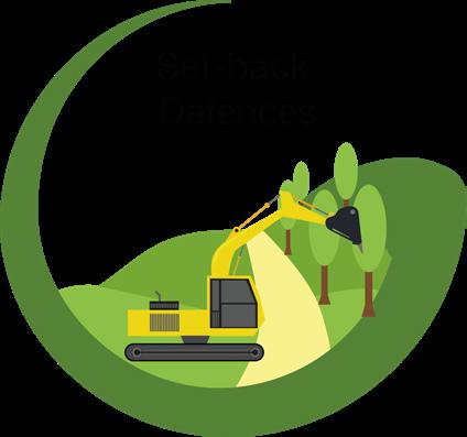
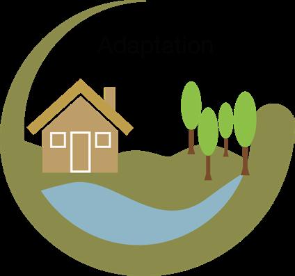
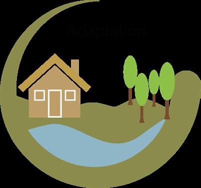
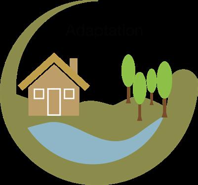
Coastal Adaptation ACCOMMODATE AVOID RETREAT
Coastal adaptation should be considered in all locations alongside the leading strategic options presented. We need to explore methods to adjust to the reality of present and future coastal flooding and erosion risk.
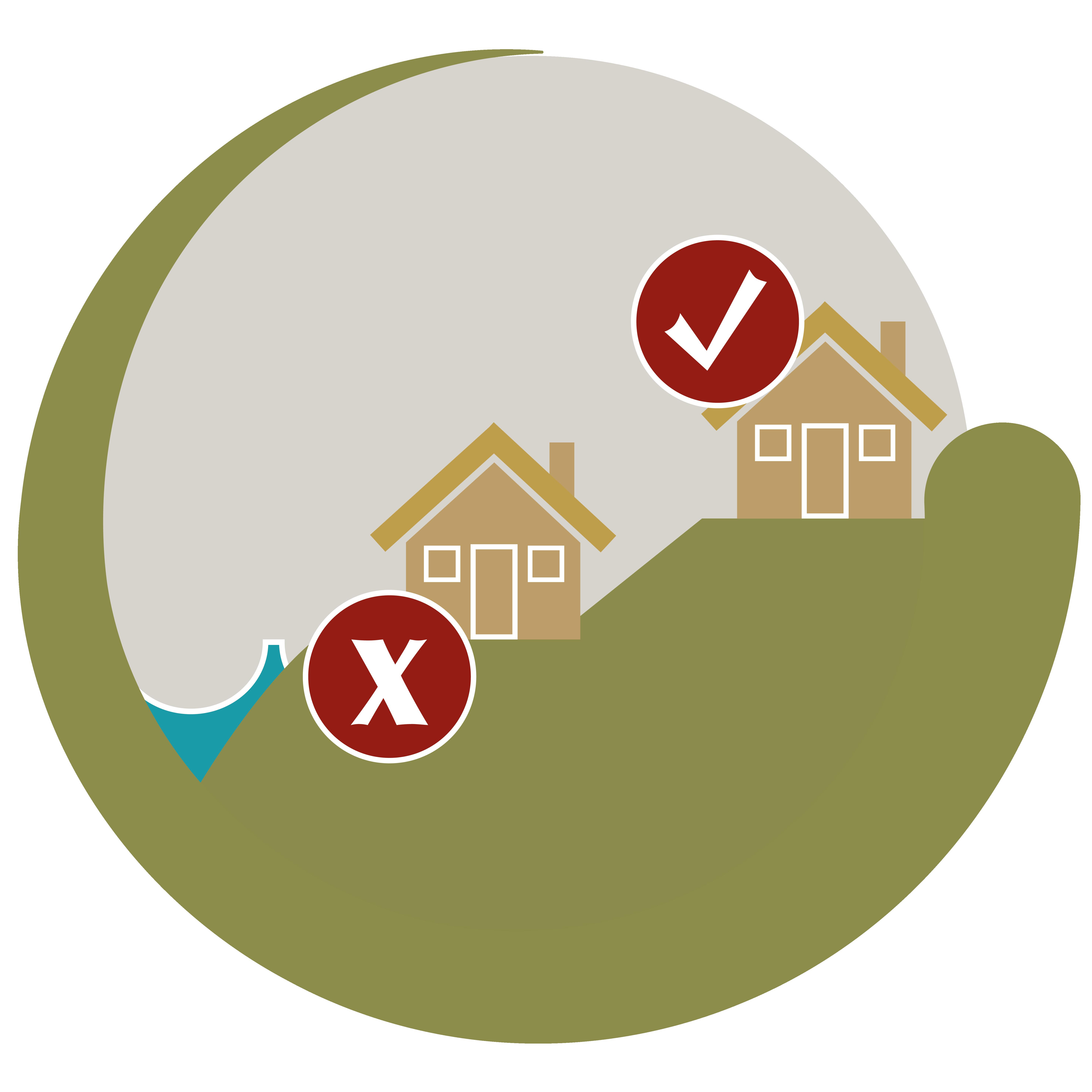
• Identify future ‘no-build areas.’
• Use risk informed land-use planning to prevent new development in areas at risk now or in the future.

• Change land use.
• Make property resilient to flooding.
• Raise community awareness.
• Community support groups.
• Flood warning.
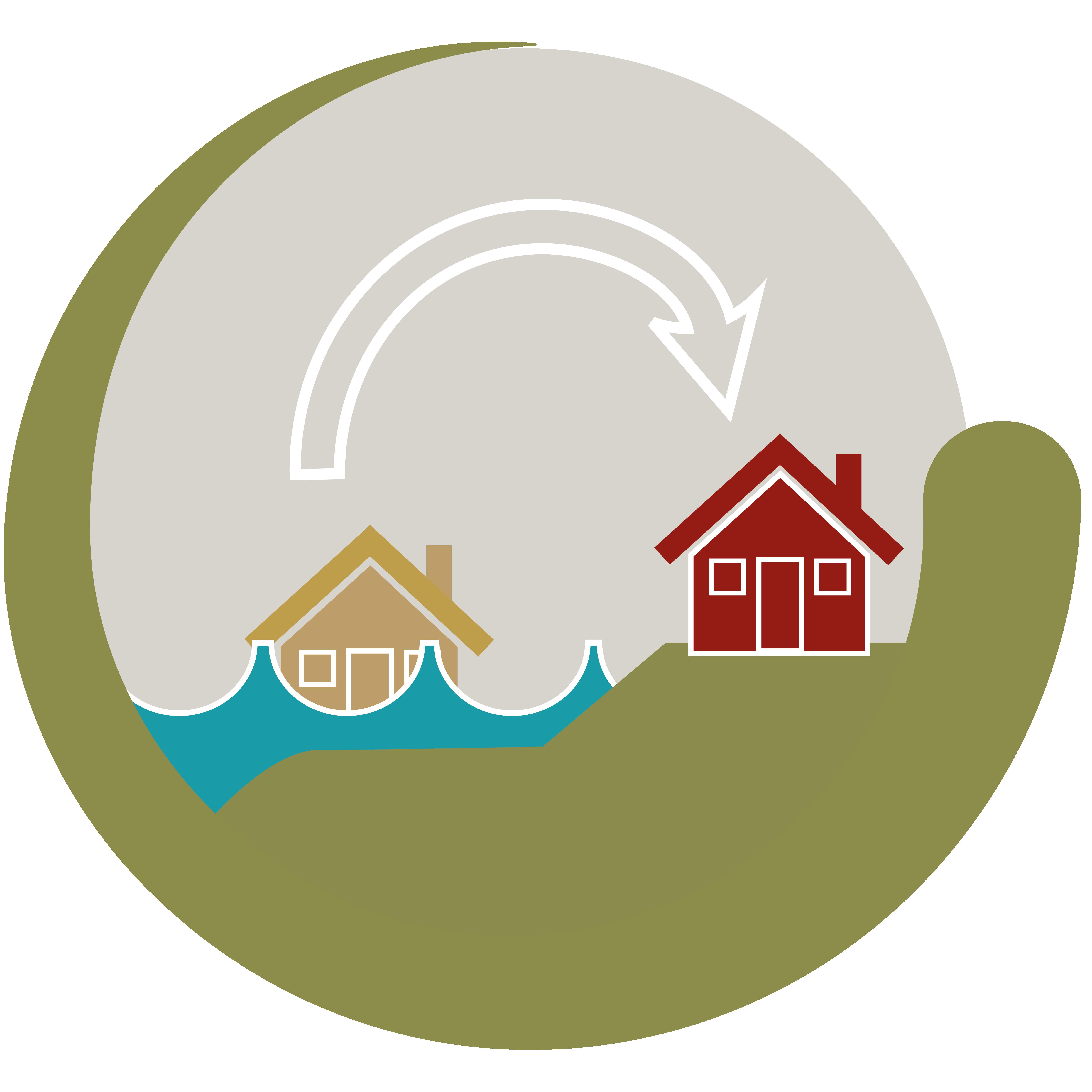
• Withdraw, relocate or abandon assets that are at risk.
• Habitats are able to move landward as sea levels rise.
havant.gov.uk coastalpartners.org.uk
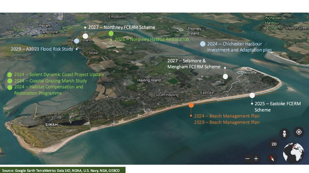
2025 2026 2027 2028 2029 2030 2031 2032 2033 2034 Solent Dynamic Coast Project Update Solent Dynamic Coast Project Update Solent Dynamic Coast Project Update Secure funding Undertake Study Secure funding Undertake Study Secure funding Continue with programme Chicester Harbour Investment and Adaptation Plan Secure funding Develop Adaptation Plan South Hayling Beach Management Plan BMP Beach management activities Develop new BML & business case Beach management activities Eastoke FCERM Scheme Feasibility & Business Case Detailed Design & consenting Construction Northney Habitat Restoration Secure funding Feasibility & Business Case Detailed Design & consenting Construction Selsmore & Mengham FCERM Scheme Feasibility & Business Case Detailed Design & consenting Construction Secure funding Secure funding Northney FCERM Scheme Feasibility & Business Case Detailed Design & consenting Construction Secure funding A3023 Flood Risk Study Secure funding Develop Study Source: Google Earth TerraMetrics Data SIO, NOAA, U.S Navy, NGA, GEBCO Photo by Keith Lawlor LRPS 2024
Draft Strategy for North East Hayling
ODU
ODU
ODU


Intent: Maintain viability of Northney Rd and the A3023 into the future as sea levels rise. Leading Option: Reduce the impacts of the tide. How: Construction of new defences along the road and raise over time to keep pace with sea level rise.
1a: Langstone Bridge to Northney Marina Short Term Medium Term Long Term Intent: Stop landfill eroding into the harbour into the future as sea levels rise. Leading Option: Reducing the impacts of the tide. How: Construction of new defences along existing alignment, maintain and raise over time to keep pace with sea level rise.
1c: Spinnaker Grange (east) to Northney Farm Short Term Medium Term Long Term Intent: Maintain flood protection to properties while making space for nature by creating a more sustainable defence alignment into the future. Leading Option: Adapting to the tide. How: Construct new set-back defences where appropriate, maintain and raise over time to keep pace with sea level rise.
1b: Northney Marina to Spinnaker Grange (east) Short Term Medium Term Long Term Intent: Maximise agricultural opportunities while making space for nature to maintain the viability of agricultural land while exploring a more sustainable defence alignment into the future. Leading Option: Adapting to the tide. How: Construct new defences over time, and set back where appropriate, maintain and raise to keep pace with sea level rise.
Northney Farm to Chichester Road Short Term Medium Term Long Term Intent: Landowners to maintain their own flood and erosion protection to assets and businesses or adapt to become more resilient to flooding in the future. Leading Option: Adapting to the tide. How: Private maintenance or replacement of defences by landowner or adaptation.
2: Northney Marina Short Term Medium Term Long Term Intent: Landowners to maintain their flood and erosion protection to assets and businesses or adapt to become more resilient to flooding in the future. Leading Option: Adapting to the tide. How: Private maintenance or replacement of defences by landowners or adaptation.
4: Chichester Road to Mill Rythe Junior School Short Term Medium Term Long Term ST E CopseLn W e s t L n A3023 A3023 OK ODU 1a ODU 2 ODU 1b ODU 1c ODU 3 ODU 4 NORTHNEY havant.gov.uk coastalpartners.org.uk
full details on the draft strategy, scan here:
ODU 3:
ODU
ODU
For


Draft Strategy for South East Hayling SouthwoodRd C h u r c h R d Elm Grove A 3 0 2 3 ODU 6 ODU 5a ODU 5b ODU 5c ODU 7 SELSMORE MENGHAM Intent: Maintain and improve flood protection to properties and businesses. Leading Option: Reduce the impacts of the tide. How: Construct new defences, maintain and raise over time to keep pace with sea level rise. ODU 5a: Mill Rythe Junior School to Tournerbury Farm Short Term Medium Term Long Term Intent: Make space for nature by creating a more sustainable defence alignment into the future. Leading Option: Adapting to the tide. How: Construct new set-back defences, maintain and raise over time to keep pace with sea level rise. ODU 5b: Tournerbury Farm to Tournerbury Woods Estate Short Term Medium Term Long Term Intent: Landowners to maintain their own flood and erosion protection to assets and businesses or adapt to become more resilient to flooding in the future. Leading Option: Reducing the impacts of the tide. How: Private maintenance or replacement of defences by landowner or adaptation. ODU 5c: Tournerbury Woods Estate to Salterns Lane Short Term Medium Term Long Term Intent: Maintain flood protection to the residents, community and businesses at Selsmore. Leading Option: Reducing the impacts of the tide. How: Private maintenance of defences in the short and medium term, then construct and maintain new defences in the longer term.
6: Salterns Lane to Wilsons Boat Yard Short Term Medium Term Long Term havant.gov.uk coastalpartners.org.uk For full details on the draft strategy, scan here: Intent: Maintain flood protection to the residents, community and businesses at Selsmore. Leading Option: Reducing the impacts of the tide. How: Construct new defences, maintain and raise over time to keep pace with sea level rise. ODU 7: Wilsons Boat yard to Fishery Creek Short Term Medium Term Long Term
ODU
ODU

ODU
ODU

For full details on the draft strategy, scan here:
ODU
ODU
Sea Front Sea Front SouthwoodRd Elm Grove EASTOKE A 3 0 2 3 ODU 10s ODU 10n ODU 9 ODU 8s ODU 8n
Intent: Maintain a healthy beach alongside flood and erosion protection to residents, community and businesses at Eastoke. Leading Option: Reduce the impacts of the tide. How: Construct new defences (flood walls, crest raising and set back floodwalls), maintain and raise over time to keep pace with sea level rise.
Draft Strategy for South Hayling
8 North: Fishery Creek to Sandy Point Nature Reserve Short Term Medium Term Long Term Intent: Maintain a healthy beach alongside flood and erosion protection to residents, community and businesses at Eastoke. Leading Option: Reduce the impacts of the tide. How: Beach management alongside new rock groynes and construct new defences, maintain and raise over time to keep pace with sea level rise.
8 South: Sandy Point Nature Reserve to Eastoke Corner Short Term Medium Term Long Term Intent: Maintain a healthy beach alongside flood and erosion protection to residents, community and businesses along the seafront. Leading Option: Working with the tide. How: Continue beach management, new rock groynes and new defences to maintain the Inn on the Beach as a control structure, maintain and raise over time to keep pace with sea level rise.
9: Eastoke Corner to Inn on the Beach Short Term Medium Term Long Term Intent: Make space for nature while landowners maintain their flood and erosion protection to assets and businesses or adapt to become more resilient to flooding in the future. Leading Option: Adapting to the tide. How: Allow the coast to evolve as naturally as possible alongside private maintenance or replacement of defences or adaptation by landowners.
10 South: Inn on the Beach to the Ferry Boat Inn Short Term
Term Long Term Intent: Landowners to maintain their flood and erosion protection to assets and businesses or adapt to become more resilient to flooding in the future. Leading Option: Adapting to the tide. How: Private maintenance or replacement of defences by landowners or adaptation.
Medium
10 North: The Ferry Boat Inn to North Shore Road Short Term Medium Term Long Term havant.gov.uk coastalpartners.org.uk
For full details on the draft strategy, scan here:


C h W e s L n u r c h R d A3023 STOKE CopseLn A 3 0 2 3 ODU 11 ODU 12 ODU 14 ODU 15 ODU 13 ODU 16 Draft Strategy for West Hayling Intent: Maintain flood and erosion protection to residents. Leading Option: Reducing the impacts of the tide. How: Construct new defences in stages, maintain and raise to keep pace with sea level rise. ODU 11: North Shore Road Short Term Medium Term Long Term Intent: Make space for nature. Leading Option: Accepting the tide. How: Allowing the coast to evolve naturally, no active management. ODU 12: North Shore Road to Newtown Short Term Medium Term Long Term Intent: Maintain flood and erosion protection to residents, community and businesses at Newtown. Leading Option: Reducing the impacts of the tide. How: Maintain in the short term, construct new defences in the medium term, maintain and raise to keep pace with sea level rise. ODU 13: Newtown Short Term Medium Term Long Term Intent: Make space for nature. Leading Option: Accepting the tide. How: Do nothing, but consider realigning sections of the Hayling Billy Trail to maintain access. ODU 14: Newtown to Stoke Short Term Medium Term Long Term Intent: Maintain the viability of the Hayling Billy Trail and the community at Stoke while making space for nature by creating a more sustainable defence alignment into the future. Leading Option: Adapting to the tide How: Construct new defences, maintain and raise over time to keep pace with sea level rise.
15: Stoke to Langstone Bridge Car Park Short Term Medium Term Long Term Intent: Maintain the viability of the A3023 into the future as sea levels rise. Leading Option: Reducing the impacts of the tide. How: Construct new defences, maintain and raise over time to keep pace with sea level rise.
16: Langstone Bridge Car Park to Langstone Bridge Short Term Medium Term Long Term havant.gov.uk coastalpartners.org.uk
ODU
ODU
coastalpartners.org.uk Further Information Scan the QR codes for more Coastal Partners information... Environment About us Coastal Partners homepage Subscribe to our E-newsletter Email the Coastal Team at: coastal.team@havant.gov.uk for further questions Climate Change West Beach Maintenance South Hayling Beach Management Plan Flood Response