


HaylingIsland CoastalManagementStrategy–Preparingforaresilientfuture DraftStrategy ConsultationSummaryBooklet October2022


TheStrategywasproducedforHavantBorough CouncilbyCoastalPartnerswithtechnicalassistance fromtheengineeringconsultantAECOM. ThisprojectwasfundedbytheEnvironmentAgency fromFDGiA(FloodDefenceGrantinAid)andby HavantBoroughCouncilthroughLocalLevy. CopyrightNotice:Thecontentsofthispublicationaresubjecttocopyrightprotection.ReproductioninwholeorinpartisforbiddenwithoutthepriorconsentofCoastalPartners.
Contents Chapter1:Introduction StrategyObjectives TheShorelineManagementPlanhierarchy ShorelineManagementPlanpolicies Theneedforastrategicapproach Purposeandstructureofthisdocument Supportinginformation Chapter2:Whatisatriskifwedonothing? BaselineScenario–DoNothing WhatisatriskifweDoNothing? Sealevelriseandincreasingrisk Erosion Chapter3:HowTheStrategyhasbeendeveloped Overviewofthestudyarea–keyfeatures,issues&opportunities Coastalprocessesoverview Coastallandfillsites Environmentaldesignations Heritageandrecreation Stakeholderengagement Existingdefences AbriefhistoryofCoastalManagementonHaylingIsland BeachmanagementonHaylingIsland Strategydevelopment GlossaryandAcronyms Chapter4:StrategyOverview Aphasedapproachtomanagementbasedonrisk Howwillfuturemanagementbepaidfor? Deliveringmore–broaderoutcomesandcontributions Adaptation ii 1 9 14 32 Chapter5:DraftStrategyLeadingOptions ODU1–LangstoneBridgetoNorthneyFarm ODU2–NorthneyMarina ODU3–NorthneyFarmtoChichesterRoad ODU4–ChichesterRoadtoMillRytheJuniorSchool ODU5–MillRytheJuniorSchooltoSalternsLane ODU6–SalternsLanetoWilsonsBoatYard ODU7–WilsonsBoatYardtoFisheryCreek ODU8–Eastoke ODU9–EastokeCornertoInnontheBeach ODU10–InnontheBeachtoNorthShoreRoad ODU11–NorthShoreRoad ODU12–NorthShoreRoadtoNewtown ODU13–Newtown ODU14–NewtowntoStoke ODU15–StoketoLangstoneBridgeCarpark ODU16–LangstoneBridgeCarparktoLangstoneBridge StrategyLeadingOptionCostsandBenefits ShortTermActionPlan 37 i 75Chapter6:Whathappensnext? 3 4 5 6 7 8 10 11 12 13 15 16 17 18 20 21 22 23 24 25 33 33 34 35 39 41 43 45 47 49 51 53 55 57 59 61 63 65 67 69 71 72
AEP(AnnualExceedanceProbability)
Thechanceorprobabilitythatafloodeventofacertainscalewilloccurata specifiedlocationinanygivenyear.
Baseline
Definesanexistingcondition/situation(usuallyDoNothing)againstwhichoptions orscenariosarecompared.
Bi-modalwaves
Abimodalseastateoccurswhenbothswellwaves(lowerinheightbuthavea longerwaveperiod)andlocallygeneratedstormwaves(highwaveheightsbut shorterwaveperiod)arepresent.Theyresultinaveryenergeticwavespectrum thatcanbeverydamagingtothecoastline.Formoreinformationonhowthese wavesimpactHaylingIslandvisitBimodalSummary—CoastalPartners.
HTL(HoldtheLine)
Apolicywithanoverarchingintenttobuildormaintaincoastaldefencessothat thepositionoftheshorelineremainswhereitcurrentlyis.
Leachate
Aliquidthatabsorbscontaminantsfromthesoilasitpassesthrough.Leachateis relevanttocontaminatedlandstudiesandcantransportcontaminatedmaterials (i.e.heavymetals)totheshoreline.
ManagedRealignment(MR)
Allowingtheshorelinetomovenaturally,butmanagingtheprocesstodirectitin certainareas.Thisisusuallydoneinlow-lyingareas,butmayoccasionallyapply tocliffs.
NoActiveIntervention(NAI)orDoNothing
Noplannedinvestmentindefendingagainstfloodingorerosion,whetherornot acoastaldefencehasexistedpreviously.
OptionDevelopmentUnit(ODU)
Asectionofthecoastlineinwhichlocalscaleoptionstomanagefloodand erosionriskaredeveloped.
PropertyLevelResilience(PLR)
Floodmitigationmeasuresappliedtoindividualpropertiesthatreducetheriskof floodingonapropertylevel(i.e.doorflooddefendersetc).
Residuallife
Thetimeleft(typicallyinyears)thatadefencestructurehasbeforeitcomesto theendofitsservicelife.Theresiduallifeisestimatedfromadefencecondition surveyandassumesthatnomaintenanceworkswillbecarriedoutinthefuture.
Scheme
Ameasure,orcombinationofmeasuresundertakentoincreasethelevelof protectionagainstfloodinganderosiontoalocalarea(i.e.anewfloodwall structure).
SMP(ShorelineManagementPlan)
Ahigh-levelnon-statutoryplanningdocumentwhichprovidesabroadscale assessmentoftheriskassociatedwithcoastalfloodinganderosionandpresents thealong-termpolicyframeworktoreducetheseriskstopeopleandthe developed,historicandnaturalenvironmentinasustainablemanner.
StandardofProtection(SoP)
Theleveloffloodriskthatacoastaldefencestructureisdesignedtoprotect against.Thelikelihoodthatacertainleveloffloodingwilloccurisdescribedas the'chance'thatalocationwillfloodinanyoneyear.Thisriskcanbeexpressed asa1in100(1%)chanceoffloodinginanyoneyear,ora1in200(0.5%)chance, andsoon.Inanyoneyearalarge(0.5%)floodeventhaslesschanceof happeningthanasmaller1%or2%floodevent.
Sustain
Thisisatermwhichreferstooptionsthatkeeppacewithchange(e.g.sealevel rise).Thisisachievedbyraisingorupgradingdefencesinthefuture.
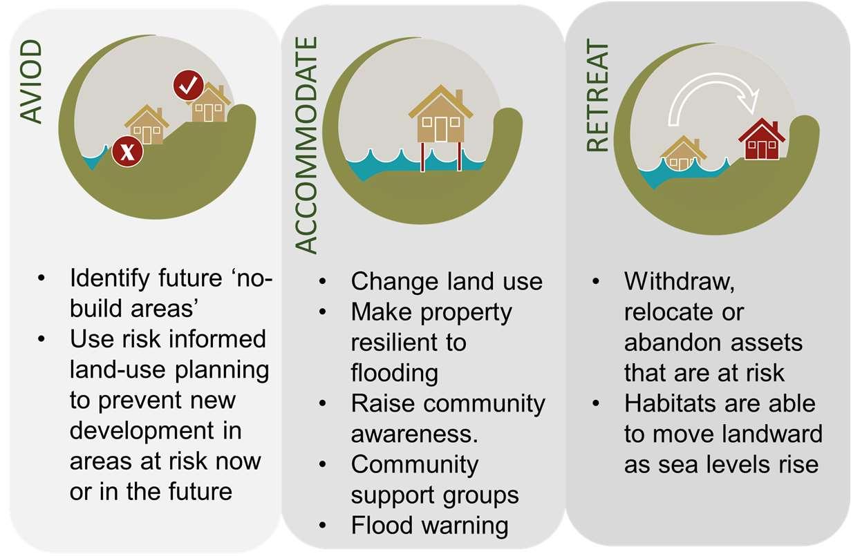
StrategicCoastalManagementApproaches
•AcceptingtheTide:Allowingthecoasttoevolvenaturally,noactive management.
•ReducingtheimpactsoftheTide:Controllingnaturalprocesseswithhard defences,toprotectpropertiesbehindthedefence.
•WorkingwiththeTide:Workingwithnaturalprocessesandreinstatingnatural defencessuchassaltmarshes.
•AdaptingtotheTide:Adaptingtoachangingenvironment,forexampleby movingdefenceslandwardorrelocatingproperty.
Glossary HaylingIslandCoastalManagementStrategyii


AEPAnnualExceedanceProbability BMPBeachManagementPlan HBCHavantBoroughCouncil HCCHampshireCountyCouncil EAEnvironmentAgency FCERMFlood&CoastalErosionRiskManagement HTLHoldTheLine LNR LocalNatureReserve MRManagedRealignment NAINoActiveIntervention NENaturalEngland ODUOptionDevelopmentUnit PLRPropertyLevelResilience SACSpecialAreasofConservation SEAStrategicEnvironmentalAssessment SMPShorelineManagementPlan SoPStandardofProtection SPA SpecialProtectionAreas SSSI SitesofSpecialScientificInterest Acronyms HaylingIslandCoastalManagementStrategy iii
Chapter1: Introduction


1
HaylingIslandCoastalManagementStrategy
CoastalPartnersandEngineeringandEnvironmentalConsultancyAECOMhave developedadraftCoastalManagementStrategyforHaylingIsland(hereafter referredtoasTheStrategy)onbehalfofHavantBoroughCouncil(HBC).


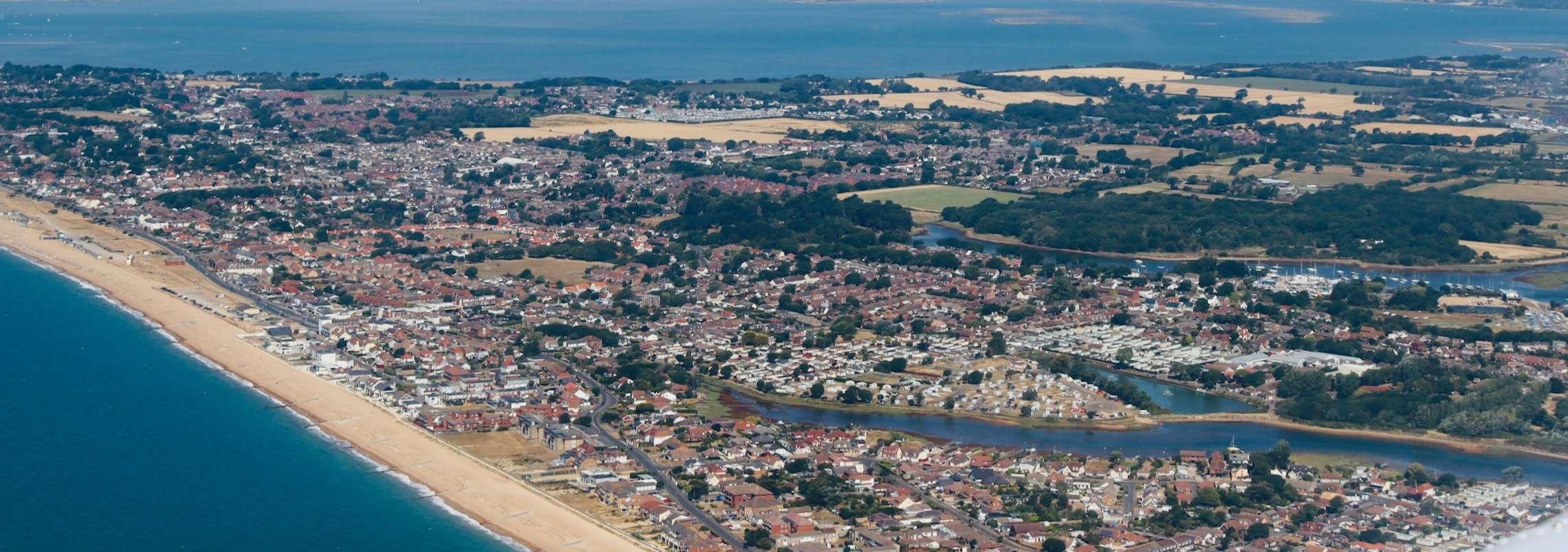
HaylingIslandhasapopulationofmorethan17,000andislocatedonthesouth HampshirecoastwithintheBoroughofHavant.Theislandhasa38kmcoastline, characterisedbybothahighlydynamicwavedominatedopencoastareaand moreshelteredtidallydominatedareaswithintheharbours.Theislandislow lyingwithamixoflanduseincludingrural,agriculturalanddenselypopulated urbanareas.Accessandegressonandofftheislandisviaasoleroadbridge connectiontothemainland(A3023).
TheStrategyareacontainsamixofresidentialandcommercialproperties. Therearelargeareasofopenspaceandsitesofsignificantenvironmental importancearoundmuchofthefrontage.Inadditiontherearehistoricalland marksandhighgradeagriculturalland.Thisdiverseandinterestingcoastal environmentprovidesextensiveaccessandrecreationopportunitiesandis widelyusedforleisurebyasignificantnumberofvisitorseachyear.Hayling Island’sbeachesarepopularwithswimmers,surfers,sailorsandwalkersalike, withtheseafrontstretchingover5kilometres,plustheshorelinesofLangstone andChichesterharbours.BeachlandsisaEuropeanBlueFlagbeach,andisthe maintouristattraction.Withuninterruptedviewsacrossthesea,itispossible toseetheIsleofWight,andtowatchtheferriesastheypassenrouteto continentalEurope.
ManypartsofTheStrategyfrontagearealreadydefended;however,the condition,StandardofProtectionagainstfloodingandexpectedlifeofthese defencesishighlyvariable.Thismeansthatsignificantareasoflandacross HaylingIslandareatriskoffloodingfromlargestormevents.Partsoftheopen coastarepotentiallyatthreatfromcoastalerosion. Inthefuture,withtheincreasedstorminessandrisingsealevelsthatare predictedasaconsequenceofclimatechange,theriskofcoastalfloodingand erosionislikelytoincreasesignificantly.
Justover40%oftheislandsflooddefencesareprivatelymaintainedwithan assortmentofdefencestructuretypes.Theremainderaremaintainedbythe EnvironmentAgency,HBCandHampshireCountyCouncil(HCC).HBCalso undertakebeachmanagementalongtheopencoastsectionatEastokewith nourishmentandrecyclingactivities.Manyoftheseassetsarecomingtothe endoftheirresiduallife,requiringsignificantinvestmenttowithstandthe impactsofclimatechangeinthefuture.
Withalloftheinteractingandcompetingpressuresonthecoastlinethe primaryobjectiveofTheStrategyistoprovidealongtermplantoreducethe riskofcoastalfloodinganderosiontopeople,thedevelopedandnatural environmentforthenext100years.
Itachievesthisbyidentifyingasuiteofleadingoptionstomanageandreduce theserisksinacosteffective,holisticandsustainablemanner.
ThedraftStrategyisnowinathreemonthperiodofconsultation(October, NovemberandDecember2022).Duringthistimekeystakeholdersandthe publicareinvitedtoattendaseriesofexhibitionstoreviewandprovide feedbackonthedraftStrategyoptions. Pleasevisithttps://coastalpartners.org.uk/project/hayling-island-coastalmanagement-strategy-16/forfurtherdetails.
WITHOUTACTIVELYIMPLEMENTINGMEASURESTOMANAGE FLOODANDEROSIONRISKS,OVER3,100PROPERTIESARE LIKELYTOBEATRISKBY2121. Introduction Implementationoftheseoptionsgoingforwardwill,however, besubjecttofundingavailabilityandtogainingrequired consents,sothereisnoguaranteethatoptionspresentedinthis Strategywillbeprogressed. HaylingIslandCoastalManagementStrategy2
StrategyObjectives
TheaimoftheHaylingIslandCoastalManagement Strategyisto:
•Developstrategiccoastalmanagementoptionsfor HaylingIslandforthenext100years
•Outlineaprogrammeofinvestmenttoreducethe riskofcoastalfloodinganderosiontopeopleliving ontheisland
•Identifythepotentialfundingsourcesandpartners requiredtodeliverthatinvestmentprogramme andbeopenandhonestaboutwherefundingis likelytobeachallenge
•Incorporateadaptationstrategies,asdefence improvementswillnotbepossibleinalllocations
•Beholistic,yetflexibleforbothpeopleandnature
•Respondtofuturechanges,supportsustainable developmentoftheislandandtakeinto accountpredictedsealevelriseandclimate change
•Makeapartnershipapproachcentral,between HBC,EnvironmentAgency,NaturalEngland, landowners,businessesandlocalcommunities, makingsurelocalneedsandprioritiesareatits core
HaylingIslandFrontage
HaylingIslandCoastalManagementStrategy3
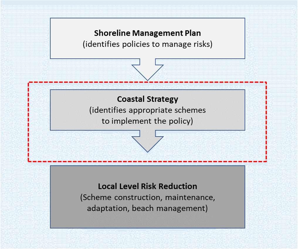
TheShorelineManagementPlanHierarchy
ShorelineManagementPlans(SMPs)sitatthetopofthehierarchyofplansfor managingcoastalfloodinganderosion.
AShorelineManagementPlan(SMP)isahigh-levelnon-statutoryplanning documentwhichprovidesabroadassessmentoftherisksassociatedwith coastalprocessesandpresentsalong-termpolicyframeworktoreducethese riskstopeopleandthedeveloped,historicandnaturalenvironmentina sustainablemanner.
AnSMPaimstomanageriskbyemployingarangeofmethodswhichreflect bothnationalandlocalpriorities,to:
•Reducethethreatofcoastalfloodinganderosiontopeopleandtheir property;and
•Benefittheenvironment,societyandtheeconomyasfaraspossible,inline withtheGovernment’s‘sustainabledevelopmentprinciples’.
TheStrategyareafallswithintheboundariesoftheNorthSolentSMP(2010). ThisSMPpresentsthehigh-levelpoliciesforfuturemanagementofthe coastline.Thesepolicieswerefinalisedfollowingaperiodofpublicconsultation andwereformallyapprovedbytheEnvironmentAgencyandadoptedby HavantBoroughCouncilin2011.
TheSMPpolicyforthemajorityofthecoastlinealongthenorth,eastandsouth ofHaylingIslandistoHoldtheLineforthecomingcentury.Thesesectionsof coastlineincludethepotentialthreatoferosionandcoastalfloodingtothe mainurbanareas,landimportantforagricultureandaccessto/fromtheisland. Thispolicymeansthatthereisanoverarchingintent,subjecttomoredetailed studiesandfunding,tocontinuetodefendsothatthepositionoftheshoreline remainswhereitiscurrently.
Inordertomaintainkeyhabitatsandenhancethenaturalenvironmentthere arealsoareasinthewestofthefrontagewheretheSMPpolicyistoallow naturalprocesstocontinue(NoActiveIntervention).Thispolicymeansthatthe shorelinewillcontinuetoevolvenaturallyinthefutureandthatnonew defenceswillbebuilt.
TheSMPpoliciesforHaylingIslandareshownoverleaf.Whilsttheseindicatea HoldTheLinepolicyforthemajorityoftheHaylingIslandfrontage,thisdoes notmeanthatthispolicyappliesforthenext100years.TheSMPpoliciesfor thedifferentepochsarefurtherdetailedforthedifferentfrontagesin Chapter5.
TheNorthSolentSMPisavailabletoviewatShorelineManagementPlanShorelineManagementPlan(northsolentsmp.co.uk).
HaylingIslandCoastalManagementStrategy4
TheCoastalManagementHierarchy
Legend

ShorelineManagementPlanPolicies HaylingIslandCoastalManagementStrategy5
SMPPolicy Boundaries Policies HoldtheLine(HTL) NoActive Intervention (NAI)
Coastalstrategiessitatthesecondtierinthehierarchyofcoastalmanagement anditistheroleofstrategiestoidentifytheappropriateschemeorrisk mitigationoptionforimplementingtheSMPpolicies.TheStrategyreviewsthe SMPpoliciesinmoredetailtoensurethesehigh-levelpoliciesremain appropriateatthelocalscale. TheStrategyconsidershowfloodanderosionriskislikelytochangeinthefuture inresponsetochangesinclimateanddevelopssustainableandrobustoptionsto managetherisksassociatedwithcoastalfloodinganderosion.Thisapproach ensuresthattechnicallyfeasible,environmentallyacceptableandeconomically viableoptionsarerecommendedtoreducetherisksfromcoastalfloodingand erosiontopeople,theirpropertiesandtheenvironment.Thisalsoensuresthat theoptionsarecompatiblewiththethoseofadjacentareas.
Withoutsuchanapproach,itislikelythatcurrentmanagementapproaches wouldcontinueintheshorttermandfuturecoastaldefenceworkswouldbe managedonan‘ad-hoc’orreactivebasiswhichwouldleadtopoorcost efficiencyandageneralincreaseinthefloodanderosionriskovertime.A Strategyisalsoimportanttodeliveranintegratedapproachtothemanagement ofourcoastline.Holisticwider-levelthinkingbehindStrategydecisionsensures thatthemanagementoptionsimplementedinoneareadonotincreasetheflood anderosionriskinadjacentareas,andthatopportunitiestodeliverwider benefitsarenotmissed.
Theoutputs
HowTheStrategyfitsinthemanagementofcoastalfloodanderosion risk
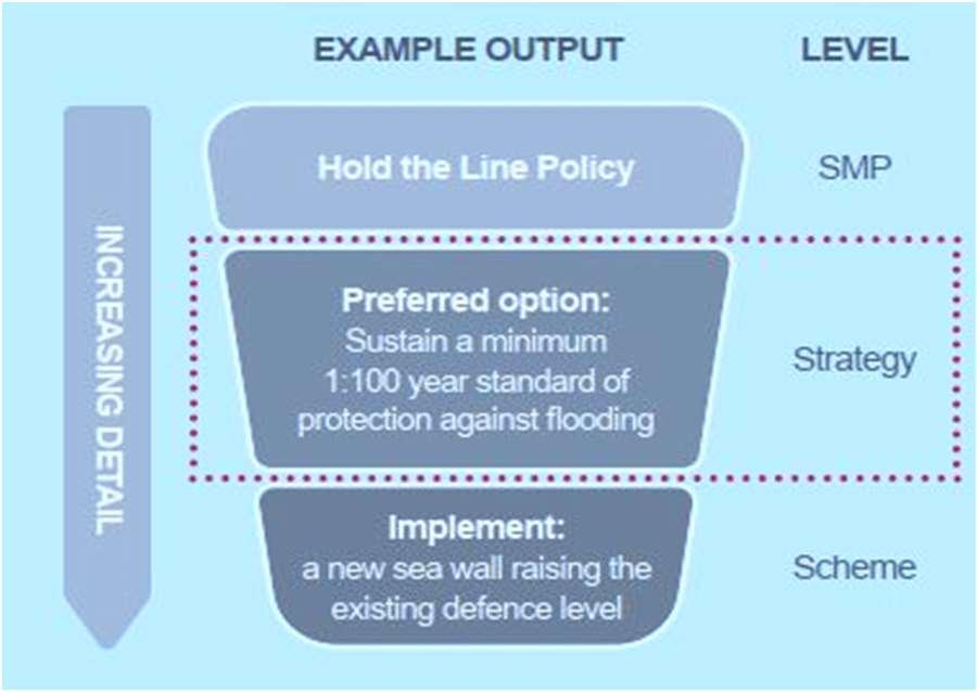
FollowingaStrategy,avarietyofoutputscanresult,dependingonthelevelof riskandthepreferredoptionsputforward.Todeliverastrategicoptionitmay benecessarytoimplementascheme(e.g.buildnewdefences)toaddress coastalfloodanderosionrisks.Beforeworkshappenontheground,afurther elementofworkiscarriedouttodesigntheschemeanddeliverthebusiness caseforfunding.Wewillworktodevelopbusinesscasestoprogressschemes ifthereisfundingandifitisinthepublicinterest,wherethereisatechnical, environmental,socialandeconomicsolution.
Inotherareas,thefutureactionmayincludemaintenance,beach managementorevento‘DoNothing’ifappropriate.Theremayalsobeactions suchasmonitoring,planningandfurtherstudiesinordertogainevidenceto helpmakerobustmanagementdecisionsinthefuture.Thiscouldincludethe needforadaptationwhichfocussesonadjustingto,andmanaging,theimpacts offloodingandcoastalerosion.

TheStrategyisrequiredinordertohelpusgainapprovalforfuture schemes.However,itisimportanttonotethatthereisnoguaranteethat anyoftheoptionsrecommendedinTheStrategywillbeprogressed. Implementationofoptionswillbesubjecttofundingavailabilityandto gainingrequiredconsents.Publicfundsforcoastalmanagementarenot widelyavailable,sosignificantfundingfromavarietyofsourceswillbe neededtoprogressanyoptionsinthisStrategy. TheNeedforaStrategicApproach HaylingIslandCoastalManagementStrategy6
ThisdocumentpresentsthedraftStrategyforpublicconsultationandsetsout therecommendedoptionsformanagingcoastalfloodanderosionriskalong thestudyfrontageforthenext100years.IndevelopingTheStrategy,an understandingofthepresent-dayriskhasbeendevelopedalongwithhowit mightchangeinthefutureandthewaysinwhichwecanmanageandadaptto thesechanges.Specifically,thisdocumentincludes:
Chapter2–Understandingwhatisatrisk
•Asummaryofwhatisatrisknowandinthefuture(definingthebaseline). Includinganassessmentofwhatwouldhappenifwe‘donothing’andhow theriskschangeovertimeasaresultofpredictedclimatechangeandsea levelrise.ThissetsthecontextforwhyweneedTheStrategy.
Chapter3–DevelopingTheStrategy
•Overviewofthestudyarea-KeyFeatures,IssuesandOpportunities.This identifiesthekeyaspectsandcharacteristicsofthestudyareawhichThe Strategyhasconsidered.Thisincludescoastalprocesses,historiccoastal landfill,theenvironment,stakeholderengagementandaspirations,anda summaryoftheexistingdefences.
•Adescriptionoftheoptiondevelopmentandappraisalprocess.Includinga summaryofhowthestrategicoptionsweredevelopedandappraised consideringtheireconomicandenvironmentalsustainability.
Chapter4–Strategyoverview
•AsummaryofTheStrategy–therationalebehinddecisionsanddiscussion ofthekeyprinciples.
•Anoverviewofthekeyeconomic,environmentalandbroaderoutcomesof TheStrategy.
•Howiscoastalfloodanderosionriskmanagementfunded–Thisincludes detailsofhowpartnershipfundingworksforFlooddefenceschemesinthe UKandthelikelihoodoffundingforthepriorityschemesidentifiedinThe Strategy.
•Deliveringmore.Howwehavebeenworkingwithotherorganisationsto tryanddelivermoreforyourcoastline.
Chapters5–DraftStrategyOptions
ThedraftpreferredoptionsbyOptionDevelopmentUnit(ODU).Anarea-byareasummaryofthedraftStrategyoptionsbeingputforwardtoreducefuture coastalfloodanderosionrisk.Includingatimelineoftheshorttermfuture projectactivitiesandindicativemilestones.
Chapter6–Whatnext?
Whatdoweneedfromyou?EngagementandfeedbackfromKeystakeholders andthepublicformsavitalpartofshapingthefinalStrategy.Wewanttohear yourviews.
ThechaptercloseswithasummaryofthefutureprogrammetofinaliseThe Strategy.
PurposeandStructureofthisDocument HaylingIslandCoastalManagementStrategy7


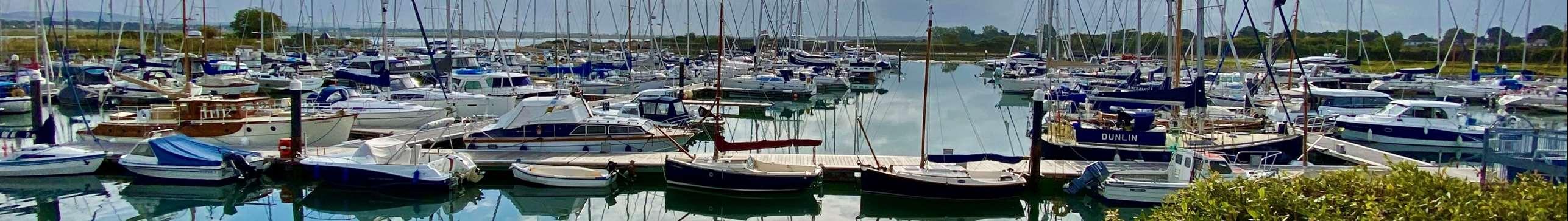
ThisdocumentprovidesaconcisesummaryofTheStrategyfindingsand proposals.Formoredetailedinformation,pleaserefertothefollowing Appendices: Pleasenotethattheseappendicesarestillindraftformandwillbefinalised followingpublicconsultation. Theseareavailableonlineat:https://coastalpartners.org.uk/project/haylingisland-coastal-management-strategy-16/ SupportingInformation HaylingIslandCoastalManagementStrategy8 AppendixA CoastalProcessReport AppendixB DefenceConditionAssessment AppendixC DesktopLandfillStudy AppendixD StakeholderEngagementReport AppendixE ShortListtoLeadingOptionAppraisal Report AppendixF Economics AppendixG StrategicEnvironmentalAssessment AppendixH HabitatRegulationsAssessment AppendixI WaterFrameworkDirectiveAssessment AppendixJ FundingandBroaderOutcomesStrategy MillRytheseadefences(ABOVE)andSparkesMarina,Eastoke(BELOW)ofHayling Island
Chapter2: WhatisatRiskifweDo Nothing?


HaylingIslandCoastalManagementStrategy9
Gaininganunderstandingofthefloodanderosionriskalongtheshorelineis imperativeinordertodefineabaselinefordevelopingTheStrategy.Itallows comparisonstobemadebetweenthepotentialstrategyoptionsandisan essentialstepinTheStrategydevelopmentprocess.Thebaselinewas establishedbyconsideringa‘DoNothing’scenario. The‘DoNothing’scenarioisdefinedas:“Wherethereisnofurtherintervention ofanykind,includingnoemergencyresponseorwarningsystem.Wherethere areassetsatpresentorwheremaintenanceactivitiesorotherinterventionsare carriedout,theoptionwillbetowithdrawallactivities,allowingnaturetotake itscourse”.


Inessence,the‘DoNothing’scenariorepresentsahypotheticalsituation wherebyallexistingdefencesareabandonedintermsofmaintenanceor repair,andnoremedialoradditionalprotectionworksarecarriedout.In addition,adaptationtosealevelriseorotherclimatechangeresponsesarenot addressed.

ForthepurposeofTheStrategy,therisksposedbycoastalfloodingand erosionoverthenext100yearshavebeenestablishedusingEnvironment AgencyapprovednumericalfloodmodellingandCoastalPartnerserosion predictions.Itshouldbenotedthatevenwiththeexistingdefencesinplace; futurefloodriskwillincreasesignificantlyduetoclimatechangeandrisingsea levels.
Throughdeterminingthepresentandfuturefloodanderosionrisksundera ‘DoNothing’scenario,theproperties,features,assetsandkeyinfrastructure thatareatriskofdamageoverthenext100yearshavebeenidentifiedand valued,afterwhichtheleadingstrategyoptionstomanagetheseriskswere developed.Theassetsatriskinclude(butarenotlimitedto)servicesasvaried ascropproductionandraisinglivestock,climateregulation,coastalhazards, tourismandrecreation,aestheticvaluesandwildspeciesdiversityand habitats.FloodingatLangstoneBridgewouldaffectaccesstoandfromthe Island,andpopulartrailssuchastheHaylingBillyTrailwouldalsobeunder threat.Areasoflandfillcoulderodeandcauseharmtotheenvironment.
Island,includingtheinfluenceofclimatechange,landfillsiteswhichareactively erodingandopportunitiesforhabitatcreation.Inordertomanageandaddress theseissues,itisconsideredimperativetodevelopanFCERMStrategy.Joinedupstrategicthinkingisrequiredtodevelopacohesive,efficient,longtermplan. TheStrategythereforeoutlinestheforwardprogrammeofworkstomost effectively,holisticallyandsustainablymanagethecoastalfloodanderosion
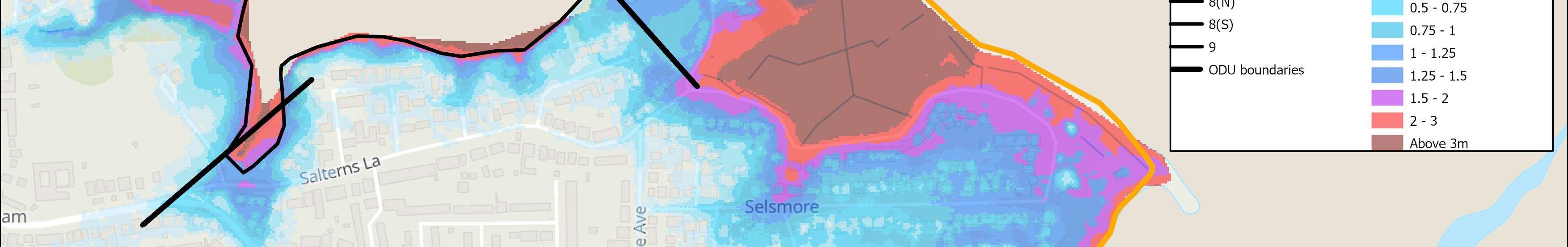
TimeHorizons Epoch1 (2021-2041) Epoch2(20412071) Epoch3(20712121) Residentialproperties34494690 Commercialproperties377105 Totalpropertiesatrisk ofcoastalerosion 37571795 Propertiesatriskofcoastalerosionoverthecomingcenturyifwe‘DoNothing’. ThereareanumberofstrategicissuesforcoastalmanagementonHayling
relatedrisksfacingtheislandoverthenext100years. TimeHorizons 2021 2121 Residentialproperties243 2,166 Commercialproperties92 992 Totalpropertiesatriskof coastalflooding 335 3,158 THEESTIMATEDDAMAGEFROMTHERISKOFCOASTALFLOODING ANDEROSIONONHAYLINGISLANDOVERTHENEXTCENTURYIF WEDONOTHINGIS£1.72BILLION(CASH). Propertiesatriskofcoastalfloodingoverthecomingcenturyifwe‘DoNothing’. Basedon1:200year(0.5%annualchance)floodevent. BaselineScenario–DoNothing HaylingIslandCoastalManagementStrategy10
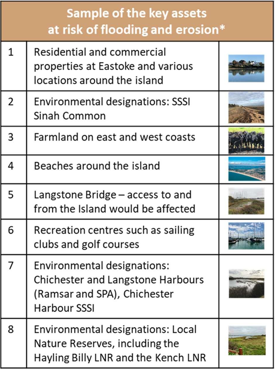
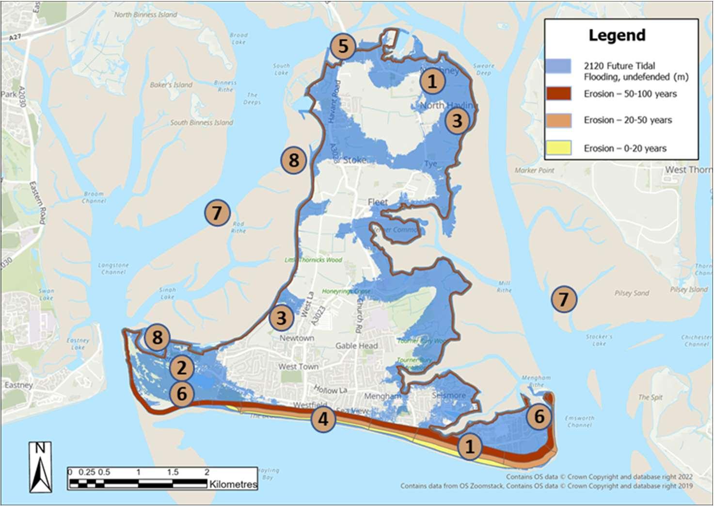
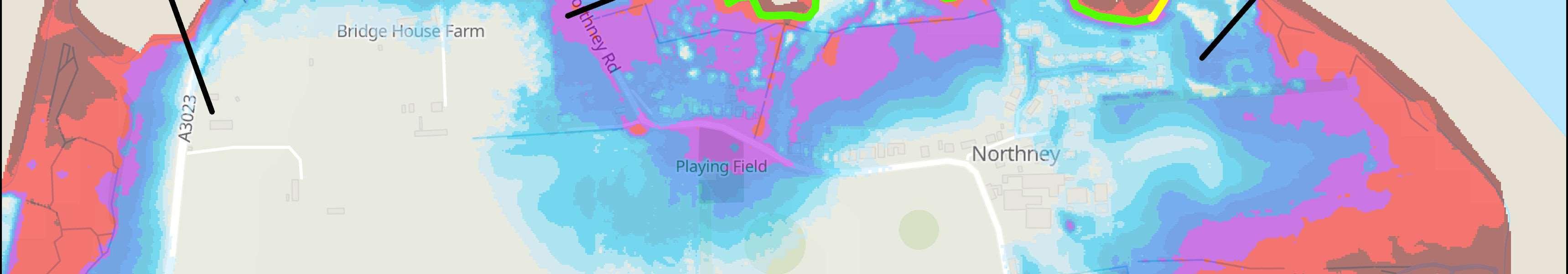
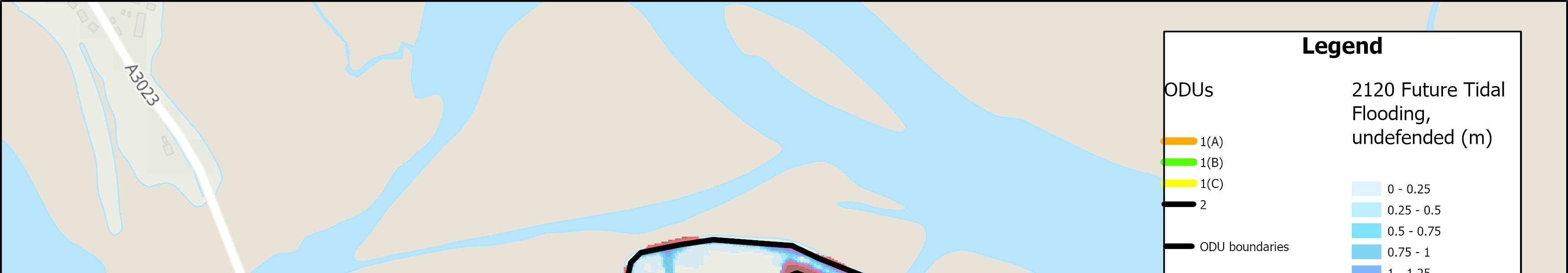
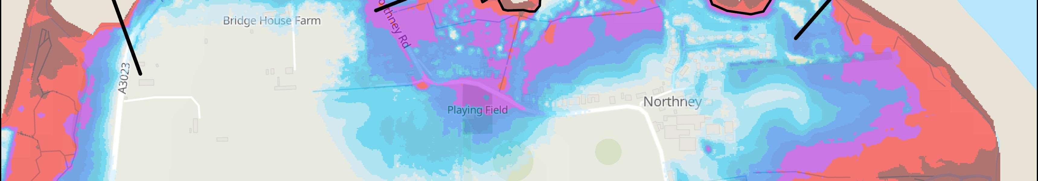
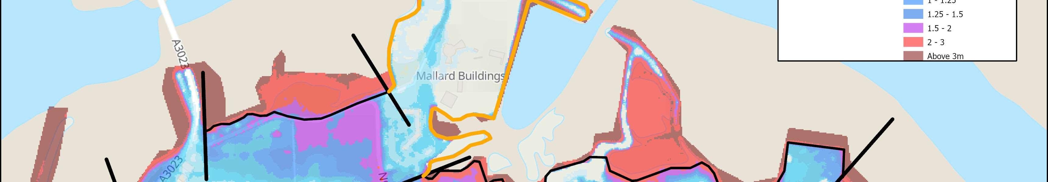
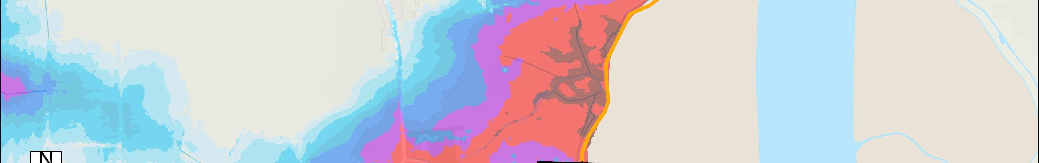
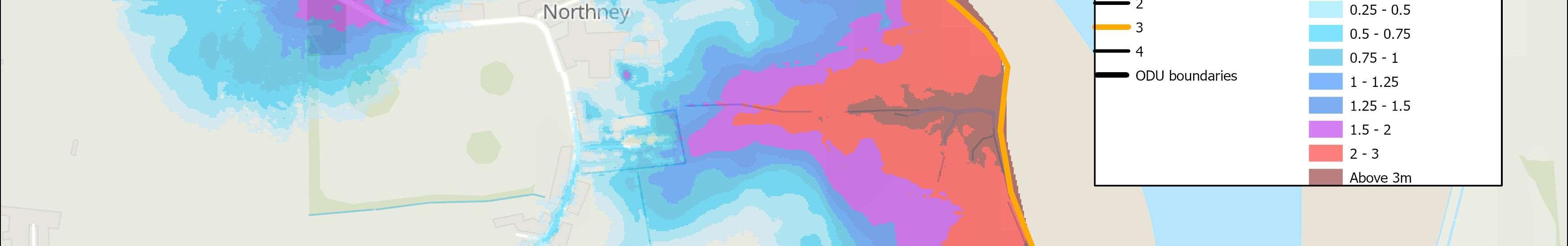
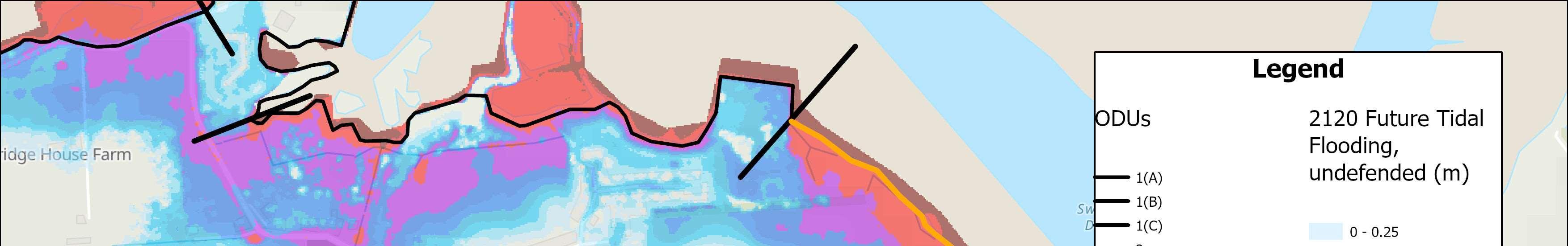
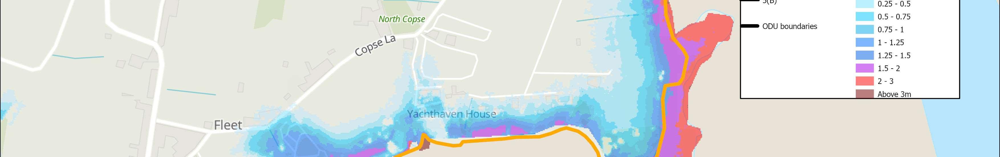
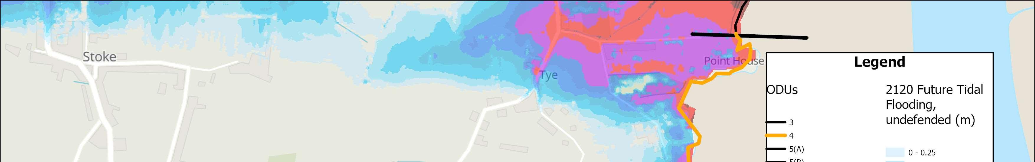
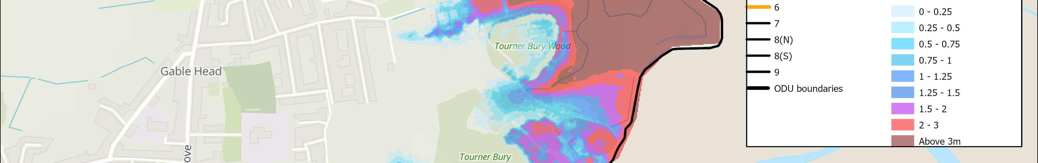
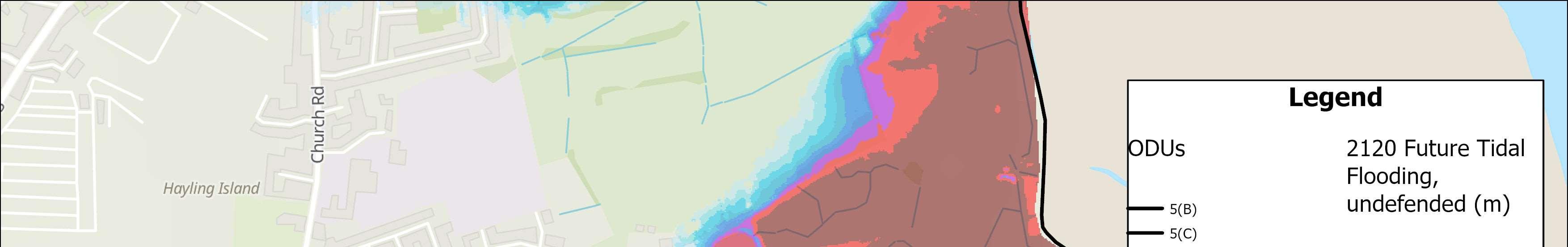
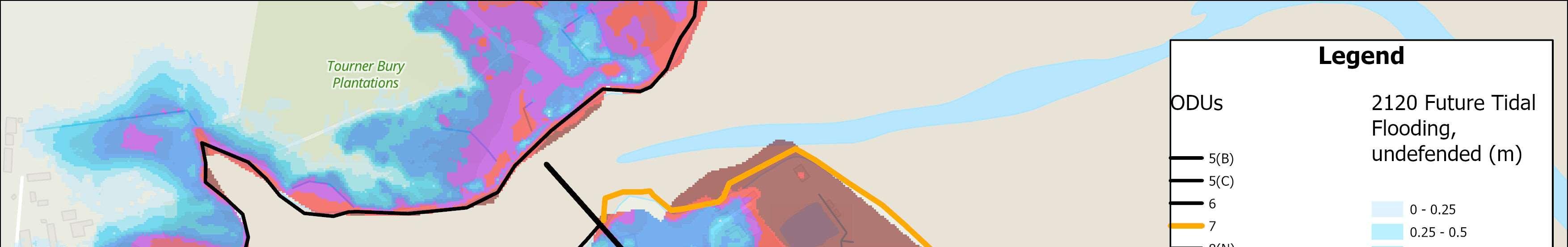
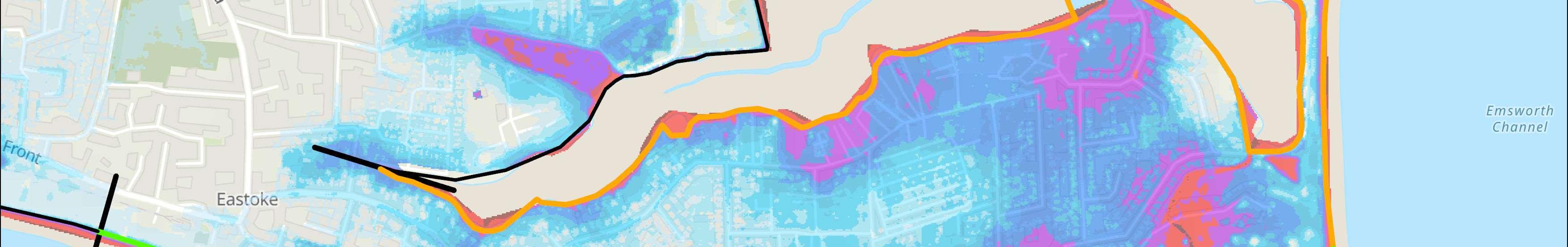
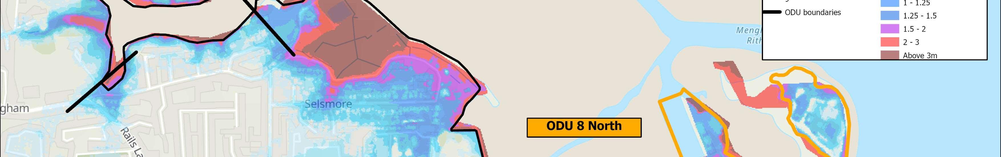
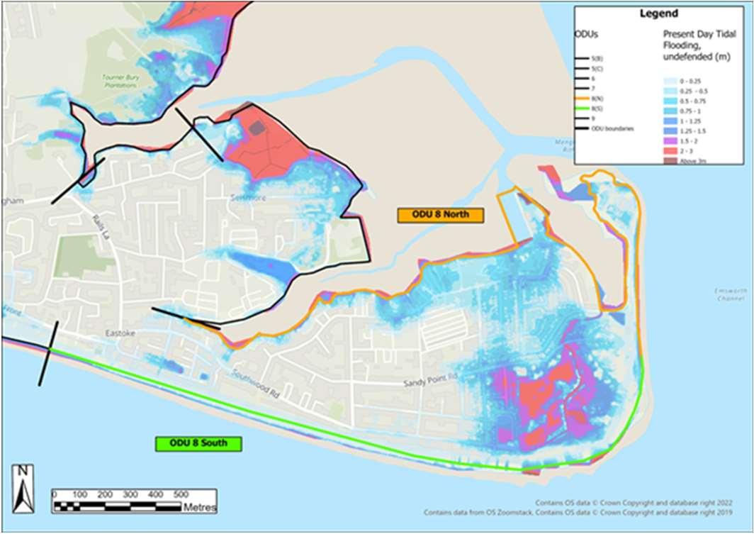
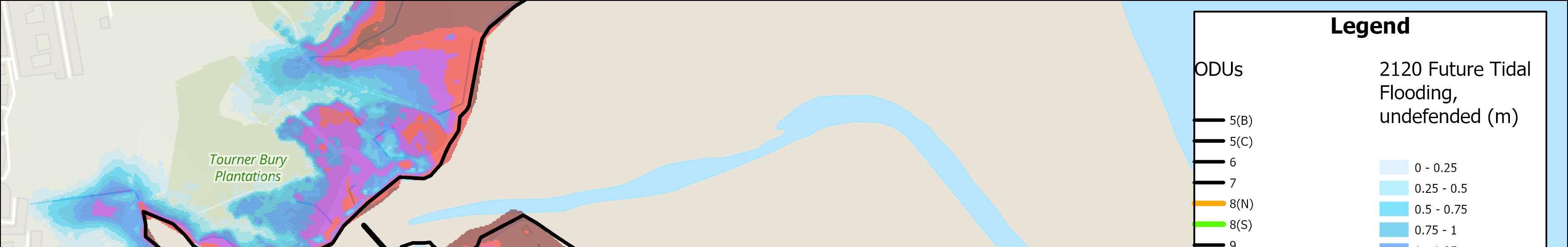
WhatisatriskifweDoNothing? HaylingIslandCoastalManagementStrategy11 *2120FutureTidalFlooding,assumingnodefences. Pleasenote,thislistcontainsonlyasampleofassets atrisk,andisnotexhaustive. Modelledextentoftidalfloodinganderosionin100yearstimewithanallowanceforsealevelrise, assumingnodefences(1in200Year,0.5%AEP).
SeaLevelRiseandIncreasingRisk
Asaconsequenceofclimatechangeandcontinuedwarmingoftheglobal oceans,sealevelsareexpectedtoincreaseinthefuture.Thiswillsignificantly increasetidalfloodandcoastalerosionriskacrossTheStrategyfrontageover thenext100years.
Toconsidersealevelrise,TheStrategyhasincorporatedthelatestsealevelrise projections(UKClimateProjections2018UKClimateProjections(UKCP)-Met Office)intothefloodmodellingtoproduce‘DoNothing’floodscenariosfor 2041,2071and2121.Followingthelatestguidelines,underthe‘medium emissions’sealevelrisescenario,meansealevelsacrossTheStrategyfrontage areexpectedtoincreasebyapproximately1moverthecomingcentury.


Aswellasproperties,therearemanyotherimportantfeaturesandvaluable assetsatrisk.Thisincludesschools,churches,publichouses,nationally importantenvironmentallydesignatedsites,heritageassets,keyservices infrastructure,majorroads,coastalfootpathsandcyclewaysandshingle beaches.Thereisalsoariskoferosiontoformerlandfillsiteswhichcouldpose afurtherthreattohumanhealthandtothequalityoftheharbours.
Whatismeantbyfloodrisk?
Floodriskreferstothepotentialforexperiencingflooding.Thisriskisoften describedbythelikelihoodorchancethatacertainleveloffloodingwilloccur atanygivenlocation.Thisriskcanbeexpressedintermsofanaveragereturn periodinyears.Thisriskcanbeexpressedasa1in100(1%)chanceof floodinginanyoneyear,ora1in200(0.5%)chance,andsoon.

Chanceisalsorelatedtothescaleoftheflooding.Inanyoneyearalarge(1in 200year)floodeventhasstatisticallylesschanceofhappeningthanasmaller 1in50or1in20yrfloodevent.Itisimportanttounderstandthata1in100 chanceoffloodingdoesnotmeanthatafloodwillonlyhappenonceevery 100years.Thechanceremainsthesameeveryyear.Throughoutthis documentthescaleoffloodriskisdescribedintermsoftheaveragereturn periodinyears.
TheStandardofProtection(SoP)offeredbyadefenceisalsodescribedin termsoftheeventthatitisdesignedtopreventfloodingfrom.Forexample,if aschemeprovidesa1in100year(1%annualchance)StandardofProtection itmeansitwillbedesignedtopreventfloodingfromalleventsuptothis magnitude.
0 0.2 0.4 0.6 0.8 1 1.2 PresentDay204120712121 Sea level rise from present (m) AxisTitle Projectedsealevelrise(m)
HaylingIslandCoastalManagementStrategy12
MuchofthefrontagealongHaylingIslandisprotectedbyman-madecoastal defences.Theseareoftenfrontedbyinter-tidalmudflats,saltmarshesand beacheswhichworktoreduceerosionriskalongthecoastline.Without theseman-madeandnaturalseadefences,theislandwouldbeunderthreat fromerosion,mostnotablyontheopencoastcomparedwiththeharbours.
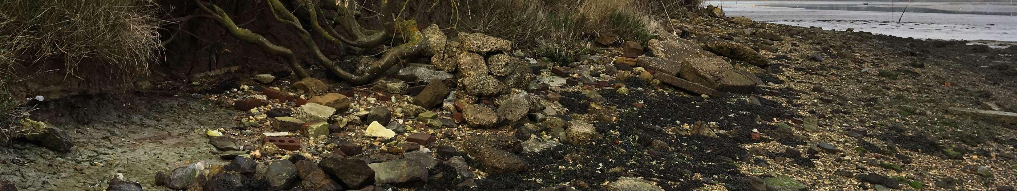

SeveralsitesaroundHaylingIslandarealreadyeroding,andmoresitescould becomevulnerableduringthenext100yearsifnoactionistaken.For example,partsoftheHaylingBillytrailmayhavetoberelocateddueto futureerosion.Thereisariskthatformerlandfillsitesalongthecoastline, bothdomesticandindustrial,couldwash-outasaconsequenceofsealevel riseandcoastalerosionwithoutsuitablemanagementorremediation. Erosionalongthewestcoastwouldalsoimpactsiteswhichareimportantfor over-winteringbirds;alongthesoutherncoast,propertiesandbusinesses alongtheseafrontcouldbeaffected.
Whatismeantbyerosionrisk?


ForthepurposesofTheStrategy,propertiesorassetsatriskoferosionare thosewhichcouldpotentiallybelosttotheseathroughshorelineretreat duetotheactionofwaves,currentsortides.Theriskhasbeenestimated assumingnofurtherworksaredonetorepairormaintaindefenceswhich currentlyprovideprotection. Understandingthepotentialerosionriskunderahypothetical‘DoNothing’ scenario’isimportantforcomparingtherelativemeritsofoptionsto maintainorimproveprotection.
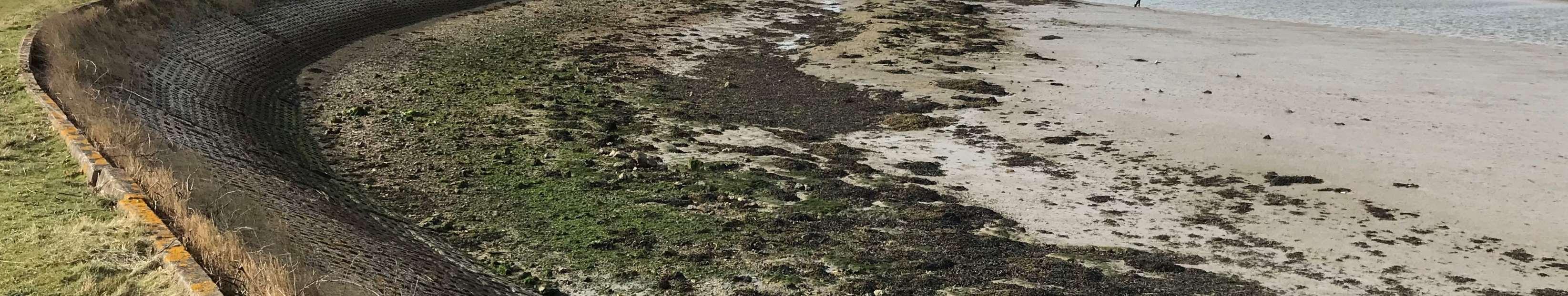
 Erosiononthewestcoast(ABOVE)andeastcoast(BELOW)ofHaylingIsland
Erosion HaylingIslandCoastalManagementStrategy13
Chapter3: HowtheStrategyhas beendeveloped


HaylingIslandCoastalManagementStrategy14
Beforestrategicapproachestomanagingfloodanderosionthreatscanbe identifiedandevaluated,itisimportanttounderstandthekeyfeatures,issues andopportunitiesthatexistwithinTheStrategyarea.Inordertoachievethis,a numberofstudiesandactivitieswereundertakenduringtheearlystagesof developingTheStrategy.
Theseincluded:
•Engagementwithkeystakeholders,residentsandthewidercommunity–meaningfulengagementwithlandowners,communitygroups,organisations andindividualstounderstandtheiraspirationsandconcerns,tohelpshape TheStrategy(seeAppendixDformoredetail);
•Sitewalkoversandvisualassetinspections–todeterminethelocation,type andconditionofcoastaldefencesandassets(seeappendixBformoreinfo);

•Astudyofcoastalprocesses–requiredtounderstandwaves,tides, sedimentmovementsandtolookatthelonger-termfloodanderosionrisk toboththeopenandharbourcoastlines(seeappendixAformoredetail);
•Desktopassessmentoflandfillsites–toidentifyareasalongthefrontage whichmayrequiredefendingtopreventthemerodingandharmingthe environment(seeappendixCformoredetail);

•Identificationofimportantenvironmentalandheritagefeaturesaroundthe Island–sothatkeyenvironmentalobjectivesandlegalrequirementsto protecttheenvironmentcanbeaccountedforinTheStrategy(seeappendix G,H,Iformoredetail);
•Identifyingpotentialbroaderoutcomesandopportunities–inorderto captureideasastohowTheStrategycanbefundedaswellasdeliverwider benefitstocommunities(seeappendixJformoredetail).
Asummaryofthefindingsoftheseactivitiesrequiredtounderstandthebaseline forTheStrategyisprovidedinthischapter.
HaylingIslandCoastalManagementStrategy 15 Overviewofthestudyarea–keyfeatures,issuesandopportunities
MuchofHaylingIslandhasbeenreclaimedovertheyears,resultinginlow lyinglandwithsignificantareasatriskoftidalflooding.Thisisexacerbated ontheopencoastwhenstormandswellwavescombinetoproducebimodalwaveconditions.
ManyofthefloodeventsexperiencedinthepastonHaylingIslandhave occurredinthesouth-easterncorneroftheislandwherethecoastlineis mostexposedtotheimpactsofwaveconditions.Theshelterednorthern partsoftheislandinsidetheharboursarepronetofloodingfromtidalsurges ratherthanlargewaveaction.Residentialroadsandextensiveareasof grazinglandhavefloodedinthepast.Floodinghasalsohistoricallyoccurred adjacenttotheA3023approachtoLangstoneBridge.Thesituationwillbe exacerbatedinthefuturewithsealevelrise.
Theopencoastisalsomorevulnerabletoerosion,duetowaveaction.
TheHaylingIslandcoastlinethatsitswithinChichesterandLangstone
Harboursiscomprisedofmostlymudflats,withsomesaltmarsh.Saltmarsh habitathasbeenerodinginbothharbourssincethe1940s,althoughtherate oflosshasslowedsincethemid-1980s.Duetothenarrowharbour entrances,largeswellandwindwavesarenoteasilyabletopropagatealong theentrancechannelsintotheharbours.Therefore,theriskofcoastal damage,floodinganderosionfromwaveattackinsidetheharbourislimited. Fortheharbours,thegreatestriskisfromextremewaterlevels,ratherthan fromwaveaction.
TheopenbeachalongthesouthcoastofHaylingIslandoffersavery differentsituation.Ithasalonghistoryofhighenergywaveaction,which resultsinsignificantbeachdrawdown,cutbackandlossofmaterial.
HaylingIslandisunusualtootherlocationsinthatitsbeachesaresusceptible tobi-modalwaveconditions,whenlongperiodswellwavesrefractaround theIsleofWight,coincidingwithlocalstormconditions.Theyresultinvery energeticwaveconditionsthatcanbeverydamagingtothecoastline.

TheStrategyrecognisestheimpactsofbi-modalwavesinrelationtofuture management,butmoredetailedresearchonbi-modalwaveswillneedtobe undertakentoinformthedesignofanynewdefencesalongHayling'scoast.

CoastalProcessesOverview HaylingIslandCoastalManagementStrategy16 FormoreinformationseeAppendixA:CoastalProcessReport
Inthecoastalzonethepresenceoflandfillisariskbecauseerosionoftheshoreline,or flooding,canreleaselandfillintotheenvironmentthroughexposureandleaching.Ifnot dealtwithadequately,thismaterialcanposeathreattotheenvironment.
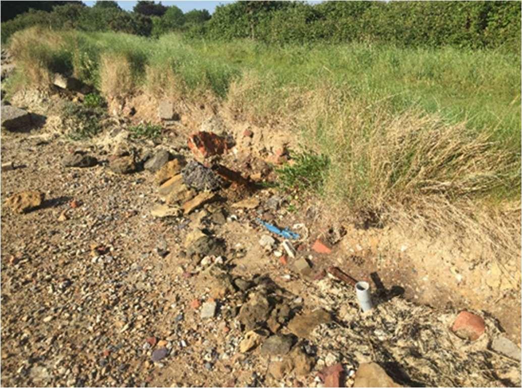
ThereareeightformercoastallandfillsitesonHaylingIsland.Adesktopstudywas undertakeninordertoclassifyeachofthesesitesasbeingeitherhigh,moderateorlowrisk.
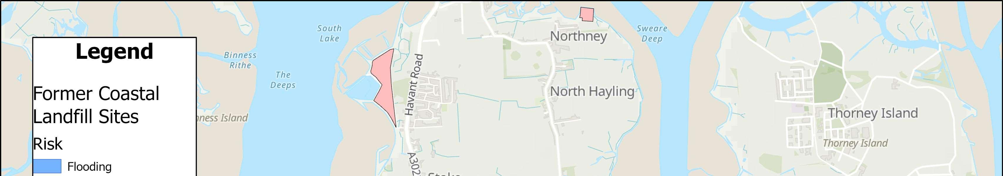
Theriskwasbasedontheprobabilityandconsequenceoflandfillbeingreleasedthrough erosionorasaresultoftidalflooding.TwositeswereclassifiedasbeingatHighRisk,fourat ModerateRisk,andtwoatLowRisk.
TheevidencefromthisstudywasconsideredduringthedevelopmentoftheLeading StrategyOptions.Optionstomitigatetheseriskswereidentifiedandconsideredinthe appraisals.

CoastalLandfillSites HaylingIslandCoastalManagementStrategy17
ExamplesoflandfillatsitesaroundHaylingIsland
FormoreinformationseeAppendixC:DesktopLandfillStudy
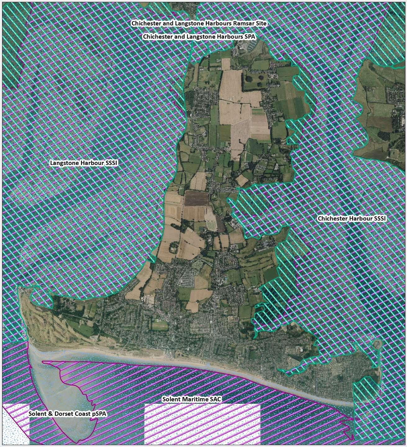
HaylingIslandissurroundedbydesignatedsites,includingtheChichesterand LangstoneHarboursSpecialProtectionArea(SPA)/RamsarsiteandtheSolent MaritimeSpecialAreaofConservation(SAC).ChichesterHarbourisalso designatedanAreaofOutstandingNaturalBeauty(AONB).Inaddition,Sinah CommonisadesignatedSSSI(SiteofSpecialScientificInterest).HaylingIsland alsosupportsfiveLocalNatureReserves(LNR),includingTheKenchandthe HaylingBillyLNR.ManyoftheseimportantsitesaresituatedalongTheStrategy coastlineandassuchitisessentialtoconsidertheseareaswhendeveloping TheStrategy. Withinmanyoftheseimportantsitesthereareanumberofdifferenthabitats suchassaltmarshesandmudflatswhichsupportawidediversityofwildlife. Theintertidalmudflatsprovideaparticularlyimportantfeedinghabitatfor birds.PartsoftheislandarealsoidentifiedasBrentGooseandWaderfeeding androostingsites. Unfortunately,withpredictedsealevelrise,itisthoughtthatmanyofthe importantintertidalhabitatswillget‘squeezed’againstcoastaldefence structuressuchasseawalls.Thiscandecreasethesizeandhealthofthe intertidalhabitatsandplaceadditionalstressesonthespeciesthatrelyupon them.Tohelpoffsettheseanticipatedlossesinthefuture,itisessentialforThe Strategytoconsiderenvironmentalimprovementoptionsandinvestigate opportunitiestocreatenewareasofhabitat.


 ViewsofSolentMaritimeSACandChichesterHarbourSPA,RamsarandSSSI (ABOVE)andKenchLocalNatureReserve(BELOW)
EnvironmentalDesignations HaylingIslandCoastalManagementStrategy18 FormoreinformationseeAppendixG:StrategyEnvironment Assessment,(H)HabitatRegulationsAssessment,(I)Water FrameworkDirective
Marine
Terrestrial

EnvironmentalDesignations HaylingIslandCoastalManagementStrategy19
TheIslandplayedavitalroleduringWorldWarII,whenitbecameanimportant militarybasewithasignificantroleinthedefenceofPortsmouthandinthe build-upto,andexecutionof,theD-DayLandings.Theseactivitieshaveleft theirmarkonthecoastallandscapeofHayling,andpillboxes,gunsitesand memorialscanstillbeseentoday.


HaylingIslandisoftenconsideredasoneoftheUK’slasttraditionalseaside resorts.ThelistedRoyalHotelbuiltin1825,alongwithanearbyBathHouse andbathingmachinesattractedwealthyholidaymakerstotheIsland.By1909, beachhutsandbathingtentswereestablishedalongtheHaylingIslandbeach. TheHaylingBillyLinewasanimportantconnection,bringingtouriststothe island.Asaresult,holidaycampsflourishedduringthe1950s.
HaylingIslandoffersarichcultural,historicandenvironmentallegacyasa leisuredestinationwhosegenesisasapre-Victorianexclusivehealthresort evolvedintomasstourismandthedevelopmentoftheholidaycamps.This formedthefoundationofawater-sportsoffer,basedaroundbeingthe worldwidehomeofwindsurfing,followinglocalresidentPeterChilvers’ inventionofthefirstwindsurfboardin1958.Haylingisideallysituatedfora varietyofwatersports,duetoitbeingshelteredbytheIsleofWight.Such sportsincludesailing,windsurfing,powerboating,jetskiing,paddleboarding, kitesurfingandkayaking.

Apillbox,alegacyofthe Island’sinvolvementinWorld WarII.


 KitesurfingandWindsurfing–twoofthemanywaterbasedactivitiesonoffer onHaylingIsland’sbeaches
HeritageandRecreation HaylingIslandCoastalManagementStrategy20
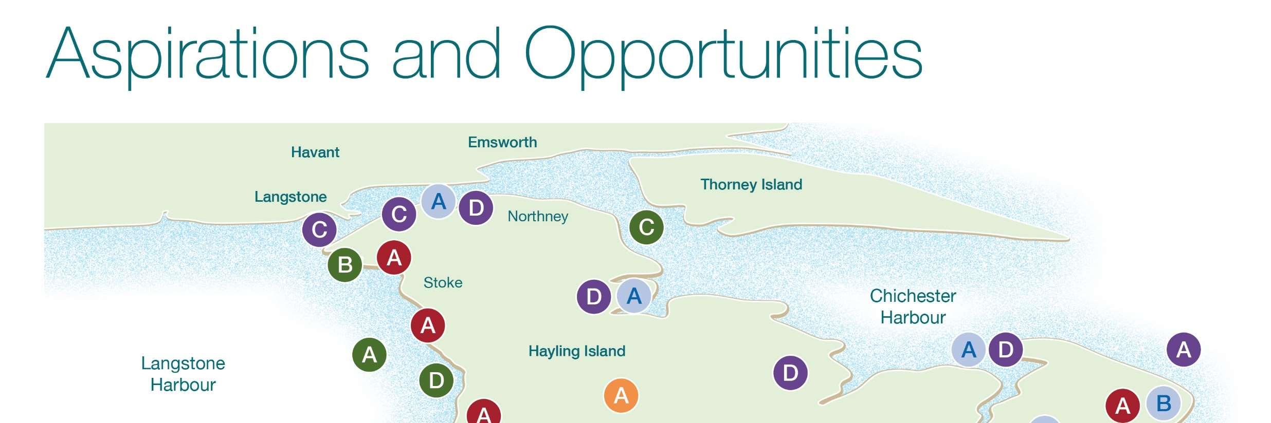
ManyindividualsandorganisationshaveakeyinterestorstakeintheHayling Islandcoastlineformanydifferentreasons.Eachstakeholderisthereforelikely tohaveauniqueviewonitsuse,developmentandfutureprotection.Assuch stakeholderengagementisfundamentalandcanbeasourceofindispensable informationwhichcanbeusedtodefinecoastalissuesandobjectives,steer Strategydevelopmentandachieveconsensusonthefuturemanagementofthe coastline.
Strategydevelopmentsetoutandimplementedaclearmethodologyfor engagingwithlocalcommunities,businessesandpublicbodieswithavested interestintheHaylingIslandcoastline.Thisapproachensuresthatthosewho mayaffect,orareinfluencedbythedecisionsofTheStrategyareactively involvedandinformedattherighttime.
TheaimsofTheStrategyengagementprocesswere:
•toraiseanawarenessandunderstandingofcoastalfloodanderosionrisk nowandintothefuturewithclimatechange
•toidentifythechallengesandconstraints
•toidentifybroaderoutcomeopportunities
•todevelopcommunityinvolvementinthedecision-makingprocessfor managingourcoastline

•tolistentotheircommentsandconcerns.
Stakeholderandpublicengagementhasinformedthecoastalmanagement optionsbearinginmindwhatistechnicallyfeasible,publiclyacceptable, economicallyviableandenvironmentallyacceptable. Atthelaunchoftheproject,apublicsurveywasinitiatedtoseekthe community’sviewsoncoastalmanagementofHaylingIsland.Respondents wereaskedabouttheirconcerns,whatisimportanttothemwhenusingthe coastlineandtheiraspirationsfortheisland.
Theresultsofthesurveyhelpedusunderstandthecommunitiesviewson coastalfloodanderosionriskontheisland,wherethemainareasofconcern wereandwhatwidercoastalopportunitiespeoplewouldliketosee.
FourvirtualsessionswereheldduringdevelopmentofTheStrategy,withthe projects'KeyStakeholderGroup,madeupofrepresentativesofthelocal community,including;localbusinesses,landownersandcommunitygroups.
Thefirstsessionprovidedanintroductiontotheproject,opportunitytomeet theteamandtofindoutwhyaStrategyisneededandwhatisinvolved.
Thenexttwovirtualworkshopsessionshelpeddetermineaspirationsand opportunitiesrelatingtoHaylingIsland’scoastline.
ThefinalvirtualsessionprovidedanopportunitytopreviewthedraftStrategy andaskquestionsbeforethestartofpublicconsultationinOctober2022.
Theprojectteamhavealsoheldanumberofvirtualandinpersonmeetings withlandownersalongHayling'scoastlinetounderstandhowtheyusetheir sectionofcoast,andestablishtheirshortandlongtermaspirationsfortheir frontages.
Throughpresentations,questionandanswersessionsandothervirtual meetings,TheStrategyteamhaslearntahugeamountabouthowpeoplewish toseetheshorelineevolve.Alloftherelevantfeedbackreceivedtodatehas beenusedtoinformthedevelopmentofTheStrategytoensurethatit accountsfor,andcaptureskeystakeholderinputandideas.
StakeholderEngagement HaylingIslandCoastalManagementStrategy21 FormoreinformationseeAppendixD:Stakeholder EngagementReport
TohelpestablishthebaselinefloodanderosionrisksalongTheStrategy frontageitwasnecessarytoidentifytheconditionoftheexistingdefencesand howlongtheyarelikelytolastwithoutmaintenance.Thiswasdoneby undertakingawalkoveroftheentireStrategyshorelineandvisuallyassessing defenceconditioninlinewiththeEnvironmentAgency'sassessmentmanual.

Thereisawiderangeofdifferentdefencetypes,fromearthembankmentson muchoftheeastandwestcoasts,toseawallsandrevetmentsalongthemore exposedopencoastwhichprotectagainsterosionandwaveovertopping.In addition,theopencoastisaffordedprotectionbythebeacheswhichactasa barriertothewaves,however,theyrequireregularmanagementtomaintain thebeachlevelsastheyareanintegralpartofthedefencesystem.
ApproximatelytwothirdsofthedefencesaroundHaylingIslandareownedand maintainedbyprivatelandowners.

Whoisresponsibleformanagingthecoastline?
CoastalProtectionAuthoritiesandtheEnvironmentAgencyhavepermissive powerstocarryoutworkstoprotectagainstcoastalfloodinganderosion. However,thisisnotalegalobligation.ThismeansHBChasthe'power'tocarry outcoastalprotectionworksbutisnotdutyboundtodosoandwillnotbeliable forthefailuretoexercisethesepowers.
Ingeneral,LocalAuthoritiesandtheEnvironmentAgencywillonlyactwhere thereisawidepublicbenefitand/oranappropriateengineeringsolutionthatis achievable.ThisiswhyHBCarecommittedtothisStrategytounderstandwhat canbedonetoprepareHaylingforamoreresilientfuture.


Landownersareultimatelyresponsibleformaintainingorimprovingtheir owndefences.Thereforewheremaintenanceorupgradeofdefencesis referredtoinTheStrategyitisassumedthatthiswillcontinuetobethe Landownersresponsibility.
Approximately70%ofthedefencesaroundtheislandareestimatedtobeina fair,poororverypoorconditionwithashortresiduallife,orprovidealow standardofprotection.Consequently,thereareanumberofcriticalareas aroundtheIslandwherethedefenceshavefailedorarebeginningtofail,some frontingareasoflandfill.
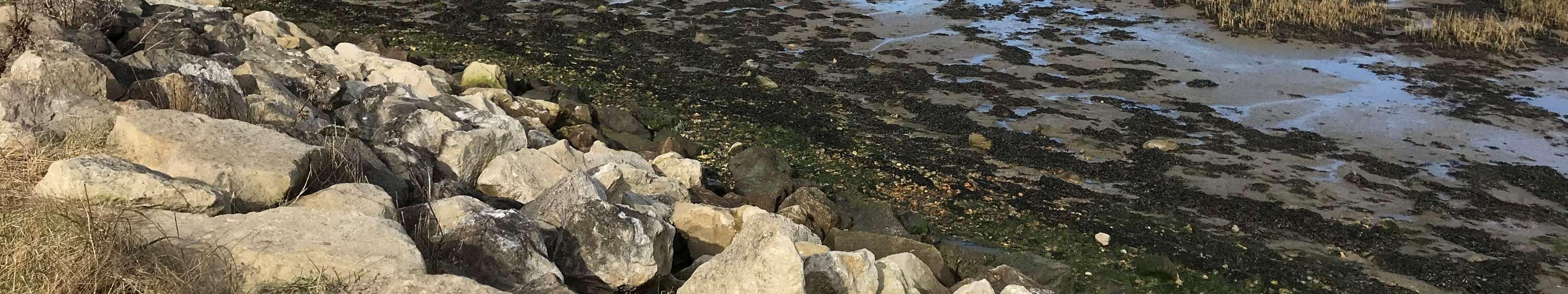
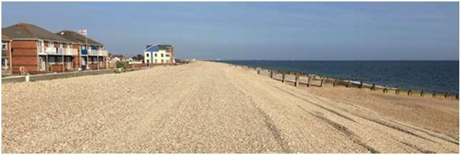
Rockrevetmentontheeastcoast ExistingDefences HaylingIslandCoastalManagementStrategy22 FormoreinformationseeAppendixB:DefenceCondition AssessmentReport
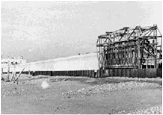
Duringthe1940s,HaylingIsland becameatouristdestination. Initialdefenceswere constructedinorderto maintainthelineofthebeach. Overtime,naturalretreatand lossofmaterialfromthebeach meantitwasnecessarytobuild moresubstantialdefences,to protectthepropertiesbehind.


1947:construction ofnewseawall, Eastoke
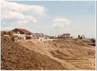
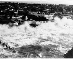
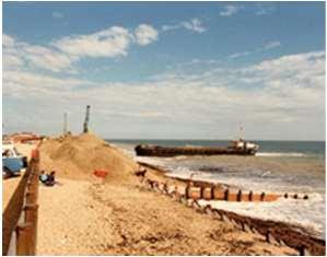
Priorto1985,lowbeachlevelsledtomore runupofseawatertotheseawall. Significantovertoppingbywavesoverthe defencesledtolargefloodingeventsat Eastoke.In1985,510,000m³ofshinglewas placedonthebeachasthefirstcampaign ofbeachmanagementonHayling,atacost ofapproximately£4m.Thisbuiltupthe beachlevelsandreducedtheriskofwave overtoppingandflooding.
1940s
1985:thefirst campaignofbeach management
The1990ssawthestartofannualbeach management,whichwascarriedoutas thepreferredmanagementoption.

1960sand 1970s 1980s 1990s 2000s–PresentDay


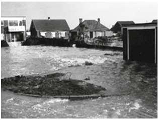
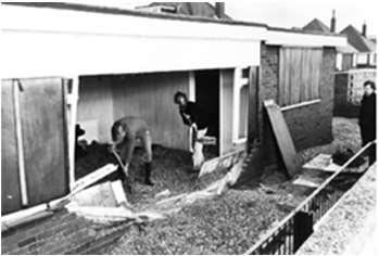
The1960sand1970ssawlargewavesovertoptheseawall,and causeextremefloodingandsignificantdamagetoproperties. Upgradedconcretedefenceshadcausedthedrawdownofthe beachinfront,underminingthedefenceandincreasingthe incidenceandseverityofflooding.Significantrepairswere carriedouttotheseawallin1978torepairstormdamage.
1960sand1970s:floodingandpropertydamageinEastoke


Beachmanagementoperationsinvolvingrecyclingaswellas importingmaterialhavecontinued.Thisactivityhelpsmaintain beachlevelswhichreducestheimpactofstormwaves.Some beachovertoppingoccurs,whichisretainedonthepromenade withacontrolledflowtotheroaddrainage.In2013,the EastokePointScheme,involvingtheconstructionofthreerock groynesandrockrevetment,wasimplementedtoaddress beachloweringandincreasedfloodrisk.
2000s:Beachmanagementcontinues. ABriefHistoryofCoastalManagementonHaylingIsland HaylingIslandCoastalManagementStrategy23
PresentDayBeachManagement
£3.3millionwaspreviouslysecuredfromtheEnvironmentAgencyto implementaBeachManagementPlan(BMP)alongtheHaylingIslandfrontage.
TheSouthHaylingBMPidentifiedastrategyfordeliveringthebeach managementapproachalongtheopencoast.
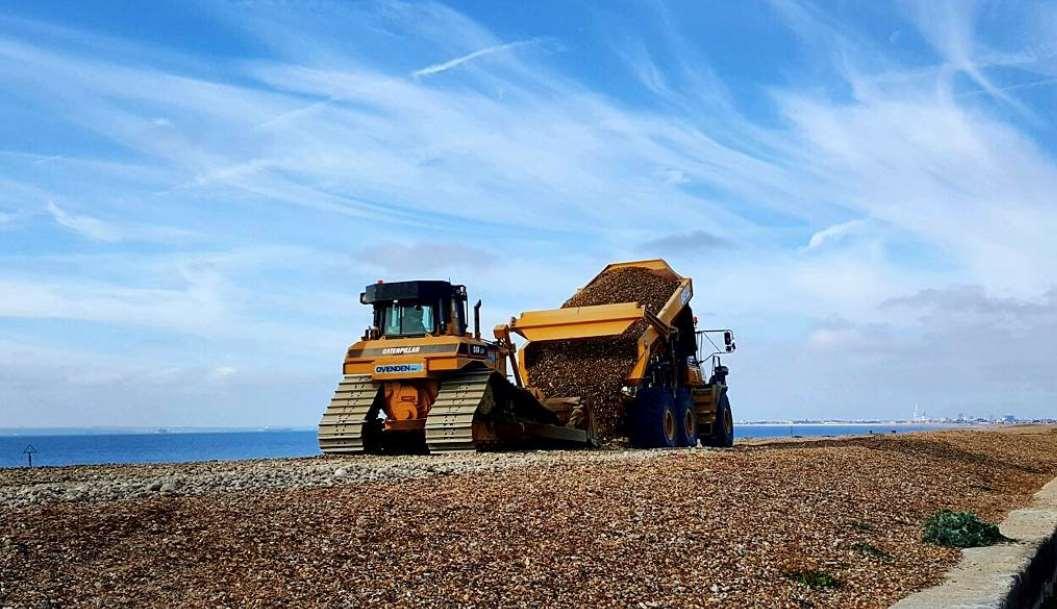
DredgingActivitiesandBeachNourishment

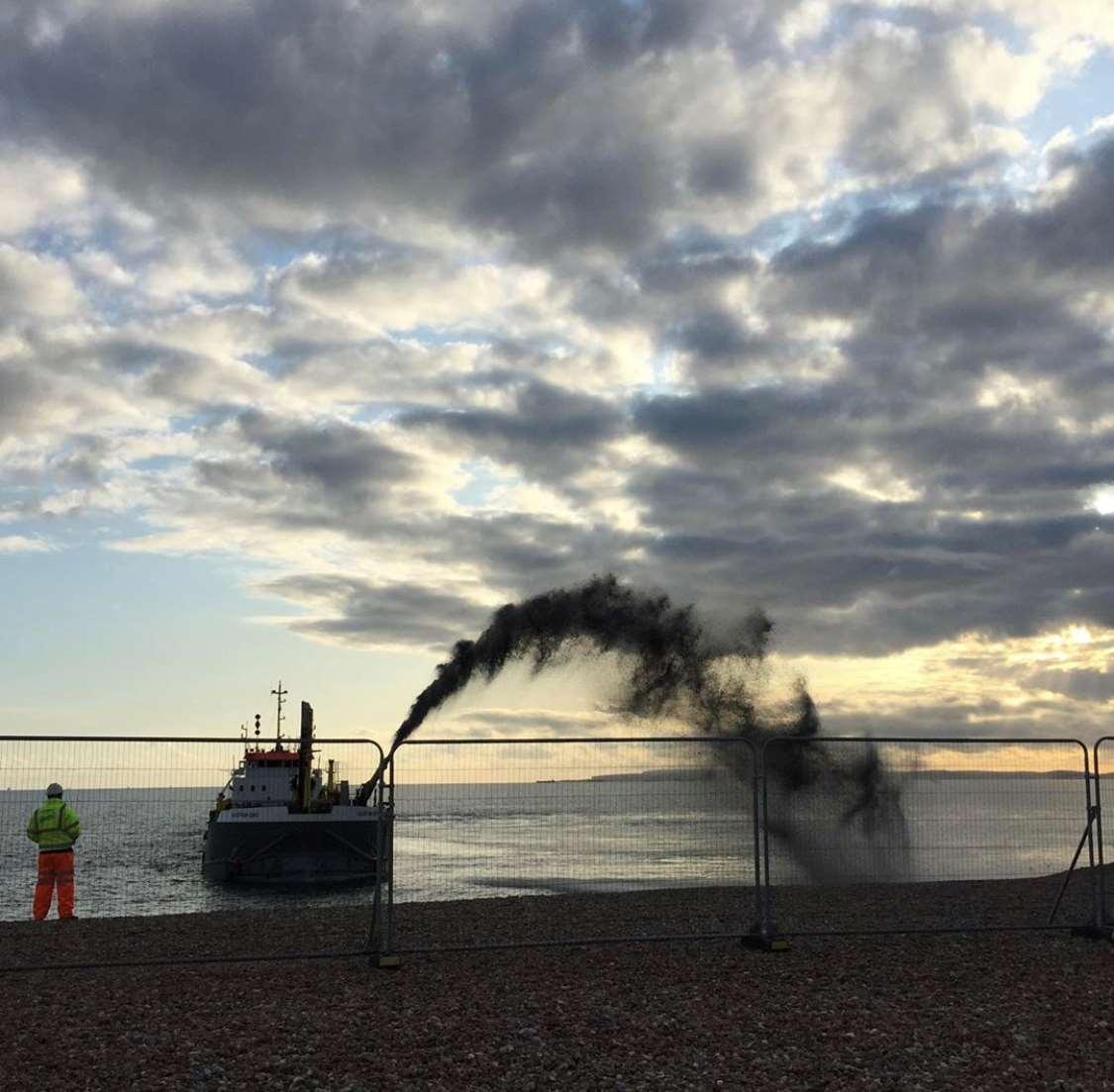
Oneofthemethodsappliedtothebeachmanagementactivitiesisbeach nourishment,whichisthereplacementofsedimentlostfromasectionof beach.Thisisachievedprimarilythroughusingeitherbeachrechargeorbeach recycling.Thiswillhelptorestoreadepletedbeachbacktoacceptablelevels.
Restoredbeachlevelscontributetoreducingtheimpactofstormwaves,which inturnhelptomanageflooding.
Beachrecharge:materialissourcedfromoutsidethenormalbeachsediment systemandintroducedtothesamenearshorezone.
Placementofdredgedmaterial, October2016
Beachrecycling:Materialismovedfromanareaofaccretiontoanareaof erosion,torestoreadepletedbeachbacktoacceptablelevels.
Transportationofmaterial,March2017
BeachManagementonHaylingIsland HaylingIslandCoastalManagementStrategy24
Ondefiningthebaseline,andhavinggainedadetailedunderstandingoftheprocesses,featuresandissuesoperatingalongthecoast,the developmentandappraisalofstrategicmanagementoptionswasundertaken.

TheoptiondevelopmentprocessreferstothetasksinvolvedtoselecttheleadingstrategyoptionsalongTheStrategyfrontage.Theprocess followedtheEnvironmentAgency’sNationalFloodandCoastalErosionRiskManagementguidelines.
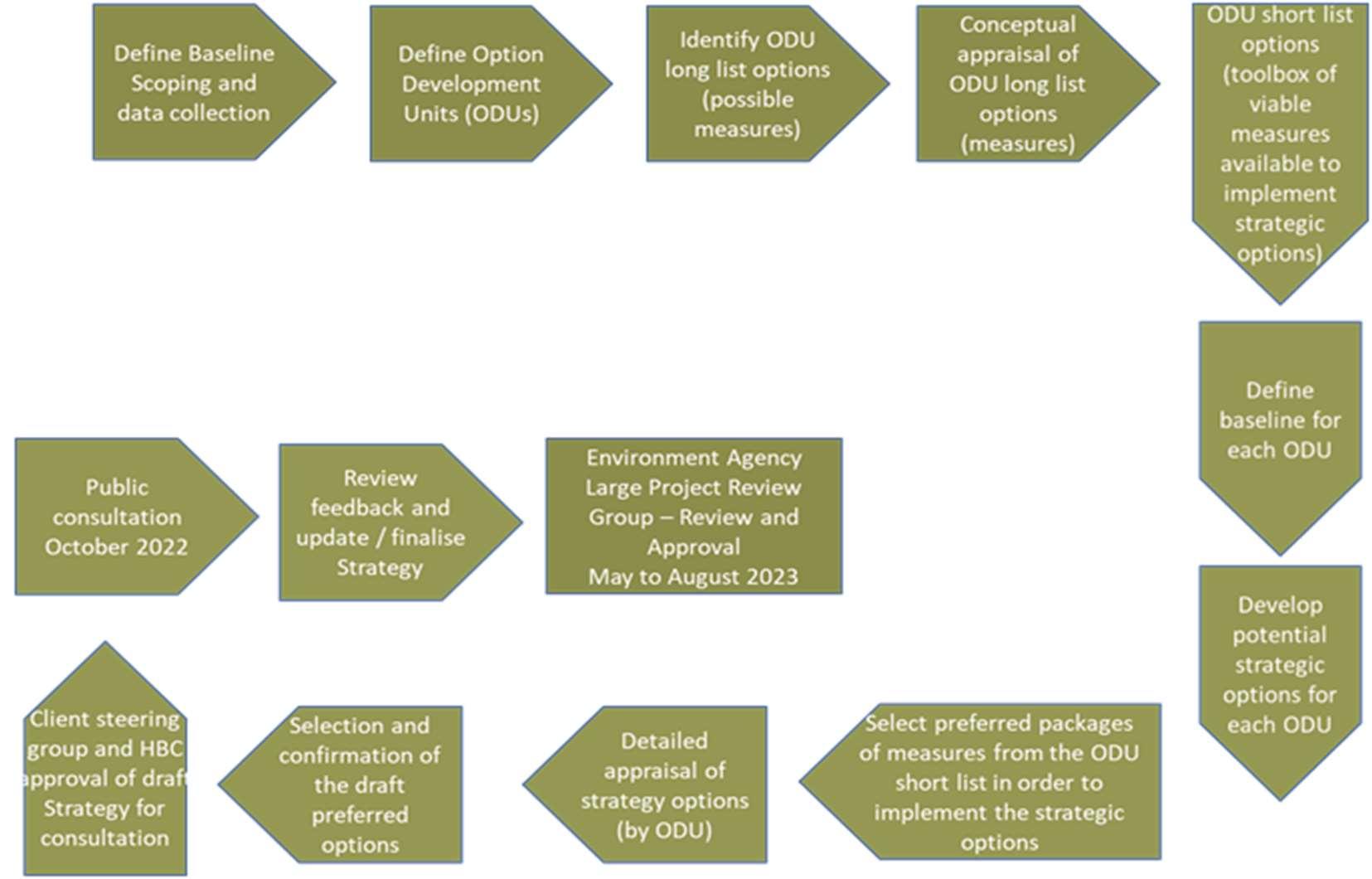
TheOptionAppraisalandStrategyDevelopmentProcess StrategyDevelopment HaylingIslandCoastalManagementStrategy25 FormoreinformationseeAppendixE:ShortlisttoLeading OptionAppraisalReport
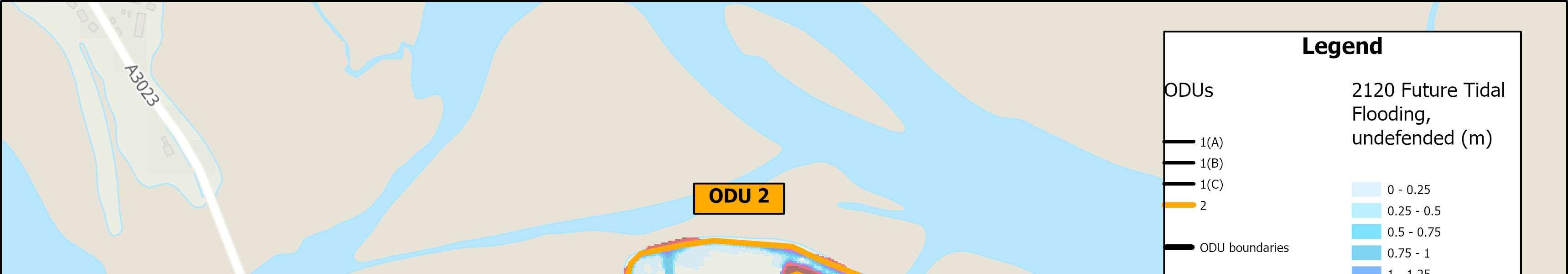
OptionDevelopmentUnits
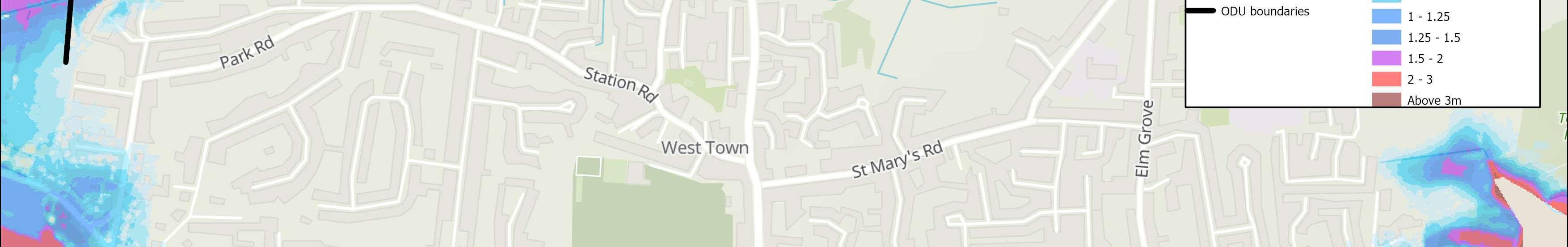
Floodanderosionrisks,coastaldefencetypes,landuses,landownershipand issuesandopportunitiesvaryalongTheStrategyfrontage.Foreffectivefloodand erosionriskmanagementoptionstobedevelopeditisimportanttoconsiderand recognisethislocalvariability.Withthisinmind,thefirststageoftheoption developmentprocesswastodividethefrontageintosmall,localsections.These sectionsareknownasOptionDevelopmentUnits(ODUs).
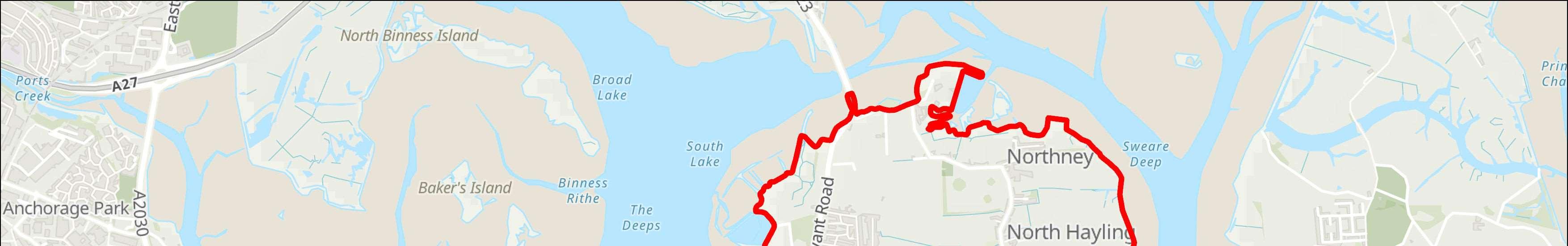
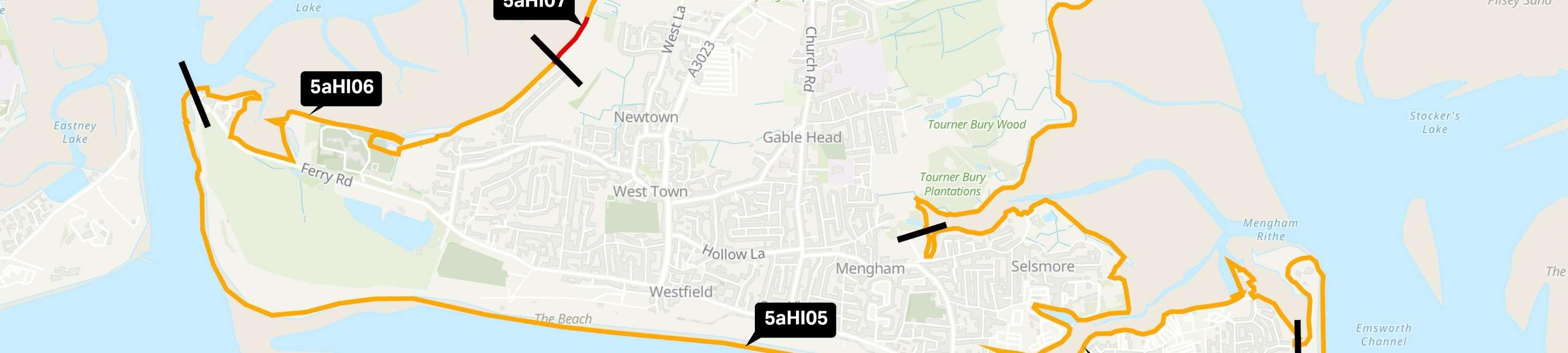
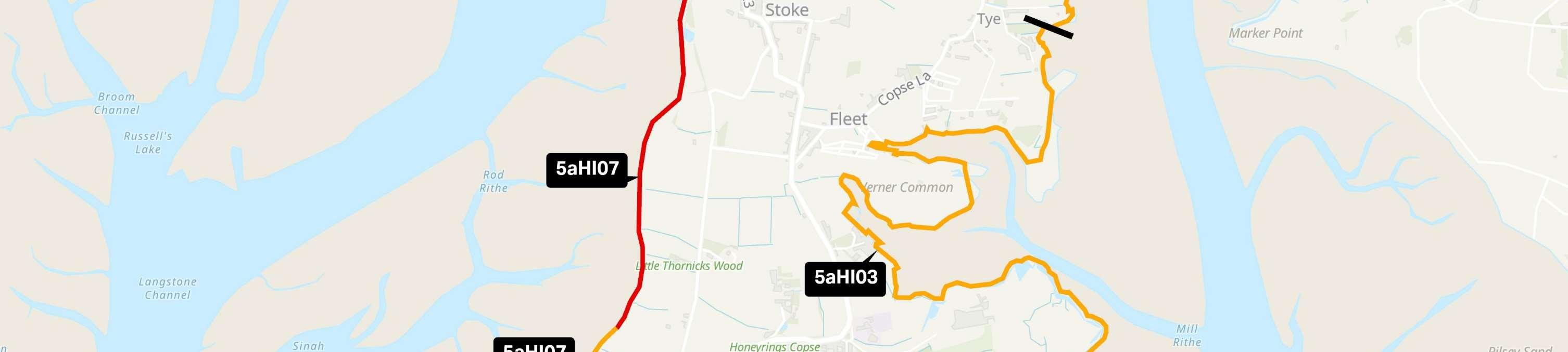
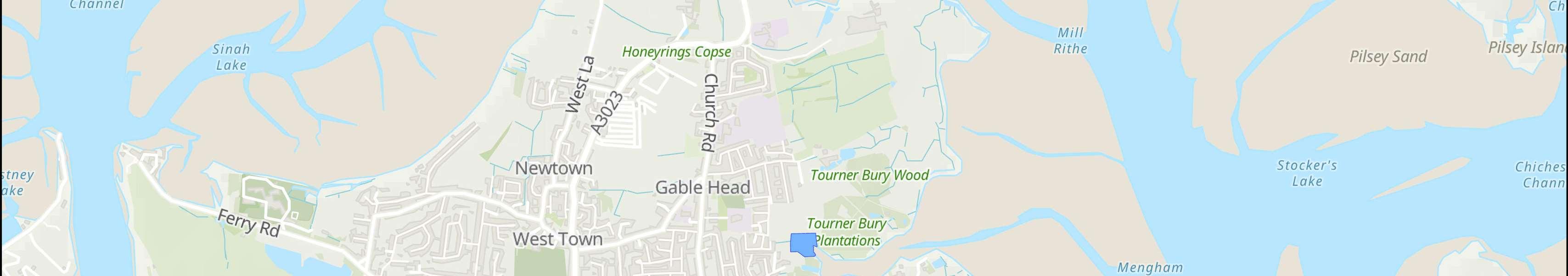
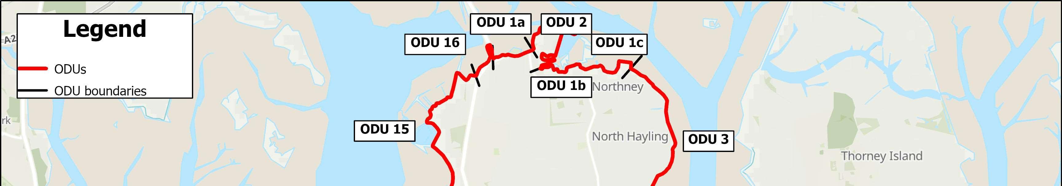
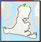
ODU1:LangstoneBridgetoNorthneyFarm(split into3sub-unitsa-c)
ODU2:NorthneyMarina
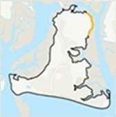
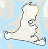
ODU3:NorthneyFarmtoChichesterRoad
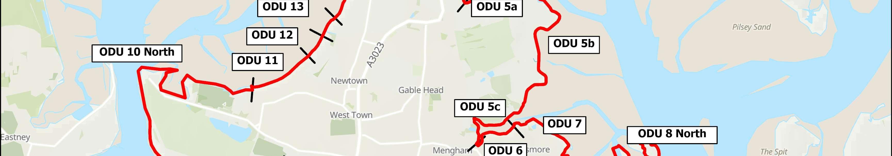
ODU4:ChichesterRoadtoMillRytheJuniorSchool
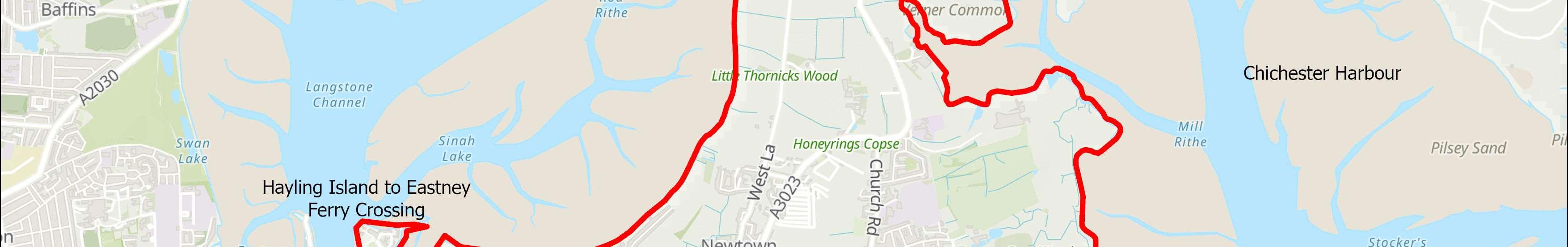
ODU5:MillRytheJuniorSchooltoSalternsLane (splitinto3sub-unitsa-c)
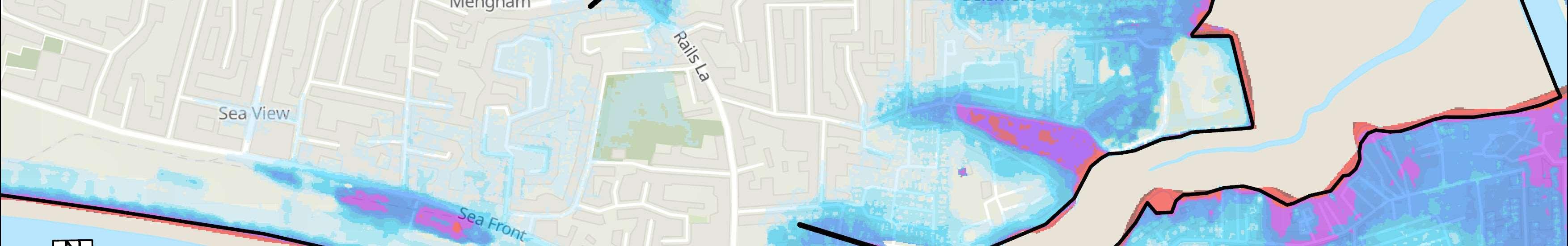
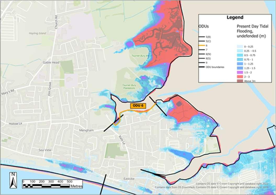
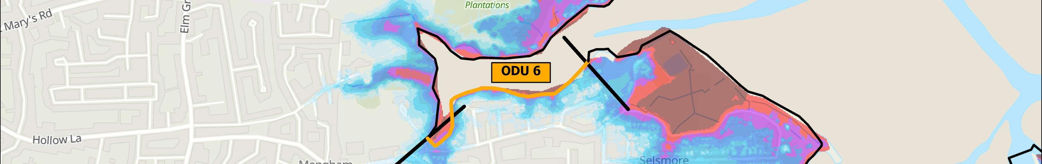
ODU6:SalternsLanetoWilsonsBoatYard
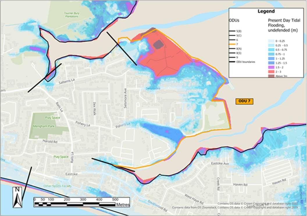
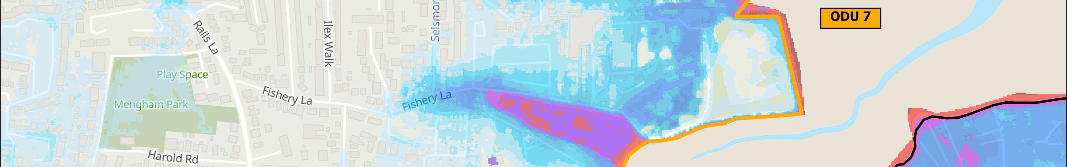
ODU7:WilsonsBoatYardtoFisheryCreek
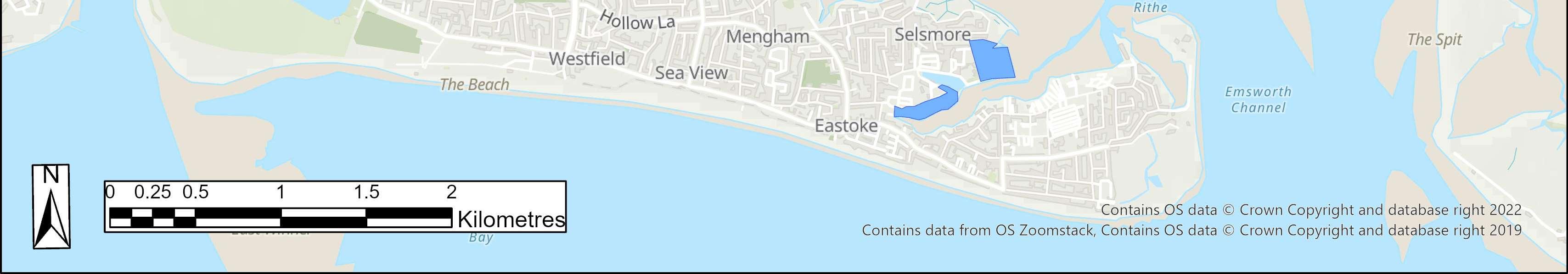
ODU8:Eastoke
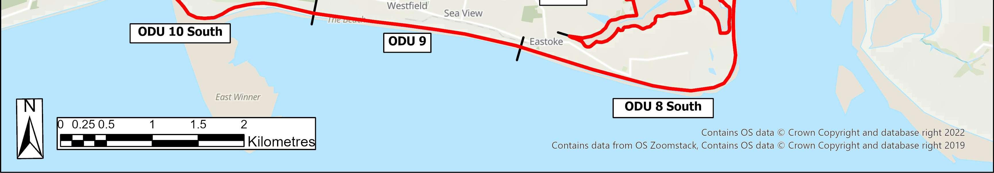
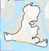
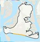
ODU9:EastokeCornertoInnontheBeach
ODU10:InnontheBeachtoNorthShoreRoad
ODU11:NorthShoreRoad
ODU12:NorthShoreRoadtoNewtown
ODU13:Newtown
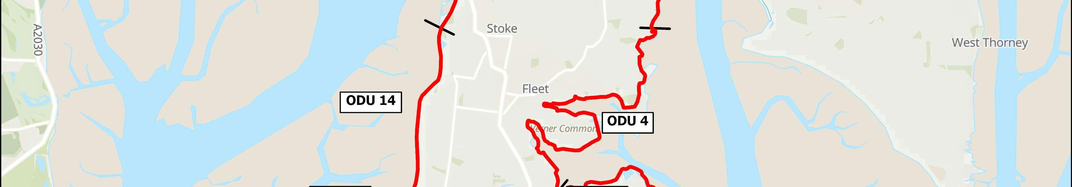
ODU14:NewtowntoStoke
ODU15:StoketoLangstoneBridgeCarPark
ODU16:LangstoneBridgeCarParktoLangstone Bridge
StrategyDevelopment HaylingIslandCoastalManagementStrategy26
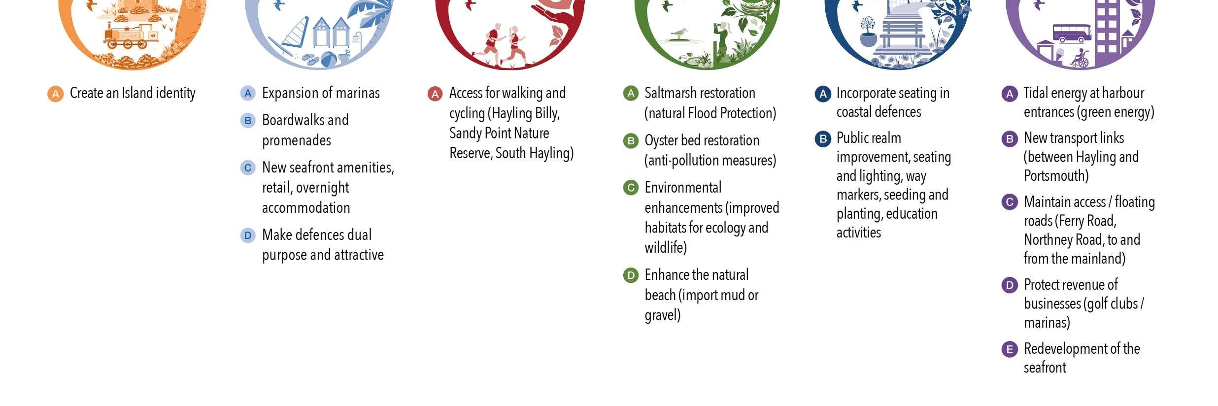
CoastalManagementApproaches
Thelonglistofoptionsfallwithinthefollowingstrategicapproaches.
AcceptingtheTide
Allowingthecoasttoevolvenaturally,noactivemanagement
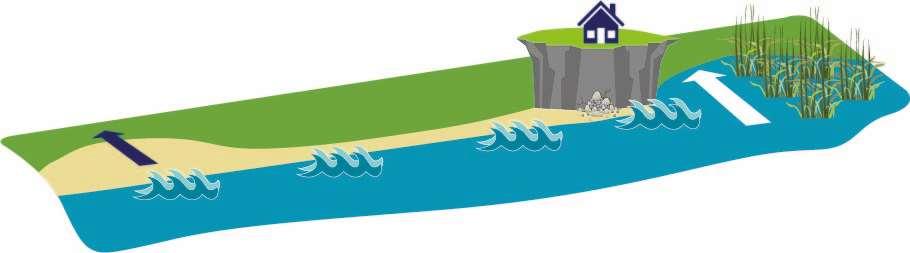
ThisapproachisconsideredasthebaselinefortheHaylingStrategy.It involvesnointerventionormanagement,wherethecoastisallowedto effectivelyevolvenaturally.Beachesandsaltmarshhabitatsareableto movelandwardnaturallyassealevelsrise,erosionisunconstrainedand floodingwillbecomedeeperandmorefrequentovertime. Thiswillnotbeappropriateeverywhere,especiallyinbuiltupareas,butis moreaboutacceptingtheriskofflooding.
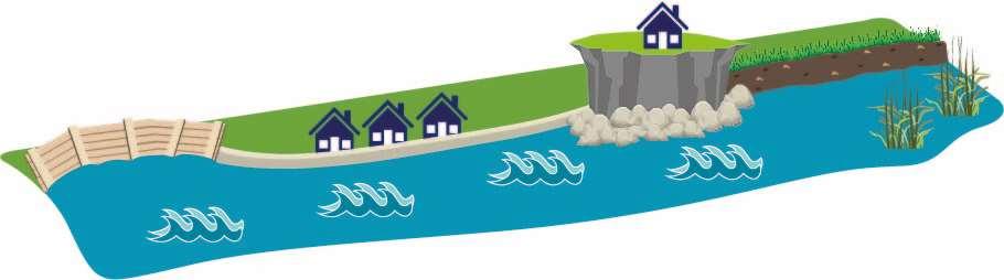
ReducingtheimpactsoftheTide
Controllingnaturalprocesseswithharddefences
Thisapproachinvolvesbuildingartificialstructureswhichtrytocontrol naturalprocesses.Theseoften‘hard’defencesaredesignedtoreduce erosionorholdbackthetide. Theycannotprotectagainsteverystormeventualityandsodonotstop floodingcompletely,thereisalwaysstillarisk.Theyareallbuiltwitha designlifeandwillnotbesustainableforever.Overtimeandassealevels rise,beacheswilldisappearandnaturalsaltmarshwillreduceasitis squeezedagainstdefences(knownascoastalsqueeze).
Saltmarshhabitats movelandward
Embankments
Morefrequent floodingBeachesmovelandward
Erosioneventsmorefrequent
Seawalls
Revetments Rock StrategyDevelopment HaylingIslandCoastalManagementStrategy27
MethodsofReducingtheimpactsofthetideinclude:
•Seawalls–asseeninfrontofInnontheBeach,HaylingBillycarparkin thenorthandMenghamRythesailingclub;
•Timberorrockrevetments–asseenatthecoastguardstationandjust southofMenghamRythesailingclub;
•Embankments–asseeninvariouslocationsonboththeeastandwest coastsofHaylingIsland.
Underthisapproach,thelevelofchangeinriskovertimewithdifferent optionsisalsoconsidered,inordertofindthebestsolution.Optionsthat Maintain,SustainorImprovethecurrentlevelofprotectionare considered.
WorkingwiththeTide
Workingwithnaturalprocessesandreinstatingnaturaldefences
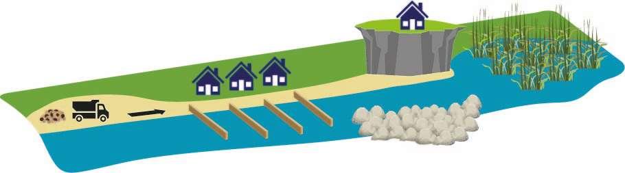
Byworkingwithnaturalprocessesratherthanagainstthem,thisapproach takesamoresustainableandnaturalapproachtomanagingthecoast. Methodsofworkingwiththetideinclude:
•Beachmanagement–bymovingmaterialfromareasofaccretiontoareas oferosionandbuildingupthebeachafterstorms.Thisneedstobecarried outfrequently.ThismethodiscurrentlyinusealongHayling’sopen coast.
•Beachordunenourishment–wherenewmaterialisplacedonthebeach, orplantingtostabilisedunes.ThebeachatEastokeisnourishedregularly, usingdredgedmaterialfromaboat.
•Groynes–totrapsedimentandbuildupabeach.Thismethodcanhave negativeeffectsbystarvingotherareasofmaterialcausingerosion elsewhere.TherearerockandtimbergroynesalongHayling’sopencoast.
•Offshorebreakwaters–helpstrapbeachmateriallandwardofthe breakwater.Thismethodishowever,onlyeffectiveforwaveovertopping, notfloodinundation.
•Saltmarshrestoration-reinstatinganaturaldefenceagainstfloodingand erosionbyrestoringsaltmarshhabitats.Thisoptionwillappealmoretothe harbourcoasts.
 Saltmarshrestoration
Groynes
Beachmanagement
Offshorebreakwaters
Saltmarshrestoration
Groynes
Beachmanagement
Offshorebreakwaters
StrategyDevelopment HaylingIslandCoastalManagementStrategy28
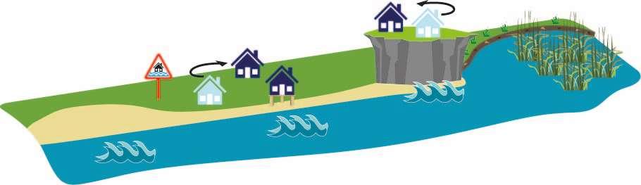
AdaptingtotheTide
Adaptingtoachangingenvironment
Thisapproachfocusesonmanagingchange,tominimisethenegative consequencesoffloodinganderosion,whereadaptationtoachanging environmentoccursbymakingcommunitiesmoreresilienttoclimate change.
Itcaninvolve:
•Makingspacetoallowbeachestorollbacklandwardnaturallyassea levelsrise;
•Adaptingpropertysoitismoreresilienttoflooding;
•Makingmodificationsinsideandoutsidetoreduceimpacts;
•Floodwarningandfloodplans;
•Relocatingpropertyorotherassetssuchascarparks;
•Changinglanduses.
Thisapproachhasthepotentialtoprovidenewopportunitiessuchas creatingnewhabitatswheredefencesaremovedbacktomakespacefor thetide.
StrategicOptions
ToassesstherelativemeritsofdifferentStrategyoptions,thebaselinefloodand erosionriskimpactsassociatedwitha‘DoNothing’approachwerederivedineach ODUforthepresentday,2041,2071and2121.Thisallowedforidentificationof theriskareaswithineachODU,andthetimingofrisksdefined.Thisformeda basisfromwhichtodevelopanumberofpotential‘strategicoptions’forfloodand erosionriskmanagement.Theoptionsconsideredincluded:
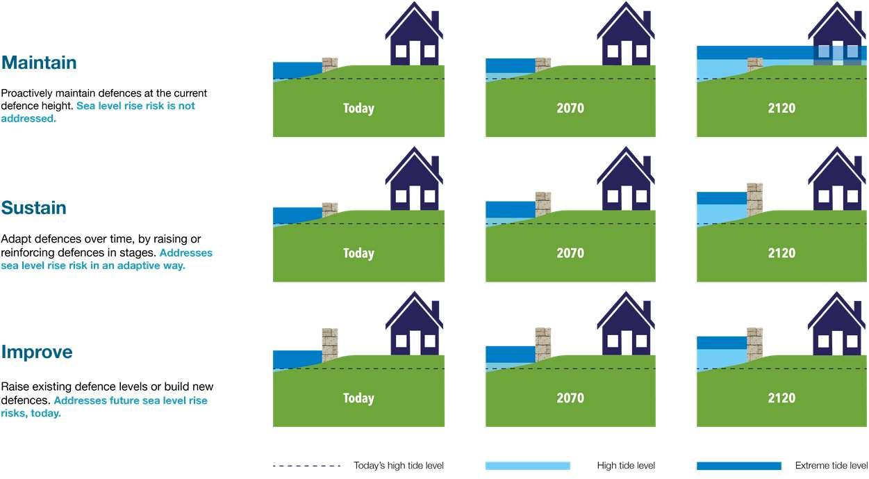
•DoNothing(baseline–developedineachODU)
•DoMinimum–e.g.maintenanceandrepairs–leastrequiredtoimplement theSMPpolicy
•Maintain–e.g.continuetoprotectagainsterosion
•Sustain–maintainaminimumstandardofprotection(SoP)byraising defencesovertimetokeeppacewithsealevelrise
•DelaySustain–maximiseexistingdefencesthenraiseSoPofdefencesata laterdate
•ImproveSoP–improveSoPcomparedtopresentday
Relocatingproperty
Beachesmovelandward
Floodwarning,adapting property
Movedefences landward
Foreachstrategicoption,anappropriate‘packageofmeasures’foreachODUwas selected.Each‘package’wasproducedinconjunctionwiththeshortlistofoptions andoutlinedthetypeofcoastaldefencestructureandtimingofworksrequired overthenext100yearstoimplementthestrategicoption.
StrategyDevelopment HaylingIslandCoastalManagementStrategy29
StrategyDevelopment
Technicalconsiderations
AprimaryconsiderationinthedevelopmentofaStrategyistoknowwhatoptionsbeingrecommendedaretechnicallyviable.Thereislittlepointinundertaking detailedeconomicandenvironmentalappraisals,orputtingtheoptionforward,iftheoptioninquestioncannotreasonablybeimplementedontheground. Technicalconsiderationsincludeaspectssuchasthedefencetypeinquestion,timingofworks,spaceandheightrequirements,allinthecontextofthelocation andpresentconditionofthesiteinquestion.Forexample,foracurrentlyundefended,openspacelocation,therearefewtechnicalissuesandarangeofoptions arelikelytobetechnicallyviable(e.g.revetments,seawalls,landraising,floodwallsearthbundsetc.).However,foramoreconstrainedsite,suchasadenseurban environmentwherespacemaybeverylimited,significanttechnicalchallengesmaybepresentformanyoptions(e.g.landraisingorearthbundswhichrequires space)andmaylimittechnicallyfeasibleoptionstothosesuchasafloodwallwhichrequireasmallerfootprinttoimplement.
Socialaspects
TwoonlineworkshopswereheldinNovember2020withkeystakeholders representingorganisations,communitygroupsandlandownersonHayling Island,focussingonunderstandingandcapturingaspirations,ideasand opportunitiesforHayling’scoastalandharbourfrontages,todayandinthe future. Theseresultshelpedustounderstandwhatisimportanttothosethatlive onandvisitHaylingIsland.Theideas,suggestionsandaspirations identified,directlyinformedthedevelopmentofthestrategicoptions alongsidewideropportunitieswhichcouldpotentiallybedelivered alongsidefloodanderosionriskmanagementschemesinthefuture.The optionappraisalprocessaccountedfortheseaspirationsandthereisan intentthatthepreferredoptionsbeingputforwardshouldsupportand facilitatethesewherepossible.
HaylingIslandCoastalManagementStrategy30
Environmentalaspects
Thekeyenvironmentalconsiderationsandobjectiveshelpedshapethestrategy
options.ThiswasachievedthroughaStrategicEnvironmentalAssessment(SEA) whichwasundertakenasanintegralpartoftheoptionappraisalprocess.An SEAScopingreportwasconsultedonduringtheearlypartoftheproject,and thekeyenvironmentalobjectivesfortheprojectwereconfirmedandthese wererelatedtothefollowingcategories:
EconomicAppraisal
Theeconomicassessmentformedanimportantpartoftheselectionofthe leadingstrategyoptions.Althoughtheleadingoptiondoesnotnecessarilyhave todeliverthemostcosteffectiveoption,becausetherearemanyother determiningfactors(e.g.socialandenvironmentaldrivers),itishowever importanttomakesurethepreferredoptionmakeseconomicsense(i.e.the benefitsofdoingsomethingoutweighthecosts).


Thestrategyoptionsweresubjecttoeconomictestingduringtheappraisal.The assessmentinvolvedanestimationoftheBenefit:Costratioofeachoption.The costsofanoptionwereestimatedaccordingtothedefencetypes(asindicated bythe‘packageofmeasures’),andthedefencelengthsandheights.Theflood anderosionbenefitsofastrategyoptionweredeterminedbycalculatingthe damagesavoidedcomparedtothebaseline‘DoNothing’scenario.

Theoptionswerethenappraisedinrelationtoeachcategory’sobjectivesand theenvironmentalimpactsoftheoptionsweredetermined.Thisinformation wasthenincludedaspartoftheevidenceforselectingthepreferredoption. Wherepossibleitisintendedthatthepreferredoptionsshouldnotsignificantly detrimenttheachievementoftheenvironmentalobjectives,butiftheydo, suitablemitigationorcompensationmustbeidentifiedinordertoensurethe optionsareenvironmentallyacceptable.
Generallyspeaking,thehighertheBenefit:Costratio,themoreeconomically viablethestrategyoption.TheBenefit:Costratiowasusedasatooltohelp informthedecision,andforStrategypurposesaslongasanoptionhada Benefit:Costratiogreaterthan1(i.e.thebenefitsoutweighthecost)itwas deemedaCostEffectiveOption.Sometimesmorecostlyoptionsprovide additionalbenefits,andiftheserepresentbettervalueoveralessexpensive option(i.e.theadditionaldamagesavoidedoutweighthecosts),thenitmay havebeenpreferabletochoosethismorecostlyoption,knownastheWider ObjectivesOption. Itshouldbenotedthatalthoughmanagementoptionsmaybeeconomically viableforthepurposesofTheStrategy,itdoesnotmeantheywillgoahead; therequiredfundingtopayfortheschemesmuststillbefound.
•Biodiversity •Culturalheritageandarchaeology •Landscape •Populationandhumanhealth •Soil •Water •Air •Climate •Materialassets •Andtheinterrelationshipbetweentheabovefactors
StrategyDevelopment HaylingIslandCoastalManagementStrategy31 FormoreinformationseeAppendixG:StrategyEnvironment Assessment,(H)HabitatRegulationsAssessment,(I)Water FrameworkDirective FormoreinformationseeAppendixF:Economics
Chapter4: StrategyOverview


HaylingIslandCoastalManagementStrategy32
StrategyOverview
Aphasedapproachtomanagementbasedonrisk
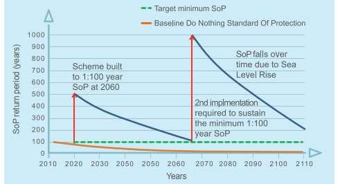
TheStrategyoptionsproportionatelyaddressfloodanderosionriskswith worksphasedovertimedependingontherisk-basedtriggers.Assealevelsrise inthefuture,andexistingdefencesreachtheendoftheirusefullife,new coastaldefenceswillberequired.TheStrategyhasrecommendedaphased implementationprogrammeforfutureworks,basedonwhenrisksmaterialise.
TheStrategyrecommendsthatfuturefloodriskmanagementintervention optionssustainaminimum1:75year(1.33%annualchance)standardof protection(SoP).Thisstandardhasbeeneconomicallytestedagainst alternativesanditisdemonstratedthat1:75year(1.33%annualchance) minimumSoPisappropriateandeconomicallysoundatthestrategiclevel. Itshouldalsobenotedthatthisstrategiclevelminimumstandardof protectionwillbereviewedandtestedonalocalscaleinthedevelopmentof specificschemes;thismayresultinhigherstandardsofprotectionbeing deliveredlocally.
Howwillfuturemanagementbepaidfor?
Inrecentyearstherehasbeenachangetothewaycoastaldefencesare funded.Thefundingsystem,referredtoasapaymentforoutcomesapproach, rewardspartnershipfundingofschemesandprovidesmanypositivebenefits withlotsmoreschemesnowbeingbuiltasaresult.
Althoughaverysmallminorityofschemescanstillgainapprovalfor100% publicfunding(GrantinAid),schemeswithanexternalcontributionarelooked onfavourablytoalsoattractpublicmonies.Inaddition,themeritsofschemes arenotjudgedpurelyfinancially,andthewideroutcomesthatascheme deliversarealsoconsidered.
Forexample,ifaschememovespeopleinhighlydeprivedareasoutof significantfloodrisk,thispropelstheschemeuptheladderinthebidforpublic funding. TheStrategyrecommendseconomicallysoundleadingstrategicapproachesto managingfloodanderosionrisk.Althoughsomefutureschemesmaybeableto attractsomepublic(GrantinAid)funding,contributionswillberequiredto makeuptheshortfalltoenableschemestoprogress.Byknowingthepotential futurecostsofworks,mechanismstoinvestigateandsecurefundingcanbe developed.
Suchcontributionscouldcomefrom:
ACommunityInfrastructureLevy–wheredevelopersareeffectivelytaxed andthismoneyisspentoncommunityprojects
Schematicshowingadaptivemanagementwithaphasedinterventionovertimeto maintainaminimumSoP
HaylingIslandCoastalManagementStrategy33
•
•Directlythroughdevelopers(e.g.raisinglandthroughredevelopment) •PotentialBeneficiariesofSchemes–businessesandprivateindividuals •Locallevies •LocalEnterprisePartnership •Othersources.
DeliveringMore–broaderoutcomesandcontributions
TheStrategyprimarilypresentstheleadingstrategicapproachesformanaging therisksposedbycoastalfloodinganderosion.However,indoingthis,there arealsomanyotheropportunitiesforTheStrategytoprotect,supportand facilitatewiderbenefits.ThisisakeyobjectiveofTheStrategy. Forexample,anewcoastaldefencetoprotectanareafromfloodingcanbeas simpleasaseawall.Whilstsuchadefencewillserveitspurpose,withsome joinedupthinkingtheremaybeopportunitiestobuildmaintenancefree passivedefencessuchasraisinglandthroughredevelopment.Suchascheme couldprovidemultiplebenefitsandnotjustaflooddefence.Thiscouldinclude regeneration,reducevisualimpact,improveaccesstothecoast,reducefuture maintenancecostsandreduceriskofdefencesbreaching.Apartnership approachsuchasthiscouldalsohelpfunddefencesandensurethattheyare approvedandbuiltmoreefficiently. Inordertoseekthedeliveryofthesemultiplebenefitsoffuturedefence schemes,TheStrategyhasidentified,signpostedandbegunexploringthe opportunities.

StrategyOverview HaylingIslandCoastalManagementStrategy34
OutdoorGymlocatedatEastoke,HaylingIsland
Informalplayareaincorporatedalongthewalking/cyclingrouteat TipnerLake,Portsmouth.
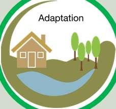
Adaptation
Thedraftleadingstrategyoptionsprovidetherecommendedpathwaysfor managingfloodingandcoastalerosiononHaylingIslandoverthenext100 years.However,theimplementationoftheseoptionsisdependentonfunding availability.Withoutthenecessaryfunding,itmaynotbepossibletoconstruct/ maintainthedefences/measuresrecommendedbytheoptions.Therealityis thatwewillneedtolooktoadaptationasarealisticresponsetocoastalriskson theislandnowandintothefuture.
‘...anticipatingappropriateactiontoprevent

NationalFCERMStrategy2020
CoastaladaptationshouldbeconsideredinALLLOCATIONSalongsidethe leadingstrategicoptionspresentedinTheStrategy.Weneedtoexplore methodstoadjusttotherealityofpresentandfuturecoastalfloodingand erosionrisk. Adaptationfocussesonadjustingto,andmanaging,theimpactsoffloodingand coastalerosion,asopposedtotheotherstrategicoptionswhichaimtomitigate theimpactsthroughphysicalfloodprotectionmeasures.
CoastalAdaptation
orminimisethelikelihoodandconsequences offloodingandcoastalchange,bothnow andinthefuture…’
StrategyOverview HaylingIslandCoastalManagementStrategy35

41 Geomatics,CoastalPartners HaylingIslandCoastalManagementStrategy36
Chapter5: DraftStrategyLeading Options


HaylingIslandCoastalManagementStrategy37
DraftStrategyLeadingOptions
ThefollowingpagesintroducethedraftStrategyleadingoptions.EachODUhasa roadmap,illustratingaCostEffectiveoptionandaWiderObjectivesoptionasa resultoftheassessmentsundertaken,describedinChapter3.
ForeachODU,anoverall'LeadingOption'hasbeenselectedastheoptionwhich scoredthehighestintheappraisal.ForthemajorityofODUstheLeadingoption willbeeitherthe'CostEffectiveOption'ORthe'WiderObjectivesOption,butin someODUs,theCostEffectiveOptionandtheWiderOpportunitiesOptionsare thesame,astheyhaveequalscores.

£CostEffective Option
Wider Objectives
Option
Thisistheoptionwhichprovides

bestvaluefortaxpayers’money inlinewithgovernmentpolicy andguidance.
Thisoptionmeetsthemost objectives(environmental,social andtechnical)usingascored multi-criteriaapproach.
TheroadmapforeachODUpresentsavisualrepresentationofthestrategy option(s)andthekeydescribingeachofthesymbolsispresentedhere.The pathwayapproachshowswhatcouldbepossibleoverthenext100yrs.Butitalso allowsustomovetoalternativepathwaysinthefuture. Forexample,ifpublicfundingruleschangeinthefuture,itmaymean,where thereisnoeconomiccasetodosomethingnow,theremaybeacaseinthe futuretoprogressworks.Oralandownermaydecidetoinvestintheirown privatedefenceswherethereisnonationaleconomiccasetodoso.
DoNothing
Nofurtherinvestmentinexistingcoastaldefences. Defenceswouldbeallowedtofailovertimeandnatural processestocontinue.
Maintenance
Maximisethelifeofexistingcoastaldefencesatcurrent heightthroughpatchandrepairandscheduled maintenance.

CapitalWorks

Constructionofnewcoastaldefences/refurbishment ofexistingcoastaldefences.

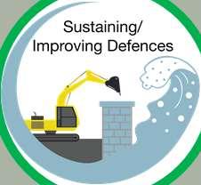
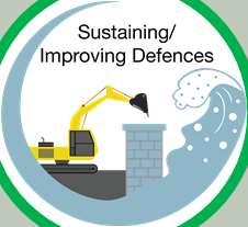
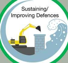
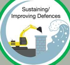
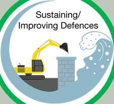
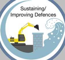
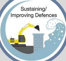
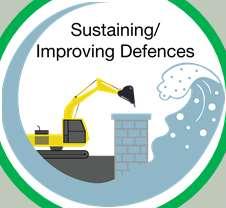
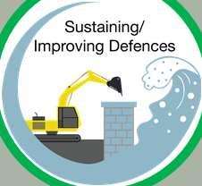
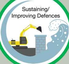
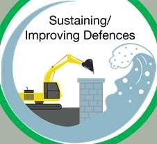
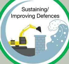
Sustaining/ImprovingDefences
Sustaining/Improvingexistingcoastaldefencesby raisingtheheightorconstructingadditionallengthsover time,tokeeppacewithsealevelriseandincreasedrisk.

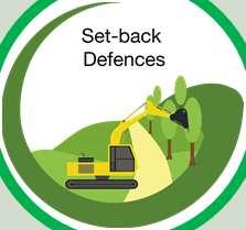
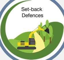
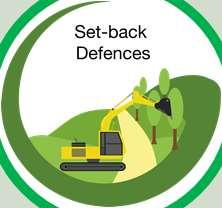
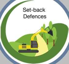
Set-backdefences
Constructionofasetbackdefencetoreduceriskto assets,alongsideopportunitiesforintertidalhabitat creation.

Adaptation
Adaptingtotheimpactsofcoastalfloodinganderosion. Thiscouldincludeanumberofofdifferentmeasures, suchaspropertyfloodresilience,earlywarningsystems, relocationofassetsandriskinformedlandplanning.

HaylingIslandCoastalManagementStrategy38 Key
OverviewandKeyDrivers
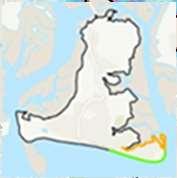
ODU1islocatedbetweenLangstoneBridgetoNorthneyFarm.ODU1isdivided intothreesub-unitswhichareseparatedbyODU2.

WhilethereisasignificantriskoftidalfloodingacrosstheODU1frontage,thereis
TidalFloodRiskMaps
Hotel.ThereisahistoriccoastallandfillsiteatthefarextentoftheunitinODU1c.
Map1:Presentdaymodelledextentoftidalflooding, assumingnodefences(1in200Year,0.5%AEP).

FurtherdetailsonthekeydriversforODU1areshowninthetablebelow,along
HoldTheLine
ODU1a:10-15years
ODU1b:10–20years
Map2:Modelledextentoftidalfloodingin100years timewithanallowanceforsealevelrise,assumingno defences(1in200Year,0.5%AEP).
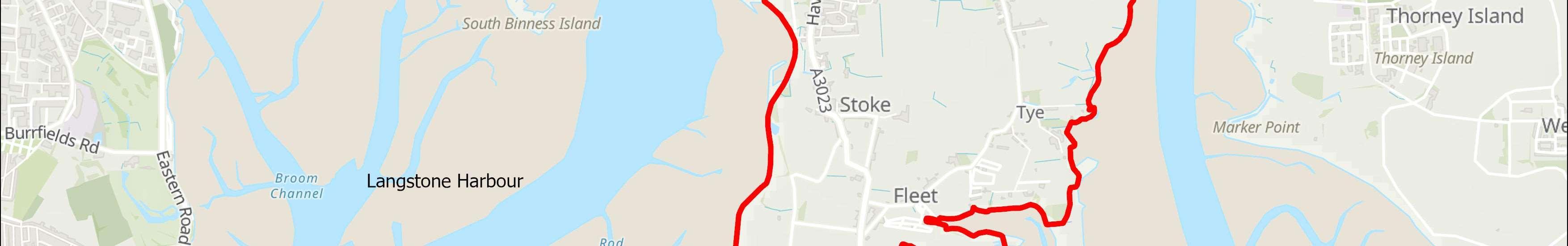
ODU1:LangstoneBridgetoNorthneyFarm HaylingIslandCoastalManagementStrategy39
aloweconomiccasetodosomething.NorthneyRoadisimportantforaccessing theeasternpartoftheislandaswellasNorthneyMarinaandLangstoneQuays
ThereisanopportunityforallowingspacefornaturealongODU1b.
withtidalfloodriskmap.ThedraftStrategyroadmapisshownoverleaf.
SMPPolicy Residuallifeofdefences withoutmaintenance(years) CurrentMaintainer
(short,medium&long term)
ODU1c:<10years HCC/HBC/EA FloodandErosionRisks Mainriskisfromtidalflooding.FloodinglinkacrossthewholeofODU1. Cumulativenumberofpropertiesat riskoferosion(withnodefences) Cumulativenumberofpropertiesatrisk fromtidalfloodingwithnodefences 0-20years00-20years16 20-50years020-50years46 50-100years150-100years138 IssuesandOpportunities Northneyroadisamajorroad,necessaryforaccessingtheeasternpartoftheisland includingNorthneyMarina,LangstoneQuaysresortandNorthneyvillage.Theroadis regularlyinundatedbythetidethroughouttheyearandimpassableforhoursata time.Coastallandfillateasternend.OpportunitytoallowspacefornaturealongODU 1b. DoNothingdamages(PresentValue):£4,380,000
Adaptingtothetide
Makespacefornaturebyconstructingnewdefences furtherinland,toberaisedinthefuturetokeeppace withSeaLevelRise


Reducingtheimpactsofthetide
INTENT:MaintainviabilityofNorthneyRdandtheA3023 intothefutureassealevelrise.

raiseovertimetokeeppacewithsealevelrise.
Adaptingtothetide
INTENT:Maintainfloodprotectiontopropertieswhile makingspacefornaturebycreatingamoresustainable defencealignmentintothefuture.


appropriate,maintainandraiseovertimetokeeppace withsealevelrise.


Reducingtheimpactsofthetide

INTENT:Stoplandfillerodingintotheharbourintothe futureassealevelsrise.
alignment,maintainandraiseovertimetokeeppace withsealevelrise.


£Cost Effective Option Wider Objectives Option LEADING OPTIONS
HOW:Constructionofnewdefencesalongtheroadand
ShortTermMedium Term LongTerm Frontage1a
HOW:Constructnewset-backdefenceswhere
HOW:Constructionofnewdefencesalongexisting
Frontage1b Frontage1c Present day 20 years 50 years ODU1:LangstoneBridgetoNorthneyFarm DraftStrategyRoadmap HaylingIslandCoastalManagementStrategy40
OverviewandKeyDrivers
TidalFloodRiskMaps
Map1:Presentdaymodelledextentoftidalflooding, assumingnodefences(1in200Year,0.5%AEP).
Map2:Modelledextentoftidalfloodingin100years timewithanallowanceforsealevelrise,assumingno defences(1in200Year,0.5%AEP).
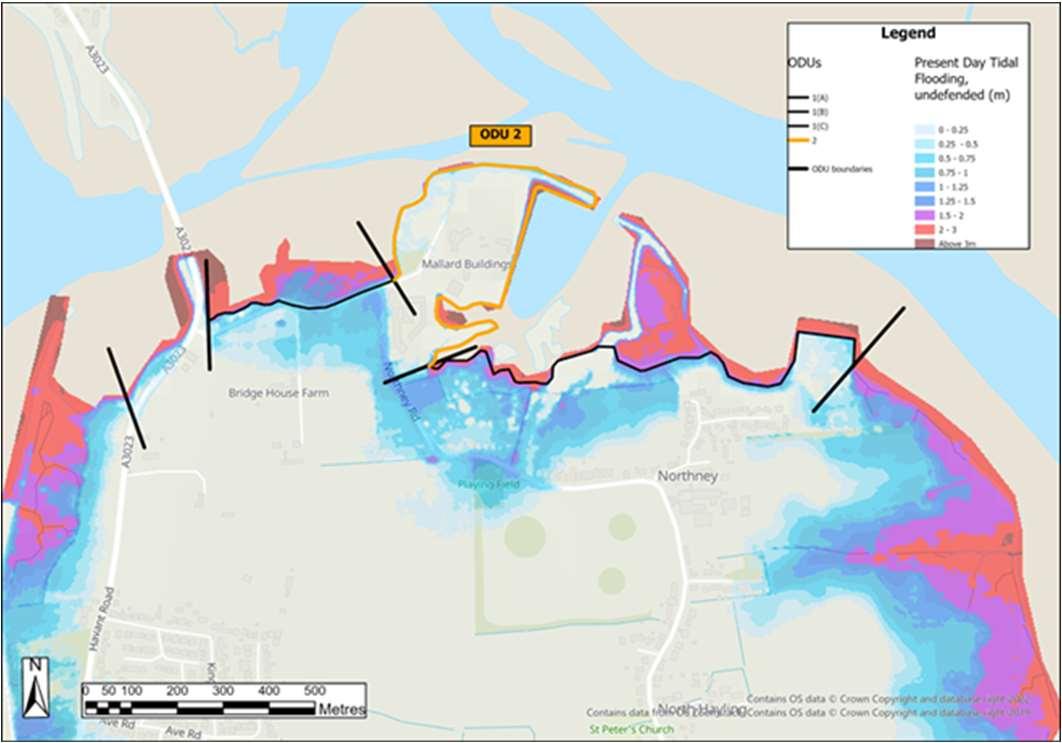
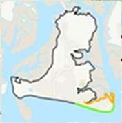
ODU2:NorthneyMarina HaylingIslandCoastalManagementStrategy41 ODU2comprisesNorthneyMarina,NorthEasttipofHaylingIsland,nestledin betweenODU1. Thereareamixofbusinesses(marina,LangstoneQuaysResort)andmorerecently anumberofresidentialpropertieswithinthemarinacomplex.Bothtidalfloodand erosionriskislow.Asriskislowthereisnoeconomiccasetodoanything. FurtherdetailsonthekeydriversforODU2areshowninthetablebelow,along withtidalfloodriskmap.ThedraftStrategyroadmapisshownoverleaf.
SMPPolicy Residuallifeofdefences withoutmaintenance(years)CurrentMaintainer HoldTheLine (shortmedium&long term) Varies,typically15-20Private FloodandErosionRisks Limitedfloodrisk;lowerosionrisk. Cumulativenumberofpropertiesat riskoferosion(withnodefences) Cumulativenumberofpropertiesatrisk fromtidalfloodingwithnodefences 0-20years00-20years2 20-50years220-50years6 50-100years350-100years17 IssuesandOpportunities Potentialforredevelopmentinthefuture. Theviabilityofthemarinaandhotelisdependantonmaintainingaccessalong NorthneyRoad. DoNothingdamages(PresentValue):£115,000


ShortTermMedium Term LongTerm Present day 20 years 50 years ODU2:NorthneyMarina DraftStrategyRoadmap Wider Objectives OptionLEADING OPTION Adaptingtothetide INTENT:Landownerstomaintaintheirownflood anderosionprotectiontoassetsandbusinessesor adapttobecomemoreresilienttofloodinginthe future. HOW:Privatemaintenanceorreplacementof defencesbylandowneroradaptation. Acceptingthetide Allowthecoasttoevolvenaturally,noactive management £Cost Effective Option HaylingIslandCoastalManagementStrategy42
OverviewandKeyDrivers
TidalFloodRiskMaps
Map1:Presentdaymodelled extentoftidalflooding,assuming nodefences(1in200Year,0.5% AEP).
Map2:Modelledextentoftidal floodingin100yearstimewith anallowanceforsealevelrise, assumingnodefences(1in200 Year,0.5%AEP).
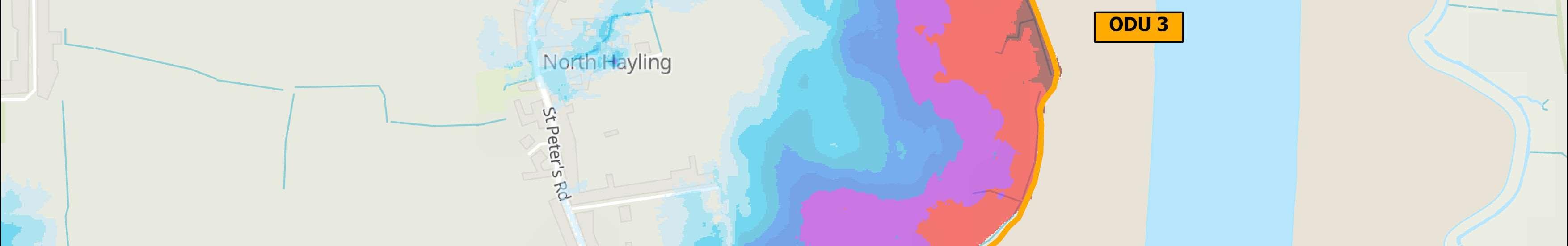
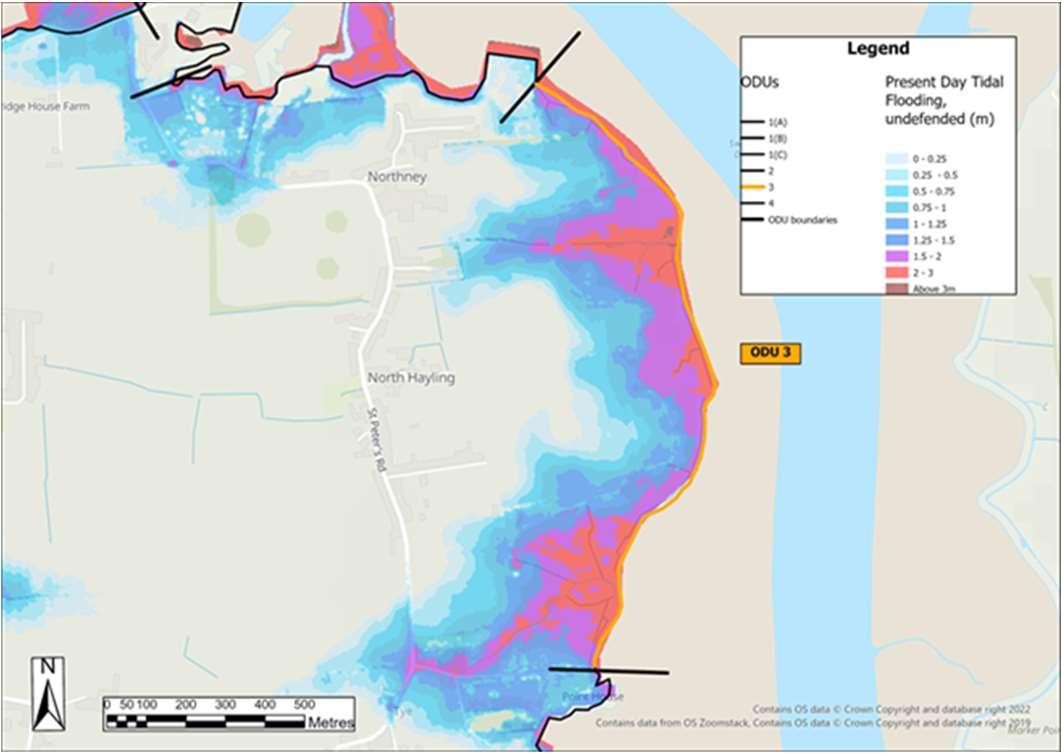
ODU3:NorthneyFarmtoChichesterRoad HaylingIslandCoastalManagementStrategy43 ODU3islocatedfromNorthneyFarmtoChichesterRoad,featuringpredominately farmland. Mainriskisfromtidalfloodinginthefuturetoagriculturallandandsetback propertiesinNorthneyvillage.Thereisaneconomiccasetodosomethinghere. FurtherdetailsonthekeydriversforODU3areshowninthetablebelow,along withtidalfloodriskmap.ThedraftStrategyroadmapisshownoverleaf.
SMPPolicy Residuallifeofdefences withoutmaintenance(years)CurrentMaintainer HoldTheLine (short&mediumterm) Longterm:further detailedstudiesto considerManaged Realignment. Typically<10Private FloodandErosionRisks Significantfloodrisk.Increasingindepthandextentinthefuture. Cumulativenumberofpropertiesat riskoferosion(withnodefences) Cumulativenumberofpropertiesatrisk fromtidalfloodingwithnodefences 0-20years00-20years11 20-50years120-50years38 50-100years1050-100years118 IssuesandOpportunities Defencescurrentlyinpoorconditioninanumberoflocations.Sectionswhichhave failedinthepasthavebeeninformallyrepaired. Needtomaximiseagriculturalopportunities. Potentialopportunitiesformakingspacefornatureinthefuture. FuturefloodrisktopropertiessetbackfromthefrontageinNorthneyvillage. DoNothingdamages(PresentValue):£2,854,000


ShortTermMedium Term LongTerm Present day 20 years 50 years ODU3:NorthneyFarmtoChichesterRoad DraftStrategyRoadmap HaylingIslandCoastalManagementStrategy44 Wider Objectives Option LEADING OPTION Adaptingtothetide INTENT:Maximiseagriculturalopportunitieswhile makingspacefornaturetomaintaintheviabilityof agriculturallandwhileexploringamoresustainable defencealignmentintothefuture. HOW:Constructnewdefencesovertime,andsetback whereappropriate,maintainandraisetokeeppace withSeaLevelRise. £Cost Effective Option
OverviewandKeyDrivers
TidalFloodRiskMaps


Map1:Presentdaymodelledextentoftidalflooding,
Map2:Modelledextentoftidalfloodingin100years
defences(1in200Year,0.5%AEP).
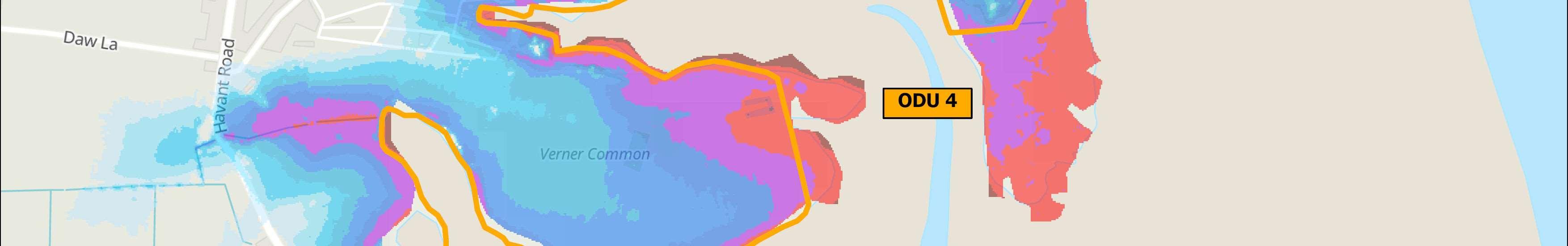
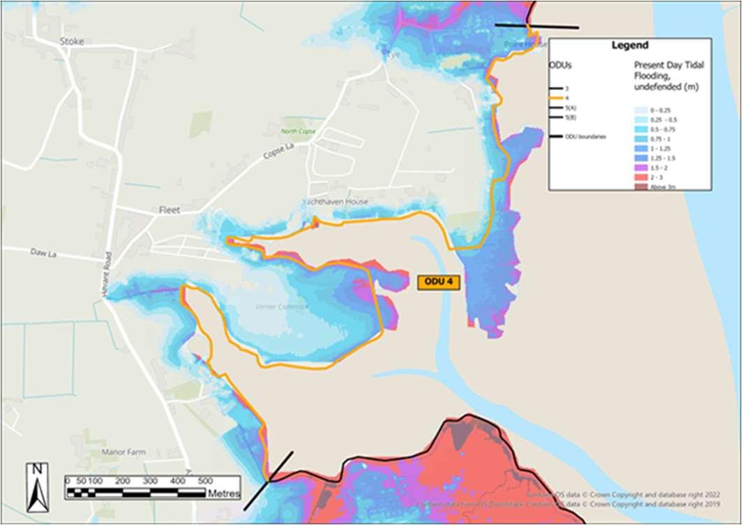
ODU4:ChichesterRoadtoMillRytheJuniorSchool HaylingIslandCoastalManagementStrategy45 ODU4islocatedfromNorthneyFarmboundaryatChichesterRoadsouthtoMill RytheJuniorschool. Thefrontageincludesresidentialproperties,aholidaypark,amarinaandaschool. Theriskismainlyfromtidalflooding,however,thereisnoeconomiccasetodo anything. FurtherdetailsonthekeydriversforODU4areshowninthetablebelow,along withtidalfloodriskmap.ThedraftStrategyroadmapisshownoverleaf.
SMPPolicy Residuallifeofdefences withoutmaintenance(years)CurrentMaintainer HoldTheLine (short,medium&long term) Varies,typically10-15,locally <10 Private/Environment Agency FloodandErosionRisks Greatestriskisfromtidalflooding,althoughlandrisesquitequicklyinthenorth. Continuousfloodcell.Floodriskincreasesinthefuture. Cumulativenumberofpropertiesat riskoferosion(withnodefences) Cumulativenumberofpropertiesatrisk fromtidalfloodingwithnodefences 0-20years10-20years15 20-50years520-50years66 50-100years950-100years187 IssuesandOpportunities Twosmallareasofcoastallandfilllocatedontheexistingshoreline. Amixofresidentialproperties,aholidaypark,amarinaandaschoolareatfloodrisk. DoNothingdamages(PresentValue):£5,913,000
assumingnodefences(1in200Year,0.5%AEP).
timewithanallowanceforsealevelrise,assumingno


ShortTermMedium Term LongTerm Present day 20 years 50 years ODU4:ChichesterRoadtoMillRytheJuniorSchool DraftStrategyRoadmap HaylingIslandCoastalManagementStrategy46 Wider Objectives OptionLEADING OPTION Adaptingtothetide INTENT:Landownerstomaintaintheirfloodand erosionprotectiontoassetsandbusinessesoradapt tobecomemoreresilienttofloodinginthefuture. HOW:Privatemaintenanceorreplacementof defencesbylandownersoradaptation. Acceptingthetide Allowthecoasttoevolvenaturally,noactive management £Cost Effective Option
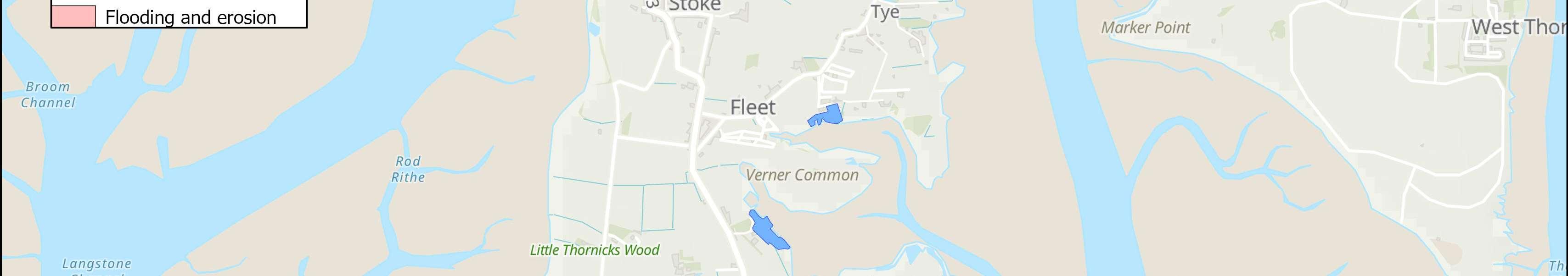
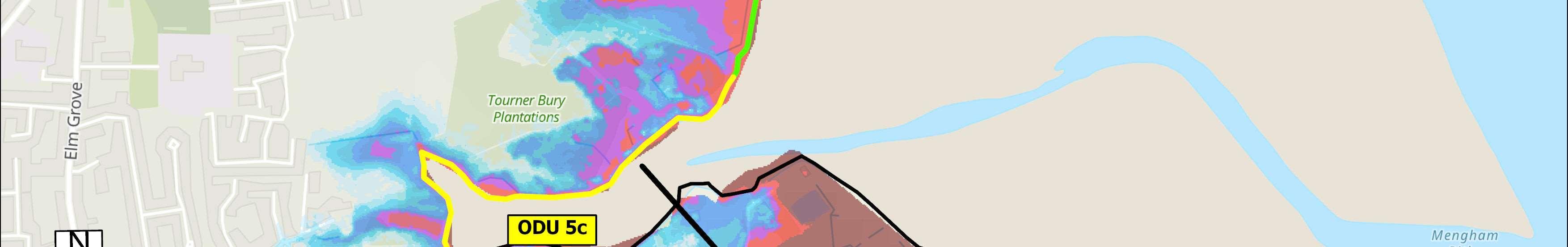
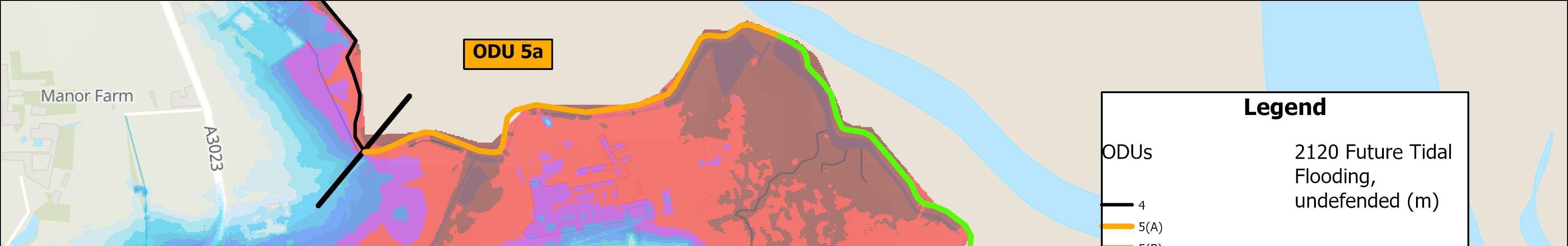
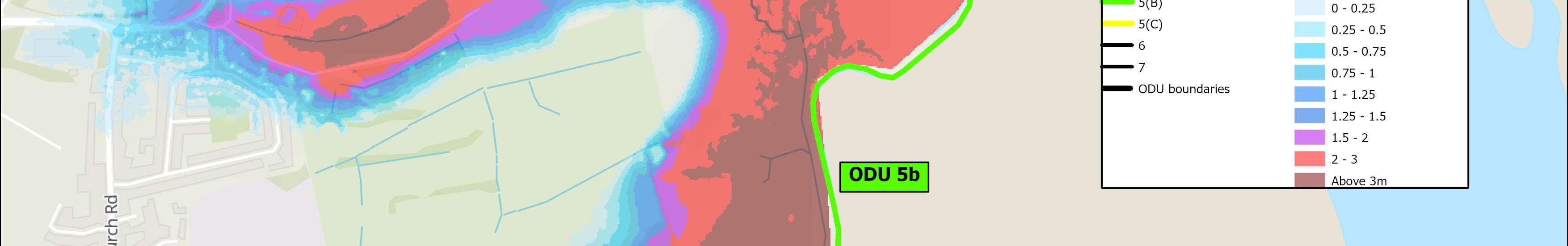
ODU5islocatedbetweenMillRytheJuniorSchooltoSalternsLane.ODU5is dividedintothreesub-units. ODU5astretchesfromMillRytheJuniorSchoolintheWesttofarmlandintheEast andcomprisesagriculturallandandtheMillRytheHolidayVillage.Theriskisfrom tidalflooding,wherethefloodextentreachestoMillRythevillage.ODU5bCovers privatefarmlandandTournerburyGolfCourse.Theriskisfromtidalflooding.ODU 5cstretchesfromTournerburyWoodsEstatetoSalternsLaneandincludes TournerburyWoodsEstate,andadhocresidentialandcommercialproperties. Floodanderosionriskislow. FurtherdetailsonthekeydriversforODU5areshowninthetablebelow,along withtidalfloodriskmap.ThedraftStrategyroadmapisshownoverleaf.
TidalFloodRiskMaps
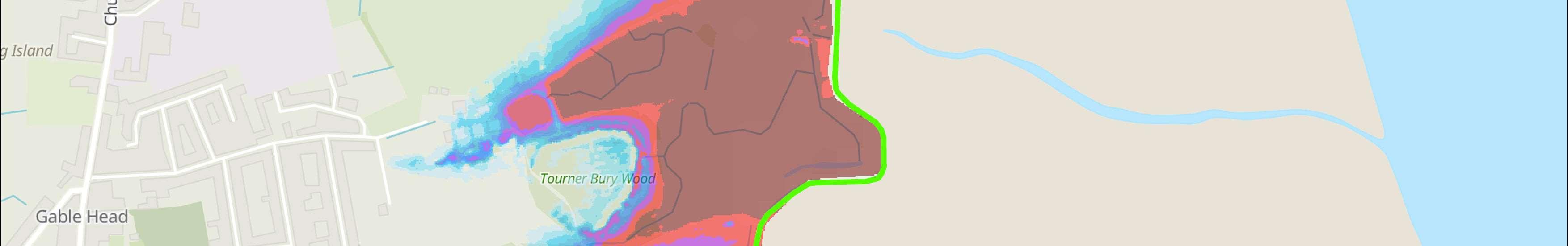
Map1:Presentday modelledextentoftidal flooding,assumingno defences(1in200Year, 0.5%AEP).
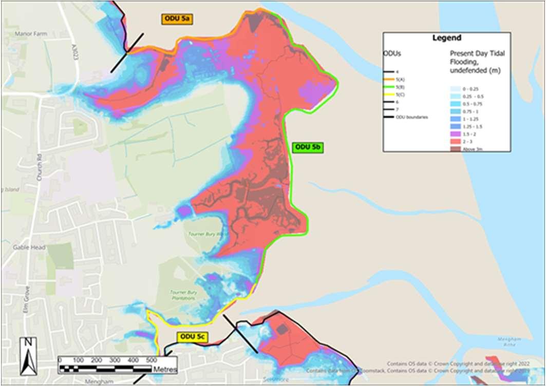
Map2:Modelledextent oftidalfloodingin100 yearstimewithan allowanceforsealevel rise,assumingno defences(1in200Year, 0.5%AEP).
ODU5:MillRytheJuniorSchooltoSalternsLane HaylingIslandCoastalManagementStrategy47
OverviewandKeyDrivers SMPPolicy Residuallifeofdefences withoutmaintenance(years)CurrentMaintainer HoldTheLine (short,medium&long term) ODU5a:10–15years ODU5b:<10years Private/Environment Agency FloodandErosionRisks Predominantlyfloodrisk,whichincreasestothesouth. Cumulativenumberofpropertiesat riskoferosion(withnodefences) Cumulativenumberofpropertiesatrisk fromtidalfloodingwithnodefences 0-20years00-20years14 20-50years220-50years99 50-100years1550-100years310 IssuesandOpportunities AnareaofformerlandfillislocatedattheendofMenghamLane. TournerburyScheduledMonument Opportunitiesformakingspacefornature DoNothingdamages(PresentValue):£6,123,000
Reducingtheimpactsofthetide
Reducingtheimpactsofthetide
Adaptingtothetide


Reducingtheimpactsofthetide


ShortTermMedium Term LongTerm Present day 20 years 50 years ODU5:MillRytheJuniorSchooltoSalternsLane DraftStrategyRoadmap HaylingIslandCoastalManagementStrategy48 Wider Objectives Option LEADING OPTIONS
INTENT:Maintainandimprovefloodprotectionto propertiesandbusinesses. HOW:Constructnewdefences,maintainandraiseover timetokeeppacewithsealevelrise.
Maximisethelifeofexistingdefences,thenconstruct newsetbackdefencesinthelongtermmakingspacefor nature. £Cost Effective Option Frontage5A
INTENT:Makespacefornaturebycreatingamore sustainabledefencealignmentintothefuture. HOW:Constructnewset-backdefences,maintainand raiseovertimetokeeppacewithsealevelrise. Frontage5B
INTENT:Landownerstomaintaintheirownfloodand erosionprotectiontoassetsandbusinessesoradaptto becomemoreresilienttofloodinginthefuture. HOW:Privatemaintenanceorreplacementofdefences bylandowneroradaptation. Frontage5C
TidalFloodRiskMaps
Map1:Presentdaymodelledextentoftidalflooding, assumingnodefences(1in200Year,0.5%AEP).
Map2:Modelledextentoftidalfloodingin100years timewithanallowanceforsealevelrise,assumingno defences(1in200Year,0.5%AEP).
ODU6:SalternsLanetoWilsonsBoatYard HaylingIslandCoastalManagementStrategy49 ODU6islocatedbetweenSalternsLaneintheWestandWilsonsBoatYardinthe East. Thefrontagecomprisesresidentialpropertiesandprivately-ownedadhoccoastal defences.Floodanderosionriskhereislowuntilthefuture.Thereisaneconomic casetodosomethinginthelongterm. FurtherdetailsonthekeydriversforODU6areshowninthetablebelow,along withtidalfloodriskmap.ThedraftStrategyroadmapisshownoverleaf. OverviewandKeyDrivers SMPPolicy Residuallifeofdefences withoutmaintenance(years) CurrentMaintainer HoldTheLine (short,medium&long term) Varies,typically10-20years, locally<10years Private FloodandErosionRisks Lowriskoffloodingandcoastalerosionuntilthelongterm. Cumulativenumberofpropertiesat riskoferosion(withnodefences) Cumulativenumberofpropertiesatrisk fromtidalfloodingwithnodefences 0-20years00-20years11 20-50years020-50years37 50-100years1250-100years123 IssuesandOpportunities Residentialpropertygardens,withprivately-ownedadhoccoastaldefences. DoNothingdamages(PresentValue):£2,218,000


ShortTermMedium Term LongTerm Present day 20 years 50 years ODU6–SalternsLanetoWilsonsBoatYard DraftStrategyRoadmap HaylingIslandCoastalManagementStrategy50 Wider Objectives Option LEADING OPTION Reducingtheimpactsofthetide INTENT:Maintainfloodprotectiontotheresidents, communityandbusinessesatSelsmore. HOW:Privatemaintenanceofdefencesintheshort andmediumterm,thenconstructandmaintain newdefencesinthelongerterm. £ Cost Effective Option
OverviewandKeyDrivers
TidalFloodRiskMaps
Map1:Presentday modelledextentoftidal flooding,assumingno defences(1in200Year,0.5% AEP).
casetodosomethinghere.
Map2:Modelledextentof tidalfloodingin100years timewithanallowancefor sealevelrise,assumingno defences(1in200Year,0.5% AEP).
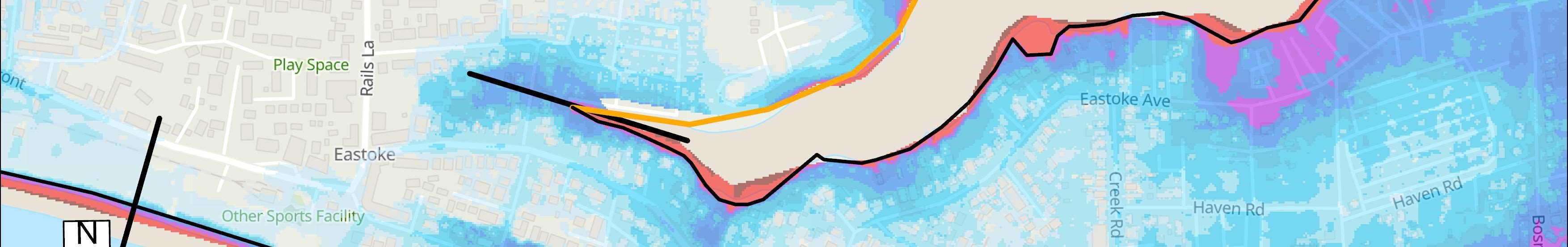
ODU7:WilsonsBoatYardtoFisheryCreek HaylingIslandCoastalManagementStrategy51 ODU7islocatedbetweenWilsonsBoatYardtoFisheryCreek. Thefrontagecomprisesalargeextentofresidentialpropertiesandavarietyof commerciallanduses,includingWilson’sBoatYard,MenghamRytheSailingClub andholiday/touringparks.Theriskisfromtidalflooding.Thereisaneconomic
FurtherdetailsonthekeydriversforODU7areshowninthetablebelow,along withtidalfloodriskmap.ThedraftStrategyroadmapisshownoverleaf.
SMPPolicy Residuallifeofdefences withoutmaintenance(years) CurrentMaintainer HoldTheLine (short,medium&long term) Varies,typically10-20+years alongthenorthernfrontage, locally<10alongthesouthern frontage Private/HBC FloodandErosionRisks Predominantlyfloodrisk.Continuousfloodcell. Cumulativenumberofpropertiesat riskoferosion(withnodefences) Cumulativenumberofpropertiesatrisk fromtidalfloodingwithnodefences 0-20years00-20years46 20-50years620-50years191 50-100years1150-100years485 IssuesandOpportunities Twoareasofcoastallandfillwhichareatriskoferoding. Residentialpropertiesandavarietyofcommerciallanduses,includingWilson’sBoat Yard,MenghamRytheSailingClubandholiday/touringparks. DoNothingdamages(PresentValue):£9,856,000


ShortTermMedium Term LongTerm Present day 20 years 50 years ODU7:WilsonsBoatYardtoFisheryCreek DraftStrategyRoadmap HaylingIslandCoastalManagementStrategy52 Wider Objectives Option LEADING OPTION Reducingtheimpactsofthetide INTENT:Maintainfloodprotectiontothe residents,communityandbusinessesat Selsmore. HOW:Constructnewdefences,maintainand raiseovertimetokeeppacewithsealevel rise. £Cost Effective Option
OverviewandKeyDrivers
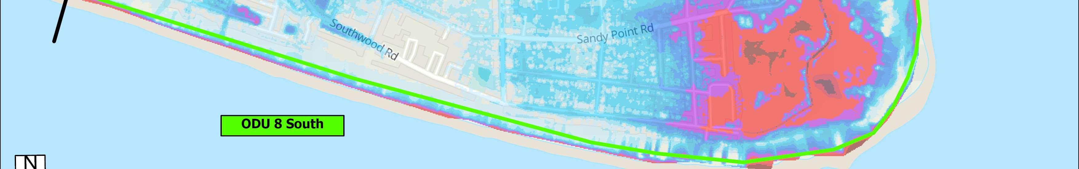
ODU8includestheEastokepeninsula,whichhasbeensplitintotwosections. Thenorthernfrontageincludesamixofresidentialproperties,holidayparks,a sailingclub,marinaandtheRNLIlifeboatstationattheneckofthespit.Thereisa riskoftidalfloodingfromtheharbouralongthisnorthernfrontage.Thereisan economiccasetodosomething.Thesouthernfrontageisprimarilyresidential,but alsoincludesapromenadeandtheSandyPointnaturereserveattheeastofthe frontage.Therisksherearepredominantlyfromwaveovertoppingandcoastal erosion.Thebeachitselfisanavitalcomponentofthecoastaldefence.Thereisan economiccasetodosomething.
FurtherdetailsonthekeydriversforODU8areshowninthetablebelow,along withtidalfloodriskmap.ThedraftStrategyroadmapisshownoverleaf.
TidalFloodRiskMaps
Map1:Presentdaymodelledextentoftidalflooding, assumingnodefences(1in200Year,0.5%AEP).
Map2:Modelledextentoftidalfloodingin100years
defences(1in200Year,0.5%AEP).
IssuesandOpportunities
ODU8:Eastoke HaylingIslandCoastalManagementStrategy53
SMPPolicy Residuallifeofdefences withoutmaintenance(years)CurrentMaintainer HoldTheLine (short,medium&long term) Varies,typically10-20+yearsPrivate/HCC/HBC FloodandErosionRisks Riskofovertoppingfromthepresentdayalongthesouthandeastfrontage.Majority oftheareaexpectedtobeatriskoffloodinginthefuture.Joinedupfloodcellacross theentireEastokepeninsularinthefuture.Riskoftidalfloodingfromthenorth.Risk ofovertoppinganderosionfromthesouth. Cumulativenumberofpropertiesat riskoferosion(withnodefences) Cumulativenumberofpropertiesatrisk fromtidalfloodingwithnodefences 0-20years340-20years613 20-50years51320-50years1436 50-100years56250-100years2848
Mixofresidentialproperties,holidayparks,asailingclub,marinaandtheRNLI lifeboatstationattheneckofthespit.IncludesapromenadeandtheSandyPoint naturereserveattheeastofthefrontage.Bio-modalwaveissues.Beachisanintegral partofthedefence. DoNothingdamages(PresentValue):£244,434,000
timewithanallowanceforsealevelrise,assumingno
Reducingtheimpactsofthetide
Constructionofnewdefences,toberaisedinthefuture tokeeppacewithSeaLevelRise.includinga combinationofcrestraising,floodwallsandsetback floodwallsacrossthefrontage.Replacementofall groyneswithnewrockgroynes,andcontinuedbeach nourishmentandbeachrecyclingtoprevent undermining.

Reducingtheimpactsofthetide


INTENT:Maintainahealthybeachalongsidefloodand erosionprotectiontoresidents,communityand businessesatEastoke.
NORTH
HOW:Constructnewdefences(floodwallsandsetback floodwalls),maintainandraiseovertimetokeeppace withsealevelrise.
SOUTH
HOW:Beachmanagementalongsidenewrockgroynes andconstructnewdefences,maintainandraiseover timetokeeppacewithsealevelrise.

ShortTermMedium Term LongTerm Present day 20 years 50 years ODU8:Eastoke DraftStrategyRoadmap HaylingIslandCoastalManagementStrategy54 Wider Objectives OptionLEADING OPTION
£Cost Effective Option
OverviewandKeyDrivers
ODU9stretchesalongtheopencoastbetweenEastokeCornerandtheInnonthe Beach.
TidalFloodRiskMaps
Map1:Presentdaymodelledextentoftidalflooding, assumingnodefences(1in200Year,0.5%AEP).
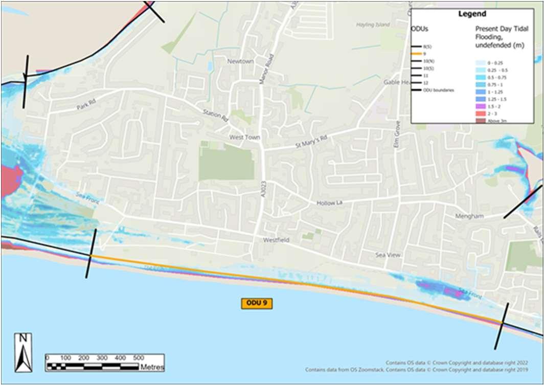
recreationareas,andisbackedbyhighconcentrationsofresidential/commercial areas.Therisksherearepredominantlyfromwaveovertoppingandcoastal erosion.Alongsidesomeprivatedefences,thebeachformsthemaindefenceand iscurrentlymaintainedbyHBCthroughbeachnourishmentandbeachrecycling whichtakesplaceatregularintervals.Thereisaveryloweconomiccasetodo anythinghere.
FurtherdetailsonthekeydriversforODU9areshowninthetablebelow,along withtidalfloodriskmap.ThedraftStrategyroadmapisshownoverleaf.
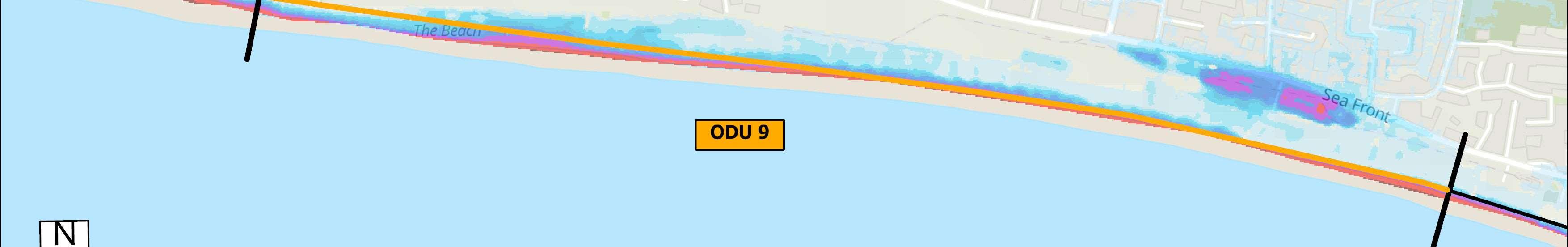

SMPPolicy
Map2:Modelledextentoftidalfloodingin100years
defences(1in200Year,0.5%AEP).
ODU9:EastokeCornertoInnontheBeach HaylingIslandCoastalManagementStrategy55
ThisfrontageincludestheInnontheBeach,thebeachfront,carparks,roads,
Residuallifeofdefences withoutmaintenance(years)CurrentMaintainer HoldTheLine (short,medium&long term) Varieswherethereareformal defencesinthewest,typically 10-15,locally<10.Thebeach formsthedefenceelsewhere. Private/HBC FloodandErosionRisks Linearfloodcellalongthefrontageduetowaveovertopping.Riskshereare predominantlyfromwaveovertoppingandcoastalerosion. Cumulativenumberofpropertiesat riskoferosion(withnodefences) Cumulativenumberofpropertiesatrisk fromtidalfloodingwithnodefences 0-20years00-20years65 20-50years1020-50years145 50-100years13750-100years251 IssuesandOpportunities Beachrecyclingisthecurrentmanagementapproachforthisarea.Beachfront,car parks,roads,recreationareas,andisbackedbyhighconcentrationsofresidential/ commercialareas.Thebeachformsthemaindefence.InnontheBeachactsasa beachcontrolstructure. DoNothingdamages(PresentValue):£7,935,000
timewithanallowanceforsealevelrise,assumingno
Workingwiththetide
Workingwiththetide


ShortTermMedium Term LongTerm Present day 20 years 50 years ODU9:EastokeCornertoInnontheBeach DraftStrategyRoadmap HaylingIslandCoastalManagementStrategy56 Wider Objectives OptionLEADING OPTION
Constructionofnewdefences,toberaisedinthefuture tokeeppacewithSeaLevelRise.Includesreplacement ofInnontheBeachandallgroyneswithnewrock groynes,andcontinuedbeachnourishmentandbeach recycling.
INTENT:Maintainahealthybeachalongsidefloodand erosionprotectiontoresidents,communityand businessesalongtheseafront. HOW:Continuebeachmanagement,newrockgroynes andnewdefencestomaintaintheInnontheBeachasa controlstructure,maintainandraiseovertimetokeep pacewithsealevelrise. £Cost Effective Option
OverviewandKeyDrivers
ODU10extendsbetweentheInnontheBeachandtheFerryboatInn,whichhas beensplitintotwosections. ThesouthernfrontageincludesthenaturalduneareaofSinahCommon,golf courses,asailingclubandcarparks.Theriskhereisprimarilyfromwave overtoppingandcoastalerosion,butareasofSinahCommonalsonaturally accrete.Thenorthernfrontageincludesbusinesses,theferrycrossingtoEastney,a boatyard,slipways,FerryRoad,theresidentialcommunityattheKench,theKench naturereserveandaholidaycomplex.Thereisariskoftidalfloodingfromthe harbouralongthisnorthernfrontage.ThecommunityattheKenchprivatelyowns andmaintaintheirowndefencesandareactivelyplanningadapttoclimate changerisksinthefuture.Thereisaveryloweconomiccasetodoanything.
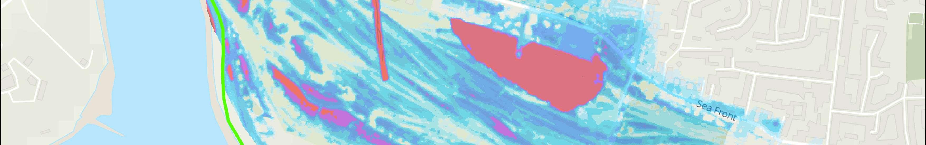
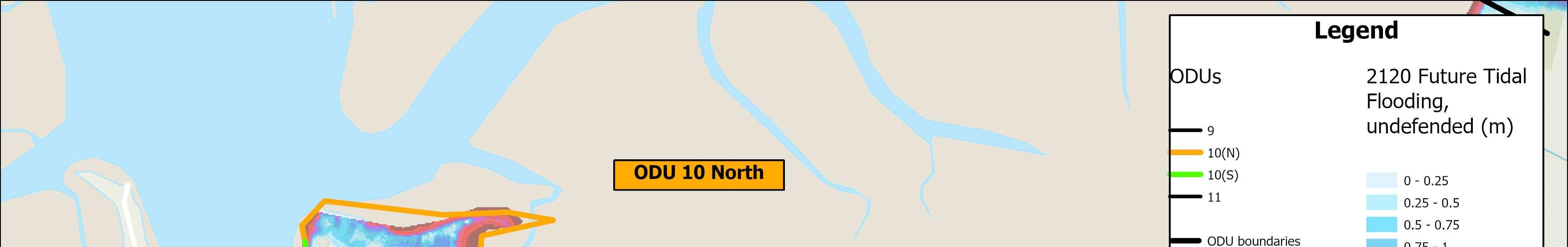
FurtherdetailsonthekeydriversforODU10areshowninthetablebelow,along withtidalfloodriskmap.ThedraftStrategyroadmapisshownoverleaf.
SMPPolicy
TidalFloodRiskMaps
Map1:Presentdaymodelledextentoftidalflooding, assumingnodefences(1in200Year,0.5%AEP).
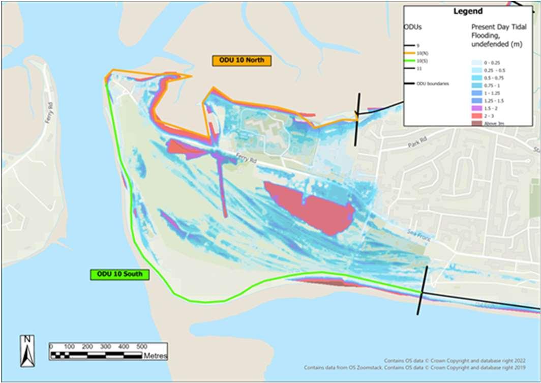
Map2:Modelledextentoftidalfloodingin100yearstime withanallowanceforsealevelrise,assumingnodefences.
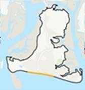
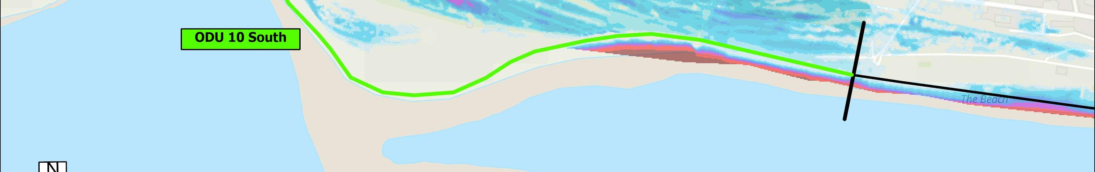
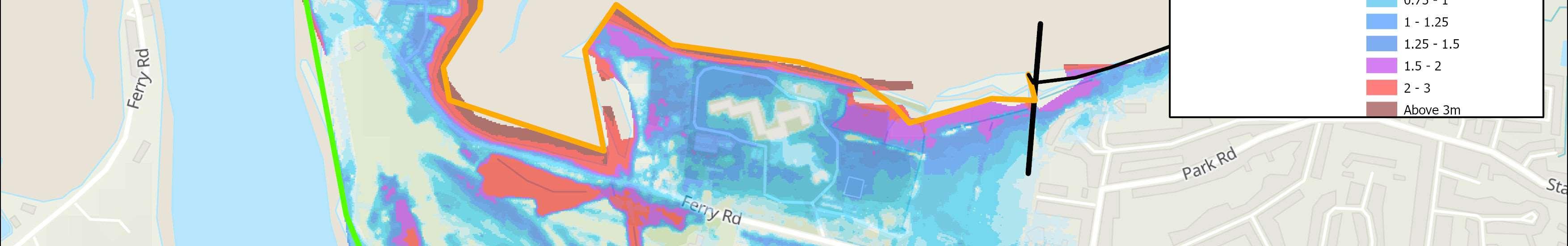
ODU10:InnontheBeachtoNorthShoreRoad HaylingIslandCoastalManagementStrategy57
Residuallifeofdefences withoutmaintenance(years)CurrentMaintainer HoldTheLine(localised naturalevolutionatGunner Point)(short,medium& longterm) Varies,typically10-20, locally<10.Largeareas undefendedinthesouth. Private/HCC/HBC FloodandErosionRisks Floodrisktothearea,butlimitedreceptorsorassetsatrisk.South–riskisprimarily fromwaveovertoppingandcoastalerosion.North–tidalfloodrisk.Materialaccretes atGunnerPoint. Cumulativenumberofpropertiesat riskoferosion(withnodefences) Cumulativenumberofpropertiesatrisk fromtidalfloodingwithnodefences 0-20years20-20years24 20-50years3020-50years80 50-100years4150-100years191 IssuesandOpportunities Naturalprocessesprevailinginthisarea.KenchNatureReserve.Scheduled Monument.Opportunitiestomakespacefornature.SSSIdesignation–Sinah. DoNothingdamages(PresentValue):£9,969,000


ShortTermMedium Term LongTerm Present day 20 years 50 years ODU10:InnontheBeachtoNorthShoreRoad DraftStrategyRoadmap HaylingIslandCoastalManagementStrategy58 Wider Objectives OptionLEADING OPTION Adaptingtothetide INTENT:Makespacefornaturewhilelandowners maintaintheirfloodanderosionprotectiontoassets andbusinessesoradapttobecomemoreresilientto floodinginthefuture. NORTH HOW:Privatemaintenanceorreplacementof defencesbylandownersoradaptation. SOUTH HOW:Allowthecoasttoevolveasnaturallyas possiblealongsideprivatemaintenanceor replacementofdefencesoradaptationby landowners. £Cost Effective Option
OverviewandKeyDrivers
TidalFloodRiskMaps
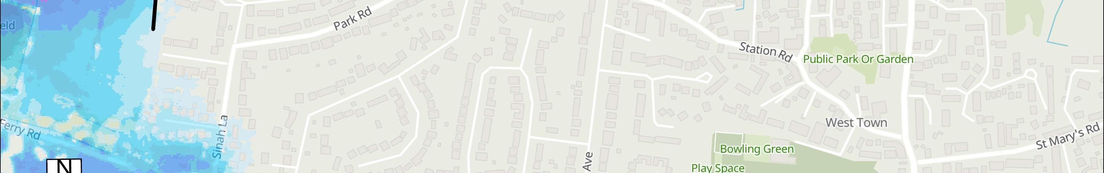
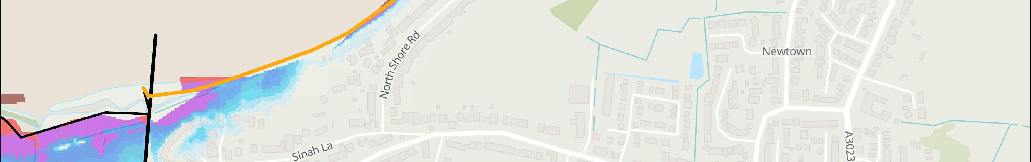
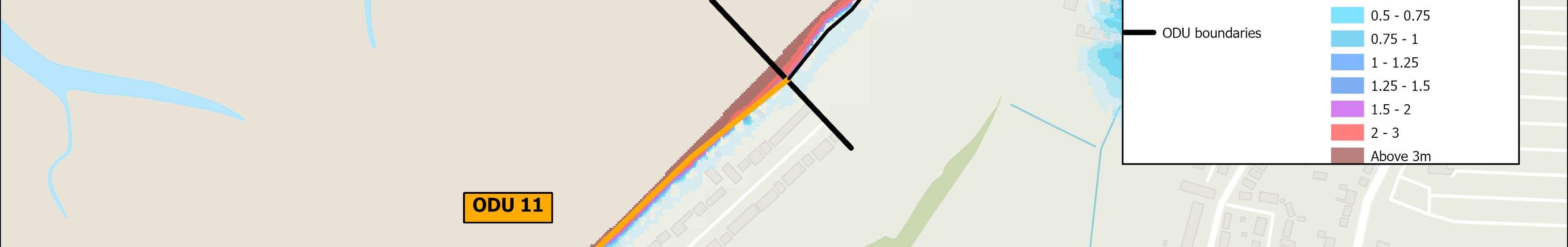
Map1:Presentdaymodelledextentoftidalflooding, assumingnodefences(1in200Year,0.5%AEP).
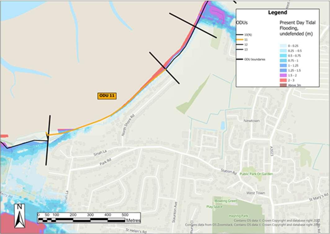
Map2:Modelledextentoftidalfloodingin100years timewithanallowanceforsealevelrise,assumingno defences(1in200Year,0.5%AEP).
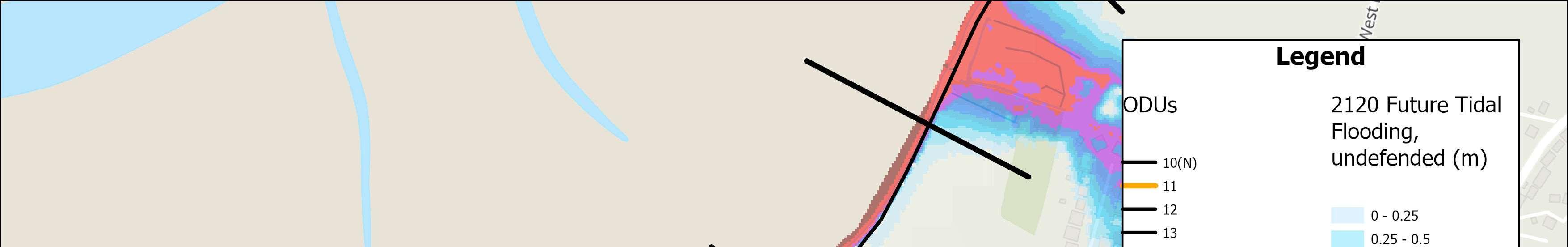
ODU11:NorthShoreRoad HaylingIslandCoastalManagementStrategy59 ODU11extendsalongtheresidentialNorthShoreRoadfrontage. Thereisariskoftidalfloodingfromtheharbouralongthisfrontage.Therearea mixofdefenceshereprivatelyownedandmaintainedbyresidents.Thereisan economiccasetodosomething. FurtherdetailsonthekeydriversforODU11areshowninthetablebelow,along withtidalfloodriskmap.ThedraftStrategyroadmapisshownoverleaf.
SMPPolicy Residuallifeofdefenceswithout maintenance(years) CurrentMaintainer HoldTheLine (short,medium&long term) Varies,typically10-20Private FloodandErosionRisks Floodriskfromtidalinundation.Coherentfloodcell. Cumulativenumberofpropertiesat riskoferosion(withnodefences) Cumulativenumberofpropertiesatrisk fromtidalfloodingwithnodefences 0-20years00-20years2 20-50years120-50years53 50-100years1050-100years129 IssuesandOpportunities Defencesareprivatelyownedandmaintainedandhavevaryingresiduallives. DoNothingdamages(PresentValue):£3,278,000


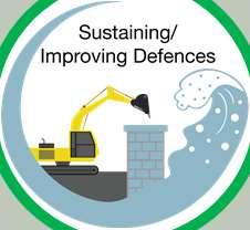


ShortTermMedium Term LongTerm Present day 20 years 50 years ODU11:NorthShoreRoad DraftStrategyRoadmap HaylingIslandCoastalManagementStrategy60 Wider Objectives OptionLEADING OPTION Reducingtheimpactsofthetide INTENT:Maintainfloodanderosionprotectionto residents. HOW:Constructnewdefencesinstages,maintain andraisetokeeppacewithsealevelrise. Reducingtheimpactsofthetide Constructionofnewdefencesintheshortterm, withscheduledmaintenanceinthefuture £Cost Effective Option
OverviewandKeyDrivers
ODU12extendsfromNorthShoreRoadtoNewtown.
SMPPolicy
TidalFloodRiskMaps
Map1:Presentdaymodelledextentoftidalflooding, assumingnodefences(1in200Year,0.5%AEP).

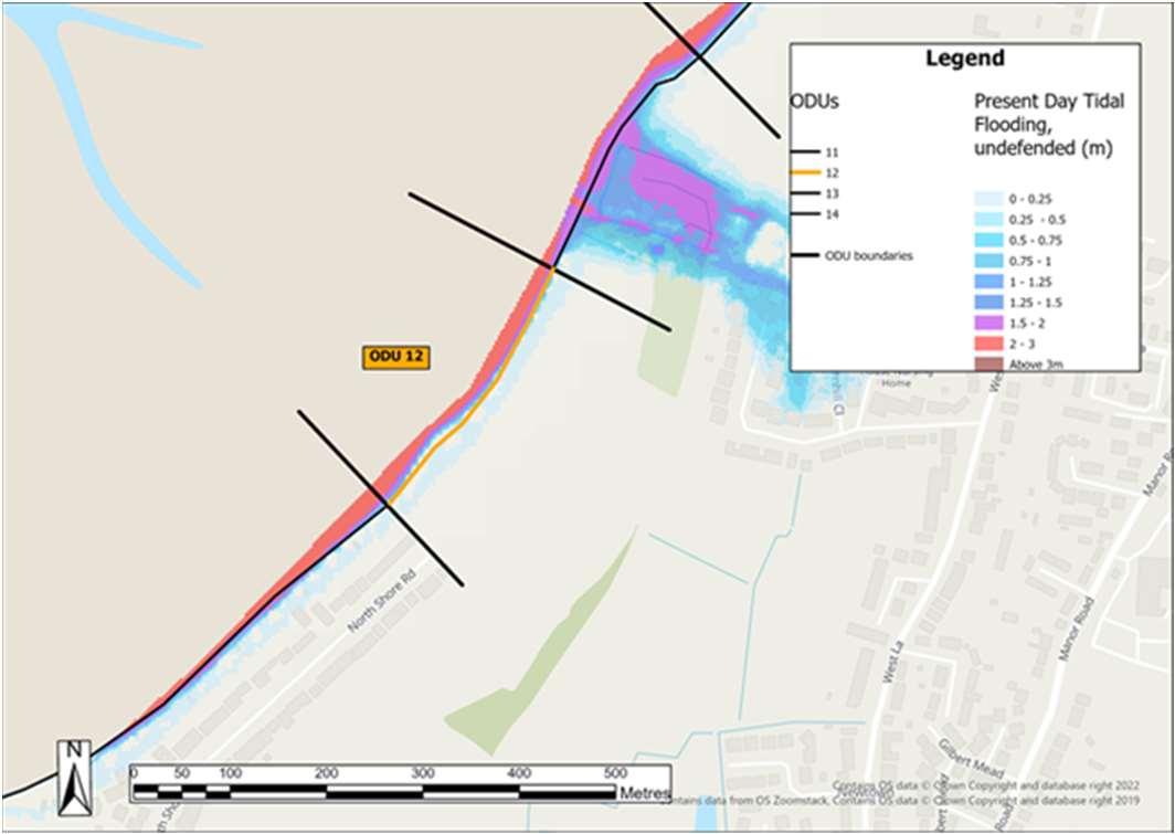
Map2:Modelledextentoftidalfloodingin100years timewithanallowanceforsealevelrise,assumingno defences(1in200Year,0.5%AEP).
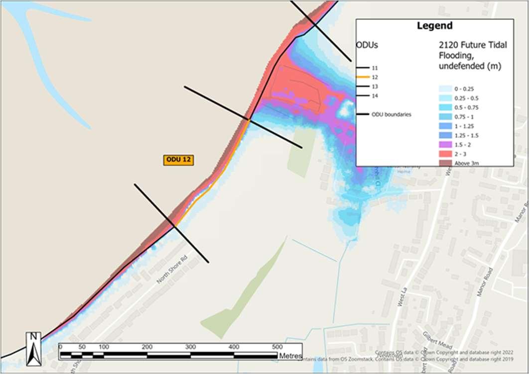
ODU12:NorthShoreRoadtoNewtown HaylingIslandCoastalManagementStrategy61
ODU12isasmall,mainlyundevelopedandundefendedfrontage,comprising privately-ownedagriculturallandandtheHaylingBillyLinepublicfootpathfurther behind.Thereareminimalassetsatriskfromfloodinghere.ACoastalChange ManagementAreahasbeendesignatedhere,topreventinappropriate developmentfromtakingplacethatmaybeatriskfromfutureerosion.Thereisno economicjustificationtodoanything. FurtherdetailsonthekeydriversforODU12areshowninthetablebelow,along withtidalfloodriskmap.ThedraftStrategyroadmapisshownoverleaf.
Residuallifeofdefenceswithout maintenance(years) CurrentMaintainer NoActiveIntervention (short,medium&long term) UndefendedPrivate/HCC FloodandErosionRisks Minimalriskofflooding,fewreceptorsatrisk.Topographyrestrictsthefloodplain. Erosionisthemainrisk. Cumulativenumberofpropertiesat riskoferosion(withnodefences) Cumulativenumberofpropertiesatrisk fromtidalfloodingwithnodefences 0-20years00-20years0 20-50years020-50years0 50-100years050-100years0 IssuesandOpportunities TheHaylingBillyLineisanimportantpublicfootpath. Agriculturalland. CoastalChangeManagementAreainplacetopreventinappropriatedevelopment. Opportunitiestomakespacefornature. DoNothingdamages(PresentValue):£62,000


ShortTermMedium Term LongTerm Present day 20 years 50 years ODU12:NorthShoreRoadtoNewtown DraftStrategyRoadmap HaylingIslandCoastalManagementStrategy62 Wider Objectives OptionLEADING OPTION Acceptingthetide INTENT:Makespacefornature. HOW:Allowingthecoasttoevolve naturally,noactivemanagement. £Cost Effective Option
OverviewandKeyDrivers
ODU13encompassesthecoastlineatNewtown.
TidalFloodRiskMaps

Map1:Presentdaymodelledextentoftidalflooding,

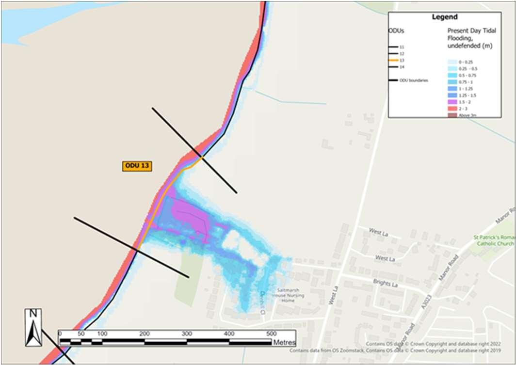


Map2:Modelledextentoftidalfloodingin100years timewithanallowanceforsealevelrise,assumingno defences(1in200Year,0.5%AEP).
ODU13:NorthShoreRoadtoNewtown HaylingIslandCoastalManagementStrategy63
ODU13includesagriculturallandwiththecommunityofNewtownbehind.There isariskoflocalisedtidalfloodingtoNewtown.Thereisaneconomiccasetodo something. FurtherdetailsonthekeydriversforODU13areshowninthetablebelow,along withtidalfloodriskmap.ThedraftStrategyroadmapisshownoverleaf.
SMPPolicy Residuallifeofdefences withoutmaintenance(years)CurrentMaintainer NoActiveIntervention (withlocalisedHoldThe LineatNewtown) (short,medium&long term) Typically10-20 Private FloodandErosionRisks CoherentfloodcellaffectingNewtown. LocalisedtidalfloodrisktoNewtowninmediumandlongterm. Cumulativenumberofpropertiesat riskoferosion(withnodefences) Cumulativenumberofpropertiesatrisk fromtidalfloodingwithnodefences 0-20years00-20years0 20-50years020-50years45 50-100years450-100years120 IssuesandOpportunities TheHaylingBillyLineisanimportantpublicfootpath. Localisedpocketoffloodrisk. CommunityofNewtown-residentsandbusinesses. Agriculturalland. DoNothingdamages(PresentValue):£3,298,000
assumingnodefences(1in200Year,0.5%AEP).


ShortTermMedium Term LongTerm Present day 20 years 50 years ODU13:Newtown DraftStrategyRoadmap HaylingIslandCoastalManagementStrategy64 Wider Objectives Option LEADING OPTION Reducingtheimpactsofthetide INTENT:Maintainfloodanderosionprotectionto residents,communityandbusinessesatNewtown. HOW:Maintainintheshortterm,constructnew defencesinthemediumterm,maintainandraiseto keeppacewithsealevelrise. £Cost Effective Option
OverviewandKeyDrivers
ODU14extendsalongthelargelyundevelopedfrontagefromNewtowntoStoke.
TidalFloodRiskMaps
Map1:Presentdaymodelledextent oftidalflooding,assumingno defences(1in200Year,0.5%AEP).
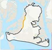
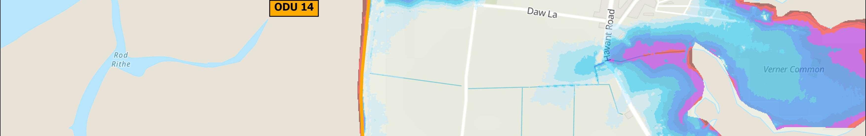
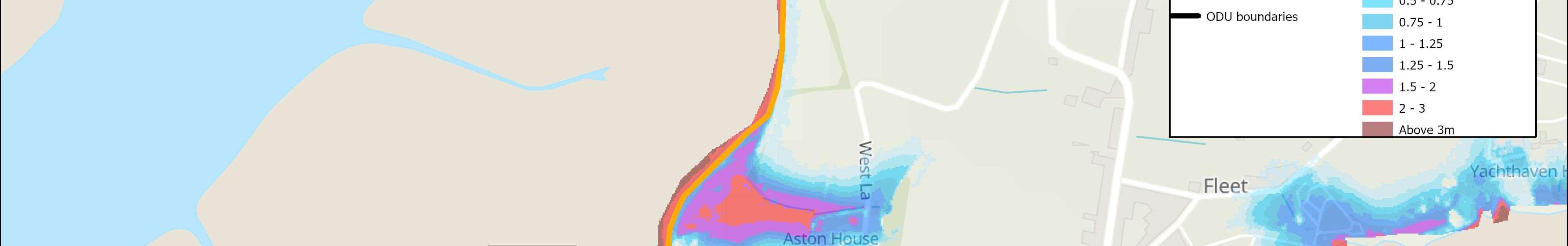
BillyLinepublicfootpath.Thereareminimalassetsatriskfromfloodinghere,
todoanything.
FurtherdetailsonthekeydriversforODU14areshowninthetablebelow,along
FloodandErosionRisks
Map2:Modelledextentoftidal floodingin100yearstimewithan allowanceforsealevelrise, assumingnodefences(1in200Year, 0.5%AEP).
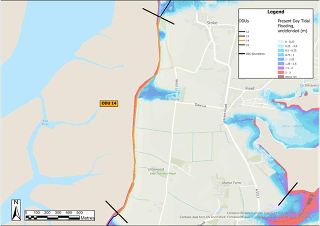

ODU14:NewtowntoStoke HaylingIslandCoastalManagementStrategy65
Thefrontageiscomprisedofprivately-ownedagriculturallandandtheHayling
thoughtheBillyTrailisclosetotheshorelineinlocationsandatriskfromfuture erosion.Thisfrontageislargelyundefendedatpresent.Thereisnoeconomiccase
withtidalfloodriskmap.ThedraftStrategyroadmapisshownoverleaf.
SMPPolicy Residuallifeofdefences withoutmaintenance(years)CurrentMaintainer NoActiveIntervention (short,medium&long term) Typically<10,plussome undefendedsections Private/HCC
Erosionisthemainrisk.Minimalriskofflooding,fewreceptorsatrisk.Topography restrictsthefloodplain. Cumulativenumberofpropertiesat riskoferosion(withnodefences) Cumulativenumberofpropertiesatrisk fromtidalfloodingwithnodefences 0-20years00-20years0 20-50years020-50years3 50-100years050-100years7 IssuesandOpportunities TheHaylingBillyLineisanimportantpublicfootpathclosetotheshorelineinplaces andatriskoferosion,sopotentialtoconsiderrealignmentofthepathwhereatmost risk. Opportunitytomakespacefornature. Agriculturalland. DoNothingdamages(PresentValue):£198,000


ShortTermMedium Term LongTerm Present day 20 years 50 years ODU14:NewtowntoStoke DraftStrategyRoadmap HaylingIslandCoastalManagementStrategy66 Wider Objectives Option LEADING OPTION Acceptingthetide INTENT:Makespacefornature. HOW:Donothing,butconsiderrealigningsectionsof theHaylingBillyTrailtomaintainaccess. £Cost Effective Option
OverviewandKeyDrivers
TidalFloodRiskMaps
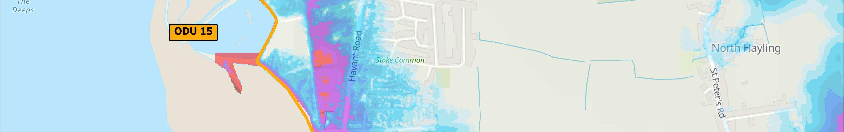
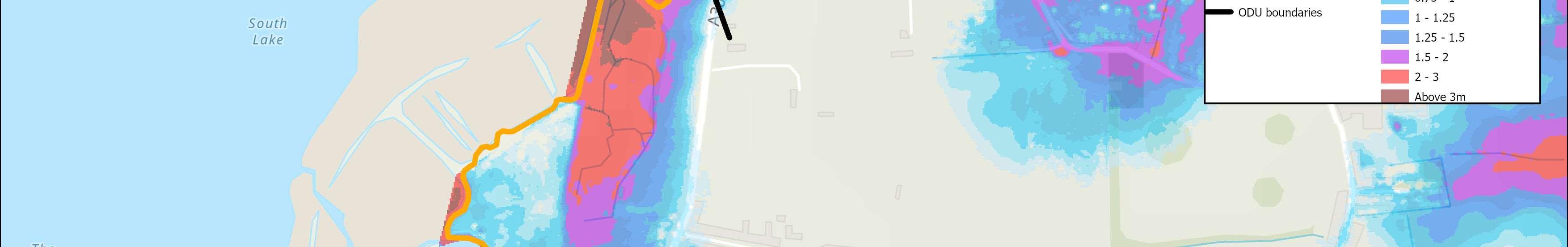
Map1:Presentdaymodelledextentoftidalflooding,assuming nodefences(1in200Year,0.5%AEP).
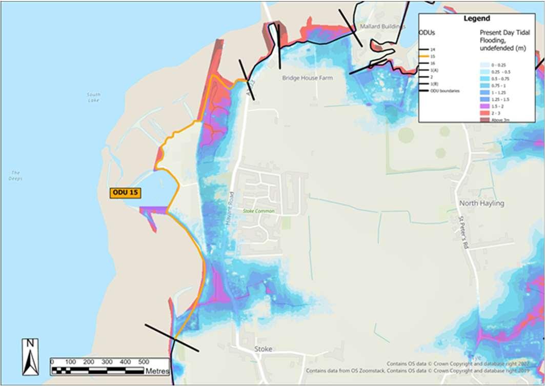
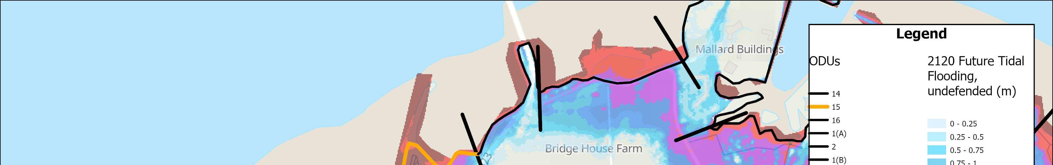
FurtherdetailsonthekeydriversforODU15areshowninthetablebelow,along
SMPPolicy
HoldTheLine(with
Map2:Modelledextentoftidalfloodingin100yearstimewithan allowanceforsealevelrise,assumingnodefences(1in200Year, 0.5%AEP).
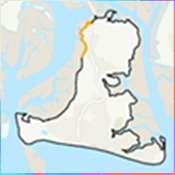
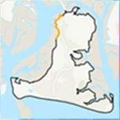
FloodandErosionRisks
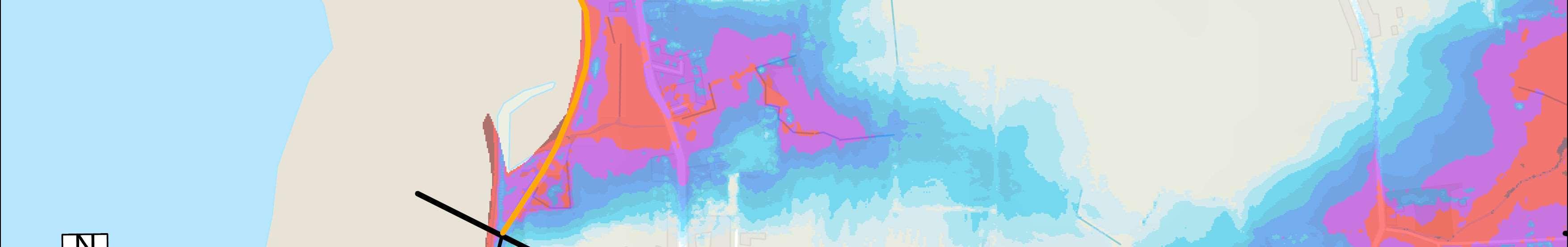
ODU15:StoketoLangstoneBridgeCarpark HaylingIslandCoastalManagementStrategy67 ODU15extendsfromStoketotheLangstonebridgecarpark. Thefrontageincludesagriculturalland,theBillyTrail,A3023mainaccessroad ontoHayling,residentialpropertiesandOysterBeds.Bothresidentialproperties andtheA3023areatriskoftidalflooding.Erosionriskislow,althoughpartsofthe BillyTrailmaybeatriskinthefuture.Thereisaloweconomiccasetodo something.
withtidalfloodriskmap.ThedraftStrategyroadmapisshownoverleaf.
Residuallifeofdefences withoutmaintenance(years)CurrentMaintainer
furtherstudiesrequired toconsiderManaged RealignmentatWest NorthneyorRegulated TidalExchangeatStoke) (short,medium&long term) Varies,typically10-15,locally <10 HCC/HBC
CoherentfloodcellacrosstheentireODU. Predominantlytidalfloodrisk.Erosionriskislow. Cumulativenumberofpropertiesat riskoferosion(withnodefences) Cumulativenumberofpropertiesatrisk fromtidalfloodingwithnodefences 0-20years00-20years26 20-50years120-50years124 50-100years1050-100years392 IssuesandOpportunities Largeareaofcoastallandfill,OysterbedsandsomepartsofHaylingBillytrailatriskof erosion.Residentialproperties,agriculturallandandA3023mainaccessroadatriskof flooding.Opportunitiesformakingspacefornature. DoNothingdamages(PresentValue):£9,785,000


ShortTermMedium Term LongTerm Present day 20 years 50 years ODU15:StoketoLangstoneBridgeCarpark DraftStrategyRoadmap HaylingIslandCoastalManagementStrategy68 Wider Objectives Option LEADING OPTION Adaptingtothetide INTENT:MaintaintheviabilityoftheHaylingBilly TrailandthecommunityatStoke,whilecreatinga moresustainabledefencealignmentwhere appropriateintothefuture. HOW:Constructnewdefences,maintainandraise overtimetokeeppacewithsealevelrise. £Cost Effective Option
OverviewandKeyDrivers
ODU16extendsfromtheLangstoneBridgecarparktotheLangstoneBridge, alongsidetheA3023mainaccessroadforHayling.
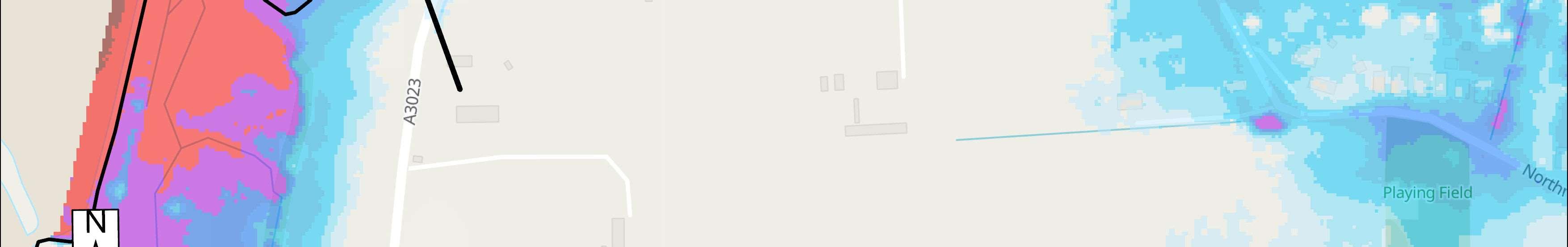
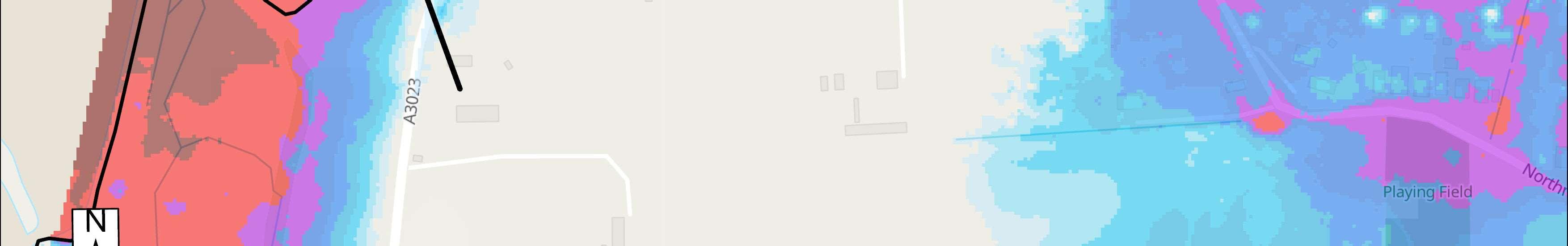
TidalFloodRiskMaps
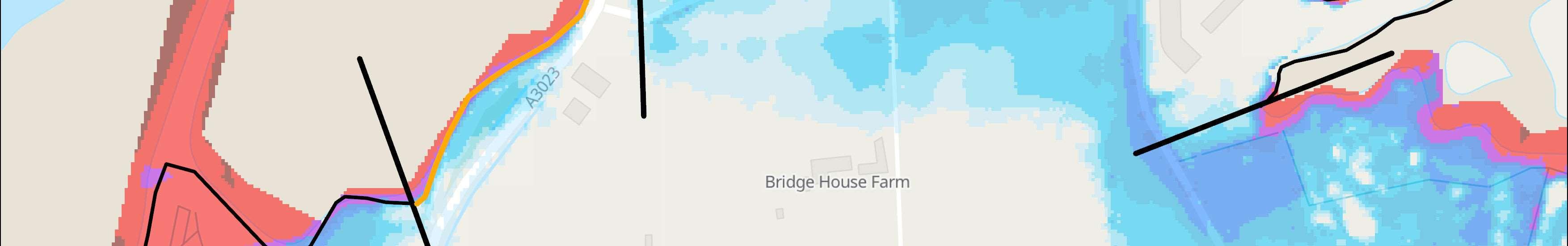
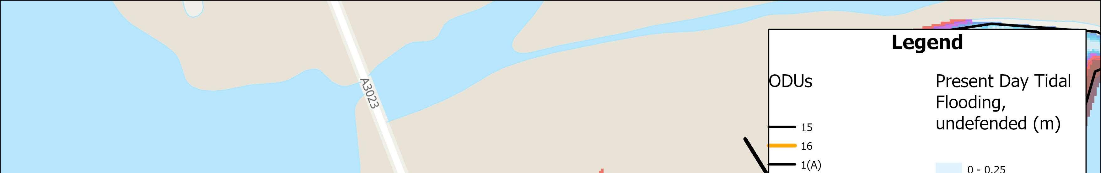
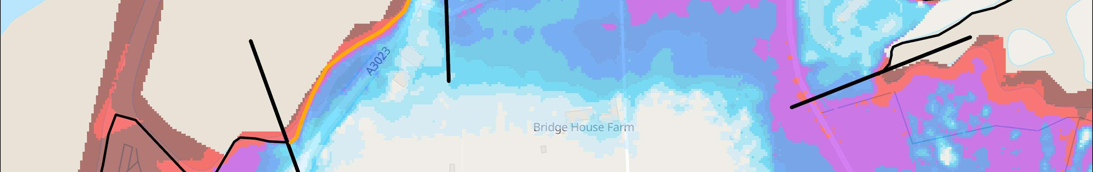
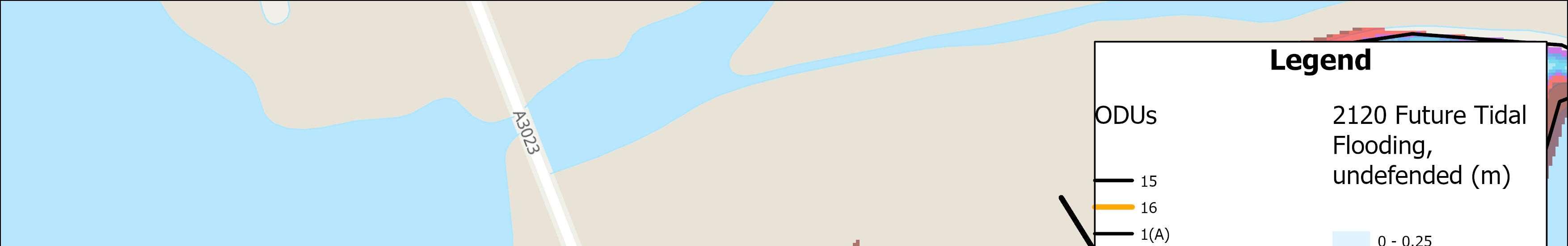
SMPPolicy
HoldTheLine(with
NorthneyorRegulated TidalExchangeatStoke) (short,medium&long
FloodandErosionRisks
Floodcellwhichmergeswithcellstothewestandeast(ODU15andODU1
Map1:Presentdaymodelledextentoftidalflooding, assumingnodefences(1in200Year,0.5%AEP).
IssuesandOpportunities
SafeaccessandegressbetweenHaylingIslandandthemainlandisatriskfrom
Map2:Modelledextentoftidalfloodingin100years timewithanallowanceforsealevelrise,assumingno defences(1in200Year,0.5%AEP).
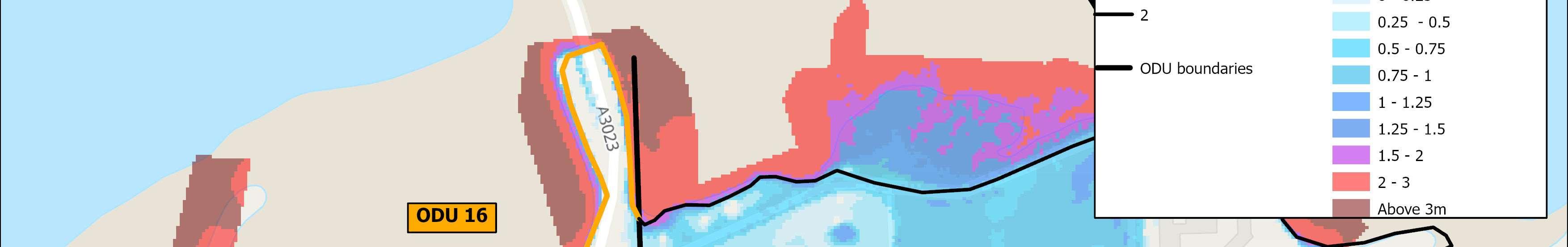
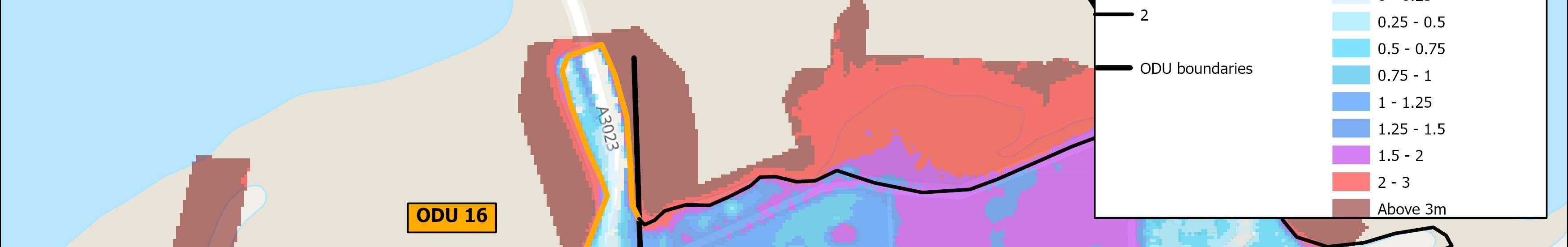
ODU16:LangstoneBridgeCarparktoLangstoneBridge HaylingIslandCoastalManagementStrategy69
Themainriskistidalfloodingtotheroad.Thereisaloweconomiccasetodo something. FurtherdetailsonthekeydriversforODU16areshowninthetablebelow,along withtidalfloodriskmap.ThedraftStrategyroadmapisshownoverleaf.
Residuallifeofdefences withoutmaintenance(years)CurrentMaintainer
furtherstudiesrequired toconsiderManaged RealignmentatWest
term) Varies,typically10-20,locally <10 HCC
respectively)duringlargerreturnperiodevents. Mainriskisfromtidalflooding.Erosionriskislow. Cumulativenumberofpropertiesat riskoferosion(withnodefences) Cumulativenumberofpropertiesatrisk fromtidalfloodingwithnodefences 0-20years00-20years0 20-50years020-50years1 50-100years050-100years3
floodinganderosion.MaintainviabilityoftheA3023mainaccessroadtoHayling. DoNothingdamages(PresentValue):£702,000


ShortTermMedium Term LongTerm Present day 20 years 50 years ODU16:LangstoneBridgeCarparktoLangstoneBridge DraftStrategyRoadmap HaylingIslandCoastalManagementStrategy70 Wider Objectives OptionLEADING OPTION Reducingtheimpactsofthetide INTENT:MaintaintheviabilityoftheA3023intothe futureassealevelsrise. HOW:Constructnewdefencestoa1in200year srtandard,maintainandraiseovertimetokeep pacewithsealevelrise. Reducingtheimpactsofthetide Constructionofnewdefencestoa1in75year standard,toberaisedinthefuturetokeeppace withSeaLevelRise £Cost Effective Option


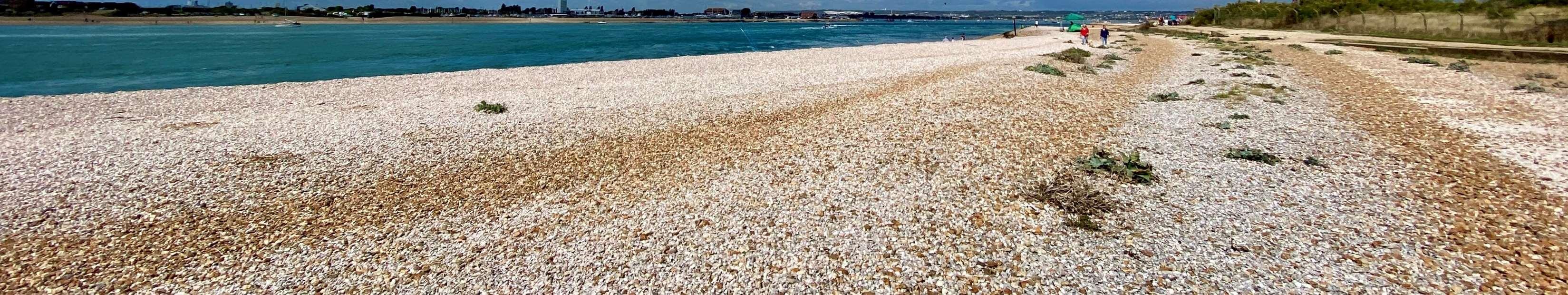

StrategyLeadingOptionCostsandBenefits Thisreportoutlinedtheprocessbywhichtheoverallleadingoptionshavebeen developedthroughamulti-criteriaappraisal.Theappraisalprocessconsidered thetechnical,economic,environmentalandsocialaspectsofeachoption.The tablebelowpresentsasummaryoftheeconomiccostsandbenefitsforeachof theoverallleadingoptionsforeachODU. •Thereisnoguaranteethatanyoftheseleadingoptionswillbe progressed,itsalldowntofunding •Significantfundingfromavarietyofsourceswillbeneededtoprogress theleadingoptions •Publicfundsforcoastalmanagementarenotwidelyavailableandkey criteriahavetobemetinordertoapplyforfunds,butitmaybepossible tosecuresomefundsforkeyareassuchasEastoke,Selsmoreand Mengham •Wewillworktodevelopbusinesscasestoprogressschemesifthereis fundingandifitsinthepublicinterest(technical,environmental,social andeconomicsolution) •Landownersareultimatelyresponsibleformaintainingorimprovingtheir owndefences. HaylingIslandCoastalManagementStrategy71 ODUPresentValuecostPresentValue Benefits BenefitCostRatio 1 £5,353,000£6,749,0001.26 2 Tobefundedprivatelybasedonindividualdecisions 3 £2,287,000£6,140,0002.68 4 Tobefundedprivatelybasedonindividualdecisions 5 £4,671,000£7,116,0001.52 6 £986,000£2,299,0002.33 7 £4,001,000£12,878,0003.22 8 £76,843,000£250,085,0003.25 9 £10,324,000£10,543,0001.02 10 £1,280,000£3,634,0002.84 11 £2,508,000£2,942,0001.17 12 0013 £342,000£3,298,0009.65 14 0015 £6,270,000£11,600,0001.85 16 £410,000£683,0001.66 Cashvalue:undiscountedcostsordamages(presentedintoday’scash terms) PresentValue:costsordamageswhichincludediscountingthroughtime.
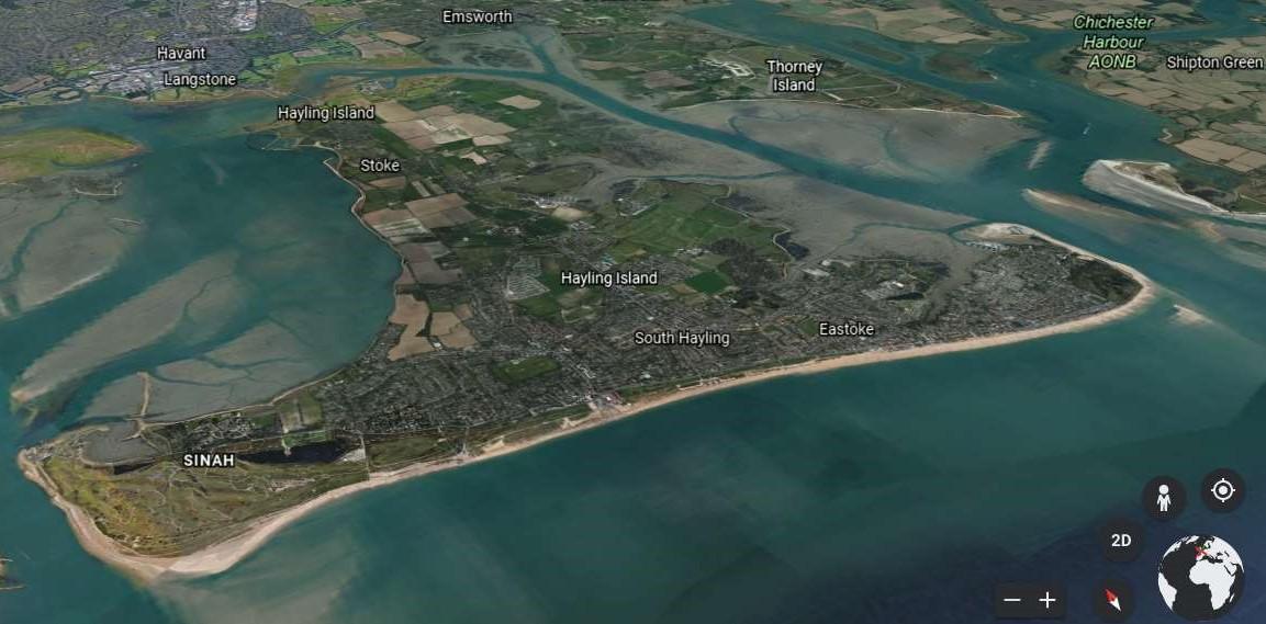
2027–Northney LandfillErosion Management TheStrategyhasidentifiedtheneedforseveralprojectsandschemesoverthenext10yearsiffundingand approvalscanbesecured.Theseincludehabitatrestoration,beachmanagement,coastaldefenceandadaptation schemes.Aguideshowingtherelevantlocationsisshownbelow,togetherwiththerecommendedtimescale presentedoverleaf,alongwithanticipatedcostsandfundingsources. Source:GoogleEarthTerraMetricsDataSIO,NOAA,U.S.Navy,NGA,GEBCO 2028-Islandwide AdaptationPlan 2024–Beach ManagementPlan 2026–Northney HabitatRestoration 2032–TournerburyHabitat Restoration 2027–Selsmore&Mengham FloodRiskmanagement 2026–North Eastoke Floodand ErosionRisk Management 2024–Eastoke Drainage 2027–Northney RoadFloodRisk management 2029–Replacement Groynes 1 2 3 4 5 6 87 9 10 11 12 2024–Bi-modal wavestudy 2029–BeachManagementPlan ShortTermActionPlan HaylingIslandCoastalManagementStrategy72
20232028 2027 2024202520262031 2030 20292033 2032 DetailedDesign& consenting DetailedDesign &consenting 5 4 1 8 2 3 10 9 12 6 Beachmanagementactivities Securefundingto progressstudy Securefundingto progressstudy Bi-modalwave study Securefunding toprogress Develop AdaptationPlan DevelopnewBMP &businesscase Feasibilitystudy& Businesscase DetailedDesign& consenting Construction Securefundingto progressstudy Feasibilitystudy &Businesscase ConstructionDetailedDesign& consenting Securefundingto progressstudy Feasibilitystudy& Businesscase DetailedDesign& consenting Construction Securefundingto progressstudy Feasibilitystudy& Businesscase DetailedDesign& consenting Construction Securefundingto progressstudy Feasibilitystudy& Businesscase DetailedDesign &consenting Construction Feasibilitystudy &Businesscase Securefundingto progressstudy Feasibilitystudy& Businesscase ConstructionDetailedDesign& consenting Feasibilitystudy& Businesscase Securefunding toprogressstudy 11DevelopBeachmanagementactivities newBMP &businesscase ShortTermActionPlan HaylingIslandCoastalManagementStrategy73 IndicativeTimescales 7
IndicativeCostsandFunding

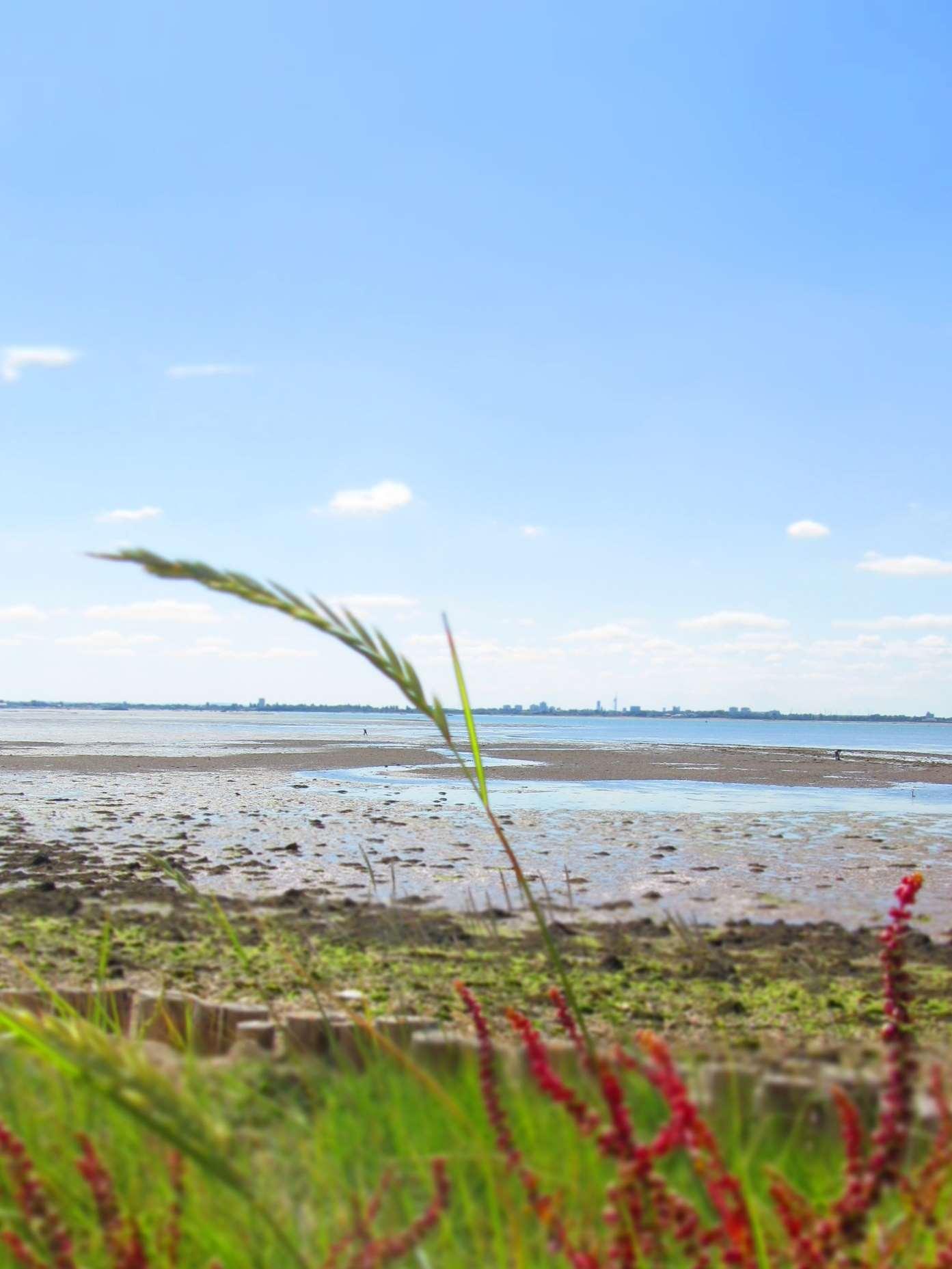

ShortTermActionPlan HaylingIslandCoastalManagementStrategy74 LocationActionApprox.CostPotentialFunding Sources 1CoastBi-modalwavestudies £50,000FCERMGrantinAid 2ODU8SouthBeachManagementPlan £1.2MFCERMGrantinAid 3ODU8SouthEastokeDrainage £22MFCERMGrantinAid Othercontributions 4ODU3NorthneyHabitatRestoration£0.2MFCERMGrantinAid 5ODU1aNorthneyRoadFloodRisk Management £2.1MFCERMGrantinAid Othercontributions 6ODU1cNorthneyLandfillErosion Management £0.53MFCERMGrantinAid Othercontributions 7ODU8NorthNorthEastokeFlood& ErosionRiskManagement £5.1MFCERMGrantinAid Othercontributions 8ODU7Selsmore&MenghamFlood RiskManagement £2.4MFCERMGrantinAid Othercontributions 9IslandwideAdaptationPlan £20,000FCERMGrantinAid 10ODU8SouthReplacementGroynes £47MFCERMGrantinAid Othercontributions 11ODU8SouthBeachManagementPlan £1.2MFCERMGrantinAid 12ODU5Tournerburyhabitat Restoration £2.7MFCERMGrantinAid Othercontributions
TheStrategyhasidentifiedhighlevelindicativecoststodelivertheshorttermactionplan.These costsweredevelopedasasnapshotintime.Giventhecurrenteconomicsituation,thesecostswill needtobereassessedattheappropriatetime.
Chapter6: WhatHappensNext?


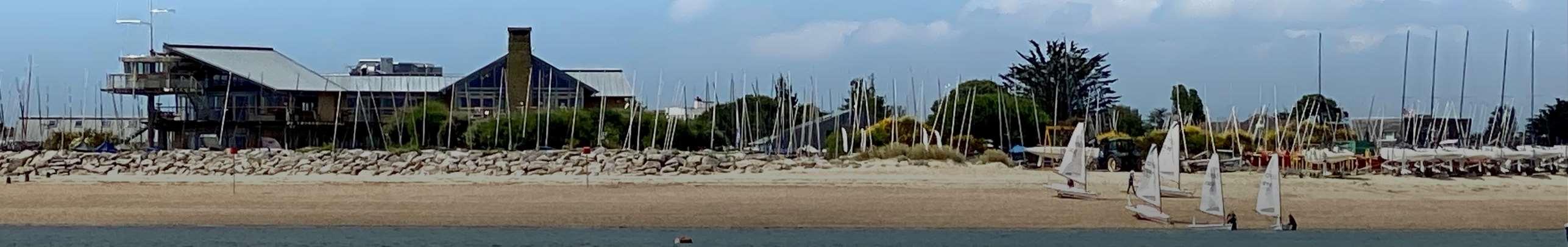


HaylingIslandCoastalManagementStrategy75
Whatweneedfromyou...
Engagementandfeedbackfromkeystakeholdersandthepublicformsavital partofshapingthefinalStrategy.Wewanttohearyourviews. TheStrategyconsultationperiodrunsforthreemonthsfrom3rdOctober2022 to26thDecember2022.Duringthistimekeystakeholdersandthepublicare invitedtoattendaseriesofexhibitionstoreviewandprovidefeedbackonThe Strategyproposals.Followingthispublicconsultationperiod,thefeedbackwill bereviewed,andTheStrategyupdatedaccordingly.Pleasevisit https://coastalpartners.org.uk/project/hayling-island-coastal-managementstrategy-16/forfurtherdetailsofthepublicexhibitionsandthewaysinwhich youcanprovidefeedbackonTheStrategy.
Followingtheevaluationandincorporationofstakeholderandpublicfeedback TheStrategywillbefinalisedduringthespringof2023.TheStrategyand businesscaseforthepreferredoptionswillthenbeputforwardforapproval bytheEnvironmentAgencyinlatespring2023.FollowingTheStrategy’s approval,itwillthenbeformallyadoptedbyHavantBoroughCouncilandThe Strategyactionplanwillbeimplementedalongwithstartingthe commencementofthepriorityschemesoverthecomingfewyears.


TIMELINE
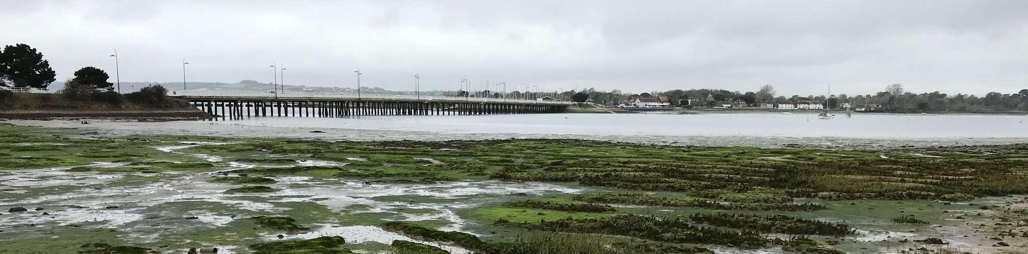
WhatHappensNext? OCTOBERTODECEMBER2022 DraftStrategyPublicConsultation JANUARYTOAPRIL2023 Reviewfeedbackandupdate/finaliseStrategy MAYTOAUGUST2023 EnvironmentAgencyreviewandapproval,and HavantBoroughCounciladoption WINTER2023 CommencedeliveryofStrategyActionPlan, subjecttofunding HaylingIslandCoastalManagementStrategy76


HaylingIslandCoastalManagementStrategy77 CoastalPartners PublicServicePlaza CivicCentreRoad Havant PO92AX 02392446019 coastal.team@havant.gov.uk
