34 minute read
EAST TO WESTERN AUSTRALIA AND BACK

WORDS AND IMAGES: SUNNY MOTOGRAPHER
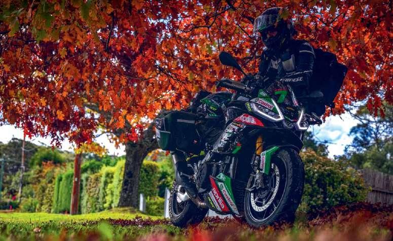
POWER TRIP SYDNEY TO Perth 2024 saw yours truly, Sundeep Gajjar (aka MotoGrapher) and Manan Chaturvedi (aka Shuttervedi) ride across australia: from Sydney to Perth and back. the machines of choice this time were the world’s fastest production motorcycle, a 2017 Kawasaki ninja H2 and a 2022 aprilia Tuono V4 Factory 1100.
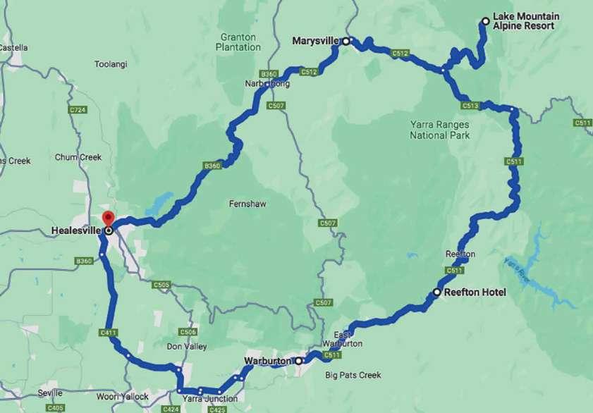
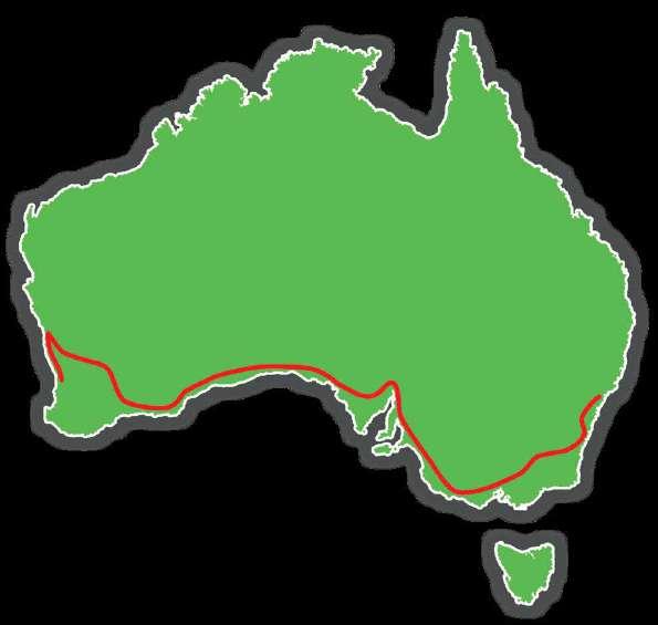
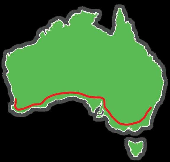
Route
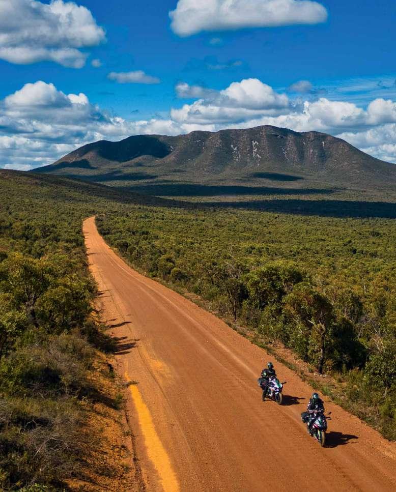
While we have ridden in Australia a fair few times, it just has so much to offer that there’s always something left. So, while charting out the route this time, we decided to touch upon a lot of places that we have not been to before. We crammed as much as we could in these 12,000 km. From bustling cities like, Sydney, Canberra, Melbourne, adelaide, and Perth to the isolated nullarbor, Pinnacle, and Iron Knob, this road-trip proved to be everything a rider can ask for. as you can probably tell from the map alone, it was a heck of a trip and we hope our story and images inspire you to take a similar journey to ours.
Waverley Cemetery
The most beautiful cemetery in Australia? That is what the Waverley Cemetery is often considered to be. One of the shot locations of the song ‘Tanhayee’ in DIl Chahta Hai, which was also one of my favourite movies, this cemetery goes right to the edge of Australia in Sydney.
Established in 1877, this cemetery is counted as one of the most significant in Australia, especially for New South Wales since it has many important personalities buried here, including the famous Australian poet, Henry Lawson.
The Newtown suburb of Sydney has been for long one of the most densely populated with artworks.There are designated areas for street artists and the residents take pride in the colours and importance of these artworks.
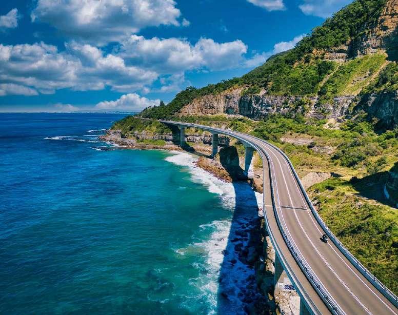
Sea Cliff Bridge, Wollongong
This is the Lawrence Hargrave Drive in Australia, originally constructed in the 1870s as Lower Coast Road, later named after the aviation pioneer Lawrence Hargrave, home to the iconic Sea Cliff Bridge. Nestled between the cliffs and the Tasman Sea, this engineering marvel stretches 665 meters, offering views that are nothing short of spectacular. But it’s not just the view; it’s the ride. This road is
a ribbon through history and adrenaline, a must-ride for every bike enthusiast passing through this area.
The famous 665-meter-long and 41 meters in height Sea Cliff bridge on Lawrence Hargrave Drive was originally built in 2005, so the piers and bridge deck are well away from the rock fall hazard.
Canberra Parliament House
Canberra is the capital of Australia. It is considered to be a relatively boring city but in 2024 it has been ranked to have the second highest quality of life in the world. And that is saying something! This is also the political capital of Australia. The Aprilia Tuono V4 can be seen against Capitol Hill which also has the Parliament house. The flag seen is the largest in Australia measuring a cool 21ft x 41ft atop an 81-meter flagpole! If you are passing through here like us on a much bigger ride, try riding to the Black Mountain which also has the Telstra Tower that rises 195 meters from the summit of this mountain.
Snowy Mountains Highway And Scheme
The Snowy Scheme: Described as one of the civil engineering wonders of the modern world, the Snowy Scheme consists of sixteen major dams, nine power stations, two pumping stations, and 225 kilometres (140 mi) of tunnels, pipelines and aqueducts that were constructed between 1949 and 1974. Just 2% of the construction is visible above ground.
This is the largest engineering project ever undertaken in Australia. This project generates electricity and also provides water for irrigation at the same time.

It utilizes the water of the Snowy River. Two towns Khancoban and Cabramurra were constructed for the scheme itself. In fact, Cabramurra is Australia’s highest permanently inhabited town at 4882 feet. It is spread over 5100 sq kilometres and took one hundred thousand people from over thirty countries to finish it.
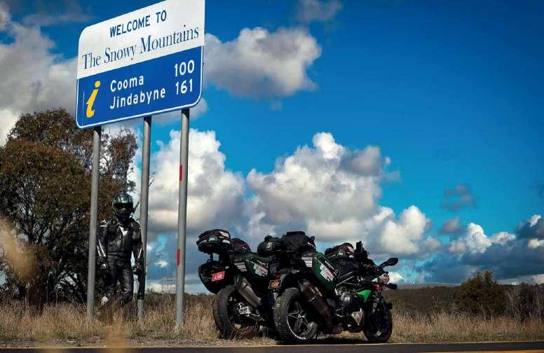

But the direct benefits of this massive engineering project to a couple of motorcyclists like us? Good asphalt roads like the Snowy Mountains Highway and the Alpine Way!
The Snowy Mountains Highway (B72) is a 333-kilometre-long road, starting near Bega Valley in the east and ending at Mount Adrah.
Blowering Reservoir
This is the Blowering Dam Reservoir. It is one of the biggest dams in the state of NSW. It is also famous for being the site for the world water speed record in 1978 when a speed of 511.10 km/h was set by a boat named ‘The Spirit of Australia’ built by Ken Warby in his Sydney house backyard!
Charlotte Pass And Mount Kosciuszko
Mount Kosciuszko is mainland Australia’s highest mountain peak. It is at 2,228 metres above sea level. If you are used to riding in the Indian Himalayas or the European Alps then the Australian alps might underwhelm you but it is still a beautiful area; worthy of a ride visit. Charlotte Pass is the closest village and snow resort to Mount Kosciuszko. It is also the coldest location in Australia with a record low of 23°C. It is a one-way toll road which means traffic is minimal if you go in the summer months at the right time and the tarmac is amazing!
Jindabyne
Jindabyne Dam is also part of the Snowy Hydro Scheme. Jindabyne is a town that lies on the foothills of Mount Kosciuszko National Park and also has the beautiful Jindabyne Lake which is a popular sailing and fishing destination.
The Alpine Way starts in Jindabyne and ends after 122 km at Towong. You can do these two in a loop, but you cannot really go wrong with any of the roads in this region. In the winter months, many of these roads will not allow motorcycles and cars must have snow chains with them.
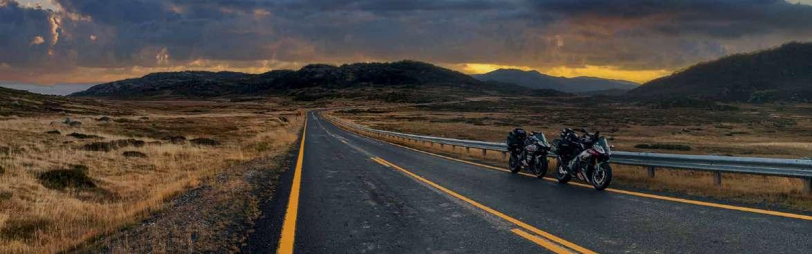
snowy River Way
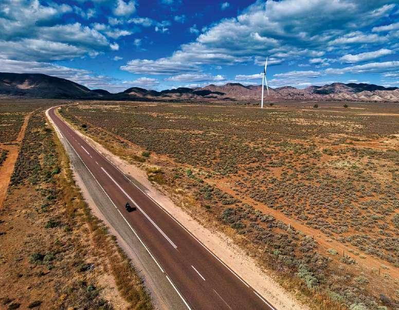
There are many beautiful roads in the NSW high country, and many of them are named like in a fairy tale story. The Snowy River Way is one of them. This 108 km stretch starts from Jindabyne and ends in Bombala in New South Wales with many great corners and open country like this. Windmills are also abundant on this route with tall golden grass swaying in the wind completing the dreamy look. The tarmac quality in some places is not good, but nothing to seriously hamper the overall riding experience unless you have a suspension tuned for the racetrack!
The Great Alpine Road is a road that runs from Bairnsdale to Wangaratta in the state of Victoria, for a total of 300 km. It is one of the most famous mountain roads in Australia that has some amazing tarmac and views and is one of the highest all year accessible roads of Australia. However, we did not do its entire length as we joined it while coming from Jindabyne. Dinner Plain, which is at 1570 meters, is one of the highest points on this road with the section at Mount Hotham, just a few kilometers from here being the highest at 1840 meters. Dinner plain is also the highest permanently inhabited freehold village in Australia and it is called so because a weekly horse-drawn coach service operated in the summer months around 1900. They would stop for a midday meal here. The danger of hitting Kangaroos and other wildlife wombats is very real on roads like these at dusk. The risk multiplies in the mountains since these animals come out earlier than sunset since its cooler must faster. A good sized Kangaroo can easily kill a motor-cyclist and even veer a big car off-track! So, you can never be too careful.
Lakes Entrance
Lakes Entrance is so named because it was the entrance for ocean-going vessels to access the Gippsland Lakes which are the largest navigable inland waterway in Australia. This is a town which most people won’t visit but serves as a good stop with many staying options. Also, as you can see in the inset photo, Australian police are serious (and creative) about reducing road accidents and the fines are high, so you would do well to stick to the speed limits if you value your money.
Melbourne
Melbourne is the second largest city in Australia and the capital of Victoria. It is also considered to be the knowledge and cultural capital with many museums and open-air art districts. One of the best things about this city are its many roadside cafes and the fact that you can park your motorcycle on the pavements unlike Sydney which is relatively bad for accommodating two wheelers like this.
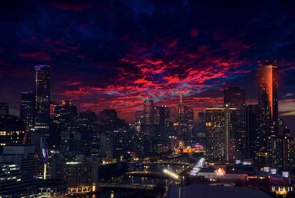
The main photo has the Ninja H2 with the famous Bolte bridge over the Yarra river. Melbourne has many such waterfronts that look beautiful at sunset and beyond it because of the colorful lighting.
The smaller inset photo shows the Melbourne skyline, which surprisingly has the highest number of skyscrapers, with the total standing at almost 80.
Oakwood Premier Melbourne
Melbourne is also home to many amazing hotels. We stayed in Oakwood Premier, which had amazing facilities like in-room laundry, kitchen and more while affording some amazing Melbourne skyline views. The hotel is also located almost in the heart of the CBD (Central Business District) so it has all the amazing building vistas around it.
Albert Park, Melbourne
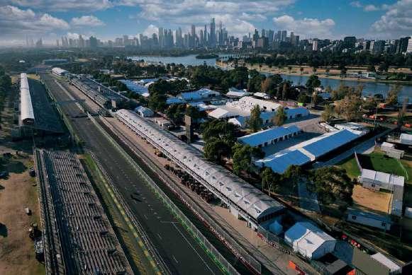
Albert Park is famous for being the venue for the Australian GP on the F1 calendar, which happened just a weekend before we reached Melbourne. This meant that many of the scaffoldings and set up for the GP were still there since this was actually a public road circuit. And I took this chance to ride the whole circuit and even did some slow-speed knee-downs with all the stuff on the bike.
hosier lane, melbourne
Melbourne has a very vibrant outdoor graffiti scene. Hosier Lane is one of the hotspots where you will find many murals and even live artists as well. The city also has an amazing array of architecture. In inset on the opposite page, Flinders Street railway station is one of the most beautiful buildings in Melbourne. Below it is the Melbourne Parliament where a few movies have also been filmed. The Princess’s Theatre is also a magnificent building that you should not miss.

The Great Ocean Road
The Great Ocean Road is perhaps the most globally famous road in Australia. This has been marketed quite well and its proximity to Melbourne and the length of 240 km makes it a good week-long drive for many tourists. This means that it is not really to enjoy motorcycling as tourist traffic can be a lot over weekends and holidays. But motorcycles can filter through the lanes of traffic that one encounters, so it is much less harrowing to do than in a car.


Having said that, the road quality is very good and the vistas are also worth a drive. But for us, this was simply on the way to Perth, so it was a no-brainer. Another downside is the relatively lower speed limit posted in many sections of the road due to tourists.
The photo on this page shows the ‘London Bridge At sunset. There are many such rock formations all along the coast. The bridge itself collapsed in January 1990 leaving just the arch beyond and leaving two tourists stranded on the arch. They had to be rescued by a helicopter.
The Great Ocean Road is 240 km long and starts from Torquay in the east (near Melbourne) to Allansford in the west, which is near Warrnambool. It is the world’s longest war memorial. WWI veterans built the road from 1919 to 1932, the dedication to which can be seen at the start of the road (inset photo).
great ocean Road
The road passes through different kinds of terrain including rain forests. There are a lot of beaches and limestone and sandstone formations, due to which erosion has created some interesting formations to look at like the London Bridge and rugged cliffs.

This is called The Baker’s Oven, perhaps named because of the oven-like hole in the island. It is one of the quieter spots on the Great Ocean Road and is great for watching a sunset! In the inset photo, you can see the 12 Apostles, perhaps the most famous of all rock formations on this road. However, only eight of them remain as the rest fell due to erosion.
Enroute to Adelaide
As you go further towards Adelaide, the landscape starts getting more stark, with fewer greens and more browns and reds.
I am quite fascinated by the kind of leafless trees you can find from here and in general all over Australia, giving it a very eerie otherworldly look.
Adelaide
Adelaide is Australia’s fifth largest city. It is also sometimes known as the twentyminute city, due to its rather compact nature compared to the previous two metropolitan cities of Sydney and Melbourne. The rolling hills and beaches also provide some great vistas. It also has decent graffiti and street art along with some radical lighting on buildings.
Bumbunga Lake
Lake Bumbunga is a salt-lake that also turns pink in spring. There’s also a huge fibreglass sculpture depicting the Lochness Monster.
Port Augusta
Port Augusta is also called the crossroads of Australia because it is at a strategic position at the junction of three major Australian highways. From here your choice will take you to either Darwin, which is a cool 2700 km away up north, or Perth on the Eyre Highway at 2300 km away, or back to Sydney on the Princes Highway which is 1500 km away! This is also the gateway to Flinders Range. Horrocks Pass Road is a great mountain road that feels right out of a movie. There are also a lot of windmills around here.
Wudinna and further west...
The name ‘Wudinna’ literally means ‘The Granite Hill’ in aboriginal language. This town is known for its interesting rock formations, especially Mount Wudinna which is the second largest monolith in Australia, after Uluru. Australia is a huge country. It has got huge farms which require machines like these, a Hardi Saritor 7000, which is a sprayer powered by a 300 bhp motor. The feature list reads out of a sci-fi movie - “GeoSelect, the manufacturer’s selective spraying technology which was first launched at last year’s showcase, and which uses drone mapping of weeds rather than on-machine cameras that add weight.” This looks more like a transformer than a farming machine!
Iron knob
Iron Knob obtained its name from its proximity to large deposits of iron ore and is also known as the birthplace of the steel industry in Australia. It provides for a MadMaxish kind of landscape from the road level and is just very cool to see.
Penong
Penong is a small settlement at the eastern edge of the Nullarbor with a population of less than 250 people. This has a windmill museum that stands out on this route, giving it MadMax vibes. They also claim to have Australia’s largest windmill (traditional) called the Comet or Big Bruce.
Lake Macdonnell
Lake MacDonnell is a salt-lake near the Nullarbor plains. It is just 13 km near the town of Penong and worth a visit because of its otherworldly landscape. It is now the largest gypsum mine in Australia on the largest gypsum deposit in the southern hemisphere. Salt is still mined but as a secondary product.
There is also a pink lake here, Lake MacDonnell. It gets its colour from the algae that crop up during the harsh summer months acting as sunglasses to the harsh light!
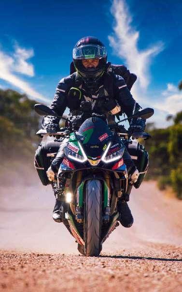
The Aprilia Tuono V4 Factory 1100 is one of the most capable bikes I have ridden. Seen here is it traversing one of the many off-road excursions that we took in this region to explore places like Lake MacDonnell.
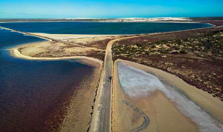
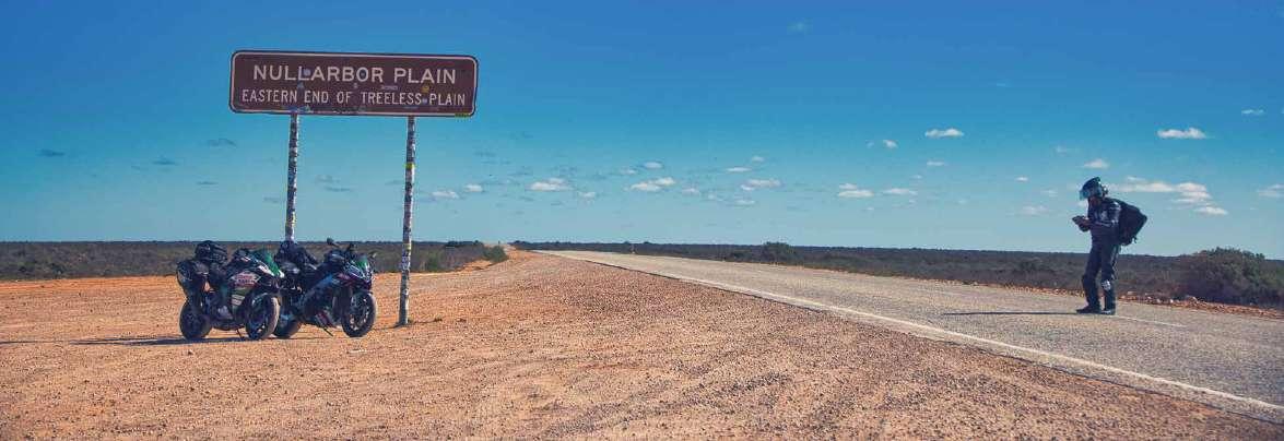
Into the Nullarbor
Nullarbor literally means ‘zero trees’. It is a huge area that starts in Norseman in Western Australia and finishes in Ceduna in South Australia. Crossing the
Nullarbor is considered to be one of the most spiritual roadtrips in the world. The nothingness beckons you to think about how insignificant one is. But it is far from boring, the treeless plain section itself feels surreal, especially if you manage to see it from a drone’s eye. It is the largest exposure of limestone bedrock in the world – an empty expanse that stretches over an area of 200,000 square kilometres. We will revisit the Nullarbor a bit more when we are making our return journey.
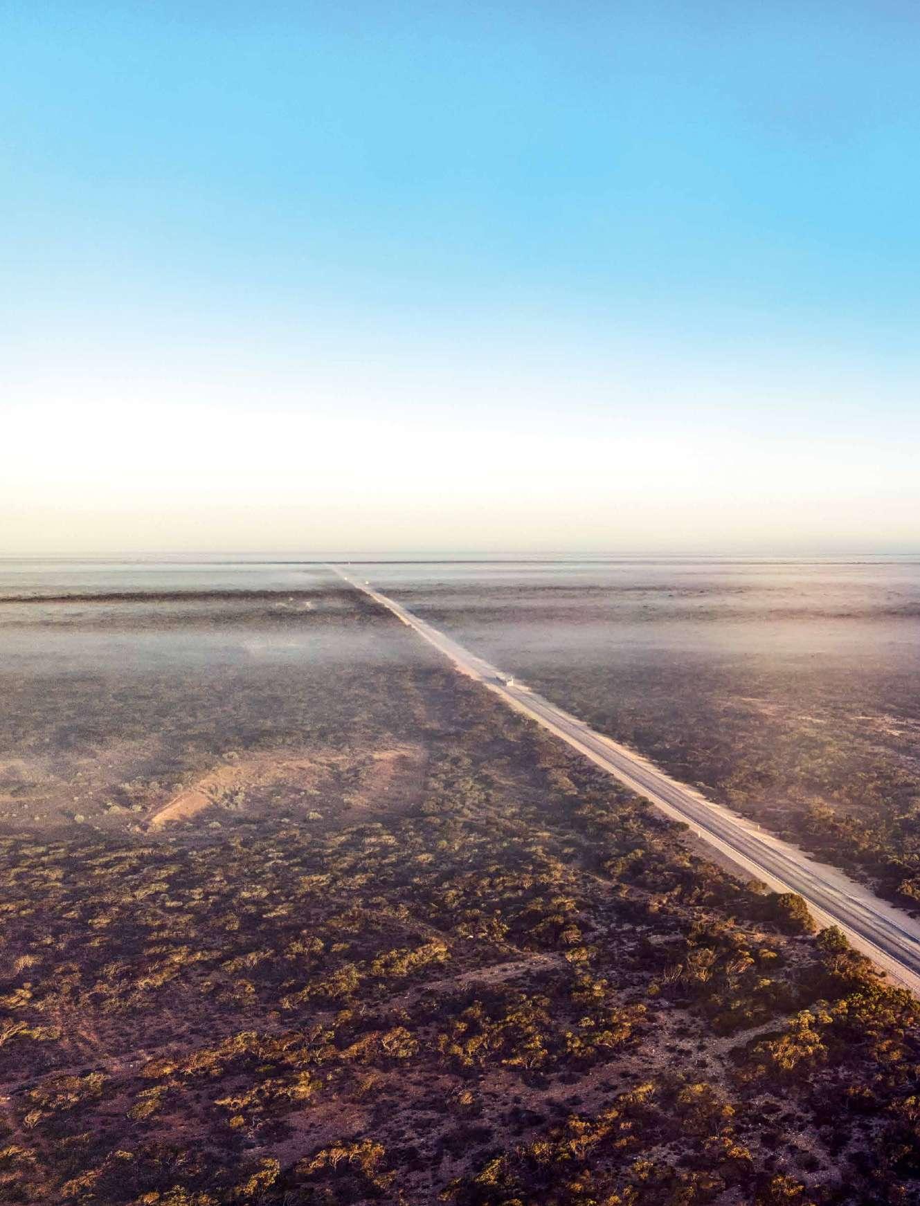
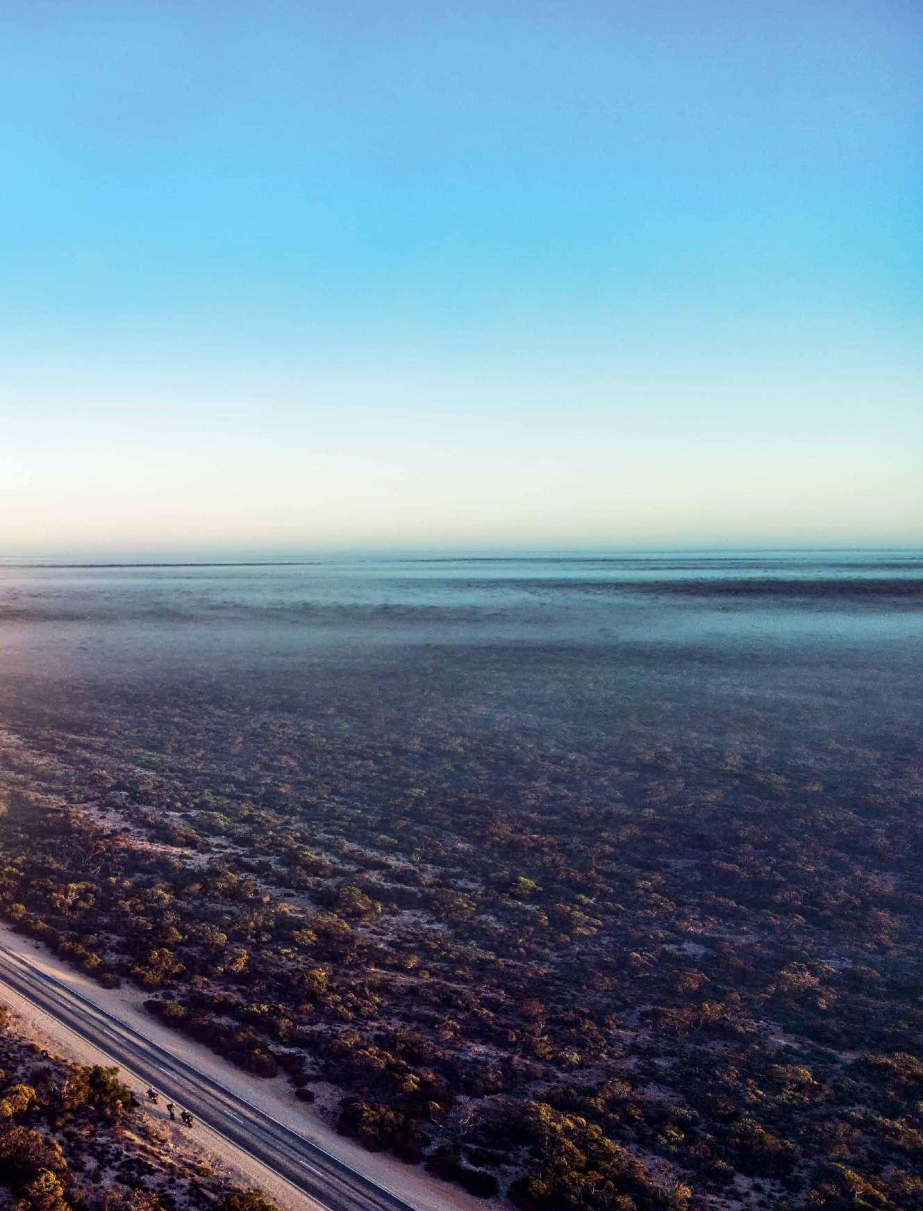
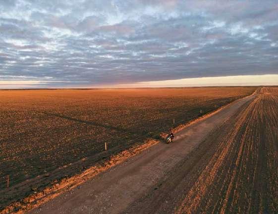
The Nullarbor plains can be an incredible place to witness the golden hour. There are over 100,000 camels that are said to roam in the Nullarbor, but we somehow didn’t even see one, even though we traversed it twice on this very roadtrip.
One of the most beautiful sights is to watch the sunrise on the Nullarbor. If you look carefully, you will see a blanket of mist that can prove to be dangerous early mornings.
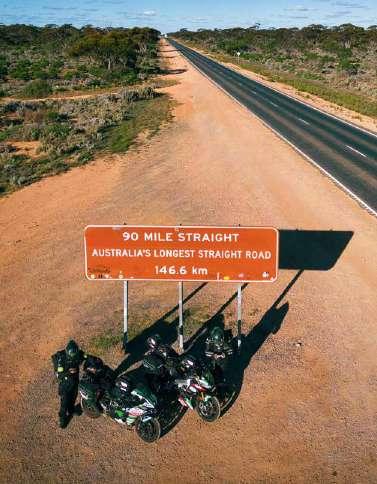
En route, we also came across a lot of straights and Australia’s longest straight road as well which is 146.6 km straight. However, it doesn’t mean that one can just twist the throttle and go flat out as it is going to cost you a lot more fuel for the same distance and hardly makes a time difference in the end. This means more fuel stops. At every fuel stop, you have to take a photo of the receipt with the timestamp along with the odometer. Road trains are an integral part of most of Australia. They are beautiful man-made creatures, gentle giants and a sight to behold on the roads. They range from 28 to 60 meters. Just for the record, pun intended, the world record for the longest road train was set in the year 2006, one year earlier than my first ever Australian big lap (that was done in 2007). The road train was 1475 meters long and had 113 trailers.
Overtaking a road train on a motorcycle can be dangerous at times. Vacuum and sudden wind blasts upon crossing one can throw the motorcycle off in the other direction and off the road shoulder. Sometimes the road trains are going close to 100 km/h. At night it is sometimes difficult to judge if a road train is coming from behind if it has its top lights switched off, which they do to protect you from their incredible brightness and glare. When you are parked on the side of the road, and you see a road train that’s going to cross you, hold tight to the bike and your belongings as the wind blast is incredible!
The RFDS (Royal Flying Doctor Service) is a non-profit charity organization that provides emergency medical and primary health care services to anyone who lives, works or travels in rural and remote Australia. In August 2020, a plane had to land on the highway at Eucla on the Nullarbor to save a man from a stroke. They did save the man because of this, considering the nearest hospital is 500 km in the town of Ceduna! There are around four widened sections of airstrips on the Nullarbor that are part of the main highway. Another thing to consider is that the Eyre highway is the only road linking South Australia and Western Australia, and that makes it an extremely important road in Australia.
This is me with the Australian Motorcyclist Magazine which had a contest run to spot me and with 1000 AUD. It was but a perfect moment to get a photo clicked with these fine officers in the middle of Nullarbor.
We also used the ADV Worx fuel bladders a couple of times during our IronButt run. If you are looking to get rid of the bulky jerry cans without worrying about not finding fuel, Fuel Bag from ADVWorx Australia is the way to go about it.
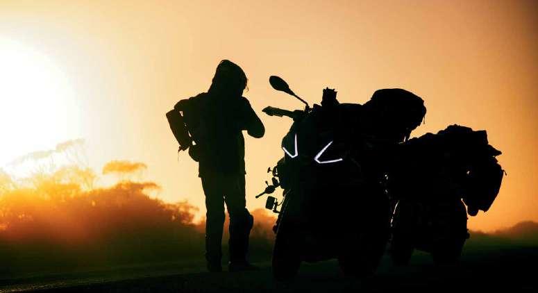
The IronButt almost always involves riding from sunrise to sunset, unless of course, you are doing it in the summer months above a particular latitude where the sun doesn’t set! Watching the sunset again on the Nullarbor on the same day was a gift!
We did complete the IronButt in a total saddle of time of just 15 hours for 1650 km; from the nothingness of the
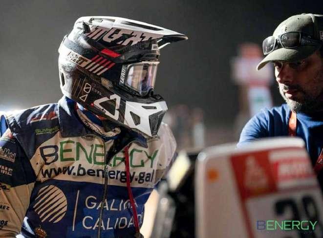
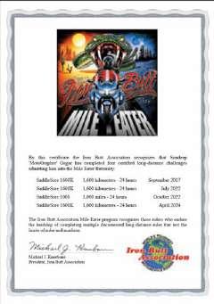
MOTOGRAPHER’S 4Th IRONBUTT
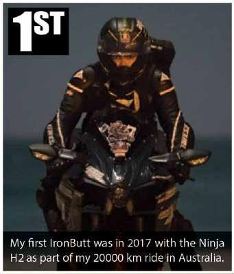
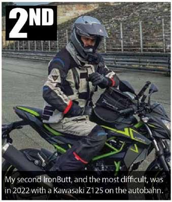
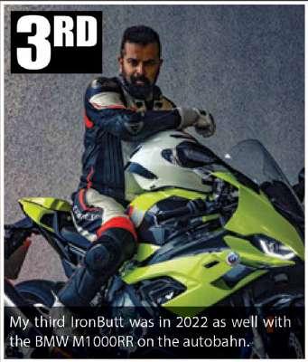
IronButt is an association based in the USA that started in the 1980s to test man and the machine’s endurance. The most famous of these certificates is the SaddleSore1600, where we have to do 1600 km in less than 24 hours. So far I have done three IronButts, the details of which are in the inset photos on the right.
My fourth (successful) attempt was on this ride. There’s a detailed video on my YouTube channel that you can watch by scanning the QR code on this page about this attempt. There are a lot of considerations before you attempt something like this, but I will not delve into it for now.
The route was from Nullarbor Roadhouse to Perth for a total of 1624 km. We started at 6 AM in the morning from the Nullarbor roadhouse when it was pitch dark and close to zero degrees. I wore rain gear on top of my leathers that protected me from the icy cold winds. The fuel station hadn’t opened up yet, that’s why we took a witness form from a roadhouse attendant last night at check in. And this was verified by the IronButt volunteers while assessing my application.
The ultimate Ironbutt guide!


Nullarbor Roadhouse to the most isolated megacity on planet Earth - Perth.
This was the most beautiful Ironbutt so far out of the four that I have done and one of the easiest for us, even though we lost almost three hours due to a leaky valve in the rear tyre of the H2!
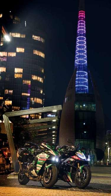
Perth
Perth is a beautiful city. It is hard to imagine how isolated it is. The closest neighbouring city with all facilities that’s not a small village is 2100 km away and it is Adelaide in South Australia. It was founded just 200 years ago, yes, it is that new! It is closer to Singapore than it is to Adelaide. The time difference between India and Perth is 2.5 hours while between Perth and Sydney, it is 3 hours in summer! The time zone of Perth and Singapore is the same!
But once you are in Perth you will forget how isolated it is, it has just five skyscrapers (buildings that reach a height of at least 150 meters), compared to Melbourne which has 77.
Duxton Hotel
Duxton is a five-star hotel located in the centre of Perth that has all the facilities that you could want. They were also kind enough to let our bikes be parked right outside the main entrance under the watchful eye of the door usher and the CCTV cameras, even though Perth is considered to be a relatively safe city compared to other big cities.
Supercars Meet
The last thing we expected to see was a supercar meet in Perth. This was an open event where kids, families and petrol heads came together in a vineyard in the Swan Valley near Perth. But it was extremely hot!
6000 Km Service
Perth was the end of our first leg before we had to take a turn back towards Sydney. This was also a good point to do a preventive checkup and service with more than 6000 km done. We got fresh Castrol POWER1 ULTIMATE in both the bikes and a fresh set of Vredestein Centauro NS tyres.
Two Rocks
Two Rocks is a small town en route to the Pinnacles desert, it is worth a visit for its beautiful and rugged coastlines and white beach.
Omeo Wreck
Omeo shipwreck as seen from above. This was a trading ship that was driven ashore in 1905 and has been there since then. This is just 30 km south of Perth and offers an amazing sunset too!
The Blue Boat House
The Blue Boat House is perhaps the most
2ND HALF
photogenic spot in Perth. This is actually a boatshed that was built in the 1930s over the Swan River. This river is one of the cleanest inner-city rivers in the world.
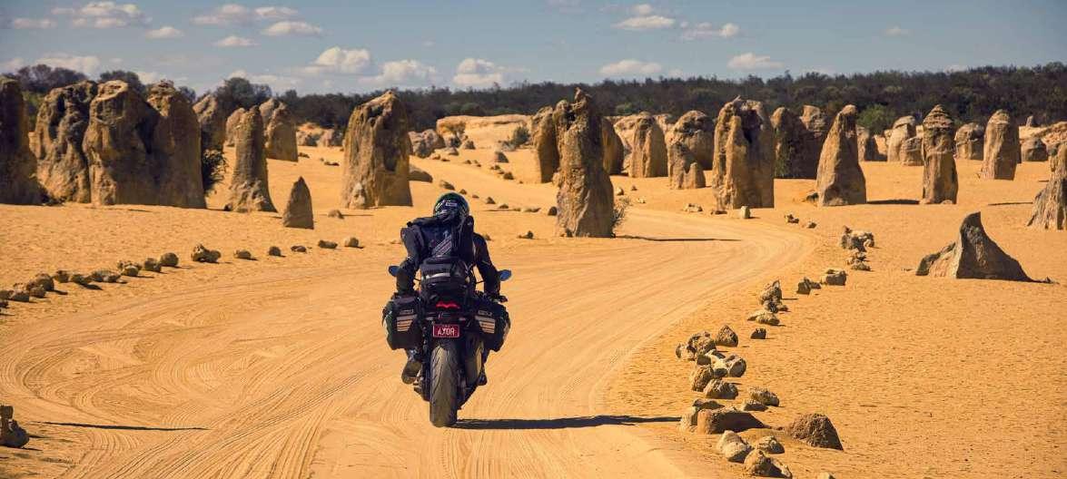
The Pinnacles
The Pinnacles is a must-visit if you are in Perth and even remotely, pun intended, interested in photography and a roadtrip.
Heading East...
From Perth we start riding back towards Sydney, but from a different route. We went down south via the coast and en route we hunted for the Giants of Mandurah, which are giant outdoor installations made from recycled wood to celebrate the extraordinary beauty and the importance of protecting our natural Then north to see the Pinnacles.
This will give you one of the most surreal backdrops for your machine as you can drive through this section of the Nambung Desert with any road bike. It is 190 km north of Perth and can be done in a day. They are 30000 years old limestone outcrops.
The Pinnacles marked the end of our leg 1 of xBhp Power Trip Sydney To Perth.
Perth Augusta Gnomesville, Australind world. Then there was Gnomesville, in the middle of nowhere at a roundabout, thousands of gnomes placed by thousands of people.It is quite an interesting sight.
We saw a sign saying Australind and immediately thought something was going on. And as we suspected it did turn out to be a name amalgamating the two, which was chosen due to the belief that the area could be used for breeding horses for the British Indian Army. mill brook state Forest
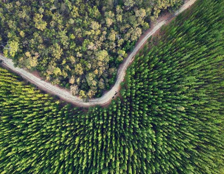
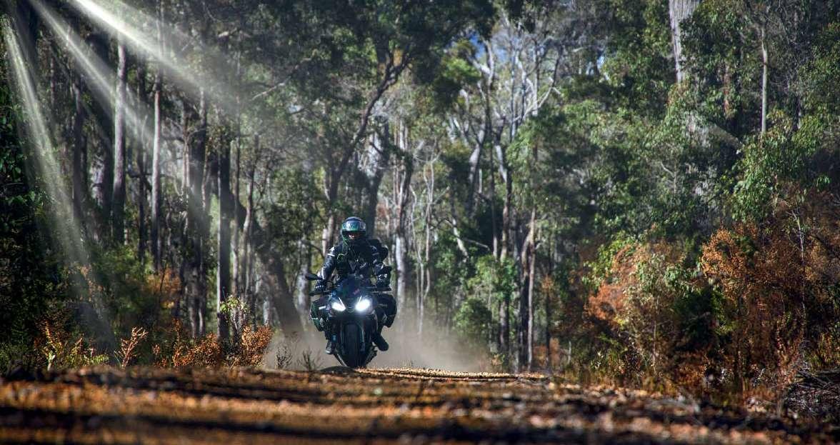
Millbrook State Forest and many other forests are en route to Augusta in this area. There are inroads that you can take to really take in the wilderness.
Lake Clifton Thrombolites
Lake Clifton is in the beautiful Yalgorup National Park. At the edge of Lake Clifton, rock-like structures called thrombolites (similar to stromatolites) can be seen, built by tiny micro-organisms believed to resemble the earliest forms of life on Earth. Scientists have suggested their presence here may be due to upwellings of fresh groundwater high in calcium carbonate. (Source Wikipedia)
Augusta
One of my favourite towns in Western Australia is Augusta. The Augusta boat harbour is a great place to go with a motorcycle, you can go right to the end of this pier with the bikes.
Augusta Cape Leeuwin Light House
It is beautiful and Cape Leeuwin is a landmark that should not be missed if you are on such a roadtrip. It is the most southwestern point of the Australian continent, beyond this there is just Antarctica in the south or Africa in the west.
Albany
Close to the city of Albany is the Torndirrup National Park which has rock formations over 1300 million years ago! At the place called the Gap, you can literally feel something supernatural with those vertical dramatic cliff drops, and the layers of rocks packed into columns with the water violently splashing down below. It is insane and one of the best coastlines I have ever seen.
In Google satellite view you can see a plane and a windmill in this unbelievable resort in the middle of nowhere. In both of these people can stay at a hotel. This was quite unexpected and made for an amazing backdrop in this area.
Stirling Ranges
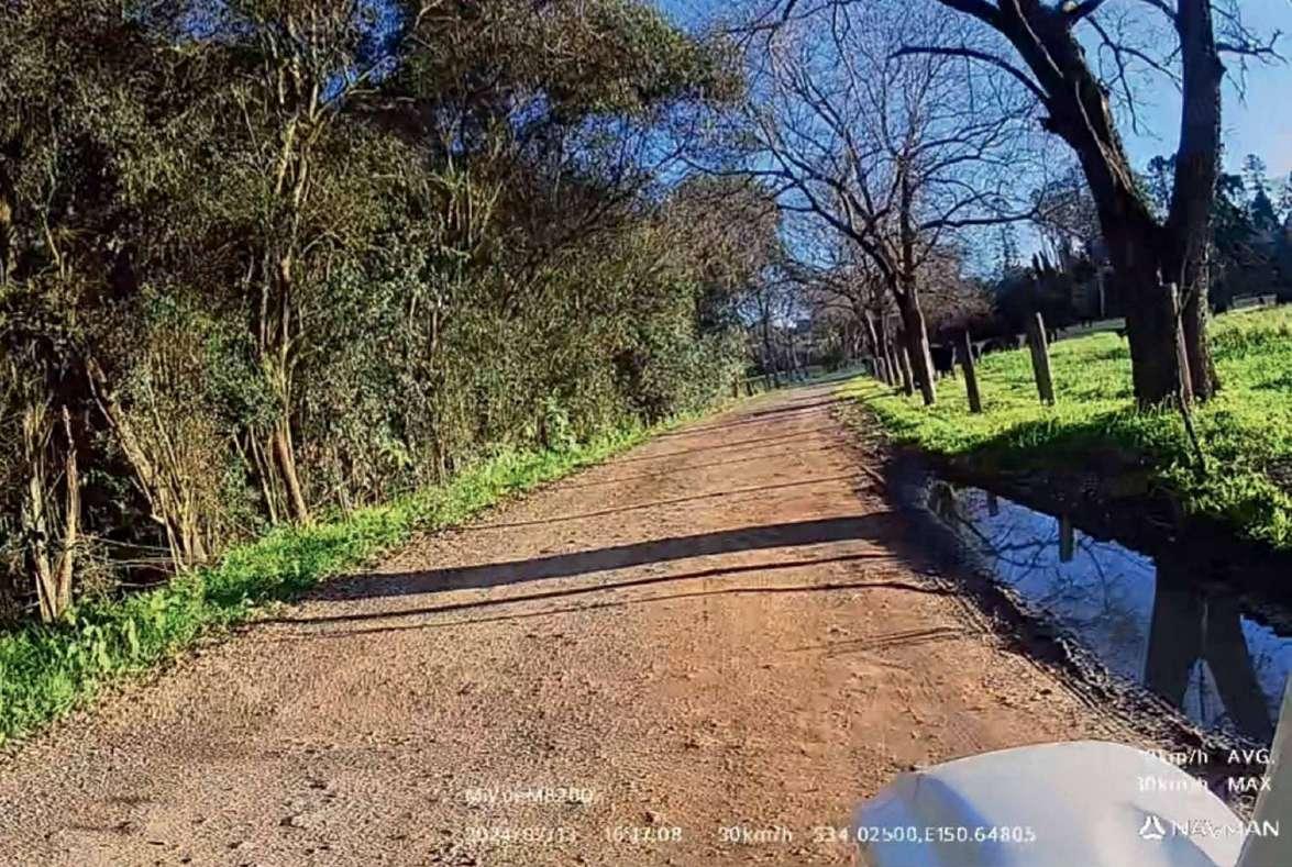
The Stirling Ranges National Park was a welcome surprise. We went a few kilometers inside on unsealed roads but the whole approach and place was dreamy.
Bluff Knoll
Nearby you have the highest mountain of this region - Bluff Knoll, at 3600 feet above sea level. A ride to the summit is one way and highly recommended.
Esperance
Esperance is one of the most beautiful towns we came across on our roadtrip. It has some of the most beautiful beaches in Australia with turquoise water, pure white sands and extremely dramatic rock formations and coastlines. But the best part about this town for motorcyclists is The Great Ocean Drive
But before we move on to the best part, we want to thank Hospitality Esperance SureStay for a wonderful stay at their hotel. Our rooms were also facing a tank that was donated by the Australian Army. This Leopard tank was used to train the army and never actually participated in any wars.
Great Ocean Drive
The Great Ocean Drive near Esperance can be mistaken for the Great Ocean Road which is thousands of kilometers away in Victoria. This is actually a
40 km loop, but in these forty kilometers, you will see incredible winding roads, beautiful coastlines rivalling its bigger namesake, dramatic coastlines and some of the best beaches and rock formations in all of Australia.
From Esperance head to the Twilight Beach road towards the west that turns into the eleven-mile beach road crossing by the Pink Lake (that unfortunately doesn’t turn pink anymore) and eventually ends back in Esperance. If you do this on a sunny day with a slight breeze and fews clouds like we did then prepare to come close to riding nirvana. Just try and skip weekends or public holidays.
Mad Max Country
This photo from near Norseman on the Eyre highway sums up Australia through the sealed outback. It shows the next very rest stop where you have a table and maybe a couple of trees. In between there will be nothing.
Below left: Stop for a quick photo at Esperance. Below: Hwy to Madura.
The road train is probably hauling something from a quarry a few thousand kilometers away. The wind draft from this is enough to blow the helmet off a motorcycle from the other side. In the inset photo you can see a double- decker livestock hauler which is a typical sight for this country.
The road quality is mostly very good, without any potholes for thousands of kilometers unless there has been an accident. This is critical since repairs in these areas would be extremely expensive and any accidents due to potholes can cause huge losses to the government’s reputation and wallet if sued and proved in court.
The cloudless sky with the harsh sun is on point with the reddish soil completing the rustic look.
The Great Australian Bight
And then there is the Great Australian Bight, which is a huge open bay just south of the Nullarbor. In some places, it comes very close to the road itself offering spectacular views and very high cliffs that just drop into the southern ocean. The Great Australian Bight came into existence about 50 million years ago when the supercontinent Gondwana broke apart, separating Antarctica from Australia. You can also spot whales if you come here in the right season.
Even though it is not recommended we more often than not ended up riding through dusk and into the night risking colliding with animals big and small. This is not a joke as there are plenty of horror stories of motorcyclists and car drivers getting into a big soup. We even had a couple of road trains swear at us for riding in the night due to the dangers posed by these seemingly cute postcard animals. Out of these Kangaroos and Emus can be the most dangerous as they will often cross you and they are incredibly heavy and strong. A big fun fact - none of them can walk backwards, so the only way for them is forward even if they are afraid of you. And both are national
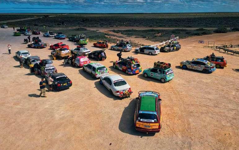
Left: Shitbox Rally cars crossing the Nullarbor.
Below left: Here we go again.
Top right: Ceduna
Far top right: Elliston Clifftop Drive animals representing how the country is supposed to move ahead and develop.
Main right: The Nullarbor Plain from above.
The shitbox Rally
We encountered something unbelievable on the Nullarbor. It was a convoy of more than 200 incredibly quirky cars. This was the Shitbox rally which is an annual charity event held in Australia where participants drive old and “shitbox” cars across some of the most remote and challenging roads in the country. The rally raises funds for cancer research and support services.
It’s not just about the journey; it’s also about the creativity and fun participants have with their cars, often decorating them in outrageous themes. It’s a unique way to combine adventure, philanthropy, and a sense of camaraderie among participants.
Each person has to buy a car for just 1500 AUD and then spend some more money on mods and safety and drive it to raise funds for charity. It was truly a unique experience that reminded us of MadMax!
FURTHER EAST… Murphy’s Haystack
Murphy’s Haystacks are a unique geological formation located on the Eyre Peninsula in South Australia. These impressive granite rock formations have been sculpted over millions of years by erosion, resulting in large, rounded boulders that resemble haystacks or piles of giant marbles. The story goes that someone saw these rocks from a distance and thought they were haystacks. The land then was owned by a man called Murphy. Hence the name! Unbelievable, right?


The photo in the inset shows another solo adventurer in a self-sustaining van that was going around Australia.
The Eyre Peninsula
The Eyre Peninsula is not on many people’s lists when going across Australia on a motorcycle. Even though I have done the big lap three times this was the first time I planned to visit and see a bit of this. It has close to 2000 km of coastline, which is a lot, so I was restricted to going down to the town of Elliston and then cutting across towards Port Augusta.
One of the most stunning drives that we came across on the trip was the Clifftop drive, though this is just 12 km drive just north of Elliston, the insane rugged and dramatic coastlines make you feel that you are in a Game of Thrones movie.
The massive sculptures on the cliffs lend a very different feeling to this whole area. Elliston Jetty is also a very picturesque place to visit and take photos of. It is also very fascinating and has lots of wonders to discover.
Australia’s abandoned sites
Goyder’s Line is an important demarcation in South Australia, identified by George Goyder in the 1860s, which delineates the boundary between areas suitable for agriculture and those better suited for pastoral activities due to low rainfall. This line, extending in a rough arc across the state, marks a significant climatic threshold; regions south of the line generally receive sufficient rainfall for cropping, while areas to the north experience arid conditions, making them more appropriate for grazing livestock. Goyder’s Line remains a critical reference for land use planning and agricultural practices in the region.

Dawson is an abandoned town in South Australia that serves as a poignant reminder of the challenges faced by settlers in the early 20th century. Established in 1882 during a period of optimistic agricultural expansion, Dawson was part of a broader effort to settle and cultivate the arid lands of the state’s interior. However, the town’s location north of Goyder’s Line made it prone to drought and unsuitable for sustainable farming. Despite initial growth and development, persistent water scarcity and poor crop yields led to its decline. By the 1930s, Dawson was largely abandoned as residents moved away in search of more viable land and opportunities. Today, the remnants of Dawson stand as a testament to the harsh realities of farming in marginal environments.
We had to ride around 40 km one way on unsealed roads without seeing even one single soul to visit this place that had two churches and a town hall.
All abandoned.
Yunta, the barrier highway
Yunta, on the Barrier Highway, was one of the most unexpected night stopovers for us on the remote Barrier Highway. We got very late because of some valve issues in the H2 and we had to find a stopover, luckily we somehow reached this small town with just one motel and two fuel pumps. The motel was full but we were helped by getting a lodge in worker’s rooms which were also decent and only 10 AUD for a night! This money went to the Royal Australian Flying Doctor service as a charity, we were told.
But since we had nothing to do in this town, we shot some night photos and watched the Milky Way. We also got to know that Yunta doesn’t have main electricity from the grid but uses a series of diesel generators to support itself!

Barrier Highway, Broken Hill
This is the Barrier Highway near Broken Hill. In the inset on the left page, you can see strange things like trees with soft toys. This could be as a memorial to being just something so that the visitors remember their town. You can find such trees in a few places in remote NSW. On the right inset photo, you can see the Broken Hill Solar Plant.
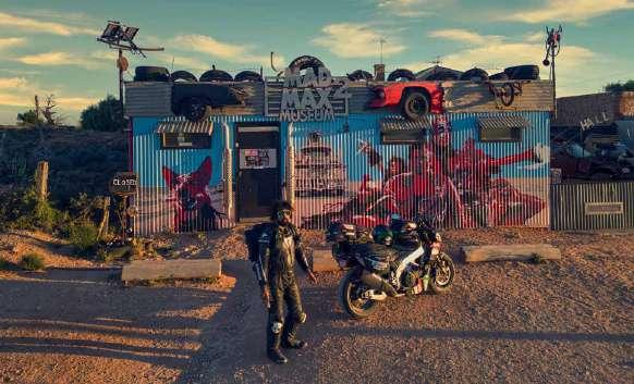
Silverton
Most of the Mad Max movies were shot around Broken Hill in remote NSW with places like Mundi Mundi Lookout that you can actually still ride to. Silverton’s connection to the “Mad Max” franchise has made it an iconic destination for motorcyclists, offering an exhilarating blend of cinematic history and thrilling riding experiences. The town’s rugged landscapes, featured in “Mad Max 2: The Road Warrior,” attract motorcyclists like me, eager to traverse the same terrain as the movie’s characters.
The Mad Max Museum, with its extensive collection of film memorabilia, including iconic vehicles and motorcycles, provides a unique immersive experience. Additionally, Silverton’s frequent “Mad Max”-themed events and the dramatic, open roads of the surrounding outback create a sense of adventure and community, making it a must-visit for fans and enthusiasts seeking to embrace the spirit of freedom and excitement epitomized by the films.
If you are lucky, you will find some quirky vehicles based on the MadMax movie here as well. We got late and just reached when the sun was about to set, otherwise we would have shot a lot more at this iconic location.

Cobar
Cobar is Australia’s largest producer of copper and this is the Cobar mine from a bird’s eye view Mining is one of the most important industries of Australia and the size of this mine is incredible, at 1.9 km deep!
The last day
The last day saw us ride through the Blue Mountains and into Sydney, concluding our cross-continental road-trip. The last day was a contrast to the days earlier, having lots of clouds and mountains. Australia is truly a vast country with a lot of variations, but the huge distances make it something to remember for a lifetime!