downgraded, where possible, and supported with new and more local connections. The proposal develops one of these nodes by adding new local connections to the area around the metro station (Figure 16).
Figure 16 Proposal: new connections (a) defined by the proposed road pattern (b).
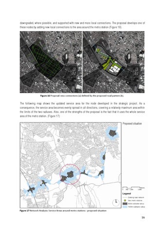
The following map shows the updated service area for the node developed in the strategic project. As a consequence, the service area becomes evenly spread in all directions, covering a relatively maximum area within the limits of the two radiuses. Also, one of the strengths of the proposal is the fact that it uses the whole service area of the metro station. (Figure 17)
Figure 17 Network Analysis: Service Areas around metro stations - proposed situation
16