City of Independence, Missouri U.S. 24 Highway Corridor Study


Chapter 2: The People and the Economy
This chapter summarizes the population demographics, economic trends and real estate market dynamics influencing the Corridor Study Area’s physical environment. It abbreviates the U.S. 24 Highway Corridor Market Study prepared by Canyon Research Southwest (2004), which is composed of two sections. First, the Economic Analysis outlines demographic and economic characteristics that influence the demand for housing and commercial space such as population growth trends, income levels, education attainment, age distribution, and employment base. Then, the Market Study identifies potential redevelopment opportunities for the Corridor Study Area. The Market Study ends with recommendations that provide guidance in determining appropriate land uses, policies, and implementation strategies for the Plan. For further details, please refer to the U.S. 24 Highway Corridor Market Study.
I. Economic Analysis of Population Demographics and Employment
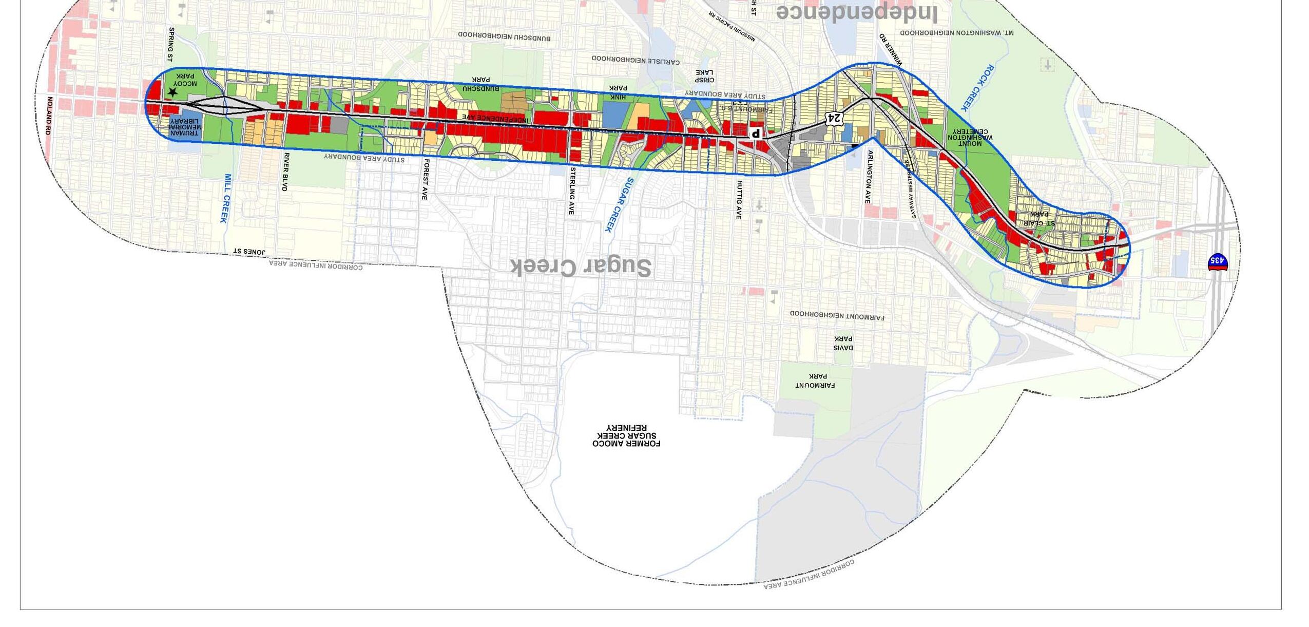
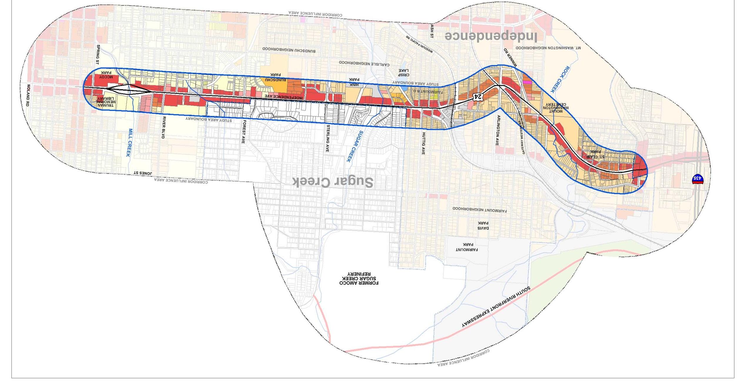
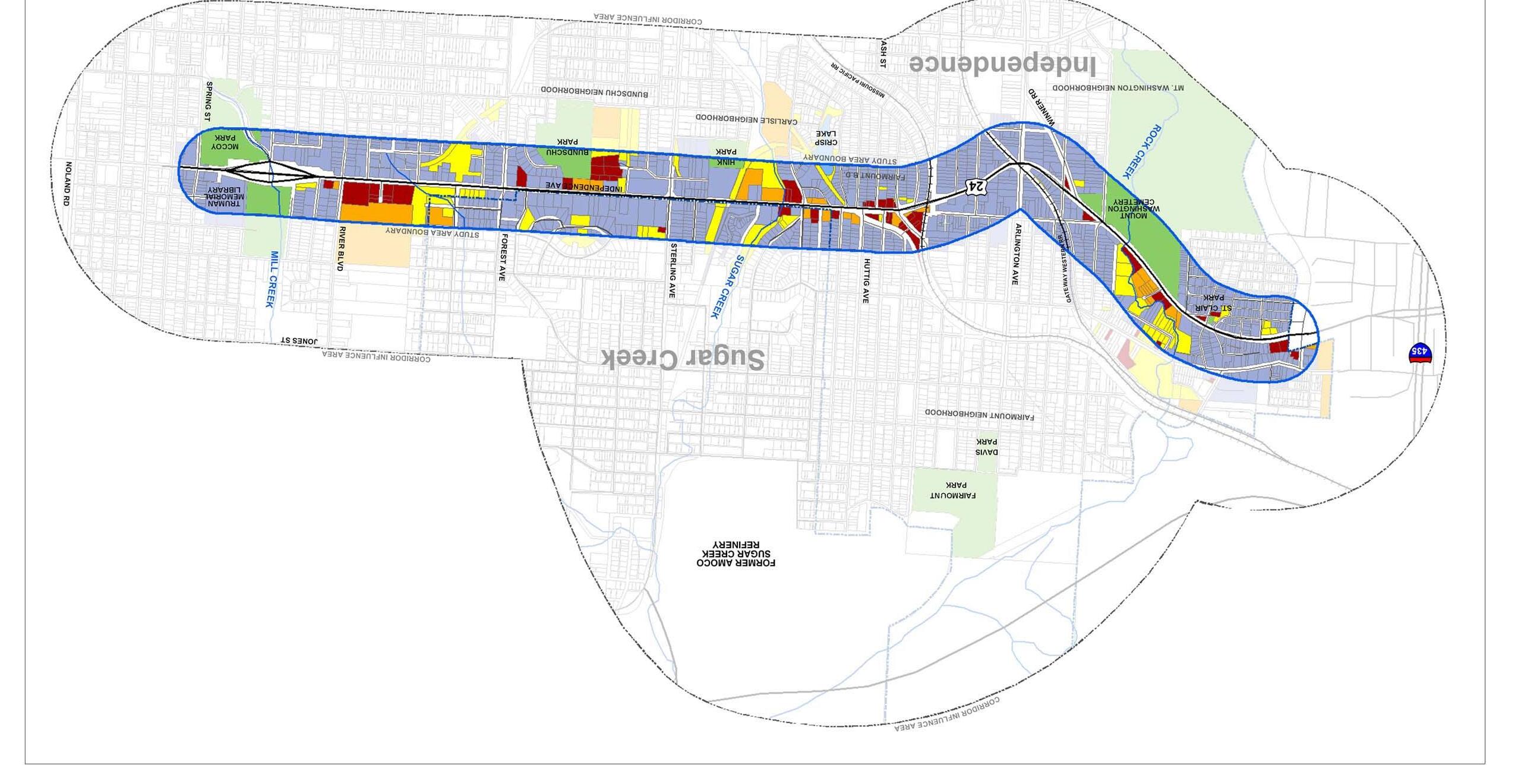
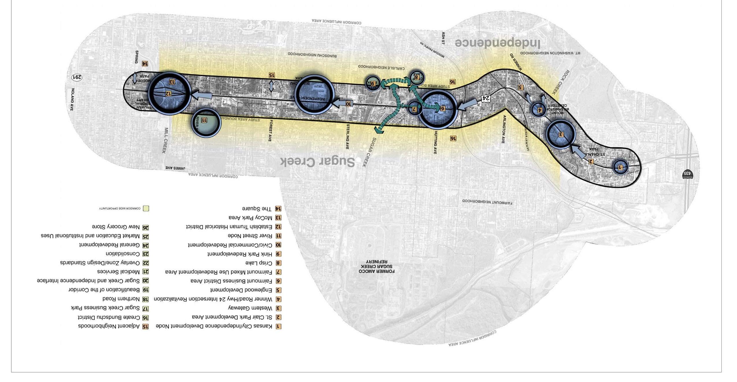
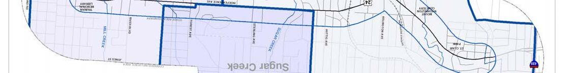
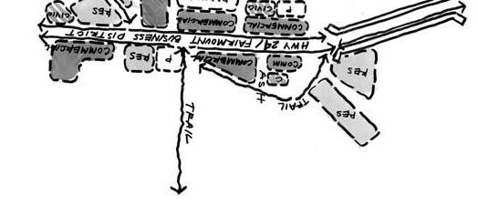
The Corridor Study Area has been defined as the geographic area bounded by the Missouri River to the north, Truman Road to the south, Noland Road to the east and the Independence-Kansas City, Missouri city limits to the west. This section of the report evaluates the economic climate impacting the Corridor Study Area’s housing market and retail trade. To assist in evaluating demographic trends and business trends, the Corridor Study Area has been divided into three sub-areas: the Sugar Creek Submarket, the East Submarket and the West Submarket (divided by Crysler Avenue, see Figure 2-1).
Total Population

Over the past two decades Independence’s population base has remained relatively stagnant. As a percentage of the metropolitan population, Independence has declined from 8.4 percent in 1980 to 6.2 percent by 2002 (Table 2-1). During the 1980s the City’s population grew by just 0.7 percent, compared to the metro-wide rate of 18.4 percent. Through the first half of the 1990s Independence’s population increased by 2.1 percent to 114,690 residents. However, since 1995 the City’s population has declined gradually to 113,023 residents by mid-2002. The recent downward trend in population, despite continued new home construction, is due primarily to Independence’s older than average population and escalating rates of single- and dual-occupancy households. Mid-America Regional Council forecasts suggest that over the next 20 years Independence’s population will reach 121,966 residents by 2010 and 126,771 residents by 2020.
Table 2-1. Population Growth Trends
Time Kansas City Jackson County, City of Sugar
Source: Mid-America Regional Council and U.S. Census.
U.S. Census data indicates that during the 1990s, the Corridor Study Area population declined by 4.45 percent, from 18,551 in 1990 to 17,726 by 2000. Only Sugar Creek reported an increase in population, from 3,678 in 1990 to 3,726 by 2000 (Table 2-2). During the 1990s the West Submarket population dropped 6.3 percent to 7,643 residents while the East Submarket declined
March 2006 2-1
The People and The Economy
Figure 2-1
Period Metro Area Missouri Independence Creek 1980 1,327,106 629,266 111,637 4,170 1990 1,570,626 633,447 112,378 3,678 1995 1,677,498 643,860 114,690 3,951 2000 1,782,231 655,686 113,297 3,726 2002 1,828,247 660,773 112,079 3,758
West Submarket
Sugar Creek Submarket
East Submarket
City of Independence, Missouri
by 5.4 percent to 6,839 residents. Claritas, Inc., a national demographic research firm, estimated that the Corridor Study Area population continued to decline through 2003 to 16,739. The Corridor Study Area population is forecast to decline to 15,304 by 2008. The Sugar Creek population has declined from 4,170 in 1980 to 3,758 by 2002. By 2020, the Sugar Creek population is forecast to decline further to 3,142 residents.
Table 2-2. Corridor Study Area Population by Submarket
U.S. 24 Highway Corridor Study
The West Submarket supports the most racial diversity with minorities, accounting for 11.2 percent of the total population (Table 2-3). Hispanics and blacks represent the largest minority groups. Minorities account for 6.6 percent of the population in East Submarket and 6.8 percent of the Sugar Creek population. Despite supporting an increasingly diverse population minorities account for only 8.5 percent of the Corridor Study Area population, compared to the metropolitan Kansas City rate of 21.7 percent.
Table 2-3. Corridor Study Area Racial Mix by Submarket; 2000 West
East Sugar Creek Total Metro KC
White 88.79% 93.39% 93.24%91.49%78.35%
Black or African America 3.48% 2.15% 0.83%2.41%12.64%
Hispanic or Latino 5.14% 2.73% 4.16%4.01%5.23%
American Indian and Alaska Native 0.86% 0.63% 0.78%0.76%0.41%
Asian and Pacific Islander 0.66% 0.63% 0.54%0.63%1.69%
Other 1.07% 0.47% 0.46%0.71%1.68%
Racial Composition
During the 1990s the Corridor Study Area population became more integrated, with the black and Hispanic populations doubling in size, and the white population declining by 7.1 percent (Figure 2-2). By 2000, minorities accounted for 8.5 percent of the Corridor Study Area population. Claritas, Inc., forecasts that by 2008 the minority population will increase by 161 residents and account for 10.9 percent of the Corridor Study Area population.
Totals 100.00% 100.00% 100.00%100.00%100.00%
Source: U.S. Census.
Population Age Distribution
The 2000 Census reported the median age of the Kansas City area population at 35.16 years. The Corridor’s population is older with a median age of 39.31 years. The median age by submarket is 43.43 years for the East Submarket; 35.71 years for the West Submarket; and 38.68 years for Sugar Creek Submarket. The Corridor Study Area population aged 0-17 accounts for 22.2 percent of the total population, compared to 26.6 percent for the metro area. Seniors account for 17.3 percent of the Corridor Study Area population, compared to 11.4 percent of the metro total.
From 1990 to 2000 the population of school-aged children and young adults declined significantly within the Corridor Study Area while the number of adults aged 35 to 54 increased. Specifically, the population of school-aged children 17 years and under declined by 6.7 percent during the 1990s, with the 18 to 24 population dropping by 11.9 percent. The 25 to 34 age group suffered the greatest loss in population, declining by 28.3 percent from 3,408 in 1990 to 2,445 by 2000. Re-population of the Corridor Study Area will hinge on the ability to retain the school-aged and young adult population. The senior population remained relatively unchanged, increasing from 3,064 in 1990 to 3,066 by 2000.
March 2006 2-2
The People and The Economy
Corridor Submarket 1990 2000 Change % Change East 7,230 6,839 -391 -5.41% West 7,643 7,161 -482 -6.31% Sugar Creek 3,678 3,726 48 1.31% Totals 18,551 17,726 -825 -4.45% Source: 2000 U.S. Census.
Figure 2-2
0 100 200 300 400 500 600 700 800 Hispanic Black American Indian Asian Other Corridor Study Area Minority Population 1990 2000
City of Independence, Missouri
Despite a 4.45 percent decline in the overall Corridor Study Area population during the 1990s, the middle-aged population reported a noticeable increase with the 35 to 44 age group increasing by 16.3 percent, and the 45 to 54 age group increasing by 26.5 percent. Figure 2-3 illustrates trends in the Corridor Study Area population by age group from 1990 to 2000 as reported by the U.S. Census.
U.S. 24 Highway Corridor Study
The West Submarket and a portion of the Sugar Creek Submarket are located within the Kansas City School District. Residents cited the poor quality of the Kansas City School District as the major contributing factor for the declining housing market and population demographics in the western half of the Corridor Study Area. While the elementary schools in the Kansas City School District are considered adequate, young families tend to leave the area when children reach high school age. However, this is not the case for families with junior high school age children and younger. Table 2-5 quantifies the number of pre-school and school-aged children in the Corridor Study Area residing in the Kansas City and Independence School Districts as reported by the 2000 Census.
Table 2-5. Corridor Study Area; 2000 School-Age Children by School District
According to the 2000 Census the Corridor Study Area senior population amounted to 3,066 residents, or 17.3 percent of the total population (Table 2-4). By comparison, seniors account for 11.4 percent of the metropolitan Kansas City population. The East Submarket houses over half of all seniors as well as the largest population aged 85+ years. People aged 65-74 years represent 45 percent of the Corridor Study Area’s senior population, followed by 75-84 years at 37 percent and 85+ years at 18 percent.
According to the 2000 Census, 8,736 people within the Corridor Study Area resided in the Independence School District while the remaining 8,990 residents were in the Kansas City School District. A total of 3,750 children between the ages 0 and 17 reside within the Corridor Study Area. As shown in table 2-5, the Kansas City School District includes a slightly higher percentage (22.2%) of pre-school and school-aged children than the portion of the Corridor Study Area located within the Independence School District (20%). While the Independence School District includes a slightly higher percentage of children 10 to 17 years old, the difference is not significant. The percentage of pre-school and school-aged children within the corridor area is considerably lower that the metro area average of 26.57 percent.
Household Size
The average household size for the metropolitan Kansas City area is 2.51 persons. Meanwhile, the Corridor Study Area’s average household size is 2.27 persons. Average household size was reported at 2.28 persons for the East Submarket; 2.23 persons for the West Submarket; and 2.33 persons for the Sugar Creek Submarket. The lower than average household size is attributed to the large number of single-person households. In fact, single-person households account for 35.4 percent of the Corridor Study Area’s total households (Table 2-6). Female households account for
March 2006 2-3
The People and The Economy
Figure 2-3
0 500 1,000 1,500 2,000 2,500 3,000 3,500 4,000 4,500
Corridor Study Area Population by Age Group
1990 2000
0-1718-2425-3435-4445-5455-6465+
Submarket 65-74 75-84 85+ Totals East 574 642 401 1,617 West 493 292 103 888 Sugar Creek 305 204 52 561 Totals 1,372 1,138 556 3,066 % of Total Corridor Population 7.7% 6.4% 3.1% 17.3% Metro Average 6.0% 4.0% 1.5% 11.4%
Table 2-4. Corridor Study Area Senior Population; 2000 Census
Kansas City % of Total Independence % of Total Metro KC Age Group School District Population School District Population Population 0-4 Years 644 7.16% 457 5.23% 7.21% 5-9 Years 562 6.25% 482 5.52% 7.43% 10-14 Years 523 5.82% 510 5.84% 7.54% 15-17 Years 269 2.99% 303 3.47% 4.39% Totals 1,998 22.22% 1,752 20.06% 26.57% Source: U.S. Census.
54.2 percent of the single-person households, with the East Submarket maintaining the highest rate of 67.2 percent.
Table 2-6. Corridor Study Area Single-Person Households
Household Income
According to the 2000 Census, the Corridor Study Area’s median household income of $32,736 was 29 percent below the metropolitan Kansas City average of $46,193. Nearly one-half of all households earned less than $30,000 annually. The West Submarket maintains the lowest median household income level of $28,642, with Sugar Creek possessing the highest at $38,937 (Figure 2-4). The below average educational levels and the large senior population on fixed incomes contribute to low-income levels in the study area. The low-income levels also translate to below average disposable incomes and supportable retail sales volumes. Table 2-8 provides household income distribution for the Corridor Study Area.
Table 2-7. Corridor Study Area Educational Attainment; 2000
The Corridor Study Area’s lower than average household size and higher than average rate of single-person households is a result of a large senior population. Over 27 percent of all households have one or more people age 65 years and over.
The 2000 Census reported 2,700 single-person households within the Corridor Study Area, accounting for over one-third of all households. According to Claritas, Inc. from 2000 to 2008 the senior population is forecast to decline by 11.6 percent. Single-person households represented over half of the Corridor Study Area’s 2,076 senior households. During the next five years the senior population is forecast to decline, providing the opportunity to repopulate the Corridor Study Area with young single and/or families possessing higher income and consumer spending levels. This re-population is an essential component in revitalizing the area’s business community.
Educational Attainment
The Corridor Study Area adult population (18+ years old), on average, is less educated than the metro norm. Over one-quarter of the population hasn’t attained a high school education, compared to the metropolitan Kansas City rate of 13.0 percent (Table 2-7). High school is the highest level of education attained by 41.4 percent of the Corridor Study Area population. Just 9.0 percent of the Corridor Study Area population attained an advanced degree (bachelor’s, master’s, professional or doctorate degree), compared to the metropolitan Kansas City average of 26.5 percent. These lower educational levels translate into a labor force dominated by blue-collar trades. The Corridor Study Area’s employment rate for management, professional and related occupations totals just 17.7 percent, compared to the metro rate of 31.5 percent.
During the 1990s the Corridor Study Area reported a 38 percent rise in median household income which lagged behind the 46 percent increase for the entire metropolitan Kansas City area. By submarket, during this 10-year period the median household income level rose just 5.1 percent in the West Submarket; 42.9 percent in the East Submarket; and 51.9 percent in the Sugar Creek Submarket. These distributions in median household income levels and income growth suggest the eastern half of the Corridor Study Area is best capable of supporting retail land uses.
March 2006 2-4 City
U.S. 24
The People and The Economy
of Independence, Missouri
Highway Corridor Study
West East Sugar Creek Total Total Households 3,181 2,859 1,595 7,635 Single-Person Households 1,192 1,024 484 2,700 % of Total 37.5% 35.8% 30.3% 35.4% % Male Households 54.9% 32.8% 51.0% 45.8% % Female Households 45.1% 67.2% 49.0% 54.2% Source: U.S. Census.
Sugar Total % of Highest Level East West Creek Population Total Metro KC Less than 5th Grade 18 22 0 40 0.3% 0.7% 5th to 8th Grade 292 306 131 729 5.9% 3.0% 9th to 12th Grade - no diploma 836 1,115 424 2,375 19.2% 9.3% High School Graduate 2,039 1,982 1,114 5,135 41.4% 29.4% Some College, Less than 1 Year 439 327 211 977 7.9% 9.2% 1+ Years of College - no degree 601 542 319 1,462 11.8% 15.5% Associate Degree 247 214 129 590 4.8% 6.3% Bachelor's Degree 292 242 183 717 5.8% 18.0% Master's Degree 188 58 58 304 2.5% 6.7% Professional Degree 34 0 8 42 0.3% 1.4% Doctorate Degree 0 18 5 23 0.2% 0.4% Totals 4,986 4,826 2,582 12,394 100.0% 100.0% Source: U.S. Census.
Table 2-8. Corridor Study Area Household Income Distribution; 1999
From 2000 to 2008, Claritas, Inc. forecasts the Corridor Study Area to experience a 23.4 percent increase in median household income, from $32,736 in 2000 to $40,402 by 2008. By comparison, during the same time frame the median household income for the metropolitan Kansas City area is forecast to increase by 30.3 percent, from $46,604 in 2000 to $60,727 by 2008. In 2000, the metro-wide median household income of $46,604 exceeded the Corridor Study Area by 42 percent. The disparity in median household income levels is forecast to widen to 50 percent by 2008. Table 2-9 below depicts household income levels through 2008 for the Corridor Study Area.
Table 2-9 Corridor Study Area Households by Income Level
March 2006 2-5
The People and The Economy
City of Independence, Missouri U.S. 24 Highway Corridor Study
Total % of Metro Income Range East West Sugar Creek Households Total Kansas City Less than $10,000 269 284 155 708 9.3% 7.3% $10,000 - $14,999 288 322 97 707 9.3% 5.0% $15,000 - $19,999 274 373 80 727 9.6% 5.3% $20,000 - $24,999 171 361 146 678 8.9% 6.1% $25,000 - $29,999 254 315 118 687 9.0% 6.5% $30,000 - $34,999 200 285 146 631 8.3% 6.5% $35,000 - $39,999 190 320 57 567 7.5% 6.1% $40,000 - $44,999 175 245 158 578 7.6% 5.9% $45,000 - $49,999 159 142 80 381 5.0% 5.3% $50,000 - $59,999 285 272 155 712 9.4% 9.9% $60,000 - $74,999 263 94 179 536 7.0% 11.9% $75,000 - $99,999 209 96 135 440 5.8% 11.8% $100,000 - $124,999 40 36 51 127 1.7% 5.6% $125,000 - $149,999 16 26 8 50 0.7% 2.6% $150,000 - $199,999 17 18 5 40 0.5% 2.1% $200,000+ 13 7 18 38 0.5% 2.2% Totals 2,823 3,196 1,588 7,607 100.0% 100.0% Median Income $33,894 $28,642 $38,937 $32,736 $46,193
Source: U.S. Census.
$0 $5,000 $10,000 $15,000 $20,000 $25,000 $30,000 $35,000 $40,000 EastWestSugar Creek Median Household Income by Sub-Market 1989 1999
Figure. 2-4
2000 2003 2008 Census % Estimate % Forecast % Total Households 7,471 7,166 6,613 Less than $15,000 1,370 18.34% 1,177 16.42% 915 13.84% $15,000 - $24,999 1,368 18.31% 1,199 16.73% 970 14.67% $25,000 - $34,999 1,289 17.25% 1,147 16.01% 951 14.38% $35,000 - $49,999 1,521 20.36% 1,534 21.41% 1,304 19.72% $50,000 - $74,999 1,247 16.69% 1,265 17.65% 1,383 20.91% $75,000 - $99,999 427 5.72% 483 6.74% 564 8.53% $100,000 - $149,999 174 2.33% 275 3.84% 411 6.22% $150,000 - $249,999 60 0.80% 64 0.89% 86 1.30% $250,000 - $499,999 14 0.19% 21 0.29% 23 0.35% $550,000+ 1 0.01% 2 0.03% 4 0.06%
Source: Claritas, Inc.
Table 2-10 depicts household income levels by age range for the Corridor Study Area. The household income data is grouped by the percentage of households within each age range.
Table 2-10 Household Income by Age of Householder
Since 1990, the Corridor Study Area has suffered a decline in population marked by a rise in the number of one-person households. Compared to the metro norms the population is older, less educated, and poorer. Household income levels are growing at a rate lower than the metro average. The rapidly aging population has an adverse impact on the local business community, as seniors possess the lowest consumer spending rates. However, the senior population is generating increased demand for independent and assisted living housing. The Corridor Study Area’s below average income levels also reduce the supportable size and depth of the local business community. This is best illustrated by the departure of many businesses over the years as well as the dominance of second-tier mom-and-pop businesses.
Households aged 35 to 44 maintain the Corridor Study Area’s highest median income levels and are large consumers of eating and drinking places, furniture and home furnishings, home appliances, food stores, and hardware and garden stores. The young adult population aged 25 to 34 represents major consumers of apparel and accessories, eating and drinking places, appliances, and general merchandise. The young adult population in the Corridor Study Area maintains a median household income of $38,915.
Seniors represent the modest conservative consumers, spending primarily on such staple goods and food and drugs. Senior residents of the Corridor Study Area possess the lowest median income levels, which decline in advancing years. The median household income for seniors aged 65 to 74 is $28,407, dropping to $20,229 for seniors aged 75+. The Corridor Study Area’s below average income levels translate into well below average retail sales and supportable retail space. The large senior population has an adverse impact on the Corridor Study Area’s retail trade.
Poverty Level
According to the 2000 Census, 11.1 percent (1,955 households) of all Corridor Study Area households were living below the poverty level (Fig. 2-5). This rate compares similarly to the rate of 11.7 percent for the State of Missouri and the national rate of 12.4 percent. The West Submarket maintained the highest rate of households living below the poverty level, reported at 12.5 percent. The East Submarket maintained the lowest rate of 9.8 percent.
The population demographics vary greatly throughout the Corridor Study Area. Sugar Creek is the healthiest submarket, marked by a slight increase in population during the 1990s, lowest rate of single-person households, and highest income levels. The West Submarket is the most distressed, suffering from the highest population loss, smallest household size, highest rate of single-person households, lowest income levels, and highest poverty rate.
Historical Business Patterns
As of the 2000 Census a reported 55,381 residents of Independence were employed, led by the service sector with 37.9 percent of the workforce (Table 2-11). Other leading sectors included manufacturing (13.0%); retail trade (12.9%); and FIRE (Finance, Insurance, Real Estate) (8.5%). Compared to the overall metropolitan Kansas City workforce, Independence lags in the rate of services, information, FIRE and public administration employment. Employment sectors in which residents of Independence occupy larger than average rates include construction, manufacturing and retail trade.
March 2006 2-6 City of
U.S. 24 Highway
The People and The Economy
Independence, Missouri
Corridor Study
% by Age Range 15-24 25-34 35-44 45-54 55-64 65+ Less than $15,000 18.10% 8.04% 9.35% 13.47% 12.92% 30.03% $15,000 - $24,999 18.10% 16.77% 12.37% 11.22% 12.05% 26.00% $25,000 - $34,999 25.00% 18.14% 14.88% 14.34% 16.94% 14.33% $35,000 - $49,999 21.90% 27.12% 24.87% 20.42% 22.58% 15.34% $50,000 - $74,999 14.52% 18.99% 22.79% 24.04% 17.48% 9.13% $75,000 - $99,999 1.19% 6.24% 9.92% 9.99% 10.75% 1.54% $100,000 - $124,999 0.24% 2.40% 4.03% 4.27% 2.61% 1.54% $125,000 - $149,999 0.00% 0.94% 0.86% 1.52% 1.95% 0.80% $150,000 - $199,999 0.71% 0.77% 0.43% 0.72% 1.19% 0.01% $200,000+ 0.24% 0.60% 0.50% 0.00% 1.52% 1.00% Totals 100.00% 100.00% 100.00% 100.00% 100.00% 100.00% Median Income $30,519 $38,915 $43,084 $43,057 $40,383 $23,650 Source: Claritas, Inc.
Figure 2-5
0.00% 2.00% 4.00% 6.00% 8.00% 10.00% 12.00% 14.00% EastWestSugar Creek KC Metro Area United States Households Below Poverty Level
City of Independence, Missouri
Table 2-11 Independence Employment by Sector; 2000 Census
U.S. 24 Highway Corridor Study
Table 2-12 Historical Business Patterns
U.S. Census data indicates Independence is a net exporter of jobs, supporting 0.49 jobs per capita. By comparison, the national rate is 0.57 jobs per capita with the metropolitan Kansas City area supporting 0.66 jobs per capita. Western Johnson County, Kansas has emerged into a major employment center supporting 1.34 jobs per capita. These statistics suggest that while considerable job growth was reported during the 1990s, Independence still remains a bedroom community.
Independence houses a broad spectrum of private-sector employers involved in health care, manufacturing, communications, and packaging and assembly. The largest employers include Alliance Tech Systems (1,750 employees); HCA (1,400 employees); GEHA (650 employees); and SBC Communications (550 employees).
Today, the mix of businesses operating within Independence’s northwest quadrant (ZIP codes 64050, 64053 & 64054), which includes the Corridor Study Area and Independence Square, is dominated by the retail trade, construction, health care & social assistance, and food service sectors. According to the U.S. Census, from 1998 to 2001 the business community contracted with the loss of 53 businesses and 369 jobs. Business sectors hardest hit were food service, administrative and support, information, and retail trade. Consult Table 2-12 for historical business patterns by business sector for northwest Independence.
New Construction Activity
The recent employment gains in Independence have fueled a strong new housing market. From 1997 to 2002 a reported 4,086 residential building permits were issued within Independence. The total valuation of residential construction amounted to over $264 million. During this same 6-year period strong non-residential construction activity was also reported, led by the retail sector. Nonresidential construction peaked in 2002 when $78.9 million in permits were issued (Table 2-13). The bulk of residential and non-residential construction has occurred within the eastern portion of Independence. Retail construction has been particularly active adjacent to Independence Center at Interstate 70 and MO 291 Highway.
March 2006 2-7
The People and The Economy
Independence % Kansas City MSA % Sector Employment of Total Employment of Total Agriculture & Mining 162 0.3% 6,370 0.7% Construction 4,106 7.4% 60,732 6.8% Manufacturing 7,206 13.0% 99,680 11.2% Wholesale Trade 2,543 4.6% 38,340 4.3% Retail Trade 7,117 12.9% 103,681 11.6% Trans. & Utilities 3.357 6.1% 53,787 6.0% Information 2,750 5.0% 47,284 5.3% FIRE 4,733 8.5% 77,558 8.7% Public Administration 2,440 4.4% 41,556 4.7% Services 20,967 37.9% 362,194 40.7% Totals 55,381 891,182 Source: U.S. Census.
Zip Codes 64050, 64053 & 64054 Industry Code 1998 1999 2000 2001 Change Utilities 1 1 1 1 0 Mining 0 0 1 1 1 Construction 63 66 61 65 2 Manufacturing 36 37 28 31 -5 Wholesale Trade 30 29 28 30 0 Retail Trade 119 125 119 113 -6 Transportation & Warehousing 19 20 20 17 -2 Information 19 16 12 11 -8 Finance & Insurance 19 20 16 19 0 Real estate 27 28 26 26 -1 Professional, Scientific & Technical 49 47 44 48 -1 Management 2 4 4 4 2 Administrative & Support 36 30 26 26 -10 Educational Services 7 7 7 9 2 Health Care & Social Assistance 56 57 56 57 1 Arts, Entertainment & Recreation 4 5 5 4 0 Hospitality & Food Service 58 56 50 48 -10 Other Services 114 108 101 94 -20 Unclassified 3 6 11 5 2 0 Total Businesses 662 662 616 609 -53 Number of Employees 8,253 8,305 8,016 7,884 -369 Annual Payroll ($000) $225,807 $231,734 $228,991 $242,063 $16,256 Source: U.S. Census Bureau.
Table 2-13 Residential & Commercial Construction Activity Independence, Missouri
According to the 2000 Census, a total of 3,750 children between the ages 0 and 17 reside within the Corridor Study Area. Despite a poor perception, the Kansas City School District supports a larger and higher percentage of pre-school and school-aged children than the portion of the Corridor Study Area located within the Independence School District. However, this trend reverses for district high school attendance. While the Kansas City School District in Independence supports a rate of pre-school and school-age population well below the metropolitan average, it doesn’t appear to have as much of a negative impact on attracting families as is perceived. However, in some cases the negative perception of the Kansas City School District may be a factor in whether families choose to live, and later remain in the Corridor area.
Economic Analysis Summary
Freeway construction, including I-435 and I-70, has diverted traditional Corridor traffic to other locations. One result has been a decline in the economic base of the Corridor, both in the business community and population base. The Corridor Study Area now suffers from deteriorating public infrastructure, below average income levels, a large senior population, depressed property values, loss of businesses, and the dominance of such second-tier businesses as used car dealerships and automotive repair. Before the Corridor Study Area’s business community can be revived, the population and income levels must improve.
Since 1990, the Corridor Study Area has experienced a steady decline in population. During the 1990s, population declined by 4.45 percent, from 18,551 in 1990 to 17,726 by 2000. Population loss was the most pronounced within the western half of the Corridor Study Area. From 2000 to 2003 the Corridor Study Area population continued to decline through 2003 to 16,739. The population base is forecast to decline further to 15,304 by 2008. In order to stabilize the residential neighborhoods and revitalize the business community steps must be taken to stop the population loss and repopulate the Corridor Study Area.
During the 1990s the Corridor Study Area population became more ethnically diverse, with the black and Hispanic populations doubling in size. By 2000, minorities accounted for 8.5 percent of the Corridor Study Area population. Claritas, Inc. forecasts that by 2008 the minority population will increase by 161 residents and account for 10.9 percent of the Corridor Study Area population. Business opportunities will arise catering to the growing ethnic population. The growing minority population and business community may serve as a cornerstone for revitalization of the Corridor Study Area.
Seniors account for 17.2 percent of the Corridor Study Area population, compared to 11.4 percent of the metro total. The large senior population is fueling accelerated demand for independent and assisted living housing.
Since 1990, the Corridor Study Area median household income levels have lagged behind the metropolitan Kansas City norm and have grown at a much slower rate. In 2000, the metro-wide median household income of $46,604 exceeded the Corridor Study Area by 42 percent. The disparity in median household income levels is forecast to widen to 50 percent by 2008. The Corridor Study Area’s lower income levels translate into below average retail sales and supportable inventory of retail space.
Overall, the mix of businesses operating within the Corridor Study Area and surrounding areas is dominated by the retail trade, construction, health care and social assistance, and food service sectors. In recent years, the business community has experienced some job loss in key sectors.
II. Market Study of Redevelopment Opportunities
This section evaluates future retail, professional office and hotel development opportunities within the Corridor Study Area. The U.S. 24 Highway Corridor Market Study inventories the retail, office, and hotel market conditions. This section begins with a description of the commercial space demand for retail, office, and hotel, followed by a site evaluation to determine the Corridor Study Area’s ability to support retail, office and hotel uses. Section II concludes with recommendations for revitalizing the Corridor.
A. Corridor Study Area Space Demand Forecasts
In an effort to quantify the need for additional commercial development, this section of the report provides long-term retail space, professional office space, and hotel room demand for the Corridor Study Area.
1. Retail Space Demand
Demand for retail floor space is a direct function of a trade area’s population and household income levels. The larger the trade area population and the higher the income levels the more retail space can be supported.
March 2006 2-8
The People and The Economy
City of Independence, Missouri U.S. 24 Highway Corridor Study
1997 1998 1999 2000 2001 2002 Residential Number of Permits 732 751 616 647 596 744 Estimated Cost $41,552,561 $47,477,592 $40,362,632 $43,799,753 $39,941,328 $51,015,505 Non-Residential Number of Permits 290 370 282 219 158 204 Estimated Costs $46,214,864 $36,386,117 $72,399,536 $61,394,644 $47,467,165 $78,904,822 Source: Independence Community Development Department.
Net demand for retail floor space is a direct function of consumer population and income levels. Claritas, Inc. estimated the 2003 population for the Corridor Study Area at 16,739 residents (Table 2-14). Claritas, Inc. estimated the 2003 per capita income level for the Corridor Study Area at $18,653. Retail expenditures within the metropolitan Kansas City area exclusive of automobiles amount to 38 percent of total household income. The Corridor Study Area captures 90 percent of the potential retail sales, indicating a negative retail pull. Based on Dollars & Cents of Shopping Centers, an average retail sales rate of $240 per square foot was used to quantify demand for retail space. Inflation for income and retail sales levels weren’t incorporated into the analysis. The result is retail space demand forecasts for the U.S. 24 Highway commercial corridor.
These lower income levels translate into 376,000 square feet of retail space in the Corridor (includes anchored shopping centers, strip commercial and freestanding retailers), with the bulk located along the U.S. 24 Highway Corridor. Existing population demographics indicate the Corridor Study Area can support an estimated 445,000 square feet of retail space, suggesting an additional 69,000 square feet of retail space could be supportable, primarily in anchored shopping center areas. In addition, if efforts are made to repopulate senior housing with families, additional retail demand will emerge. Assuming 1,000 senior single occupancy housing units are repopulated with families and an estimated 750 new housing units are constructed by 2020, an additional 100, 000 square feet of retail may be possible.
Table 2-14 Projected Retail Space Demand
Two supermarkets currently operate within the Corridor Study Area, occupying an estimated 40,000 to 50,000 square feet of retail space. According to Claritas, Inc., during 2003 the Corridor Study Area supported $30.3 million in food sales. At the median annual sales for supermarkets within the United States of $735 per square foot, the Corridor Study Area can support an estimated 41,219 square feet of supermarket space, suggesting short-term market entry of an additional supermarket does not appear to be supportable. At the Corridor Study Area’s current per capita food store sales of $1,810, each new resident can support approximately 2.5 square feet of supermarket space.
2. Office Space Demand
Demand projections for new professional office space within the Corridor Study Area through the year 2020 have been calculated utilizing an occupational employment-driven model (Table 2-15). This model was designed using the variables of office-related employment growth forecasts published by the Mid-America Regional Council and average space requirements ranging from 200 to 225 square feet per employee. Two office space demand scenarios were formulated based on variations of these assumptions.
Table 2-15 New Office Space Demand Projections Corridor Study Area; 2000 – 2020
According to the Mid-America Regional Council, from 2000 to 2020 the Corridor Study Area is forecast to experience a net gain in 164 service/office-related jobs. Based on this rate of growth, through 2020 an estimated 32,800 to 36,900 square feet of new professional office space will be supportable within the Corridor Study Area. The proposed Bluffs at Sugar Creek Business Park is not incorporated into these office space demand projections.
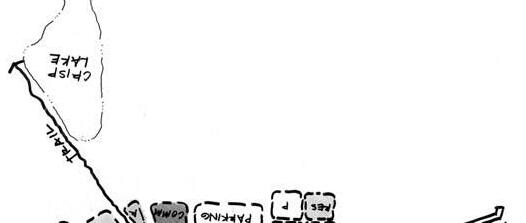
The most viable location for the majority of this new demand is in the three primary redevelopment nodes along U.S. 24 Highway at River Boulevard, Sterling Avenue and the Fairmount Business District. These areas are capable of supporting additional shopping center space in the form of neighborhood and specialty services.
March 2006 2-9
City of Independence, Missouri
The People and The Economy
U.S. 24 Highway Corridor Study
Corridor Study Area; 2003 – 2020 2003 2020 Change Population 16,73920,639 3,900 Per Capita Income $18,653 $18,653 $0 Total Personal Income $312,232,567$384,979,267 $72,746,700 % Income Spent on Retail Goods % Services 38%38% 0% Estimated Total Retail Sales $118,648,375$146,292,121 $27,643,746 Retail Sales Pull Factor 0.900.90 0.00 Estimated Retail Sales $106,783,538$131,662,909 $24,879,371 Average Retail Sales Per Square Foot $240 $240 $0 Supportable Retail Space (Sq. Ft.) 444,931548,595 103,664 Required Land Area (FAR of 0.20) 51.163.0 11.9 Source: Canyon Research Southwest, Inc.; April 2004.
Year Employment Growth Conservative Moderate 2000-2020 164 32,800 Sq. Ft. 36,900 Sq. Ft. Annual Average Demand 1,640 Sq. Ft. 1,845 Sq. Ft. Source: Canyon Research Southwest, Inc.
3. Hotel Room Demand
The Queen City Motel at 11402 E. U.S. Highway 24 is the only hotel operating within the Corridor Study Area. No bed and breakfasts operate within the Corridor Study Area, though several are located within or near Independence Square, catering primarily to the tourism market. The bed and breakfasts operate within older historic homes with period furnishings, providing a setting that appeals to heritage tourists.
Average occupancy levels and revenue per available rooms are presently insufficient to support economically feasible new hotel construction within Eastern Jackson County. The short-term prospects for new hotel construction are also not favorable. However, as the existing properties achieve stabilized occupancies and the local business community and population continues to grow, the long-term demand for additional hotel rooms will materialize.
The size and composition of the Eastern Jackson County employment and population base forecast for 2020 suggests at an average stabilized occupancy rate of 70 percent an additional 1,250 to 1,500 hotel rooms are warranted over the next two decades. Based on the location of hotel room generators and the tendency of national hotel chains to develop properties adjacent to freeways, the most appropriate location for future hotel development is within the Interstate 470 and 70 corridors. Due to the proximity of the Corridor to the Truman Library and religious attractions, the tourist segment will serve as the primary source of hotel room demand. Unfortunately, the absence of freeway exposure greatly limits the Corridor Study Area’s potential to support future hotel development. Through the year 2020, additional demand for hotel rooms within the Corridor Study Area is estimated at 30 to 45 lodging rooms.
Site Selection Evaluation
This section of the report evaluates the potential for the Corridor Study Area to support retail, professional office and hotel development.
1. Retail Site Evaluation Criteria
Shopping center developers and major retailers evaluate potential sites based on a series of site specific criteria. Common site selection criteria include appropriate zoning; availability of infrastructure; parcel size; visibility and exposure; accessibility; trade area demographics and the level of direct competition. Three potential retail nodes were evaluated within the Corridor Study Area, including the U.S. 24 Highway intersections at River Boulevard and Sterling Avenue as well as the Fairmount Business District. The suitability for future development of each retail node with a variety of shopping center formats has been evaluated.
Adequate Zoning
The U.S. 24 Highway frontage is zoned primarily for strip commercial use. Therefore, freestanding retail and shopping center uses adjacent to U.S. 24 Highway are legally permissible.
Availability of Infrastructure
While some site-specific infrastructure improvements will likely be required, sufficient public utilities are available along U.S. 24 Highway to facilitate retail and shopping center development.
Parcel Size and Dimensions
Feasible retail development sites generally range in size from 1 to 3 acres for freestanding retailers and strip shopping centers; 8 to 15 acres for neighborhood shopping centers anchored by a supermarket; 15 to 40 acres for community centers; and 25 to 80 acres for power and lifestyle centers. Each shopping center type also requires an orientation towards the most prominent adjacent arterial. Freestanding 100,000+ square foot big-box retailers such as Home Depot and Wal-Mart Supercenter generally require a 15 to 25-acre site located at a section-line corner.
While the existing commercial zoning legally permits retail uses, along most of U.S. 24 Highway the depth of the commercial zoning is too narrow to assemble a suitable sized site to accommodate community or power center development. The strip commercial zoning and excellent highway exposure provides the opportunity to support continued development of strip centers and 1.0+ acre parcels housing restaurants, banks, and convenience stores.
The sloping topography and strip commercial zoning along U.S. 24 Highway place constraints on the opportunity to accommodate development of a freestanding 100,000+ square foot big-box retailer such as a discount department store, warehouse club or home improvement center. Through property assemblage the potential may exist to support a 100,000+ square foot freestanding big-box retailer at the northwest corner of River Boulevard and U.S. 24 Highway.
The most suitable shopping center format for future development along U.S. 24 Highway is a neighborhood shopping center anchored by a supermarket. The U.S. 24 Highway intersections at Sterling Avenue and River Boulevard represent the premier neighborhood shopping center development sites due to their corner locations. Each intersection is built-out with potential redevelopment sites created through property assemblage and considerable site work.
The Sterling Ridge Shopping Center at the southeast corner serves as a potential neighborhood shopping center redevelopment site, though considerable site work will be required. Additional property to the south needs to be assembled to create a deeper site. The southwest corner houses a new CVS, and therefore is not likely a potential redevelopment site. Several properties could be assembled at the northeast corner to create a potential development site (American Sterling Bank, Sterling Lanes Bowling, O’Reilly Auto Parts and Jim’s Family Restaurant). This site
March 2006 2-10
The People and The Economy
City of Independence, Missouri U.S. 24 Highway Corridor Study
City of Independence, Missouri
is deeper than the Sterling Ridge Shopping Center parcel, allowing for a more efficient neighborhood shopping center design. While attempts have been made to redevelop the northwest corner with a neighborhood center, the site’s sloping topography and multiple property ownership will make feasible development difficult.
The retail development formats best suited for the Fairmount Business District include strip commercial and specialty centers. Specialty centers are developed around a retail theme (i.e., dining, entertainment, etc.) and a unique architectural character. The Fairmount Business District’s history and unique architecture are ideal for fostering specialty center development.
Visibility and Exposure
Visibility and traffic volumes have a major impact on customer and retail sales volumes. National and regional big-box retailer, restaurant, convenience store and bank chains require major arterial frontage, and generally prefer a section-line corner location.
U.S. 24 Highway provides the necessary visibility and exposure to attract a supermarket or bigbox retailers. Missouri Department of Transportation reported average daily traffic volumes for 2000 on U.S. 24 Highway of 25,634 east of the Interstate 435 interchange and 22,326 vehicles west of MO 291.
Accessibility
The larger the shopping center type the larger the geographic trade area. Therefore, while strip and neighborhood shopping centers require adequate local and on-site accessibility, larger community and power centers as well as big-box retailers rely on an efficient regional transportation network that typically includes a mix of major streets and freeways. The Corridor Study Area possesses a sufficient highway and major arterial network to support strip center, specialty center and neighborhood shopping center formats. The U.S. 24 Highway interchanges at Sterling Avenue and River Boulevard both are signalized, allowing for sufficient site ingress and egress to facilitate big-box retailers and neighborhood shopping centers.
Supermarket Trade Area Demographics
Neighborhood centers anchored by supermarkets generally require a minimum primary trade area population of 12,000 residents and a median household income of $35,000. Claritas, Inc. provided demographics for the primary trade area within a 1-mile radius of the U.S. 24 Highway intersections at Sterling Avenue and River Boulevard (see Market Study).
The U.S. 24 Highway and Sterling Avenue site supports a current 1-mile radius population of 10,585 residents and a median household income of $33,725. In 2008, primary trade area demographics are forecast at 9,738 residents and a median household income of $38,110. For 2003, total food store sales within the primary trade area totaled $19.7 million. At average
U.S. 24 Highway Corridor Study
supermarket sales of $486 per square foot as reported by the International Council of Shopping Centers, 40,630 square feet of supermarket space is supportable. Through 2008, trade area demographics are insufficient to support new neighborhood center development. What is needed to support a supermarket is an additional 1,500 residents within the 1 - mile primary trade area.
The U.S. 24 Highway and River Boulevard site supported a 2003 primary trade area population of 10,099 residents and a median household income of $31,924. In 2008, primary trade area demographics are forecast at 9,360 residents and a median household income of $35,910. For 2003, food store sales were estimated at $19,040,700, capable of supporting 39,178 square feet of supermarket space. Through 2008, trade area demographics are insufficient to support neighborhood center development. What is needed to support a supermarket is an additional 2,000 residents within the 1-mile primary trade area.
Big-Box Retailer Trade Area Demographics
Feasible community center, power center and big-box retailer development generally requires a primary trade area population of 80,000 to 100,000 people and a median household income of at least $35,000. The primary trade area for each of the retail formats generally encompasses a 3 to 5-mile radius from the site. The intersection of U.S. 24 Highway and River Boulevard is the most viable community/power center and big-box retailer development site within the Corridor Study Area. The intersection of U.S. 24 Highway and River Boulevard possesses sufficient primary trade area demographics to support big-box retailer development.
The Fairmount Business District currently caters to the local residents. For the Fairmount Business District to support specialty shopping center development it must operate a retail trade area which extends far outside the immediate neighborhood.
An estimated 142,019 people reside within a 5-mile radius of the Fairmount Business District. The median household income of $34,883 is 33 percent below the metro average of $52,119. These below average income levels don’t bode well for the potential to support upscale specialty retailers. The below average income levels also suggest the 5-mile radius trade area will generate below average retail sales volumes and supportable inventory of retail shop space.
A retail trade area’s age composition is an important factor to consider because personal expenditures change as an individual ages. The 5-mile radius trade area population for the Fairmount Business District consists primarily of young families with children as well as seniors, supporting a median age of 35.61 years (compares to metro norm of 35.94 years). Adults aged 25 to 44 years old, which are large consumers of durable goods, entertainment and personal services, account for 25.8 percent of the trade area population. Children under the age of 18 years account for 26.06 percent of the population, driving demand for toy stores, day care centers, stores with baby care merchandise, department stores, supermarkets, movie theaters and entertainment, clothing stores, and fast food restaurants. Residents 65+ years account for 14.44 percent of the trade area population base, supporting drug stores and medical care services.
March 2006 2-11
The People and The Economy
Direct Competition
Redevelopment of a neighborhood shopping center along U.S. 24 Highway will require attracting a supermarket. Just two small-scale supermarkets currently operate along U.S. 24 Highway, including Apple Market at the southeast corner of Sterling Avenue and Thriftway at the northwest corner of River Boulevard. The closest major supermarkets located outside of the Corridor are located along 23rd Street: Sun Fresh at Sterling Avenue; Hy-Vee at Lee’s Summit Road; and two Aldi stores east of Sterling Avenue and east of Lee’s Summit Road. An Apple Market is also located within Chrisman Plaza on U.S. 24 Highway east of Noland Road. During 2003, the Corridor Study Area supported food store sales of $30.3 million. At average supermarket sales of $486 per square foot as reported by the International Council of Shopping Centers, 62,338 square feet of supermarket space is supportable within the Corridor Study Area.
No big-box retailers currently operate within the Corridor Study Area. The Kmart store at MO 291 and U.S. 24 Highway is the closest discount department store, over two miles from the Truman Library. The closest concentrations of big-box retailers include Noland Road south of 23rd Street and the Independence Center node.
The primary trade area demographics for each potential neighborhood shopping center redevelopment sites are sufficient to support 40,000+ square feet of supermarket space, which greatly exceeds the size of both existing supermarkets (Apple Market and Thriftway). Rather than supporting new neighborhood shopping center development at the U.S. 24 Highway intersections at Sterling Avenue and River Boulevard, a viable redevelopment option is razing the existing shopping centers and supermarkets in favor of neighborhood shopping centers anchored by 40,000+ square foot modern stores. The new shopping centers would incorporate small shop space housing such neighborhood-based businesses as restaurants, dry cleaners, beauty salons, video rentals, cards and gifts, home electronics, florists and bike shops.
The potential is limited for the U.S. 24 Highway Corridor to support freestanding big-box retailers such as discount department stores and home improvement stores. The primary constraint includes assembling a 15 to 25-acre site sufficient to accommodate a big-box retailer. The northwest corner of U.S. 24 Highway and River Boulevard represents the only potential big-box retailer site.
The retail redevelopment formats best suited for the Fairmount Business District include strip commercial and specialty centers. Specialty centers are developed around a retail theme (i.e., dining, entertainment, tourism, etc.) and a unique architectural character. The Fairmount Business District’s long history and unique architecture are ideal for fostering specialty center development.
2. Office Site Evaluation Criteria
A feasible office building site possesses the following characteristics: excellent location and access; proximity to a large and diverse labor pool; appropriate parcel size and shape; and compatibility with adjacent land uses. The bulk of suburban office space within the U.S. is generally located within a freeway corridor. The feasibility of the Corridor Study Area as a future office location was evaluated using these site selection criteria.
Location
As an office location the Corridor Study Area suffers from the absence of direct freeway access and exposure, small inventory of existing office space, and poor market perception. On a positive note, re-population of the Corridor Study Area could generate modest demand for such servicerelated businesses as insurance agents, financial planners, travel agents, etc.
Proximity to Labor Pool
The Corridor Study Area possesses a very small inventory of executive housing which is critical in fueling office demand by small, independent companies that are locally owned. According to the Mid-America Regional Council, the Independence labor force maintains below average levels of employment in managerial, business and financial (10.6%); computer and mathematical (2.2%); architectural and engineering (1.4%); legal (0.7%) and other professions (7.1%) which suggests below average demand for office space. Data published by the Mid-America Regional Council also indicates that the Corridor Study Area employment base maintains a below average concentration of office workers.
Parcel Size and Shape
Most existing office space in Eastern Jackson County consists of 1 to 3-story garden or single tenant office product. The existing used automobile dealerships along U.S. 24 Highway possess the necessary size, access and visibility to support redevelopment as office uses. The opportunity also exists for the renovation and conversion of commercial buildings within the Fairmount Business District to office use.
Surrounding Land Uses
Existing and/or proposed land uses should have the ability to enhance an adjacent site’s potential as a professional office location. One of the attractions of the Fairmount Business District as an office location is the potential to support a mixed-use urban setting.
To conclude, it has been determined that the Corridor Study Area is a marginal professional office location, suffering from a poor image; absence of freeway exposure; reduced access to necessary labor pool; poor area demographics; and small inventory of existing office space, executive
March 2006 2-12
The People and The Economy
City of Independence, Missouri U.S. 24 Highway Corridor Study
City of Independence, Missouri
housing, and support services. Re-population of the Corridor Study Area could generate demand for such service-related businesses as insurance agents, financial planners, and travel agents. One of the attractions of the Fairmount Business District as an office location is the potential to support a mixed-use urban setting. Overall, future professional office space demand within the Corridor Study Area is forecast to be minimal.
3. Hotel Site Evaluation Criteria
The competitive market strengths and weaknesses of the Corridor Study Area as a potential hotel location have been examined to determine the probability of supporting future development.
Access and Visibility
Freeway frontage is particularly important for budget, economy and limited-service hotels, providing for an excellent marketing window. While the Corridor Study Area is accessible from Interstate 435 and MO 291, it lacks frontage onto these highways. This site deficiency is one of the primary reasons no major hotel chains operate within the Corridor Study Area.
Proximity to Room Demand Generators
The primary sources of hotel room demand for existing properties in Independence include: 1) corporate and business travelers; 2) leisure travelers; and 3) groups. Truman Presidential Museum & Library (100,000 visitors annually) is located within the eastern portion of the Corridor Study Area. Major attractions located in close proximity to the Corridor Study Area include the Mormon Visitor Center, Community of Christ Temple and Auditorium, Church of Christ, the Truman Home, 1827 Log Courthouse, National Frontier Trails Museum, and Independence Square. Due to the distance from area employment centers and Interstates 70 and 435, the Corridor Study Area isn’t conveniently accessible to existing business traveler and group hotel demand generators.
Proximity to Existing Hotel Properties
Existing hotels in Independence are concentrated around Independence Center and Interstate 70. Recent hotel development has concentrated at Independence Center, offering hotel guests convenient freeway access, close proximity to major employers and ample availability of restaurants, shopping and entertainment. The independently operated Queen City Motel is the only existing hotel operating in the Corridor Study Area.
Site Characteristics
Necessary infrastructure is available throughout the Corridor Study Area. A 1.5 to 3.0-acre site is typically sufficient to accommodate development of a budget, limited-service or full-service hotel. Given the large number of under-utilized properties (i.e., used car lots), creating a suitable development site in the Corridor Study Area for hotel development would not be difficult or cost
U.S. 24 Highway Corridor Study
prohibitive. The greatest opportunity to support future hotel development would be within the eastern portion of the Corridor Study Area in close proximity to existing heritage tourism sites. Bed and breakfasts would be best accommodated by existing residential properties.
To conclude, the potential is limited to support future hotel development in the Corridor Study Area due to the lack of a freeway location and a major hotel room demand generator such as a convention center or large employment base. Heritage and religious tourism represents the largest source of hotel room demand within the Corridor Study Area. Lodging alternatives include a small boutique hotel or bed and breakfast.
Competitive Retail Market Summary
Assuming the Corridor Study Area is repopulated with 3,900 residents through the year 2020, the three potential retail nodes along U.S. 24 Highway at River Boulevard, Sterling Avenue and the Fairmount Business District are forecast to support an additional 114,000 square feet of shopping center space. Over the same time frame the balance of the Corridor Study Area is forecast to absorb up to an additional 60,000 square feet of retail space taking the form of strip centers and small freestanding retailers such as restaurants, banks, auto parts stores, and convenience stores.
The most viable retail formats supportable within the Corridor Study Area’s three potential retail nodes include neighborhood, strip and specialty centers. The U.S. 24 Highway intersections at River Boulevard and Sterling Avenue represent the most viable neighborhood shopping center redevelopment sites. Prior to feasible new development the 1-mile primary trade area must support an additional 1,500 to 2,000 new residents.
The primary trade area demographics for each potential neighborhood shopping center redevelopment sites are sufficient to support 40,000+ square feet of supermarket space, which greatly exceeds the size of both existing supermarkets (Apple Market and Thriftway). Rather than supporting new neighborhood shopping center development at the U.S. 24 Highway intersections at Sterling Avenue and River Boulevard, a viable redevelopment option is razing the existing shopping centers and supermarkets in favor of neighborhood shopping centers anchored by 40,000+ square foot modern stores. The new shopping centers would incorporate small shop space housing such neighborhood-based businesses as restaurants, dry cleaners, beauty salons, video rentals, cards and gifts, home electronics, florists and bike shops.
The potential is limited for the U.S. 24 Highway to support 100,000+ square foot freestanding bigbox retailers such as discount department stores and home improvement stores. The primary constraint is the ability to assemble a 15 to 25 - acre site sufficient to accommodate a big-box retailer. The northwest corner of U.S. 24 Highway and River Boulevard represents the only potential big-box retailer site.
March 2006 2-13
The People and The Economy
Office tenants comprise only a small portion of the business community operating along U.S. 24 Highway. Just 21 office tenants are present, led by insurance agencies, construction companies, real estate companies, and income tax services. The small professional office market stems from poor market perception of the corridor; absence of freeway exposure; reduced access to necessary labor pool; below average area demographics; and small inventory of existing office space, executive housing, and support services. Re-population of the Corridor Study Area could generate demand for such service-related businesses as insurance agents, financial planners, and travel agents. Through 2020, the Corridor Study Area is forecast to absorb an additional 32,800 to 36,900 square feet of professional office space. One of the attractions of the Fairmount Business District as an office location is the potential to support a mixed-use urban setting.
Limited potential exists to support future hotel development in the Corridor Study Area. The Corridor lacks a freeway location and a major hotel room demand generator such as a convention center or large employment base. Heritage tourism represents the largest source of hotel room demand within the Corridor Study Area. Through the year 2020, demand for hotel rooms within the Corridor Study Area is estimated at 30 to 45 hotel rooms. Lodging alternatives include a small boutique hotel or bed and breakfast.
B. Competitive Residential Marketability Analysis
This section of the report evaluates the potential for the Corridor Study Area to support new residential housing.
Corridor Study Area Housing Market
Existing Housing Stock
The Corridor Study Area supports 1,187 acres of residential land, or one-third of the total land area. Low density residential accounts for 1,148 acres, followed by medium density residential with 30.8 acres and high density residential with 8.2 acres. The 2000 Census reported 8,320 housing units within the Corridor Study Area, down 6.6 percent from the inventory of 8,904 housing units present in 1990 (Figure 2-6). Only Sugar Creek experienced a gain in housing supply, with the addition of 89 housing units. Both the East (-473 units) and the West (-200 units) Submarkets reported a loss in housing supply during the 1990s. The loss in housing stock resulted from deteriorating structural conditions and subsequent structure demolition activity.
The 2000 Census reported an 8.2 percent vacancy rate for the Corridor Study Area housing stock, led by the East Submarket with a 5.8 percent vacancy rate. By submarket the vacancy rate was reported at 5.8 percent for East Submarket; 6.8 percent vacancy rate for Sugar Creek Submarket and 11.0 percent for the West Submarket. The West Submarket suffered from a vacancy rate of 11.0 percent. The 1990 Census reported a cumulative vacancy rate of 9.3 percent within the
Corridor Study Area, led by Sugar Creek Submarket at 7.0 percent. The East Independence Submarket experienced a significant decline in vacancy rate during the 1990s, dropping from 8.2 percent in 1990 to 5.8 percent by 2000.
As reported by the 2000 Census, 58.2 percent of the housing units within the Corridor Study Area were owner-occupied (Figure 2-7). This falls well below the metropolitan Kansas City home ownership rate of 67.9 percent. The high rate of rental housing is consistent with the Corridor Study Area’s older population and lower than average educational attainment and household income levels. Sugar Creek’s home ownership rate of 66.8 percent is consistent with the metro average. Conversely, the West Submarket reported a home ownership rate of just 54.5 percent. According to interviews with area realtors, the submarket’s low home ownership rate is largely attributed to the dominance of small, older homes and location within the less desirable Kansas City School District.
The Corridor Study Area maintains a mature housing stock (Table 2-16). The average construction date for owner-occupied housing units was 1949, with the bulk of housing constructed during the 1950s and prior to 1940. Just 4.08 percent of the owner-occupied housing stock has been built since 1980. The West Submarket maintains the oldest housing stock with a median year built of 1944. Sugar Creek supports the newest housing product with a median year built of 1957.
Rental housing within the Corridor Study Area is slighter newer on average, with the median unit built in 1958. A total of 9.62 percent of the renter-occupied housing stock was built since 1980. The West Submarket supports the largest inventory of renter-occupied housing units. Due to the age of the Corridor’s housing and high rate of rental units, little re-investment has occurred and property values have lagged. Consult the table on the following page for a breakdown of the Corridor Study Area’s housing stock by year built and product type.
March 2006 2-14
The People and The Economy
City of Independence, Missouri U.S. 24 Highway Corridor Study
Figure 2-6
0 1,000 2,000 3,000 4,000 5,000 6,000 7,000 8,000 9,000 EastWestSugar Creek Total Corridor Study Area Housing Stock 1990 2000
City of Independence, Missouri
Owner-occupied housing product within the Corridor Study Area consists of small homes with 2 and 3-bedroom models accounting for over 80 percent of the stock. By comparison, new suburban homes are generally much larger possessing 3 and 4-bedrooms. The West Submarket, which maintains the oldest housing stock within the Corridor Study Area, also possesses the smallest housing product dominated by 2-bedroom models. The West Submarket’s large inventory of small, older homes has led to an increasing dominance of rental housing and low property values.
Three-quarters of the rental housing stock within the Corridor Study Area consists of 1 and 2bedroom units (Table 2-17). The East Submarket maintains the largest inventory of 1-bedroom rental units. This antiquated housing stock suffers from below average rental rates and depressed property values.
U.S. 24 Highway Corridor Study
Table 2-16 Corridor Study Area Housing Stock – Year Built
Mix
Owner- and Renter-Occupied Housing Units
Housing Values and Rents
According to the 2000 Census, the median housing value for the Corridor Study Area of $58,500 was 44 percent below the median of $104,700 for the metropolitan Kansas City area (Table 2-18). Over one-third of the housing stock within the Corridor Study Area was valued between $40,000 and $79,999. These well below average housing values stem from the Corridor’s old, small and antiquated housing product. The West Submarket supports the lowest median value of just $45,000, which may be a result of being located within the Kansas City School District as well as maintaining the Corridor Study Area’s oldest and smallest housing product. The Corridor’s well below average housing values creates the opportunity to foster an affordable entry-level housing market for singles, empty nesters, and young families.
According to data provided by the Multiple Listing Service (MLS), from January 1, 1999 through October 31, 2003, a total of 1,771 single-family homes sold within zip codes 64050, 64053 and 64054. Sales prices ranged from $700 to $325,000.
March 2006 2-15
The People and The Economy
Figure 2-7
Sugar Total % of Time Period East West Creek Units Total Owner-occupied Housing Units 1,641 1,737 1,066 4,444 100.00% 1999 to March 2000 0 0 0 0 0.00% 1995 to 1998 11 0 12 23 0.52% 1990 to 1994 5 6 15 26 0.59% 1980 to 1989 11 56 65 132 2.97% 1970 to 1979 80 47 121 248 5.58% 1960 to 1969 328 136 207 671 15.10% 1950 to 1959 480 320 264 1,064 23.94% 1940 to 1949 128 417 187 732 16.47% 1939 and earlier 598 755 195 1,548 34.83% Median 1950 1944 1957 1949 Renter-occupied Housing Units 1,218 1,451 529 3,198 100.00% 1999 to March 2000 0 0 0 0 0.00% 1995 to 1998 6 16 12 34 1.06% 1990 to 1994 0 20 6 26 0.81% 1980 to 1989 154 53 41 248 7.75% 1970 to 1979 262 235 80 577 18.04% 1960 to 1969 154 304 75 533 16.67% 1950 to 1959 254 341 122 717 22.42% 1940 to 1949 93 153 95 341 10.66% 1939 and earlier 295 329 98 722 22.58% Median 1961 1957 1957 1958 Source: U.S. Census.
0.0% 10.0% 20.0% 30.0% 40.0% 50.0% 60.0% 70.0% EastWestSugar Creek TotalMetro KC
Owner Renter
of
City of Independence, Missouri
Because the Corridor Study Area’s rental market is dominated by older and smaller housing product, achievable rents fall short of both the metro Kansas City and Independence averages (Table 2-19). Specifically, the median contract rent within the Corridor is $382 per month, compared to the metro rate of $473 and $409 for Independence. The contract rent for half of all Corridor Study Area rental units ranges from $300 to $449 per month. Contract rents are the highest within the East Submarket ($417) and lowest within the West Submarket ($346). The median contract rent in Sugar Creek is $400 per month. The West Submarket maintains the largest inventory of rental housing, however, the stock is the oldest, offers the smallest units, and garners the lowest rents. The Corridor’s low rents pose a major constraint in the ability to support financially feasible development of new market rate rental housing. To support short-term development of rental housing, financial subsidizes will likely be required.
U.S. 24 Highway Corridor Study
Table 2-18 Corridor Study Area Housing Values; 2000 Census
Redevelopment Activity
Since 1980, very little new home construction has taken place within the Corridor Study Area. However, with the assistance of the Midtown/Truman Road Corridor Redevelopment Corporation considerable residential property reinvestment has taken place within the eastern portion of the Corridor Study Area south of U.S. 24 Highway. The Midtown/Truman Road Corridor Redevelopment Corporation oversees revitalization efforts in an area surrounding the Harry S Truman home. The original area was bounded, generally, by Waldo Avenue to the north; Pacific Street to the south; Pleasant Street on the east; and Forest Avenue on the west. In 2000, the City of Independence expanded the area to U.S. 24 Highway on the north; College Avenue on the south; and Spring Street on the east.
March 2006 2-16
The People and The Economy
# of Sugar Total % of Bedrooms East West Creek Units Total Owner-occupied Housing Units 1,641 1,737 1,066 4,444 100.00% No bedroom 0 0 0 0 0.00% 1 bedroom 55 126 38 219 4.93% 2 bedrooms 430 871 348 1,649 37.11% 3 bedrooms 884 548 537 1,969 44.31% 4 bedrooms 222 139 118 479 10.78% 5+ bedrooms 50 53 25 128 2.88% Renter-occupied Housing Units 1,218 1,451 529 3,198 100.00% No bedroom 56 156 12 224 7.00% 1 bedroom 628 356 122 1,106 34.58% 2 bedrooms 381 689 247 1,317 41.18% 3 bedrooms 133 205 124 462 14.45% 4 bedrooms 15 40 12 67 2.10% 5+ bedrooms 5 5 12 22 0.69% Source: U.S. Census.
Table 2-17 U.S. 24 Corridor Housing Stock – # of Bedrooms
Sugar Total % of Price Range East West Creek Units Total Metro KC Less than $10,000 0 41 12 53 0.70% 0.49% $10,000 - $14,999 0 15 7 22 0.29% 0.55% $15,000 - $19,999 5 79 0 84 1.11% 0.78% $20,000 - $24,999 21 62 21 104 1.37% 1.02% $25,000 - $29,999 0 96 18 114 1.51% 1.24% $30,000 - $34,999 32 191 30 253 3.34% 1.58% $35,000 - $39,999 51 84 75 210 2.77% 1.91% $40,000 - $49,999 107 499 122 728 9.61% 4.58% $50,000 - $59,999 421 277 162 860 11.36% 5.42% $60,000 - $69,999 389 152 112 653 8.62% 6.47% $70,000 - $79,999 329 86 169 584 7.71% 7.20% $80,000 - $89,999 114 17 117 248 3.27% 8.23% $90,000 - $99,999 119 14 47 180 2.38% 7.79% $100,000 - $124,999 57 9 35 101 1.33% 14.63% $125,000 - $149,999 94 20 41 155 2.05% 12.56% $150,000 - $174,999 10 0 23 33 0.44% 7.85% $175,000 - $199,999 0 0 0 0 0.00% 5.27% $200,000 - $249,999 19 0 7 26 0.34% 5.42% $250,000 - $299,999 6 0 7 13 0.17% 2.78% $300,000 - $399,999 0 0 0 0 0.00% 2.34% $400,000 - $499,999 0 0 0 0 0.00% 0.90% $500,000 - $749,999 0 0 0 0 0.00% 0.64% $750,000 - $999,999 0 0 0 0 0.00% 0.21% $1,000,000+ 8 0 0 8 0.11% 0.15% Median (dollars) $67,250 $45,000 $65,000 $58,500 $104,700
Source: U.S. Census.
City of Independence, Missouri
The Original and Expanded Areas contain 2,095 housing units. Property owners may participate in a parcel-specific tax abatement program that allows 25 years of property tax relief when homes are upgraded to meet standards required by the City of Independence and the M/TRC Redevelopment Corporation. The property owner receives full abatement during the first 10 years and 50 percent abatement during the remaining 15 years.
Table 2-19 Corridor Study Area Contract Rents; 2000 Census
City of Independence, Missouri U.S. 24 Highway Corridor Study

3. This scenario focuses on the development of four places of heritage (Frontier, Fairmount, Cultural and Truman), each forming the components of a healthy corridor.

Neighborhoods adjacent to the corridor will continue to be improved, consolidating parcels and infusing new housing.
New Gateways will be created including a new one as part of a Frontier Heritage Zone. This gateway area will center on Rock Creek and tell the history of the early explorers. Areas will be redeveloped with gateway commercial and interpretive uses overlooking the greenway. The area will be beatified from this gateway to the next heritage zone, Fairmount. The Truman Heritage zone will anchor the eastern part of the corridor. Streetlights and design elements will be extended to River Boulevard with a common theme related to President Truman. The heritage zone will focus on heritage tourism. New developments on the corner of River Boulevard and U.S. 24 Highway will be incorporated into the zone.
The Business District of Fairmount will form the heart of Fairmount Heritage Zone. New mixed-use developments will center on Fairmount District’s rich heritage.
New Mixed-Use areas will be connected to the Fairmount Business District and include the Cultural Heritage Zone which will center on the rich Slavic ethnic heritage of the area. New mixed-use development including commercial and residential areas will form a vital link along Sterling Avenue to a new business park.
General Commercial areas will continue to redevelop according to new design guidelines.
Heritage Zone
4. This scenario focuses on the development of four nodes, the Western Gateway, Fairmount, Sterling Avenue and U.S. 24 Highway and the Eastern Gateway.

St. Clair – Winner Road Node will be a large western gateway node from the St. Clair Neighborhood to the intersection of Winner Road. This area will focus on a softer look with a high proportion of green space. The St Clair Neighborhood would include additional residential infill and the park will be redeveloped. New development will center on the Rock Creek area, including a new trail, trailhead, bike shop and restaurant. Incentives and tax abatements will help establish new development. The intersection of Winner Road and U.S. 24 Highway will be redeveloped and include signage to both the Fairmount Business District and the Englewood area. A loop trail will continue along Rock Creek, connecting to Arlington Avenue, Fairmount Park and the new Business Park. It will then connect to the Fairmount Business District. Themed
signage, curb and sidewalk would be carried from this area to Winner Road, setting the stage for the entrance to the Fairmount Business District.
Truman Library Node will form the study area’s eastern gateway. Streetlights and design elements will be extended to Forest. A new development at River Boulevard, including a new multi-family residential and supermarket will be developed with a suitable design theme.
Fairmount BD Node will form another vital node. It will include community services such as a health center, community center, assisted living and library. The area will also focus on business incubation for artists, antiques and bookstores.
Sterling Node will be a mixed-use area centered on Sterling Avenue and U.S. 24 Highway. This area includes new commercial development. Areas west of Bundschu Park adjacent to U.S. 24 Highway will be redeveloped and include new commercial development fronting U.S. 24 Highway. Complementary medium and high density residential uses will be situated along arteries to the area. New single-family residential uses will be developed along the southern edge of Bundschu Park.
New Mixed-Use areas will be connected to the Fairmount Business District node and include a new residential area center on Ash. The area will include new street trees, lighting, curbs and sidewalks, trail, bike lanes, intersection improvements, new homes, housing rehabilitation programs, new commercial services for elderly. The area will form a vital connection between the Fairmount Business District and the new business park in Sugar Creek.
Neighborhoods adjacent to the corridor will continue to be improved, consolidating parcels and infusing new housing.
General Commercial areas will continue to redevelop according to new design guidelines.
After reviewing the opportunities and constraints along the Corridor and examining a number of alternative land use associations, a number of common themes emerged. Potential redevelopment options were tested for policy feasibility, market demand feasibility, and on-theground feasibility. Discussing the full range of options for redevelopment allowed the Technical Advisory Group, Steering Committee, and public to develop an ambitious yet realistic palette of preferred activities that will stimulate redevelopment. Based on their input, a clear plan emerged, which is described in the following chapter.

The Building Blocks 4-7 March 2006
March 2006
City of Independence, Missouri
5 - 1
U.S. 24 Highway Corridor Study
Framework Plan
I. Introduction
Successful revitalization of the Corridor will require a comprehensive and coordinated approach to social services, housing improvements, and economic development by the Cities of Independence and Sugar Creek. It is based on the premise that obstacles to economic revitalization, namely decreasing population, deteriorating housing stock, retreating businesses, and crime, can be solved only through a coordinated effort. No single public agency or private investor can solve these complex problems alone.
In this light, building on the efforts of current, effective programs is a key building block. For example, the Weed and Seed Strategy, a collaborative effort by the United States Attorney, Jackson County, and the City of Independence, as well as several community-based organizations and non-profits, exemplifies the integrated approach required to resolving the complex problems faced along the U.S. 24 Highway Corridor area. These efforts, in combination with the market opportunities described in Chapter 2 create a bright outlook for the Corridor. The Plan outlines a comprehensive, long-term strategy for the revitalization of the Corridor. The Framework Plan, illustrated in Figure 5-1 located on page 5-3, includes the following components:
Corridor Wide (CW) principles that apply to the entire Corridor which help ensure the longterm health of the area.
Residential Neighborhoods (NH) offering a range of housing types for new families and seniors will surround the Corridor.
Fairmount Business District (FB) will form the economic and civic heart of the area. Development intensity, land use, building height and urban design elements will create a sense of identity for the Corridor.
Mixed-Use (MU) centers will concentrate on commercial, office and housing in compact nodes.
Commercial (CD) strip areas will be redeveloped, reinvented and revitalized.
Gateways (GW) of appropriate character consisting of commercial and civic uses will anchor the eastern and western portions of the Corridor.
Transportation (TS) system consisting of multi-modes will connect neighborhoods with the Fairmount Business District, mixed-use areas, and other destinations in the community and region.
Natural Resources, Parks, and Open Space (NR) will create the foundation of a comprehensive greenway system, improving the quality of life of residents and attracting new families to the area.
Within the key component sections of Gateways, the Fairmount Business District, and Mixed-Use Areas, the plan outlines potential development scenarios that were developed by the staff, Technical Advisory Group, Citizens Advisory Group and the community. As demonstrated in Chapter 4, these potential development scenarios describe one of many potential futures for the area. Key to these scenarios is the concept of directing future growth into key development nodes and the matching of future development with forecasted additional market demand of approximately 76,000 square feet of neighborhood shopping space. The scenarios also considered the potential re-population of adjacent neighborhoods which would result in the additional demand of 40,000 square feet.
Principles and Policies
Principles and policies provide guidelines to help achieve the vision and goals expressed by the community for the Corridor. The principles and policies statements described below were developed through a 12-month process which consolidated the values and ideals expressed through stakeholder interviews, public workshops, planning staff meetings, a Steering Committee, and a Technical Advisory Group. Previous plans described in Chapter 1 were consulted for general direction when developing specific principles and policies.
A principle is defined as a general or fundamental rule, doctrine or assumption; a policy is defined as a definite course or method of action, selected to guide and determine present and future decisions. The following pages contain a complete list, with the principles in bold. The first section contains principles and policies that are applicable Corridor-Wide (CW). The next six sections are directly related to the places depicted in the Plan. Each policy has been named and is also identified by letters that designate the section of the Plan where it is located and numbers that indicate the sequence of principles and policies within each section. In the Transportation section, for instance, a policy might be called “T-2.3.” This would be “T,” a Transportation policy; “2,” in the second principle of the Transportation section; and “3,” the third policy for that principle. Additional information on tools related to principles and policies can be found in Chapter 6.
Throughout the planning process, residents of Northwest Independence have faced challenging decisions about how the Corridor might redevelop. Each principle and policy represents a choice, and each choice requires balancing complex, and sometimes conflicting, issues. Each represents a significant decision to be made about the future form and pattern of the area. Additionally, the comprehensive nature of revitalization efforts requires that each principle and policy be understood in its proper context. The spirit of this Plan is one that:
March 2006
U.S.
Framework Plan 5 - 1
City of Independence, Missouri
24 Highway Corridor Study
• Strives to achieve a fair and proper balance among conflicting interests, to protect the rights of citizens, and to affirm community values as they have been expressed by citizens throughout the community participation process.
• Is designed to realize interrelated goals for land use, historic preservation, housing, transportation and economic development.
• Builds on desirable existing conditions while recognizing and improving undesirable conditions.
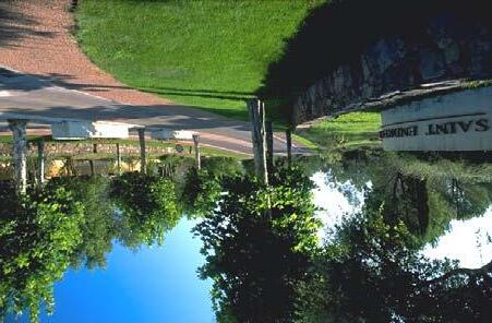
• Uses the authority and influence of local government to realize this vision by coordinating many public efforts and developing partnerships with private sector efforts to support this vision.
II. Plan Components
Corridor-Wide (CW)
This section contains principles that apply to the length of the Corridor as defined by Figure 5-1, the Framework Plan located on page 5-3.
Principle CW 1. The principles and policies of the Plan should be consistent with the general direction set forth in related plans.
Principle CW 2. The Plan should utilize the private market to make change work for the Corridor.
Policy CW 2.1 Market Based. Sugar Creek, Independence, the Northwest Communities Development Corporation, cooperating agencies, developers and the community will use current and induced market demand to redevelop key locations of the Corridor. A market based analysis demonstrated the need to increase the Corridor’s housing stock, focus development at key intersections of Sterling Avenue, River Boulevard and U.S. 24 Highway and then redevelop key areas such Fairmount Business District, and areas near Crisp Lake and Bundschu Park.
Policy CW 2.2 Phasing. The Northwest Communities Development Corporation, the Cities of Independence and Sugar Creek, cooperating agencies, developers and the community should work toward implementing the plan in phases over a 20 year period.
Policy CW 2.3 Implementation. The Cities of Independence and Sugar Creek, the Northwest Communities Development Corporation, cooperating agencies, developers and the community should work toward completing each implementation item necessary to achieve the vision outlined in the Plan.
Principle CW 3. The revitalization of the U.S. 24 Highway Corridor will be based on Public and Private Partnerships.
Policy CW 3.1 Private Partners. The City will continue to work with the development community to enhance the services, amenities, and products available in the Corridor by providing predictable permitted uses, design standards, and an efficient development review system.
Policy CW 3.2 Public Partners. The City will continue to coordinate and implement revitalization strategies with the City of Sugar Creek, Sugar Creek Community Development Corporation, Northwest Communities Development Corporation, the City of Kansas City, MODOT and other allied agencies such as the Mid-America Regional Council (MARC) to achieve Plan objectives.
Policy CW 3.3 Key Public/Private Initiatives. The City will continue to coordinate, support and assist BP and the City of Sugar Creek with the implementation of the Sugar Creek Business Park, community center, housing projects and the connection to the Lewis & Clark Expressway.
Principle CW 4. The physical environment of the Corridor will be improved as a functional, beautiful, decent, healthful, interesting, and efficient setting for human activities.
Policy CW 4.1 Creation of Streetscape. New streetscape features will first be added to the redevelopment areas and then to the remainder of the Corridor over the next 20 years. These features will be implemented in conjunction with the design and construction of each area.
Policy CW 4.2 Streetscape Improvements. Deteriorated streetscape, especially sidewalks, should be repaired and upgraded.
March 2006
Framework Plan 5 - 2
City of Independence, Missouri U.S. 24 Highway Corridor Study
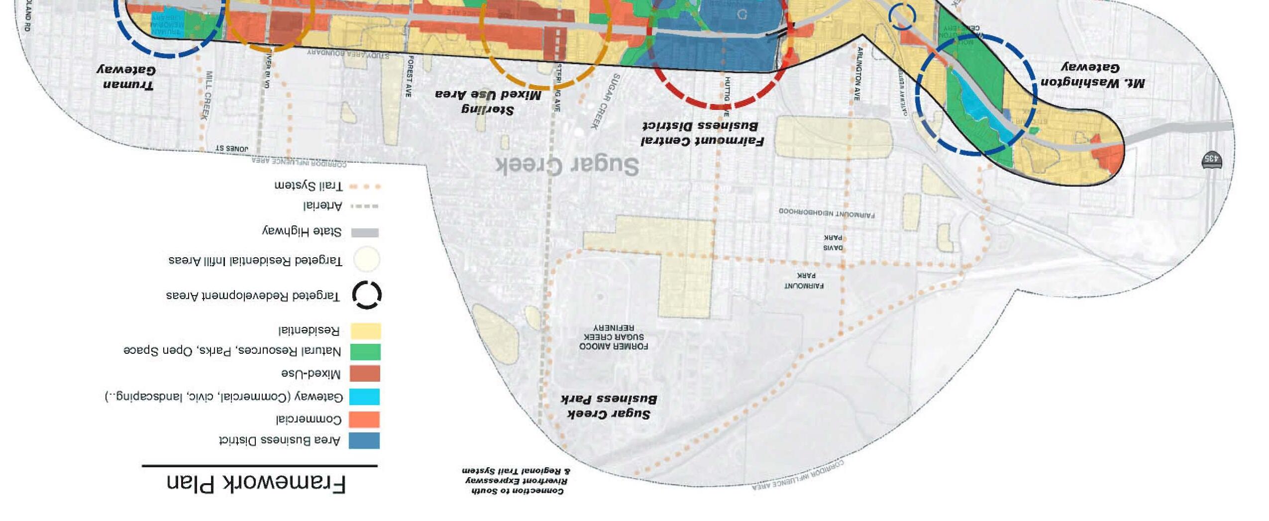
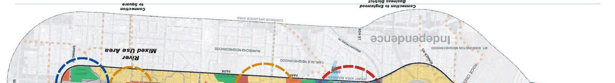
March 2006
Framework Plan 5 - 3
City of Independence, Missouri U.S. 24 Highway Corridor Study
N
Figure 5-1
Policy CW 4.3 Visual Blight. The appearance of the area will be improved through the removal and prohibition of overhead utility line and billboards.
Policy CW 4.4 Sign Enforcement. The Sign Code will be enforced and new sign regulations developed to further improve the physical environment of the Corridor. This should include the prohibition of pole signs and billboards.
Policy CW 4.5 Image. Transportation and streetscape elements should be designed to create a unified, cohesive and significant image.
Policy CW 4.6 Separation. Vehicular and pedestrian traffic will be separated with landscape and hardscape barriers.
Policy CW 4.7 Landscaping. Developers will be encouraged to plant trees and shrubs or provide public art.
Policy CW 4.8 Public Spaces. New commercial development and redevelopment opportunities will incorporate public spaces to create a prominent civic component in core commercial areas.
Policy CW 4.9 Location of Commercial / MixedUse. Mixed-use developments should be encouraged and when possible concentrated in the Fairmount Business District or mixed-use redevelopment nodes as a way to maintain commercial viability, property values, aesthetics, quality of life, and to promote quality development.
Policy CW 4.10 Pedestrian Scale. Retail areas will be designed with a pedestrian scale and building character that is comfortable to pedestrian users.
Policy CW 4.11 Orientation. When feasible, buildings should be moved forward toward the street to screen parking and promote pedestrianoriented streetscapes. The City will encourage parking areas to be oriented to the side or behind commercial buildings. Entrances to the building shall be oriented toward the street.
Policy CW 4.12 Design Standards. Policies contained in this section should form the basis for future design standards that will be incorporated into the Independence City Code as supplemental regulations for development review of properties.
Principle CW 5. Walking, bicycling, or riding the bus will be a practical and enjoyable means of travel.
Policy CW 5.1 Multimodal Options. The City will continue to provide alternative transportation options including pedestrian and mass transit along with existing vehicular access. New sidewalks, bus routes, and pathways should be developed.
Residential Neighborhoods (NH)
The first Strategic Goal of the Independence City Council calls on the City “to revitalize and rebuild neighborhoods that contain deteriorated private property or infrastructure through a cooperative partnership with owners and tenants” (City of Independence, 2002). The City has a responsibility to ensure that residents have access to safe, secure, and healthy housing, a goal that can only be achieved in collaboration with property owners. As described earlier in this plan, renewed population growth in areas with deteriorating housing is critical to achieving economic development objectives. The rejuvenation of the Corridor’s neighborhoods will provide an opportunity for first-time homebuyers, young or small families, and retirees. These families will need new amenities that will be provided within walking distance.
Long-term improvements should not only be focused solely on housing conditions, but on how the surrounding neighborhoods function (Ferrell, 2004). Pedestrian pathways should be created that link neighborhoods to the Fairmount Business District and mixed-use areas. Each neighborhood should have a public transit stop, and many ways of getting to, through, and between it and other neighborhoods and activity centers by driving, walking and bicycling. Sidewalks and other
March 2006
Framework Plan 5 - 4
City of Independence, Missouri U.S. 24 Highway Corridor Study
Source: MARC
pedestrian improvements that improve the walkability of neighborhoods will become more important as demographics change and the population ages. At the same time, these improvements are necessary to attract younger families into the area.
Revitalizing neighborhoods will partly depend on increasing population through redevelopment and infill housing. In some areas this will include the transition from housing for seniors to housing for new families. New housing areas will be developed as part of the BP redevelopment in areas where vacant parcels can be assembled and within the redevelopment sites along U.S. 24 Highway. As depicted in Figure 5-1 on page 5-3, compatible infill should occur in targeted areas throughout the Corridor influence area. Neighborhood associations will be encouraged, and housing programs will help residents transition from rental to home ownership. For example, the long-term areas in close proximity to Crisp Lake could be developed into a primary housing area for both new families and seniors. The proximity to the Fairmount Business District and Crisp Lake could be considered a vital amenity by new residents. Parts of Crisp Lake may be opened and public access to the area provided. Greenways and trails will integrate these resources into the larger neighborhood fabric.
A variety of housing types will be provided in these neighborhoods. These housing choices will provide residents with the ability to live in these neighborhoods through all their life cycles, from raising a family to retirement. The affordability of housing in the study area provides choices to low- and moderate-income families that are not found in most suburbs.
New housing types should be provided as have been successful in other communities. Products including single-family detached homes, row houses, apartments, live/work units, condominiums and multi-unit buildings should be incorporated into the neighborhoods. New residents will be willing to pay for characteristics associated with different product types.
The following principles and policies relating to neighborhoods and housing offer a multi-faceted approach to rebuilding the Corridor’s older neighborhoods.
Principle NH 1: Through partnerships with the City, individuals, public agencies and private organizations will work to improve the quality of life in the neighborhoods by stabilizing the existing housing stock.
Policy NH 1.1 Accountability. Property owners will be accountable for the maintenance and improvement of their property through code compliance and rental licensing.
Policy NH 1.2 Access to Programs. The City and its partners will provide information regarding available resources, assistance, and on property rehabilitation programs.
Policy NH 1.3 Code Compliance. The City will assist and ensure that residents have access to safe, secure, and healthy housing types and sizes.
Principle NH 2. The City will work with individuals, public agencies and private organizations to reverse the trend of rental occupancy through the construction of new owner-occupied housing units and the conversion of existing rental units back to owneroccupied single-family units.
Policy NH 2.1 Support for Low Income Homeowners. The City will support a single family emergency minor home repair program for low and very low income homeowners.
Policy NH 2.2 Rental Inspections. The City will explore the possibility of scheduled rental property inspections to improve housing conditions.
Principle NH 3. The City will stimulate neighborhood revitalization by encouraging new housing options with a diversity of housing types and sizes throughout the Corridor.
Policy NH 3.1 Infill and Redevelopment. Through public-private partnerships, new housing products will be created on redevelopment sites along U.S. 24 Highway, where vacant lands can assemble, on areas identified by BP, along River Boulevard, adjacent to Crisp Lake and near Bundschu Park.
Policy NH 3.2 Density. The City will encourage a variety of housing types and densities within these areas to meet the needs of residents of different economic levels and age groups.
Policy NH 3.3 Incentives. The City will encourage the redevelopment of key areas using a variety of tools including the exploration of the use of waiving building development fees.
Policy NH 3.4 Circulation. The design of new housing or the redevelopment of existing housing will encourage walking, social interaction and neighborhood connectivity.
Policy NH 3.5 Traditional Neighborhood Design. New residential development will promote homes designed with traditional neighborhood principles, such as:
March 2006 City
U.S.
Framework Plan 5 - 5
of Independence, Missouri
24 Highway Corridor Study
Source: MARC
• Buildings are aligned and close to the street.
• Houses have front porches.
• Vehicle storage, garbage and mechanical equipment are away from the street.
• Recessed garage elements.
• Sidewalks on both sides of street.
• Improved landscaping.

Incorporating these concepts into future design guidelines should be investigated.
Policy NH 3.6 Introduction of Neighborhood-Related, Non-Residential Development. New services, conveniences, and/or gathering places will be supported in existing neighborhoods provided they respect the neighborhood’s positive characteristics, level of activity, and parking and traffic conditions.
Policy NH 3.7 Infrastructure. Infrastructure improvements should continue to support existing and future neighborhoods.
Policy NH 3.8 Design Standards. Policies contained in this section should form the basis for future design standards that will be incorporated into the Independence City Code as supplemental regulations for development review of properties.
Principle NH 4. The City will promote the social capital of neighborhoods.
Policy NH 4.1 Leadership Capacity. Neighborhood groups and homeowner associations will be reinvigorated. These groups will have training and opportunity to provide leadership that works toward the good of the neighborhood and the whole community.
Policy NH 4.2 Safety. In coordination with its partners, the City will support and expand the 2003 Weed and Seed Strategy, specifically but not limited to prevention, early intervention, and treatment for truancy, family violence, and crime and drug activity.
Policy NH 4.3 Gathering Places. Each neighborhood will have a safe park, school, shared facility, or other gathering space to encourage recreation and dialogue.
Policy NH 4.4 Mobility. Each neighborhood will have access to a minimum of one transit stop and pedestrian-friendly streets with adequate sidewalk width, quality, and connectivity, and traffic calming measures as needed. Neighborhoods will connect to adjacent commercial areas.
Policy NH 4.5 Education. Neighborhood residents will have access to high quality educational opportunities.
Principle NH 5. In partnership with other organizations, the City will preserve the rich cultural history of the area.
Policy NH 5.1 Historic Survey. Continue to promote surveying of unsurveyed buildings along the Corridor and Area of Influence to determine areas of greatest significance for possible listing.
Policy NH 5.2 Historic and Conservation Districts. Investigate the creation of a local or National Register Historic District for neighborhoods around Fairmount Business District.
Policy NH 5.3 Restoration. Focus historic revitalization efforts on areas that have the highest potential. Efforts should include grass-roots initiatives and tax credits programs.
Policy NH 5.4 Education. Develop a primary interpretive exhibit and satellite interpretive signage to tell the story of the history of the area.
Policy NH 5.5 Agency Coordination. Emphasize building partnerships and coalitions with a wide variety of organizations and agencies such as the State Historic Preservation Office, historical societies, the Heritage Commission and the Preservation Renaissance of Independence to increase awareness and interest in preservation of the area.
Principle NH 6. The City will involve local citizens in the planning and decision-making processes of government.
Policy NH 6.1 Communication. The City will continue to be committed to inclusive, democratic government and a continuing dialogue between government and the residents of northwest Independence.
Policy NH 6.2 Collaboration with Surrounding Residents. The City will ensure that neighbors will be advised of changes and be requested to comment on, including but not limited to, acceptable intensity and character of infill and redevelopment.
Policy NH 6.3 Support Citizens’ Efforts. The City will support efforts by citizens’ organizations to promote and improve their neighborhoods, in accordance with the following considerations:
March 2006 City of
U.S. 24
Framework Plan 5 - 6
Independence, Missouri
Highway Corridor Study
• Neighborhoods and the City will work hand-in-hand to identify neighborhood needs, resolve issues, establish lines of communication, and maintain and improve the quality of life.
• Neighborhood groups and Homeowner Associations will have training and opportunity to provide leadership that works toward the good of the neighborhood and whole community, such as addressing neighborhood concerns through matching grants which would allow residents to initiate projects for their area; and direct assistance from City staff and Northwest Communities Development Corporation members who act as neighborhood liaisons.
• Every area of the Corridor will be within a recognized neighborhood boundary and represented by a neighborhood group.
• Every neighborhood will contain a neighborhood gathering facility that people can use, such as a park, school, or other activity area.
• The City will continue to involve, advise, and support individuals and neighborhood groups in identifying and addressing issues.
Fairmount Business District (FB)
Like most first ring suburbs of Kansas City, the Fairmount Business District enjoyed enormous prosperity in the early 1900’s serving as a trolley stop and central location for destinations such as the Mt. Washington and Fairmount Amusement Parks. The decline of similar business districts and an increase in strip commercial, accompanied by decreasing population and housing conditions has reduced the area’s vibrancy.
Lessons learned from the recent renaissance of the Englewood Business District shows that the active leadership of the business community, the retention of existing businesses, private investment in key properties, and phased investments in streetscape and infrastructure improvements are critical to rejuvenating the health of historic retail districts. Kansas City has a rich tradition of successful areas that fill this role; the Country Club Plaza, Brookside, Downtown Overland Park, Prairie Village Shopping Center, Downtown Weston, Liberty Square, and Independence Square are examples of commercial areas that also instill community pride (MARC, 2004).
Building off the market demand for additional 76,000 square feet of neighborhood shopping presented in Chapter 2, the conceptual plan shown in 5-2 on page 5-9 demonstrates one vision of how to return Fairmount to a symbol of community pride. The described vision is only one possible future and serves to demonstrate the potential to reinvest in this District. In this concept, the renewed District will provide a needed identity for both the Corridor and the surrounding
neighborhoods. Its location is strategic as it is positioned in the center of the neighborhood, but also serves as the Western Gateway to the Truman Library. Key historic buildings on the south side of the Fairmount Business District will form the core of the Business District. These buildings will be preserved and the facades restored and will provide a key connection to the history of the area. Other buildings on the north side of U.S. 24 Highway and on the south side near Crisp Lake would be redeveloped. Redevelopment of commercial areas would permit an additional 30,000 to 40,000 square feet of retail space. These new landmark buildings will be a focal point as travelers pass through the District.
These two to three story buildings will have ground floor retail and upper stories will accommodate residential apartments and office uses. These services will be designed to serve local residential neighborhoods and larger trade areas with small-size specialty shops and services such as antique shops, travel agencies, art galleries, and other related activities (TND, p. 70). New uses will be unique and notable, with some uses encouraging people to visit at different times of the day. The area will serve as a destination for neighborhood residents, the region and tourists.
The Fairmount Business District will not only provide convenient locations for goods and services, but its public spaces will create a forum for dialogue, recreation, and foster a distinct sense of place. These new civic areas will include small plazas, parks, trails and courtyards. Elements within these civic spaces will celebrate the local and regional history not told in other places within the City. A primary interpretive exhibit may accompany a civic use which celebrates the history of Native Americans, trolley systems, the Fairmount Business District, Englewood Business District, the Square, the Truman Library, the Mt. Washington Cemetery, or local amusement parks. Smaller interpretive exhibits located in Mt. Washington Cemetery, the former site of the Fairmount Amusement Park, and other locations will lead visitors to the Fairmount Business District as well as provide an additional destination.
The District will be expanded both to the north, south and east, to ensure that the area is large enough to be self supporting and be considered a destination by citizens of Independence and adjacent municipalities. Key non-residential land uses around the Fairmount Business District would need to be transitioned into complementary uses as it would be difficult to integrate certain uses into adjacent neighborhoods. These include the light industrial areas to the northwest, adjacent to the bridge, and auto dealerships located on the north side of the street.
Re-population, infill and redevelopment in adjacent neighborhoods will create a critical mass of population surrounding the Business District. Higher density residential development will be located within walking distance of the District. This will include a variety of senior housing, including a new independent living apartment building and small apartment houses that provide an affordable and low-maintenance lifestyle. The small apartment houses will provide a transition from the higher density buildings to adjacent detached single-family units.
March 2006
Framework Plan 5 - 7
City of Independence, Missouri U.S. 24 Highway Corridor Study
As shown in Figure 5-2 on page 5-9, moving key transmission line towers will allow for a new street grid to be established, creating new north-south and east-west connections to efficiently move people. The new street grid will create several new corners and blocks large enough for feasible development. The street system will include a new east-west road located one block to the north of U.S. 24 Highway increasing the depth of the District and creating a population density that will help support new businesses. Streetscape and housing improvements will be centered on this street and later expand outward into the adjacent neighborhoods. The street will be anchored on either side by key building and design elements. The bridge will also be realigned to the north to improve safety and to enhance the entry into the Fairmount Business District. Design features associated with the bridge will complement the character of the District.
Pedestrian activity is vital to the success of the Fairmount Business District. The District should be compact, walkable, and provide visual interest to both pedestrians and automobiles. The area will be serviced by an efficient multi-modal transportation system, including bus, foot and bicycle. To facilitate this, sidewalks will be improved along U.S. 24 Highway and streets leading to the District. Additional connections behind buildings fronting the Corridor will provide new north-south and east-west connections. These systems could connect to a larger greenway system using an old railway bed linking to new public areas around Crisp Lake. This system will also be able to directly connect to the Sugar Creek Greenway and the new Bluff’s Business Park to the north.
Additional parking and service areas behind buildings will provide an aesthetically-pleasing environment to integrate neighborhoods and the Fairmount Business District. This will be complemented by on-street parallel parking on both sides of U.S. 24 Highway for the length of the District. This new parking will help create a new feel to the area, protect pedestrians, and act as a traffic calming measure.
The area will be supported by a new mixed-use area surrounding Crisp Lake. This unique area will be designed as an extension to the District. The area will provide places to live and work in the same location. Small scale tree lined streets will be lined with compatible commercial uses on one side and residential areas on the other. Other units will be created to serve both as residence and a business with separate entrances for both. Located at the terminus of these key streets will be a new senior center that will help establish this new area.
Principles and policies for the Fairmount Business District area are described below. These statements work in addition to the Corridor-Wide and Neighborhood Principle and Policies statements.
Principle FB 1. The City will strengthen the neighborhood economy by retaining, supporting, and encouraging the growth of existing businesses.
Policy FB 1.1 Leadership Development. The City will strengthen the effectiveness of the NWCDC as a liaison with the City and a catalyst for infrastructure improvements, business retention, and promote a sense of community in the Fairmount Business District. A new District business organization should be created in conjunction with the Chamber of Commerce and ICED to assist in the redevelopment effort.
Principle FB 2. In partnership with the NWCDC and property owners, the City will assist in stabilizing and ensuring the safety of existing commercial buildings.
Policy FB 2.1 Existing Buildings. The City will assist in evaluation and improvement of the existing building stock. Buildings will be evaluated for their condition, code compliance, owner history, and historic and reuse potential. Buildings with no historic significance and in poor condition will be replaced with new development. Barriers to business owners redeveloping and taking advantage of existing programs will be listed and actions determined to overcome them. The City will encourage the reuse of historic buildings. Potential uses should be compatible with the vision of the District.
Principle FB 3. The City will partner with the Chamber, ICED and other organizations to strengthen the neighborhood economy by encouraging new job-creating investments.
Policy FB 3.1 Incentives. The City and ICED will implement financial incentives to attract new businesses and investments in the Fairmount Business District.
Policy FB 3.2 Awareness. In partnership with the Northwest Communities Development Corporation, the City will increase awareness of economic incentives available in the study area. A website should serve as a resource to residents, investors and visitors. The current plan and market study should be made available to decision makers, developers, activists, and investors.
March 2006 City
U.S.
Framework Plan 5 - 8
of Independence, Missouri
24 Highway Corridor Study
Principle FB 4. Fairmount Business District will provide a resilient balance of retail, office, housing, entertainment, service and civic uses.
Policy FB 4.1. Compatible Uses. Compatible land uses will be permitted, while incompatible land uses such as car dealerships and light industrial areas will be phased out.
Policy FB 4.2 Strategic Retail Locations. Provide niche and amenity-based retail at strategic places, such as pedestrian linkages to neighborhoods, key corners, trails, transit stops, and adjacent parking areas.
Policy FB 4.3 Types of Business. Target and support businesses that provide neighborhood and niche services. These would include small grocery store, specialty food services, restaurants, antiques artists and other service related businesses. Community buildings and monuments will be located in the area to create a sense of identity. Small scale cultural facilities, day cares, and meeting halls could also provide a center of activity for an area.
Principle FB 5: Commercial buildings will contribute to the character of Fairmount Business District as a unique place (see Figure 5-3).
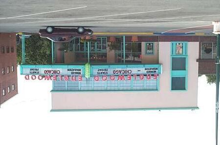
Policy FB 5.1 Appropriate Character. Appropriate use of scale and architectural diversity will emphasize Fairmount Business District’s “image” and enhance the pedestrian experience.
Policy FB 5.2 Design Standards. Policies contained in this section should form the basis for future architectural design standards that will be incorporated into the Independence City Code as supplemental regulations for development review of properties.
Policy FB 5.3 Durability. Building design should be flexible and adaptable to meet the shifting consumer needs over time and allow for the expansion and contraction of a variety of businesses.
Policy FB 5.4 Compatibility. The design of new commercial buildings and associated site planning for properties in the Fairmount Business District should be in character with the adjacent commercial properties and residential neighborhoods. Buildings should reflect traditional architectural patterns; the facades of incompatible buildings should be rehabilitated. Compatibility in character is achieved through techniques such as: repeating roof lines and pitches, using similar proportions in building mass and outdoor spaces, using similar relationships to the street, window and door patterns, and/or the use of building materials that have color shades and textures similar to those existing in the immediate area.
Policy FB 5.5 Architectural Elements Based on HumanScale (see Figure 5-3). Human-scale design and architectural elements will be encouraged in the Fairmount Business District.
• Visual Interest. Blank walls should be avoided along streets, plazas and parks. If that is not possible, building facades lacking windows should have other architectural details facing or visible from public spaces. Buildings should also be screened by landscaping to buffer the impacts of building mass.
• Relationship of Buildings to Public Space. Buildings will reinforce and revitalize streets and public spaces by providing an ordered variety of architectural features that may include entries, awnings, storefronts, windows, bays and balconies, and other human-scale building details along public ways. While vertical mixed-use is encouraged, maximum building height will be limited to three (3) stories.
March 2006 City of Independence, Missouri U.S. 24 Highway Corridor Study Framework Plan 5 - 9
Source: MARC
City of Independence, Missouri
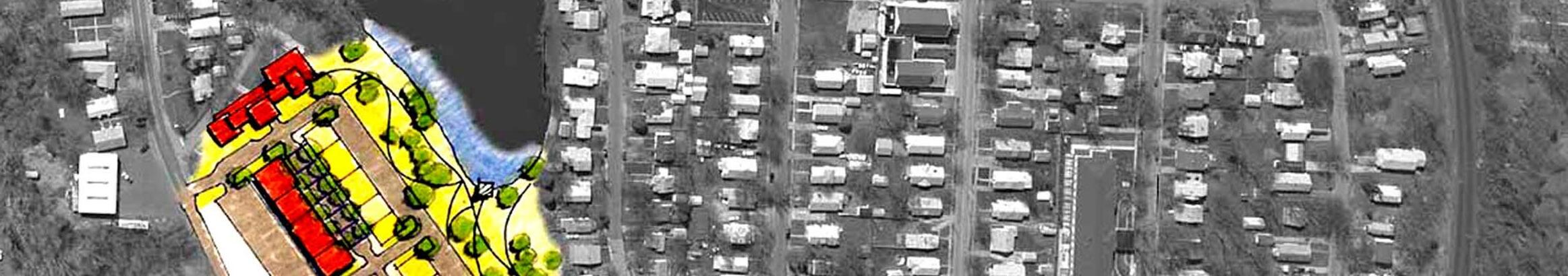
U.S. 24 Highway Corridor Study
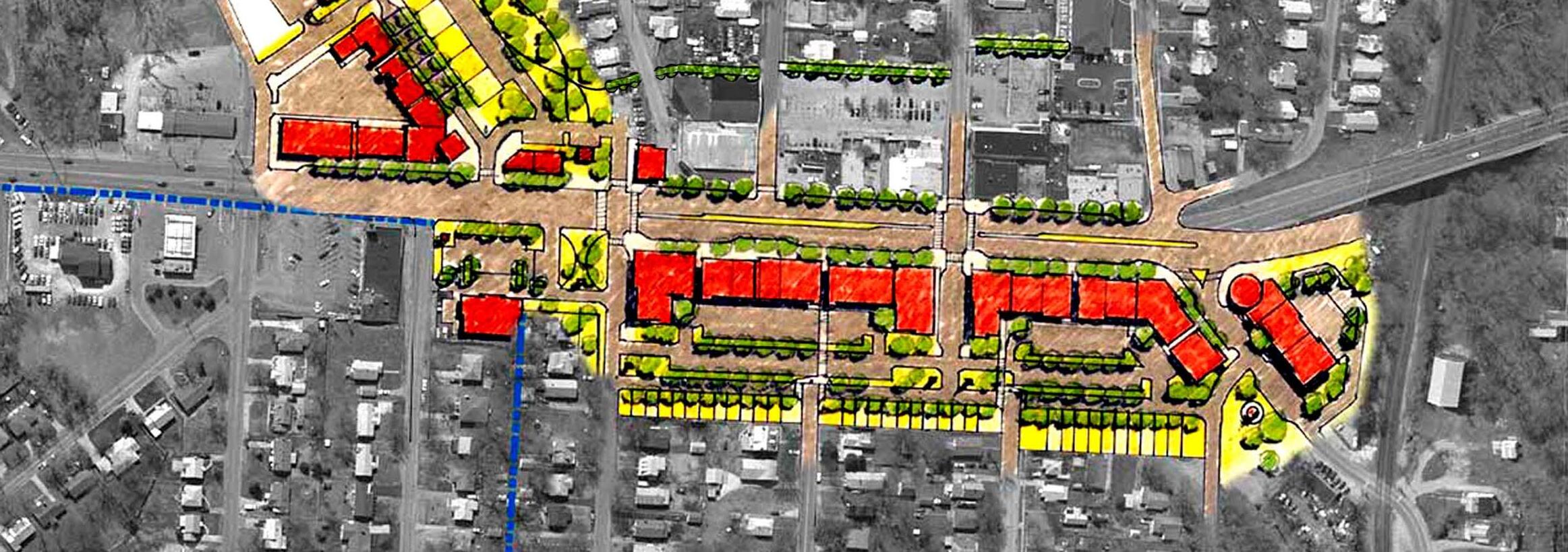
March 2006
Framework Plan 5 - 10 • Bridge Relocation Improved Median Existing Buildings to Remain Green Connection to Crisp Lake Senior Housing (2-3 Stories) Light Industrial / Office Use Compatible with Neighborhood Neighborhood Park Anchors Street Row/Town Homes Signature Residential Street New Mixed-Use Development (2-3 Stories) Front and Rear Facing to Connect to Residential Areas New Park Green Connection Small Anchor Development Fairmount Niche District Mixed-Use Development Signature Street Live / Work Housing Crisp Lake Trail and Public Access Senior Housing (3 Stories) Parallel Parking through Entire District
Relocate 1-2 Transmission Line Towers Improve Streetscapes and Sidewalks Encouraging Pedestrian Connection US 24 Highway Wilson Huttig Rd. Lake Drive Ralston Ash Hardy Ave Cedar Rd. Ash Rd. Hardy Rd.
Figure 5-2 Conceptual Revitalization Sketch for Fairmount Business District
Principle FB 6. The design of streets, parking areas, and public spaces in the Fairmount Business District will reinforce its unique and distinctive character (see Figure 5-3).
Policy FB 6.1 Incorporation of Public Spaces. New development and re-development opportunities will incorporate public spaces to create a prominent civic component in core commercial areas. A diversity of types and scale of public areas will ensure a wide range of pedestrian destinations throughout the District such as civic plazas, courtyards, fountains, pocket parks, art, and sidewalks. These public spaces will provide meeting and gathering points for people and will be within close proximity to work, shopping, civic, cultural, entertainment activities and activity centers.
6.2 Pedestrian Experience. The design of streetscapes, parking lots, signage, and landscaping will provide a safe, dignified pedestrian shopping experience. If the land between a commercial building and parking area is hard-surfaced, the area must contain two or more pedestrian amenities such as benches, drinking fountains, planters, kiosks, public art, outdoor eating areas, vending space or other design elements
Policy FB 6.3 Landscaping. Shade trees, seasonal plantings, and “soft” spaces will be installed and maintained to mitigate the intensity of U.S. 24 Highway and summer climate, and to contribute to an attractive retail environment. New parallel parking will assist in protecting pedestrians.
March 2006
Framework Plan 5 - 11
City of Independence, Missouri U.S. 24 Highway Corridor Study
P o l i c y F B 6
Figure 5-3. Fairmount Business District Character
Policy FB 6.4 Pedestrian Safety. Potential accidents at points of conflict among transportation choices (i.e., pedestrian crosswalks) will be reduced by changing the paving materials, enhancing traffic lights, parallel parking and utilizing access management techniques along U.S. 24 Highway and arterial streets.
Policy FB 6.5 Public Safety. The design of buildings, parking areas and streets will provide a sense of security and safety for users. Adequate lighting, visibility and location of facilities collectively will add to a secure 24-hour environment for employees, tourists, and visitors. New parallel parking will assist in protecting pedestrians.
Principle FB 7: As funds are available, the City will work with private and other public entities to invest in a comprehensive infrastructure improvement program for strategic, “model” blocks, streets, or buildings, including but not limited to improvements to water mains, sewer lines, curbs and gutters, sidewalks, street pavements and street trees in order to define the District and encouraging private reinvestment.
Principle FB 8: The Fairmount Business District will be served by a balanced transportation system designed for motor vehicle, bus transit, pedestrian, and bicycle.
Policy FB 8.1 Design of Streets and Public Spaces. Streets and public spaces within the District will be attractive, accessible, functional, and designed to enhance pedestrian and bicycle activity. New model streets demonstrating these characteristics will be created surrounding the commercial areas.
Policy FB 8.2 Connectivity. The Fairmount Business District’s sidewalks, streets, and gathering spaces will provide connections between Crisp Lake, businesses, surrounding neighborhoods, and greenways. The street grid through the District will be reconnected to further integrate neighborhoods and create new signature spaces. New streets will help relieve congestion in the area by dispersing traffic to multiple areas. This will also create activity on streets other than U.S. 24 Highway, reducing crime and increasing the appeal of the area.
Policy FB 8.3 Balanced Transportation Access. The City will work to lessen the effect of auto congestion and intensity by emphasizing other transportation means, including walking, bicycling, and transit.
Policy FB 8.4 ADA and Special Transportation Services. The transportation needs of disabled and senior populations will be assessed and addressed appropriately in the Fairmount Business District.
Policy FB 8.5 Parking. Parking is a critical factor in the future of the Fairmount Business District. Parking will be convenient, economical, affordable and accessible to meet diversified parking demands. Reduced parking standards may be applied to the Fairmount Business District as its proximity to high-frequency transit service, walkable environment, and mix of uses increases. In addition:
• The replacement of angled-parking with on-street parallel parking should be explored along U.S. 24 Highway for the expanded Fairmount Business District and intersecting local streets to provide close access and add to the pedestrian nature of the District.
• Shared parking allowances will be encouraged for nearby uses with staggered peak periods of demand, such as for retail and entertainment uses. A portion of any project’s parking requirements in the Fairmount Business District will be considered satisfied by on-street parking.
• Parking lots must be located to maintain their accessibility while minimizing their visibility from primary pedestrian streets, plazas and public spaces. Lots should be located behind buildings, in side yards, or in the interior of blocks throughout the District. Their visual impact shall be softened and screened with a perimeter landscape buffer.
March 2006
U.S.
Framework Plan 5 - 12
City of Independence, Missouri
24 Highway Corridor Study
Source: MARC
• Large-surface parking lots will be visually and functionally segmented into several smaller areas. Land devoted to surface parking lots should be reduced, over time, through redevelopment and/or construction of structured parking facilities.
Principle FB 9. Adjacent neighborhoods will be integrated into the Fairmount Business District.
Policy FB 9.1 Transitions. Neighborhoods will be integrated into the Fairmount Business District with active development types centered closer to commercial areas. The District will transition to less intense uses, such as from mixed-use commercial areas to apartments, to row houses, to patio homes, to detached residential units.
Policy FB 9.2 Neighborhoods. Appropriate infill and redevelopment will occur in adjacent neighborhoods especially along U.S. 24 Highway, south of the former BP refinery site and adjacent to Crisp Lake.
Policy FB 9.3 Neighborhood Integration. Adjacent neighborhoods will be integrated with the Fairmount Business District’s through sidewalks, off-street and on-street trails.
Mixed-Use Areas (MU)
As emphasized in the Mid-America Regional Council’s Report, “Creating Quality Places”, mixing development types has definite market benefits. The intent of new mixed-use areas is to meet existing and future market demand by focusing land use patterns in compact developments that locate jobs, shopping, and services near housing along arterial, transit-supportive corridors. These multi-purpose activity center areas should be designed with transit-supportive and traditional neighborhood principles such that they accommodate a range of densities and uses as markets change. Retail stores, civic buildings, offices, and residences, including single-family, townhouses, and apartments will be encouraged.
A number of mixed-use centers are proposed, including the previously described Fairmount Business District, creating activity areas for people to walk, shop and live. Figure 5-4 on page 5-14 describes one potential conceptual mixed-use plan for the southeast corner of Sterling Avenue and U.S. 24 Highway. In this concept, the existing strip center would be redeveloped in conjunction with the adjacent multi-family development. The redeveloped commercial uses would consist of a total of 40,000 square feet of neighborhood shopping commercial space. The concept
includes fronting buildings on U.S. 24 on either side of Claremont Avenue. The result will be the creation of a gateway to a pedestrian-friendly street consisting of row homes and a new multifamily development. The area would transition to single family homes closer to Bundschu Park. Access to the park would be provided from several trailheads located in the new neighborhoods. Alternatively, the primary commercial redevelopment area could occur on the northeast or northwest corner of U.S. 24 Highway and Sterling Avenue. Development in these areas would require the removal of existing businesses, some residences, and the consolidation of a number of parcels. Depending on the location of the primary commercial development, other areas should continue to be redeveloped into supporting residential uses with complementing smaller scale mixed-use commercial development.
Figure 5-5 on page 5-15 describes a conceptual plan for the northwest corner of River Boulevard and U.S. 24 Highway. The concept is centered on the redevelopment of the existing strip commercial center into a larger commercial development consisting of an additional 30,000 to 40,000 square feet of retail space. To further support this development, adjacent vacant and underutilized properties would be developed with a variety of housing types, including single and multi-family housing. Housing would be located adjacent to open space, creating a break from the intensity of the Corridor. Smaller open spaces between developments and within the interior of medium to high density housing areas will provide additional green space. Trailheads and overlooks for the open space would provide vital amenities to local residents and the community at-large. Trails will connect local neighborhoods, Sugar Creek, and the larger regional trail system. The result will be a transition in land uses to types more compatible with the adjacent Truman Presidential Museum and Library.
Principles and policies for the Mixed-Use Areas are described below. These statements work in combination with the Corridor-Wide, Neighborhood, and Fairmount Business District Principle and Policies statements.
Principle MU 1: The City will promote compatible infill and redevelopment in targeted areas within the Corridor.
Policy MU 1.1 Targeted Redevelopment/Infill. Redevelopment and infill development will be encouraged at the intersections of Sterling Avenue and U.S. 24 Highway, and River Boulevard and U.S. 24 Highway, and other targeted locations. The purpose of these areas is to channel growth where it will be beneficial and can best improve access to jobs,
March 2006
Framework Plan 5 - 13
City of Independence, Missouri U.S. 24 Highway Corridor Study
housing and services with fewer and shorter auto trips. These targeted areas are parts of the Corridor where general agreement exists that development or redevelopment is beneficial. A major goal is to increase economic activity in the area to benefit existing residents and businesses and, where necessary, provide the stimulus to redevelop.
Policy MU 1.2 Priority. U.S. 24 Highway nodes at Sterling Avenue and River Boulevard should take priority for land use, streetscape and urban design improvements to promote its transition to a series of mixed-use commercial centers.
Policy MU 1.3 Land Use. Redevelopment will be encouraged to locate and design buildings such that a percentage of the fronts of buildings directly face adjacent streets, provide a mix of types and size of businesses, provide pedestrian-oriented site design, and incorporate convenient, safe and attractive parking areas. Retail uses will include the redevelopment and expansion of existing commercial uses. Commercial areas should include a primary anchor and complementing smaller retail stores. To support these areas, higher density housing should be located adjacent to these districts. A mixed-use commercial area may include just one side of U.S. 24 Highway, rather than bridging both sides.
Policy MU 1.4 Mixed Use. A variety of commercial and residential uses should be included in these areas. Where appropriate vertical mixed-use developments (2-3 stories) consisting of office, commercial and residential uses should be considered.
Policy MU 1.5 Flexibility. Types of developments permitted in mixed-use areas will remain flexible to accommodate the densities, mix of uses, and shifting consumer needs over time.
Policy MU 1.6 Integration. These intense development areas will quickly transition to lower intensity uses by reducing the height and scale of buildings. These areas will include pedestrian and street connections to adjacent neighborhoods.
Principle MU 2: Mixed-Use Areas will be served by a balanced transportation system designed for cars, transit, pedestrian, and bicycle.
Policy MU 2.1 Transportation Access. Mixed-Use Areas should be easily accessible by the automobile and transit. Internal areas within the Mixed-Use Areas should be pedestrian oriented. Streets connecting to the areas will be attractive, accessible, functional, and designed to enhance pedestrian and bicycle activity.
Policy MU 2.2 Connectivity. Mixed-Use Area sidewalks, streets, and gathering spaces will provide connections to surrounding neighborhoods and greenways.
Policy MU 2.3 ADA and Special Transportation Services. The transportation needs of disabled and senior populations will be assessed and addressed appropriately in each Mixed-Use Area.
Policy MU 2.4 Parking. Parking lots must be located to maintain their accessibility while minimizing their visibility from primary streets and public spaces. Lots should be located behind buildings. Their visual impact shall be softened and screened with a perimeter landscape buffer.
Principle MU 3. The design of each area will contribute to the character of each Mixed-Use Area

Policy MU 3.1 Buildings. A variety of building scales and heights should be used. Buildings should include common design elements that create a unified feel.
Policy MU 3.2 Streetscape. The design of streets, parking areas, and public spaces should reinforce the distinctive character of each redevelopment area.
Policy MU 3.3 Adaptability. Building design should be flexible and adaptable to meet the shifting consumer needs over time and will allow for the expansion and contraction of a variety of businesses.
March 2006 City
U.S.
Framework Plan 5 - 14
of Independence, Missouri
24 Highway Corridor Study
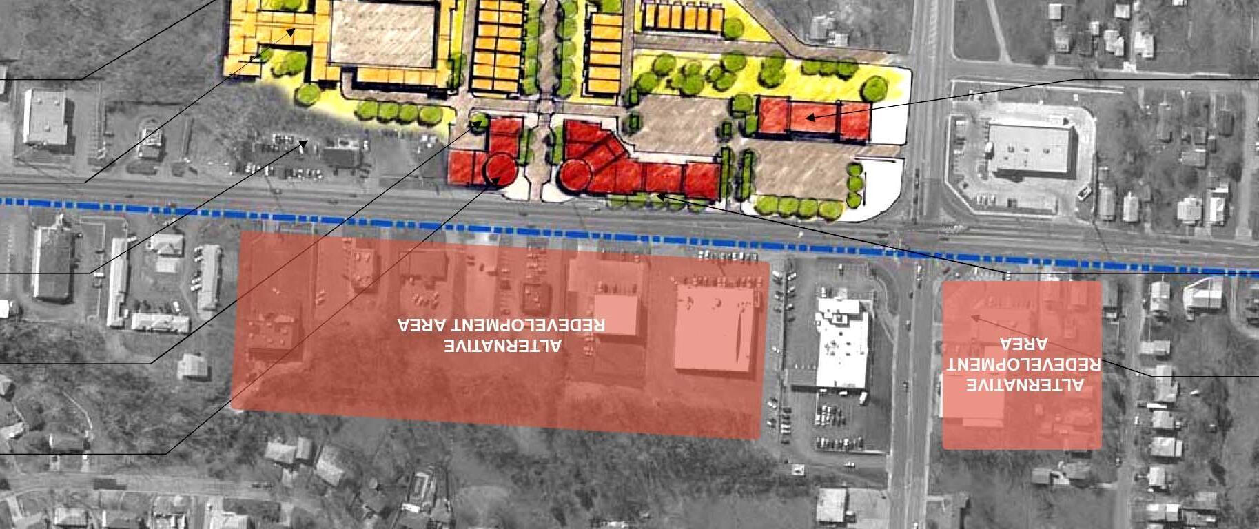
March 2006 City of Independence, Missouri U.S. 24 Highway Corridor Study Framework Plan 5 - 15 Attached Row/Town Homes US 24 Highway Future Single Family Housing Units Renovated Retail Development New Retail Development Future Redevelopment or Renovation Small Scale Retail or Housing Units Stepped Town/Row Homes Multi-Family Units Connection to Park Bundshu Park Commercial Redevelopment
Parking Landscape Screening Sterling Avenue
Figure 5-4. Conceptual Revitalization Sketch for Sterling Avenue Mixed-Use Area
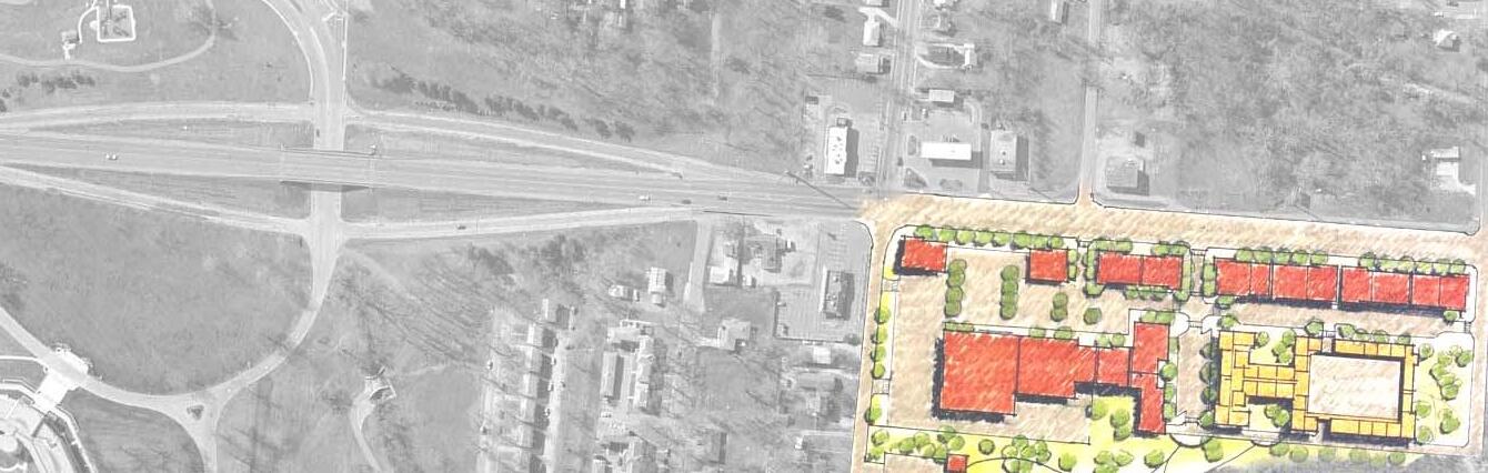
March 2006
Framework Plan 5 - 16 Multi-Family Units Open Space Overlook Park System Connection Single Family Residential Garden Court Trail Head / Shelter Connection to Trail System / Sidewalk Extension of Existing Streetscape Elements to River Boulevard Common Landscape Features on All Corners Redeveloped Commercial Anchor
City of Independence, Missouri U.S. 24 Highway Corridor Study
for River Boulevard Mixed-Use Area River Boulevard US 24 Highway Commercial Development
Figure
5-5. Conceptual Revitalization Sketch
Policy MU 3.4 Human-Scale. Human-scale design and architectural elements will be encouraged.
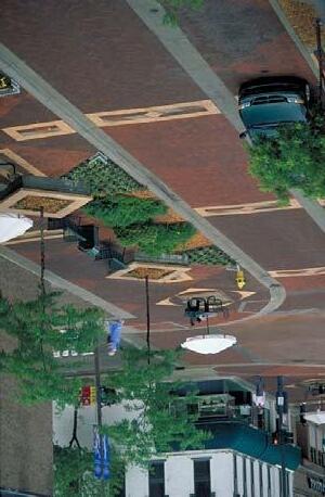
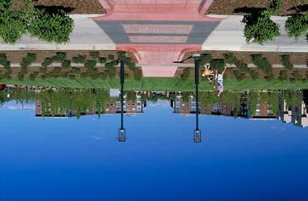
Policy MU 3.5 Signage. The Sign Code will be enforced and new sign regulations developed for Mixed-Use Areas. This should include the removal of pole signs.
Policy MU 3.6 Design Standards. Policies contained in this section should form the basis for future design standards that will be incorporated into the Independence City Code as supplemental regulations for development review of properties.
Commercial Districts (CD)
Commercial areas outside of the mixed-use districts such as banking, service, and lodging locations, are typically composed of strip commercial uses. New vitality will be infused into these areas over time through the gradual redevelopment of underutilized properties. Redevelopment will include new higher quality commercial developments and medium to high residential housing. Access improvements, including reducing curb cuts, will improve safety along the corridor. The pedestrian environment will also be improved, connecting these areas to adjacent neighborhoods, Mixed-Use Areas and the Fairmount Business District. Principles and policies for the Commercial Districts are described below. These statements work in addition to the Corridor-Wide Principle and Policies statements. Transportation System Principle and Policy statements are especially applicable to these areas.
Principle CD 1: The size and scale of businesses within Commercial Districts will vary. New development and redevelopment will include a mix of commercial uses avoiding dominating parking areas.
Policy CD 1.1 Existing Strip Commercial Conversion. The City will encourage and support the gradual evolution of existing, auto-dominated strip commercial areas to compact, multi-modal-oriented, commercial places with enhanced walking connections between destinations.
Policy CD 1.2 New Development. New development in Commercial Districts will locate and design buildings such that a percentage of the fronts of buildings directly face adjacent streets, provide a mix of types and size of businesses, provide pedestrian-oriented site design, and incorporate convenient, safe and attractive parking areas into the block.
Principle CD 2: The design of Commercial Districts should provide for convenient access by all modes of travel, with efficient and cost effective pedestrian and vehicular circulation.
Policy CD 2.1 Linkage to Neighborhoods
Adjacent to Commercial Districts. New models for retail development will be necessary to link neighborhoods with retail areas. Pedestrian and bicycle linkages from surrounding neighborhoods to Commercial Districts will be provided, particularly at key transit stop locations and from multiple directions, if practical.
Policy CD 2.2 Arterial Crossings. Improve pedestrian/bicycle linkages across arterial streets and along commercial corridors. Pedestrian travel routes should be clearly identified and distinguished from auto traffic through parking areas, across streets, and along building frontages. Pedestrian/bicycle linkages through existing parking lots to commercial destinations should be improved when opportunities arise.
Policy CD 2.3 Transit Facilities. Transit stop facilities will be located at safe and convenient destinations -- strategically distributed within Commercial Districts to serve users in the area. Benches, shelters and other drop-off sites will be aesthetically designed and be located away from arterial street curb lines in order to provide a safe, accessible, secure and positive experience for transit users.
Policy CD 2.4 Parking. Parking lots will not dominate the frontage of streets or interrupt pedestrian routes. Large-surface parking lots will be visually and functionally segmented into several smaller areas. Land devoted to surplus surface parking lots should be reduced, over time, through redevelopment. Their visual impact shall be softened and screened with a perimeter landscape buffer. All parking must provide for visibility, personal safety and security.
March 2006
U.S.
Framework Plan 5 - 17
City of Independence, Missouri
24 Highway Corridor Study
Source: MARC
Principle CD 3: The physical environment of the Corridor will be improved as a functional, beautiful, decent, healthful, interesting, and efficient setting for human activities.
Policy CD 3.1 Streetscape Improvements. Deteriorated streetscape, especially sidewalks, should be repaired and upgraded.
Policy CD 3.2 Visual Blight. The appearance of the area will be improved through the removal and prohibition of overhead utility lines and billboards.
Policy CD 3.3 Sign Enforcement. The Sign Code will be enforced and new sign regulations developed to further improve the physical environment of the Corridor. This should include the prohibition of pole signs and billboards.
Policy CD 3.4 Image. Transportation and streetscape elements should be designed to create a unified, cohesive and significant image.
Policy CD 3.5 Separation. Vehicular and pedestrian traffic will be separated with landscape and hardscape barriers.
Policy CD 3.6 Orientation. When feasible, buildings should be moved forward toward the street to screen parking and promote pedestrian-oriented streetscapes. The City will encourage parking areas to be oriented to the side or behind commercial buildings.
Policy CD 3.7 Design Standards. Policies contained in this section should form the basis for future design standards that will be incorporated into the Independence City Code as supplemental regulations for development review of properties.
Gateways (GW)
Creating and maintaining memorable places are the result of a synthesis between good design, economic vitality, activity, ecology, and a community’s heritage. Each day, incremental decisions regarding where redevelopment occurs, how it occurs, and what it looks like affect the long-term character of the Corridor.
A collective vision and public investment is prerequisite to private reinvestment. Gateways to Independence provide a unique opportunity for the City to “make a statement” regarding its heritage and civic pride in order to stimulate redevelopment. The Plan seeks to build upon a historic and modern gateway. The Mt. Washington Cemetery and Truman Presidential Museum and Library contain landmark open spaces that are home to some of Independence’s most meaningful memories and provide a respite from the often overwhelming intensity of the highway environment.
The most prominent visual landmark upon arrival along U.S. 24 Highway to Independence is Mt. Washington Cemetery, which has been an important gathering site in the community for almost one-hundred years. Rock Creek, which flows through the Cemetery and north across the Corridor, is another unique visual amenity in the urban environment and holds significant potential as a recreative greenway. An existing transit stop maintains a high intensity of use by families and workers living in this area. At present, this area consists of several commercial properties and open spaces, many of which are underutilized and could be used to promote Independence and the Fairmount Business District area. Investments stemming from its designation and incentives will increase property values to neighborhoods and commercial properties on the north and east.
One possible vision for the future illustrated in Figure 5-6 and 5-7, develops this key area into a major gateway. Key to this concept is the redevelopment of properties along the north side of U.S. 24 Highway, across from Mt. Washington Cemetery. Suitable businesses of a modest size, less than 15,000 square feet, could be intermixed with adjacent open space. Limiting the size and scale of these buildings will create a suitable gateway, avoid competing with the Fairmount Business District and allow the integration of open space and other design elements. Businesses such as a restaurant or nursery could overlook Rock Creek to the north. A new trailhead for Rock Creek would provide a valuable recreational amenity. Users of the new trail will be able to head north along Rock Creek or south through the Cemetery or along Brookside Avenue or Winner Roads. A new median, lighting and other streetscape features for this short stretch will reinforce the character of the place. Signage noting the entrance to the City of Independence will complete the picture.
The Corridor’s eastern gateway, the Truman Presidential Museum and Library, is also a destination. Over 100,000 tourists visit the Library each year, fueling the growth of businesses along the Corridor and Independence Square. The Library is picturesquely situated near McCoy Park, Mill Creek, and several trails. Recent road improvements, landscaping, lighting, and signage have enhanced the image and accessibility of the Library. Existing elements at this gateway will be extended westward to meet up with new mixed development area at River Boulevard.
Commercial land uses and an architectural character befitting of an entrance to Independence and complementary to Mt. Washington Cemetery and the Truman Library will be encouraged. The application of carefully planned strategies and principles, targeted private investment, and public reinvestment to the streetscape along Winner Road and Truman Library can enhance the economic, aesthetic, and cultural role of Independence.
March 2006
Framework Plan 5 - 18
City of Independence, Missouri U.S. 24 Highway Corridor Study
Principle GW 1. Gateways will reinforce the heritage, community pride, and improve the overall image of the City of Independence.

Policy GW 1.1. Mt. Washington Gateway. Entry to the Corridor at Mt. Washington Cemetery will reinforce the historic cultural and natural character of the Corridor at set the stage for entry into the Fairmount Business District. The City will work with the private developers, the Chamber, MODOT, MARC and other agencies to initiate gateway improvements in this area which would be a catalyst for the Corridor. A minor gate located at Brookside Avenue and Winner Road will have complementing landscaping and signage.
Policy GW 1.2. Truman Library Gateway. Entry to the Corridor at the Truman Library will reinforce the historic character related to the Truman Library and set the stage for entry into the Corridor and the River Street Redevelopment Node.
Principle GW 2. Streets, transit stops, trails, and sidewalks will continue to be upgraded to provide a dignified and accessible experience for pedestrians, cyclists, and transit users.
Principle GW 3. The design of new gateway developments will be attractive and possess a distinctive architectural character.
Policy GW 3.1 Design Standards. Policies contained in this section should form the basis for future design standards that will be incorporated into the Independence City Code as supplemental regulations for development review of properties.
Policy GW 3.2 Aesthetic Appearance. Design standards will enhance the aesthetic appearance of new buildings, site planning, landscaping, and signage. Infrastructure will be improved and enhanced by using urban standards.
March 2006
Framework Plan 5 - 19
City of Independence, Missouri U.S. 24 Highway Corridor Study
Figure 5-7. Conceptual Revitalization Cross-section for the Western Gateway Character
Policy GW 3.3 Landscape Enhancements. Landscaping along public right-of-ways, screening of undesirable views, street tree plantings, and proper maintenance will enhance the open, green character of the gateways.


Policy GW 3.4 Streetscape. Streetscape improvements including signage and lighting will capitalize on the architectural character of the Truman Library and Mt. Washington Cemetery.
Policy GW 3.5 Partnerships. The Truman Library, MODOT and the City should partner to expand existing streetscape features and to implement elements of the plan. The identified gateways should provide key areas to focus these activities.
Policy GW 3.6 Types of Business. Target, market and support businesses that would be appropriate to the Western Gateway. These would include restaurants, sports related commercial uses, nurseries and other related businesses.
Transportation System (TS)
The City of Independence has a rich history as a multi-modal hub including a vital stop for merchants heading westward on the Santa Fe Trail, California or Oregon Trails. Fairmount Business District owes its origin, in part, to the Metropolitan Railway Company which provided service to the Business District and the Fairmount Amusement Park in the late 1800s and early 1900s. In the most recent decades, however, progress gave sole dominance to the personal vehicle. Today trails, trolleys, buses, and even sidewalks are almost absent on several segments of the Corridor. Furthermore, U.S. 24 Highway and its arterials are designed as highways, not as city streets. This designation makes them difficult to cross, and not supportive of pedestrian activities. Previous plans have indicated that a lack of transportation choices has hampered economic redevelopment efforts in northwest Independence (Weed and Seed Strategy p. 32).
In contrast, enhanced multi-modal connectivity catalyzes economic development and neighborhood improvement. Bus services enhance neighborhood livability, decrease parking needs, increase economic development potential, and support a pedestrian friendly environment. How a community chooses to manage personal mobility and provide for the safe and efficient movement of people and goods throughout the community has a profound effect on the character of the City and the quality of life enjoyed by its residents.
The Plan envisions an integrated transportation system that provides a variety of transportation choices for all abilities, ages, and income levels. In coordination with the Kansas City Area Transportation Authority, Jackson County, and other regional transportation organizations, fixed and flexible routes will enhance the connectivity of existing neighborhoods and commercial/retail
sites. Pedestrian, bicycle, and bus routes would be closely interrelated with the new multi-modal Independence Transit Center located near Independence Square.
As described in each concept plan, clear pedestrian pathways will be established from commercial and mixed-use areas into the neighborhoods. Trees and appropriate landscaping will provide a separation between the pedestrian and traffic as well as improve the aesthetics of areas.
The Plan also recognizes the importance of the automobile. Traffic from U.S. 24 Highway is vital to the success of the District. Future transportation improvements such as the new interchange in Sugar Creek with the Lewis and Clark Parkway at Sterling Avenue will form a new vital transportation connection to the Fairmount Business District, the new Bluff’s Business Park and mixed-use areas at Sterling Avenue and Bundschu Park.
The following section provides principles and policies for developing an effective multi-modal transportation system to help achieve the Corridor’s land use and economic development goals.
Principle TS 1. U.S. 24 Highway and its supporting transportation system will be improved to provide a variety of safe and efficient transportation choices, thus increasing mobility for all sectors of the population, including all ages, income levels, and people with disabilities.
Policy TS 1.1 Multimodal Network. Highway improvements will incorporate bikeway, pedestrian, and transit networks as essential parts of the transportation system.
Policy TS 1.2 Traffic-calming. Traffic-calming techniques will be explored for arterial, collector and residential streets leading from U.S. 24 Highway to existing and future neighborhoods to increase the safety of adjacent neighborhoods, such as in conflict points at the Fairmount Business District, Winner Road, Sterling Avenue, Bundschu Park, and River Boulevard nodes.
Principle TS 2. The Corridor’s transportation, land use, and redevelopment decisions will be mutually supportive, and structured in a compact pattern that facilitates pedestrian, bicycle and transit travel.
Policy TS 2.1 Transit Supportive Design. The City will explore and integrate Transit Oriented Design strategies with respect to new development, redevelopment, and infill development opportunities.
March 2006 City
U.S.
Framework Plan 5 - 20
of Independence, Missouri
24 Highway Corridor Study
City of Independence, Missouri
Future Open Space or Passive Commercial Uses
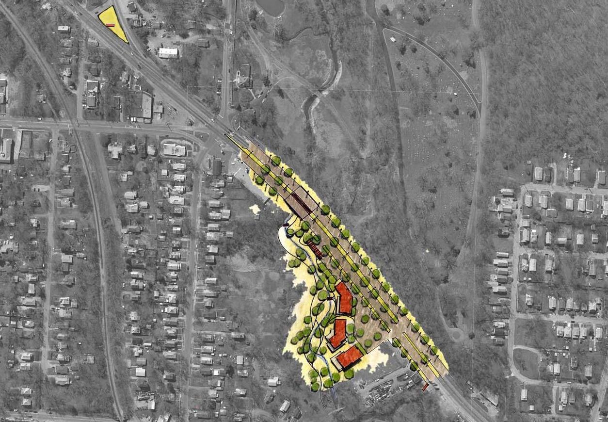
U.S. 24 Highway Corridor Study
Rock Creek Greenway and Trail System
Trailhead
Entry Signage for Independence
Off Street Trail for Bicyclists
Gateway Commercial Uses
Redeveloped Commercial Uses
New Landscaping and Signage with Commons Elements
Landscape and Lighting Median
Pedestrian Trail / Interpretive Signage
March 2006
Framework Plan
5
21
-
Figure 5-6. Conceptual Revitalization Sketch for the Western Gateway
US 24 Brookside
Mt. Washington Cemetery
Independence Avenue Winner Road
Principle TS 3. City streets and walkways will be planned, built, and maintained as safe, attractive public spaces.
Policy TS 3.1 Access Management. Efficiency and safety will be increased by utilizing access management techniques along U.S. 24 Highway and arterial streets, including but not limited to reducing the number of curb cuts, improving access points, and installing medians.
Policy TS 3.2 Street System Improvements. Streets should be improved, relocated and redesigned to support a safe and efficient transportation system. Such improvements could include improving the street system with the Fairmount Business District.
Principle TS 4. The City will provide leadership to support and maintain a comprehensive, efficient and high-quality public transit service for the U.S. 24 Highway Corridor.
Policy TS 4.1 Partnerships. The City will partner with MODOT, KCATA and MARC to improve the transportation system in the Corridor and integrate future design elements.
Policy TS 4.2 Independence Transit Center
New and existing transit routes will connect the Independence Transit Center to key redevelopment nodes such as the Western Gateway, Fairmount Business District, Sterling Avenue, Bundschu Park, and River Boulevard.
Policy TS 4.3 Transit Stops. Easy pedestrian access and a mix of uses are encouraged at existing and proposed transit stops to allow transit to become a viable alternative to the automobile. Interfaces with the existing bus system will be passenger friendly and will accommodate bicyclists and the disabled to the greatest extent possible (Regional Transit Association).
Policy TS 4.4 Quality Facilities for Transit Users. The design of passenger/transit interfaces will provide a dignified experience for the transit user by including quality benches, shelters, adequate lighting, and landscaping as needed.
Policy TS 4.5 Convenient Connections. Frequent and convenient connections will be provided to employment sites, major attractions, and other activity centers.
Principle TS 5. The safety, security, aesthetics, and convenience of the pedestrian and cyclist will be a fundamental consideration in the design of the transportation system.
Policy TS 5.1 Bicycles. The bicycle will be a practical transportation choice for residents and should use a combination of on and off-street trail systems. The system will be enhanced with the adoption of a new bikeway and trail plan.
Policy TS 5.2 Convenience. Directness, continuity, street crossings, visual interest, amenities, and security for pedestrians will be incorporated into site planning and infrastructure improvements. Streets and sidewalks will be pedestrian friendly with appropriate traffic calming, tree plantings, landscaped strips, sidewalk width, sidewalk connectivity, sidewalk quality measures as needed.
Policy TS 5.3 Sidewalks. All areas within the Corridor shall be connected with walkways that are well lit, ADA compliant, and physically separated from driveways and parking spaces by landscaping, berms, barriers, or crosswalks. Crosswalks will be clearly marked, with raised grade and/or distinct paving materials if possible. Parking lots shall not interrupt pedestrian right-of-ways.
Policy TS 5.4 Accessibility. Interconnected multi-use trail network will be designed to function as both recreational and transportation routes for all skill and user types, with wellconnected trail access points and wayfinding materials to nearby community features, such as the Truman Library, Fairmount and Englewood Business District, City of Sugar Creek and Mt. Washington Cemetery.
Natural Resources, Parks and Open Space (NR)
Natural resources areas and green space will provide a release from intense urban areas. A greenway system based on the existing floodplain will form the foundation for the Plan.
Principle NR 1. Natural resources within the Corridor study area will be maintained and protected to the maximum extent feasible.
March 2006
Framework Plan 5 - 22
City of Independence, Missouri U.S. 24 Highway Corridor Study
Policy NR 1.1 Riparian Interface. The interfaces between Rock Creek, Sugar Creek, and Mill Creek and development along U.S. 24 Highway should be coordinated to retain environmental quality, enhance wildlife habitat, and accommodate, with appropriate buffers, multi-use trails.
Policy NR 1.2 Natural Features. Natural features such as existing trees, ridgelines, steep slopes, riparian areas and ponds will be integrated into new developments.

Policy NR 1.3 Natural Hazards. Protection from natural hazards and public safety will be a primary concern. Areas prone to flooding or having steep slopes shall be preserved as natural areas.
Policy NR 1.4 Riparian Areas. The City of Independence stream setback requirements should be implemented and enforced to create a riparian open space buffer that will help absorb floodwater, enhance water quality and protect wildlife habitat.
Principle NR 2. The Corridor study area will be served by parks, multi-use trails and other recreational facilities to support existing and future neighborhoods.
Policy NR 2.1 Off-Street Trail System. The Cities of Independence and Sugar Creek, in conjunction with MARC and the private development community, should actively pursue the expansion of a multi-use paved off-street trail system to increase transportation options and serve recreational needs. Key locations for trails should include stream corridors and abandoned rail lines.
Policy NR 2.2 On-Street Trail Connections. Off-street and on-street trails should be connected in order to efficiently link destinations within the Cities of Independence and Sugar Creek.
Policy NR 2.3 Open Space. The Cities of Independence and Sugar Creek, in conjunction with MARC and the private development
community should continue to preserve open space in areas that include and surround the 100-year floodplain, sensitive wildlife areas, water bodies and steep slope.
Policy NR 2.4 Parks. The Cities of Independence and Sugar Creek should continue to improve the recreational amenities in existing parks and where appropriate provide additional parkland.
Policy NR 2.5 Recreation Amenities. The Cities of Independence and Sugar Creek should encourage recreational facilities such as community and recreational centers to be located along the new trail and greenway system.
Policy NR 2.6 Local Connectivity. The trail system will provide functional and recreational linkages to commercial areas, neighborhoods, parks, open space and greenways including Mt. Washington Cemetery, Englewood and Fairmount Business Districts, Bundschu and McCoy Parks. In addition, the trail system should be used to interconnect the Sugar Creek and Independence park systems.
Policy NR 2.7 Regional Connectivity. The Cities of Independence and Sugar Creek will cooperate with Jackson County, MARC and adjacent governmental entities to ensure the development of an interconnected trail system according to the MetroGreen trail plan joining the urban and rural green corridors throughout a seven-county region.
March 2006
Framework Plan 5 - 23
City of Independence, Missouri U.S. 24 Highway Corridor Study
 City of Independence, Missouri
U.S. 24 Highway Corridor Study
City of Independence, Missouri
U.S. 24 Highway Corridor Study
Chapter 6. The Implementation
I. Introduction
First-tier suburb areas like Fairmount around larger cities such as Kansas City, Chicago and St. Louis are experiencing fiscal stress. Solutions to these problems can come in many forms. However, when looking long-term, relief must focus on economic development initiatives. Economic development will result in the expansion of the tax and job base, assisting in the overall regeneration process. Reinventing key areas by attracting new businesses to redevelopment sites will also restore eroded value.
Economic development will no longer come from the manufacturing side, instead it relies on other sectors of our economy. Located close to employment, connected by transit and offering a variety of homes, areas such as Fairmount are an untapped retail and residential market. Select investors will seek out this market to provide needed neighborhood services to these areas. Not always considered a traditional market, these first-tier areas hold significant retail spending power. By working with the private sector to rehabilitate or demolish older structures, acquiring tax delinquent properties, and working to improving aesthetics and infrastructure, these areas hold great opportunity. Underutilized commercial spaces are becoming opportunities for more modern neighborhood shopping areas anchored by large retail chains.
Like other first-tier areas that are experiencing a rebirth, this plan capitalizes on the U.S. 24 Highway Corridor’s unique market position and pent-up market demand. The three primary redevelopment nodes along U.S. 24 Highway at River Boulevard, Sterling Avenue and the Fairmount Business District are currently capable of supporting an additional 76,000 square feet of shopping center space. To succeed, the Cities of Sugar Creek and Independence will have to put their full array of tools on the table to attract private capital, but as shown in many communities it can be done.
Chapter Organization
Each of the following sections outlines implementation tools for each of the six Plan components, including specific approaches to four targeted redevelopment nodes. An action plan table is included within each section. For reference purposes, a description of each tool including its past and potential use on the Corridor is found in Section VIII. Additional terms found in this and other chapters are defined in the Glossary.
II. Residential Neighborhoods
III. Fairmount Business District
IV. Mixed-Use Areas (Sterling & River Redevelopment Nodes)
V. Commercial District
VI. Gateways (Western & Eastern Redevelopment Nodes)
VII. Transportation
VIII. Natural Resources, Parks and Open Space
IX. Implementation Tools – Corridor-Wide
X. Other Tools - Public and Private Partnerships
Ultimately, choices will need to be made as insufficient resources exist to implement every tool. Success will require public-private partnerships. Since funding and other variables will change, this Chapter should be periodically amended and new tools added to the action steps. This Chapter should be used in conjunction with Chapter 5 in order to understand the context in which the tools are used. Additional information on tools (shown in italics and underlined) referenced in the general text of this chapter can be found in Sections IX and X.
II. Implementation Strategy – Residential Neighborhoods
Revitalization of the U.S. 24 Highway Corridor must start with improving the fabric, livability and population base of the residential neighborhoods. Enhancing the Corridor’s housing stock must be a priority with the goal of improving living conditions, increasing property values, and stimulating population growth. The stabilization and enhancement strategy will need a long-term commitment by the Cities of Independence and Sugar Creek, community groups, neighborhood activists and local residents. Steps will involve stabilizing the existing housing stock through property repair and code enforcement. Other tasks will involve upgrading the existing housing stock through investing in major improvements (i.e., new roof), building additions and public infrastructure. Other key steps will involve new home construction. The ultimate goal is to improve the Corridor’s
City of Independence,
U.S. 24
The Implementation 6-1 March 2006
Missouri
Highway Corridor Study
Fairmount Business District, Independence, MO
demographics to foster demand for additional businesses and commercial space. Without a larger population, the Corridor’s business community will continue to suffer. This framework for investment in the U.S. 24 Highway Corridor should include an infill strategy and overlay zones (described in the Corridor-wide Implementation Tools), and flexible zoning to encourage new housing construction and products.
A key first step to jump-start efforts and provide a catalyst to revitalization is for the City of Independence, Sugar Creek and local residents to embark on a pilot housing project involving a target neighborhood utilizing a public-private partnership. The goal is to revitalize a key neighborhood, thereby stimulating a ripple effect through adjoining neighborhoods. General steps toward accomplishing this are:
• Determine appropriate site
• Identify and hold meetings with partners
• Create preliminary concept plans
• Hold public meetings
• Identify and partner with developer
• Construct project
A potential target area is the BP-owned housing and vacant land that straddles both Sugar Creek and Independence. This area is under single ownership, possesses an attractive topography, is capable of incorporating public open space into the development plan, and can support a large enough inventory of new housing to positively influence a larger geographic area. The first phase of this pilot neighborhood revitalization project is for both Sugar Creek and Independence to enter into an agreement to collectively plan and implement development of the target neighborhood. In conjunction with this inter-governmental agreement, BP would convey the property to a non-profit organization whose responsibility will be to coordinate development. The second phase involves approval of a preliminary concept plan for use as a marketing tool to builders. As an incentive to builders, flexible zoning should be adopted to allow for the construction of a variety of housing products and the possibility of building permit and utility connection fees waived. To attract builders, public infrastructure such as street paving, curbs, and sidewalks should be constructed within the target neighborhood through the creation of a Neighborhood Improvement District (NID) or Community Improvement District (CID). Finally, the non-profit organization can construct homes and/or deed residential lots to a builder(s).
The City of Independence has already complemented the pilot housing project by promoting additional new home construction. The City has conveyed City-owned properties suitable for residential use to non-profit organizations for construction of affordable housing and/or sold at a discount to private builders for construction of market-rate housing. To assist in facilitating financially feasible construction of affordable housing and stimulate the construction of market-rate housing, the City should explore waiving municipal building permit and utility connection fees. The
goals of such a program are to stimulate construction of infill housing, stabilize and strengthen neighborhoods, repopulate the U.S. 24 Highway Corridor, and improve the rate of home ownership.
A method of promoting rehabilitation of the existing housing stock is administering a model streetscape program within a targeted neighborhood. Through the 353 Tax Abatement Program the Midtown/Truman Road Corridor Corporation (M/TRC) funded a similar model residential rehabilitation program with great success. The goal is to stabilize and improve a specific neighborhood’s physical infrastructure, consequently generating private investment in the housing stock. This improved neighborhood then, in theory, will have a ripple effect on adjacent neighborhoods. The neighborhood targeted for the initial model residential rehabilitation program should already possess a “scattering” of owner-occupied homes in good condition such that private investment has a better chance of taking hold.
Throughout the revitalization process, public infrastructure in the form of street paving, curbs and sidewalks should be improved within Corridor neighborhoods. Both Independence and Sugar Creek must work together to assure public infrastructure is being continuously upgraded. Creation of a Neighborhood Improvement District (NID) or Community Improvement District (CID) within target neighborhoods will be potential funding sources for infrastructure improvements.
Corridor demographics suggest a growing need for independent and assisted living housing to meet the needs of the large senior population. Additional private sector development of senior housing should be promoted through the use of federal programs. The Fairmount Business District and Crisp Lake area are excellent locations for the construction of additional senior housing.
Gradual development of the Sugar Creek Bluffs Business Park will have a positive impact on the demand for housing and commercial space within the U.S. 24 Highway Corridor, and assist in supporting more vibrant neighborhoods. The Corridor must be in position to take advantage of this future opportunity by facilitating new home and commercial construction. A key location for new market rate housing could include Crisp Lake and the Sterling and River Redevelopment nodes.
Residents of the U.S. 24 Highway Corridor should continue to be involved in their community, strengthening community pride. Actively being involved in local planning efforts, neighborhood events and community programs are some of the ways residents can support their community. Agencies such as the Northwest Communities Development Corporation can help support residents by continuing to apply for local grants, such as the Neighborhood Assistance Program (NAP). The Northwest Communities Development Corporation could receive additional NAP credits and seek more private donors. The increased funds could be used to improve the level of
City
U.S.
The Implementation 6-2 March 2006
of Independence, Missouri
24 Highway Corridor Study
community service and finance a brick and mortar project such as entry-level housing or a new community center.
Federal and state low income housing tax credits are available to investors in affordable housing. The credit can be used each year for ten years and is allocated to developers, who may sell it to raise equity to construct or acquire and rehabilitate affordable rental housing. The federal and state low income tax credits could be used as an inducement to stimulate rehabilitation of existing multi-family housing or new construction within the U.S. 24 Highway Corridor. Affordable housing must be scattered throughout the Corridor to avoid major concentrations of low-income dwelling units.
To assist in funding the rehabilitation of the Corridor’s housing stock the following public programs HOME Investment Partnership Program, Neighborhood Preservation Tax Credits, and the Local Initiatives Support Commission. The City of Independence’s First Time Home Buyer Grant Program could also be expanded to promote increased rates of home ownership within the Corridor. Other tools could also be employed. Code enforcement provides a valuable tool to improve the quality of residential neighborhoods. Already in place, the City could increase these efforts. Other strategies could include targeting new families to this area. This could be achieved by providing new housing, retrofitting the existing housing stock or providing amenities that these families desire.
Improving the education system for children and young adults residing in the U.S. 24 Highway Corridor is critical in strengthening the fabric of the neighborhoods, providing for improved economic opportunities, and retaining young families. Residents consider the presence of the Kansas City School District a negative impact on the residential neighborhoods within the western half of the U.S. 24 Highway Corridor. Demographics of school-aged children suggest that the Kansas City School District’s influence may not be as negative as perceived. Regardless, the City of Independence should work closely with the Kansas City School District to assure its residents are obtaining a quality education.
In conjunction with City-wide efforts, the quality of the educational institutions within the Corridor should be improved as part of the revitalization of the Corridor. Schools should become hubs of the community, focused on providing activities for youth and the community. Schools need to be further connected to the community by partnering with national groups, City Departments, local development agencies, volunteers and families. Other associations should include partnerships with higher educational institutions to provide mentorship and a potential path for students. Partnerships with teachers and leaders are integral and should include support for leadership and skill training.
Other programs and tools focused on the revitalization of the Corridor should be implemented as a way to create a healthy community, one that can support a strong learning environment. Most
importantly, the City and the School Districts should celebrate and publish its successes and its achievements as a way to change perceptions based on historical challenges.
Other options suggested by key community leaders have included the transferring of the Corridor from the Kansas City School District into the Independence School District. Key first steps would include:
• The initiation of a dialogue by the City of Independence and the Independence School District with the Kansas City School District.
• The formation of a board, including members from both Districts and the two municipalities to recommend suggested adjustments to the Kansas City School District boundary.
• Public meetings on the boundary changes would need to be initiated.
• An assessment of the impacts of student distribution to schools in both Districts should be conducted.
• The School Districts would need to vote on the recommended changes.
Additional options to boundary change include after-school programs and charter schools. Reinforcing proven after school programs through the Northwest Communities Development Corporation or other non-profit organizations such as YMCA, Boys & Girls Clubs of America; and religious institutions will assist in strengthening the neighborhoods, promote continued education, and provide opportunities for children and young adults. At a time when more children are spending the time between 2:00 p.m. and 6:00 p.m. unsupervised, the need for quality afterschool programming is great. More than 28 million children today have parents who work outside the home and as many as 15 million children have no place to go once the school day ends. A quality before-school, after-school, or summer program can provide a safe place for kids and additional learning opportunities.
Research shows that developing comprehensive after-school programs that are integrated into the regular school program and other family support systems within the community can yield positive outcomes for students and their families. An after-school program operating within the U.S. 24 Highway Corridor should establish community partnerships, provide recreation and educational programming, provide a culturally sensitive climate, and engage the public (i.e., volunteers) and parent involvement. Potential federal funding sources are available through Community Development Block Grants, U.S. Department of Education (i.e., GEAR UP grants), and Department of Health & Human Services (i.e., Child Care & Development Fund).
Charter schools are nonsectarian public schools of choice that operate with freedom from many of the regulations that apply to traditional public schools. The “charter” establishing each such school is a performance contract detailing the school’s mission, program, goals, students served, methods of assessment, and ways to measure success. The length of time for which charters are granted varies, but in Missouri you must be granted no less than 5 years and no more than 10 years.
City of
U.S.
The Implementation 6-3 March 2006
Independence, Missouri
24 Highway Corridor Study
Adopt an Infill Policy
Administer the BP Public-Private Pilot Housing Development, followed by the development of office park.
6-1 NEIGHBORHOODS IMPLEMENTATION TABLE
At the end of the term, the entity granting the charter may renew the school’s contract. Charter schools are accountable to their sponsor – usually a state or local school board – to produce positive academic results and adhere to the charter contract. The basic concept of charter schools is that they exercise increased autonomy in return for this accountability. They are accountable for both academic results and fiscal practices to several groups: the sponsor that grants them, the parents who choose them, and the public that funds them.
NH 5.2 Community Development Departments, Heritage Commission
NH 3
NH 3.1
The intention of most charter school legislation is to:
Community Development Departments, Residences, Developers, NWCDC, BP, MHDC
Cities of Independence and Sugar Creek Community Development Departments, NWCDC, SCCDC
• Increase opportunities for learning and access to quality education for all students;
• Create a choice for parents and students within the public school system;
• Provide a system of accountability for results in public education;
• Encourage innovative teaching practices;
Continue to work with Kansas City School District and other educational institutions to identify solutions to issues surrounding educational quality including modifying District boundaries.
NH 4.5
Expand or Create 353 Tax Abatement Program Area NH 1, NH 2, CW 3.2
Administer a Model Streetscape Program NH 4.4, NH 3.5, CW4
Invest in Public Infrastructure and Landscape Improvements. (create NID or CID) NH 3.7
Public-Private Partnership for New Senior Housing NH 1, NH 2
Investigate the Creation and Adoption of Neighborhood Design Standards NH 3.8
Conduct Rental Inspections NH 2.2
Implement Programs to Encourage Owner Occupancy & Retrofitting Homes for New Families (design manual etc) NH 2, NH 3
Implement New Neighborhood Sub-area Plans NH 6
Implement New Housing at Crisp Lake, Sterling Ave. and River Blvd. NH 3
Educate Residents on Tools Available to Assist in Remodeling Housing Stock NH 6.2, NH 6.3, NH 6.1
Improve Citizen Participation by Holding Neighborhood Meetings and Promoting the (Re)establishment of Homeowners Associations NH 4, NH 6
Convey Jackson County Land Trust Property for Residential Development NH 3
Continue to Improve Educational System NH 4.2, NH 6.3
City of Independence, Kansas City School District, Independence School District
Community Development Departments
Community Development Departments, IPL
Residents, Neighborhood Groups, Cities of Independence and Sugar Creek, Public Works, IPL, MODOT
Neighborhood Groups, NWCDC, Cities of Independence and Sugar Creek, Health Care Agencies, Churches, Banks, Area Seniors, St Ann's
Community Development Departments
Community Development Departments
Community Development Departments, MARC
Community Development Departments
Developers, Neighborhood Groups, NWCDC, SCCDC, Public Works, Parks Dept, WPC, Public/Private Collaboration
Community Development Departments, NWCDC, SCCDC On-going
Community Development Department, Homeowner and Neighborhood Associations, NWCDC On-going
Community Development Department , JCLT, NWCDC On-going
Community Development Department , School Districts On-going
• Create new professional opportunities for teachers;
• Encourage community and parent involvement in public education; and
• Leverage improved public education broadly.
Today, 41 states and the District of Columbia have enacted charter law legislation, with a total of 685,000 students enrolled in 2,695 charter schools nation-wide. Missouri passed charter school legislation in 1998 and today 12,130 students are enrolled in 27 schools. Because state law restricts charter schools to Kansas City, St Louis and Springfield, no charter schools are permitted in the City of Independence. Modifications to existing legislation would be necessary to make this a viable tool.
Additional information on tools discussed in this section can be found in Section IX of this chapter.
III. Implementation Strategy – Fairmount Business District (Fairmount Redevelopment Node)
The U.S. 24 Highway Corridor traditionally served as a major retail and business location catering to area residents and the highway vehicular traffic. Like so many first-tier suburbs, over the past several decades as new transportation corridors were constructed and the major employers which once served as the principal economic engines closed, the Corridor’s economic base, housing stock, public infrastructure, and population demographics have deteriorated. The population is also aging in a place which has hampered retail trade and produced a growing trend in absentee property owners and rental housing. The U.S. 24 Highway Corridor Plan identified this location as a key redevelopment node. Descriptions of key action steps in Table 6-2 followed by a phasing map
City of Independence,
The Implementation 6-4 March 2006
Missouri U.S. 24 Highway Corridor Study
(Figure 6-1).
YEAR ACTION STEPS POLICY/ PRINCIPLE REFERENCE NUMBER (Chapter 5) COORDINATING MANAGING ENTITY 0-5 years 5-10 years 10-15 years 15-20 Years Analyze and Implement Findings from Housing Studies NH 1 Community Development Departments Complete Survey of Historic Structures NH 5.1,
TABLE
The Plan proposes an expanded district including the existing Fairmount Business District and Crisp Lake. The new District includes mixed-use development including retail and professional office space, row housing, live/work housing and senior housing. Through redevelopment of existing commercial structures as well as re-use of adjacent car dealerships and industrial properties the Fairmount Business District is expanded to create the critical mass of commercial space and businesses needed to foster a retail and entertainment destination. As described in Chapter 5, new mixed-use commercial developments would permit an additional 30,000 to 40,000 square feet of retail space. The City should draft and adopt an overlay zoning district for this expanded area to establish design guidelines for future development.
A catalyst for redevelopment will be the formation of an oversight group to help implement the plan and associated projects around the Fairmount Business District. This could include the formation of a citizen’s group or a strong and active merchant association. For example, the role of a new merchant association could be to promote businesses, host special events, administer an advertising campaign, and maintain common areas. Funding could be provided via membership dues, revenue from special events, sponsorships, private donations, a special assessment district or Community Improvement District. Coinciding with the merchant association could be the expansion of the Midtown/Truman Road Corridor, or the creation of a new 353 Corporation would make the 353 Tax Abatement available to a larger inventory of commercial properties along the U.S. 24 Highway Corridor. This financial incentive could be used to lure small companies and real estate investors into the District and further support creating a stronger business climate. In addition, the creation of a marketing package for redevelopment of the area would begin to identify potential investors.
General steps toward accomplishing this task are:
• Identify interested owners and citizens
• Hold meetings with the group and the NWCDC
• Identify and secure funding for the group
• Review projects and current status
• Prioritize and actively become involved in key projects
Other tasks over the next several years should include a historic survey of the area and an evaluation of the potential of designating the Fairmount Business District as a Historic District. With designation of the Fairmount Business District as a historic district and registering individual properties, historic preservation incentives can be accessed, including rehabilitation historic tax credits and abatements, grants and loans for endangered properties, and revolving loan funds for building and facade improvements. Designation of the Fairmount Business District as a historic district will also assist in creating a unique character and market niche. A Historic Preservation Ordinance for the Fairmount Business District should outline building codes for historic districts and properties, establish design and review standards for new development, and manage a building demolition process.
The image of the Fairmount Business District will also be greatly enhanced through new streetscape improvements. Improved infrastructure will display the City’s commitment in the redevelopment process and assist in attracting private sector investment in the form of property rehabilitation and new construction. Important infrastructure improvements include sidewalks connecting the Fairmount Business District with the adjacent residential neighborhoods, improved signage identifying public parking areas, improved lighting and uniform landscaping/improvements to public parking lots, seating in the common areas, and improved street lighting. A Neighborhood Improvement District or Community Improvement District could be formed within the Fairmount Business District to fund the costs of streetscape improvements. Other applications for the Fairmount Business District include funding the costs of maintaining common areas (i.e., sidewalks, public parking facilities, and open space) and promoting special events and area business. Establishment of a CID could coincide with a developer commitment to construct a new mixed-use project.
As part of this District and in conjunction with the public sector, other infrastructure improvements should be made. The Missouri Department of Transportation has begun making improvements to the Fairmount Bridge. The City should work toward securing transportation enhancement funds to make the bridge a secondary gateway into the District. By incorporating historically significant architectural details to the new bridge, it could serve as part of the Fairmount Business District and mark the beginning of the area’s revitalization efforts. Local drainage problems, the relocation of utility transmission lines, and the realignment of parking are also needed to improve the area.
To further create potential development sites within the Fairmount Business District the City has several options, including purchasing property via land banking or eminent domain, removing clouded titles from privately purchased property, relocating existing businesses and residents, and demolition and clearing of new development sites. Because eminent domain is a politically unpopular redevelopment tool the City should investigate engaging in the practice of land banking.
Land banking will allow the City to assemble property over time suitable for redevelopment and to hold the property until a user, project or developer is identified. Through use of land banking the City can have more control over land use and design of redevelopment projects.
The City could foster redevelopment efforts through public-private partnerships. Applications of such partnerships include the development of senior and affordable housing as well as commercial/mixed-use projects whereby the City would be a tenant (i.e., recreation center, police substation or library). Public-private partnerships will also be important for redevelopment. This could begin with one-on-one conversations with the owners of the property about the vision for the area, the plan and the market analysis. Marketing pieces and further implementation analyses for this area may increase interest in this area. Targeting appropriate developers to implement parts of the Plan may also assist in changing the area. Once parcels are assembled, the City can solicit developer interest in redevelopment sites by issuing either a request for qualifications (RFQ) or request for proposals (RFP). The City may either determine land use and design of a redevelop-
City of
The Implementation 6-5 March 2006
Independence, Missouri U.S. 24 Highway Corridor Study
National Register of Historic Places
NH 5.1, NH 5.2, FB 2.1 Community Development Department, SHPO
Adopt Street Standards and Construct Streetscape Improvements. Evaluate the need for a CID/NID FB 5.2, FB 6, FB 7 Public Works and Community Development Departments, MoDOT, IPL, Business Owners
Work with MoDOT on Bridge Improvements FB 8 Public Works and Community Development Department, MoDOT
Expand 353 Tax Abatement Program Area FB 1, FB 2 Community Development Departments, ICED
Develop a Marketing Plan and Business Recruitment Materials FB 4.3
Relocation of 1-2 Transmission Line Towers FB 7
Public-Private Partnership for New Senior Housing FB 9, NH 3.1
ment site or request input from interested developers. To facilitate economically viable development and attract developer participation the City can use land write-downs which involves conveying property at below the acquisition price or fair market value.
Dictated by economics, renovation of existing buildings will lead private sector revitalization efforts. As shown in Figure 6-1, over the next five years the existing commercial buildings on the south side of U.S. 24 Highway offer the greatest potential to support revitalization. These buildings possess a distinctive architecture, a strong street presence and the ability to link with adjacent neighborhoods. Financial incentives will likely be required to facilitate financially feasible redevelopment of the existing commercial buildings. The growing demand for senior housing will fuel the second stage of redevelopment, with a senior housing community proposed for the northwest corner of U.S. 24 Highway and Wilson Road. Forecast over a 5 to 10-year horizon, construction of senior housing will assist in stimulating revitalization efforts on the north side of U.S. 24 Highway. MoDOT is purchasing this property for the purpose of rebuilding the bridge on U.S. 24 Highway. The City should negotiate with MoDOT regarding the acquisition of any residual developable land.
Community Development Departments, ICED
Public Works and Community Development Departments, MoDOT, IPL, Business Owners
Community Development Departments, ICED, SCCDC, NWCDC, Chamber of Commerce, Churches, Area Seniors Code Enforcement CW 4.3
Community Development Departments, ICED, SCCDC, NWCDC, Chamber of Commerce, City Manager On-going
Develop Private-Public Partnerships With Owners, Developers FB 1.1, FB 2.1, FB 3 Community Development Departments, ICED, SCCDC, NWCDC, Chamber of Commerce, City Manager On-going
Infrastructure Improvements FB 7, FB 8
Property Assemblage / Removal of Buildings in Poor Condition FB 2, FB 4
Redevelopment of Retail Core. FB 2, FB 4
Redevelopment of Adjacent Housing Areas. NH 3.1
Public Works and Community Development Departments, MoDOT, IPL, Business Owners
Community Development Departments, ICED, SCCDC, NWCDC, Chamber of Commerce
Community Development Departments, ICED, SCCDC, NWCDC, Chamber of Commerce
Community Development Departments, ICED, SCCDC, NWCDC, Chamber of Commerce
Another step will be to increase the population base and improve demographics. The increased levels of disposable income and potential retail sales will assist in escalating demand for additional consumer goods and services, which in turn will create demand for new businesses and commercial space. Over the next 5 to 10-year horizon, new row housing along the north side of Cedar Avenue is supportable. In connection with the senior housing and row housing, investments in the public infrastructure must be made, including right-of-way abandonment and new streetscape improvements. Potential funding sources include a Community Improvement District, Tax Increment Financing and Transportation Development District. With the senior housing, row housing and new streetscape improvements in place, as well as escalating retail rents, redevelopment of the 1-story commercial buildings in favor of multi-story, mixed-use buildings on the north side of U.S. 24 Highway from Wilson Road east to Ash Avenue become feasible. A 10 to 15-year horizon is forecast to complete this task.
The property at the northeast corner of U.S. 24 Highway and Ash Avenue serves as an excellent redevelopment site given the ample highway frontage. This site will be ideal for a single user such as a medical clinic, restaurant and bar, or specialty retailer. Development could occur simultaneously with redevelopment of the commercial buildings to the west.
The Crisp Lake area serves as a “jewel” redevelopment opportunity, and, thus will be best developed near the close of the redevelopment process. Additional studies (drainage, water quality, ownership, etc.) and consultation with property owners will be necessary before realistic development plans can be put into place. Here, the City should investigate how to capitalize on a beneficial public-private redevelopment opportunity. A 15 to 20-year horizon is forecast.
Additional information on tools discussed in this section can be found in Section IX.
City of Independence,
The Implementation 6-6 March 2006
Missouri U.S. 24 Highway Corridor Study
TABLE
YEAR ACTION STEPS POLICY/PRINCIPLE REFERENCE NUMBER (Chapter 5) COORDINATING MANAGING ENTITY 0-5 years 5-10 years 10-15 years 15-20 Years Draft and Adopt an Overlay Zoning District / Design Standards for the New Expanded District Boundary FB 5, FB 8, FB 2.1, FB 6 Cities of Independence and Sugar Creek Community Development Departments, ICED, Technical Advisory Group Establish Merchants Association and Associated Funding FB 1.1 ICED, Chamber, NWCDC, Merchants, Local Banks Conduct Survey of Historic Structures NH 5.1, NH 5.2, FB 2.1 Community Development Departments, SHPO Investigate and/or Adopt Historic Preservation Ordinance for Area or Nominate District for
6-2 FAIRMOUNT BUSINESS DISTRICT / REDEVELOPMENT NODE IMPLEMENTATION TABLE
On-going
On-going
On-going
On-going

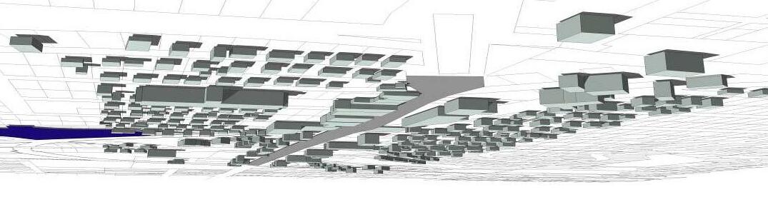


 City of Independence, Missouri
The Implementation 6-7 March 2006
Conditions
U.S. 24 Highway Corridor Study
Existing
0-5 Years 5-10 Years 10-15 Years 15-20 Years U.S. 24
Figure 6.1 Area Business District Phasing
Wilson Rd
Huttig Rd
IV. Implementation Strategy - Mixed-Use Areas (Sterling & River Redevelopment Nodes)
Key catalyst projects to stimulate redevelopment of the Corridor will be the proposed mixed-use projects at Sterling Avenue and River Boulevard as they intersect U.S. 24 Highway. As described in Chapter 5, these locations could capture 40,000 to 50,000 square feet of new retail. Potential land uses would also include medium to high-density residential. General steps to achieving this task could include:
• Establish a “Planned Area Development” district for the targeted intersections
• Determine land use and building design standards
• Resolve infrastructure or site issues
• Meet with property owners and provide background information
• Determine development barriers and identify any necessary incentives
• Consolidate property
• Solicit development proposals
• Enter into agreement with developer
The intersection of Sterling Avenue and U.S. 24 Highway is situated at the Corridor’s busiest intersection and is ideally positioned to benefit from the future employmentrelated development at the Sugar Creek Business Park. Its southeast corner is designated as a mix of commercial, market-rate row housing, and high-density multi-family housing. The multi-family housing would abut onto Bundschu Park, creating a desirable amenity. Redevelopment of this site will require considerable site work in the form of grading, stormwater detention, new streets and utility extensions. Potential funding sources for the required infrastructure improvements include Tax Increment Financing; Transportation Development District; Neighborhood Improvement Districts; and Community Improvement District.
The City of Sugar Creek is pursuing an opportunity to redevelop the northwest corner of U.S. 24 Highway and Sterling Avenue with a grocery store anchored neighborhood shopping center. Impediments to successful development have included excessive site preparation costs and insufficient retail market rents. Development of this site may require pursuing an alternative development format for the designated mixed-use site at the southeast corner of U.S. 24 Highway and Sterling Avenue. Open communication and cooperation between the Cities of Independence and Sugar Creek will be critical to successfully redeveloping Sterling Avenue.
The proposed mixed-use area at the northwest corner of U.S. 24 Highway and River Boulevard is designated for a mix of commercial, single-family housing, and high-density residential. The redevelopment site benefits from its location at a section-line corner, panoramic views, potential trails, and proximity to forested green spaces, Mill Creek, the Truman Presidential Museum and Library, and Independence Square.
The City could begin by actively marketing these two redevelopment nodes to commercial developers. For example, the City could offer financial and entitlement incentives to attract a modern grocery store necessary to facilitate neighborhood shopping center development within the designated mixed-use areas. The designated mixed-use area at U.S. 24 Highway and River Boulevard is located within the Midtown/Truman Road Corridor and commercial property owners can take advantage of the 353 Tax Abatement. This financial incentive should be better promoted in order to stimulate private investment. At the Sterling Node the City could do the same and provide incentives. This would involve the replacement of the existing low-income housing with market rate housing. A partnership with existing owners will be necessary especially to replace the existing high-density housing.
To further create potential development sites within each redevelopment node the City has other options, including purchasing property via land banking or eminent domain, demolition and clearing of new development sites. Land banking will allow the City to assemble property over time suitable for redevelopment and to hold the property until a user, project or developer is identified. This is especially relevant since the purchase of the high density apartment property may be necessary in order to encourage redevelopment of the area. The same is true for the River Boulevard Node with the purchase of the residential property to the northwest.
A long-range objective should be new streetscape improvements at each intersection. Coordinated streetscape and signage improvements will enhance the image of the areas. Improved infrastructure will display the City’s commitment in the redevelopment process. Important infrastructure improvements include sidewalks, a recreational off-street trail system, and improved street lighting. The extension of the streetscape from the Truman Presidential Library to River Boulevard should be coordinated with the redevelopment of the area. The streetscape should create a unified image. The funding of the streetscape could include a partnership between the Truman Presidential Museum and Library, developers and the Cities.
Overall, the market analysis supports long-term redevelopment of each of these intersections. Redevelopment could occur on any corner, even if it was not specifically identified by this study. However, any redevelopment will need municipal support by both the Cities of Independence and Sugar Creek. Possible phasing scenarios are illustrated in Figures 6.2 and 6.3.
Additional information on tools discussed in this section can be found in Section IX.
The Implementation 6-8 March 2006
City of Independence, Missouri U.S. 24 Highway Corridor Study
Existing Conditions


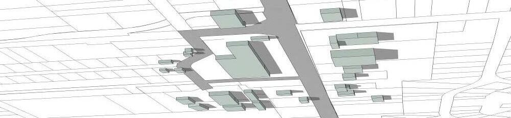
 City of Independence, Missouri
The
6-9 March 2006
U.S. 24 Highway Corridor Study
Implementation
0-5 Years 5-10 Years 10-15 Years 15-20 Years
Figure 6.2 Sterling Redevelopment Node
Sterling Ave U.S. 24 Sterling Ave


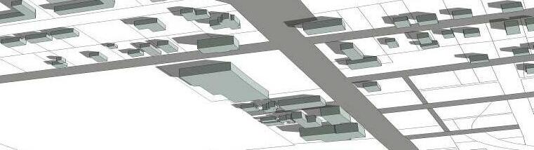
 City of Independence, Missouri
The Implementation 6-10 March 2006
U.S. 24 Highway Corridor Study
0-5 Years 5-10 Years 10-15 Years 15-20 Years Existing Conditions RiverBlvd. U.S.24
Figure 6-3. River Redevelopment Node
Draft and Adopt an Overlay Zoning District and Design Standards MU 3
Modify Current Zoning or Create a New Category to Promote Mixed-Use Development and Higher Densities MU 1.4, MU 3
Market Mixed-Use Areas to Grocery Chains, Commercial and Housing Developers MU 1.3
Public-Private Partnership for Housing NH 1, NH 6
Develop Private-Public Partnerships With Owners, Developers NH 1, NH 6
Assist in the Assemblage and Planning of Mixed-Use Areas (including key housing areas) MU 1.1, MU 1.3
Administer Streetscape Improvements Including Extension of Truman Library Streetscape MU 3, MU 2
Cities of Independence and Sugar Creek Community Development Departments, Technical Advisory Group
Community Development Department
Cities of Independence and Sugar Creek Community Development Departments, ICED, SCCDC, Chamber of Commerce, Realtors
Cities of Independence and Sugar Creek Community Development Departments, CDBG
Cities of Independence and Sugar Creek Planning Department, ICED, SCCDC, NWCDC, Chamber of Commerce, City Manager
Cities of Independence and Sugar Creek Community Development Departments, ICED, SCCDC, Chamber of Commerce, Realtors
Public Works and Community Development Departments of Independence and Sugar Creek, MoDOT, Business Owners, Truman Library
V. Implementation Strategy – Commercial District
As described in Table 6-4, the revitalization of commercial areas outside of mixed-use areas and the Fairmount Business District should gradually occur over time. The cities of Sugar Creek and Independence should work together to encourage the redevelopment of underutilized areas to new commercial or residential uses. One key first step, the creation of design standards, will improve the aesthetics of the area and attract new businesses. In addition, assisting in assembling properties where possible will be important to encourage redevelopment and better use of the land. The City should also continue to consider land use proposals for uses other than retail. Office, civic and housing uses will break up the intensity of the commercial corridor. Rezoning of parcels to other uses could occur over time.
The City should also begin to work on addressing access control improvements to improve safety. This could include a new access control plan. Access improvements should consider the need for new pedestrian amenities and streetscape. These new features such as sidewalks will connect these areas to the mixed-use centers, neighborhoods and the Fairmount Business District. The acquisition of open space and trails will also demonstrate a commitment to the area and provide a relief form commercial areas. Overall, the market analysis supports the redevelopment of these areas. Additional information on tools discussed in this section can be found in Section IX.
Draft and Adopt Design Standards CW 4, CD 3
General Revitalization Efforts MU 1
Cities of Independence and Sugar Creek Community Development Departments, ICED, SCCDC, Chamber of Commerce, Realtors
Assist in Property Assemblage CW 3, CD 1
Implement Access Control Improvements TS 3
Administer Streetscape Improvements CW 4
General Revitalization Efforts CD 1, CW 1
Cities of Independence and Sugar Creek Community Development Departments, Technical Advisory Group
Cities of Independence and Sugar Creek Community Development Departments, ICED, SCCDC, Chamber of Commerce, Realtors
Cities of Independence and Sugar Creek Community Development Departments, MODOT
Public Works and Community Development Departments of Independence and Sugar Creek, MoDOT, Business Owners
Cities of Independence and Sugar Creek Community Development Departments, ICED, SCCDC, Chamber of Commerce, Realtors
of
U.S. 24
The Implementation 6-11 March 2006 Develop a Marketing Plan and Business Recruitment Material that Promotes the Location of these Mixed-Use Areas MU 1.1, MU 1.3 Cities of Independence and Sugar Creek Community Development Departments, ICED
City
Independence, Missouri
Highway Corridor Study
YEAR ACTION STEPS POLICY/PRINCIPLE REFERENCE NUMBER (Chapter 5) COORDINATING MANAGING ENTITY 0-5 years 5-10 years 10-15 years 15-20 Years
TABLE 6-3 STERLING AND RIVER REDEVELOPMENT NODE IMPLEMENTATION TABLE
On-going
YEAR ACTION STEPS POLICY/PRINCIPLE REFERENCE NUMBER
5) COORDINATING / MANAGING ENTITY 0-5 years 5-10 years 10-15 years 15-20 Years
TABLE 6-4 COMMERCIAL DISTRICTS IMPLEMENTATION TABLE
(Chapter
On-going
VI. Implementation Strategy - Gateways (Western & Eastern Redevelopment Notes)
Eastern and western “gateways” are proposed for the U.S. 24 Highway Corridor Study. The Truman Presidential Library has been designated as the eastern gateway while the area along Rock Creek north of Mt. Washington Cemetery has been designated as the western gateway. Development of the designated gateways will assist in improving the image of the U.S. 24 Highway Corridor. These areas represent some of the biggest opportunities to make a change in the Corridor. General steps to achieving this task could include:
• Amend Parks, Recreation and Open Space Master Plan to include recommendations
• Establish a “Planned Area Development” district for the areas
• Resolve infrastructure or site issues
• Meet with property owners and provide background information
• Determine development barriers and identify any necessary incentives
• Consolidate property
• Solicit development proposals and enter into agreement with developer
• Identify and secure funding sources
• Construct streetscape and trails projects
• Redevelop property
The western gateway encompasses Rock Creek, which is included in the list of approved projects for sales tax revenues dedicated for open space improvements. Given this head start, development of the western gateway could occur over the next five years. The gateway will “play off” the adjacent natural environment and future recreational amenities. The City should encourage complementary commercial development in the western gateway (less than 15,000 square feet). This may be done as part of an overlay district or through voluntary measures. Development of commercial uses will foster the opportunity to create public-private partnerships to help subsidize initial capital costs as well as ongoing operating costs of the public open space. Potential public-private partnerships include sponsorships, concession agreements, and granting of exclusive property development rights. Potential commercial uses include a restaurant overlooking Rock Creek, a bike shop, coffee shop and nursery/flower-fruit stand. The western gateway’s commercial uses would be ideal for operation under public-private partnerships. Figure 6.4 illustrates existing building patterns and possible future phasing for this area The City should immediately begin to work with the property owner or future buyer to create a vision for the area.
The eastern gateway would be themed in a manner that is befitting of the Truman Presidential Museum and Library. Though no new commercial use is planned, future gateway streetscape improvements should be coordinated with the redevelopment outlined in the River Street MixedUse Node. Streetscape improvements to both areas will build upon the existing landscape and previous streetscape investment. For the western gateway, this will include a landscaped
boulevard and lighting improvements. For the eastern gateway, this will include extending existing streetscape improvements (lighting, landscaping, etc.) at the Truman Library to River Boulevard.
The redevelopment of areas adjacent to these gateways should follow, using the tools described in this Chapter. Additional information on tools discussed in this section can be found in Section IX.
Incorporate Gateway Designs into Parks Master Plan GW 1
Administer Streetscape Improvements (median, lighting, landscaping) GW 3
Redevelopment of Western Gateway Including New Commercial Development and Trailhead GW 2, GW 3
Develop a Marketing Plan and Development Strategies that Further Integrate Gateways with Heritage Tourism Objectives
GW 3.6
Draft and Adopt an Overlay Zoning District GW 3
Extend Improvements for Eastern Gateway GW 3
General Revitalization Efforts CD 1, CW 1
Parks Department, Public Works, Community Development Department of Sugar Creek and Independence, MODOT, Public Works
Parks Department, Public Works, Community Development Departments of Sugar Creek and Independence, MODOT, Public Works
Parks Department, Public Works, Community Development Department of Independence, MODOT, Public Works NWCDC, Design Competition
Cities of Independence and Sugar Creek Community Development Departments
Cities of Independence and Sugar Creek Community Development Departments, Technical Advisory Group
Parks Department, Public Works, Community Development Department of Independence, MODOT, Public Works, Truman Library, Business Owners
Cities of Independence and Sugar Creek Community Development Departments, ICED, SCCDC, Chamber of Commerce, Realtors
City of
U.S.
The Implementation 6-12 March 2006
Independence, Missouri
24 Highway Corridor Study
YEAR ACTION STEPS POLICY/PRINCIPLE REFERENCE NUMBER (Chapter 5) COORDINATING / MANAGING ENTITY 0-5 years 5-10 years 10-15 years 15-20 Years
TABLE 6-5 WESTERN AND EASTERN GATEWAY NODE IMPLEMENTATION TABLE

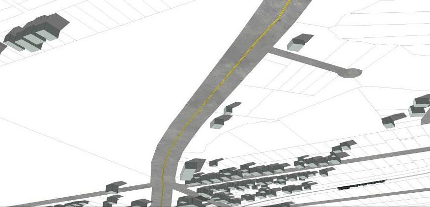

 City of Independence, Missouri
The Implementation 6-13 March 2006 Existing Development U.S. 24
U.S. 24 Highway Corridor Study
Brookside
0-5 Years 5-10 Years 10-15 Years 15-20 Years
Figure 6.4. Western Gateway Phasing
VII. Implementation Strategy - Transportation Systems

The U.S. 24 Highway Corridor Study envisions an integrated transportation system. Creating a pedestrian-oriented environment in key places along the Corridor is critical to rejuvenating the commercial districts. Within the Fairmount Business District, traffic calming and movement must be a priority. Using streetscape elements associated with the bridge, re-orientation of parking, and the development of new east-west connectors, the pedestrian shopping experience will be more easily facilitated.
In conjunction with these activities, pedestrian connections in the Fairmount Business District and other redevelopment nodes should be improved. Through the use of possible funding sources as Neighborhood Improvement Districts, Community Improvement Districts, Transportation Development Districts and streetscape improvements such as curbing, sidewalks and landscaping could be constructed.
The U.S. 24 Highway Corridor’s infrastructure is also deteriorating and does not promote pedestrian movement. The City and MoDOT must continue to work cooperatively to design and fund new streetscape improvements as well as sidewalks within each redevelopment node. The new bridge leading to the Fairmount Business District is an excellent example of the cooperative effort required. Other coordination efforts should begin with MoDOT, such as the possible transition to parallel parking in the Fairmount Business District. New cross sections through this area would need to be developed that incorporate the desired future condition.
A multi-modal transportation network should be implemented including bike, pedestrian, and transit elements. The recommended recreational trail system as shown on the Framework Plan Map (page 5-4) should be implemented. This will allow pedestrians to use off-street systems and
avoid conflicts with traffic. In addition, new transit stops should be provided at each redevelopment node.
An access control plan should also be developed in conjunction with MoDot. This plan should incorporate the designated redevelopment areas, and the potential for general redevelopment and consolidation of property in other areas of the Corridor. The plan should also include the need to provide other pedestrian and streetscape amenities identified in this Plan.
Overall, the infrastructure in this area is aging and an improvement phasing plan is necessary to ensure that the area’s transportation network meets the need of changing land uses. Additional information on tools discussed in this section can be found in Section IX.
City
The Implementation 6-14 March 2006
of Independence, Missouri U.S. 24 Highway Corridor Study
Promote Traffic Movement and Calming
Implement Landscaping and Sidewalk and Improvements
Implement New Bridge Improvements
Investigate Funding Sources For Design Enhancements
4.1, TS 4.4, TS 5.2, TS 5.3, TS 5.4
Implement and Adopt Bikeway Plan TS 5.1
Develop and Adopt Design Standards as they Relate to Signage and Lighting
Construct Pedestrian Linkages between Business Districts and Residential Neighborhoods
NH 3.8, FB 5, FB 8, MU 3
TS 5.4, TS 5.2, TS 5.3
City Public Works, Neighborhood Watch
City Public Works
Community Development Department, Public Works
Community Development Department
Community Development Department
Neighborhood Groups, City Parks and Recreation, Public Works and Community Development Department
VIII. Implementation Strategy - Natural Resources, Parks & Open Space

The natural resource areas and green space will play an important role in improving the livability of the U.S. 24 Highway Corridor as well as provide a distinctive community image and amenity. The gateways, Crisp Lake, Rock Creek and Sugar Creek open space and other recreation recommendations in the U.S. 24 Highway Corridor Study should be adopted into a revised parks master plan.
The initial phase of revitalization of the U.S. 24 Highway Corridor involves development of the western gateway which includes Rock Creek. Rock Creek Trail is included in the City’s Parks, Recreation and Open Space Master Plan Map and sales tax revenue has been allocated for development. The City should make development of Rock Creek Trail as it intersects with U.S. 24 Highway a priority, with a 0 to 5-year horizon recommended.
As shown on the Framework Plan Map in Chapter 5 on page 5-3, trail and pedestrian connections between Rock Creek, Fairmount Business District, Crisp Lake, and Sugar Creek is critical to building a stronger community. The trail system can also be used to further link commercial areas in the Corridor. The Crisp Lake area holds significant natural resource and redevelopment potential, both of which can be sensitively capitalized on without conflict. The City should work with the Department of Natural Resources to improve these waterways, and investigate the possibility of parcel assembly. If redevelopment occurs, the City and its partners should consider monitoring water quality and pollutant levels, dredging Crisp Lake, and restoring riparian habitat along the edges of Crisp Lake. Continual activities should include improvement of parks within the influence area and the continual planning and construction of an off-street trail system.
Promote a Multi-Modal Network
TS 1.1, TS 4.4, TS 5.3
Neighborhood Groups, City Parks and Recreation, Public Works and Community Development Department, MARC, ATA Continue to Enforce Existing Codes as Well as Promote Activities to Ensure Clean Streets
Additional information on tools discussed in this section can be found in Section IX.
City of Independence, Missouri U.S.
The Implementation 6-15 March 2006
24 Highway Corridor Study
TABLE 6-6 TRANSPORTATION
TABLE YEAR ACTION STEPS POLICY/PRINCIPLE REFERENCE NUMBER (Chapter 5) COORDINATING MANAGING ENTITY 0-5 years 5-10 years 10-15 years 15-20 Years
IMPLEMENTATION
TS,
MODOT,
Work with MODOT on a Final Approved Cross-Section for Each Gateway and the Fairmount Business District
4.1 CW 3.2
City Public Works
MODOT,
Techniques in Fairmount Business District TS 1.2
TS
MODOT,
4.4, TS 5.2, TS 5.3, TS 5.4
Near Fairmount Business District.
TS
Community
On-going General
TS
On-going
CW 4
Development Department
Improvements Including Access Control Plan
3.1, TS 3.2 MODOT, City Public Works
Riparian Buffer Standards and Investigate Buffer Standards for Other Natural Resources NR 1
Incorporate Gateways, Crisp Lake and Sugar Creek into Parks Master Plan NR 1.4, NR 1.2, NR 1.1, NR 2.3, NR 2.5, NR 2.4
IX. Implementation Tools – Corridor-Wide
MARC, DNR, Community Development Department, Parks and Recreation, Water Pollution Control
Community Development Department, Parks and Recreation
Locate ROW of Future Off-Street Trails and Require Dedication by Private Developers NR 2.6, NR 2.7 NR 2.2, NR 2.1 Community Development Department, Parks and Recreation
Continue to Investigate the Relocation/Addition of Hink and St. Clair Parks NR 2.6, NR 2.7, NR 2.2, NR 2.1
Acquire Public Area on Crisp Lake and Construct Trail NR 2.6, NR 2.7, NR 2.2, NR 2.1, NR 2.5, NR 2.3
Continue to Investigate Ways to Improve Stormwater Management NR 2.5, NR 2.3
Work on Reclamation Activities as they Relate to Crisp Lake and Sugar Creek
NR 1.3, NR 1.4, NR 1.1, NR 2.3

Continue to Improve Facilities within Existing Parks NR 2.5, NR 2.4
Coordinate with MARC regarding Trail Locations. Outline in Plan to Ensure Regional Linkages NR 2.6, NR 2.7, NR 2.2, NR 2.1
Acquire Through Fee-Purchase or Conservation Easement Open Space Areas and Trails NR 2.1, NR 2.3, NR 2.4, NR 2.5
Community Development Department, Parks and Recreation
Community Development Department, Parks and Recreation
Public Works, MARC
Parks, Neighborhood Groups, WPC, Public Works, Private Developer, DNR
Many public programs, private and legislative tools are available for revitalization activities in Missouri. Below is a list of additional tools for the public sector to encourage private sector involvement and investment (also see Table 6-6). Because many of the tools have been or currently are being used, this section describes their effectiveness and suggests options to better apply them in the future.
A. Tools Utilizing Property Tax Abatement
353 Tax Abatement Description
On-going
Chapter 353 of the Missouri Revised Statutes allows Urban Redevelopment Corporations in certain cases to receive property tax abatement equal to 100% of property taxes, excluding land value, for 0-10 years and 50% of property taxes for years 11-15. The tax abatement is granted to a “353" Development Corporation who then may “pass on” the abatement to other property owners who conform to the Corporation’s approved Development Plan. While the City of Independence has not typically granted eminent domain powers, state law allows the Development Corporation to be granted eminent domain powers by the City Council in order to facilitate a particular redevelopment proposal.
Community Development Department, Parks and Recreation, MARC
On-going
MARC, DNR, Community Development Department, Parks and Recreation On-going
Summary of Steps:
1. 353 Corporation must be formed.
2. Blight Study must be completed.
3. 353 Corporation proposes a redevelopment plan to the City.
4. Tax Impact Analysis must be completed and sent to all taxing jurisdictions.
5. City sends notice to property owners within the proposed 353 area.
6. Planning Commission holds public hearing and then makes recommendation to City Council regarding plan for development or redevelopment.
7. City Council may approve Plan and declare area blighted. Once Plan is approved, the 353 Corporation receives tax abatement for property it acquires and uses in compliance with the Plan.
City
U.S. 24
The Implementation 6-16 March 2006
of Independence, Missouri
Highway Corridor Study
YEAR ACTION STEPS POLICY/PRINCIPLE REFERENCE NUMBER (Chapter 5) COORDINATING MANAGING ENTITY 0-5 years 5-10 years 10-15 years 15-20 Years Implement
TABLE 6-7 NATURAL RESOURCES, PARKS AND OPEN SPACE IMPLEMENTATION TABLE
The amount and duration of abatement is specified in the Plan the Council approves. The 353 Corporation may transfer any property it acquires and the new owner will retain the tax abatement (i.e. the property tax abatement is “passed on”). The deed can then be transferred back to the owner if desired. The effective duration of the Plan (or the time during which tax abatement is available) is specified in the Plan, but in no case exceeds 25 years. Phases may also be specified in the Plan which specify dates when different areas will be developed or redeveloped.
Past Use of 353 Tax Abatement in Independence
A 353 Development Plan has been adopted for the Midtown/Truman Road Corridor (M/TRC) area, which includes U.S. 24 Highway between Forest Ave. and Delaware St. Owners of property in this area who wish to gain property tax abatement must make application to the M/TRC office and follow the development or redevelopment standards, which includes a minimum expenditure and adherence to certain design standards. Property owners along the south side of U.S. 24 Highway have not taken advantage of this tax abatement incentive. One reason is that, while the original M/TRC Plan was adopted in 1995, the Plan did not include the south side of U.S. 24 Highway until 2000, and even then properties on U.S. 24 Highway were not eligible until design guidelines were approved in 2002. Another reason property owners have not taken advantage of the tax abatement opportunity is that they simply do not know it is available.
Potential Use Within the U.S. 24 Highway Corridor
There is a great likelihood that the U.S. 24 Highway Corridor properties in the M/TRC area could be redeveloped through this incentive. The Thriftway and adjacent shopping center are all inside the current M/TRC area and would be great candidates for being redeveloped using this incentive. The administration for using this tool also is already in place. The program is administered by staff contracted by the M/TRC Redevelopment Corporation Board.
Use of the 353 tax abatement tool in other areas of the U.S. 24 Highway Corridor is currently not available. One concept is to expand the current M/TRC area. This may be somewhat of a challenging process. First, the current M/TRC Board must agree to the expansion and they would then control the entire process. Second, in order to approve a Plan that incorporates a larger area, notification will have to be sent to all the owners of property within both the present M/TRC area and the proposed additional area.
Another way of using the 353 Tax Abatement incentive in other areas of the U.S. 24 Highway Corridor is to create a new 353 Corporation that could submit one or more Development Plans for approval. The Corridor Plan being developed for U.S. 24 Highway could function as the backbone or basis for the 353 Development Plan(s). Several approaches exist, each with their respective pros and cons: 1) one 353 Plan for a very large area, 2) multiple plans for each property redevelopment proposal, or 3) plans for each small neighborhood. A description of each follows:
a. One 353 Development Plan for a large area:
This strategy would be consistent with what is being done with the current M/TRC Corporation. The M/TRC Corporation has been successful, but it must be remembered that they have received operating funds annually from a TIF to administer the parcel-specific tax abatement program. The M/TRC Corporation also has a well-organized board, an office in the M/TRC neighborhood, and well-established procedures involving professional administration and inspections to process requests for parcel-specific tax abatement. All these features would need to be replicated in order to see the same kind of success, or any success, in a large-scale tax abatement program throughout the U.S. 24 Highway Corridor.
The purpose of a single 353 tax abatement tool will be to secure ongoing operating funding for inspection and administrative staff. There is already in place a TIF for Mt. Washington that could provide up to $250,000. However, the amount that has actually come from this TIF for such purposes has not reached more than $10,000 in total. This funding must be used for the Fairmount commercial district, not for the entire U.S. 24 Highway Corridor.
The City of Independence could partner in administering the program, however this would require additional funding. The City may be able to devote staff to process and review submitted applications, as well as to complete required inspections. This could easily require an additional full-time position. Otherwise, funding would be needed in order to contract administration and/or inspection services.
b. 353 Development Plan for each specific property redevelopment proposal:
This strategy would resemble what has happened in Kansas City, Missouri for the last several years. There, 353 Redevelopment Corporations submit Development Plans for small parcels of land using many of the same procedures for Plan approval in the City of Independence and granting of the tax abatement. However, Kansas City’s method of creating 353 areas has proven cumbersome and follow-up responsibilities for the City are heavy. As a result, the Kansas City Development Management Department has created “template” 353 Development Plans which make submission and processing of 353 Plans comparatively simple. It is possible that a template 353 Plan, in application form, could be made available to property owners in the U.S. 24 Highway Corridor. The application/template 353 Plan could include elements of the U.S. 24 Highway Corridor Study, or even specifications for design elements that must be included in residential or commercial redevelopments, whichever may be applicable to the property being redeveloped. After a property owner “fills in the blanks,” he or she could submit the plan for approval to the City. The current application fee of $2,000 may be cost-prohibitive for smaller projects and may need to be revised. State law requires that a 353 Redevelopment Corporation be the sponsor of the Development Plan and area. Each area would have to have either a separate 353 Corporation or the City might have to incorporate its own 353 Corporation. Either way, it may be beneficial to
City of Independence, Missouri U.S. 24 Highway Corridor Study The Implementation 6-18 March 2006
have the board members of this Redevelopment Corporation come from those who have been involved in the U.S. 24 Highway Corridor Study process.
c. New 353 Development Plans for each small neighborhood:
One limitation to the first and second approaches discussed above is that they may not target redevelopment efforts at a small scale. If isolated individual redevelopment projects happen anywhere along the U.S. 24 Highway Corridor, improvements are likely to have little impact if surrounding properties remain unimproved. An alternative approach to address this issue would be to have 353 Development Plans for small district or neighborhood areas. The benefit of this third approach is that it creates concentrated pockets of redevelopment activity, such as in the Fairmount Business District. Individual neighborhood areas ranging from 2 to 20 blocks would be other candidates. Using the 353 tax abatement incentive under this approach would likely be coupled with other strategies or implementation tools to see changes in more than one way. For instance, a 353 Development Plan could be submitted for a neighborhood that successfully organizes a Neighborhood Crime Watch or one that creates a Neighborhood or Community Improvement District to fund infrastructure improvements. As with the other two approaches, a Redevelopment Corporation will need to be formed, redevelopment will need to adhere to specified design standards and inspections of redevelopment efforts will need to be made. These details will need to be addressed regardless of which approach is used.
Land Clearance Redevelopment Authority (LCRA)
In 1958, the Independence City Council adopted an LCRA enabling ordinance. The same year, Independence voters approved a measure accepting the provisions of the Redevelopment Law. Originally, the Independence City Council exercised the community's LCRA power directly. But in 1960, the City Council transferred the exercise of that power to a separate LCRA, as the Redevelopment Law allows. Independence subsequently adopted multiple urban renewal plans under the Redevelopment Law.
In 1975, the City Council adopted Resolution 928, authorizing the LCRA to "close out the neighborhood development program and acknowledging that the assets and liabilities become the property" of the city. In 1977, the City Council adopted Ordinance No. 4830, accepting all remaining responsibilities from the LCRA for a separate urban renewal project. A recent court ruling has determined that the previously approved LCRA plans are still valid and property within the existing plan areas could be eligible for tax abatement per statutory requirements.
Based on the recent court determination, the City is currently reevaluating the use of LCRA provisions to provide incentives for redevelopment. The state statute allows for property within the approved plan area to request tax abatement on the improvements or the increase in property tax valuation for a 10-year period. This basically has the effect of 'freezing' the property tax assessment prior to redevelopment for a 10-year period.
It should be noted that only a small portion of the Corridor (the south side of U.S. 24 Highway roughly between Delaware St. and River Blvd.) is currently covered under an LCRA Plan. In order to effectively use this tool, a larger portion of the Corridor would need to be designated under an LCRA Plan. While the City is currently evaluating its options regarding LCRA Plans, it is unlikely that the City will designate new plan areas.
Under case law and state statute provisions the LCRA is considered tax exempt. As such, the Authority could purchase real estate property and personal property and lease these assets to a for-profit-entity thereby reducing the tax responsibility for the for-profit-entity.
Satellite Enterprise Zone (established prior to December 2004)
Description
Most of the northwest part of Independence is within a Missouri Enterprise Zone. It is called a “satellite” enterprise zone because there was already an original Enterprise Zone in Independence when the Northwest Independence Satellite Enterprise Zone was created in 2000. This designation not only provides tax abatement as an incentive, but also tax credits to qualifying businesses. In this section only the tax abatement will be described. Tax credits available through this program are described in the following section.
Real property tax abatement equal to half of the property taxes is available to certain types of businesses in the Satellite Enterprise Zone that invest at least $100,000 and create two new jobs. The tax abatement lasts for ten years. The types of businesses that are eligible to receive tax abatement are manufacturing, assembling, fabricating, processing, mining, warehousing, distribution, and any business that creates at least 50 new full-time jobs. Other types of businesses are eligible for income tax credits, as described in the next section.
Past Use
Businesses in the northwest Independence Satellite Enterprise Zone have not taken advantage of the available incentives. This may be due to the fact that the Satellite Enterprise Zone was established primarily with the intent to use the tax credits available through the enterprise zone designation to entice retail and other businesses eligible for the tax credits to build or expand within the Zone area.
Potential Use Within the U.S. 24 Highway Corridor
Recent state legislation has significantly altered the use of existing Enterprise Zones and Satellite Enterprise Zones. As of December 31, 2004, applications for credits under the program will no longer be accepted. Existing zones will need to be reestablished under new criteria. The reestablishment of new zones along the U.S. 24 Highway Corridor may be possible, however, until
City of Independence, Missouri U.S. 24 Highway Corridor Study The Implementation 6-19 March 2006
additional information regarding the rules and regulations are provided by the State it is unclear as to the effectiveness of this tool.
B. Tools Utilizing Tax Credits
Satellite Enterprise Zone (established prior to December 2004)
Description
As mentioned in the section above, the Satellite Enterprise Zone, which covers most of northwest Independence, provides both tax abatement and tax credits to eligible businesses. The tax abatement incentive is described in the section above.
Credits to pay State of Missouri income taxes are available to certain types of businesses in the Satellite Enterprise Zone that invest at least $100,000 and create two new jobs. The amount of credits depends on the number of new employees hired and the type of employees hired. For instance, a credit of $400 is claimed each year for 10 years for the creation of each new job (meaning an average of at least 20 hours per week). An additional credit of $400 per year may be claimed for each employee that is a resident of any Missouri Enterprise Zone. Another $400 credit per year may be claimed for each employee that is “difficult to employ” or for other types of special employees. Tax credits may also be claimed to cover a portion of the costs of training employees.
The types of businesses that are eligible for tax credits includes all those eligible for tax abatement listed above plus telecommunications, computer services, health services, banks, insurance, poultry/egg producers, employment agencies, recycling operations, commercial research/development services, transportation terminals, office activities, renting/leasing residential property to low/moderate income persons, and, most importantly, retail businesses. Most state enterprise zones do not give tax credits to retail businesses, but the Satellite Enterprise Zone has this special feature.
Past Use
The only business within the Satellite Enterprise Zone that has taken advantage of the tax credit incentive is a restaurant in Englewood. A restaurant can really utilize the tax credits more than many other businesses because it typically has many employees, which is what the tax credit amount is based on.
Potential Use with U.S. 24 Highway Corridor
Recent state legislation has significantly altered the use of existing Enterprise Zones and Satellite Enterprise Zones. As of December 31, 2004, applications for credits under the program will no
longer be accepted. Existing zones will need to be re-established under new criteria. The reestablishment of new zones along the U.S. 24 Highway Corridor may be possible, however, until additional information regarding the rules and regulations is established by the State it is unclear as to the effectiveness of this tool.
Rebuilding Communities Tax Credits
Description
This State of Missouri program aims to attract certain types of businesses to certain census block groups (“distressed areas”) throughout Missouri by offering the businesses State of Missouri income tax credits. It also will give tax credits to existing businesses in the eligible areas if they meet program requirements. Historically, the area north of U.S. 24 Highway and west of Ash, the area south of U.S. 24 Highway and west of Home, and the area south of U.S. 24 Highway and east of Crysler were eligible under this program. As the eligible areas change regularly based on census data, it is recommended that one contact the Missouri State Financial Assistance office at 1-877-618-5857 or 573-751-0717 to determine eligibility for specific areas.
New or relocating eligible businesses receive either:
1. 40% Income Credit: State income tax credit to the taxpayer for three years based on 40% of their income taxes due; or,
2. 40% Specialized Equipment Credit: State income tax credit of 40% based on the amount of funds expended for computer equipment and its maintenance, medical laboratories and equipment, research laboratory equipment, manufacturing equipment, fiber optic equipment, high speed telecommunications, wiring or software development expense. In addition, qualified employees of a new or relocating business may receive a tax credit against state individual income tax, equal to 1.5% of their gross salary paid at such facility. This credit can be earned for each of three years that the facility receives one of the 40% tax credits.
Eligible businesses already located in a distressed area, which expend funds for specialized equipment, exceeding their average of the prior two years for such equipment, shall be eligible to receive a 25% tax credit against state income taxes owed. Any existing business that doubles the number of existing employees (based on FTE equivalent) at the facility, measured from the submittal date of the Pre-Application, can apply for the 40% tax credits and the 1.5% Employee tax credit as a "New or Relocating" business.
City of Independence, Missouri U.S. 24 Highway Corridor Study The Implementation 6-20 March 2006
Eligibility Criteria
1. Businesses must either relocate to the distressed area from a non-distressed area, begin as new business in a distressed area, or already exist in the distressed area.
2. Business must be manufacturing, biomedical, medical devices, scientific research, animal research, computer software design or development, computer programming, telecommunications or certain types of professional firms.
3. Business must have more than 75% of its employees employed in a distressed community, prior to the issuance of tax credits.
4. Business must have fewer than 100 employees total for all facilities at the time a preapplication is submitted.
Past Use
There is no known past use of this program in the U.S. 24 Highway Corridor.
Potential Use Within the U.S. 24 Highway Corridor
Many people interested in revitalizing the U.S. 24 Highway area have wanted to attract medical professionals to the area. This is an excellent program for such a purpose. Of course, the eligible areas are limited. For instance, the Swope Clinic on U.S. 24 Highway is currently not located in an eligible distressed area. However, if a facility were to be built east of Ash Avenue, but still north of U.S. 24 Highway, any doctor or other medical professional who located there would be eligible for these tax credits. It should be noted, too, that dentists, accountants, attorneys, chiropractors and other professionals would also be eligible. Such a fact points to the possibility of developing mixed office/retail facilities in some of areas that are eligible distressed areas. The incentives offered to medical and other professionals through this program may be just enough to entice them to move into the area. However, there needs to be offices available for them, and those offices must be marketed by highlighting these types of benefits of the location.
Historic Tax Credits
Historic tax credits are received after making eligible expenses for the rehabilitation of a historic property. The credits can be used to pay income taxes. The rehabilitation must be considered substantial and eligible activities may include work on the building itself, architectural fees, legal expenses and development fees. It may not include any work to expand the building or grounds.
There are actually three different programs available:
• State of Missouri 25% Historic Tax Credit
• Federal 20% Tax Credit
• Federal 10% Tax Credit
a. State of Missouri 25% Historic Tax Credit Description
The State of Missouri 25% Historic Tax Credit Program provides tax credits for 25% of eligible costs and expenses of the rehabilitation of approved historic structures. The tax credits may be used to offset Missouri income tax liability for up to three previous years or up to 10 years forward. Any person, firm, partnership, trust, estate, or corporation is eligible to participate in this program, with the exception of not-for-profit entities and/or government entities. The tax credits are also sellable and transferable. However, to be eligible properties must be either (a) listed individually on the National Register of Historic Places, or (b) certified by the Missouri Department of Natural Resources as contributing to the historical significance of a certified historic district listed on the National Register, or (c) of a local historic district that has been certified by the U.S. Department of the Interior. Costs and expenses associated with the rehabilitation must exceed 50% of the "total adjusted basis of the property" (acquisition cost minus depreciation).
Past Use
There has been no known use of the state historic tax credit in the U.S. 24 Highway Corridor. Some properties in the Truman Historic District have received state historic tax credits.
Potential Use Within the U.S. 24 Highway Corridor
To take advantage of this incentive that would offset the costs of rehabilitating an older building, the building must first be placed on or determined eligible for the National Register of Historic Places or a Historic District must be created that includes the building within its boundaries. To be eligible, the building cannot be owned by a non-profit or government entity. To qualify, a survey must first be completed, and then an application submitted to the State Historic Preservation Office. The National Parks Service must then approve the proposed nomination. This credit will be an effective tool in the Fairmount Business District and surrounding residential areas.
b. Federal 20% Historic Tax Credit
Description
The Federal 20% Tax Credit is much like the state historic tax credit except that these tax credits may be used to offset Federal income tax liability for up to 20 tax periods (none of which may be in the past). There are also other differences. First, the property must be income-producing
City of Independence, Missouri U.S. 24 Highway Corridor Study The Implementation 6-21 March 2006
(meaning owner-occupied homes would not be eligible). Although there are ways to structure partnerships so that federal tax credits can be used by equity partners, federal tax credits cannot be sold.
Past Use
There has been no known use of the federal historic tax credit in the U.S. 24 Highway Corridor.
Potential Use Within the U.S. 24 Highway Corridor
To take advantage of this incentive that would offset the costs of rehabilitating an older building, the building must first be placed on or determined eligible for the National Register of Historic Places or a Historic District must be created that includes the building within its boundaries. To be eligible, the building cannot be owned by a non-profit or government entity. To qualify, a survey must first be completed, and then an application submitted to the State Historic Preservation Office. The National Parks Service must then approve the proposed nomination.
c. Federal 10% Historic Tax Credit
Description
The Federal 10% Tax Credit is far easier to qualify for than the other historic tax credits. With this program, a tax payer receives tax credits worth 10% of the costs of rehabilitation of a building that was placed in service before 1936 and is NOT eligible for listing in the National Register. The property rehabilitation does not need to meet the same rehabilitation guidelines of the 20% historic tax credit. The tax credits may be used toward the payment of one’s personal federal tax bill. To claim the credit, a tax payer simply fills out a certain schedule and attaches it to their income tax return to the Internal Revenue Service. This credit is only available for income-producing commercial or industrial buildings.
Past Use Within U.S. 24 Highway Corridor
There has been no known use of this tax credit in the U.S. 24 Highway Corridor.
Potential Use
This program should be publicized to anyone who may be interested in rehabilitating an older building which meets the criteria. It is likely, however, that this program alone will not provide enough to bring the kind of rehabilitation that is needed. It should also be noted that the 10% credit can only be used once. So, it is best to use it on a big project when a building really needs major repairs, such as a new roof, mechanical and electrical work rather than on a small fix, such as a new awning or façade.
Neighborhood Preservation Act tax credits Description
The Neighborhood Preservation Act (NPA) was passed during the 1999 Missouri General Assembly. The law’s intent is to aid in the rehabilitation and new construction of homes in certain census blocks in the state of Missouri. NPA provides taxpayers a state tax credit worth 15% of the eligible costs associated with the construction of a new residence, or up to 35% of eligible costs of rehabilitating an existing home. The home, whether new or rehabilitated, must become owner-occupied and it must be in a census block group where the median income of the block group is less than 90% of the median income of the Kansas City Area Median Income (AMI). In block groups where the median income is less than 70% of the AMI, the developer/owner would receive a tax credit worth 35% of the rehabilitation costs for substantial rehabilitation (i.e. costs exceed $10,000) up to $70,000 in a 10-year period. For other rehabilitation, the tax credit received is 25% of rehabilitation costs, up to $25,000 in a 10-year period. The tax credits can be used to pay state income taxes, and can be sold or transferred.
Most all of the area surrounding U.S. 24 Highway would qualify for the NPA tax credits. As the eligible areas change regularly based on census, one can call 573-522-8004 or visit http://www.co.st-louis.mo.us/scripts/plan/taxcred.cfm to determine eligibility.
However, eligibility does not guarantee that someone making application will be awarded the tax credits because the amount of NPA tax credits is limited each year. Therefore, there is a “lottery” to award the available tax credits among the various applications received from all over the state. Any taxpayer whose application is not chosen in the lottery one year has to wait until the next year and resubmit the application.
Past Use
Some taxpayers in Independence have taken advantage of this program and received the tax credits, but none in the U.S. 24 Highway area are known.
Potential Use Within the U.S. 24 Highway Corridor
The most straightforward use of this program is by a homeowner who wishes to rehabilitate his or her home. The homeowner simply makes application, and if awarded tax credits, proceeds with the project, claims the tax credit upon finishing the project, and then uses the tax credits to pay their taxes. But, a developer can use the program, too. After being awarded the tax credits, the developer either builds a new home or rehabilitates one and then sells the home and collects the tax credit. However, the developer must sell the home to someone who will live in it (the home must be owner-occupied). Since the developer must be a taxpayer, one challenge in taking advantage of this program is to attract for-profit developers that will build new homes in an older
City of Independence, Missouri U.S. 24 Highway Corridor Study The Implementation 6-22 March 2006
area due to theft, vandalism, and other financial obstacles. One alternative is to have the NWCDC form a partnership with a for-profit entity to take advantage of the tax credits.
Neighborhood Assistance Program (NAP)
Description
A qualifying nonprofit organization can be granted assistance to administer a community or neighborhood project if the community or neighborhood itself does not have the ability or resources. A tax credit worth up to 50 percent of a donation can be given to those who donate to a nonprofit organization that will provide community services, physical revitalization, or economic development.
Past Use
The Northwest Communities Development Corporation has received NAP credits in the past. They then have to find taxpayers who are willing to make a donation to the Northwest CDC in exchange for the tax credits, which are worth 50% of the donation. It has sometimes been difficult for them to find donors who want to make such an exchange.
Potential Use Within the U.S. 24 Highway Corridor
More donors can be sought for the Northwest Communities Development Corporation’s current efforts. Also, an identified physical revitalization project could be identified for which donors could be sought. Sometimes, a brick and mortar project, as opposed to community service, will generate more interest and therefore elicit more donations.
Low Income Housing Tax Credits (State and Federal) (LIHTC)
Description
This program provides a federal tax credit and a state tax credit to investors in affordable housing. The credit can be used each year for 10 years and is allocated to developers, who may sell it to raise equity to construct or acquire and rehabilitate affordable rental housing. The Housing Credit is limited to a percentage of the Qualified Basis, based upon depreciable basis, and the percentage of affordable units in the development. The minimum number of qualifying units is (a) 40% of the total number of units affordable to persons at 60% of the median income or (b) 20% affordable to persons at 50% of the median income. Projects are selected by the Missouri Housing Development Corporation (MHDC), who is charged not only with the allocation of credit, but also with assuring compliance with the regulations. This includes the performance of a physical inspection of the property and a review of management and occupancy procedures during the compliance period of the initial 15 years and the extended use period (an additional 15
years). A copy of the Tax Credit Compliance Manual is available on the MHDC website at http://www.mhdc.com/program_compliance/LIHTC/.
Developers (for-profit and not-for-profit) are eligible to apply for tax credits. Applicants must demonstrate prior, successful housing experience and engage the services of housing professionals, such as architects, appraisers, attorneys, accountants, contractors and property managers with demonstrable tax credit and housing experience. Developers must have the financial capacity to successfully complete and operate the proposed housing development. Proposed housing developments must:
1. Meet a demonstrated affordable housing need;
2. Provide housing for low income persons and families;
3. Demonstrate local support;
4. Leverage tax credit funding with other financing and/or rental assistance;
5. Be economically feasible; and
6. Balance sources and uses of funds.
Typically, a Notice of Funding Availability (NOFA) is published during the month of August. Once the NOFA is released, an application packet is available on the MHDC web site or by mail, upon request. The deadline for proposal submission is typically in late October, and recommendations are made to the Commission in January or February. More information can be found at www.mhdc.com/rental_production/low_inc_tax_pgrm.htm.
Past Use
There is no known past use of low-income housing tax credits in the U.S. 24 Highway Corridor.
Potential Use within the U.S. 24 Highway Corridor
Some of the people who participated in developing scenarios for the U.S. 24 Highway Corridor area suggested apartment or town home developments near the Fairmount Business District or Crisp Lake. Such a development would be a prime candidate for using low-income housing tax credits.
New Markets Tax Credit (NMTC) Program
Description
The New Markets Tax Credit (NMTC) Program permits taxpayers to receive a credit against federal income taxes for making qualified equity investments (QEIs) in designated Community Development Entities (CDEs). Substantially all of the qualified equity investment must in turn be used by the CDE to provide investments in low-income communities. The credit provided to the
City of Independence, Missouri U.S.
The Implementation 6-23 March 2006
24 Highway Corridor Study
investor totals 39% of the cost of the investment and is claimed over a seven-year credit allowance period. In each of the first three years, the investor receives a credit equal to five percent of the total amount paid for the stock or capital interest at the time of purchase. For the final four years, the value of the credit is six percent annually. Investors may not redeem their investments in CDEs prior to the conclusion of the seven-year period.
NMTCs are allocated annually by the Community Development Financial Institution Fund (CDFI Fund) to CDEs under a competitive application process. These CDEs then sell the credits to taxable investors in exchange for stock or a capital interest in the CDEs. Through efforts of the Northwest Communities Development Corporation, a CDE has been established in Independence with the intent to help provide funds for development and redevelopment of northwest Independence, the U.S. 24 Highway Corridor and other areas. This CDE, which was certified by the CDFI Fund in 2003, is called the Traditional Marketplaces Finance Corporation (TMFC). It was established with board members who include representatives from the Independence Council for Economic Development, Fairmount, Englewood, Maywood, the Square and local banks. The intent in creating the TMFC was to create an entity that could offer low-interest loans for the rehabilitation and new construction of commercial structures in “traditional”, or older, business districts in and around Independence. While other programs offer tax incentives, this entity was to provide up-front cash to help property owners and developers get started on development or redevelopment projects. Besides offering loans, it is possible that the TMFC could make outright investments in projects.
However, before the TMFC can make loans or investments, it must have capital. The New Market Tax Credits are supposed to entice investors to provide capital to the TMFC as an eligible CDE. If the TMFC receives an allocation of NMTCs, it can “sell” those tax credits to its investors. For instance, if a bank, corporation or other tax payer invests $100,000 in the TMFC, after the first year, that tax payer will receive $5000 (5%) in federal tax credits. After the second year, the tax payer receives another $5000, and the same after the third year. After the fourth year the tax payer receives $6000 (6%), and the same after the fifth, sixth and seventh years. After the seventh year (and not before) the investor can redeem their initial investment. The TMFC can also pay dividends to its stock holders / investors, besides the tax credits it provides to them.
Several difficulties or obstacles have arisen in trying to get the TMFC started. First, it is difficult to find investors. Local banks, some of which had officers represented on the TMFC Board, were sought out to be initial investors who could reap the benefit of the New Markets Tax Credits. But, banking regulations typically prohibit a bank from making investments in other corporations. The TMFC, however, would qualify as a community development corporation in which a bank would be allowed to invest. In fact, the Community Reinvestment Act would encourage such investment. Nonetheless, investment in such a corporation will be a new approach to these banks, one that may hold unknown risks, and in preliminary discussions there were no banks that were willing to make an investment (though one said it will donate $5000).
Another difficulty with the NMTC Program is that the CDE is required to invest substantially all (over 85%) of each qualified equity investment (QEIs) it receives from an investor within 12 months of receipt of the QEI. This means that within a period of only 12 months, a CDE must
1. Identify a low-income community investment or loan opportunity that will qualify under the standards of the NMTC Program. This could include much publicity and education.
2. Take applications or otherwise consider the opportunities to make one or more qualified low-income community investment (QLICIs), evaluating whether or not each QLICI will be a wise and prudent investment.
3. Render decisions and disburse funds that will invest substantially all of the QEIs received by the CDE. All this would have to be done in 12 months with a board that has never worked together before and without staff currently doing any such things. Putting all these pieces together makes the NMTC a tool that is currently not very accessible.
Past Use
There has been no use of the NMTC Program in Independence or Missouri. There are no active CDE’s in the Kansas City area.
Potential Use in the U.S. 24 Highway Corridor
While using the NMTCs to put together a viable program may be difficult, it could have much potential for the redevelopment of the U.S. 24 Highway Corridor. Some examples of how it could be used include:
1. Offering start-up loans for new businesses.
2. Offering loans to businesses looking to expand or relocate in the U.S. 24 Highway Corridor.
3. Providing loans (or equity investments) for new health care facilities, such as the Swope Health Clinic.
4. Providing equity investments or loans for rehabilitation or new construction of homes that would be offered for sale (the NMTC Program may not be used for rental housing). Such a use would be best coupled with the Neighborhood Preservation Act Tax Credits. Also, the Northwest Communities Development Corporation might provide properties it receives from the Jackson County Land Trust for such housing development. The Northwest Communities Development Corporation could make a contract with a developer to provide the properties for housing development and not receive compensation for the properties until the home to be built upon it sells to an owner-occupant.
5. Providing loans or equity investments to redevelop commercial buildings in Fairmount. This could then be coupled with receiving a 10% rehabilitation tax credit for buildings placed in service prior to 1936. Tax abatement through the Missouri 353 statute could also be used, as well as the City’s facade grants. This could be very beneficial to the Palomino Restaurant. One other source of funding could be HOME funds for low-income apartments on the top floors
City of
U.S.
The Implementation 6-24 March 2006
Independence, Missouri
24 Highway Corridor Study
of buildings (but coupling such funds with NMTCs would limit the apartments to providing no more than 20% of the income of the entire project).
6. Providing loans for community-based charter schools.
C. Tools that Provide Funding/Financing through Taxes or Assessments
Community Improvement District (CID)
Description
Section 67.1400 of the Revised Statutes of Missouri allows for the creation of a Community Improvement District (CID) by ordinance in which revenue can be raised and then used to complete projects or perform services for the residents and/or owners of property within the district boundaries. A CID’s revenue can come through several different methods: special assessments, real property taxes, sales tax, or fees. The special assessments can be structured in many different ways, depending on the improvement or service to be funded by the assessment. For instance, an assessment can be levied based on a certain dollar amount per linear foot of street frontage, or it could be per square foot of property, or per square foot of building floor area. The duration of an assessment or tax is flexible. An assessment could be an annual amount that lasts every year for two years or for 20 years. The revenues raised by a CID can also be combined with other funding sources to pay for projects or services.
Using a CID to generate funds through assessments or taxes is a two-part process: first, the CID must be established; second, the special assessment or tax must be approved by a majority of residents and/or property owners. To establish a CID, a petition must be signed by:
1. Property owners who collectively own real property representing more than 50% of the assessed value of the real property within the CID; and,
2. More than 50% per capita of all owners of the real property located within the CID.
The petition must include an initial five-year plan specifying the type and estimated costs of the improvements or services to be provided by the CID. The petition must also declare the CID area, the duration of the CID and the maximum rates of real property taxes and/or special assessments that it may impose. After the petition is filed and verified by the City Clerk, the City Council holds a public hearing on the establishment of the proposed CID. Amendments may be made to the petition through the hearing process, and at the close of the hearing the Council may adopt an ordinance establishing the CID.
After the CID is established and a board of directors in place, the CID still cannot levy special assessments until after a petition is submitted to the CID board requesting that the CID levy such assessment. As with the petition to establish the CID, the petition must be signed by (1) property
owners who own property that represent more than 50% of the assessed value of real property within the CID, and by (2) more than 50% per capita of the owners of all real property within the CID.
In order for the CID to be able to levy a real property tax, a majority of the registered voters who live within the CID must vote to approve such a tax. If no registered voters live inside the CID, then a majority of the owners of property inside the CID must vote in favor of the tax.
One of the main benefits of the CID is that it allows for funds to be expended related to the maintenance of the area covered under the CID. This would allow for the on-going maintenance of such things as common areas.
Past Use
No CIDs have been established in Independence.
Potential Use Within the U.S. 24 Highway Corridor
There are many ways in which a CID, or CIDs, could benefit different parts of the U.S. 24 Highway Corridor. A CID could be established in a residential area that would initially provide funds to build curbs, sidewalks, or trails, and then even generate funds to maintain trails or provide other ongoing services. The Fairmount Business District could establish a CID that could likewise initially fund physical improvements either through assessment property tax or sales tax. It could then generate on-going funds for the maintenance of landscaping, signage, lights (such as Christmas lighting) and special events or marketing. Assessments can be set up on tiered levels, so those closest to improvements (the first tier) would pay a higher assessment than those further away (second and third tiers). Downtown Overland Park, Kansas, has such an assessment.
Neighborhood Improvement District (NID)
Description
Similar to CID in that its purpose is to assess those within a proposed district for the cost of improvements in the district. However, the NID is limited to a one-time project that is specified in the petition. (Although the petition may also provide for an annual assessment of maintenance costs of the improvement in each year after the bonds issued for the original improvement are paid in full.)
There are two procedures by which a District may be established:
1. Voter Approval. The City Council may by resolution submit the question of creating a District to all qualified voters residing within the proposed District.
City of Independence, Missouri U.S. 24 Highway Corridor Study The Implementation 6-25 March 2006
2. Proper Petition. The governing body of the city may create a District when a petition has been filed by the owners of at least two-thirds by area of all real property located within the proposed District. The petition must be filed with the City Clerk. After receiving requisite voter approval or upon the filing of a proper petition, the governing body would need to approve the establishment of the NID. Upon completion of a number of public hearings the City Council would then issue bonds to pay for the proposed improvements. The property within the NID would then be required to pay a yearly assessment (typically 10-20 years) to pay off the bonds. Property owners would have the option of paying the total assessment after the completion of the project rather than paying a yearly assessment.
Past Use
NIDs have successfully been established in the Englewood and Noland Road business areas in Independence. The improvements have focused on streetscape items such as sidewalks, crosswalks, lighting, and curb and gutter. Other areas have also used NIDs to provide for sanitary sewer improvements or stormwater improvements.
Potential Use
A NID could be used in different ways in the Corridor area. A NID could be established for the entire U.S. 24 Highway frontage to obtain funds for streetscape improvements. Such improvements could include new curbs, sidewalks, street lights, and/or common landscaping along the highway. Or, a smaller commercial district, like the Fairmount Business District, could form a NID to raise funds for a streetscape or other project only for the district. Likewise, a residential neighborhood or a block could create a NID to raise funds for new sidewalks and curbs. A neighborhood could even create a NID to raise funds for a trail system. Whatever the case, support for a NID will be more likely if the NID dollars raised could be leveraged with other funds.
Transportation Development Districts (TDD)
Description
A Transportation Development District may be created by petition presented to a circuit court by property owners (in fact, by a single property owner) or by a vote of the registered voters in the district. Once the district is created it may impose: 1. A sales tax, 2. An ad valorem property tax, 3. A special assessment, or 4. A business license tax.
Because the TDD allows for the assessment of a special sales tax, this tool is most effectively used in areas which are retail in nature.
Revenue is used in order to pay for road improvements which will be turned over to the Missouri Department of Transportation or city after completion and payment of any bonds. The boundaries of the Transportation Development District may include several properties or a single parcel of property. TDDs are independent political subdivisions. Debt incurred by such districts is totally independent of the financial statements of the state Department of Transportation or the city or county which will own and maintain a project once it is completed.
Past Use
Mt. Washington Forever, which owns the Mt. Washington Cemetery, created a TDD that will provide funding for landscaping improvements on Truman Road. A TDD has also been created on 39th Street.
Potential Use Within the U.S. 24 Highway Corridor
A TDD may be an excellent way for businesses along U.S. 24 Highway to raise funds to install new curbs, sidewalks and landscaping. Unlike the NID or CID, with a TDD the businesses or property owners can offset the costs of certain improvements. For example, if the TDD is used to impose an additional sales tax, only retail consumers will bear the cost of improvements paid through the TDD. TDD funds can only be used for a project, not for on-going maintenance. Therefore, if the TDD project pays for the installation of landscaping, other funds will need to be obtained to cover the on-going cost of maintaining the landscaping. Fairmount Business District, and the intersections of U.S. 24 Highway and Sterling and River would be the most suitable locations for a TDD.
Tax Increment Financing (TIF) Description
Tax Increment Financing (TIF) is a mechanism that allows cities in Missouri to fund public infrastructure and streetscape improvements by designating project redevelopment areas and capturing the increased retail sales (EATS) and property taxes (PILOTS) that result from revitalization. A TIF has been described as financing that “allows future real property taxes and other taxes generated by new development to pay for the costs of construction of public infrastructure and other improvements required to make the project possible. The purpose of tax increment financing is to encourage development of blighted, substandard and economically under-utilized areas which would not be developed without public assistance.” Some key points include:
City of Independence,
U.S. 24
The Implementation 6-26 March 2006
Missouri
Highway Corridor Study
1. The amount of revenue captured annually (up to 23 years) to pay the costs of the project is equal to the increment between the previous taxes due and the new taxes due. Also captured are 50% of the local economic activity taxes (EATS) such as city sales tax.
2. The redevelopment area on the whole must be either a "blighted area", "conservation area" or "economic development area" as defined in the TIF Act.
3. The proposed redevelopment project must meet the "but for" test: but for tax increment financing the redevelopment area probably will not be developed.
4. The City’s Tax Increment Financing Commission considers TIF proposals before the City Council. After proper notice and a public hearing, the TIF Commission makes a recommendation to the City Council. The TIF Commission negotiates the amount and length of the increment based on the least amount that would cause the project to occur.
5. Prior to the implementation of tax increment financing the following actions must be taken in the following order or simultaneously:
• The redevelopment area must be designated by finding that the area is a blighted, conservation or economic development area:
• A redevelopment plan must be adopted: and
• One or more redevelopment projects must be adopted and the redevelopment area for each redevelopment project must be designated.
6. The redevelopment plan must analyze the economic impact to each taxing district.
7. If TIF is approved, a development agreement will be executed between the City and developer which may include specific expectations by the developer and City.
8. The approved project costs may be funded either by issuance of bonds or the developer may also fund the approved project costs and be reimbursed from the increments over an approved time period (pay as you go).
Past Use
Mt. Washington Cemetery was designated a TIF project in 2004. As part of the project, a new mausoleum has been built, roads inside the cemetery repaired, a lake created, and landscaping provided along Truman Road. The TIF project also is to provide $200,000 in installments of up to $40,000 a year for certain economic development activities focused on the Fairmount Business District. However, the Mt. Washington TIF has not generated sufficient revenue to meet this goal. It is unclear if the Mt. Washington TIF will be able to meet this obligation.
Potential Use Within the U.S. 24 Highway Corridor
Under Missouri TIF, a single TIF area can be established and then one or more TIF projects within that area. It is conceivable that the entire U.S. 24 Highway Corridor Study Area be designated a TIF area with a TIF Plan that coincides with this plan. Then, projects could be solicited for different project areas within the district. For instance, one project area could be the Fairmount Business District, another the Sterling Mixed-Use Area and another the River Mixed-Use Area. Alternately, a different plan could be made for each of these three areas. The advantage, though,
of designating one larger area, is that TIF revenue from the entire area could be captured to fund corridor-wide projects, such as curbs, medians, street lights and street-side landscaping. Tax Increment Financing for each project area will help spur redevelopment for Fairmount and the Sterling and River Mixed-Use Areas. Drawbacks will center on the need to get agreement from a large number of property owners.
General Obligation Bonds
Backed by the City’s credit and future property tax revenues, general obligation bonds are used to finance public improvements. Ad valorem tax revenues are used to retire the bond debt. Potential applications for use of general obligation bonds include construction of street improvements, public parks and open space, and municipal facilities such as a recreation center.
Past Use
The City has mainly applied this tool to governmental services such as fire stations.
Potential Use
The City could further investigate using General Bonds to meet the objectives of this Corridor.
D. Tools that Provide Low-interest Loans
First Place Loan Program Description
The First Place Loan Program available through MHDC offers first-time homebuyers affordable mortgage financing, often at an interest rate below that offered by market rate loans. Homebuyers may also be eligible for a Cash Assistance Payment. This cash assistance of 3 percent of the loan amount does not have to be repaid and may be applied at closing to a portion of the down payment, closing costs, prepaid taxes, insurance premiums and other loan expenses. Qualified participants must have a total gross annual household income within the program limits. Only first-time homebuyers may participate in the program. A qualified first-time homebuyer (and spouse) cannot have had an ownership interest in a primary residence for the past three years.
The purchase price of a home financed through the program cannot exceed the established limits for Missouri properties. Properties eligible for loans include:
1. Single-Family Detached
2. Duplexes - provided one unit is owner-occupied and the units are at least five years old.
City of Independence, Missouri U.S. 24 Highway Corridor Study The Implementation 6-27 March 2006
3. Modular or manufactured housing, permanently attached to a foundation, excluding mobile homes.
4. Town home
5. Condominium
Typically, home buyers can apply for assistance through the First Place Loan Program at a participating lender.
Past and Potential Use
Many people have used this program in different parts of Independence. It may be used to buy a home anywhere in the City. Packaging this program with one or more other programs specific to the U.S. 24 Highway Corridor together will draw new homebuyers to the area by making it affordable to buy new or renovated housing in a certain district. A marketing publication should be made available to realtors, banks and others who come in contact with those who are looking, or could be enticed to look, to buy a home for the first time.
E. Grants
Community Development Block Grant (CDBG)
Description
The Community Development Block Grant is a federal grant that is locally allocated through the City of Independence. Annual grants are used for the benefit of low and moderate-income persons and/or in preventing or eliminating blight. Projects may include rehabilitation of private buildings, assistance to non-profits for community development and other services, and reconstruction or construction of streets, water and sewer facilities, neighborhood centers, etc.
Each year applications are taken by the City of Independence to award some of the limited CDBG funding that the City of Independence receives. The application period generally starts in December or January of each year and allocations are made for the following July through June fiscal year. Various entities make application, plus the City itself can propose projects.
Past Use
Several different projects in northwest Independence have been funded through CDBG. These include new curb and sidewalks on U.S. 24 Highway and various projects sponsored by the Northwest Communities Development Corporation.
Potential Use Within the U.S. 24 Highway Corridor
Through the process of completing the U.S. 24 Highway Corridor Revitalization Study, some projects may be identified that would be the best candidates for funding through CDBG, whether the City sponsors the project, the Northwest Communities Development Corporation or another organization.
Missouri Housing Trust Fund
The Missouri Housing Development Commission (MHDC) administers the Missouri Housing Trust Fund, which provides grants and/or low interest loans to organizations providing housing assistance to very low income families. Funding is available for a variety of housing needs, such as acquisition and/or rehabilitation or new construction of rental housing (and related services), rental assistance, emergency housing aid and home repair.
Developers or non-profit organizations that provide housing and/or related services may apply. Applicants must demonstrate prior, successful housing experience and have the financial capacity to successfully complete and operate the housing and/or service proposed. Providers of services must have qualified and trained staff, and a successful record of providing the proposed services.
A proposal for funding must meet a demonstrated need for housing for very low income persons, leverage Trust Fund dollars with other forms of subsidy, provide housing and/or housing services to persons below 50 percent of median income with corresponding rents or fees, and be economically feasible.
The deadline for proposal submission is typically in late October, and recommendations are made to the Commission in January or February. More information and an application packet can be found at the MHDC web site (www.mhdc.com/rental_production/trust_fund/MHTF-info.htm).
Past Use
The Northwest Communities Development Corporation has successfully applied for, received and used funds to run a program that provides for emergency home repair.
Potential Use Within the U.S. 24 Highway Corridor
Besides continuing to fund emergency home repair, MHDC funds could be sought for the construction of multi-family apartments in the Fairmount Central Business District, near Crisp Lake, or in either the Sterling or River Mixed-Use Area.
City of Independence, Missouri U.S. 24 Highway Corridor Study The Implementation 6-28 March 2006
Department of Justice Weed and Seed Grant Description
Operation Weed and Seed is a U.S. Department of Justice initiative that aims to prevent, control, and reduce violent crime, drug abuse, and gang activity in targeted high-crime neighborhoods across the country. Currently there are approximately 300 sites nationwide officially recognized. Fairmount is one of those sites, and includes the area north of Truman Road and west of Sterling. The multi-agency strategy "weeds out" violent crime, gang activity, drug use, and drug trafficking and "seeds" the area through social and economic revitalization. This two-pronged approach first involves law enforcement agencies and prosecutors cooperating to "weed out" criminals who participate in violent crime and drug abuse, attempting to prevent their return. The second part of the approach, "seeding", brings a variety of human services to the area encompassing crime prevention, intervention, treatment, and neighborhood revitalization. A community-oriented policing component bridges the weeding and seeding aspects of the program. Officers obtain helpful information from area residents for weeding efforts while they aid residents in obtaining information about community revitalization and seeding resources.
Past and Potential Use
The U.S. Department of Justice provided the City of Independence and the Northwest CDC funding for five years for both “Weeding” and “Seeding” activities. The majority of funds for weeding are allocated to the Independence Police Department. Funds for seeding have been allocated to the Northwest Communities Development Corporation to fund different activities. As long as the funding continues, the Northwest Communities Development Corporation will use it to complete activities that fulfill elements of the Weed and Seed Strategy.
HOME Investment Partnership Program
HOME is a Federal Block Grant Program designed exclusively to create affordable housing for low-income households. HOME funds are awarded annually as formula grants to participating jurisdictions, such as the City of Independence. The program is flexible, allowing HOME funds to be used for grants, direct loans, loan guarantees or other forms of credit enhancement, or rental assistance or security deposits. The eligibility of households for HOME assistance varies with the nature of the funded activity. For rental housing and rental assistance, at least 90 percent of benefiting families must have incomes that are no more than 60 percent of the HUD-adjusted median family income for the area. In rental projects with five or more assisted units, at least 20% of the units must be occupied by families with incomes that do not exceed 50% of the HUDadjusted median. The incomes of households receiving HUD assistance must not exceed 80 percent of the area median.
HOME funds can be used for a broad range of housing activities. For instance, HOME funds can be used to provide home purchase or rehabilitation financing assistance to eligible homeowners and new homebuyers. They can be used to build or rehabilitate housing for rent or ownership. Or, they can be used for "other reasonable and necessary expenses related to the development of non-luxury housing," including site acquisition or improvement, demolition of dilapidated housing to make way for HOME-assisted development, and payment of relocation expenses.
HOME-assisted rental housing must comply with certain rent limitations. HOME rent limits are published each year by HUD. The program also establishes maximum per unit subsidy limits and maximum purchase-price limits. Every dollar of HOME funds used by the City of Independence (except for administrative costs) must be matched with 25 cents from non-federal sources, which may include donated materials or labor, the value of donated property, proceeds from bond financing, and other resources. In addition, the City of Independence must reserve at least 15 percent of its allocation to fund housing to be owned, developed, or sponsored by experienced, community-driven non-profit groups designated and certified as Community Housing Development Organizations (CHDOs). The City must also ensure that HOME-funded housing units remain affordable in the long term (20 years for new construction of rental housing; 5-15 years for construction of homeownership housing and housing rehabilitation, depending on the amount of HOME subsidy).
There are many potential uses for HOME funds in the U.S. 24 Highway Corridor. As discussed above, HOME funds could be used to create greater home-buyer assistance than that already provided by the City’s First Time Home Buyer Program. HOME funds can also be used to provide gap financing for a housing development, such as a mixed-income development or a senior citizens housing development.
Private Foundations and Agencies:
a. Local Initiatives Support Commission (LISC)
Description
The Greater Kansas City LISC (GKC LISC) is a program area of the Local Initiatives Support Corporation, the nation's largest community development organization, dedicated to revitalizing urban core and rural neighborhoods. GKC LISC helps community development corporations (CDCs) rebuild urban core neighborhoods in the greater Kansas City area. They provide financial resources and technical assistance to CDCs that provide new and renovated housing, commercial and economic development, crime prevention programs, and other community services. LISC serves as an intermediary through which charitable investors and government deliver grants, loans and technical assistance to local CDCs.
City of Independence, Missouri U.S. 24 Highway Corridor Study The Implementation 6-29 March 2006
Past Use
The Greater Kansas City LISC office was opened in Kansas City, Missouri, in 1981, and opened a Kansas City, Kansas office in 1998. Over the years, GKC LISC has supported 18 CDCs in developing $180 million worth of affordable housing. The GKC LISC also has helped CDCs develop 3,660 new homes and apartments, nearly 200,000 square feet of community facilities, and more than a million square feet of commercial space. To date, LISC has not funded Community Development Corporations working in Independence.
Potential Use Within the U.S. 24 Highway Corridor
Independence has three CDCs which the GKC LISC could assist. One or more of these CDCs could strive to receive assistance from GKC LISC to bring some of the development scenarios of the Corridor Study to fruition.
b. Truman Heartland Community Foundation
Description
The Truman Heartland Community Foundation is a public charity whose purpose is to receive, hold, invest, administer and distribute assets for charitable purposes in Eastern Jackson County. Donors entrust the Truman Heartland Community Foundation Board with the responsibility for selecting appropriate grantees from broad areas of charitable activity. Organizations may apply for grant support from the unrestricted funds of the Truman Heartland Community Foundation if they are either:
1. Exempt from federal income tax under section 501(c)(3) of the Internal Revenue Code and currently serve, or propose to serve, persons or communities in Eastern Jackson County, Missouri (priority given to organizations currently located in Eastern Jackson County); OR,
2. Units of local government or public education institutions or civic organizations for charitable purposes located in Eastern Jackson County.
Grant proposals are considered for a grant period of up to one year. No maximum amount was set for grants to be awarded during 2004, however, the Foundation had approximately $100,000 in unrestricted grant funds available. Organizations are strongly encouraged to submit proposals that show clear evidence of support from or collaboration with other funding sources.
The Foundation adopted ten general priorities for 2004 grants. Proposals that addressed one or more of the following issues were to be considered:
1. Arts, Culture, and Historic Preservation
2. Building Stronger Neighborhoods
• Grassroots community organizing
• Revitalization of neighborhood infrastructure and facilities
• Development of affordable housing
3. Education
• Employment and job training
• Youth and adult education
4. Fostering a Sense of Community Spirit
• Building community identity, pride, and hope
• Supporting the growth and maintenance of strong, healthy families
• Encouraging partnerships and collaboration across diverse segments of the community
5. Health Needs for the Community
6. Leadership Development for Youth and Adults
7. Programs for Seniors
• Ensuring access to and availability of necessary services
• Utilizing the talents and experience of senior adults
8. Positive Youth Development
9. Transportation
10. Violence Prevention
Grants are awarded following a two-step application proposal review process. In the first step, applicants are asked to summarize their proposals in a two-page letter of interest. These are reviewed by a committee of the Truman Heartland Community Foundation. Organizations whose proposals show the greatest potential for serving or strengthening the community are then invited to submit full applications. The letter of interest is due in early April; the full application in late May.
Past Use
Some of the programs and causes funded in the past include:
• Bingham Waggoner Historical Society: $4,000
• Cultural Arts Coalition: $10,000
• Independence School District Foundation: $1,000
• Independence Symphony Orchestra: $2,700
• Truman Memorial Building/Palmer School Restoration Fund: $5,000
• Greater Blue Springs Community Foundation: $5,000
• City of Lee's Summit Parks & Recreation: $2,000
• Neighborhood Self Help Fund: $2,000
• NW Communities Development Corporation: $4,000
• Family Literacy Center, Inc.: $3,000
City of Independence, Missouri U.S. 24
The Implementation 6-30 March 2006
Highway Corridor Study
• Youth Friends: $3,000
• Hillcrest Ministries of EJC: $8,300
• Jackson County Therapeutic Horseback Riding Program: $3,000
• Legal Aid of Western Missouri: $5,000
Potential Use Within the U.S. 24 Highway Corridor
As can be seen by the variety of programs funded in the past by the Truman Heartland Community Foundation, there are many different ways in which such funding could be used in an overall strategy for revitalizing the U.S. 24 Highway Corridor.
c. The Bayer Foundation
The Bayer Foundation is the philanthropic arm of the Bayer Corporation, which has a manufacturing facility devoted to crop science products in Kansas City just north of the Mt. Washington area of Independence. The Bayer Foundation supports programs that enhance the quality of life, provide unique and enriching opportunities that connect diverse groups and ensure the preparedness of tomorrow's leaders. The Foundation provides funding and assistance to organizations that serve the communities near one of its facilities. With Bayer CropScience so close to the U.S. 24 Highway Corridor, the Bayer Foundation may consider funding initiatives in the area.
The Foundation welcomes proposals from 501(c)(3) organizations whose proposals fall within the following giving areas:
1. Civic and Social Service Programs
2. Science Education and Workforce Development
3. The Arts, Art Education and Culture
More Information about the Bayer Foundation, how to apply and where to apply can be found at www.bayerus.com/about/community/i_foundation.html.
Community Backed Anti-drug Tax (COMBAT)
COMBAT, Jackson County Missouri’s anti-drug tax, was first initiated in 1989. County voters have since renewed the tax in two different elections. At the mandate of the voters of Jackson County, COMBAT is dedicated to reducing drug-related crime, providing substance abuse treatment for nonviolent offenders who have demonstrated they want to get off drugs, and preventing youth from experimenting with drugs. Each year, around October, the Jackson County COMBAT Commission solicits Proposals for Contracts with not-for-profit community agencies to develop and provide programs on behalf of the County for preventing drug and drug-related offenses. In
past years the Northwest Communities Development Corporation has received funding from the COMBAT tax to provide such a program.
First Time Home Buyer Grants Description
The City of Independence also has a program to assist persons in buying their first home. Using HOME funds (see above), the City provides up to $2,000 toward down-payment or closing costs on the purchase of a new home. Applicants must contact one of about two dozen participating lenders and make application through them. The applicant must qualify for a loan from the lender as well as have an income no higher than the income limits in effect at the time. The applicant must also complete an approved First Time Home Buyer class and sign an agreement with the City of Independence stating that the applicant will use the home as his/her primary place of residence for five years, or repay the City if he or she moves before the five years is completed. Also, to be eligible an applicant must not have owned a home in the past three years.
Past Use
This program has been operating in Independence since 1994 and as of this date has helped 520 families and individuals get into their first home, some of which have been in the U.S. 24 Highway Corridor area.
Potential Use Within the U.S. 24 Highway Corridor
To further spur the rehabilitation and new construction of homes in the U.S. 24 Highway Corridor area, this program can be altered to provide more home buyer assistance to those who buy a new or rehabilitated home in the U.S. 24 Highway Corridor area. Currently, it is difficult to remodel an older home with modern amenities while still maintaining a price that attracts people to the U.S. 24 Highway Corridor. Building new homes in the area with such amenities that are affordable to the low-income people that live, or are willing to live, in much of northwest Independence also appears to be unfeasible. Young families may move into the area for a while, but often as soon as they can afford to, they move to more stable neighborhoods where the homes are larger or more modern. Incentives will be needed to help pay for rehabilitation, removal, and/or new construction. The City may consider modifying the program provide up to $10,000 toward principal buy-down for new or significantly rehabilitated homes in the area.
City of Independence, Missouri U.S. 24 Highway
Study The Implementation 6-31 March 2006
Corridor
TEA 21 Transportation Enhancement Funding Description
In the past the City of Independence has applied for and received federal transportation enhancement (TE) funding through the Surface Transportation Program (STP) authorized by the Transportation Equity Act for the 21st Century (TEA 21). Ten percent (10%) of the STP funds have been set aside for transportation enhancements under TEA 21. Communities in the Kansas City Metropolitan Region submit proposals for TE funds to the Mid-America Regional Council (MARC), which serves as the designated Metropolitan Planning Organization (MPO) for the Kansas City Metropolitan Region. Transportation enhancements (TE) are transportation-related activities that are designed to strengthen the cultural, aesthetic, and environmental aspects of the nation’s intermodal transportation system. The Transportation Enhancements Program provides for the implementation of a variety of non-traditional projects, with examples ranging from the restoration of historic transportation facilities, to bike and pedestrian facilities, to landscaping and scenic beautification, and to the mitigation of water pollution from highway runoff. Most of a project’s costs are paid with federal funds, but there is a local match requirement of 25% of the project’s costs. Congress has extended the program, but has not passed new legislation to become a successor to TEA 21. Regardless of the new legislation, federal transportation funding local communities will still likely come through MARC following submission and approval of a proposal to MARC’s Total Transportation Policy Committee.
Past Use
The U.S. 24 Highway Corridor has been the recipient of TE funds for several projects. One such project was a bike trail on the east edge of the Study Area that extends from McCoy Park to Mill Creek Park, running along the western edge of the Truman Presidential Museum and Library grounds. Another project put in the new street lights and landscaping along the U.S. 24 Highway bridge near the Truman Library. Landscaping and new lights were also funded through TE funds for the other end of U.S. 24 Highway near the Mt. Washington Cemetery.
Potential Use Within the U.S. 24 Highway Corridor
Historically TE funding has been especially useful in improving the Corridor, and it is anticipated that additional funding will be provided by the federal government. Future projects might include medians in Fairmount or at the Eastern or Western Gateways, sidewalk or trail improvements to connect redevelopment nodes, lighting, landscaping, or restoration of streams as they are impacted by the Corridor. As new legislation goes into effect, a person or organization will need to be in contact with the Public Works Department of the City of Independence to ensure that proposals for U.S. 24 Highway are submitted to MARC for funding. Prior to applying for the funding, a project must be identified, plans prepared, costs estimated, and matching funds enlisted. The City Council will need to approve the proposal. The City’s Public Works Department
and Community Development Department will have a lead or significant supporting role in the design and engineering of the proposed plans.
Kansas City Neighborhood Alliance (KCNA) Neighborhood Self Help Fund
Description
The Neighborhood Self Help Fund (NSHF) provides funding for small projects identified by Kansas City Metropolitan grass roots neighborhood groups in low/moderate income areas that will accomplish significant neighborhood goals, build leadership capacity, and encourage strategic thinking and planning.
NSHF grants target qualified low/moderate income neighborhoods to support crime prevention, youth activities, minor home repairs, neighborhood clean ups, house painting programs, identifying neighborhood assets and other eligible projects based on NSHF criteria.
The Kansas City Neighborhood Alliance (KCNA) administers the Neighborhood Self-Help Fund (NSHF) and works in partnership with the NSHF Funders Committee to awards these grants annually. The 2002 - 2003 cycle was the 19th funding year for this program, with 96 groups receiving grants for the period of May 2002 through April 2003, totaling $338,000.
Neighborhood leaders also benefit by learning how to develop projects, write grant proposals, implement and report on grants and increase their capacity throughout the grant process.
Past Use
Recently, KCNA has sought to broaden participation of neighborhoods in first-ring suburbs like Independence. Several neighborhoods in Independence have applied for and received grants through the NSHF program.
Potential Use
It is quite likely that any organized neighborhood in the U.S. 24 Highway Corridor area could receive funding through the NSHF program. Also, the hope of receiving funds through the program may spur some neighborhoods into organizing, which in itself is very valuable in helping the neighborhoods in the U.S. 24 Highway Corridor stabilize. More information can be found at http://www.kcna.org/kcna/nshf/
City of Independence, Missouri U.S. 24 Highway Corridor Study The Implementation 6-32 March 2006
City of Independence Commercial Facade Improvement Program Description
The Commercial Facade Improvement Program (CFIP) offers financial assistance to property owners or tenants seeking to rehabilitate commercial building facades in the Fairmount, Englewood, Maywood, and Independence Square Business Districts. Using CDBG funds (see above), the City makes grants available of $10,000 per eligible facade, up to a maximum of $25,000 per building (or contiguous building facades), for well-designed exterior facade improvements to eligible commercial and mixed-use structures. The types of improvements that can be funded include exterior restoration of architectural details, window and door treatments, installation of awnings, and lighting. Grants are awarded in the form of a 5-year declining balance loan/grant for eligible expenses. Loan balance declines at a rate of 20% per year provided the improved building is maintained in compliance with the program guidelines. Project applications are reviewed and funded on a first-come first-served basis until program funds are depleted. To be eligible, project applicants must either provide a sealed licensed engineer’s or architect’s report verifying that the building’s structural, mechanical, plumbing and electrical systems are currently code compliant. Project plans must also comply with the Design Guidelines for Independence Historic Commercial Districts, as adopted by the City. Projects must also meet other City and federal requirements, including the requirement to pay prevailing (Davis-Bacon) wages for projects that receive more than a $2,000 grant.
Past and Potential Use
Evidence of the success of this program can be seen all around the area of the historic Independence Square and Maywood Business District. Application of this program to the Fairmount Business District holds significant promise to the south side of U.S 24 Highway to assist in retaining the historic character.
X. Other Tools – Public and Private Partnerships
Business Retention and Recruitment
The Independence Council for Economic Development (ICED) has responsibility for business retention and recruitment efforts. The City could provide staff assistance to the ICED to assure an increased level of services. The goal is to become more pro-active in the marketing and management of the revitalization process on the Corridor.
Independently owned small business is the foundation of the U.S. 24 Highway Corridor’s economy. The retail sector is currently unable to support national chains in this area. Small businesses have historically suffered from a high failure rate stemming from the absence of a
business plan and business experience, under capitalization, lack of knowledge in the local market, seasonal fluctuations in business and poor marketing. The City and/or economic development organization should establish a plan to aid existing businesses through educational programs and available funding sources.
Marketing and Promotions
Promoting the Fairmount Business District within the U.S. 24 Highway Corridor as a unified shopping and entertainment district with a unique identity is an important factor in building a strong and vibrant business community. Development of a merchant’s association organization responsible for marketing of the Fairmount Business District and sponsoring special events and festivals is essential. With the assistance of the City and private sector, the organization responsible for marketing and promotions could, over time, expand its scope and become more actively involved in marketing the entire U.S. 24 Highway Corridor and prompting heritage tourism. Potential sources of private sector funding include membership dues, funds generated by special events, fund raising, advertising revenues, and implementing a self-imposing taxing jurisdiction to raise funds (i.e., Community Improvement District).
Adoption as an Element of the Comprehensive Plan, Zoning and Development Standards
The City should facilitate revitalization efforts beginning with adoption of a component of the City of Independence Comprehensive Plan, designed to guide future land use policy specific to the Corridor. Implementation will include establishing overlay districts and adopting an infill strategy. Zoning inconsistent with the Corridor Plan’s vision should be rezoned.
Other overlay districts should be created for such special use areas as the Fairmount Business District, Crisp Lake, and BP residential redevelopment site which includes both Independence and Sugar Creek. Overlay districts will establish revitalization boundaries whereby more comprehensive and flexible land use policies may be implemented. The goal will be to encourage creative, mixed-use development.
To facilitate new development within the U.S. 24 Highway Corridor, the City should design and implement an infill strategy. Infill development is the process of developing vacant or underutilized parcels within existing urban areas that are already largely developed. The U.S. 24 Highway Corridor maintains a substantial inventory of properties of these types; however, many of the properties are constrained due to small parcel size, odd shape or other conditions. The City’s infill strategy should promote quality infill development and establish priorities and programs to facilitate redevelopment in targeted areas. The infill strategy will assist in financially feasible development of infill properties and facilitate creative mixed-use and housing development.
Major goal and policy recommendations regarding infill development within the U.S. 24 Highway Corridor are summarized by the following bullet points:
City of Independence,
U.S. 24 Highway
Study The Implementation 6-33 March 2006
Missouri
Corridor
• Promote infill development, rehabilitation and reuse that contributes positively to the surrounding area and assists in meeting neighborhood and other City goals;
• Revise City plans and ordinances to support infill development goals and create more flexible development standards for infill development;
• Provide infrastructure improvements to allow increased infill development potential;
• Provide focused incentives and project assistance to infill development; and
• Engage the community to ensure new infill development addresses neighborhood concerns and to gain greater acceptance and support for infill development.
Major components of a successful infill strategy include:
• Strong policy support and commitment from decision makers and City departments;
• Area plans and zoning that support infill development goals and facilitate small-scale projects;
• Streamline regulatory process and flexible development standards;
• Provide financial incentives to enhance financially feasible development and promote creative project design;
• Clear building design guidelines; and
• Community acceptance.
Public/Private Sector Partnerships
When significant public incentives are required to make a project financially feasible public/private sector partnerships are often utilized. Through a legally binding agreement, both parties enter into a development agreement outlining the responsibilities, financial contributions and profit sharing for each party. Such an equity partnership can involve added risk by exposing the City to additional financial responsibilities should the project fail. Potential applications for a public/private sector partnership would involve the construction of senior and entry-level housing and commercial facilities, granting exclusive development rights of the gateways and public open space, granting concession rights, and funding merchant associations and streetscape improvements.
Attract Real Estate Development and Investment
The City should assist in attracting real estate investment through such actions as establishing land use and development standards, conveying City-owned properties for new home construction, offering economic incentives when possible, promoting public-private sector partnerships, TIF, establishing a Missouri 353 Development Plan, and administering low or no interest loans and grants.
XI. Summary
Implementation will determine the success of the revitalization of the Corridor. The types of tools and their application are summarized in Table 6-7. An oversight body should be formed to implement the plan, meeting monthly to ensure the action plan steps are completed. This group could be led by BP, the City of Independence and Sugar Creek. Key involvement of groups such as the Northwest Communities Development Corporation will be critical to the success of the Plan. This Plan should be updated every five years to ensure it reflects recent actions and strategies.
City of
U.S. 24
The Implementation 6-34 March 2006
Independence, Missouri
Highway Corridor Study
March 2006
City of Independence, Missouri
U.S. 24 Highway Corridor Study
Glossary of Key Planning Terms
ADA: Americans with Disabilities Act.
Anchor Tenant / Shopping Center: The most important tenant in a development project whose lease is usually instrumental in securing financing for a commercial undertaking. Anchor tenants form the core of key shopping areas.
Big-Box Retail / Power Center: A term applied to very large floor plate, one-storey retail outlets, usually operated as part of a chain that locate on individual sites or that cluster on a large site, sometimes adjacent to each other. Big-box retailers, also known as "superstores", “power centers”, "retail warehouses" or "large format retail", serve a regionwide market and typically locate at highly-visible locations at major intersections or adjacent to highways.
BP: British Petroleum.
Compatibility: Compatibility refers to the characteristics of different uses or activities or design, which allow them to be located near or adjacent to each other in harmony. Some elements affecting compatibility include height, scale, mass, and bulk of structures.
Conservation District: An area designated to protect local resources.
Economic Development: A term generally applied to the expansion of a community's property and sales tax base or the expansion of the number of jobs through office, retail, and industrial development.
EIS: Environmental Impact Statement, a detailed statement regarding proposed actions having an effect on the quality of the environment.
FIRE: Finance, Insurance, & Real Estate.
Freestanding Retailers: Retail buildings not physically connected to adjacent retail uses
Frontage: The side of a lot abutting a street or road right-of-way usually regarded as the front of the property. The amount of frontage tends to influence what is perceived to be the residential density of the area.
Density: The average number of persons, households or dwellings per acre of land. Developments at higher densities may be beneficial to a community if quality design features are utilized. Higher density development may make transit service more effective and maximize public infrastructure costs.
Design Guidelines: Formal set of guidelines (with oversight by a board comprised of area stakeholders, neighborhood representatives, and design professionals) for use by investors doing projects within priority areas. Guidelines address character and quality levels and frame discussions with staff.
Design Standards: Formal set of standards (either administered through an appointed design-review committee and/or municipal staff) for development, which require certain development character and quality levels for the built and natural environment.
Gateway: An important road or path that serves as a major entry into the city, into a district, or into a local area. Gateways are also created where a road or path intersects with key areas, and are often signified by entrance features, landscaping.
ICED: Independence Council of Economic Development.
Heritage District / Zone: A heritage district provides policies and guidelines for management, protection, and enhancement of the area’s heritage resources, streetscapes and vistas, as well as for ensuring compatibility of future alterations, development and redevelopment of properties within the district.
Improvement District: Both an organizing and financing technique for area revitalization. Districts provide stable stream of income for activities and projects considered special to area or in addition to general municipal services. Districts are vehicle for providing additional services for a fee and not to substitute for services funded through traditional tax revenues.
Infill Development: Development of new homes, commercial and/or retail buildings, and public facilities on unused or underused lands in existing communities.
Infrastructure (Public) - Public facilities provided to a site so it can be developed, including roads, bridges and utilities like sewerage and water.
Land Assembly: Land assembled by public, private or non-profit entity in effort to position for development of larger projects. Assembly can happen through purchases of properties, vacating and/or rerouting streets, alleys, etc.
Land Banking: The purchase of land by a local government for use or resale at a later date. Banked lands have been used for development of low and moderate income housing, expansion of parks, and development of industrial and commercial centers.
Landscaping: The change and enhancement of a site by:
- soft landscaping consisting of vegetation such as trees, shrubs, hedges, grass and ground cover;
- hard landscaping consisting of non-vegetation material such as brick, stone, concrete, tile and wood, excluding monolithic concrete and asphalt; and/or
- architectural elements consisting of wing walls, sculptures and the like.
Live-Work Unit: Buildings that offer the opportunity for individuals to live and work in the same structure. Units may be rental or condominium. Purchase of home and office may be accomplished through a single mortgage.
MARC: Mid-America Regional Council.
Mixed-Use: A project or limited area of development that combines different land uses, such as housing, retail and office uses.
Multi-Modal Transportation System: A transportation system that accommodates a variety of transportation options, including automobiles, public transit, public safety vehicles, pedestrians and bicycles in a balanced way to maximize access and mobility and to minimize congestion throughout the community.
March 2006
U.S.
City of Independence, Missouri
24 Highway Corridor Study
Node / Neighborhood Center / Activity Center: These areas provide commercial and civic services to serve the everyday needs and also tend to be community gathering points. Higher density residential uses may be located in or near these areas.
NWCDC: Northwest Communities Development Corporation.
Market / Trade Area: A statistical area that represents the local retail, commercial and employment market. A trade area generates the majority of the customers for an area.
Overlay Zone: A zoning district applied over one or more other districts that contains additional provisions for special features or conditions, such as historic buildings, wetland or steep slope protection, or a mix of land uses.
Pedestrian Enhancements and Linkages: Various public, private and non-profit initiatives to improve the pedestrian environment in a designated area, i.e., permanent and temporary streetscape elements, sidewalk widening, reduced speeds, etc. Resulting environment designed to accommodate needs of pedestrians, as well as through and destination traffic, by incorporating select infrastructure improvements, design elements, and traffic management mechanisms.
Pedestrian or Human Scale: The pedestrian scale is an informal and relative standard. It suggests that the relationship between the person and his or her environment, whether natural or man-made, is comfortable, intimate, and contributes to the individual’s sense of accessibility.
A Planned Area Development: An area intended to encourage innovation and flexibility in planning the development of land so development is compatible with the site’s physical and environmental characteristics. This district allows for flexibility in zone district requirements.
Redevelopment: Planning, development, replanning, redesign, clearance, reconstruction, or rehabilitation of an area.
Retail: Space for selling merchandise.
Retail Pull: Attractiveness of locations to potential retailers (positive or negative).
Rezoning: Either city-owned and initiated, or petition-based, through an organized effort initiated by the “advocacy entity” to enlist the support of property owners within a designated area – request for a change in property zoning designation (to mixed-use); the objective is to provide landowners the incentive and economic strength to maintain and redevelop a high-quality environment and react more swiftly to market trends.
Riparian: The transitional zones between aquatic and terrestrial (or upland) environments. Therefore, riparian areas occur as a belt along the banks of rivers, streams, and lakes.
Signature Street: A street that embodies desirable design elements, which can be applied to other areas.
Smart Growth: Growth management program, which combines incentives, disincentives, and traditional planning techniques to promote a pattern of growth that achieves economic, environmental, and quality-of-life objectives.
Specialty Centers: Retail areas that cater to specific market, such as the elderly.
Streetscape: The distinguishing character of a particular street, within the public right-of-way, including paving materials; and the adjacent space extending along both sides of a street, including landscaping, sidewalks, medians, lighting, street furniture, and signage.
Strip Commercial: A long, narrow development style usually found along major thoroughfares with a series of commercial establishments. This style is characterized by a strip of buildings oriented solely toward the nearest roadway with no connection to adjacent land uses or neighborhoods. It is often no more than one lot deep, but extends for miles cumulatively and has a large parking lot adjacent to the major road.
Traditional Neighborhood Development: Planned neighborhoods that offer alternatives to conventional, usesegregated developments by providing greater variety in type, design and layout of residential and nonresidential uses. This mixed-use development pattern seeks to connect people to places by combining a variety of housing types with limited office, retail and civic uses into a pedestrian-friendly setting.
Traffic Calming: Street design measures that slow traffic down, restrict the areas in which cars are allowed, and otherwise manage the flow of traffic to make other forms of transportation, such as walking and bicycling, more attractive and feasible options.
Transit-Supportive Development: A development pattern that reinforces the use of public transportation through efficient, pedestrian-oriented land use design and higher densities. The development, within walking distance of the transit station, center or stop, offers a variety of housing and commercial activities.
Vernacular Housing: Vernacular is relevant to our own time. The principles often prescribed to historic vernacular architecture are those that are generally applied, today, to the meaning of sustainability. Buildings of simple quality, reusable and adaptable, produced from materials that are freely available and economic to produce and use in construction.
Zoning Ordinance: A legal document that spells out the requirements for each category of land use. Each use has a specific set of requirements regarding the amount of a site that can be covered with buildings, how far the buildings must be set back from the street, the heights of the buildings, the amount of parking required, and the amount of landscaping or open space required.
March 2006
U.S.
City of Independence, Missouri
24 Highway Corridor Study

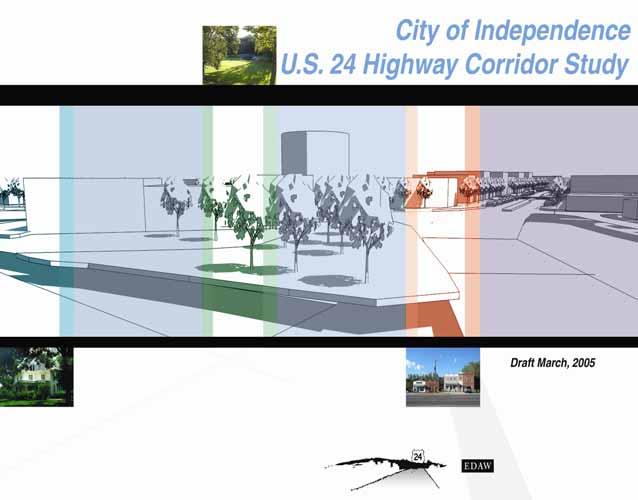

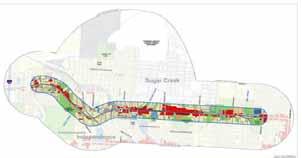
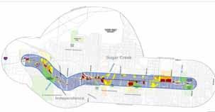
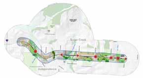
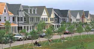
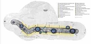
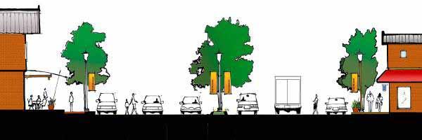
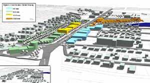
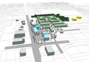
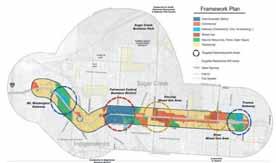
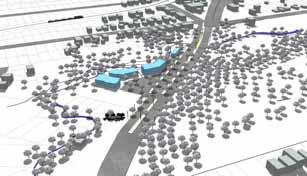
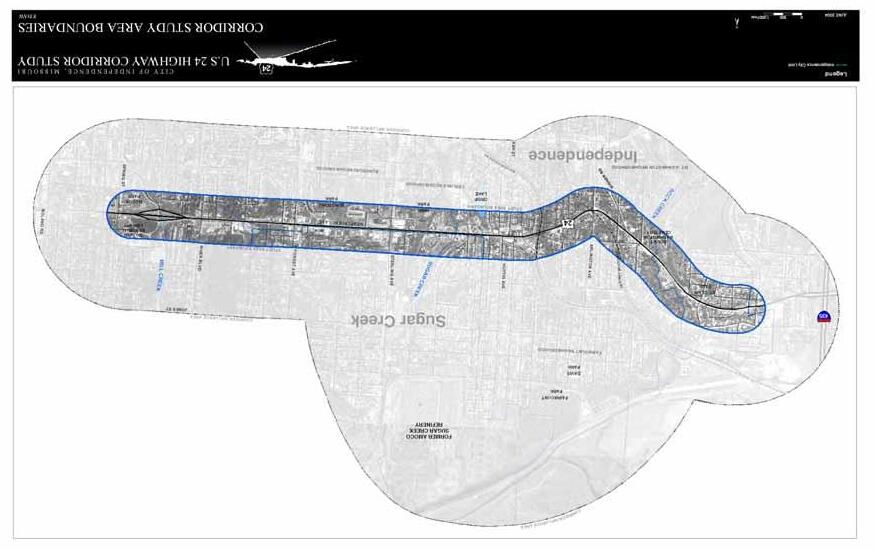 U.S. 24 Highway Corridor Study
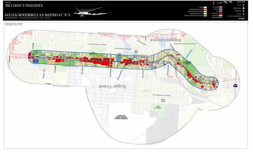 U.S. 24 Highway Corridor Study
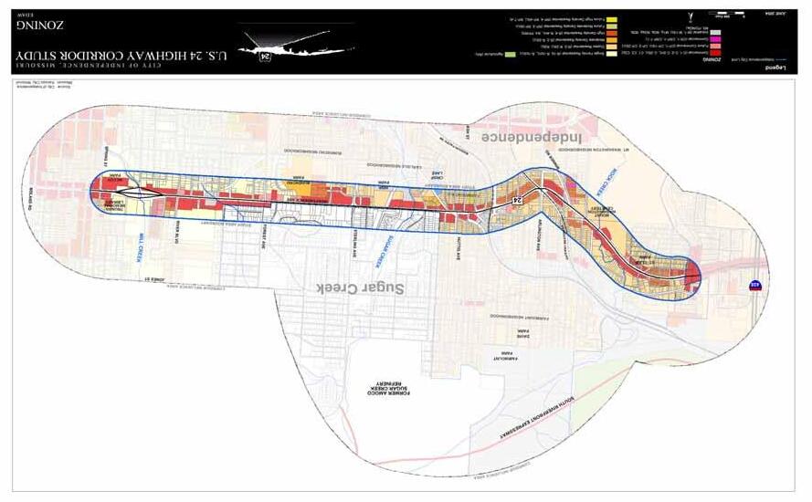 U.S. 24 Highway Corridor Study
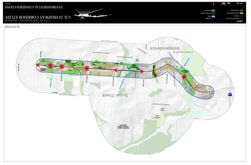
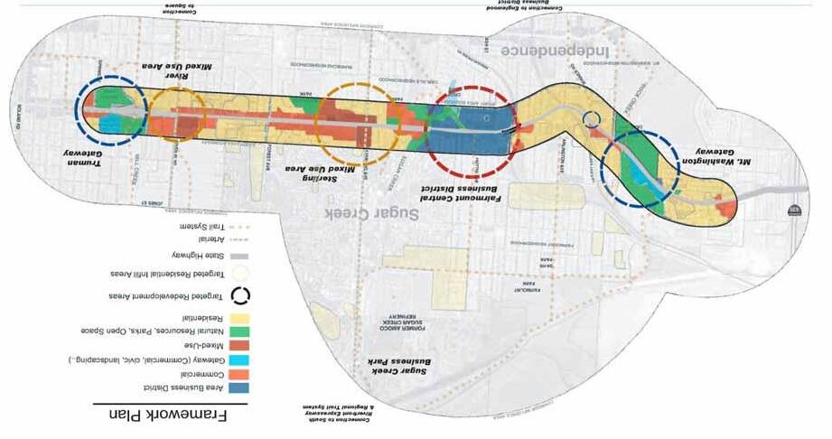
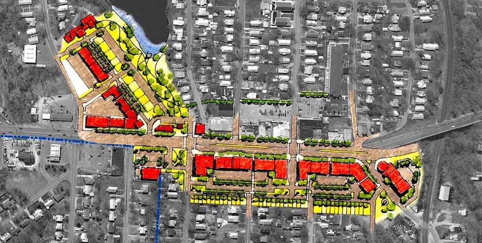 U.S. 24 Highway Corridor Study
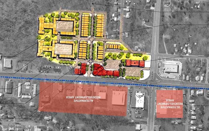 U.S. 24 Highway Corridor Study
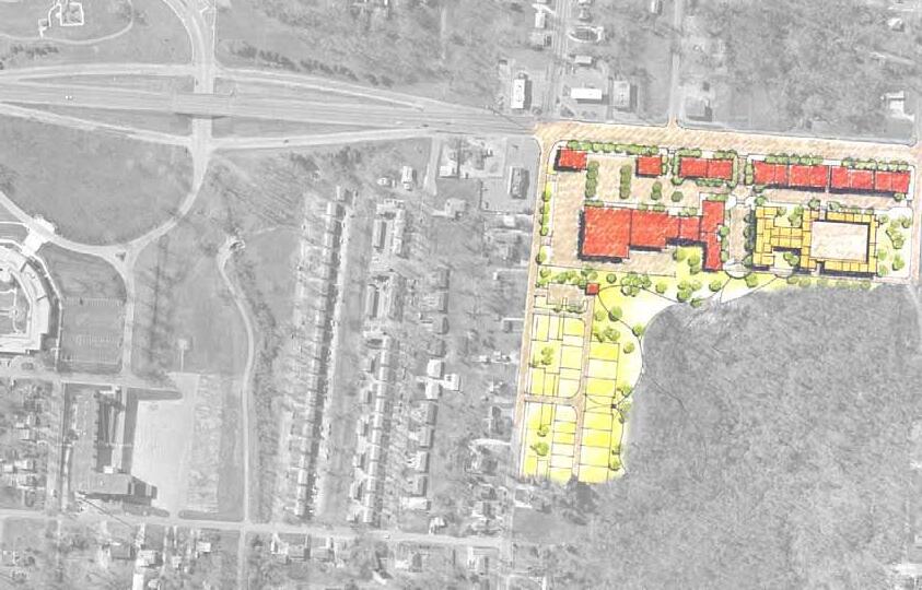 U.S. 24 Highway Corridor Study
 U.S. 24 Highway Corridor Study
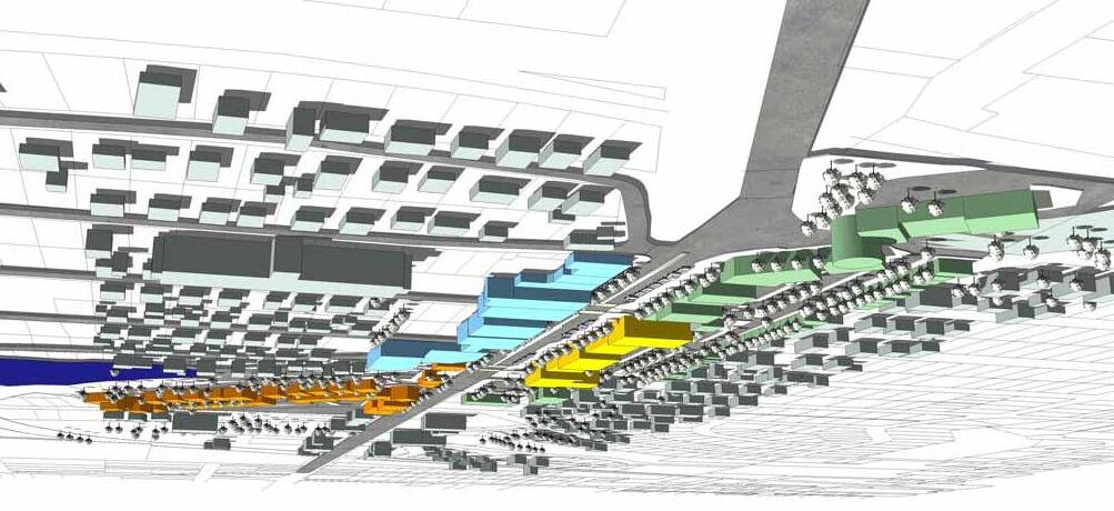
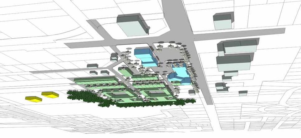
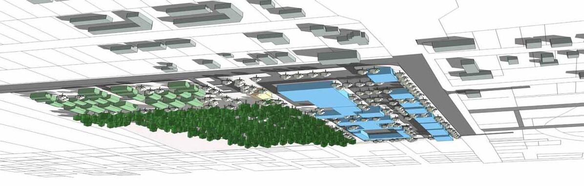

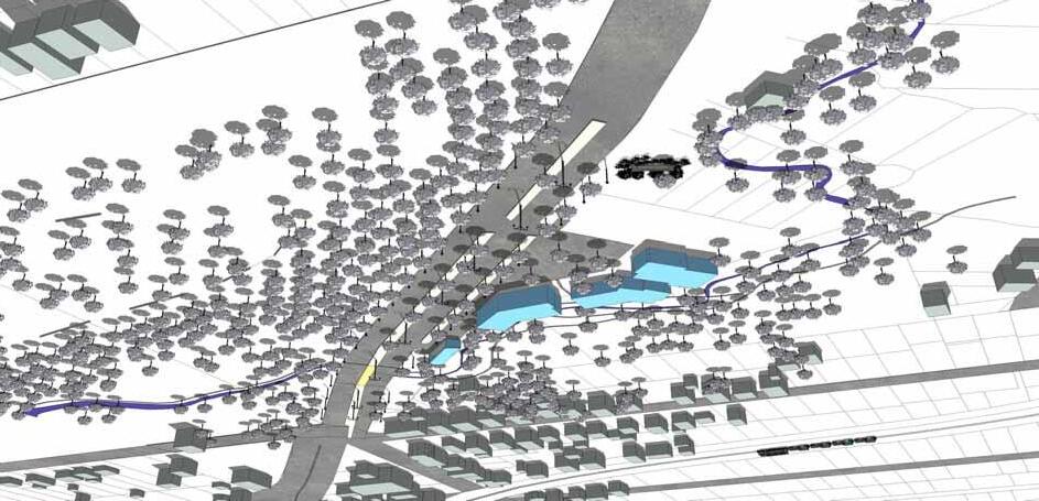 U.S. 24 Highway Corridor Study