TRUMAN ROAD GREEN GATEWAY
INDEPENDENCE + JACKSON COUNTY, MISSOURI FROM I-435 TO WINNER ROAD
MARCH 6, 2014
THANKS TO:
BOB ROBINSON (Independence School District)

BRAD HALSLEY (Independence Police)
CHRIS KLINE (Jackson County)
CHRISTINA HEINEN (Independence Health)

DONNA PITTMAN (Citizen)
ED KRAWCZYK (Citizen)
EILEEN WEIR (Independence City Council)

GEORGE POLETIS (Mt. Washington)
GRAHAM RENZ (Jackson County)
IVAN UBBEN (Independence Public Works)

JENNIFER CURZON (Citizen)
JOHN MCCLERNON (Jackson County Public Works)
JOHNNY SWEENEY (Jackson County)
LORETTA KRAWCZYK (Citizen)
MARCIE GRAGG (Independence City Council)
MARY HUNT (City of Independence)
MATT KILLION (MoDot)
NICK BABCOCK (Allied Waste)
SIMON CURZON (Citizen)
DATE: MARCH 6, 2014


TITLE This report was funded by a grant from the Mid-America Regional Council’s (MARC) Creating Sustainable Places Initiative. Creating Sustainable Places is a regional initiative funded by a Sustainable Communities Grant from the U.S. Department of Housing and Urban Development, Office of Sustainable Housing and Communities. ACKNOWLEDGMENTS TABLE OF CONTENTS INTRODUCTION.....................................................1-7 DISCOVERY..........................................................8-12 VISION + GOALS.......................................................13 IDEAS.............................................................14-26 RECOMMENDATIONS......................................27-50 IMPLEMENTATION...........................................51-57 APPENDIX........................................................A1-A8
INTRODUCTION
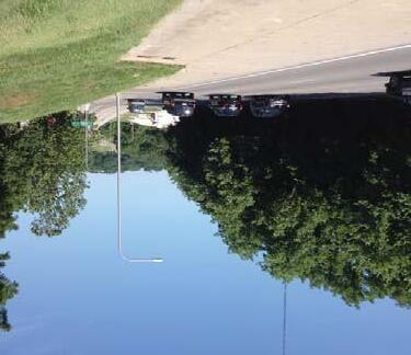
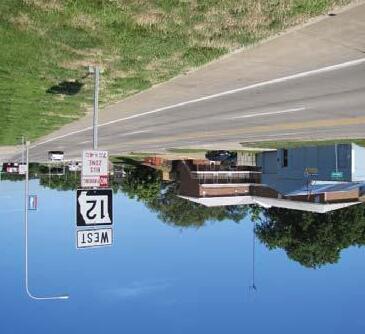
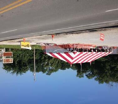
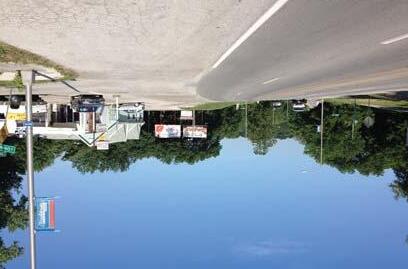
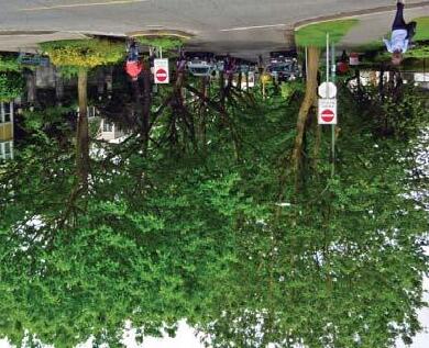
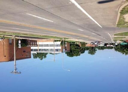
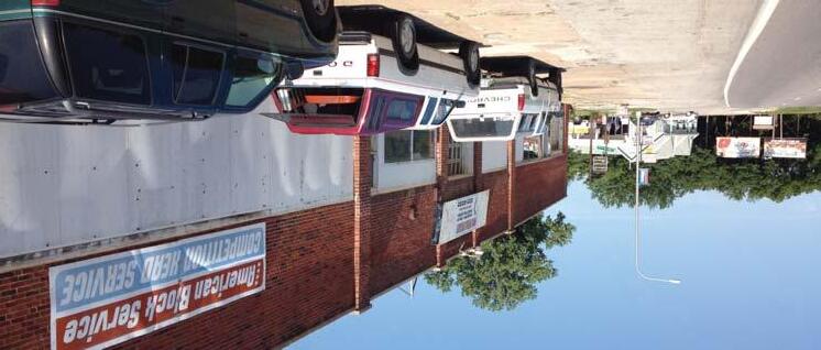
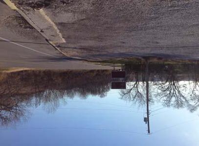
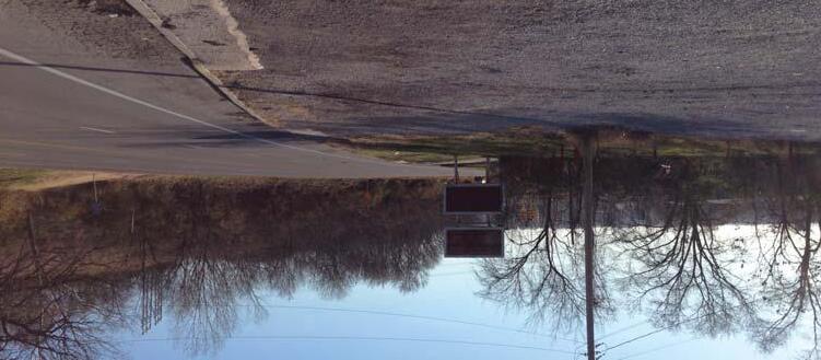
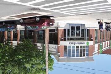
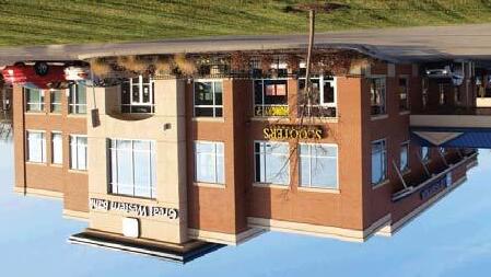
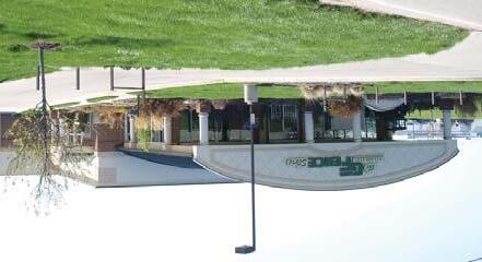
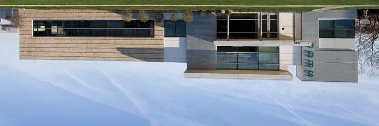
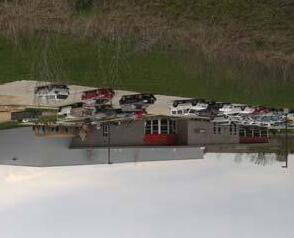
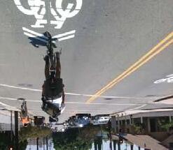
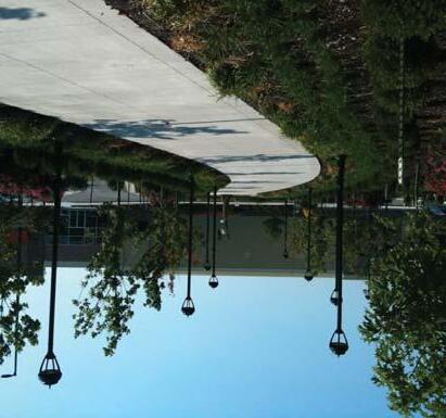
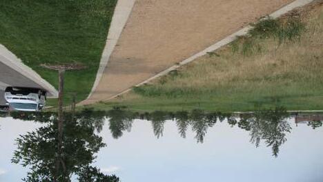
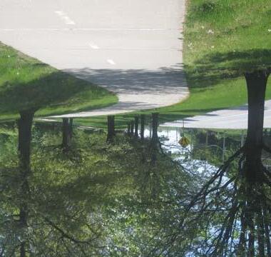
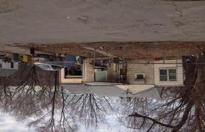
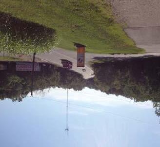
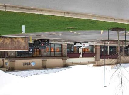
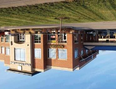
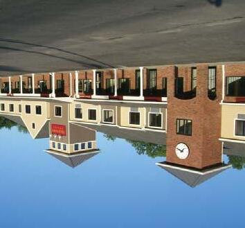
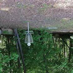
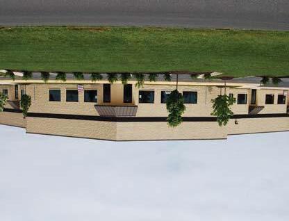
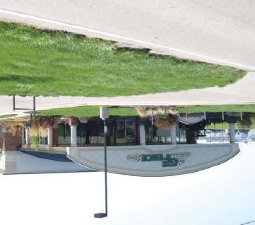
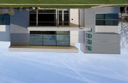
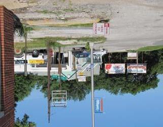
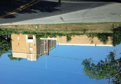
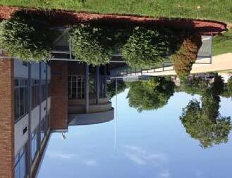
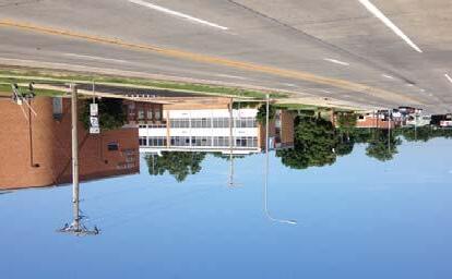
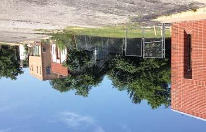
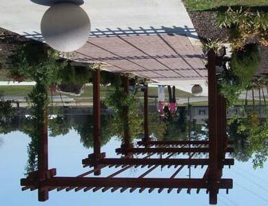
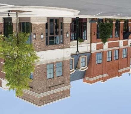
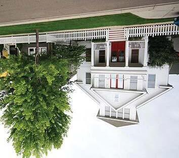
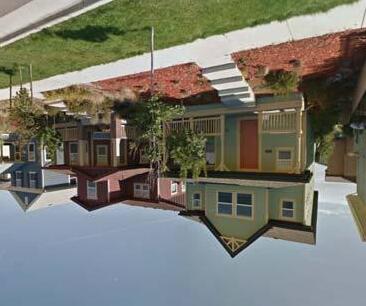
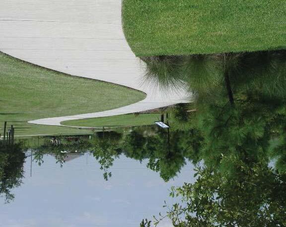
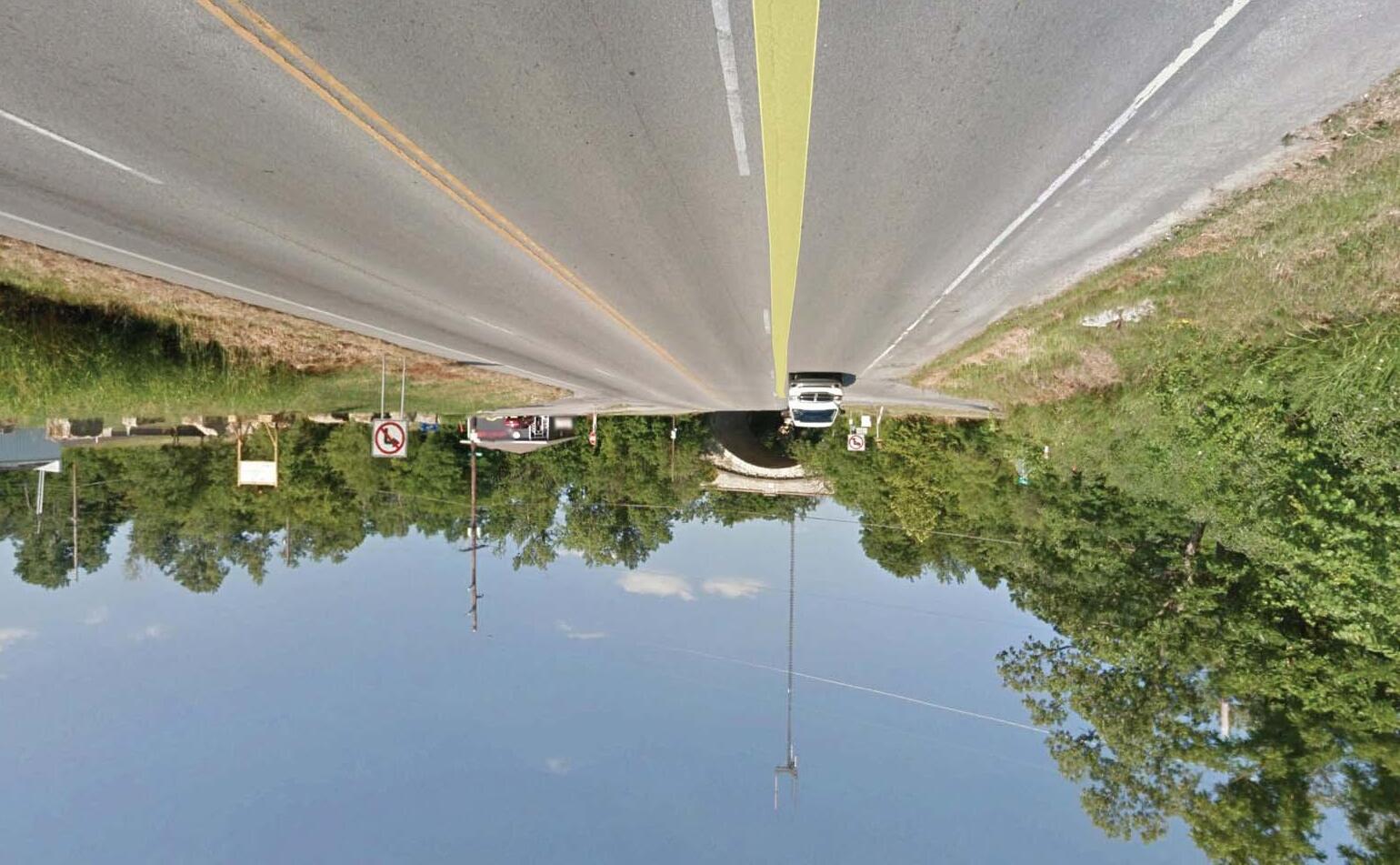
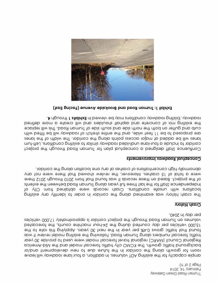
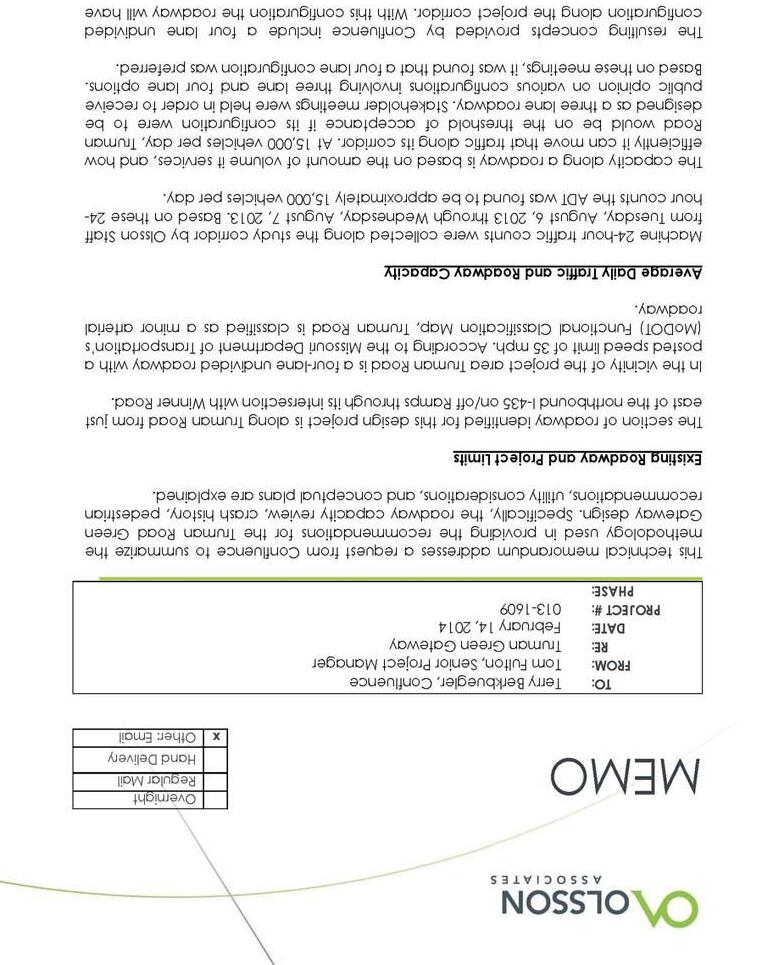
Existing Conditions Images
TRUMAN ROAD GREEN GATEWAY
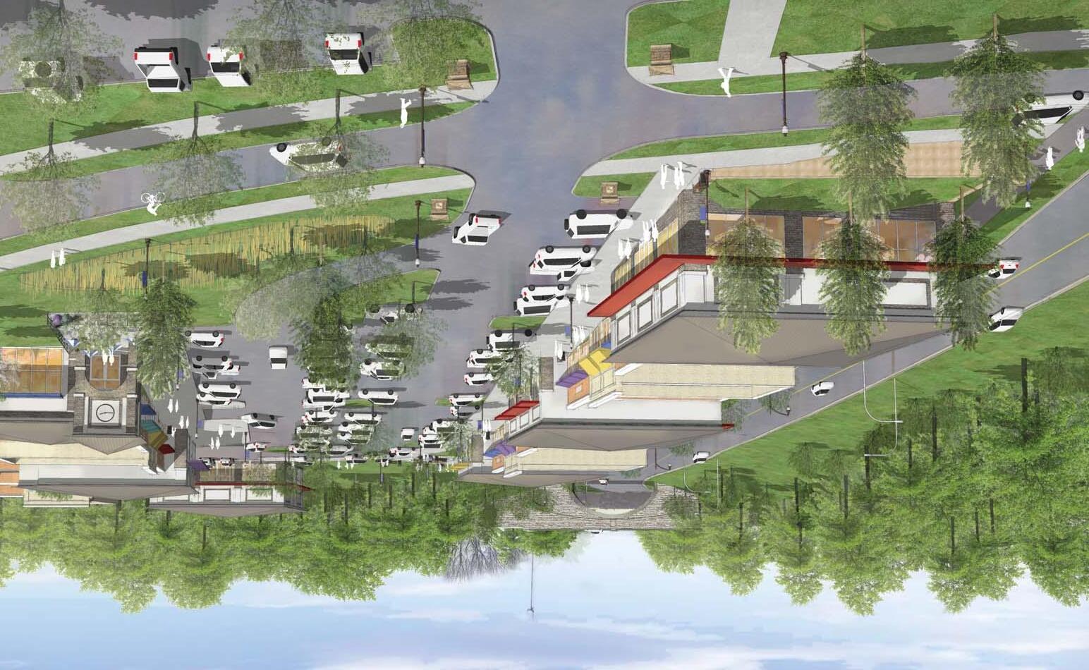
Truman Road is a major east/west arterial in Jackson County, Missouri, and serves Independence, Kansas City, and eastern unincorporated Jackson County. It is named after Harry Truman, the 33rd U.S. President and runs through his hometown of Independence.
PURPOSE
This study is intended to capitalize on the gateway potential of the corridor, and the area’s natural assets, to better define a unique and distinctive sense of place and better leverage the areas proximity to the I-435 interchange. The recommendations herein work to establish a consistent, comprehensive design approach for the corridor that promotes efficiency, safety, and functionality throughout.
The Truman Road Green Gateway Development Plan is intended to enhance transportation choices, with all users in mind – including bicyclists, transit vehicles and riders, and pedestrians of all ages and abilities. Recommendations that promote pedestrian and bike facilities are at the forefront of this plan, with attention being paid to the impacts of future development on the traffic and future aesthetics of the corridor.
Through a robust citizen engagement process, the plan was created to promote sustainable land-use patterns by focusing on pedestrian and bicycle connections to adjacent residential uses and regional trails. Adjacent land use recommendations, which focus on infill and redevelopment potential throughout, are intended to identify opportunities for future redevelopment along Truman Road, in particular near the I-435 interchange to the west and around Winner Road to the east.
PAGE 1
CONFLUENCE OLSSON ASSOCIATES HARDWICK LAW FIRM
INTRODUCTION
INTRODUCTION
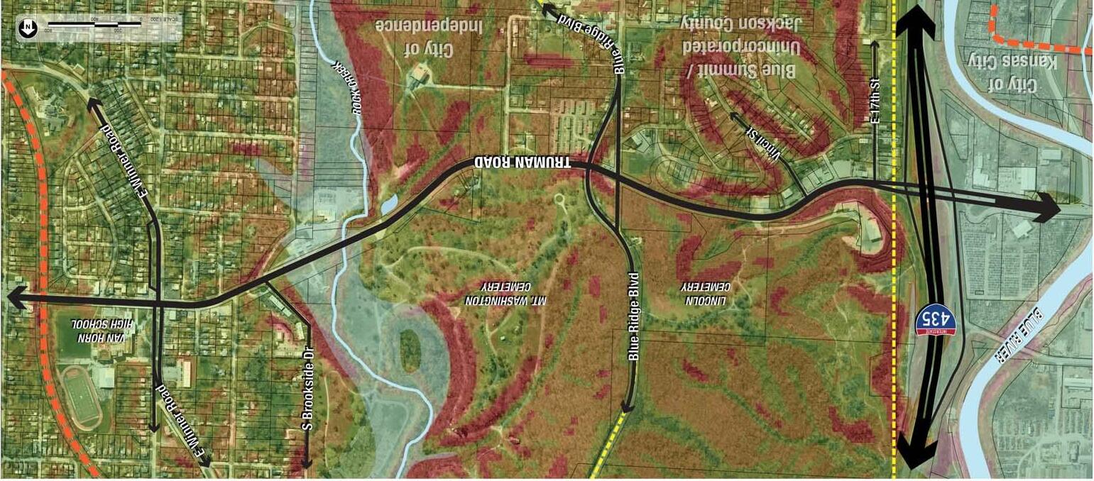
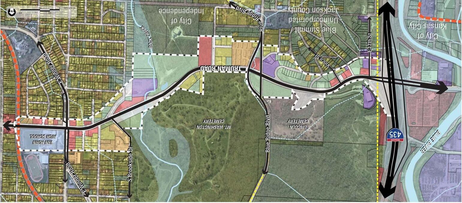
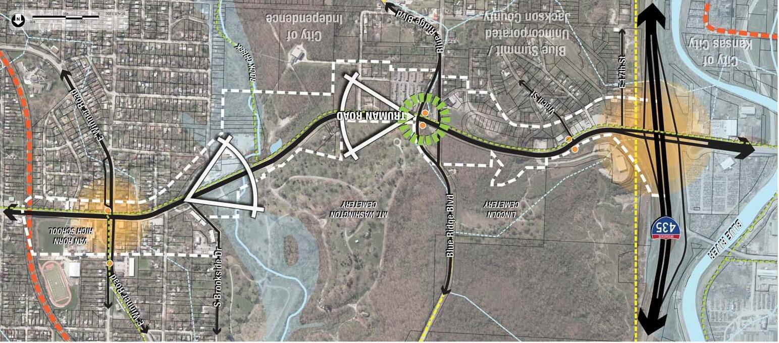
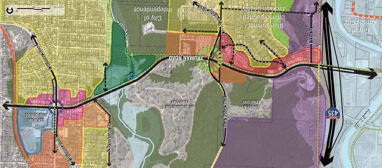
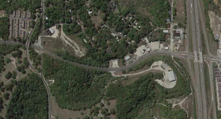
PROJECT LOCATION
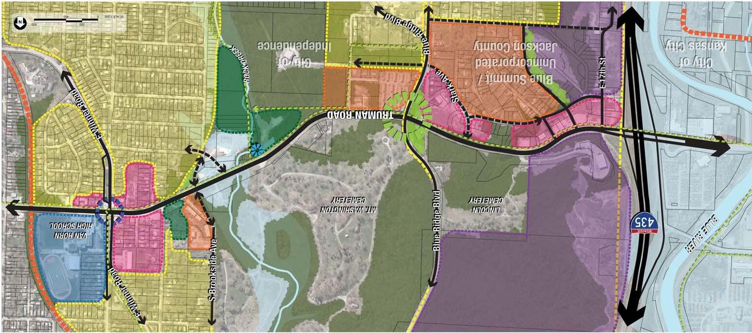
The project is located along Truman Road in unincorporated Jackson County and Independence, Missouri, bound by I-435 to the west and Winner Road to the east. The corridor serves east/west traffic providing a major connection from downtown Independence to I-435 and the City of Kansas City. The approximate length of the project is 7,300 linear feet; 1.4 miles.
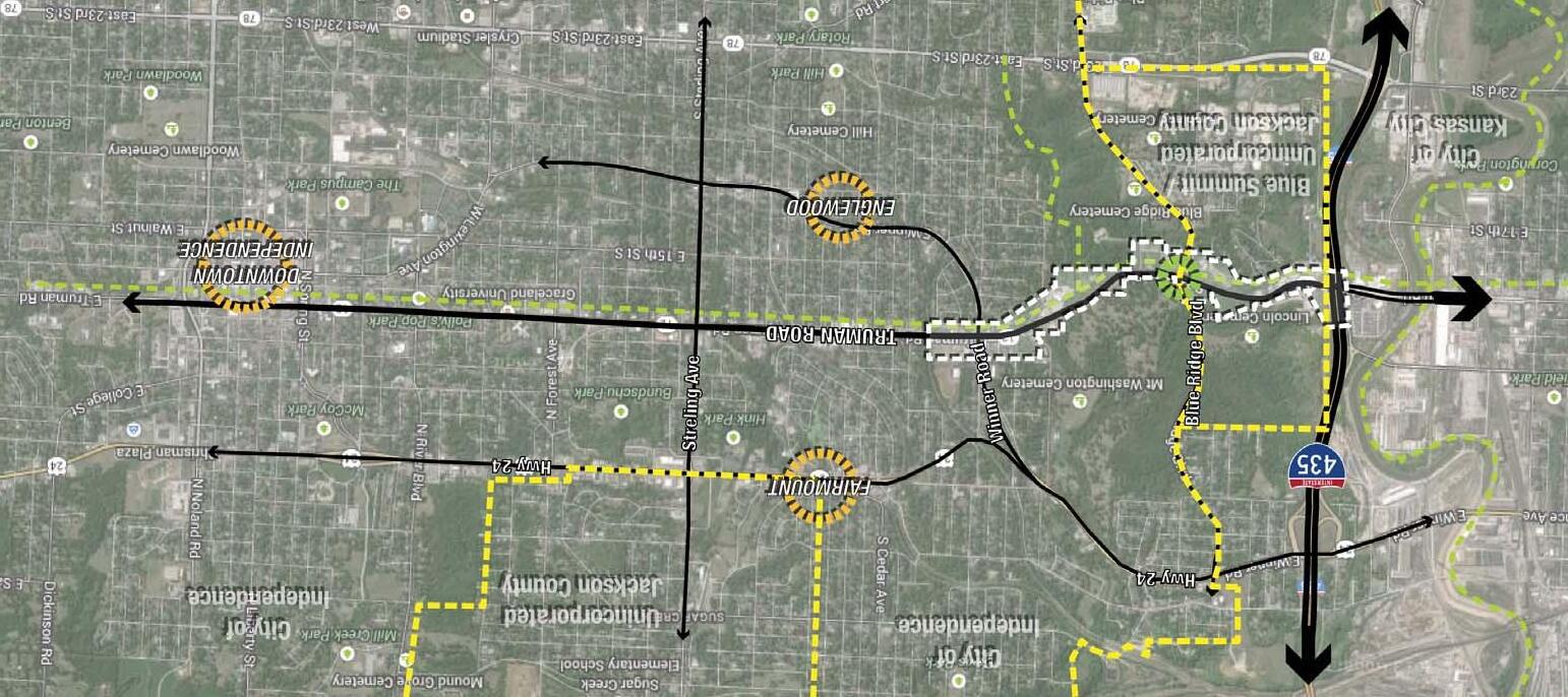
LEGEND
PROJECT BOUNDARY CITY LIMITS
PROPOSED TRAIL
ADJACENT ACTIVITY CENTERS
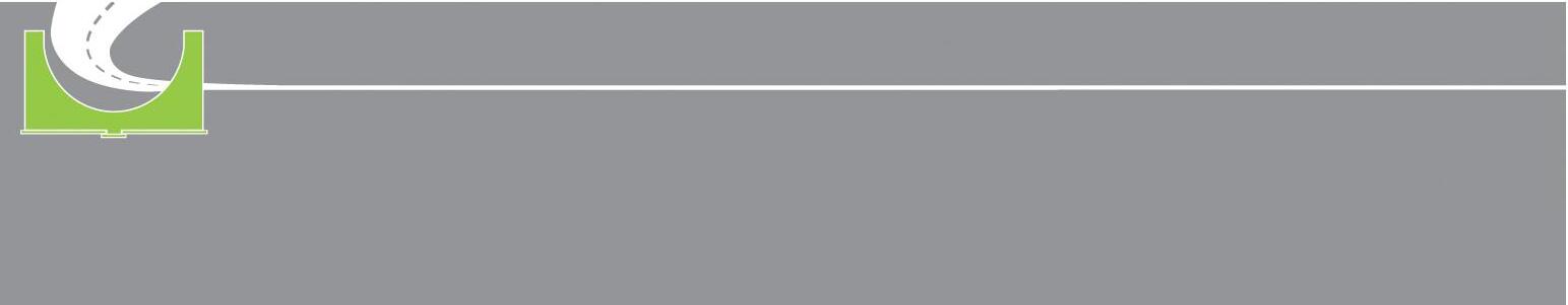
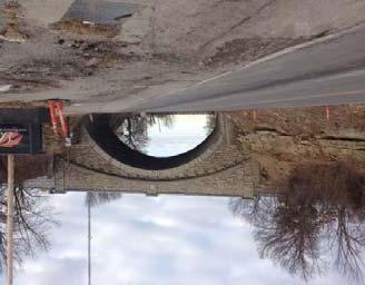
STONE ARCH BRIDGE/GATEWAY
TRUMAN ROAD GREEN GATEWAY PAGE 2
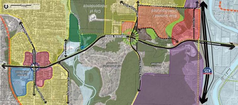
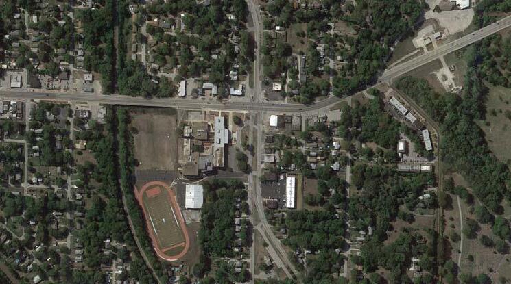
Vicinity Map
Approximate Study Area
PROJECT BOUNDARY CITY LIMITS RAILROAD
PAGE 3
CONFLUENCE OLSSON ASSOCIATES HARDWICK LAW FIRM
INTRODUCTION
LEGEND
EMERGING TRENDS
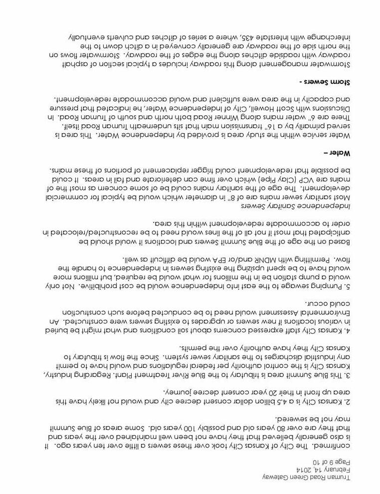
A number of changes in the way cities function and the way society lives today are requiring a change in the way we plan for long term community sustainability. Nationwide, communities are seeing a need to respond to changes in consumer choices, citizen lifestyles and ever-shrinking municipal budgets. This change is driving a need to plan for redensification of older areas of our inner ring suburbs, like Independence. This shift in population will also lead to increased transit and multi-modal transportation considerations along primary corridors. Mid America Regional Council (MARC) identifies Truman Road as a priority corridor for increased transit opportunities and has identified a number of community activity centers that provide for future increased demand on goods and services as well as transit offerings. In addition to MARC, the American Planning Association, Urban Land Institute, and other organizations have invested in research to further understand the impact of these trends on future community planning and development.
SUBURBAN DEVELOPMENT TYPES

• Suburban Mall Retrofits (transforming obsolete malls into compact mixed-use places)
• Suburban Transit-Oriented Development (leveraging transit connections to support higher densities)
• Suburban Arterials or Commercial Corridors (transforming aging land uses + integrating bus transit)
• Wholesale or Large-Scale Suburban Transformation (reshaping how suburban places function - very rare)
• Suburban Town Centers (mixed-use hubs offering entertainment residential, office)

Corridors TRUMAN ROAD GREEN GATEWAY PAGE 4
Planned Transit
Adopted Growth Scenario
Shifting Suburbs
KEY CHALLENGES + OPPORTUNITIES
Suburban Arterials
Challenges:
• Designed for easy retail access or swift through-traffic
• Disjointed jumbles of strip retail centers and parking lots
• Visible utilities, narrow or no sidewalks, extensive curb cuts
Opportunities:
• Typically larger parcels of underused / lower-value land
• Often near existing commercial, retail, and entertainment
• Explore opportunities to increase transit service and facilities
First-Ring Suburbs
Challenges:
• Does the community want or need certain areas to change?
• Will there be community/governmental support?
• Upgrading outmoded infrastructure can be expensive.
Opportunities:
• America’s first-ring suburbs could be “sweet spot” for growth
• Already served by transit + transportation infrastructure
• Highways + street networks efficient/adaptable urban pattern
• Well established neighborhoods with mature trees + amenities
• Close to center of the metropolitan region and other suburbs
• Attractive for redevelopment
WINNING STRATEGIES
• Public/private partnerships
• Comprehensive approach to infrastructure and transit
• Programming and place management
• Connectivity: Trails + sidewalks + public spaces
• Proactive Planning: Attracting the “right fit”
• Stakeholder engagement and adjacent neighborhoods
• Identify many funding sources
• Riding the demographic wave
PAGE 5
CONFLUENCE OLSSON ASSOCIATES HARDWICK LAW FIRM
INTRODUCTION
COMPLETE STREET DESIGN
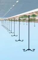
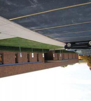
Complete Street Designs in an initiative to enhance streetscapes and help develop more livable areas and neighborhoods by allowing safe street access for all road users. All pedestrians, bicyclists, motorists, and public transit users will see improved transportation methods with the ease of crossing the street, walking to nearby shops/restaurants, biking to work, riding the bus on time, etc. The Complete Street Design is not a specific set of design guidelines, as all applications must be flexible and sensitive to the project’s surrounding conditions and context.
Implemented guidelines will address many issues in the community. With the ease of access for all users, mobility is increased, especially for those with physical disabilities. A more active environment improves the health of the residents, and help prevent obesity. The implementation of complete street amenities improves the safety for all users, especially those on foot and bike.
Numerous design guidelines should be considered for every Complete Street Design. For pedestrians, wider sidewalks, designated cross walks, and signalized intersections are a few examples. Amenities for bicyclists can include a designated bike lane, signal detection, passing areas, paved shoulders, and off-road multi use trails. Many options are available to incorporate bicycle traffic into vehicle and pedestrian traffic ways. Public transit users can see improvements with amenities like bus shelters, designated bus lanes, and safe and convenient bus stop locations. Roads can be updated with curb bump-outs, speed bumps, traffic circles, and raised center medians to slow traffic speeds and enhance pedestrian safety.
Independence is one of many communities in Missouri that have passed Complete Streets policies. In the United States, more than 240 policies have been passed by local public agencies.
BENEFITS
• Reduce injuries of road users and liability exposure
• Reduce the need to retrofit future projects
• Increase use for pleasure and recreation, in addition to mobility
• Increase safety and amenities for public transit users
• Increase activity at surrounding commercial areas
• Improve neighborhoods with safe, more comfortable, and more convenient atmosphere
 Example
TRUMAN ROAD GREEN GATEWAY PAGE 6
Complete Street Designs
INTRODUCTION
PROCESS
Together with the consultant team, the City of Independence and Jackson County embarked on a four part process to develop the Truman Road Green Gateway Development Plan. That process and the resultant planning recommendations and implementation guide are summarized in the following chapters.
Discovery – Compiling historic background, community perspective and physical features of the corridor in order to understand the place and the parameters that have shaped it into its current condition and that will influence opportunities for the future.
Vision – Aligning the community to support a common vision and direction for the future of the corridor. With this vision defined and goals outlined, the likelihood of successfully improving the corridor is greatly improved.
Ideas – No singular idea will be successful. The best ideas result from the generation and thoughtful consideration of many ideas. This iterative process of creating and testing ideas results in the most authentic framework for success.
Recommendations – When the ideas address project goals and are brought into alignment with the community’s vision, the next step is defining how to realize the concept through appropriate planning and engineering recommendations.
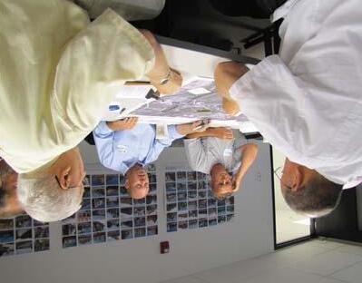
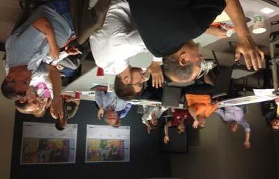
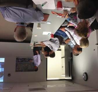
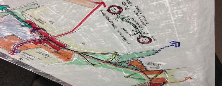
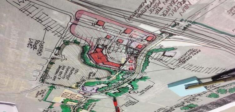
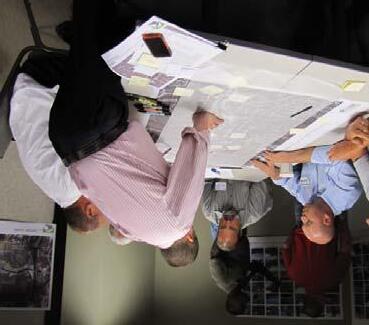
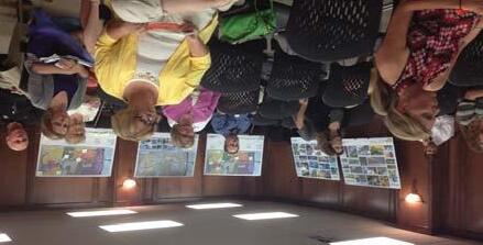
Meeting Images PAGE 7 INTRODUCTION CONFLUENCE OLSSON ASSOCIATES HARDWICK LAW FIRM
DISCOVERY
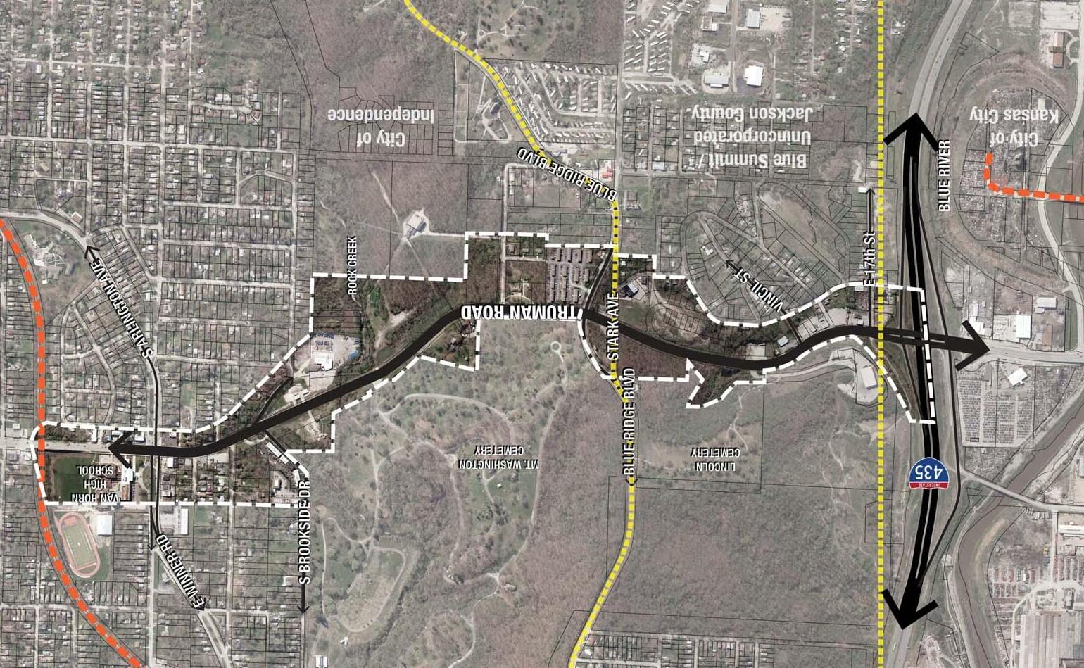
EXISTING PROJECT AREA

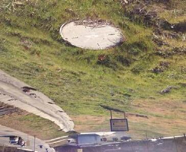
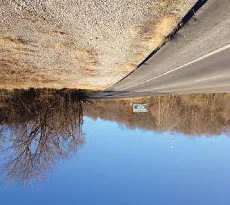
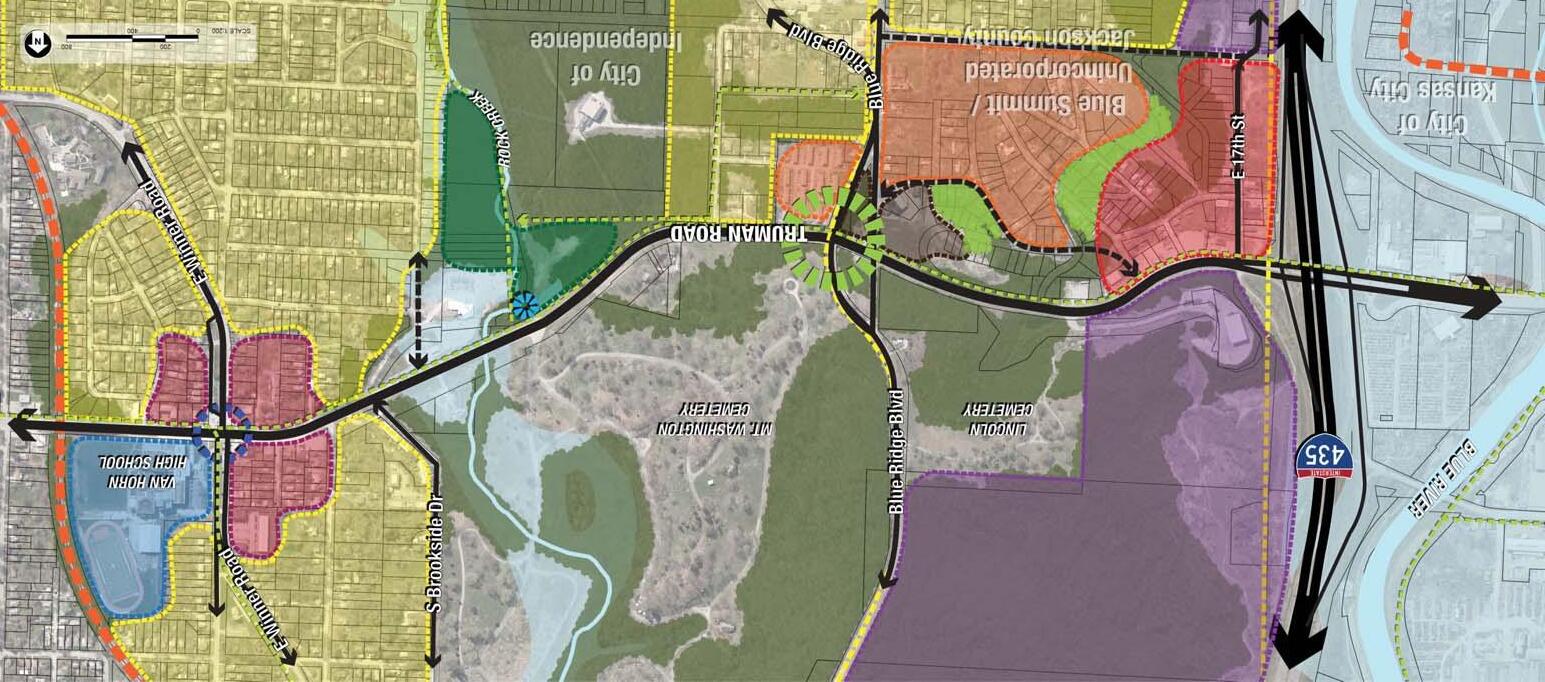
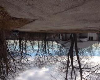
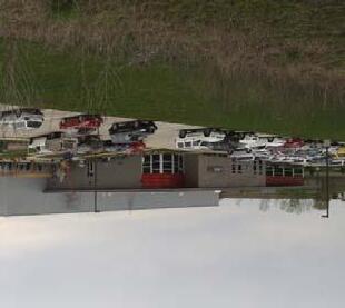
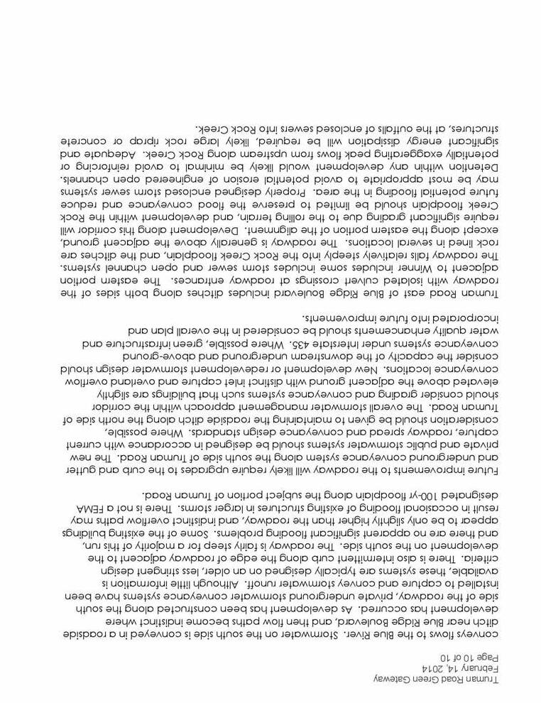
The project area is located in both the City of Independence and Blue Summit unincorporated Jackson County, in an area with significant topography and existing vegetation. The roadway undulates dramatically to follow the rolling terrain, which allows expansive views over the Rock Creek and Blue River Valleys – framing views to Independence and the Kansas City skyline.
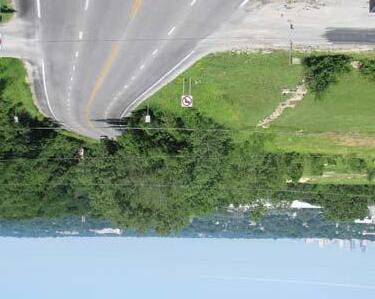
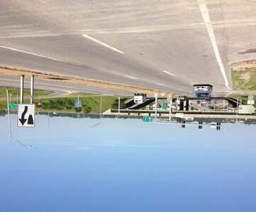
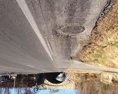
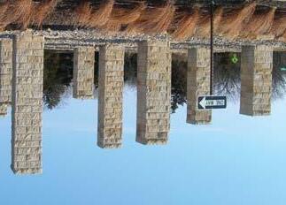
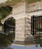
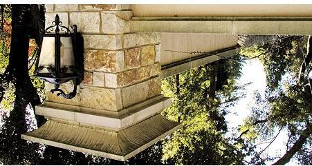
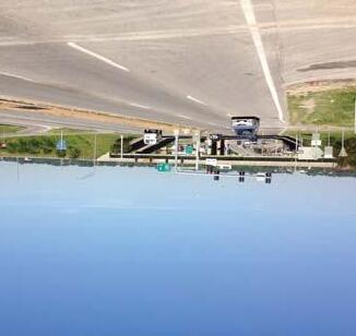
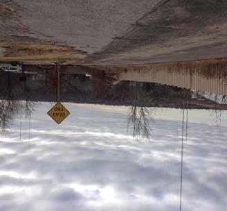
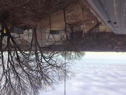
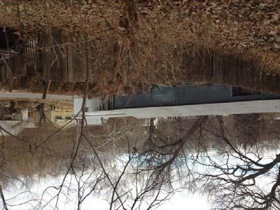
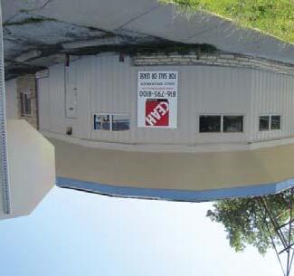
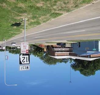
From west to east, the roadway climbs from the I-435 interchange through unincorporated Jackson County to the Stone Arch Bridge, which marks the entry into the City of Independence. The unincorporated portion of the corridor is largely undeveloped, and steep, naturally wooded terrain abuts the North side of Truman Road throughout. Existing development along the south side of the road is a mix of vacant property and distressed commercial/industrial uses. These varying and deteriorated properties create an unattractive appearance along this portion of the corridor.
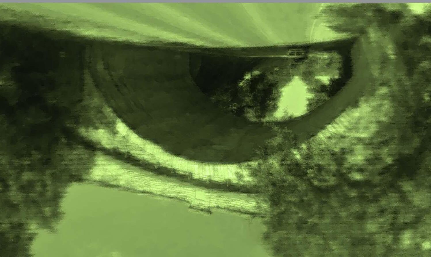
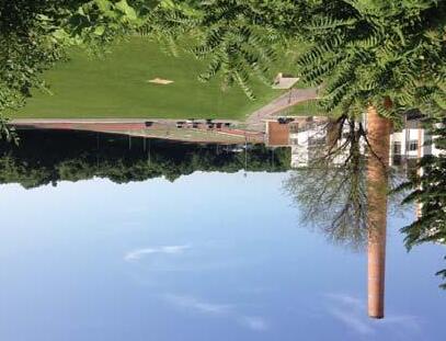
The Stone Arch Bridge, which is located on a high point in the road, provides an opportunity for an iconic gateway element for the corridor. East of the bridge, the roadway moves down the valley and crosses Rock Creek. This portion is heavily vegetated on both sides, and provides dramatic views to Independence and beyond. The Lincoln and Mt. Washington cemeteries to the North, along with heavily wooded parcels to the South, provide a lush and beautiful corridor aesthetic.
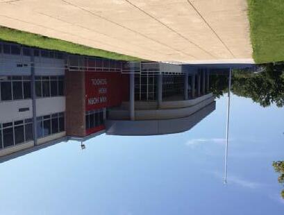
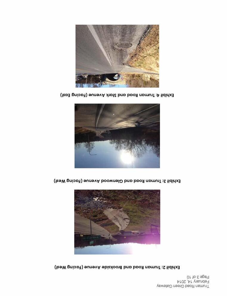
The eastern segment of the project area is more densely developed than other portions of the corridor. The land use near Winner Road is predominantly commercial (along Truman Road), with single family residences immediately beyond. These businesses and some of the adjacent neighborhoods are currently under performing and in need of revitalization. Van Horn High School, which serves approx. 850 students, is a major anchor to development in this area. Several plan graphics (see pages 10-12) were created to highlight these existing site features.
Existing Site Conditions PAGE 8 DISCOVERY CONFLUENCE OLSSON ASSOCIATES HARDWICK LAW FIRM
EXISTING INFRASTRUCTURE
EXISTING ROADWAY
In the vicinity of the project area Truman Road is a four-lane undivided roadway with a posted speed limit of 35 mph. According to the Missouri Department of Transportation’s (MoDOT) Functional Classification Map, Truman Road is classified as a minor arterial roadway. Machine 24-hour traffic counts were collected along the study corridor from Tuesday, August 6, 2013 through Wednesday, August 7, 2013. Based on these 24-hour counts the average daily traffic (ADT) was found to be approximately 15,000 vehicles per day.
The crash history was also examined along the corridor to identify any existing locations with unsafe conditions. Crash records were obtained from City of Independence Staff for the last three full years along Truman Road between the extents of the project. Based on these records it was found that from 2010 through 2012 there were a total of 15 crashes. Moreover, the review showed that there were not any abnormally high concentrations of crashes at any one location along the corridor.
TRUMAN ROAD GREEN GATEWAY PAGE 9 DISCOVERY
Existing Roadway Conditions
Natural Features Map
LEGEND
STEEP - 20% OR MORE SLOPE
MODERATE - 5-20% SLOPE
LEVEL - 5% OR LESS SLOPE

FLOODPLAIN
WATERWAY RAILROAD CITY LIMIT
NATURAL FEATURES
Topography in the surrounding project area can be a challenge to develop. Areas that are level, shown in dark green, are the most desirable land on which to build. Moderate slopes between 5-20% can be developed, but with a challenge as significant earth work will be needed. Areas shown in red with a steep slope are undesirable for future development.
PAGE 10 DISCOVERY CONFLUENCE OLSSON ASSOCIATES HARDWICK LAW FIRM
Existing Land Use
DISCOVERY
LEGEND
INDUSTRIAL
CIVIC
SINGLE FAMILY RESIDENTIAL


MULTI-FAMILY RESIDENTIAL
COMMERCIAL
VACANT
PUBLIC/RECREATIONAL
PROPOSED TRAIL
PROJECT BOUNDARY
FLOODPLAIN
WATERWAY
RAILROAD
CITY LIMIT
WATERSHED BOUNDARY
EXISTING LAND USE
Adjacent to the project area, much of the existing land use is single family residential along with public/recreational. Within the project area, fewer areas of residential land use are seen. As Truman Road is a main connector road, most of the land adjacent to the road is commercial, civic, or industrial. Various areas are shown as vacant, portraying the need for more development along Truman Road. Land use within the project area varies and includes a significant amount of undeveloped open space.
TRUMAN ROAD GREEN GATEWAY PAGE 11
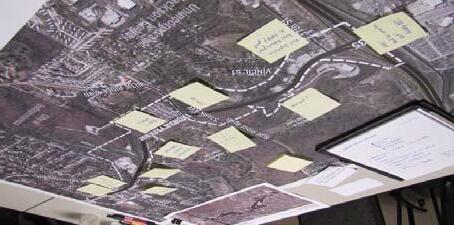
Site Analysis
LEGEND
PROPOSED TRAIL
PROJECT BOUNDARY
ACTIVITY NODES
STONE ARCH BRIDGE/GATEWAY
WATERSHED BOUNDARY
SITE ANALYSIS
FLOODPLAIN
WATERWAY
RAILROAD
CITY LIMIT
BUS STOP VIEWSHED
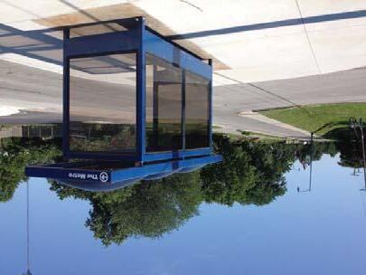
Access to I-435 provides great corridor connectivity to the greater metropolitan area, an asset not currently being fully leveraged for maximum economic benefit for the area. The stone arch bridge provides an iconic entry portal to Independence. However, a lack of sidewalks along the corridor make them difficult to access. Numerous bus stops exist along Truman Road and Winner Road. Two activity nodes exist today with increased amenities, businesses, and traffic. The two cemeteries north of the project area provide a large amount of attractive vegetation and create attractive view-sheds along Truman Road.
PAGE 12 DISCOVERY CONFLUENCE OLSSON ASSOCIATES HARDWICK LAW FIRM
VISION + GOALS
VISION + GOALS
In order to achieve the community’s vision of the Truman Road corridor as a unique and distinctive place that leverages its natural assets and proximity to the I-435 interchange to promote more sustainable development while providing safe and interconnected transportation choices, the following project priorities were established at the outset of the process:
PROJECT PRIORITIES
• Create a welcoming aesthetically pleasing gateway to tourists and citizens
• Capitalize on the “Gateway Potential” and natural assets
• Develop a signature green street in Independence
• Enhance transportation choices along Truman Road
• Promote sustainable land use patterns
• Enhance pedestrian and bike connections between neighborhoods
• Increase pedestrian connections between activity nodes
• Infill development opportunities
• Form a strategy for implementation of public improvements
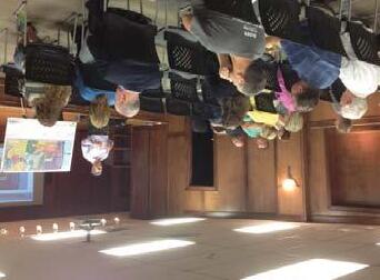
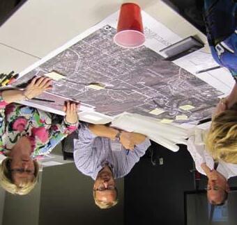
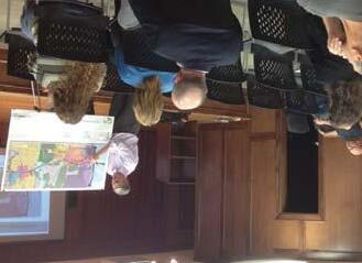
Meeting Images PAGE 13 VISION + GOALS CONFLUENCE OLSSON ASSOCIATES HARDWICK LAW FIRM
IDEAS
CONCEPTUAL LAND USE SCENARIOS
These project priorities, or “Goals”, form the framework upon which the planning recommendations are based. Two redevelopment scenarios (on the subsequent pages) were shared with the advisory committee, with varying approaches to proposed land use distribution.
LAND USE SCENARIO A

Scenario A illustrates a land use concept that capitalizes on the corridor’s visibility from I-435. In this scenario, a large commercial anchor is proposed near the I-435 interchange, with multi-family development to the south and east. Future industrial uses remain north of Truman Road, and a pocket of office is located in proximity to the Stone Arch Bridge (at Blue Ridge Boulevard). A large public park is located within the Rock Creek floodplain, with a trailhead in this location to capitalize on future trail connections from the Rock Creek and Truman Road Trails. To the east, a mixed-use center at the intersection of Winner Road and Truman Road creates increased density and a mix of commercial and residential uses. In this scenario, the surrounding single family development remains, with an added emphasis on neighborhood revitalization.
LAND USE SCENARIO B
Scenario B creates a strip of commercial development along the south side of Truman Road, throughout unincorporated Jackson County. Future industrial uses remain to the north of Truman Road. This concept realigns Stark Avenue to create an opportunity for commercial adjacent to the Stone Arch Bridge, with additional multi-family development proposed to the north. Similar to Scenario A, a public park and trailhead are proposed in the Rock Creek floodplain. At the intersection of Winner Road and Truman Road, commercial uses are more concentrated, potentially single story, with additional multi-family development proposed to the north. As in Scenario A, neighborhood revitalization efforts throughout single family neighborhoods are encouraged.
Land Use Scenarios A & B
PAGE 14 IDEAS CONFLUENCE OLSSON ASSOCIATES HARDWICK LAW FIRM
Meeting Images
A B
IDEAS
Land Use Scenario A


LEGEND
INDUSTRIAL
CIVIC
SINGLE FAMILY RESIDENTIAL


MULTI-FAMILY RESIDENTIAL
MIXED USE
HIGHWAY-ORIENTED COMMERCIAL OFFICE
PROPOSED TREES
PUBLIC/RECREATIONAL
FLOODPLAIN
EXISTING VEGETATION
PROPOSED TRAIL
TRAILHEAD
PROPOSED STREET
RAILROAD
PROPOSED FUTURE TRANSIT CENTER
CITY LIMITS
STONE ARCH BRIDGE/GATEWAY
WATERWAY
TRUMAN ROAD GREEN GATEWAY PAGE 15
Land Use Scenario B

LEGEND
INDUSTRIAL
CIVIC
SINGLE FAMILY RESIDENTIAL
MULTI-FAMILY RESIDENTIAL
HIGHWAY ORIENTED COMMERCIAL
NEIGHBORHOOD-ORIENTED COMMERCIAL
OFFICE
PROPOSED TREES
PUBLIC/RECREATIONAL
FLOODPLAIN
EXISTING VEGETATION
PROPOSED TRAIL
TRAILHEAD
PROPOSED STREET
RAILROAD
PROPOSED FUTURE TRANSIT CENTER
CITY LIMITS
STONE ARCH BRIDGE/GATEWAY
WATERWAY
PAGE 16
CONFLUENCE OLSSON ASSOCIATES HARDWICK LAW FIRM
IDEAS
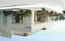
PREFERRED IMAGES
A series of character images were presented to the advisory committee and public meeting participants to gauge opinions on preferred development types and character. The images were evaluated by architectural style, development type, and overall aesthetics. Participants ranked the various images on their appropriateness for the corridor (using a scale of 1-5).
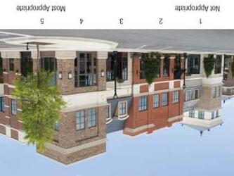
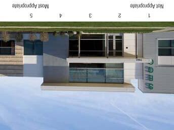
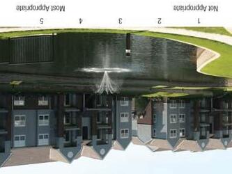
Based on the results of this polling, groups of preferred character images were assembled by land use type. These images correspond to the redevelopment scenarios to provide character examples that correspond to each of the various proposed land uses.
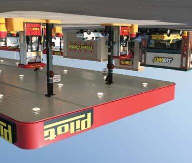
COMMERCIAL

Generally, participants favored commercial development types that make use of various materials, especially brick. A strong preference emerged for a travel center near I-435, and smaller scale buildings (1-2 stories) with articulated building facades in other areas.
TRUMAN ROAD GREEN GATEWAY PAGE 17
IDEAS
Preferred Commercial Images
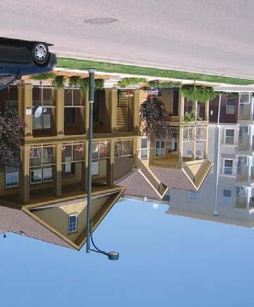
Example Polling Images
INDUSTRIAL
Preferred character images for industrial uses are categorized by building facades articulated with varying building materials. Business park and warehousing uses were favored over larger manufacturers due to the terrain and character of the corridor.
MULTI-FAMILY
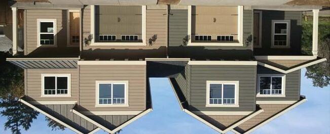
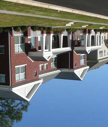
Townhomes, row houses, and other attached single family developments are preferred for increased residential density. Higher density multi-family was considered least desirable, although it may be appropriate in certain areas.
PAGE 18
CONFLUENCE OLSSON ASSOCIATES HARDWICK LAW FIRM
IDEAS
Preferred Industrial Images
Preferred Multi-Family Images
ROADWAY WIDTH OPTIONS

The capacity along a roadway is based on the volume of vehicular traffic it services, and how efficiently it can move that traffic along its corridor. At 15,000 vehicles per day, Truman Road is on the threshold of potentially accepting a three lane roadway configuration, which would help to slow traffic down.
This question was posed in stakeholder meetings, and a clear preference emerged for maintaining four-lanes throughout the project area.
TRUMAN ROAD GREEN GATEWAY PAGE 19
3-Lane versus 4-Lane Options
IDEAS
4 - L A N E 4-LANE 4 - L A N E 4-LANE 3 - L A N E 3-LANE
PREFERRED CONFIGURATION
 4-Lane Section
PAGE 20
CONFLUENCE OLSSON ASSOCIATES HARDWICK LAW FIRM
3-Lane Section
IDEAS
PARKWAY VERSUS BOULEVARD


The existing roadway consists of four 11’ lanes, with generous asphalt shoulders throughout the majority of the project area. This extra width, along with a potential reduction in the number of roadway lanes, allows the possibility of introducing a boulevard, or landscaped median, in many locations along Truman Road.
Three distinct concepts were generated to gauge public reaction to this concept. The first proposes a boulevard in the center portion of the project area, and not on the more developed east and west ends. This concept would provide additional landscaping opportunities in the center of the project area, while keeping the roadway open in the more densely developed areas. This would allow less curb cuts and more functional maneuvering in and out of the proposed commercial areas.
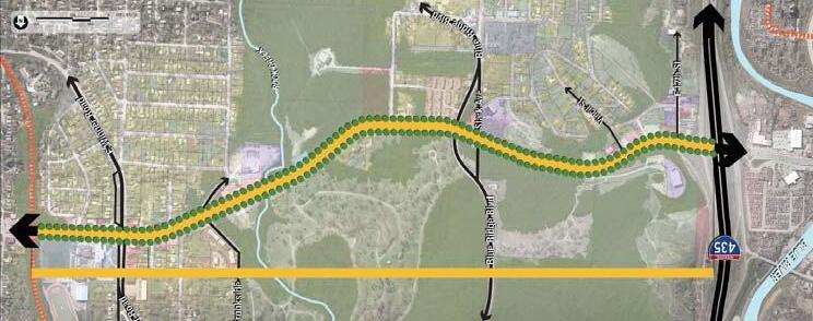
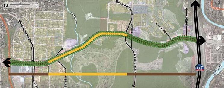
The second concept is the reverse of the first. The center portion, which is the most densely vegetated portion of the corridor, remains open parkway to capitalize on existing vegetation on either side of the roadway. The boulevard is proposed on the east and west ends, which are more sparsely vegetated, to introduce more landscaping in those areas. This concept allows for a more consistent landscape treatment throughout the entire length of the project area.
The third option maintains a parkway configuration throughout. This concept was preferred by stakeholders for its ease in traffic circulation/access, constructibility, and maintenance.

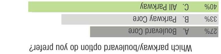
Roadway Configuration Options TRUMAN ROAD GREEN GATEWAY PAGE 21 IDEAS P A R K W A Y PARKWAY P A R K W A Y PARKWAY B O U L E V A R D BOULEVARD B O U L E V A R D BOULEVARD B O U L E V A R D BOULEVARD P A R K W A Y PARKWAY P A R K W A Y PARKWAY
All Parkway
Parkway Core
Boulevard Core
PREFERRED SECTION


Parkway Section Boulevard Section PAGE 22 IDEAS CONFLUENCE OLSSON ASSOCIATES HARDWICK LAW FIRM
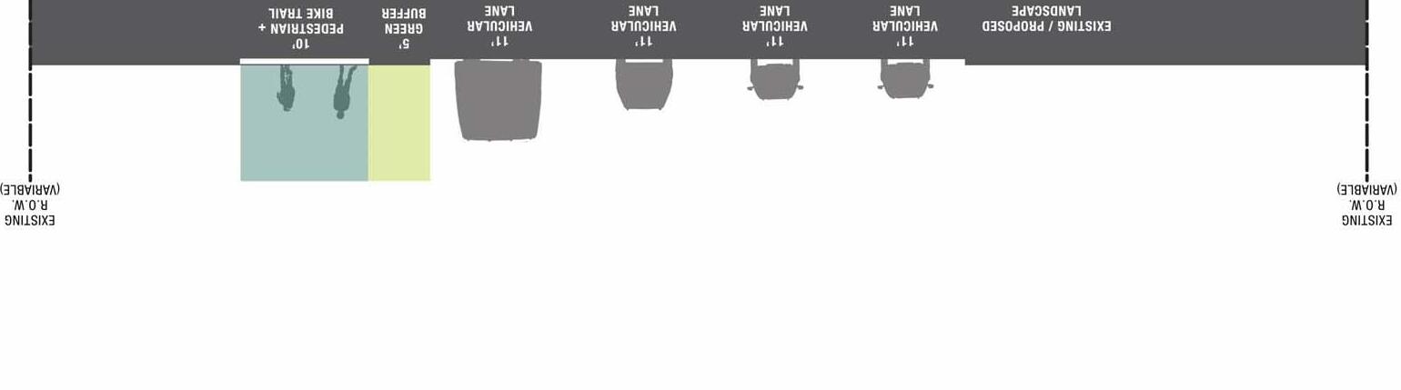
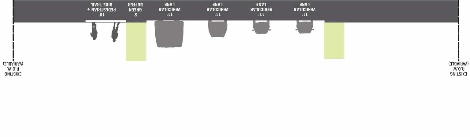
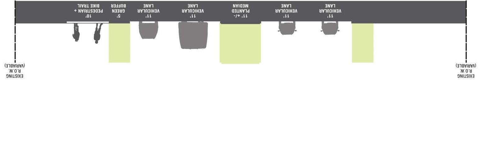
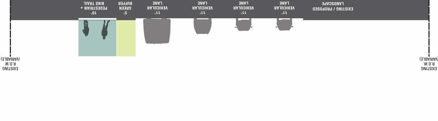
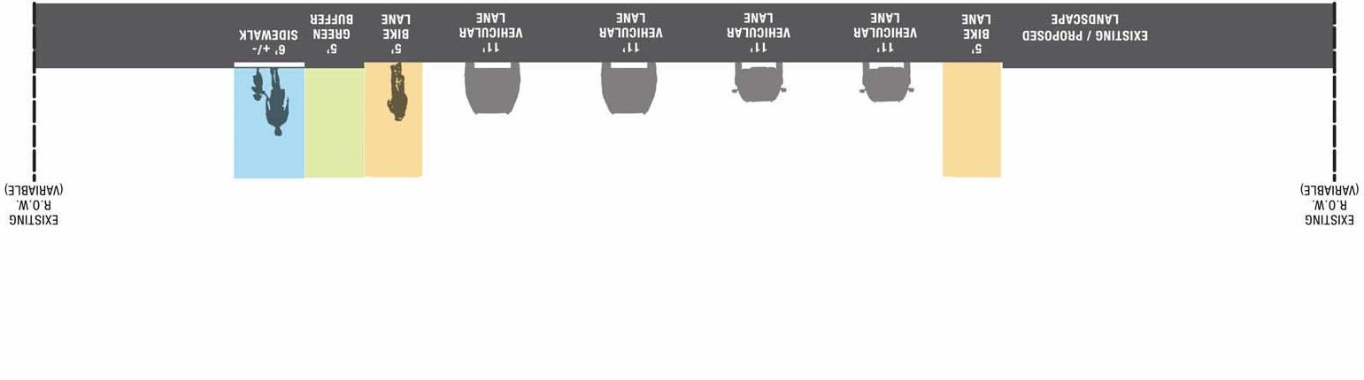
ON-STREET BIKE LANES VS. OFF-STREET MULTI-USE TRAILS

The group was also asked to weigh in on the preferred pedestrian/bicycle facilities to be introduced in the corridor. Two concepts were presented with differing approaches to pedestrian and bicycle circulation.
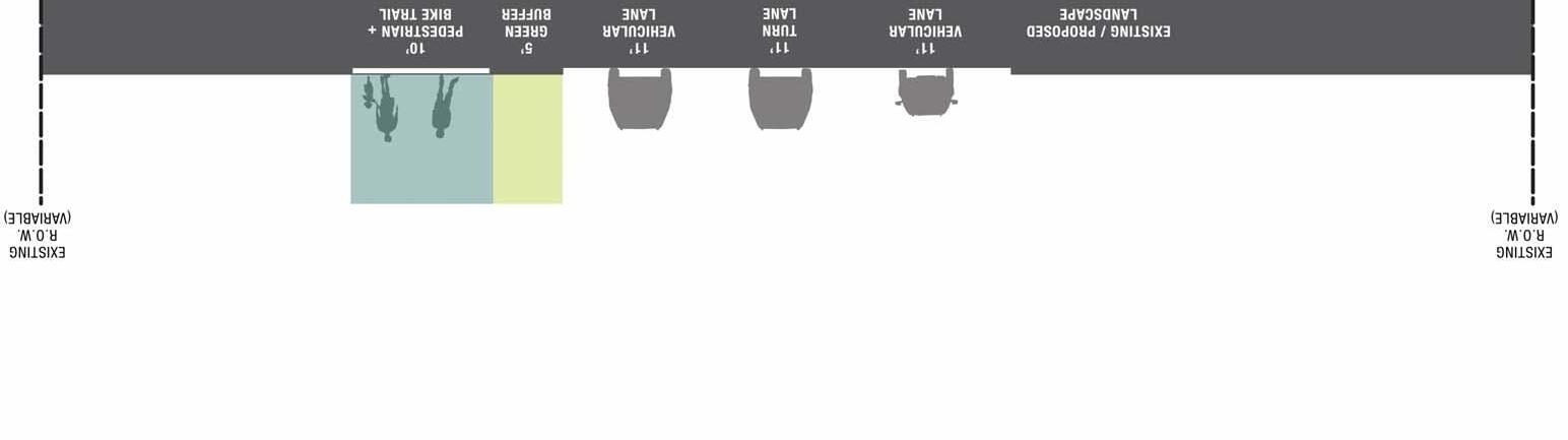
The first concept introduces dedicated bike lanes to both sides of Truman Road. The additional shoulder width throughout the existing roadway would allow for this configuration while maintaining the number and width of existing traffic lanes. This concept separates bicycle and pedestrian traffic, by providing a new sidewalk on the South side of Truman Road.
The second concept proposes an off-street, multi-use trail to serve both pedestrians and bicyclists. This option was very clearly preferred by stakeholders. Given the existing slopes and traffic speeds of the corridor, the separation of bicyclists and motorists was a clear priority established by participants in order to create a safe multi-modal environment.
TRUMAN ROAD GREEN GATEWAY PAGE 23
IDEAS
On Street Bike Trail Images Multi-Use Trail Images
PREFERRED SCENARIO
 On Street Bike Lane Section
PAGE 24
CONFLUENCE OLSSON ASSOCIATES HARDWICK LAW FIRM
Pedestrian/Bicycle Trail Section
IDEAS
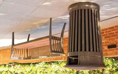
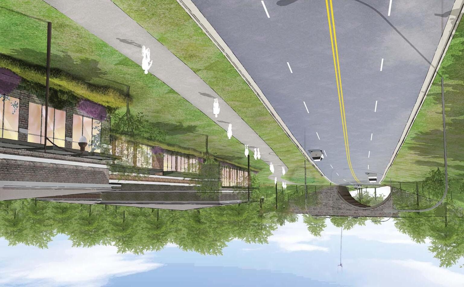
CORRIDOR AESTHETICS
In order to enhance the aesthetics of the corridor as an attractive gateway to Independence, new corridor streetscape amenities are proposed.
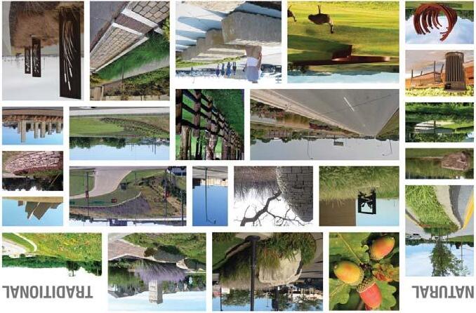
CHARACTER STUDY
When selecting families of amenities for enhancing the corridor, the stakeholders were first asked to identify their preferred character type, in a very general sense. The “Natural/Traditional” option illustrated natural materials (stone, wood, etc.) applied in traditional methods. The “Modern/Clean” option indicated modern materials (steel, acrylic, etc.) applied in clean, geometric forms and patterns.
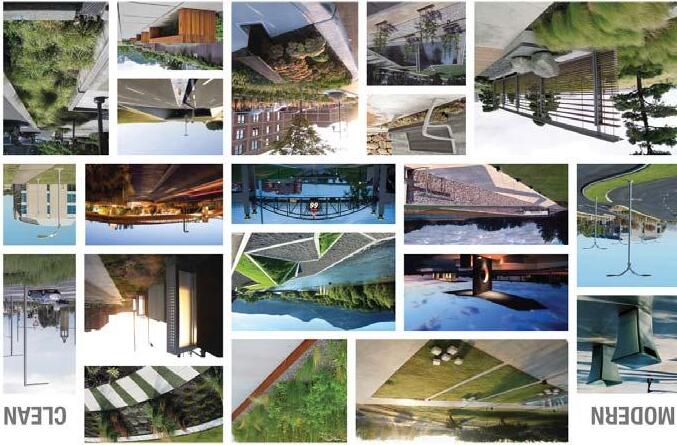
The advisory committee preferred the “Natural/Traditional” approach to the corridor character. This family of textures and materials typically has a more timeless feel, which was favored over the more modern elements.
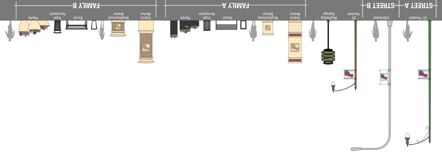
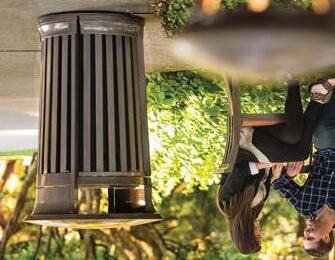
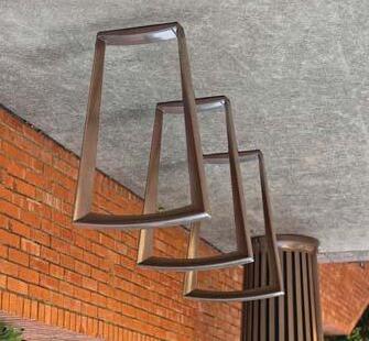
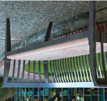
KIT OF PARTS
Based upon the results of the initial character study, concepts for a streetscape ‘Kit of Parts’ were proposed. Two options were presented to the committee, with differing approaches.
First, ‘Family A’, proposes traditional materials (brick and concrete) in a very sleek and clean manner, drawing from architectural styles prevalent when Harry Truman was President. This family has streamlined modern architectural influences, and very simple options for site furnishings.
The second option, ‘Family B’, presents a more traditional approach. This option was preferred by the advisory committee. Rough cut stone and precast concrete with traditional column tops provide a classic, traditional look, complementing the stone arch bridge and other elements along the corridor.
Character Study Boards
TRUMAN ROAD GREEN GATEWAY PAGE 25
IDEAS
PREFERRED KIT OF PARTS


PAGE 26
CONFLUENCE OLSSON ASSOCIATES HARDWICK LAW FIRM
IDEAS
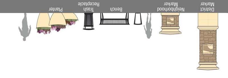
Site Furnishings
Images Kit of Parts
RECOMMENDATIONS
FUTURE LAND USE
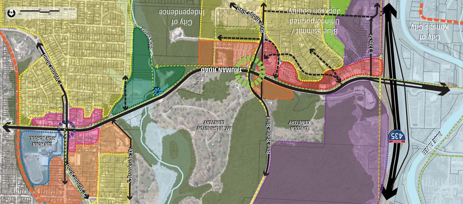
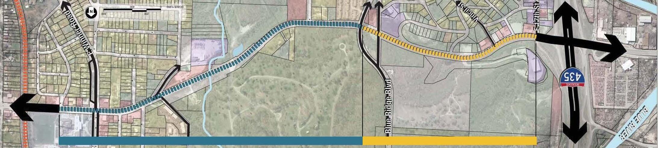
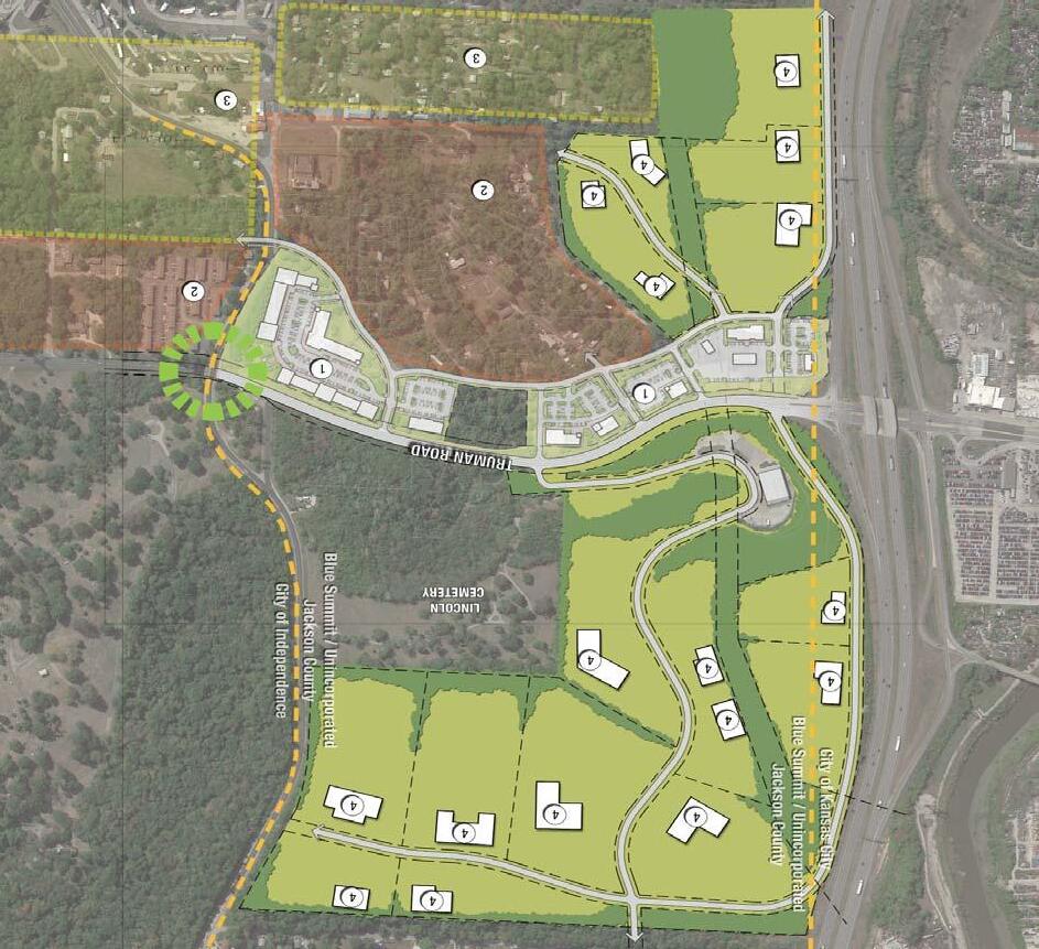
The Recommended Future Land Use Plan is a combination of the preferred components of the two Land Use Scenarios presented to the Advisory Committee and Public. The Future Land Use Plan establishes a framework or future redevelopment and revitalization of the Truman Road Corridor and adjacent land by introducing areas for additional, quality commercial and mixed use development. A primary objective is to enhance the visual character of the corridor eastbound, when entering Independence at the top of the hill near Blue Ridge Boulevard. The historic Stone Arch Bridge in this area is an existing iconic gateway to the City that should be highlighted as the eastern gateway to Independence. East of the stone arch bridge, additional multi-family opportunities are introduced to encourage additional density along the corridor.
The Rock Creek valley affords very attractive vegetated views from both eastbound and westbound lanes. The floodplain in this area is proposed to remain as undeveloped open space with the proposed addition of a trailhead/park facility near the future Rock Creek Trail.
Street realignments are proposed at Brookside Avenue in order to improve circulation and mitigate an existing grade transition issue at the southbound Brookside Avenue intersection.
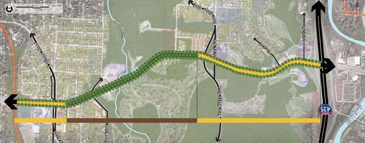
RECOMMENDATIONS
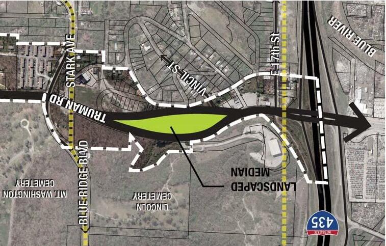
HARRY S TRUMAN PARKWAY
One concept that was investigated for the Jackson County/Blue Summit area early on in this process was the introduction of a more significant roadway configuration modification. The concept of creating “Harry S Truman Parkway” as a more attractive entrance into Independence was considered. The concept involves realigning Truman Road to introduce a sizeable landscape median between I-435 and Blue Ridge Boulevard that creates a very a different and attractively landscaped parkway character. This would require additional right-of-way acquisition along the south side of Truman Road. While the concept was of interest for the visual impact it can achieve it will not be pursued in the near term due to the complexity required in property acquisition.
PAGE 27
CONFLUENCE OLSSON ASSOCIATES HARDWICK LAW FIRM
Harry S. Truman Parkway Concept
RECOMMENDATIONS
TRUMAN ROAD GREEN GATEWAY PAGE 28
PAGE INTENTIONALLY LEFT BLANK
RECOMMENDATIONS
Future Land Use
LEGEND
INDUSTRIAL
CIVIC
SINGLE FAMILY RESIDENTIAL
MULTI-FAMILY RESIDENTIAL
MIXED-USE COMMERCIAL
OFFICE
PROPOSED TREES

PUBLIC/RECREATIONAL
FLOODPLAIN
EXISTING VEGETATION
PROPOSED TRAIL
TRAILHEAD
PROPOSED STREET
RAILROAD
PROPOSED FUTURE TRANSIT CENTER
CITY LIMITS
STONE ARCH BRIDGE/GATEWAY
WATERWAY
PAGE 29
CONFLUENCE OLSSON ASSOCIATES HARDWICK LAW FIRM
JACKSON COUNTY/BLUE SUMMIT ‘FOCUS AREA’COMMERCIAL DEVELOPMENT VISION

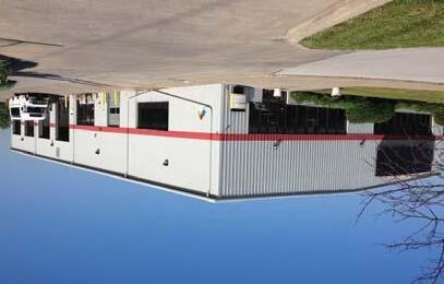
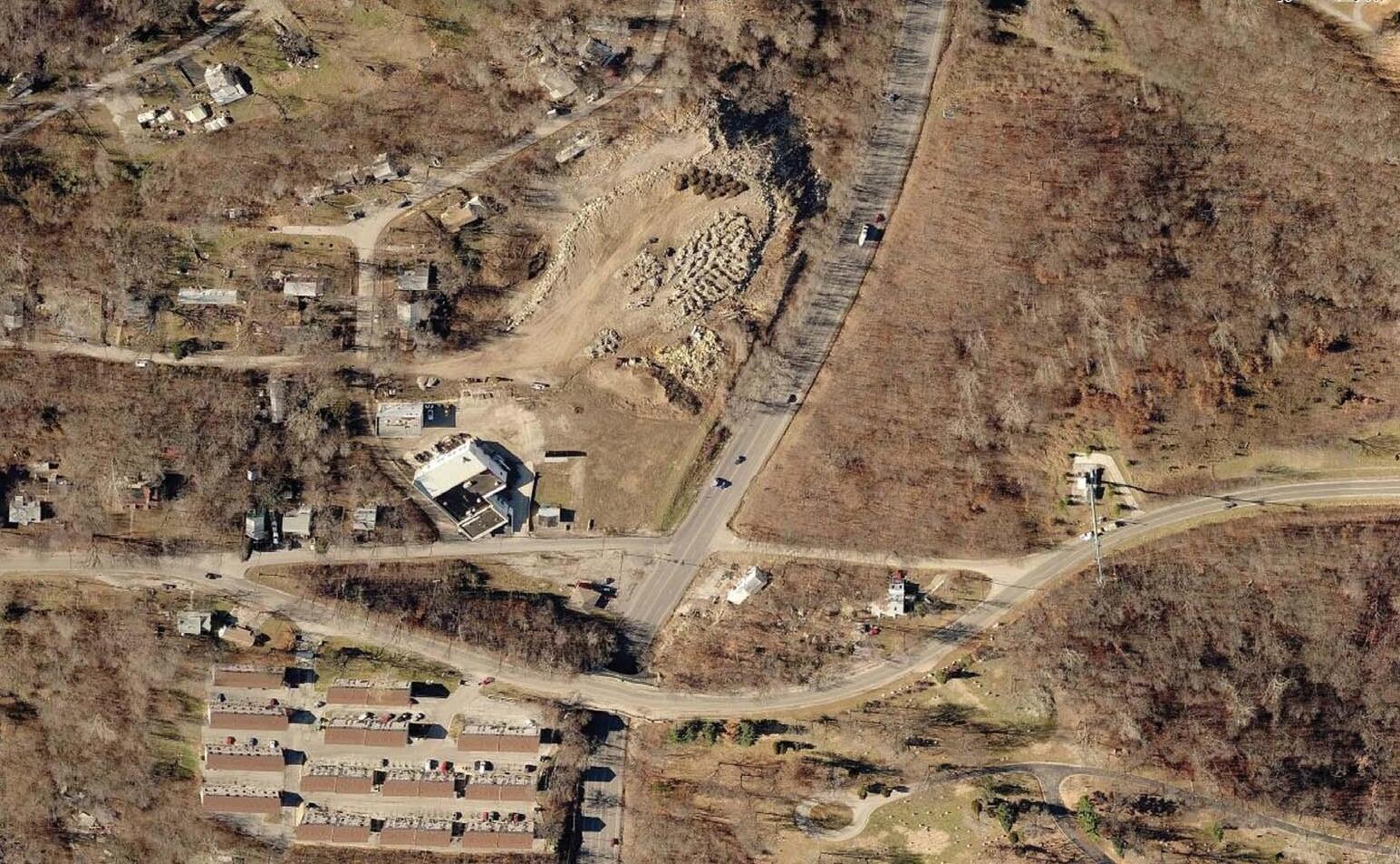
EXISTING CONDITIONS
Unincorporated Jackson/Blue Summit is an area that has suffered for decades from lack of a sense of ownership by the County. Not being located within the City of Independence or Kansas City, it lacks the attention otherwise given to city facilities and services. This has led to significant blight along the corridor and in the residential area south of Truman Road. However, Jackson County and the City of Independence have begun to make this area a priority and are working together to develop a sound strategy to implement positive changes over time.
Vacant properties, boarded up homes and burned out buildings are the norm throughout the wooded area south of Truman Road. The commercial properties through this segment of the corridor establish an undesirable image for the City of Independence. Unfortunately, since this area is outside of the city limits, there is little that the City can do to mitigate this issue. A strong partnership between the City and County will be important to realizing the desired change in the Blue Summit segment of the corridor.
TRUMAN ROAD GREEN GATEWAY PAGE 30
I-435
RECOMMENDATIONS Existing Conditions
BLUERIDGEBLVD
TRUMAN ROAD
RECOMMENDATIONS
Existing Conditions
STRENGTHS
• Low cost land
• Lower regulations, taxes than other areas
• Several properties in land bank/trust
• Cities and County want redevelopment to occur(Potential for incentives)
• Proximity to I-435
• Proximity to destinations (downtown KC, square)
• Proximity to large residential neighborhoods
• Proximity to good public school
• Community support for area clean up
WEAKNESSES
• Environmental concerns, contamination
• Topography
• Lack of infrastructure, amenities (sidewalk, sewer, fire, etc.)

• Under performing market
• Current business is undesirable
• Undermining North of Truman Road
• No real established market (high risk)
OPPORTUNITIES
• Transform area
• Become a major catalyst in area re-development
• Recent planning (Truman Green Gateway)
• Organized group of business and property owners/citizens
THREATS
• Financing
• Perception of crime (“Perception is Reality”)
• Unknown environmental issues
• Infrastructure + development costs
PAGE 31
CONFLUENCE OLSSON ASSOCIATES HARDWICK LAW FIRM
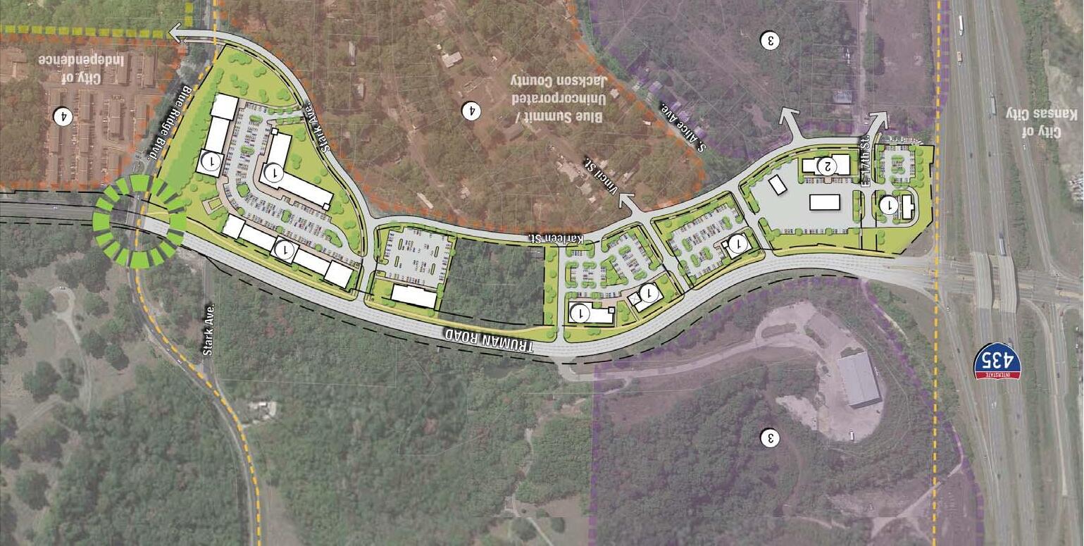
REDEVELOPMENT CONCEPT
As illustrated on the Corridor Redevelopment Scenario, proposed commercial development in Unincorporated Jackson County is concentrated along the south side of Truman Road. This concept provides continuous development along the corridor from I-435 to the Stone Arch Bridge. A proposed truck stop/travel center and fast food restaurant anchor the westernmost portion, catering predominantly to I-435 traffic, with a larger commercial center located on the east to support the nearby industrial redevelopment. Approximately 80,000 to 95,000 square feet of commercial development is proposed.
OUTDOOR RECREATION
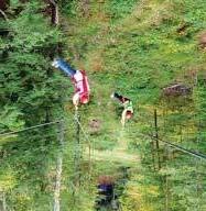
The area just south of the commercial development is currently indicated to be multi-family residential. However, due to the terrain and heavily wooded nature, this area could be better suited to some type of outdoor adventure/recreation activity. A unique recreation area has the possibility to attract the public to this new area. Various possibilities for the rugged terrain could include zip line course, disc golf, bike trails, ropes course, or off road vehicle area. While these won’t be significant tax/revenue generators, they would serve to clean up a number of blighted properties and attract more visitors to the area to support future commercial opportunities.
TRUMAN ROAD GREEN GATEWAY PAGE 32
Commercial Development Character Images
Recreation Examples
RECOMMENDATIONS


NOTE:
In order to identify the demand for new commercial space within the Truman Green Gateway plan, City of Independence economic development staff conducted a high-level retail market analysis. Three scenarios have been presented ranging from conservative to aggressive. Understanding that the market will drive the ultimate phasing or implementation sequence, the above concept illustrates the vision of the “Aggressive” build-out scenario. See appendix pages A7 and A8 for detailed analysis.

PAGE 33
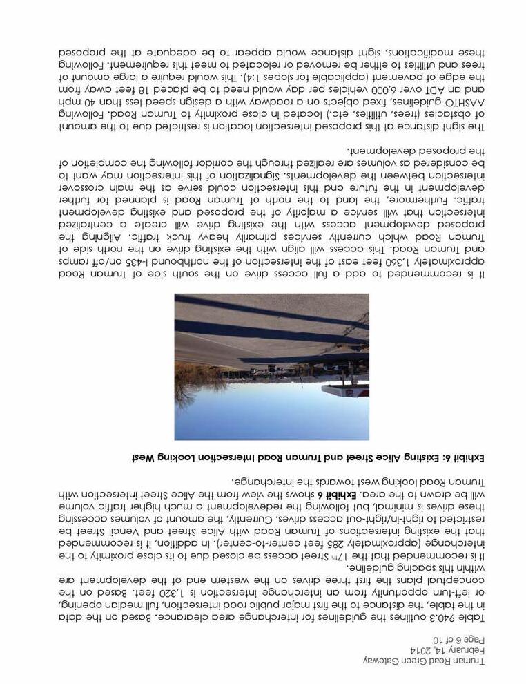
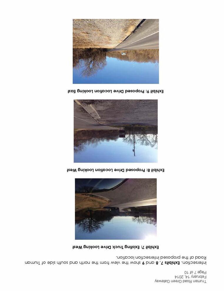
A traffic signal may be required at this intersection in the future. Further study will be required during the development planning process.
CONFLUENCE OLSSON ASSOCIATES HARDWICK LAW FIRM A A
LOCATIONS OF PERSPECTIVE VIEW LEGEND COMMERCIAL FUEL STOP AND TRAVEL CENTER LIGHT INDUSTRIAL/BUSINESS PARK MULTI-FAMILY RESIDENTIAL STONE ARCH BRIDGE / GATEWAY 1 2 3 4 CITY LIMITS
Commercial Development Vision - Jackson County/Blue Summit
RECOMMENDATIONS
TRUMAN ROAD GREEN GATEWAY PAGE 34
Eastward View of Existing Jackson County/Blue Summit Area
PAGE 35 RECOMMENDATIONS CONFLUENCE OLSSON ASSOCIATES HARDWICK LAW FIRM
of Proposed Redevelopment A
View
RECOMMENDATIONS
JACKSON COUNTY/BLUE SUMMIT ‘FOCUS AREA’INDUSTRIAL DEVELOPMENT VISION
REDEVELOPMENT CONCEPT
Proposed light industrial uses in Unincorporated Jackson County are located north of Truman Road, in an area currently zoned for industrial. This area was master planned previously, by a developer, for industrial and warehousing uses. The development was never realized and the majority of this property remains undeveloped today. Another area is proposed for future light industrial uses south of proposed commercial development that is located along the south of Truman Road.
The northern area is configured to capitalize on existing drive connections and topography to minimize site disturbance as the proposed lots will be located above existing mines. This property being situated high above I-435 will minimize any negative visual impacts to surrounding properties associated with light industrial uses while providing great views of the surrounding cityscape.
The southern area includes new (or relocated) industrial situated between I-435 and the existing limestone bluff. This area has immediate access to a mix of proposed commercial uses as well as convenient access to I-435. Approximately 250,000 to 300,000 square feet of industrial is proposed.
TRUMAN ROAD GREEN GATEWAY PAGE 36
Industrial Character Images
Industrial Concept - Jackson County/Blue Summit
A traffic signal may be required at this intersection in the future. Further study will be required during the development planning process.


PAGE 37
CONFLUENCE OLSSON ASSOCIATES HARDWICK LAW FIRM
RECOMMENDATIONS
LEGEND MIXED-USE MULTI-FAMILY SINGLE FAMILY LIGHT INDUSTRIAL CITY LIMITS STONE ARCH BRIDGE/GATEWAY 1 2 3 4
RECOMMENDATIONS
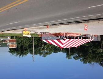
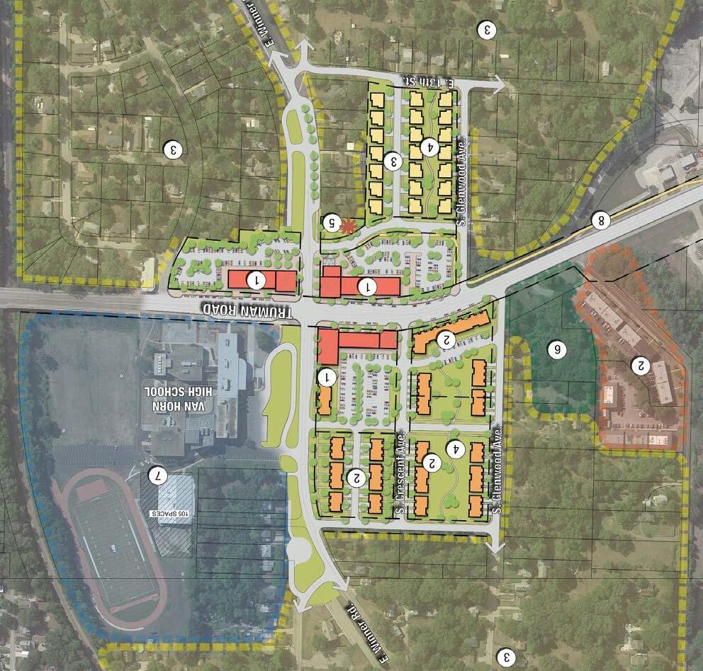
WINNER ROAD ‘FOCUS AREA’COMMERCIAL DEVELOPMENT VISION

EXISTING CONDITIONS
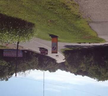
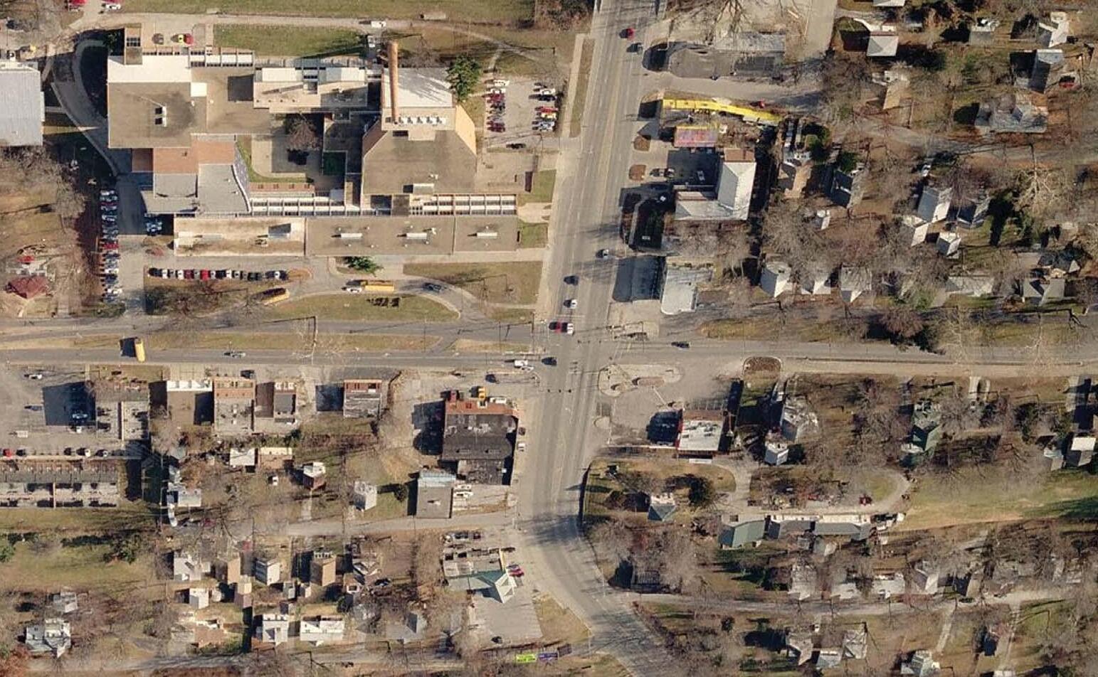
The Winner Road area is comprised of a series of under-performing and vacant commercial properties, a Pizza Hut restaurant, a number of multifamily properties and well maintained nearby residential neighborhoods to the south. The area is anchored by Van Horn High School, recently annexed and significantly improved by the Independence School District.
Both Winner Road and Truman Road carry a significant amount of traffic, which can be capitalized on for future commercial development opportunities. The growth of the school also presents an opportunity to provide additional housing choices for future students’ families.
This area is the only location within the project limits, which presents a somewhat urban street and building configuration, making it a good fit for additional neighborhood oriented and walkable businesses and services.
Existing Conditions
TRUMAN ROAD GREEN GATEWAY PAGE 38
WINNER ROAD TRUMAN ROAD
RECOMMENDATIONS
Existing Conditions
STRENGTHS
• 15,000 vehicles per day on Truman Road and significant traffic on Winner Road
• Van Horn High School
• Nearby neighborhoods to south are stable
• Gateway to historic sites
WEAKNESSES
• Median income of adjacent residents is lower than U.S. and city average
• Poor existing building stock
• Proximity and competition of other nearby commercial areas
OPPORTUNITIES
• Leverage passing traffic, give them a reason to stop
• Convenient in/out access for commuter traffic
• Upgrade the residential offerings in the area
• Take advantage of student/school traffic
• Create urban/walkable environment
• Redevelop existing vacant property on southeast corner

THREATS
• Nearby competition
• Lack of funding
• Lower than average adjacent income levels result in reduced market demand
PAGE 39
CONFLUENCE OLSSON ASSOCIATES HARDWICK LAW FIRM
RECOMMENDATIONS
REDEVELOPMENT CONCEPT

Proposed commercial development in the Winner Road Focus Area focuses on creating opportunities for new development near the intersection of Truman Road and Winner Road, an area currently anchored by Van Horn High School. The proposed concept reconfigures Winner Road to simplify traffic movements and minimize unsafe street connections. The priority in this areas is to provide opportunities for neighborhood-oriented commercial businesses that cater to local residents, high school traffic, and some commuter traffic.
On-street parallel parking is planned for the north and south sides of Truman Road surrounding the intersection. Currently there is on street parallel parking on the northeast side of this intersection for the high school drop off. The proposed added parking would expand this configuration. Preferred residential development types , attached and detached single family, are proposed to the north and south of the commercial areas.
A trail head park and trail connection are proposed on the south side providing pedestrian and bicycle access to the proposed multi-use trail, which will extend along Truman Road to the west to I-435. Approximately 40,000 to 50,000 square feet of commercial development is proposed.
TRUMAN ROAD GREEN GATEWAY PAGE 40
Commercial Development Character Images
Commercial Redevelopment Vision - Winner Road
RECOMMENDATIONS

NOTES:
In order to identify the demand for new commercial space within the Truman Green Gateway plan, City of Independence economic development staff conducted a high-level retail market analysis. Three scenarios have been presented ranging from conservative to aggressive. Understanding that the market will drive the ultimate phasing or implementation sequence, the concept to the left illustrates the vision of the “Aggessive” build-out scenario. See appendix pages A7 and A8 for detailed analysis.
MoDOT has raised concerns with the introduction of on-street parking along Truman Road in this location due to potential conflicts and performance issues. However, it is the goal of the City to introduce such traffic calming measures and create more pedestrian oriented street-side activity in the district. With this in mind, prior to implementing the proposed on-street parallel parking along Truman Road, further traffic analysis and coordination with MoDOT will be required.
LEGEND COMMERCIAL
ATTACHED TOWN-HOME RESIDENTIAL
SINGLE FAMILY RESIDENTIAL

SHARED OPEN PARK
TRAIL HEAD PARK
PAGE 41
CONFLUENCE OLSSON ASSOCIATES HARDWICK LAW FIRM B A
TRAIL
PERSPECTIVE VIEW 1 2 3 4 5 6 7 8
PUBLIC/RECREATIONAL CIVIL MULTI-USE
LOCATION OF
RECOMMENDATIONS
TRUMAN ROAD GREEN GATEWAY PAGE 42
Westward View of Existing Winner Road Area
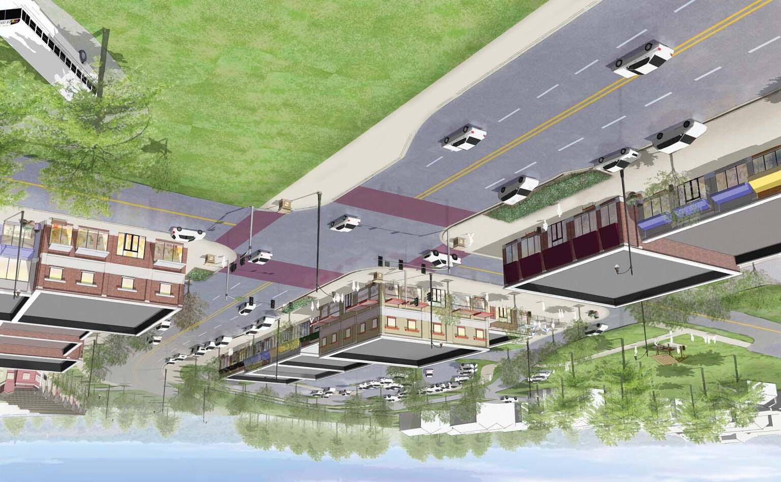
PAGE 43 RECOMMENDATIONS CONFLUENCE OLSSON ASSOCIATES HARDWICK LAW FIRM B View of Proposed Redevelopment
RECOMMENDATIONS
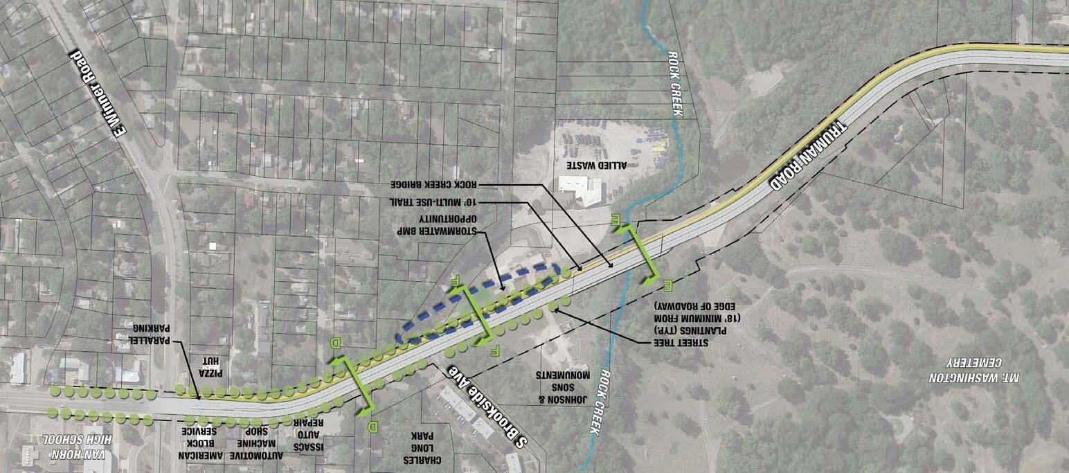
CORRIDOR ENHANCEMENTS
The proposed roadway concept includes a four-lane undivided configuration throughout the corridor. With this configuration the roadway will have ample capacity for the existing average daily traffic (ADT) volumes. In addition, a four-lane roadway will allows adequate capacity for future traffic volume increases along the corridor due to new development and/or background traffic growth.
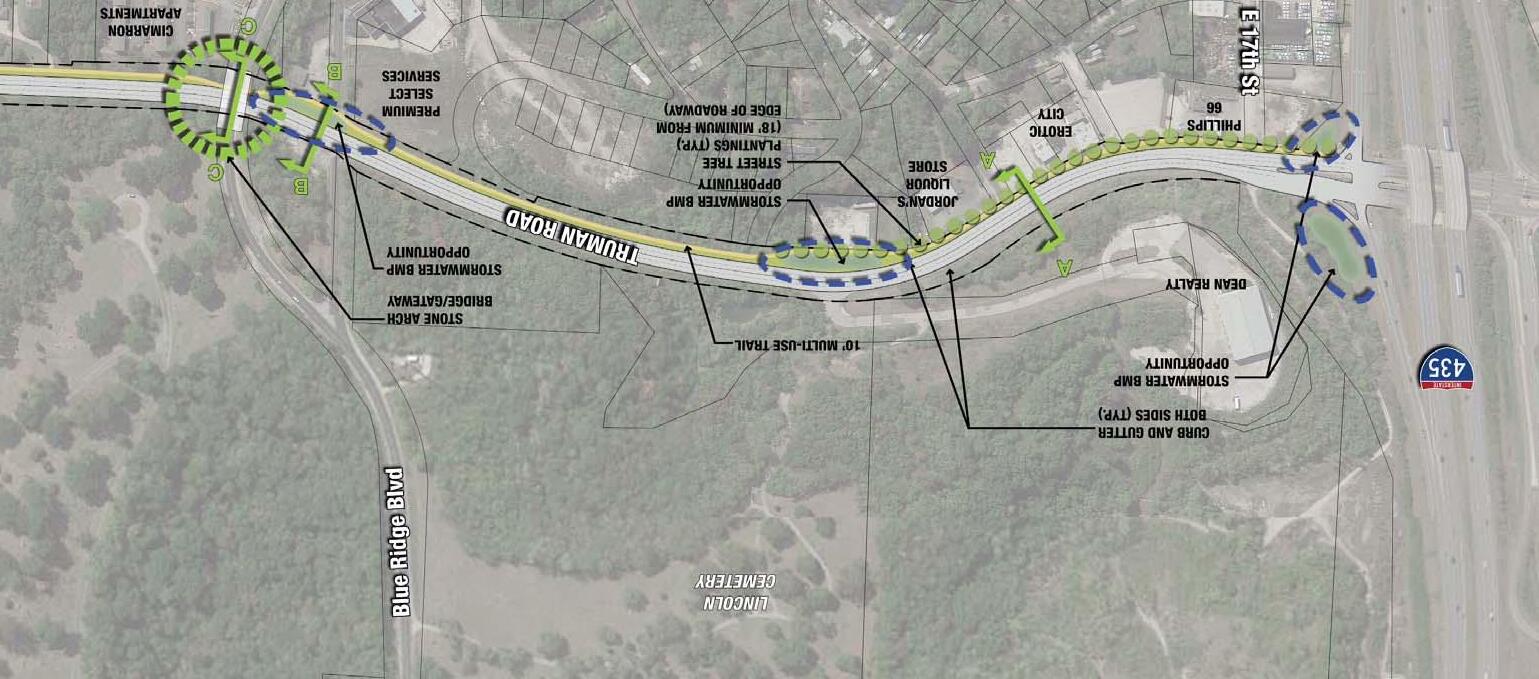
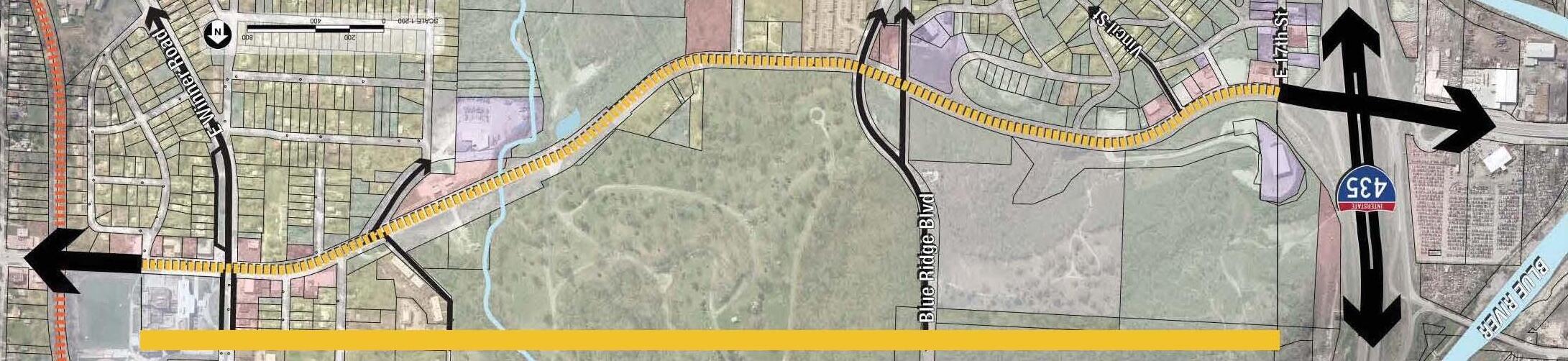
Corridor Plan
Indicates Location of Typical Street + Trail

Sections - See Pages 46-47


The KCMO city traffic forecast model and the Mid-America Regional Council (MARC) Regional Travel Forecast Model were used to provide 30 year traffic forecast numbers along Truman Road.
Following the existing model review it was found that traffic is projected to grow approximately 0.4% per year over the next 30 years. Applying this rate to the 15,000 vehicles per day counted during the 24-hour machine counts, the forecasted volumes on Truman Road through the project corridor is anticipated to be approximately 17,000 vehicles per day by 2040.
TRUMAN ROAD GREEN GATEWAY PAGE 44
C
A A
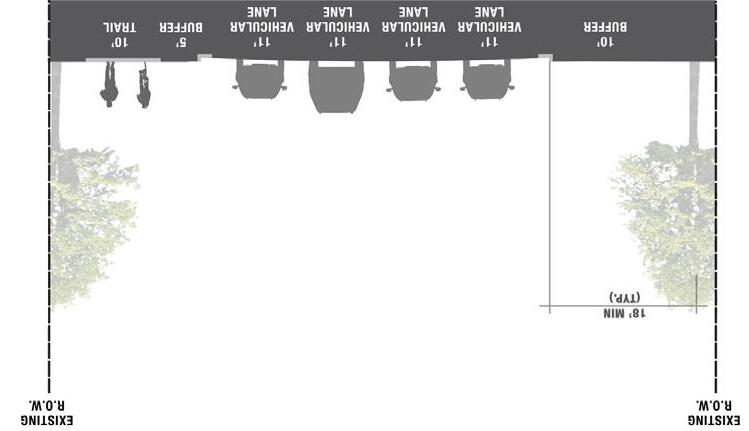
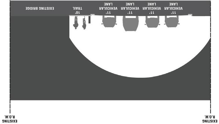
The recommended roadway configuration for Truman Road through the project corridor is a four-lane undivided roadway similar to existing conditions. Left-turn lanes will be added at major access points along the corridor. The width of the lanes are proposed to remain 11’ wide, as existing, and the entire roadway will be fitted with curb and gutter on both the north side and south sides. This will replace the existing mix of concrete and asphalt shoulders to create a more defined roadway.
RECOMMENDATIONS
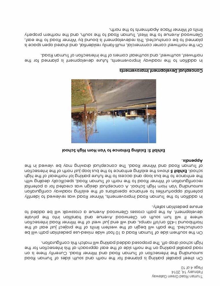
On the southern side of Truman Road a 10’ wide multi-use trail is proposed. The trail will begin at the western limits of the project, just east of the Northbound I-435 on/off ramps, and will end just west of the Winner Road intersection where it will turn south on S. Glenwood Avenue and transition into the proposed redevelopment area (See Winner Road Redevelopment Vision - Pg 41). As the path crosses Glenwood Avenue, a crosswalk will be added to ensure pedestrian safety. As an initial phase, prior to redevelopment occurring near Winner Road, the trail will continue parallel to Truman Road up the Winner Road Intersection.
PAGE 45
CONFLUENCE OLSSON ASSOCIATES HARDWICK LAW FIRM
RECOMMENDATIONS
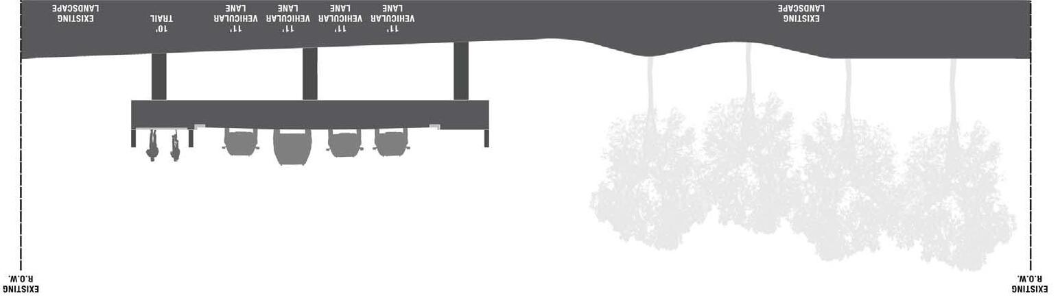
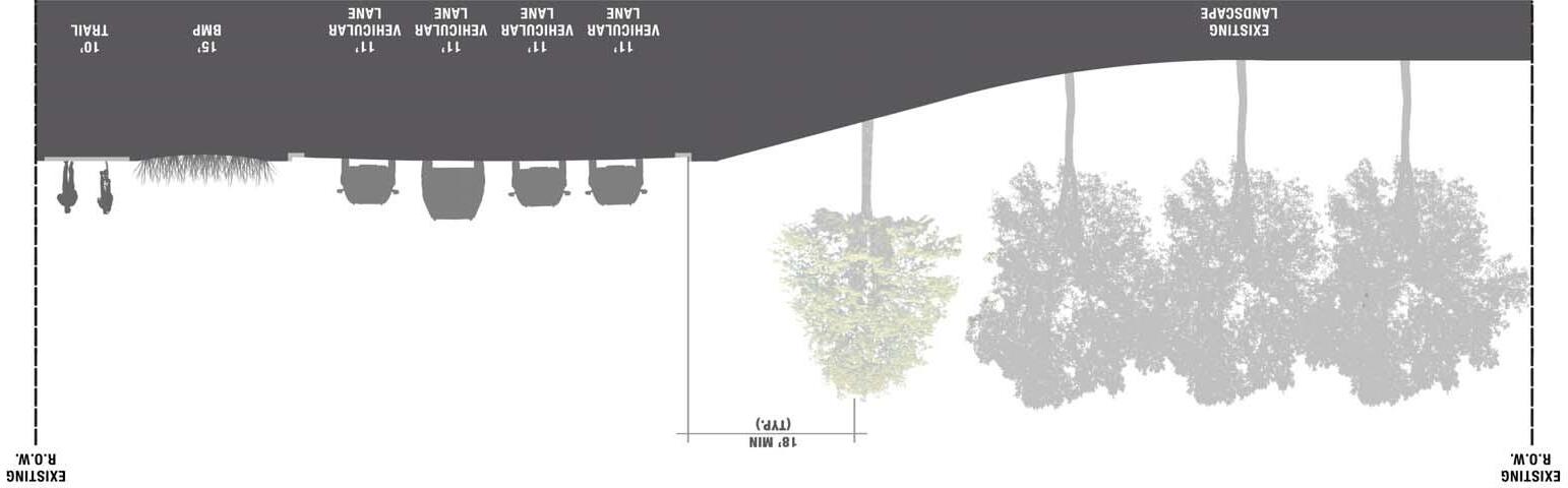
CORRIDOR SECTIONS
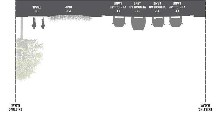
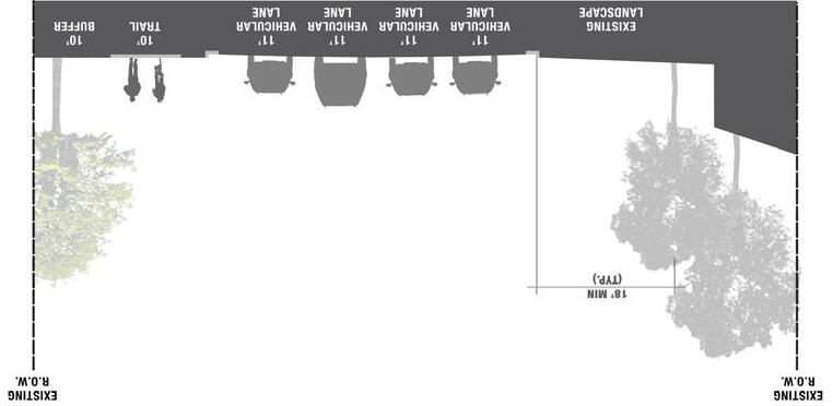
TRUMAN ROAD GREEN GATEWAY PAGE 46
Section C
Section D
Section B
Section A
PAGE 47
CONFLUENCE OLSSON ASSOCIATES HARDWICK LAW FIRM
RECOMMENDATIONS
Section E
Section F
RECOMMENDATIONS
TRUMAN ROAD GREEN GATEWAY PAGE 48
Eastward View of Existing Corridor
PAGE 49 RECOMMENDATIONS CONFLUENCE OLSSON ASSOCIATES HARDWICK LAW FIRM
C
View of Proposed Corridor/Trail
Improvements
RECOMMENDATIONS
PREFERRED CORRIDOR AESTHETIC
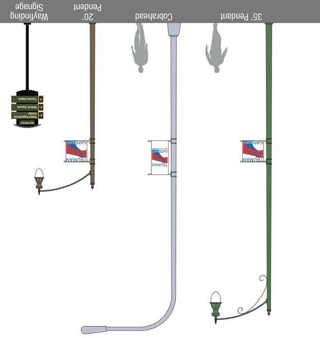
The preferred corridor aesthetic emphasizes traditional styles through the use of natural materials. Rough cut stone, to match the existing Stone Arch Bridge, is the preferred material for proposed gateway markers and/or streetscape elements. A preferred ‘kit of parts’ was selected to provide a general sense for the character of site furnishings. This information is intended to serve as a guide for future public and private improvements along the corridor. Future fixture selections and design of any corridor, neighborhood or gateway monuments should be developed according to this conceptual design.

Preferred Kit of Parts
TRUMAN ROAD GREEN GATEWAY PAGE 50
Recommended Site Furnishings
IMPLEMENTATION
CORRIDOR IMPROVEMENTS - CONCEPTUAL COST ESTIMATES
ITEMQTYUNITUNIT COST $COST $
1Mobilization1LS$58,000.00$58,000
2Demolition and Removals1LS$72,500.00$72,500
3Curb + Gutter10,000LF$30.00$300,000
410” Concrete Drive2,600SY$55.00$143,000
5Asphalt Base Repair2,900SF$110.00$319,000
610’ Asphalt Trail4,500SY$40.00$180,000
7Handicap Ramp14EA$2,500.00$35,000
8Grading8,700CY$18.00$156,600
9Curb Inlets23EA$5,000.00$115,000
10Storm Pipe (Includes Excavation, Bedding, Pavement Patching)
Subtotal:$2,328,400
Contingency1%25%582,100 Construction Total:
Engineering, Survey, Testing, + Inspection
Notes:
1. Cost estimate does not include cost for purchasing Right-of-Way or easements.
2. Cost estimate was developed from a conceptual layout. Impacts from vertical profile were not taken into consideration.
3. Cost estimate is based on a rehab of Truman Road, adding a concrete trail, and curb and gutter per the concept design.
4. Cost estimate assumes no work at the bridge or overpass.
5. Cost estimate does not include cost for utility relocations or adjustments.
Total Cost:$3,347,075
The consultant, using his or her professional judgment, has developed this stated Opinion of Probable Construction Cost based upon the design status identified above. Development of this Opinion has included consideration of design input level; however, the circumstances under which the work is expected to be undertaken, the cost and availability of materials, labor and services, probable bidder response and the economic conditions at the time of bid solicitation are beyond the control of the consultant and will impact actual bid costs. Should bidding be delayed, these costs should be reviewed and, if necessary, adjusted to a more applicable Engineering News Record Construction Cost index.
PAGE 51
CONFLUENCE OLSSON ASSOCIATES HARDWICK LAW FIRM
IMPLEMENTATION
4,350LF$110.00$478,500
Striping, and Pavement Patching 1LS$20,500.00$20,500
1LS$290,000.00$290,000
Control1LS$29,000.00$29,000
11Signing,
12Lighting1LS$145,000.00$145,000 13Incidental Construction (Erosion Control, Seeding, Small Walls, Guardrail)
14Traffic
- Surface Course25,500SY$15.00$382,500 162” Milling25,500SY$2.00$51,000 17Landscaping + BMP’s1LS$375,000.00$375,000 18Monumentation + Signage1LS$87,000.00$87,000 Subtotal:$3,237,600 Contingency1%25%809,400 Construction Total: $4,047,000 Engineering, Survey, Testing, + Inspection 1%15%$607,050 Total Cost:$4,654,050
152” AC
OF INDEPENDENCE
ITEMQTYUNITUNIT COST $COST $ 1Mobilization1LS$42,000.00$42,000 2Demolition and Removals1LS$52,500.00$52,500 3Curb + Gutter7,000LF$30.00$210,000 410” Concrete Drive1,900SY$55.00$104,500 5Asphalt Base Repair2,100SF$110.00$231,000 610’ Asphalt Trail3,300SY$40.00$132,000 7Handicap Ramp10EA$2,500.00$25,000 8Grading6,300CY$18.00$113,400 9Curb Inlets17EA$5,000.00$85,000 10Storm Pipe (Includes Excavation, Bedding, Pavement Patching) 3,000LF$110.00$330,000 11Signing, Striping, and Pavement Patching 1LS$14,500.00$14,500 12Lighting1LS$105,000.00$105,000 13Incidental Construction (Erosion Control, Seeding, Small Walls, Guardrail) 1LS$210,000.00$210,000 14Traffic Control1LS$21,000.00$21,000 152” AC - Surface Course18,500SY$15.00$277,500 162” Milling18,500SY$2.00$37,000 17Landscaping + BMP’s1LS$275,000.00$275,000 18Monumentation
Signage1LS$63,000.00$63,000
CITY
- WINNER ROAD TO BLUE RIDGE BOULEVARD
+
1%15%$436,575
$2,910,500
JACKSON COUNTY - BLUE RIDGE BOULEVARD TO I-435
IMPLEMENTATION
FUNDING
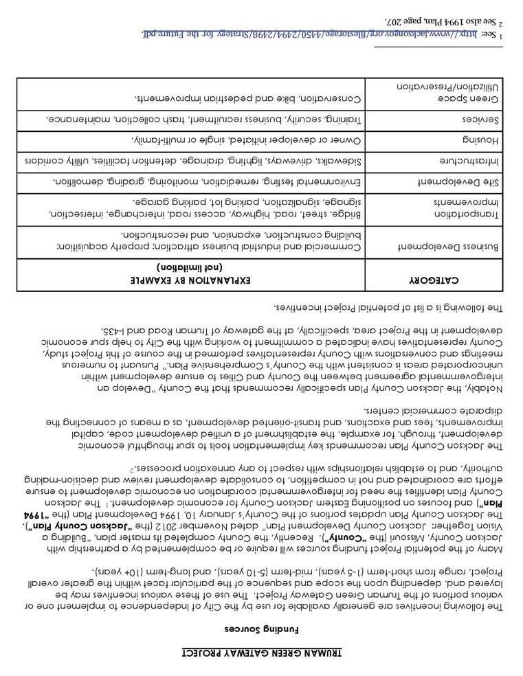
The best ideas will also require a creative approach to public funding in order to achieve significant results. To that end, a detailed list of funding programs has been assembled that apply to redevelopment of private property as well as implementation of public improvement projects. The previous summaries of funding opportunities are not all inclusive and are presented in no particular order of priority. The summaries are intended to equip City and County leaders with a quick reference guide or “toolbox” of ideas to consider as they continue to develop scenarios for future implementation.
While the revitalization of private property will, to a certain extent, rely on market driven factors, the City and County can take steps to begin implementing public improvements, which can help catalyze future interest in private reinvestment. With this in mind, the capital improvements proposed for the corridor, trail, streetscape and roadway improvements, have been identified and an associated conceptual level estimate of costs has been assembled. This is presented as one, comprehensive project. However, based on funding capacity, these improvements could be phased in over time. Priority should be placed on implementing the trail facility in one phase throughout the corridor in order to avoid the “trail to nowhere” situation, which comes with phased construction. There are a number of local, state and federal funding programs the City and County can investigate, which would be appropriate for the identified corridor improvements. Those programs are explained in the previous summaries.
TRUMAN ROAD GREEN GATEWAY PAGE 52
PAGE 53
CONFLUENCE OLSSON ASSOCIATES HARDWICK LAW FIRM
IMPLEMENTATION
IMPLEMENTATION
TRUMAN ROAD GREEN GATEWAY PAGE 54
PAGE 55
CONFLUENCE OLSSON ASSOCIATES HARDWICK LAW FIRM
IMPLEMENTATION
IMPLEMENTATION
TRUMAN ROAD GREEN GATEWAY PAGE 56
PAGE 57
CONFLUENCE OLSSON ASSOCIATES HARDWICK LAW FIRM
IMPLEMENTATION
APPENDIX
ENGINEERING SUMMARY

PAGE A1 APPENDIX CONFLUENCE OLSSON ASSOCIATES HARDWICK LAW FIRM

TRUMAN ROAD GREEN GATEWAY PAGE A2
APPENDIX
PAGE A3 APPENDIX CONFLUENCE OLSSON ASSOCIATES HARDWICK LAW FIRM
TRUMAN ROAD GREEN GATEWAY PAGE A4
APPENDIX
PAGE A5 APPENDIX CONFLUENCE OLSSON ASSOCIATES HARDWICK LAW FIRM
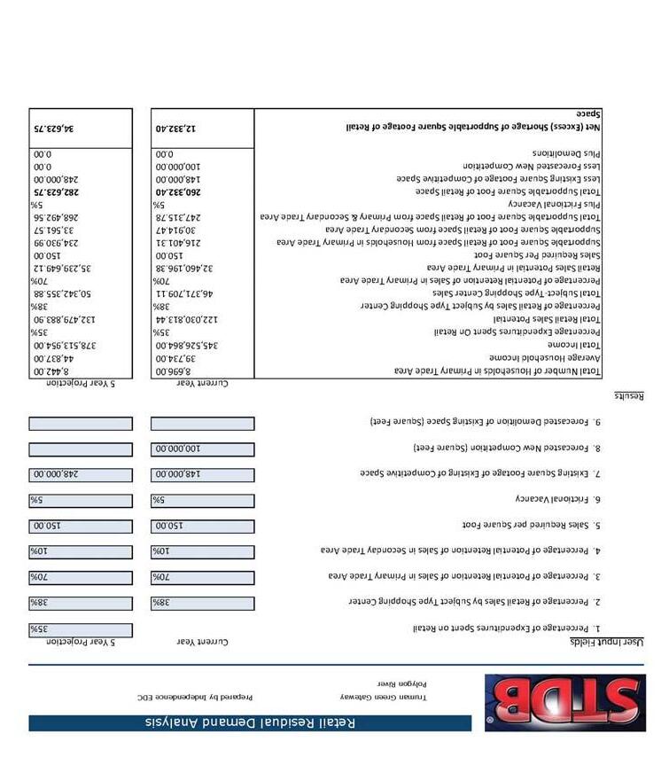
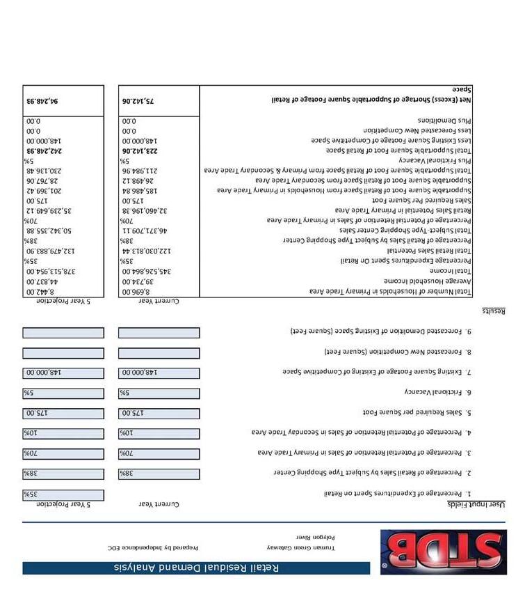
RETAIL GAP + FUTURE BUILD OUT STUDY
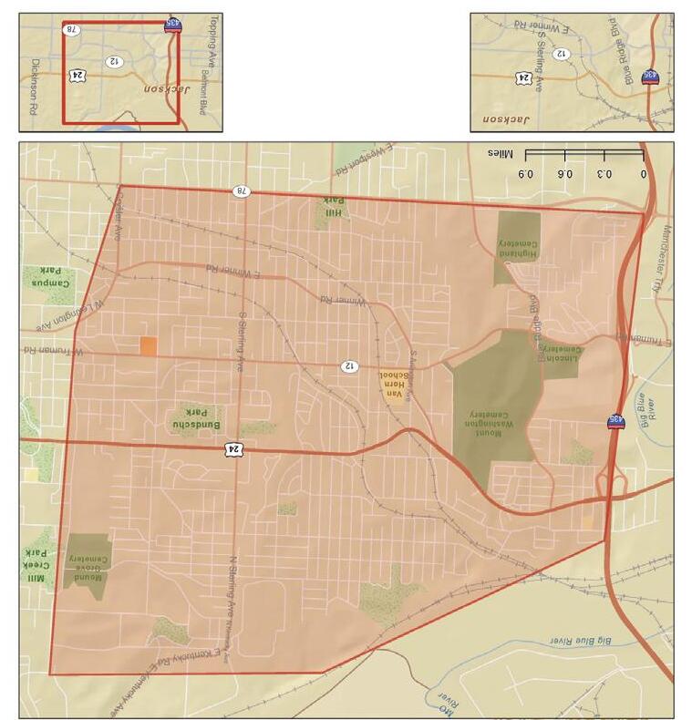
In order to identify the demand for new commercial space within the Truman Green Gateway plan, City of Independence economic development staff conducted a high-level retail market analysis. This study analyzed data from within the study area and designated surrounding trade area, which would potentially serve any new retail development. The trade area is identified on the map shown at right.
The first step in this analysis was to determine the population and incomes of the study area, then evaluate spending patterns – what they are buying and how much they are spending. The City uses Site To Do Business and ESRI as their information source, their data is extrapolated from US Census Bureau and the Bureau of Labor statistics. This information was used to calculate the total buying power of the trade area and what a new project could be expected to capture. From there we identified existing stores or supply within the market and potential new competitive space. For the purposes of this study we ran analysis assuming the Sugarland development planned for Sugar Creek would be constructed within the next five years and one assuming construction would take longer than development on the studies proposed sites. By using average sales per square foot as estimated by Urban Land Institute Dollars and Sense Guide and local data, we translated buying power into supportable square footage of stores. Beyond the aforementioned data, lifestyle characteristics of residents, site constraints, traffic patterns and competition from outside the immediate trade area were considered as factors impacting necessity and feasibility for future retail.
Based on the market analysis this area could support a neighborhood shopping center ranging from approximately 15,000 square feet (assuming immediate construction of Sugarland) or 100,000 square feet (assuming no new construction).
Neighborhood shopping centers are typically grocery anchored and offer various retail goods and services needed on a daily or weekly basis. There currently exists a gap in hardware, grocery, health and personal care stores, full and limited service restaurants. All of these categories would be potential targets for tenants in a neighborhood center. Retail development will likely need to be phased in over several years and will based on local, regional and national market conditions.
TRUMAN ROAD GREEN GATEWAY PAGE A6 APPENDIX
Trade Area Map
PAGE A7 APPENDIX CONFLUENCE OLSSON ASSOCIATES HARDWICK LAW FIRM

TRUMAN ROAD GREEN GATEWAY PAGE A8
APPENDIX
