2 minute read
“M A K E I N V I S I B L E V I S I B L E”


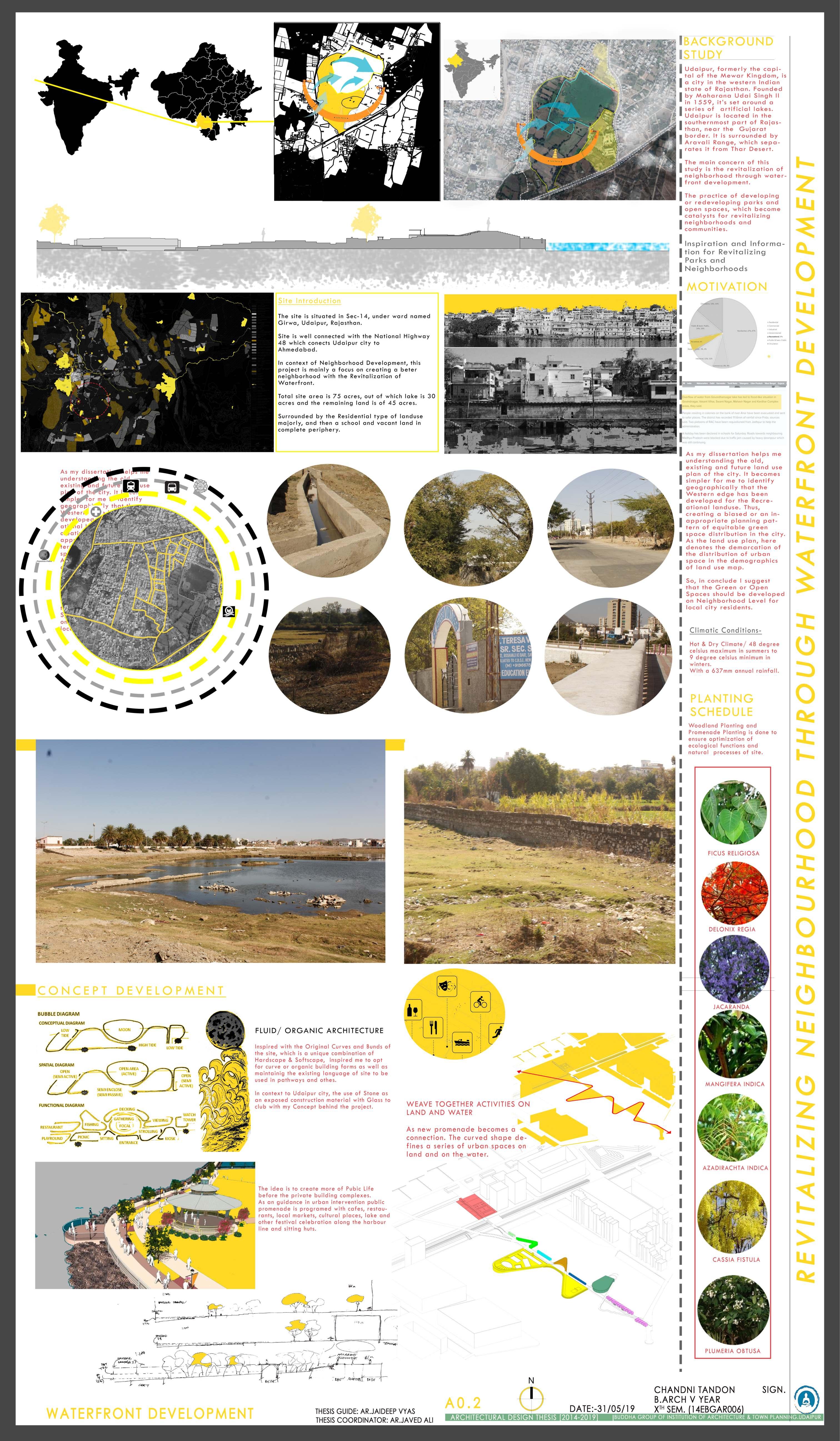
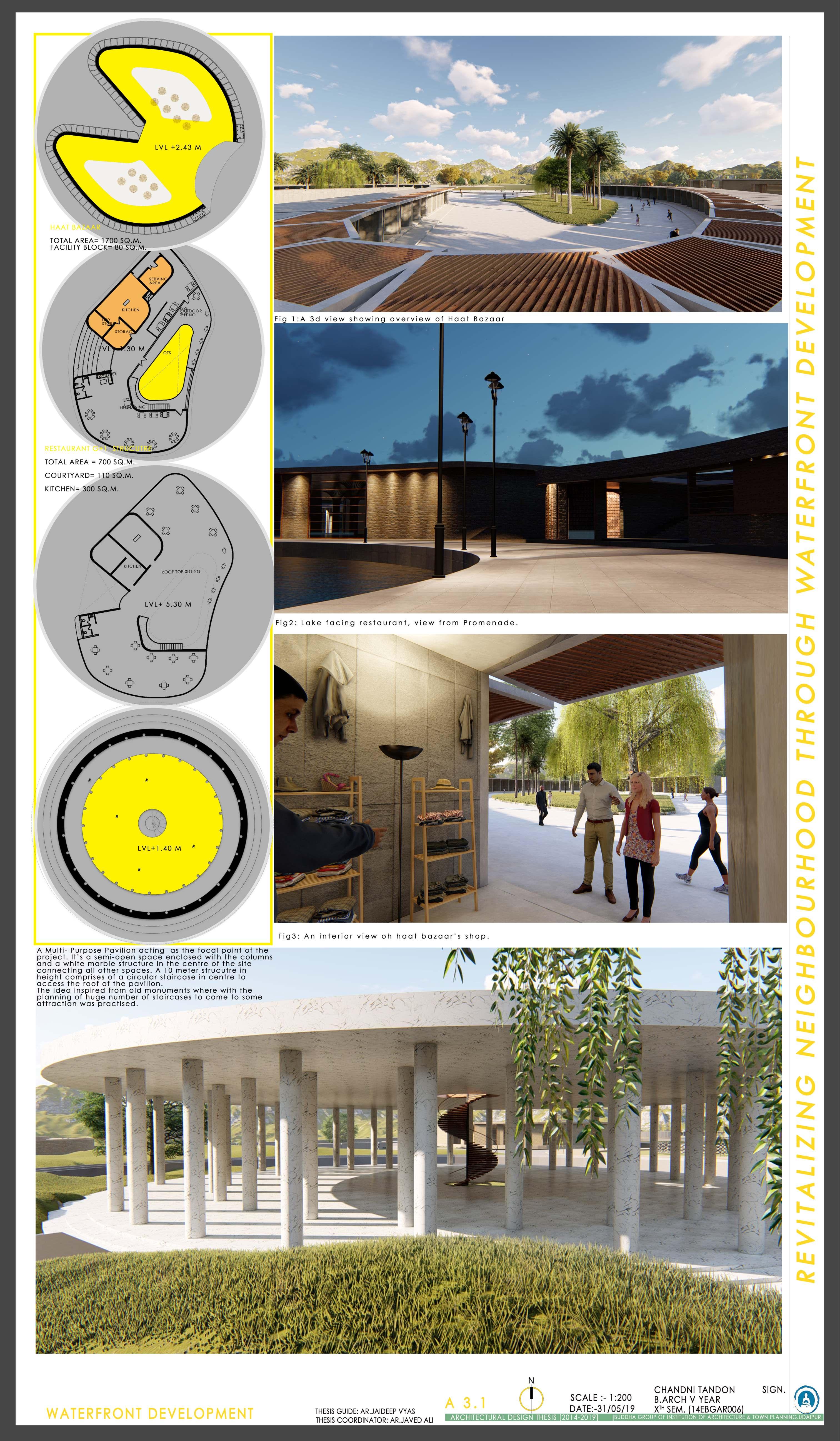
The purpose of this thesis is to study how lakes contribute in respect to identity of a city.
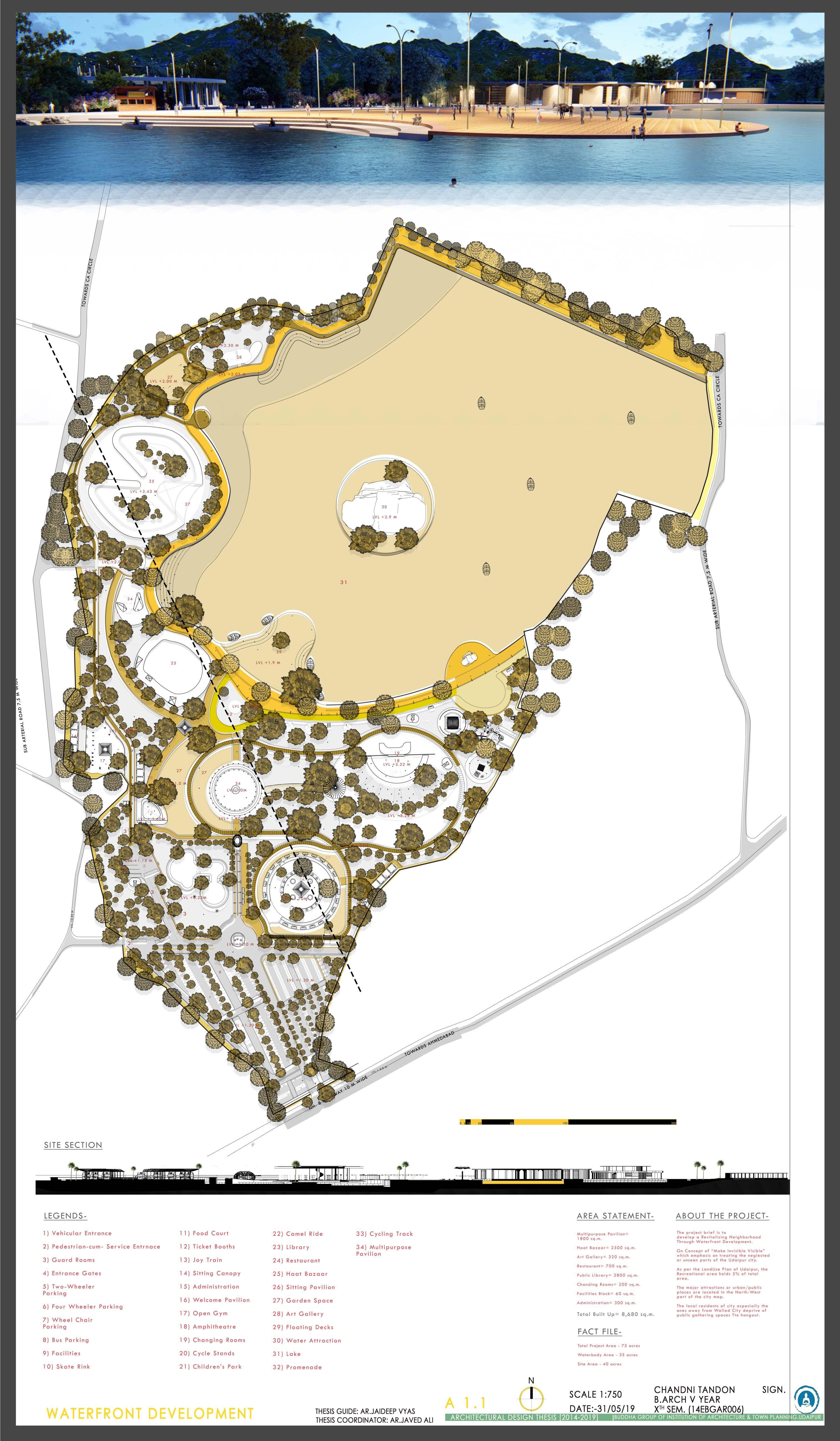
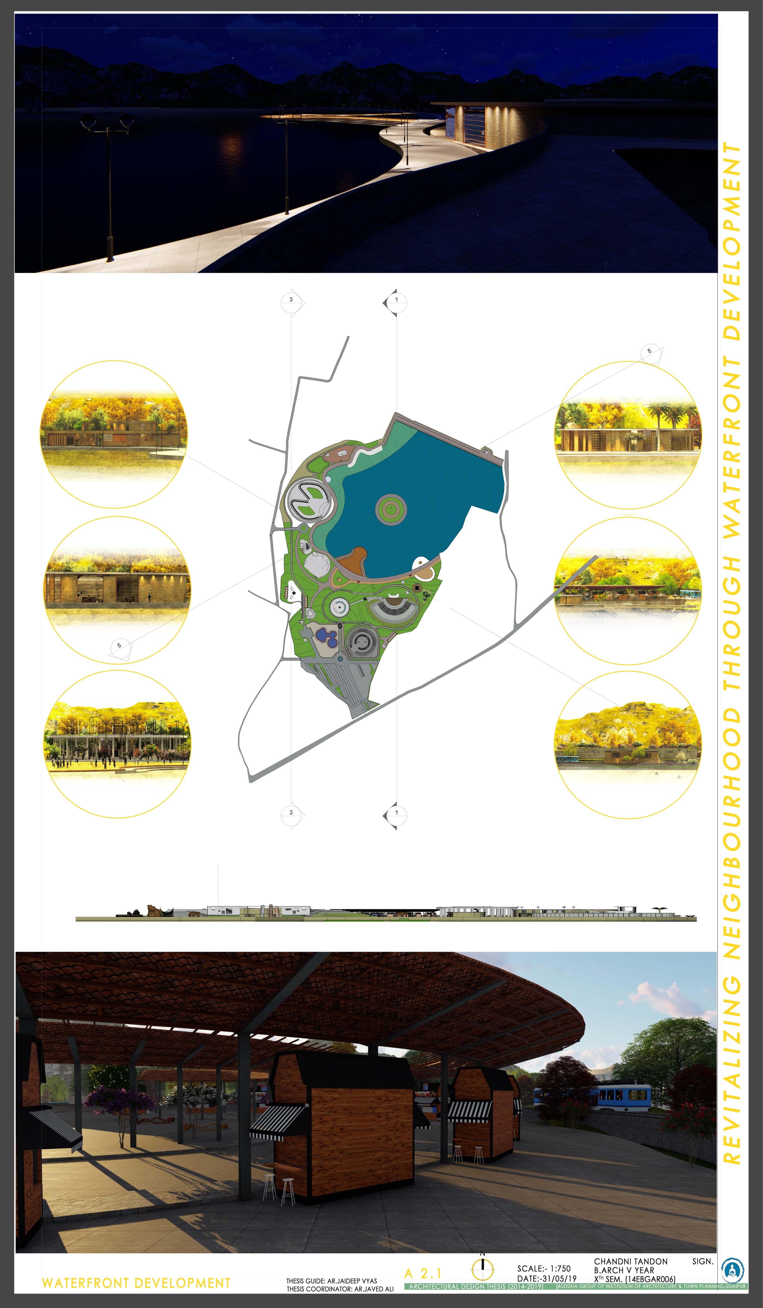
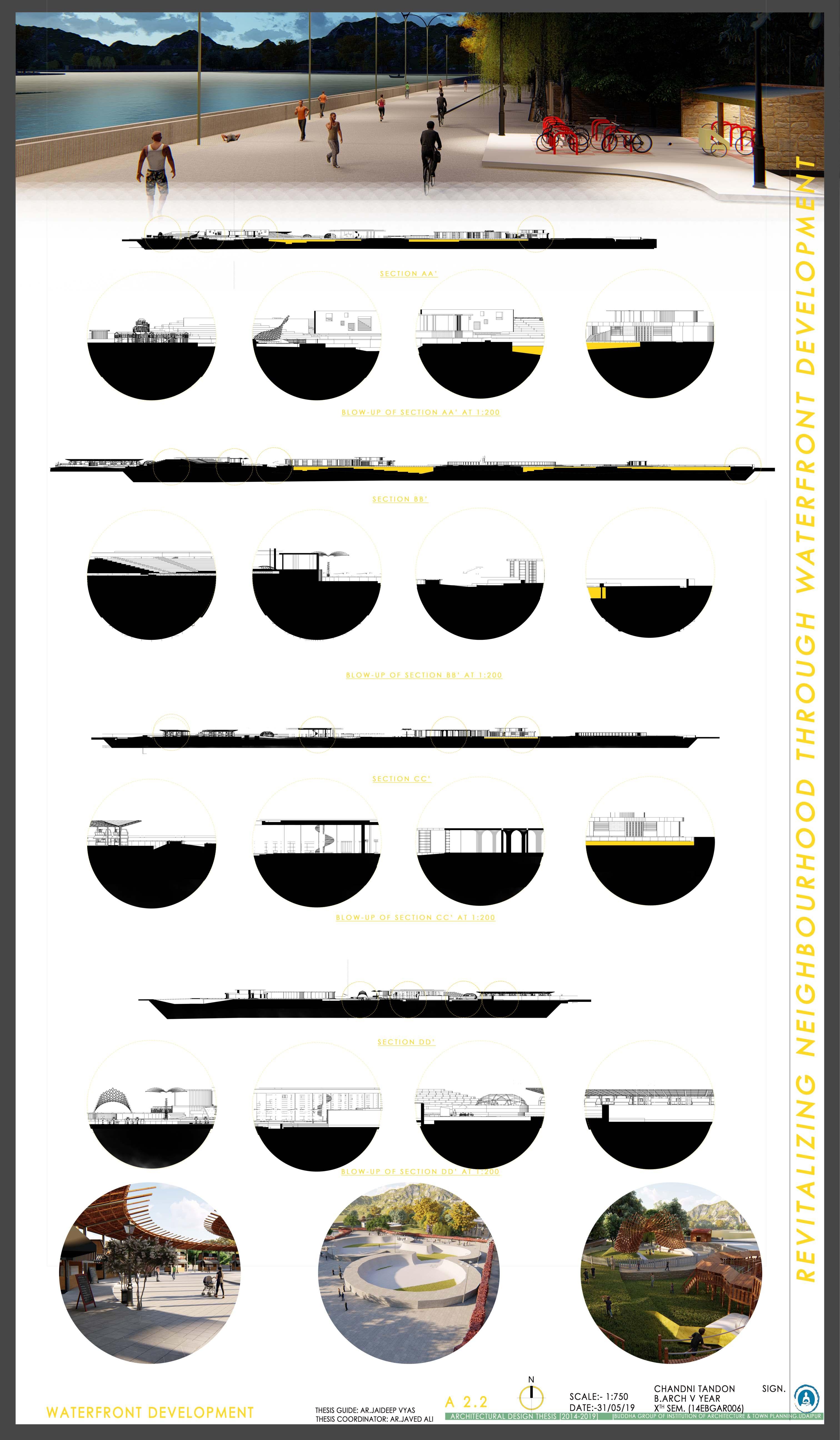
The idea is to create an economically vibrant and safe and inclusive waterfront providing the best social and physical infrastructure for it’s neighborhood residences, business tourists, recreational tourists and local visitors. Also, at developing the waterfront areas by treating the catchment area and to provide aesthetically pleasing and highly functional spaces and activities that encourages the city dwellers to experience the beauty and serenity of the waterfront. Creating a vital waterfront that serves to unite the community and the visitors in a shared experience of the city.
Advertisement
The concept Make Invisible Visible says to highlightthe unseen neglected spaces of the city. According to the guidelines, a development close to river/ lake area would not increase the level of water flow. Demonstrating the connection between access, greenway development and market demand.
Recommendations and Findings
Waterfront & Green areas -based solutions supply innovative approaches to extend the standard of urban settings. It enhances local resilience and promote sustainable lifestyles, improving both the health and the well-being of urban residents. Parks, playgrounds or vegetation publicly and personal places are a unit central part of these approaches and may felicitate to make sure that:
● urban residents have adequate opportunities for exposure to nature;
● urban biodiversity is maintained and protected;
● environmental hazards such as air pollution or noise are reduced;
● the impacts of extreme weather events (heatwaves, extreme rainfall or flooding) are mitigated;
● the quality of urban living is enhanced;
● the health and well-being of residents is improved.
Urban inexperienced area could be a part of “green infrastructure”. It is a vital part of public open areas and customary services provided by a town and may function as a health-promoting setting for all members of the urban community. It is thus compulsory to make sure that all urban, open or public green spaces are easily accessible for all age groups and distributed equitably within the city.
Land use planning is central for managing issues related to climatic variation in urban environments. However, Master Plans usually do not include climatic aspects, and few studies have addressed climate change at the urban scale, especially in developing countries.
This report proposes a framework with the thesis and live case studies helping & concluding the more and more placement of urban space at one part of the city and ignoring the rest of it.
Each category comprises attributes that describe a complex of relationships in influencing amenities for local public as well as the tourists. Proper land use planning provides the opportunity to assess where you are, where you would like to go and how you might get there.
Planning now to protect important open space and recreational facilities can greatly enhance the attractiveness of your community and encourage compatible growth in the future. Also, planning accordingly helps allowing the City to confront and manage aspects of growth and development in ways that preserve, protect, and enhance the environment.
The urban planning process in relation with equitable open space relationship can expose potential problems while there is still time to prevent them. Open space plans allow the benefits of open space that make up the character and protects the "green infrastructure" of a community. With the help of planning the spaces wisely this "green infrastructure" of water supply, land, working farms and forests, viable wildlife habitats, parks, recreation areas, trails, and greenways is as important to the economic future of a community as coming up with for planning for schools, roads, water, and wastewater infrastructure.
Although open area itself could be an easy concept, the factors that have an eect on it, which aects, are complex. Through an Open Space Plan, one can identify and examine these factors and lay out strategies for residents and can use to protect and enjoy its character, natural resources and open spaces.
Consequently, these findings form a replacement approach to the diculty of patterns of spatial use of public spaces, based on the global understanding of the dynamics of the urban grid and the visual and the permeability connections between public space and the urban environment.