How Geol o g i sts R e a d t h e E a rt h ’ s Hi story To place the groundwater resources of the
years, more than a mile of marine shale,
uplift. The Arapahoe tends to be gravel-rich,
Denver Basin into perspective, it is best to start
rich in sea shells and fossil fish, accumulat-
particularly in the western part of the basin.
with the container—the rocks. Come along, it’s
ed on top of these sediments. These fossils
Detailed mapping and correlation of
a fun story.
are easy to find on the edges of the Denver
data from water wells show that the Arap-
Basin and are on display in museums, such
ahoe Formation was, in part, deposited by
as Denver’s Museum of Nature & Science.
rivers as a giant apron or fan of debris that
The geologic history of Colorado is eloquently written in the rocks beneath our feet. Geologists learn to read this writing,
As the ocean retreated over the next
came out of a vanished canyon located
and they deduce the history of the Earth
million years, a geological layer known as
from clues we can all see.
Fox Hills Sandstone accumulated on top
Over geologic time, these deposits
west of Castle Rock.
Core samples taken from well bores
of the marine shale. Immediately over this
were buried and eventually subsided to
tell geologists that the Denver Basin aqui-
sandstone layer, another geological layer
depths of 2,000 feet or more, where they
fers are curved and layered one on top
full of coal beds, sandstone, shale and
make up the water-saturated sandstone
of another, like a stack of bowls. In some
mudstone beds soon accumulated, repre-
beds of the Arapahoe aquifer. This is one
areas, these rocks are found in thick lay-
senting a swamp-like environment. This is
of the most important aquifers in the basin
ers far underground. At the margins of the
called the Laramie Formation.
and is the major source of groundwater for
basin the layers outcrop, giving scientists
The porous units of these two forma-
a great opportunity to determine what the
tions make up the oldest and deepest of
municipal water users in Douglas County. The Denver and Dawson formations
rocks of the Denver Basin look like under-
the Denver Basin aquifers—the Laramie-
overlie the Arapahoe Formation and in-
ground, and how the aquifers formed.
Fox Hills Aquifer.
termingle with one another. The Dawson
In the Denver area, for example, the
Some 68 million years ago, the Central
tends to be rich in granite fragments,
steeply tilted sandstone ridge west of town
Rocky Mountains were being uplifted by tec-
while the Denver is rich in volcanic com-
at Dinosaur Ridge, near Red Rocks Park,
tonic forces. Tumbling wild from the moun-
ponents. The diversity of the geologic
reveals dinosaur bones and foot prints,
tains came rivers full of the ingredients for a
environments at the time of deposition
ripple marks, and fossil plants. Remains of
series of rock layers that spread across and
results in variable quality aquifers de-
mangrove-type swamps and tidal estuar-
filled the Denver Basin. This variable debris
pending on location within the Denver
ies can be seen on the rocky ridge.
was the genesis for the most water-rich rock
Basin. Generally, the western portion of
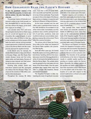
Knowing what modern beach and
layers of the Denver Basin. Over the years,
the aquifers are better water producers
near-shore systems look like, geologists
geologists have named these rocks from
than their equivalent units in the central
can deduce that the Dinosaur Ridge out-
older to younger—the Arapahoe, Denver
or on the eastern side of the basin. The
crops are the remains of 100 million year-
and Dawson Formations.
location of a well with respect to the
old shoreline landscapes. Throughout the ensuing 30 million
The Arapahoe Formation is older, representing the onset of significant mountain
ancient sediments is critical to its water producing potential.
Visitors to Dinosaur Ridge near Morrison view 100 million year old Iguanadontid footprints.
10 |
Colorado Foundation for Water Education