One of the oldest spans on the Fraser, this historic walking bridge is located 22km/14mi north of Yale, adjacent to the Alexandra Provincial Park. Established in 1984, the park provides a rest stop and picnic facilities for travelers. The site of the original Gold Rush Trail crossing over the Fraser River, you can access the historic bridge from a walking trail through the day-use area.
Hell’s Gate
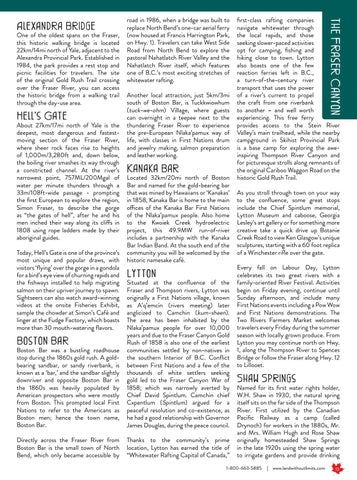
About 27km/17mi north of Yale is the deepest, most dangerous and fastestmoving section of the Fraser River, where sheer rock faces rise to heights of 1,000m/3,280ft and, down below, the boiling river smashes its way through a constricted channel. At the river’s narrowest point, 757ML/200Mgal of water per minute thunders through a 33m/108ft-wide passage - prompting the first European to explore the region, Simon Fraser, to describe the gorge as “the gates of hell”, after he and his men inched their way along its cliffs in 1808 using rope ladders made by their aboriginal guides. Today, Hell’s Gate is one of the province’s most unique and popular draws, with visitors ‘flying’ over the gorge in a gondola for a bird’s eye view of churning rapids and the fishways installed to help migrating salmon on their upriver journey to spawn. Sightseers can also watch award-winning videos at the onsite Fisheries Exhibit, sample the chowder at Simon’s Café and linger at the Fudge Factory, which boasts more than 30 mouth-watering flavors.
Another local attraction, just 5km/3mi south of Boston Bar, is Tuckkwiowhum (tuck-we-ohm) Village, where guests can overnight in a teepee next to the thundering Fraser River to experience the pre-European Nlaka’pamux way of life, with classes in First Nations drum and jewelry making, salmon preparation and leather working.
Kanaka Bar
Located 32km/20mi north of Boston Bar and named for the gold-bearing bar that was mined by Hawaiians or ‘Kanakas’ in 1858, Kanaka Bar is home to the main offices of the Kanaka Bar First Nations of the Nlaka’pamux people. Also home to the Kwoiek Creek hydroelectric project, this 49.9MW run-of-river includes a partnership with the Kanaka Bar Indian Band. At the south end of the community you will be welcomed by the historic namesake café.
Lytton
Boston Bar was a bustling roadhouse stop during the 1860s gold rush. A goldbearing sandbar, or sandy riverbank, is known as a ‘bar,’ and the sandbar slightly downriver and opposite Boston Bar in the 1860s was heavily populated by American prospectors who were mostly from Boston. This prompted local First Nations to refer to the Americans as Boston men; hence the town name, Boston Bar.
Situated at the confluence of the Fraser and Thompson rivers, Lytton was originally a First Nations village, known as A’q’emcín (rivers meeting) later anglicized to Camchin (kum-sheen). The area has been inhabited by the Nlaka’pamux people for over 10,000 years and due to the Fraser Canyon Gold Rush of 1858 is also one of the earliest communities settled by non-natives in the southern Interior of B.C. Conflict between First Nations and a few of the thousands of white settlers seeking gold led to the Fraser Canyon War of 1858; which was narrowly averted by Chief David Spintlum. Camchin chief Cxpentlum (Spintlum) argued for a peaceful resolution and co-existence, as he had a good relationship with Governor James Douglas, during the peace council.
Directly across the Fraser River from Boston Bar is the small town of North Bend, which only became accessible by
Thanks to the community’s prime location, Lytton has earned the title of “Whitewater Rafting Capital of Canada,”
Boston Bar
first-class rafting companies navigate whitewater through the local rapids, and those seeking slower-paced activities opt for camping, fishing and hiking close to town. Lytton also boasts one of the few reaction ferries left in B.C., a turn-of-the-century river transport that uses the power of a river’s current to propel the craft from one riverbank to another – and well worth experiencing. This free ferry provides access to the Stein River Valley’s main trailhead, while the nearby campground in Skihist Provincial Park is a base camp for exploring the aweinspiring Thompson River Canyon and for picturesque strolls along remnants of the original Cariboo Waggon Road on the historic Gold Rush Trail.
the Fraser Canyon
Alexandra Bridge
road in 1986, when a bridge was built to replace North Bend’s one-car aerial ferry (now housed at Francis Harrington Park, on Hwy. 1). Travelers can take West Side Road from North Bend to explore the pastoral Nahatlatch River Valley and the Nahatlatch River itself, which features one of B.C.’s most exciting stretches of whitewater rafting.
As you stroll through town on your way to the confluence, some great stops include the Chief Spintlum memorial, Lytton Museum and caboose, Georgia Lesley’s art gallery or for something more creative take a quick drive up Botanie Creek Road to view Ken Glasgow’s unique sculptures, starting with a 60 foot replica of a Winchester rifle over the gate. Every fall on Labour Day, Lytton celebrates its two great rivers with a family-oriented River Festival. Activities begin on Friday evening, continue until Sunday afternoon, and include many First Nations events including a Pow Wow and First Nations demonstrations. The Two Rivers Farmers Market welcomes travelers every Friday during the summer season with locally grown produce. From Lytton you may continue north on Hwy. 1, along the Thompson River to Spences Bridge or follow the Fraser along Hwy. 12 to Lillooet.
Shaw Springs
Named for its first water rights holder, W.H. Shaw in 1930, the natural spring itself sits on the far side of the Thompson River. First utilized by the Canadian Pacific Railway as a camp (called Drynoch) for workers in the 1880s, Mr. and Mrs. William Hugh and Rose Shaw originally homesteaded Shaw Springs in the late 1920s using the spring water to irrigate gardens and provide drinking
1-800-663-5885
| www.landwithoutlimits.com
13