November 9-11, 2017 • 11
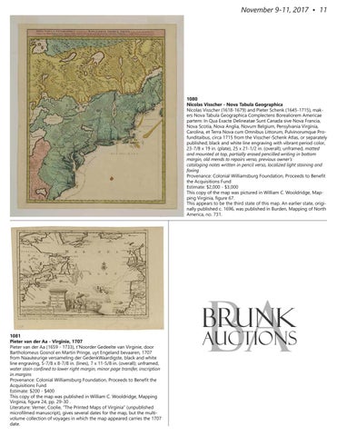
1080 Nicolas Visscher - Nova Tabula Geographica Nicolas Visscher (1618-1679) and Pieter Schenk (1645-1715), makers Nova Tabula Geographica Complectens Borealiorem Americae partem: In Qua Exacte Delineatae Sunt Canada sive Nova Francia, Nova Scotia, Nova Anglia, Novum Belgium, Pensylvania Virginia, Carolina, et Terra Nova cum Omnibus Littorum, Pulvinorumque Profunditaibus, circa 1715 from the Visscher-Schenk Atlas, or separately published; black and white line engraving with vibrant period color, 23-7/8 x 19 in. (plate), 25 x 21-1/2 in. (overall); unframed, matted and mounted at top, partially erased pencilled writing in bottom margin, old mends to repairs verso, previous owner’s cataloging notes written in pencil verso, localized light staining and foxing Provenance: Colonial Williamsburg Foundation, Proceeds to Benefit the Acquisitions Fund Estimate: $2,000 - $3,000 This copy of the map was pictured in William C. Wooldridge, Mapping Virginia, figure 67. This appears to be the third state of this map. An earlier state, originally published c. 1696, was published in Burden, Mapping of North America, no. 731.
1081 Pieter van der Aa - Virginie, 1707 Pieter van der Aa (1659 - 1733), t’Noorder Gedeelte van Virginie, door Bartholomeus Gosnol en Martin Pringe, uyt Engeland bevaaren, 1707 from Naaukeurige versameling der GedenkWaardigste, black and white line engraving, 5-7/8 x 8-7/8 in. (lines), 7 x 11-5/8 in. (overall); unframed, water stain confined to lower right margin, minor page transfer, inscription in margins Provenance: Colonial Williamsburg Foundation, Proceeds to Benefit the Acquisitions Fund Estimate: $200 - $400 This copy of the map was published in William C. Wooldridge, Mapping Virginia, figure 24, pp. 29-30 . Literature: Verner, Coolie, “The Printed Maps of Virginia” (unpublished microfilmed manuscript), gives several dates for the map, but the multivolume collection of voyages in which the map appeared carries the 1707 date.
BA
Brunk
Auctions