T-SHAPED EXPERTISE DELIVERING INNOVATIONS FAR AND WIDE Sophisticated satellite technology crucial for diverse industrial and business applications for increasing productivity, safety, and further innovation is currently being rolled out in Australia and New Zealand.
I
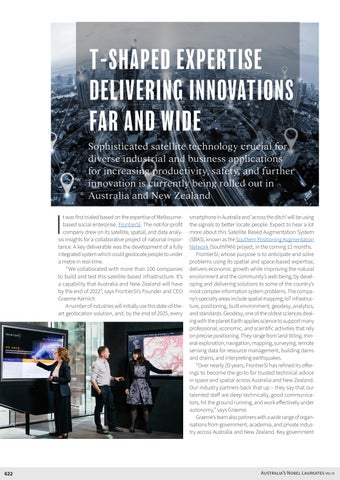
t was first trialed based on the expertise of Melbournebased social enterprise, FrontierSI. The not-for-profit company drew on its satellite, spatial, and data analysis insights for a collaborative project of national importance. A key deliverable was the development of a fully integrated system which could geolocate people to under a metre in real-time. “We collaborated with more than 100 companies to build and test this satellite-based infrastructure. It’s a capability that Australia and New Zealand will have by the end of 2022”, says FrontierSI’s Founder and CEO Graeme Kernich. A number of industries will initially use this state-of-theart geolocation solution, and, by the end of 2025, every
622
smartphone in Australia and ‘across the ditch’ will be using the signals to better locate people. Expect to hear a lot more about this Satellite Based Augmentation System (SBAS), known as the Southern Positioning Augmentation Network (SouthPAN) project, in the coming 12 months. FrontierSI, whose purpose is to anticipate and solve problems using its spatial and space-based expertise, delivers economic growth while improving the natural environment and the community’s well-being, by developing and delivering solutions to some of the country’s most complex information system problems. The company’s specialty areas include spatial mapping, IoT infrastructure, positioning, built environment, geodesy, analytics, and standards. Geodesy, one of the oldest sciences dealing with the planet Earth applies science to support many professional, economic, and scientific activities that rely on precise positioning. They range from land titling, mineral exploration, navigation, mapping, surveying, remote sensing data for resource management, building dams and drains, and interpreting earthquakes. “Over nearly 20 years, FrontierSI has refined its offerings to become the go-to for trusted technical advice in space and spatial across Australia and New Zealand. Our industry partners back that up – they say that our talented staff are deep technically, good communicators, hit the ground running, and work effectively under autonomy,” says Graeme. Graeme’s team also partners with a wide range of organisations from government, academia, and private industry across Australia and New Zealand. Key government
Australia’s Nobel Laureates VOL III