2023-2024 Impact Report | Blue Mountain Land Trust
Blue Mountain Land Trust is a nationally-accredited nonprofit land trust working in southeast Washington and Eastern Oregon. Our mission is to protect the lands and waters of the Blue Mountain region for people, agriculture, and wildlife.
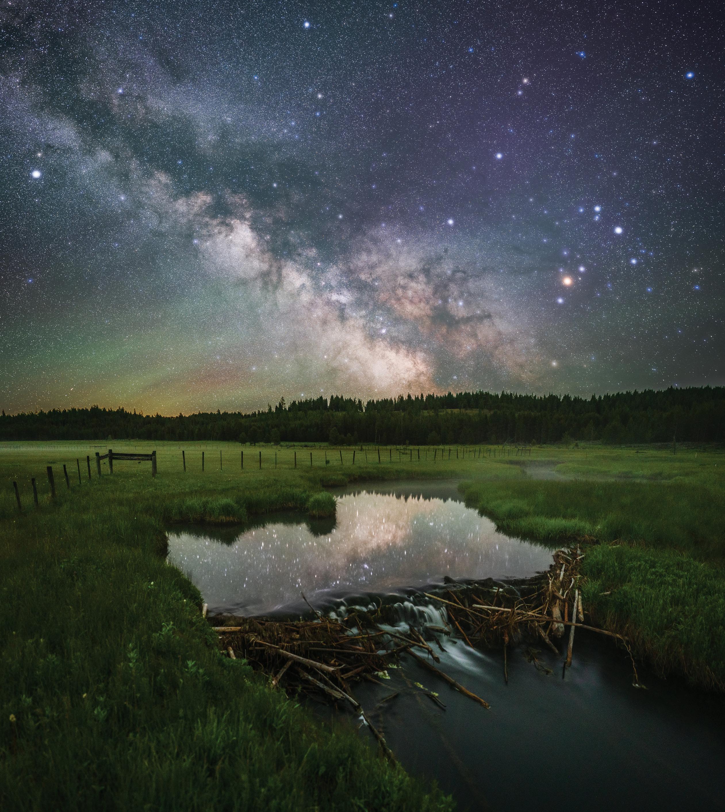
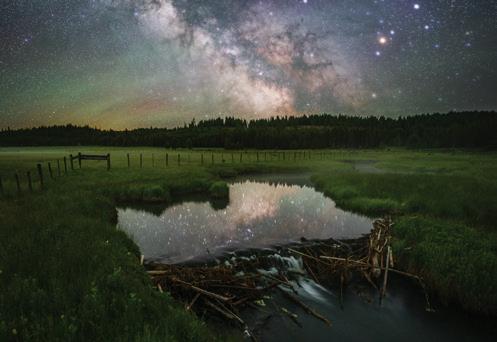
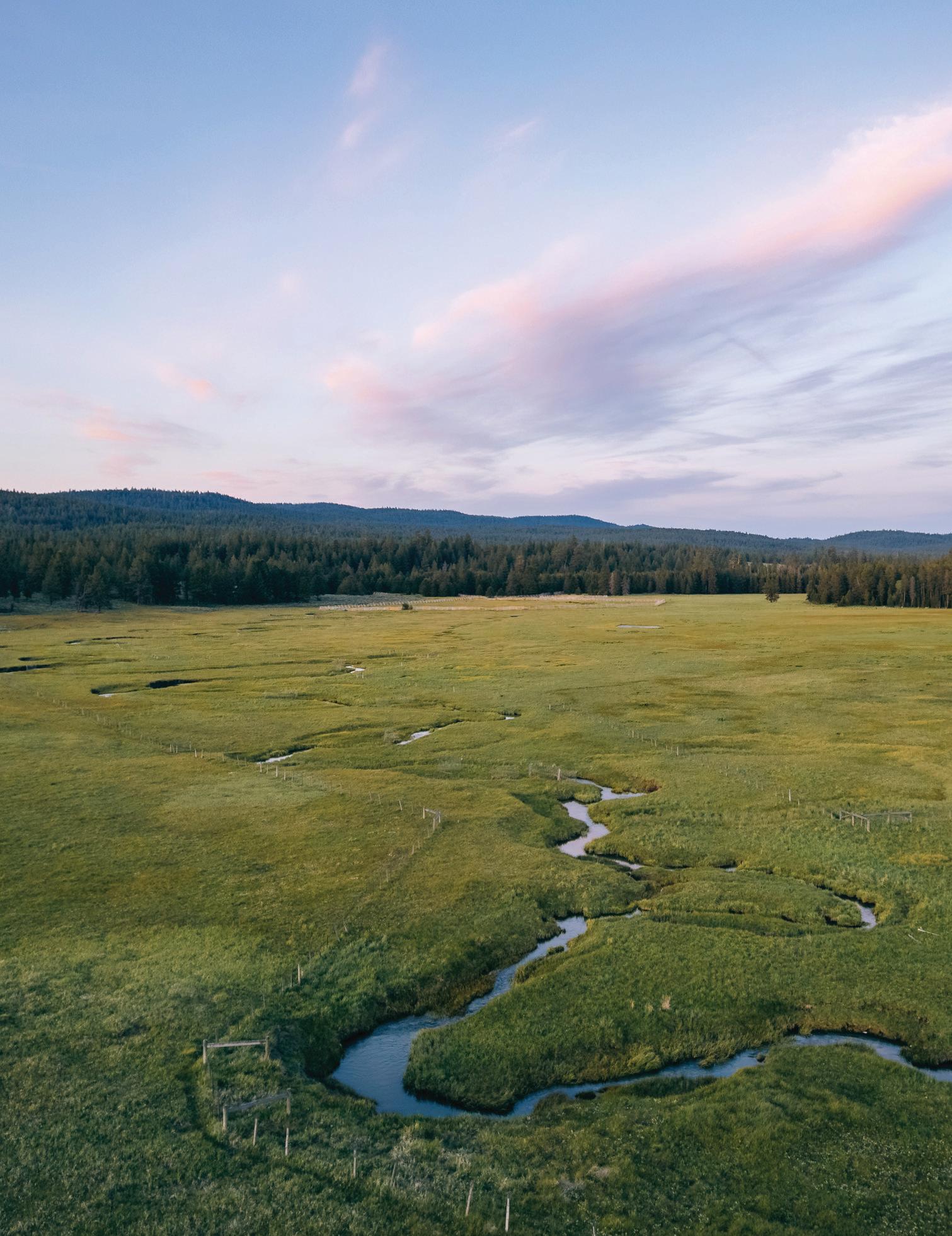
COVER IMAGE
Milky Way over the Middle Fork John Day River at Phipps Meadow.
PHOTOGRAPH BY
Staff
EXECUTIVE DIRECTOR
Amanda Martino
COMMUNICATIONS & MARKETING DIRECTOR
Alyssa Martinez Neumann
DEVELOPMENT DIRECTOR
Marcus Frey
STEWARDSHIP & RESTORATION DIRECTOR
Andrew Addessi
CONSERVATION
Fraser Moore
STEWARDSHIP
Emma Erickson
ADMINISTRATIVE
Carlee Allen
TRAIL
Greg Brown
Mike McArthur
Amy Molitor
Jack Percival
Bill Rodgers
A future we shape together.
Blue Mountain Land Trust celebrates a quarter of a century of bringing communities together to protect working farms, ranches, and natural lands of the region. 25 years is a major milestone, an important opportunity to appreciate the hard work and dedication that is the legacy of collective community action. I’m sure I’m not alone in feeling nostalgic when reflecting on so many memories, from the monumental to the tiny (but mighty).
On my first day at BMLT, I toured three potential conservation projects in the rugged, rural landscapes of Wheeler and Grant counties in Eastern Oregon. Riding in a side-by-side with landowners up a steep butte, I caught my first glimpse of the area from a high-elevation view. It was jaw-dropping: the mountains, ridgelines, and stunning rock formations stretched on forever on that clear summer day. In that moment, I grasped the vast scale of the Blue Mountain region and the deep connections between its working lands, grasslands, rivers, and forests. I realized the potential impact and opportunities BMLT could have to collaboratively protect the land and waters of this special country.
Over the past 25 years, our community’s love of these incredible places has shaped our ethos, scaled the size of our impact, guided the evolution of our thinking, and brought new voices and perspectives to BMLT’s programs and projects.
In 2024, our team grew to its largest ever, with the exciting addition of new positions and a revised program structure to better care for the more than 23,300-acres we now steward. Our team is collaborating with more partners than ever before to dive deeper into the critical resources on our protected properties and develop management strategies to help those ecosystems thrive. We are working on some of the most complex (and impactful) land and water acquisitions in our history, driving towards our goal to protect another 25,000 acres in the next 10 years.
With the dedication of volunteers and partners, we cared for major trails in the Umatilla and Malheur National Forests and created more opportunities for visitors at Horseshoe Prairie to stay warm and connect with each other in a new warming hut. Children learned about the wonders of pollinators and biodiversity at Farm Kids. We continue to lean into land justice work, following our commitment to learn about historical injustice, uplift voices, and support more equitable access to the outdoors. After pausing a few programs to evaluate, reimagine, and redesign, we’re excitedly planning for a 2025 relaunch which will create new opportunities to connect our communities with these resources and protected places.
When I reflect on BMLT’s 25 years, I think of all the people — staff, board, volunteers, partners, landowners, and community members — who’ve dedicated themselves to this work and each other. Each person’s connection to these lands and waters adds to our shared vision: a future where these places thrive for generations to come. We’re shaping that future together, building on past chapters and embracing new ones with a team as diverse and resilient as the landscapes we protect.
We could not have accomplished all that we have without you. Thank you for being an important part of shaping a positive future together.
- Amanda Martino / Executive Director
ACRES OF LAND
COUNTIES
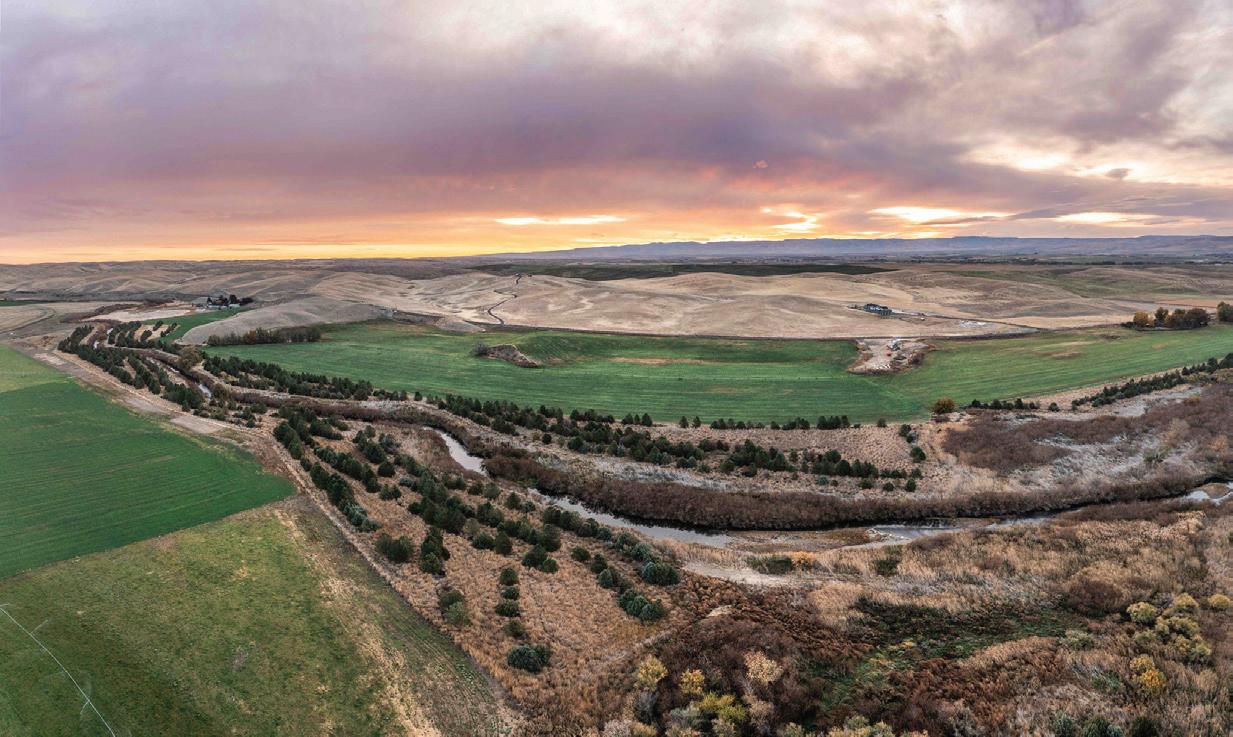
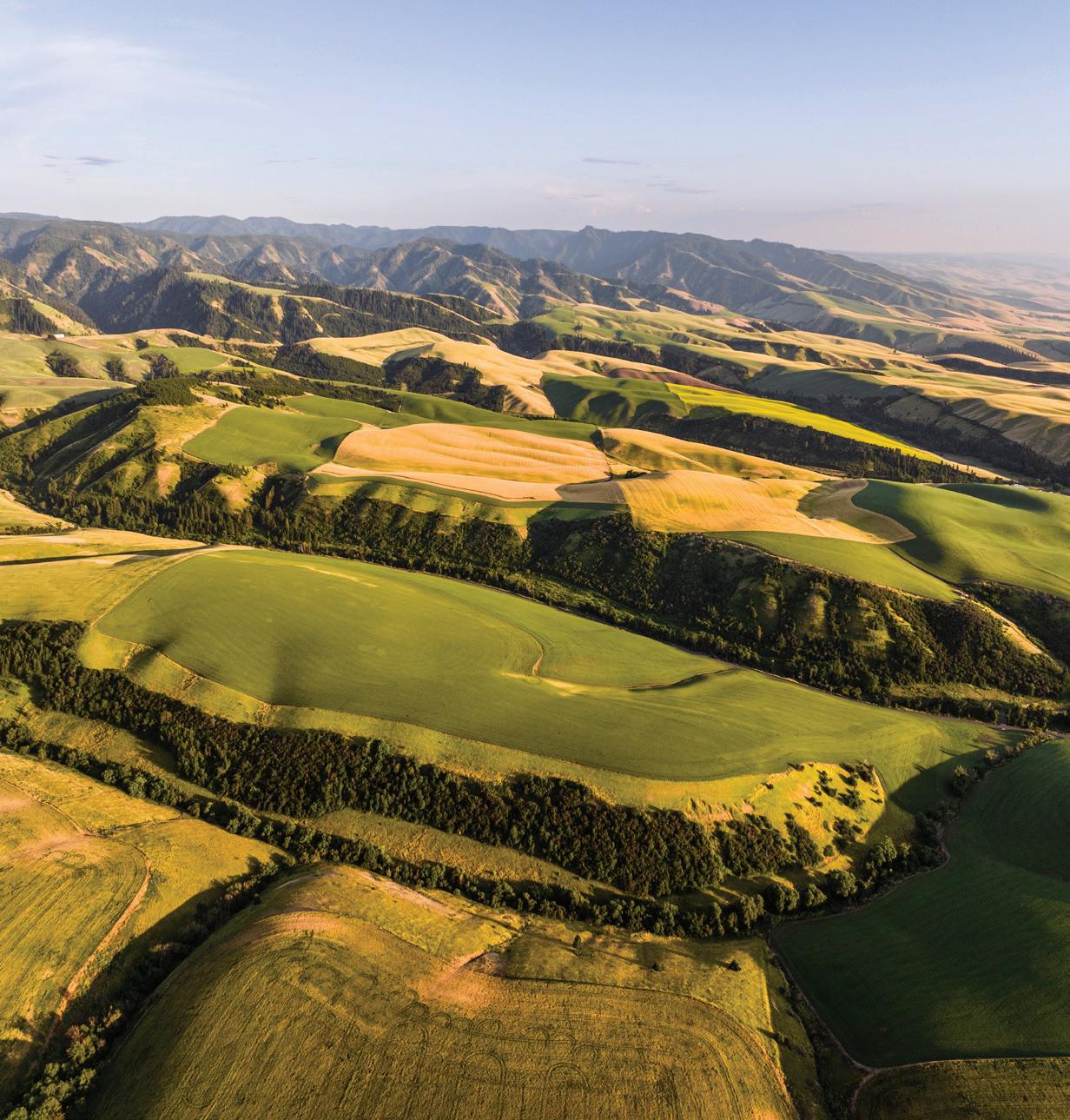
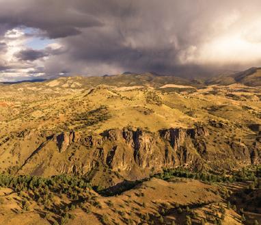
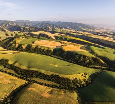
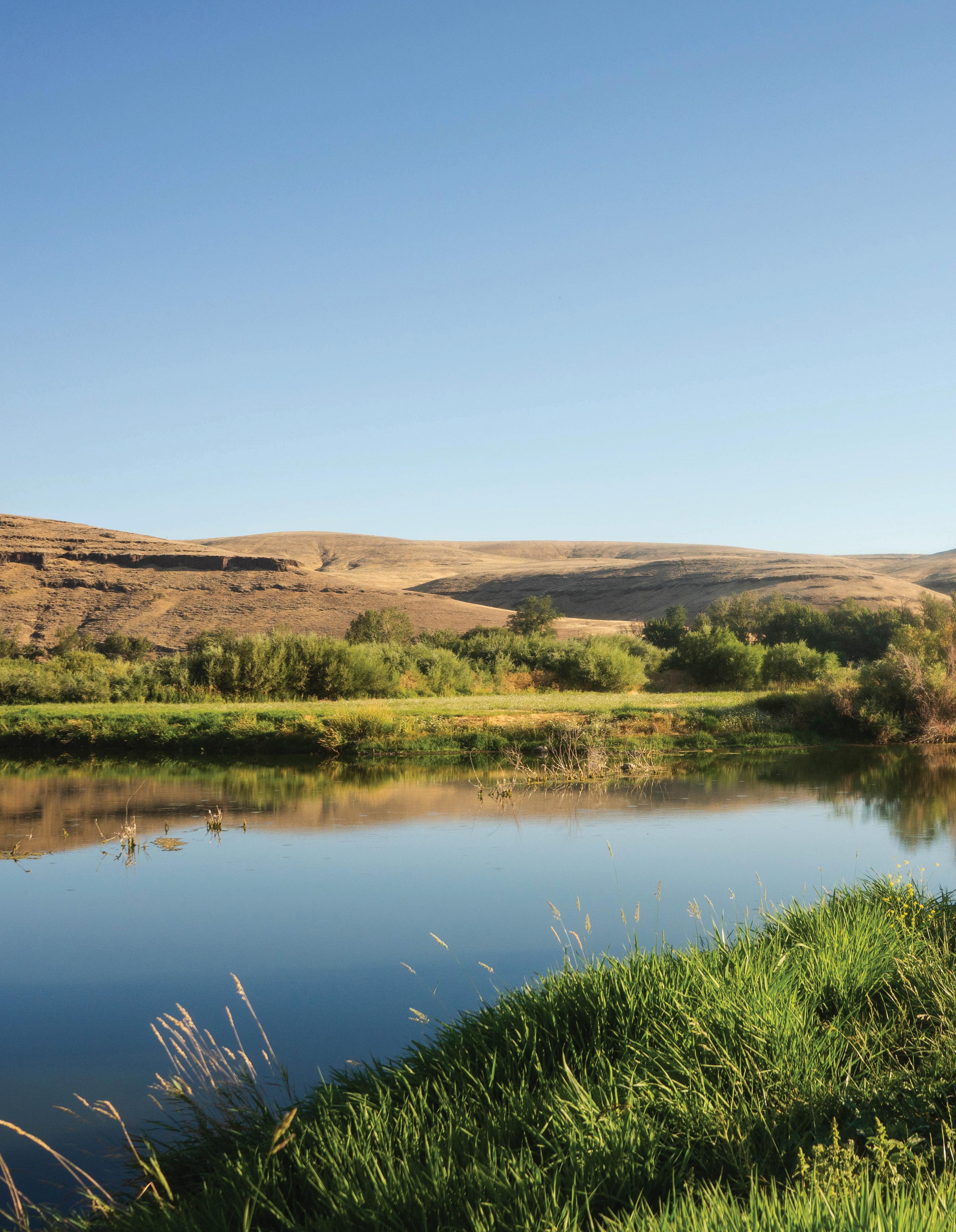
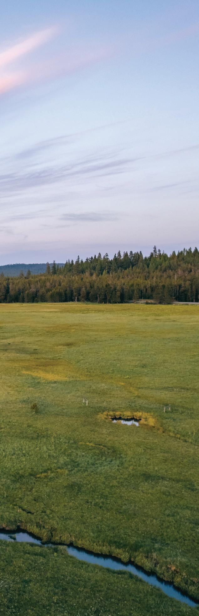
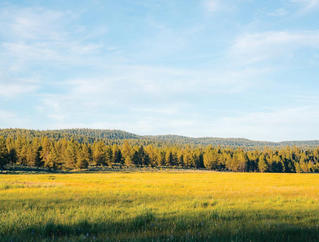
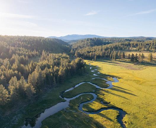
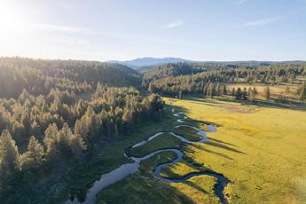
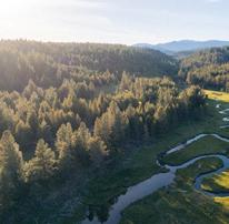
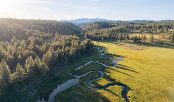
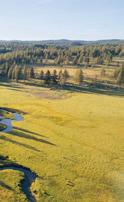
PHIPPS MEADOWGRANT COUNTY, OR Conservation & Community
ACRES OF PROTECTED RIPARIAN HABITAT *Supports CTUIR’s restoration of North Fork Touchet River 6,340+
Touchet River: Coppei Creek, Wolf Fork, North Fork Touchet, Patit Creek, Touchet River
Walla Walla River: Mill Creek
Grande Ronde River: Meadow Creek, Dark Canyon Creek, McCoy Creek
Burnt River: Camp Creek, West Camp Creek, Long Creek
Middle Fork John Day River
John Day River: Bear Creek
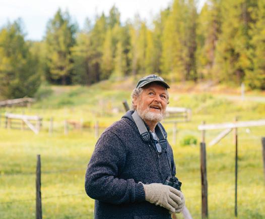
Camping under the stars
volunteer hours for trails on public lands @
CONSERVATION SPOTLIGHT
SAVING FARMLAND
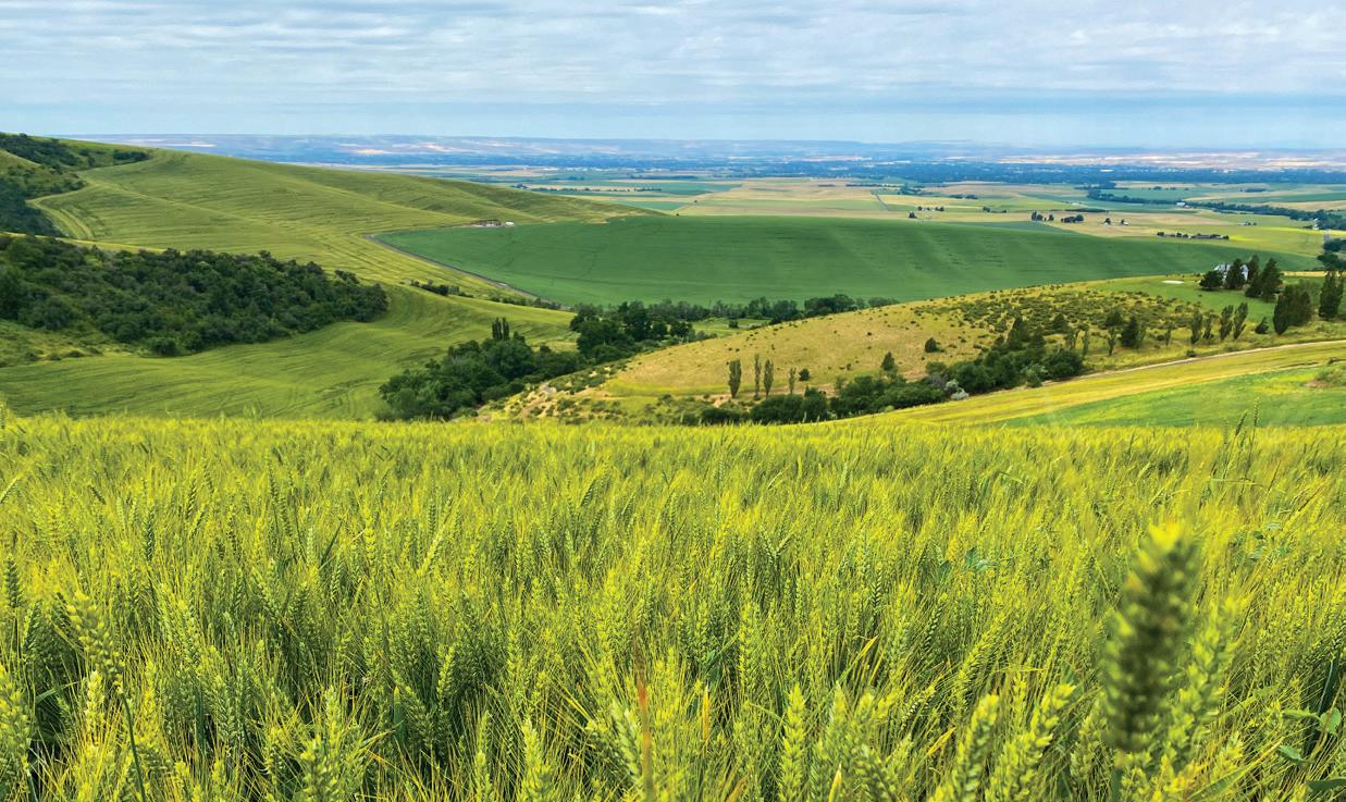
Once farmland is developed, it’s gone for good. Keeping land in production supports rural economies, protects open spaces, and strengthens community food systems. Blue Mountain Land Trust protects 23,327 acres, with 81% being working farms and ranches. By prioritizing the conservation of these essential lands, we can create a sustainable future for both our communities and the environment.
BY WILLIAM FROHNE & LEANDER SWAN
PHOTOGRAPHS
MUD CREEK DIXIE RANCH
WALLA WALLA COUNTY, WA
SECRET VALLEY RANCH BAKER COUNTY, OR
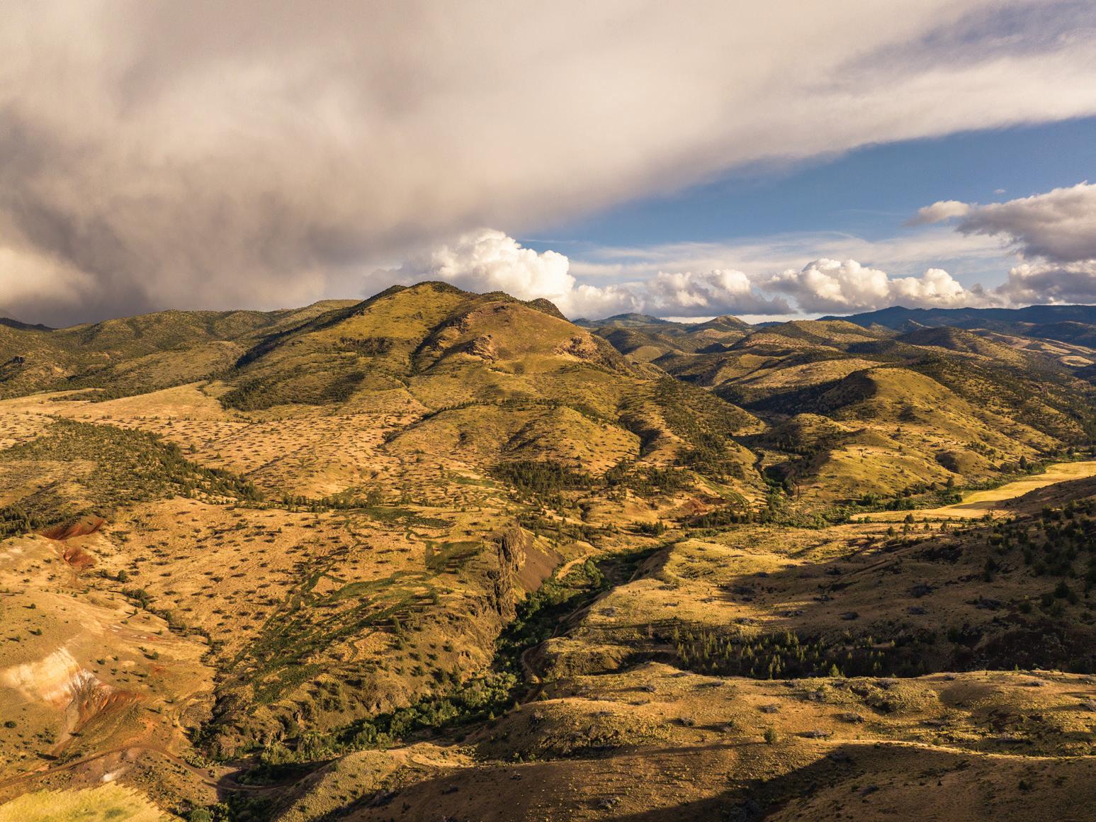
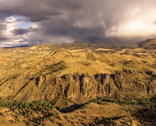
CANYON CREEK WHEELER COUNTY, OR
SEACHRIS FAMILY FARM
WALLA WALLA COUNTY, WA
PETERSON PROJECT WALLA WALLA COUNTY, WA
PERSPECTIVES
It’s time to take action.
What gives you hope for the future of the Blue Mountain region, and what do you believe the most impactful change could be?
“What gives me hope for the future of the Blue Mountain region is the incredible commitment of our partners and landowners to conserving and protecting the people, land, water, and wildlife that call this region home. I believe the most impactful change for protecting this region lies in expanding and uniting those who recognize its value. By sharing stories, we can inspire others to appreciate the significance of the Blue Mountain region and inspire a lasting commitment to its protection.”
— EMMA ERICKSON BMLT Stewardship Associate
“When I first got involved with the Blue Mountain Land Trust, there were many overgrown and undeveloped trails in the region, and many of the thousands of acres today protected by BMLT were not yet protected. BMLT’s conservation and trail work over the last several years have enabled more people to connect with the natural beauty and vital resources of our region. Continued engagement across the community to expand access to the outdoors and protect our lands will be the most impactful work we can do here.”
— EMILY SLUSSER Energy Program Analyst; BMLT Board Member
“The reintroduction of fire into the Blue Mountains gives me great hope [an important land stewardship technique and traditional ecological practice used since time immemorial by Indigenous people in the area.] I think the most impactful change for the Blue Mountain region and greater Columbia River Basin would be the long awaited removal of the lower Snake River dams. Salmon re-colonized habitats in the upper Klamath within months, imagine the possibilities on the Snake.”
— GABE SHEOSHIPS
(Cayuse/Walla Walla); Executive Director, Friends of Tryon Creek; Co-founder of the Oregon Land Justice Project
“I find hope in the continued and expanding coordination efforts across agencies and landowners, paired with the passion people in the Blue Mountain region have for the landscape. We must passionately agree on the common goal of sustainable utilization of our natural resources by and for the benefit of all community members in order to encourage ecological resiliency and revitalize larger processes within our ecosystems. I believe conversations between natural resource agencies and the community fostered in this understanding will allow the most impactful changes to take center stage.”
— Elizabeth “Liz” Ruszczyk
Fisheries Restoration Monitoring Biologist & Program Manager, Confederated Tribes of the Warm Springs Reservation of Oregon
“Recent documented travels of dispersing gray wolves have confirmed our understanding of the critical ecological role of the Blue Mountain Front as a migratory corridor between the Northern Rockies, through central Oregon to California and places beyond. As our climate continues to rapidly alter the quality and location of essential habitats, fish and wildlife will have to adapt, move or perish. The Blue Mountain Land Trust will continue to play a central role in maintaining options for the movement of species through the targeted conservation of habitats and working landscapes in our region.”
— CARL SCHEELER
Retired CTUIR Wildlife Biologist & BMLT Founding Board Member
HISTORY OF BLUE MOUNTAIN LAND TRUST
1999
Local leaders form the Blue Mountain Land Trust to protect fish and wildlife, habitat, forests, grasslands, and agricultural land from development and degradation.
2019
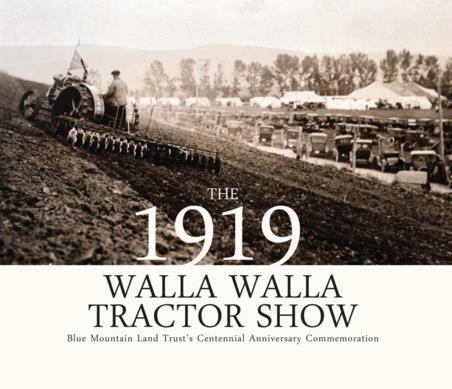
BMLT and Linda Herbert host the Centennial Anniversary Commemoration of the 1919 Walla Walla Tractor Show, including a demonstration farm day, documentary screening, and book launch. The 1919 event attracted 49,000 visitors, highlighting the region as a hub for agriculture.
2000
BMLT secures the first conservation easement on Titus Creek with Sonia and Carl Schmitt, protecting 30 acres of critical farmland & habitat. It’s the first step to longterm commitment to conservation.
2020
BMLT doubles its protected acreage, closing the Canyon Creek Ranch conservation easement adjacent to the Painted Hills National Monument at 6,783 acres. Thanks to now Executive Director Amanda Martino, it’s the first time in state history OWEB and NRCS have funded a project together.
2001 - 2015
BMLT completes 10 conservation easements, protecting 835.55 acres of farmland and habitat in Walla Walla and Columbia counties. (Projects include: Schmitt 2nd phase, Coppei Creek, Lasher/Scholl, Brewer Wetland, Schwerin, Martin, Fritze/ Tracy, Chatman, & Fairchild.)
2021
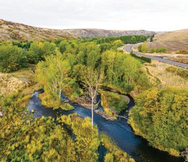
BMLT purchases its first property, Phipps Meadow in Grant County, Oregon. It includes 278 acres of critical fish and wildlife habitat and 1.58 miles of the Middle Fork John Day River, one of the last free flowing rivers in the Columbia River Basin.
2013
BMLT’s launches Learning on the Land, an education series that connects communities to nature in the Blue Mountain region. It will reach over 2,000 community members in 2019.
2021
BMLT protects the Seachris Family Farm, the project that started it all. Carolyn’s interest in protecting her land was the impetus for community members forming BMLT back in 1999. After 20 years, a conservation easement now protects this 215-acre farm in Touchet, WA.
2014
BMLT receives national accreditation from the Land Trust Alliance. The accreditation seal is awarded to land trusts meeting the highest national standards for excellence and conservation practices. BMLT will renew its accreditation in 2020.
2022
BMLT protects Secret Valley Ranch, the largest project to date at 8,877 acres and the first one located in Baker County, OR. This is the second OWEB and NRCS project to be completed in the state. Ever :)
25 years of conservation community.
2015
In partnership with the Confederated Tribes of the Umatilla Indian Reservation (CTUIR), BMLT completes the first Oregon conservation easement, Dark Canyon, its largest project to date at 2,928 acres.
2022
BMLT completes a 661 acre farmland protection project at Mud Creek Dixie Ranch in Walla Walla County, WA. The property contains soils of statewide significance and is adjacent to another BMLT protected property, owned by the Schwerin Family.
2017
BMLT officially expands service area to John Day, Oregon and joins the John Day Basin Partnership, a group of conservation leaders working to restore watersheds to maximize their ecological, economic, social, and cultural benefits.
2023
BMLT receives a Recreational Trails Program (RTP) grant from Oregon Parks and Recreation Department to expand Horseshoe Prairie Nordic Ski Area. Grant funds support trail expansion, construction of warming hut, increased signage and permanent maps.
2018
BMLT and Greg Brown launch the volunteer trail stewardship group: Blues Crew. The first work party was held at Buck Creek Trail in the Umatilla National Forest.
2022 - 2023
BMLT completes its first conservation easement that includes permanent water transfer on the North Fork Touchet River at Touchet Orchards. BMLT also conserved 21.65 acres on the adjacent property to protect CTUIR’s restoration investment on the river in 2022.
2018
BMLT hosts its first BioBlitz with partners, inviting community members to help identify and learn about the ecosystems, waters, and biodiversity of the Blue Mountain region.
2024
BMLT Blues Crew completes over 23,950 hours of volunteer trail maintenance on public lands. Thanks to their efforts, communities have continued safe access to trails throughout the Umatilla, Malheur, and Wallowa-Whitman National Forests. Plus, the warming hut opens at HSP for the winter.
2019
BMLT Blues Crew revitalizes Horseshoe Prairie Nordic Ski Area. Volunteers place blue diamonds on trees and posts to help with navigation at the first work party.
2024
BMLT celebrates 25 years of conservation & community, plus 23,327 acres protected. “Life on earth, human and otherwise, needs clean air, clean water, and wild open spaces to survive. BMLT’s work, protecting lands and waters in perpetuity for people, agriculture and wildlife, is essential to create a healthier homeland, not only for ourselves but for the generations that follow us.” - Robin Fitch, retired biologist and BMLT board president.
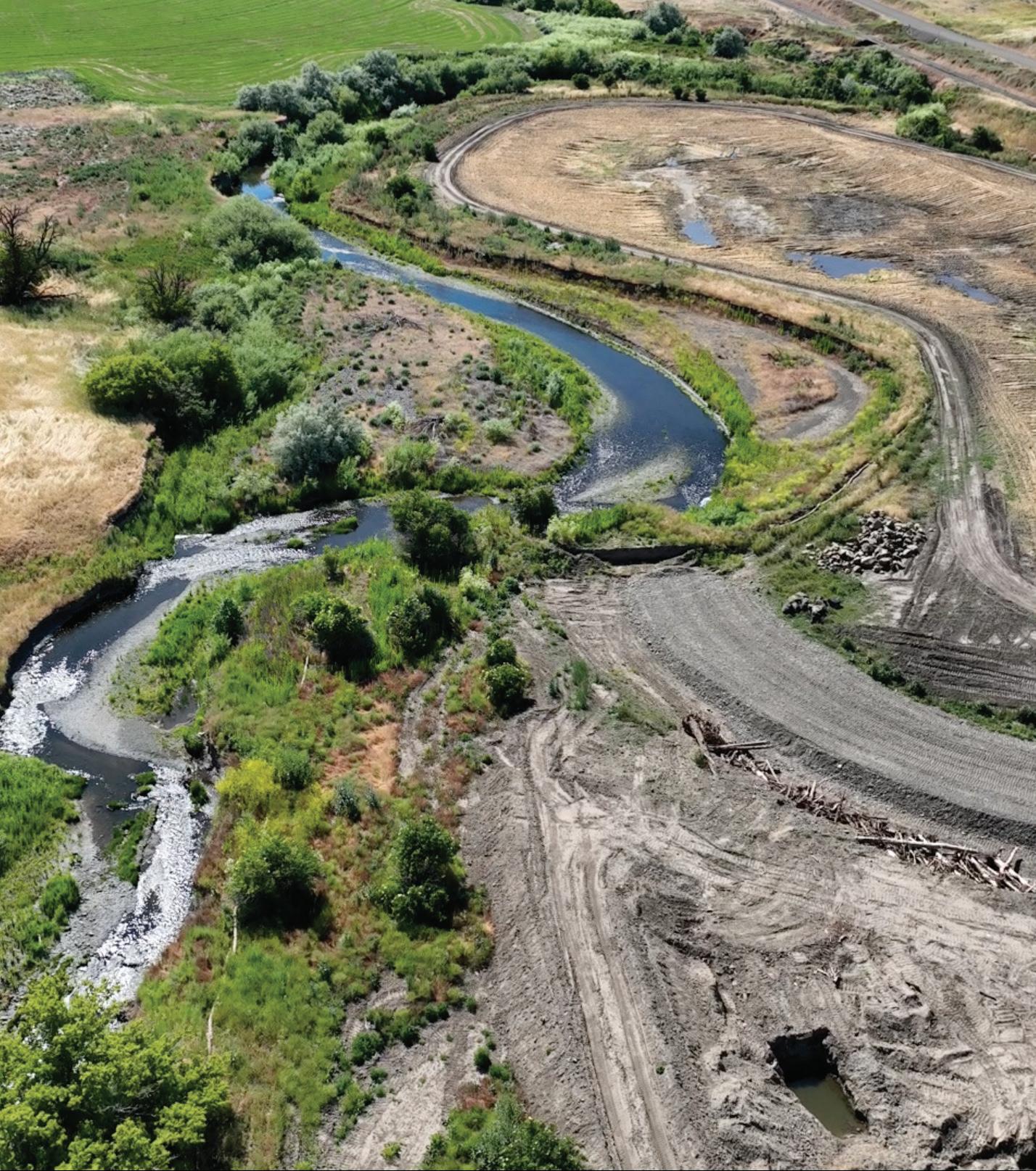
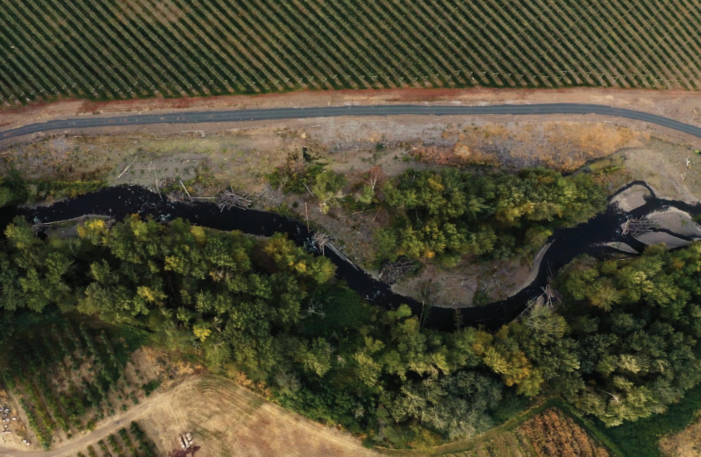
A river’s revival.
Restoring the Umatilla River to its original flow.
Just outside Pendleton, Oregon, where basalt cliffs meet short grass prairies, an ambitious restoration project is underway at the confluence of the Umatilla River and Birch Creek. This is no ordinary conservation project — it’s a collaborative effort on a massive scale and soon to be the largest floodplain restoration project in the Umatilla River Basin.
Through the dedicated efforts of the Confederated Tribes of the Umatilla Indian Reservation (CTUIR), fish populations now have a better chance at recovery in one of the most productive steelhead tributaries in the region.
Blue Mountain Land Trust is working to permanently protect CTUIR’s investment in the river restoration project to ensure its longevity, forever.
The Umatilla River flows 89 miles from Oregon’s Blue Mountains across the Columbia Plateau, reaching the Columbia River near Pendleton. Birch Creek meets the Umatilla River here, and is one of the most productive tributaries in the Umatilla River Basin for ESA-listed Middle Columbia steelhead, supporting 50% of all steelhead in the watershed.
The UmaBirch restoration effort is part of a larger movement in the U.S. and beyond, where Tribal nations are leading the way on expansive conservation projects. This project is just the beginning — a robust model that builds momentum for even more restoration across the region, bringing together Tribal expertise, community support, private landowners, and the vision for a future where rivers thrive naturally.
Throughout history, human attempts to control rivers by straightening their natural courses drastically disrupted these ecosystems. By channelizing rivers to flow in straight lines, water was forced to rush downstream like a fire hose, bypassing the natural meanders and floodplains that once absorbed floods and supported diverse habitats. This unnatural flow exacerbated downstream flooding, eroded the landscape, and left native fish — especially Middle Columbia summer steelhead — without the complex habitats they depend on for spawning and rearing. A wide range of native fish species also suffered from this habitat loss, leading to cascading effects throughout the ecosystem.
Guided by their First Foods mission and River Vision, CTUIR is dedicated to restoring the impacts of past river channelization. Their plan demonstrates how restoring natural flows and honoring the floodplain’s role can revitalize the river and surrounding landscape for native fish and aquatic species.
The restoration process reintroduces natural meanders and curves, allowing water to slow down and spread across the floodplain. By adding pools, side channels, and woody structures, the river
gains essential habitats where fish can spawn, feed, and find refuge from predators. Levees are either removed or set back, letting high waters flow freely and reducing downstream flood risks. Finally, native vegetation is planted along the riverbanks, stabilizing soil, filtering runoff, and creating habitats for insects, birds, and other wildlife. Together, these steps enable the floodplain to function like a sponge, absorbing floodwaters and recharging groundwater supplies.
“As we know from floods, water goes where it wants to go. CTUIR will lay out the river path where it was historically, but it will move and change from year to year depending on high and low water levels,” said property owner Jim Whitney. “It will move around, but that’s nature and we’re going to let nature do what it does. It’s just one of the good things we can do for this type of property.”
Working together for the future
The heart of this project is the floodplain restoration, but it’s only possible through the collaboration of private landowners and regional conservation organizations. Jim Whitney of Whitney Land Company knows a thing or two about the importance of connection between the Blue Mountain community and the natural world.
His real estate company specializes in agricultural properties and has worked with various conservation organizations on land transactions throughout Eastern Oregon. He’s also an avid fisherman and hunter, hiking 20 miles a week in the uplands of his property. When approached about the idea of a river restoration project and conservation easement, it was the obvious choice.
“The discussion I had in the beginning with CTUIR, it just made sense to do this with the property. I looked into it and could see their vision,” said Jim. “It will be an enhancement that will last forever in a location where many eyes will see and understand what conservation is and how we can do a better job with the land. It was the right thing to do, and it will make a difference for Eastern Oregon.”
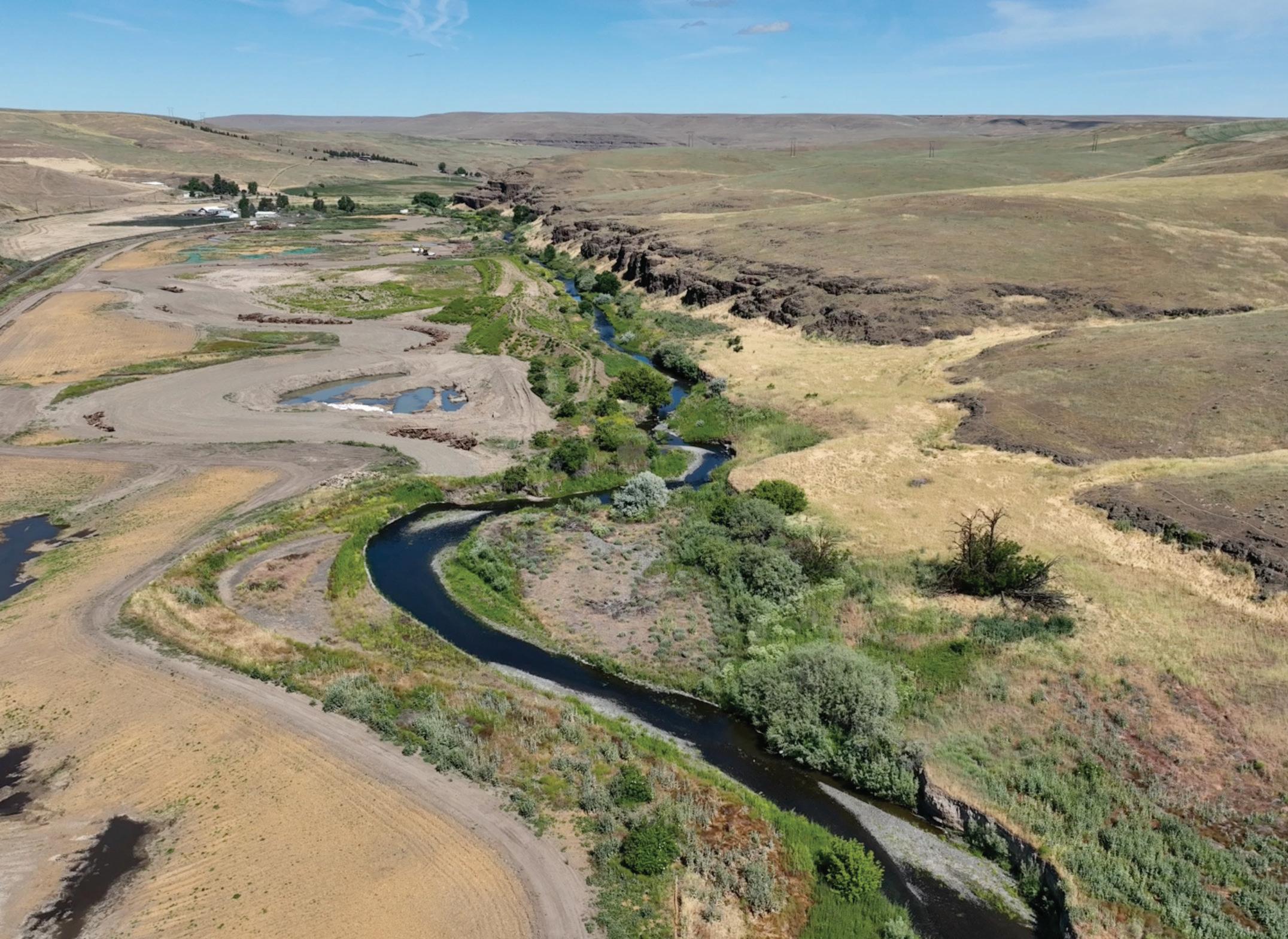
Restoration work near the confluence of Birch Creek and Umatilla River outside of Pendleton, OR.
PHOTOGRAPH BY CTUIR DNR
PHOTOGRAPH BY JUSTIN MORDENO
Flowing water, thriving rivers
In conjunction with CTUIR’s restoration, Blue Mountain Land Trust (BMLT) is working to permanently protect this critical landscape, including 3.7 miles of rivers and over 942 acres of the property. Through conservation easements, BMLT protects clean water, open spaces, and various habitats for fish, wildlife, and communities. The easement provides additional protections along the river, where sensitive management plans focus on improving water quality and the river’s natural flow.
The conservation easement also includes the permanent instream protection of 227.57 acres, or approximately 3.525 cubic feet per second (cfs) of water that will be permanently transferred to remain in the river, enhancing year-round flow for fish and wildlife. Plants benefit as well. On a healthy floodplain with a higher water table, cottonwoods can grow up to 12 feet in a year. The result is a thriving riparian area: habitat for ESA-listed Middle Columbia summer steelhead, rainbow trout, Bull trout, fall Chinook salmon, Coho salmon, redband trout, Pacific lamprey, freshwater mussels, and other native fish.
“A river is nothing without water,” said BMLT Conservation Manager Fraser Moore. “The more water that can stay instream, the more a river can thrive.”
The benefits extend beyond the aquatic realm. Approximately 250 species of wildlife, including the bald eagle and river otter, rely on these habitats for survival. Protecting and enhancing the landscapes along the Umatilla River and Birch Creek provides a safe haven for these species, promoting biodiversity and ecological resilience.
“I enjoy the outdoors that Eastern Oregon provides to everyone. There’s a lot of open country to get out, whether hiking, fishing, hunting, or taking pictures. It’s the outdoors that I was raised in, and I value and want to protect it,” said Jim. “This is one of those areas where I can be a part of protecting a piece of
property that is a significant location for fish and wildlife. It will improve the number of steelhead migrating successfully, meaning more opportunities for fish on the Columbia and Umatilla Rivers.”
As BMLT finalizes the closing of the UmaBirch Conservation Easement, we recognize this as a step toward ecological and cultural restoration. It is about supporting Tribal-led conservation initiatives to revitalize ecosystems and secure the future of the Umatilla River and Birch Creek. The result is a thriving landscape with diverse habitat, reduced flood risk for nearby communities, and a model of collaborative conservation that balances ecological health with community resilience.
This project is made possible through the collaboration of the Confederated Tribes of the Umatilla Indian Reservation (CTUIR), Jim Whitney, Blue Mountain Land Trust, Western Rivers Conservancy, and Bonneville Power Administration.
Learn more about the UmaBirch project: www.bmlt.org/conservation
Bold action for a brighter future.
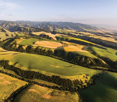
The Blue Mountain region is like no other. From rolling farm fields to flowing rivers and sagebrush seas, these landscapes hold what we value most: clean water, wide-open spaces, vital wildlife habitat, healthy soils, and livelihoods for agricultural communities.
Protecting a property isn’t where the work ends, it’s when our perpetual responsibility begins.
When BMLT completes a conservation easement, we are responsible for regularly monitoring and collecting data to ensure responsible stewardship, leading to greater conservation benefits for the environment and communities.
This ongoing land stewardship is what we mean when we say, “We protect the land you love. Forever.”
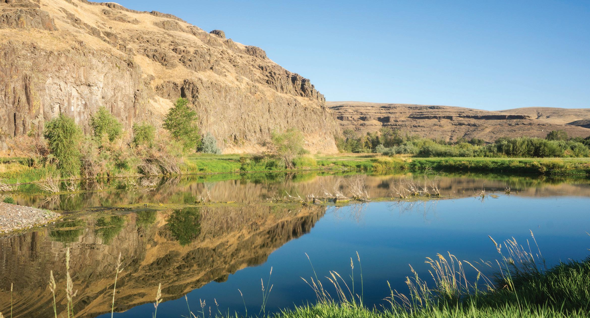
PHOTOGRAPH BY MATT FRANKLIN
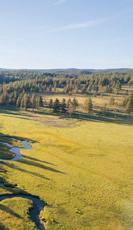
Phipps Meadow - Grant County, OR
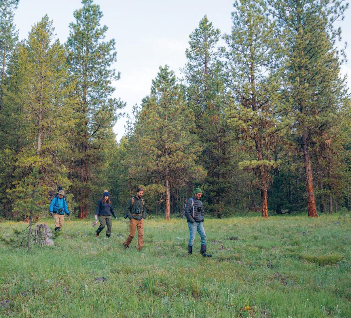
>> BMLT’s stewardship team visits protected properties to monitor changes and successes over time.
Pictured above: completed river restoration of the North Fork Touchet River at Touchet Orchards upstream of Dayton, WA; volunteers survey birds at Phipps Meadow; fish count at Phipps.
PHOTOGRAPHS BY WILLIAM FROHNE & MATT FRANKLIN
WHY IS STEWARDSHIP IMPORTANT?
Caring for the land.
Forever.
Our commitment to stewardship is built on a promise to protect and care for over 23,327 acres of lands and water — forever. Through knowledge-driven conservation practices and collaborative partnerships, we safeguard diverse habitat, productive farmland, and fish and wildlife corridors across the Blue Mountain region, ensuring their resilience and health for future generations.
At the core of our stewardship approach is a commitment to collaboration with partners and landowners to strengthen nature’s capacity to improve biodiversity, enhance ecosystem resilience, uplift natural resources, and support fish recovery. We are deeply invested in building enduring relationships with the landscapes we protect and the communities who depend on them.
Stewardship is an active process — one that requires monitoring, data collection, and direct engagement. Our dedicated stewardship team visits each protected property every year to assess conditions, support needs, and ensure practices adapt and uphold the health of these lands over time. This consistent relationship allows us to proactively address challenges and sustain the conservation values that make each property unique.
By building connections and embracing our shared responsibility, we ensure that clean water, sustainable agricultural lands, and thriving fish and wildlife habitat remain accessible and protected.
DATA-DRIVEN CONSERVATION
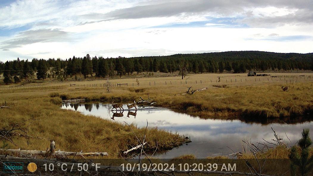
Fish recovery at Meadow Creek
The innovative use of PIT tag ID technology, akin to tiny barcodes for tracking individual fish, is setting the stage for tracking recovery efforts of salmon and steelhead in the Meadow Creek sub-basin.
This area in Eastern Oregon is critical habitat for the spawning and rearing of salmon and steelhead fish in the Grande Ronde and Snake River Watersheds. In 2015 & 2019, BMLT permanently protected the Dark Canyon and McCoy Meadows properties. This protection helps support ongoing efforts to restore and monitor the aquatic environment, led by partner groups including the Confederated Tribes of the Umatilla Indian Reservation (CTUIR), Oregon Department of Fish and Wildlife (ODFW), U.S. Forest Service, and the Columbia River Intertribal Fish Commission.
Near where Meadow Creek joins several important tributary streams and the Grande Ronde River, CTUIR and ODFW set up a special trap and a solar-powered system to track fish, known as a screw trap and PIT tag array. These devices help researchers catch and measure fish as they migrate, as well as tag important species like the MidColumbia summer steelhead and spring Chinook salmon with small chips. These chips work like tiny barcodes: whenever a tagged fish swims past detection points at this site or other monitoring locations, it is identified and logged.
The information gathered helps scientists understand how the fish populations are changing over time. The data from the Dark Canyon site will also play a key role in assessing the success of several major river restoration projects that are planned for the Meadow Creek area in the next few years.
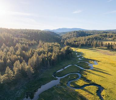
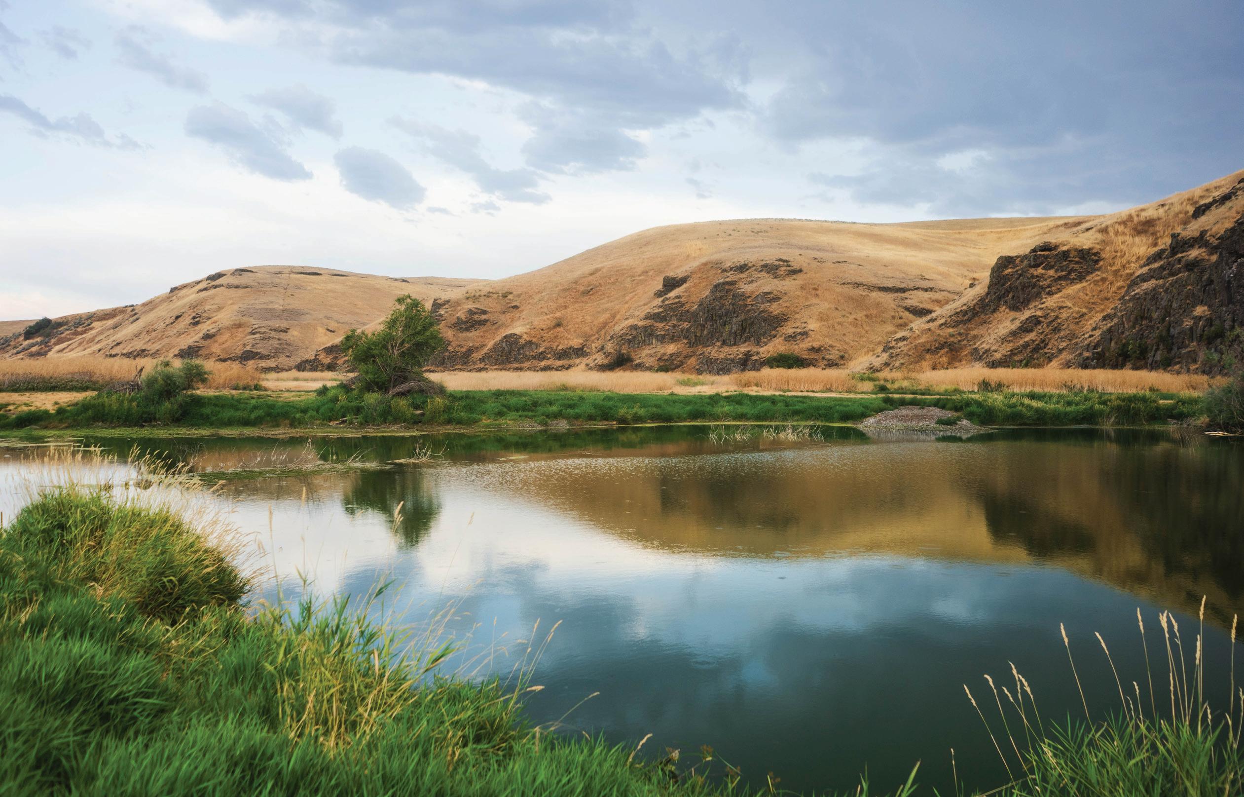
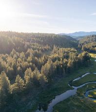
Phipps Meadow
LOCATION: Grant County, OR
PROJECT SIZE: 278 acres
RIVERS: Middle Fork John Day
STATS: Home to 200+ Species
Phipps Meadow is undergoing significant restoration planning efforts aimed at reviving its natural function and ecological health. This project is driven through collaboration with important partners, including the Confederated Tribes of Warm Springs, the Oregon Department of Fish and Wildlife, the North Fork John Day Watershed Council, and Malheur National Forest, along with various environmental and engineering firms. As of Fall 2024, the restoration plan is about 30% complete. The final design will be ready in 2025, followed by implementation in 2026.
The project aims to restore vital habitats for native salmon and other fish species in a key area of the Middle Fork John Day River. This river system has faced over a century of challenges due to human activity. The restoration efforts will work to counteract these issues by reshaping the river to reactivate the surrounding floodplain habitats, and improve water quality.
Techniques will include raising certain areas of the river, placing large pieces of wood in the water for habitat, and creating structures that mimic beaver dams. Additionally, native plants like willows, alders, and cottonwoods will be planted and protected to promote growth and provide shade for the river.
Design efforts also include upland management, with about 90 acres of dense pine thinned to enhance forest health, fire resiliency, and habitat diversity. Removed materials will be repurposed for meadow restoration and protective fencing around sensitive habitats. BMLT Blues Crew volunteers and community members will assist in thinning and monitoring to sustain these efforts long-term.
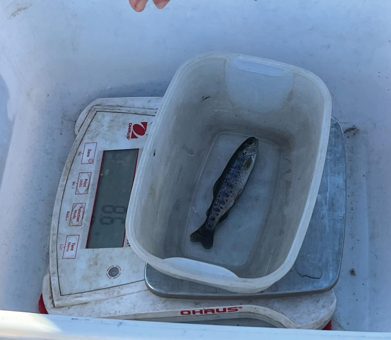
FISH
& DATA MONITORING
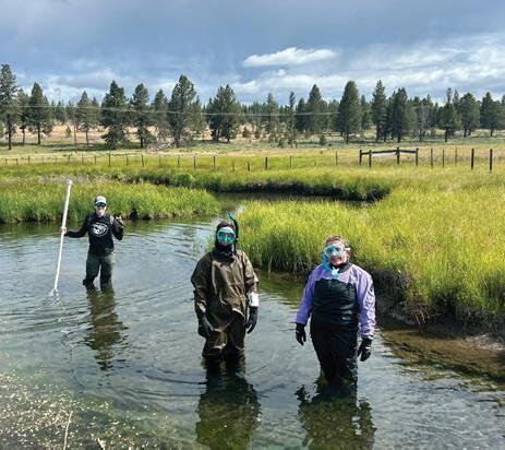
AT PHIPPS MEADOW Snorkel surveys
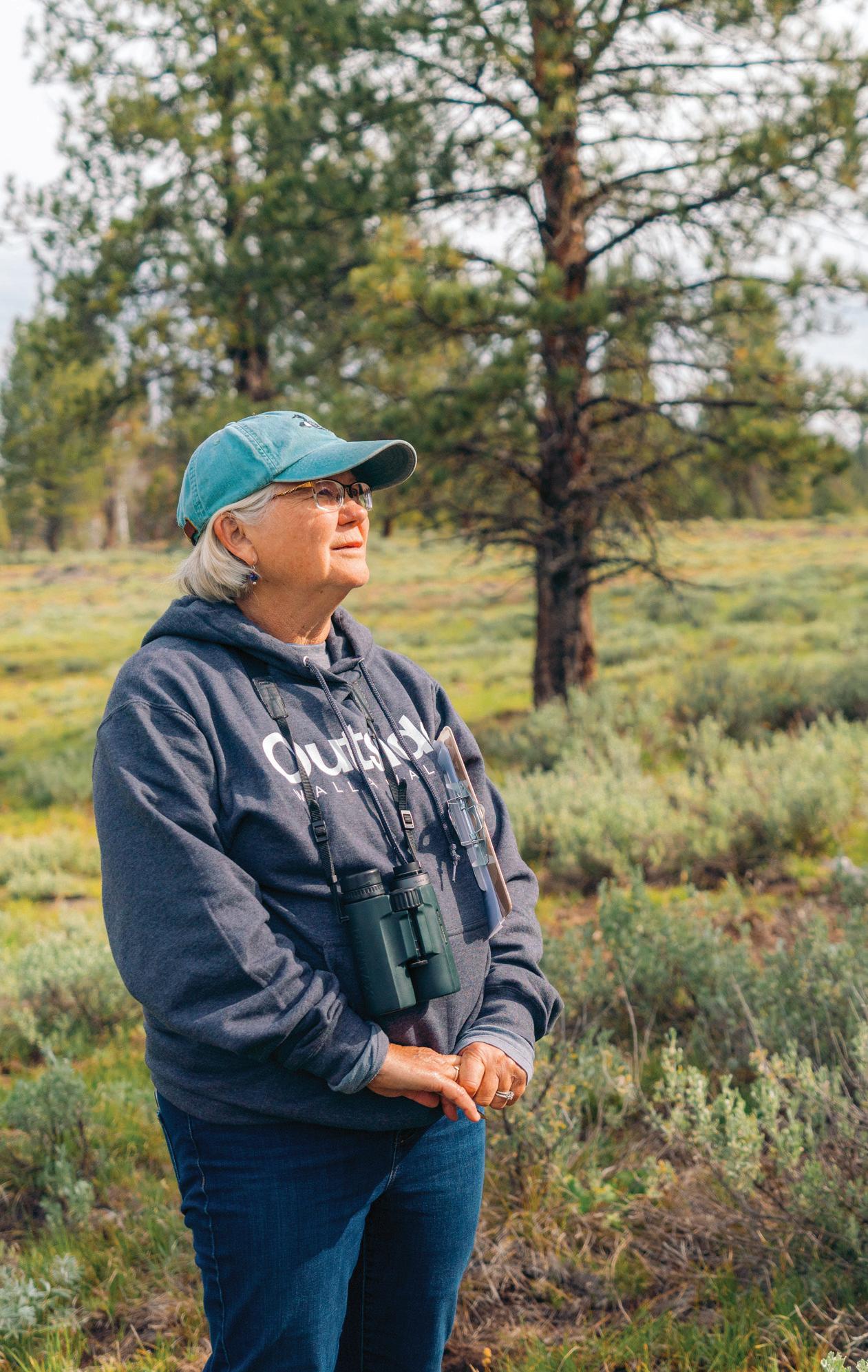
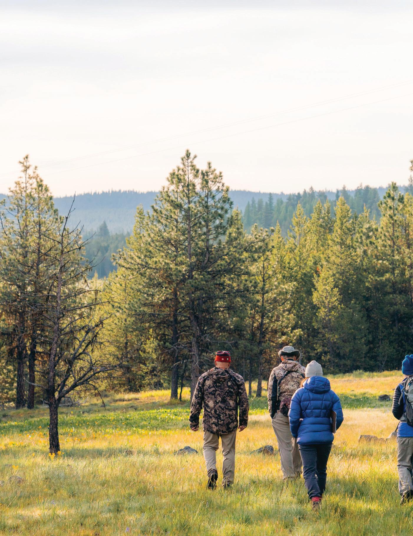
Collaboration between conservation organizations is essential for the success of fish recovery efforts in the Blue Mountain region. Monitoring teams from the Confederated Tribes of Warm Springs (CTWS) and Oregon Department of Fish and Wildlife (ODFW) regularly visit Phipps Meadow to collect key data on stream temperature, water quality, water velocity, and other factors. This data helps establish a baseline understanding of stream conditions at the property and its seasonal variation.
This past summer, Columbia River InterTribal Fish Commission (CRITFC), CTWS, and ODFW conducted a snorkel survey on the Middle Fork John Day River. A snorkel survey is a technique used to observe and collect data on fish populations by allowing researchers to swim just below the water’s surface. This method helps assess fish abundance and diversity and is important for monitoring aquatic ecosystem health to guide conservation efforts.
ODFW started a fish monitoring project with help from CTWS and BMLT. They used a non-lethal method to temporarily stun fish, which allowed for the tagging and measuring of important species before letting them go. This approach helps researchers keep track of the growth and movement of key fish types, including MidColumbia summer steelhead and spring Chinook salmon. The goal is to see if the restoration efforts are positively impacting fish populations. Additionally, the streams are checked every September for Chinook salmon nests, called redds, to monitor their breeding success.
PHOTOGRAPHS BY EMMA ERICKSON
Nature’s symphony
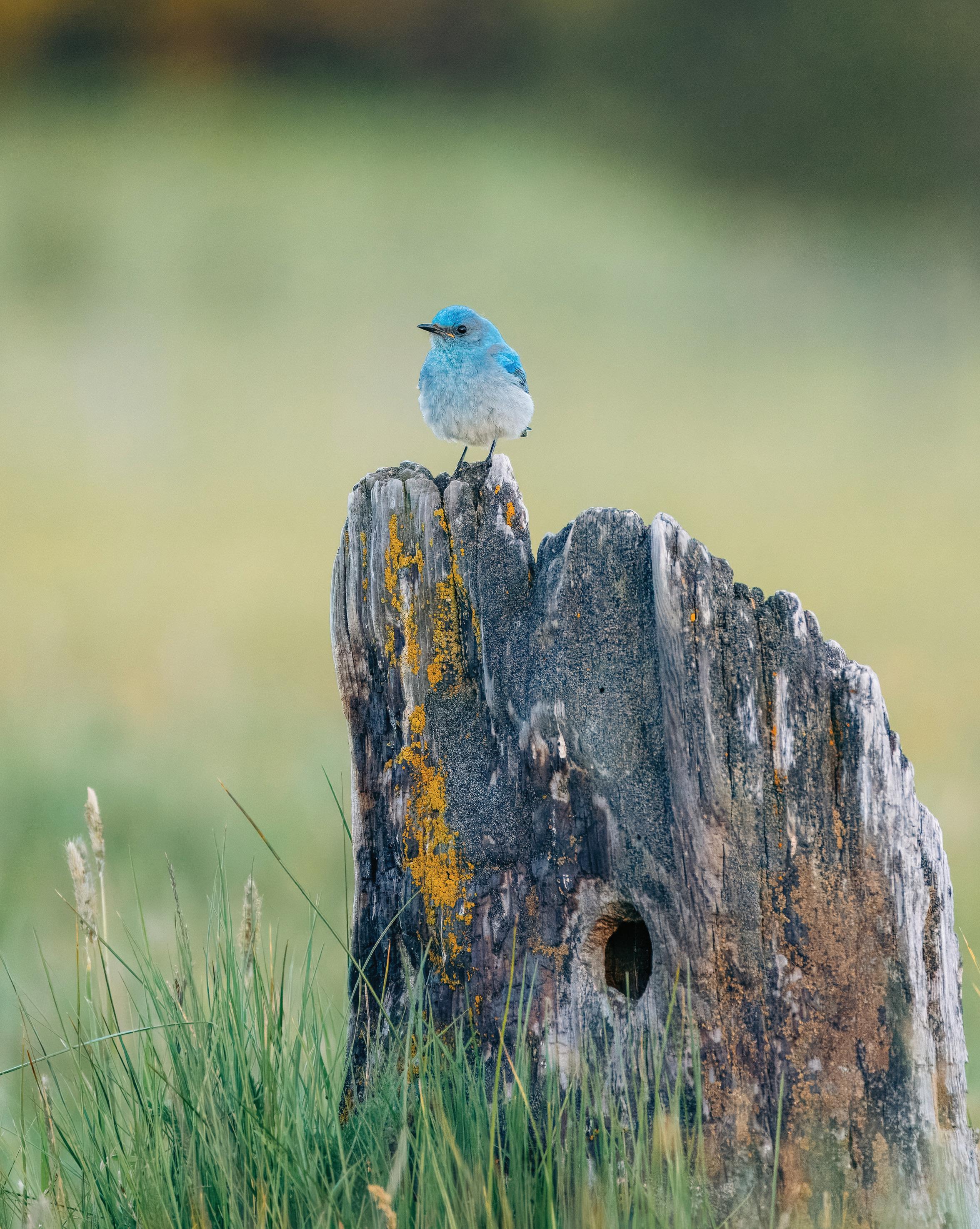
Forest restoration isn’t just about trees — it’s a game changer for bird and wildlife populations. By enhancing habitat quality through methods like selective thinning and native plantings, we can steward healthier, more diverse ecosystems that cater to the needs of both local and migratory bird species.
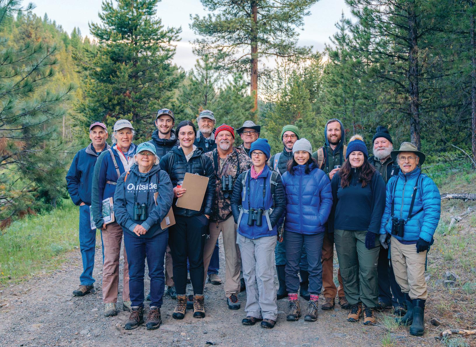
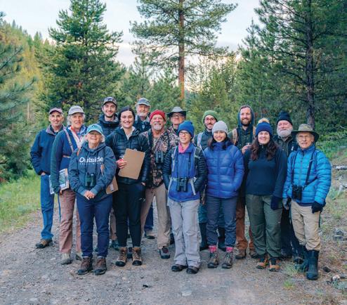
With funding from Cornell University, BMLT was able to establish a bird protocol that will be the cornerstone of ongoing monitoring at Phipps Meadow. In June, staff and volunteers from Grant County Birders and Blue Mountain Audubon Society visited the property in the early morning hours to observe birds at monitoring stations positioned throughout varied habitats. Using tools like Merlin, a phone application that helps with bird identification through images and audio recordings of sounds, as well as expert knowledge of more experienced volunteers, a wide diversity of bird species were identified. This data was recorded on eBird, a world-wide portal that tracks community-science observations of bird activity.
These dedicated monitoring days, along with contributions by volunteer birders throughout the year, help fill in our understanding of bird species diversity and seasonal changes. We want to understand how planned restoration actions will lead to a shift in bird abundance over time.
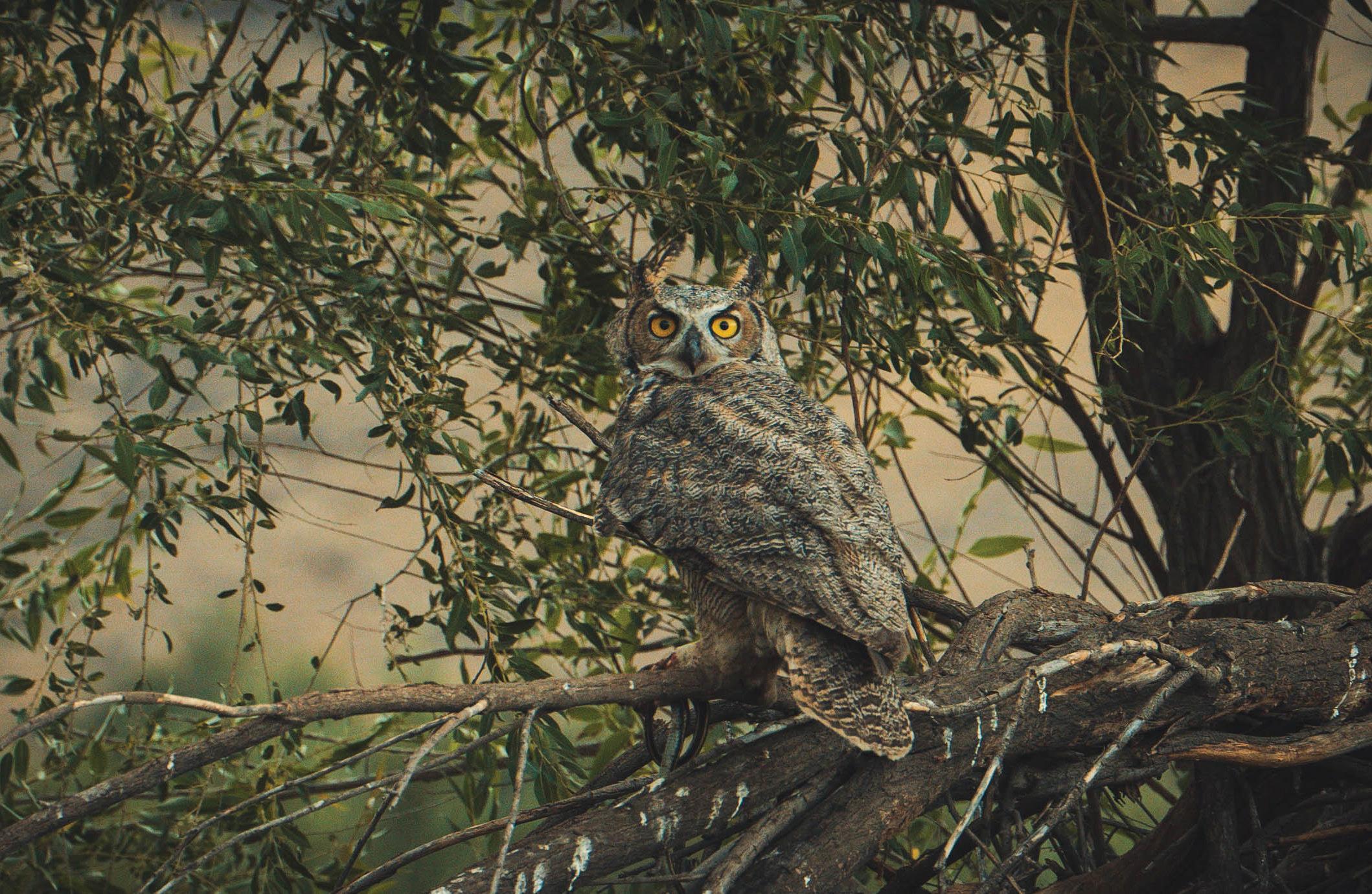
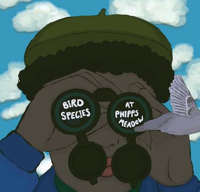
To date, 72 bird species have been observed at Phipps Meadow. 36 species were observed at the bird count in 2024 alone, with five of these species identified for the first time on the property. Notable species that visit Phipps Meadow include: Sandhill Cranes, American Kestral, Black-headed Grosbeak, Wilson’s Snipe, Merlin, Great Horned Owls, Great Blue Heron, and a wide variety of other songbird, shorebird, raptor, waterfowl and woodpecker species. DOCUMENTING
Check out the bird species at Phipps Meadow with eBird, a free online tool from the Cornell Lab of Ornithology. >>
bmlt.org/news/bird-count-phippsmeadow
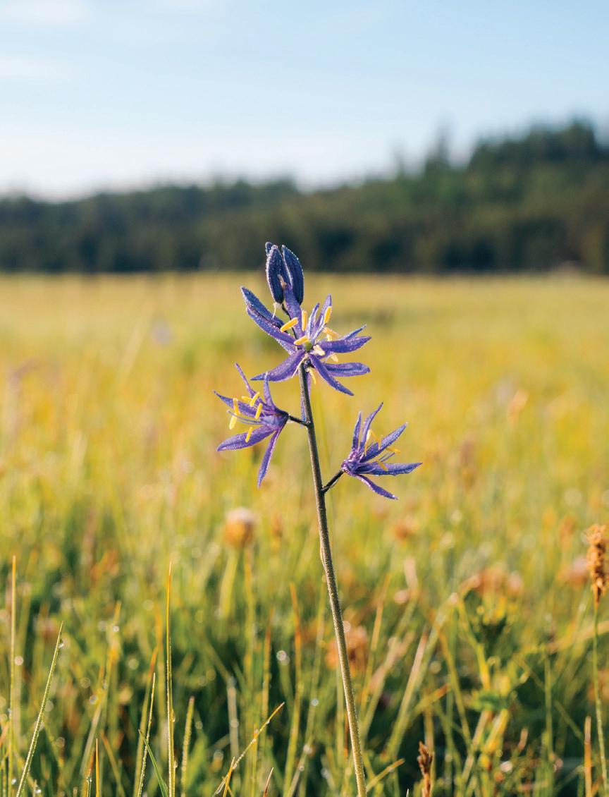
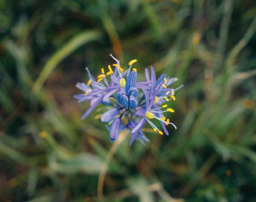
NATIVE PLANTS AT PHIPPS MEADOW: Camas & conservation
How do you protect vital plant species during restoration? BMLT’s latest project at Phipps Meadow aims to find out.
During peak bloom, the BMLT stewardship team identified plant species at Phipps Meadow to address key management questions: (1) What culturally important or sensitive plant species are present (2) How can we determine their abundance and location to minimize short-term negative impacts during restoration?
The team documented over 50 wildflower species using the Seek app by iNaturalist for rapid identification. This year’s visit yielded a very important and unexpected result: the southeast portion of Phipps Meadow is particularly abundant in camas, a hotspot previously unknown to restoration design teams.
“In previous years, BMLT identified small patches of camas on the west side, which informed our restoration design plans. Now, we have a better understanding of camas distribution on the property,” said Andrew Addessi, BMLT Stewardship Director.
Camas (Camassia quamash) is a perennial plant native to the Pacific Northwest with striking blue to purple flowers. The plant’s grass-like leaves emerge from an underground bulb, which is an important First Food for many Pacific Northwest Tribes, including the Confederated Tribes of the Warm Springs Reservation of Oregon. Camas bulbs are traditionally harvested, cooked, and consumed as a staple carbohydrate, rich in nutrients and cultural significance. However, camas distribution has dwindled due to habitat conversion.
By identifying where these sensitive species thrive, BMLT and partners can plan restoration efforts that minimize short-term impacts and increase the diversity of wetland-dependent native plants as a long-term outcome.
Finding common ground outside.
At Blue Mountain Land Trust, we go beyond just protecting land. We focus on building connections to place, strengthening relationships, and providing meaningful experiences outside. We aim to inspire a deeper sense of well-being and a greater understanding of the natural world surrounding us.
Connecting with a specific place — whether it’s a trail, meadow, or park — brings a sense of belonging. This connection can inspire us to take responsibility for its care, ensuring its wellbeing for the future.
Our commitment at BMLT is clear: we’re here to share positive environmental education opportunities and outdoor experiences for all. Our programs are designed to help build community, common ground, and connection with the land.
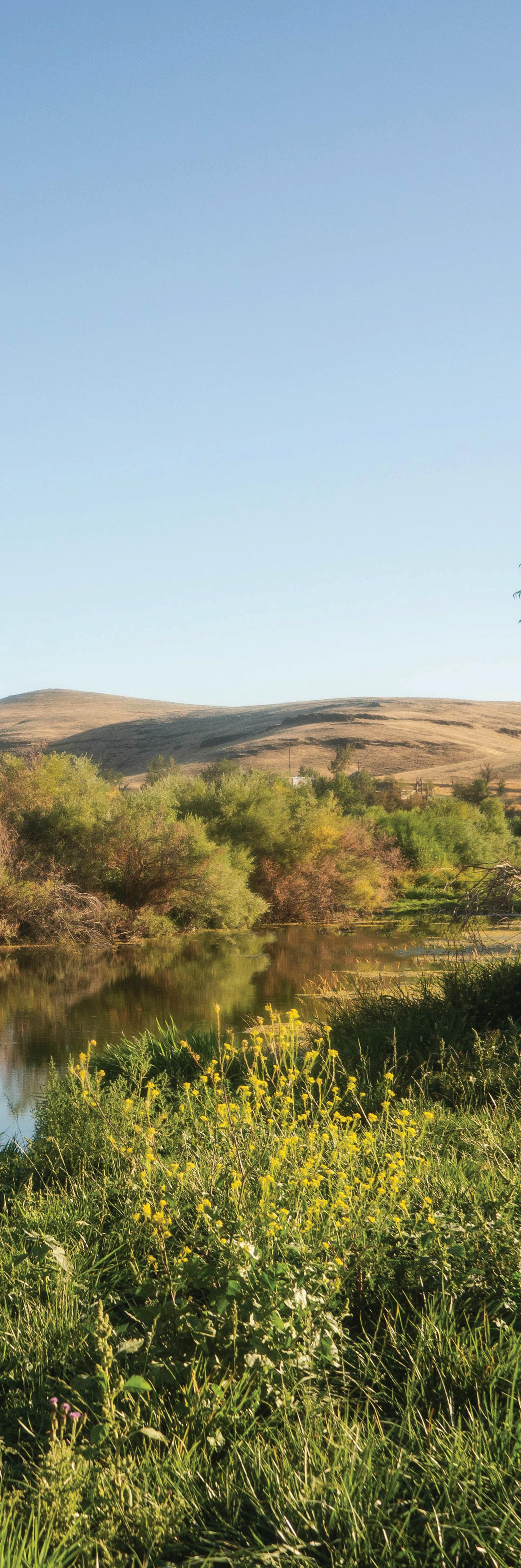
PHOTOGRAPH BY MATT FRANKLIN
Phipps Meadow - Grant County, OR
COMMUNITY ENGAGEMENT & EDUCATION
Reimagining the future
This year, BMLT took time to reflect and recalibrate, collaborating with a dedicated consultant to evaluate our community engagement programs. Together, we assessed the goals, effectiveness, and impact of our efforts to ensure they evolve with our mission and meet the needs of our community. When we say communities, we mean all of our neighbors. Strategic planning is vital — sometimes, taking a step back enables us to move forward with a renewed purpose.
Stay tuned for updates on our 2025 Learning on the Land series, which will offer fresh, mission-aligned opportunities for outdoor and conservation education. From youth and family nature classes to winter recreation programs and cultural land restoration projects, we are excited to keep building inclusive opportunities that deepen community connections to the lands & waters that define the region.
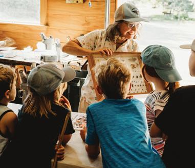
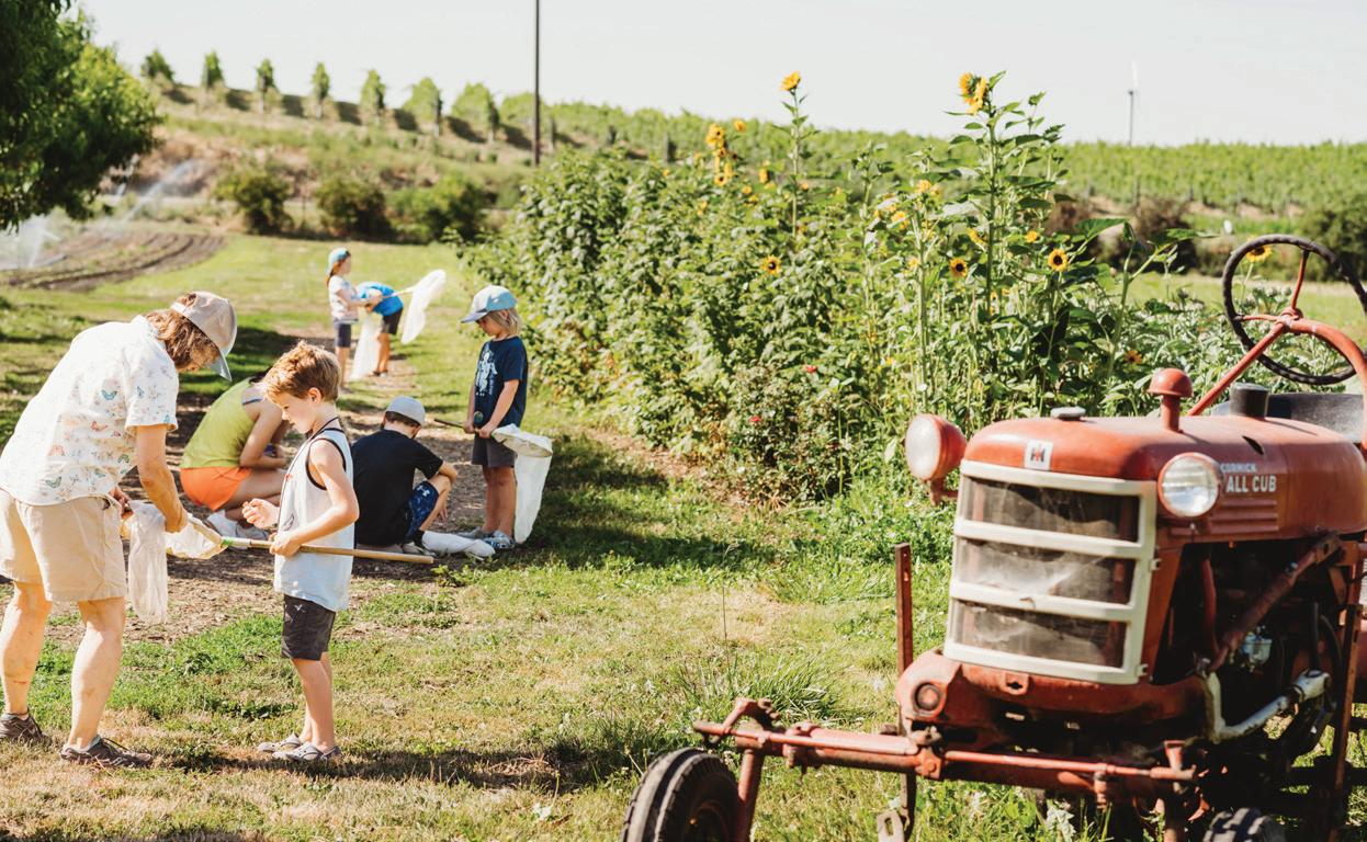
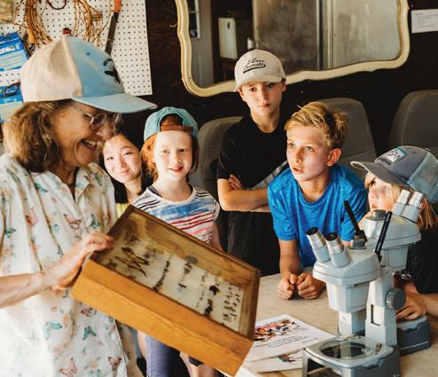
Summer fun at Welcome Table Farm
This summer, Welcome Table Farm partnered with BMLT to host Farm Kids summer camp, along with the new Kinder Sprouts camp, designed for pre-K and kindergarteners. Over four weeks, 70 young campers explored farm life and connected with the natural world around them.
For the first time, BMLT was thrilled to offer scholarships to cover the cost of tuition, making it possible for more kids to join in the fun. From pickling cucumbers and arranging bouquets to creek adventures and critter observations, each day was filled with hands-on activities that brought nature learning to life. We’re grateful to Emily & Andy Asmus and camp counselors for creating such a positive summer experience to nurture curiosity and joy in the outdoors.
CONNECTING WITH THE TOUCHET RIVER
A river runs through
Blue Mountain Land Trust hosted a tour of two adjacent conservation easements — North Touchet and Touchet Orchards. These easements collectively protect approximately 1.6 river miles and 35 acres of historic floodplain and riparian habitat along the North Fork Touchet River, just upstream of Dayton, Washington. The conservation easements support river and floodplain restoration efforts prioritized and implemented by the Confederated Tribes of the Umatilla Indian Reservation (CTUIR).
Attendees learned how restoration efforts align with CTUIR’s First Foods mission, the benefits of reconnecting a floodplain, and why conservation easements and water transactions support river health. Community-driven conservation reinforces a shared commitment to protecting these vital ecosystems for people, farms, fish and wildlife.
SUPPORTING TRIBAL PARTNERS
Oregon Land Justice Project
We honor and acknowledge the importance of Indigenous peoples on the landscape, and their stewardship today and since time immemorial. In our partnerships with local Tribes, tribal leaders and natural resources teams are the experts on how to restore the land.
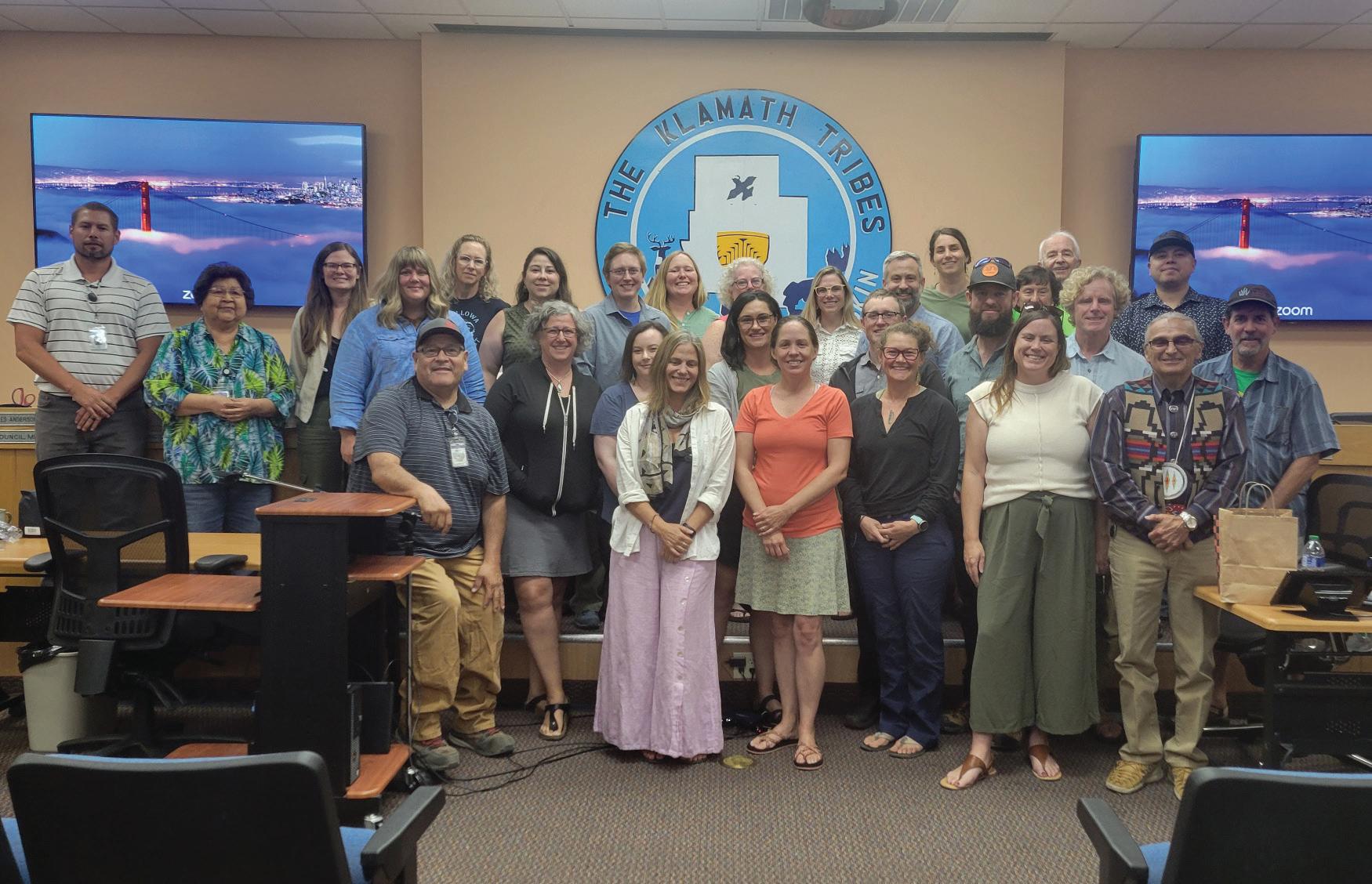
The Oregon Land Justice Project is a cohort of land trusts, including BMLT, working to change land conservation practices to enhance collaboration, support land access projects, and recognize the important role of Tribally-led initiatives.
As part of the project, the Indigenous Land Relationship Fund supports Indigenous-led community projects to reconnect with culture, traditional landscapes, and First Foods. Created to demonstrate solidarity, it provides financial resources and logistical and technical assistance.
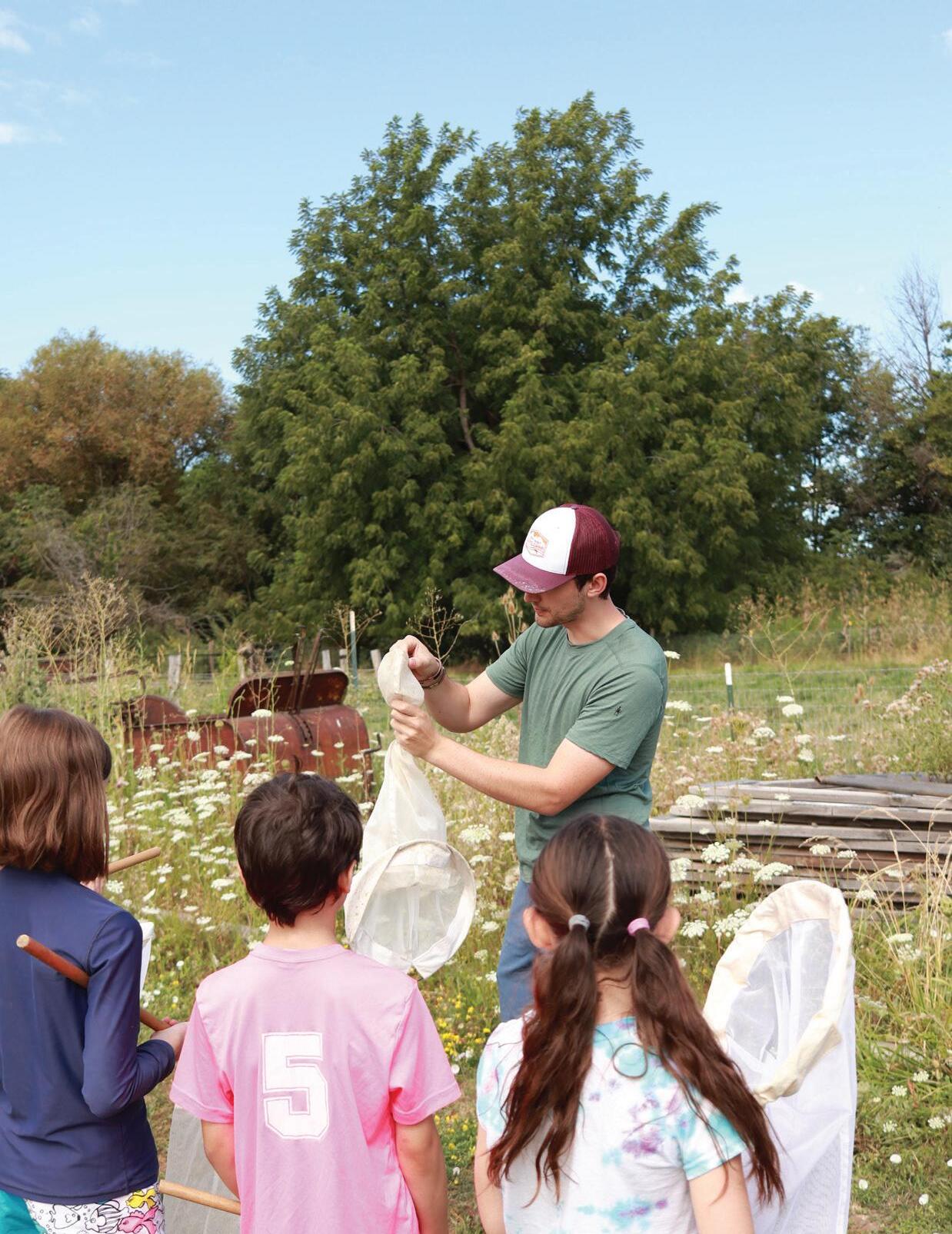
>> LEFT: Tours at the restoration site of the North Fork Touchet River upstream of Dayton, WA (Photo by Isaac Baik); Oregon Land Justice Project site visit to the Klamath Tribes (Photo by Gabe Sheoships); Pollinator education at Welcome Table Farm with Heidi Dobson and Conservation Manager Fraser Moore (Photos by Carlee Allen & Brittani Smith).
FARM KIDS AND KINDER SPROUTS CAMP
Adventure starts here.
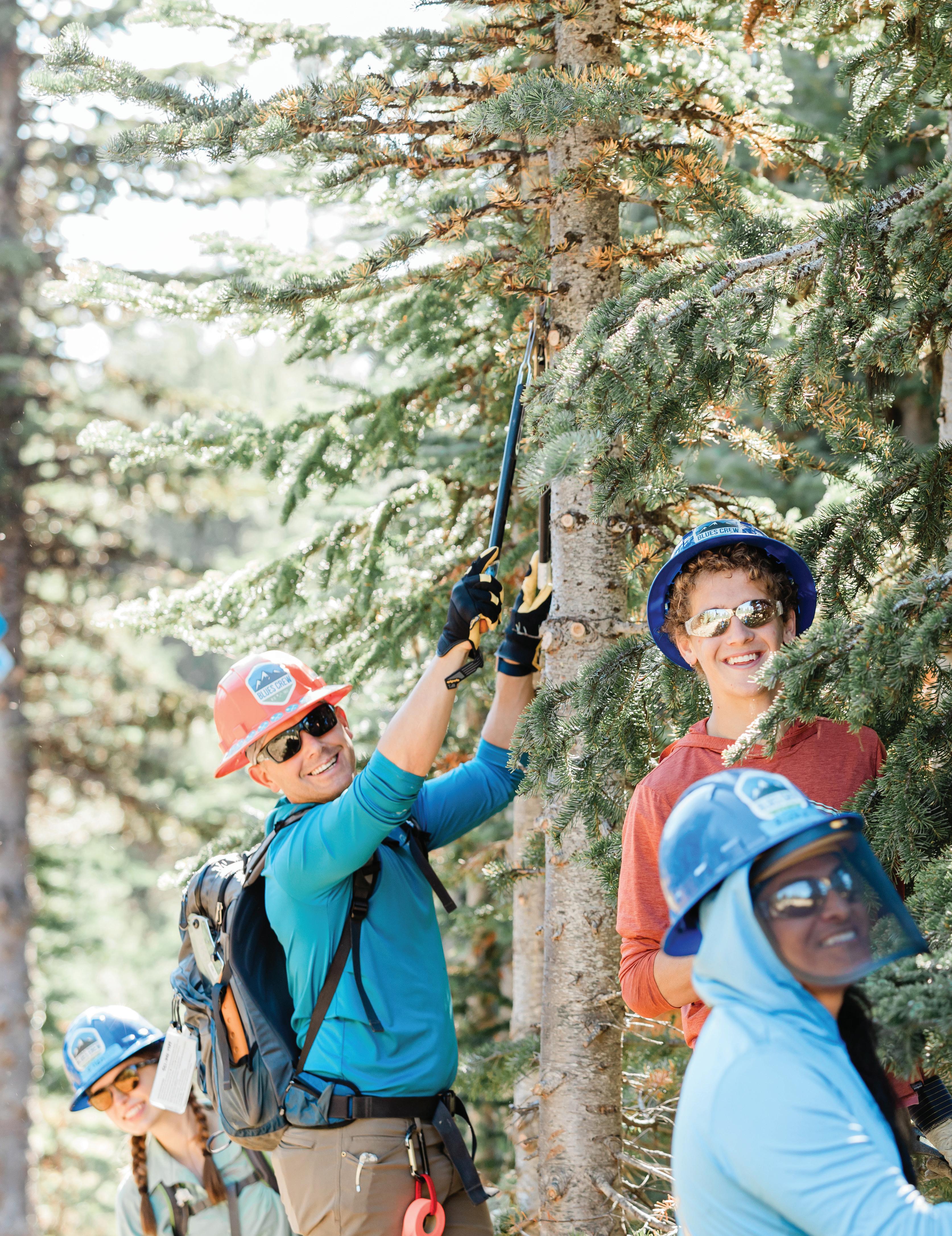
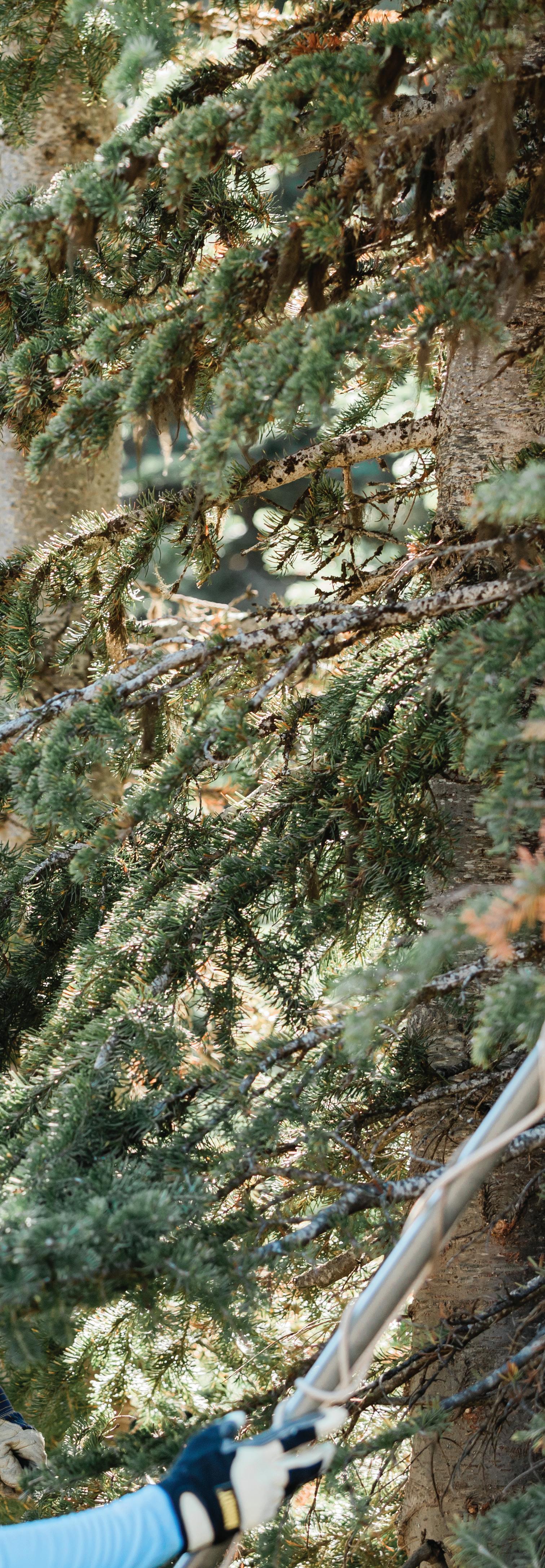
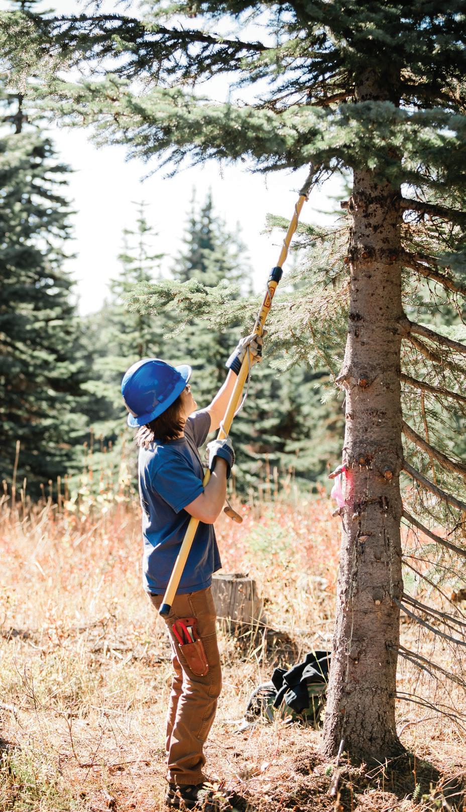
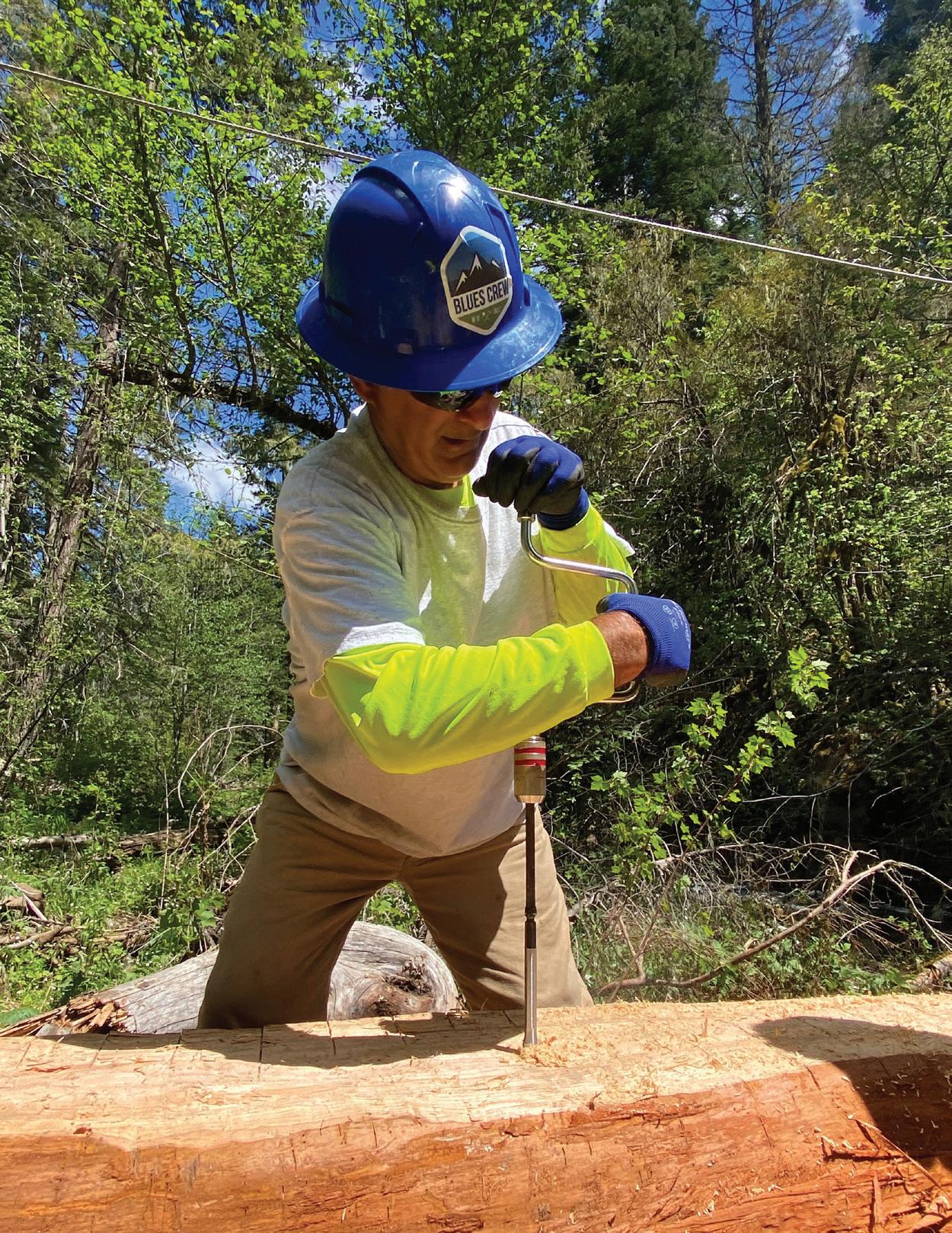
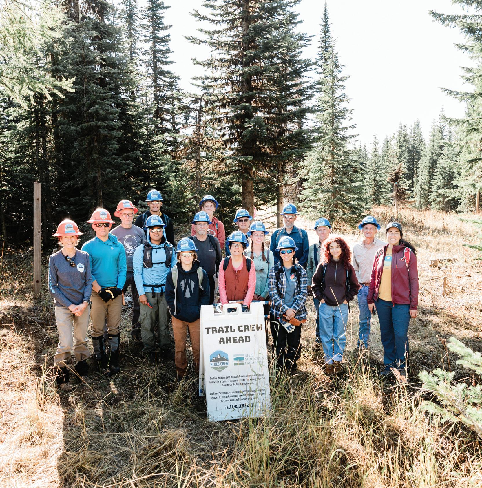
The Blue Mountains are home to countless miles of trails, filled with scenic vistas, beautiful wildflowers, and a surplus of solitude. We understand that a day spent on the trail provides growth, perspective, and a whole lot of grit.
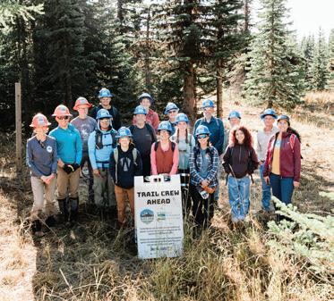
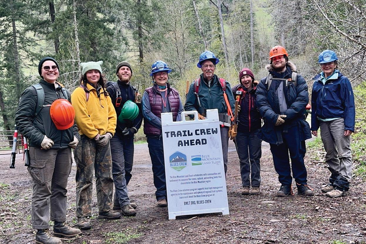
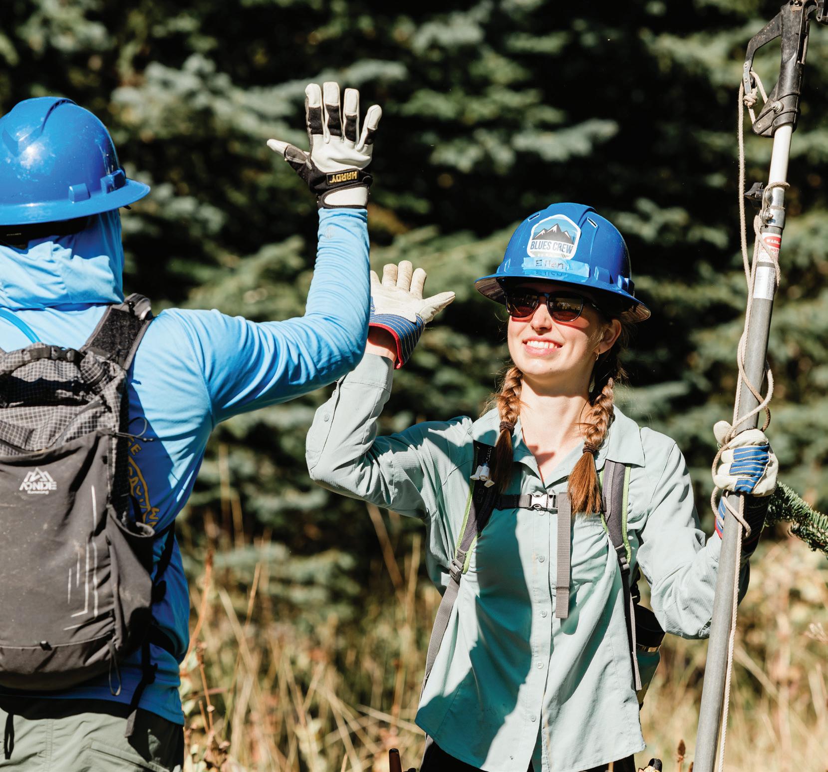
The trails of the Blue Mountains need attention and care. From the jagged Elkhorns in Eastern Oregon to the river trails outside of Dayton, WA, the BMLT Blues Crew volunteers are dedicated to improving trails on public lands. Whether you’re a hiker, skier, biker, or birdwatcher, our volunteers work hard to ensure the trails are primed for every level of outdoor pursuits.
We welcome anyone with a passion for these mountains to lend a hand for a fun and rewarding way to give back to the places you love.
PHOTOGRAPH BY SARAH TODOROVICH
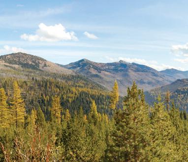
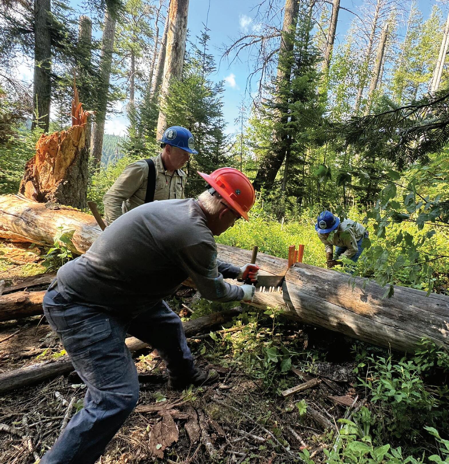
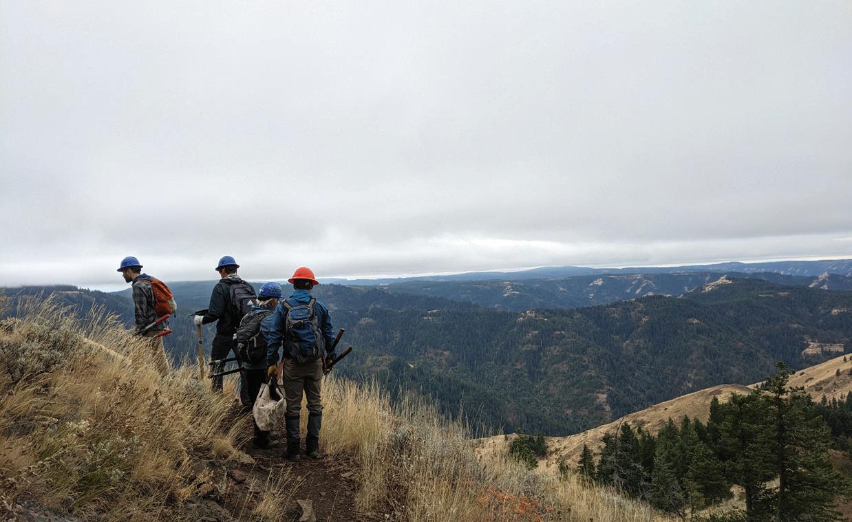
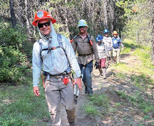
Wilderness revival
Since 2018, the BMLT Blues Crew has worked to improve and enhance recreational trails in the North Fork Umatilla Wilderness — a recreation gem spanning 20,299 acres in Umatilla and Union counties. With 27 miles of wilderness trails for hikers and equestrians, connected to non-wilderness biking and motorized trails, this area offers an abundance of routes for both day trips and extended adventures.
The BMLT Blues Crew, Greater Hells Canyon Council, Umatilla National Forest, and the Northwest Youth Corps (NYC) collaborated this past spring to repair and improve sections of trail damaged by 2020 floods. The Northwest Youth Corps consists of college students and tribal high school students. Working with groups like NYC multiplies our efforts and gives us space to learn from the next generation.
Over four intensive work weeks in the backcountry, crews carefully tackled various trail improvement and construction efforts. Tasks included rerouting sections of the trail and constructing essential infrastructure, including a 60-foot turnpike and a log bridge to reconnect trail access across Coyote Creek. Teams extracted and transported tons of rocks, categorizing them by size for specific trail improvements (all done by hand due to wilderness restrictions.) The project aims not only to repair trails but also to prevent future erosion, enhance drainage, and restore safety following flood damage.
Together, the crews improved and restored access to this popular trail network for countless hikers and outdoor enthusiasts. Thank you to all our partners and volunteers for their incredible efforts in creating safer and more accessible outdoor spaces for everyone.
This project was made possible with support from the Oregon Trails Fund by Travel Oregon administered in partnership with USFS.
22,949+
Volunteer trail stewardship hours on public lands since 2018
“The Blues Crew is a connected group of individuals bringing their skills and passion to create and rebuild recreational trails in our region.”
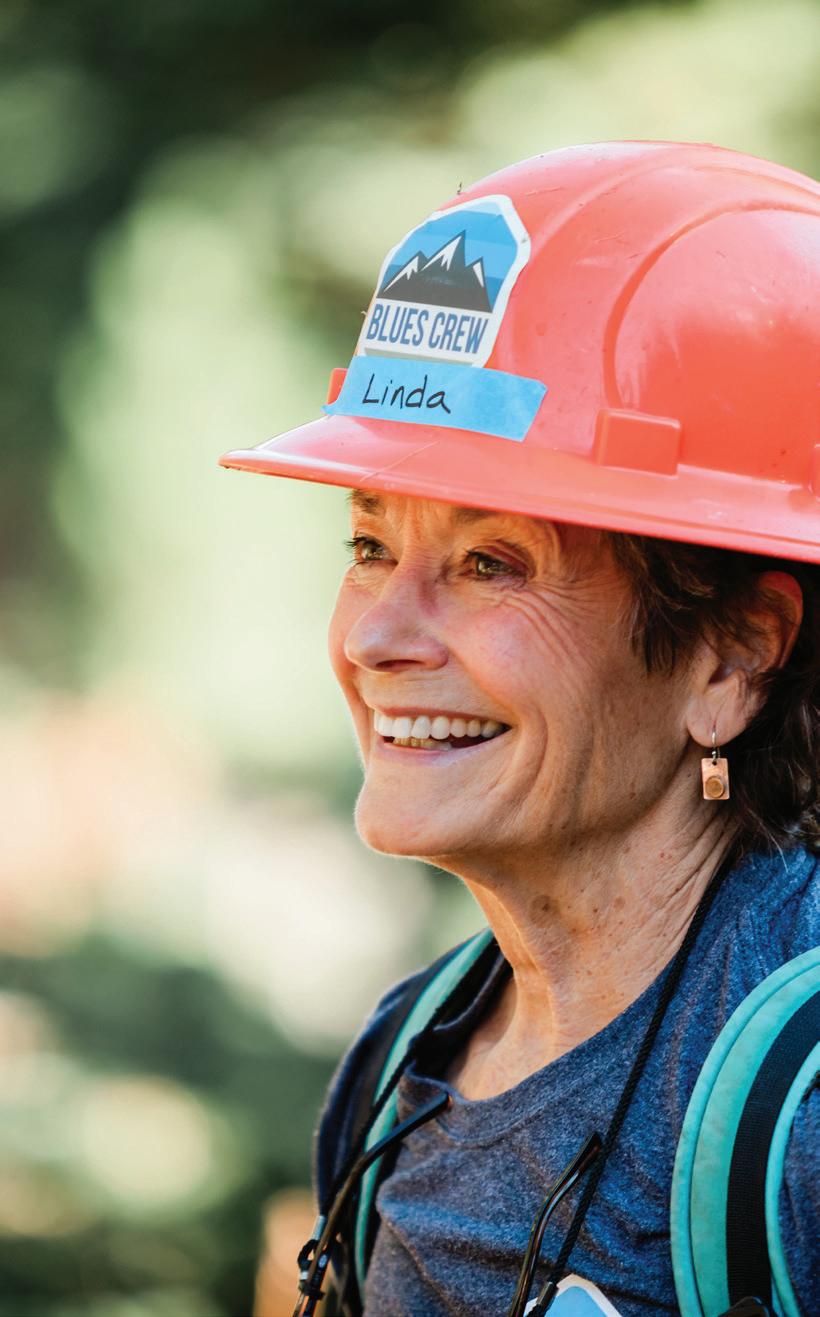
— GREG BROWN, BMLT BLUES CREW FOUNDER 8439+
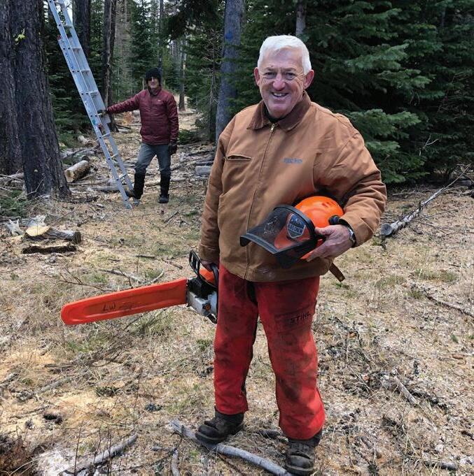
MEET LARRY WACHTEL
Expert sawyer mentor
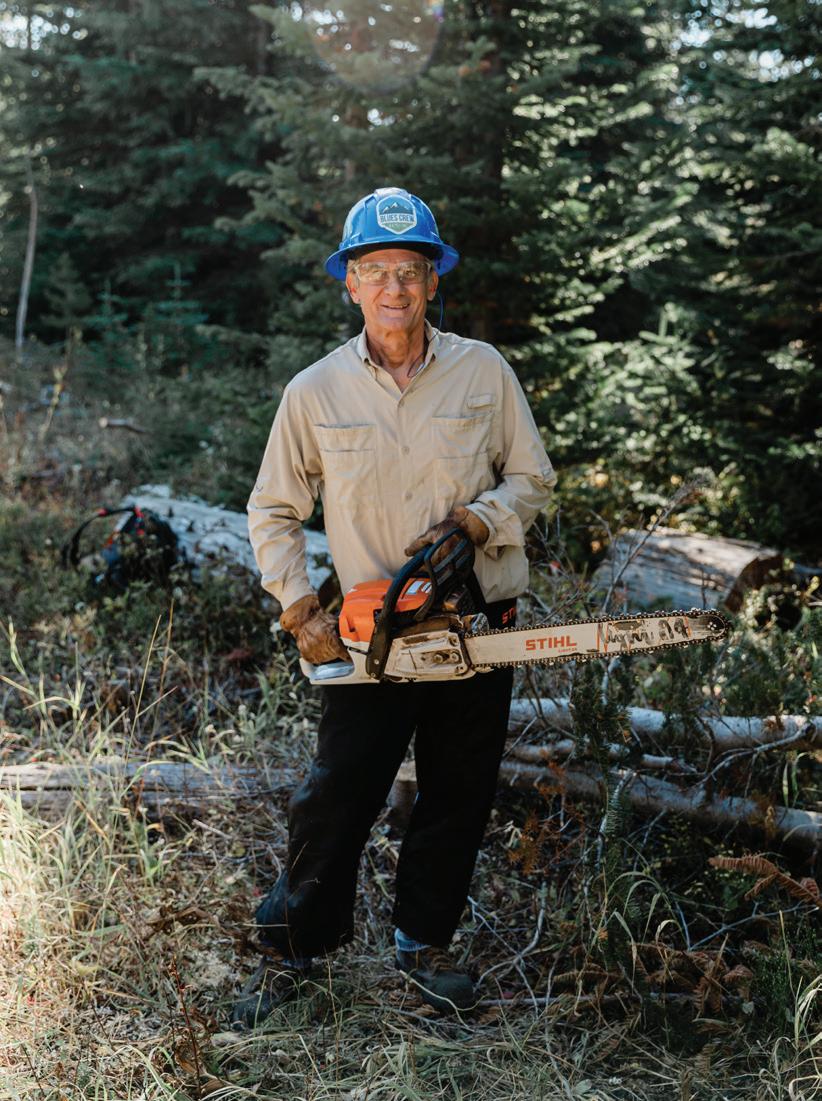
“See Something, Say Something!” BMLT Blues Crew Lead Sawyer C-Instructor/Evaluator Larry Wachtel knows that shared group observation and wisdom keep people safe in the woods. Since 2021, BMLT Blues Crew has partnered with Back Country Horsemen of Washington (BCHW) to offer our volunteers a USDA Forest Service-accredited Sawyer Training Program. Larry has over 50 years of experience using a chainsaw, making him an expert C-certified advanced sawyer who can independently buck and limb any size material in highly complex situations. Larry generously donates his time and knowledge to train and certify sawyers in both the classroom and in the field. He has traveled hundreds of miles to training sites in remote corners of Washington and Oregon to learn and to teach, including most recently partnering with the Wallowa Whitman Hell’s Canyon Trails Association (WMHCTA), certifying crosscut sawyers in the Lostine River Canyon.
The USFS Sawyer Training Program “Developing Thinking Sawyers” is designed to give all sawyers critical knowledge of OHLEC, a framework for accomplishing the work efficiently and safely. The top BMLT Blues Crew objectives are to come home unharmed and to clear the trail for all users, the ‘O’ in OHLEC. ‘H’ represents hazards, as sawyer work can be dangerous with heavy logs. ‘L’ refers to observing leans and binds that influence cutting actions. ‘E’ emphasizes having an escape route to stay safe when things start moving. ‘C’ is the Cut Plan, an evolving and unfolding process where everyone on the team gets a voice, not just the expert sawyers. “See Something, Say Something” isn’t just a slogan but a BMLT Blues Crew principle. Larry Wachtel encourages it in every class, every team, and every volunteer, leading with integrity, encouragement, and cheer.
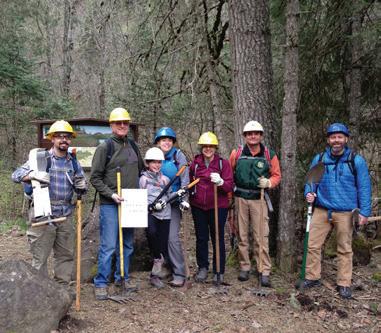
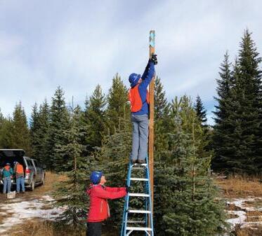
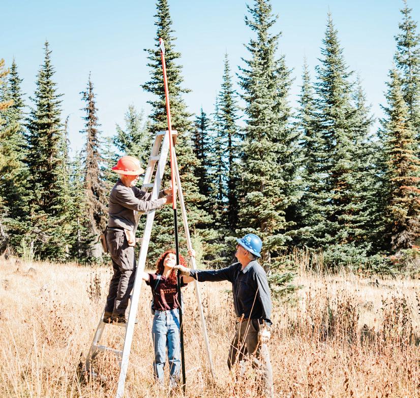
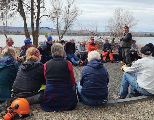
National Public Lands Day offers a chance to celebrate and give back by joining local efforts to enhance public lands, including trails, parks, and natural areas. In celebration, volunteers from the BMLT Blues Crew and the Whitman College Outdoor Program gathered at Horseshoe Prairie Nordic Ski Area for an impactful trail work party to prepare for the upcoming winter season. Together, they focused on improving the Red Fox Racetrack, a one-mile loop designed for Nordic skiing.
With enthusiasm and teamwork, the Sawyer team and volunteers cleared stumps, brushed tree limbs, and installed trail markers and signage for the upcoming winter season. Their hard work not only improved the trail’s accessibility but also created a sense of community among participants.
We can improve and provide safe access to public lands through collective action. Thank you to everyone who contributed their time and effort to make this day successful — your dedication truly makes a difference!
Give back to the places you love. Volunteer today: bmlt.org/volunteer
CELEBRATING NATIONAL PUBLIC LANDS DAY
Trail transformations
PHOTOGRAPHS BY SARAH TODOROVICH
WINTER RECREATION ACCESS
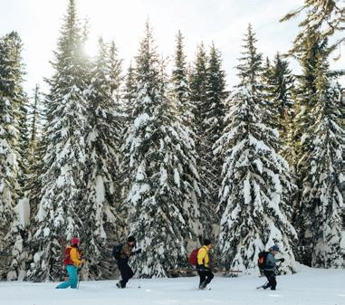
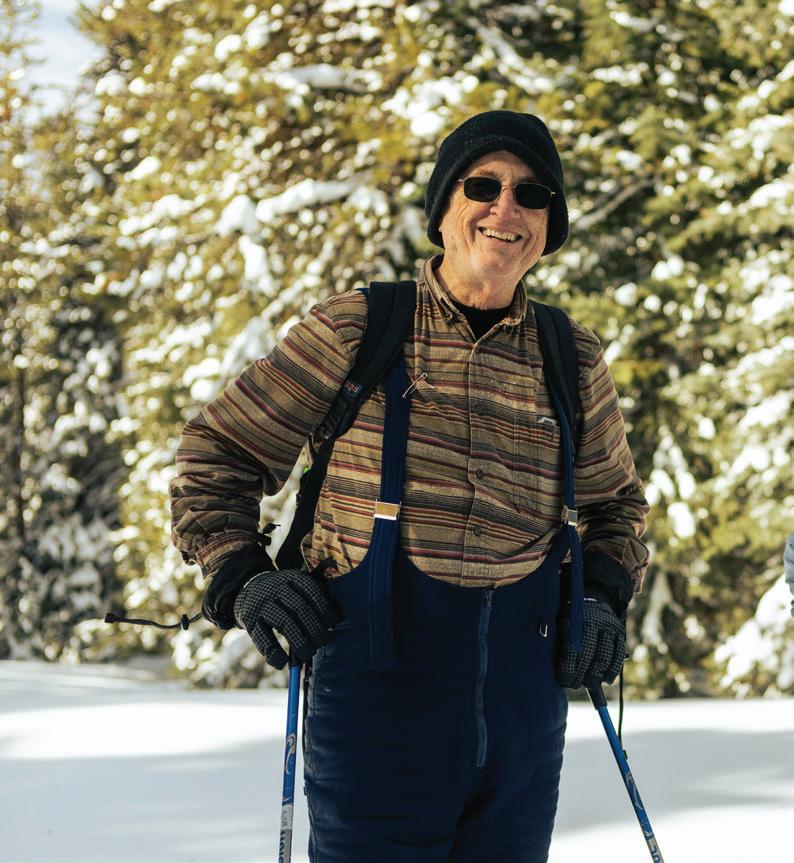
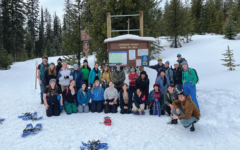
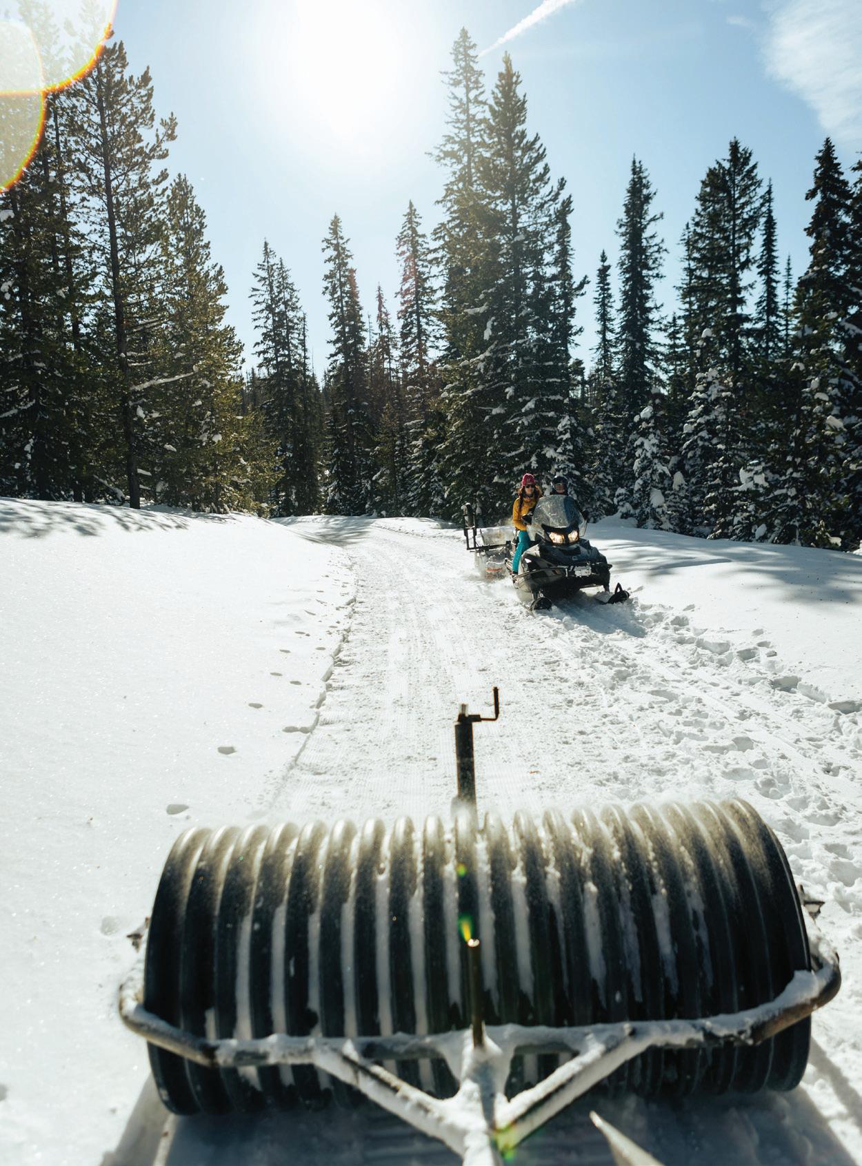
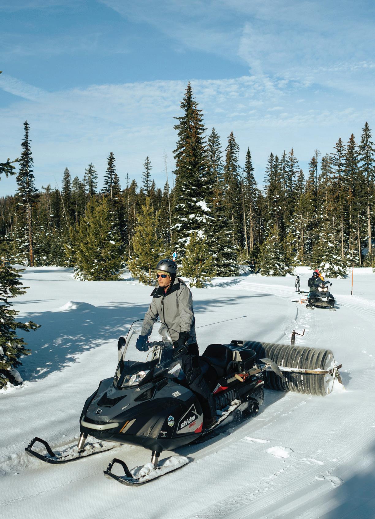
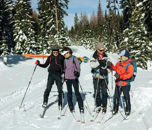
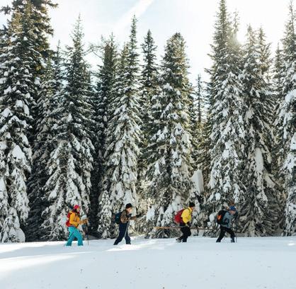
Ski at Horseshoe Prairie
Since 2019, the volunteer-led BMLT Blues Crew has partnered with the Umatilla National Forest to provide access to the Horseshoe Prairie Nordic Ski Area. Nestled adjacent to the North Fork Umatilla Wilderness, this area offers a variety of Nordic skiing and snowshoeing opportunities across both groomed and ungroomed trails.
With approximately 16 miles (26 kilometers) of marked and unmarked paths, Horseshoe Prairie is the unique destination for winter outdoor adventures. Thanks to the dedication and hard work of the BMLT Blues Crew, this once-overlooked winter recreation area has undergone significant improvements, including enhanced trails and signage. With over 6,340+ total volunteer hours invested, they have transformed Horseshoe Prairie into a cross-country skiing and snowshoeing spot in the Blue Mountain region.
Every winter season, the BMLT Blues Crew plays a vital role in the ongoing care of Horseshoe Prairie. Due to shifting snow levels and conditions, volunteers consistently clear trails, install signs and maps, and mark routes with blue diamonds to aid navigation throughout the trail network. They also assess and groom the trails each week to ensure they remain in top condition for outdoor enthusiasts.
The BMLT Blues Crew created a diverse trail network suitable for all skill levels, including the beginner-friendly Tenderfoot Trail, located conveniently next to the parking lot at Andie’s Prairie. Embrace the beauty of winter, stay active, and enjoy the great outdoors this season.
Access maps, grooming conditions & more:
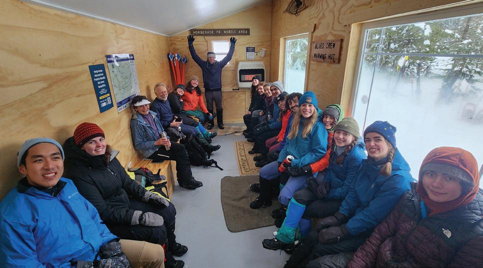
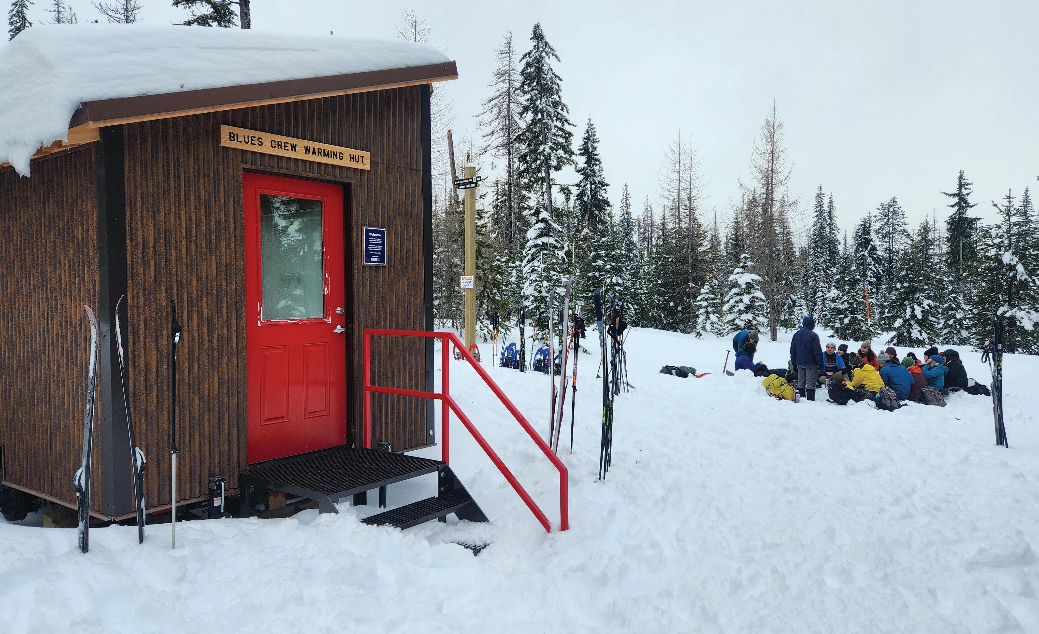
BLUES CREW WARMING HUT @HSP
A gathering place
Thanks to grant funding from the Oregon Recreational Trails Program, BMLT Blues Crew volunteers have expanded the trail network, improved maps and signage, and constructed a new warming hut. This important new addition provides a welcoming destination for skiers and snowshoers, offering a place to warm up, relax, and connect with fellow outdoor enthusiasts.
What makes this place special is the genuine sense of community it creates. Whether you’re a skier or a snowshoer, the warming hut offers a chance to enjoy the outdoors while connecting with others who share the same passion. It is a great spot to take a break, share stories, and meet new people, making each visit feel more like a gathering than just a solo outing. It’s the type of welcoming atmosphere that draws people back throughout the season.
Grooming operations at HSP by the BMLT Blues Crew. PHOTOGRAPHS BY ISAAC BAIK
POWER OF PARTNERSHIPS
Community is everything.
When you support the Blue Mountain Land Trust, you are part of conserving important farms, ranches, and natural habitats in the Blue Mountain region, from Dayton, WA, to John Day, OR. Thank you for being part of this effort.
>> DONORS
Keeping the Blue Mountain region healthy, sustainable, and beautiful is a community effort. When you support BMLT, you are part of a community of over 300+ individuals, families, and businesses donating annually. BMLT’s supporters are at the heart of our work, and we’re committed to maintaining the highest level of accountability to ensure that your gifts are stewarded according to your intentions. Your gifts fill in the gaps for critical work, such as conservation project development, that is not usually eligible for grant funding.
>> BUSINESS SPONSORS
When your business gives to BMLT, you are demonstrating your values and commitment to keeping this community healthy and strong. Your business is keeping local dollars local, and making it possible for our region to thrive for years to come. Thank you for your support!
Interested in being a business sponsor? Contact us at marcus@bmlt.org if you would like to discuss a business sponsorship.
>> INSTITUTIONAL SUPPORT
We are very lucky to have a great deal of support from state and federal agencies, tribal governments, and private foundations. Your support is the backbone of our core mission.
>> VOLUNTEERS
When you give the gift of your time to BMLT, you are providing an invaluable service. Not only your efforts, but your presence in our community as an ambassador for land conservation, trail stewardship, and environmental education. The relationships and community we build together, the laughter and the hard work, is what keeps BMLT strong. We are incredibly grateful for our many volunteers, interns, and fellows for their time and energy.
Give back to the places you love. Learn how to get involved: bmlt.org/give >>
Partner
Organizations
Blue Mountain Audubon Society
Blue Mountain Backcountry Horsemen
Confluence Project
Coalition of Oregon Land Trusts
Cornell Lab of Ornithology
Ft. Walla Walla Museum
Grant County Birders
Greater Hells Canyon Council
Intermountain Alpine Club
John Day Basin Partnership
Land Trust Alliance
Lincoln High School
North Fork John Day Watershed Council
Oregon State University Extension Service
Outside Walla Walla
South Fork John Day Watershed Council
Sustainable Living Center
Salmon-Safe
The Bug Guru
Tri-State Steelheaders
Trout Unlimited
Vital Wines and Providence Foundation
Walla Walla Conservation District
Walla Walla High School Latino Club
Walla Walla Public Library
Walla Walla Volunteer Corps
Walla Walla Water 2050 (WWW2050)
Walla Walla Community College Water & Environmental Center
Wallowa Mountains Hells Canyon Trails Association
Washington Association of Land Trusts
Washington Water Trust
Welcome Table Farm
Western Rivers Conservancy
Whitman College Career & Community Engagement Center
Whitman College Outdoor Program
THANK YOU
Private Foundations
American Endowment Foundation
Art and Clara Bald Trust
Bella Vista Foundation
Blue Mountain Community Foundation
Cape Flattery Foundation
Goldman Sachs Philanthropy Fund
Hollis Foundation
Mary Garner Esary Trust
Oregon Community Foundation
Pacific Power Foundation
Sherwood Trust
Sunny Day Foundation
The Healy Foundation
United Way of the Blue Mountains
Walla Walla Basin Watershed Foundation
Businesses, Sponsors, & Collaborators
Amazon
A&R Solar
Bill Rodgers Photography
Banner Bank
Brasserie Four
Cayuse Vineyards
Columbia REA
Crave Clay
Inter-Fluve
Justin Mordeno Photography
Lamb Weston
Matt Franklin Photography
Milliman
Mongata Winery
Portland General Electric
Sarah Todorovich Photography
Vim & Vinegar
William Frohne Photography
Government
& Tribal
Bureau of Reclamation
Bonneville Power Administration
Confederated Tribes of the Umatilla Indian Reservation
Confederated Tribes of the Warm Springs Reservation of Oregon
Oregon Department of Fish & Wildlife
Oregon Parks & Recreation Department
Oregon Watershed Enhancement Board
Travel Oregon
U.S. Army Corps of Engineers, Walla Walla Project Office - Mill Creek
U.S. Forest ServiceMalheur National Forest
U.S. Forest ServiceUmatilla National Forest
USDA Natural Resources Conservation Service
Washington Recreation and Conservation Office
Washington State Parks
- Camp Wooten
Washington State Parks
- Sacajawea State Park
Give back to the Blue Mountain region.
Since 1999, Blue Mountain Land Trust has conserved critical habitats, scenic landscapes, and productive farmland, promoting environmental health and biodiversity. With your help, we have protected nearly 25,000 acres of natural landscapes and working lands, ensuring that future generations can enjoy clean air, water, and vibrant ecosystems.
Our goal is to protect another 25,000 acres in the next 10 years and continue creating a strong connection between our communities and natural surroundings. Join us today in protecting the land we love forever. With your generous support we will conserve the beautiful Blues for generations to come.
Ways to give
By planning a legacy gift to the Blue Mountain Land Trust, you are playing a significant role in the protection of land, water, and habitat for generations to come.
Please contact us if you are interested in learning more about planned giving or including Blue Mountain Land Trust in your estate plans: marcus@bmlt.org
Sign up to make a monthly donation to BMLT on our website. Small, regular donations add up and make it easier for you to support in a way that increases our long term sustainability.
If you normally give $100 at the end of year, please consider signing up for a $10 gift monthly — easier to budget for and ultimately increases your gift by 20%.
Make a one-time gift in the month of December through the Valley Giving Guide and your impact will be increased by a match.
Together, we can make a lasting impact for future generations.