

www.australiainspace.com.au ISSUE #4 | 2022
The Andy Thomas Space Foundation Week French flair - Australia shines at IAC 2022 Australia's capability to build and operate lunar services rover Dr Space Junk with Elizabeth Weeks, Research Operations Manager, SmartSat CRC ZES extends LEO satellite lifespan
Australia aims for the moon
GRAVITATING TO TRADE SCAN HERE www.australiainspace.com.au/tv PLUS
The Australian defence strategic review and space Ukrainian space power in the Russian invasion DART attempts to alter asteroid’s course Catching a ride on a caravan to space
FROM DEEP SEA TO SPACE. MISSIONS DELIVERED... ANYWHERE.
As a key partner of the Australian Space Agency (ASA), and with the support of the Western Australian Government, Fugro is proud to be part of the future of the Australian exploration
and remote operations industry. Fugro will design, build and operate the Australian Space Automation, Artificial Intelligence and Robotics Control Complex (SpAARC).


To find
out more www.fugro.com/spaarc
Interview with Krystal Azelton Director of Space Applications Programs at Secure World Foundation.


We speak with the Summit Chair Krystal Azelton, who is Director of Space Applications Programs at Secure World Foundation.
Krystal has over 10 years of international and domestic space, public policy, and management experience. Prior to joining SWF, Ms. Azelton was a consultant at Access Partnership, where she worked with international satellite service providers and other leading technology companies on policy issues related to spectrum management, emergency communications, telecommunications standards, orbital debris, and multilateral processes including representing industry at the Inter-American Telecommunication Commission. She has also served as a project manager at the Tauri Group, a leading aerospace analytics firm, providing research, analysis, strategic planning, and regulatory assessment to government and commercial clients. She led and supported production of NASA’s strategic plans, audits, performance plans, budgets, and annual reports. Her work exposed to the full range of NASA’s Earth observation, human exploration, and aviation programs. In that role, she was also recognized as a key member of a data management team that received the NASA Group Achievement Award.

WATCH NOW
For more of the latest news and interviews in space sector! or head to
SCAN HERE
www.australiainspace.com.au/tv

We speak with Christopher Pyne, Chairman of Pyne & Partners, who served as the 54th Australian Defence Minister, and was responsible for delivering the $200 billion build-up of Australia’s military capability, the largest in Australia’s peacetime history.


We discuss the opportunities and strengths of the Australian space sector and why Australia, the United States and the United Kingdom should work together, through AUKUS, to bolster their space capabilities using economies of scale and technology sharing.


Serving previously as Minister for Defence Industry, Christopher assisted in developing the 2016 Defence White Paper and implementing the Integrated Investment Program.
Christopher also worked to ensure the growth and sustainment of Australia’s Defence Industry, and thus implemented Australia’s Defence Export Strategy, Defence Industrial Capability Plan, and the Naval Shipbuilding Plan. He also created the Defence Cooperative Research Centre, the Centre for Defence Industry Capability (since renamed the Office of Defence Industry Support), the Defence Innovation Hub, and the Next Generation Technology Fund.
WATCH NOW
SCAN HERE For more of the latest news and interviews in space sector! or head to www.australiainspace.com.au/tv
Interview
with Christopher Pyne Chairman of Pyne & Partners
Director & Executive Editor
Chris Cubbage Director David Matrai
General Manager – Industry Engagement Jessica Bainbridge
Art Director Stefan Babij
Sales & Relationship Manager Troy Hale - SYDNEY Veronica Koh - SINGAPORE
Head of Communications Laura-Jane Hawkins
MARKETING AND ADVERTISING
promoteme@mysecuritymedia.com

Copyright © 2022 - My Security Media Pty Ltd GPO Box 930 SYDNEY N.S.W 2001, AUSTRALIA E: promoteme@mysecuritymedia.com
Contents
Australia - Italy - Collaboration and investment opportunities in space and complimentary industries 8 Perth-based QL Space takes centre stage at Indian space expo 12 Technological networking events 14 within The Andy Thomas Space Foundation Week 14
French Flair - Australia Shines at IAC 2022 18 AI for space at the IAC 20
France - Australia: Space is the limit 22 Study confirms Australia's capability to build and operate lunar services rover 24 AUS / UK Space Bridge Building the space workforce 27 The Space Bridge: The UK and Australia gravitating to trade 28

ZES Extends LEO Satellite Lifespan by Protecting Commercial-Off-the-Shelf (COTS)
Electronics in Space 32 Catching a ride on a caravan to space 36 Australia aims for the moon 38 Pioneering ocean-sensing satellite to benefit Australia’s Blue Economy 40
The Australian defence strategic review and space 44 Ukrainian space power in the current Russian invasion 48 Scotland’s holistic approach to space sustainability 50 NASA spacecraft crash attempts to alter an asteroid’s course 54 Introducing Space Machines Company 56


The Eartheye Space Platform promises to democratise earth observation data 58 New Frontier in space weather forecasting opens 61 Aussie start-ups growing plants on the moon 62

6 | Australia in Space Magazine
Contents
OUR CHANNELS
All Material appearing in Australian in Space Magazine is copyright. Reproduction in whole or part is not permitted without permission in writing from the publisher. The views of contributors are not necessarily those of the publisher. Professional advice should be sought before applying the information to particular circumstances.
us
22 24 40 50 CORRESPONDENTS* & CONTRIBUTORS
Andrew Curran*
Shane Keating Nicola Sasanelli Luke Heffernan Jo Hawley Henry Sayers Shaun Kenyon Dr Malcolm Davis Dr Chris Flaherty Daniel Smith Samantha Douarin Ali Buchberger Helene Baron Like us on Facebook and follow
on Twitter and LinkedIn. We post about new issue releases, feature interviews, events and other topical discussions.
Welcome to edition four of the AustraliainSpaceMagazineand released as Official Media Partners to The Andy Thomas Space Foundation’s 14th Space Forum.
This edition follows our attendance in Paris with the International Astronautical Federation who gathered more than 9,300 delegates from 110 countries at the 73rd International Astronautical Congress (IAC). We provide insights into this global event where, throughout the week, more than 3,000 papers were presented and facilitated over 800 presentations.
Australia emerged as one of the big winners from IAC. Sydney was announced as the host city for IAC 2025, an event that is expected to bring around 5,000 delegates from around the world. Sydney’s success follows Adelaide hosting the conference in 2017.
“IAC 2025 will create opportunities for Australian industry, both those already operating in space and those with the potential to contribute to make new connections, accelerate the adoption of critical technologies and tap into global supply chains,” said Australian Space Agency Head, Enrico Palermo.

Alongside the IAC 2025 announcement was the release of an AROSE study, commissioned by the Australian Space Agency that confirmed, for the first time, that there is sufficient design and advanced manufacturing capability within Australia to build, test and operate a Lunar Services Rover in support of NASA’s return mission to the Moon.
We have also seen the first Australian commercial launch provider, Southern Launch, sign a Space Situational Awareness Sharing Agreement with the United States Space Command. Under the arrangement, Southern Launch will notify ahead of launches to identify launch windows that ensure the trajectory of launch vehicles avoids space objects already in orbit.

Virgin Orbit has signed a Memorandum of Understanding with Wagner Corporation, proprietor of the Toowoomba Wellcamp Airport and Business Park in Queensland. The agreement will allow the companies to begin the process of implementing a national launch capability, with the goal of providing satellite launch services from the Toowoomba Wellcamp Airport using Virgin Orbit’s LauncherOne System. The companies are exploring the potential to certify Toowoomba Wellcamp Airport as a national spaceport to perform an orbital launch demonstration, as early as 2024.
Optus has announced a partnership with Space Machines Company to provide the Australian public and private sector with an option to not only operate satellites from Australia, but now build them. Ben White, Managing Director, Wholesale, Satellite and Strategy at Optus said, “Optus is committed to supporting the growth of the Australian space industry and increasing awareness of our country’s technology and space capabilities.
With a focus on satellites, SmartSat Cooperative Research Centre (CRC) and cosine have announced that the hyperspectral imaging camera, HyperScout 2 Flight Model instrument, will be onboard the South Australia (SA) state satellite and is now ready to be integrated into the spacecraft. HyperScout 2 will be launched into space on board the satellite Kanyini, a 6U CubeSat, as part of the SA Space Services Mission and will provide critical data to government and non-government agencies. The launch of the satellite is part of the SA Space Sector Strategy 2030 and is Australia’s first state-based satellite.
Chris Cubbage CPP, CISA, GAICD Director & Executive Editor
Euroconsult has published new research indicating the satellite industry is likely to see an explosion of services-driven revenue to the tune of a cumulative $1.2 trillion by 2031, with the share of data applications jumping from 15% of total market revenues to a remarkable 42% by 2031.
A falling average revenue per user (ARPU) and a fiercely competitive market have been the main drivers for changes in strategies, with operators pushed to look for extra revenues to avoid the commodity price trap. Their sights have been increasingly set on a new revenue stream – Services –which will grow from $108 billion to $124 billion in the space of 10 years, with all the growth coming from data services.
The firm also predicts that the Satcom industry is on the springboard of a period of accelerated change created by the introduction of disruptive Non-Geostationary Orbit Satellites (NGSO).
However, COVID-19 and the war in Ukraine have not spared the Fixed-Satellite Service (FSS) industry, with supply chain issues due to microprocessor shortages and manufacturing bottlenecks leading to a significant number of satellites being delayed. The global inflation crisis has also pushed up satellite prices, most visibly impacting NGSO constellations like Telesat’s Lightspeed, which was forced to downsize.
We give special recognition to Alice Gorman on her efforts with her Dr Space Junk series and this issue her guest is Elizabeth Weeks. Elizabeth is Research Operations Manager at SmartSatCRC, a consortium of universities and other research organisations, partnered with industry that has been funded by the Australian Government to develop know-how and technologies in advanced telecommunications and IoT connectivity, intelligent satellite systems and Earth observation next generation data services.
Also, in this edition we cover the international space sector, with coverage of the IAC, space sector in Scotland, UK and Asia. The UK is on the cusp of becoming the first country to launch a rocket into orbit from European soil, expected to launch before the end of 2022. The UK space industry is growing constantly, now with 1,200 companies and 47,000 direct employees and counting. Innovation is a driving force in the UK, with an estimated £836 million spent on space related R&D in 2019/20, equivalent to 5% of total industry income.
Finally, a thought-provoking article from Dr Chris Flaherty on the role of space in the Russian invasion of Ukraine, relates directly to that of Dr Malcolm Davis of the Australian Strategic Policy Institute who writes on the newly elected Albanese Government’s Defence Strategic Review (DSR), set to be formally released in March 2023. The space domain is now an operational domain, and likely, has become a warfighting domain. It is no longer simply an enabling adjunct to traditional air, sea and land domains, and the DSR is the perfect opportunity to clarify this nation’s direction in space for defence and national security.
As always, we again cover the full diversity of the Australian and international space industry and there is so much more to touch on. Enjoy the reading, watching and listening.
Chris Cubbage CISA, GAICD Executive Editor
Australia in Space Magazine | 7
Editor's Desk
Australia - Italy
Collaboration and investment opportunities in space and complimentary industries


As part of the ASITII International Space Series, 70 industry professionals gathered in Perth during Global Space Week to discuss collaboration and investment opportunities between Australian and Italian organisations in the space sector as well as cross sector applications. The luncheon was organised by Australia in Space Magazine in collaboration with the Italian Chamber of Commerce and Industry.
"Italy and Australia: Collaboration and Investment opportunities in space and complimentary industry" networking lunch was opened by David Matrai from Australia in Space Magazine with foundation speeches delivered by ICCI President, Raffaele Iannizzotto and Italian Consul Nicolo Costantini. There was an emphasis on the respective strengths of Australia and Italy in space innovation and the opportunity for collaboration in both space as well as complimentary industries.

Professor Simon Driver, University of Western Australia, spoke about the geographic advantages that WA presents to the global space eco-system and the chance for WA to be a key player in satellite data processing.
Panel moderator James Yuen, Director of Space for the Western Australian Department of Jobs, Tourism, Science and Innovation presented an introduction on WA’s significant space infrastructure, including ground stations, telescopes and strong data analytic capabilities. WA’s strong capabilities in data analytic capabilities were further presented by Professor Melanie Johnston-Hollitt, Director of Curtin’s Institute for Computation and Australian Space Data Analysis Facility. This was complimented by presentations on the strength of remote operations expertise and experience from AROSE’s Michelle Keegan and Fugro SpAARCs Mark Cassidy. All presented current projects as well as the benefit space brings to other industries such as agriculture and resources.
8 | Australia in Space Magazine
AUSTRALIA IN SPACE
All Images courtesy - MySecurity Media





Australia in Space Magazine | 9

Date Location Event Organised by Tech Domain Oct 24 MELBOURNE AIPIO Conference Media Partner Security Management Oct 25 ADELAIDE AUSTRALIAN SPACE FORUM Andy Thomas Space Foundation Official Media Partners Space Oct 27 SYDNEY Cyber Risk Meetup Grab a copy of the latest print edition of the Australian Cyber Security Magazine MySecurity Media Cyber Security Date Location Event Organised by Tech Domain Nov 2 SINGAPORE CYBER RISK MEETUP Cyber Risk Meetup MySecurity Media Cyber Security Nov 3 PERTH SPACE SUNDOWNER Grab a copy of the latest print edition of the Australia in Space Magazine MySecurity Media Space Nov 9 SYDNEY SPACE SUNDOWNER Grab a copy of the latest print edition of the Australia in Space Magazine MySecurity Media Space Nov 16 MELBOURNE CYBER RISK MEETUP Cyber Risk Meetup MySecurity Media Cyber Security Nov 14-18 NATIONAL Australian Cyber Week 2022 ( Official Media Partners ) AUSTCYBER Cyber Security Nov 14-17 SINGAPORE Privacy Summit Media Partners Cyber Security Nov 15-17 SINGAPORE Canalys APAC Forum Grab a copy of the latest print edition of the Australian Cyber Security Magazine Media Partners IT Sector Nov 15-17 SYDNEY Financial Crime Summit Grab a copy of the latest print edition of the Australian Cyber Security Magazine Media Partners Security Management Sector Nov 21 BRISBANE Bringing Together Australia’s Space Sector to Reach the Moon Grab a copy of the latest print edition of the Australia in Space Magazine Sundowner - Bringing Together Australia’s Space Sector to Reach the Moon MySecurity Media QUT Space Nov 30 ADELAIDE CYBER RISK MEETUP – CYBER/SPACE Grab a copy of the latest print edition of the Australian Cyber Security Magazine Cyber Risk Meetup MySecurity Media AUSTCYBER Cyber Security INDUSTRY ENGAGEMENT OPPORTUNITIES WITH MYSECURITY MEDIA EVENTS 2022 | 4TH QUARTER OCTOBER NOVEMBER




The ability to operate in and from space depends on improved access to space. Can there ever be a reliable, affordable and repeatable operational capability? Key topics for this upand-coming panel include space domain awareness, space surveillance and tracking, the impact of new mega-constellations and international partnerships in space.
SPACE OPERATIONS SUNDOWNER NETWORKING EVENT Your invited to our second SYDNEY Wed 9th Nov 2022, 5:30 pm - 8:30 pm AEDT Wolfpack Space Hub, 24-30 Wellington Street, Waterloo, NSW, 2008 FEATURING A PANEL DISCUSSION WITH
SYDNEY
COO QUASAR
SABER
CHIEF TECHNOLOGY OFFICER AUSTRALIAN SPACE AGENCY
Natasha Rawlings
Jason Held CEO
ASTRONAUTICS Aude Vignelles
DEPUTY DIRECTOR SPACE AND ASTRONOMY GROUP CSIRO Join us from 5.30pm for light refreshments for a 6pm start. PROUDLY PRODUCED BY
Dr Mark Cheung
Perth-based QL Space takes centre stage at Indian space expo
By MySecurity Media
QL
Space signed three of the six Australia-India space industry memorandums which were signed at the Bengaluru Space Expo 2022 on 5th September 2022. The company formed part of a 40-member Australian delegation led by the head of the Australia Space Agency, Enrico Palermo.

QL Space will partner with Chennai-based GalaxyEye to develop a hybrid optic and radar payload to reduce the adverse environmental impact of critical mineral exploration in Australia and beyond.
QL Space will also work with Bengaluru-based SatSure to build the satellite and AI-based solutions to support the agriculture, mining and defence industries, and apply space technology to the outer space environment.
QL Space also signed MOU with Hyderabad-based Skyroot Aerospace to launch a satellite from Australia and
collaborate on an outer space exploration mission.
Raj Gautam, QL Space's founder, says: "We're excited that these memoranda will help bring to life our vision of making exploration mining more environmentally friendly. Currently, there are huge expenses in CAPEX and concern about ESG in mineral exploration. By developing the technology to allow for more targeted critical earth drilling exploration, we aim to reduce the load on capital and operational expenditure, making the process more environmentally conducive. Further, we will be developing values-based solutions with our partners for agriculture, disaster management and response, environment and beyond.”
This comes as India and Australia continue to grow and strengthen their ties in space after the Australian federal government announced in March it was investing $42 million into space initiatives with India.
AUSTRALIA IN SPACE 12 | Australia in Space Magazine
Australian Space Agency head Enrico Palermo with delegation members and space entrepreneurs at Bengaluru Space Expo in Bengaluru, on September 5, 2022. All images courtesy: Australian Space Agency/Bengaluru Space Expo


AUSTRALIA IN SPACE Australia in Space Magazine | 13
Technological networking events within The Andy Thomas Space Foundation Week
 By Nicola Sasanelli Chief Executive Officer, The Andy Thomas Space Foundation
It is well known that innovation stems from emerging new technologies made possible through an organisation's accumulated stock of skills and capabilities. Amongst these we distinguish best practice technological and networking skills. To highlight these best practices, specifically in the growing Australian Space sector, the Andy Thomas Space Foundation would like to share its approach to and experience in engaging with technological networking.
Networking events provide an excellent opportunity for stakeholders to meet and network with key national and international technological players. Participation in the networking events is targeted at researchers, entrepreneurs, academics, teachers, private consultants, public employers, and others with an interest in contributing to innovative sectors such as space. These networking events such as the Australian Space Forum, aim to stimulate the Australian space ecosystem by:
1. Encouraging the exchange of information and promoting the latest industry developments;
2. Showcasing national and international capabilities to national and international investors;
3. Assisting research organisations to identify industry needs and future areas of demand, particularly within STEM pathways;
4. Promoting commercial application of new research and technologies.
Networking is also considered important for facilitating access to components of technology that are generally considered inaccessible to an organisation. Formal and informal engagements are also encouraging for contemplating strategic partnerships through which organisations can share the risks of innovation with others and develop partnerships comparatively easily.
One of the three strategic pillars of The Andy Thomas space foundation is promoting innovation through technological networking. In the first two years the Foundation has not only managed the Australian Space Forum, a one-day event attracting more than 1000 attendees and an exhibition area with over 100 organisations showcasing their products and services, but it has built a solid legacy around the Australian Space Forum.
For the first time in the Australian Space Forum’s history, during the week - 24-29 October - the ATSF has organised a number of industry leading and dynamic events, each highly relevant to promoting space technologies to flank the Forum. These events will offer something for everyone in the industry, with great promise for the promotion of STEM subjects to young students as well as knowledge and outreach amongst the Australian community. This week is
14 | Australia in Space Magazine
AUSTRALIA IN SPACE
known as ‘The Andy Thomas Space Foundation Week’. “The Andy Thomas Space Foundation week” represents a new way to approach the organisation of technological events, as an aggregation of relevant events with different focus topics, providing a more agile, flexible and accessible approach to offering expert information in a comprehensive manner. This week has showcased its capability to aggregate different leader organisations to share specific niches, knowledge or technologies, generating discussion, understanding international best practices and achieving new skills.
The First ‘Andy Thomas Space Foundation Week’ from the 24th to 29th October presents following program:
On Monday 24 October four events have been coorganised:
• Space Accelerator – University of South Australia’s Innovation & Collaboration Centre is home to Australia’s first of it’s kind Incubator and Accelerator for space startups. The Venture Catalyst Space program attracts space founders from all over the globe and has supported 29 early stage space startups through four annual programs since 2018. These startups have gone on to raise over $13M in investment and seed grants and more than 90% are still operating. Join a presentation
with program alumni: Astroport Space Technologies (US); Astrogate Labs (India) and Espy Ocean (Adelaide).
• Space and Cloud – Changing the world. Cloud is essential in all areas of the space business. With Amazon Web Services Cloud, customers are accelerating space missions, removing barriers to innovation and inspire future generations.

• The 2nd Australian Space Education Mixer – An ATSF initiative with the support of the Australian Space Discovery Centre to connect, promote and improve STEM subject engagement in Australia primary, secondary and tertiary education institutions.
• The Andy Thomas Space Foundation Dinner – The dinner aims to increase networking opportunities and allow Australian Space Forum sponsors to further connect and discuss the future of space development in a unique environment.
On Tuesday 25 October the 14th Australian Space Forum has been organised: Following welcome speeches from the Premier of South Australia and the Australian Minister for Industry, Science and Technology, The Hon Ed Husic MP (TBC), the Head of Australian Space Agency Mr. Enrico Palermo and Mr. JeanMarc Astorg the Director for strategy from CNES (France) will provide an update from their respective national space
Australia in Space Magazine | 15
AUSTRALIA IN SPACE Cont next page >>
agencies. The remainder of the Forum will comprise the Exhibition are and the following three panels contributing to the Symposium:
1. Optical Communications - A quantum leap in Australia’s secure and high bandwidth communications to connect the world and beyond.
2. Foundation Services Rover - Exploring remote operations and autonomous systems
3. Earth Observation - The National Space Mission for Earth Observation
On Wednesday 26 October two events have been coorganised:
• The Future of Environmental, Social, and Governance (ESG) and Space -This event, developed by the EY Space Tech Lab, will provide a unique perspective to the growing importance of ESG and the benefit of utilising data sourced from Space to measure, predict and minimise our environmental footprint. During this interactive session, we will be exploring how the downstream application of space technology is enabling the ESG agenda, as well as considering how companies operating in the domain of Space should be applying ESG principles to their own businesses. This event will discuss examples of how companies are currently taking advantage of the power of Space at scale to improve life on Earth, what opportunities will arise in future and also what this means for companies that are part of the Space industry.
• Women in Space, impacting the world and beyond – Inspire, Empowering, Advancing are drivers of this much anticipated event with female leaders from withing the space industry coming together to share their rich experiences and inspire greater participation in this exciting and growing sector of the South Australian economy.
On Thursday 27 October two events have been coorganised:
• The River Murray International Dark SKY – This location is the Australia’s first and offers SA’s growing space industry an exceptional dark and radio silence location just 90 minutes from Adelaide CBD. Actively supported by the Mid-Murray Council the 3,200 square kilometer Reserve is backed by dark sky friendly development
and lighting policies.
• From the Australian Outback to Mars – Australian has taken a big step in joining the international space community in going back to the Moon and ultimately on to Mars. The Mars Society Australia has contributed to the search for life and exploration of Mars. The Australian outback provides many environments, analogous to Mars. The established of a multipurpose Mars Analogue Research Station (MARS) at Arkaroola in Outback Australia would support important activities such as STEM, educator development, surface exploration research and operations, astrobiology, exploration instrument testing and even space tourism.
On Friday 28 October three events have been co-organised:
• Mercury Program, The ATSF’s 3D Innovation Challenge, final showcase – This is a private event for the school participants involved in the program. In collaboration with Makers Empires, students from nine primary schools will have the opportunity to design and manufacture 3D printed models in line with a spacethemed curriculum program. Students will have the opportunity to showcase how their innovations would impact current space challenges.
• Mars Program, the ATSF’s school’s challenge, Final showcase – This is a private event for the school participants involved in the program. In collaboration with Hamilton Secondary School in SA, students from eight secondary schools will have the opportunity to showcase their projects relating space travel solution with the support of Giant Mars Maps provided by Buzz Aldrin Foundation.
• Adelaide Planetarium, Mawson Lakes Campus University of South Australia (a second event to be hosted on the 29th October) – This event will provide a lovely experience and hear about some of the Aboriginal Dreaming stories their: ‘dark pattern’ constellations such as the ‘Celestial emu’.
The Andy Thomas Space Foundation believes that technological networking strengthens innovation. We are sure that organisations such as private companies, universities, start-ups and research institutes, with extensive networking are more likely to implement their innovation and development with strategic partners, further growing the industry’s capabilities both nationally and internationally.
The ‘Andy Thomas Space Foundation Week’ is capable of aggregating together a large networking opportunity, gathering thousands of experts and providing a tangible contribution to the growth of the space sector in Australia. The dynamic and vibrant space sector in Australia needs to grow its capabilities and expertise, with organisations needing to incorporate new skills and technologies as fast as possible to become more innovative and competitive in an ever-growing global market. The Andy Thomas Space Foundation Week has historically played a key role in the advancement of the industry and is projected to grow its contributions through further economic and knowledge economy development opportunities.
AUSTRALIA IN SPACE 16 | Australia in Space Magazine
'The Andy Thomas Space Foundation week' represents a new way to approach the organisation of technological events, as an aggregation of relevant events with different focus topics, providing a more agile, flexible and accessible approach to offering expert information in a comprehensive manner.


For more information contact us at info@dug com Email info@dug.com to find out how DUG can help accelerate your space and astronomy workflows Our reliable high performance computing helps you shoot for the stars. Your priorities are our focus. UNRAVELLING COSMIC MYSTERIES, ONE BYTE AT A TIME •ISO 27001• OC M PASSASSURANCESERV SEC •ISO 9001• OC M PASSASSURANCESERV SEC
Image credit: John Goldsmith/Celestial Visions, 2012.
French Flair - Australia Shines at IAC 2022
By Andrew Curran Correspondent MySecurity Media
Australia emerged as one of the big winners from the International Astronautical Federation (IAF) Congress recently held in France. During the fiveday event, Sydney was announced as the host city for IAC 2025 – an event that is expected to bring around 5,000 delegates to the city from around the world. Sydney’s success follows Adelaide hosting the conference in 2017.
“IAC 2025 will create opportunities for Australian industry – both those already operating in space and those with the potential to contribute – to make new connections, accelerate the adoption of critical technologies and tap into global supply chains,” said Australian Space Agency Head Enrico Palermo.
The Australian Space Agency headed a large Australian contingent at the Congress, including AvComm, NextAero, the Space Industry Association. A sizeable media pack was also present, including MySecurity Media’s General Manager of Industry Engagement, Jessica Bainbridge who was there representing the Australia in Space channel, which was a media partner of the event.
“It was terrific to see so many friendly faces at the Australian stand. Many conversations took place that will no doubt spark strategic partnerships and the alike between Australian and international Space companies, further solidifying our place in the global market,” said Industry Engagement General Manager, Jessica Bainbridge.
Sydney-based Av-Comm presented their locally manufactured Cassowary satellite ground station tracking antenna system in Paris.
“Australia’s geography and climate are perfectly suited to space missions, earth observation and satcoms, and attending IAC22 will give us the chance to let the world know that,” said Managing Director Michael Cratt.
In conjunction with the Australian Space Agency, the Australian Trade and Investment Commission (Austrade) hosted a dedicated Industry Zone within the popular Australia Stand. That stand showcased Australia’s capability across the space sector and was working to identify international opportunities for local space sector firms.
“The IAC is the one place and time of the year where all global space players come together,” said an Austrade official in a statement. But the Australians were competing for the delegate’s attention with over 250 other exhibitors and several high-profile announcements.

The French took advantage of their hometown location to bring in their Prime Minister, Elizabeth Borne, who announced a nine billion Euro budget for the French space sector over the next three years. Ahead of the ultimately successful DART spacecraft crashlanding into the Dimorphos asteroid, an update on that program proved a big drawcard while a session detailing developments with the James Webb Space Telescope MIRI Instrument also attracted crowds.
Next year’s IAC Congress will be held in Baku, Azerbaijan, in early October, with the 2024 event slated for Milan, Italy. The New South Wales Government, who in conjunction with Tourism Australia, has guaranteed the IAC a return of at least €500,000 (AU$762,00) from the 2025 event, estimates IAC Sydney will generate at least AU$21 million in direct expenditure at local businesses.
“Our state already generates up to 75% of Australia’s space-related revenue, and 41% of the country’s space businesses are based in NSW. Hosting IAC 2025 will reinforce NSW as the Australian gateway to the global space community,” said Interim CEO of Investment NSW Katie Knight.
18 | Australia in Space Magazine


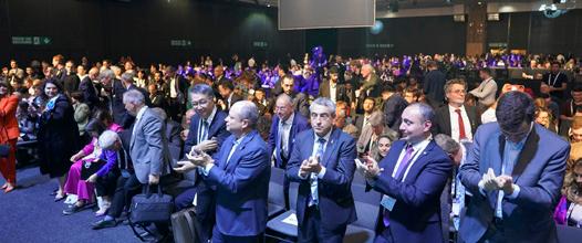


 Australian Space Agency Head Enrico Palermo with MySecurity Media’s General Manager of Industry Engagement, Jessica Bainbridge
AI for space at the IAC
By Luke Heffernan Co-chair (New Horizons Summit), National Space Society. National Point of Contact (Australia), Space Generation Advisory Council
Artificial intelligence (AI) is changing the face of healthcare, transport, communication, and many other sectors, but where is its place in space? At the 2022 International Astronautical Congress (IAC), the AI4Space: Perspectives from the Next Generation plenary opened that conversation up for a talented panel of upand-coming young visionaries from around the world.
With a rigorously selected mix of students and young professionals, moderated by experienced experts in their field, the Next Generation Plenary (NGP) series consistently gives voice to those putting their hand up to shape the future space industry. This year, led by Danielle Woods of the MIT Media Lab’s Space Enabled group, the panel explored advanced concepts around the application of AI for supporting off-earth missions; like remote hosting of AI/machine learning (ML) on robotic systems or simplified design processes using learnt language models.
To open the plenary, each panellist gave personal statements on their experiences and visions for the future. The presenters came from varied technical and cultural backgrounds, but a core message prevailed: AI is very much a current-day technology, not future, and there are far fewer barriers to use than many expect. Even some of the harder problems of robotic control were made approachable by Sorina Lupu, who uses the resources available to her during her PhD studies at Caltech to develop autonomous control and ML algorithms to “make robots think on their
own”. These attitudes are prevailing in the AI community worldwide, with much of the rest of the world needing to capture the benefits to reap – including the space industry.

Tools like GPT-3 and Stable Diffusion are already disrupting approaches to nearly any written or graphical form of communication, from coding to marketing, reducing timelines to draft even the most technical content from days or weeks to seconds. It was made clear how ESA Research Fellow, Audrey Berquand, saw the impact of these types of AI on our day-to-day lifestyles and efficiency. Referencing an oft-quoted statement from Bill Gates on hiring lazy people to find simple solutions to complex problems, Audrey made her own call to smarter action, “let’s be lazy together”. The question implied in this simple statement is clear: why keep spending our time as we always have? Let’s go further, faster.
My own ideas like to explore this present capability to see a more collaborative future. AI technology is already useful to save us time in low-level tasks, but in no time may be able to do this in more high-level explorative ways. Humans are still at the reins for every task these tools are directed to solve, but as AI research evolves, our models come closer and closer to understanding intent, purpose, and mission, and therefore self-definition of tasks to reach those goals. Either during the mission design phase or when errors inevitably occur that shift the mission, recent advancements in fields like reinforcement learning will
20 | Australia in Space Magazine
Image Courtesy of IAC
allow our machine collaborators to adapt more fluidly and robustly to support us in our mission – be it exploration, science, or survival.
As the session progressed, the floor was opened for questions to allow attendees to prompt discussion from the panel. With over 3000 attendees, the complexity and field of questions varied, but clear themes arose. Early questions implored the panellists to explore where AI ran the risk of being overused, but also where it could contribute the most value to the industry – both questions taken in the spirit that they are not unique to space.
To the resounding agreement of her co-panellists, Kelsey Doerksen very poignantly stated a simple fact: AI has the potential for huge benefit in our lives and work, but to always keep in mind that advanced technology is not a replacement for a proper understanding of stakeholder needs. Referencing her work in developing deep learning models to predict landslides in Nepal, Kelsey highlighted that the key to projects like this lay in how the models were translated into actionable advice for decision makers, not in the technology itself. As is often the case, the failings of “overuse” come not from the methods, but the ability to empower decision makers.
The IAC each year celebrates the values of the 3Gs of diversity – Geography, Gender, and Generation – with a special emphasis in 2022 the theme of “Space for All”. With this 73rd year of the congress, finally returning to its home city, the Next Generation Plenary served this theme through both the panel participants and the value of AI to the audience present.
Each panellist brought their own unique perspectives to the conversation, as well as diverse representation from the modern-day space industry. Going beyond the 3G values clearly displayed, the panellists also came from a variety of technical and business backgrounds, as well as every point along the spectrum of development from emerging to established space industries. As commented by Sorina, the NGP provided a one-of-a-kind opportunity to inspire and empower the next generation to grow into the space industry, especially women and other underrepresented groups.
Antonio Stark described it aptly through his justification
for bringing AI to the space industry: with the low barrier to entry and massive gains through its use, it can be seen to raise emerging space industries and actors, bringing those traditionally underrepresented or disadvantaged into the fold. While there are risks involved in trusting AI unreservedly, with the right verification processes in place, technologies like these and the broad knowledge it may be trained on can save years and experimental failures that other space pioneers have needed to get to where they are.


As is the case in any other domain, AI has the potential to revolutionise the space industry. Each of the panellists –Audrey, Antonio, Kelsey, Sorina, and myself – emphasised the potential for this technology in each of our fields and in our own ways, and even then, barely scratched the surface. To each and every person in the space industry (and beyond), if you have even one hour to spare each day, learn about where AI fits into your life and multiply it.
I would like to acknowledge and thank Business France for enabling and supporting my attendance at the IAC Paris 2022.


Australia in Space Magazine | 21
AUSTRALIA IN SPACE
Image Courtesy of IAC: Luke Heffernan on stage at IAC 2022
Image Courtesy of IAC
Image Courtesy of IAC
Image Courtesy of IAC: Luke Heffernan on stage at IAC 2022
France - Australia: Space is the limit
France represents a little more than half of the European space sector, and it has more than 1,704 companies, 33,200 employees, and a turnover of 10.8 billion euros.
 By Samantha Douarin Aeronautics and Space project manager, Export activity - Industry Department, Business France
Whether for Earth observation programs to better understand climate change or significant international space exploration missions, France is at the forefront of innovation and plays a decisive role in building the European and international space sector.
French space policy is based on the Centre National d'Etudes Spatiales (CNES), world-renowned research laboratories and highly specialised and competitive industrial companies. France's strengths cover various fields such as launch systems, observation satellites, meteorological satellites, scientific satellites, telecommunications satellites, nanosatellites, etc.
CNES invests half of its funds in the European Space Agency (ESA) and collaborates with all the planet's space powers in five main areas: launchers with the Ariane rocket, science (exploration of Mars, the Moon, the International Space Station), Earth Observation, Satellites and Defence.
France represents a little more than half of the European space sector, and it has more than 1,704 companies, 33,200 employees, and a turnover of 10.8 billion euros. Very internationally oriented, 43% of the French space market is aimed at foreign customers.
The French spatial ecosystem is spread over the entire territory. Some regions are particularly active, such as
Occitanie (Toulouse), the leading space employer region which hosts key players such as CNES and Onera, industrial partners, and the two main satellite producers, Thales Alenia Space and Airbus Defense & Space, or Île-de-France, which has 8,600 employees and includes most of the headquarters of major groups, and finally Guyana, Kourou hosting the Guyana space centre, a French and European launch base.
The IAC (International Astronautical Congress) 2022, which was held in September in Paris, was an opportunity to announce significant investments in the coming years for research and the French space industry. The ambitions mainly concern launchers, industrial competitiveness, exploration, climate and defence. Particular attention will also be paid to reusable launchers, mini and micro-launchers, constellations, space surveillance and in-orbit services.
The United States is France's leading partner with projects in oceanography (Jason satellites), on Mars (Curiosity, Insight, Mars 2020) and the Moon (signing of the Artemis agreements in 2022). The country also collaborates with India in climate monitoring (Saral/Altika and Meghatropics satellites), with China (CFOSat satellite to observe winds and waves, participation in the future Chang'e 6 lunar mission where the France will provide 25 kg of scientific
22 | Australia in Space Magazine
AUSTRALIA IN SPACE
experiments), with Japan (Mars Moons Explorer mission with a rover which will go to the moons of Mars in 2024).
Australia is also one of the countries with which France collaborates. On September 1, 2018, the Australian Space Agency (ASA) signed its first international cooperation agreement with CNES. This agreement establishes a framework for strategic discussion between the two space agencies promoting the establishment of partnerships to develop the French and Australian space industries on niche technologies with high potential. It will be followed by specific agreements to implement each joint project. The main areas of cooperation between CNES and ASA are satellite technologies (miniaturization, onboard data processing, etc.), Earth observation, particularly with the study of the climate, navigation and associated applications, stratospheric balloons, and regulatory aspects. The two agencies intend to use artificial intelligence to focus on embedded data processing technologies.
Moreover, the Australian National Space Industry Hub has announced that it will work with French aerospace hub Aerospace Valley after the two signed a memorandum of understanding. The deal represents a significant step forward for bilateral space industry relations between France and Australia. Aerospace Valley and the National
Space Industry Hub share similar goals in the development of their national space industries through the provision of incubator services to assist budding space industry entrepreneurs and start-ups.

Business France is the national agency supporting the international development of the French economy, responsible for fostering export growth by French businesses, as well as promoting and facilitating international investment in France. It promotes France’s companies, business image and nationwide attractiveness.
Business France and CNES (which have just signed a letter of intent to support French Space companies in their international development) will conduct a 5-day mission from October 24 to 28 in Australia. This mission will allow the French delegation of 15 companies to meet the local space ecosystem and strengthen commercial ties between the two countries.
The mission's first stage will take place in Adelaide, where the delegation will meet the Australian Space Agency and the South Australia Space ecosystem, followed by the 14th Australian Space Forum, where Business France will have a French booth. The third day will take place in Canberra, where the French companies will discuss potential trade opportunities. Finally, the roadshow will stop in Sydney, where the delegation will have an exciting journey with the NSW Space ecosystem and Government agencies. Come along to meet the French delegation that includes big, world-wide-renowned players, well-established SMEs and innovative startups:
3D PLUS (supplier of advanced high-density radiation tolerant components miniaturized), ARIANESPACE (leading global launch services company), AXON CABLE (Interconnect solution such as wires, cables, connectors, harnesses for harsh environment), CS Group (design, development, integration and operation of secured space software and service), DASSAULT SYSTEMES (solutions for sustainable innovation), INSIGHT (Satellite imagery, mapping services based on AI, trainings), MECANO ID (mechanical and thermal subsystems for the space sector), MEWS Partners (independent management consulting firm), PLUG'IN (design and manufacturing of hermetic feedthroughs using epoxy based technology), Safran (Space: technologies for rocket propulsion systems, satellites, ground stations and high- performance space optics), SHARE MY SPACE (startup specialized in Space Situational Awareness), SODERN (development of cuttingedge technology for the space, defense and neutron analysis markets), SYNTONY (design, manufacture and market high-performance positioning, navigation and testing solutions based on SDR GNSS), and THALES (multinational technology company delivering trusted, mission critical solutions).
Australia in Space Magazine | 23 AUSTRALIA IN SPACE
The French Trade Commission (Business France) is organizing a mission to Australia from October 24 to 28 to strengthen commercial ties between Australia and France in the space sector.
Study confirms Australia's capability to build and operate lunar services rover
Courtesy of AROSE
An AROSE study commissioned by the Australian Space Agency has confirmed for the first time that there is sufficient design and advanced manufacturing capability within Australia to build, test and operate a Lunar Services Rover in support of NASA’s return mission to the Moon.
Australia is a world-leader in technology and services for remote operations on Earth, and the study demonstrates there is a tangible pathway for that expertise to be applied in Space.

To undertake the study AROSE received funding through the Australian Space Agency’s Demonstrator Program, which provides opportunities for businesses and researchers to scope out the feasibility of projects which have the potential to operate or support operations in Space.
The grant led to AROSE securing additional funding and in-kind support from its members. AROSE also received sponsorships from IMDEX, South 32, OZ Minerals and the Western Australian Department of Jobs, Tourism, Science and Industry.
The project team for the study were First Mode, Fugro and Nova Systems, Woodside, MDA, Curtin University, The University of Western Australia, Queensland University of
Technology and University of NSW.
Study Lead, Dr Sarah Cannard, from AROSE member Nova Systems, said the study identified more than 60 companies across Australia with the combined technology, services, facilities and workforce skills available, or under development, to design, manufacture, test and operate a Lunar Services Rover for NASA’s Artemis mission.
“The study confirms Australia has all the capabilities available either today or under development, to plan, build, test and operate the Lunar Services Rover,” Dr Cannard said. “Including the necessary components, sub-systems, testing and workforce skills.”
Rover sub-systems include navigation and control, excavation, regolith characterisation (sensors), on-board testing and computation, electronic power supply and ground communications.
AROSE CEO, Leanne Cunnold said it is an exciting time for Australia’s space industry with many opportunities for local companies to expand their service offering, develop workforce skills and become a valued part of the international Space supply chain.
“The Space sector is creating a new economic engine for growth and jobs in Australia,” Ms Cunnold said. “Companies
24 | Australia in Space Magazine
AUSTRALIA IN SPACE
can expand their industry focus to include Space and, perhaps for the first time, the next generation can look to the Space industry in Australia as a place to build a sustainable career at home.”
The study demonstrates Australia is ready to meet the challenges of the Australian Government’s Trailblazer Program. Under the program, a consortium of suitably qualified and experienced Australian companies will be chosen by the Australian Space Agency to design and develop a semi-autonomous rover for NASA’s Moon mission, planned to launch as early as 2026.
The Trailblazer Stage 1 tender to design and build the Lunar Services Rover was issued by the Australian Space Agency in December 2021 as part of the Federal Government’s $150 million initiative to support Australian businesses and researchers to join NASA’s return to the Moon. Up to $50 million has been made available for the Lunar Services Rover project.
AROSE is a participant in the Trailblazer Stage 1 tender. The AROSE Trailblazer Team is led by First Mode, Fugro and Nova Systems with financial support from the Western Australian Government.
The Federal Government is due to announce two
preferred consortia to advance to the next round of assessment, the Preliminary Design Review, in which the consortia will submit detailed information on how they plan to work with the Australian Space Agency and NASA to build, test and operate the rover on the Moon. Based on the review a single consortium will be chosen to develop their rover and operation on the Moon.
AROSE Program Director Michelle Keegan said undertaking the study enabled all AROSE members and sponsors to come together and collaborate on a multidimensional project for the first time.
“The study bridged the gap between the resources industry, tertiary research organisations and our members with direct Space capability,” Ms Keegan said. “It is exactly the type of successful national collaborative process required for Australia to deliver on the Trailblazer rover project for NASA.”

Australia has entered into an agreement with NASA to build the Lunar Service Rover as Australia is a world-leader in remote operations and automation technology.
The rover will collect lunar soil containing oxides, from which NASA aims to extract oxygen, a key step towards establishing a sustainable human presence on the Moon and supporting future missions to Mars.
Australia in Space Magazine | 25
AUSTRALIA IN SPACE
w w w . o n e g i a n t l e a p a u s t r a l i a . c o m w w w . o n e g i a n t l e a p f o u n d a t i o n . c o m . a u
What we do What we do What we do
F o r A u s t r a l i a t o r e a c h i t s f u l l p o t e n t i a l i n S c i e n c e , T e c h n o l o g y , E n g i n e e r i n g a n d M a t h e m a t i c s ( S T E M ) , w e n e e d t o e n s u r e w e a r e d e v e l o p i n g a f u t u r e w o r k f o r c e e q u i p p e d w i t h t h e d i v e r s e a n d d y n a m i c s e t o f s k i l l s t h a t w i l l m e e t t h e n e e d s o f e m p l o y e r s i n t h e s e d e v e l o p i n g a n d i n n o v a t i v e i n d u s t r i e s
O n e G i a n t L e a p A u s t r a l i a h e l p s s c h o o l s b u i l d a n d m a i n t a i n s t u d e n t i n t e r e s t a n d a s p i r a t i o n i n S T E M .
O n e G i a n t L e a p Au s t r a l i a h a s f o r g e d s t r o n g w o r k i n g r e l a t i o n s h i p s a n d p a r t n e r s h i p s w i t h a r a n g e o f e d u c a t i o n a l i n s t i t u t i o n s a n d p r o v i d e r s ; l o c a l , s t a t e a n d n a t i o n a l g o v e r n m e n t a g e n c i e s ; S T E Mb a s e d c o m p a n i e s ; a e r o n a u t i c a l a n d a s t r o n o m i c a l r e s e a r c h e r s a n d s c i e n t i s t s a n d o t h e r c o m m u n i t y - b a s e d o r g a n i s a t i o n s .
Key Programs Key Programs Key Programs
Seeds i n Space

Australian school students experiment with and cultivate seeds, such as wattle and basil, that have spend time in space on the international space station in this unique scientific study.

Connecti ng Mi nds Project
Students around the globe collaborate together to develop solutions to STEM challenges in space. Students not only develop STEM skills but also key communication and collaborative skills
Gadget Gi rlz
Run by girls, for girls, this programs opens the door to young girls who want to pursue a career in STEM Free one day workshops are held across Australia
Space Teams
Former NASA Astronaut, Dr Gregory Chamitoff has developed an online platform for students to learn about and develop space missions and colonies in space Participants also have access to key industry mentors
C o n t a c t : j a c k i e @ o n e g i a n t l e a p a u s t r a l i a . c o m
AUS / UK Space Bridge Building the space workforce
The Government of Western Australia and Australia in Space presented a morning of discussion and networking on leveraging the UK-Australia Space Bridge to build the Space Workforce in London this month.


The Space Bridge between the UK & Australia is a partnership focused on facilitating collaboration between the two countries’ space sectors. The Space Bridge has unlocked improved access to trade, investment and academic research opportunities, better business advice, and innovative bilateral collaborations.
With both the UK & Australia facing challenges in building a strong Space sector for the future it makes sense that the UK - Australia Space Bridge should be leveraged to assist with this. But how? An array of industry experts presented ways this can be achieved, with an opening address by Chris Hewett, General Manager, Space Strategy, Australian Space Agency and Joseph Dudley, Director, Space Skills Alliance.
Panellists:
Gary Hale - Director, Space & Defence Curtin University
Leanne Cunnold – CEO, AROSE
Martin Soltau – Co-Chair, Space Energy Initiative
Dr Louise Butt – Centre & Business Development Manager, South Coast Centre of Excellence for Satellite applications
Mark Cassidy – Systems Engineer, Fugro SpAARC
Dr Joanna Hart - Skills Factory Director, National Labs, UKRIScience & Technology Facilities Council
Brett Biddington - Founder, Biddington Research
The Space Bridge: The UK and Australia gravitating to trade
by Jo Hawley
Deputy Director Aerospace, Space and Automotive, UK Department for International Trade and Henry Sayers
Senior Space Trade & Investment Adviser, UK Department for International Trade
There is no time like the present to be working with the UK space sector. We are on the cusp of becoming the first country to launch a rocket into orbit from European soil, expected to launch before the end of 2022. Our thriving industry is growing constantly, now with 1,200 companies and 47,000 direct employees and counting. The UK space sector is commercially resilient, with exports in 2019/20 worth £5.3bn and 90 investment deals worth £6bn over the last decade. Innovation is a driving force in the UK, with an estimated £836 million spent on space related R&D in 2019/20, equivalent to 5% of total industry income.

Simply put, business is booming. That is personified at the National Propulsion Test Facility in Westcott, Buckinghamshire. With the UK’s notable space heritage and Westcott’s role in the development of the BLACK ARROW rocket in the 1960s and 1970s, we have a history interwoven with Australia from the launch days at Woomera.
In the UK we have an array of accomplishments under
our belts. In 1957, we built the Lovell Telescope, the then largest steerable dish radio telescope in the world. We launched our first satellite in 1962, and in the same year received the first transatlantic TV signal at Goonhilly Earth Station. We were one of the founders of the European Space Agency in 1975. Surrey Satellite Technology Ltd has pioneered the small satellite from 1985 to the present day with the UK now being the second largest small satellite producer globally.
In recent years we have exceeded our share of the global space industry beyond 5%. We created the Space Industry Act 2018 which regulates activities carried out in the UK, including launch (space and sub-orbital) and return, the procurement of a UK launch, and the operation of a satellite in orbit. Two British astronauts, Helen Sharman and Tim Peake have gone into space.
We announced our National Space Strategy in 2021 with the vision to build one of most innovative and attractive
28 | Australia in Space Magazine
28 | Australia in Space Magazine
COVER FEATURE
space economies in the world. To achieve this, we want to collaborate with international partners. So now really is the time to get involved.

We want to work more with Australia. Seeing past the (friendly) rivalry that occasionally flares after a game of cricket or rugby(!), we are great allies in every sense. With hundreds of years of Commonwealth history binding us historically and culturally, we have continued to share common goals and priorities in the modern day, including in our Five Eyes and AUKUS alliances. Within the space sector, we recognise and admire Australia for its rapid growth, strong academic and R&D foundations, unique geography, and wealth of technical expertise. We welcomed the establishment in 2018 of the Australian Space Agency, building on the national legacy in the space sector dating back decades and asserting Australia’s readiness and capability for international collaboration against global challenges.
We share the same values and ambitions for science and technology in space. So it’s easy to see why Australia was our first choice as a partner for the world’s first “Space Bridge”. To improve our ability to collaborate and to stimulate growth in the size and job creation potential of the sector, we undertook the Space Bridge Framework Arrangement, signed in 2021, to deliver on a number of priority areas of mutual benefit.

Our Space Bridge is underpinned by our Free Trade Agreement (FTA), signed in December 2021. The FTA was a significant milestone for the UK as it was the first new trade deal we negotiated from scratch since leaving the European Union. This carefully tailored FTA provides key benefits across the board by levelling the playing field, eliminating tariffs and improving accessibility to each other’s markets. The FTA is expected to increase trade by 53% in the coming years.
Where has the Space Bridge gotten us since we signed

AUSTRALIA IN SPACE Australia in Space Magazine | 29
Australia in Space Magazine | 29
Space Bridge Roundtable, co-hosted by Martin Rowse from Airbus, Dan Hunter from Austrade and Henry Sayers from Department for International Trade. During Farnborough International Airshow UK in July 2022.
Cont next page >>
Henry Sayers and Jo Hawley from Department for International Trade with Andrew Cawthorne from SSTL (right to left) at Space Comm UK in September 2022. SSTL recently expanded into Lot Fourteen in Adelaide, Australia.
Innovation
the Framework Arrangement in February 2021? The Space Bridge has and will continue to remove barriers to trade and investment, generate academic research opportunities, create better advice to businesses, and create innovative bilateral collaborations.
On the first anniversary of the signing in of the Space Bridge, we reflected on a year of successfully implementing our ambitions against the challenging backdrop of the COVID-19 pandemic. Some of those successes included Australian businesses expanding into the UK and vice versa. We announced a $500,000 fund for collaborative UK-Australian research projects which was awarded across five projects in the areas of Earth Observation, Agriculture, Space Communications, and Quantum Technologies for Space. We have bolstered collaboration through the UK’s recent £1m commitment for Earth Observation in climate data for agriculture, to help farmers deal with climate change. We improved sector awareness by hosting virtual roadshow webinars to put the spotlight on regional strengths and ambitions. We have supported the
sponsorship of PhDs and internships. Companies have competitively undertaken Deloitte's Gravity Challenge to provide solutions to global challenges. Earlier this year we also hosted our first inward delegation of Australian space companies to the Farnborough International Airshow for B2B opportunities and to participate in a Space Bridge Roundtable. We’ve also participated in skills workshops, working to address the skills shortage in the sector for the UK and Australia in the immediate and long term.
In the pipeline we have several more opportunities on the horizon. The UK is planning to take a trade delegation to Australia for the Avalon Airshow in March 2023 to meet with businesses and form commercial partnerships.
Work has been undertaken this year by the UK’s Satellite Applications Catapult to map the industrial ecosystem in a “UK Space Capabilities Catalogue”. The Catapult are now collaborating with colleagues in Australia from SmartSat CRC and Austrade, and across industry and academia, to help mirror this product for the Australian market. This tool can help us to recognise our technological and capability strengths so that we can create a more dynamic and strategic environment for collaboration on our mutual priorities.
- Australia: Building the Space Workforce Morning


Time: 8:30am - 11:00am
Location: One, Birdcage Walk, London
Date: Monday 21st November
Time: 5:30pm - 8:30pm
Location: QUT, Brisbane
*Registrations open soon
ASITII
Sydney Space Sundowner
Time: 5:30pm - 8:30pm
Location: Wolfpack Space Hub Sydney
*Registrations open soon
Check
Date: November 30th
Time: 5:30pm - 8:30pm
Location: KPMG, Adelaide
*Deatils and Registrations out soon
AUSTRALIA IN SPACE 30 | Australia in Space Magazine
is a driving force in the UK, with an estimated £836 million spent on space related R&D in 2019/20, equivalent to 5% of total industry income.
So how can you get involved? Please do reach out to us directly on space@trade.gov.uk. We value your opinion and input and would welcome any ideas you have for helping to shape the successful future of our Space Bridge ambitions. We look forward to hearing from you. out the link to stay up to date with our events >>>
www.asitii.space/sessions-2022
UPCOMING SPACE EVENTS
LONDON BRISBANE SYDNEY ADELAIDE
International Space Bridge Series
Tea
UK
Date: Tuesday 18th October
*Registrations open soon
ASITII Brisbane Space & Robotics Sundowner
Space and Cyber Risk Meetup
Date: November Wednesday 9th November
Dr Space Junk presents 5 questions. with
Elizabeth Weeks RESEARCH OPERATIONS MANAGER
SmartSat CRC
Dr Alice Gorman Space Archaeologist at Flinders University
Alice Gorman is a space archaeologist at Flinders University, Adelaide, and a member of the Advisory Council of the Space Industry Association of Australia. Every issue she will showcase up-and-coming talent, thought leaders, and companies in the Australian space sector.


In this issue, her guest is Elizabeth Weeks. Elizabeth is Research Operations Manager at SmartSat CRC, a consortium of universities and other research organisations, partnered with industry that has been funded by the Australian Government to develop know-how and technologies in advanced telecommunications and IoT connectivity, intelligent satellite systems and Earth observation next generation data services.
1. What do you consider to be your greatest achievement so far?
Achieving a balance between work, study and family is extremely important to me and something I continue to strive for. Outside of that, I am very proud to be working in such an exciting and developing industry.
2. What was the most useful subject you studied at school or university for your current career?
My background is actually in the humanities,
and I have an honours degree in philosophy and literature. Whilst these do not seem directly relevant to my current career, critical thinking and problem-solving skills are transferrable to any industry. I recently completed a topic on strategic thinking, and this has also been very useful to understand the concepts, tools and frameworks that can be applied to organisational issues and opportunities.
3. What are you currently reading and how does it relate to your space work? [This could be a book, article, audio book or podcast, website]
I’m always reading, listening to, and watching many things so this question is easy! I’ve been on a music memoir bender lately and am currently reading Life by Keith Richards. This has absolutely no relation to my space work but does help me unwind and escape at the end of the day. Another much more work relevant book that I have on the go is Satellite: innovation in orbit by Doug Millard. This traces the history of the satellite’s technological development and the historical and political context. I really enjoy the In-Orbit podcast by Satellite Applications Catapult UK who we recently collaborated with on a suite of research projects under the UK-Australia Spacebridge Framework Arrangement.
4. If you went on a one-way trip to Mars tomorrow, what is the one item you couldn’t leave without and why?
The thought of such a trip terrifies me but if I were to go to Mars, I would have to take something I could listen to music on as I can’t get through a day without it. Nothing lifts my mood, motivates, or calms me like music does. My Mars playlist would definitely include some David Bowie.
5. What is your vision for the future of Australian space industry?
SmartSat CRC’s vision is to build an Australian sovereign space capabilities through worldclass research and development in space systems, technology and solutions to enhance Australia’s economic prosperity and deliver national benefit. It’s exciting to see our research teams working towards this vision and solving real world problems including water and land management, and safeguarding our national security.
Australia in Space Magazine | 31
ZES Extends LEO Satellite Lifespan by Protecting Commercial-Off-theShelf (COTS) Electronics in Space
Australia Space Magazine interviewed Singaporebased Zero-Error Systems (ZES) about the company’s state of the art power reliability and data integrity solutions that enable high functionality non-radiation hardened electronics to last longer in space and thereby lower total cost of ownership for satellite service providers.

Could you share a little about why your company was established?
Zero-Error Systems (ZES) is a spin-off from Nanyang Technological University (NTU) Singapore. It was founded in 2019 by a group of researchers and semiconductor industry veterans with more than 30 years of industry experience. We observed growing demands for larger constellation and smarter low earth orbit satellites to provide communication, data access, earth observation, surveillance, and reconnaissance. Cost, reliability, and performance remains a constant challenge for satellite subsystem and space electronics manufacturers given constant pressure by their end customers (eg: service providers) to keep the system delivery price down despite the increased sophistication in functionality and processing capability.
Hence, many companies now build their satellite electronics systems with Commercial-Off-the-Shelf (COTS) semiconductor devices to meet the lower cost requirement and to attain higher processing capability to support the sophisticated artificial intelligence algorithms. However, these COTS devices are not meant to thrive in space environment, which radiation can cause latch-up (a type of short circuit) that results in mission failure and bit flip (eg: ‘0’ becomes ‘1’ and vice versa) that corrupts the data. Service providers that launch these satellites will suffer major losses when the system fails in space as a satellite can easily cost hundreds of millions of dollars, depending on the size. To close this gap, ZES addresses the power reliability and data integrity issues of space electronics by protecting COTS semiconductor devices from malfunction with our patented radiation hardened by design technologies.
How do you think your "space journey" has been, given the challenges that you have overcome and new challenges that are coming along? What are the opportunities that you have tapped on and turned out successful?
32 | Australia in Space Magazine
32 | Australia in Space Magazine
Scientists behind ZES Inventions (from left): Dr Wei Shu (Co-Founder & CTO), Professor Joseph Chang (Founder & Senior Technical Advisor), Dr KS Chong (Co-Founder & Director of Engineering)
Power reliability and data integrity are often an afterthought for many new space players as they focus primarily on making the functions work first and put reliability at the backseat. New space players are nontraditional satellite subsystem or space electronics manufacturers that want to apply niche computing, imaging, or AI capabilities in space applications. Due to the availability of low-cost satellite building kits and associated Commercial Off the Shelf (COTS) semiconductor hardware via the Internet, small teams start to build their own satellites and develop their applications on them. They then try to sell their solutions to the traditional satellite subsystems and space electronics manufacturers. These players have limited knowledge on the space radiation environment, radiation impact on the electronics, potential system failures and radiation hardened mechanisms for semiconductor devices.
Hence, ZES invested initial effort to impart reliability by design philosophy to these companies through technical workshops so that they understand that power reliability and data integrity must be addressed in their designs from the beginning so that they need not re-work the design later. In the long run, this will save them money, time, and reputation cost as there is no way they can correct the mistakes after the satellites are launched. The same good design can be the foundation of their future products. Besides coaching customers’ engineering teams on radiation hardened by design philosophy, ZES also offers reliability test with advisory services to stress test customer’s systems in various radiation scenario, provide analysis on their designs and advise them on the necessary radiation hardened enhancements with ZES patented technologies.
The early effort to educate the customers pay off as we see more awareness and demands for ZES services and solutions to protect their space electronics systems. The traditional satellite subsystem manufacturers also exploring ZES solutions on their new designs that require higher functionalities at lower cost, which is difficult to achieve with current conventional semiconductor solutions. The space industry is an emerging industry worth US$447B in 2020 [Source: Statista] and is projected to grow to multi-trillion dollars over the next decade. Hence, ZES is in the right position to enable companies to build smart, cost effective yet reliable space electronics systems with radiation hardened by design technologies. To date, ZES has flight legacies in space that proved our solutions work.
How are you able to achieve what you have achieved so far? Any lessons learnt on staying viable and sustainable as a business model?
Coming from the academia background, ZES starts with education to the customers so that they understand the key impacts of radiation on their electronics systems and instil the right mindset to these companies to design with power reliability and data integrity awareness from the beginning. The workshop allows ZES to gain better understanding of the customers’ applications, their challenges and thereby propose the right solutions to them. ZES’ solutions include semiconductor hardware, reliability tests with advisory
services and IP licensing of our patented radiation hardened by design technologies. Customers can pick and choose the combinations that best meet their needs to comprehensively enable their COTS-based satellite systems in space.
ZES also rolls out joint market outreach, joint flight legacy and joint product development partnership programs with strategic partners as part of our go to market strategy to leverage partners’ resources and expertise to support ZES’ global ambitions. ZES also champions green space movement that advocates for space debris reduction. COTS-based satellites and space electronics that fail will eventually become space debris and overtime they may enter the atmosphere and burn away. There are remnants that will remain in space that may cause collisions with other satellites. With ZES solutions, COTS-based satellites can last longer.
What are your company's plan going forward?
The impact and value of our technology starts top down in the value. The real benefit comes from extending life time of satellites, reducing development cost, and speeding up the introduction of new technology and processing capability in space. For satellites network operators and service providers, this can impact their business positively into the billions of dollars. Our plan is influence at the top to create an understanding and demand to the creators of satellites and new space applications, and then enable from the bottom-up, meaning we will create an ecosystem, whereby the designers and integrators can use our technology to enable the business case in the top end of the value chain. In other words, ZES vision is to be a part of every satellite, including its payloads. Our current key addressable markets are in Europe and the US as most of the global tier 1 satellite subsystem manufacturers are based there. Having said that, there is growing trend of new satellite builds and launches in Asia Pacific, which put ZES, a Singapore-based company, on a sweet spot to fulfil the growing Asia Pacific customer demands. The ubiquitous nature of our technologies means we will have huge market potential, but we need the right partners to complement us to achieve our global market ambitions. Hence, growing our global partner pipeline will take priority. We will continue to educate the satellite value chain players from service providers to satellite subsystem manufacturers and component suppliers that power reliability and data integrity should be by design and not an afterthought. Service providers need to set the right requirements during their request for proposal (RFP) call so that players in the supply chain will do the right thing. While we instil the right mindset through various outreach platforms, ZES continue to actively engage with both traditional satellite subsystem manufacturers and new space players to design in ZES technologies in their future systems. ZES will also continue to invest in research and development activities and expand our patent portfolio to remain the technology leader in radiation hardened by design technologies.
AUSTRALIA IN SPACE Australia in Space Magazine | 33
The space industry is an emerging industry worth US$447B in 2020 [Source: Statista] and is projected to grow to multitrillion dollars over the next decade.


34 | Australia in Space Magazine S T A T E O F T H E A R T P O W E R R E L I A B I L T I Y & D A T A I N T E G R I T Y I N E L E C T R O N I C S C O N T A C T U S W e P r o t e c t C o m m e r c i a l - O f f - T h e - S h e l f ( C O T S ) S e m i c o n d u c t o r D e v i c e s i n S p a c e T a l k T o U s : + 6 5 6 4 2 8 6 0 7 0 i n f o @ z e r o - e r r o r s y s t e m s c o m V i s i t O u r W e b s i t e h t t p s : / / z e r o - e r r o r s y s t e m s . c o m / RADIATION HARDENING BY DESIGN RELIABILITY TEST SERVICES SEMICONDUCTOR SOLUTIONS E x t e n d E l e c t r o n i c s L i f e s p a n L o w e r T o t a l C o s t o f O w n e r s h i p E n a b l e H i g h F u n c t i o n a l i t y F a s t T i m e T o M a r k e t & T o S p a c e Y O U R B E N E F I T S :
Dr Amy Parker is an up- and down-stream Earth Observation (EO) specialist with ten years of experience spanning satellite operations and mission planning, EO data management and EO applications research and development. She is currently located in the CSIRO Centre for Earth Observation where she manages operations for Australia's first-ever sovereign EO satellite capability, NovaSAR-1, and leads a competitively funded cross-business unit Synthetic Aperture Radar (SAR) Science program. Through the Centre for Earth Observation, Amy is also working as part of the Aquawatch Australia mission team.

Amy holds an Australian Research Council Discovery Early Career Research fellowship at Curtin University. Her technical expertise lies in the use of SAR EO to measure displacements of Earth's surface. She holds a PhD in volcanology and geophysics from the University of Bristol, UK, and an undergraduate first class honours degree in Geophysics from the University of Liverpool, UK.
The NovaSAR-1 Earth observation satellite is officially an all-Aussie operation. The Centre for Appropriate Technology (CfAT) ground station is downlinking all the data from NovaSAR-1.

WATCH NOW
SCAN HERE For more of the latest news and interviews in space sector! or head to www.australiainspace.com.au/tv
Interview with Dr Amy Parker Director CSIRO Centre for Earth Observation
Catching a ride on a caravan to space
Gilmour Space Technologies’ Satellite Program Manager, Shaun Kenyon, talks about a new 100kg-class microsatellite technology demonstration mission that could boost growth and innovation in Australia’s NewSpace sector.
By Shaun Kenyon, Satellite Program Manager, Gilmour Space Technologies
There has never been a more exciting time for space activities in Australia. There isn’t a month that goes by without a headline-grabbing announcement of heavy investment, a major development milestone being met, or yet another international space player moving in. There is phenomenal potential for Aussie Space…
But we could go faster.
Collectively, we as an industry are scrambling to hire the talent we need to power the growth of our sector. Creative start-ups, with passionate founders and brilliant engineers are competing fiercely for morsels of flight opportunity — the lack of which is depriving our newest innovators of the chance to get their first missions off the ground.
Technical teams (on the satellite front) are getting side-tracked from their real innovation by having to work on peripheral ‘overhead’ technologies such as “interface adaptors”, custom esoteric space-only protocols, or respinning a board to fit a different form factor.
And many promising new technologies continue to languish in the TRL (Technology Readiness Level) valley of death.
Australia needs more flight opportunities
Yes, flight opportunities for technology demonstrations are starting to emerge — shout-out to the great teams building SpIRIT and Kanyini! As 6U CubeSats, however, the power and volume available to the national space community is incredibly limited, and hotly contested.
I say this as someone who has worked on scores of CubeSat missions now in orbit, and who’s still a big fan of the CubeSat movement – it’s so much easier to innovate when you’re not fighting for every cubic millimetre of volume and every milliwatt of power.
Readily available, predictable access to orbital flight opportunities for new Australian space tech is what is needed. Without it, we can watch other space nations overtake us, and any chance of leapfrogging the incumbent space players will evaporate.
At Gilmour Space, we are committed to moving fast. We are also committed to building a rich, diverse, and domestic supply chain for space technologies. We WILL go faster… if we go together.
With that in mind, Gilmour Space is providing one of our 100-kilogram class satellites (a “G-Sat”) as a dedicated Technology Demonstrator mission for Australia’s new space

AUSTRALIA IN SPACE
36 | Australia in Space Magazine
technologies. For those of you who think in CubeSat units –we’re providing over 125U (yes, one hundred and twenty-five units) of payload volume. That’s a lot of new technologies.
We want satellite hardware developers to get to space quickly, cost effectively, and with as little overhead NonRecurring Engineering (NRE) as possible.
Opening that bottleneck will allow Australia’s new space SMEs to prove their kit in orbit faster and easier. Domestic, sovereign primes can start selecting local hardware suppliers with real flight heritage; and more and more new engineers get a taste of having their work in orbit.
This approach works. This approach is not new.
ESA’s Proba program has yielded countless new capabilities for European space technology developers and paved the way for the Copernicus program and their Sentinel series of satellites.
JAXA’s Innovative Satellite Technology Demonstration Program has also accelerated the capability of the Japanese space industry. One mission alone (RAPIS-1) yielded two new spin-out companies, seven new technologies pushed to TRL9, and enabled 41 subsequent sales of space subsystems.
The UK’s TechDemoSat was the forerunner and derisking satellite for later innovative missions like NovaSAR, which the Australian EO community makes use of –showing that international sales can be generated from microsatellite technology demonstration missions.
I haven’t even mentioned the impact of NASA’s multiple technology demonstration programs.
The point is this: 100kg-class microsatellite technology demonstration missions like this are like a shot of adrenaline for a national space industry looking to grow and innovate faster.
It gives multiple organisations the opportunity to get their first kit in space, unrestricted by a CubeSat volume. More power is available, and the mission-level efforts and costs can be shared over many more payloads.
We go faster, together
This cost-competitive hosted payload mission will launch on Gilmour Space’s Caravan-1 Eris rideshare mission (indicatively 500km, 33 degrees inclination) in the fourth quarter of 2024.
Why not get orbit experience by catching a ride on our Caravan to space? No mission-level engineering required.
A G-sat Payload User Guide is already available to those serious about launching with us. It includes information on the Mechanical, Electrical, Thermal, and Software interfaces, along with what we expect in terms of how you’d demonstrate that your equipment is flight worthy. If you are familiar with CubeSat flight qualification tests, then you will find it straightforward.
This is just a first step for us. We believe in an Australian space technology industry that provides leadership in the Asia Pacific region, collaborates for the benefit of all, and contributes to the global efforts to push humanity towards the stars.
Successful cooperation is only possible if we are smart
about inter-operability, as the CubeSat community has admirably demonstrated. We think the same is possible for the Microsatellite community; and we are quietly working on a Microsatellite NewSpace Standard to promote interoperability and minimise the need for payload developer NRE on every new mission.

We can move faster as an industry if our equipment is compatible; and we’d love to work with you on it.
With greater flight opportunities to try out new things, and a common set of known interfaces for satellite hardware, we can propel ourselves forward and make sure that Australia takes its place in space. Kangaroos are the best at playing leapfrog.
About the Author
Shaun is the Satellite Program Manager at Gilmour Space Technologies, Australia's leading manufacturer of launch vehicles and satellite platforms. With over 15 years of space engineering experience across Europe, Shaun has built a number of small satellites for commercial, institutional and government missions. Today, he leads a team of engineers in Gold Coast, QLD, to design and build Australia’s first sovereign 100kg satellite.
AUSTRALIA IN SPACE Australia in Space Magazine | 37
It gives multiple organisations the opportunity to get
their first kit in space, unrestricted by a CubeSat volume.
More power is available, and the mission-level efforts and costs can be shared over many more payloads.
Australia aims for the moon
By Ali Buchberger, Director, Industry Engagement QUT (Queensland University of Technology)
Humankind is going back to the Moon and on to Mars – and QUT and its partners are on track to join the Artemis campaign.
Following a successful Artemis I launch, NASA plans to send the first humans back to orbit the Moon with Artemis II no earlier than 2024. In 2025, Artemis III will land astronauts – including the first woman - on the surface of the moon for the first time in 50 years.
Australia has joined this inspirational global endeavour. In October 2021, the Australian Space Agency announced that it would support the development of an Australianmade “foundation services” rover to operate on the lunar surface from 2026 through its Trailblazer program.
Envisaged as a collaborative effort between government, Australian scientists and companies, the semiautonomous rover will collect lunar soil (regolith), which contains oxygen in the form of oxides. It will then deliver the regolith to a NASA instrument that will extract oxygen from the regolith. If the mission succeeds, it will bring the international community one step closer to establishing a sustained human presence on the moon, and position Australia as a leading provider of space robotics and automation services.
Associate Professor Thierry Peynot, who leads QUT’s rover program, said developing solutions that can operate
let alone survive in the unhospitable lunar environment will be monumentally challenging.
“The moon has no atmosphere; very fine, charged, and reactive dust that sticks to everything; temperature variations of up to 300 degrees, and 200 times the radiation of Earth”, Professor Peynot said.
QUT Director Industry Engagement Ali Buchberger said the mission would require a huge uplift in Australian capability.
“Big missions require big collaborations” she said.
“One of the great things about our space sector is that it is highly collaborative - the Australian Space Agency has presented our industry with an incredible opportunity and I believe we’re up for the challenge”.

Australia’s robust space heritage positions it well to succeed in its first lunar rover mission. Australia is already contributing to NASA’s Mars Perseverance rover mission, which aims to find signs of ancient life on the red planet.
A QUT team led by Dr. David Flannery are currently working with NASA JPL on the Perseverance rover mission. Dr Flannery is a Long-Term Planner for the Perseverance mission and helped develop the Planetary Instrument for X-ray Lithochemistry (PIXL), which has been integral in helping identify and characterise martian rocks. NASA also commissioned QUT to develop software for the
38 | Australia in Space Magazine
Perseverance Rover that will crunch complex geochemical data captured by the rover’s scientific instruments.
In December last year, QUT announced that it had developed a navigation and perception system to support a small, autonomous, 20kg rover.
In a trial of the system at CSIRO’s In-Situ Resource Utilisation Facility, QUT researchers demonstrated the rover’s autonomous navigation and perception system as part of a broader partnership with aerospace giant Boeing.
In June, QUT Centre for Robotics researchers, led by centre director Distinguished Professor Peter Corke, announced they had joined the push to take humanity back to the Moon in designing and demonstrating a logistics robot for space applications.
Professor Corke said the project is breaking new boundaries but is built on years of research into developing robotic solutions to real-world problems.
“The project, with Canadian-based space technology company MDA, to design a logistics robot prototype that may be used inside the Lunar Gateway, can be traced back to our Amazon Robotics Challenge winning robotic grasping technology,” Professor Corke said.
Professor Peynot, who is also the Mining3 Chair at QUT, said Australia had rich terrestrial heritage in robotics and automation for the mining and defence industries.
“Our automation technology helps drive Rheinmetall land vehicles and Caterpillar underground mining trucks” Professor Peynot said.
“We have a real opportunity to pivot our expertise in mining and exploration for fast returns on developing an Australian space industry”.
Technologies developed for the Australian rover mission will likely have Earth applications too, and should lead to new industries, jobs, and long-term economic growth.
The growth of analytics and robotics capabilities in the resources sector alone is estimated to add $74 billion to the economy by 2030 and create 80,000 new jobs.
Companies like Boeing – the largest aerospace company in the world - have more than 100 years of space heritage and are experienced in managing large, complex missions.
“Australia is Boeing’s largest footprint outside of the US, and Boeing Australia have a lot to offer” Ms Buchberger said.
“Australian SMEs such as Titomic, Emesent, Raytracer and Saber Astronautics have been developing mission-relevant technologies and our research sector is world-leading.
“We have emerging capability in lithium-ion battery production from the defence and power racing industries, and the manufacturing capability in the National Battery Testing Centre (located at QUT) can not only help the mission but also catalyse sustainable technologies that drive innovation in our mining sector.
“The important thing is to ensure we are able to commercialise – to ensure the long-term growth and jobs benefits of the mission stay right here in Australia,” she said.
“A rover is a really complex technology, made up of lots of components, and so ensuring all Australian companies can use and benefit from their contributions to the mission will be critically important.”
Perhaps the most exciting part of the mission is its potential to inspire millions of people to new careers in the space industry.
“Through this mission we can engage communities, especially school children, in the rover journey, using tools such as pre-launch 3D digital simulations open to the public”, Ms Buchberger said.
“I hope our most brilliant graduates and future space professionals will aspire not to work for NASA or SpaceX, but the Australian Space Agency, Boeing Australia or one of Australia’s high-growth space startups”.

Many of the technologies developed for the mission can be tested and showcased in QUT’s new lunar testbed, which is on track for completion in early 2023.
QUT received $1.33 million funding from the Australian Research Council to build Australia’s largest space facility for testing equipment, robotics and materials processing techniques in realistic Moon, Mars and asteroid conditions.
The 20m x 10m testbed and associated rover lab are part of QUT’s new $5 million space precinct, which will allow researchers and companies to test technologies capable of operating and surviving in inhospitable environments.
AUSTRALIA IN SPACE Australia in Space Magazine | 39
The growth of analytics and robotics capabilities in the resources sector alone is estimated to add $74 billion to the economy by 2030 and create 80,000 new jobs.
David Flannery and team celebrates Perseverance Mars landing - Image courtesy of QUT
Pioneering oceansensing satellite to benefit Australia’s Blue Economy
Image courtesy of NASA/JPL-Caltech
By Shane Keating, Associate Professor, UNSW Sydney
Australia's $80B “Blue Economy” will receive a boost later this year from a pioneering new US-French ocean-se nsing satellite.
The $1.5B Surface Water and Ocean Topography (SWOT) mission will carry a ground-breaking new radar altimeter that will map sea-surface elevation and ocean currents at 10 times the resolution of present-day instruments. This increase in resolving power – analogous to jumping from the earliest days of television to HDTV – will unveil ocean currents that are critical for coastal and maritime industries.
“Today, satellite altimetry measures sea level variations and ocean currents, but even with multiple satellites in flight, we can only construct maps of the larger features”, says Australian researcher Rosemary Morrow, who is leading the oceanography component of the mission. “SWOT aims to provide global observations of the smaller-scale currents --- it’s a missing link”.
Essential satellite data
Satellite remote sensing data is crucial to ensure Australia’s economic prosperity, maritime safety, climate resilience, and national security.
Marine industries such as offshore oil and gas,
fisheries, tourism, and shipping support 340,000 FTE jobs nationally and are forecast to grow to $100B/yr by 2025. These industries rely on satellite geospatial data to drive accurate and timely ocean forecasts for decision-making and risk assessment.
The workhorse of ocean remote sensing is satellite altimetry, which has provided continuous global measurements of sea-surface height (SSH) for the past 25 years. These data are routinely used by meteorological agencies around the world for ocean forecasting and form part of the “backbone” of essential satellite data for global numerical weather prediction and ocean forecasts.

In Australia, altimetry data are used by the Bureau of Meteorology’s operational forecast model, Bluelink, which supports search-and-rescue and safety-ofnavigation services and delivers geospatial information in support of Defence, marine conservation activities, and fisheries management.
A Grand Challenge for ocean remote sensing
Once it becomes operational, the SWOT mission will provide the first 2D maps of the ocean surface at horizontal scales of 1-10 km. This regime of ocean dynamics --- called the
40 | Australia in Space Magazine
AUSTRALIA IN SPACE
submesoscale --- is found ubiquitously throughout the upper ocean and plays a central role in ocean circulation, climate, and marine ecology.
Submesoscale ocean currents interact strongly with the atmosphere and can couple with weather systems. “SWOT will help us to observe and understand this coupling, important for both ocean and meteorological prediction”, says Dr Morrow, who completed her PhD in Physical Oceanography at Sydney University and is now an oceanographer at the Laboratory of Space Geophysical and Oceanographic Studies (LEGOS) in France. “In Australia, our land of droughts and floods, it is important to understand how these ocean interactions can impact on our regional weather.”

Submesoscale currents also critically impact Australia's Blue Economy, including coastal industries, fisheries, offshore oil and gas, and marine safety. Kilometre-scale ocean turbulence disperse ocean-borne material, such as marine pollutants like plastics, radioactive plumes, and debris from the MH370 disaster, over large distances. Surface convergence and downwelling near submesoscale fronts concentrate harmful algal blooms and oil from the 2009 Montara Wellhead Platform and the 2010 Deepwater Horizon spill.
Merging observations with ocean models ("data

assimilation") --- a key component of ocean forecasting efforts --- presents additional practical challenges: submesoscale dynamics are complex, rapidly evolving, and difficult to predict. As a result, monitoring submesoscale ocean currents is "a Grand Challenge for ocean remote sensing", in the words of NASA oceanographer Dr. LeeLeung Fu, Lead Scientist for the SWOT Mission.
Australia invests in SWOT
Australian researchers are making important contributions to the SWOT mission.

“Australia has always been a strong international contributor to our scientific understanding of ocean sea level, ocean currents and their variations”, says Dr Morrow. “Australian scientists are contributing ground-breaking studies to calibrate the SWOT instrument, to undertake important field work to validate the satellite's observations of surface currents, to develop innovation mapping schemes to combine the data with models, and to ingest the data in our ocean prediction schemes.”
The Australian government is providing essential support for SWOT through enhancements to Australia's observing infrastructure. These include the Integrated
AUSTRALIA IN SPACE Australia in Space Magazine | 41
Dr Rosemary Morrow, Oceanography lead for the SWOT mission, holding a model of the satellite. Credit S. Chastanet, OMP, Toulouse
Cont next page >>
Australia’s flagship research vessel, the Investigator, will undertake two field campaigns to support the SWOT mission in 2023. Credit: CSIRO ScienceImage.
Marine Observing System (IMOS) altimeter subfacility in the Bass Strait --- the only southern hemisphere calibration stream for the SWOT mission -- as well as an IMOS mooring in the Southern Ocean and the Yongala National Reference Station in the Great Barrier Reef.
The broader Australian marine sciences community is also contributing to this trail-blazing mission through the Australian SWOT (AUSWOT) working group, which I established in early 2019. Our working group is actively engaged in leadership roles within the international SWOT Science Team and BOM’s Bluelink ocean forecasting system, ensuring that the outcomes of this research will benefit the broader international oceanographic community.
AUSWOT will leverage Australia’s investment in the SWOT mission by building the "intellectual infrastructure" required to ensure that the economic benefits of the SWOT mission flow through to Australian marine industries. This intellectual infrastructure will include new domestic capacity in wide-swath altimetric observations, data assimilation and forecasting of ocean submesoscales, downstream data products for end-users in fisheries management, marine safety, defence, and oil and gas, and training skilled professionals for the rapidly growing Earth Observation sector, which is projected to generate 15,000 jobs in Australia by 2025.
SWOT is a path-finding mission -- the first of its kind, but by no means the last. Several future satellite missions utilizing wide-swath altimetry are currently being planned for launch in the next decade, including by the US, European, and Chinese space agencies. The intellectual infrastructure developed by the AUSWOT project will have a legacy well beyond the planned lifetime of the SWOT satellite itself.
A once-in-a-generation opportunity for Australian

marine science
The SWOT mission will provide a once-in-a-generation opportunity to advance our understanding of upper ocean dynamics in Australia's marine environment.
The RV Investigator, Australia's national flagship for blue water ocean research, will conduct two dedicated field campaigns to support the SWOT mission in 2023. These campaigns are part of an unprecedented global effort to gather essential in situ measurements under the SWOT ground track to assist with calibration and validation and fine-scale ocean process studies.
The voyages, led by Prof Moninya Roughan (UNSW Sydney) and Dr Benoit Legresy (CSIRO), will study eddy interactions and fine-scale dynamics in the Tasman Sea and Southern Ocean using the Investigator's suite of world-class scientific equipment and instrumentation. Prof Roughan will lead the Tasman Sea campaign, which aims to understand eddy-eddy interactions and frontal processes in the mesoscale eddy field of the East Australian Current. Dr Legresy is lead-CI of the Southern Ocean campaign, which will target a standing meander of the Antarctic Circumpolar Current south of Tasmania.
For the first 90 days of its mission, SWOT will operate in a "fast sampling mode", revisiting specific locations around the globe once per day and offering a glimpse of ocean dynamics at high spatial and temporal resolution. With the world's third largest exclusive economic zone, Australia has a lion's share of potential field sites of high oceanographic and economic significance in the footprint of the fastsampling orbit.
Australian researchers will participate in a global series of field campaigns in regions covered by SWOT's unique fast-sampling phase. Preliminary science data from SWOT will be made available to these groups to carry out studies of fine-scale ocean processes that have never been possible before. The AUSWOT working group has identified several high-priority target sites for synergistic research activities during SWOT's initial fast-sampling phase, including the Great Barrier Reef, the Tasman Sea, and the Northwest Shelf.
Preparing for launch
Engineers at NASA’s Jet Propulsion Laboratory in California, USA and Thales Alenia Space facility in Toulouse, France have spent almost a decade designing, building, and assembling this complex mission. The satellite has now passed its final round of tests and is scheduled for launch aboard a SpaceX Falcon 9 rocket from Vandenberg Space Force Base in California on December 5, 2022.
For Dr Morrow and the rest of the SWOT team, it is a thrilling and anxious time. “We are all so excited now to get the satellite launched”, she says. “I admit I'll be a little stressed when it is on the launchpad. I'll be so relieved when our first data comes through!”
About the Author
Shane Keating is an Associate Professor at UNSW Sydney. He leads the Australian SWOT working group and is a member of the international SWOT Science Team. He writes about Earth and Space Science at www.scienceshane.com.
AUSTRALIA IN SPACE 42 | Australia in Space Magazine
Marine industries such as offshore oil and gas, fisheries, tourism, and shipping support 340,000 FTE jobs nationally and are forecast to grow to $100B/yr by 2025.
Economic output ($ million) Direct employment (FTE)
Source: 2020 AIMS Index of Marine Industry, a tri-annual analysis, Data from 2017-18. All figures are economic output


AUSTRALIAN INTERNATIONAL AIRSHOW AEROSPACE AND DEFENCE EXPOSITION 28 FEBRUARY – 5 MARCH 2023 AVALON 2019 HIGHLIGHTS The Australian Government has formed the Defence Space Command and has committed to investing around A$7 billion this decade in the space domain. The Australian Space Agency is working to triple the size of the Australian commercial space sector by 2030. WWW.AIRSHOW.COM.AU 698 companies from 30 countries 171,830 total event attendance 38,952 accredited trade visitor attendances 161 delegations from 28 countries 41 International Air Chiefs present or represented 36 conferences and symposia 371 aircraft on display THE COMMITMENT TO THE SPACE INDUSTRY AT AVALON 2023 Major space industry participation Defence Space Command International space agency delegations Australian Space Agency sponsorship and participation
The Australian defence strategic review and space
By Dr Malcolm Davis Senior Analyst Australian Strategic Policy Institute
The Albanese Government’s Defence Strategic Review (DSR), set to be formally released in March 2023, needs to fully consider how the space domain can be more fully exploited by the Australian Defence Force in the coming decade. The space domain is now an operational domain, and likely, will quickly become a warfighting domain prior to, or at the outset of the next major war in our region. Its no longer simply an enabling adjunct to traditional air, sea and land domains, and the DSR is the perfect opportunity to clarify this nation’s direction in space for defence and national security.
Our dependency on space to undertake joint and integrated military operations within the ADF, and to facilitate our participation within integrated deterrence with allies such as the United States is becoming ever clearer. We cannot undertake modern military operations without assured access to space.

Yet our access to space can no longer be taken for granted, given emerging counterspace threats, and the reality that the space domain is increasingly contested by peer adversaries, whilst ever more congested through a growing amount of space debris. Space is also more competitive as the growth of commercial space democratises access, and ever more complex as new types of space capabilities and missions are transforming
how we access and use space. In the past, Australia has been content to depend on others to provide critical space support for Australia would generate greater risks in coming years. Thankfully, Australia is moving beyond this traditional posture of passive dependency on foreign provided space capabilities, and is now establishing much greater sovereign capability, including for sovereign space launch. As a rising space power, we are well placed to take full advantage of space capabilities that can be locally developed to allow the ADF to punch well above its weight, and to burden share in orbit. In that sense, the DSR needs to consider where the ADF must go in space.
The establishment of Defence Space Command in March 2022 and the release of the Defence Space Strategy and Spacepower ‘eManual’ at the same time was a first important step in taking a more sophisticated approach to using space for military purposes by explaining conceptual thinking behind the ADF’s approach to space operations and capabilities. The signing of the AUKUS agreement in September 2021, although not addressing the space domain specifically, creates the opportunity for a more ambitious approach to space collaboration with the United States and the United Kingdom. Even going back to the 2020 Defence Strategic Update and Force Structure Plan, there is clear acceptance that space is now far more central to how the
44 | Australia in Space Magazine
AUSTRALIA IN SPACE
ADF operates, and greater investment is required for the space domain. The policy steps have been put in place, and DSR needs to build on these.
As a starting point, the DSR’s comments on space, should align with not only the existing Defence Space Strategy, but also ideally, the National Space Policy (formerly ‘Space Strategic Update’) now being written by the Australian Space Agency. As part of this approach, it’s important to fully bring Australia’s commercial space actors, including the huge potential offered by rapidly growing small to medium enterprises in the national space sector, to complement and compete with large overseas primes for major space projects. Large projects such as JP9102 for satellite communications, and DEF-799 Phase 2, for sovereign controlled space-based intelligence, surveillance and reconnaissance capabilities, are ideal for ensuring opportunities are created to enable local commercial space companies to play an increasing role. This may be through development of complementary small satellite capabilities to support large satellites, and to exploit different orbital regimes to build resilience. Put simply, a few large satellites in GEO may be insufficient to meet Australia’s eventual requirements for assured access to space support in a contested space domain.

It’s vital to ensure capability assurance and important
to reinforce self-reliance in a crisis. This starts with sovereign launch. Australian satellites must be able to be launched on Australian launch vehicles from Australian launch sites, in a rapid and responsive manner, without relying on overseas launch providers where queues can stretch for years. In the next war, assured access and space resilience demand a greater ability to rapidly augment and reconstitute space capabilities in the face of adversary counterspace systems. So, the solution begins at home –not overseas.
The DSR should therefore be willing to recommend that Australia’s traditional approach to space capability acquisition, epitomised by dependency on a few large satellites, sourced from overseas primes, and launched by foreign launch providers, be complemented by a ‘newSpace’ approach built locally that taps into sovereign commercial capability that can be more rapidly developed and deployed. This should be hard-baked into Australian space policy and whilst this is not an argument for space autarky, its vital to reduce dependency on foreign space capabilities – including for launch – as much as is practicable.
Reinforcing local commercial capability as a key provider for defence space requirements opens all sorts of new possibilities for the future. Firstly, in considering how Defence’s use of space capability should proceed,
Australia in Space Magazine | 45
Cont next page >> AUSTRALIA IN SPACE
speed is of the essence. Future space projects cannot be multi-decadal in terms of acquisition timelines. The DSR should recommend a three-to-five-year requirement for new, locally developed space capabilities – from conceptual beginning to sitting on the launch pad at Whaler’s Way, or Nhulunbuy, or Bowen. The recent announcement of a contract for Virgin Orbit to fly missions out of Wellcamp Airport in Toowoomba, QLD, adds to Australia’s ability to rapidly deploy space capabilities on demand. Investment in commercial space, including with a focus on small satellite technologies, combined with locally developed launch capabilities, such as that now being developed by Gilmour Space Technologies, opens the possibility of exploiting rapid innovation cycles rather than continued decade long waits for space capabilities based around large satellites in GEO. This is not to dismiss the importance of major projects such ass JP-9102, which will be the essential backbone of ADF satellite communications. It is, however, to challenge the notion that a ‘few large birds in GEO’ is all Australia needs in space.
Experimentation complements and drives rapid innovation and should be aligned to the establishment of an Australian equivalent to the US DARPA, which must sit outside Defence Science and Technology Organisation (DSTO) if it is to be effective. Such an Australian DARPA could promote commercial development of new types of space capabilities beyond that considered for the major projects such as JP-9102 and DEF-799 Phase 2, as well as JP-9360. These projects should be seen a starting point, but not an end-state for ADF space capabilities. The DSR could identify new types of space roles for Defence Space Command and the AUSSpOC such as sovereign missile early warning and tracking to complement US provided SBIRS and Next Generation Overhead Persistent Infra-Red (OPIR). Already, companies such as Leidos are developing sensors which could be deployed on JP-9102 satellites, but also open the potential for a dedicated ADF missile early warning constellation based around small satellites that are locally made.
Space is and will be increasingly contested, and whilst official government policy refers to space as an ‘operational domain’, the risks are increasing that it will become a warfighting domain in the next war. Determined efforts at the diplomatic, legal and regulatory levels are being made to establish new norms of responsible behaviour in space, to better manage the risks posed by counterspace threats. In considering future force structure and force posture in
the DSR, the space domain must be seen as one of fragile stability. The success of these efforts hinges not only on establishing new rules and declaring unilateral bans on testing of anti-satellite weapons, but also on credible enforcement mechanisms with real teeth, and ensuring a political will to use such measures if an adversary employs counterspace capabilities or behaves in an irresponsible manner. Attribution of such activities is a vital first step, with JP-9360 to build on existing ground-based space domain awareness capabilities such as the hosted US C-Band Radar and electro-optical surveillance telescope at Exmouth, Western Australia. Commercial companies such as HEO Robotics, and Electro-Optical Systems Australia are already playing a key role in space situational awareness, and the DSR could consider how these, and other companies could further contribute to enhancing space domain awareness as a key means for attribution and to deny an actor – be it state or commercial – anonymity that they might seek to undertake grey zone actions in orbit.
The DSR will be a missed opportunity if it ignores, or pays lip service to the space domain, perhaps in the form of a few short sentences in the final report. Space is rapidly emerging as the most crucial operational domain for multi-domain operations and a vital area of collaboration between Australia and its allies. The DSR has an opportunity to build on AUKUS and the 2020 Defence Strategic Update and Force Structure Plan, to further develop Australian defence space policy, by more directly and deeply integrating Australia’s rapidly growing commercial space sector with the ADF’s more sophisticated approach towards space. It also is the golden opportunity to strengthen Australia’s space force posture and force structure with the view towards deeper burden sharing in orbit. Bringing space in AUKUS, enhancing it in the Quad and strengthening bilateral space collaboration should be obvious steps. The DSR mustn’t forget the space domain – it’s a part of Australia’s strategic geography and indeed our future astrostrategic perspective. Its time to move determinedly to think big in space.
AUSTRALIA IN SPACE 46 | Australia in Space Magazine
The DSR will be a missed opportunity if it ignores, or pays lip service to the space domain, perhaps in the form of a few short sentences in the final report. Space is rapidly emerging as the most crucial operational domain for multi-domain operations and a vital area of collaboration between Australia and its allies.
Australians have been looking at the night sky for over 50,000 years.

T h e F o u n d a t i o n i s c o m m i t t e d t o p r o m o t i n g a n d s u p p o r t i n g t h e h i g h e s t q u a l i t y s p a c e a c t i v i t i e s i n A u s t r a l i a , d r i v i n g p r o g r e s s i n e d u c a t i o n , r e s e a r c h a n d i n n o v a t i o n t o e n s u r e t h a t t h e s p a c e s e c t o r i s a k e y c o n t r i b u t o r t o A u s t r a l i a ’ s e c o n o m i c t r a n s f o r m a t i o n .
Quod Invenias Explorans Spatium Progressus Est Humanitatis
F o r m o r e i n f o r m a t i o n o n t h e A n d y T h o m a s S p a c e
F o u n d a t i o n , s c a n t h e Q R c o d e b e l o w :
F o r m o r e i n f o r m a t i o n p l e a s e c o n t a c t u s b y e m a i l c o n t a c t u s @ a n d y t h o m a s f o u n d a t i o n

Australia in Space Magazine | 47
Human progress is in space exploration
We look forward to inspiring future generations
Ukrainian space power in the current Russian invasion
By Dr Chris Flaherty
Little known and high above the battlefield in Ukraine a Space power conflict has been waged between Russia, Private Companies, and many countries including the United States - all in support of Ukraine. Space power has been fundamental in the Russo-Ukrainian war, and this short article will look at some of its known aspects.
The Space power aspects of the current Russian invasion of Ukraine have manifest in various ways since the beginning of the war, which began 24 February, 2022. However, it was preceded by months of build-up as massive military vehicle parks were created at various places along the Russian, and Belarusian boarders – all viewed from Space.
Some regard the Russian Anti-Satellite Missile test, that endangered every user of Outer Space in 2021, as now having been a prelude to their establishing Space Power Dominance in what would become a full-scale invasion of Ukraine. It is known in Russian military literature as, “the Practice of Maskirovka, which involves concealment of forces and intentions, as well as the use of decoys and deception to misdirect the adversary.” (Boston, 2017) Ukrainian use of Maskirovka Practices have likely been superior to those attempted by Russia, and this relates to the better use of Space power.
At the start of 2022, world news was dominated by satellite pictures showing massive Russian base camps on the border of Ukraine, and vehicle parks full of thousands of tanks and trucks. In the beginning, this display of military might on Russia’s behalf, may have served the purpose of
mass global intimidation.
Subsequently throughout the year, satellite photography from a plethora of Earth Survey Satellites, that have come online in the last few years which provide Remote Sensing Images, acquired from commercial firms, normally used to provide real-time data to assist environmental and commercial management, even Humanitarian relief efforts, have been put to use allowing news services, public and other agencies ability for roundthe-clock military activity monitoring, and other impacts of the conflict.
Survey Satellites have charted Russia’s war progress, that has enabled extensive mapping and analysis to take place in public – outside the regular official defence organisations that usually inform the public.
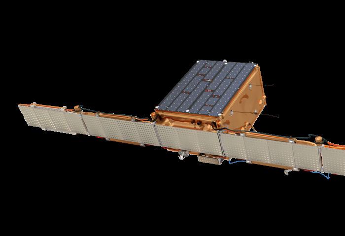
At the same time as Russia’s military progress was in full view for all the world to see – the question was being asked ‘where are the Ukrainian forces?’ Significantly, it appears there has been a near catastrophic failure of Russian Space Power. It has been unable to detect the build-up of Ukrainian forces, their positions and composition. There has also been an inability to block Starlink access, and to assert Satellite Shutter-Control over numerous Third-Party Providers and conceal the whereabouts of their own forces.
A key concept, demonstrated by Ukraine in achieving its own version of Space Power, has been augmentation via Third-Party Providers in the Space Domain. Ukraine has likely achieved greater Space Domain Dominance over

48 | Australia in Space Magazine
AUSTRALIA IN SPACE
(1) Gaining support from Third-Party Earth Survey
Providers who have enacted self-imposed Shutter-Control in regards to Ukrainian forces whereabouts, while putting into the public domain satellite pictures of Russian forces’ movement, location, composition and losses sites.
(2) Harnessing secure Third-Party Communications Providers such as Starlink. The use of Starlink also saw a Russo-SpaceX Space Cyber Battle play-out earlier in the year; in which SpaceX was victorious! Early in the Russian Invasion, thousands of Starlink terminals were sent to Ukraine. The Starlink Satellite Broadband Service was important in keeping Ukraine connected to the Internet. It is widely understood Starlink was able to quell Russian Electromagnetic Warfare efforts to jam its capabilities in Ukraine, being able to quickly respond, and immediately shut down Russian jamming efforts, with “a line of code and fixed it.” (Losey, 2022)
The Ukrainian strategic Space Power problem at the beginning of the Russian Invasion, despite having a highly sophisticated Space Industry, was having limited capability and haveing a major dependency relationship with United States, United Kingdom and European Union Private Companies, and dependent on U.S.–NATO military support.
Over the course of the war, the end goal currently is achieving the, “three pillars of Ukrainian Space Program” (Usov, 2022), by securing: (1) Remote sensing services; (2) Communications services; and (3) Autonomous capacity to bring this infrastructure into orbit.
Ukrainian Space Power currently lacks a viable, secure sovereign launch capability. The technology option is likely to be solved with an air-launch capacity using a medium-range aircraft. Able to do emergency launches putting in orbit a constellation of micro satellites to achieve rapid battlefield situational awareness and communications superiority.
More recently Ukrainian Space Power was expanded, gaining exclusive access purchase of ICEYE SAR: Synthetic Aperture Radar satellites network capable of imaging locations at night, through clouds, fog and smoke, giving situational dominance over the battlefields of Ukraine, as it has been reported recently:
The Russian Invasion of Ukraine has brought into focus how the two Global Positioning Systems could be susceptible to attack. The United States operates the Global Positioning System. The Russian Federation maintains its own GLONASS: Globalnaya Navigazionnaya Sputnikovaya Sistema.
The Russian global system is fully operational and consists of 24+ satellites. The Russian military has routinely jammed GPS in Eastern Ukraine since the Crimean conflict in 2014. In the current invasion, Russian GPS jamming has continued in various degrees. It was reported that this
significant piece of Space Infrastructure for Ukraine was under attack (Howell, 2022).
It was known that localised Russian jamming of GPS signals was occurring in Ukraine, as Russian force’s jammers were targeting GPS satellite signals – intending to prevent Ukrainian forces from receiving any usable signal used for navigation, mapping and other purposes.
It appears however, that local Russian GPS jamming in Ukraine was ultimately having little effect on military operations outside the country and was also “unclear if the jamming has had an effect on Ukrainian operations incountry.” (Hitchens, 2022) However, Russian GPS jamming practices did result in:
“flight disruption cases … recorded where pilots of commercial aircraft had to deal with alerts on the flight deck while flying around the Black Sea, the Russian enclave of Kaliningrad, and Finland.” (Petrauskaite, 2022)
At the start of the invasion, Roscosmos Head Dmitry Rogozin stated, “Russia will treat any hacking of its satellites as a justification for war”; further stating, that: “Off-lining the satellites of any country is actually a casus belli, a cause for war” (Reuters, 2022). For instance in March this year, a hacking group affiliated with Anonymous claimed that it had shut down Russia’s Space Agency Control Center, which saw Russia warn that a cyberattack against its satellites would be a justification for war (Lonergan, 2022).
From its start, the Russian Invasion has had a nuclear dimension. U.S. Early Warning Satellites in Geosynchronous Orbit can identify launch of an Intercontinental Ballistic Missile (Kuo, 2021). The satellites are also sensitive enough to detect the launch of shorter-range Tactical Ballistic Missile used in conventional warfighting. Significantly, weaponized chemical, or low-yield nuclear weapons can be launched, “on the same short-range missiles Russia is currently using to bombard Ukraine, such as its Iskander Ballistic Missile, which has a range of about 500 kilometres.” (Tannenwald, 2022)
It is widely thought that the first indication of an imminent nuclear weapon use would be cyberattacks on U.S. Early Warning Satellites (Kuo, 2021). We may also see possible use of large vehicles, such as mobile Russian Peresvet, convey laser battery activity attempting to dazzle, or blind overhead surveillance satellites as a way to cover preparations to fire a shorter-range Tactical Ballistic Missile carrying a weaponized chemical or nuclear warhead.
 - (Kyiv Post, 2022)
AUSTRALIA IN SPACE Australia in Space Magazine | 49
“The ICEYE satellite, purchased with money raised by Ukrainians, detected more than 60 units of enemy military equipment during its first two days of operation. Russian troops lost armored vehicles worth more than the cost of the entire satellite project.”
Scotland’s holistic approach to space sustainability
 By Daniel Smith Director of Space Scotland and Founder of Astro Agency.
It’s a little known fact that many of the inventions we rely on today were invented in Scotland. The television, phone, pneumatic tyre, steam engine, mammal cloning, MRI scanners and penicillin, not to mention more crucial discoveries, such as toasters, whisky and golf. For a little country, we like to think we’ve made a mark on the world and shown leadership on the global stage, despite not always being brash enough to shout about it.
Scotland’s space sector is a case in point. Despite representing less than 9% of the UK population, a report released earlier this year by the UK Space Agency revealed that the country makes up more than 20% of all UK space industry employment. Britain’s space landscape is further enhanced by Scotland’s small satellite manufacturing expertise, with more cubesats, nanosats or picosats built in Glasgow than any other city in the world outside of the United States, thanks to companies such as Spire, AAC Clyde Space and Alba Orbital. Those payload providers are the ideal target audience for local launch vehicle manufacturers such as Skyrora and Orbex, recently joined by Astraius, HyImpulse and ABL Space Systems (courtesy of Lockheed Martin). On top of that, there are no less than five spaceports under development, with three vertical sites dotted around low populated areas in the Highlands and Islands and two horizontal launch sites at airports that include Glasgow Prestwick Airport, the only place where Elvis ever set foot in the UK and once the backyard of Robert Burns himself. However, the most thriving area of
private space activity is also the segment that completes the end-to-end value chain; earth observation. With more than ten satellite data analytics companies in Edinburgh alone, it’s no wonder the city is branding itself (albeit quietly, as is typical) as Europe’s space data capital.
But it’s not just commercial space where the land of whisky and wool have made an out of this world contribution, either. The MIRI instrument for the James Webb Telescope was built in Scotland at the UK Astronomy Technology Centre at the Royal Observatory of Edinburgh site, but the country’s contribution to large ‘deep space’ research missions goes back much farther, with the University of Dundee’s contributions going back decades. In fact, there’s even a rumour that batteries built in the Scottish highlands have made it to Titan.
With all of this happening in support of a broader UK space proposition, it should come as little surprise that a country of such rich heritage in engineering, invention and science is now seeking to demonstrate leadership on the space sector’s global stage. This, typically, has not been a premeditated decision backed by fanfare and bold rhetoric, but something that has come around through the realisation that the country has quietly - leveraging a combination of entrepreneurship, a strong academic backbone and simple geography - developed a ‘full service’ space ecosystem.
With the voluntary, not-for-profit, industry-led group Space Scotland in place to enable, champion and represent
50 | Australia in Space Magazine AUSTRALIA IN SPACE
the sector’s interests, fully supported by government and its agencies who clearly recognise the sector’s potential to stimulate economic growth, Scotland unveiled its inaugural Space Strategy at Expo Dubai last year. That document, one of many regional development plans encouraged by the UK Space Agency, pinpointed a clear opportunity to become the place for sustainable space, partly due to Scotland’s aims to reach net zero by 2045, and partly due to the industry’s movement towards this as a futureproofing mechanism and distinguishing factor. Scotland’s two leading launch companies, Orbex and Skyrora, are creating ‘green fuels’ for their launch vehicles, while the five spaceports all work on their Environmental Impact Assessments that are required in order to qualify for a launch licence (Space Hub Sutherland and Saxa Vord Spaceport have been particularly vocal on their planned green credentials). Knowing the benefits that Earth Observation data can bring to supporting the battle against climate change, Space Scotland is engaging with other sectors, like FinTech and AgriTech, to increase the uptake of innovative analytics for sustainable practices. It seems the latest DiCaprio movie had it right; when it comes to climate change don’t look up, rather, look down from the ultimate vantage point.
The Strategy’s sustainability pillar was applauded and quickly supported by Space Scotland’s Environmental Task Force, which had already established a track record in working with environmental groups such as Friends
of the Earth Scotland, as well as the European Space Agency, to deliver workshops in collaboration with industry and academia, seeking tangible outcomes that could demonstrate thought leadership internationally. Even then, it was clear that if Scotland was to make its mark on the global stage as a country seriously looking to develop the next phase of its space industry in a sustainable fashion, it could only do so with international partners. Dreaming big is admirable, but Space Scotland was aware of its limits as a group of volunteers, mostly from space SMEs, and such initiatives paved the way for interactions with experts around the world that proved key to a vital next step.
In September this year, Space Scotland followed up its Strategy with a Space Sustainability Roadmap consisting of 11 work packages and a series of short, medium and longterm goals leading up to that key 2045 date. The Roadmap was created by space sector strategy firm AstroAgency and Glasgow-based consultancy, Optimat, but the key to the work was always going to be the input from local and international experts in space sustainability. It includes contributions from non-space industries that had gone down a similar journey too, and received the all-important “buy in” from Scotland’s space companies. This industry “blessing” was particularly important to the authors and Scottish Government agency Scottish Enterprise, who funded the work, due to the inclusion of bold recommendations around future government funding being dependent on a company’s ability to demonstrate sustainable practices. As with the majority of the 80+ countries around the world developing space programmes, public funding is a key catalyst and enabler for industry growth, making the link between sustainability and future funding arguably the most controversial inclusion in the plan.

The Roadmap not only covers the decluttering of low-Earth orbit (LEO) and reducing the negative impact on land, sea and air from upstream activities, but calls for a broader definition of space sustainability than can be seen elsewhere. It stretches the definition to consider the ramifications of traffic and tourists travelling to watch launches from otherwise pristine landscapes, the detrimental effects of a manufacturing supply chain or materials selection process that puts cost savings over carbon footprint, and even the consequences of data centres running 24/7 to crunch all of that downstream information sourced from satellites that were launched to help save the planet.
At the time of writing, the Roadmap has been well received both locally and overseas and initial work packages are already underway, led by representatives from companies across the UK and Scottish universities, and supported by the first official employee of Space Scotland. Out of respect of the sad passing of Her Royal Majesty, a planned reception at the IAC in Paris to augment the launch at Glasgow’s Science Centre was postponed, and the event will now take place at the Bremen Space Tech Expo in Bremen, Germany, along with the launch of the Space Sector Equality Diversion and Inclusion (EDI) Guidance Pack, developed by Space Scotland’s New Voices in Space working group. The ‘deep dive’ Sustainability Roadmap event in Bremen will encourage private and public
AUSTRALIA IN SPACE
Australia in Space Magazine | 51 Cont next page >>
Scotland’s space sector is a case in point. Despite representing less than 9% of the UK population, a report released earlier this year by the UK Space Agency revealed that the country makes up more than 20% of all UK space industry employment.
partners around the world to collaborate on a shared goal of developing a more sustainable approach to space. The Roadmap presents an opportunity to develop existing international partnerships - many of which are missing an initial collaborative project to solidify strong intentionsand to forge new ones, which is both a ‘value add’ of the work and a necessity if the Roadmap is to move from words to actions. And it must, both because it's the right thing to do but also because of the aforementioned benefits around distinguishing Scotland as a place for sustainable space.
International partners are going to be key for knowledge sharing, resource pooling and strengthening a will around establishing new regulatory frameworks and providing them with the necessary “teeth” to remove non-compliance as an option. As the husband of a Ukrainian, I know only too well that countries can go rogue and ignore international treaties, charters and laws, but when it comes to moving towards a more sustainable sector, every country that promotes initiatives such as the Roadmap, the Paris Peace Forum “Net Zero Space” or the Space Sustainability Rating hosted within eSpace - EPFL Space Centre can play a role in
reducing the negative impact and dangers of space debris or pollution from launch. The work by the Secure World Foundation and others that have seen multiple countries declaring commitments against anti-satellite (ASAT) weapons testing in LEO is encouraging, but should just be the start of a more holistic, global movement towards protecting all of Earth’s vulnerable environments, whether on or off planet.

Ultimately, whether you interpret space sustainability as safeguarding our orbital environment, or ensuring that access to space does not come at the price of polluting Earth, or - as in the Scottish approach - a combination of both, there is no doubt that global problems require global solutions. When dealing with such a complex, geopolitical conundrum where literally everyone on the planet is a stakeholder and there are commercial, government and financial considerations at play, a unilateral approach to encouraging a more environmentally conscious space sector is simply nonsensical. However, as the wave of condemnation over the latest ASAT test continues to build momentum and countries work together to put agreement and, perhaps, even international law in place in an attempt to prevent such activity in the future, there is hope that a blueprint is being created. It may be that all it takes for significant improvements to gain traction will be a selection of like-minded space nations coming together to chart a path to a more sustainable future that can contribute to, rather than work against, ‘net zero’ targets.
The road has been mapped, all we need now is a few people to come along for the ride.
Space Scotland’s Environmental Task Force is cochaired by representatives from the University of Edinburgh and strategic space marketing firm AstroAgency. For more information on Space Scotland visit www.scottishspace.org
About the Author
Daniel Smith is the Director of Space Scotland and the Founder of AstroAgency. A legal graduate and entrepreneur who has helped set up four space companies since 2017, he supports AstroAgency’s clients with strategic communications and business development. A member of the Space Safety & Sustainability UK government advisory group, CPG for Aviation & Space at the Scottish Parliament, the ESA BIC UK Steering Group and a long-term participant of the LaunchUK Industry Group, he also acts as an Advisory Board member for UKSEDS, a mentor for New Voices in Space and Co-Chair of Space Scotland’s Environmental Task Force.
Daniel has been nominated for two Sir Arthur Clarke awards for his services to the UK space sector, notably in the areas of sustainability and educational outreach through AstroAgency's SpaceBar initiative, as well as being a Great British Entrepreneur of the Year Award finalist. A passionate advocate for a sustainable approach to launch and in-orbit activity, Daniel has spoken on the environmental impact of space and the role of geospatial data in the drive to net zero with CNN, BBC and on stage at the Dubai Expo, Korea Space Forum, UKSA Ignite Space and UN COP26 events. He writes a column in the Scotsman newspaper on the importance of ensuring the 'new space' sector develops in a sustainable manner.
AUSTRALIA IN SPACE 52 | Australia in Space Magazine
www.fncaustralia.com.au
Mak i ng eve r y step coun t
We are a leading systems and engineering technology consultanc y. Par t of the KBR Group, Frazer -Nash is renowned in the defence, transpor t, energy, resources, government, industr y, and space sectors worldwide.

Are you looking to improve efficienc y, safety and productivity? Our systems approach responds to your challenges. We have the insight and exper tise to suppor t your technical needs, to deliver business, and to add value to your organisation.
Whether you need suppor t in the ver y early stages in adoption; to refining the specification and development of systems that meets your precise requirements, the oppor tunities for collaboration are endless.
Please get in touch by email at defence@fncaustralia.com.au to find out how we can help you bridge the gap between ideas and outcomes, one step at a time.

SYSTEMS ENGINEERING TECHNOLOGY
NASA spacecraft crash attempts to alter an asteroid’s course
By Andrew Curren Correspondent, MySecurity Media
NASA has deliberately crashed a spaceship into an asteroid to alter the asteroid’s orbit. The experiment is an attempt to prove it is possible to shift a future Earth-bound asteroid off course.
At 09:14 (AEST) on Tuesday, September 27, the 590kg refrigerator-sized spaceship called DART (the Double Asteroid Redirection Test) smashed into a small asteroid at approximately 22,530 kilometres per hour.

The asteroid, named Dimorphos is around 160 metres in diameter and orbits a larger asteroid called Didymos. NASA says the duo of asteroids are located within 11 million kilometres of Earth but pose no threat, however, they expect the impact to knock Dimorphos off course by 1% (or 10 minutes) and that’s enough to potentially make a difference if it had been on course for Earth.
“At its core, DART represents an unprecedented success for planetary defence,” said NASA Administrator Bill Nelson after the successful impact, noting that a (substantially larger) asteroid that hit Mexico’s Yucatán Peninsula 66 million years ago wiped out the dinosaurs.
Citing the 2005 Deep Impact precedent, Curtin University’s Dr Hadrien Devillepoix didn’t think the mission that was launched using a SpaceX Falcon 9 rocket in November 2021 from California’s Vandenberg Space Force Base, was particularly difficult for NASA to pull off, “still, (it’s) cool that a 170 metres asteroid can be hit bang on!,” he told Australia in Space Magazine.
Dr Devillepoix says one of the main goals of DART is discovering how much of a nudge the impact is going to give. He says that all asteroids have different properties, but
the trick is to detect potentially dangerous objects as early as possible, ideally decades ahead of any impact with Earth.
“If done well in advance, even a small impact can make a big difference in the asteroid's position in the future,” Dr Devillepoix said.
In July, a bus-sized asteroid called 2022 NF came within 90,000 kilometres of Earth at short notice – a relatively near miss given the vast distances in space. NASA has flagged around 25,000 asteroids classed as “near Earth,” although some can still be millions of kilometres away. The asteroids range from a few metres wide to kilometres wide. The Yucatán asteroid was about 10 kilometres in diameter.
After orbiting the Sun as it drew nearer to Dimorphous, DART’s sole instrument, the Didymos Reconnaissance and Asteroid Camera for Optical navigation (DRACO),
54 | Australia in Space Magazine AUSTRALIA IN SPACE
together with sophisticated guidance, navigation and control systems that worked in tandem with small body manoeuvring autonomous real-time navigation (SMART Nav) algorithms, enabling the spacecraft to successfully zero in on Dimorphos.
Onboard cameras captured close-up images of the asteroid as DART careened towards it. Two weeks prior, an Italian-made CubeSat was deployed from the spacecraft and it photographed the impact and the resulting cloud of ejected matter. Images from the CubeSat and DRACO will help scientists better understand the ability of a kinetic impact on shifting an asteroid.

“DART’s success provides a significant addition to the essential toolbox we must have to protect Earth from a devastating impact by an asteroid,” said Lindley Johnson, NASA’s Planetary Defence Officer. “This demonstrates we are no longer powerless to prevent this type
of natural disaster.”
Dr Devillepoix was impressed by the NASA demonstration but suggested the threat of Earth-bound asteroids was solved yet.
“If a civilisation-ending impact was predicted in a few days or weeks, I don't think there would be much we can do apart from desperately trying to use some desperate uncontrolled options like nukes,” he said. “With a decade's warning, a lot more options are on the table, with much more controlled and predictable outcomes.”
In four years, the European Space Agency’s Hera Project will survey Dimorphos and Didymos, examining the crater left by the DART impact and making a more precise measurement of Dimorphos’ mass.
Image: The final five-and-a-half minutes of images leading up to the DART spacecraft’s intentional collision with asteroid Dimorphos. The DART spacecraft streamed these images from its DRACO camera back to Earth in real time as it approached the asteroid. This replay movie is 10 times faster than reality, except for the last six images, which are shown at the same rate that the spacecraft returned them. Both Didymos and its moonlet Dimorphos are visible at the start of the movie. At the end, Dimorphos fills the field of view. The final image in the movie shows a patch of Dimorphos that is 51 feet 16 meters) across. DART’s impact occurred during transmission of the final image to Earth, resulting in a partial picture at the end of this movie. Didymos is roughly 2,500 feet (780 meters) in diameter; Dimorphos is about 525 feet (160 meters) in length. Image Credits: NASA/Johns Hopkins APL.
Australia in Space Magazine | 55
Introducing Space Machines Company
Optimus Orbital Transfer Vehicle (OTV)
By Helene Baron Strategic Business Development Space Machines Company
Imagine you could travel from point A to point B, say from LA back home in Sydney or Paris, with your car, without worrying about the logistics: having your seat secured for you on the plane, and your car on a cargo hold, ready to go when you land.
Now, imagine the same thing in space, getting your payload delivered precisely where you want, with someone taking care of all the logistics, transports, launch and orbit transfer? It is happening now and it is just the beginning…

Space Machines Company (SMC) is an Australian owned business with a goal and vision to build democratised transport and logistics services for space. In achieving this, SMC is developing a robust in-space logistics network that powers the Space economy, to provide reliable, versatile, and cost-effective in-space transportation services.
SMC’s Optimus Orbital Transfer Vehicle (OTV), one of the largest commercial satellites designed, manufactured and assembled in Australia, has multiple applications: deployment of payloads to desired orbits, inclination changes, orbit raising (LEO to MEO, LEO to GEO and GTO to GEO), servicing (inspection and maintenance, life extension) and exploration missions (cislunar and interplanetary).
Its development and implementation will be a major step forward in increasing Australia’s sovereign space capabilities.
SMC is the only Australian organisation focussed on in-space transportation and logistics, a key foundation service required for Earth Orbits, Lunar transport and beyond. Just as different modes of transportation and logistics have unlocked tremendous economic value on earth, SMC believes that in-space transportation is next.
SMC’s capability provides a foundation service for lunar and Martian exploration and is a fundamental input for Australian Access to Space.
Space will increasingly need infrastructure and logistics services to support and manage the exponential growth in satellites and debris around the globe. SMC's development of a local space logistics capacity is critical to ensuring Australia can meet this growing challenge and manage its satellites in space.
SMC provides support for missions as follows:
- Commercial: constellation deployments in LEO, Transfers to GEO for Telecommunications, Life Extension, Debris Management and more.
- Government: supporting the transportation requirements for strategic assets deployments and sovereign capability missions.
- Research and Science: from a nanosatellite constellation for detecting bushfires on Earth to delivering mapping satellites to the Moon.
- Launch Services Providers: providing OEM transport solutions to help Launchers deliver customer missions whilst providing a cost effective and robust last mile transport capability.
SMC’s ‘Roll Out’ mission in Q2 2023 will be supported by SpaceX as its launch provider. SMC will test the capability of its 270 kg Optimus OTV to deliver in-space logistics services and will reinforce SMC’s capability as a last-mile services provider. The 2023 mission will also see SMC obtain
56 | Australia in Space Magazine
flight qualification and test solutions for multiple Australian payloads and customers.

Space Machines has offices and facilities in Adelaide and in Sydney, where the engineering team started the Assembly, Integration and Testing (AIT) of Optimus at UTS Tech Lab. For instance, a 65sqm ISO 8 Clean room was just commissioned at the Tech Lab, where SMC’s first vehicle is being assembled.
The development of the joint project is part of a broader focus for UTS Tech Lab to enhance the space ecosystem for start-ups, SMEs and large national or international organisations.
The UTS Tech Lab is currently in the process of adding nearly 5,500sqm of additional office and warehouse that will enable multi-company projects to be undertaken in close proximity to one another and also with external partners.
Additionally, SMC’s recently inaugurated its office in Bangalore, India. Ideally located close to the Indian Space Research Organisation (ISRO)’s test facility - ISITE, this new headquarters where a growing team of 10 staff is leading the Research & Development Department of the company, has been instrumental in the development of Space Machines’ first mission and will be key in the development of further collaboration between Australia and India.
For more information, please visit: spacemachines.co

Australia in Space Magazine | 57
Space will increasingly need infrastructure and logistics services to support and manage the exponential growth in satellites and debris around the globe. SMC's development of a local space logistics capacity is critical to ensuring Australia can meet this growing challenge and manage its satellites in space.
Space Machines Company Mission Roll out mission
Space Machines Company Mission Roll out mission
By Andrew Curran Correspondent, MySecurity Media
In just a few years, Sydney-based Eartheye Technologies has built a business providing satellite and data services to a range of customers around the Asia Pacific and Japan region. Now the company is about to roll out a platform that will allow subscribers to task directly a particular satellite or a constellation from multiple constellations to collect a specific set of data at a time, place, and price point that suits the user.
“I know it’s a cliché, but we are building a platform that is for everybody, we are democratising Earth observation,” says Shankar Sivaprakasam, founder of Eartheye Technologies. “It’s for power users and novice users … everybody gets access to their data and more importantly, everyone gets answers to their questions.”
The MVP launch of the platform will occur before the end of 2022. Sivaprakasam likens the new platform to Google Maps that so successfully took the complexity out of getting from A to B. While the user might get a few choices, the user will also be presented with the fastest and most efficient route. “That’s the kind of experience we want to make available,” he said. “What we are doing is a simple three-step process to get you your data and your answer –with no humans in the loop.”
The platform will offer a subscription service via a web app to satellite data across a range of constellations and operators. The simple three-step interface allows users to specify what data they want from what satellite. The service will come with multiple price points but will have options available that make it a viable choice for sole traders and small businesses.
“Whenever you use the platform, you are literally tasking the satellite by yourself – you’re sending your order to the satellite of your choice, and then you get data or request for answers in your context.”
Sivaprakasam says while there are several Earth observation solution companies out there, the process of accessing satellite data and services have traditionally

involved some friction. He says the Eartheye platform is all about removing that friction and delivering user efficiency and delightful experiences. “That’s what we will deliver across the board, whether it is defence intelligence, geosciences, emergency services, financial services or a farmer who wants to see what’s happening. I can get the answers and go away, or I can also see the analysis behind the answers.”
The company is initially rolling out the MVP platform to existing Eartheye Technologies’ customers in Australia as well as customers in India, Southeast Asia, and North Asia. The plan is for these existing customers to jumpstart the platform, before, to quote Sivaprakasam, “we scale like hell.”
To date, Sivaprakasam and a business partner have brought the platform to a viable product stage using their own resources, but now they have got there, they are eyeing available government grants and private capital to help fund growth with proof of product/market fit.
Singapore national, Sivaprakasam sees Sydney and the Asia Pacific region in general as a good place to be for Earth observation companies. By 2030, the Earth observation market is forecasted to be worth around US$8 billion and after the US, the Asia-Pacific is the second largest market. He also thinks he’s on a safe bet with the platform, with Earth observation data playing an increasingly large role in our day-to-day lives.
“We won’t even notice it, but it’s going to be there and helping us in our lives. It’s going to get embedded and ingrained – it’s got huge potential.”
58 | Australia in Space Magazine
“It’s for power users and novice users … everybody gets access to their data and more importantly, everyone gets answers to their questions.”
The Eartheye Space Platform promises to democratise earth observation data The Eartheye Platform promises democratise earth observation data


ngc.com/australia


60 | Australia in Space Magazine www.spaceanddefence.io
A dedicated channel for all things in Space, including Defence and Military Technology and related Aeronautics, Information Systems, Communication Systems and Space Exploration.
New Frontier in space weather forecasting opens
The Bureau of Meteorology’s Australian Space Weather Forecasting Centre has been formally opened by the Minister for Environment and Water in Adelaide.

The centre will deliver 24/7 space weather forecasting and warning services to support Australia’s space industry understand, prepare for and respond to space weather events.

Space weather affects communications, GPS, energy supply, aviation and other critical infrastructure.
The Bureau’s expansion of its space weather capability will improve industry’s and governments’ understanding of space weather events and the impacts on Australia’s security and Australians’ lives.
Dr Kate Brand, Operations Manager at the Bureau’s Australian Space Weather Forecasting Centre, said space weather is principally driven by the Sun.
“The Sun’s turbulent activity is the main source of space weather. Solar events that cause space weather impact include solar flares, coronal mass ejections and particle radiation events. As our reliance on technology grows, so does the risk of disruption to our lives from these events.”
The Australian Space Weather Forecasting Centre is based at Lot Fourteen in Adelaide, alongside 80 other space industry agencies and businesses. The Bureau collaborates closely with its industry and government partners to devise, refine and deliver real-time services to those who need them most.
Australia in Space Magazine | 61
Minister for Environment and Water Tanya Plibersek MP, and Deputy Premier Susan Close MP, formally opened the Bureau of Meteorology's Australian Space Weather Forecasting Centre in Adelaide.
Aussie start-ups growing plants on the moon
The Australian National University (ANU) will lend its unique expertise in plant biology to an ambitious mission led by Australian space start-up Lunaria One that aims to grow plants on the moon by as early as 2025.
Lunaria One’s Australian Lunar Experiment Promoting Horticulture (ALEPH) will be the first in a series of experiments to investigate whether plants can not only tolerate but thrive on the lunar surface.
The project is an early step toward growing plants for food, medicine and oxygen production, which are all crucial to establishing human life on the moon.
The researchers hope the lessons learnt from this mission will help unlock new methods to boost sustainable food production on Earth and bolster food security in the face of climate-driven weather disasters.
The mission is an international collaboration between a number of institutions, including Queensland University of Technology (QUT), RMIT University, ANU and Ben Gurion University in Israel, as well as industry bodies.
The types of plants sent to the moon will be carefully selected based on how quickly they germinate and their tolerance to extreme temperature swings experienced in space.
ANU Associate Professor Caitlin Byrt is a science advisor for Lunaria One and an ARC Future Fellow. She said the mission presented a “unique” opportunity for ANU scientists to apply knowledge of plant germination resilience to determine the types of plants that could tolerate harsh environments such as the moon.

“Space is an exceptional testing ground for how to propagate plants in the most extreme of environments,” Associate Professor Byrt, from the ANU Research School of Biology and the ANU Institute for Space (InSpace), said. “The extreme conditions that Earth is facing due to climate change present challenges for how we manage food security in the future. This project is important for developing propagation systems relevant to challenges here on Earth. This includes the creation of controlled environments that
enable communities to rapidly propagate plants after natural or climate related disasters. If you can create a system for growing plants on the moon, then you can create a system for growing food in some of the most challenging environments on Earth.”
One of the plants to be considered for the mission is an Australian native resurrection grass known as Tripogon loliiformis that can endure harsh conditions and survive in a dormant state for months without any water.
“Even after losing more than 95 per cent of its relative water content, the dead-looking grass remains alive and pre-existing tissues flourish when provided with water,” Dr Brett Williams, a plant biologist from QUT, said.
The seeds and “resurrection” plants will be transported in a specially designed chamber on board SpaceIL’s Beresheet 2 spacecraft. The chamber will contain sensors, a camera and water.
“The seeds and resurrection plants can survive in a dehydrated dormant state and will be carried in a hermetically sealed chamber on the lunar lander and, we hope, germinate and reactivate upon watering,” Dr Williams said.
After landing on the lunar surface the plants’ growth and general health will be monitored for 72 hours and data and images will be beamed back to Earth. Citizen scientists and school children from around the world will be invited to use the data to conduct their own experiments to identify which plant varieties have the best chance of growing on the moon.
Lunaria One Director Lauren Fell, from QUT, said: “The key to this mission is to get humans involved and to give them a say in how we get there. The ALEPH project aims to open up the science and engineering behind growing life on the moon so that anyone can be involved.”
The Lunaria One team includes scientists from Australia, Israel, South Africa and the US.
62 | Australia in Space Magazine


PRESENTS WESTERN AUSTRALIA SPACE INDUSTRY SUNDOWNER FOR A NIGHT OF NETWORKING AND PANEL DISCUSSION SPACE | AI | ROBOTICS | REMOTE OPERATIONS AUTONOMOUS VEHICLES | DATA ANALYTICS | AUTOMATION PLANETARY SCIENCE | EARTH OBSERVATION | DEFENCE | INVESTMENT STEM | EDUCATION | LAUNCH | FUTURE OPPORTUNITIES 5pm - 8pm | Thursday 3rd November The Locker Room | OPTUS STADIUM PROUDLY SPONSORED BY PROUDLY PRODUCED BY


FUTURE WORLD ENDLESS POSSIBILITIES Global Space and Technology Convention Sheraton Towers ∙ Singapore 15 & 16 February 2023 14 February 2023 (Workshops) Contact us: contact@space.org.sg | vivian.koo@space.org.sg The Global Space & Technology Conference, #GSTC2023 is the go-to platform for your space and satellite business to connect with the burgeoning-space industry in Asia. Join us as we explore the future world of SpaceTech and unlock unlimited possibilities! REGISTER NOW! www.space.org.sg/gstc
