
From the publisher of
The electric revolution


Transport has a huge role to play in the international effort to decarbonise – find out how EV infrastructure, kerbside management and smart data will all play their part
| MaaS in the Netherlands


How the race to implement Mobility-asa-Service in Intertraffic’s homeland is sparking productive competition
| Real-time data in Mexico

Making sense of informal public transport in Mexico City is just one way in which real-time data is aiding mobility
| Digital twins in cyberspace

Discover how creating exact, virtual replicas of transport infrastructure is aiding road construction and traffic management

TRAFFIC MANAGEMENT
PARKING SMART MOBILITY 2022 WORLD
INFRASTRUCTURE
ROAD SAFETY
The acceptable number of traffic deaths.


If it matters to you, it matters to us.
Your job is critical in helping make roads safer for the driving public—but you’re not alone in your mission. We’ll continue to collaborate with you on innovative and effective solutions to the challenges you face.


0
29
3M Transportation Safety
http://go.3M.com/intertraffic-road-safety Visit us at Intertraffic Amsterdam
MAR - 1 APR 2022, booth 01.253
“The traffic has now returned to pre-pandemic levels but the goal over time is to decrease the number of cars circulating in Milan. I don’t think we’ll go back to how things were”
Arianna Censi, city councillor for mobility, Milan
Exclusive features
010 The place to be Joyce de Winter, exhibition director at Intertraffic Amsterdam, reveals what’s not to be missed at the 2022 event
012 Space to breathe
Covid-19 has changed the way cities around the world are managing public space and traffic flow. Are these changes here to stay?

020
MaaS adoption
The Mobility as a Service concept has been around for more than 15 years, but uptake has been slow. The Dutch, however, are now determined to make it happen in a big way
030 EV charging for all
064
Networks of desire
As on-demand public transport hits the mainstream in Europe and the USA, developing cities, from Mexico City to Gauteng in South Africa, are grappling to make long-established informal modes efficient and comprehensible
072
Guided into space
Parking is a challenge that is often neglected in city planning, particularly in the developing world. But, by applying the latest tech to parking infrastructure, the process can become safer, more efficient and sustainable
078
“The Rivier platform connects MaaS providers with mobility providers and provides planning, booking, account management, idverification and payment functionalities. But it’s up to the app builder of the MaaS provider which features to use and how to use them”
Emilio Tuinenburg, digital transformation officer for the Netherlands, Siemens
036
Building a blueprint for extending the electric revolution to underserved communities in London and beyond
Cross-border connectivity
Border crossings could create 5G coverage blackspots. New EU research projects are looking to overcome this
046
Who’s on your kerb?
A new era of smart kerb management, with the tools to provide a nudge toward vehicle electrification, is relieving pressure on road space
054 Digital
twins
Building digital twins of roads has the potential to assist asset management operations and enable more sophisticated traffic modelling
084
Data dreamer
US researcher Hesham A Rakha at Virginia Tech has been investigating machine-learning algorithms that may one day lead to V2X data replacing roadside sensors
V2X and beyond
Technology is helping make the world’s roads smarter, safer, and less congested, as well as reducing carbon emissions – we take a look at some of the latest solutions
178
Staying safe
Together for Safer Roads’ president, David Braunstein on how technology and insight from the private sector can improve road safety
Annual Showcase 2022 | Intertraffic World 003 CONTENTS
091 Infrastructure
098 Signposts to a sustainable world
Triplesign’s solar-powered prismatic VMS systems are cable-free, cheap to install, easy to maintain and offer a sustainable alternative to energy-hungry LED counterparts
100
“The demand for kerb space has changed a lot in the last few years. It’s not just demand from commercial vehicles and for resident parking. We also have demand for bike lanes and – since the pandemic –demands for outdoor dining space”
Erin Clark, autonomous vehicle policy analyst, City of Pittsburgh Department of Mobility & Infrastructure
092
Innovative water blasting solutions
Effective line-marking maintenance and removal requires machinery that is built for purpose, according to Hog Technologies
094 Enhancing road markings
3M’s Transportation Safety Division provides smart tips for adhering to road marking specifications and keeping drivers safe
096 Join the movement
Sustainable production methods by Avery Dennison Reflective Solutions create road signs that are more durable and easier to maintain than ever
107 Traffic management
108
“Our approach relies on using only CV data without the need to install new sensors in the field, which makes our approach’s implementation cost lower compared to state-of-the-art approaches”
Hesham A Rakha, principal investigator at the Urban Mobility & Equity Center, Morgan State University, Maryland
The perfect camera
To succeed, ANPR applications need the highest possible detection rates and best possible accuracy. Carrida meets these needs with versatile camera solutions that can suit any project
102
Beyond Europe’s barriers of waste
A trial project in The Netherlands, involving Meiser Straßenausstattung, is demonstrating how the recycling of roadside guardrails can greatly reduce CO2 emissions and reduce costs
Smart pavement marking maintenance
Reflective Measurement Systems looks at how the latest innovations in road marking condition surveys are helping to prioritize maintenance in the face of global material shortages and budgetary constraints

104
Micromobility markings improve safety
As citizens embrace the mircomobility revolution, Geveko Markings looks at how cities must adapt and update infrastructure to help enhance the safety of all road users
118 Evolving the artificial eye
Driven by advances in sensor technology, processing power and machine intelligence, artificial vision is rapidly evolving. Now, Lector Vision is applying the technology to real-time traffic management

111
Multi-camera object tracking
When you combine advances in AI with a multi-camera object tracking system, traffic monitoring becomes more accurate, accessible, and reliable, notes Sprinx Technologies
120 Driving smart mobility
A range of innovative roadside solutions from Jenoptik is helping communities and authorities to reduce emissions, improve road safety and enhance efficiency
114
Optimizing weighing technology
Strain gauge technology from Intercomp is helping to improve the accuracy and stability of both static weighing and WIM applications
116
Tyre safety in motion Systems using cutting-edge sensors to diagnose the condition of heavy vehicle tyres in motion are proving invaluable to agencies, writes International Road Dynamics
004 CONTENTS Intertraffic World | Annual Showcase 2022
The Better Way. Every Day.

Traffic and transportation issues are on our minds every day. We all want smoother and safer traffic flows, quicker travel, and less congestion and emissions. Whenever and wherever this is not the case, we see our quality of life at risk. That is why SWARCO focuses on improving the travel experience.


Whether you walk, drive your electric car, or ride on a bus or a bicycle: The coordination of different transport modes is crucial for a smooth, environmentally sound journey and a timely arrival. SWARCO road marking systems and traffic management solutions make this happen. With clear guidance and orientation, up-to-date, real-time information, and the broadened view on the entire mobility ecosystem.
Let’s talk how we can improve your travel experience.


Explore the world of SWARCO www.swarco.com
convenient travelling for all people
the
on
move.
Watch our webinar series SWARCO INNOVATION TALKS www.swarco.com/innovation-talks
128
From complexity to simplicity
Adaptive Recognition’s innovative and adaptive all-in-one ANPR technology solutions deliver high reliability and accuracy with a quick ROI
130
“Digital twins have the potential to make construction quicker and easier. They will also enable us to operate our infrastructure in a more resilient way”
Elliot Shaw, executive director of strategy and planning, National Highways
122
Mobility in harmony
Oriux presents an innovative solution to managing intersections, which significantly reduces delays caused by LRT and traffic signal conflicts
124
The power of accuracy
An advanced digital weight enforcement system from Kistler provides highly reliable and accurate data to monitor and manage traffic
126
Underloading: just as
dangerous as overloading
Underloading is often overlooked, notes Haenni Instruments, but it is important to recognize the detrimental effect it has on road infrastructure, users, and the environment
139 Road safety
140
“A chicken-and-egg scenario is failing communities. Operators won’t build infrastructure unless they see adoption. But without infrastructure, why would anyone go electric?”
Chris Pateman-Jones, CEO, Connected Kerb
Colour match
The colour of road markings is important. So how can we make sure that drivers see road markings in the correct colour at night-time? Easylux reveals more
132
Digital disruption
Yunex Traffic looks at how digitalising traffic management will make urban transportation safer and greener
The power of traffic detection
The digitisation of infrastructure has opened new doors in smart traffic management, says Vitronic making it greener, safer, and more flexible
134
360° versatile vision
The Parifex Nano-Cam is a 3D-lidar traffic tool with 360° vision. Its all-seeing eye simultaneously collects varied data and detects multiple vehicles in any conditions
136 Number plate futures
Electronic vehicle identification via RFID plates or stickers is strengthening optical means of vehicle recognition and revolutionizing registration systems, writes Tönnjes International Group
142
Sensors for safety in fog
Sernis’s smart detector beacon system uses sensors and LEDs to guide and warn drivers, improving safety for those travelling in dense foggy conditions

143
Detecting jams to improve safety
Portable LED traffic jam detection systems from Ibotech help to improve safety around work zones by preventing dangerous rear-end collisions
144
Safety meets flexibility
An innovative development in median crossing guardrails by Saferoad makes routing safer and more flexible

006 Intertraffic World | Annual Showcase 2022 CONTENTS
Innovative traffic safety and technology
Innovative traffic safety and technology
First-class product quality and best service – from one source
First-class product quality and best service – from one source
We are one of the biggest companies in Germany for safety in traffic construction sites and road markings.
We are one of the biggest companies in Germany for safety in traffic construction sites and road markings.
Thanks to its affiliate company Ibomade GmbH, Ibotech GmbH & Co. KG is able to offer “turnkey” services. From the first request until the end of the traffic safety measures Ibotech is one provider for everything.
Thanks to its affiliate company Ibomade GmbH, Ibotech GmbH & Co. KG is able to offer “turnkey” services. From the first request until the end of the traffic safety measures Ibotech is one provider for everything.
Implementation of mobile road barriers, road markings, installation of traffic signs and more: we are taking care of the whole processing and our customers only need one contact.
Implementation of mobile road barriers, road markings, installation of traffic signs and more: we are taking care of the whole processing and our customers only need one contact.


Visit us at stand 08.565
Visit us at stand 08.565
www.ibotech.eu | www.ibomade-technik.de
www.ibotech.eu | www.ibomade-technik.de
/ibotech
/ibotech
148 Safety net
projekt-w’s sustainable barrier safety system provides powerful protection in multistorey parking garages

150
Closing the circle for parking
Circontrol presents its new smart parking camera with high resolution image recognition technology, for a more convenient parking experience
159 Smart mobility
160 How rugged is rugged?
Computer systems in demanding transport environments with high vibration require robust solutions, writes congatec 162 Become
a mobility expert
The combination of sensor know-how, traffic engineering, and AI from SwissTraffic is helping cities to master any mobility challenge

152 Boosting the parking experience
Big data is enabling a smarter parking experiencing, notes Quercus Technologies, leading to reduced travel time, improved mobility, and improved security inside facilities 154
The complete package
Hectronic will soon expand its digital parking solutions offering to include an all-new e-mobility terminal 156 All under control
A cloud-based management solution from Green Center is enabling car park operators to manage multiple facilities from a single centralised platform
164 Readable roads for self-driving cars
For safe deployment of self-driving vehicles, we need lane markings and road signs that can be read easily by cameras and sensors, notes Swarco
166 Platforms for revolution
Grupo Etra looks at the need for open, robust, and interoperable platforms to manage multimodal mobility across cities in real time 168 Big data analytics for traffic centres
By providing operators with complete, integrated data, advanced software from Telegra makes traffic management more effective 171 Advertisers’ directory
Intertraffic World, ISSN 2042-7204 (Print), ISSN 2397-5989 (Online), is published annually by MA Aviation & Auto International, Hawley Mill, Hawley Road, Dartford, Kent, DA2 7TJ, UK Tel: +44 (0) 1322 221144
Intertraffic World is a partnership with Amsterdam RAI, organizers of the Intertraffic events Amsterdam RAI, PO Box 77777, NL-1070 MS Amsterdam, Netherlands Tel: +31 20 549 12 12 www.intertraffic.com
Subscription records are maintained at MA Business Limited Hawley Mill, Hawley Road, Dartford, Kent, DA2 7TJ, United Kingdom. Air Business Ltd is acting as our mailing agent.
© MA Business Limited 2021. All rights reserved. No part of Intertraffic World may
Welcome
Since March 2020 the world we live in has changed almost beyond recognition due to the coronavirus pandemic and the restrictions it placed on our lives. But, while many of these were negative, there were also some positives to be taken, ones that can point the way to a better future, particularly in the world of transport (p12).
But the great challenge for this century has nothing to do with fighting disease –the urgent need to decarbonise is becoming clearer with each passing day. Prepandemic, the herculean effort required seemed almost out of reach – the need for international cooperation and focus and the many rapid advances in technology that will be vital. But now, the vaccine development and rollout and the willingness of entire populations to act together for the greater good have shown us that the world is capable of collective action on the scale that is required. Yes, the challenges are still immense. But now it seems just possible that populations can rise to meet them.
At the heart of any decorbonisation agenda must be transport – responsible as it is for 24% of all greenhouse gas emissions globally, according to the International Energy Agency. This startling statistic means that every single person reading this magazine has a key role to play in reducing this figure to net zero. Whether that’s through the rollout of EV infrastructure (p30), the management of curbside space (p46), by making on-demand public transport more efficient through the use of real-time data (p64) or by any number of other new initiatives that you will find detailed throughout the pages of this magazine – we all have a responsibility to act boldly. And when you hit upon something that works, share it with the community at the next Intertraffic event – in 2022 they arre in Amsterdam and Mexico City. See you soon.
Tom Stone editorbe reproduced, stored in a retrieval system, or transmitted in any form or by any means electronic, mechanical, photocopying, recording, or otherwise without prior written permission of the publishing director. The views expressed do not necessarily represent those of the editor. The presence of advertisements in Intertraffic World implies no endorsement of the products or services offered. Every effort has been made to ensure the accuracy of statements in this magazine but we cannot accept responsibility for errors or omissions, or for matters arising from clerical or printers’ errors, or an advertiser not completing their contract. We have made every effort to secure permission to use copyright material. Where material has been used inadvertently or we have been unable to trace the copyright owner, acknowledgement will be made in a future issue.
Please read our privacy policy by visiting http://privacypolicy. markallengroup.com. This will explain how we process, use and safeguard your data.
Printed in the UK by Pensord, Pontllanfraith, Blackwood, NP12 2YA
MOVING ON?
If you change jobs or your company moves to a new location, please contact circulation@markallengroup.com to continue receiving your free copy of Intertraffic World
Cover image: dimazel@stock-adobe.com

008 Intertraffic World | Annual Showcase 2022 CONTENTS
: Tom Stone Associate editors: Lauren Dyson, Helen Norman, Jack Roper
editor: Andy Bass
Anna Davie, Louise Green, Julie Welby
manager:
Jon
Chief
Ben
Chairman: Mark
Editor
Art
Designers:
Publication
Julian Bidlake julian.bidlake@markallengroup.com Chief operating officer:
Benson
executive officer:
Allen
Allen Part of www.markallengroup.com
The electric revolution Transport has a huge role to play in the international effort to decarbonise find out how EV infrastructure, curbside management and smart data will all play their part MaaS in the Netherlands Real-time data in Mexico Mexico City is just one way in which Digital twins in cyberspace of transport infrastructure is aiding road INFRASTRUCTURE TRAFFIC MANAGEMENT ROAD SAFETY PARKING SMART MOBILITY 2022 WORLD
147 Parking

The place to be
As the industry looks forward to the first in-person Intertraffic Amsterdam for four years, Joyce de Winter, exhibition director for the event, reflects on how the industry has evolved and picks notto-be-missed highlights to watch out for at the 2022 gathering
The last two years has been hugely challenging for the whole world as businesses navigate the Covid pandemic. But the transport industry has proved more resilient than most, with new traffic management methods and infrastructure catering for the active-travel boom and on-demand public transit seeing a surge in popularity. As Joyce de Winter looks forward to the first in-person Intertraffic Amsterdam for four years, she reflects on how the mobility sector has changed, with Covid-19 forcing society to accelerate smart mobility solutions.
“Covid has disrupted mobility worldwide,” she says. “The various lockdown periods and travel restrictions have forced society to rethink mobility. Travellers are now much more focused on healthy, safe and hygienic transport, and sharing mobility has less focus, with private cars proving popular again. This will accelerate the introduction of automated and autonomous driving.”
Digitialisation is also accelerating, and de Winter notes that data-driven solutions have become key for sustainable and responsible mobility, while on-demand mobility services are becoming an important way for travelers to plan routes.
“These developments will bring nextgeneration themes and new key players to our show floor,” de Winter continues. “Players coming from other markets, such as data, telecoms and IT, are set to take a leading role in where our industry is going. Furthermore, new business models and
• 29 March to 1 April 2022


• 13 halls showcasing the latest mobility trends, products, and services
• 900+ exhibitors, including market leaders, game changes and start-ups
• 100+ nationalities represented
• 120+ experts speaking as part of the extensive summit program, which includes interactive theatre sessions, demos, and presentations
collaborations will evolve. This might even mean that companies from the traditional industry who are not adapting their business models toward a connected and data-driven era, might decline.
“It’s also important to not forget about the startup industry: they bring us the next-generation of innovative solutions.
Collaboration with start-ups will keep us focused on developing new business models to stay in the game.”
Show highlights
Next-generation themes are key highlights to watch for at Intertraffic Amsterdam 2022.
100The approximate number of different nationalities that will be represented at Intertraffic Amsterdam 2022
“They form a key part of our broad summit programme,” says de Winter. “I am also looking forward to engaging in the match-making platform we have developed, called Intertraffic Connect, which could lead to new collaborations in the industry.”
The summit programme covers everything from big data, CAVs and MaaS, to road safety, traffic management and urban parking. For de Winter, the main highlight will be the simple fact that the event will be live again.
“The in-person interaction and breathing and feeling the dynamic atmosphere cannot be replicated by the virtual events we all experience during Covid-19,” she says. “Virtual events make collaboration and spontaneous interactions more difficult, and people can become disengaged. As human beings we communicate with each other in many ways beyond just voice. Body language and facial expressions, for example, are part of our communication and they alone can lead to discussions. When people meet each
other in person, they are more likely to contribute to the conversation and this is important for building strong relationships, and for loyalty and trust.”
De Winter notes that “coincidental encounters” are another important benefit of in-person events. “These kinds of encounters are highly appreciated by both visitors and exhibitors because they could lead to new business and opportunities. This cannot be replaced by a 2D virtual meeting,” she adds.
Health and safety
The Intertraffic team has spent a lot of time and effort making sure that the event can go ahead in the safest way possible. The event will comply will all the latest official Covid-19 protocols and the organizers are asking for all attendees to either have proof of vaccination or show a valid negative test or proof of recovery. The relevant checks will be carried out by a team at the entrance.
It’s important to not forget the startup industry: they bring us the next-generation of innovative solutions. Collaboration with start-ups will keep us focused on developing new business models
Joyce de Winter, exhibition director, Intertraffic Amsterdam
010 Intertraffic World | Annual Showcase 2022 MEET THE TEAM
Intertraffic Amsterdam in numbers
“Because of Covid-19 we will be taking extra precautions to provide a safe and secure event,” says de Winter. “The safety of our audience is a key focus, and we will implement all the necessary measures based on whatever the government guidelines are at the time of the show. This will help ensure the event goes ahead and that everyone from the Intertraffic community can see each other again in person.”
50th anniversary
The 2022 edition of Intertraffic is the 50th anniversary of the Intertraffic brand. The event started as a local fair back in 1972 but has since become a global event, attracting professionals from around the world. One of the keys to success for the Intertraffic brand is its ability to change with the times.
“This year, Intertraffic Amsterdam has a brand new floor layout,” says de Winter, “We redefined our show segments and ordered them logically and efficiently to create a natural flow and also to allow for expansion in certain areas. The number of on-floor summit theatres has gone up to three, with a wide variety of content sessions and demonstrations.
“Our Intertraffic Award content will also be running, but with brand new categories. The winners will be announced during the
Left to right: Lars Kloppenburg, sales consultant; Kim Barend, event operations manager; Carola JansenYoung, senior brand marketing manager; Joyce de Winter, exhibition director; Touria Abahai, brand marketing manager; Marijke Jansen, event operations manager; Rogier Peijster senior sales consultant; Fleur Kaldenberg, content and online community marketeer; Carina Corado de Araújo, brand marketing intern “

Intertraffic Mexico City 2022
Our show in Mexico will be held from November 8-10, 2022,” says Joyce de Winter, exhibition director at Intertraffic. “We ran a show in November 2021 and as our Mexico event is biennial, originally the following edition would be 2023, but we feel that would be too long a gap for all companies that couldn’t attend because of travel restrictions this year.”
According to de Winter, Mexico offers the worldwide traffic technology and mobility industry so many interesting business opportunities on things like road safety, traffic congestion, and smart urban mobility.
opening ceremony of the show. And finally, we are also introducing Intertraffic Connect. This is an online platform for all registered visitors to reach out to one another and preplan get-togethers during the show, browse through all the exhibitor offerings and add summit sessions to their agendas.”
Intertraffic Connect was developed after the team analyzed visitor feedback and found people were often frustrated they didn’t have time to do and see all the things
“We want to offer these opportunities to our international community without a two-year wait,” she adds.
“Our 2022 edition will have a special focus on future intelligent mobility. The 2021 show brought exhibitors a high-quality audience like mayors, project leaders and decision makers from relevant public and private organizations. Across the board we see that the pandemic accelerated the mobility transition which has sparked an even bigger interest in acquiring knowledge and hearing about lessons learned and recent best practices,” de Winter concludes.
that triggered their interest. “Intertraffic Connect is a smart tool for optimal and efficient preparation to map out your visit to the event. We will kick-off the launch of the platform in January 2022 with our preview called, All Eyes on Intertraffic Amsterdam. This is an engaging 30-minute video summary highlighting what visitors can expect in March 2022. Visitor registration opened in December 2021 and all pre-registered attendees will have access to the platform.” n
Annual Showcase 2022 | Intertraffic World 011 MEET THE TEAM
Space to breathe
Covid-19 has changed the way cities around the world are managing public space and traffic flow, with parking lots turning into al fresco dining areas and new cycle lanes popping on urban streets. But are these changes here to stay and how have they impacted congestion?
 Words | Paul Willis
012 Intertraffic World | Annual Showcase 2022 COVID TRAFFIC MANAGEMENT
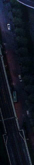
The Covid-19 crisis has led to major changes in the way public space is used in Europe’s urban centers.
As lockdowns began to lift in the summer of 2020, European cities, like their counterparts around the globe, found themselves with quiet streets and urban populations desperate for some respite after weeks, sometimes months, of stay-at-home orders in place. In response to this came a boom in outdoor dining and along with it a proliferation in dedicated cycle paths. In Milan, Italy, for example, the lifting of a tax related to restaurants and bars’ square footage paved the way for around 1,500 businesses to expand their outdoor facilities, resulting in the loss of around 3,000 parking spaces, notes Arianna Censi, Milan’s city councillor for mobility.

Annual Showcase 2022 | Intertraffic World 013 COVID TRAFFIC MANAGEMENT
New York City’s bustling Korea Town district is reclaiming street space for pedestrians and outdoor dining, in the heart of Manhattan
Known as parklets, these al fresco dining spots became common in many other European cities. At the same time large sections of many city centres became cut off to cars.
In Paris, the city’s iconic Rue de Rivoli, which runs adjacent to the Louvre, was turned into a multi-lane bicycle highway as the city’s mayor, Anne Hildago, designated more than 50km of traffic lanes to bikes. In London, meanwhile, the emergence of so-called pop-up bike lanes saw protected cycleways created on Park Lane in the West End and another on Euston Road in central London.
Permanent fixtures?
This repurposing of outdoor space was mirrored throughout the world. In New York City, for example, a total of 8,550 parking spots were given up for outdoor dining at the height of the pandemic. In most places these changes have been welcomed. In Milan, for example, Censi says that while “there have been some protests” it is much less than in the past when similar changes to public space were attempted.
But if these Covid-era changes are to become permanent, what will be the impact on traffic flow and congestion? Isn’t there a danger that restricting car access in one area will lead to congestion elsewhere in the city, especially as traffic volumes return to normal?
According to Censi, the evidence so far suggests not. “Road use is currently a little higher than it was pre-pandemic,” she says. Yet despite this they have seen only a “low impact on traffic flows” from the Covid-era changes to public space.
Careful planning
Censi puts this down in part to the city’s careful management of the changes, which were not restricted to the parklets and included the rollout of 35km of new cycle lanes and a program to pedestrianise several of Milan’s piazzas.
“All our interventions were deeply evaluated using computer modelling to estimate their impacts on places and people,” says Censi. “At the same time, they were also the result of a long engagement process with residents.”
1,500
Milan businesses expanded their outdoor facilities, resulting in the loss of around 3,000 parking spaces
She puts this down to a change in our priorities brought on by the pandemic. “The need for outdoor spaces and the desire to socialize after long closures were widely shared by people and have been satisfied by the rise in outdoor dining,” says Censi.
The popularity of these Covid-era measures means that many cities are considering making them permanent. In London, local councils in the west and central areas of the city have already signalled their desire to make outdoor dining a permanent fixture. There are also plans to establish pedestrian piazzas on either side of the city’s busiest pedestrian junction, Oxford Circus.
In Paris too, Mayor Hildago has publicly stated her intention to retain the car-free measures brought in during the pandemic. This feeling is echoed in Milan by Censi. “We are all waiting for a return to normalcy in everyday life but, in terms of mobility, I would not want to step back from the results achieved this last year and I would like to maintain many of the choices we have made as permanent,” she says.
In some cases, the pedestrianisation of public space was mitigated against alterations to traffic routing.

“In several cases it was necessary to create one-way roads, especially when there were several streets leading to the same square,” she adds.
It was also managed through traffic calming measures. In the QT8 district in the west of Milan, for example, some roadways were narrowed, and the sidewalks widened “with the purpose of naturally decreasing cars’ speed and creating more space for pedestrians,” Censi explains. A number of 30km/h zones were also introduced in several areas of the city.
According to Nikos Tsafos, an expert in sustainable cities and mobility at the Center for Strategic and International Studies (CSIS), a Washington DC-based think-tank, lowering speed limits on the periphery of the newlypedestrianised areas helps make them safer to access. He believes this is also part of a general trend in the traffic management of cities that is seeing the priority shift away from traffic flow.
“Maximizing flow can only come when you prioritise cars over other forms of transport,” says Tsafos. “I think there are many city mayors who would say that their goal is not to have cars move as quickly as possible through the city because that leads to fatalities. Their goal instead is to create friction, to slow traffic down.”
In several cases it was necessary to create one-way roads, especially when there were several streets leading to the same square Arianna Censi, city councillor for mobility, Milan
COVID TRAFFIC MANAGEMENT 014 Intertraffic World | Annual Showcase 2022
In Milan, pandemic lockdowns were the catalyst that led to the remodelling of roadways into urban, outdoor social spaces – leading in turn to new traffic-management challenges

Annual Showcase 2022 | Intertraffic World COVID TRAFFIC MANAGEMENT 015
Tsafos also believes that the lack of impact the changes to public space in Milan have had on traffic congestion may be less to do with good planning and more because of how driver behaviour changes in accordance with accessibility.
He says: “While we haven’t had time to study what has happened with the pandemic, cities have a lot of experience of converting streets to pedestrian-only and the thing that we’ve learned in general is that traffic adjusts. If you make more space for cars, more people use cars. But if you take space away, car use shrinks.”
Tsafos gives the example of the creation of a large pedestrian plaza in New York’s Times Square in 2014, which despite the concerns of the then-mayor Michael Bloomberg, had little adverse effect on congestion in the city.
Transit agencies may have to shift their focus away from servicing the commuter periods and instead concentrate on providing a more reliable service throughout the day
Brianne Eby, senior policy analyst, Eno Center for Transportation, Washington DC

Impact on congestion

Tsafos thinks this trend away from prioritizing road traffic was likely only furthered by the pandemic where many cities were able to experience first-hand the positive impact reducing car access can have on a city’s vitality. “A lot of business owners think that their money comes from cars being able to access them,” says Tsafos. “Whereas what we see a lot of times is that when you shut down the streets you increase pedestrian flow, and businesses benefit. They were able to see this for themselves during the pandemic.”
The magic number for modern urban design – all citizens should have access to essential urban services within a 15-minute walk or cycle
15The changes to public space in New York brought on by the pandemic are also not believed to have had much impact on traffic congestion even as traffic volumes have returned to their pre-pandemic levels, notes a spokesman for the New York City Department of Transportation.

The importance of transit
But in the case of Milan and New York, these are both cities with good public transport systems. In places where this is not the case the Covid-era changes may be harder to retain, Tsafos believes. “It’s very difficult to restrict car traffic in the absence of compelling alternatives,” he says.
He thinks the same holds true for reducing parking space availability. “If you take away parking spots but there are no transportation alternatives all you’ve done
Trying to understand the impact of the Covid-19 crisis on city traffic management doesn’t just mean looking at changes to public space. It also means grappling with the question of how the pandemic has changed work patterns, according to Brianne Eby, a senior policy analyst with the Eno Center for Transportation in Washington DC.
“Prior to the pandemic, city traffic flows were fairly predictable, with peaks during the morning and evening commute periods and traffic more stable throughout the rest of the day,” says Eby. “But right now, many people are working in a kind of hybrid situation where they go to the office a few days a week and work from home the rest of the
time. Therefore, a lot of how you manage traffic in a city going forward might hinge on this question of: what does going back to the office look like?”
Prior to the pandemic, she notes, much of the management and construction of roadways within a city has been about having enough capacity to accommodate the peak traffic periods. But if the hybrid model of working stays, then these peak commute periods could conceivably become a thing of the past.
“Transit agencies may have to shift their focus away from servicing the commuter periods and instead concentrate on providing a more reliable service throughout the day,” Eby adds.
COVID TRAFFIC MANAGEMENT 016 Intertraffic World | Annual Showcase 2022
Above: Empire Diner in Manhattan has used road space to create an alfresco dining area
What will the ‘new normal’ look like?

is your expert partner with end-to-end solutions for:
Road Safety & Traffic Monitoring
Civil Security
Road User Charging
Emission Control & Environmental Protection
Make Life Safer & Brighter. With Jenoptik Light & Safety.
See you at Intertraffic Amsterdam 29.03. - 01.04.2022 Booth 01.416 Jenoptik
•
•
•
•
Our solutions are based on the very latest hardware and software, supported by a range of operational and support services. With global experience based on more than 30,000 delivered systems worldwide, as well as local know-how supported by a strong partner network in more than 80 countries, we help to achieve improved, sustainable global safety in the public space. jenoptik.com linkedin.com/company/jenoptik-light-and-safety
Above: In Brooklyn, New York, whole streets were made inaccessible to cars during lockdowns
Below: And in Queens an exercise class took place in the middle of a road

is reduce mobility services and accessibility to the city,” he adds.
In the absence of mass-transit alternatives promoting cycling is one way to mitigate against the transportation loss you create when you reduce car use. Many European cities took advantage of the unusual circumstances offered by the pandemic to prioritise bike use.
In both Italy and France programmes were established whereby residents who invested in bikes were eligible for government stipends. In Paris, the expansion of the cycle lanes was incorporated into a broader vision of the 15-minute city, a new concept in urban design that starts from the proviso that all residents in a city should have access to essential urban services within a 15-minute walk or cycle.
In Milan too, Censi notes that the changes that have happened in response to the pandemic are part of a bigger shift that is seeing the city move its mobility priorities from four- to twowheeled transport.
She says that bike use in Milan has yet to take off to the same levels as in other European cities such as Copenhagen, Amsterdam, or Paris. She thinks this is “partly for cultural reasons, and partly for safety reasons.”
Even so, says Censi, “the goal is to increase cycle lanes to consolidate and increase the use of bikes.” She adds: “The traffic has now returned to pre-pandemic levels but the goal over time is to decrease the number of cars circulating in Milan. I don’t think we’ll go back to how things were.” n
Milan’s public space revolution
Nowhere was the opportunity to re-imagine public space more fiercely embraced than in Milan. Within a few months of the March 2020 lockdowns the city had released a 36-page report on using the pandemic to transition the city to a car-free future. In the report, titled Open Streets, it was noted that the current crisis offered “an unprecedented opportunity” to do this.
The report included an array of proposals including cycle lane expansion, 30km/h zones, sidewalk expansion, pedestrian-only streets and parklets. The scope and depth of the Open Streets report attested to the fact that many of the changes were already being trialled in the city.

For example, Open Squares, the initiative to pedestrianize many of Milan’s piazzas was first trialled in September 2018. At the end of 2019, a public consultation began inviting neighbourhoods from around the city to submit piazzas for possible inclusion in the scheme. As proof of Milan residents’ enthusiasm for the scheme, a total of 65 proposals were submitted.
“The roads have always been considered as something useful to go from A to B,” says Arianna Censi, Milan’s city councillor for mobility. “With these new urban changes, we tried to get people to consider them as something different, as places to socialize and which provide cultural value.”

COVID TRAFFIC MANAGEMENT 018 Intertraffic World | Annual Showcase 2022
Uniting what‘s next in traffic.
We connect the dots of a new mobility revolution that will transform cities all over the world.
With the broadest end-to-end portfolio of intelligent traffic management solutions in the market, we enable cities, highway authorities,

and mobility operators to make road networks and fleets intelligent, enhance safety, and increase value sustainably over the lifecycle.
It’s time to make the world a better place. We are ready. Are you? www.yunextraffic.com
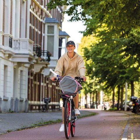
MaaS adoption
Mobility as a Service (MaaS) aims to take stress out of multimodal travel, thereby reducing private car use and increasing transit ridership. Although the idea has been around for 15 years, it’s taken time to catch on. Now the Dutch are determined to make it mainstream, sparking an exciting competition among providers
 Words | Django Mathijsen
MAAS IN THE NETHERLANDS 020 Intertraffic World | Annual Showcase 2022
Mobility as a Service isn’t just an app that searches through all available mobility options and plans your journey according to your preferences: the quickest mobility mix, most comfortable, lowest emission, lowest number of transfers. It also takes care of the cumbersome formalities: booking rides, paying for them, and tracking overall mobility cost. It’s a personal mobility assistant that makes using multimodal transport as simple and relaxing as satnav has made using private transport.
But what’s simple for the consumer is an enormous technical and organizational challenge for the businesses trying to realize it. For starters, all modes of transport, from public trains, buses and trams, to bike, moped and car sharing plans must be integrated into one application.

Annual Showcase 2022 | Intertraffic World MAAS IN THE NETHERLANDS 021
With the Amaze Mobility app users can plan, pay and travel with public transport or shared mobility
Above: To raise awareness of the MaaS app Glimble, for one day only Arriva users in Amsterdam could book a trip on a submarine Right: Glimble users can book, pay and unlock micromobility rides with bike and e-bike share operators such as Hopperpoint and Urbee (pictured)

Cooperation and competition
To start the ball rolling, on November 9, 2017, the Dutch Ministry of Infrastructure and Water Management issued an open letter for a market consultation. And in May 2019, a workgroup convened to develop an open standard: the TOMP-API (Operator to Mobility Provider – Application Programming Interface). This interface should make it easier for the mobility- and MaaS-providers to communicate with each other.

The ministry called for seven pilot projects. The first one, Gaiyo in the city of Utrecht, was launched on September 17, 2020. Arriva, a Deutsche Bahn subsidiary running some of the trains, trams and buses in the Netherlands, won two of the other pilots: in the provinces of Groningen/Drenthe and Limburg.
Open data sharing
Arriva launched its MaaS-app called Glimble for these pilot regions in August 2021. Immediately available for the whole country, it was developed together with Moovit, a major MaaS player worldwide, according to Arriva’s Martijn van de Weijer, who is director of the Glimble project: “They have the experience,” he says.
All public transport has been deep integrated into the app, meaning Glimble can perform all the planning, booking and paying. The traveller uses just this one app to access all the transport modes needed for the journey.
Surprisingly rival train and bus operators didn’t decline facilitating Arriva’s MaaS-app. “The government has prevented that by obliging everyone to make their data available,” van de Weijer comments. Operational data that is, personal consumer data will not be shared, since this information is protected by the EU-wide General Data Protection Regulation (GDPR).
Amber shared cars, and Urbee and Hopperpoint shared bikes will soon be deep integrated as well. Uber and more than half a dozen other mobility providers have only been deep link integrated, meaning that if the
The Rivier platform connects MaaS providers with mobility providers and provides planning, booking, account management, id-verification and payment functionalities. But it’s up to the app builder of the MaaS provider which features to use and how to use them
Emilio Tuinenburg, digital transformation officer for the Netherlands, Siemens
MAAS IN THE NETHERLANDS 022 Intertraffic World | Annual Showcase 2022

Annual Showcase 2022 | Intertraffic World MAAS IN THE NETHERLANDS 023
Above: Amber, a sharedcar provider offering on-demand mobility with electric cars, is integrated into the Amaze MaaS app

Above right: Amber guarantees that there will always be a car available at the time requested by its users

traveller wants to use any of these, he’s forwarded to the mobility provider’s app. But Van de Weijer states: “We’re working on further improvement and development. Every few weeks we release new functionalities or integrations in the app. We learn by customer feedback and with every new release, the app is evolving and expanding.”
National and international Laws can make or break MaaS-apps. The Covid-19 pandemic, for example, caused a
change in Dutch tax laws regarding travel expenses, which can help MaaS-adoption. “That change will cause a lot more paperwork for employers,” says Van de Weijer. “We can obviate that with Glimble. The employer can offer Glimble to their employees. Then they don’t have to buy, prepay and declare tickets anymore. And Glimble provides a travel summary for bookkeeping, with mileage, cost and CO2emissions specified. The employer can choose which transportation modes to offer, for example excluding the car if there are sustainability
A mobility provider’s viewpoint
Felyx, a provider of shared scooters, doesn’t have its own MaaS-app, but is already integrated into the Amaze and Glimble apps. “We’re talking to various pilots and MaaS-providers,” says Felyx’s public affairs associate, Nigel van den Berg. “MaaS should make multimodal travel more accessible, so more people can abandon the car. It’s difficult to get people out of their cars. That’s our goal: so they don’t take the car into the city anymore. I do think MaaS still has a long way to go, but the Ministry took the right step by launching those pilots. And the TOMP-API should help. The challenge is always to have systems communicate with each other and make good agreements about who’s responsible for what.”
Felyx was founded in 2016 and placed the first 100 scooters in Amsterdam in 2017. Now they have 6,000 scooters in 12 cities in the Netherlands, Belgium and Germany.


MAAS IN THE NETHERLANDS 024 Intertraffic World | Annual Showcase 2022
MaaS should make multimodal travel more accessible, so more people can abandon the car. It’s difficult to get people out of their cars. That’s our goal: so they don’t take the car into the city anymoreNigel van den Berg, public affairs associate, Felyx

Top: Glimble provides real-time arrival information for buses and trains

Above: Users of Glimble can use mobile payment for all public and shared transport countrywide
goals. Pay is as you go, but we also have a postpay option for employers: pay once per month for all travelling.”
The app will cater to the private car as well, aiding with parking and charging. And it’s been extended to work in the whole country. “Of course, we also want to cross the border with Glimble,” Van de Weijer says. “Our trains in Limburg cross the border into Germany and are already available in Glimble. Together with our German partners we’re working on expanding our cross-border functionalities. Arriva Group runs public transport in 14 countries.”
you can quickly get an alternative.” A travel summary can be sent at the end of the month, and the app has been extended to cover the entire country. “The company was founded, triggered by the pilot to keep Zuidas, an Amsterdam business district, accessible,” Sijbring continues. “But you can’t serve Zuidas exclusively because people who work there live in the whole country.”


Changing behaviour
runs public transport in 14 countries.”
No wheels
Amaze, launched on October 1, 2021, is a MaaSapp by a provider that doesn’t have its own mobility. “We don’t have wheels on the ground,” says Amaze’s Karin Sijbring. “Our goal is to make flexible travel as simple as possible.”

Again, some mobility providers are still deep linked, while others have already been deep integrated. “For example, you can directly book, use and pay for Donkey Republic bikes and Amber cars with our app,” says Sijbring. “And it allows you to directly buy tickets for trains, buses and trams, display the QR-code on the screen and check in with it. We also have a ‘Near me’-option: if your ride of choice has just left,

The MaaS-app providers are competing heavily to create the best service, which can only benefit the traveller. Has a mobility revolution been sparked? “If you tell people what you’re working on, they’re generally excited,” Sijbring says. “But you do have to explain it: Amaze is more than a journey planner. You can book, buy and use public transport and shared mobility in the app. MaaS requires a change in behaviour. But not everyone can park in front of their house anymore, so shared mobility is stimulated in other ways as well. And then it’s very convenient not to have to look at five different apps.”
“I had to get used to it myself,” Arriva’s Martijn van de Weijer comments. “I was used to planning my trip according to public transport departure times. Now, I can plan my journey by the time I plan to leave.”
Glimble provides a travel summary for bookkeeping, with mileage, cost and CO2-emissions specified. An employer can choose which transportation modes to offer, for example excluding the car if there are sustainability goals
Martijn van de Weijer, director, Glimble, Arriva
MAAS IN THE NETHERLANDS 026 Intertraffic World | Annual Showcase 2022
„ A fair and modern approach to financing infrastructure


Those who use infrastructure should also contribute to its maintenance.
VITRONIC tolling systems allow for dynamic and flexible pricing models –for a fair funding solution.

We get many requests from MaaS-apps to integrate us. That’s a lot of work to figure out technical integration and contracts, and discuss finance, accounting and customer support
Alexander Sprey, senior manager of strategic partnerships, Tier Mobility, Berlin
More MaaS-apps
Others are getting into the MaaS-game as well. NS, HTM and RET (The largest Dutch rail company and the companies running trams and busses in The Hague and Rotterdam) together founded the company Rivier to commission Siemens to build not an app, but an integrated platform to build MaaS-apps on.


“The Rivier platform connects MaaS providers with mobility providers and provides planning, booking, account management, id-verification and payment functionalities,”
Experience from Berlin
We started in 2018 and have grown to 135,000 vehicles in 160 cities in 16 countries in Europe and the Middle East,” says Alexander Sprey, senior manager of strategic partnerships for Tier Mobility, a Berlin startup offering shared e-bikes, e-mopeds and e-scooters. He likes the approach of Siemens’ Rivier platform to MaaS. “Rivier isn’t an app, but an infrastructure MaaS-operators and mobility providers can dock onto: that’s good! We get many requests from MaaS-apps to integrate us. That’s a lot of work to figure out technical integration and contracts, and discuss finance, accounting and customer support.
“Standardization helps. One integration with Rivier and we’re integrated with all MaaSapps that use the platform. It’s a promising approach. We’re already integrated into nearly 40 MaaS-apps worldwide. Our mission to ‘Change Mobility for Good’ is one we cannot achieve alone,” Sprey adds.
“To create a better-connected tomorrow and change the mobility sector, we aim to connect our sustainable micro-mobility solutions with public transport by integrating them into local MaaS solutions,” he continues. “There are good local apps already: Jelbi in Berlin for example. Still, we only see a small percentage of our rides coming through applications like Jelbi. Why if it’s so convenient is customer adoption so low?”
In other cities with MaaS-apps, Paris and Munich for example, Tier sees equally low customer adoption. That could be because travellers haven’t got used to it yet. But Tier has also identified that for a MaaS-app to be used, all available travel options have to be in there and they all have to be deep integrated. Because as Sprey says: “On average, our deep integrations generate 30x more ridership than deep link integrations.” (I.e., for MaaS to work everything needs to be in one app, not simply via links that send you do another app).
Siemens’ digital transformation officer for the Netherlands, Emilio Tuinenburg, comments. “But it’s up to the app builder of the MaaS provider which features to use and how to use them. They can for example choose to offer pay as you go or subscriptions.”
Rivier didn’t spring from the pilot projects. It will be rolled out in the entire country, with the option of extending it abroad. “The first apps will probably be by NS, RET and HTM as they requested the platform,” Tuinenburg comments. “But every app builder can build their own MaaS-app using our platform. We can provide a white label app for you, for example, but most mobility providers already have an app and would prefer to extend that to MaaS. For that they can use our facilities.”
Lowering barriers
Forty mobility providers have shown interest in being integrated into Rivier so far. “We’re integrating bike, moped and car sharing providers,” Tuinenburg explains. “And we expect to connect assets such as Park+Ride and electric car charging.”
Private transport will also be integrated. “Then the customer can compare their own means of transportation with others, or the car can be incorporated into the journey,” Tuinenburg continues. “Lowering barriers this way will persuade consumers to use other modes of transport, so they don’t have to use the car all the time.”
The Rivier-platform is a flexible and ambitious plan, but Tuinenburg reckons it will be up and running soon: “We’ve been involved with this technology for a long time. Of course, the configuration is specific for the Netherlands, but the first apps could be available in the spring of 2022,” he says.
So, it’s a question of may the best app win? “Yes,” comments Tuinenburg. “But I’m convinced eventually there won’t be just one app that appeals to everyone. You could need different functionalities for different target groups. An app that can do everything can be confusing. And the business market could prefer a different app than elderly people with walking difficulties, for example.” n
MAAS IN THE NETHERLANDS 028 Intertraffic World | Annual Showcase 2022
“
Above: Using Moovit’s technology, Glimble combines official information from all Dutch transport agencies, as well as crowdsourced information to calculate the best route for each journey using options such as bus, rail, tram, underground, ferry, taxi, Uber, car share, scooters, and bikes

SENSOR FUSION Seamless object tracking on the entire intersection Data collection & storage Ethernet and PLC communication Expandable platform, i.e. for V2X applications Big data for central software solutions Remotely accessible SMART CITIES WITH SMARTMICRO TECHNOLOGY | | | VISIT US AT INTERTRAFFIC AMSTERDAM 29 MAR - 1 APR 2022 BOOTH 01.351 www.smartmicro.com


030 Intertraffic World | Annual Showcase 2022 EV INFRASTRUCTURE
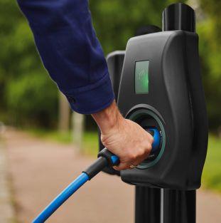
EV charging for all


Encouraging EV adoption is a cornerstone of government plans to decarbonise, but such vehicles are only really feasible for those with driveways or access to limited public charge-points. But now, London’s Lambeth Council is building a blueprint for extending the electric revolution to underserved communities in London and beyond
By Frank Millard and Jack RoperThe London Borough of Lambeth is working with Connected Kerb, the EV charging specialist, in a first-of-its-kind project to demonstrate how affordable and accessible public EV charging infrastructure can be deployed to tackle EV inequality


For countries worldwide to achieve carbon-neutral transport targets in the teeth of mounting climate turmoil, popular adoption of electric vehicles (EVs) will be imperative. That will depend on national charging infrastructures which are universally accessible, regardless of location or social context. Crucially, EV ownership must be rendered viable for dwellers in high-rise blocks or urban estates without off-street parking or access to overnight charging.
By 2030, the UK government hopes to see 14 million EVs on British roads. But 40% of UK households today have no garage or driveway and for every public-access on-street charger nationally, there are 34 EVs on the road. Consequently, these households own just 20%

Annual Showcase 2022 | Intertraffic World 031 EV INFRASTRUCTURE
of Britain’s EVs, despite often living in urban communities whose disproportionate exposure to toxic exhaust fumes means they have most to gain from EV uptake.
“Unfortunately, a classic chicken-and-egg scenario is failing communities,” says Connected Kerb CEO, Chris Pateman-Jones. “Charge-point operators won’t build public infrastructure unless they see high EV adoption. But without reliable charging, why would anyone go electric?” It falls to proactive local and city councils to break this retrograde circle. In London, Lambeth Council has enlisted the services of Connected Kerb to install curbside chargers in areas of most need.

In 2018, Lambeth became the first London borough to declare a climate emergency and aims to reach net-zero carbon emissions across its estate, services and operations by 2030. Today, traffic causes 50% of its air pollution. Since about one-third of residents live on council-managed estates and less than half have off-road parking, a preponderant portion of Lambeth’s potential EV-driving populace would be entirely reliant on public charging infrastructure.

Walking the Lambeth walk

Connected Kerb will install 22 on-street chargers across 11 council estates in Lambeth, two at each location. The units combine a power and data pack in a protective steel box beneath the A


CEO, Connected Kerb

032 Intertraffic World | Annual Showcase 2022 EV INFRASTRUCTURE
is
The number of public charge-points Britain will need by 2035 Above: Each of Connected Kerb’s chargers will provide a 7kW fast charge and feature contactless payment via the Connected Kerb app
chicken-and-egg scenario
failing communities. Operators won’t build infrastructure unless they see adoption. But without infrastructure, why would anyone go electric? Chris Pateman-Jones,
2.8m
pavement with a visible, above-ground socket. The subterranean componentry will enable an array of hardware and software applications. The socket provides a 7kW fast-charge tailored to habitual charging at predictable daily times.


Contactless payment via the Connected Kerb app based on a consistent tariff across sites will support fair and equitable access.
Charge-point broadband and 5G connectivity will be essential in future transport ecosystems driven by data science and artificial intelligence.


Connected Kerb’s sunken smart city boxes already support connected environmental and parking management sensors and are equipped to provide data to tomorrow’s advanced mobility solutions. Its software platforms meanwhile optimize performance and energy-usage across its smart-node networks.
On the level…


Connected Kerb’s aspirations to democratize charge-point access dovetail with the “Levelling-


Up” agenda professed by UK government. “For those in society unable to park and charge at home, EVs remain an unattractive option,” says Pateman-Jones. “Failure to serve those communities risks creating a two-tier scenario where EVs are primarily adopted by the wealthy.” Nationally, Connected Kerb expects to install 30,000 on-street chargers in 2022 and 190,000 by 2030. “It’s critical to win the hearts and minds of all transport users,” he continues. “We’re pledging to educate every community in the UK on the benefits of EVs.”
Lambeth Council’s strategy is motivated by its early commitment to carbon-neutrality and the introduction of London’s Ultra Low Emission Zone (ULEZ). The current scheme is supported by 75% funding from the UK Office for Zero Emission Vehicles. “On highways, priority is driven by demand,” comments Lambeth Council’s head of communications, Lawrence Conway. “On estates, we have initially
30,000


Annual Showcase 2022 | Intertraffic World 033 EV INFRASTRUCTURE
Above: One of the entrances to Istanbul’s Eurasia tunnel, which opened in 2016
The number of public charge-points in Britain today
ConnectMore provides real time network capacity and projected EV demand between 2025 and 2050
chosen larger estates in both the north and south of the Borough.
The number of EVs on UK roads per public charge-point
34“Going forward, we will look to provide chargers to estates of over 100 properties where we have a specific request,” he continues. Site surveys will determine the availability of adequate electrical capacity before the initial locations are confirmed. “Our ultimate strategy is to spread chargers as widely as possible and provide them within a five-minute walk of anywhere with no off-street parking.” Lambeth Council aims to install 200 chargers by 2022.
The British government has committed to phase out new petrol and diesel car sales by 2030, by which time it expects the national EV fleet to grow to 14 million. Correspondingly, it predicts a need for 2.8 million public chargepoints nationwide and has recently announced proposals for a robust and expansive charging network. Considering the UK has just 30,000 public charge-points today, it is an enormous task. But councils are uniquely placed to support the transition which Connected Kerb’s businessmodel is designed to enable.
Current example
Mapping the revolution
A free online tool allows installers to cross-reference grid capability with future demand to accelerate the UK’s EV infrastructure roll-out

The Charge Project has created an online map identifying optimal locations for new EV infrastructure in the UK. Formed by SP Energy Networks and its partners EA Technology, PTV Group and Smarter Grid Solutions, the Charge Project aims to accelerate charge-point deployment across Cheshire, Merseyside, North Shropshire and north- and mid-Wales.

Its ConnectMore Interactive Map (CIM) is a free-to-use tool accessible via the SP Energy Networks website. It enables local councils, property developers and chargepoint operators to identify areas of high public demand and see where the electricity grid can most readily accommodate charging infrastructure. It establishes available capacity in minutes, whereas correspondence with distribution network operators can take days or weeks.
“The CIM allows installers to prioritize locations where existing network connection is plausible,” says SP Energy Networks Charge Project lead, Geoff
Murphy. “In the past, both local authorities and businesses were put off investing in EV charging because establishing expected demand and installation feasibility was complex and time-consuming. The CIM could change that forever, quickly delivering the hard evidence needed to get charge projects off the ground.”
The CIM includes a predictive transport model based on PTV Group’s Visum software. This uses four potential EV uptake and charge-point roll-out scenarios and displays demand data for each in fiveyear increments from 2025 to 2050. It also shows where residential driveways will enable home-charging. The electricity network model, provided by EA Technology, will be updated every three to six months.
“Transport models are updated after a shelf-life of about three years,” Murphy says. “Plans to update or extend the CIM depend on its utilization and value. But potentially, it’s a game-changer for public charge-point installation.”
“Our partnership with Lambeth Council is a prime example of how affordable and accessible charge-points can kick-start the EV revolution in council-owned housing estates,” says PatemanJones. “Our sustainable, long-life, easy-to-deploy on-street infrastructure allows us to reach communities others cannot.”
Other solutions typically last for five to seven years, but Connected Kerb believes its system can offer a 25-year lifespan. “It becomes an infrastructure proposition as opposed to a product sale,” explains Pateman-Jones. “Because we earn our money back over a longer period of time, we can reduce the cost of EV charging points to our consumers.”
Connected Kerb sees Lambeth as a blueprint for public EV infrastructure roll-out elsewhere. From East Sussex to Northumberland, it is already implementing its technology in councilled projects across the country. “In Kent, we’re installing chargers for non-urban parish councils,” says Pateman-Jones. “We can bring vital infrastructure to communities which would otherwise be left behind due to low footfall and limited grid coverage.
“The time for pledges is over,” he concludes. “We need every road user to fight the climate change battle together, in every corner of the globe. That’s why we are focused on deploying EV infrastructure that makes charging sustainable, affordable and inclusive. By working with councils, we can help them meet air quality and emissions targets, deliver infrastructure and ultimately enable the UK to reach net-zero.” ■
EV INFRASTRUCTURE 034 Intertraffic World | Annual Showcase 2022
Quartz WIM sensors with accuracy of ±2.5 percent
The digital era of Weigh In Motion has just arrived!
Kistler is proud to launch KiTraffic Digital – the world’s most advanced Weigh In Motion system. At its heart: Lineas Digital quartz WIM sensors – with certified accuracy of ±2.5 percent for axle load and gross weight measurements, regardless of lane changes. KiTraffic Digital: the brand-new solution of choice for direct truck weight and tire enforcement.

www.kistler.com/digitalwim 961-600e-11.21 ©2021 Kistler Group
Cross-border connectivity

Advanced 5G networks herald a new era of vehicle connectivity, but border crossings could create coverage blackspots where safety is compromised – a particular problem in urban settings and for long-distance platooning. This is why new EU research projects are looking to ensure seamless network handovers
Words | Jack Roper036 Intertraffic World | Annual Showcase 2022 INTERNATIONAL 5G SAFETY
NicoElNino@stock_adobe.com
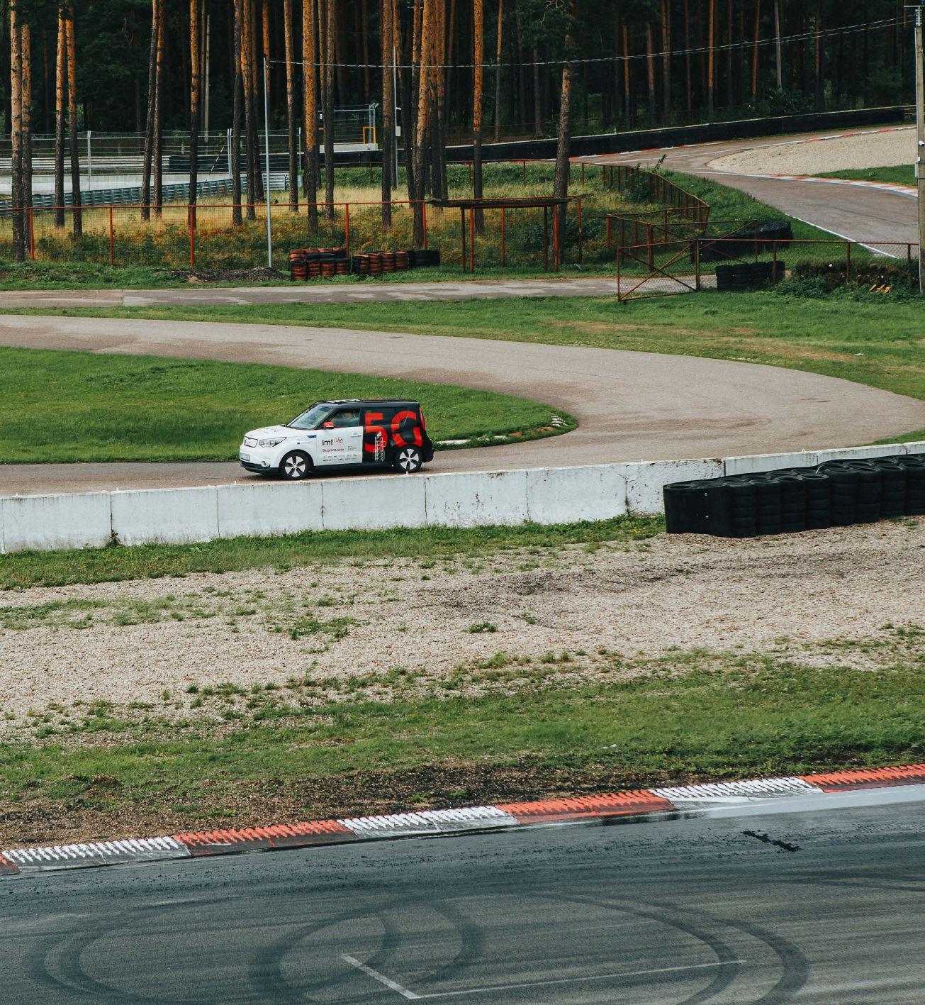
Baltic innovation could help to deliver the crossborder connectivity required for transnational connected and autonomous mobility (CAM) corridors across Europe’s patchwork of frontiers. A 5G testbed established by Latvian telecoms operator LMT will become the region’s first cross-border simulation space as part of the EU-funded 5G-Routes project. This collaboration between Latvia, Estonia and Finland will enable vehicles traversing the Baltic corridor to transition seamlessly between national 5G networks as a prelude to pan-European roll-out.
LMT is already renowned for 4G innovation and network efficiency and believes 5G will usher in a mobileonly future. “We are not just a telecoms company,” says LMT’s mobility innovation lead, Artūrs Lindenbergs. “We look at many verticals and 5G will provide totally new opportunities to build services and ecosystems.”
LMT is working on 5G-enabled beyond-visible-line-ofsight (BVLOS) drone operation and recently conducted a teleoperated vehicle demonstration. “Connected and

Annual Showcase 2022 | Intertraffic World 037 INTERNATIONAL 5G SAFETY caption caption
Above: Latvian network operator Latvijas Mobilais Telefons (LMT) has set up a 5G mobility innovation testbed at the Bikernieki racetrack in the capital city of Riga
autonomous vehicles (CAVs) are not in the future – because we’ve seen them working already,” says Lindenbergs. “It’s just a question of when it will escalate onto the roads.”

Collaborative testing
In 2021, LMT launched its 5G mobility testbed at Riga’s Biķernieki racetrack [see On the right track, opposite], which is owned by Latvia’s Road Traffic Safety Directorate (CSDD). It will foster innovation by allowing Latvian and other developers to test 5G-based services on a noncommercial network. “Startups don’t have the resource of a closed-track with
5G for drive-by-wire vehicles,” says Lindenbergs. “Rather than sit in their offices, now the public sector, academic institutes and companies can collaborate to innovate and deploy new features much faster.”
For Lindenbergs, 5G is not merely an evolution of 4G, but an entirely different technology representing a new paradigm for mobility services. “4G is a best-effort network, which makes vehicle connectivity possible but gives operators no way to guarantee services,” he says. “But 5G network-slicing will allow us to totally guarantee the services we provide.”
For the first time, 5G also offers potential for the seamless cross-border network transitions
4G is a best-effort network, which makes vehicle connectivity possible but gives operators no way to guarantee services. But 5G network-slicing will allow us to totally guarantee the services we provide Artūrs Lindenbergs, mobility innovation lead, LMT

038 INTERNATIONAL 5G SAFETY Intertraffic World | Annual Showcase 2022
which 5G-Routes will explore. Preliminary to this, LMT demonstrated its 5G remote driving capability in August 2021.
“It was the first use-case we showed at Biķernieki,” says Lindenbergs. “We were able to drive a car from another city over the existing 5G network.” A Kia e-Soul electric vehicle equipped with 5G and drive-by-wire hardware was successfully controlled from Cēsis, 80km to the northeast.
“In Cēsis, we had remote controls with a wheel and a display showing camera-feeds from the car,” explains Lindenbergs. “Everything worked smoothly and there was a chance for everyone to have a go at remote driving.”
Public safety


The Road Traffic Safety Directorate (CSDD) is invested in such experiments, both as custodians of Biķernieki and of Latvian road safety. “Before
On the right track

In its 1970s heyday, Biķernieki was the Soviet Union’s premier motorsport venue. In 1958, motorcycle racers Eduard Kiope and Kārlis Ošiņš embarked on a tour of Soviet racing tracks to determine what made a good circuit before selecting the site. Biķernieki held its first car and motorcycle races in July 1966 – with Kiope and Ošiņš winning the two-wheeled events.
“Biķernieki has great traditions,” says Latvia’s Road Traffic Safety Directorate (CSDD) board member, Aivars Aksenoks. “It has many different configurations: for drift-driving, rallycross, motorcycles and speedway. Although close to the city of Riga, it may be the world’s only racing track located in a forest.”
Kiope and Ošiņš identified the site because it was close to Riga’s population, while the forest would serve to reduce noise nuisance and hazardous crosswinds. Biķernieki’s 3.6km Ring of Skill was designed for motorcyclists and its 3.7km Speed Ring for cars. Its variety of different curves and gradients and the absence of long straights demand a high level of skill from racing drivers.
In 1991, Latvian independence followed a period of Soviet economic decline during which Biķernieki fell into disrepair. “It was in very poor condition,” Aksenoks recalls. “Nobody was in charge, so the Transport Ministry asked us to take responsibility.”
“Our main task is traffic safety,” he says. “We provide technical inspections, vehicle registration and driver qualification. Ten years ago, we also became responsible for Biķernieki and invested in its reconstruction.” Since 2011, CSDD has restored Biķernieki’s speedway track and grandstands, rebuilt its race control building, renewed its curbs and repaved sections of track.
“Lately, Biķernieki has hosted high-level competitions including the World Rallycross Championship,” says Aksenoks. “LMT evaluated the advantages of the site as a 5G testbed and we started our collaboration four years ago.”

INTERNATIONAL 5G SAFETY 039 Annual Showcase 2022 | Intertraffic World
The historic Biķernieki Racetrack is an ideal testbed for connected vehicle technologies
Borders across Europe
The Latvian project is just part of a much larger research movement across Europe looking to develop seamless 5G networks. Another EU-funded undertaking, looking at tsimilar challenges is 5G-Mobix
The EU-funded 5G-Mobix project is focused on developing 5G use cases in transportation, in particular enabling 5G functionality across borders. EU countries and industry first agreed to establish cross-border 5G corridors in September 2017. Thanks to these 5G corridors, Europe is now leading the world in testing 5G technology for connected and automated driving and mobility.
5G-Mobix is testing automated vehicle functionalities using 5G core technological innovations along two live cross-border corridors and a number of local trial sites, under varying conditions of vehicular traffic, network coverage and service demand.
One of the real-world trial sites is the border crossing between Ipsala Turkey and the Greek town of Kipoi. At this border crossing, there is a customs area, where administrative procedures and x-ray checks on passing vehicles are performed, and innovations such as truck platooning and assisted border crossing are being implemented as a part of the trial.
The other real-world border corridor test site is between Portugal and Spain and six pre-deployment trial sites are in Germany, China, Finland, France, South Korea and the Netherlands.

“This project is important because automated mobility is necessary for the future in order to meet our demands for efficiency and sustainability. To make this happen, cooperative mobility needs multiple actors from industry to solve the potential challenges,” says Nazli Guney of Turkcell, one of the project partners at the Turkey-Greece crossing,.“Lately, Biķernieki has hosted high-level competitions including the World Rallycross Championship,” says Aksenoks. “LMT evaluated the advantages of the site as a 5G testbed and we started our collaboration four years ago.”
Right: A Kia Soul EV equipped with 5G and drive-by-wire hardware was one of the first vehicles to be tested by LMT at its new testbed
autonomous vehicles (AVs) can drive on the streets, they must be tested on a racetrack or some similar, closed territory,” says CSDD board member, Aivars Aksenoks. “We sometimes have different views: LMT professionals want to test AVs on the roads as soon as possible, but we prefer to be sure.”

Latvia’s Transport Ministry only recently issued regulations to allow even off-road tests. “In the event of some danger, the driver must instantly be able to take control,” says Aksenoks. “We’re interested in cross-border connectivity, because the moment vehicles change between two networks is potentially dangerous. Unless it works properly, accidents could occur.”
“Crossing the border, it can take a few minutes to register on the other country’s network,” says Lindenbergs. “People can wait a minute to send an SMS or make a call, but we can’t have a situation where cars lose connection for even a few seconds.”
We’re interested in cross-border connectivity, because the moment vehicles change between two networks is potentially dangerous. Unless it works properly, accidents could occur

Aivars Aksenoks, board member, CSDD (Latvia’s Road Traffic Safety Directorate)


040 INTERNATIONAL 5G SAFETY Intertraffic World | Annual Showcase 2022


INTERNATIONAL 5G SAFETY 041 Annual
2022 | Intertraffic World
Showcase
Above: LMT’s 5G mobility testbed will foster innovation by allowing Latvian and other developers to test 5G-based services on a noncommercial network

5G-Routes will create a virtual border at Biķernieki by combining the 5G networks of LMT and Estonian telecom operator, Telia.
“There will be a handover connectivity between the two standalone networks,” says Lindenbergs.
“It means we can test cross-border use cases and validate technical solutions.” Once proven at Biķernieki, the technology will proceed to fieldtests in Valka-Valga.
A historic border
After World War I, Latvia fought a War of Independence against Soviet and later German forces, backed by Estonia, Poland and the Western Allies. When fighting concluded in 1920, Valka in Latvia and Valga in Estonia were separated by the border between two new Baltic
states. “In Valka-Valga, we can validate use-cases in real conditions in a city between two cities, two countries and two networks,” says Lindenbergs. “Of course, our focus is not only on Valka-Valga, but on how to deploy cross-border connectivity across the whole of Europe.”
Lindenbergs anticipates 5G deployment on key routes by 2024, with end-user CAM services coming online from 2025. But what these will be remains a matter of guesswork. “Early-stage 5G networks are currently based on Release 15, with limited features for CAM,” he says.
The nature of services, their pricing and whether mobile network operators (MNOs) or traffic authorities will provide them all need working out. “If somebody knows the answers, I will give them a bonus!” says Lindenbergs. “Platooning is a key use-case; in each country, it could proceed case-by-case.”
Future use cases
Artūrs Lindenbergs, mobility innovation lead, LMT
For traffic authorities, a mobile-only future offers considerable promise. “It will be easier to deploy intelligent transport solutions based on mobile networks, because you will no longer

INTERNATIONAL 5G SAFETY Intertraffic World | Annual Showcase 2022 042
In Valka-Valga, we can validate use-cases in real conditions in a city between two cities, two countries and two networks
SERNIS

5G vs V2V in the Netherlands
Collision avoidance is a further promise of 5G technology – but will latency levels be low enough to ensure safety? At the 5G-Mobix Netherlands Trial Site trials are underway to compare 5G collision avoidance with well-established Wi-Fi based V2V technology. The trials are being undertaken in collaboration with KPN together with VTT and TNO. Play the video embedded on this page to find out more
Above: The 5G-MOBIX collision avoidance application was developed by VTT and run as an app on the network edge and in the vehicles
Below: LMT has provided two EVs for testing in Riga. A Kia Soul EV and BMW i3, which are equipped with radars, cameras, sensors and drive-by-wire equipment


need to provide fixed networks with each camera and traffic-sign,” says Lindenbergs. 5G is harder to deploy than 4G due to differences in band-frequencies and network range, but will create as-yet unknown traffic use-cases. “There should be close collaboration between MNOs and road authorities to proceed with deployment together,” says Lindenbergs.
Aksenoks is cautious on the timescale for AVs rolling out commercially on Latvian roads. “Change will come step-by-step,” he says. “There are many unanswered questions: for instance, how to check AV systems during technical inspections.” He believes autonomy will advance gradually via driver assistance systems and expects full autonomy to manifest first in demarcated applications like public transport and cargo truck platoons. “But autonomy is not just a target,” says Aksenoks. “These systems must help people in different situations.”
“Everybody dreams they will sit on the back seat, drink tea and maybe read a book,” says Lindenbergs. “But I agree with Aivars: it will happen step-by-step.” It is not only a question of autonomous cars, but of also deploying infrastructure which will increasingly take over the strain of autonomy from inbuilt vehicle systems. Lindenbergs notes that human error is implicated in over 90% of accidents and autonomous systems are in reality far safer than fallible, anthropoid drivers – but concedes that a shift in perception must come as the forerunner of public acceptance.
Winning hearts and minds
One way to familiarize a sceptical public with AVs could be first deployments in geofenced environments, before they are let loose in mixed ecosystems to contend with human drivers. “But I don’t believe that’s how we should proceed,” Lindenbergs argues. “We should consider how to connect older vehicles, perhaps with a smartphone or some other device, to get information from AVs and the infrastructure. Data-exchange between all road users is crucial, but just a beginning.”
smartphone or some other device, to get information from AVs and the infrastructure.
“In Latvia, the average age of cars is 13 years,” adds Aksenoks. “Our car park is very, very old!” He therefore sees an opportunity for Latvia to lead European mobility innovation, replacing its current fleet with new, intelligent vehicles more rapidly than is feasible elsewhere. “We believe in our country,” he says. “Even when we disagree, we are proud to work with LMT and support these innovations.”
“Historically, LMT has been a top-three operator for data-consumption,” says Lindenbergs. “Latvians are heavy smartphone users and our focus is always to provide the newest technologies.” This not only applies to 5G: LMT was among the first operators to offer 4G and to provide flat-rate broadband and mobile data. “Our vision was not a ticking clock in the heads of customers, but to see our flat-rate service as an entrance to future content,” he concludes. “We want to be as user-friendly as possible and expect to play a key role in future mobility services.” ■


INTERNATIONAL 5G SAFETY Intertraffic World | Annual Showcase 2022 044


Saferoad, your partner for road safety. saferoad.com Road Restraint Systems Light Poles & Masts Signs & Work Zone Protection Road Marking Visit us at Intertraffic 2022 stand 08.234
Who’s on your kerb?


046 Intertraffic World | Annual Showcase 2022 SMART KERB MANAGEMENT
The pandemic has put pressure on kerb space like never before, with more delivery drivers servicing the e-commerce boom, more active travel options requiring docking spaces, outdoor seating and pedestrianisation seeing a surge in popularity, and private car-use, with associated parking needs, on the rise. Enter a new era of smart kerb management – and with it the tools to provide a nudge toward vehicle electrification
Words | Paul WillisIn August 2021 US president Joe Biden made headlines after issuing an executive order demanding that half of all new vehicles are zero emissions by 2030.
It was big news in a country where EV uptake still lags behind the two main markets of Europe and China (according to the most recent International Energy Agency figures, the US has 1.74 million plug-in electric cars on its roads compared to three million in Europe and 4.6 million in China.)
Alongside the executive order the Biden administration also announced US$60 millionworth of grants through the US Department of Energy (DoE) to fund projects aimed at decarbonizing the US transportation sector.
One of the grants was a US$4 million award for ongoing funding for a pilot project aimed at incentivizing EV use in three US cities - Los Angeles, Santa Monica and Pittsburgh.
The project, “the most comprehensive of its kind” yet to be tried in the US, according to Ariana Vito, the electric vehicle program coordinator for the City of Santa Monica, hopes to push EV uptake through kerbside management policies.

It will do this primarily through the creation of dedicated zero-emission loading zones for commercial vehicles. The selection of the three cities was deliberate, notes Erin Clark, the

Annual Showcase 2022 | Intertraffic World 047 SMART KERB MANAGEMENT
caption caption
autonomous vehicle policy analyst of Pittsburgh Department of Mobility and Infrastructure. “These are all cities with historically poor air quality,” she says.

Computer vision
The three cities are working with a number of technology partners, including several US universities. However, integral to the success of the project will be the deployment of
technology developed by the computer vision start-up Automotus.
Automotus’ tech works by deploying “cameras as a data source to tell cities how different types of vehicles are using the public right of way,” comments CEO and co-founder Jordan Justus.
The company’s software can verify how the kerb is being used as well as the types of vehicles parking there by leveraging machinelearning and AI to identify a vehicle’s make and

The demand for kerb space has changed a lot in the last few years. It’s not just demand from commercial vehicles and for resident parking. We also have demand for bike lanes and – since the pandemic – demands for outdoor dining space
Clark,
048 Intertraffic World | Annual Showcase 2022
KERB
SMART
MANAGEMENT
Above: The Santa Monica kerbside management programme will include local delivery firms
Erin
autonomous vehicle policy analyst, City of Pittsburgh Department of Mobility & Infrastructure
model. This means that it can know immediately if the parking vehicle is zero-emission or not.
While this may eventually be used for the purposes of enforcement, Justus believes that for the early stages of the pilot the camera technology will only be used to understand how the kerb is being used.
“Historically the kerbside has been used for on-street parking for passenger vehicles but that's not how it's being used anymore,” says Justus. “So we want to help cities first understand what's actually happening on the ground so that they can then use the tools at their disposal to change driver behavior.”
Pilot projects
The first pilot is already underway since early this year in Santa Monica, Los Angeles County’s famous beach-front city. Prior to it going live a
Robots to the rescue?
More likely to catch the eye of visitors to Santa Monica than the monitored loading zones are the zeroemission delivery robots currently operating out of food outlets located in the downtown – which conveniently don’t need any kerb space at all, in order to make their deliveries.


Known as Coco bots, the units were produced by the robotics company Cyan Robotics, and are also part
of the Santa Monica pilot. While the main focus of the pilot is the zero-emission loading zones, since its broader goal is to “create a roadmap to increase deliveries that are made more sustainably,” says Santa Monica’s electric vehicle program coordinator Ariana Vito, she and her team have been looking at other solutions, such as the deliver bots.
“We definitely have a lot of visitors to Santa
Monica,” says Vito. “These visitors will see what we’re doing with the new kerb set-ups and it might spark interest and awareness of sustainable alternatives for deliveries and transportation in general.”
Vito is hoping to have Santa Monica’s latest zeroemission architecture fully in place and operational by 2024 when it will find itself on the global stage as Los Angeles plays host to the Olympics that year.
suitable place to host the pilot needed to be found in the city’s downtown, notes Vito. Vito explains: “We selected a one-mile pilot zone within our downtown area where we have the highest concentration of deliveries, and then scouted different available kerb spaces within that specific area.”
Through this process 11 zero-emission loading zones were selected and fitted out with Automotus’ camera technology. The city also spent several months of outreach to “surrounding retail businesses that could potentially benefit from the spaces,” says Vito. They also contacted a number of delivery companies to see if they would take part. While the response was lukewarm from the big players in the field such as UPS and Amazon (“they were unwilling to commit to the data sharing requirements,” says Vito) a number of smaller-
Annual Showcase 2022 | Intertraffic World 049 SMART KERB MANAGEMENT
Above: Coco uses delivery robots with remote human overseers to shuttle food and other goods to customers in downtown Santa Monica
We selected a one-mile pilot zone within our downtown area where we have the highest concentration of deliveries, and then scouted different available kerb spaces within that area
Ariana Vito, electric vehicle program coordinator, City of Santa Monica
sized companies have come on-board.
They include the produce delivery company Perfectly Imperfect Produce, the linen delivery firm Alsco and the yerba mate herbal beverage company Guayaki.
Besides delivery companies, the city has also teamed up with a number of tech companies including Fluid Truck, a truck sharing platform that has agreed to make available its small fleet of zeroemission trucks to delivery companies operating in the Santa Monica downtown.
The Pittsburgh pilot, meanwhile, was set to launch in early November and will run for an initial 12 months, according to Clark. Like the Santa Monica pilot it will begin with an outreach phase to local businesses and delivery companies in the city.
This will be followed by “an education phase,” says Clark. “What that will look like will be installing signage on the poles near those zones to alert drivers and the public that smart loading zones are coming to this location. It won’t be until the later half of the pilot that we'll be attempting to do any enforcement.”
The same is true in Santa Monica where the city council will need to approve an ordinance allowing for the ticketing of non-EVs parking in zero-emission loading zones. “We aren't authorized within our municipal code to issue citations for this new type of zone,” says Vito.

What kerbside management policies ultimately wind up being adopted long-term by the cities involved the pilot is yet to be decided, according to Justus.
Enforce or charge?
One possibility being looked at is a move away from an enforcement parking model to a payment model, whereby EVs pay for access to the loading zones.
While asking delivery companies to pay for parking that they have traditionally accessed for free may seem a difficult sell on the surface, Justus points out that delivery companies are already paying cities large amounts in fines for parking violations every year.
In New York City, for example, UPS pay millions in parking tickets annually, says Justus.

“What they typically do is come up with some sort of agreement with the city to pay a percentage of those tickets,” he says. “What we’re saying is, let's transition that account from citations as much as we can over to getting people to pay for their fair share of space, and then giving them enough space to where they don't have to double park.” Or as Clark puts it: “This is a way to create more predictability.”
Automotus’ camera technology can identify delivery trucks occupying the loading zones by reading their license plates, with the payment
Charging-free EV deliveries in Amsterdam
In 2021 the World Economic Forum published a white paper entitled, “Pandemic, Parcels and Public Vaccination – Envisioning the Next Normal for the LastMile Ecosystem”. Among other things, it carefully considers the challenges faced by delivery drivers as the global mission to decarbonize gathers pace.
One study it highlights looks at zero-emission zones in


Amsterdam, the Netherlands, to analyze how, where and when vehicle-charging infrastructure needs to be put in place, to service electric delivery vehicles.
The surprising conclusion of the study was that no additional charging infrastructure was required for any of the city logistics investigated including waste collection, construction, retail and hospitality. This was
because the best placed charging happened at a distribution center or depot at night using 150kW vehicle chargers.
Therefore, the study suggested that there is no need for governments to provide charging infrastructure in city centers for delivery vehicles. It was estimated a zero-emission zone in Amsterdam will cause a total energy demand 1-2% of total
energy demand in the greater Amsterdam region.
The study was made using available statistics and a costoptimization model, considering the vehicular, battery and charging station characteristics and the journey profiles.
Estimates were also made of projected impact on the power grid, required number of charging points and spatial impacts.
SMART KERB MANAGEMENT 050 Intertraffic World | Annual Showcase 2022
Above: A Coco delivery bot does its rounds on the streets of Santa Monica
Left: In February 2021 Los Angeles Cleantech Incubator (LACI) and the City of Santa Monica launched and deployed a first-in-the-nation Zero Emissions Delivery Zone

Are you ready for the marking demands of the future? Visit us at Intertraffic Amsterdam 2022 Marking the future with you Micromobility Markings Accessibility & Safety Markings 01.152 stand geveko-markings.com Contrast Markings Follow Geveko Markings
We can use the model to determine what is the optimal pricing to reduce congestion levels
Qian, professor of civil and environmental engineering, Carnegie Mellon University, Pittsburgh
automatically charged to the delivery companies account with the city. Non-EVs that use the zeroemission zones could be charged a premium.
The price is right?
Finding the right pricing model will be key to making such a system a success, says Sean Qian, a professor of civil and environmental engineering at Carnegie Mellon in Pittsburgh.
To do this Qian and his team are pulling the Automotus kerbside data currently being collected in Santa Monica and later in Pittsburgh and Los Angeles, and feeding it into computer models. The simulations use insights from behavioral science to predict how driving habits change when pricing is introduced at the kerbside. “We can use the model to determine what is the optimal pricing to reduce congestion levels,” comments Qian.
The pilot project authors see reducing congestion as an important secondary effect of the zero-emission zones because of the correlation between congestion and emissions. A 2010 study by the University of California Transportation Center (UCTC), for example, found that CO2 emissions could be reduced by up to 20% through the use of congestion mitigation strategies.
Justus.
“Right now cities have such an under-served problem with commercial vehicles and that is where their biggest focus is,” says Justus.
Covid pressures
One of the main reasons this problem has arisen is because of a rise in commercial vehicle volumes brought on by the growing trend for online retail, Justus notes. This trend has been exacerbated during the last year by the impact of the Covid-19 pandemic, with city center restaurants in particular experiencing a sharp rise in food deliveries.
The result of this, according to Justus, is that “there are a lot more commercial vehicles fighting for kerb space.”

Alongside this spike in delivery operations there’s also been growing competition for kerbside access from other sources, says Clark.
“The demand for kerb space has changed a lot in the last few years,” says Clark. “It’s not just demand from commercial vehicles and for resident parking. We also have demand for bike lanes and – since the pandemic - demands for outdoor dining space.”
According to Justus, many US cities have failed to keep pace with these changes.
“The existing systems and real estate just don't align with the needs of commercial vehicles,” he says. “There's not enough real estate allocated for them. Meanwhile, the systems for payment, enforcement and data collection don't work.” n

052 Intertraffic World | Annual Showcase 2022 SMART KERB MANAGEMENT
The pilot project will focus on commercial vehicles rather than private vehicles because this is the area of most concern for city parking departments, says
Sean
Above: Automotus technology identifies kerb users in Santa Monica
Images: konoplizkaya, nullplus, both at stock-adobe.com
Above right: Kerbs are monitored using lamppost-mounted cameras
As a globally active company with several decades of experience in the field of vehicle identification, TÖNNJES has specialised in EVI. To this end, we have developed the IDePLATE system, which consists of, among other things, the IDePLATE license plate and the IDeSTIX windscreen sticker. Both products contain a RAIN RFID chip that can be read in both stationary and moving traffic. We firmly believe that our certified system solutions increase safety on the roads worldwide, while enabling the authorities and registration offices to work much more efficiently and reliably.
APPLICATIONS
Electronic vehicle identification, Toll collection, Traffic management, Parking and access control, Section control, Border control, Traffic infraction control

BENEFITS
·Identification under all weather conditions
·Data can be retrieved contact free and in moving traffic
·Enables multi-lane-free-flow functionality

·Readable at high speeds
·Protection of data and privacy
·System can be adapted to all specific country requirements
·Off- and online verification
·Compatible with all vehicle types
·In full compliance with according to ISO/IEC 20248 and ISO 7591
·Passive UHF in accordance with ISO/IEC 18000-63 respectively GS1 EPC UHF Gen2v2
·Can be combined with all other innovative high-security elements, e.g. Digital Signatures in accordance with ISO/IEC 20248
·Cryptographic authentication in compliance with ISO/IEC 29167-10
License plate with integrated passive RFID-Chip
The intelligent windshield label with fraud resistant data memory
Headlamp Tag

Headlamp stickers for motorcyles fully personable and fraud resistant
Software solutions for the reliable registration and verification of vehicles and vehicle owners

TÖNNJES INTERNATIONAL GROUP GmbH
Tel. +49 (0) 4221 795-315 Fax +49 (0) 4221 795-300 pr@toennjes.com www.electronic-vehicle-identification.com
Make: Audi Colour: Black, Metallic Model: S4 Limousine 3.0 TFSI quattro tiptronic VIN: WAUZZZ4B543210123 Registration: AF MV 234 Status: Verified Make: VW Colour: Pure White Model: Tiguan SOUND 2.0 TSI 4MOTION VIN: XVWAAE6Z968563421 Registration: DR 513 GVC Status: Verified Make: Mercerdes Colour: designo diamondwhite Model: E 200 4MATIC Coupé 9G-TRONIC VIN: WMEFFE8K385190462 Registration: HF 279 RE Status: Verified
Mirror to the world
Building digital twins of road infrastructure has the potential to greatly assist asset management operations as well as enable new construction projects to be more efficient than ever before and even enable more sophisticated traffic modelling, saving time and money and lowering emissions across entire road networks
 Words | Lauren Dyson
Intertraffic World | Annual Showcase 2022 054 DIGITAL TWINS
The Covid-19 pandemic has changed the way that many industries operate – in some cases, forever. With a lot of physical and interactive work being moved online, the world needed digital infrastructure for remote working and monitoring. While this already existed to an extent, the ‘stay at home’ restrictions accelerated the development of truly viable solutions and opened our minds to change. For the transportation and infrastructure sectors, remote working meant finding new ways to manage physical assets and developing better ways to share information. It highlighted the power of accurate and reliable data, and demonstrated the benefits of information sharing across different sectors.
“The experience of the past year has shown what we can do when forced,” says Steve Cockerell, industry marketing director, transportation at Bentley Systems, “And this is an indicator to the level of opportunity that change provides if it is part of a strategy for delivering better business outcomes rather than a reaction to challenges encountered. We have to find safe, sustainable ways of overcoming the challenges we encounter in a very complex industry. In the short term this means increased digitisation, remote working, and a greater reliance on building information modelling (BIM) – advancing it to include 4D and 5D simulation to re-plan and reoptimise project schedules.”

055 Annual Showcase 2022 | Intertraffic World DIGITAL TWINS
Digital twins enable engineers to build infrastructure in a virtual world prior to, and alongside, realworld construction
Above: Virtual reality will be used by National Highways to inspect roads and plan future investments
Right: It is hoped that the Digital Roads strategy will dramatically reduce the need for time consuming and costly on-site inspections
BIM standards and processes are well known to increase productivity and quality. Road authorities have been using 3D models to aid with the design process for a while now. Some organisations are also looking at how a similar approach to managed information, standardized processes and digital workflows could also benefit procurement and construction.

IoT and data-driven decisions
“Moving beyond BIM, fuelled by the increasing amount of data we collect, create, and consume in our day-to-day tasks, and the volume of connected devices delivering big data and the Internet of Things (IoT), we are already seeing more and more decisions being made based on insight gained directly from data,” says Cockerell. “That’s why I believe that infrastructure digital twins will be the next big disruption in our industry.”
Digital twins are an interactive, virtual representation of physical assets or systems. They increased in popularity during the depths of pandemic when teams were forced to learn new ways of working together remotely. Now as the industry works to recover from the effects of Covid-19, forward-thinking organizations are looking at how they can harness this technology to rebuild in a safer, more sustainable way.
The Centre for Digital Built Britain (CDBB) predicts that over the next decade this combination of BIM technology, digital twins and IoT will enable us to plan infrastructure more effectively, build it at lower cost, and improve operations and maintenance for better performance over a longer lifespan. CDBB is a partnership between the Department of Business, Energy & Industrial Strategy and the University of Cambridge. Their combined aim is to understand how the construction and
We are already seeing more and more decisions being made based on insight gained directly from data. That’s why I believe that infrastructure digital twins will be the next big disruption in our industry
Steve
Cockerell, industry marketing director for transportation, Bentley SystemsDIGITAL TWINS 056 Intertraffic World | Annual Showcase 2022
infrastructure sectors can use a digital approach to better design, build, operate, and integrate the built environment. A key part of CDBB’s strategy is its National Digital Twin program (NDTp), which aims to ensure that high-quality, secure data is used effectively to improve how infrastructure is built, managed and operated. The NDTp is already working with future users and early adopters of digital twins to develop an information management framework that will ensure secure and resilient data sharing, and effective information management.
Virtual reality and road infrastructure

A digital twin can contain a lot of varied information – and may even represent a whole city – but it can also be streamlined to represent specific assets, such as road network infrastructure. A great example of an early adopter is the National Highways agency (formally Highways England), which is currently developing several virtual twins of the UK road network as part of its Digital Roads Strategy. The digital twins will see drawings and static models replaced with digital versions that can predict maintenance issues, such as potholes. The idea is
Cutting CO2 with digitalization

While the most visible benefits of the digital twin involve connecting different entities together, reducing the need for manual surveys and intelligent future planning, making all operations quicker and easier is beneficial for the environment too. “It is well known that construction and utility works have a high carbon footprint, but even things like surveys have an impact on the environment,” says Shaw.
“Carbon dioxide is now widely recognized as the primary driver for climate change and around 70% of the world’s emissions can be traced to infrastructure,” says Steve Cockerell, industry marketing director, transportation at Bentley Systems. Figures from the International Energy Agency (IEA) indicate that transport is currently responsible for 24% of direct CO2 emissions
from fuel combustion. Of all transport CO2 emissions, road vehicles, including cars, trucks, buses and two- and three-wheelers account for nearly 75%. The IEA warns that for the transport sector to continue to meet mobility and freight demand while reversing CO2 emissions growth, ‘energy efficiency measures will need to be deployed to maximum effect’.
“If we can simulate our network to improve traffic flow, that will reduce our carbon footprint because stopped traffic creates a lot of emissions,” says Shaw. “The digital twin will enable us to demonstrate that making specific changes to signage or signals – or other things - will improve traffic flow, without having to physically trial these changes. This has the potential to reduce substantially emissions on the UK road network.”
Annual Showcase 2022 | Intertraffic World DIGITAL TWINS 057
to join all of the digital twins together as the data builds up, to create one single source of data.
“These digital twins have the potential to make construction quicker and easier,” comments Elliot Shaw, executive director, strategy and planning at National Highways. “They will also enable us to operate our infrastructure in a more resilient way.”
Surveying still involves sending people out to physically look at and assess the condition of assets to plan for improvement. If that can all be done digitally, it saves a lot of time and money.

“There are a lot of potential benefits in terms of both construction and operation,” Shaw confirms. “One of the exciting things in the longer term will be the ability to operate with other entities in a much more joined-up way.
One of the challenges we have when we’re enhancing our roads is understanding where other utilities, such as cables and pipes, are. A national digital twin would make it much easier for organizations to
share information and understand how our different activities or initiatives impact each other. This will not only reduce costs and time spent on investigations, it will also improve safety because we will all have a much clearer sense of how the different pieces of our networks work together.”
The National Highways digital twin project is being developed in collaboration with UK Research and Innovation (UKRI), Engineering and Physical Sciences Research Council (EPSRC), the EU MSCA COFUND programme, Costain and the University of Cambridge. The collaborative team is excited to see how the digital twins will transform the way they plan and upgrade the road network.

“Let’s say you wanted to upgrade your road signs to digital signs,” says Shaw. “The digital twin can provide you with the current location of all of the signs and gantries, as well as the position of power cables and pipes on the network. You can then determine where would be a good position for the upgrade. And you do all of this on a computer, instead of physically having to go out and look at the infrastructure.”
Information integration
For now, the focus is on asset management, but ultimately National Highways wants to use the

DIGITAL TWINS 058 Intertraffic World | Annual Showcase 2022
Above: A digital twin of the road network could help managers identify where pipes and cables are to plan work easier
Digital twins have the potential to make construction quicker and easier. They will also enable us to operate our infrastructure in a more resilient way
Elliot Shaw, executive director of strategy and planning, National Highways


Become part of the Tra cJet community with 600+ trusted partners across the globe leading the industry transforma on to sustainable tra c sign produc on Join the movement. Are you ready? Visit us at Intertra c 2022: Booth 01.306 + 01.502 29 March–1 April Visit us online: avydn.co/tra cjet Tra cJet™ Xpert
Above: Through its Digital Roads strategy, National Highways is striving to replace drawings and static 3D models with dynamic and data-rich digital models, that could combine asset management and traffic operations

digital twin to combine asset management with traffic operations. “We will be able to use the digital twin to simulate traffic flow on the network,” Shaw explains. “This will enable us to work out how we can optimise flow using signs and signals and get as many people through the network as smoothly as we can. We also expect the data in our digital twin to build over time, so eventually it could include things like movement of data and maps. Ultimately, we want the digital twin to include data about ongoing operations.” Captured data can also be used to inform National Highways’ operational grid.
Sharing data
When there is so much information to manage, data needs to be held securely and used effectively. For National Highways, data integration is being achieved in several ways. One example is the Business Information Framework (BIF), which forms part of National Highways’ Smart Motorways program. “This is a useful platform that enables the data in our programme to be standardized, integrated and shared between all of the players involved,” says Shaw. “Historically, a lot of that information
would not have been captured digitally. It would have been on PDFs and on proprietary systems. We’re trying to get everyone collaborating, using one single data source.”
Real-world projects
As a starting point, digital maps are currently being drawn up of the M25 (London’s orbital motorway). This is one of the UK’s most important roads and is accordingly one of the busiest. Ongoing severe congestion has led to the introduction of numerous traffic management initiatives over the years, most recently National Highways’ smart motorway scheme. The digital maps will be a useful tool for managing infrastructure on this notoriously busy road, providing critical information on operations that can be shared in real time.
A digital twin pilot is also being used to help with the planning and implementation of National Highways’ A428 Black Cat project, which will improve journeys between Milton Keynes and Cambridge. These two projects will form the foundation of National Highways’ digital twin infrastructure.
“We’re really trying to push forward the dream of an ultimate single digital twin that covers the entire network for both development and operations, but that’s going to take some time,” says Shaw. “So, we’re taking on the

DIGITAL TWINS 060 Intertraffic World | Annual Showcase 2022


RetroTek-D Transforming Road Marking Retroreflectivity Surveys • One Pass assesses Lane Lines Left & Right & Centre Lane Markings • Delivers 50% reduction in survey costs, survey distance & time • Records absence & presence of Road Studs/RPMs • Measures Day or Night Retroreflectivity (RL) and Day Contrast Ratio • Provides detailed survey reports with GPS tagged Maps & Video • Front mountable unit is safer for operator & road users • Easy to calibrate, operate for single operator/driver (Covid-19 compliant) Independently Certified to EN 1436 & ASTM E 1710 with accuracy of hand-held retroreflectometers at traffic speeds. For more information and to book a demo visit www.reflective-systems.com or call +353 1 254 9261 One Lane - One Pass All Road Markings Retroreflectivity Assessed
Above: The Digital Roads strategy represents a step-change in UK transport infrastructure and is at the heart of National Highways’ long-term vision for the Strategic Road Network

Below: Data and technology will be harnessed to enable predictive asset management

network in bite-sized chunks, advancing our digital assets in a variety of ways that will realize that vision over time.”
Long-term success
The Project of the Future report, which summarizes the best ideas presented at the 2021 GII (Global Infrastructure Initiative) Summit, says that while most infrastructure owners and contractors recognize the potential of digital transformation, there are challenges that need to be overcome to make these work long term and at scale. The report notes that too often organizations fail to progress further than individual pilot projects. Why is this?
One reason is data: getting it, securing it and being able to trust it. “The biggest challenge that
everyone has at the moment is making sure that the data is there, and the data is good quality,” Shaw comments. “You also need to make sure that you have rules around your data, which make sure that it is operable – both within your organization, and as part of a national digital twin.”
Participants at the 2021 GII summit, held in Montreal in April 2021, also raised concerns about cost, as well as worries about an overall lack of knowledge and experience. Indeed, change can be a challenge. The Project of the Future report resolves that “to move beyond pilot projects and experimentation, organizations must undertake comprehensive transformation efforts at both the enterprise and project levels,” stressing that “increased collaboration can help align stakeholders, inspire innovation, and establish outcome-focused measures of progress.”
Digital twins are powerful tools that provide road infrastructure owners with a better understanding of their systems and enable them to anticipate problems before they occur. They have the potential to revolutionize the way we manage our infrastructure, providing benefits to society, the economy, business, and the environment. But only if we have vision, reliable data, and a willingness to collaborate.
“We recognize that data is a massive asset for us, so we need to make sure that we are managing our data and exploiting its value in the biggest way possible,” says Shaw. “By starting with a handful of initiatives, we are making sure that we can access that high-quality data. We can then start building on that and over time we can create a longer-term digital twin.” n
062 Intertraffic World | Annual Showcase 2022 DIGITAL TWINS
The major task of passive safety barriers is the reduction of accident severity.


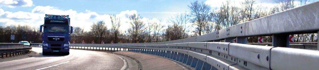


MEISER Straßenausstattung offers a wide range of vehicle restraint systems with various applications. Only steel systems provide highest crash resistance combined with low impact severity.
Phone: +49 6887 - 9590 100
+49 6887 - 9590 100
E-Mail: strassenausstattung@meiser.de Web: strassenausstattung.meiser.de

Networks of desire
Demandresponsive public transport options are making first and last-mile connections vastly more efficient than traditional local bus services

In Europe, demand-responsive transport (DRT) has leapt from niche to mainstream. Ondemand buses are rolling out in cities and rural districts alike, driven by a desire for innovative post-Covid-19 public transport and government agendas focused on social equity. Across the developing world, informal and flexible transport is an established part of urban life and has proven resilient in adapting to change. But data platforms must make sense of vast, seemingly chaotic systems to enable optimised real-time choices.
DRT now part of the mix
Global DRT player Via has seen rapid expansion of UK on-demand bus services. “We’re just in a different world,” says Via UK partnerships manager, Jonathan Hampson. “In two years, we’ve gone from one or two DRT schemes to 17
As on-demand public transport hits the mainstream in Europe and the USA, developing cities, from Mexico City to Gauteng in South Africa, are grappling to make long-established informal modes efficient and comprehensible – with real-time data the key to it all
Words | Jack Roper

and now have dedicated funding-streams.” The UK Rural Mobility Fund supports provincial deployments, while a £3bn (US$3.9bn) National Bus Strategy requires local authorities to submit bus service improvement plans (BSIPs) to determine funding. “All of those now include DRT,” says Hampson. “There’s general recognition that must be part of the mix.”
Britain’s poorly connected villages provide the most obvious use-cases for DRT services like Tees Flex, established by Via and Stagecoach in northeast England. “Previously, fixed-route buses went round villages maybe twice a day,” says Hampson. “But how can you plan your life around that?” Now villagers can summon Tees Flex via an app with average 20-minute wait-times. “For rural communities, that’s transformative.” Hampson casts DRT in terms
064 Intertraffic World | Annual Showcase 2022 REAL-TIME DATA

Annual Showcase 2022 | Intertraffic World 065 REAL-TIME DATA
Above and right: The Rumbo app is helping to make Mexico City’s combination of formal and informal transport options easier to use
of the Conservative government’s professed levelling up agenda. “Suddenly, everyone can access jobs and services,” he says. “People not on fixed bus-routes are no longer car-dependent.”
New world of demand
Mexico City is the world’s fifth-largest city and one of the most congested. Its dizzyingly complex transport network typifies cities across the majority of the world, where 80% of urban dwellers depend on informal public transport. “People who have lived in these cities their whole lives struggle to find the most efficient routes, never mind first-time visitors,” says WhereIsMyTransport co-founder and CEO, Devin de Vries. “Solving that
The colectivo network is 10 times larger than the formal system and critical to Mexico City’s functionality
Devin de Vries, co-founder and CEO, WhereIsMyTransport

challenge requires data on every mode and operational style, with added layers such as service alerts and the all-important communitycontributed content.”
Public transport ranges from government-run Metro and bus systems to flexible and semiflexible modes known as colectivos. “Private operators run many thousands of microbuses, camiones and combis under government concession,” explains de Vries. “The colectivo network is 10 times larger than the formal system and critical to Mexico City’s functionality.” Like DRT services, colectivos run on flexible routes and timetables, but unlike them they have been unpredictable, especially when external events impact the network. Colectivos are a hard mode to pin down.
But back in November 2020, WhereIsMyTransport launched its Rumbo Android app in Mexico City. Rumbo provides real-time data and alerts for both formal and informal modes across 2,400 routes. “Local data-collectors on the

REAL-TIME DATA 066 Intertraffic World | Annual Showcase 2022
ground use our bespoke app to track routes, frequencies and fares,” says de Vries. “We map entrances, exits, stairs, gates and platforms at stations and interchanges. After initial data collection, we keep a team in each city to maintain data accuracy.” Rumbo is further informed by social listening and allows users to submit their own disruption reports.
Rumbo enables travellers to navigate a tumultuous network continually reshaped by fluid vicissitudes of demand. Already, it has 100,000 users in Mexico City and has issued 750,000 real-time disruption alerts. “In recent months, Rumbo was a go-to resource as commuters navigated disruptions caused by the overpass collapse and Metro fires,” says de Vries. “Visitors can experience full cultural immersion and wander without getting lost.”

Car-free uplands
The UK decarbonisation agenda informs new DRT services that reduce car-dependency. “For a year, we told people not to use public
Making it real-time in Chicago
An award-winning rider-detection system enabled Chicago Transit Authority to adapt to ensure safe and socially distanced bus travel.
Digi International’s transit-occupancy pilot project with Chicago Transit Authority (CTA) and City Tech Collaborative was conceived in response to the need for safer transit during the pandemic. By providing real-time insights into the occupancy of buses on its 79th Street routes, it has helped CTA proactively meet ridership demand, reduce passenger crowding and wait-times and provide a socially-distanced travel experience.
The system tracked unique riders via wi-fi detection enabled by routers on vehicles. This information was provided to the Digi Remote Manager command center, which configured, deployed and managed remote devices and assets securely at the edge.


IoT World recognized the innovative system, which enables demand-responsive bus deployment, with its IoT Deployment of the Year Award for 2021.
“We are proud to be named a winner in this year’s IoT World Awards, particularly for a collaborative project that aimed to solve unique challenges brought on by the pandemic,” says Digi business development director for government, Steve Mazur. “Covid-19 paused many smart city and transportation projects but prompted an impactful one in Chicago, where citizens rely heavily on public transit.
“Through this pilot, Digi demonstrated the value of IoT technology in solving current challenges within the core functions of society and built a solid foundation for future operations prioritizing the greater good.”
Covid-19 paused many smart city and transportation projects but prompted an impactful one in Chicago, where citizens rely heavily on public transit
Annual Showcase 2022 | Intertraffic World REAL-TIME DATA 067
Steve Mazur, business development director for government, Digi International
transport,” says Hampson. “Now, we need to get people away from private cars and back on shared transport. Frankly, public transport didn’t function well before, so simply rebuilding it won’t work.”
Britain needs new solutions – and Via’s research supports the case for on-demand buses. “In Wales, we have a nationwide scheme called Fflecsi,” says Hampson. “Recently, 73% of car-owning survey-respondents said they drive less now Fflecsi is in place.”

“In the world’s most polluted cities, Covid-19 translated into the first clear skies seen in decades,” says de Vries. “Now, sustaining the new normal calls for blue-sky thinking.” But he questions proposals to invest in Mexico City’s Metro, bus and railway systems and reduce reliance on dirty and overcrowded minivans. “Informal transport is often maligned in this way,” he says. “It’s easy to see cramped, older vehicles and miss the advantages of
informal networks.” Per person, he estimates that colectivos emit at least four times less than single-occupancy cars.

Collective good Mexico City has 1,400 informal public transport services, compared to just 199 formal ones. “Informal vehicles serve peripheral areas the Metro doesn’t reach,” continues de Vries. “Without them, the city would grind to a standstill.” Instead of costly network expansion, he advocates affordable improvements to demand-driven travel.
“Informal transport receives zero subsidy. Channelling even a fraction of transport spending would create safety and travel-time benefits.” This could include safety cameras, better vehicle standards and upgrade subsidies, while dedicated public transport lanes cost little and benefit low-income passengers.
Formerly ViaVan, Via has a global presence with partnerships across 26 countries. But no UK services are Via-branded. “We white-label our technology to power other people’s mobility services,” Hampson explains. “Our partners are bus operators and local authorities.” Tees Flex is a partnership with Stagecoach and Tees Valley Combined Authority. “We provide the technology layer and sometimes the operations:

REAL-TIME DATA 068 Intertraffic World | Annual Showcase 2022
Above and below: Via builds white label apps that allow local authorities to add on-demand services to their networks under their own branding
In two years, we’ve gone from one or two DRT schemes to 17 and now have dedicated funding-stream Jonathan Hampson, partnerships manager, Via UK


JOIN THE KEY EVENT FOR TRAFFIC TECHNOLOGY & MOBILITY PROFESSIONALS IN LATIN AMERICA! SPEEDING UP THE MOBILITY TRANSITION 8 – 10 NOV 2022 MEXICO CITY • Future intelligent mobility • The power of data • Smart infrastructure • Sustainable solutions • Knowledge exchange INFORMATION AND EXHIBITING OPPORTUNITIES: RAI Amsterdam - Intertraffic Worldwide Events T +31.20.5491212 E intertraffic@rai.nl W www.intertraffic.com SUBSCRIBE TO OUR E-NEWSLETTER: The latest mobility developments and intertraffic event news straight to your inbox. CONTACT US!
Above: A Via service operating in New York City. The company has a presence in 26 countries

whichever makes most sense.” The technology consists of three disarmingly simple pillars.

The first component is customer-facing. “We have some really nice-looking, white-label apps,” says Hampson. “Our services can also
be booked by phone.” The second, back-office pillar is the Via Operations Center. “The beauty of DRT is the reporting. It shows exactly who’s travelling, where they booked and their destination. The insight is substantial.”
The third pillar, a driver app, provides a dynamic agenda and makes the vehicle visible to passengers. “That’s it,” says Hampson. “Other than the driver’s mobile device, no additional hardware is needed.”
A suite of APIs enables Via to connect with mobility-as-a-service (MaaS) models which combine on-demand and fixed-route travel within one experience. “We can either integrate other services into our app, or integrate our services into third-party MaaS apps,” Hampson explains.
69%
The proportion of citizens who rely on privately-run minibus taxis for their daily mobility, in South Africa’s Gauteng City
In Berlin, the BerlKönigbranded Via service is already integrated into the Jelbi MaaS app, while Via has partnered with Ticketer to evolve its third-party planning and ticketing.
African routes
Frankfurt’s on-demand network
Germany’s Rhein-MainVerkehrsverbund (RMV) transport association has launched an ondemand transportation app expected to benefit up to 1.8 million people. It coincides with the introduction of EMIL, a new shuttle service in Taunusstein near Frankfurt which is bookable via the RMV app.

Deutsche Bahn subsidiary ioki is responsible for the intelligence underpinning the platform. The project will see 10 local partners in the Frankfurt Rhine-Main metropolitan area roll out on-demand services, creating the largest such network in Germany.
“New, data-based transport will play a decisive role in the mobility turnaround of Germany and in Europe,” says ioki managing director, Dr Michael Barillère-Scholz. “Our goal is to support public transport companies and municipalities with our digital knowledge and platform as best as we can. This project’s significance extends far beyond the borders of the Rhine-Main region. It exemplifies an integrated, planned and efficient approach to new mobility.”
The EMIL shuttle is intended to promote both digital and climate-friendly mobility for the citizens of Taunusstein. By 2022, the fleet will include up to five electrically-powered shuttles. Some will be barrier-free, to enable flexible mobility for all users. They will operate for longer than existing services, particularly at evenings and weekends.
New, data-based transport will play a decisive role in the mobility turnaround of Germany and in Europe
Dr Michael Barillère-Scholz, managing director, ioki
DRT is inherently adaptable. In South Africa’s Gauteng City Region, 69% of households rely on tens of thousands of privately-run minibus taxis for their daily mobility. “Public transport consists mostly of buses, subject to frequent breakdowns and delays,” says de Vries. “The minibus taxis receive no subsidy and short journeys within Johannesburg cost only a few rand. But together, they represent a business essential to the economy and worth US$6.4bn a year.”
The minibus-taxi network is dynamic and shifts to meet demand: routes crop up or extend to serve new housing developments or shopping malls. During the pandemic, fluidity provided resilience. “In 2020, 30% of routes changed as operators reacted to falling ridership by extending or merging them,” says de Vries. “Fares initially rose before settling at 10% to 40% above pre-Covid levels.”
Now, he believes comprehensive datamapping is needed to provide confidence in new ventures and investment – in South Africa and beyond. “In emerging-world cities, 85% of public transport operates informally and two billion people rely on it,” he says.
The rapid growth of UK on-demand bus services is driven in part by parallel innovations in private mobility and customer expectations created by Uber-type services. “If bus companies and cities aren’t keeping up with those services, public mobility will suffer,” says Hampson. In the end, this is why DRT matters. “It’s just so important that public shared mobility wins over private mobility. We now have a government prepared to reinvest into public transport. The key thing is: does the money actually flow and translate into better services?” ■
REAL-TIME DATA 070 Intertraffic World | Annual Showcase 2022


Smart and Secure Cities - Advanced speed measurement: multi-vehicle detection, classification, multi-lane tracking... - Real-time data collection: dimensions, direction, distance, classification... - Reliable traffic management through the 3D-LiDAR sensor - Plug-and-play and user-friendly solution with automatic calibration www.parifex.com l info@parifex.com Speed Enforcement and Traffic Management Multifunctional Tool
spaceGuidedinto


072 Intertraffic World | Annual Showcase 2022 SMART PARKING
Parking is too often a secondary consideration for urban traffic managers, particularly in the developing world, where cities are growing at an exponential rate. But, by applying the latest advances in technology, systems can become safer, more efficient and more sustainable

Parking issues date all the way back to the early 1900s, when automobiles first started to gain popularity.

Interestingly, one of the main attractions of automobiles was that they could be left unattended when not moving, unlike any other mode of transport at that time. Henry Ford once described the reactions he received while out driving his first Quadricycle. The Quadricycle (first built in 1896) was considered somewhat of a nuisance in public places where horse carriages were in use, because it scared the horses. It also blocked the traffic. “If I stopped my machine anywhere in town, a crowd was around it before I could start up again,” he said.
“If I left it alone even for a minute, some inquisitive person always tried to run it. Finally, I had to carry a chain and chain it to a lamppost whenever I left it unattended.” The issue of automobile parking had begun. With time, as the number of automobiles on roads increased, there became a serious need for unmanned, compact and sometimes automated parking systems. Efforts to create primitive automated parking began as early as 1905, when Paris, France, became the first city to try out an automated parking system,
Annual Showcase 2022 | Intertraffic World 073 SMART PARKING
Words | Prabhat Khare, transportation consultant and senior industry veteran of Tata Motors, Honda Motor Company and Ashok Leyland
Above right: The challenge of parking is as old as the automobile itself – Henry Ford experienced it when using his first ever car, the Quadricycle, built in 1896
Main: Today, smart parking can help EV drivers to find charging points
Automated parking systems are an impressive way to save urban space, but their cost means they remain relatively rare
which consisted of a multistorey concrete structure with an internal elevator. It was nearly another 50 years before the first driverless automatic parking garage opened in Washington, DC, in 1951. Throughout the 20th century, as technology evolved, better, safer, more compact, and more efficient parking systems were developed. Slowly automation was brought to parking systems.
Smart automation
In many current automated parking systems (APS), an electro-mechanical system is used to optimize the area and/or volume available for parking cars. In multistorey parking garages, APS can stack cars in various configurations. These systems may use a variety of subsystems to pick up vehicles from the entry point and transport them to parking bays. They can later reverse the process when retrieving these vehicles for their owners.
These APS are also known as automated parking facilities (APF), automated vehicle storage and retrieval systems (AVSRS), car parking systems, mechanical parking, and robotic parking garages.


But fully automated parking systems remain something of a novelty and are now being overtaken by smart parking technologies that utilize numerous different intelligent technologies including floor-embedded smart parking sensors, infrared cameras, location sensors and counting sensors. These are linked
with in-car technology or smartphone applications, harnessing the power of the Internet of Things (IoT) to guide drivers to available parking, and even allow for reservation of spaces and payment in advance, making parking an altogether more streamlined and seamless process.
This kind of real-time information means that all free parking spots can be dynamically ‘talking’ as a single entity to all approaching vehicles. Once the driver decides on a particular facility, the smart parking system ‘pulls’ the vehicle to an available bay.
Naturally, such complex systems have cost implications, but may become more affordable to create as the price of electronics diminishes over time. They can be seen as integral to future smart cities driven by IoT infrastructure, utilizing that infrastructure to drive economic growth and enhance quality of life. Indeed, smart parking systems promise manifold benefits to various city stakeholders. If the same footprint can accommodate more vehicles, cities can update building codes and land-use policies to reflect a reduced need for parking areas. This will make cities cleaner, greener and inherently more amenable to people instead of cars.
Look smart, save space
As so many vehicle miles are wasted looking for parking, smart parking systems could save millions of liters of fuel. Such systems also provide the best routes to parking in any area of
074 Intertraffic World | Annual Showcase 2022 SMART PARKING
Above & Below:


BECOME OUR PARTNER for AI smart mobility solutions White Lable solution with your brand Large portfolio of high-precision smart mobility products with AI, all GDPR compliant full range of products for AI smart mobility solutions Let‘s shape the future of mobility together! www.swisstraffic.com White Lable solution with your brand Large portfolio of high-precision smart mobility products with AI, all GDPR compliant Use our 20 years of Swiss engineering expertise and support Scan it for full range of products for AI smart mobility solutions Let‘s shape the future of mobility together! www.swisstraffic.com White Lable solution with your brand Large portfolio of high-precision smart mobility products with AI, all GDPR compliant Use our 20 years of Swiss engineering expertise and support Scan it for full range of products BECOME OUR PARTNER for AI smart mobility solutions White Lable solution with your brand Large portfolio of high-precision smart mobility products with AI, all GDPR compliant Use our 20 years of Swiss engineering expertise and support Scan it for full range of products
Above: Smart parking sensors in car parks can feed data to facility managers and drivers on where spaces are available

the city. Thus, smart parking improves the utilization of existing parking spaces, leading to greater revenue for parking facility owners.
It also plays a major role in reducing emissions. Smart parking programs are now being deployed in many cities including San Francisco, Los Angeles, Stockholm, Beijing, Shanghai, São Paulo, and several cities in the Netherlands. In most of these smart parking systems, low-power sensors and smart meters track the occupancy of parking spaces throughout the city.
Developing smart parking solutions within a city requires standardized data and management, mobile phone integration, hardware and software innovation, and coordination among various stakeholders, such as parking facility owners, municipalities,
transportation authorities, customers, and software developers. Coordination between all these entities is integral to making a smartphone-enabled, multimodal, fully integrated transportation solution a reality. The technical enablers and multi-stakeholder coordination effort behind the development of a local smart parking solution create a launchpad for full transportation system integration.
Smart parking can transform urban landscapes, making them more amenable to people rather than cars. With the advent of smart parking and more mobility alternatives to personal vehicles, there will be less need for surface parking. By updating building codes and land use policies to reflect the reduced need for parking, cities can drive down building costs and encourage more varied development options. Ultimately, urban spaces can become greener, cleaner, more compact, and more inherently walkable, bikeable and serviceable by a multimodal transportation system.
Smart thinking
India (see: A country in need of smart parking, below) is an extreme example that shows how important parking is to our mobility systems. Any country that has a complex, dense mobility network needs a well-planned, focused approach to parking solutions.
A fully integrated approach to smart parking is the ideal replacement for primitive and unorganized parking systems. These smart parking facilities can also become integrated electric vehicle charging hubs, meaning that they serve a dual purpose.
It is important that policymakers understand the importance of intelligent and smart parking areas. Smart parking helps mobility planners to optimize city space, reduce emissions and enhance quality of life for all. A smart city starts with smart parking. n
A country in need of smart parking
Despite India having some of the world’s best automotive brands on its roads, the country’s parking system is in chaos. A deadly combination of too many vehicles and unorganized parking systems creates danger and disorder, as well as many other socioeconomic issues in public places. With outdated, unplanned manual parking systems lacking any kind of discipline, the general tendency of people in India has been to park their cars anywhere they want to. This approach causes traffic jams, unsafe parking, automotive damage and accidents.
Haphazard parking areas have spread across Indian cities. These are a serious social issue that not only lead to congestion on the roads, they also eat into pedestrian pathways, green
belts and bodies of water, contaminating the land. This single-level unplanned parking also leads to different modes of transportation fighting for space on the roads. All of this chaotic parking wastes people’s time and discourages them from visiting places like shopping malls or amusement parks. Customers end up spending more time parking and retrieving their vehicle than on the activities they actually want to do.
Another critical issue is related to parking charges. Currently, most parking spaces are owned and operated by unregulated entities who make up their own rules. Automated car parking systems would overcome the problem of mismanaged parking spaces, providing security to people parking there.
They would also be more time efficient, more environmentally friendly, and could recover other unaccounted losses caused by the existing system.
Even though many multilevel parking facilities have popped up in India recently, the approach has been much the same, with a lot of wasted space. Effective and efficient parking can only be managed when it is created using technology-based solutions to optimize the available space. With sensors and software, smart parking solutions can provide efficient use of limited space, easing operations for parking operators and drivers with a real-time map of tracking of parked vehicles.
076 Intertraffic World | Annual Showcase 2022 SMART PARKING
Images: Akarat Phasura, chesky, and Pavel Losevsky all stock-adobe.com


Data dreamer

One of the promises of connected vehicle data is that it could do away with the need for any other type of road sensor. That dream has not yet been realised, but US researcher Hesham A Rakha has been investigating machine learning algorithms that could one day help to do just that
Words | Anthony James

Knowing how many cars are on a given part of the road is critical for traffic management, especially at intersections with traffic lights, where estimates of traffic density are used as inputs for the timing of traffic signals. In theory, when every vehicle is a smart vehicle, able to communicate with infrastructure, estimating traffic density will be far easier and more accurate. It will also be cheaper, as modellers will no longer have to rely on expensive embedded loop or other stationary sensors to capture vehicle data.
With this future scenario in mind, a team from the Urban Mobility & Equity Center – a federally funded research consortium in the USA, led by Morgan State University, with support from the University of Maryland and Virginia Tech – has investigated and tested several approaches to estimating traffic stream density on roads with traffic signals using data from connected vehicles, in downtown Blacksburg, Virginia, USA.
The findings have been published in a report, entitled, Estimating Traffic Stream Density Using Connected Vehicle Data. The report found that the most accurate estimates resulted from using a linear Kalman filter – a type of algorithm.
The research also involved determining the level of market penetration of connected
vehicles, which the researchers did by developing a machine-learning model. As that level increases, so too will the accuracy of the estimates, the report found. Intertraffic World spoke to Hesham A Rakha, the principal investigator on the research project, which was completed in April 2021, to discover more.
What is the problem you are trying to solve?
Traffic stream density is a critical input to various advanced traffic management systems. However, measuring traffic density in the field is difficult since it is categorized as a spatial measurement. In our work, several estimation approaches are developed to provide real-time estimates of the traffic stream density on signalised approaches using connected vehicle (CV) data. The estimates are then input to adaptive traffic signal controllers to improve intersection performance, namely its efficiency, mobility, and environmental impacts.
Past research has used different data sources, such as stationary sensors (e.g. loop detectors) or fused data (combining two different sources of data) to estimate the traffic stream density along traffic roadways. However, stationary sensors suffer from poor detection accuracy and have high installation and maintenance costs. The fusion of data from multiple sources requires considerable
CONNECTED VEHICLE Q&A 078 Intertraffic World | Annual Showcase 2022
In our work, several estimation approaches are developed to provide real-time estimates of the traffic stream density on signalised approaches using connected vehicle data

Annual Showcase 2022 | Intertraffic World CONNECTED VEHICLE Q&A 079
Hesham A Rakha, is principal investigator at the Urban Mobility & Equity Center, Morgan State University, Maryland
Above: One of the keys to ensuring the accuracy of connected vehicle (CV) data is knowing the level of market penetration (LMP)
Below: The new CV data models have been tested in the real world by looking at traffic on streets in downtown Blacksburg, Virginia, USA

resources and suffers from the same drawbacks as stationary data.
How is your approach different to previous attempts to solve this problem?
Real-time traffic estimation has received increased attention following the introduction of advanced technologies, such as CV technology.
In our work, we attempt to develop novel estimation approaches using only inputs from CVs. Our new research approach is unique as we are attempting to reduce the cost of data collection through the elimination of, or reduction of, stationary sensors.
The idea was introduced to improve the research area of real-time traffic density estimation. The new improvements include avoiding data quality issues produced by current sensors, such as detection failures, and reducing sensor installation and maintenance costs.
How can connected vehicles help?

CVs are defined as vehicles that can exchange information, such as instantaneous speed, position, and acceleration, with other CVs. This is generally referred to as vehicle-to-vehicle, or V2V, communication. These CVs can also exchange information with road infrastructure, which is referred to as vehicle-to-infrastructure, or V2I, communication. Comparing our new approach to state-of-the-art approaches, the use of CV data allows us to track all CVs in real-time,
while for state-of-the-art approaches the system accesses vehicles’ information at fixed locations (around the sensors’ locations). Consequently, our new system will have more information about traffic behaviour at any time and is also cheaper given that vehicle connectivity is the new norm of the future.
Can you summarize your major findings?
The report develops a linear Kalman filter (KF), a linear adaptive KF (AKF), and a nonlinear particle filter (PF) to estimate the traffic stream density using CV data only. The proposed approaches were evaluated using empirical and simulated data, the former of which were collected along a signalised approach in downtown Blacksburg, Virginia.
Results indicate that density estimates produced by the linear KF approach are the most accurate and robust. A sensitivity of the estimation approaches to various factors, including the level of market penetration (LMP) rate of CVs, the initial conditions, the number of particles in the PF approach, traffic demand levels, traffic signal control methods, and vehicle length, were presented.
Providing accurate LMP estimates should improve the estimation accuracy of the vehicle counts. Therefore, in this research, a machinelearning model was also developed to provide real-time estimates of the LMP values. This developed filtering model was combined with the developed machine learning model (AKFNN) to improve the vehicle count estimation accuracy.
Does increased penetration of CVs automatically give greater data accuracy?
Results show that the accuracy of the density estimate increases as the LMP increases. They also showed that the KF is the least sensitive to the initial traffic density estimate, while the PF is the most sensitive to the initial traffic density estimate.
The results also demonstrate that the proposed estimation approaches work better at higher demand levels given that more CVs exist for the same LMP scenario. For traffic signal
CONNECTED VEHICLE Q&A 080 Intertraffic World | Annual Showcase 2022
URBAN AREA
RAIN RFID READER
High speed identification HSM/SAM module 800 MHz Dual Core IP67
RAIN RFID ANTENNA
Gantry mounted Plaza mounted IP67
CROSSTALK SOFTWARE
Device management Filtering Event creation Backend integration
PROFESSIONAL SERVICE
PARTNER TAK H R EIN END C U S T REMO
LAW ENFORCEMENT
CAR WASH
ROAD CHARGING
TOLLING
PARKING
Consulting Support Training 128-bit AES encrypted Tamper proof Anti-Counterfeit
LOW EMISSION ZONE
RAIN RFID TRANSPONDER
Kathrein Solutions GmbH is manufacturer of RAIN RFID hardware, also referred to as passive UHF RFID technology (860 – 960 MHz). It is thus partner and technical backbone for Electronic Vehicle Identification (EVI) and Registration (EVR) companies, integrators for Intelligent Transportation Systems (ITS), tolling providers (ETC, EETS) and parking operators worldwide. Kathrein’s modular portfolio of readers, antennas, the software platform CrossTalk
and its professional services is the perfect fit for partners that are handling barrier solutions (Stop&Go), multi-lane free flow as well as Parking and Smart City scenarios.
If you are looking for a strong and globally operating RAIN RFID expert to support your end-customer applications, then visit us and become part of our world-wide partner eco-system.
Meet us at: Intertraffic World 2022 29 Mar. - 1 Apr. 2022, Amsterdam Hall 01, Booth 442 Your Partner for ITS Solutions www.kathrein-solutions.com
Right: Figure 1,
Our approach relies on using only CV data without the need to install new sensors in the field, which makes our approach’s implementation cost lower compared to state-of-the-art approaches
control methods, the results demonstrate a higher estimation accuracy for fixed traffic signal timings at low traffic demand levels, while the estimation accuracy is better when the adaptive phase split optimiser is activated for high traffic demand levels.
The report also investigated the sensitivity of the KF estimation approach to vehicle length, demonstrating that the presence of longer vehicles (trucks, for example) on the approach reduces the estimation accuracy. In conclusion, the use of the linear KF approach is highly recommended in the application of traffic density estimation due to its simplicity and applicability in the field.
How will machine learning help to further improve the model?
In our developed KF, the state and measurement equations use one LMP (ρ) value for the entire
simulation for each LMP scenario. This means that we ignore the instantaneous changes that occur in real scenarios. Instead, we use the average ρ value in our equations. Figure 1 demonstrates how the actual ρ values are changed in every step. However, our model was designed to use the average ρ value along the estimation steps.

The AKFNN machine-learning model was developed to use real-time ρ values to reflect all instantaneous changes. Specifically, a machine learning (ML) model was developed to provide real-time estimates for the ρ values so the AKF model can use these estimates in every estimation step. The use of ML improved the traffic density estimation as the errors produced from the state equation were reduced due to the use of actual ρ values instead of using an average ρ value. Consequently, it is much easier for the AKF to correct a small error rather than a large error after applying the measurement equation.
Just how much do you expect the new method to improve traffic density measurement?

We compared our proposed approach with a previous study into this subject (Vigos, G; Papageorgiou, M; Wang, Y. Real-time estimation of vehicle-count within signalized links. Transp. Res. Part C Emerg. Technol. 2008, 16, 18–35). Using the simulated data, Vigos et al. proposed using at least three loop detector measurements with a fixed time interval (i.e., 20 seconds), which resulted in a robust model with up to 27.5% RRMSE (relative-root-mean-squared deviation) values. In contrast, our approach uses only connected vehicle data, producing RRMSE values of a maximum of 16%.
Our approach relies on using only CV data without the need to install new sensors in the field, which makes our approach’s implementation cost lower compared to state-ofthe-art approaches. Data can be gathered directly by the controller using the vehicle-toinfrastructure (V2I) communication.
Our estimation approaches are developed to improve the overall intersection measures of effectiveness (reducing traffic delays, queue lengths, fuel consumptions and emissions). The new approaches are designed to allow traffic signal controllers to utilize accurate realtime estimates as inputs to assist with green time allocation.
We now plan to test the traffic signal controller performance using the estimation outcomes from our KF estimation approach. n
FIND OUT MORE
For more information on the Estimating Traffic Stream Density Using Connected Vehicle Data research project, please contact Professor Hesham A. Rakha, Ph.D., P.Eng., FIEEE, Samuel Reynolds Pritchard Professor of Engineering, Dept. of Civil & Environmental Engineering, Virginia Tech Transportation Institute, email: hrakha@vt.edu.
CONNECTED VEHICLE Q&A 082 Intertraffic World | Annual Showcase 2022
Above: The higher the density of traffic, the more CVs are likely to be present
actual LMP (level of market penetration) variations compared to average, along the estimation steps
Images: Song_about_summer and Sundry Photography both at stock_adobe.com


KNOWLEDGE Subscribe to unique and essential content now MA Engineering and Technology features four highly focused engineering magazines as well as nine industry newsletters that are full of mission-critical news and innovation. Covering technologies from pump engineering, filtration systems, and advanced composite materials to biometric know-how, sealing technologies and even safety management of big data, the MA Engineering and Technology titles provide subscribers with a truly innovative, global insight into their specific industries. Titles include: Plus! • Biometric Technology Today • Computer Fraud & Security • Network Security And Fuel Cells Bulletin which comes with a free subscription to Electric & Hybrid Rail Technology as well as Electric & Hybrid Vehicle Technology International! A subscription to this unique collection of publications provides users with back issues starting from 2018 as well as the latest news. Titles can be individually ordered or purchased as a collection at a discounted price. • World Pumps • Pump Industry Analyst • Sealing Technology • Filtration + Separation • Filtration Industry Analyst • Membrane Technology • Reinforced Plastics • Additives for Polymers • Metal Powder Report To find out how you can access this mission-critical information, email: institutions@markallengroup.com Web: www.markallengroup.com www.markallengroup.com Part of plastics reinforced the voice of the composites industry worldwide www.reinforcedplastics.com November/December 2021 An exclusive interview with Wes Jacklin, McLaren Composites Technology Centre plant director COMPOSITE TECHNOLOGY ‘ON ANOTHER LEVEL’ AT MCLAREN Lost in the flood PUMPING TECHNOLOGY THAT’S DESIGNED TO DEAL WITH FLOOD DISASTERS www.worldpumps.com Marine So ware Chemicals & abrasives THEINTERNATIONALMAGAZINEFORPUMPUSERS December 2021 VOL 76 NO 6NOVEMBER/DECEMBER 2021 www.markallengroup.com/brands/metal-powder-report/ TO THE STARS SPANISH COMPANY IS 3D PRINTING A NASA ALLOY TO MAKE FUNCTIONING AEROSPIKE ENGINE PARTS Resusing dirty water NOVEMBER/DECEMBER 2021 Preventing drinking water going down the drain Monitoring How measuring, monitoring and control can ensure sustained performance Food & beverage Microplastics One of the biggest environmental issues is explained at FILTECH 2022 WATER & WASTEWATER
V2X and beyond
Technology is helping make the world’s roads smarter, safer and less congested, thereby reducing carbon emissions. Here we profile some of the most popular – as well as some of the more unusual – new solutions
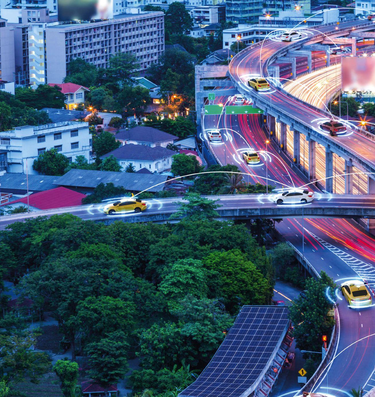
SMART ROADS 084 Intertraffic World | Annual Showcase 2022
Words | Prabhat Khare, transportation consultant and senior industry veteran of Tata Motors, Honda Motor Company and Ashok Leyland
Even though roads are some of the key arteries of modern societies and economies today, they are still commonly viewed as classical civil and structural engineering infrastructure.

However, several technological innovations have been made over the past few decades to challenge this perception and address the current challenges of the existing road network, such as congestion and safety.
Roads are now becoming sensitive to their surroundings. For example, various sensors are being embedded into them, so networks can be developed that are more efficient. Smart road systems are just one part of what goes to make up today’s smart cities.
Roads can now communicate with their surroundings and with other vehicles moving on them, and harness energies to maintain constant communication with a central server, updating information on a real-time basis. This kind of detailed real-time updated information is useful in tackling congestion and improving traffic flow, enabling faster response time to accidents, and for the swift handling of traffic violations.

Annual Showcase 2022 | Intertraffic World SMART ROADS 085
Above: A timeline illustrating how technology has and will continue to impact the mobility sector

Below: If executed well, vehicle-toeverything (V2X) communications could transform congested streets, improve road safety and reduce vehicle emissions
Using artificial intelligence (AI), this information can also be utilized for adaptive traffic lights and to integrate various roadways for smooth traffic flow. Such a large amount of data can also be used for long-term analysis for monitoring and improving the road conditions and to reduce CO2 emissions.
This article examines some of the key recent advancements in road technology and looks at how they address some specific problems affecting the current mobility system. It is expected that as technology evolves further, a new mobility system will be created which sees smart, intelligent, connected, and communicative roads playing a much bigger, important, and critical role in society.
Vehicle-to-everything
One of the key technologies that road agencies and automotive OEMs around the world are
investing in to improve the safety and efficiency of their networks is V2X (vehicle to everything) communications. With such systems vehicles can ‘talk’ to each other and to infrastructure and other road users. This means drivers can be alerted about potential upcoming traffic hazards, before they see them, enhancing their perception and reducing crashes, improving safety for road users. Such systems can also be used to enhance enforcement of traffic offences.
V2X technology can also enable roadside variable message signs (VMS) to communicate their alerts with drivers way beyond line-ofsight, as well as act as nodes for gathering information from the cloud, based on alerts coming from other connected vehicles.

Intersections can also be made smarter and safer with multiple sensors for V2X connectivity. Furthermore, AI can be employed at these smart intersections to enable better understanding of traffic densities, roadway situations and to dynamically adjust traffic signal timing to optimise traffic movement.
Connected vehicle technology also enables automatic crash notification with geo-location sent to all agencies involved to handle the case. This helps to reduce the time elapsed between the crash and the arrival at the hospital. Reducing this time gives injured people can have a greater chance of survival.
As the World Health Organization estimates around 1.3 million people die on roads every year and around 20-50 million more people suffer serious injury. It’s hard to think of a more pressing task for the transportation world than reducing this number.
But V2X isn’t the only way in which the world can reduce crashes on roads. Some other, more novel technology is being used to improve safety in different locations around the globe.
Musical roads
These roads are designed to produce music or tunes when vehicles drive on them at a set speed. Countries like Japan, USA, Denmark, Netherlands, Taiwan, and South Korea have constructed such roads using grooves or rumble strips, which are spaced out at specific intervals on the road surface, forming the tones of the music generated.
In Korea, for example, musical road surfaces have been developed, with the tune of Mary had a Little Lamb played when motorists keep to the speed limit. The optimal speed for listening to these songs from the road is 62mph. At faster speeds, motorists still hear the music, but it is a double-time, high-pitched version.
The primary purpose of these musical roads is to warn the driver of a hazard, make them aware of road safety and help them to maintain the speed limit. However, such music from the roads can be disturbing to residents living nearby, especially during the night, hence their use has been restricted or used particularly on highways and long country roads, to serve as a reminder of the driving speed.
SMART ROADS 086 Intertraffic World | Annual Showcase 2022
Harvesting energy and EV charging
Apart from improving safety, technology is also stepping in to aid decarbonization. Two factors make roads highly attractive for energy harvesting. First, they have a large surface area open to solar radiation, and second, due to the constant movement of vehicles, there is a lot of dissipation of kinetic and frictional energy on them. For harvesting solar energy, heavy-duty and rugged photovoltaic modules are placed directly on top of road surfaces (these roads are known as solar roads). To harvest kinetic and frictional energies from vehicular movement, piezoelectric devices
The Indian smart-roads scenario
While India may have the second-largest road network in the world, spanning a total of 5.89 million kilometres, it lags far behind in terms of road quality. Only 69% of India’s roads are paved, for example, and for the roads that are surfaced many of them fall well below global benchmarks in terms of quality and design.
In general, the roads in India have never been treated with respect. They are one of the most
are placed below the road surface to generate electrical energy (these roads are known as piezoelectric roads).
With the rise of EVs which need to be recharged at regular intervals also came a need to charge them while they are traveling on the road. In 2016, the very first solar road consisting of 2,880m2 of solar panels, was made in France, and the power generated by this solar road was used to power all streetlights. Later, the USA, Sweden, China, the UK, and Japan followed suit by developing various solar-powered road stretches
which are currently under performance trials.
While France leads in solar road development, Sweden has developed a stretch of 1.2 miles of road near Stockholm into an electrified road which dynamically recharges vehicles while they move on the road using magnetic induction technology. Cables are buried underneath the road surface and generate electromagnetic fields strong enough to be received by a receiver device in the vehicle, transforming it into electrical power and charging the onboard battery.
abused infrastructures in the country and are coming under increased pressure from urbanisation, growing traffic volumes and public misuse. The country’s network has a very long way to go before it can be considered even slightly smart.
The Indian Government, engineers, and infrastructure stakeholders, who have all been focusing on creating smart cities around the country, must also think about how the road
Above: Solar radiation and kinetic and frictional energy can be harvested on roads to power vehicles and roadside units, such as streetlights

Left: Smart intersections, which use sensors to monitor traffic, offer improved driver safety and optimized vehicle movement

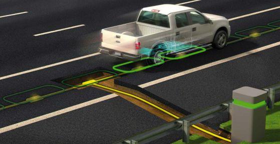
Annual Showcase 2022 | Intertraffic World SMART ROADS 087
CO2 reduction tech
Above: Figure showing breakdown of road length, number of vehicles, road density and number of vehicles per person, for countries around the world

network can be upgraded so it can seamlessly integrate with the new modern cities.
To make the move to smart and intelligent roads, India needs to overcome some tremendous challenges. However, the country has begun to take some small steps. One of these steps is by an Indian team from HP Lubricants and Leo Burnett India. The team has installed a set of SmartLife poles on the National Highway 1 (NH 1) in India, which connects Jammu and Srinagar, and is considered one of the most dangerous roads in the world.
The poles are installed as part of an anticollision vehicle management system for a dangerous hairpin. The poles gauge the speed of approaching vehicles and communicate with
Smart lighting
Decarbonisation efforts are further aided by making street light smart. The first road with a smart/intelligent street lighting system was deployed in Oslo, Norway, in 2006 with a purpose of optimizing the street lighting system based on daylight, weather conditions and traffic movement to save energy.
CO2 reduction tech
Many streetlights today have been replaced with LEDs, and sensors and wi-fi are also being added to streetlights’ control units to allow them to sense the presence of pedestrians and traffic, to turn on and off when needed, while maintaining minimum illumination for social safety (this is known as on-demand lighting).
Wireless connectivity has allowed streetlights to be connected, enabling them to form networks, and allowing them to be controlled remotely or in tandem forming pairs or groups based on the particular needs of the roadway where they are deployed.

Roads that honk
HP Lubricants and Leo Burnett India have innovated with #RoadsThatHonk: the world’s first anti-collision system for dangerous hairpin bends. The pilot initiative is at NH1 on the Jammu-Srinagar highway, in India. Play the video embedded on this page to find out more.

each other to alert drivers if they are speeding by sounding a horn (see video demo above).
Although the modernization of the Indian road network is a herculean task for the government and it may take many years to fully realise, it should certainly be a high priority for the nation. Investment in smart roads with cutting-edge technologies, such as the SmartLife poles, could help India catch up with the rest of the world in terms of smart infrastructure development. India also has an ambitious goal of 30% of all new vehicle sales being electric by 2030. Current and future roads plans must be developed with this target in mind to ensure that the country develops smart roads for the future.
SMART ROADS 088 Intertraffic World | Annual Showcase 2022
Looking to a smarter future
In the transportation sector, smart roads can bring about greater automation, higher energy efficiencies, lower costs, improved road safety, cleaner air, reduced congestion, fewer accidents and fatalities, and an improved quality of life for society. To achieve these benefits, roads should no longer be viewed as static infrastructure, but rather as a dynamic and intelligent sub-system of society, which can sense its surroundings and be responsive to various situations.
The smart road system should be able to communicate, in real-time, with a central server to provide regular updates on traffic conditions, road loading, weather conditions, and accidents, among other things. The possibilities and

benefits of smart roads seem endless, and they can make a great contribution to efficient and smooth city operations.
Live neural system
In the future, it is possible that the ‘information grid’, the ‘electric grid’, and the ‘transportation grid’ will all blend to form a live neural system for smart cities in which a central control room serves as the ‘brain’ of the operation, while the smart roads serve as the ‘central nervous system’. Meanwhile, EVs and connected and autonomous EVs, serve as the ‘arms and legs’ and information and power flows through a virtual eco-system creating a real alive and kicking smart city. n
Above: Fitting solar panels into road surfaces is helping the drive towards decarbonisation

Below: Smart, connected infrastructure can inform drivers of road conditions via smart devices

Annual Showcase 2022 | Intertraffic World SMART ROADS 089
Lead image: kinwun@adobe-stock.com


from quality one head attachment WATER BLAST & GRIND TOGETHER WATER BLAST ONLY GRIND ONLY from our family tree to yours... total pavement solutions live bi-weekly webinars sign up at thehog.com
born
INFRASTRUCTURE


PARKING TRAFFIC MANAGEMENT


Annual Showcase 2022 | Intertraffic World 091
Innovative water blasting solutions
Efficient, effective line marking maintenance and removal requires machinery that is built for purpose, supported by industry experience and knowhow
Water blasting is now established as a highly effective way to maintain or remove line markings on roadways or runways. With no need for harsh chemicals, abrasives or substances, it is a safe, clean and environmentally friendly approach. Water blasting efficiently performs cleaning, maintenance or removal applications without damaging the pavement below.

Hog Technologies has been honing its expertise in this sector since 1988, when founder and CEO James Crocker began a small pressure washing service in Florida.
“For the first 15 years, we were known as PCS, Pressure Cleaning Services,” explains Vince Giordano, vice president of sales, Hog Technologies. “About 17 years ago, we moved from being a contractor to being an equipment manufacturer. This switch came about because James was frustrated with other manufacturers in the industry; the customer service and quality they were providing was not sufficient.”
So in the spirit of entrepreneurship and innovation, the company set out to master the technology itself.
“Now we manufacture six different types of trucks. We’ve sold machines to municipalities, airports and contractors in 57 countries around the world,” says Giordano.

The turning point in the airport industry came 12 years ago. “Prior to this, airports would use five or six people with chemicals and machines to sweep rubber off the runway so planes aren’t sliding when they land,”
Above: Water blasting enables rapid removal of single, continuous lines
says Adam Baldwin, vice president of marketing, Hog Technologies. “Environmentally, this is not the most conducive way to do it.”
Pittsburgh International Airport saw the value in buying a Hog Technologies Stripe Hog water blaster to remove rubber instead, leading the way for several other large airports to do the same. Today, 93% of airports in the USA that own a water blaster, own a Stripe Hog.
Spirit of innovation
Hog Technologies helps private roadway and runway contractors to find solutions for anything from line striping to cutting rumble strips.
35
“The Stripe Hog is the machine that launched us into the industry to become the dominator,” Baldwin explains. Its applications include marking, rubber and paint removal, marking cleaning, hydraulic spill clean-up and retexturing. It has won multiple awards in the USA.
Constant innovation keeps Hog Technologies at the industry’s cutting edge. “We have a laundry list of innovations on our machines,”
says Giordano. “We were the first manufacturer in the world to add vacuum recovery to water blasting, and that was a game changer. We also have a patented dewatering system. This enables you to run the truck for a longer period of time because you can collect more debris by draining out the water.”
Hog Technologies also has a patented system called bladder bags. Dirty water is pumped into compressed bags that fill the freshwater container. It is possible to double your run time when you have this ability to hold the additional dirty water.
INFRASTRUCTURE | 092 Intertraffic World | Annual Showcase 2022
Words | Adam Baldwin, vice president of marketing, Hog Technologies, USA
The minutes it takes to break down and rebuild Hog Technologies’ easy-to-use pump
is to help
roadways
providing
advanced equipment
the best possible back-end service for the end user. It’s about safety, efficiency, keeping costs low and keeping operations simple
This kind of innovation is particularly useful for roadway applications where you need to minimize the disruption caused by roadworks. It is also valuable at airports, where it is essential to minimize runway downtime, and keep planes and passengers moving.


Innovation is also driven by Hog Technologies’ commitment to simplicity, making life easier for the end-user. “We have designed a very simple, easy to use pump,” says Giordano. “It can be completely broken down and rebuilt in about 30-35 minutes.”
The new Hog Tusk also provides a very efficient way to take off the top of a marking using grinding teeth and water blast the remainder, cutting water use in half and doubling forward speed.
Keeping operations simple
“Our goal is to help create safe roadways by providing technologically advanced equipment with the best possible back-end service for the end user,” says Giordano. “It’s about safety, efficiency, keeping costs low and keeping operations simple.”
Above: The Stripe Hog can clean and rejuvenate the retroreflectivity of thermoplastic and cold plastic markings
Prague airport has just bought its first Stripe Hog and international demand for the equipment is on the rise. “Airports see the value in owning their own equipment instead of contracting it out,” says Giordano. “We have equipment all over the world and our tech support, customer service and training make it easy for customers to use our equipment. We operate a parts office and we will have maintenance capability in the Czech Republic, meaning that we ship parts to most of our European customers directly out of the country. We also have a hub in Dubai.” ■
093 | INFRASTRUCTURE Annual Showcase 2022 | Intertraffic World
Our goal
create safe
by
technologically
with
Vince Giordano, vice president of sales, Hog Technologies
Enhancing road markings
Smart tips for specifying high-performance lane guidance and adhering to road marking specifications, while keeping drivers safe – whatever the weather or time of day
Words | Rik Nuyttens, 3M Transportation Safety Division, BelgiumFor a traffic engineer, the safety of motorists on the roads is a top priority. Motorists need reliable lane guidance to help keep them safe on roads – day or night and in all weather conditions. This is especially true for aging drivers and vehicles with advanced driving assistance systems (ADAS.) The EU’s General Safety Regulation (GSR), with ‘A’ safety measures set to enter into force in July 2022, mandates the use of lane departure warning systems (LDWS) as one of the new ADAS in all new cars and vans. As of July 2024, the regulation (‘B’ measures) will expand to existing types (all new registrations) and include emergency lane keeping systems (ELKS).8
Developing specifications for road marking materials that are applied to the roads is a critical component in helping provide safety. This article looks at the key factors to consider when developing specifications for roadways.

Retroreflective levels
Specifying retroreflectivity levels and performance for road markings is critical for ensuring their performance at night and in black spots. Road markings typically appear clearly to motorists navigating roads during normal daytime lighting conditions. However, as the sun sets and night falls, drivers rely more on the retroreflectivity of those road markings to help see them and perceive lanes at a distance.1
If road markings are considered for use in black spots (more complex roadways with higher instances of crashes) or roadways serving older populations with vision issues, increasing the brightness required in a road marking specification could provide more consistently reliable lane guidance that helps reduce crashes.2,3 That’s because brighter
markings provide more preview time, where motorists traveling at higher speeds can still comfortably react and adjust their driving based on how the roadway changes.4
Inclement weather
Road markings can disappear from the drivers view in wet, nighttime driving conditions, creating a dangerous situation.1 Recent studies demonstrate that wet reflective markings are an effective countermeasure for reducing 32% of wet-night crashes and 49% of wet-night fatal injury crashes5,6 so consider wet retroreflective performance when developing a road marking specification.
The two ASTM methods for testing these performance levels are: E2832-12 for Wet Continuous, which involves a wetting apparatus that continuously wets the measurement area during
measurement; and E2177-19 for Wet Recovery, which is measured 45 seconds after the measurement area has been wetted.7 Meanwhile, CEN EN1436 covers the testing and respective classes in all weather conditions: dry (R0 to R5) wetness (RW0 to RW6) and rain (RR0 to RR6).9
Long-term durability
Help limit costly repairs or replacement earlier than expected by checking your pavement marking’s durability. Take into consideration the wear and tear caused by your specific traffic patterns and weather when you specify your road markings.
The use of long term ‘performance-based contracts’ where the focus lays on the KPI’s important to you and the road user, are gaining interest. The contract could cover expected performance and visibility aspects during the lifetime of the marking, avoid the
INFRASTRUCTURE | 094 Intertraffic World | Annual Showcase 2022
Above: Upgrading to high-performance road markings can enhance safety for motorists
need for replacement and maintenance, avoid congestion, keep the mobility and the capacity of the road. A well enforced contract will give you peace-of-mind.
Lifetime cost of road markings
Road markings can be an effective safety countermeasure and upgrading a safety countermeasure like high-performance road markings can enhance safety for motorists.
Sand and traffic abrade softer glass beads, which can create a hazy surface, resulting in a less than efficient optical system. Choose a pavement marking with microcrystalline ceramic beads that are tougher and more durable than glass-only beads.
High-performance markings
3M applies technology platforms across its operation to create products that help make roads safer. The company’s approach to road markings means you get the best technology. 3M offers more than 80 years of road safety innovation with facilities and support around the world.
3M’s team of experts actively support pilot projects and full installations of road marking solutions with 3M Stamark High Performance Pavement Marking Tapes and 3M Connected Roads All Weather Elements and work with transportation agencies across the world on road marking specifications. Visit 3M’s website and learn more: go.3M.com/PM-Intertraffic2022EN. ■
References
1. 3M blog: What happens to the road markings at night when it rains?
2. Carlson et al. (January 2015). Nighttime Safety and Pavement Marking Retroreflectivity on Two-Lane Highways: Revisited with North Carolina Data. Crash Modification Factors Clearinghouse. http:// cmfclearinghouse.org/study_detail. cfm?stid=409. (Retrieved September 16, 2021)

3. FHWA. (December 2005). Enhanced Night Visibility Series, Volume VIII: Phase II – Study 6: Detection of Pavement Markings During Nighttime Driving in Clear Weather. https://www. fhwa.dot.gov/publications/research/ safety/humanfac/04139/index.cfm.
Above: Wet reflective markings are an effective countermeasure for reducing wetnight crashes
(Retrieved September 16, 2021)
4. MN Department of Transportation. (March 2020), Pavement Markings –Wet Retroreflectivity Standards. Adam Pike, principal investigator, Texas A&M Transportation Institute. http://www. dot.state.mn.us/research/ reports/2020/202009.pdf (PDF, 5.03 MB). (Retrieved Sep 16, 2021)
5. FHWA. (December 2015). Safety Evaluation of Wet-Reflective Pavement Markings. https://www.fhwa.dot.gov/ publications/research/safety/15083/ index.cfm. (Retrieved September 16, 2021)
6. Park et al. (January 2019). Safety Effects of Wet-Weather Pavement Markings. Crash Modification Factors Clearinghouse. http://cmfclearinghouse. org/study_detail.cfm?stid=567. (Retrieved September 16, 2021)
7. Do your pavement markings pass the test? Understanding test methods (PDF, 350.85 KB)
8. Publication of the EU General Safety Regulation: https://ec.europa.eu/ commission/presscorner/detail/en/ IP_19_1793
9. CENCENELEC official site: https://www. cencenelec.eu/. Norm EN1436 is covered by TC226 WG2
Annual Showcase 2022 | Intertraffic World | INFRASTRUCTURE 095
Are you ready? Join the movement
The latest production methods can create road signs that are more durable and easier to maintain than ever before. They also use advanced production methods that are more sustainable and have less environmental impact than traditional techniques
Let’s start with ‘what is the movement?’ The movement started as a vision for the team at Avery Dennison Reflective Solutions. This is a transformational journey towards a sustainable future of modern, creative and better looking traffic signs. This is a world where traffic signs can last longer, where graffiti vandalism or unwanted stickers can be easily removed from signs, and most importantly, they can all be produced using more sustainable conversion methods while improving the quality of life for the workforce throughout the process.
If signs last longer, this means municipalities can get more out of their budget, and invest in more signs, making roads safer and easier
Above: There are now more than 600 TrafficJet installations around the globe
to navigate. If signs last longer, that means signs are disposed of less often, meaning less material ending up in landfills or less energy being wasted to recycle the sign substrate.

If graffiti and stickers can be easily removed, it means signs can simply be cleaned and reused rather than being replaced. Performing sign maintenance around replacement cycles rather than reacting as signs are vandalized, allows road crews to be scheduled more efficiently, limiting their time on the roadside, improving safety, and also limiting the carbon emissions from idling vehicles. This is very attractive to local authorities who can now better plan their limited resources.
Last but not least, if these signs can be produced using more
sustainable converting methods, this means our industry can start doing its part in the fight against climate change. By moving away from screen printing, sign makers are no longer exposed to the harsh solvents used, nor do they generate the hazardous waste and wastewater during the cleaning process, all while taking advantage of the production efficiencies brought by digital printing. These all lead to a happier and healthier work environment while keeping healthcare, environmental compliance and waste disposal costs to a minimum.
This vision is now a reality with the TrafficJet Print System. All signs produced using this system carry industry leading warranties up to 15 years for traffic colours and
096 Intertraffic World | Annual Showcase 2022 INFRASTRUCTURE |
Words: A aron Means, senior manager Global Digital Printing Solutions, Avery Dennison Reflective Solutions , USA
and bring more value to their customer’s finished signs with industry leading warranty at no extra cost. Today, this is the most broadly accepted traffic sign digital printer globally with print speeds up to 15m 2/hr. Pair this with the colour consistency brought by the True Traffic Color Spot inks in its small footprint, and it is a great fit for almost all small to midsize sign shops.
Since its launch in 2013, more than 600 sign shops have joined the TrafficJet community. This community has not only experienced significant business growth for themselves, but also contributed massively to environmental resource savings over the years.
Just the start of the journey
TrafficJet Pro. This printer is designed around the industry expectations of affordable ownership, optimum footprint, excellent productivity, and superior durability. The independent dual roll system on this printer enables users to run two 100 yard rolls side by side to maximize production efficiency and limit changeover time and scrap.
Combining that with print speeds up to 79m 2/hr with a print resolution of 605 x 1200 dpi and our True Traffic Color Spot Inks, this printer offers the industry a viable solution to replace screen printing at a comparable cost of sign production while also being more environmentally responsible.
79m2/hr
The speed at which the TrafficJet Pro can print traffic signs


10 years for custom colours. These signs can now have built-in graffiti and sticker cleanability with OL-1000 overlay that also offers UV resistance in a single layer. Producing signs using digital printing rather than other converting methods like applying sheeting on sheeting, cut overlay, or screen printing also results in less waste to landfills and exposure to hazardous chemicals by sign makers. This is the new standard in traffic signage!
Advanced manufacturing


Within the TrafficJet Print System, Avery Dennison has a digital printer that matches the needs of almost all traffic sign shops. The TrafficJet Xpert is a great solution for shops needing to begin with digital print capabilities
We believe these savings are just the beginning of what is possible within the entire traffic sign industry. To accelerate and maximize the environmental benefit across the industry, larger sign shops are required to play an important role. To do so, they need an affordable digital printing solution that completely eliminates the use of screen printing, while providing a significant productivity improvement.
With that in mind, the team at Avery Dennison has developed the next generation print platform,


Below: Environmental savings contributed by the TrafficJet community over the years since its launch in 2013


The team at Avery Dennison Reflective Solutions has exemplified our organization’s core value of driving sustainability with the launch of the world-class TrafficJet Print System, which is poised to solve long-term environmental challenges in our industry. Since its launch, the TrafficJet community has grown to include not only the customers using the print system directly, but stakeholders throughout the value stream recognizing the sustainable advantage made possible by Avery Dennison. With this inspiration, the team at Avery Dennison, along with the global TrafficJet community are committed to lead this transformation. To date, hundreds of converters, specifiers, and end users across the globe have proudly joined the movement towards better and more sustainable traffic signs. Are you ready? ■

Annual Showcase 2022 | Intertraffic World | INFRASTRUCTURE 097
Left: Avery Dennison OL1000 premium clear overlay film not only protects traffic signs, it also enables vandalized traffic signs to be cleaned
Signposts to a sustainable world
Triplesign’s solar-powered prismatic VMS systems are cable-free, cheap to install, easy to maintain and offer a sustainable alternative to energy-hungry LED counterparts.
Words | Hans-Ivar Olsson, CEO, Triplesign System
Providing flexible traffic information to road users is a powerful means to improve traffic-system efficiency and save lives. For this reason, variable message signs (VMS) are used across the world. But these typically rely on LED technology which is both expensive and unsustainable.
Above: Triplesign’s solar-powered VMS systems can be installed in a matter of hours.

Installation: LOOK-SYS, Poland
LED VMS lamps require continuous power to display a message and thus increase our carbon footprint. This does not sit well with the Glasgow Climate Pact and the need for our whole economic system to address rising global temperatures. LED VMS is also unsafe, since a power outage can cut
down safety-critical messages. Though it can be combined with an uninterruptible power source (UPS), this is prohibitively costly beyond very short periods.
Transformative solar efficiency
By contrast, Triplesign VMS creates transformational possibilities. The
INFRASTRUCTURE | 098 Intertraffic World | Annual Showcase 2022
power-consumption of a standard Triplesign VMS is now just 1W –inclusive of communications. Based on prismatic technology, it requires only a 20W solar panel in most countries, or modest battery power in regions with little or no sun. Because solar power costs so little, there is no need to connect to the grid. Triplesign’s cable-free VMS system mirrors the evolution from cable to mobile phones.
The total installation cost for a Triplesign Solar VMS is 70% to 90% less than the LED equivalent: a dramatic reduction. The Triplesign Solar VMS unit cost ranges from €2,500 to €4,000. There are no cable excavation costs and no grid connection charges. Because installation takes hours, rather than days, it costs far less. There is minimal disruption to traffic and less need, if any, for expensive redirection solutions during installation.
Once operational, reduced powerconsumption delivers sizable costsavings every year. Cable-free VMS is immune to power outages and needs no UPS or additional static signage as
a fallback. Compared to the complex maintenance demands of LED VMS, Triplesign VMS requires very limited upkeep. It has an expected lifetime of 20+ years and a patent system for active component exchange across a second 20-year period.
Lower cost, greater safety Often, budget limitations mean traffic authorities cannot install all the VMS needed to optimize safety. But the low cost of Triplesign VMS means more safety information points can be implemented.
Triplesign VMS can be activated by sensors to automatically warn drivers or reduce speed limits in response to ice, floods, accidents or congestion. Standalone solar VMS can be sited anywhere to deliver traffic safety information where it is most needed.
Standalone solar installations minimize VMS carbon footprints. While all VMS technologies reduce
0.2W
emissions by improving traffic flows, the continuous power-consumption of LED VMS detracts from their climate benefits. Triplesign VMS requires no power to display a message and power-consumption is just 1W for the complete system. Because no cable excavation is needed, no heavy diesel machinery is used during installation.
Diminishing power horizons
The level of standalone VMS power-consumption 5G and dual-band communication will enable – low enough to be powered by framemounted solar foil
For Triplesign, the pursuit of better energy-efficiency continues. It believes 5G and dual-band communication will enable VMS powerconsumption levels in the 0.2W range. This will mean signs can be powered with only a solar foil attached to the frame. Many countries have already introduced sustainable VMS and others seem sure to follow, as traffic authorities work to reduce their carbon footprints and contribute to the global climate effort. ■

Annual Showcase 2022 | Intertraffic World | INFRASTRUCTURE 099 www.triplesign.com - info@triplesign.com - +46 8 626 7350 Lowest power consumption. Now 1W VMS- system available. 70 to 90% cost saving compared to LED VMS installation. Solar standalone VMS-system Sustainable VMS technology for environmentally friendly cities. 3, 6, 9 and 12-Message Prismatic VMS. 1006083_TTI_Triple Sign System AB.indd 1 14/08/2019 15:57 STANDNO. 01.519 1037934_TTI Supp_Triple Sign System AB.indd 1
Beyond Europe’s barriers of waste
Recycling roadside guardrails promises to reduce CO2 emissions by 70% and cost 10% less. Refurbished barriers must meet the same stringent safety conditions as newly made guardrails. A trial project in the Netherlands has demonstrated this can be achieved
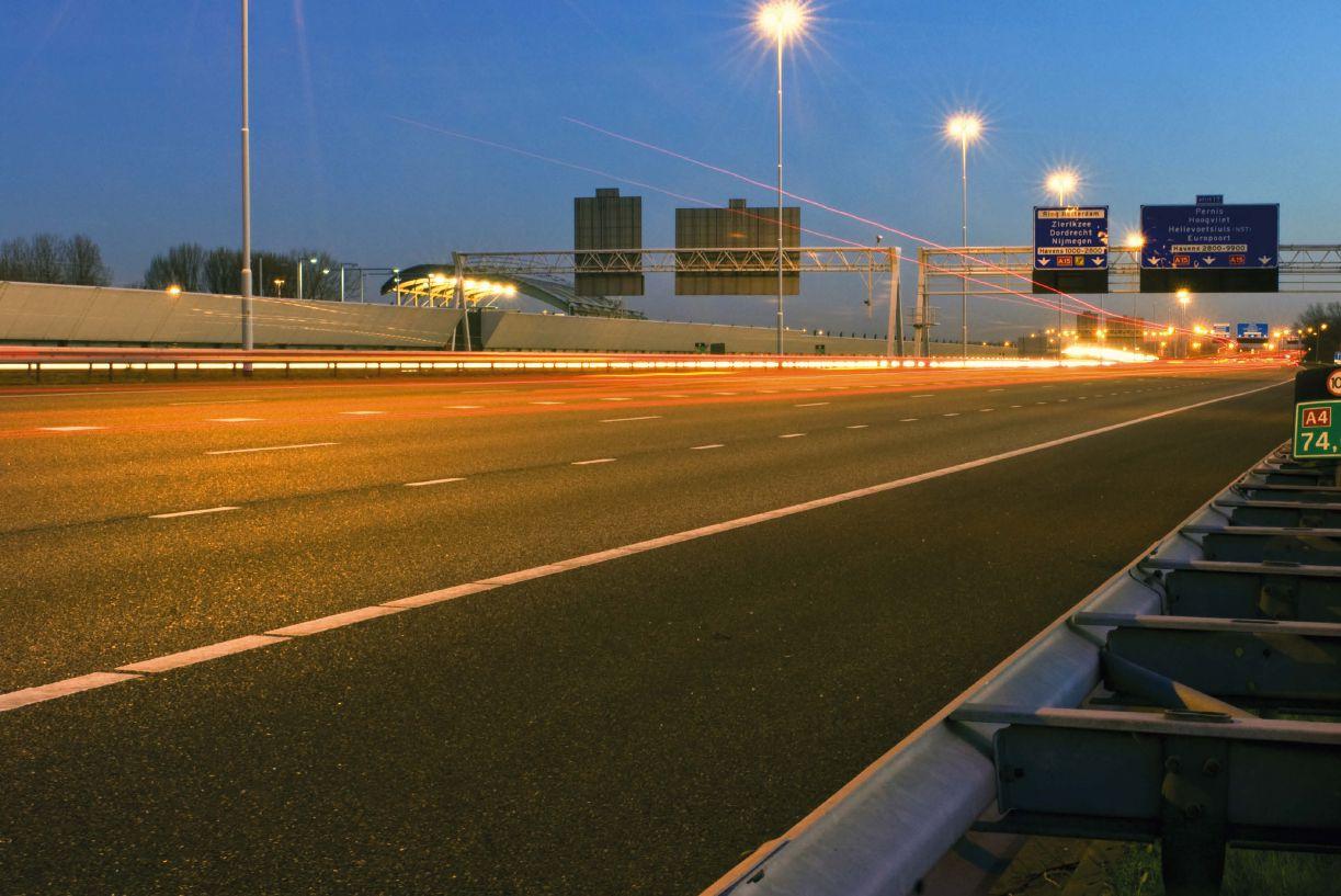 Words | Nicola Massara , head of international strategy, Meiser Straßenausstattung, Germany
In November 2021, world leaders met in Scotland in the latest attempt to reach agreement on tackling climate change. Since the 2015 Paris Agreement, countries have been committed to adapt to its impacts and mobilize the funds necessary to do so. Environmental conservation and carbon footprintreduction are no longer marginal issues, but global priorities.
For years, the principle of reduce, reuse, recycle has helped reduce the waste we throw away. Waste can be managed in several ways, each with its own climate change impacts. Let’s consider our business at Meiser – the production of steel guardrails for road safety – and the environmental implications of protecting motorists.
Wasted lifespans
Poor road safety is a symptom of transport dysfunction. Road crashes kill and seriously injure many
thousands each day and their economic impact is between 2% and 4% of GDP. While the average service-life of steel constructions is 20 years, many guardrails are replaced much earlier. The lifespan of guardrails expire when they are completely rusted or their zinc layer has washed away. When roads are renovated, often the guardrails have not reached this stage.
Renovating guardrails therefore makes sense in terms of emissions reduction. There are several benefits to renovating steel structures, which are already shaped and galvanized. It conserves raw materials and reduces energy-expenditure and CO2 and NOx emissions generated in the production of new steel. The economic advantages compared to new production are also substantial.
US highways departments have conducted in-house recycling operations for used guardrail
and guardrail posts for 25 years. These use existing guardrails removed under normal contracts for reconstruction, rehabilitation or widening of primarily interstate highways. Guardrails from such projects are delivered to a dedicated yard, where specialized workers straighten bent or damaged rail or posts with a rolling-machine that restores the rail beam to its original W-shape. Straightened rail and posts are galvanised by a contract vendor then returned to the yard and reinstalled on the roads.
Safety first
Before considering specifications for using recycled materials in highway safety applications, it is necessary to understand existing test procedures and design requirements. The foremost design concern for most safety features is impact performance. Generally, roadside
INFRASTRUCTURE | 100 Intertraffic World | Annual Showcase 2022
safety devices shield or delineate roadside hazards. Although these features are meant to protect motorists and maintenance crews, they themselves also constitute hazards and must be demonstrated to be crashworthy.
European Norm EN 1317 details procedures for evaluating the safety of road restraint systems. The features covered include longitudinal barriers. The procedures are directed at evaluating the safety performance of roadside features through vehicle crash-testing and in-service evaluation. For vehicle crash-testing, specific impact conditions are defined for vehicle mass, speed, approach angle and point of impact. Individual tests are designed to evaluate one or more principal performance factors. These include structural adequacy, occupant risk and vehicle post-impact trajectory.
Longitudinal steel guardrails may be designed to any one of seven containment-levels defined in EN 1317-2. Generally, the lower test-levels are applicable to features intended for lower service-level roads, higher test-levels to features for higher service-level roads or locations requiring special, high-performance barrier. The basic design-level of most existing roads equates to Containment Level N2, whose impact conditions govern the strength of the barrier and its components. Across Europe, the most commonly-used guardrail system is the W-beam (or doublebeam) guardrail, which most European countries have successfully tested and used for many years.
Good as new?
Clearly, any renovated steel guardrail needs to guarantee the same safety and durability as if it were newly made. Therefore any manufacturer wishing to market renovated guardrails - or local authority defining acceptance criteria for its use on roads – should be mindful of the main characteristics that guarantee the compliance of steel barriers with existing regulations.
66%
processes at its Limbach and Oeisnitz plants to refurbish and renew used steel guardrails and return them to the roadside.
Percentage of W-beams found to be reusable in a Rijkswaterstaat trial
In recent years, the Dutch road authority Rijkswaterstaat has facilitated a sustainable road equipment programme. It has collaborated with contractors, suppliers and specialized companies to investigate the environmental, technical and economic implications of guardrail renovation. It found renovating guardrails to be both technically and economically feasible with potential for dramatic environmental gains. Consequently, Rijkswaterstaat has set out a policy to increase its use.
Raising the standard
Meiser has always been focused on human and environmental wellbeing. We are thrilled to invest in resource-saving technologies and relish the challenge of potentially reducing the carbon footprint of steel production. Supported by expert Hans Versteppen, Meiser will embrace Rijkwaterstaat policy and implement industrial
Meiser has formed a workgroup with several divisions: technical and production managers as well as commercial and quality-management specialists. Its goal was to determine whether renovation is feasible, costeffective and, most importantly, can guarantee the same performance standards as newly-made barriers. The refurbished barrier will be covered by Meiser’s CE marking procedures and certificates according to EN 1317-5. Implementing the renovation process within its overall quality management system entails several selection stages related to criteria for dimension, shape, hole configuration, steel quality, absence of damage, surface contamination and physical characteristics. Only components found to be suitable will enter the reconditioning programme and find their way back to market. The next stages of renovation involve surface cleaning, degalvanisation and regalvanisation according to EN-ISO 1461 to ensure full durability of renewed guardrails.
Planetary guard duty
A first trial project demonstrated reductions of 70% in CO2 emissions and 40% in environmental costs, together with a cost-reduction of more than 10%. In terms of steel parts selection, 66% of W-beams, 57% of spacers and 42% of steel diagonals were selected as reusable after renovation. Facilitated by Rijkswaterstaat in the Netherlands, this project showed guardrail renovation to be both possible and economically viable.
Hopefully, road authorities across Europe will be inspired to follow the Dutch example. The importance of a 70% reduction in CO2 cannot be overstated in the context of modern climate concerns. It is crucial for the steel industry to develop processes and technologies with a zero or negative carbon footprint by whatever means available. ■

Annual Showcase 2022 | Intertraffic World | INFRASTRUCTURE 101
SHUTTERSTOCK
Road pavement marking maintenance – the smart way
With global material shortages and budgetary constraints, as well as the challenges created by ADAS and connected autonomous vehicle (CAV) developments, there is a real need to use the latest innovations in road marking condition surveys to prioritize maintenance
Words | Joe Turley, CEO, Reflective Measurement Systems, IrelandThe lesson to ‘measure twice, cut once’ is instilled in every joiner to minimize material waste and maximize productivity. In the current environment, with material shortages and long lead times on certain supplies, it is perhaps a lesson that road authorities and the road maintenance industry now need to consider. The cost of replacing and renewing road markings is increasing, yet the need for road marking maintenance has not abated.
If anything, the introduction of ‘lane keep assist’/’lane departure warnings’ and a future involving connected autonomous vehicles (CAVs) has increased pressure on improving the quality of road markings. These combined with road traffic accidents and the natural degradation of markings due to environmental conditions means it is an endless programme of road maintenance for all road authorities. With limited budgets, how do you ensure you spend that maintenance budget where it really matters? The solution lies in measurement and gathering accurate data through road marking condition surveys by industry certified equipment.
Reducing survey costs
Reflective Measurement Systems is leading the way in the measurement field. The company has produced
Above: RetroTek-D mobile retroreflectometer on survey vehicle
technological innovations for day and night retroreflectivity assessments, as well as line contrast measurements for both dry and wet conditions, which is necessary for the safe operation of vehicles with advanced driver-assistance systems (ADAS).

The RetroTek-D mobile frontmounted retroreflectometer plays a key role in increasing the productivity of road surveys. It simultaneously records full-lane measurements on road markings to the left and right of the survey vehicle, as well as road studs (RPMs) and critical central road markings
(such as arrows, stop lines and chevrons) in one survey pass. This system performs continuous measurements on the whole of the road marking, not just a small section or at regular intervals.
All of this is achieved with the same level of accuracy and repeatability as handheld retroreflectometers, but without the need for lane closures and traffic management. On a section of threelane motorway, both sides/directions of the road can be surveyed in four survey runs, (two in each direction), compared to the eight runs a single side-mounted retroreflectometer
102 Intertraffic World | Annual Showcase 2022
INFRASTRUCTURE |
would need. This cuts survey costs by 50%, taking into account operator time and fuel savings. There will be further savings in maintenance of the survey vehicle. The business case to use road marking condition survey data to prioritize road marking maintenance could not be stronger.
Validating road markings
When budgets for maintenance are tight, road authorities need to be confident that the maintenance work is carried out to full contract specification. Globally there are different approaches to this, with some authorities conducting their own road surveys post maintenance. Others engage independent survey contractors to perform the validation, and some pass the responsibility back to lining/striping contractors to provide the survey data. Irrespective of the approach, with the current bottlenecks in material supplies and with the discipline of validating maintenance works likely to increase, the pressure will be on independent survey operators to collect more survey data more efficiently.
At Reflective Measurement Systems, the process of transferring survey data and processing this data has been greatly simplified by using QuickView-Pro Reporting visualization software with enhanced interactive map-linked video. With results available instantly, this software accelerates the process of pinpointing road marking failures with GPS-tagged locations, visual mapping and video footage recorded at the same angles as retroreflectivity measurements (30m geometry). No other retroreflectivity measurement system provides this level of capability.
Making surveys safer
Eliminating the need for lane closures, by having the capability to measure central road markings, is an important step toward minimizing risk to road survey workers and other road users. These central markings would normally be measured using handheld systems. This is expensive and introduces the need for traffic controls and lane closures.
As a front-mounted unit, the RetroTek-D retroreflectometer does not require any side protrusions or strapping systems on the side of the survey vehicle. This is good news for survey operators and other road users, and it also means that survey operators do not have to regularly interrupt the survey to check the sensor lenses are clear and undamaged. Dirt and debris from the survey vehicle wheels thrown onto side-mounted retroreflectometer lenses can be problematic in these situations. In addition, while undertaking the survey, Reflective Measurement Systems’ advanced algorithms automatically identify line types (single/double, skip/continuous) and colour during the mobile survey. This ensures the operator has minimal interaction with the control tablet and can focus on driving. It also removes the necessity to change settings every time the road markings
Above: Road markings detected by RetroTek-D in one survey pass

Below: QuickView-Pro survey visualisation screen

change from single to double, or dashed to continuous, or from yellow to white.
Simplifying system installation
The engineering team at Reflective Measurement Systems have used the pandemic to focus on simplifying the whole process of installation, calibration and operator training and certification. They have identified ways to make the unpacking process easier and have provided equipment to enable the unit to be safely raised and secured to the survey vehicle by one person.
The RetroTek-D system can also be accessed remotely using wifi or cell phone hotspot, allowing remote engineers to assist operators, improving the user experience.
50%
The reduction in survey costs with the RetroTek-D mobile retroreflectometer
In addition, the team at Reflective Measurement Systems have developed an online training program supported by training documentation to train and certify survey operators on how to use the system. The support also includes a remotely monitored live first survey, which helps reinforce the training for operators and provides a reassuring validation of the test survey results.
All these steps ensure that when survey contractors choose to invest in the latest technology in retroreflectivity measurement, their operators receive the training they need and also that the survey system spends more time on the road, delivering the vital data needed to prioritize road marking maintenance. ■
Annual Showcase 2022 | Intertraffic World 103
| INFRASTRUCTURE
Micromobility markings improve cycling safety
As citizens embrace the cycling and micromobility revolution, cities must adapt and update infrastructure to help enhance the safety of all road users
Words | Anders Wellving, Geveko Markings, SwedenNo matter what means of transportation you use, there should be room for you on the roads so that you can feel safe in traffic. This is a statement that most of us can probably agree on. However, it is an increasingly difficult aspiration to live up to. The United Nations predicts that by 2030, over 60% of the global population will live in cities and this will put increased pressure on the urban infrastructure that will need to be adapted to keep up with this trend. One solution is to get more people to switch from cars to smaller, more eco-friendly means of transportation –so-called micromobility vehicles.
Micromobility on the rise
Bikes are a big part of micromobility, but this term also covers other modes of electric- or human-powered transport. Micromobility vehicles are usually characterised by going at a low (25 km/h) to medium (45 km/h) speeds and includes, for example, e-bikes and e-scooters.
These are modes of transport that are growing in popularity and are also being politically endorsed due to positive effects on health, the environment, and the increasingly intense traffic volumes. The Covid-19 pandemic has continued to push this trend forward bringing about a veritable ‘bicycle boom’ that was caused in part by concerns over public transportation and the increased focus on easily accessible, outside exercise.
This is all well and good, but without clearly marked spaces and dedicated lanes, safety can
Above: Before and after application of micromobility markings in Rudersdal, Copenhagen. A good example of what markings can do to increase visibility and safety significantly in a hazardous area

be an issue for the vulnerable micromobility users. To become a strong alternative to traditional modes of traffic, micromobility infrastructure needs to be developed so that it is easy, logical, and not least, safe to use. And here, horizontal markings play an essential role.
Eyes on the road
”Keep your eyes on the road!”
This is a saying that most of us have probably heard before as a reminder to stay focused in traffic. According to a study done by the Swedish research institute RISE, this is quite literally what cyclists tend to do1
The study commissioned by the Swedish traffic authorities, used eye tracking to measure cyclists’ visual
distribution of attention and how it was divided between the road surface, other road users, road safety devices and the surroundings. The results were clear: A large part (48%) of the cyclists’ attention is directed towards the road surface. When symbols, signs and guiding markings are placed on the roads, there is a greater chance of cyclists noticing them. Another advantage of horizontal markings is that horizontal signs are less at risk of vandalism than vertical signs. Apart from being stolen, vertical signs can be broken, turned around or painted with graffiti, making them more difficult to decode or even make them unreadable.
INFRASTRUCTURE | 104 Intertraffic World | Annual Showcase 2022
destination, even as a vulnerable road user. It will also make it easier for motorists to judge how much space to allow when passing, preventing them from swerving into a vulnerable road user’s space.
Knowing that the road is where cyclists focus most of their attention is an essential insight. In the greater perspective, the results of this and similar studies could in fact be the foundation for a more systematic way of planning and managing attention for road users.
It underlines the huge potential of horizontal markings to influence traffic flows and create a safer infrastructure – especially for vulnerable road users. Their feeling of safety is a prerequisite for creating a more holistic transport system with room for everyone on the roads.

Making a colourful mark
The purpose of micromobility markings is to separate vehicles in this category from the rest of the road where cars and other large vehicles are usually dominant. This
can for example be done with coloured areas, clearly marked out routes and guidance symbols.
48%
The proportion of cyclists’ attention that is directed towards the road surface
International road marking company Geveko Markings has a wide range of solutions for improved and effective micromobility infrastructure investments. These solutions are designed to attract attention and guide both micromobility users and drivers safely through traffic. They will strengthen any bicycle infrastructure project including crossings, intersections, region-wide cycle highways and safe routes to school.
Safety first
Creating dedicated micromobility infrastructure will make it easier to navigate cities and get safely to your
In short, establishing micromobility infrastructure can encourage more people to choose an active mode of mobility such as a bicycle because they feel safe doing so. This will heighten their overall activity level leaving a positive effect on both personal and public health. More electric and human powered vehicles on the road will also lead to a lower level of traffic pollution and thereby have a positive effect on the environment. With relatively simple means, micromobility markings can help ensure that every city - big or smallis able to improve conditions for its citizens and take climate action as well. The solutions are available for this increasing need, so it is now up to the stakeholders within road infrastructure and urban planning and development to take action, promote and implement them for the benefit of all road users.

Reference
1. https://www.ri.se/en (‘Modell för att mäta oskyddade trafikanters uppmärksamhetsfördelning som funktion av trafikmiljöers utformning och standard’)

Annual Showcase 2022 | Intertraffic World | INFRASTRUCTURE 105
Below: Bright colours and recognisable symbols make markings easy for road users to navigate
Left: Micromobility markings and dedicated lanes help improve safety for vulnerable road users


JOIN THE WORLD’S LEADING EVENT ON MOBILITY & TRAFFIC TECHNOLOGY! SPEEDING UP THE MOBILITY TRANSITION 900 EXHIBITORS - 120 SUMMIT SESSIONS - 100+ COUNTRIES REPRESENTED 29 MAR - 1 APR 2022 AMSTERDAM / NL YOU’RE INVITED! Intertraffic Amsterdam is your one stop destination for insights, future proof solutions, business opportunities and a global peer network. • The largest international presentation of innovative mobility technology and solutions • Smart mobility, infrastructure, traffic management, road safety and parking all-in-one • Public and private parties from across the entire mobility ecosystem • A huge choice of free to attend knowledge sessions & demonstrations • Valuable networking and matchmaking opportunities GET YOUR COMPLIMENTARY TICKET ON INTERTRAFFIC.COM • Data as a game changer • Intelligent infrastructure • Sustainable & resilient solutions
TRAFFIC MANAGEMENT


Annual Showcase 2022 | Intertraffic World 107
ANPR that fits
To succeed, ANPR applications need the highest possible detection rates and best possible accuracy. Carrida meets these needs with versatile camera solutions that can be customised to suit any project
Many automatic number plate recognition (ANPR) projects have similar requirements: reliable reading results and highest detection rates for number plates, with a robust housing and easy setup. Ideally, software and hardware are perfectly aligned and no external processing units are needed. This is what Carrida offers with its ready-to-use cameras. But in some projects, more flexibility is key. For this reason, Carrida offers proven electronics
Above: Ready-touse camera with onboard ANPR processing or electronics kit for individual designs: Carrida offers versatile solutions that fit any project
and components that can be used to build custom cameras, to integrate the hardware into existing housings or individual developments or for prototyping purposes. Both versions feature the Carrida SDK software library for high quality ANPR and perfect reading results.

The brand new Carrida CAM Dragon+ is a ready-to-use, standalone camera that features onboard license plate recognition (LPR) in an ultracompact and robust housing. It can also determine the specific make and
model of cars, and classify different types of vehicles such as car, delivery vehicle, truck and bus. This enables detailed traffic statistics and is powered by AI-features of the well-proven Carrida SDK.
Measuring only 91 x 62 mm, it’s smaller than a smartphone, but comes with protection against dirt, dust and moisture in accordance with IP67. It is also suitable for permanent outdoor use thanks to the integrated heater. A high-end image sensor from Sony ensures the best possible image
TRAFFIC MANAGEMENT | 108 Intertraffic World | Annual Showcase 2022
Words | Jan-Erik Schmitt, Carrida Technologies, Germany
quality
reading results even under difficult lighting and weather conditions, and with changing irradiation. The result is a typical accuracy of over 99%, including damaged or bent licence plates. Compared to Carrida’s proven and cost-effective Carrida Cam Basic+, the new Carrida Cam Dragon+ provides a three-times higher computing power. Both models are available with different optics for working distances from 2-20m.
99%
Rapid development
Innovative ANPR applications, special use cases and specifications regarding hardware design and integration require individually developed cameras and complete


solutions. For their easy development and design, Carrida offers camera kits and board-level cameras based on validated embedded processor platforms such as Raspberry Pi, NVIDIA Jetson Nano and other popular boards. Customers can choose the perfect level of integration for their project, making development quick and easy. The embedded vision systems provide all components for image acquisition, processing and analysis based on validated components. Customers who like to develop their individual ANPR solution only need to integrate the electronics quickly and easily into their solution or use the hardware for prototyping or pilot series. All components are perfectly adapted to the interaction with the Carrida software engine.
Perfect reading results
Carrida Edge solutions feature the versatile and powerful Carrida SDK ANPR library. It is hardware independent and works both on PCs running Windows or Linux and ARM-based edge devices with Linux or Android. On top, the software uses deep learning for make and model recognition and added functionalities, such as the vehicle classifier. This means that the computer itself ‘learns’ how to recognise a particular vehicle type. It is therefore possible to run much more complex and thus more reliable recognitions. In addition to the number plate, the Carrida software can check whether the vehicle type matches the number plate by checking a list stored on the system. It is also possible to categorize vehicles whose number plates are not stored in the system itself. This enables the implementation of intelligent traffic management systems and helps parking providers, who do not know the majority of their customers, to increase their efficiency enormously. ■
Annual Showcase 2022 | Intertraffic World | TRAFFIC MANAGEMENT 109 Best-in-class ALPR Cam smaller than your phone Size matters! CARRIDA CAM Dragon+ •Smallest on board ALPR Cam •Accuracy >99 % •Make and Model recognition •IP67 protected •Plug & Play setup •Ready-to-use or electronics kit Find the perfect ALPR solution for your project! www.carrida-technologies.com 104092_TTI Supp_Carrida Technologies GmbH.indd 1 23/11/2021 16:08
The minimum
plate-reading accuracy of the Carrida CAM Dragon+
and first-class


The electric revolution Transport has a huge role to play in the international effort to decarbonise – find out how EV infrastructure, curbside management and smart data will all play their part MaaS in the Netherlands How the race to implement Mobility as a Service in Intertraffic’s homeland is sparking productive competition Real-time data in Mexico Making sense of informal public transport in Mexico City is just one way in which real-time data is aiding mobility Digital twins in cyberspace Discover how creating exact, virtual replicas of transport infrastructure is aiding road construction and traffic management INFRASTRUCTURE TRAFFIC MANAGEMENT ROAD SAFETY PARKING SMART MOBILITY 2022 WORLD From the publisher of SUBSCRIBE TO INTERTRAFFIC WORLD NOW! FREE SERVICE! Visit www.intertrafficworld.com to register for your free print or digital copy of Intertraffic World magazine – keeping you in touch with the Intertraffic community all year round www.intertrafficworld.com Never miss an issue!
The potential of multicamera object tracking
When you combine advances in AI with a multi-camera object tracking system, traffic monitoring becomes more accurate, more accessible and more reliable
Nowadays, most efforts in traffic management systems are focused on finding the best solution for detection and trajectory reconstruction using AI techniques. Many companies are engaged in improving deep learning models that will build algorithms more efficiently and that will be better able to generalize.
Traffic managers want a system capable of recognizing each type of vehicle, behaviour and anomaly, in a way that is not affected by weather, light or environmental conditions.

No matter what type of object these analytics are being trained to recognize, the approach is always based on the analysis of a single camera. Cameras are being treated as independent to one another and data collected by these cameras is isolated. One camera can only monitor a fixed view and there is no bridge to share the information. Further, data coming from a previous observation will not be propagated through to the next element in the chain of computation. This information will be lost.
Intra-camera correlation is usually manually carried out by traffic managers and operators, aided only by camera names, numbers and kilometres. Other times a certain degree of correlation is obtained by applying logical rules between cameras (i.e., suppressing alarms from the following camera if something was already detected by the previous one).
Exploiting unlimited potential Sprinx believes that in the future, a surveillance system will be
Annual Showcase 2022 | Intertraffic World | TRAFFIC MANAGEMENT 111
Words | Andrea Galbiati, head of development, and Daniele Marzorati, head of innovation, Sprinx Technologies, Italy
considered as a whole. All information is valuable to simplify, accelerate, focus and pre-alert operators and traffic managers. With the exponential growth of IP video surveillance cameras, the opportunity to take advantage of the rich information that comes from multi-camera systems is immense.
Sprinx’s Spectra solution enables a network of connected cameras to be represented as a single entity. This video-based solution can identify and reconstruct the trajectory of all objects moving within the complex field of view of all the cameras. As such, it enables the detection of long-term vehicle behaviours and can make inferences throughout a vehicle’s journey.
Furthermore, information from previous observations can help to reduce noise in measurements, remove ambiguities in detection and improve tracking performance by focusing only on specific regions of interest.
When compared to traffic information based on single-camera, multi-camera systems are more challenging but, as previously outlined, they are highly accurate. Spectra enables monitoring of real-
Above: Spectra processes live video streams to obtain every object’s trajectory through all of the cameras in the system
world scenarios, extracting features of the same object from several camera views, even if orientation and lighting conditions create variations.
Spectra overcomes spatialtemporal constraints to correctly track objects as they pass through the network of cameras. The system can even estimate the relative position of road lanes and surfaces between the different cameras. This means it knows on which camera an object will appear when exiting from another one. This enables the creation of graphs of connected lanes.

tasks and obtain every object's trajectory through all of the cameras in the system. This is achieved despite problems such as occlusions, missed detections and view changes. Traffic managers can follow objects at single-camera and system-wide levels.
With the exponential growth of IP video surveillance cameras, the opportunity to take advantage of the rich information that comes from multi-camera systems is immense
To reach these objectives, Spectra has been designed to tackle a variety of tasks: single-camera calibration, multi-camera calibration, multicamera tracking, data fusion (data association), global inference and data visualization.
Spectra processes live video streams to perform all of these
The key element of the system is the data association process, which deals with recognition and reidentification. This process enables the system to understand that it is observing the same object from different perspectives. Once Spectra has associated all of the data, it can start to integrate information into a common reference system. Spectra can then aggregate all of the raw data; some data will be duplicated, and some will be complimentary. The idea is to combine all of the data from both noisy and clean inputs to obtain a more consistent, accurate and precise output. The integrated information dashboard visualizes new information in an accessible way, making it easier for operators to understand and identify patterns and behaviours. ■
TRAFFIC MANAGEMENT | 112 Intertraffic World | Annual Showcase 2022

Optimising weighing technology
There are various scales and sensors that can be employed to acquire vehicle weights. Each measurement technology has its benefits. For USA-based manufacturer Intercomp, the design and manufacture of products based on strain gauge technology has been its focus for over 40 years. With a portfolio that includes certified portable static, and certified portable and in-ground weigh-in-motion (WIM) scales and sensors, the benefits of strain gauge technology are available across a large range of weighing applications.
Strain gauges at work
Weighing vehicles on static truck scales relies on strain gauge load sensing. This method is widely used in weighing for legal and direct enforcement applications and is viewed as the most accurate means to weigh a vehicle. Strain gauge sensing possesses inherent performance characteristics, which include accurate performance, linearity throughout the capacity range, and
internal temperature compensated output. These characteristics ensure repeatability and stability over time and across changes in temperature. This assists in the certification of scales and systems to metrological and performance standards throughout the world.
The well-known performance of strain gauge load cells has led to its use within force and weight measurement for many decades, as well as widespread incorporation into scale manufacturing and field use. Low acquisition cost and an absence of moving parts allows for fully electronic scales and sensors to be constructed that provide accurate performance while avoiding unnecessary maintenance.
WIM sensors
Designed for use at speeds starting at 2mph (3km/h) ranging up to mainline speeds, Intercomp WIM strip sensors provide OIML R134 certified performance for low, medium, and high-speed weighing applications. In addition to achieving
certification for high-speed WIM direct enforcement in several countries, uses also include data collection, screening for enforcement, tolling, and border or industrial check weighing applications.

Installed in pairs in the pavement across the traffic lane, the WIM strip sensors measure axle and gross vehicle weight (GVW) in addition to axle spacing and vehicle length. Typical installations include between two to eight sensors in multiple rows, depending on the required accuracy, and are available for integration to a variety of different electronics and software. To secure the sensors in place, small channels are cut into the pavement. There is no need for drains. The minimal sensor depth and form factor enable rapid installation.
Strain gauge technology provides a stable and temperature compensated output for the integrator’s electronics to measure vehicle data. As temperatures fluctuate over the course of seasons or even throughout a single day, end
114 Intertraffic World | Annual Showcase 2022 TRAFFIC MANAGEMENT |
Strain gauge technology is helping to improve the accuracy and stability of both static weighing and WIM applications, while also providing a low cost of ownership and a certifiable performance
Words | Jon Arnold, transportation market manager, Intercomp Company, USA
Above: Strain gauge scales and sensors for vehicle weights
users can be confident that a strain gauge WIM system will stay within performance tolerances.


Portable weighing Strain gauge technology has a history of use within static weighing. Intercomp has developed portable scales that operate in static mode, or have both static and WIM capabilities. Several of these scales are certified to National Type Evaluation Program (NTEP) and OIML R76 static performance requirements.
The benefits of low-profile strain gauge technology can be seen in the in the NTEP and OIML R76 certified LP788 wheel load scale. As the first scale in the Intercomp 788 series of portable scales, the design is highly portable at 17kg, with a scale platform height of only 0.85in (22mm). Typically deployed in sets of two or more scales for weighing wherever vehicle weighing is
required, the scales use solar charging, and wirelessly communicate with indicators and software. The low profile makes it easier and safer for vehicles to climb onto the scales. Variations of the design are used for in-motion applications as well as vehicle inspections and tyre ratings of individual tyres within a dual-wheel configuration.


Intercomp has strain gaugebased scale and sensor options for in-ground and portable WIM and static scales and sensors, depending on the weighing requirements. Building on existing NTEP and OIML scale certifications, the company offers a wide range of performance tested and approved products to acquire vehicle and weight information. ■

Annual Showcase 2022 | Intertraffic World 115 | TRAFFIC MANAGEMENT A BETTER WEIGH OIML Certified Scales & Sensors intercompcompany.com +1763 476 2531Worldwide +44 118 932 0578 UK Strain Gauge STRIP SENSORS LS-WIM® Weigh-In-Motion Axle Scale LP788™ Portable Scale TS30™ CPU Touchscreen Indicator 1034836_TTI Supp_Intercomp.indd 1 30/11/2021 14:49
Above: Low profile portable scales certified for enforcement
80mph The
speed up to which
Intercomp’s
WIM sensors can accurately weigh vehicles (130 km/h)
Tyre safety in motion
Suboptimal tyre maintenance endangers safety, reduces fuel efficiency and increases harmful emissions. Systems using cutting-edge sensors to diagnose the condition of heavy vehicle tyres in motion are proving invaluable to agencies, both for enforcement and decision-quality driver feedback
Words | Rish Malhotra, International Road Dynamics (IRD), CanadaFor more than 40 years, International Road Dynamics (IRD) has been at the forefront of commercial vehicle screening technology to make roads safer and more efficient. Initially, it pioneered development of weigh-inmotion (WIM) pre-clearance systems, then became an integrator of complex automated vehicle inspection systems. Its development of VectorSense tyre sensors enabled IRD to create a new system for identifying tyre anomalies on moving vehicles.
The Tire Anomaly and Classification System (TACS) combines in-road sensors and customized analytics software to enable non-intrusive examination of truck tyre conditions in live lanes at highway speeds.

Value added TACS
Mindful of safety and fuel economy, most commercial operators follow rigorous tyre safety regimes. But in a sector characterised by tight margins, some cut corners, hoping to minimise effort and cost. Unfortunately, this increases safety risks and can actually decrease vehicle fuel efficiency. Tyre underinflation impacts vehicle handling, increases rolling resistance and can even cause overheating, delamination and failure.
TACS deployments substantially improve safety, efficiency and user experience without needing to stop and inspect every vehicle. TACS identifies unsafe or environmentally harmful tyre conditions and provides vital feedback encouraging changes in personal and operational behaviour.
VectorSense sensors create a 3D imaging profile of tyre conditions for each axle and tyre on a vehicle. Footprint data is converted into an intermediate calculated value, then a proprietary algorithm is applied to arrive at an approximate tyre
Above: The VectorSense tire sensor array provides input to the Tire Anomaly and Classification System (TACS)
Right: The VectorSense electronics are compact and capable of directly hosting standalone TACS

pressure and condition. Each tyre’s contact patch is examined in detailed slices, which are then combined to provide a comprehensive data-view of the tyre. This data enables the TACS system to locate any problem tyres – either as a standalone or part of a larger pre-clearance system.
Underinflation nation
In the United States, TACS has been widely adopted within weigh-station pre-clearance systems, identifying flat, underinflated or missing tyres on heavy commercial vehicles. States are acutely aware that the size and weight of these vehicles multiplies the risks inherent to tyre problems. Inspectors are empowered to levy fines for flat or severely underinflated tyres or debar vehicles from service until tyres are repaired. In some locations, where over 2% of all trucks have tyre problems sufficient to warrant exclusion from service, the need for TACS is inarguable.
In North America, TACS provides vital enforcement capability. But the European approach has so far concentrated on condition-management and providing decision-quality information to drivers and fleet operators. There has been a focus on detecting ‘inefficient’ tyres – those close enough to regulation pressure
TRAFFIC MANAGEMENT | 116 Intertraffic World | Annual Showcase 2022
not to pose a safety threat, but offering potential to reduce emissions and improve fuel efficiency through better operational practice.
Dutch encouragement
In the Netherlands, TACS has been incorporated into a dynamic tyrepressure meter system. This project was motivated by a 2017 study indicating that 41% of commercial vehicle incidents in the south of the country were caused by problem tyres – a finding consistent with national statistics.
The system provides direct feedback to drivers and influences tyre awareness and maintenance, improving safety and environmental performance. Tyre safety issues are communicated by a roadside Dynamic Message Sign (DMS) downstream of the sensor. It gives drivers immediate feedback: Tyres OK or, if tyres are deflated, Check Tyres. This vital element raises the probability
41%
of corrective action since, in many cases, a commercial vehicle’s tractor and trailer components are owned by separate entities. Immediate feedback enables drivers to take appropriate action to ensure safe and efficient travel.
The TruckMeister smartphone app provides a parallel means of notifying drivers when tyres fall within the inefficient pressure-range.

TruckMeister is a fleet management platform supporting efficient and effective vehicle operations – and TACS provided data valuable to augmenting its functionalities. The system also allows the extent of tyre inefficiencies to be accumulated and quantified in a database. This provides means to monitor behavioural change by determining the number of vehicles with unsafe or inefficient tyres both before and after public message initiative implementations.

Global TACS dividend
Percentage of commercial vehicle safety incidents in the southern Netherlands caused by problem tyres
Above: TACS in the Netherlands provides immediate feedback to drivers via roadside signs and a smartphone app
Left: TACS may be integrated with weigh station software, including IRD’s Virtual Weigh Station software, for pre-screening
Some may consider the effects of improved tyre maintenance in small numbers of vehicles relatively trivial. But as changes fan out across a regional, national or global driving population, they can deliver significant environmental benefits. The greatest impact comes from addressing suboptimal tyre conditions on heavy vehicles. Because they consume the most fuel and travel great distances each year, these vehicles present a prime opportunity for fuel and emissions savings.
Inefficient tyres are probably on their way to becoming non-compliant tyres, which can attract hefty fines. Information on tyre condition is therefore especially welcome to commercial fleet operators. Not only is tyre pressure and condition directly related to safety, but also to emissions and fuel consumption. With operators across the world eager to improve vehicle performance and reduce emissions, TACS offers proven capability to provide decision-level information on tyre condition. Both TACS and VectorSense can also be part of larger, more closely-integrated smart mobility management systems which combine data from multiple sources to manage and co-ordinate all transportation modes. ■
Annual Showcase 2022 | Intertraffic World | TRAFFIC MANAGEMENT 117
Evolving the artificial eye
Driven by advances in sensor technology, processing power and machine intelligence, artificial vision is rapidly evolving. Now, Lector Vision is applying the technology to predictive and real-time traffic management
 Words | Lector Vision,
Spain
Our world is undergoing unprecedented change due to a common disruptor: technology. One area of rapid evolution – that of trying to imitate human thought-processing –is commonly known as artificial intelligence. In this field, two fundamental challenges arise: the structuring of autonomous learning and the acquisition and processing of both structured and unstructured data. The human brain’s ability to obtain, process and interpret images – in other words, to see – is complex.
Aspirations of seeing
Artificial vision is the branch of artificial intelligence that processes
Above: Lector Vision technology is being used to monitor traffic flow, vehicle speed and incidents on roads in several countries
and analyses an image obtained from a capture device such as a camera. It detects faults, identifies elements, contextualizes environments and, in short, draws conclusions. The obtained image can be static or dynamic, in which case they are treated as a set of individual static images and analyzed in sequence. This processing enables decisionmaking based on visual observation: a capacity hitherto exclusive to human beings.
Artificial vision has become intrinsic to digital transformation across numerous sectors and several factors have driven its exponential advance. The rapid evolution of hardware has provided devices
with greater computing capacity, better specifications, reduced size and lower power-consumption, enabling solutions impossible or barely viable before.
Cameras and sensors now offer improved resolution, accuracy, speed of response, as well as increased control over and adaptability to environmental factors such as variable light. Nevertheless, the cost of some devices has driven exploration of cheaper, more flexible alternatives, further boosting the development of digital imaging techniques.
Reinforced by new algorithms, the processing capacity of devices has evolved, giving rise to more
TRAFFIC MANAGEMENT | 118 Intertraffic World | Annual Showcase 2022
complex machine learning or deep learning methods with enhanced features and capabilities.
Eyes on the road
It is in this context that Lector Vision has developed its Smart Traffic Manager Suite (STMS). A unique, all-in-one, automatic vehicle recognition system, STMS combines advanced traffic sensors based on artificial vision with a control centre that facilitates real-time data analysis.

STMS incorporates advances in big data, deep learning and convolutional neural network technologies with the application of artificial vision to traffic and mobility. This gives it a significant edge, creating a system responsive to real market needs associated with smart city concepts and integrated traffic management.
Lector Vision’s solution integrates the Advanced Smart Multi-Purpose Traffic Sensor (ASMPTS) with STMS software. The hardware consists of two synchronized image sensors, an industrial processing unit and a communications system.
The ASMPTS is an advanced traffic sensor combining radical innovations based on the latestgeneration artificial vision devices. Developed by Lector Vision, the device fuses multiple functionalities.
It can read number plates, detect vehicles without number plates, measure speed instantaneously and recognize a vehicle’s type, make, model, colour, or other delimited areas of interest.
It also incorporates fingerprint technology, which can associate each vehicle with unique identifying characteristics other than number plates.
Mind behind the eyes
STMS traffic controlcentre software gathers and proactively manages all information generated by the sensors, applying advanced processing techniques to enable active, realtime control of the environment. The system obtains multiple forms of data such as traffic flows, average or
Lector Vision’s years of experience in developing neural networks, deep learning algorithms and optoelectronics for ITS applications
20instantaneous speeds or disruptions. This allows real-time incident detection and alert generation, the creation of models and early execution of automated actions. Big data, machine learning and data-mining techniques also enable predictive analysis of different variables.
Lector Vision’s Smart Traffic Manager Suite (STMS) stands out as one of the most advanced systems available for capturing and exploiting traffic data through artificial vision. ■
Annual Showcase 2022 | Intertraffic World | TRAFFIC MANAGEMENT 119 1036413_TTI Supp_Lector Vision.indd 1 30/11/2021 14:48
Driving smart mobility
A range of innovative roadside solutions is helping communities and authorities to reduce emissions, improve road safety and enhance efficiency
Words | Stefanie Stäglin , Jenoptik, GermanyJenoptik is a global leader in road safety, smart mobility, and civil security, and provides innovative solutions to make mobility safer and easier. For road safety, Jenoptik provides state-of-theart photo enforcement technology to positively impact driver behaviour and enhance road safety. This includes speed and red-light cameras, as well as many other enforcement applications.
Jenoptik technology also helps roadway operators to manage traffic flow, emissions, congestion, and tolls. Special expertise relates to automatic number plate recognition (ANPR). These systems capture, analyze, and help to act against public safety threats such as serious organized crime and border control violations using real-time predictive data analysis. As cities become smarter and mobility becomes more autonomous and connected, Jenoptik contributes to make future mobility smarter, safer, greener, and more efficient.
All applications are supported by a powerful back office that uses artificial intelligence (AI) to analyze the multitude of data collected in real time and reports hazard alerts, rule violations and other anomalies. Jenoptik also provides extensive services that cover the entire process chain including operation, automated data processing and analysis.
With global experience based on more than 30,000 delivered systems worldwide, in-house engineering and design along with local know-how supported by a strong partner network in more than 80 countries, Jenoptik helps to make the roads, journeys, and communities safer.
Getting closer to vision zero Equipment and systems that improve road safety are important. But these alone are not enough. Today, traffic cameras must fit into modern

infrastructures, contribute to sustainability, and offer flexible options for a wide range of technical applications. One example is Jenoptik’s new TraffiPole. This has an award-winning modern design, is sustainable, quick to set up and offers many options for integrating the latest traffic monitoring technologies. TraffiPole is a new housing system that enables more sustainability and emission reduction.
The TraffiPole climate housing has been developed to meet both high design and sustainability requirements. It fits well into a modern cityscape and enables both cost-effective operation and energy-efficient cooling of the installed electronic components without the need for air conditioning. The upper oval segment houses the non-invasive measuring system with camera and sensor to enable accurate speed measurement across multiple lanes, red light detection with lane
47%

indication and offender vehicle marking in the violation images, as well as vehicle classification in approaching and departing traffic. Other functionalities such as ANPR and additional sensors for emissions measurement are available as options with the Vector camera.


TraffiPole’s highly functional double-wall design enables efficient air circulation, eliminating the need for air conditioning even in very hot climates. This special design helps to significantly reduce power consumption and thus reduces CO2 emissions of up to 1.74 tons per year. In addition, TraffiPole is made entirely of recyclable aluminum and the design elements on the outside can be exchanged for solar panels to support self-sufficient operation.
With its new TraffiPole housing, Jenoptik has convinced the German Design Council’s jury. TraffiPole was awarded a Special Mention in the Excellent Product Design/Public
TRAFFIC MANAGEMENT | 120 Intertraffic World | Annual Showcase 2022
Above: Vector ANPR average speed camera
The reduction in NO2 levels in some areas of Wales attributed to Jenoptik average speed
Design category for its innovative and functional design at the internationally renowned German Design Award 2022 and received a Special Mention at the ABC Design Award in the Mobility and Innovation product category.
Thus, Jenoptik complements its range of housings and adds a second design-award winning housing for traffic monitoring systems to TraffiTower, honored with the iF Design Award in 2014.
Using AI for civil security
Jenoptik provides state-of-the-art ANPR cameras that can be used for a multitude of road safety as well as civil security applications such as combating organized crime and terrorism, securing borders, monitoring suspect vehicles, or protecting public places. These AI-enhanced ANPR cameras monitor vehicles and evaluate data in real time, securely and accurately. The
AI enhanced real-time analysis software turns up the accuracy of the technology, arming authorities with the most accurate number plate read possible – even if the plate is dirty, from a different jurisdiction or obscured.
The plate data captured is evaluated in real time, using the powerful TraffiData analysis software. This compares the plate to local and national hotlists, alerting the responsible authorities within seconds if there is a match. TraffiData also makes it easier to identify patterns and potential threats, using tools such as convoy analysis and geographical zones. User specific filters can be setup and run, allowing a highly flexible, proactive approach.
Where other ANPR systems stop, Jenoptik’s DL engine makes its ANPR even more powerful. The DL engine enables the system to discern the make, model, and colour of cars and to distinguish individual characters
on number plates. It can learn new plates and expand its database to include updated and unfamiliar designs. Such updates, keeping the reading algorithm accurate and up to date, are produced in the lab under carefully controlled conditions. In the end, this is leading to a significantly higher number plate read rate.
Clean air solutions
Throughout Europe, many regions are currently failing to meet the EU’s air quality targets. Governments are therefore coming under increasing pressure to meet European air quality limits and new ways to reduce emissions are essential.
Jenoptik’s Clean Air solutions help communities and governments effectively reduce emissions in a variety of ways. These solutions provide traffic managers with a valuable and highly cost-effective tool to reduce air pollution.

One example are average speed cameras that are common across the UK, with more than 200 Jenoptik SPECS systems in operation. But their locations are usually chosen at sites with a high number of serious collisions. However, in Wales, four new schemes have been installed at areas where speeds were primarily reduced to lower emissions and to enable a smoother traffic flow.
The result has been stunning: since 50mph speed limits were introduced in 2018 and enforced from 2019, nitrogen dioxide levels in those areas have fallen by up to 47%, helping to protect people from serious illness as well as playing a part in tackling the climate emergency.
Road user charging
Jenoptik also offers road user charging solutions and experience from one of the largest toll projects in the world. For these applications, the division developed innovative monitoring pillars that combine various digital sensor technologies such as stereo image processing and axle number detection in a single system.
With innovation as the driving force, Jenoptik is a global leader and reliable partner with intelligent solutions that are constantly evolving and helping to make roads and communities safer, reduce congestion and emissions, and meet the challenges of future smart mobility. ■
Annual Showcase 2022 | Intertraffic World | TRAFFIC MANAGEMENT 121
Above: New sustainable and design-award winning climate housing for the TraffiPole
Mobility in harmony
An innovative solution to managing intersections significantly reduces delays caused by light rail transit (LRT) and traffic signal conflicts
Words | Jon Meusch and Gustavo de la Pena, Oriux, USAThe Metro Blue Line, or ‘Hiawatha Line’ was the first light rail transit (LRT) system in Minnesota, USA. Opened in 2004, it is 12 miles in length and it connects the regional airport with the Mall of America, Downtown Minneapolis and Target Field. It has been a very successful line in terms ridership, exceeding projections by 30%.
A portion of the line runs parallel to the very busy Hiawatha Ave. commuter corridor. In this area, a series of five signalised intersections were suffering from repeated ‘gate down’ preemptions due to randomly arriving trains. The random nature of the preemption events meant that phase movements that conflicted with the LRT might, at times, have to wait through three successive events, with wait times measured up to 11 minutes.
The most significant challenge was the random distribution of trains. Equally spaced trains with 5+ minute spacing would not have raised concerns. But, when a second train arrived shortly after its predecessor, major delays occurred.
When busy LRT lines overlap, and also compete with other traffic, congestion can be a problem. This was indeed the case in downtown Minneapolis where the Blue Line and the Green Line overlapped between two stations and through three signalised intersections. The overlapping lines meant that more than 400 LRT trips were occurring daily within a critical portion of the traffic control system that needed to remain in coordination with the surrounding grid network. The net effect was that LRTs would regularly have to stop between the stations, causing an average estimated delay of approximately one minute.
The LRT stoppages were occurring because the traffic signals were running fixed-time, time-of-day
Above: Phase movements conflicted with the LRT
Right: Peer-topeer logic is used to activate transit signal priority (TSP) along the route
based coordination plans and the LRTs were arriving at and departing the stations randomly. Furthermore, the sequences available to the existing controllers were inflexible, especially with regard to pedestrian movements. They also failed to properly support emergency vehicle preemption.
Intelligent traffic management
With the assistance of ACT Traffic Solutions, Oriux’s exclusive distributor in Minnesota, a customised solution was developed for the City of Minneapolis to reduce the delays from repeated LRT preemptions and eliminate stops between LRT stations.
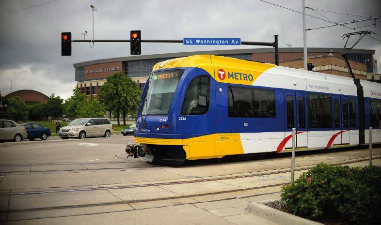
The ultimate solution involved a unique combination of features in GREENWave, Oriux’s local intersection software, including ‘max delay recovery’, ‘return to coordination’, peer-to-peer logic, pedestrian overlaps and transit priority.
Max delay recovery selects the most delayed recovery phase in each
ring. If a vehicle or pedestrian phase(s) has been delayed beyond the preset threshold time, the preemption sequence will exit to serve the delayed phase(s). After the delayed phase(s) is served, the preemption algorithm honors the ‘return to coordination’ command. If the delay thresholds aren’t met, the preemption algorithm honors the ‘return to coordination’ command.
‘Return to coordination’ operates with straightforward rules to immediately return the intersection to coordination. When leaving preemption, the feature will serve the next phase(s) in the sequence that have demand and that are allowed by coordination timing. There is significant time in a coordination sequence when only the main street phases are allowed, therefore the main street is very often the beneficiary of this feature.
Under normal operation, with LRTs present in or between the stations, the intersections now run a new fixed time plan that guarantees progression in both directions. This
TRAFFIC MANAGEMENT | 122 Intertraffic World | Annual Showcase 2022
plan eliminates unexpected stoppages between stations. The plan also integrates with neighbouring intersections in the grid network during the peak hours.

Peer-to-peer logic was used to notify all controllers when LRTs were absent, so more time could be allocated to general traffic flow. Peerto-peer communications also came into play during conditional transit priority events.

An interconnected solution
This segment of the Blue Line is contiguous with another 10 intersections that rely on GREENWave’s transit signal priority (TSP) functions. Again, peer-to-peer logic is used to activate TSP along the route. Transit priority works in conjunction with time-of-day signal coordination plans to allow trains to move from station to station without stopping in between. When trains are not present, TSP allows extra green time to be given to non-transit vehicle phases and extra walk time to be given to pedestrian movements.
64%
The entire corridor is monitored on Oriux’s Spinnaker ATMS by both city traffic and transit staff, giving complete visibility of real-time operations and historical logs for maximum civic benefit. The powerful TSP logs in GREENWave provide a clear understanding of the impact of TSP events on general traffic and allow transit agencies to measure, track and improve TSP performance.
Results of the change were immediate and impressive. Former wait times to service a phase movement were recorded as high as 11 minutes. After deployment, maximum wait times are about four minutes. The new system also easily met the project goal of reducing travel time by one minute, allowing the transit agency to remove one train set from daily operation. Oriux’s GREENWave features advanced LRT preemption and transit signal priority, and is the preferred traffic controller by some of the major transit agencies in North America. ■
Annual Showcase 2022 | Intertraffic World | TRAFFIC MANAGEMENT 123
The reduction in wait times at signals after implementation of Oriux’s GREENWave solution
The power of accuracy
An advanced digital weight enforcement system provides highly reliable and accurate data to monitor and manage traffic, and protect road infrastructure from overloaded vehicles
Words | Christoph Klauser, Kistler, GermanyThere is no doubt that roads are vital to supply people and industries with much needed goods. They are, however, under serious stress: overweight trucks cause heavy wear on road surfaces and bridges. This calls for effective ways to m onitor streets to protect critical infrastructure and enforce traffic regulation.
In 2020, almost 3.7 million tons of goods were moved via roads in Germany, making this traffic mode by far the most important in terms of logistics. The amount of transported goods has steadily increased over the past 20 years, and experts predict this trend will continue. This will put a heavy burden on road surfaces, because the number of overloaded trucks will grow accordingly. Overloaded trucks put a high strain on road surfaces as the impact of force per vehicle
Above: KiTraffic Digital contains proven WIM technology and sensors for vehicle count and classification
increases exponentially with higher axle load. This can result in potholes and cracks, which lead to frost weathering, or ruts, which increase the risk of aquaplaning. Trucks that exceed their permitted width or height or that drive with deflated tyres put other road users in danger. The rising traffic volume thus increases the demand for reliable and efficient direct enforcement systems.
A digital breakthrough
For a long time, weight enforcement systems lacked accuracy, which hampered their wider use for direct enforcement. However, ler has made a breakthrough with its KiTraffic Digital WIM system. This is a digital platform that contains proven weigh-in-motion (WIM) technology, as well as sensors for vehicle count and classification. It offers unprecedented
accuracy, enabling direct weight enforcement on a large scale.

As the first technology of its type available in the industry, the KiTraffic Digital WIM system has been awarded OIML R134 certification f or accuracy class F5 by the Swiss Federal Institute of Metrology METAS. This accuracy class indicates a maximum permissible error (MPE) of +/- 2.5% of the gross vehicle weight (GVW) during initial verification. The system was certified for a wide range of axle loads, ranging from 1 to 20 tonnes. The GVW is unlimited. Certified speed ranges are between 10km/h and 100km/h (6mph and 62mph) for heavy trucks, and up to 130km/h (81mph) for light vehicles and vans.
Though the OIML certificate is not binding for national legislations, it is widely recognized. The METAS institute operates within the
TRAFFIC MANAGEMENT | 124 Intertraffic World | Annual Showcase 2022
framework of the ‘mutual recognition of national measurement standards and of calibration and measurement certificates issued by national metrology institutes’ (CIPM MRA).
With the most recent OIML certificate, Kistler builds on its own legacy. The company had already achieved OIML certification in 2015 for its KiTraffic Basic WIM system.
Direct enforcement
The KiTraffic Digital WIM system opens the door to effective prosecution of hazardous vehicles on a large scale. The technology facilitates both the weighing of vehicles in motion without impairing traffic flow and the direct enforcement of overloaded
trucks. As well as being an established WIM system, KiTraffic Digital combines Kistler’s tried and tested sensors with cuttingedge digital technology.
Left: Lineas Digital delivers uniform signals throughout the length of the sensing element because each single quartz is digitized and calibrated Below: KiTraffic Digital has already been successfully installed in Switzerland


via a digital interface. Therefore, each crystal can be calibrated individually with no signal interference on the transmission path. Its accuracy of up to +/- 2.5% GVW allows for immediate identification and penalisation of weight violations.

A digital platform
The set-up of KiTraffic Digital is designed to ensure maximum robustness. Its core features are sensor health-status monitoring, standard industrial grade electronics, digital signal transmission and Power over Ethernet. KiTraffic Digital also operates without additional induction loops, which were required in the past. Here, the sensor itself detects the presence of vehicles and their classes.
3.7m
The weight of the total amount of goods – in metric tons – moved via road in Germany in 2020
KiTraffic Digital comprises multiple rows of sensor strips based on unique digitalized Lineas WIM sensors. They are equipped with piezoelectric quartz crystals that are built in the road surface. The system calculates the wheel, axle and total weight of each vehicle with absolute precision, regardless of driving manoeuvres like lane changes. The quartz crystals supply data independently
The position of the force signal is also used to reliably detect single, dual, flat or mismatching tyres. The system automatically records this information, thus providing a costeffective tyre screening and enforcement solution that prevents potentially fatal situations.
KiTraffic Digital also stands out for its flexibility. The system features open standard interfaces that allow for the easy integration into higher-level or third-party WIM systems. This makes it applicable for weight enforcement, toll-by-weight collection systems or traffic monitoring. As it compensates for poor road quality, there is almost no limit to its use. ■
Annual Showcase 2022 | Intertraffic World | TRAFFIC MANAGEMENT 125
Underloading: just as dangerous as overloading
Underloading is often overlooked but it is important to recognize the detrimental effect it has on road infrastructure, road users and the environment
 Words | Marcia Otter, Haenni Instruments, Switzerland
To protect infrastructure investment, avoid unfair competition and prevent road accidents, government authorities try to avoid or at least minimize the number of overloaded vehicles on their roads. This is
Above: The Haenni WL 400 low-speed weigh-in-motion (WIM) system can be used anytime, anywhere
usually achieved through weightenforcement measures. This type of weight control is now also becoming of interest to truck companies, not only to prevent overloading but to avoid underloading as well.
Underloading - or partial loadingalso presents a problem for the industry, road users and the environment. Underloading means that additional truck journeys are required to transport the same amount of material, generating
TRAFFIC MANAGEMENT | 126 Intertraffic World | Annual Showcase 2022
greater fuel and running costs. The additional trips also lead to more wear on the trucks. In short, it generates more cost, which decreases profitability for the company.

A partially loaded vehicle will not exceed the maximum total weight allowed but, in many cases, it will exceed the maximum axle load. This is, in fact, the main cause of early deterioration of the road network. Furthermore, the risk of poor load distribution is much higher with partially loaded vehicles. Over and underloaded axles change the driving dynamic, and therefore make it difficult to steer the vehicle. If a trailer has been loaded incorrectly, its rear axles could make the vehicle shake. In addition, underloading generates more traffic, which impacts the environment.
A simple solution
It is technically feasible to eliminate, or at least drastically reduce, this problem. And many companies are now becoming more aware of the importance of avoiding underloading and incorrect loading. Indeed, Haenni Instruments, a leading
supplier of portable scales for the police worldwide, has noticed a shift in demand for its products.
“The application of our portable weighing systems has spread exponentially in recent years", says Daniel Kneubühl, managing director of Haenni. "Although we develop our solutions focused on the legal weight enforcement, we are now being approached by companies from different sectors, with different weighing needs.”
The Haenni WL 400 low-speed weigh-inmotion (WIM) system is the most sought-after system by the private industry. Comprising two strip sensors that are 11mm high, four levelling mats and a processing unit, the equipment can be used anytime, anywhere. It is ideal for measuring the axle loads of vehicles with any axle configuration driving up to 20km/h (13mph). As no component weighs more than 20kg, it is easy for anyone to set up the system in a couple of minutes, while

20kg
complying with the rules. Also, due to its low thickness, only minimal civil work is needed to use the system as a fixed installation.
A standalone processing unit completes the system, offering the possibility to print out any relevant information a customer may need. Deductions, vehicle catalog and other customerspecific queries can also be defined in the set-up. The device can be adapted to local legislation and conditions.
The maximum weight of any single component in Haenni WL 400 scales, making them highly portable
Haenni hopes that road users will continue to proactively contribute to protecting roads and increasing road safety. Not all truck drivers are aware of the risks that over and underloading may cause - and also do not know the best ways to avoid them – so education is still very important. Weight enforcement provides a means of contact between police officers and truck drivers. The consequent exchange of ideas, concerns and knowledge builds the way towards safer roads. ■
What are you weighing for?
www.haenni-scales.com
Annual Showcase 2022 | Intertraffic World | TRAFFIC MANAGEMENT 127
S w iss Quality 1034837_TTI Supp_HAENNI Instruments AG.indd 1 02/12/2021 13:03
From complexity to simplicity
Innovative and adaptive all-in-one ANPR technology solutions deliver high reliability and accuracy with a quick return on investment
Words | Zsofia Karetka, Adaptive RecognitionVehicle detection rate is one performance indicator with profound financial implications for traffic monitoring system operators. Consider what a 0.1% difference means in the case of an ETC (electronic toll collection) system with, say, 6 million events per day, which counts as medium-size. Missing 0.1% represents 6,000 vehicles a day. Assuming that 2% of these vehicles are unauthorized users - again, a real-life average - and calculating with a US$50 fine for each, we are talking about missing out on more than US$2 million of income per year. In the case of a pay-per-use tolling system, each and every missed vehicle represents missed income, which, calculating with the same numbers as above, amounts to US$100 million.
It is easy to see why maximising the vehicle detection rate is in the operator's interest.
Above: Vidar ANPR camera for traffic monitoring with built-in laser trigger. L-R; Single-optic camera with cloudbased ANPR; Dualoptics camera with onboard ANPR; Dual-otics camera with onboard ANPR & radar; Singleoptic camera with cloud-based ANPR & radar

There are several ways to achieve this, but the methods and technologies widely used in the industry are either costly, high-maintenance, or both. To get something close to 99%, you need a laser scanner, radar, and induction loops. The latter requires breaking asphalt, which implies costly downtime. Induction loops also wear down quickly. Depending on several factors such as road quality and traffic, manufacturers recommend replacing them every five years or so.
36,000
The number of plate types from around the globe recognised by the Carmen software engine
Adaptive Recognition's answer to this challenge is Vidar, a traffic monitoring ANPR camera with built-in triggers (laser and software-based) that delivers results without the high cost and maintenance.
"The market is very price-sensitive, and maintenance can be a major cost factor,” says Márton Sipos, product director for Vidar. “What operators want is a simple, easy-to-maintain
system. That is what we provide, for about a third of the price of a complex system involving many components and different vendors for each. They get plate recognition, make and model recognition (MMR), and laser triggering in one single device instead of at least three. They save huge amounts on installation and maintenance without having to compromise on quality. Closing off one lane for a couple of hours costs hundreds of dollars, and it also impacts the economy in ways that are hard to quantify. Our cameras selfdiagnose, and maintenance can be performed on them remotely."
Based on the above numbers, the investment in an all-in-one device like Vidar can return in a single day. And from an aesthetic point of view, they are also incomparable to monitoring systems consisting of multiple different components.
Evolving with the times
All Adaptive Recognition ANPR cameras are powered by Carmen, the company's plate recognition software developed in-house. Carmen is available on-board the cameras,
TRAFFIC MANAGEMENT | 128 Intertraffic World | Annual Showcase 2022
separately as a software development kit or as a cloud-based subscription.

The secret of Carmen's success is continuous development driven by client feedback. Engine updates come out every quarter to include new table types and formats as soon as they appear, as well as enhancements based on integrator requirements around the globe. The emphasis on responsiveness to client needs results in a win-win situation. Integrators get what they need quickly, and the product now boasts unparalleled worldwide coverage: 36,000 plate types from all around the world are recognised by the engine, and it keeps getting more robust with every update. Results are available in less than 100 milliseconds.
From a purely business point of view, reliable accuracy is important for system operators as it reduces the need for manual checking performed by humans, another costly item on their bill. Carmen provides this even in highspeed, multilane traffic situations.
Anyone with experience in traffic monitoring knows that poor visibility conditions and damaged plates are the enemies of accurate plate
recognition. Carmen answers this challenge by leveraging AI to provide an informed guess complete with a confidence rate. In any case, the algorithm has been specifically trained to handle suboptimal images and does so with outstanding results.
Some highway operators use the software purposely for back-office checking. Carmen is currently used in more than 100,000 installations in various traffic monitoring systems around the world.

Decades of expertise
If you are familiar with the automatic number plate recognition (ANPR) industry, there is a good chance you have come across ARH, Adaptive Recognition’s former brand. ARH is well established in this field. Behind the new Adaptive Recognition brand, the people, the experience, and know-how remain.


“We are technology vendors who have been around for more than three decades, closely following the evolution of the sector and the market,” says Adaptive Recognition CEO, László Kis. “Our client base consists of traffic monitoring system integrators and operators. We know
All of Adaptive Recognition’s products, software or hardware, are developed and manufactured in-house. Integrators can design a system that delivers maximum results with fewer parts while saving time and money on installation and maintenance. Instead of managing multiple vendors for different system components, they have one single point of contact, and their custom requests are readily accommodated. ■
what kind of challenges they face in their daily work. They choose us because we understand their business and motivation. We think of our technology as a means to achieve goals. Above all, the principal goal is road safety, but we also consider our partners’ pragmatic business goals, such as time- and cost-effectiveness. How far can we simplify integration without compromising quality? How can our technology enable our clients to execute their business plans and ensure operational stability? These are the kind of questions that we ask ourselves when we develop our products, be it software or hardware.”
Annual Showcase 2022 | Intertraffic World | TRAFFIC MANAGEMENT 129
Above: Carmen ANPR software by Adaptive Recognition
Digital disruption
Digitalising traffic management will make urban transportation safer and greener – and will also help to make cities nicer places to live
Words | Yunex Traffic,Germany
Let’s face it: urban mobility will change, whether we want it to or not. More and more people are living in cities, and these people need to move around – but roads have only so much capacity. The result is what we experience every day: congestion, a lack of parking space, and air pollution.
Cars are still the leading mode of transport for individual mobility, but this comes at the expense of quality of life. So how can we create good alternatives that people will really accept and use? This is critical because in the long term, we have to move beyond meeting mobility demands with private vehicles. If we want to
>600
preserve cities and urban areas as sustainable, ecological, and healthy spaces to live and work, public transport must be a pillar of urban mobility.
Yunex Traffic (former Siemens ITS), a company of Siemens Mobility, has set clear goals: Digitalising traffic management to make roads safer and greener, and make cities more livable. With clear business purposes alongside the megatrends of today’s world, Yunex Traffic is set to disrupt the industry:

• By making cities more livable: Yunex Traffic solutions make transportation networks more efficient and increase quality of life.
• By increasing safety: Yunex Traffic solutions make transportation networks safer and help save lives.
• By helping solve the climate crisis: Yunex Traffic solutions can reduce CO2 and other transportation-related emissions.
Emissions and safety
This mobility shift will also help us resolve two other major challenges in urban and interurban mobility: reducing emissions and improving road safety. Digitalisation gives us the tools we need for this as well; for example, enabling smart intersections that connect road and infrastructure data acquired by smart systems. This will help traffic managers to predict and thus, better control the traffic situation. Better traffic management will help reduce accidents and
TRAFFIC MANAGEMENT | 130 Intertraffic World | Annual Showcase 2022
the number of cities currently using intelligent traffic management solutions from Yunex Traffic
congestion, and improve road safety and air quality in urban areas.

Expertise and agility
Yunex Traffic combines the best of both these worlds: profound technological expertise and the flexibility to bring its expertise to life anywhere. Founded and matured under the Siemens technical umbrella, armed with market-leading expertise and many years of experience in infrastructure projects, Yunex Traffic is a market-leading and agile mobility innovator. This gives the company the freedom to enter into goaloriented partnerships and
collaborations worldwide, enabling the successful implementation of infrastructure projects for city and highway authorities as well as mobility operators.
At Intertraffic in March 2022, Yunex Traffic will showcase highlights of its portfolio and share new ideas. In addition to the newest hardware, Yunex Traffic will also present its newest software solutions.

There are three highlights in particular to look forward to:
Tunnel projects go digital Yunex Traffic uses state-of-the-art methods in tunnel projects. With the
help of Building Information Modeling (BIM), a virtual tunnel including all components is first created together with the project partners involved. The model can then be developed into a digital twin of the tunnel and used throughout the entire life cycle of the tunnel.
Adaptive traffic control
Sitraffic Fusion is the next level of adaptive traffic control from Yunex Traffic that allows towns and cities to intelligently manage their traffic and pedestrian signals, as well as complex road networks, in real time, to ensure traffic flows smoothly. Whether travelling by public transport, car, foot or bicycle, adaptive traffic control optimises the road network and transport infrastructure, improving road user safety, travel times and reliability, whilst reducing vehicle emissions. This can also include establishing right-of-way solutions to accelerate the movement of fleets and bicycles.
Next-generation management
With Sitraffic Symphony, the experts at Yunex Traffic have reimagined traffic management and built a platform that can adapt, grow, and transcend boundaries with its customers. From urban traffic control to multimodal and environmental traffic management, Sitraffic Symphony enables comprehensive traffic management for cities of all sizes, ranging from simple field device monitoring to complex environmental traffic management. ■
Annual Showcase 2022 | Intertraffic World | TRAFFIC MANAGEMENT 131
Left: Yunex Traffic is ‘connecting the dots’
The power of traffic detection
Digital technologies are transforming the transport industry at a rapid pace. Innovations like artificial intelligence (AI) and the Internet of Things (IoT) have the potential to improve everything from pricing models and traffic management to safety and emission reduction.
Vitronic is harnessing the full potential of intelligent infrastructure and its data to take traffic management to the next level – to the benefit of customers, road users, and the environment.

Above: Vitronic is using sensors to detect vulnerable road users (VRU) such as cyclists and pedestrians and pass on their position to vehicles
Efficient and sustainable tolling
Tolling is playing an increasingly important role in future mobility –reducing congestion, making traffic safer, and contributing to new mobility solutions like Mobility-as-aService (MaaS). Tolling also has an important role to play in reducing emissions and overcoming the climate crisis. Dynamic tolling systems that differentiate between factors like vehicle types and emissions are a fair solution to fund modern infrastructure and more environmentally friendly means of
transport. Tolling can also be used to control pollution and congestion, with models being developed that impose speed limits, access restrictions, or increased fees when thresholds are exceeded.
Versatile, flexible, and userfriendly tolling systems are needed to manage the increased volume of traffic in cities and allow the sustainable financing of alternative mobility concepts such as connected and autonomous driving. Vitronic enables a new level of tolling through 360° technology and comprehensive tolling expertise, including image/ video-based tolling (AI detection), high-performance laser vehicle detection, and both mobile and stationary automatic control. Systems from the Vitronic portfolio do more than measure excessive speed –defining vehicle classes, capturing
132 Intertraffic World | Annual Showcase 2022
The digitization of infrastructure has opened new doors in smart traffic management, making it greener, safer, and more flexible
TRAFFIC MANAGEMENT |
red light violations, ensuring the correct use of lanes, and gathering information on the configuration of the traffic flow.
One new Vitronic development is mobile toll control vehicles. These vehicles are powered by an Enforcement Bar – a mobile, fully automatic number plate reading and classification system that can recognise number plates in four directions. Even at high speeds, the system achieves a very high recognition rate – meaning the detection, identification, and classification of vehicles can be
carried out automatically from a moving vehicle. More than 100 of these vehicles are already being used by the National Tax Administration in Poland.

Greater safety for VRUs
Vulnerable road users (VRUs) –pedestrians and those on bicycles/e-scooters – account for about half of people killed or seriously injured in road traffic accidents. This rises to 70% in cities. Excessive speed is one of the main reasons for fatal accidents, along with driver and human error. With the number of VRUs increasing in urban centres, cities need intelligent technology and traffic concepts to help protect them. Speed cameras, redlight cameras, object detection, agile speed limitations, and the exclusion of heavy vehicles in cities can all protect VRUs. A number of innovative pilot programmes are currently taking place all over the world to explore how new technologies can be utilised to protect road users.
Below: The Enforcement Bar is a fully automated license plate recognition system that is integrated into the latestgenerated siren system on patrol cars
Safety Analyzer (LTSA) to record VRUs in complex traffic scenarios. The objective is to identify potentially dangerous situations, namely collisions, between various types of road users before they occur and send messages to warn road users of a potential situation.
70%
The percentage of VRU injuries and deaths on city roads
In Dubai, a pilot project jointly developed by Dubai Police and Vitronic Middle East is exploring how machine learning and AI can be used to increase safety at crosswalks. A convolutional neural network (CNN)-based system monitors the crosswalk and automatically distinguishes between pedestrians, cyclists, and motorised road users. If a vehicle disregards a pedestrian’s right of way or endangers them, a violation is issued. The system can also connect to a traffic light and automatically switch it to red to allow pedestrians to cross.

The future of smart mobility
At the test track for automated and connected driving (TAVF) in Hamburg, real-time data from Vitronic cameras and sensors helps optimize traffic flow and increase safety for VRUs. Collective perception messages (CPMs) are sent to the autonomous or semiautonomous vehicles in use, warning the driver of a potential collision.
Meanwhile in Potsdam, a research partnership between Vitronic, the German Aerospace Center and the University of Applied Sciences Potsdam is developing a Local Traffic
Vitronic’s vision for future mobility is intelligent infrastructure that comes to life through the smart integration of different traffic technologies –from speed cameras and traffic lights to the vehicle itself. This connectedness could generate a wealth of data that could be used to shape all kinds of planning and policy activities.
Data could help structural engineers and architects predict the utilization of a bridge, and inspectors measure abrasion and potential danger. It could also help countries monitor mobility trends or reduce pollution, congestion, and noise –paving the way for greener cities.
To fully unlock the potential of traffic data, it needs to be centrally accessible, yet adhere to the highest data protection standards. By using two data streams, Vitronic seeks to help transport authorities differentiate between data used for toll enforcement and anonymized data to support mobility concepts that enhance safety, efficiency, and emission reduction.
Smart mobility is about more than just traffic control. Reliable and precise traffic detection systems will play a central role in the future of transport. With the right technology and infrastructure in place, traffic management becomes green, sustainable, safe, and flexible. ■
Annual Showcase 2022 | Intertraffic World | TRAFFIC MANAGEMENT 133
Above: The Nano-Cam speed, enforcement and data collection system offers a 360° view based on 3D-lidar technology

360° versatile vision
The Parifex Nano-Cam is a 3D-lidar traffic tool with 360° vision. Its all-seeing eye simultaneously collects varied data and detects multiple vehicles in any conditions. It is easily deployed as a multifunctional single-sensor solution or within AV safety infrastructure
PARIFEX’s Nano-Cam sensor is an innovative detection tool designed to improve traffic counting and road safety. It enables users to detect speed infringements and collect traffic data in multiple situations across both urban and extra-urban environments. With this tool, just one
sensor enables complete enforcement, meaning that traffic management is dramatically simplified.
Nano state
The Nano-Cam speed, enforcement and data collection system detects vehicles with unfailing precision. It offers a 360° view based on 3D-lidar
technology and accurately detects speeding violations, even in busy, fast-paced traffic. It simultaneously discriminates multiple targets, measures speeds and reliably tracks vehicles, even during lane-changes.
Depending on its intended application, the Nano-Cam is available with or without a camera.
TRAFFIC MANAGEMENT | 134 Intertraffic World | Annual Showcase 2022
Words | Claire Legrand, project manager, Parifex, France
This cutting-edge sensor monitors a 360° environment, concurrently collecting different types of traffic information such as speed, vehicle classification, tailgating, dimensions, direction and counting data. The urban version detects infringements, like using a mobile phone while driving or running a red light or stop sign, and provides automatic number plate recognition.
Unlike conventional solutions, the Nano-Cam includes a 3D-lidar sensor to enable 3D wraparound modelling of environments. It is easily set up in any orientation and requires little processing power, providing instantaneous monitoring accuracy. Unlike a simple camera, it provides constant quality regardless of day, night or humidity. Once configured through a dedicated app, the sensor can perform tracking, counting and classification of motorbikes, light
vehicles or heavy trucks and can detect both fixed and mobile objects.
A tool for all needs
The Nano-Cam is designed to support smart mobility applications such as vehicle counting, flow management (based on origin-destination matrices), vehicle autonomy and riskdetection. Connected to automated street lighting, the Nano-Cam allows lighting-level control based on traffic or weather conditions. It supports sending drivers automatic updates on available parking spaces.
If you don’t want trucks carrying hazardous substances somewhere in your city, the Nano-Cam can detect their discs and number plates.
Above: The Nano-Cam is designed to support a variety of smart mobility applications
Since customers need flexibility, the Nano-Cam is compatible with both fixed and mobile use.
OneIt is user-friendly and virtually plug-and-play, with automatic calibration enabling quick installation in any location. Light and compact, the solution can be positioned on a tripod, mounted on the rear of a vehicle or directly integrated into street furniture.
The Nano-Cam readily fits into existing infrastructure to facilitate communication with autonomous vehicles (AVs) and ensure smooth traffic flows. It can detect vehicles, pedestrians and priority violations as the basis for automatically slowing or stopping AVs so that they run safely.

■
Annual Showcase 2022 | Intertraffic World | TRAFFIC MANAGEMENT 135
The number of Nano-Cam sensors needed for multiple enforcement applications
Number plate futures
Electronic vehicle identification via RFID plates or stickers is strengthening optical means of vehicle recognition and revolutionizing registration systems. It provides frictionless access control, toll collection and emission control, equipping users for a digital future
Words
| Natascha Dyck, Tönnjes International GroupGerman plate manufacturer
Tönnjes aims to provide vehicles worldwide with secure and readable identities. It develops and manufactures number plates and vignettes using RAIN (RAdio frequency IdentificatioN) RFID to enable electronic vehicle identification (EVI). This means cars, lorries and motorbikes can be securely identified contact-free in moving traffic with authorized readers. EVI has replaced optical camera-based recognition at technology’s leading edge, creating new possibilities for the digital traffic and mobility of tomorrow.
Everywhere city solutions
“The world’s population is growing continually,” says Tönnjes managing
Above: Schematic view of EVI using overhead gantry

director, Jochen Betz. “The complexities of modern traffic management will demand alternative solutions, not just in megacities, but in cities everywhere. Efficient, state-of-the-art EVI processes provide the basis for smart city solutions.”

RAIN RFID enables wireless communication between vehicle number plates and authorised reading devices. This not only supports targeted traffic management. It offers potential to revolutionise toll collection and access control, implement environmental zones and protect against vehicle theft and number plate forgery.
Tönnjes doesn’t just make number plates. For several years, it has led the development of software and hardware prerequisite to EVI. Its
TRAFFIC MANAGEMENT | 136 Intertraffic World | Annual Showcase 2022
innovations include the IDePLATE RFID number plate and IDeSTIX vignette. The IDePLATE resembles a conventional plate, but stores a unique, multi-encrypted identification number on its RAIN RFID chip, which authorities equipped with authorised readers can compare to a database under the highest security standards. The IDeSTIX RAIN RFID windscreen label also functions as a so-called third number plate.
Towards a wireless world Tönnjes technology has been proven across numerous countries and applications. In Saudi Arabia, oil company Saudi Aramco uses IDeSTIX for business-premises access control. In the Philippines, twowheeled vehicles are equipped with IDeSTIX front headlamp RFID labels.
Above: IDePLATE –number plate with integrated RAIN RFID tag

Below: RAIN RFID offers the potential to revolutionise toll collection and access control


“Scooters and motorbikes are extremely popular, especially in Asia,” says Betz. ‘Every one of these vehicles can be efficiently registered and reliably identified with IDeSTIX headlamp tags.”
Tönnjes technology and expertise is already helping authorities and registration offices to build future efficiencies. Worldwide, the company is involved in more than 50 local joint ventures to produce and personalize number plates on-site. It supports authorities across a spectrum of activities, from implementing central approval systems to developing customized vehicle identification solutions, as more countries wake up to the benefits of EVI.
“Tomorrow’s solutions must not only work reliably, but also meet the demands of a digitalised society,” says Betz. “Our solutions do both.” ■
Annual Showcase 2022 | Intertraffic World | TRAFFIC MANAGEMENT 137


29 MAR - 1 APR 2022 THE EVENT FOR STARTUPS IN SMART MOBILITY A DEDICATED PAVILION @ INTERTRAFFIC AMSTERDAM GO THERE. GO FAST. INTERTRAFFIC.COM/ITSUP INITIATIVE BY
ROAD SAFETY SMART MOBILITY


Annual Showcase 2022 | Intertraffic World 139
Colour match
The colour of road markings is important. So how can we make sure that drivers see road markings in the correct colour at nighttime?
Words | Gustavo Felipe Paolillo, Easylux, BrazilWhen looking for guidance or essential information on the road, drivers mainly look for markings on the pavement. It is therefore essential that road markings can easily be seen at all times of day. There are minimum retroreflectance values required for nighttime visibility of road markings, but retroreflectance values do not show us how drivers experience the retroreflected colour of the road marking.
The colour of road markings is an important indicator of traffic direction and positioning. Colours must be unambiguous, especially at night, when driving conditions are more challenging.
In the industry, a lot of effort is being made to ensure that white and yellow paintwork can reliably identified in both daytime and nighttime conditions. The ASTM D6628 standard, for example, covers the daytime and nighttime colour of retroreflective pavement marking materials used for traffic control lane markings and symbols on road surfaces. The standard specifies the CIE coordinates (x,y) colour range of marking colours under nighttime conditions at a 30m viewing distance (Figure 1).

The specific colour ranges for white and yellow were established to minimize the possibility that drivers confuse the two colours in different types of light.
Technological validation
The Easylux Mini retroreflectometer has been expertly engineered to measure the nighttime retroreflected colour coordinates (CIE chromaticity) of white and yellow markings.
The way it works is simple. The colour coordinates are stored for each measurement. They are classified according to whether they lie inside or outside the ASTM colour box. This makes it easy to determine whether a road marking has the correct colour at nighttime when retroreflected.
The Mini retroreflectometer has an external light beam. That is, the light shines out of the instrument housing and onto the roadway, ahead of the instrument for measurements of nighttime
SAFETY | 140 Intertraffic World | Annual Showcase 2022
visibility (RL), daytime visibility (Qd) and retroreflected colour coordinates. The external beam enables the reading area to be visible, allowing detailed assessments of marking characteristics. It is also ideal for measuring retroreflectivity in wet weather conditions (ASTM E2832 and EN1436).


Assessing the colour of pavement markings is becoming even more important, as road authorities start making more effort to use more sustainable paint pigments, technologies and road marking materials. The Mini retroreflectometer from Easylux has been designed to make it easy to assess the colour of road markings, so there is no need for guesswork. ■


Annual Showcase 2022 | Intertraffic World | SAFETY 141 NIGHTTIME RETROREFLECTED COLOR CIE chromaticity (x,y) as per EN1436, ASTM D6628 and ASTM E2367. EXTERNAL BEAM Measurement area is clearly visible for RL, RL-2, RLwet, Qd and CIE chromaticity (x,y). CONVENIENT AND SMALL 2 kg (4.5 lbs), AA-battery powered, 15 mm profiled, 1 second reading for both RL and Qd. +55 11 3438 3448 EASYLUX RETROREFLECTOMETER vendas@easylux.com.br 1034832_TTI Supp_Easylux Retroreflectometers.indd 1 04/11/2021 20:35
Above: The Easylux Mini retroreflectometer has been expertly engineered to measure nighttime retroreflected colour coordinates Inset: Figure 1: Nighttime chromaticity coordinates for white and yellow colours at CEN 30m geometry (88.76°/1.05°) EN1436 x=0.546 y=0.427
Sensors for safety in fog
A smart detector beacon system uses sensors and LEDs to guide and warn drivers, improving safety for those travelling in dense foggy conditions
Words | Sandra Fernandes, marketing communications manager, Sernis, PortugalIf you can’t avoid fog entirely, the first thing you should do is increase the space between your vehicle and the vehicle in front of you. However, judging the distance can be quite a challenge since fog can significantly reduce your visibility.
There is often dense fog on the Autovía del Cantábrico (A-8) in Spain. The last section of the highway to be put into service – the Mondoñedo to Vilalba section – is in Alto Do Fiouco, 698m above sea level. Currents or air masses from the Cantabrian Sea in this area regularly create fog by orographic elevation.
On July 26, 2014, a serious multicar accident occurred on this section of highway, as a direct result of dense fog. The accident involved 40 vehicles and resulted in loss of life.
A smart solution
To try to improve safety on the highway, cameras and weather stations with visibilimeters that send information to the Northwest Traffic

Above left: Smart detector beacon system for dense fog warnings
Above right: Project BICA in dense foggy conditions on the A-8 in Spain
Management Centre every minute were installed. Since visibility conditions change very quickly here, the solution proved not to be very efficient. Dirección General de Tráfico (DGT) launched an open tender to develop a smart system that could alert drivers about fog immediately. In response Sernis developed Project BICA (Balizas Inteligentes Climatologia Adversa, in Spanish), a smart detector beacon system designed for adverse weather, particularly fog.
Each smart detector beacon has two powerful LED beacon windows, amber and red, with brightness control, for guidance. Each detector also has a set of a dedicated sensors (like radar sensors) and a local processing unit to detect vehicles and alert drivers in real time if they have traffic in front of them, even with very limited visibility conditions.
There are 382 units on this section of highway, covering a distance of around 4km of road. They are connected via an RS485 communication protocol, which makes it possible to communicate individually with each set of smart detector beacons, to monitor and control several internal parameters.
When there is reduced visibility or when meteorological elements prevent correct visibility, the smart system provides guidance and lane limitation through amber LEDs. It provides warnings and vehicle detection via red LEDs.
The system works according to three different scenarios:
• Under normal conditions, all lighting devices remain off.
• In low light conditions, either on a cloudy day or during the night, amber LEDs turn for guidance signalling.
• In foggy conditions, vehicle detection and guidance lights are activated simultaneously. When the smart detector beacon system detects the passage of a vehicle, it activates red LEDs in the device for a predefined time to warn the following vehicle about the presence of another vehicle in front of it. The guidance lights (amber LEDs) remain active as guidance signaling.

Connected information
In addition to its main functionality, the smart detector beacon also monitors traffic flow between every set of two consecutive systems. This means that the software can continuously check vehicle correlation between the smart detector beacons and alert about possible accidents.
The 382 smart detector beacons are installed approximately every 48m on each side of the road on the A-8. Each point has become a detection barrier with doppler radar sensors. The management software was developed according to all DGT requirements, including integration in the existing road equipment management application in the Northwest Traffic Management Centre. After several tests that validated the results in the research, installation was completed at the end of 2021. To find out more, visit Sernis at Intertraffic Amsterdam 2022 (March 29 – April 1, 2022) on booth 01.207. ■

SAFETY | 142 Intertraffic World | Annual Showcase 2022
Detecting jams to improve safety
Traffic density is increasing all around the world. This creates safety problems, which are particularly intensified around construction sites. In these areas there is an even higher risk of crashes, every one of which has a high cost associated, both directly and in terms of knock-on impacts on traffic flow.
To help to improve road safety around work zones, mobile traffic signs and temporary traffic management systems can be installed, which can give early congestion warnings. Early traffic jam detection is very important due to the danger of serious accidents and rear-end collisions.

With the modern and innovative traffic jam detection system by Ibotech and partner company Ibomade, traffic can react quickly, speed can be reduced and dangerous rear-end collisions prevented.
Besides improving safety the traffic jam warning system also gives useful information about congestion, which means drivers can be given the opportunity to change their route, thereby avoiding delay.
Above: Upgrading LED installations for driver warning and safety
The innovative Ibomade LED traffic jam detection system has many advantages, for example a quick data transfer and excellent visibility and dependability. What makes the traffic jam detection system unique is the energy self-sufficiency as it is solarpowered, making regularly battery replacement a thing of the past.
Upgrading existing installations
With installations becoming eversmarter, Ibomade recently upgraded an already-installed mobile congestion warning system with traffic data recording, on the A3 autobahn between Straubing and

Regensburg in Germany, so that it can now also improve route safety.
The process involved updating nearly 20 displays, so that the system reacting to the traffic flow displays not only congestion warnings but also a ban on overtaking, and speed limits, when and where it is appropriate.
The project has been in a testing phase since July 2021. This unconventional and costeffective approach is a first for Bavaria and, due to its success, it is now likely that similar upgrades will also be deployed in other areas.
A road to the future
The mobile LED traffic jam detection system continuously collects data related to the current traffic situation. Within a split second, the data is processed and sent to the relevant location and system. In this way, it is possible to detect traffic jams early, in a dependable way. This increases safety for traffic moving through potentially dangerous situations.
With the portable traffic jam warning system, Ibotech is trailblazing a new path towards the future of intelligent traffic management – with innovative technology and energy selfsufficiency. Even though traffic jams cannot be avoided, drivers can be warned and rerouted - and safety can be improved. ■
Annual Showcase 2022 | Intertraffic World 143 | SAFETY
Portable LED traffic-jam detection systems help to improve safety around work zones by preventing dangerous rear-end collisions, as well as improving traffic flows
Words | Adem Bogocli, CEO, Ibotech GmbH & Co. KG, Germany
Safety meets flexibility
Words | Tianni Wei , SaferoadThe automobile is still the predominant means of transport in societies across the world, and the number of cars and trucks on the roads is increasing every year. The challenge in road construction is to make roads as safe as possible by enabling flexible road routing when maintenance work is necessary or when accidents occur.
On the approach to structures, such as tunnels and bridges, the combination of safety and flexibility is particularly important. Repair work often takes place at these locations, meaning that traffic needs to be diverted. Median crossings are therefore installed in front of such structures to allow for the necessary flexibility in management of traffic and road
Above: Safestar emergency opening in place on Autostrada A18, in Sicily

Right: How to open the Safestar system (from top to bottom) 0: Initial situation 1. Lock the lifting device and rise the system
Disassembly of pin-wedge connection 3. Disassembly and hang up the socket posts 4. Open the emergency gate
routing. The areas around tunnels and bridges are also typically prone to accidents. A median crossing with an emergency opening can provide quick access for emergency services and also enables the quick release of any trapped traffic, which helps to minimise the delays caused to other road users.
Easy opening, easy maintenance
Saferoad’s SafeStar guardrails with the three-wave beams are widely used on European roads. Now the company has also added a median crossing to its product family. The new emergency opening with containment level H2 and working width W4 has a light and elegant design. The innovative system has a minimum opening length of 36m. It can be easily
adapted to local conditions in 4.5m or 9.0m modular units.
The emergency opening can be opened within 15 minutes by only two people without specialist tools. The integrated 4.5m-long emergency gate can be opened in less than two minutes in an emergency, where time is critical.
The use of standard components from the SafeStar product family ensures easy connection to existing vehicle restraint systems and simplifies assembly, maintenance, and repair.
The SafeStar emergency opening is an open median crossing erected on posts. The open design reduces the risk of water accumulation and aquaplaning after heavy rainfall. Open guardrails also provide crossing opportunities for small
SAFETY | 144 Intertraffic World | Annual Showcase 2022
2.
An innovative development in median crossing guardrails makes routing safer and more flexible
animals. According to numerous studies, motorists prefer open systems because closed walls create uncertainty and increase the risk of accidents.

Commitment to safety
Saferoad is committed to the goal of Vision Zero. Therefore, we are constantly developing new products that make roads safer. Saferoad offers a comprehensive product range of vehicle restraint systems, covering all areas of use on roads and motorways, which can easily be adapted to local conditions and requirements. With leading product brands such as MegaRail, SafeStar, SafeLine, CrashGuard and Primus, to name but a few, it can offer CE marked solutions to overcome all design challenges its customers encounter.
Most of the product brands comprise several product families; offering systems with containment level from N1 to H4b. In addition, Saferoad offers a large number of transitions to enable connectivity within of all its systems.

Saferoad’s innovative approach combined with the company’s focus on customer satisfaction provides its clients with great flexibility and helps to facilitate planning for a uniform streetscape. ■
Saferoad systems are based on a modular design. They are lightweight and easy to assemble. With our wide range of connectable systems covering all areas of use on roads and motorways, Saferoad offers a complete building set for vehicle restraint systems


Annual Showcase 2022 | Intertraffic World | SAFETY 145
15
Wolter Jager, region manager, Saferoad
0 1 2 3 4


www.traffictechnologytoday.com Subscribe to Intertraffic World’s partner publication! TrafficTechnologyToday.com Roads that talk to drivers Smart, connected road studs that can combat wrong-way driving and even read road weather are being piloted on The Ray, Georgia Using apps for tolling Smartphone technology has taken time to break into the toll industry – but now new solutions are here Published by MA Business Ltd TRAFFIC TECHNOLOGY INTERNATIONAL DECEMBER 2021 DECEMBER 2021 SHOW SPECIAL! PLUS previews of Gulf Traffic, TRB Annual Meeting and CES Can new technology help to bring vulnerable road users safely and equitably into the connected vehicle ecosystem? V2P SUBSCRIBE AT WWW.MAGUPDATE.CO.UK/PTTI Request or renew your subscription FREE! FOLLOW US ON TWITTER @TRAFFICTECHMAG Stay informed with all the latest industry news, subscribe NOW
PARKING


TRAFFIC MANAGEMENT

Annual Showcase 2022 | Intertraffic World 147
Safety net
Words | Burkhard Kahl-Pfeiffer, projekt w, GermanyProjekt w was founded in 1984 and is located in central Germany, near Paderborn. Here, the company’s skilled employees continue to engineer and manufacture products on its own premises.
Currently, projekt w’s main business line is its INTEGRA-pw product – a safety barrier for car parking garages. The company has become a market leader in the safety barrier industry since the product’s launch in 2000, and its applications now include state-of-theart facade design for buildings and parking garages.
The INTEGRA-pw product portfolio complies with the German and international quality standards. The company operates with a network of long-established German business partners and an increasing number of wider European partners.
Above: projekt w’s INTEGRA-pw car parking barriers provide one solution for ensuring the safety of both vehicles and people


INTEGRA-pw also meets the legal requirements of the state building codes of the German Federal States, as well as the applicable European
standards for collision protection systems in car parks. It has technical, economic and sustainable advantages over conventional systems.
The INTEGRA-pw security system prevents vehicles and people from unsecured falling and replaces conventional systems such as concrete parapets or guardrails. As a proven safety system, it offers decisive advantages and is suitable for both new buildings and retro-fit car parking garages.
The use of the INTEGRA-pw safety barrier system eliminates the need for a brute concrete parapet or a thick steel profile. Dynamically acting security systems can be filigree-designed and implemented.
INTEGRA-pw combines a safety barrier for people as well as car crash protection in one system solution. In the instance of a crash, INTEGRA-pw guarantees the absorption of
PARKING | 148 Intertraffic World | Annual Showcase 2022
A cost effective and sustainable barrier safety system provides robust protection for vehicles and pedestrians in parking garages
• DIN EN 1991-1-1 for personnel loads • DIN EN 1991- 1-7 for impact loads • DIBt Z-14.7-635 • DIBt Z-14.7-882 • ETA European approval (in progress). The INTEGRA-pw safety barrier meets the following legal standards and requirements | Need to know
appearing charges into the on-site subconstruction. In addition, an optional four-point attachment can keep the deformation of the INTEGRA-pw safety barrier to a minimum and

protect a prefabricated facade in the event of an impact.


Legal requirements and standards include DIN EN 1991-1-1 for personnel loads; DIN EN 1991-1-7
8,509
for impact loads. In terms of specifications, the INTEGRA-pw’s maximum column-free span is 7,806mm, while there are two choices of system height: 943mm and 1,143mm. The product can also be used for possible applications in roads with a gradient, for example ramp and spindle ramp areas. In addition to the safety function, there is also an architectural aspect to the product. In areas with highly frequented passenger traffic, INTEGRA-pw can also be equipped with a handrail profile such as round tube or a U-profile). The materials used here are galvanized steel or stainless steel. The profiles are factory dimensioned = to the required lengths of fall protection and mounted on site by our trained personnel. projekt w has completed 8,509 projects with 4,144 satisfied customers. It has delivered more than 9,100 tons of steel, all made possible by the hard work of the company’s 72 employees. ■
projekt w – Systeme aus Stahl GmbH Tel. +49 5258 9828-0 | info@projekt-w.de www.projekt-w.com
Annual Showcase 2022 | Intertraffic World | PARKING 149
INTEGRA-pw INTEGRA-pw Extra THE SMART CAR PARK SAFETY BARRIER TECHNOLOGICALLY AND ECONOMICALLY SENSIBLE System height 943 mm / 1143 mm, max. 5506 mm wide Meets the requirements of DIN EN 1991-1-7 for impact loads Version galvanized / powder coated according to RAL colours Alu nature / powder-coated Perforated sheet / Plain sheet Handrail: Galvanized / stainless steel Glare Protection: Standard hight 670 mm 1035616_TTI Supp_Projekt W.indd 1 04/10/2021 10:20 Left: The INTEGRApw security system replaces conventional systems such as concrete parapets and guardrails with a safe alternative and a clean, modern aesthetic
The number of INTEGRA-pw safety barrier systems installed across Europe
Visit Circontrol at Intertra c Amsterdam 2022: Hall 10, Stand 113
Closing the circle for parking
A new smart-parking camera with high-resolution image recognition technology, used alongside security and payment systems, can transform parking into a more convenient, adjustable, secure, and completely contactless experience
Circontrol has recently achieved a new standard in efficient parking solutions. The company’s CirPark platform is entering a new era thanks to the launch of the latest smart parking device – the CamSensor. For years, Circontrol has been able to meet different smart requirements for vehicle parking facilities, such as intelligent guidance, efficient LED lighting and integrated EV charging systems, thanks to the iPark, LEDPark and EVPark product families. But there was something
Above: The new CamSensor device allows an easy integration between car park, EV charging and touchless easy payment


Left: A parking facility enlightened Circontrol’s LEDPark solutions

missing, and CamSensor has finally come to close the circle and provide even more features for car park operators and users.
The device has been specifically designed to fill all the gaps that existed in efficient car parking, also improving almost all the existing features. Its main contribution lies in its high resolution and image recognition technology that makes it possible to view and record up to six parking places via live streaming. The images are sent through a cable directly to parking operators, allowing them to know exactly what is happening in each parking bay at all times. This means that the device
PARKING | 150 Intertraffic World | Annual Showcase 2022
Words | Toni Alfaro, Circontrol, Spain
can function as an integrated video surveillance camera, which will substantially increase the security control standards in the facility.
CamSensor not only records but can also distinguish the shape of vehicles and their number plates thanks to high-standard image recognition software. This differs from the traditional ultrasoundbased technology and, integrated with the smart parking system, the CamSensor can use this image recognition feature to detect a vehicle in a space and recognize its number plate, and therefore match each parking place with each vehicle and its driver.
This new device can also acquire all this information and process it in non-optimised parking facilities, adapting to low light conditions and high humidity environments. This feature, combined with the adjustable image resolution depending on the recording situation, means that
CamSensor can adapt to all kinds of parking facilities and continue functioning even with limited data processing capacity. Its camera and hardware are also integrated and protected against different environmental conditions, reducing possible technical problems, and minimising operating expenses (OPEX).
On the path to parking excellence
CamSensor is not only a very useful specialised parking hub image recording and recognition device. Thanks to its number plate recognition feature, it completely enhances the Find Your Car service already present in iPark solutions, accurately locating specific vehicles and thereby improving user satisfaction. In addition, when integrated with the parking payment service, the device enables a completely contactless and convenient experience by
With the addition of this new recording and image recognition device, Circontrol turns its CirPark family into a 360-degree parking solution
linking parking bay occupation with number plate recognition, EV charging and the payment itself.
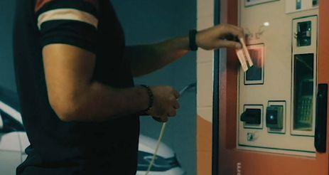
Finally, as part of the CirPark family, CamSensor is completely integrated with any of the other Circontrol systems specially designed for car parking facilities, such as smart LED lighting, EV charging infrastructures and intelligent vehicle guidance. This, in addition to its quick and easy installation, which reduces capital expenditure, makes CamSensor the best partner in the pursuit of the perfect parking experience and makes it a 360-degree solution, with ideal solutions for every need. ■

Annual Showcase 2022 | Intertraffic World | PARKING 151
Above: Contactless payment can be ultimately simplified with CamSensor, allowing parking bay, car ID and driver linkage for a comfortable automatic transaction
Boosting the parking experience with big data


At a time when data is everywhere, it is essential that parking management technologies unify and process information in a cohesive, orderly, and clear manner. There is power in data but generating it in an uncontrolled way does not make sense. Data must be interpreted by people and used accordingly, with the goal of obtaining the greatest growth and profit for the business, as well as enhancing the parking experience for users.
Above: One indicator light can be allocated per space with Quercus Technology parking solutions. Infinitely variable colours can be used to guide drivers, for example green lights can indicate an available space
Below: Quercus SC indoor camerapart of the parking guidance system

management and business maximization. Planning for the future can be optimised. Customers can find out which days and hours usually have more traffic, as well as which facilities are more or less popular. Facility owners can manage rates, schedules and parking spaces. Usage statistics can also be obtained to understand user habits and propose campaigns to strengthen their loyalty.
Optimising the parking experience
by allowing users to reserve their parking space online, which means it takes minimal time to leave their car in the facility. It is also possible to install signage to guide drivers to available spaces in a user-friendly, dynamic way, or provide kiosks to help them find their vehicle quickly. Another way to add to the parking experience is to prevent heavy traffic both inside and outside the facility.
management. This is business
of all indoor and outdoor parking reports for the business.

The interconnection between big data and smart devices leads to increased productivity and profit, as well as smooth access to information and less stress. By analysing of data generated by the global parking sector, it is possible to create a set of strategies focused on parking management. This is business intelligence. A parking software platform can provide full control of all indoor and outdoor parking guidance devices, centralizing information and generating key reports for the business.
Parking areas should provide optimal convenience and simplicity for customers. As such, facility operators should be looking at how to enhance the parking experience. It can be a real challenge to manage the complexities and the stress of parking in a downtown area, where there are often long queues. However, if you know that a particular parking facility is equipped with features to make parking a pleasant experience, it is a different story.
Quercus Technologies’ range of comprehensive parking solutions empower parking facility operators to manage and process parking space reservations through their websites. Properly configured, the software can even stream parking capacity and availability in real time. In this way, a specific license plate number can be linked to a reserved stay, a certain price, or a special discount rate.
All of this data can be compiled into reports for decision-making on parking
decision-making on parking
make parking a pleasant experience, enhance the parking experience
There are several actions that a parking facility owner can take to raise the satisfaction of customers. For example, they can enhance the parking experience
If the user has reserved a stay, access will be automatically granted via license plate recognition by the LPR camera at the entrance. Inside the facility, camera-based parking sensors provide parking space guidance. Alarms can be set to go off if a vehicle with a different license plate number parks in a reserved space.

PARKING | 152 Intertraffic World
Big data enables smarter parking. This means a better user experience, reduced travel time, improved mobility and improved security inside parking facilities
Words | Adrià Miralvés, digital marketing manager, Quercus Technologies, Spain
| Annual Showcase 2022
For users without a reservation, touchless, barrier-free access is made possible by Quercus Technologies’ SmartLPR Access vehicle license plate recognition unit, installed in the access lanes. SmartLPR Access reads the number, and then either prints out a ticket with the license plate number on it, or in the case of a ticketless solution, saves the license plate number in the parking facility system. This is then later retrieved for payment, with no need for paper.
Inside the parking facility, digital parking signs show the availability of spaces in rows and can also provide directions, to optimize the user experience and expedite parking times. These matrix information displays are completely customizable with fixed or dynamic messages, providing instructions for drivers with information that is relevant to them. These signs can also indicate parking space availability in outdoor areas, thanks to the SC Outdoor video-based parking guidance system. This solution saves users from entering these areas if it is not possible to park in them.
The parking sensors use a colour code to indicate whether a parking space is free, occupied or of a certain class, such as blue for users with disabilities, pink for families and green for electric vehicles. Once parked, vehicles benefit from the security of video surveillance of each space provided by the SC Indoor parking guidance system. License plate recognition is also applied to each of the parking spaces. To help users find their parked cars when they return to the parking facility, kiosks can be installed, which can locate a vehicle based on its license plate number. Users can also be provided with an on-screen reminder of their vehicle’s location when they are paying for their stay.
Vision and control
according to business interests and opportunities.

To make integration easier, Quercus Technologies’ BirdWatch platform has an application programming interface (API) that makes it compatible with any other parking system. This system can also detect incidents that affect the normal operation of a parking facility. Detected incidents provide the operator with all the necessary data to make an informed decision.
The light colour that could be used to indicate a space for users with disabilities in Quercus parking systems (colours are fully usercustomisable)
The full integration of parking management software provides operators with global vision and control. It enables them to monitor all vehicle movements inside the parking facility and to make decisive decisions

BlueQuercus Technologies aims to expand integration options, facilitate compatibility, and optimize useability. Its parking software platform includes recurring updates and constant software enhancements.
Every parking facility is different; owners will have different needs depending on their unique characteristics. No matter which parking solution you choose, what matters most is getting the highest performance from the facility, bringing more to the user experience and, as a result, enjoying greater financial yields. ■
Annual Showcase 2022 | Intertraffic World | PARKING 153
The complete package
Hectronic is evolving into a provider of digital parking solutions. Its cloud-based software already integrates coin and cashless machines with state-of-the-art surveillance and optimization. Soon, its all-new e-mobility terminal will also hit the market
Payment, surveillance, management, charging –Hectronic offers complete parking management from one source. Its Citea ticket machine enables drivers to pay with coins, card or smartphone, while the CiteaPico is completely cashless and ticketless. Hectronic’s cloud-based HecSpot system provides surveillance and parking-space optimisation and its CityLine
web-based software connects all these components. CityLine stores mobile payment data and enables operators to survey terminals and parking spaces in real time. Its HecPay Eco payment terminal will soon provide operators with a cost-efficient entry to e-mobility.

Brave new cashless world
During the pandemic, contactless payments in the retail sector rose
sharply. The desire for fast and frictionless payment by card or smartphone – via Apple Pay or Google Pay – has fanned out to other spheres. As a pioneer of parking management, Hectronic continually responds to evolving demands and now offers the fully ticketless CiteaPico machine. Drivers enter their parking time and number plate number, then pay via near-field communication (NFC) from their
154 Intertraffic World | Annual Showcase 2022 PARKING |
Words | Sascha Schiele, sales director, Parking Systems, and Christian Kuppel, director BU Parking Systems, Hectronic, Germany
smartphone. Receipts are sent via SMS or email upon successful transaction
Hectronic, a family enterprise from Bonndorf, Germany, still stocks classic Citea ticket machines, which allow drivers to pay by coin. On request, it can quickly retrofit the Citea for card payment by simply exchanging the door. Both machines can be connected to a power line or equipped with solar panels for self-sufficient, weather-independent operation.
CityLine management software amalgamates all parking-machine data in the cloud. Operators can perform configurations such as fee adaptations centrally and view parking revenues and periods or card transaction numbers in real time. CityLine reports incidents automatically, forwarding information to service staff. It is platform-independent and operable by tablet, notebook or smartphone thanks to a dedicated app.
Hectronic also enables parking app providers, cities and municipalities to review parking


process payment data in one place via CityLine interfaces.

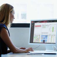

Space optimisation
HecSpot not only surveys parking times but also optimises occupancy of parking spaces, be they paved, unpaved or multistorey. A single camera is capable of surveying up to 300 spaces, sending snapshots to CityLine at customer-determined time-intervals. By comparing these to predefined framework data, the system knows how many spaces remain available and can forward this information to parking guidance systems.
For supermarket parking operators, surveillance, detection and notification of maximum parking time violations provides another useful function. HecSpot allows camera-based automatic number plate recognition (ANPR) at entry and exit. The process is simple. Users park then pay via a Hectronic solution. On departure, the system checks approval and completes the parking process. If approval is not granted, it provides the relevant
dataset to the responsible authority or the barrier remains closed.

New electric dawn
Hectronic is poised to launch a new, totally cashless payment terminal: the HecPay Eco. Exceptionally userfriendly, the HecPay Eco will enable easy and cost-efficient entry to e-mobility for cities, municipalities, parking space operators, companies with customer and employee parking and small charging parks.

“Customers will simply select a charging-station at the touch display then pay by card, or smartphone,” explains Hectronic director of Business Unit Parking Systems, Christian Kuppel. “We are evolving from a classic parking machine manufacturer into a provider of complete parking management solutions. Our cloudbased CityLine software represents a major step towards digitisation. Our modern terminals, digital services and integration of numerous interfaces reflect our continuous pursuit of this path. We are happy to bring the HecPay Eco, an answer to future mobility, to our portfolio.” ■

When it comes to parking - Hectronic:
Annual Showcase 2022 | Intertraffic World | PARKING 155 Don´t hesitate to contact us: Hectronic GmbH | Allmendstrasse 15 D-79848 Bonndorf | Tel. +49 7703 9388-0 mail@hectronic.com www.hectronic.com
Your control centre: parking management software Camera-based solutions All from one source - suited to your requirements Terminals and digital payment options CityLine 1036055_TTI Supp_Hectronic GmbH.indd 1 30/11/2021 14:39
Left: Hectronic offers complete parking management from one source
All under control
With a growing number of car parks and access points, an operator’s job is becoming increasingly complex. A cloud-based management solution enables operators to manage multiple car parks from a single centralised platform
Words | Aneta Chlumecká, Green Center, Czech RepublicIn today’s busy world, everyone wants straightforward and userfriendly system administration and management. As parking systems provider, Green Center is eager to contribute to this movement – not only for car park users but also for operators. The goal is to make parking systems easily manageable and to provide operators with enough tools to run their business efficiently and profitably. Green Center has developed two new remote management systemsits Parking Monitoring Center (PMC) for online parking systems and devices, and its Monitoring And Reporting System (MARS) for autonomous devices.
Information in the cloud Managing multiple car parks can be quite overwhelming. Green Center’s parking monitoring center (PMC) has been developed to make

Above: Green Center’s Parking Monitoring Center allows supervision and administration of several car parks from one place
the whole process much easier. PMC can be accessed by a web browser, enabling operators to monitor and supervise multiple car parks from anywhere, while allowing each car park to operate independently.
Central monitoring, service and administration is convenient, not only for public parking areas, but also for parking associated with retail, supermarkets, hotel chains and ski resorts. These operators benefit from centralised monitoring to manage and administrate differently located car parks, as well as to collect data for predictive modeling, dynamic pricing, or statistics. Moreover, operators also have the possibility to connect existing parking systems from the other suppliers if they want to include them in the monitoring process.
To simplify the parking payment procedure for users of the connected
car parks, a centralised manual pay station can be included. This strategically located pay station collects parking fee payments from all involved car parks.
From words to deeds
The PMC eases the everyday struggles of car park operators and provides them with the right tools to boost their business. Within the PMC you can find valuable information, such as the current occupancy status of all car parks or an overview of the status of all the parking system units. To minimise problem-solving time, the dispatcher can remotely control all entries, exits and pay stations. S/he is also capable of assigning specific tasks to service technicians that are on the field. The technician receives the message about a specific task together with the relevant documentation, such as photos on a PMC mobile application. The mobile application shows all tasks with real-time status so all faults can easily be addressed.
Benefits of the PMC include:
• Connection of multiple car parks
• Audio and visual communication with car park CCTV cameras and intercom connection
• Integration with other mobile applications and transport systems – to share occupancy or make reservations
PARKING | 156 Intertraffic World | Annual Showcase 2022
• Data collection
• Monitoring of parking devices in all connected car parks
Monitoring autonomous devices
To offer a comprehensive solution, Green Center has also developed a cloud solution for the remote management of autonomous devices. The Monitoring and
Reporting System (MARS) includes an economy offline parking system, as well as access control systems such as turnstiles and small automatic pay stations. These can be used to collect fees for usage of facilities, such as toilets or showers, which can be used either within the car park or separately.
Two
The architecture of the MARS solution dictates that individual devices communicate with the main server. Operators can then connect to this server via a common web browser. This means that the only requirement to ensure effective remote management is an internet connection.
In the past, user functions and remote technical support have been very limited with autonomous devices. MARS offers the possibility to receive information about the status of all connected devices. This includes things like the need to refill the paper roll in the parking ticket printer or empty the cash box.
In addition, the operator can gather financial statements.
The administration of longterm parking cards is also supported in MARS, making it ideal for car parks that accommodate permanent users.
With Green Center’s solutions, managing multiple car parks and access control points becomes simple and easy. ■


Complex parking solution technology
operating
Annual Showcase 2022 | Intertraffic World | PARKING 157
Visit us at Intertraffic Amsterdam 29 March - 1 April 2022, booth 12.415 www.green.cz Advertisement_Green_Center_183x115.indd 1 04.12.2021 17:15
•
• monitoring
Left: Individual devices communicate with the main server in the cloud, to which users connect via a web browser
• Mobile application for technicians
The number of new remote parking management systems developed by Green Center


SMART MOBILITY


Annual Showcase 2022 | Intertraffic World 159
How rugged is rugged?
Words | Zeljko Loncaric, marketing engineer, congatec, GermanyMost standard computeron-modules (COMs) use SO-DIMM connectors to integrate the main memory. Since the main memory is often customised for a specific application, this modular approach works well for module manufacturers and their OEM customers. However, the resistance of such connectors to shock and vibration is limited. Even comparatively small vibrations can impair the functional reliability of the RAM when standard memory
Above: Smart
modules are used. Applications that are exposed to high shock and vibrations therefore require more robust designs.

In the rail cargo sector, vibrations of around 0.002g²/Hz at frequencies from 0 to 350Hz are common. Vibration levels experienced in jet aircraft are significantly higher at 0.01g²/Hz with frequencies up to 2000Hz. For systems deployed in trucks, levels reach up to 0.02g²/Hz. And turbine engines, such as those used in wind turbines, pose higher
demands still, stressing components with up to 0.03 g²/Hz.
Soldered memory
Developers of mobile and stationary systems exposed to shock and vibration are looking for better solutions to connect the main memory. In response, memory manufacturers have added screw holes at the far end of their SODIMMs to attach the RAM modules securely, so that shock and vibration are no longer a problem.
160 Intertraffic World | Annual Showcase 2022 SMART MOBILITY |
Computer systems in demanding transport and mobility environments with high vibration require robust solutions that can withstand movement and maintain reliable functionality
mobility applications need rugged designs
However, this type of technology in not in high demand. Rugged SODIMMs with mounting holes are not mass-produced, and this makes them expensive. They are also more mechanically complex and hence more expensive to assemble. Lastly, they require additional mounting holes on the boards, which further increases production costs.
The best solution is to avoid these add-ons and simply solder the memory directly onto the module. This reduces the bill of materials for
components, makes production more cost-effective and, most importantly, ensures ruggedness. Soldered memory also makes cooling easier than with conventional memory connectors - firstly, because the PCB on which it is soldered has better heat dissipation, and secondly, because the heat sinks of rugged COMs are specially designed for the respective ruggedness requirements and can be equipped with a heat-conducting connection for cooling hot spots such as the main memory.
A rugged solution
congatec has recently introduced new COM solutions based on the very latest 11th generation Intel Core processors with soldered RAM. These COM Express Type 6 Computer-on-Modules comply with the ETSI EN 300 019-1-7 and IEC 607213-7 specifications for portable and non-stationary telecom equipment and have been tested for commercial 7K3, 7M2 and industrial 7K4, 7M2 environments. This class also applies to non-weather protected locations in moderate outdoor climates and transfers between these conditions. For example, where equipment may be exposed to direct sunlight, radiant heat, ambient air movement, condensation, precipitation, and water from sources other than rain and ice.
Below: congatec COM Express modules with 11th generation Intel Core processors are predestined for harsh environmental conditions


humidity and heavy mechanical stress due to shocks and vibrations. They also meet all requirements for fire protection.
4,266MT/s
Typical customers for the new range of COMs based on Tiger Lake microarchitecture are OEMs of trains, commercial vehicles, construction equipment, agricultural vehicles, self-driving robots and many other mobile applications in demanding outdoor and off-road environments. Shock and vibration-resistant stationary devices are another important application area as digitization requires critical infrastructure protection (CIP) against earthquakes and other mission-critical events.
Maxium speed of congatec’s COM Express Type 6 modules of LPDDR4X RAM
All of these applications can now benefit from super-fast LPDDR4X RAM with up to 4,266MT/s, which congatec offers in graded versions with 32, 16, 8 and 4GB as standard variants.
Depending on the requirements of the application, the highestperformance modules can also be equipped with smaller memory or lower-performance variants based on the Intel Core i3-1115G4E with more than 8GB RAM. In-band error correction code (IBECC) for single failure tolerance and high data transmission quality in EMI-critical environments corroborate the ruggedness of the modules.
In terms of shock and vibration, these modules are suitable for use in demanding transport and mobility applications, including off-road and rail vehicles. They can withstand continuous operation in extreme temperatures (-40°C to +85°C), high
Comprehensive support
The value package also includes rugged mounting options for the COM and carrier bundle, active and passive cooling options, optional conformal coating for protection against corrosion from moisture or condensation as well as sulfur protection, a list of recommended carrier board layouts and – for maximum reliability – shock and vibration resistant components for the extended temperature range. This impressive technical feature set is complemented by a comprehensive service offering that includes shock and vibration testing for custom system designs, temperature screening and high-speed signal compliance testing, as well as designin services and all necessary training to simplify the use of congatec’s embedded computer technologies.
Annual Showcase 2022 | Intertraffic World 161 | SMART MOBILITY
■
Become a mobility expert
Words | Alain Bützberger, SwissTraffic AG, SwitzerlandThe future of mobility is defined by the seamless integrating of our work life, home life and leisure time. Just getting from A to B will no longer be enough. What will truly matter in a multimobile world are experience, sustainability, and health.
Companies, city authorities and other actors are faced with major
Right: Smart cities enable traffic flow optimisation, increase safety, promote cycling, reduce noise and improve air quality

challenges to draw the right conclusions from a huge range of new products and services. SwissTraffic supports its customers and partners and applies an integral approach to this highly complex issue. With more than 20 years of expertise in mobility, SwissTraffic is an ideal partner for innovative and sustainable mobility solutions.
Become a partner
As one of the European leaders in the field of mobility of the future, SwissTraffic combines sensor know-how with mobility
engineering to make cities smarter and improve quality of life in the field of mobility. By using state-ofthe-art technologies such as artificial intelligence (AI), SwissTraffic can support you on your journey towards a smart city, putting people at the center. Together, you can master any mobility challenge.
“Partnering with SwissTraffic will give you access to a wider range of mobility expertise and create more business opportunities. They can bring a new perspective about today’s mobility challenges that you and your clients are faced with,” says
SMART MOBILITY | 162 Intertraffic World | Annual Showcase 2022
The combination of sensor know-how, traffic engineering, and artificial intelligence is helping cities to master any mobility challenge
We offer you the advantage of white label solutions for all products
Alain Bützberger, chairman of the board, SwissTraffic
Bützberger, chairman of the board at SwissTraffic.
SwissTraffic offers its customers the advantage of white label solutions for all products as well as the appropriate training for the operation/use of the equipment and after-sales customer service. As experts with more than 20 years of experience, the company actively supports its customers in the analysis of actual conditions, selection of the best method/ technology, and user requirements.
SwissTraffic develops innovative sensors and adapts them to customer requirements. All results can be visualised on dashboards or made available via APIs.

In addition to its mobility engineering services, the


company also offers white labelling


of its products. related products and services


SwissTraffic offers clients direct access to know-how and products to serve their customers more efficiently. This helps companies to increase their competitive edge. To help even more road authorities and related companies, SwissTraffic is looking to start distributing its products and services internationally.
multimodal. Mobility must be available to everyone, cost-effective, and safe at all times. Micromobility, city logistics, electromobility, autonomous driving, Mobility-as-aService (MaaS), 30km/h speed limits, environmental zones and cycling will all play important roles in the mobility of the future.
SwissTraffic engineers combine decades of experience with sector expertise to offer solutions for a safe coexistence.


The


path ahead The path chains of mobility are
See SwissTraffic’s full product catalogue at: https://www. swisstraffic.com/en/assets/ downloads/webseite-2021/Product_ catalogue2021_E_WEB.pdf ■
Build on our more than 20 years of experience and let us shape the future of mobility together Alain Bützberger, chairman of the board, SwissTraffic


Annual Showcase 2022 | Intertraffic World | SMART MOBILITY 163
Alain
Ma(r)king roads readable for self-driving cars
For safe and efficient deployment of self-driving vehicles to become a reality, we first need lane markings and road signs that can be read easily by cameras and sensors
Words | Richard Neumann, Swarco, AustriaCAV, V2X, C-ITS, CCAM – the acronyms differ, but they all have one thing in common. They all represent a connection between road infrastructure and vehicles that aims to improve traffic flow, reduce emissions, make traffic safer and make our journeys more convenient. Vehicle automation is often cited as one of the biggest disruptive technologies, both economically and environmentally. But for automation to happen, the surrounding infrastructure must be adapted to support efficiency and safety. Connected infrastructure is key to design and certification procedures as well as for testing environments. Connectivity between infrastructure and vehicles is also necessary to support operational conditions in the transition period, which could last for decades.
Apart from the automotive and C-ITS aspect of managing the traffic of self-driving cars, it is also essential to consider the road itself, and in particular its readiness to be read by driver assistance technologies.

“Lane markings are currently read by two kinds of sensors: camera and lidar,” says Harald Mosböck, Swarco’s vice president of road marking systems for Europe and the APMEA regions, and vice president of the European Union Road Federation (ERF). “Even the most advanced vehicles equipped with high-definition maps need sensors to capture information from lane markings and traffic signs, and to determine whether all the data fits together. Road markings and traffic signs still lack uniformity on roads.
There are too many differences. And for as long as these things remain inconsistent, we will not be able to fully rely on sensors.”
Global initiative
On an international level, it is mainly the Japanese, American and European standardization bodies pushing to improve and standardize road markings. The latest edition of the North American Manual on Uniform Traffic Control Devices (MUTCD) is to contain a requirement for major roads that normal lines be 150mm (6in) wide and for markings to be more uniform. Just recently, a major standardization body proposed to the Federal Highway Administration (FHWA) that lane markings on the future highway network should not only have a standardized width, but there should be a general requirement for dotted lines at highway exits and a standardized gap width for interrupted lines. Right now, there is work in progress addressing the topic of better retroreflectivity, which is a very challenging subject. Another issue is how lane markings in roadwork zones can be improved to attain reliable and consistent machine readability for automated or assisted driving.
The number of different weather conditions in which Swarco has tested
24Commission to form an expert group to work out how to make road markings and traffic signs easily readable for vehicles and, of course, for humans as well. Initial results were expected by mid-2021 but, due to the COVID-19 pandemic, will not be available before spring 2022.
“In general we can say the communication between carmakers, industry associations and Brussels on the expectations for the quality of road markings has already greatly improved,” says Mosböck.
In 2019, the European Council revised its road safety management directive and charged the European
One recommendation pushed forward by the European Road Federation (ERF) is very similar to the approach in the USA. The formula was created based on what the human eye can see, with the goal to improve road safety. Interestingly, several studies show that what is good for the human eye also works very well for machine vision. The 150 x 150 formula recommends a line width of 150mm and a

164 Intertraffic World | Annual Showcase 2022 SMART MOBILITY |
lane markings
retroreflectivity (RL) of >150 mcd/m²/ lx under dry conditions (RL > 35 mcd/m²/lx under wet conditions).
Machine vision
To find out more about the ability of cameras and lidar to read lane markings, Swarco carried out tests in the world’s biggest climate tunnel in Vienna, in partnership with automotive lighting technology company ZKW. They implemented eight different kinds of lane markings - from standard to high performance systems - and investigated how they were ‘seen’ by three different kinds of cameras and eight different kinds of lidar sensors. They also simulated 24 different weather conditions, including bright daylight,
nighttime, wind, stormy weather, heavy rain and fog.
The tests confirmed that anything the cameras could read, could also be read by the human eye. However, the cameras could not read everything that the human eye could see. “One strong point of cameras is their identification of contrast,” says Mosböck. “However, they show a weakness when glare light is coming from vehicles in the oncoming lane.”
When it comes to lidar sensors, some highly retroreflective road markings successfully increase readability and detectability. “Special pigmentation enables the lidar to read orange road markings very accurately,” Mosböck confirms.

“This is important in light of ongoing discussions in the USA about
Road markings and traffic signs still lack uniformity on roads. There are too many differences. Improving uniformity is a prerequisite to increase the reliability of readings by different types of sensors
whether lane markings in roadwork zones should be orange in the future. The lidar is also not affected by glare. If you combine cameras and lidar in a car, you will have very good readability and reliability for assisted driving.”
There is of course a financial element to improving road markings. “Whenever you discuss higher performance lane markings with the automotive industry or road authorities, the first question is always: Who is going to pay for that?” says Mosböck. “My belief is that all over Europe we need better performing lane markings on our road networks. Once we have achieved a level that is suited to the human eye, it will work for automated vehicles as well. There is still a long way to go because road authorities lack sufficient funds and I doubt they will be able to finance high performance lane markings for all road networks. But I hope to see major progress in better road markings for human and machine vision on the long-distance arteries of the trans-European network in the near future.” ■
Annual Showcase 2022 | Intertraffic World 165
Above: Connectivity between infrastructure and vehicles is essential for the future of automation
Harald Mosböck, vice president of road marking systems for Europe and the APMEA regions, Swarco, and vice president of the European Union Road Federation (ERF)
Platforms for revolution
Europe faces sustainability challenges that electromobility alone cannot resolve. It must optimize multimodal mobility across cities – but this demands open, robust and interoperable platforms to combine and manage vertical systems in real time
 Words | Antonio J Ortín, general manager of ETRA I+D, Grupo Etra, Spain
Building sustainable urban mobility (SUM) is among the foremost challenges confronting Europe in the next half-century. It will be instrumental in efforts to reduce climate change and transition to a low-carbon economy. Transportation must play a pivotal role in achieving COP21 Paris Agreement climate targets and United Nations Sustainable Development Goals. Indeed, SUM must become a cornerstone of the European Union’s future economic growth and the quality of life of its citizens.
A SUM of infinite parts Electric vehicles (EVs) present a perfect replacement for internal combustion vehicles, offering similar services and benefits with fewer environmental drawbacks. Integrating electromobility with
80%
energy from renewable sources can form a virtuous circle whereby vehicle batteries become a valuable asset for massive and decentralized renewable energy deployment. But simply electrifying mobility is not enough: to successfully tackle the climate emergency, it must be combined with other measures.
technological solutions to balance and coordinate the combined operation of different modes. It requires tools like Etra’s suite of smart mobility solutions.
Above: To combat climate change, the electrification of mobility must be combined with other measures
According to the International Union of Public Transport (IUTP), several studies show that 80% fewer cars would be sufficient to support the current travel of EU citizens. Removing four in every five cars would deliver profound environmental benefits to European cities, improve traffic efficiency, reduce the need for parking and free up urban space. But it requires an integrated approach encompassing not only proper public transport and electromobility infrastructure, but
Mistral is based on open-source tools that gather and monitor realtime data across every city mobility system, from traffic management to public transport and EVs to public bikes. It uses configurable criteria to analyze and graphically visualize this data through intuitive dashboards to inform decisionmaking. It enables global, integrated management actions to be implemented and the results monitored across all vertical mobility systems. It supports publication of city mobility information via an open data approach which facilitates its use by external third-parties.
One platform, many modes
The usefulness of such a smart mobility platform depends on several key characteristics. It must be
SMART MOBILITY | 166 Intertraffic World | Annual Showcase 2022
The percentage reduction in cars that could still support EU travel demands
horizontal, to enable integration of different vertical mobility systems. It must be interoperable, to allow interaction and integration with external systems, and scalable, to increase its capacity without changing its architecture. It must be robust, capable of uninterrupted performance if problems arise, cybersecure and compliant with data privacy regulations.
Such a platform must be based on standard and open protocols. It must combine modularity, enabling progressive deployment as new functionalities are required, with a capacity to evolve in response to future needs. It must be capable of both operating and providing the information it gathers to third-parties in real time. It must be accessible via a web-based interface that enables multiple actors to interact with it simultaneously in a userfriendly way.
Finally, its focus must be moving people, not just vehicles, in support of coherent city strategies for use of urban space. It must therefore integrate multiple vertical systems used to manage mobility. It must
integrate traffic management, public transport (including bus priority at intersections), parking systems and accessibility for citizens with reduced mobility. It must do all this in accordance with the principles of open data, interoperability and full transparency.
Strategic eye to the wind
A powerful big data and business intelligence tool is essential to complement real-time operations and

facilitate strategic mobility planning.
Garbi from Etra is a leading solution in this domain. It enables mobility managers and urban planners to evolve from static, reportbased analysis to dynamic, online analytical processing (OLAP) visual tools, interact with the data and instantly grasp the details and complexities of urban mobility.
Today, Europe faces challenges. The solution demands qualitative technological change. Openness, integration, reactiveness, electrification and interoperability will become mandatory for real-time mobility management. This will need to be complemented by powerful big data and business intelligence tools for strategic planning. Only then will more human, sustainable and efficient cities become a reality. ■

Annual Showcase 2022 | Intertraffic World | SMART MOBILITY 167 @grupoetra www.linkedin.com/company/etra
Above: Etra’s smart mobility platform, Mistral
Big-data analytics for traffic centres
Every city, agency, operator, or concessionaire has its own traffic management use case. There is no off-the-shelf, ready-to use software solution that fits all of them. Yet, there are solutions with versatile functional modules that can easily be configured and customised to serve each of them optimally.
Telegra’s topXview, for example, is a versatile, comprehensive, and open software solution designed specifically for the traffic industry. Thanks to its modular architecture, it supports the implementation and delivery of an extensive number of use cases depending on integrated equipment/subsystems and/or customer requirements.
A virtually unlimited number of use cases can be supported by combining different modules, configuring the software for specific projects, and, if necessary, through the development of new, specialised, modules. Two examples of challenges
that are being managed by topXview currently are described here

Prioritisation of public transport Agencies aim to optimise the utilisation of public transport by opening a shoulder lane for buses (utilising a free shoulder lane in congested traffic). This improves travel time for buses and consequently encourages people to use public transport to reach their destination. Since the shoulder lane is generally used by vehicles in case of emergency, it is important that there are no incidents present on the road while buses are permitted to travel through the shoulder lane. The lane also needs to be clear of people and other potential obstacles, such as stopped vehicles, pedestrians, debris, wildlife and similar.
The above challenge is addressed by the topXview software solution, with the combination of a customised Decision Support System (DSS) and proven AI-based video analytics –X-AID. Roads under observation are
segmented into sub-sections in topXview where each sub-section can open the shoulder lane for public transportation.
The system has many parameters, which inform the operator’s decision on whether to open the shoulder lane, or whether or the bus lane is opened automatically. These include speed threshold, presence of incidents, time within a day, and similar. However, the core idea behind the bus lane management can be summarised in following four principles:

1) If the current time of day is within expected rush hour periods, then congestion can be expected. Rush hours are configurable by the user.
2) If the speed of traffic flow through the main lanes is between configurable thresholds, then utilising the shoulder lane as a bus lane is expected to reduce travel time for public transportation.

SMART MOBILITY | 168 Intertraffic World | Annual Showcase 2022
Above: Telegra’s topXview software solution can help traffic managers decide when to open highway shoulder lanes to buses
Rafal@stock_adobe.com
By providing operators with complete, integrated data, advanced software makes traffic management simpler, safer and more effective
Words | Dave Hude, Telegra, Croatia
3) If there are no incidents present on the road then the shoulder lane is free for use.
4) If the above conditions are satisfied, shoulder lanes should be used for public transportation and corresponding variable message signs (VMS) can be set to indicate buses to use shoulder lane.
The customised bus lane management system in topXview uses a complex concept of operations. The DSS suggests optimal response plans (VMS, cameras, open/close lane) based on the location of an event. Traffic speed, count, classification, and incidents are detected by X-AID. Since multiple operators work in the same management centre, customised logic for prioritisation of events and handling by different operators has also been implemented. The system supports full redundancy –in case of a disaster all functions are transferred to a backup centre.
Integrated management system
Aegean Motorway’s (AMSA) Motorway Management Center (MMC) in Greece operates more than 230km of highway with four long dual-tube tunnels, featuring more than 20 different technology subsystems (including traffic, SCADA and maintenance).

Prior to the integration of the topXview system, MMC topology resembled a disjointed set of independently integrated subsystems. These subsystems were unaware of each other, each with their own human machine interface (HMI). As expected, complexity increased to the point that the system became difficult to handle. The operators were overloaded with unfiltered, unprioritised data from sensors about events from each subsystem.
Thus, to mitigate arising issues and increase safety, AMSA laid out its business goals to acquire a system that would integrate all equipment/ subsystems, provide a single HMI interface to operators and support AMSA’s standard operating procedures (SOP).
The first step was the integration of existing equipment and subsystems on open road and tunnels’ SCADA. The project came with a large diversity of equipment
and subsystems in their own different stages of lifecycle, such as early planning phase, in use and at end of lifecycle. After the initial deployment of the topXview platform, new systems were added monthly without any interference with daily operations. This way, the platform progressively grew, and existing HMI interfaces became obsolete.
The second step was establishing connectivity with MMC systems for business model, operations, and asset support. Using topXview’s API, interfaces with existing systems were established. Part of business logic was offloaded from existing systems to topXview’s Asset Management and basic Event management module. Operation procedures and strategies were executed within the Event management module using a simple rule-based engine.
After key building blocks were operational (equipment integration and asset management), prerequisites were fulfilled for an advanced Event management system or DSS installation. The system completely removed the need for operators to consult any other application and all AMSA business goals are articulated in Event management.
In a nutshell, Event management is a system that recommends, suggests, and presents operators with an outcome of qualitative and quantitative system analysis in the context of event handling. Upon receiving the results, operators must evaluate the recommendation validity and allow continuation with
recommended solutions for the given traffic problem. The system guides the operator by asking key questions such as, “How many lanes are affected?” or, “Are there any injuries?”. The operator either answers the questions properly or chooses to postpone the answer until the required information arrives. The system reminds the operator to answer the skipped questions at a later stage.
Event management reduces operator errors by involving high level actions instead of atomic control of individual equipment. Operators are expected to perform only highlevel tasks making full use of their expertise while removing tedious housekeeping tasks. The system makes full use of integrated sensors by filtering and fetching information in the context of incident resolution.
After an incident is triggered and the location is known, the system selects only nearby and relevant sensor data presenting distilled information to the operator (traffic load, weather data, closest patrollers, etc.). The system also calculates and proposes optimal strategy based on those data.
Smarter data for all
The examples here represent only two use cases for Telegra’s big-data analytics. With topXview the possibilities for enhancing traffic management through smarter data use are almost limitless. Contact the experts at Telegra and find out for yourself, today. ■
Annual Showcase 2022 | Intertraffic World | SMART MOBILITY 169
Above: Telegra topXview is improving tunnel management by aggregating over 20 different traffic management subsystems
Susan Vineyard @stock_adobe.com
The electric revolution Transport has a huge role to play in the international effort to decarbonise – find out how EV infrastructure, curbside management and smart data will all play their part MaaS in the Netherlands How the race to implement Mobility as a Service in Intertraffic’s homeland is sparking productive competition Real-time data in Mexico Making sense of informal public transport in Mexico City is just one way in which real-time data is aiding mobility Digital twins in cyberspace Discover how creating exact, virtual replicas of transport infrastructure is aiding road construction and traffic management INFRASTRUCTURE TRAFFIC MANAGEMENT ROAD SAFETY PARKING SMART MOBILITY 2022 WORLD From the publisher of SUBSCRIBE TO INTERTRAFFIC WORLD NOW! FREE SERVICE! Visit www.intertrafficworld.com to register for your free print or digital copy of Intertraffic World magazine – keeping you in touch with the Intertraffic community all year round www.intertrafficworld.com Never miss an issue!
Products & services


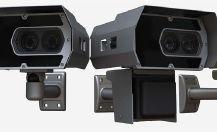


Find out more about the advertisers in this issue


Annual Showcase 2022 | Intertraffic World 171 ADVERTISER DIRECTORY
3M Transportation Safety Division (Inside Front Cover)
At 3M we are dedicated to improving transportation infrastructure and mobility so motorists can arrive at their destinations safely. Our high-performance materials combine with innovative systems and services to help you bring the best roadways systems into reality. For more than 80 years, we have shared in your mission to make our roadway safer.
Contact details: Tel: +44 870 536 0036 Web: www.3m.co.uk
Adaptive Recognition (page
25)
Adaptive Recognition develops and produces software and hardware based on computer image processing technology. The company’s agship product is CARMEN, a globally recognized, market-leading automatic number plate recognition (ANPR/LPR) software. Adaptive Recognition also designs and manufactures ANPR cameras and IoT devices specially made for access control, tra c monitoring, and speed and tra c enforcement. Adaptive Recognition is also present on the identity veri cation market with innovative identity document readers, passport scanner devices, and related optical character recognition software.
Contact details: Tel: + 36 1 201 9650 Email: requestinfo@adaptiverecognition.com Web: www.adaptiverecognition.com
Avery Dennison (page
59)
Avery Dennison re ective technology has been making highway and street safety solutions bright with prismatic signs for nearly one hundred years. The company is one of the preferred suppliers to professional sign shops worldwide and service the tra c and safety market with one of the industry’s most comprehensive range of re ective sheeting.
Contact details: Tel: +1-877-214-0909 or email Email: re ective.orders@averydennison.com Web: re ectives.averydennison.com
Carrida Technologies (page 109)
Carrida Technologies is a provider of ALPR software and solutions. Its product portfolio ranges from Carrida SDK, a hardware-independent software library that runs on any PC, edge device or server/cloud to edge solutions with onboard data processing. The company was founded in 2017 and is based in Germany and Austria.


Contact details: Tel: +49 6331 259 9795 Email: info@carrida-technologies.com Web: www.carrida-technologies.com
Circontrol (page 151)
Circontrol is a company with in-house technology where innovation is a constant objective. It was founded in 1997 to provide solutions toward developing mobility or, more speci cally, toward e cient solutions for mobility in car parks, and e-mobility, with smart charging solutions for electric vehicles.

Contact details: Tel: +34 93 736 29 40 Email: circontrol@circontrol.com Webs: www.circontrol.com
congatec (page 158)
congatec is a rapidly growing technology company focusing on embedded and edge computing products and services. The high-performance computer modules are used in a wide range of applications and devices in industrial automation, medical technology, transportation, telecommunications, and many other verticals.


Contact details: Tel: +49-991-2700-0 Email: info@congatec.com Web: www.congatec.com

172 Intertraffic World | Annual Showcase 2022 ADVERTISER DIRECTORY
Easylux Retrore ectometer (page
141)
Easylux develops innovative, small and lightweight retrore ectometers powered by AA batteries, designed for people that do not want to carry heavy devices on the road.
Contact details: Tel: +55 11 3438 3448 | +55 11 2564-4868 Email: vendas@easylux.com.br Web: www.easylux.com.br
Grupo Etra (page 167)
Etra is an international industrial group providing turnkey solutions and services in the elds of tra c, transportation, smart lighting, energy e ciency, security, water management and communications. The company covers the whole value chain, from technological research and innovation, to development, manufacturing, installation, commissioning and operation. Etra combines innovative technologies with a pragmatic approach, providing advanced, environmentally friendly solutions and services for both smart cities and technological infrastructures.
Contact details: Tel: +34 9631 34082 Email: grupoetra@grupoetra.com Web: www.grupoetra.com
Geveko Markings (page
51)
Geveko Markings develops, manufactures, and distributes horizontal markings in any size, material, colour, or form that meet the requirements of the segments the company serves. Geveko mainly focuses on areas of application where its products must perform to either strict performance, durability and safety standards, decorative requirements or under demanding circumstances. The company provides guidance and safe travel for road users of all types, improves ow of tra c, assists the visually impaired and o ers decorative and aesthetic properties. Its markings enable safe, sustainable, and e cient mobility in more than 80 countries around the world.
Contact details: Tel: +45 63 51 71 71 Email: sales@gevekomarkings.com Web: www.geveko-markings.com
Green Center (page 157)
Green Center is a producer and developer of smart parking technologies, parking systems, automatic barriers, license plate recognition technologies and parking guidance systems, veri ed by hundreds of parking systems installations worldwide and almost 30 years of experience. Green Center is also focusing on new trends in smart software solutions.


Contact details: Tel: +420 266 090 090 Email: export@green.cz Web: www.green.cz
Haenni Instruments (page 127)
Haenni Instruments is a leading supplier of mobile wheel load scales, with more than 45,000 units sold worldwide. Its mission is to provide the best solution for mobile weight enforcement. Haenni’s scales are thin, light, robust and reliable. The variety of types, sizes and ranges enables their use in di erent applications.
Contact details: Tel: + 41 31 506 5400 Email: info@haenni-scales.com Web: www.haenni-scales.com
Hectronic (page 155)
With its headquarters in Bonndorf, south Germany, Hectronic GmbH has specialised in the development of intelligent system solutions for the areas of parking, petrol station and tank content management. Since the establishment of the “primordial mother” Kienzle in 1928, Hectronic GmbH has evolved into an internationally active industrial enterprise. With more than 380 employees, eight locations and 70 partners in sales and service, the company holds a top position worldwide today.
Contact details: Tel: +49 7703 9388-0 Email: mail@hectronic.com Web: www.hectronic.com

Annual Showcase 2022 | Intertraffic World 173 ADVERTISER DIRECTORY
Hog Technologies (page 90)

Hog Technologies manufactures solutions for the roadway and airport industries. Solutions include the award winning Stripe HOG water blaster to remove markings and rubber deposits from surfaces, along with multiple various equipment for pavement marking, grinding, grooving, and rumble strips, hard surface cleaning, hydro demolition and more! Their equipment is owned in 56 countries and working in over 80 around the world. Hog’s customer service provides excellent technical support, training, and spare parts promises while bringing value beyond the quality of each hand crafted product.
Contact details: Tel: +1 772 214 1714 Email: sales@thehog.com Web: www.thehog.com
Ibotech (page 7)
Ibotech is, together with its partner company Ibomade, one of the biggest providers in Germany for developing, manufacturing and service providing in the elds of safety in tra c construction sites and road markings. As manufacturer for mobile road barriers, LED tra c jam warning systems and individual tra c signs, the company’s mission is to identify potentials for more sustainability, e ciency, and security, and to transform them into innovative technology.
Contact details: Tel: +49 6205 28 672 10 Email: info@iboholding.eu Web: www.iboholding.eu
Intercomp (page 115)
Intercomp is the world’s largest manufacturer of portable vehicle weighing solutions and has been serving the industry for more than 35 years. It manufactures weigh-in-motion, wheel load, axle load scales and complete systems for weighing and classifying vehicles.

Contact details: Tel: +1 763 476 2531 | +1 800 328 3336 Email: info@intercompcompany.com Web: www.intercompcompany.com
International Road Dynamics (page 77)
IRD’s tra c monitoring/management products and solutions measure tra c, collect data and provide information on operations and performance of transportation infrastructure and systems. Along with providing advanced technologies to detect and weigh vehicles at highway speeds, IRD integrates other ITS technologies into web-based solutions to improve safety and mobility.
Contact details: Tel: +1 306 653 6600 Email: info@irdinc.com Web: www.irdinc.com

Jenoptik (page 17)
Jenoptik is a global leader in road safety, smart mobility and civil security solutions providing innovative technology to make mobility safer and easier, with enforcement technology including speed and red-light cameras, and ANPR solutions for various applications such as border control and crime prevention. With global experience based on more than 30,000 delivered systems worldwide, in-house engineering and design along with local know-how supported by a strong partner network in more than 80 countries, Jenoptik helps to make roads, journeys, and communities safer.

Contact details: Tel: +49 2173 3940 -0 Email: tra c-solutions@jenoptik.com Web: www.jenoptik.com/tra c-solutions
Kathrein Solutions (page 81)
Kathrein Solutions GmbH is manufacturer of RAIN RFID hardware, also referred to as passive UHF RFID Technology (860 – 960 MHz) and thus a partner for ITS Integrators and tolling providers worldwide. Kathrein’s modular portfolio is perfectly suited for barrier solutions (Stop & Go), multi-lane free ow, as well as for parking and smart city scenarios.
Contact details: Tel: +49 (0) 8036 90831 0 Email: info@kathrein-solutions.com Web: www.kathrein-solutions.com
174 Intertraffic World | Annual Showcase 2022 ADVERTISER DIRECTORY
Kistler (page 35)
Kistler is the global market leader for dynamic pressure, force, torque, and acceleration measurement technology. The company features more than 20 years of experience in the weigh-in-motion quartz technology. It is based on piezoelectric measurement, which Kistler rst applied in its invention of the charge ampli er some 60 years ago. Today, Kistler employs around 2,200 employees at more than 60 locations worldwide.
Contact details: Tel: +44 1256 741 550 (UK) Email: Kristina.Pal y@kistler.com Web: www.kistler.com
Oriux (page 9)
Oriux is a technology innovator of intelligent transportation systems and tra c management solutions, providing the world with safer roads and better mobility. The company is the manufacturer of the rst and most widely used ATC tra c controller in the world and provides a broad range of other products among three di erent product lines: data collection, detection, and intersection control. The company employs more than 1,000 people in the Americas.
Contact details: Tel: (281)-928-4497 Email: gustavo.delapena@oriux.com Web: www.oriux.com
Lector Vision (page 119)
Lector Vision designs, develops and manufactures ALPR systems and other applications based on computer vision. Its systems are used in di erent environments related to tra c management and car parking, providing the ability to monitor and control vehicles, improving management and increasing road safety and infrastructure e ciency.


Contact details: Tel: +34 91 651 06 44 Email: info@lectorvision.com Web: www.lectorvision.com
Meiser Straßenausstattung (page 63)
For more than 35 years Meiser Straßenausstattung GmbH has been dedicated to the development, production, assembly and worldwide distribution of a wide range of restraint systems. Our product range covers all requirements of modern restraint systems – both on motorways and on federal and country roads. Steel crash barriers clad with wood, steel sliding walls for securing construction sites and noise barriers round o our delivery options. For more than 20 years, this company has also specialized in the installation of protective equipment, fall protection systems, railings and noise barriers. We can guarantee a professional and smooth assembly of our products by e cient assembly teams, which you can nd everywhere in Germany.
Contact details: Tel: +49 68 87 30 90 Email info@meiser.de Web: www.meiser-group.com


Parifex (page 71)
Parifex o ers a wide range of applications suitable to the great projects of intelligent cities. Indeed, the company has developed intelligent transportation systems, allowing vehicle identi cation, speed measurement, tra c lights detection, automatic number-plate recognition, intelligent counting, etc., using 3D-lidar technology and arti cial intelligence including machine learning techniques.
Contact details: Tel: +33.1.39 20 80 60 Email: info@parifex.com Web: www.parifex.com


projekt w (page 149)
Projekt w is a medium-sized company founded in 1984 with headquarters in Salzkotten, Germany. All production steps are carried out in its 12,000 m² factory. The two main product groups are divided into Integra Safety Barriers – dynamic safety barriers for multi-storey car parks, and Urban Systems – system housings for storage areas, carports, pavilions and pergolas.
Contact details: Tel: +49 5258 9828-0 Email: info@projekt-w.de Web: www.projekt-w.de

Annual Showcase 2022 | Intertraffic World 175 ADVERTISER DIRECTORY
Quercus Technologies (page
153)
Quercus Technologies is a consolidated company in the parking sector with installations worldwide in more than 60 airports, 80 shopping centers, hotels, and universities. The company offers optimal parking solutions for any type of parking facility, maximizes the efficiency in its management and improves the customers’ parking experience.
Contact details: Tel: +34 977 300 377 Email: info@quercus.biz Web: www.quercus-technologies.com
Reflective Measurement Systems – RetroTek (page 61)
RetroTek’s technology offers the next generation of dynamic vehicle mounted retroreflectometers. It collects road marking/striping data across full lane widths in one pass. Efficient and safe, it identifies essential maintenance areas with interactive mapping and video for analysis. It is evaluated to CEN EN1436 and ASTM E1710.
Contact details: Tel: +353 1 254 9261 Email: info@reflective-systems.com Web: www.reflective-systems.com
Saferoad Group (page 45)
Saferoad is a leading supplier of road safety and road infrastructure solutions in Europe. The group’s core business comprizes design, manufacturing, sales and installation of a wide range of products and solutions that improve the standard of road safety and road infrastructure.

Contact details: Tel: +47 70064000 Email: mail@saferoad.com Web:www.saferoad.com
Sernis (page 43)
Sernis is a Portuguese company that manufactures and supplies a wide range of high-quality road safety solutions. Its effort on continuous research and development have been recognized and awarded several times worldwide. It is the world’s leading road studs specialist and
develops and manufactures flexible bollards, ITS, LED signs, controllers and VMS. Visit the company at Intertraffic Amsterdam 2022 on Stand 01.207.
Contact details: Tel: +351 253 300 440 Email: sernis@sernis.com Web: www.sernis.com
Smartmicro (page 29)
At smartmicro, we design, develop and manufacture sensors for traffic management and automotive applications. We are the leading specialist in high performance sensor technology with more than 24 years of experience. Our key motivation is to make roads safer, optimize traffic flow, and enable greener, smarter cities. Visit us at Intertraffic Amsterdam 2022 on Stand: 01.351.

Contact details:
Tel: +49 531 39023-0 Email: info@smartmicro.de Web: www.smartmicro.com
Sprinx Technologies (page 113)
Sprinx is an independent software vendor (ISV) specialized in designing and providing video intelligent software platforms able to analyse the mobility of vehicles and people. Sprinx is present with its technology in over 15 countries worldwide and has provided over 10,000 video analysis channels thanks to its added-value local partners.
Contact details: Tel: +39 0362 341040 Email: info@sprinx.ai Web: www.sprinx.ai

Swarco (page 5)
Swarco improves quality of life by making travel safer, quicker, more convenient and environmentally sound. The Austrian traffic technology corporation provides a large range of products, systems, services, and turnkey solutions in road marking, urban and interurban traffic control, parking, public transport, e-mobility and CCAM. Intertraffic Amsterdam 2022 stand numbers: 02.236, 02.222, 02.332
Contact details: Tel. +43-5224-5877-0 Email. office.ag@swarco.com Web: www.swarco.com
176 Intertraffic World | Annual Showcase 2022 ADVERTISER DIRECTORY
SwissTraffic (page 75)
SwissTraffic is a planning and consulting firm operating internationally in the fields of mobility, road safety and signalisation. Since 2008, SwissTraffic is, furthermore, working within the topic of smart city – smart mobility, and of late also in the internet of things – Mobility 4.0. The company combines innovative planning with the latest technology, and meets the highest demands of quality as a result. Our strengths lie in customer orientation, a dedicated and on-time service, and the continuous search for optimal solutions.
Contact details: Tel: 0800 180 000 Email: office@swisstraffic.ch Web: www.swisstraffic.ch
Telegra (Outside Back Cover)
For more than 25 years Telegra has been operating as a leading supplier of advanced traffic management system (ATMS). The company is a manufacturer of premium DMS (NextGen), video analytics (XAID) and ATMS software (topXview). Telegra has in-house software development team and expertise for on-time delivery of integrated software solutions as standalone systems, robust middleware, and complete platforms.

Contact details: Tel: +385 1 33 88 500 Email: info@telegra-europe.com Web: www.telegra-europe.com
Triplesign (page 99)
Triplesign VMS can be installed in projects for tunnels, highways, toll stations, bridges, traffic management vehicles and portable traffic signs for road work. Triplesign 1W Solar standalone VMS save lives and meets the requirements of the sustainable society. Reduced costs with 70-90% enables more lifesaving installations. No cables enables lifesaving installations everywhere. Sensors warning system on time saves lives. Follow the guidelines of UN and a modern society for minimum carbon footprint. Avoid high power consumption of the LED lamps for sustainable 1W solar Triplesign VMS.
Contact details: Tel: +46 8 6267350 Email: info@triplesign.com Web: www.triplesign.com Vitronic (page 27)

Vitronic’s core competency in the traffic technology sector is to monitor vehicles. With over 30 years of expertise in traffic technology, Vitronic is the ideal partner for customized solutions on an international scale. For future mobility concepts Vitronic is working on using existing traffic infrastructure to control and optimize traffic flows as well as increasing road safety.
Contact details: Tel: +49 611 7152 0 Email: sales@vitronic.com Web: www.vitronic.com
Yunex Traffic (page
Tönnjes (page 53)
Tönnjes, from Delmenhorst, Germany, is a technology supplier and system provider that sells products for all areas of vehicle registration and identification from a single source, from number plate production to the creation of a central registry. With the IDePLATE (RFID tag) and IDeSTIX (RFID windscreen sticker), the company has developed solutions that protect against manipulation, fraud, and theft. Tönnjes distributes its services via equity holdings at 50 locations worldwide and, with its partners, employs around 2,000 people.
Contact details: Tel: +49 4221 795-315 Email: pr@toennjes.com Web: www.toennjes.com
19)
Yunex Traffic is a separately managed company of Siemens Mobility. It is a global leader in the field of intelligent traffic systems, offering the widest end-to-end portfolio of solutions for adaptive traffic control and management, highway, and tunnel automation, as well as smart solutions for V2X and road user charging tolling. Yunex Traffic has 3,100 employees from 58 nations and is active in more than 40 countries worldwide. Its intelligent mobility solutions are currently being used in major cities across the world, including Dubai, London, Berlin, Bogota, and Miami. Yunex Traffic has successfully concentrated its efforts on mastering technologies in the three segments of hardware, software, and service, and is subsequently the only supplier who can meet all major regional standards in Europe, UK, Asia and America.

Contact details: Tel: +498978050 Email: contact@yunextraffic.com Web: www.yunextraffic.com

Annual Showcase 2022 | Intertraffic World 177 ADVERTISER DIRECTORY
Staying safe
Together for Safer Roads’ president, David Braunstein, looks at how technology and insight from the private sector can be used to make the world’s roads safer

We need to make the consequences of crashes far less catastrophic. This means redesigning roads, so they are safer to travel on and implementing things like intelligent speed assist on every vehicle
Tell us more about Together for Safer Roads
Together for Safer Roads was founded in 2014 to respond to the United Nations’ call to action around road safety. Several small and large corporations got together and formed a non-profit, which is Together for Safer Roads, to help the private sector become more of a contributor to road safety efforts around the world. We also refer to ourselves as a corporate social accelerator, as although the private sector has great intentions, assets, skills, and products, it doesn’t always know how to contribute. We are trying to accelerate corporate efforts in the road safety area by focusing on three key areas – data and insight, technology, and know-how – to help achieve vision zero.
Secondly, we need to make the consequences of crashes far less catastrophic. This means redesigning roads, so they are safer to travel on and implementing things like intelligent speedassist on every vehicle.
Does more need to be done to discourage distracted driving?
Yes, it certainly does. We are aiming to accelerate efforts to eliminate distracted driving. I also believe that distracted driving is far more prevalent than the measured data from police records would suggest. Here, we need to close the data gap and be more progressive about the way we deal with this issue.
How can roads be designed so they are safer for drivers?
40%
The proportion of drivers who admit to using their phone at least once a day while driving. At an average of 1min 52secs use per hour, this is like driving 1.2 miles blindfolded*
Safety needs to be engineered into the roads from the outset, rather than it being an afterthought. Having retail, public transit, and high-speed roadways right next to each other, for example, is a formula for disaster. In such locations we have witnessed people dashing across the road to try and catch a bus, because they didn’t know when the next one would arrive as the timetables can be unreliable. Data sharing between authorities can help solve this. If people know exactly when a bus is going to arrive, they can manage their time better and cross the road safely. Real time traffic information needs to be shared with transit authorities so they can share the information with potential users. It’s not always thought of as a safety tool, but real-time information doesn’t just make transport more efficient, it can make it safer, too.
How can cameras on vehicles be used to improve road safety?
Road fatality data is either increasing or plateauing around the world. Why do you think this is?
I believe one of the key issues is that the wrong things are being measured. Deaths and injuries are looked at in the past. We need to move toward looking forward at leading indicators. We have done a lot of work around near-miss analytics, for example. There is a lot of evidence that near-miss data can act as a precursor to road safety.
Some companies, such as Mobileye and Ford, are already exploring how cameras on passenger and commercial vehicles can be better used to identify infrastructure shortcomings. I believe there is a big opportunity in this area – if it is done in a privacy appropriate way. These cameras could gather information about where the built environment shortcomings are and share this data with the public sector. Many commercial operators already have dash cams, mainly to monitor drivers, but this footage could be used for the public good to make our roads safer. ■
178 LAST WORD Intertraffic World | Annual Showcase 2022
*On an averge journey. Source: Distracted Driving in Europe: How Smartphones Change the Way we Perceive Distraction on the Road by Diana Suke, head of NGO on Responsible Driving in Europe


INFORMATION AND EXHIBITING OPPORTUNITIES: RAI Amsterdam - Intertraffic Worldwide Events T +31.20.5491212 E intertraffic@rai.nl W www.intertraffic.com SUBSCRIBE TO OUR E-NEWSLETTER: The latest mobility developments and intertraffic event news straight to your inbox. 29 MAR – 1 APR 2022 AMSTERDAM / NL 8 – 10 NOV 2022 MEXICO CITY / MX 14 – 16 JUN 2023 ISTANBUL / TR SPRING 2023 SHANGHAI / CN CONTACT US! SMART MOBILITY – INFRASTRUCTURE – TRAFFIC MANAGEMENT - ROAD SAFETY - PARKING THE WORLD’S LEADING EVENT ON MOBILITY & TRAFFIC TECHNOLOGY!
ITS For Real Life Challenges
Evolving challenges of real life traffic require customized, yet opened software solution to tackle them. Implemented in 50+ Traffic Management Centers worldwide together with 15.000+ Telegra DMS/VMS units.
Complete ITS Platform or any of 40+ customized modules, GUI, and API for any specific use case.


Video Analytics System - Deep Learning proven in traffic video analysis, with 100% better results than traditional products.

NextGen™ Dynamic Message Signsvirtually no maintenance, top of the class. Maintains the gap at the top.


VISIT US AT INTERTRAFFIC
AMSTERDAM, BOOTH 01.104
