AGCSATECH UPDATE
HighHigh
flyers Drone technology is rapidly evolving and as AGCSATech agronomist Bruce Macphee writes it could only be a matter of time until they form a regular part of a turf manager’s equipment arsenal
Tech
Analytical, Diagnostic and Consultancy Services
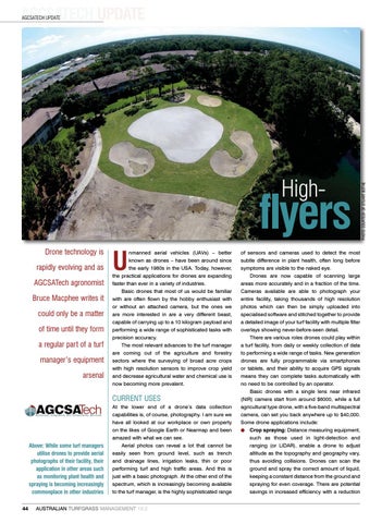
Above: While some turf managers utilise drones to provide aerial photographs of their facility, their application in other areas such as monitoring plant health and spraying is becoming increasingly commonplace in other industries 44
U
nmanned aerial vehicles (UAVs) – better known as drones – have been around since the early 1980s in the USA. Today, however, the practical applications for drones are expanding faster than ever in a variety of industries. Basic drones that most of us would be familiar with are often flown by the hobby enthusiast with or without an attached camera, but the ones we are more interested in are a very different beast, capable of carrying up to a 10 kilogram payload and performing a wide range of sophisticated tasks with precision accuracy. The most relevant advances to the turf manager are coming out of the agriculture and forestry sectors where the surveying of broad acre crops with high resolution sensors to improve crop yield and decrease agricultural water and chemical use is now becoming more prevalent.
CURRENT USES At the lower end of a drone’s data collection capabilities is, of course, photography. I am sure we have all looked at our workplace or own property on the likes of Google Earth or Nearmap and been amazed with what we can see. Aerial photos can reveal a lot that cannot be easily seen from ground level, such as trench and drainage lines, irrigation leaks, thin or poor performing turf and high traffic areas. And this is just with a basic photograph. At the other end of the spectrum, which is increasingly becoming available to the turf manager, is the highly sophisticated range
AUSTRALIAN TURFGRASS MANAGEMENT 19.2
of sensors and cameras used to detect the most subtle difference in plant health, often long before symptoms are visible to the naked eye. Drones are now capable of scanning large areas more accurately and in a fraction of the time. Cameras available are able to photograph your entire facility, taking thousands of high resolution photos which can then be simply uploaded into specialised software and stitched together to provide a detailed image of your turf facility with multiple filter overlays showing never-before-seen detail. There are various roles drones could play within a turf facility, from daily or weekly collection of data to performing a wide range of tasks. New generation drones are fully programmable via smartphones or tablets, and their ability to acquire GPS signals means they can complete tasks automatically with no need to be controlled by an operator. Basic drones with a single lens near infrared (NIR) camera start from around $6000, while a full agricultural type drone, with a five-band multispectral camera, can set you back anywhere up to $40,000. Some drone applications include: l Crop spraying: Distance measuring equipment, such as those used in light-detection and ranging (or LIDAR), enable a drone to adjust altitude as the topography and geography vary, thus avoiding collisions. Drones can scan the ground and spray the correct amount of liquid, keeping a constant distance from the ground and spraying for even coverage. There are potential savings in increased efficiency with a reduction
PHOTO COURTESY OF STUART BOTHE
AGCSATECH UPDATE