1 minute read
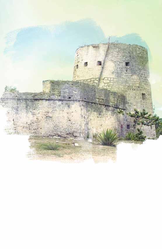
Martello Tower Spanish Point


This tower, 32 feet high, and fort of 3 guns was used as a look-out along the south coast and for sighting in-coming or wrecked ships. This information was then signalled onward to the village of Codrington, several miles north.
The fort, once with 3 guns, is situated by a small river which only appears in times of wet weather. This small stream is caused by the drainage of swamps that lie inland behind the beach. The fort guarded the main anchorage on the south-western side of Barbuda. The name ‘Martello’ is derived from a tower at Cape Mortella in Corsica that the British, had difficulty in taking in 1794. The south coast of England was defended by Martello Towers against Napoleon’s intended invasion of England in 1803.
Advertisement
Spanish Point, studded with coral reefs, is the most south-easterly point of Barbuda and is perhaps named after the wreck of a Spanish merchantman by the name of “Santiago de Cullerin.” She was lost here in 1695, and indeed, shortly afterwards maps began to appear with the name of Spanish Point. She was carrying 13,000 pesos to pay Spanish garrisons at Maracaibo, on the Spanish Main, but all this and some of her other cargo was salvaged by divers at the time.
In 1988, the dive ship “Riptide” of H & E Marine, began mapping the site and recovered a few artefacts from under a thick coral concretion in heavy surf on the windward side. No coins were found, but large jars and a wooden comb are some of the many artefacts recovered. The Point’s history had begun much earlier, for maritime Amerindians from South America had settled in the vicinity about 500 years after the birth of Christ.
Then later, European colonists built a small lookout tower, probably as a precaution against marauding Amerindians from Dominica who at the time were jealous of the European incursion.
Antigua and Barbuda Tourism Authority
Tel: +1(268) 562-7600
Email info@visitaandb.com
Antigua and Barbuda Tourism Authority

Tel: +1(268) 562-7600
Email info@visitaandb.com


