LANDSCAPE ARCHITECTURE
Zahra Darvishi
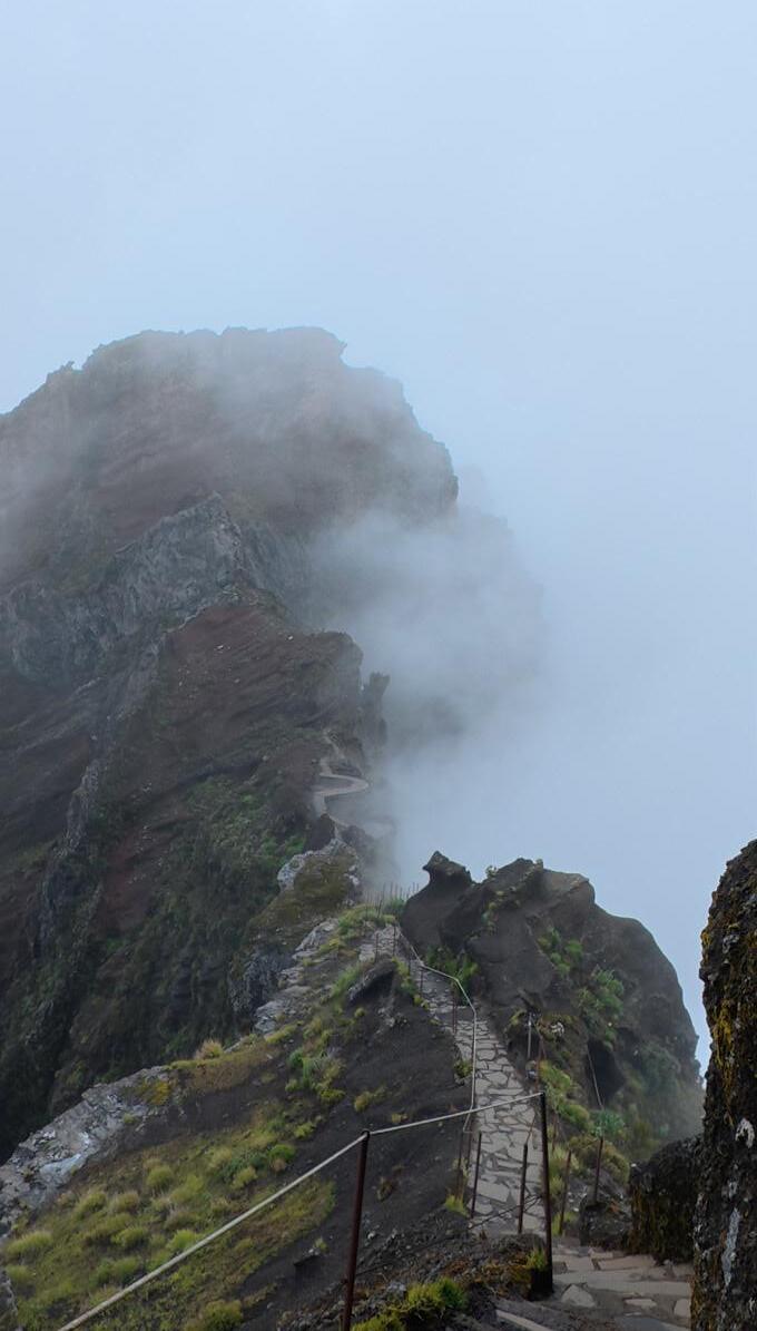
photo by zahra darvishi
Zahra Darvishi
darvishi.zahra1996@gmail.com
+393791457625
Landscape Architecture Intern
H+N+S Landscape Architects, Netherlands
2026 – Present
TECHNICAL SKILLS
Adobe Creative Cloud
Illustrator
Photoshop InDesign
AutoCAD (BricsCAD)
Rhino 2D/3D
SketchUp
Lumion
ARC GIS - QGIS
Profile:
Landscape designer with experience in ecological design, water management, and urban landscape planning. My work explores the relationship between landscape systems and urban environments, focusing on climate adaptation, green and blue infrastructure, and sustainable public space design.
STUDY
Polytechnique of Milan
Landscape Architecture. Landscape Heritage
Wageningen University & Research erasmus exchange
Landscapearchitecture&Landscape planing
University of Tehran MSc
environmentaldesignengineering
University of Arak BSc
Natural resourcesandenvironmentalengineering
TABLE OF CONTENTS
02 03 04 05 01
Master Studio (park design)
Master Studio (climate responsive design)
Master studio( green way)
Voronoi Roof (competition)
Isar Plaza(competition)
01
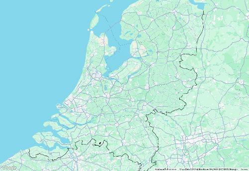
ENECO WARMTEPRODUCTIE UTRECHT
STUDIO PARK DESIGN (NARRATIVE APPROACH)
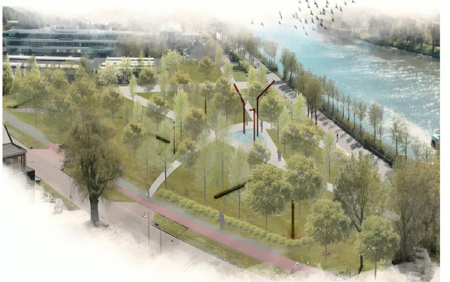
REVIVA is here to appreciate history of industry and bringing back livability to the life.
Design Analysis Diagram
The old industrial site is being converted into a diverse ecosystem teeming with plants, wetlands, and green spaces that will overshadow the original scenery of concrete. This new area will be a hiding place for many animals, supporting pollinators, birds, and fish, and linking nature with the city. Fragmented biodiversity within cities must be carefully restored and nurtured to not only recover lost ecosystems but also to create thriving, interconnected habitats. By reconnecting green spaces, enhancing native species populations, and integrating sustainable practices, urban environments can transform into rich, resilient ecosystems that support both wildlife and human well-being.
Always the most direct rout is the fastest
First, access points were sought through the most significant entrances from converging routes originating from key urban points: the city center, the canal, and the train station. These are vital connections serving not just to connect but also to conduct people in a strategic flow both to and around the revitalized space.
Visualizations and ornamental detail

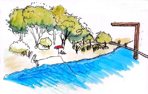
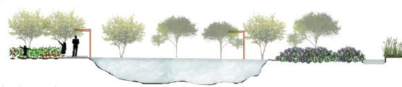
Section:In the second and third layers, water harvesting and farming systems are designed to promote sustainability and biodiversity. Water is collected through natural slopes and rain gardens to support vegetation and recharge groundwater. Farming focuses on local, resilient crops that benefit from these systems, creating a self-sustaining ecosystem.
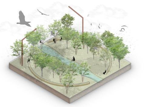
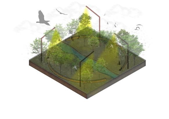
The activities in the first layer foster a deep connection between people and biodiversity, transforming the area into a sanctuary that feels alive and renewed.
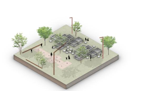

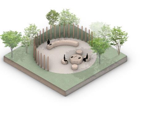
A more natural workspace blends greenery, wood, and stone elements, creating a serene environment where nature supports focus and well-being. With sensory elements like bird sounds and gentle breezes, it offers a peaceful, grounded atmosphere that fosters a deep connection to the outdoors while working.
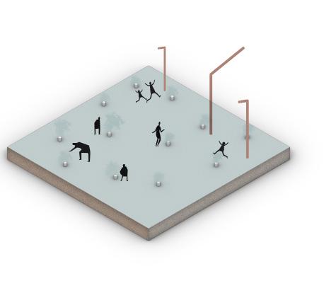
Play with Water is an interactive feature designed to let visitors engage with natural water elements in a fun and creative way. Shallow streams, splash zones, and water channels encourage exploration and play, allowing people, especially children, to connect with nature through touch, sound, and movement, fostering a joyful experience with water in a safe, natural setting
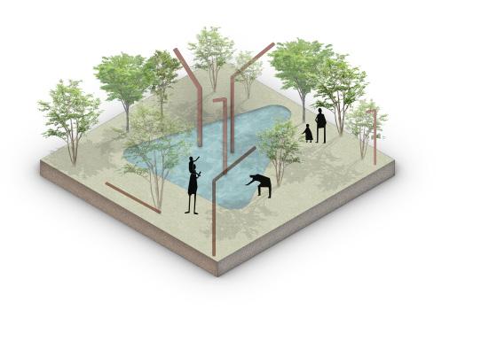
The core area integrates rain harvesting systems, capturing and storing rainwater to sustain the surrounding biodiversity. This feature not only supports native plants and wildlife but also serves as an educational element, demonstrating sustainable water practices and reinforcing the connection between natural resources and ecological health.
BETWEEN THE WAVES
TAPPING INTO THE ENERGY WAVES OF THE AFRIKAANDERWIJK
University project ( Climate-responsive Planning and Design 7.2)
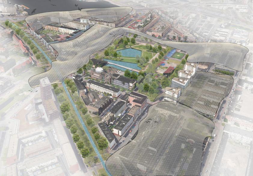
Finding synergies between challenges and opportunities
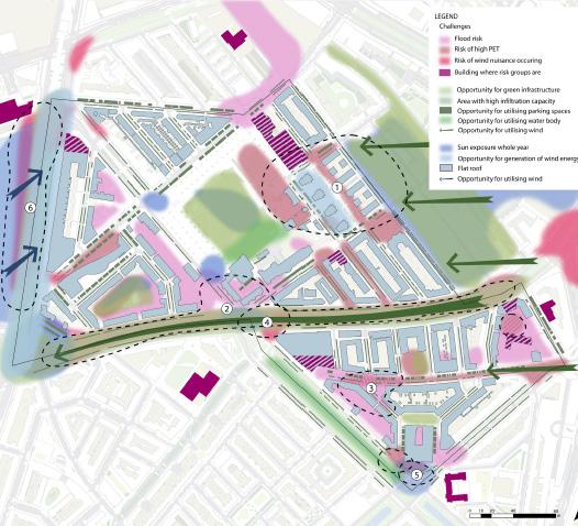
Afrikaanderwijk is faced with multiple challenges relating to climate adaptation and mitigation. They are visible in figure . On some places, there is an excess of energy. This can result in heat stress, wind nuisance or flood risk. By redirecting these energies, the Afrikaanderwijk can adapt to and mitigate climate change. For instance, the area east of the Afrikaanderpark (1), the Slaghekstraat (2) and Putselaan (4), are exposed to strong to extreme heat stress during heat waves (Brosy et al., 2014). This heat can be battled by finding solutions to bring the eastern winds into the site. Other places, like the Maashaven road (6) and the Putsebocht (4) are exposed to high wind speeds and wind nuisance. However, this can be turned into an advantage. The waterfront and water area could be used for the generation of wind energy. Finally, this neighbourhood has risk groups, like elderly people and people with low income, that are more vulnerable to harsher climate conditions. But, there is high social cohesion within areas of the Afrikaanderwijk, so people are willing to work together to take care of their neighbourhood.
The harbour wave
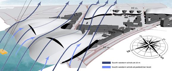
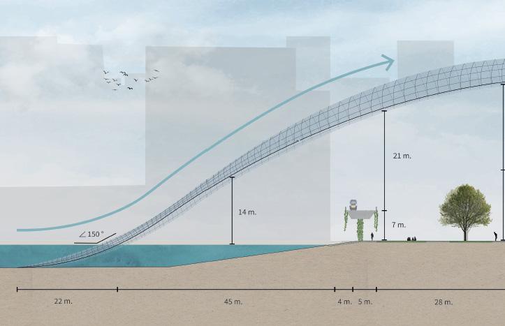
The biggest wave in the design is the Harbour Wave. It has a surface area of about 65.000 m2 and covers the harbour area in the west of the study area. This massive wave starts at the Maashaven, and flows over the harbour, the metro line, and the building block at the Maashaven Oostzijde. The main function of the Harbour Wave is to redirect southwestern winds over the neighbourhood, instead of letting them flow in. The analysis shows that especially around the Maashaven road, wind nuisance can occur. The strong southwestern winds in winter, hit the buildings on the side of the road, causing discomfort for pedestrians. The southwestern winds have the highest wind speeds and are most prevalent during winter.
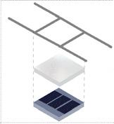
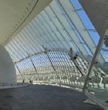
Because the panels are on an axis, they can also be opened to let rain through in order to water plants underneath the wave, to let sunlight in when it would be too dark otherwise, and to allow hot air to escape from the wave during heat waves. The adaptive panels are inspired by L’Hemisfèric in Valencia (Spain).
The park wave
The analysis showed that the dominant wind during heat waves comes from the eastern direction. In this regard, the natural flow of wind on the eastern part of the Afrikaanderwijk is blocked by high-rise buildings, resulting in a higher PET.
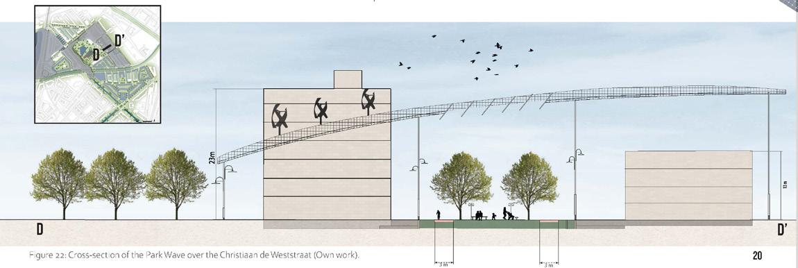
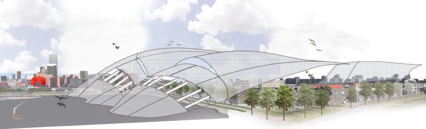
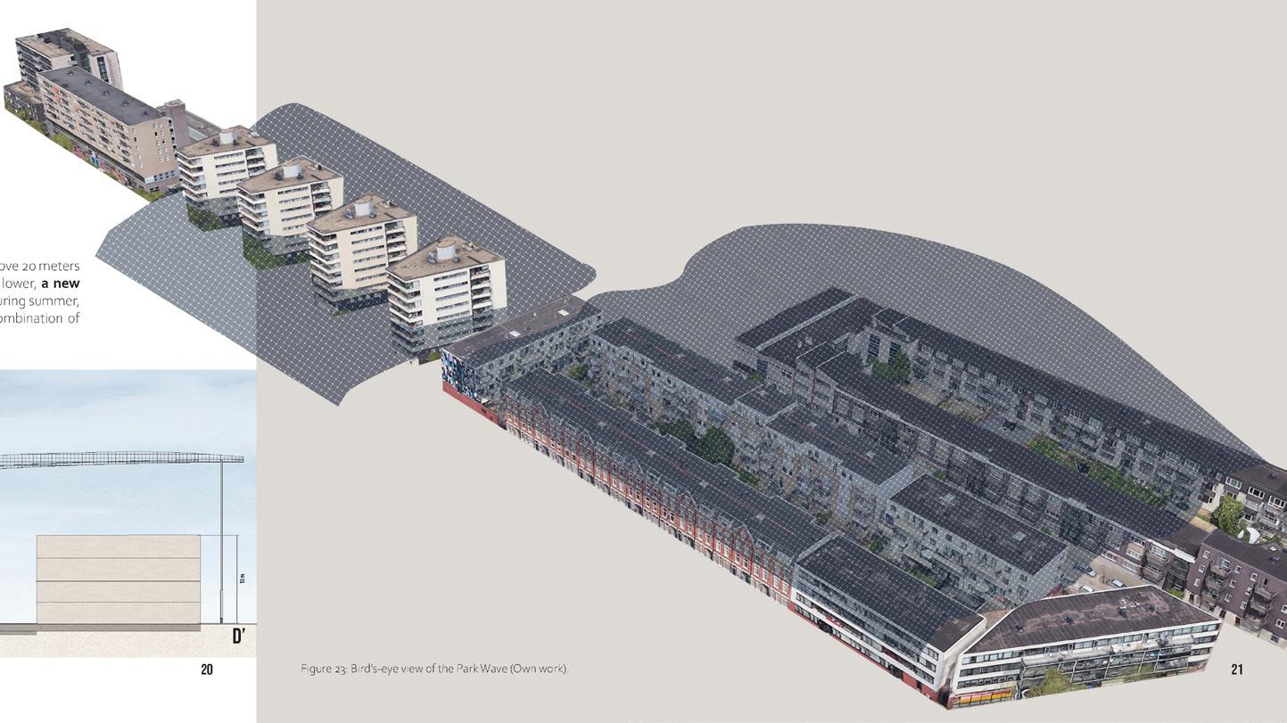
In addition to the lack of wind in the neighbourhood, the area is paved for 82%, which absorbs heat from the sun. In order to solve this challenge, the Park Wave of 50.000 m2 has been designed as the third wave of the Afrikaanderwijk. With its angled shape, the Park Wave guides eastern winds into the park, while allowing light to pass through the wave into the streets below.
The Park Wave consists of three parts that function as one big wave . All the parts start above the De La Reystraat, but end above different streets.
GREEN WAY ALONG THE RIVER
RETHINKING THE REST AREAS ALONG THE SENTIERO VALTELLINA IN TEGLIO
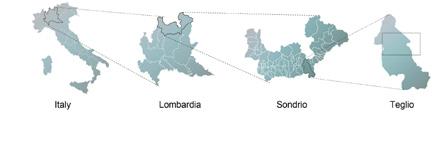
Historically, Valtellina has been a land of passage connecting the central European space through natural and artificial geographical corridors, where migration and economic development around agriculture, winemaking and the railway connection at the time of the industrial revolution, caused the influx of a plurality of traditions that make this geographic region very rich culturally. Today, the region is looking at the possibility of enhancing its natural areas of high mountains and the course of the Adda River, through the co struction of tourist routes that encourage the development of agro-tourism solutions, environmental protection and attract the interes of the local and foreign population in the knowledge of the numerous and significant architectural monuments of the region.
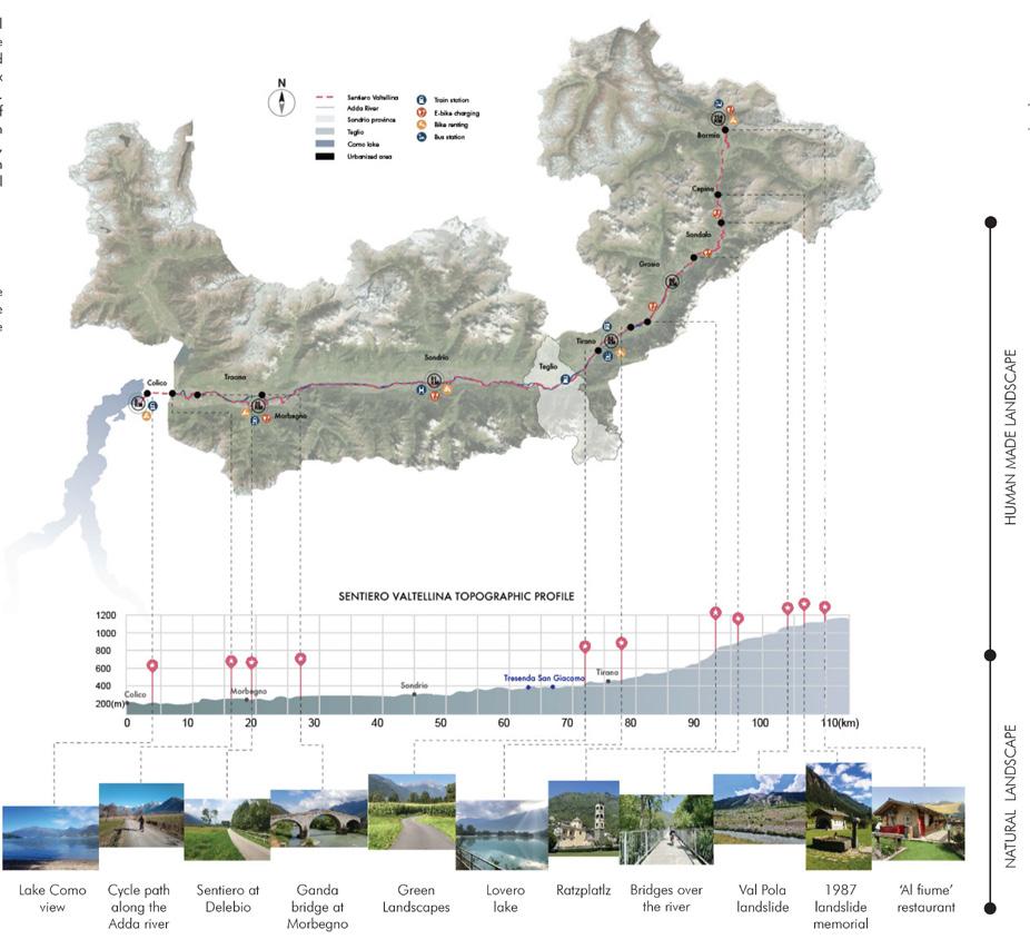
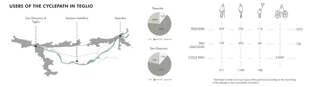
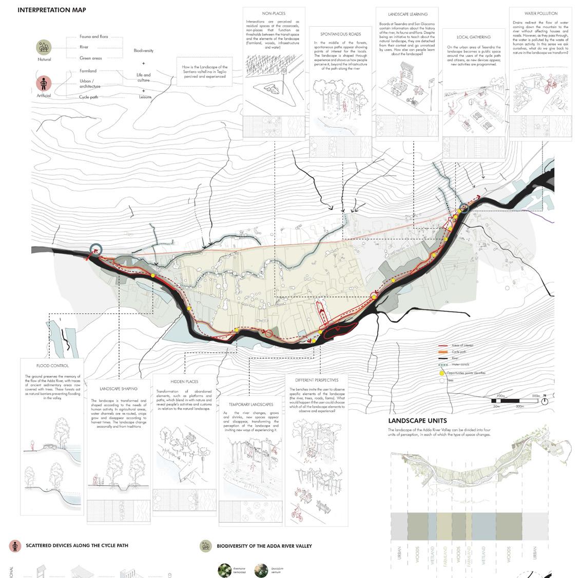
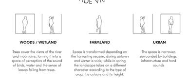
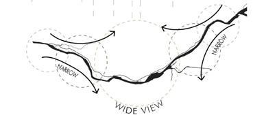
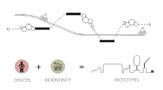
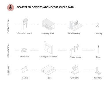
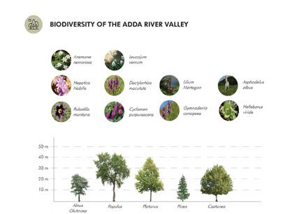
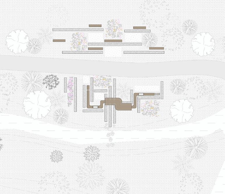
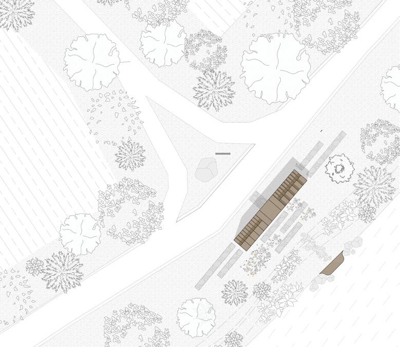
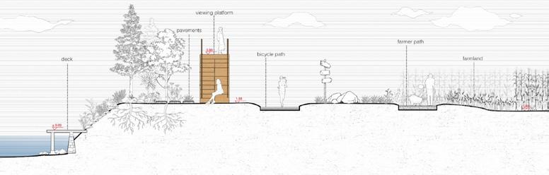
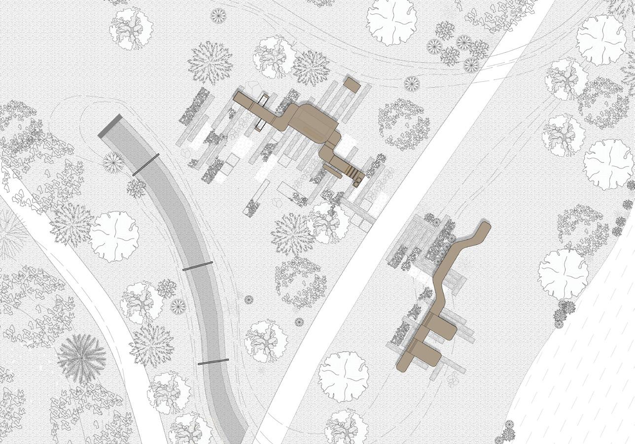
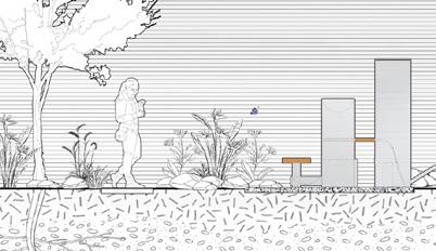
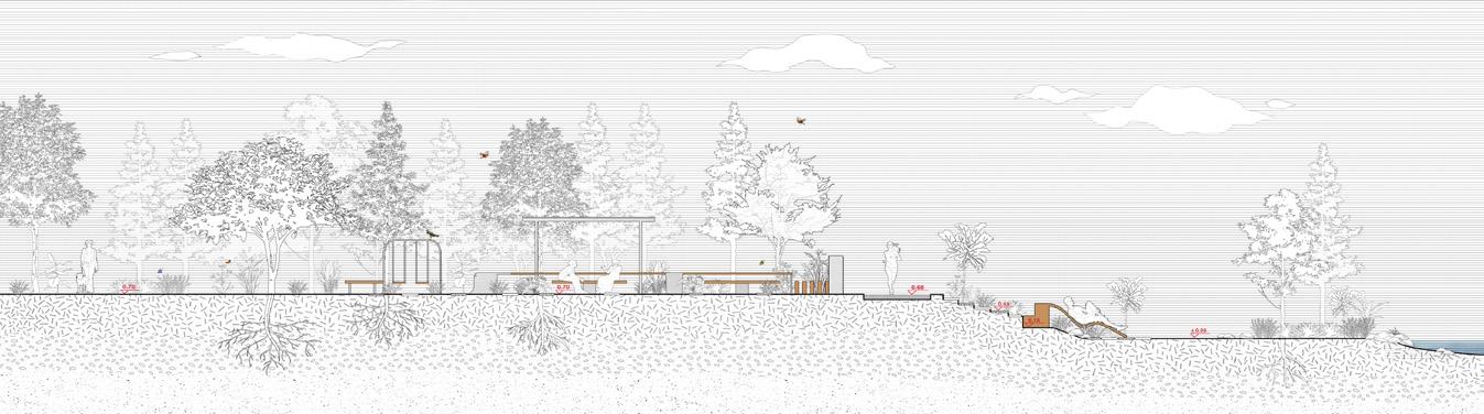
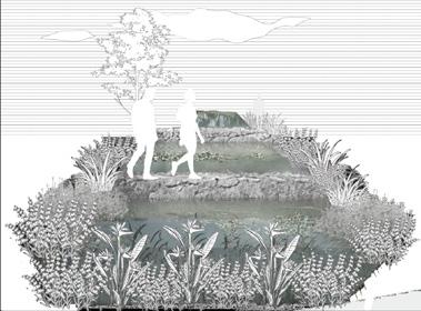
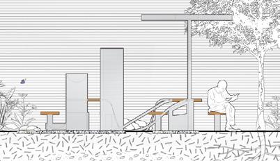
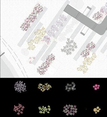
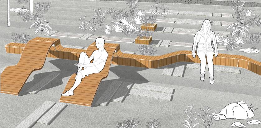
The project aims to create a system of rest areas using the existing ones along the Sentiero Valtellina cycle path in Teglio, redesigning the devices found, so that they relate more to the biodiversity and perceptions identified on the landscape units. Inviting locals and users to find a place to experience and learn from nature, in addition to using the path as a place to pass through. Create a line made of activity and biodiversity prototypes that offers new ways of experience the landscape along the cycle path.
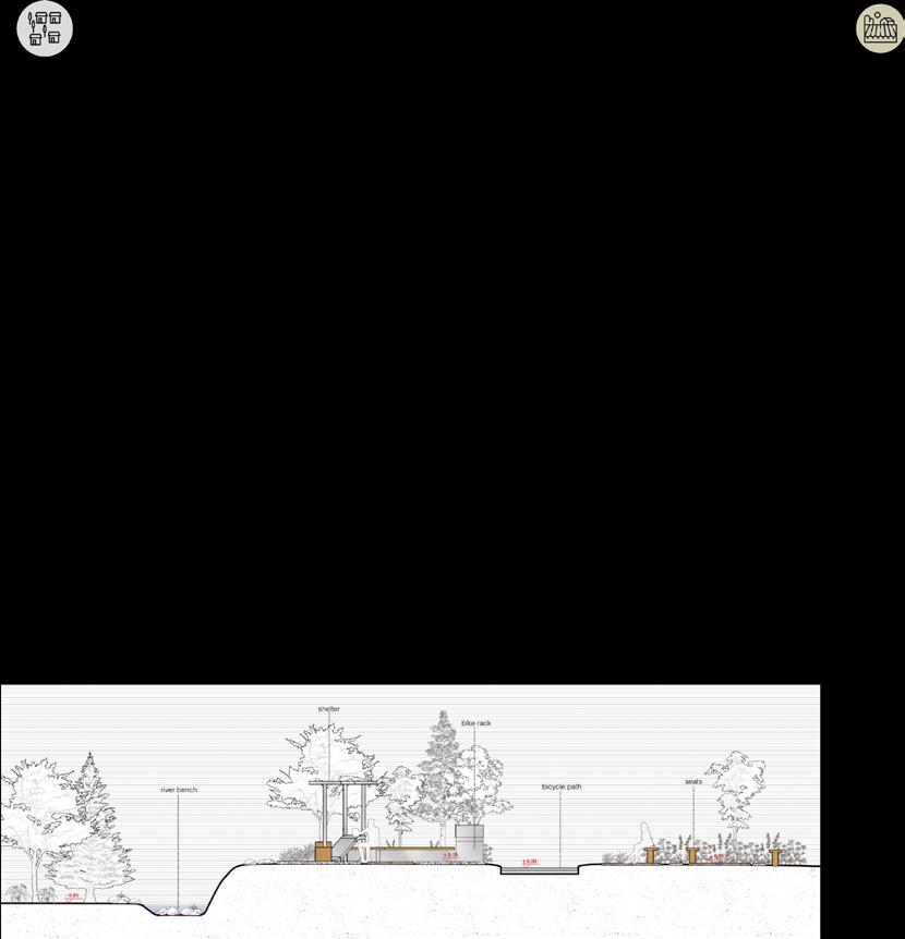
Multifuntional resting area - San Giacomo
Sight viewing - Agricultural fields


garden
Alnus Glutinosa Platanus Picea Flower Populus
SCALE 1: 150
SCALE 1: 150
Alnus Glutinosa Platanus Picea Flower garden Populus
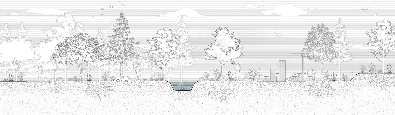
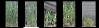
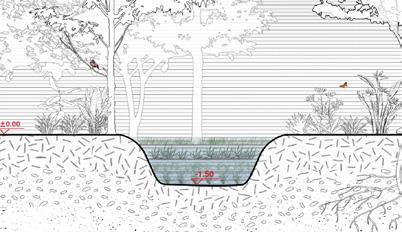
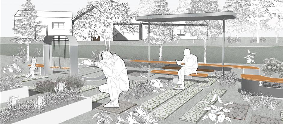
Brachiaria mutica Cyperus laevigatus Brachiaria mutica Cyperus laevigatus
Hepatica Nobilis viridis
Gymnadenia conopsea
Leucojum vernum
VORONOI ROO f 04
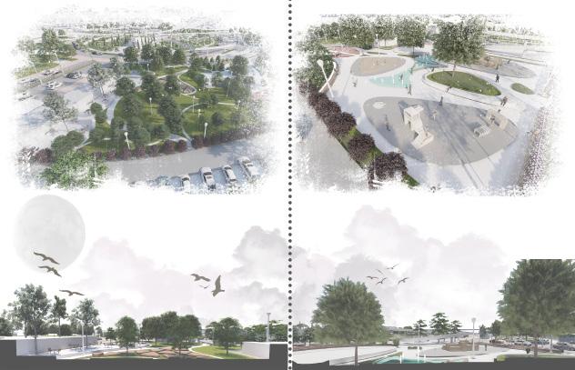
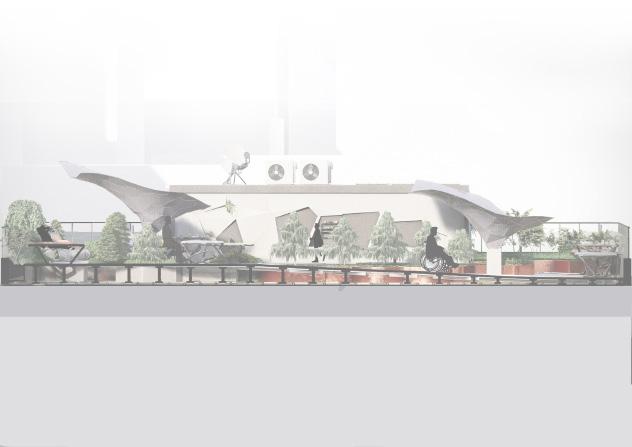
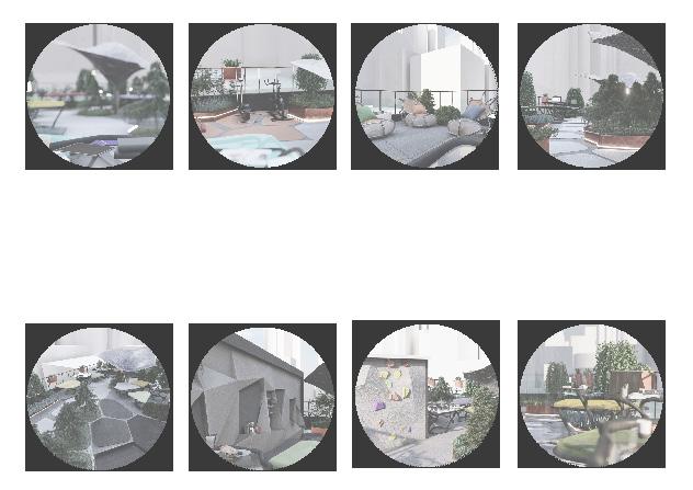
Voronoi roof is a place for rest, recreation, and work. The main aim of the design is that everyone can use this place. It is located in the city center and above a five-story building. The employer needed a place where employees can rest and also work. This Zigotech’s job is based on task and sometimes people spend several days in session at the company so the recreational place has to be multi functional for those who want to work in the fresh air or who which want play a game or eat a cup of café.
softwares: rhino grasshoper lumion photoshop indesign
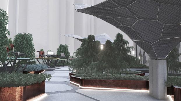
Location :Tehran, Azadi square, Laleh st.
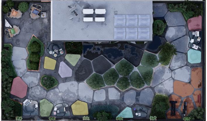


Morus japonicaThymus vulgaris Mahonia japonicaSalvia rosmarinus Dichondra repens
Laurus nobilis Pinus mugo
Juniperus rigida
Daphne odora
Festuca glauca
05 ISAR PLAZA
Subject: competition / Location: Iran,Ardabil / principal: university of Mohaghegh Ardabili/ Status: ranked second.
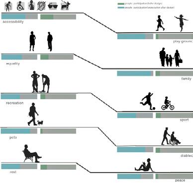
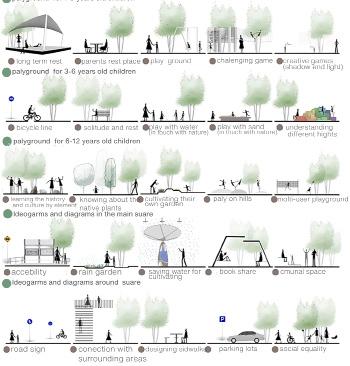
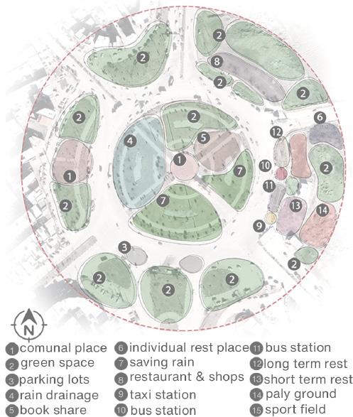
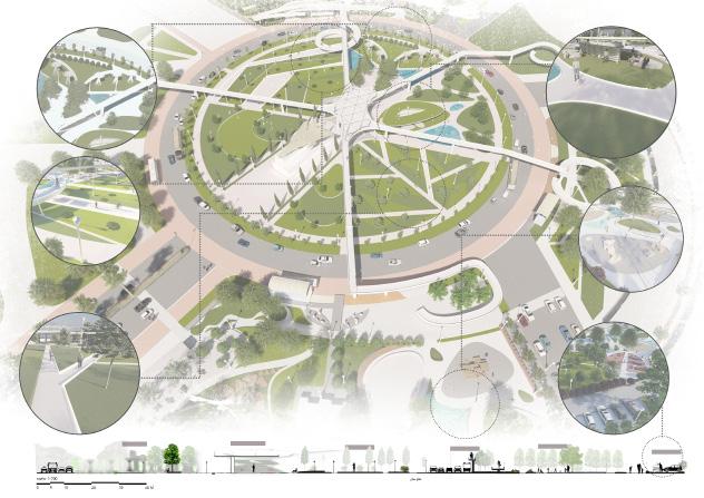
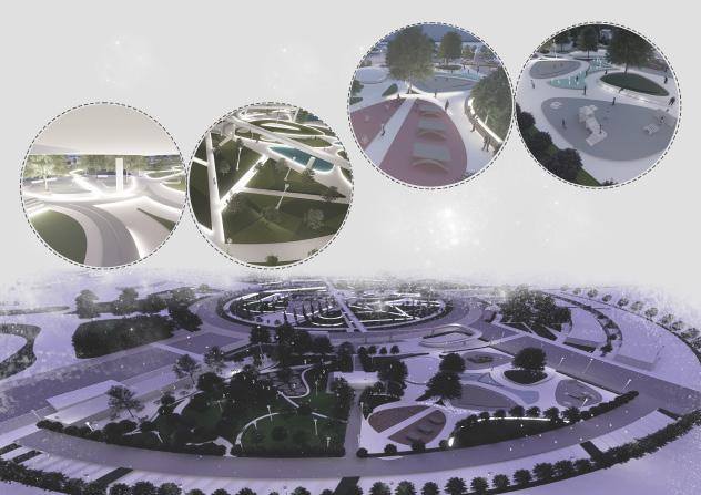
Ardabil province is one of the northern cities in Iran and is neighbor by Azerbaijan republic from the north .This Isar plaza is located in south of the city with 160meter dimension from the center and the overall 80384 square meters area. The name of the square means sacrifice ,and there is an element of eight years fight between Iran and Iraq .For the committee of the match it was important to save that element which is a F24 warplane. After that they want us to show the history of the city. So, what is all the time important is to increase local attendance and persuade them to use urban area so after having people from all walks of life we can feel free that where we designed is efficient.
Designing group:
Zahra Darvishi
Maryam Norouzy
My rule was making 3D model after that the design was finalized by both of us and some of the diagrams like traffic and presence of people done by me. And physical analyze in ARCMAP was my duty.
Software:
Sketchup
Revit
ARCMAP
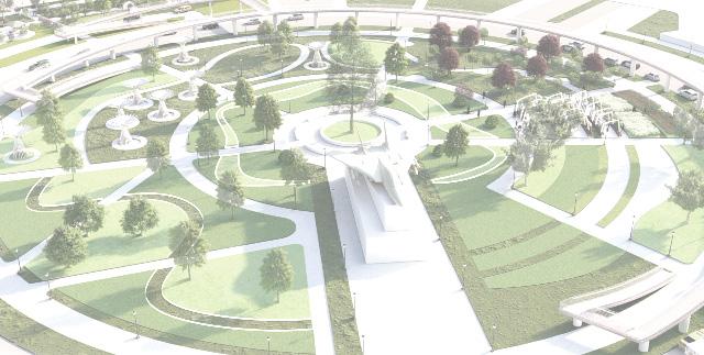
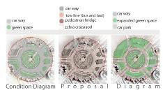
Although Isar Plaza has a lot of space it do not has visibility. by adding bus line ans devoting areas to green spaces and add\ ing zebra crossroad helps pedestrian a feel of safety and separated their path from car lines.