
6 minute read
A River Runs Through It – Again

Deb Biechler
Deb Biechler, a freelance writer and retired educator, serves on the Board of Directors of the Friends of Necedah National Wildlife Refuge. NNWR wildlife biologist Brad Strobel contributed to this story.
In "Marshland Elegy," one of Aldo Leopold's essays from “A Sand County Almanac,” the naturalist wrote of Wisconsin’s “great marsh,” lamenting how the historic marshlands of central Wisconsin had been changed.

“An epidemic of ditch-digging and land-booming” took a toll, he wrote, as settlers drained the marsh in hopes of farming those lands. As the 1900s began, for example, more than 100 miles of deep ditches were dredged across 60,000 acres of marshland in northern Juneau County.
The Necedah National Wildlife Refuge is part of the “great marsh” and includes the Little Yellow River. Once, the river meandered in wide S-bends, supporting a dynamic and diverse ecosystem for thousands of years.
But the ditches straightened the Little Yellow River, drained the wetlands and lowered the groundwater. More damage followed, as fire events turned dried peat into ashen waste.
After a time, people came to understand the value of restoring the marshlands and, eventually, the river and its watershed. It would take the cooperative efforts of caring stewards.
Now, a group of concerned and dedicated stewards — from the refuge, the DNR and beyond — are working together to regenerate the richness and balance of the Little Yellow River watershed.
Out Of Balance
Before deep ditches confined the Little Yellow River, it could spill over into its floodplain during wet periods, nourishing the wetlands. In turn, those wetlands gave back to the river in drier times, delivering a steady source of clean, cool water.
Confining the water within the banks of the ditches caused water to rush downstream during heavy rains and thaws, often leading to episodes of flooding. With water rapidly carried downstream, precious little moisture remained during dry spells.
This sort of unpredictability in water levels strains plants, animals and people alike.
Invasive plants such as reed-canary grass, which can tolerate the “flashy” conditions of the ditches, get a leg up over many native sedges. Wetland nesting birds, like whooping cranes, struggle to choose nest sites that will not be too wet or too dry.
And community members, especially those downstream who depend on water for agriculture or recreation, often face extreme water conditions.

These challenges have existed for the Little Yellow River since the 1930s. But today, a dedicated partnership is working to resolve them.wnr
First Steps
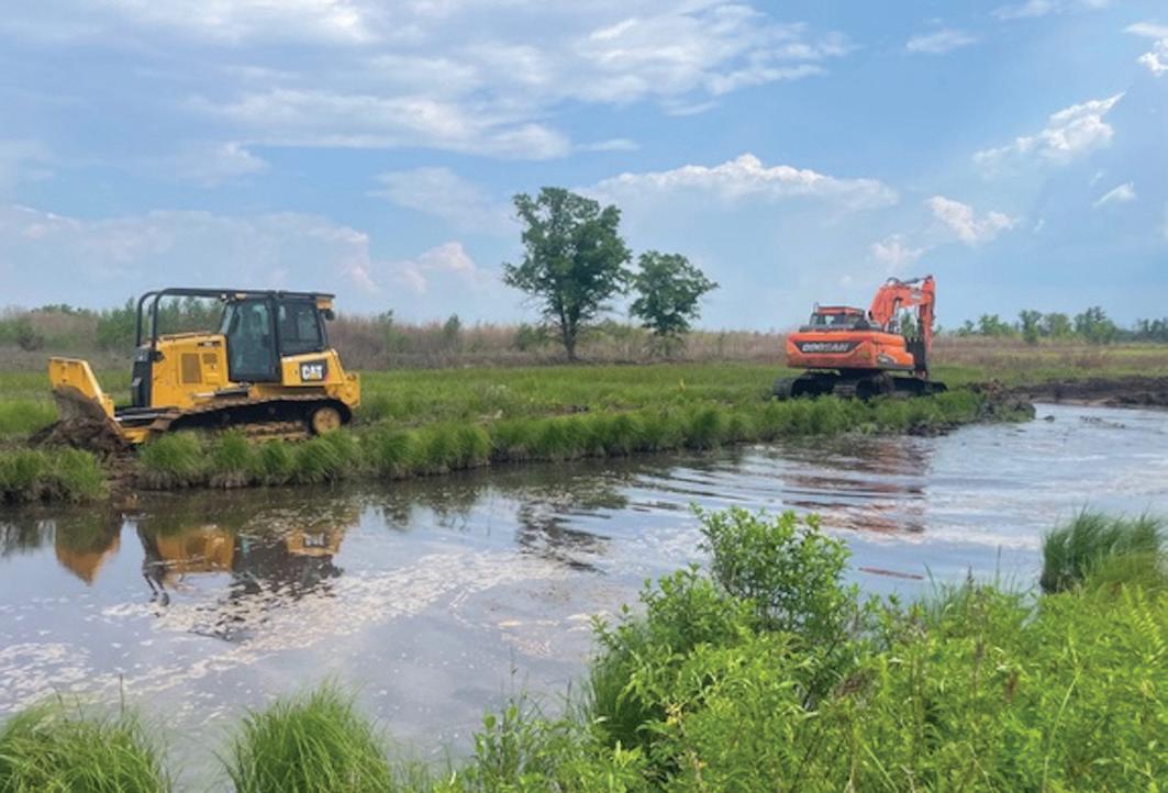
Recently, staff at the Necedah National Wildlife Refuge developed a plan to restore the Little Yellow River, beginning with the West Branch, a small upstream tributary. The team used historic plat maps and field notes, high-resolution drone images and detailed elevation maps to determine exactly where the river had been 100 years before.
Because the ditch is deeper and straighter than the riverbed, it is the path of least resistance. To convince the river to reclaim its old channel, the team needed to make it harder for water to follow the ditch.
Refuge staff used heavy equipment to remove the soil the historic dredging operations had piled along the ditch banks. The buried wetlands were carefully uncovered, and the dredged soil was used to refill the ditch and restore flow to the river’s former path.
Many portions of the riverbed had changed during the last century; vegetation blocked the river’s path and sediment accumulated. In some places, the river struggled to find its old meander.
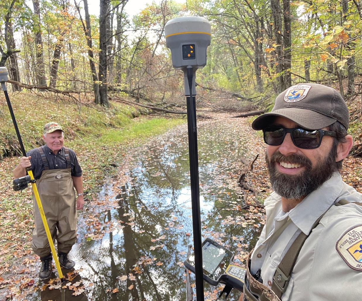
Determining if the restoration was fully successful would require careful monitoring on several levels and by many partners.
Community Engagement
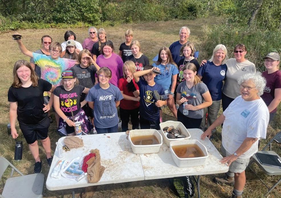
Brad Strobel, a wildlife biologist at the refuge, joined with teachers and students in Necedah’s N-Gage Charter School to boost monitoring efforts.
Led by teacher Beth Hecht, students donned waders to measure the water’s clarity, speed and temperature. They used nets and traps to sample aquatic invertebrates, fish and plants, sometimes with help from DNR biologists.
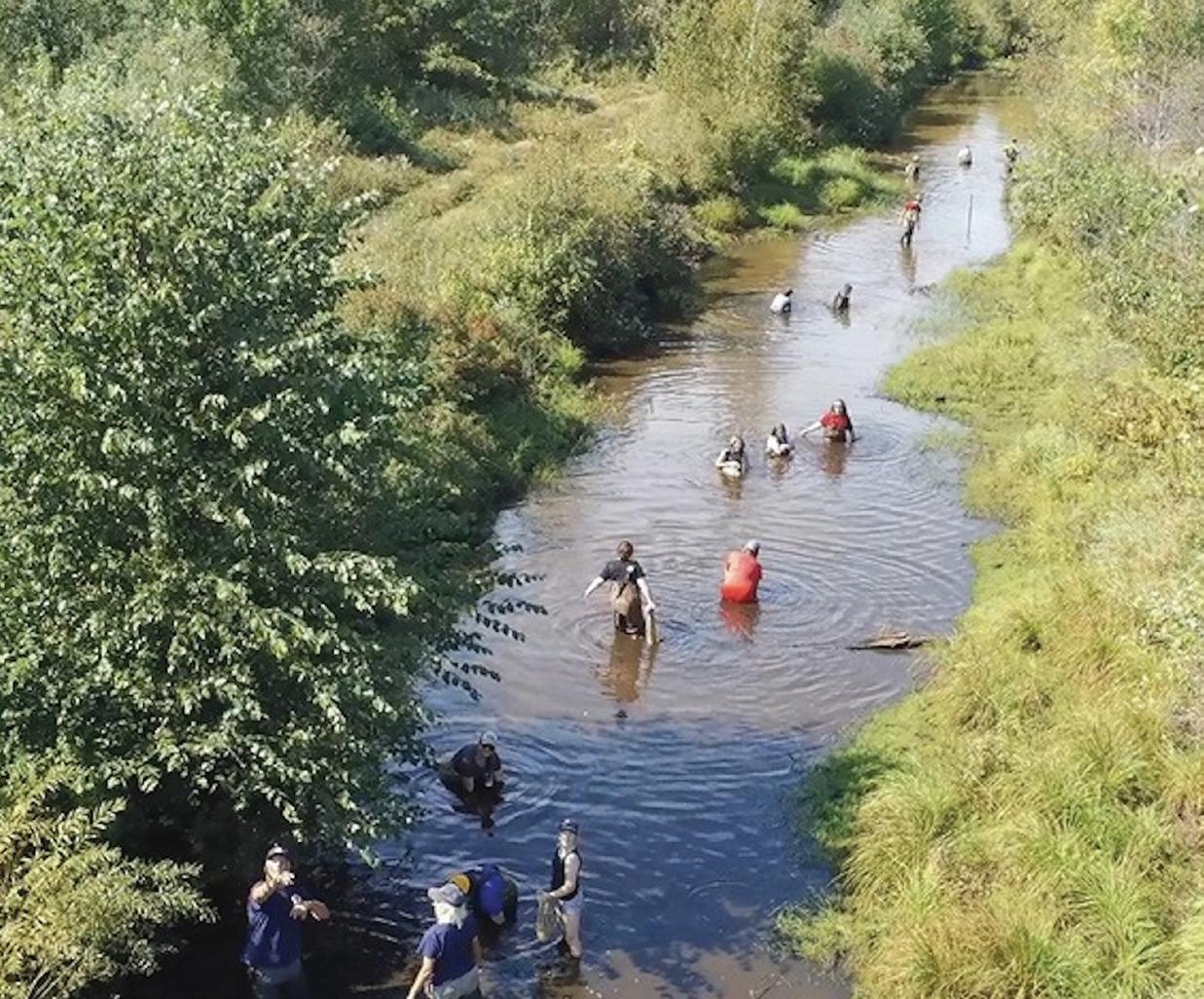
Using instruments called piezometers, the students measured groundwater levels around the river and compared statistics from the restored portion of the West Branch to the unrestored East Branch. It showed that water flowed through the restored river more gently than it did through a ditch.
Students also found the water flowed from the restoration area clearer than it did the ditch. Strobel analyzed the resulting groundwater and found the restoration allowed the river to reconnect with its floodplain and regain the wetlands’ important flood storage ability.
The following spring, broods of trumpeter swans, mallards and ring-necked ducks used the “new” river and wetlands, another sign heralding success.
Watershed Approach
Encouraged by these positive results, the Friends of the Necedah National Wildlife Refuge — with funding from the Friends and the DNR’s Surface Water Grant Program — have worked to restore an additional section of the river’s West Branch.
What once was 4 miles of straight, deep ditch is now more than 5 miles of winding stream and floodplain wetlands.
Work remains before the West Branch is complete, and more community partners have been needed for ultimate success in restoring the broader watershed.
Last year, the Wisconsin Waterfowl Association, Ducks Unlimited, Juneau County Highway Department, Juneau County Land and Water Resources Department and the town of Kingston all joined the team. Together they bring expertise to help with ongoing watershed restoration work.
“The ultimate value in these marshes is wildness,” Leopold wrote in his elegy. He knew restoring the “great marsh” would not be easy.
But Leopold also knew the best chance for success was through cooperation and community, people willing to work not just for today, but for the future.
Learn More
Check the Friends of Necedah National Wildlife Refuge website for more on the Little Yellow River watershed restoration project. The website also has general refuge information, including details for visiting and ways you can get involved.
