29 4 | CHAPTER 4: FUTURE LAND USE PLAN 29 1 2 3 4 5 6 VISION & GUIDING PRINCIPLES FUTURE LAND USE PLAN GOALS & POLICIES IMPLEMENTATION INTRODUCTION PLANNING CONTEXT
FUTURE
4
• Future Land Use Categories • Focus Areas
LAND USE PLAN CHAPTER

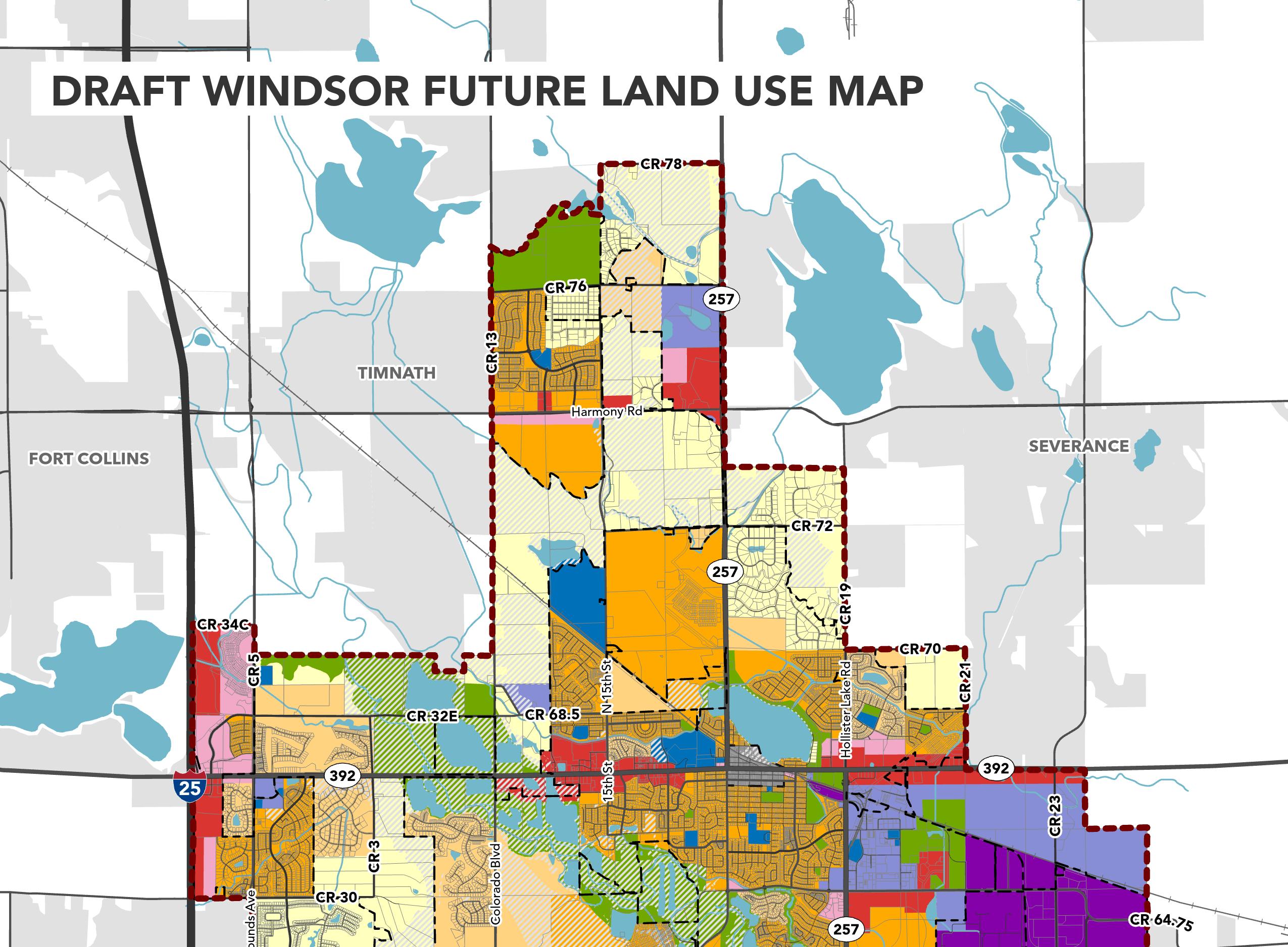
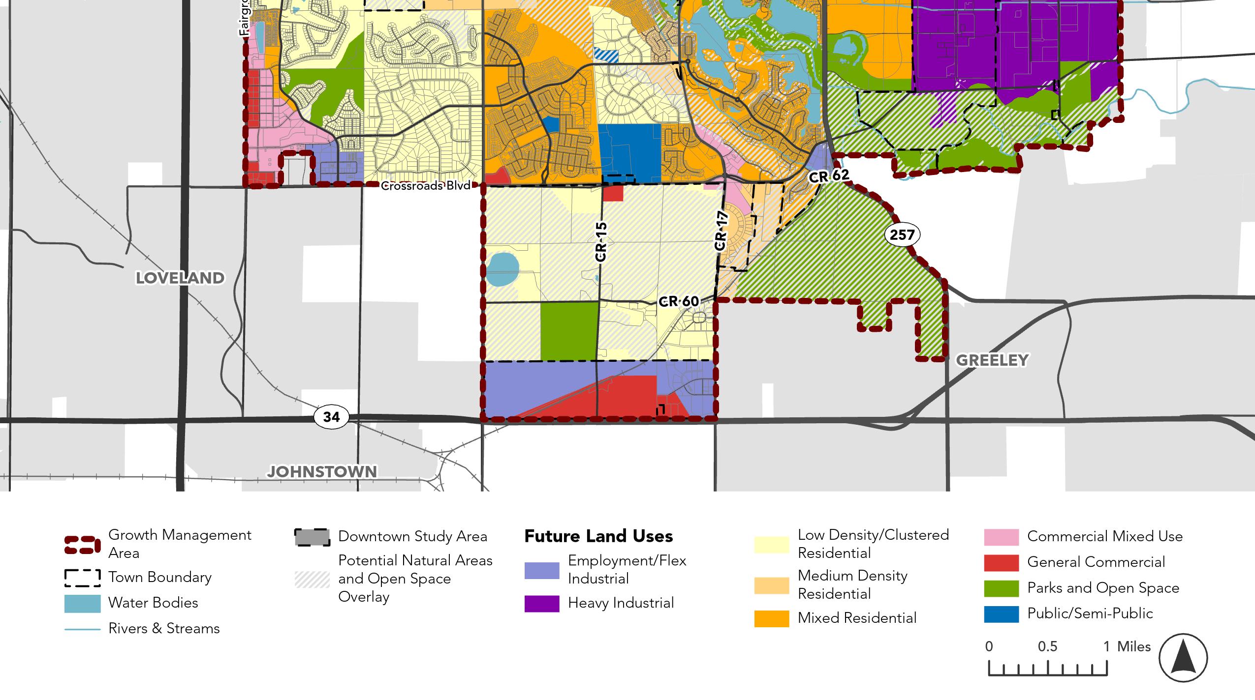
The Future Land Use Plan is designed to shape future development and growth in Windsor for decades to come.
The map and associated land use categories provide a guide for Town officials, developers, and residents and indicates what type of development will appropriately reflect the community’s long-range goals and vision for Windsor.
Land use densities shown in this Comprehensive Plan land use map and descriptions are far greater than what is assumed in Town sewer master plans, Water Master Plan and Transportation Master Plan. Therefore the Comprehensive Plan must address how the deficits in supporting infrastructure are to be addressed. Sewer interceptor infrastructure will likely be deficient if the densities shown on the land use map are evenly distributed over emerging growth areas.
30 WINDSOR COMPREHENSIVE PLAN | 4
FUTURE LAND USE CATEGORIES
HOW TO USE
The Future Land Use categories provide insight into preferred densities, uses, and characteristics that would be most suitable for each Future Land Use category. The Future Land Use categories were established based on conversations and engagement activities with community members, Town staff, and elected officials conducted throughout the planning process. The categories have been modified from the 2016 Future Land
Future land use category
Key elements within the category
General guidelines for the allowable uses within the category
Use categories to reflect the community’s vision and goals for the future.
This section illustrates how each land use would align with existing zoning in Windsor. These categories provide the framework for any future zoning updates. The following diagram illustrates how each of the land use category pages are structured.
LOW DENSITY/CLUSTERED RESIDENTIAL
• Single-family homes, including both planned subdivisions and large-lot family homes developed over time.
• Contributes to the rural character of Windsor and helps transition and buffer from other towns, outlying rural areas, or sensitive natural features such as the Poudre River and the bluffs adjacent to Raindance.
• Clustered development protects environmentally sensitive areas. KEY CHARACTERISTICS
LAND USE MIX
RESIDENTIAL
• Primary: Detached singlefamily homes, large-lot homes, small-lot clustered neighborhoods
• Secondary: Accessory dwelling uses
Suggested range of density to achieve the desired form for the category Identifies which current zoning categories align with the land use category
• Parks, open space, agriculture and equestrian uses RECREATION
31 FUTURE LAND USE PLAN 1 2 3 4 5 6 VISION & GUIDING PRINCIPLES FUTURE LAND USE PLAN GOALS & POLICIES IMPLEMENTATION INTRODUCTION PLANNING CONTEXT
Up to 1.25 DU/Acre Estate
SUGGESTED DENSITY RANGE
Residential (ER)
ALIGNMENT WITH CURRENT ZONING
LOW DENSITY/CLUSTERED RESIDENTIAL
KEY CHARACTERISTICS
• Single-family homes, including both planned subdivisions and large-lot family homes developed over time.
• Contributes to the rural character of Windsor and helps transition and buffer from other towns, outlying rural areas, or sensitive natural features such as the Poudre River and the bluffs adjacent to Raindance.
• Clustered development protects environmentally sensitive areas.
LAND USE MIX
RESIDENTIAL
• Primary: Detached singlefamily homes, large-lot homes, small-lot clustered neighborhoods
• Secondary: Accessory dwelling uses
SUGGESTED
DENSITY RANGE
Up to 1.25 DU/Acre Estate Residential (ER)
ALIGNMENT WITH CURRENT ZONING
• Parks, open space, agriculture and equestrian uses RECREATION
32 WINDSOR COMPREHENSIVE PLAN |
FUTURE LAND USE PLAN
MEDIUM DENSITY RESIDENTIAL
KEY CHARACTERISTICS
• Neighborhoods with primarily single-family homes, and a smaller mix of duplexes, townhomes, and multifamily
• There are bike and pedestrian connections to nearby parks, schools, and open space.
SUGGESTED DENSITY RANGE
Single family (SF-1)
LAND USE MIX
• Generally considered suburban neighborhoods. RESIDENTIAL CIVIC
• Primary: Single-family detached homes and duplexes
• Secondary: Townhomes, small multifamily apartments/ condos, accessory dwelling units
Single-family attached (SF-2)
Mobile home (MH)
Multifamily residential (MF)
Residential mixed use one (RMU-1)
Residential mixed use two (RMU-2)
• Schools, places of assembly, libraries, police and fire stations, and government offices
• Parks and open space
33 1 2 3 4 5 6 VISION & GUIDING PRINCIPLES FUTURE LAND USE PLAN GOALS & POLICIES IMPLEMENTATION INTRODUCTION PLANNING CONTEXT
RECREATION
Up to 4 DU/Acre
ALIGNMENT WITH CURRENT ZONING
KEY CHARACTERISTICS
• Promotes compact, pedestrian-oriented neighborhoods with a variety of housing types and densities, small-scale commercial activity centers, and other public amenities.
• Accommodates a range of housing types, including single-family detached, attached, and multifamily.
• Promotes development that caters to a variety of family sizes and incomes and provides an opportunity for residents to age-in-place.
LAND USE MIX
• Primary: Single-family homes, multifamily apartments/ condos, townhomes, duplex, and triplex.
• Secondary: Senior housing and assisted living facilities
SUGGESTED DENSITY RANGE
• Small-scale retail and restaurants, Small-scale office
• Schools, places of assembly, libraries, police and fire stations, and government offices
• Parks and open Space
34 WINDSOR COMPREHENSIVE PLAN |
RESIDENTIAL RECREATION CIVIC COMMERCIAL
6
Multifamily
ALIGNMENT WITH CURRENT ZONING
- 12 DU/Acre MIXED RESIDENTIAL Residential mixed use one (RMU-1) Residential mixed use two (RMU-2)
residential (MF)
FUTURE LAND USE PLAN
DOWNTOWN
KEY CHARACTERISTICS
• Traditional and historic downtown area that honors Windsor’s history and provides a smalltown feel.
• Includes a mix of commercial, office, and complementary residential uses to create a vibrant town center that concentrates a range of activities.
• Residential uses on upper levels of commercial buildings are encouraged.
LAND USE MIX
• Primary: Retail, service, restaurants, cultural or entertainment uses
• Secondary: Upperstory residential with commercial
SUGGESTED DENSITY RANGE
• Offices
• Multifamily on upper levels of commercial buildings
CIVIC
RECREATION
• Parks and open space
• Schools, places of assembly, libraries, police and fire stations, and government offices
35 1 2 3 4 5 6 VISION & GUIDING PRINCIPLES FUTURE LAND USE PLAN GOALS & POLICIES IMPLEMENTATION INTRODUCTION PLANNING CONTEXT
COMMERCIAL EMPLOYMENT RESIDENTIAL
Central business
Permanent parking (PP) 4-12
(CB)
DU/Acre ALIGNMENT WITH CURRENT ZONING
COMMERCIAL MIXED USE
KEY CHARACTERISTICS
• Walkable commercial areas that integrate residential uses, with commercial uses on ground-floors and along primary corridors.
• Multifamily residential uses can be integrated into the site design by including on upper stories of a mixed-use building.
• An interconnected grid of streets and pedestrian connections is emphasized.
• As traditional shopping centers age, redevelopment should integrate residential uses to activate and revitalize the center the site.
• Parking should be located behind buildings, below grade or in structures.
• Auto-oriented uses should be limited.
LAND USE MIX
• Primary: Local commercial and service uses, such as restaurants, personal services, small shopping centers, medical facilities, and multi-tenant centers
• Secondary: Hotels
SUGGESTED DENSITY RANGE
• Professional offices
• Multifamily on upper levels of commercial buildings
• Places of assembly, libraries, police and fire stations, and government offices
36 WINDSOR COMPREHENSIVE PLAN |
COMMERCIAL CIVIC RESIDENTIAL EMPLOYMENT
Up to 30 DU/Acre
Neighborhood commercial (NC)
General commercial (GC)
ALIGNMENT WITH CURRENT ZONING
FUTURE LAND USE PLAN
GENERAL COMMERCIAL
KEY CHARACTERISTICS
• Shopping centers, lifestyle centers, or commercial corridors that are not intended to integrate residential uses.
• These areas are appropriate for auto-oriented uses, stand-alone uses with vehicle drivethroughs, and larger scale shopping.
• Generally located along Windsor’s primary arterial corridors and highways, with excellent access and visibility.
LAND USE MIX
• Primary: Retail stores, eating establishments, supermarkets, multiplex movie theaters, medical facilities
• Secondary: Hotels, personal services, small shopping centers, and multi-tenant centers
SUGGESTED DENSITY RANGE
• Professional offices
• Places of assembly, libraries, police and fire stations, and government offices
37 1 2 3 4 5 6 VISION & GUIDING PRINCIPLES FUTURE LAND USE PLAN GOALS & POLICIES IMPLEMENTATION INTRODUCTION PLANNING CONTEXT
COMMERCIAL EMPLOYMENT CIVIC
General commercial (GC) N/A ALIGNMENT WITH CURRENT ZONING
EMPLOYMENT/FLEX INDUSTRIAL
KEY CHARACTERISTICS
• Provides flexible employment uses, light industrial, and supporting commercial businesses.
• Activities within this category tend to occur inside structures, with outdoor areas allowing well-screened and limited storage or distribution.
• Uses should be well-screened and buffered from adjacent non-business type uses.
LAND USE MIX
• Primary: Professional office, research and development labs, business and office parks
• Secondary: Light manufacturing, processing, production, warehousing, distribution of goods
SUGGESTED DENSITY RANGE
• Supporting commercial uses, hotels
38 WINDSOR COMPREHENSIVE PLAN |
EMPLOYMENT COMMERCIAL
N/A Limited industrial (LI) ALIGNMENT WITH CURRENT ZONING
FUTURE LAND USE PLAN
HEAVY INDUSTRIAL
SUGGESTED DENSITY RANGE KEY CHARACTERISTICS
• Given the freight traffic, visual, noise, and environmental impacts generated by heavy industrial uses, these areas should mitigate impacts if and when those uses are adjacent to incompatible uses.
• Residential land uses adjacent to heavy industrial uses should be heavily buffered and screened from view.
LAND USE MIX
EMPLOYMENT
• High-intensity facilities that involve the processing of chemicals or plastics, refineries, and industrial machinery
39 1 2 3 4 5 6 VISION & GUIDING PRINCIPLES FUTURE LAND USE PLAN GOALS & POLICIES IMPLEMENTATION
PLANNING CONTEXT
INTRODUCTION
N/A ALIGNMENT WITH CURRENT ZONING
Heavy industrial (HI)
PUBLIC/SEMI-PUBLIC
KEY CHARACTERISTICS
• Generally integrated within and adjacent to residential and commercial land uses to serve the Windsor community and nearby areas.
SUGGESTED DENSITY RANGE
LAND USE MIX
CIVIC
• Schools, libraries, police and fire stations, and government offices
40 WINDSOR COMPREHENSIVE PLAN |
N/A N/A ALIGNMENT WITH CURRENT ZONING
FUTURE LAND USE PLAN
PARKS & OPEN SPACE
KEY CHARACTERISTICS
• Intended as accessible public amenities for residents and the broader community.
SUGGESTED DENSITY RANGE
N/A
ALIGNMENT WITH CURRENT ZONING
Recreation and open lands (ROL)
LAND USE MIX
RECREATIONAL
• Primary uses: Active and passive recreation, sports facilities and fields, golf courses, gathering spaces associated with athletics, greenways and trails, community gardens, undeveloped natural areas, conservation easements
• Secondary uses: Temporary mineral extraction sites, such as gravel mining
41 1 2 3 4 5 6 VISION & GUIDING PRINCIPLES FUTURE LAND USE PLAN GOALS & POLICIES IMPLEMENTATION INTRODUCTION PLANNING CONTEXT
42 WINDSOR COMPREHENSIVE PLAN |
FUTURE
WINDSOR
LAND USE MAP
FOCUS AREAS
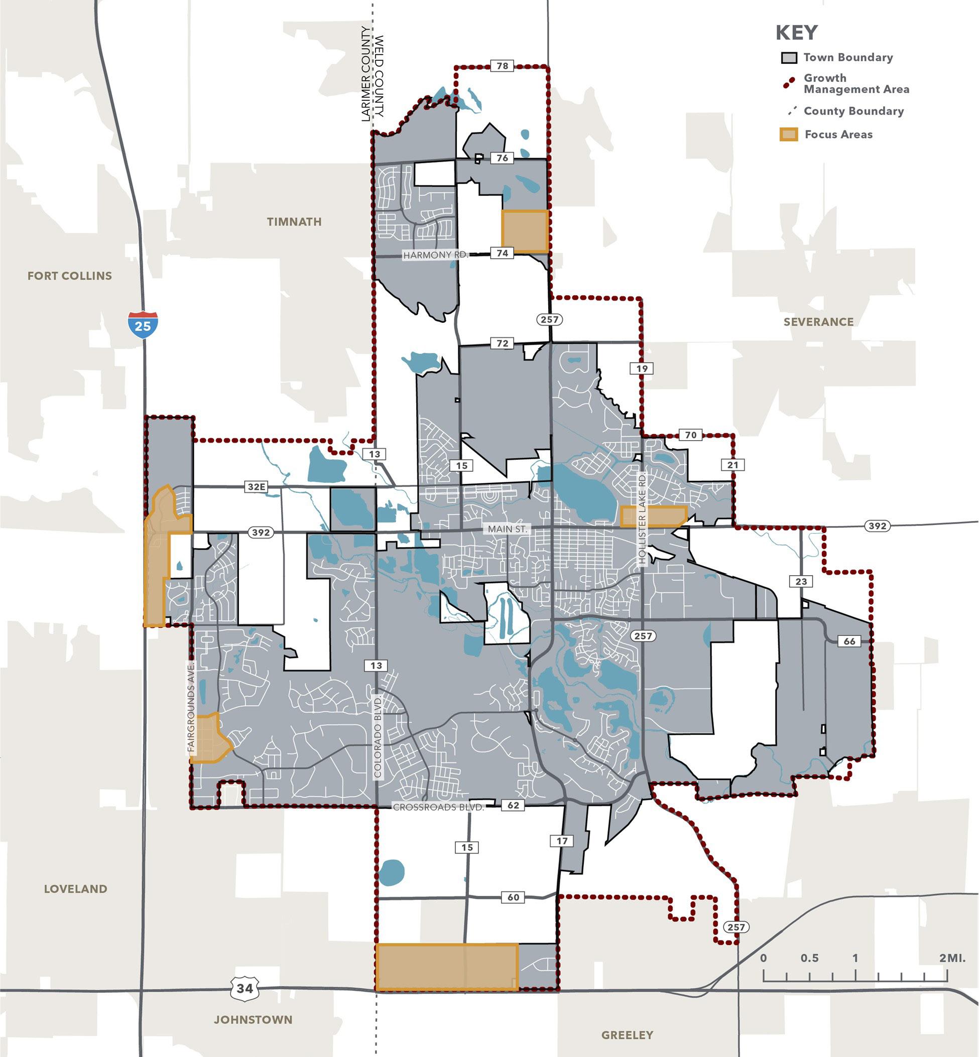
Five Focus Areas were identified through the planning process as areas for future growth. By taking a close look at the site-specific opportunities, constraints, and community preferences, conceptual site designs and graphic renderings were created to show potential development concepts. These conceptual designs
and graphics help to illustrate possible character, uses, and experiences within each Focus Area, and do not reflect all current zoning, building, or design requirements. The conceptual designs are generally consistent with the policy direction and the Future Land Use Plan in this Comprehensive Plan.
43 FUTURE LAND USE PLAN 1 2 3 4 5 6 VISION & GUIDING PRINCIPLES FUTURE LAND USE PLAN GOALS & POLICIES IMPLEMENTATION INTRODUCTION PLANNING CONTEXT
1
ACTIVITY CENTER 2 . DOWNTOWN WINDSOR EXTENSION AND INFILL 3 . HIGHWAY 34 AREA 4 . HARMONY AND HIGHWAY 257 AREA 5 . FAIRGROUNDS AVENUE AREA
. CORRIDOR
FOCUS AREAS
CORRIDOR ACTIVITY CENTER
DOWNTOWN EXTENSION
FAIRGROUNDS AVE .
44 WINDSOR COMPREHENSIVE PLAN |
HIGHWAY 34
HARMONY AND HIGHWAY 257
FUTURE LAND USE PLAN
Corridor Activity Center
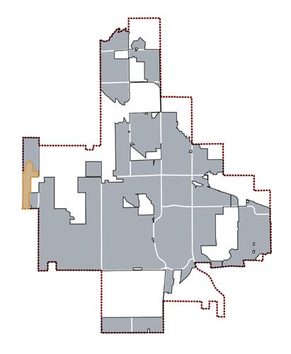
Location: This covers an area governed by an Intergovernmental Agreement (IGA) between Windsor and Fort Collins along I-25 and Hwy 392.
Characteristics and Constraints:
Future Land Use Mix:
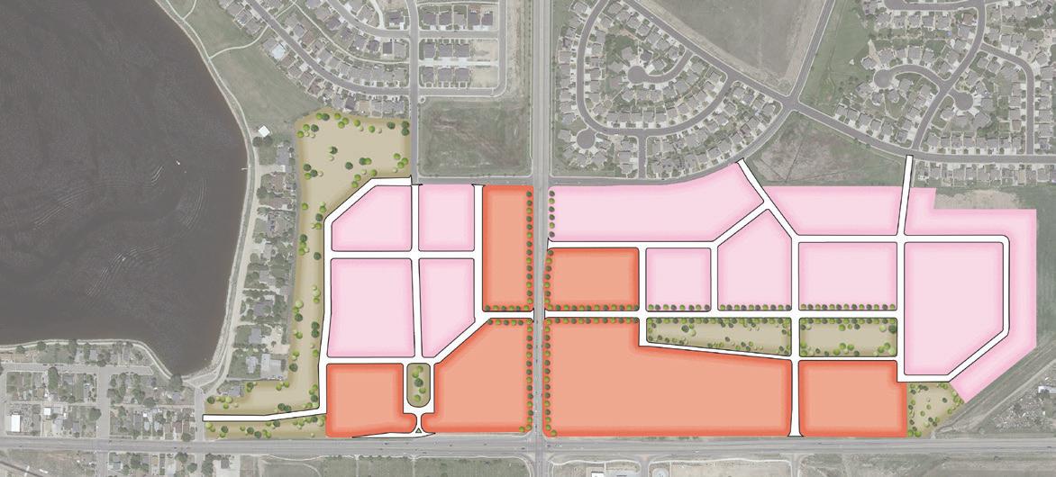
The IGA establishes design standards to unify the appearance. Currently, the site’s zoning is a mix of General Commercial, Limited Industrial, and Residential Mixed Use.
60% General Commercial
25% Commercial Mixed Use
15% Parks and Open Space
Defining Features of Design:
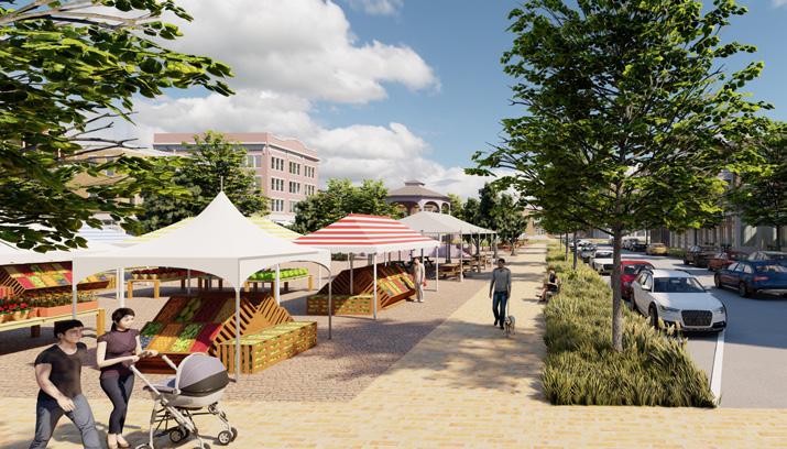
A central plaza functions as a community gathering space for events such as farmers markets, presentations, and celebrations. Large sidewalks lend themselves as optimal spaces for outdoor dining, shop signage, and increased walkability.


On-street parallel parking offers supplemental parking options to the rear parking lots located behind the mixed-use buildings. Having a variety of activated plaza spaces helps to identify the character of the area, which attracts visitors and become wayfinding points throughout the area.
The corridor contains strategic pockets of green space utilizing native plants and offers plenty of shaded seating. The corridor will be multimodal with a focus on comfortable navigation for pedestrians and bicyclists.
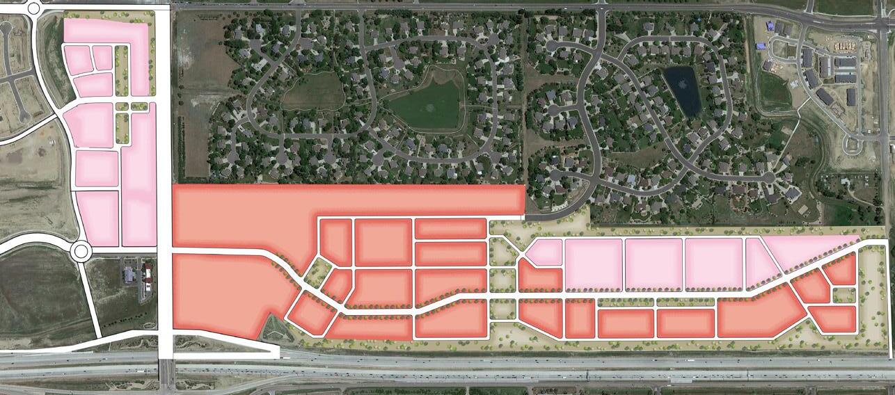
Corridor Activity Center, Future Land Use Plan
Note: The plan and illustrations are representative of the type of development allowed in this area. Actual development will vary.
Corridor Activity Center, Conceptual Illustration
Corridor Activity Center, Conceptual Illustration
2 3 4 5
45 S. Co Rd. 5 Future Land Use Plan 60% - General Commercial 25% - Commercial Mixed Use 15% - Parks and Open Space I-25 Hwy. 392 1500’ Primary Gateway Secondary Gateway S. Co Rd. 5 Future Land Use Plan 60% - General Commercial 25% - Commercial Mixed Use 15% - Parks and Open Space
1
6 VISION & GUIDING PRINCIPLES FUTURE LAND USE PLAN GOALS & POLICIES IMPLEMENTATION INTRODUCTION PLANNING CONTEXT
Focus Area Location
Downtown Windsor Extension and Infill
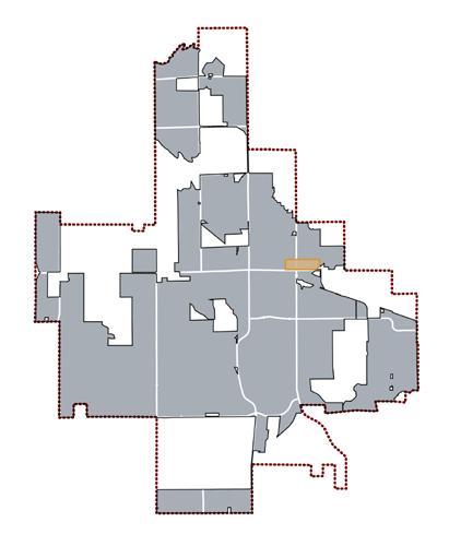
Location: This site is located east of downtown, along Main Street and straddling Hollister Lake Rd.
Characteristics and Constraints:
The main street of Windsor in downtown has the highest concentration of historical and cultural structures. The continuous building walls, street trees, wider sidewalks, and on-street parking create a friendly and walkable environment. The small-town character of Windsor is best represented in these downtown main street blocks.
The current zoning on the site is Limited Industrial, General Commercial, and Residential Mixed UseOne. A utility easement bisects the western site diagonally.
Future Land Use Mix:
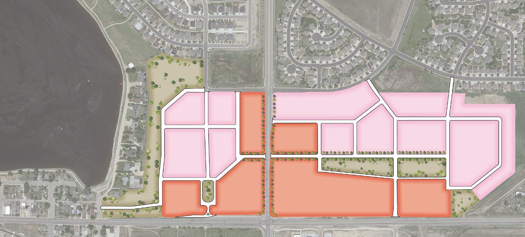
50% Mixed Residential
40% Commercial Mixed Use
10% Parks and Open Space
Defining Features of Design:
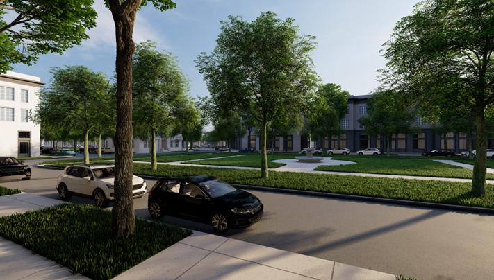
The proximity to downtown makes this a prime location for additional retail and mixed use. The interconnected street network is designed for a continuous flow of vehicles and minimal congestion. To accommodate the diagonal utility easement, green areas and parking lots are located along this utility alignment and buildings are set back 50 feet. Sufficient space is provided for parking in the center of blocks keeping the streets activated and walkable. This walkable character is integrated throughout the site, but especially along Main Street/Highway 392, to visually connect the site to downtown. The mixed use nature of the site is intended to create interest and diversity when exploring the area.
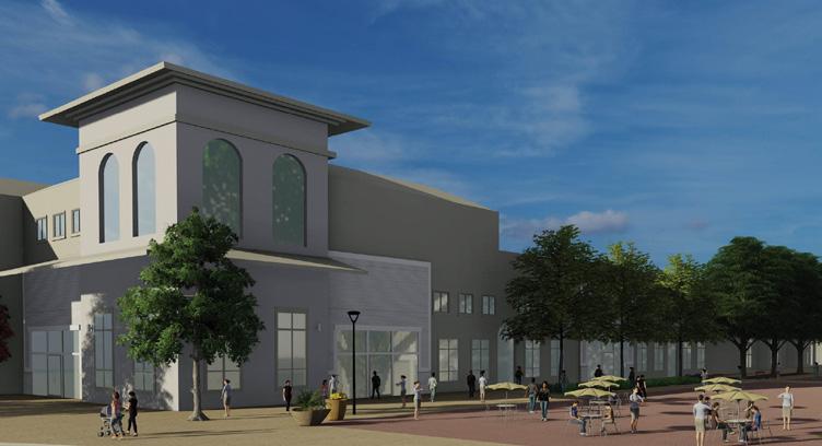
Vacant sites are limited in the downtown area, but certain sites could be imagined for other uses in future. One example is the southeast corner of the intersection of 4th Street and County Road 68. This street corner could accommodate a multi-story, mixed-use building. The structure could accommodate uses residents desire such as a restaurant, rooftop dining, small-scale retail, residential units, or outdoor seating areas.


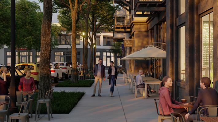
Main Street/Highway 392 is an important gateway to the community. The character of Main Street changes drastically east of the railroad crossing near 3rd Street. The sidewalk terminates abruptly, and buildings are set back further from the street.
The waterfront site that borders the train tracks, 2nd Street and Main Street has the potential to host a gateway feature. During the weeklong design workshop conducted during the planning process, residents expressed preference for using iconic buildings as gateway features. An elegant hotel building with vertical building features is one possible use of the space. Signage could be installed to point motorists, pedestrians, and cyclists to main points of interests in downtown.
Disclaimer: The plan and illustrations are representative of the type of development allowed in this area. Actual development will vary.
46 WINDSOR COMPREHENSIVE PLAN | 0 375’ 1”=375’ 750’ 1500’ Primary Gateway Secondary Gateway Future Land Use Plan 50% Mixed Residential 40% Commercial Mixed Use 10% Parks and Open Space
Downtown Windsor, Conceptual Illustration
Downtown Windsor, Conceptual Illustration
Focus Area Location
0 375’ 1”=375’ 750’ 1500’ Primary Gateway Secondary Gateway Future Land Use Plan 50% - Mixed Residential 40% - Commercial Mixed Use 10% - Parks and Open Space
Hollister Lake Rd.
Hwy. 392
FUTURE LAND USE PLAN
Highway 34 Area
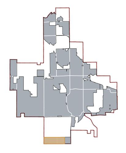
Location: The site is Windsor’s southern gateway off Hwy 34 and Colorado Blvd.
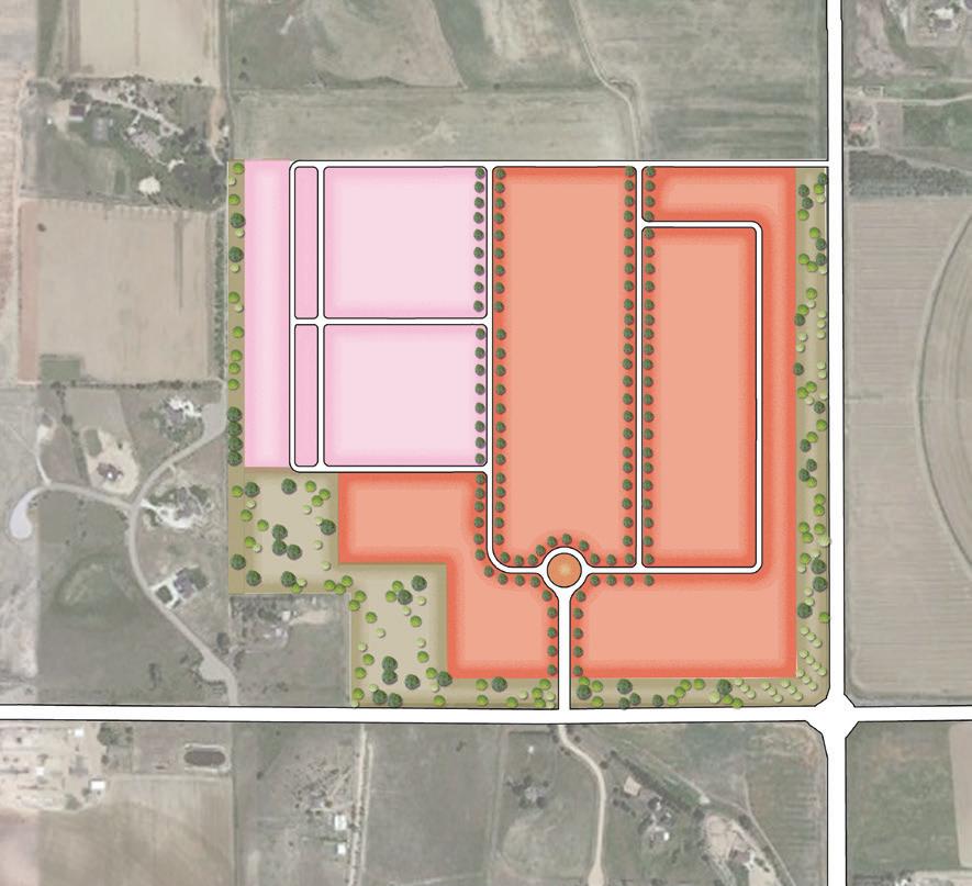
Characteristics and Constraints: A railroad bisects the site, as well as irrigation canals and utility rights of way. The current zoning is Limited Industrial. Future Land


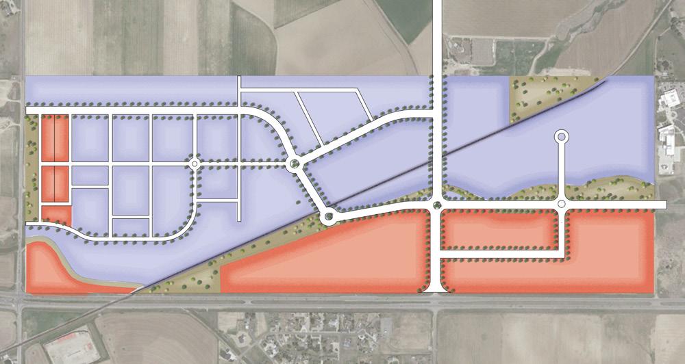
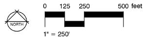
Highway 34 Area, Future Land Use Plan
Defining Features of Design:
The design is intended to advocate for light industrial uses supplemented by retail and office uses. The opportunity for AIMS Community College to expand west can be intertwined with related professional offices, ultimately creating new relationships between the academic and professional communities. Retail, restaurants, and office space along US Hwy 34 and along Colorado Blvd provide visibility to passing car traffic.
Disclaimer: The plan and illustrations are representative of the type of development allowed in this area. Actual development will vary.
In the center of the site, large, light industrial office and warehouse buildings provide expanded employment opportunities. Increased investments along the existing irrigation canals could include multi-purpose trails and attractive business offices campuses.
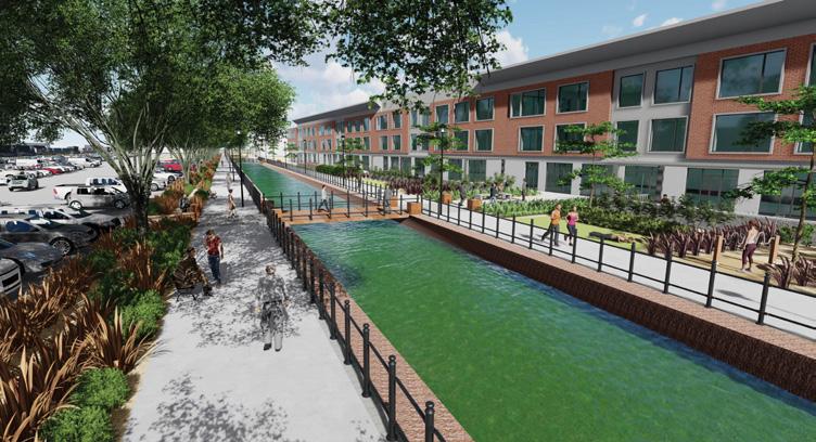
Highway 34, Conceptual Illustration
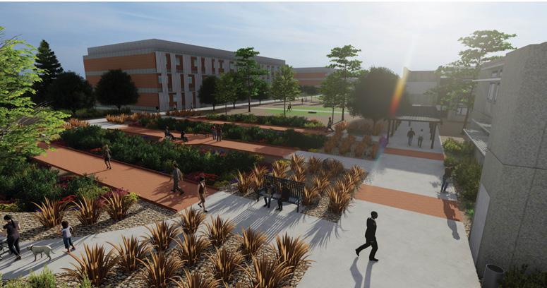
Highway 34, Conceptual Illustration
47 US 34 Colorado Blvd. 0 375’ Future Land Use Plan 25% - General Commercial 60% - Employment/ Flex Industrial 15% - Parks and Open Space 1”=375’ 750’ 1500’ Primary Gateway Secondary Gateway US 34 0 375’ Future Land Use Plan 25% General Commercial 60% Employment/ Flex Industrial 15% Parks and Open Space 1”=375’ 750’ 1500’ Primary Gateway Secondary Gateway US 34 0 375’ Future Land Use Plan 25% - General Commercial 60% - Employment/ Flex Industrial 15% - Parks and Open Space 1”=375’ 750’ 1500’ Primary Gateway Secondary Gateway
1
5 6 VISION & GUIDING PRINCIPLES FUTURE LAND USE PLAN GOALS & POLICIES IMPLEMENTATION INTRODUCTION PLANNING CONTEXT
2 3 4
25% General Commercial 60% Employment/Flex Industrial 15% Parks and Open Space
Use Mix:
Focus Area Location
Harmony and Highway 257 Area
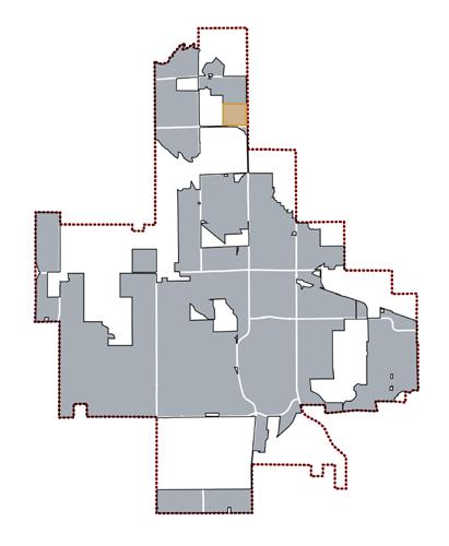
Location: The site is Windsor’s northwest gateway along East Harmony and Hwy 257.
Characteristics and Constraints:
Adjacent land uses are mostly residential. The current zoning for the site is General Commercial.
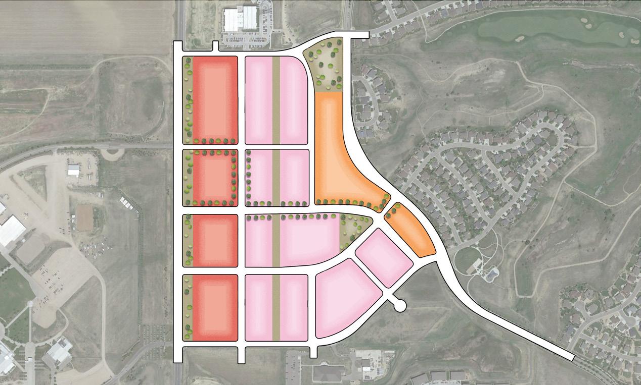
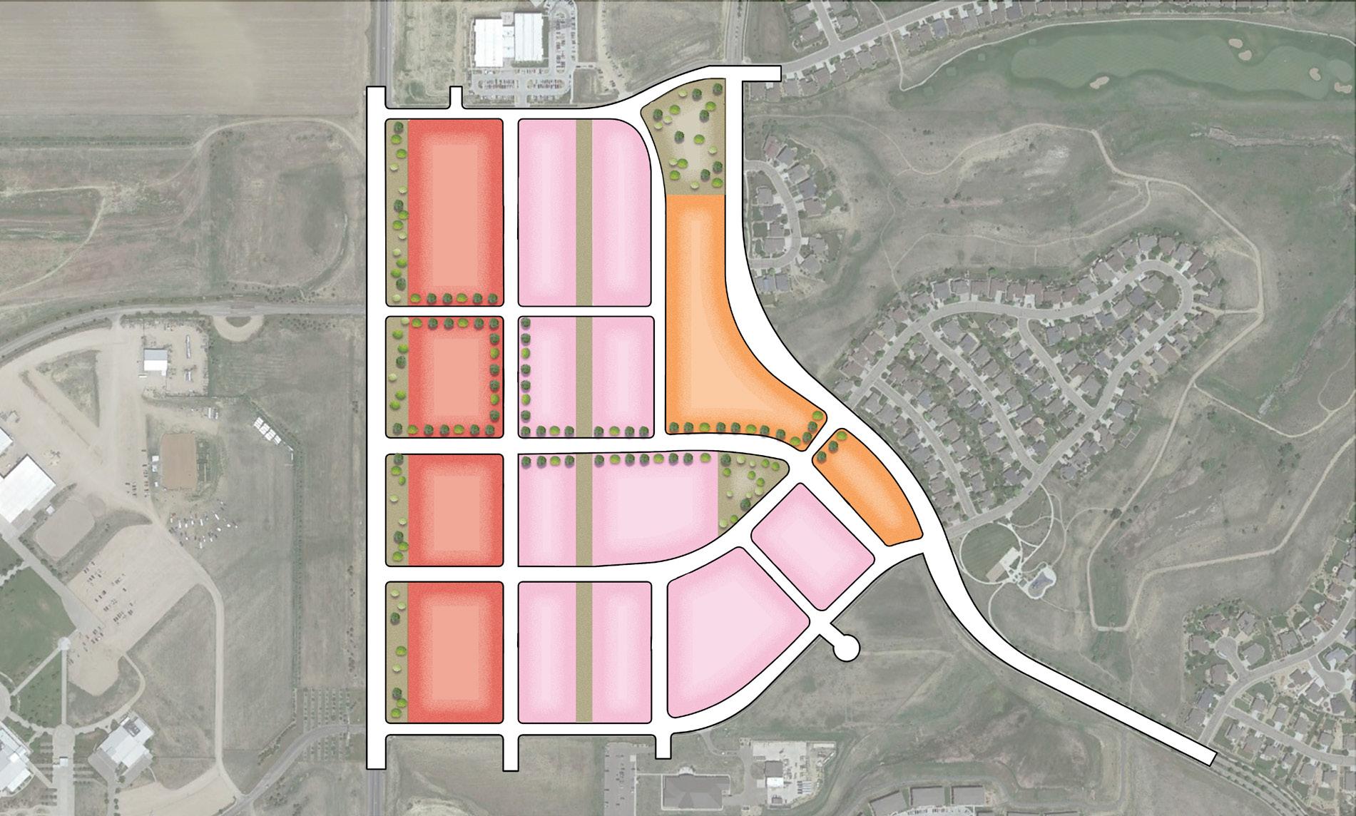
Future Land Use Mix: 60% General Commercial 30% Mixed Residential
10% Parks and Open Space
Disclaimer: The plan and illustrations are representative of the type of development allowed in this area. Actual development will vary.
Harmony and Highway 257 Area, Future Land Use Plan
Defining Features of Design:
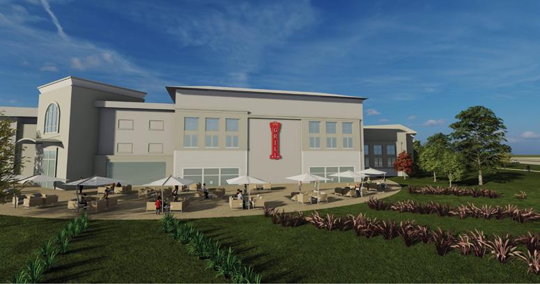
This northern gateway will prioritize lifestyle retail shopping and restaurants, with townhomes and apartments adjacent to existing single-family neighborhoods. Entry roads align with existing access to the south and northeastern.
With a focus on commercial development, the plan would provide opportunities for a variety of unique businesses, restaurants, and provide employment opportunities within Windsor town boundaries.
48 WINDSOR COMPREHENSIVE PLAN | E. Harmony Hwy 257 Future Land Use Plan 60% - General Commercial 30% - Commercial Mixed Use 10% - Parks and Open Space Primary Gateway Secondary Gateway 0 375’ 1”=375’ 750’ 1500’ Hwy 257 Future Land Use Plan 60% - General Commercial 30% - Commercial Mixed Use 10% - Parks and Open Space Primary Gateway Secondary Gateway 0 375’ 1”=375’ 750’ 1500’ E. Harmony Hwy 257 Future Land Use Plan 60% - General Commercial 30% - Commercial Mixed Use 10% - Parks and Open Space Primary Gateway Secondary Gateway 0 375’ 1”=375’ 750’ 1500’
Harmony and Highway 257 Area, Conceptual Illustration
Harmony and Highway 257 Area, Conceptual Illustration
Focus Area Location
FUTURE LAND USE PLAN
Fairgrounds
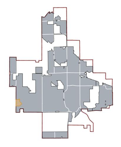
Location: The site is southwest Windsor, located along Fairgrounds Avenue.
Characteristics and Constraints:
Adjacent to residential uses and Belmont Ridge Open Space to the east and N. Fairgrounds Ave. to the west. The current zoning is Limited Industrial.
Defining Features of Design:
The design is intended to support mixed residential and commercial mixed use. First floor commercial uses wrap around the perimeter of the site with opportunities for second-story residential uses. The site is intended to be a pedestrian-oriented development with primary vehicular access through gateways along Fairgrounds Avenue.
representative of the type of development allowed in this area. Actual development will
49
1 2 3 4 5 6 VISION & GUIDING PRINCIPLES FUTURE LAND USE PLAN GOALS & POLICIES IMPLEMENTATION INTRODUCTION PLANNING CONTEXT
Mix: 30% General Commercial 40% Commercial Mixed Use 20% Mixed Residential 10%
Future Land Use
Parks and Open Space
Primary Gateway Secondary Gateway Future Land Use Plan 40% - Commercial Mixed Use 10% - Parks and Open Space 30% - General Commercial 20% - Mixed Residential Primary Gateway Secondary Gateway Future Land Use Plan 40% - Commercial Mixed Use 10% - Parks and Open Space 30% - General Commercial 20% - Mixed Residential Focus
Area Location
This page is intentionally left blank.
50 WINDSOR COMPREHENSIVE PLAN |