2
PLANNING CONTEXT CHAPTER 2
• Existing Conditions
• Jurisdiction & Planning Area
• Land Use & Zoning Context
• Plans & Studies
11 1 2 3 4 5 6 VISION & GUIDING PRINCIPLES FUTURE LAND USE PLAN GOALS & POLICIES IMPLEMENTATION INTRODUCTION PLANNING CONTEXT
The Town of Windsor, Colorado was founded as a small 19th Century agricultural and railroad town and has evolved into one of the most desirable communities in Colorado.
Its desirability is reflected in the steady population growth over the last 30 years, with significant growth occurring between 2015 and 2022. As of 2022, Windsor’s population was 42,840 people. The previous 2016 Comprehensive Plan projected the Town to have a total population of 25,693 by 2020, which assumed the continuation of the historic growth rate between 1-3%. Windsor grew much faster, at a growth rate more than triple that projected under the 2016 Plan, averaging a 7% annual growth rate. Windsor’s rapid growth has transformed the Town into a largely suburban community, anchored by the historic downtown. Current population projections for 2041 range from 61,206, reflecting low growth, up to 89,389, reflecting high growth. The low-end projection, 61,206, is based on historic trends before the record high rate of building permits for the past five years. The high-end projection is derived from the Colorado State Demographer’s Office. WINDSOR’S 2022 POPULATION
42,840
12 WINDSOR COMPREHENSIVE PLAN | 2
EXISTING CONDITIONS
Demographics: Windsor has a large population of families and older residents, and the residents are generally highly educated. The Town’s median household income has been about 56% higher than the regional average for the last decade, which also translates into higher-priced housing and higher home ownership rates.
Housing: Windsor is one of the newer housing markets in the region, with over 60% of homes built after 2000. The Town also has a larger share of single-family housing units than its neighbors but more multifamily units than the smaller towns in the region. The 2016 Comprehensive Plan stressed the need for more diverse housing. Progress has been
made since the adoption of that plan, although more work is still needed. As Windsor grows and demand for housing increases, market demand will drive prices higher. Homeownership may become less attainable, and more types of housing will be needed to fill in housing gaps. Development of more multifamily, attached single-family, and condos will help mitigate the impacts of high housing costs by offering transitional housing options between renting and homeownership.
County Population 2010-2022 Change
Population Trends by Jurisdiction,
Source: Town of Windsor, Colorado State Demographers Office
INTRODUCTION
13 PLANNING CONTEXT 1 2 3 4 5 6 VISION & GUIDING PRINCIPLES FUTURE LAND USE PLAN GOALS & POLICIES IMPLEMENTATION
PLANNING CONTEXT
Larimer Weld 2010 2022 Growth Percent Windsor X X 18,918 42,840 23,922 126% Evans X 18,628 22,924 4,296 23% Fort Collins X 144,461 171,848 27,387 19% Greeley X 93,156 110,186 17,030 18% Loveland X 67,000 77,913 10,913 16% Severance X 3,174 10,757 7,583 239% Timnath X X 632 7,917 7,285 1153% Larimer County 300,532 366,843 66,311 22% Weld County 254,230 350,206 95,976 38%
Single-Family Attached (5%)
Multifamily (12%)
Single-Family Detached (83%)
Windsor’s Housing Units by Type,
Source: US Census, 2022 American Community Survey 5-Year Estimate
Land Use: Land use in Windsor is primarily residential and industrial, with room for growth in both areas. Of the Town’s developed land, residential land uses make up 61.5%, industrial land uses make up 12%, and commercial land uses make up 7.8%. Of undeveloped land, residential land uses make up 54.8%, industrial land uses make up 15.4%, and commercial land uses make up 12.3%. As Windsor considers its future growth patterns and land use designations, this Plan supports a balance of housing, retail, employment, and recreation options.
WINDSOR’S MEDIAN HOUSEHOLD INCOME
$121,754
Source: US Census, 2022 ACS 5-Year Estimates
Economic Development: Over a third of the Town’s jobs are in manufacturing, and according to the U.S. Census, a high percentage of people who work in Windsor live outside of Windsor. Most residents commute outside of Windsor for work. Significantly, 18% of the population works from home, which might help local businesses and services during the workday.
Undeveloped Land in Windsor, Source: Town of Windsor 15%
UNDEVELOPED RESIDENTIAL LAND
UNDEVELOPED INDUSTRIAL LAND of undeveloped land in Windsor is industrial. 54%
Commuting patterns in and out of Windsor (2021), Source: LEHD, U.S. Census of undeveloped land in Windsor is residential.
14 WINDSOR COMPREHENSIVE PLAN |
Work in Windsor but Live Elsewhere (7,719) Live in Windsor but Work Elsewhere (14,966) Work & Live in Windsor (1,580)
Transportation: Transportation in Windsor is closely tied to its economic growth and land use decisions. Windsor residents commute further than surrounding communities for work, and most drive alone. White the Town has an extensive trail system, Windsor is still largely car-dependent. There is a dedicated commuter bus line between Fort Collins and Greeley with stops in Windsor, as well as a connection to a Loveland bus route.
Water: Windsor has maintained a proactive stance toward water planning by securing additional water sources for future growth through the Northern Integrated Supply Project (NISP), implementing water efficient practices, and incentivizing the community to monitor their own water use. Windsor is also a regional leader in the use and requirement of non-potable irrigation systems in new developments. As growth on the Front Range challenges water resources, Windsor has demonstrated its ability to plan ahead and adapt to new conditions through partnerships and community-driven programs aimed at increasing the use of low-water and native plants.
Average Vehicle Miles Traveled per Household Comparison, Source: Housing and Transportation Affordability Index
THE TOWN HAS TAKEN STEPS TO MAXIMIZE WATER EFFICIENCY USING PROVEN PRACTICES AND TECHNOLOGIES, INCLUDING THE FOLLOWING:
• Installation of water-efficient appliances and irrigation systems at town facilities
• Lawn watering restrictions (no watering from 10 am-6 pm daily)
• Use of irrigation system rain sensors and ET based scheduling
• Detection of water leaks and repair through the Town’s water efficiency audits
Mode of Transportation to Work (Windsor), Source: U.S. Census, ACS K200801: Means of Transportation to Work: 2022: ACS 5-year Estimates
• Establishment of a xeriscape garden to assist residents to understand and implement water saving landscapes and related technologies
15
CONTEXT 1 2 3 4 5 6 VISION & GUIDING PRINCIPLES FUTURE LAND USE PLAN GOALS & POLICIES IMPLEMENTATION INTRODUCTION PLANNING CONTEXT
PLANNING
22,254 21,670 18,441 16,293 Fort Collins Loveland Erie Windsor
Drive Alone (75%) Work from Home (18%) Carpool (5 .3%) Bike, Walk, Other (1 .3%) Public Transport ( .1%)
15,000 22,000
Infrastructure: Windsor has a robust infrastructure system consisting of water, sewer, stormwater, and roads, all supported by either general, capital improvement, or enterprise funds. Spatially, the Town’s infrastructure is spread out, resulting in higher infrastructure service and maintenance costs. Land use decisions will play an important part in future infrastructure challenges or solutions as future development requires more connections to public services. Providing existing infrastructure can support development, concentrating development in appropriate areas could reduce overall construction and maintenance costs and increase efficiency and long-term sustainability of the system as a whole.
Additional context and trends can be found in Appendix D: Existing Conditions Report.
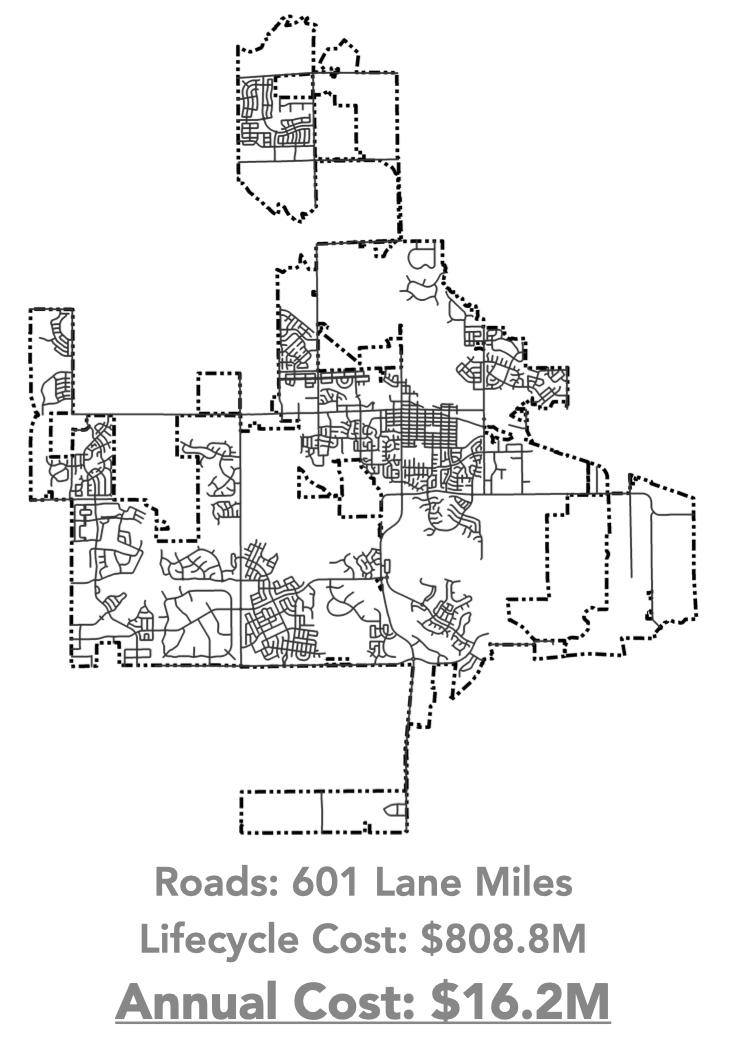
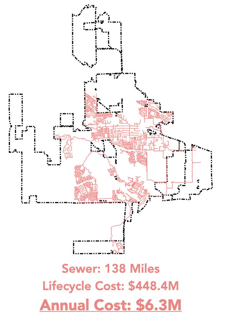
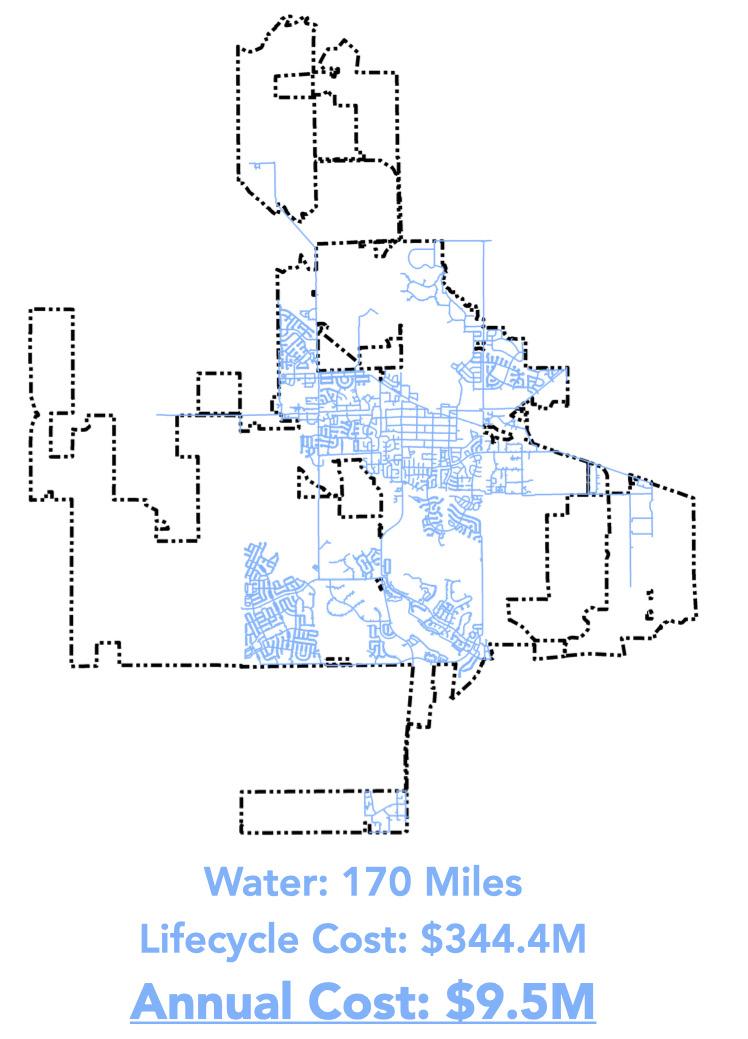
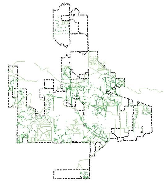
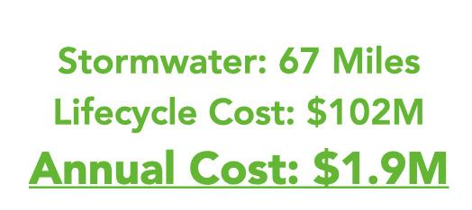
Cost of Windsor’s Infrastructure Systems, Source: Town of Windsor
INFRASTRUCTURE SYSTEMS
THE TOWN MAINTAINS:
600
170 138 86 lane miles of roads
miles of water pipes miles of sewer pipes
miles of stormwater ditches, culverts, & pipes
16 WINDSOR COMPREHENSIVE PLAN |
JURISDICTION & PLANNING AREA
The Town of Windsor is located in the Northern Colorado Front Range Region and Town boundaries extend across both Larimer and Weld counties. Surrounding communities include Timnath and Severance to the north, Fort Collins to the northwest, Loveland and Johnstown to the southwest, and Greeley to the southeast. Located on the I-25 corridor, Windsor sits approximately 56 miles north of Denver.
GROWTH MANAGEMENT AREA
This Comprehensive Plan applies to areas within the municipal boundaries of Windsor as well as the unincorporated areas that fall within the Town’s Growth Management Area (GMA). The land within the GMA is anticipated to be served with municipal services and infrastructure to support future development. Development in close proximity to the Town core and existing infrastructure is a priority, but areas in the GMA will likely experience development pressure and are anticipated to be annexed into the Town in the future.
WINDSOR 3-MILE PLANNING AREA
The Colorado Revised Statutes § 3112-105 require every municipality to have a plan in place for areas within a 3-mile distance of its municipal boundary prior to any annexation. The 3-mile planning area does not include land incorporated by other municipalities or claimed through a formal intergovernmental agreement. As much of the Town’s GMA is abutting the GMA and/ or corporate limits of neighboring communities, Windsor does not intend to extend the GMA boundaries beyond the boundary that exists today.

17 PLANNING CONTEXT 1 2 3 4 5 6 VISION & GUIDING PRINCIPLES FUTURE LAND USE PLAN GOALS & POLICIES IMPLEMENTATION INTRODUCTION PLANNING CONTEXT
0 5 10 2.5 MI. WELD COUNTY LARIMER COUNTY GREELEY FORT COLLINS LOVELAND DENVER DENVER INTL’ AIRPORT LONGMONT BOULDER BROOMFIELD FREDERICK BOULDER COUNTY JEFFERSON COUNTY ADAMS COUNTY WINDSOR 76 70 25 255 36 85 34 287 36 40 FRONT RANGE CONTEXT MAP
INTERGOVERNMENTAL PLANNING AREAS (IGAs)
The Town of Windsor has entered into several land use specific Intergovernmental Agreements (IGAs) with neighboring municipalities to jointly plan for future development. These include components such as a determination of future land uses, design standards, and in certain instances, revenue sharing. In some cases, the IGAs resulted in Cooperative Planning Areas where both jurisdictions agree to design and performance standards for development.
Town Boundary
Intergovernmental
REGIONAL CONTEXT MAP

18 WINDSOR COMPREHENSIVE PLAN | TIMNATH LOVELAND JOHNSTOWN FORT COLLINS SEVERANCE MILLIKEN LA SALLE GREELEY EVANS EATON LAPORTE WINDSOR LARIMER COUNTY WELD COUNTY 287 85 34 34 25 14 257 257 257 392 56 392 402 0 2.5 5 MI.
TIMNATH LOVELAND JOHNSTOWN FORT COLLINS SEVERANCE GREELEY 25 34 392 257 257 257 MAIN ST. HOLLISTER LAKE RD. HARMONY RD. FAIRGROUNDS AVE. CROSSROADS BLVD. COLORADO BLVD. 392 78 76 74 72 19 70 21 23 66 13 62 60 17 32E 15 15 13 KEY Town Boundary Intergovernmental Planning Areas Growth Management Area County Boundary W E L D C O U N T Y L A R M E R C O U N T Y 0 1 2 0.5 MI. SEVERANCE 392 257 257 MAIN ST. HOLLISTER LAKE RD. BLVD. 78 76 74 72 19 70 21 23 66 62 KEY
Growth
PLANNING AREA MAP
Planning Areas
Management Area County Boundary
LAND USE & ZONING CONTEXT
Anchored by a historic downtown, the Town includes a mix of new and old residential districts, emerging commercial centers, and an evolving industrial sector. Windsor includes a diverse range of land uses that accommodate residential, commercial, and industrial users.
The Town’s residential neighborhoods are comprised of historic homes near downtown as well as newer subdivisions, many of which surround golf courses and large open spaces and have been built in the last 20 years. The Town’s commercial and retail areas are anchored on Main Street (SH 392) and downtown Windsor, while I-25 and emerging east-west corridors like Harmony Road, Crossroads Boulevard, and Highway 34 play an increasingly important role in the area’s growth. Additionally, the Great Western Industrial Park includes large-scale sites and heavy manufacturing uses, which defines the eastern parts of Windsor and carries implications for land use and economic planning across the community.
CURRENT LAND USE CHARACTER
As part of the comprehensive planning process, a character analysis identified ten different character types in Windsor. The classifications are based on spatial attributes, street pattern, zoning, and land use. Spatial attributes include building height and sizes of lots, as well as the relationship between the buildings and street. The street pattern greatly influences connectivity and major modes of transportation.
Downtown Core: The downtown core of Windsor is near Windsor Lake. The Great Western Railroad runs through downtown diagonally, creating a triangular space with 7th Street and Main Street. The downtown core has the highest concentration of restaurants, shops, and various services in town.
Traditional Neighborhood: Traditional neighborhoods surround downtown and were mostly developed before 1970. These neighborhoods have smaller blocks and wellconnected street networks. The land use is mostly single-family housing with amenities like schools, and religious institutions that are integrated within residential areas. This neighborhood also has access to services and jobs in the downtown core only a short walk away.
Cluster Development: This character area encompasses neighborhoods that arrange homes and developments in clusters to conserve open space, parks, or sensitive environmental areas.
These neighborhoods typically have more public spaces.
Suburban: The suburban character type is the most common development pattern in the Town of Windsor. This type of development mostly consists of detached single-family homes, often as part of a planned subdivision, and garages often face the street.
Agriculture and Emerging Growth: This character type refers to lands that are currently vacant or used for agricultural purposes. Current zoning allows for development and some level of future growth or change in use can be expected in these areas.
Institutional: The institutional character type covers civic and educational spaces such as the High School, police buildings, fire stations, Town Hall, and Community Recreation Center.
Commercial Corridor: Commercial corridor areas refer to retail and office developments that prioritize vehicular access and are usually located around major roads and corridors. The Town’s land use code and commercial corridor plans strive to de-emphasize parking and encourage buildings to front the street. The areas along Highway 392 outside of downtown currently have the highest concentration of commercial corridor developments.
19 PLANNING CONTEXT 1 2 3 4 5 6 VISION & GUIDING PRINCIPLES FUTURE LAND USE PLAN GOALS & POLICIES IMPLEMENTATION INTRODUCTION PLANNING CONTEXT
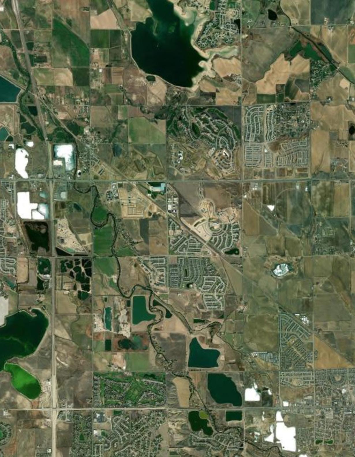
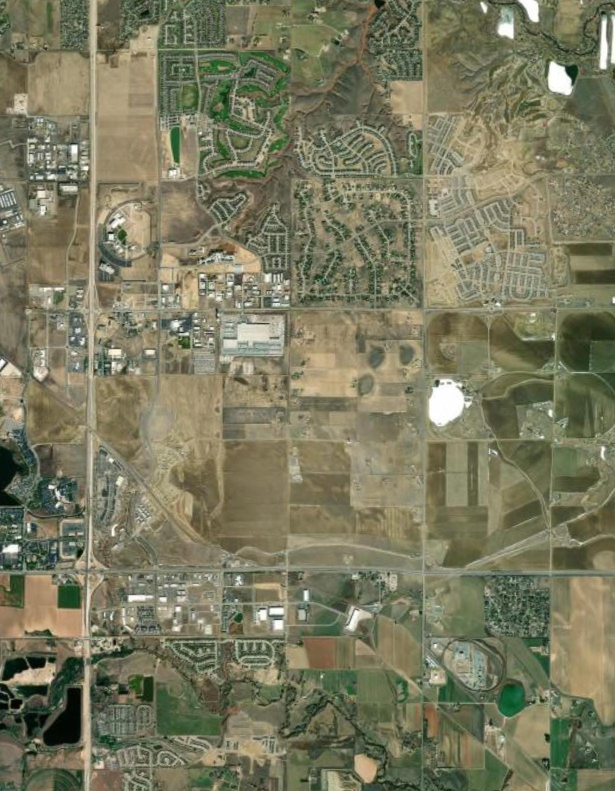
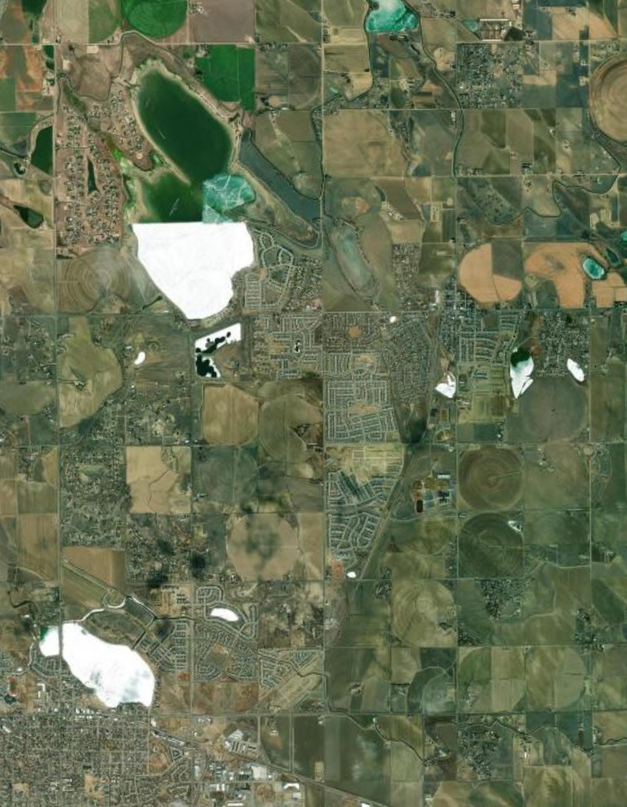
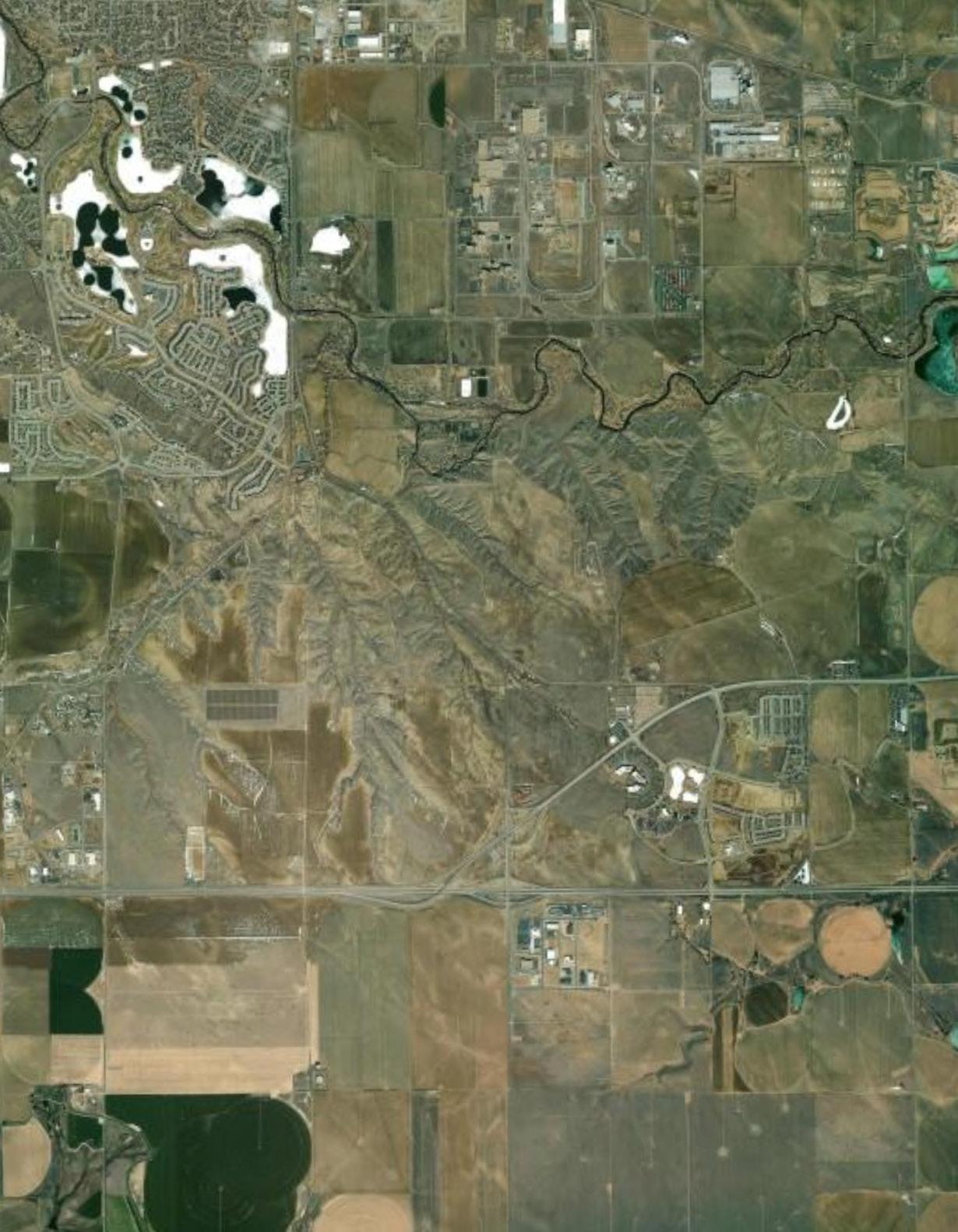
20 WINDSOR COMPREHENSIVE PLAN | 257 CR 62 CR 72 CR 64 75 CR 68.5 CR 19 CR 30 CR 76 CR 21 CR 60 CR 34C CR 3 CR 17 CR 70 CR 5 CR 23 CR 15 CR 13 CR 78 CR 32E 392 Harmony Rd Hollister Lake Rd Colorado Blvd 3rdSt Crossroads Blvd N 15th St Fairgrounds Ave 15th St 0 1 0.5 Miles Natural Edge and Open Space Light Industrial Heavy Industrial Commercial Corridor Institutional Emerging Growth Suburban Cluster Development Traditional Neighborhood Downtown Core Character Areas Growth Management Area Town Limit Waterbodies CURRENT LAND USE CHARACTER MAP
Heavy Industrial: Most of the heavy Industrial areas are in the eastern side of the Town. The buildings and structures in this character area support higher intensity of land use, often with greater volume of truck traffic, noise and other factors that are not compatible with residential development. These areas also generally have convenient access to major roadways and railroads.
Light Industrial: Light industrial uses produce smaller consumer goods and include warehousing, research, and development. The land use intensity
ZONING CODE ALIGNMENT
As the long-term guide to future development in the Town, the Comprehensive Plan provides the policy direction that should guide any future zoning requirements or development standards. Generally, the adoption of the Comprehensive Plan should be followed by an initiative to update the Town’s development codes, which includes zoning regulations, subdivision regulations, and others. Changes to the Town’s zoning regulations may include the refinement of existing regulations to address height, bulk, and intensity standards, as well as permitted uses.
The previous 2016 Comprehensive Plan document and Municipal Code were generally in alignment, at the time of adoption of this updated Plan. While there should be an understanding of what zoning districts could apply to each Future Land Use category, the Future Land Use Map in this Comprehensive Plan is not granular as is the regulatory zoning map. Instead, the Future Land Use Map provides a general guide of character and land use types that encompass neighborhoods or corridor areas.
More information about Future Land Use designations and categories is in Chapter 4: Future Land Use Plan.
is less than heavy industry. Light industrial businesses tend to cluster together to form bigger light industrial zones and are usually separated from residential areas.
Natural Edge and Open Space: The natural edge and open space are lands reserved for parks, outdoor recreational, and ecological services. The riparian buffer along the Poudre River plays an important role in protecting biodiversity and water quality.
The zoning regulations are located within the Town of Windsor Municipal Code, Chapter 16, and an example of the Zoning Map is included on the next page. The Zoning Code includes requirements for 16 zoning districts, including:
• Estate Residential (ER)
• Single-Family Detached (SF-1)
• Single-Family Attached (SF-2)
• Multifamily (MF)
• Residential Mixed Use (RMU-1 and RMU-2)
• Mobile Home (MH)
• Neighborhood Commercial (NC)
• Central Business (CB)
• General Commercial (GC)
• Limited Industrial (LI)
• Heavy Industrial (HI)
• Recreation and Open Lands (ROL)
• Agriculture Holding (AH)
• Planned Unit Development (PUD)
• Public Parking District (PP) (subarea of the CB zone district)
21
CONTEXT 1 2 3 4 5 6 VISION & GUIDING PRINCIPLES FUTURE LAND USE PLAN GOALS & POLICIES IMPLEMENTATION INTRODUCTION PLANNING CONTEXT
PLANNING

22 WINDSOR COMPREHENSIVE PLAN | 1 3 3 2 2 1 11 11 12 22 14 15 36 13 23 36 35 34 25 10 26 24 10 25 26 35 34 27 12 13 14 15 3 5 9 8 8 1 6 9 4 2 2 3 7 1 7 6 11 11 32 33 34 10 35 25 12 36 32 36 27 12 20 17 26 33 34 15 22 29 21 28 31 10 16 29 28 18 31 19 27 30 35 26 25 30 14 15 17 13 16 18 ¨ ¨ ¨ ¨ ¨ ¨ ¨ ¨ ¨ ¨ ¨ ¨ ¨ ¨ ¨ ¨ ¨ W W W W 25 Kyger oud W neyD B nD hn La nahR W ana ana Blackwoo Annapolis Walden Couples Stadler Hillspire Trevino Country Nightfall SummerBloom Dartford Crooked Stick Veronica ingree veD Rancho Silverwood Branching Canopy Atna rook Greenbrook Rise Clydesdale Blue Moon Floret Prairie owcap Frost lowtwig Charlton Flourish Babine Crisp Montana Kelmsley aplow Cayman Bounty Goldmoss Sce ayS Murano eC eakV Shavano Ashb Ladb Shavano I25Ram rum Meadowlark W S " R68R67 T7 T6 T6 T5 TOWN OF WINDSOR, CO ZONING MAP R68R67 misuse or misrepresentation whether intentional not, are Created by: Map Data Planned Unit Development Estate Residential Single Family Residential Single Family Attached Residential Multifamily Residential Mixed UseOne Residential Mixed UseTwo Central Business District Permenant Parking Neighborhood Commercial General Commercial Limited Industrial Heavy Industrial Recreation & Open Lands
the most up-todate zoning map, visit the Town’s webpage here.
CURRENT ZONING MAP For
PLANS & STUDIES
The Comprehensive Plan builds on several existing plans and studies, which have influenced, and will continue to influence, Windsor’s growth and development. The Comprehensive Plan incorporates past policy direction where it continues to be reflective of the community’s vision. Many of these supporting documents provide further guidance on specific topics such as transportation planning, parks and open space, and parking. The most relevant plans and studies are summarized below and referenced throughout the Plan.
Existing plans
&
studies help inform the Comprehensive Plan.
EXISTING PLANS
Potable Water Master Plan (2009): The objective of the Potable Water Master Plan is to provide the Town’s decision makers with the information needed to make sound decisions associated with its water portfolio.
Demographics and Housing Opportunities Study (2015): This study identifies evolving trends and changes to existing development policies, to respond to emerging housing needs. The study provides general and policy recommendations focusing on diversity of housing, aligning jobs with the resident workforce, and identifying strategic areas for denser residential development.
Transportation Master Plan (2020): As Windsor’s first Transportation Master Plan, it serves as a long-term vision and guide for multimodal transportation. It includes short-term action items and integrates the 2017 Roadway Improvement Plan to plan for a connected, efficient, and comfortable network for bicycling, walking, taking transit, and driving.
23
WINDSOR COMPREHENSIVE PLAN PLANNING CONTEXT 1 2 3 4 5 6 VISION & GUIDING PRINCIPLES FUTURE LAND USE PLAN GOALS & POLICIES IMPLEMENTATION INTRODUCTION PLANNING CONTEXT
Windsor Public Art Master Plan (2020): The Public Art Master Plan provides guidance for the Town of Windsor, Windsor Art Commission, artists, community stakeholders, and others interested in helping advance the future of public art in Windsor. Since its adoption in 2020, the Town Board adopted a public arts ordinance and established the Windsor Arts Commission.
Parks, Recreation, and Culture Strategic Plan (2020): This plan serves as a roadmap for the Town, Parks, Recreation & Culture Advisory Board, and the Town Board. It strengthens and strategically expands existing programs, facilities, and amenities.
Open Space and Trails Strategic Plan (2022): The Open Space and Trails Strategic Plan provides a five- to ten-year framework to define areas for open space preservation and trail development within Windsor’s GMA. The Plan serves as a strategy and policy document for open space acquisition, long-term stewardship, capital project planning, and funding efforts.
Energy Action Plan (2023): The Town’s first ever Energy Action Plan is intended to explore ways to help the community save energy and money while leveraging renewable energy programs. The action plan establishes an overall vision, goal, and seven focused strategies to achieve that direction.
Historic Preservation Master Plan (2023): The Preservation Plan serves as a guiding document for the Historic Preservation Commission and outlines Windsor’s vision for the sustainable preservation of historic resources. It sets forth goals, policies, and an action plan for implementation. It serves as an informational resource for property owners and members of the general public to learn about preservation in Windsor.
Subarea and Corridor Plans: Windsor has several subarea and corridor plans that include more detailed land use, transportation, economic goals and recommendations, as well as design standards. The Town of Windsor also has developed Intergovernmental Agreements (IGAs) with adjacent communities, including but not limited to Fort Collins, Severance, Timnath, Loveland, and Greeley; as well as the counties of Weld and Larimer.
• 7th Street Multimodal/Walnut Street Bikeway Study
• O Street Corridor Study
• Downtown Windsor Parking Study
• Eastman Park Drive Corridor Plan
• Corridor Activity Center (CAC) Design Standards
• Downtown Corridor Plan
• I-25 Corridor Plan and Regional Design Standards
• Commercial Corridor Plan Design Criteria and Procedures
• East Side Industrial Subarea Plan
• Great Western Annexation Design Criteria and Development Standards
24 WINDSOR COMPREHENSIVE PLAN |