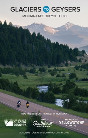
MONTANA MOTORCYCLE GUIDE
RIDE THE BEST OF THE WEST IN MONTANA
GLACIERSTOGEYSERS.COM/MOTORCYCLING
RIDE THE BEST OF THE WEST
MOTORCYCLE MONTANA Some of the most stunning landscapes in the world surround Glacier and Yellowstone national parks. Montana’s open highways, scenic byways and backroads of discovery offer the two-wheeled trip of a lifetime. The best riding in the state is found in Western Montana, Southwest Montana and Yellowstone Country, where winding roads connect it all—towering peaks, sparkling lakes, rolling ranchlands and rambling rivers. Ride past glacial valleys and geothermal wonders, through welcoming small towns, captivating ghost towns and hot springs tucked into the hills. Each mile reveals something new, from the region’s rich history to its pristine, untamed beauty.
© 2025 Western Montana’s Glacier Country, Visit Southwest Montana and Montana’s Yellowstone Country. Distributed with Accommodation Tax Funds. Any reproduction or reprint of this guide or any portion thereof, without the written permission of Western Montana’s Glacier Country, Visit Southwest Montana and Montana’s Yellowstone Country, is strictly prohibited. Every effort was made to ensure the accuracy of the information in this publication. However, due to the passage of time and the anomalies inherent in the publishing process, we cannot be responsible for errors or incorrect information. Please contact the individual establishments to confirm information.
Exploring the country’s most iconic landscapes by motorcycle is a one-of-a-kind experience, with unforgettable views and roads built for adventure. Ride Glaciers to Geysers in the regions known as Western Montana’s Glacier Country, Visit Southwest Montana and Montana’s Yellowstone Country.
Montana
Idaho
Wyoming
North Dakota South Dakota
St. Mary, Montana. © GLACIER COUNTRY COVER PHOTO: Pintler Veterans Memorial Scenic Highway, Montana. © ANDY AUSTIN
WESTERN MONTANA’S GLACIER COUNTRY Western Montana invites discovery—where towering mountain ranges give way to pristine rivers and lakes, small towns hum with local character and rich cultural traditions span two Tribal Nations. From Glacier National Park to Flathead Lake and beyond, this region is a dream destination for motorcyclists, offering scenic routes, sweeping straightaways and winding canyon roads—along with unforgettable experiences at every turn. 1 GOING-TO-THE-SUN ROAD + GLACIER NATIONAL PARK Between St. Mary and West Glacier, ride from one side of Glacier National Park to the other on the 50-mile-long Going-to-the-Sun Road, an engineering marvel and National Historic Landmark. You’ll see jagged mountain peaks, alpine lakes, cascading waterfalls, expansive valley views and, chances are, wildlife. Crest the Continental Divide at Logan Pass, known for wildflowers and mountain goat sightings. This also marks the starting point for the Highline Trail, offering views of the Garden Wall. There’s a visitor center and a short 1.5-mile hike to Hidden Lake Overlook here, too. This route—one of the most spectacular in the country— offers plenty of places to pull over and take in the views or hit the trail. You’ll experience steep elevation changes and some hairpin turns. From Browning, head to St. Mary Lake and take in the incredible 4,500-foot peaks before you begin your “ride to the sun.” Check seasonal road status here: glaciermt.com/gtsr. Please note: During peak summer months, a vehicle reservation system is in place at Glacier National Park. Also note, Google Maps will automatically reroute when the Going-to-the-Sun Road is closed. 2 GREAT SCENIC LOOP + MONTANA’S BITTERROOT VALLEY Ride the exhilarating 655-mile Great Scenic Loop through Western Montana and Idaho along the banks of five rivers and over six scenic byways. Starting in Lolo, travel west on US-12 to Lolo Pass and the Idaho state line. Make sure to take a selfie with the WINDING ROAD NEXT 99 MILES sign. This route takes bikers through a handful of small towns in Idaho, including Kooskia, Grangeville, McCall, Stanley, Challis and Salmon, then north on US-93 back to Montana’s Bitterroot Valley. The craggy Bitterroot Mountains provide a picturesque backdrop to the communities of Darby, Hamilton, Victor, Stevensville and Florence before you arrive back in Lolo. Be sure to map out a plan in terms of lodging—this is a multiday trip.
Glacier National Park, Montana. © GLACIER COUNTRY
3 BLACKFOOT RIVER ROUTE + MISSOULA + OVANDO Follow the Blackfoot River—made famous by Norman Maclean’s “A River Runs Through It”—along this 50-mile scenic ride from Missoula to Ovando on MT-200. This is a popular stretch of river for anglers and a great way to watch recreators float and fish this prized Montana waterway. Keep an eye out for the giant cow statue at Clearwater Junction, 13 miles before Ovando, where MT-200 meets MT-83. Veer off route onto MT-83 to head up to Seeley Lake on the Seeley Swan Scenic Drive, stopping along the way for good food and lake views, or take this detour on your way back from Ovando. 4
FLATHEAD LAKE LOOP + POLSON + LAKESIDE + BIGFORK
Cruise around the largest freshwater lake west of the Mississippi—Flathead Lake—in either direction. US-93 on the west side offers four lanes and higher speed limits for a nonstop lakeshore cruise, and MT-35 on the east side offers a two-lane, slower-paced ride with a little more character. The views are incredible on this approximately 90-mile ride, and from mid to late summer fruit stands dot the roadside with Montana’s coveted Flathead cherries. 5 ST. REGIS-PARADISE SCENIC BYWAY + HOT SPRINGS Gas up at the bustling St. Regis Travel Center (check out the trout aquarium) on I-90. This popular roadside stop acts as the starting point for the 24-mile-long St. Regis-Paradise Scenic Byway (MT-135), which runs along the Clark Fork River. Stop along the way at Quinn’s Hot Springs Resort for a daytime soak or a meal (be sure to make reservations in advance). At the junction of MT-200, drive the last 2.5 miles of this scenic route, landing in Paradise. If you want to extend your trip up to Flathead Lake, follow MT-200 to Plains then east on MT-28 for 48 miles (noting that Symes Hot Springs Resort is about halfway) landing in Elmo, a small town on the lakeshore. 6
LAKE KOOCANUSA SCENIC BYWAY + EUREKA + LIBBY
The 67-mile Lake Koocanusa Scenic Byway (MT-37) cuts through the Kootenai National Forest to connect the towns of Eureka and Libby. From Eureka, ride through Rexford to the shores of Lake Koocanusa, a 90-mile-long reservoir behind Libby Dam that stretches into Canada. The blacktop hugs the reservoir all the way to the dam. Shortly after the dam, the byway turns west to follow the Kootenai River—one of Montana’s blue-ribbon trout streams—into Libby. Extend your trip and make it a 134-mile loop tour by driving from Libby to Kalispell and then back north to Eureka.. 7
SEELEY SWAN SCENIC DRIVE
This 74-mile-long corridor along MT-83 stretches through the picturesque Swan Valley between Seeley Lake and Swan Lake, ending on Flathead Lake in the community of Bigfork. Follow the Swan River and take in stunning views of the Mission Mountains and the Swan Range, plus dozens of lakes, two rivers, lush forestland, expansive meadows and steep mountain walls just beyond the boundaries of the Bob Marshall Wilderness Complex. You’ll find some nice sweepers on this route and only a few tight turns. 8
HIGHWAY 200 + THOMPSON FALLS + TROUT CREEK + NOXON
If you prefer straight and relatively empty roads with plenty of chances to stop, MT-200 is the route for you. From Missoula, head north along the Clark Fork River on US-93 for 36 miles to Ravalli where you’ll pick up MT-200. The route from Ravalli to Noxon, roughly 102 miles tucked between two mountain ranges, travels by the communities of Thompson Falls (visit the dam) and Trout Creek (famous for huckleberries).
VISIT SOUTHWEST MONTANA Between Yellowstone and Glacier national parks lies a vast region of picturesque mountains, rolling foothills and glistening waterways. Motorcyclists are drawn to Southwest Montana’s beautiful backroads and winding mountain passes with twists and turns overlooking the Rocky Mountains. This is the place to view intriguing geological formations, relax in hot springs, explore ghost towns and visit vibrant small towns with local restaurants, breweries, shopping and lodging experiences. 1 ENNIS + VIRGINIA CITY + LEWIS & CLARK CAVERNS + NORRIS Ride some of Montana’s favorite backroads through wide-open spaces and friendly communities. You’ll discover historical sites, unusual natural geological features and opportunities for blue-ribbon fishing along this 130-mile loop. Beginning in Ennis, take MT-287 West through the ghost towns of Virginia City and Nevada City along Alder Gulch, featuring living history demonstrations, live theater, tours, dining and shops. From there, head toward Twin Bridges, where you’ll take MT-41, MT-55, MT-69 and MT-2 to Lewis and Clark Caverns State Park. Schedule a tour—these are the most decorated limestone caverns in the western U.S. After the caverns, you’ll backtrack slightly on MT-2, heading west to Cardwell, where you’ll pick up S-359 south to US-287 south and stop at Norris Hot Springs for a relaxing soak. 2
PIONEER SCENIC BYWAY + BIG HOLE NATIONAL BATTLEFIELD
Just a stone’s throw from Butte and Dillon, this 141-mile loop tour offers easy access to some of Southwest Montana’s most scenic spots as well as plenty of reasons to pull over. Enjoy epic landscapes, traversing Montana’s Pioneer Scenic Byway through the Pioneer Mountains and snaking along the Big Hole River. Head south from Wise River to ride over the high elevation mountain passes of Badger Pass (6,760 feet) and Big Hole Pass (7,400 feet). Along the way, you’ll find Crystal Park, where you can dig for quartz crystals. Consider a soak at Jackson Hot Springs as you make your way north on S-278, then head west on MT-43 to the Big Hole Battlefield and on to Wise River. 3 ANACONDA + PHILIPSBURG + PINTLER SCENIC HIGHWAY + LINCOLN Take a 100-mile (one-way) ride on some of the most scenic roads in the region. From historic Anaconda (keep an eye out for the towering smelter stack—it’s taller than the Washington Memorial in DC), you’ll ride along the stunning Pintler Veterans Memorial Scenic Highway (State Highway 1). As you continue, the shores of picturesque Georgetown Lake will lead you to Philipsburg, a charming (and historic) small town with a big, Old West personality. From there, your adventure continues north to Drummond. Take S-271, MT-41 and MT-200 to Lincoln, to explore Blackfoot Pathways: Sculpture in the Wild, a must-stop, large-scale outdoor sculpture park. 4
HELENA LOOP: HELENA + CANYON FERRY + TOWNSEND
Just 91 miles, this day trip highlights Canyon Ferry Lake, a large scenic reservoir on the Missouri River, along the Lewis and Clark Trail. From Helena, Montana’s capital city, take US-287 and US-12 to S-284 and drive along the eastern shore of Canyon Ferry Reservoir. Look for St. Joseph’s Catholic Church, today known as the Canton Church, which is listed on the National Register of Historic Places. There is also a visitor center just before you reach the dam. As you near Townsend, you will see the Big Belt Mountains to the east and the Elkhorn Mountains to the west. There are ample recreation opportunities along this drive and abundant wildlife, including a herd of antelope northeast of Townsend. On your way back to Helena via US-287, stop by Stonehouse Distillery.
VISIT SOUTHWEST MONTANA CONTINUED
5 BUTTE + LEWIS & CLARK CAVERNS + DILLON + BANNACK The 243-mile “Vigilante Trail” historic corridor loop is the perfect ride for anyone interested in ghost towns, the rich mining history of Montana and jaw-dropping scenery. Begin in Butte, then take MT-2 east over Pipestone Pass (6,300 feet) with hairpin turns as you view the Boulder Batholith granite outcroppings. Continue on MT-2, stopping at the Western Legacy Center in Whitehall, then onto Lewis and Clark Caverns. From there, ride to Twin Bridges (an angler’s paradise) and then to Dillon via MT-55 and MT-41. From Dillon, visit Bannack State Park, Montana’s first Territorial capital and the site of Montana’s first significant gold discovery in 1862—dozens of buildings still stand in this living history ghost town. From Bannack, make your way back to Butte via I-15. 6
OVANDO + HELMVILLE + HELENA
Charming small towns on the edges of the Lolo and Helena national forests, known for their natural beauty, lead the way to Montana’s vibrant capital city on this 77-mile (one-way) ride. Begin on MT-200 in Ovando, home of the famous Trixi’s Antler Saloon. After about 10 miles, you’ll pick up MT-141 to Helmville, home of the Copper Queen Saloon. Eventually, you’ll take US-12, which crosses the Continental Divide at MacDonald Pass (6,312 feet). 7 HELENA + WOLF CREEK + AUGUSTA + LINCOLN The beautiful Rocky Mountain Front sets the stage for a 132-mile (one-way) journey. Begin your exploration in Helena on I-15, heading north. As you pick up US-287 in Wolf Creek, the road ahead is filled with expansive views. Traverse the rolling, wide-open ranchlands from Wolf Creek to Augusta, and, from there, head south on S-435 to MT-200 to Lincoln along the base of the Scapegoat Wilderness. In Lincoln, Blackfoot Pathways: Sculpture in the Wild is a must-stop. Also visit Hi-Country Trading Post for their renowned jerky, and stock up on snacks, outdoor gear, apparel and souvenirs. 8 BUTTE + DEER LODGE + HELENA + BOULDER This 162-mile loop offers picturesque Southwest Montana views, mining history, a drive through Montana’s capital city and relaxation at hot springs. Begin in Butte on I-90 traveling north to Deer Lodge, where you can stop at the Old Montana Prison Complex and explore five unique museums. From Deer Lodge, pick up US-12 at Garrison, heading east to Helena, where you’ll then head south back toward Butte on I-15. Midway between Helena and Butte, stop in Boulder to explore Elkhorn Ghost Town (gravel road) and enjoy a rejuvenating soak at Boulder Hot Springs. You’ll also find plenty of recreation opportunities here.
Virginia City, Montana. © TEMPEST TECHNOLOGIES
to Cranbrook, BC to Cardston, AB
Eureka
Rexford
Yaak
6
Troy
GLACIER NATIONAL PARK
Polebridge
Fortine Trego
Lake McDonald West Glacier
to Sandpoint, ID
Kila
Lakeside Rollins Proctor Dayton Elmo Big Arm
5
to Coeur d’Alene, ID
Trout Creek
Thompson Falls Hot Springs Haugan De Borgia St. Regis
Bigfork
Somers
Noxon
Paradise
Hamilton
Fort Shaw
Philipsburg
Craig Wolf Creek
Lincoln Canyon Creek
6
PINTLER SCENIC ROUTE
Marysville
Helena
Elliston
Garrison
Deer Lodge
3
Stockett
Cascade
Ovando
3
Greenough Helmville
East Helena 4
Montana City Winston
Clancy
Jefferson City
Basin
8
Georgetown Lake
White Su Spring
Townsend
Boulder
Anaconda
Darby Conner
569
2
Sula
BIG HOLE NATIONAL BATTLEFIELD
Dewey Divide
McCall, ID
Melrose PIONEER MTNS SCENIC BYWAY
278
Salmon, ID
Butte
Wise River
Wisdom 2
IDA H O
Great Falls Ulm
Drummond
Stevensville Corvallis
95
Brady
Bynum
7
Bonner Clinton
Florence
Grangeville, ID
Conrad
er
7
Missoula Lolo
13
Dupuyer
Riv
Fairfield
Seeley Lake
Alberton
Kooskia, ID
ad
Augusta
Arlee
2
the
Vaughn
St. Ignatius
Victor
Heart Butte
Fla
Condon
Ronan
Moiese
Dixon
Superior
Galata Valier
Choteau
4
Charlo
8
East Glacier Park
Swan Lake
Polson
Plains
Shelby
Martin City Hungry Horse Essex
Kalispell Marion
Cut Bank
Browning
Columbia Falls Coram
Whitefish Heron
Sunburst
Apgar
Olney
Libby
Sweetgrass
Babb St. Mary
1
Stryker
to Lethbridge, AB
CANA DA
Jackson
Polaris Bannack
278
Logan
Three Forks
Whitehall Silver Star Twin Bridges
Harrison Pony Norris Sheridan
1
5
Alder
Nevada City
Gallatin Gateway
Bo
3 Ennis
Virginia City
Dillon
Manhatta Belgra
Cameron East
2
Big Sk
Grant
55
324
Challis, ID
Quake Lake
324
Garden Valley, ID Lowman, ID
Stanley, ID
Dell Lima 75
21
IDAHO
Monida
Lakeview
to Idaho Falls, ID
to Rexburg, ID
H
West Yellowston
F
Loring
Peerless
Whitewater
Chinook Rudyard
Havre
F OR T PEC K IN DI A N R ES ER VA T I ON
ENLARGED AREA
Fort
Box Elder
Hinsdale
Saco
Belknap
Dodson
Agency
Saint
Lustre
Marie
Vandalia
Malta
Wolf
Nashua
Glasgow
Big Sandy
Point
Fort Peck
Virgelle Loma Zortman
Landusky Fort Benton
Winifred
Circle
Brusett Belt Raynesford
Roy
Denton
WESTERN MONTANA’S GLACIER COUNTRY MOTORCYCLE ROUTE
Geyser Stanford
Lewistown
Monarch Neihart
Grass Range
Utica
Two Dot
Brockway
Jordan
253
Cohagen
VISIT SOUTHWESTMosby MONTANA MOTORCYCLE ROUTE MONTANA’S YELLOWSTONE Ingomar Melstone COUNTRY MOTORCYCLE ROUTE
Judith Gap
Harlowton
Martinsdale
Sand Springs
Winnett
Hobson
ulphur gs
Miles City
Roundup Hysham
Forsyth
Ringling Rosebud
Bighorn Custer
Big Timber
Wilsall
an ade
Clyde Park
7
4
Silver Gate
Gardiner
Columbus
Absarokee
5
Mammoth 8 Tower Junction Hot Springs Canyon Village YELLOWSTONE Norris
Fishtail Nye Roscoe
BEARTOOTH Closed in Winter
NATIONAL
Madison PARK Junction Lake West Thumb
Old Faithful
6
Grant Village
to Grand Teton National Park and Jackson, WY
Park City
Roberts
Joliet
Laurel
1
Billings
Pryor
Hardin
Deer
Crow Agency
WA RRI O R
Ashland
T R AIL
Busby
Rockvale
Bridger
Red Lodge
Cooke City
Colstrip
Pompeys Pillar
McLeod
Pray Emigrant
ky
Worden
Greycliff Reed Point
Livingston
ozeman
ne
Four Buttes
Opheim
Turner
Chester
to Assinib
to Kildeer, SK
to Swift Current, SK
CANADA
Saint Xavier
Fort Smith
Garryowen Lodge Grass
HI G
H
Birney
Otter Wyola
Belfry
to Cody, WY
Decker
WYOMING to Lovell, WY
WYOM IN to Sheridan, WY
MONTANA’S YELLOWSTONE COUNTRY CONTINUED
3 LAKE LOOP + BOZEMAN + NORRIS + WEST YELLOWSTONE From Bozeman to Norris, take in the snowcapped Tobacco Root Mountains along MT-84. Once you hit the legendary Madison River, you’ll wind through a small canyon and then on to Norris Hot Springs, offering a relaxing mineral-water soak plus on-site camping. From there, head southeast on US-287 through Ennis to Quake and Hebgen lakes. Once you reach West Yellowstone, head north on US-191 back to Bozeman (the Gallatin Canyon Scenic Drive) for a total of 219 miles of jaw-dropping vistas and stop-worthy points along the way. 4
ABSAROKEE LOOP + ABSAROKEE + NYE + FISHTAIL + ROSCOE
On this 45-mile loop, wind your way westward on S-420 (Stillwater River Road) along the wild Stillwater River from Absarokee to Nye through grasslands and a small burn area into a narrow canyon stretch with jagged Beartooth Mountain peaks. This quiet road turns to gravel at the Nye Basin but stays open year-round. From Nye, take S-419 (Nye Road) along Fishtail Creek right into the town of Fishtail. Fuel up at the Fishtail General Store, founded in 1900, and head back north to Absarokee via MT-78. At the junction of MT-78, you could also head south on a highly-recommended 15-minute side trip to Roscoe for a burger at the Grizzly Bar. 5
PARADISE VALLEY + LIVINGSTON + GARDINER
Follow the Yellowstone River along the soaring peaks of the Absaroka Mountains to the east with the picturesque Gallatin Range to the west on US-89. Stop at Mallard’s Rest Fishing Access Site (13 miles south of Livingston at mile marker 42) where you’ll find the ultimate in Montana views. This aptly named panoramic river valley offers the epitome of Big Sky Country vistas. Halfway through this 54-mile ride, stop in Pray at Chico Hot Springs, and then ride on to Gardiner, Montana’s gateway to Yellowstone National Park. This flat, straight ride gives way to sweeping curves. 6 BEARTOOTH FRONT SCENIC DRIVE + COLUMBUS + RED LODGE On the northern front of the Beartooth Mountains, travel MT-78 for 46 miles between Columbus and Red Lodge. After you cross the Yellowstone River you’ll travel along the Stillwater River and the Beartooth foothills. If you’re riding to Red Lodge to access the famous Beartooth Highway, this is a more scenic route than US-212. You’ll reach the charming community of Absarokee two thirds of the way through your ride, where you can also pick up the Absarokee Loop. 7 BOULDER RIVER BACKCOUNTRY + BIG TIMBER + LIVINGSTON From the grasslands of Big Timber on S-298, follow the Boulder River into the heart of the Absaroka Mountains before reaching Livingston. Along with excellent views of the Absaroka Mountains and the Absaroka-Beartooth Wilderness Area, you’ll pass the Natural Bridge Falls Picnic Area—well worth the stop to see the natural rock tunnels and waterfall. The first 20 miles of the road are paved, and the rest is gravel. 8
YELLOWSTONE NATIONAL PARK + GARDINER + COOKE CITY
Take the long, scenic route from Gardiner to Cooke City through the northwest corner of Yellowstone National Park. From Gardiner, head south on US-89 to US-212 heading east. Pull over in Mammoth Hot Springs and explore steaming hot springs terraces or tour historic Fort Yellowstone and the Albright Visitor Center. After that, you’ll find the hottest thermal area in Yellowstone—the unique rainbow-colored Norris Geyser Basin. From there, head to Canyon Village to witness Yellowstone’s 20-mile-long Grand Canyon. Next up, Yellowstone’s TowerRoosevelt area to visit Tower Falls, Calcite Springs Overlook, Lamar Buffalo Ranch and the Roosevelt Lodge before reaching Cooke City via the wildlife-filled Lamar Valley.
MONTANA’S YELLOWSTONE COUNTRY The peak of adventure is found in Montana’s Yellowstone Country, where America’s first national park stuns with otherworldly geothermal features and epic natural beauty that stretches for miles beyond the park. Woven through the landscape north of Yellowstone National Park, scenic routes and spectacular roadways offer a chance to discover the region’s wild places, open spaces and lively mountain towns at your own pace. 1 BEARTOOTH HIGHWAY + RED LODGE + COOKE CITY The Beartooth Highway is one scenic route to cross off your bucket list. From the destination mountain town of Red Lodge to the small outposts of Cooke City and Silver Gate at the northeast entrance to Yellowstone National Park, travel this National Scenic Byways All-American Road (US-212) west for 68 miles of sublime switchbacks through the Absaroka and Beartooth mountain ranges. Along the way, take in views of 20 peaks towering over 12,000 feet and stop at numerous scenic pull-outs. Explore alpine plateaus, glacial lakes, forested valleys and pristine waterfalls, and summit Beartooth Pass at 10,947 feet—the highest drivable point in the state. Stretch your legs and fuel up at the “Top of the World,” 38 miles from Red Lodge. Just before the park you’ll reach Cooke City (make sure to visit the General Store) and Silver Gate (don’t miss the Stop the Car Trading Post). Note: Google Maps will automatically reroute when the Beartooth Highway is closed. 2
GALLATIN + BOZEMAN + BIG SKY + WEST YELLOWSTONE
The craggy Gallatin Canyon calls, with cinematic views of the Gallatin River, towering rock formations, deep forests and sweeping valleys. Begin on US-191 in the lively college town of Bozeman and stop halfway (about 44 miles) in Big Sky for great views of Lone Peak. From Big Sky, drive 50 miles to West Yellowstone and you’ll be at the west entrance to Yellowstone National Park. In this popular gateway community you’ll find plenty to eat and drink, from bison burgers to locally brewed beer. If you’re up for a little off-road exploration, there are hiking trails and mountain lakes on either side of Gallatin Canyon. Watch for bighorn sheep—they like to cross the road in this part of the region.
Bridger Mountains, Montana. © ALLEN RUSSELL
TOUR TWO NATIONAL PARKS IN ONE TRIP ST. MARY > WEST GLACIER > COLUMBIA FALLS > KALISPELL > FLATHEAD LAKE > MISSOULA > DEER LODGE > ANACONDA > BUTTE > BOZEMAN > LIVINGSTON > GARDINER > COOKE CITY > RED LODGE For the full Glaciers to Geysers park-to-park experience, start in St. Mary and travel the famous Going-to-the-Sun Road across Glacier National Park to West Glacier. From there, head through Columbia Falls and Kalispell, and then down along the west side of Flathead Lake to Missoula. Then it’s on to Deer Lodge, Anaconda, Butte, Bozeman and Livingston, before heading south to Gardiner and into Yellowstone National Park. You’ll ride to Tower Junction and then through the Lamar Valley up to Cooke City, just outside the park. Top off your trip with one of the most beautiful stretches of roadway in America—the Beartooth Highway from Cooke City to Red Lodge.
GLACIER NATIONAL PARK
West Glacier Columbia Falls Kalispell
St. Mary
Flathead Lake
Missoula Deer Lodge Anaconda
Butte
Bozeman Livingston Cooke City
Gardiner
Red Lodge BEARTOOTH ALL-AMERICAN ROAD
YELLOWSTONE NATIONAL PARK
Closed in Winter
GEAR UP + FUEL UP
The weather in Montana has a mind of its own. It’s best to layer up or bring extra clothing, especially on routes that gain elevation quickly, where temperatures can drop pretty dramatically. Also, fuel up when you can, and research routes before you head out. Gas stations can be few and far between and cell service can be patchy—which is part of what makes Montana special.
LODGING + DINING
One of the highlights of riding through Western Montana’s Glacier Country, Southwest Montana and Montana’s Yellowstone Country is the abundance of lively communities along the way, where you’ll find plenty of unique, comfortable lodging options—from luxury to rustic and everything in between. Book a stay at a guest ranch, bed-andbreakfast, timbered lodge, cabin, hotel or motel, or pitch a tent at a campsite along your route. For more information on lodging, visit:
After a long day behind the handlebars, take in the flavors of Montana at a steakhouse or local watering hole. Between the three regions you’ll find exceptional food no matter your taste, as well as plenty of places to grab a drink. With 50+ breweries and a number of historic western bars full of authentic Montana character, there’s no shortage of places to pull up a barstool. For more information on where to eat, visit:
Flathead River near Paradise, Montana. © GLACIER COUNTRY
KNOW BEFORE YOU GO
Before you hit the road, it’s important to check road status and road closures, and stay up-to-date about road construction projects, especially in Glacier National Park and Yellowstone National Park. You can find Montana road reports here: mdt.mt.gov/travinfo 511mt.net Both Glacier and Yellowstone national parks require entrance fees. Learn more here: nps.gov/glac/planyourvisit/fees.htm nps.gov/yell/planyourvisit/fees.htm Please also note that vehicle reservations are required for entrance into Glacier National Park during peak season. Learn more here: nps.gov/glac/planyourvisit/vehicle-reservations.htm
Philipsburg, Montana. © ANDY AUSTIN
Glacier National Park, Montana. © GLACIER COUNTRY
PICK YOUR SEASON
Summer is ideal for multiple reasons, but so are spring and fall. Springtime means wildflowers are blooming, and autumn gives you the chance to see Montana in full fall color. Though the days are shorter and you have to pay closer attention to the weather, the shoulder seasons are excellent times to ride.
MORE INFORMATION + RESOURCES
Silver Gate, Montana. © KADEN HARRISON BACK COVER: Beartooth Highway, Montana. © ANDY AUSTIN
MONTANA MOTORCYCLE GUIDE
GlacierMT.com | 800.338.5072
SouthwestMT.com | 800.879.1159
VisitYellowstoneCountry.com | 800.736.5276
GLACIERSTOGEYSERS.COM/MOTORCYCLING