9 minute read
2022 Organization Chart


and Treaty departments. The ability to process GIS work in-house will allow WLFN to not only build its capacity with regards to natural resource management, but will further support WLFN’s transition towards self-government by providing additional support for digitization and mapping initiatives.
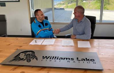
Chief Sellars signing the participation agreement with Barkerville/Osisko.
Advertisement
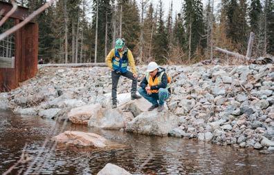
Exploratory walk around Mt. Polley.
Education/Training: In conjunction with the Northern Secwepemc te Qelmucw (NStQ)
In partnership with the NStQ, WLFN is participating in an Environmental Field Skills Development program through the Natural Resources Training Group (NRTG). A total of 6 WLFN-affiliated staff members are currently participating in the training, which is anticipated to conclude in May 2022. Once training is complete, all participants will receive their accreditation as provincially certified Applied Biology Technician, as well as their backpack electrofishing certification ticket. The training program is designed to enhance WLFN’s natural resource monitoring capacity, and to promote continued stewardship within the traditional territory.
Fraser River East Corridor Interior Douglas Fir (IDF) Landscape Planning Team: In conjunction with Esk’etemc First Nation, Stswecem’c Xget’tem First Nation, Xat ūll First Nation, and the Northern Secwepemc te Qelmucw (NStQ)
The Fraser River East Corridor IDF Landscape Planning Team consists of representatives from the Province of British Columbia, the communities of the NStQ (Stswecem’c Xget’tem First Nation, Williams Lake First Nation, and Xat ūll First Nation), and Esk’etemc First Nation. Formed in 2019, it is the team’s goal to establish a new collaborative Forest Landscape Plan for the co-management, identification, management, and protection of cultural heritage and natural resource values within WLFN, and NStQ, traditional territory. The plan will be informed both by local Indigenous knowledge and western science, with the goal of creating a forested landscape that is resilient in the face of climate change and major disturbances.
As identified by the project team, the key values being considered under the plan include: cultural heritage, fire, forage supply, forest management, grasslands, recreation, forest management, and watershed health. These key values were identified both through technical table discussions, as well as via a four-community meeting held by the planning team in February 2020 that had representatives in attendance from the Canim Lake Indian Band, Esk’etemc First Nation, the Ministry of Forests, Lands, Natural Resource Operations and Rural Development, Stswecem’c Xget’tem First Nation, Williams Lake First Nation, and Xat ūll First Nation.
After key project values were identified in 2020, the IDF Landscape Planning Team held a series of individual values workshops. Due to Covid-19 and capacity issues, these community workshops were held in a virtual format and presented to members of all NStQ communities, and Esk’etemc First Nation from Summer 2021 to Winter 2022. With the value workshops complete, the next phase of the project involves the synthesis of information learned during the workshops into usable data for incorporation into a Forest Landscape Plan model. It is anticipated that the creation of a FLP model will begin in Spring 2022.
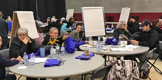
NStQ and WLFN community members participate in roundtable discussions at the February 2020 community meeting.
Northern Secwepemc te Qelmucw (NStQ) Joint Resources Committee (JRC) In conjunction with the Canim Lake Indian Band, Stswecem’c Xget’tem First Nation, Xat ūll First Nation, and the Northern Secwepemc te Qelmucw (NStQ)
Hosted through the Northern Secwepemc te Qelmucw, the JRC ensures that NStQ communities are provided with equal opportunity to work towards self-governance within the NStQ Statement of Intent (SOI) area. Committee representatives work together on issues of mutual interest, and share ideas as they pertain to the management and preservation of Natural Resources, as well as issues involving Cultural Heritage, Fisheries, and Wildlife. A technical table in nature, the JRC meets a minimum of once monthly, and must have a quorum of all NStQ communities on the line to make decisions.
During 2021, the JRC met to discuss a wide variety of natural resource management initiatives, issues, plans and projects within the NStQ SOI area. Issues discussed at the table include, but are not limited to:
» Capacity building and training; » Fisheries monitoring and survey; » Forest practices evaluation and planning programs; » Placer mines and mineral extraction; » Proposed archaeological and cultural resource management models; » Natural resource referrals portal development and training; » Species at-risk legislation and protection; » Timber Supply Area data packages and development; » Watershed health and monitoring; » Wildlife monitoring (moose, big horn sheep, salmon etc.); » Wildfire mitigation and remediation; Northern Secwepemc te Qelmucw (NStQ) Forest and Range Evaluation Program (FREP) – Cultural Heritage Resource Pilot Project: In conjunction with the Canim Lake Indian Band, Stswecem’c Xget’tem First Nation, Xat ūll First Nation, and the Northern Secwepemc te Qelmucw (NStQ)
The Forest and Range Evaluation Program (FREP) is designed to assess industry compliance with the Forest and Range Practices Act (FRPA), in accordance with 11 key values: biodiversity, cultural heritage, fish/riparian, forage and associated plant communities, recreation, resource features, soils, timber, visual quality, water, and wildlife. Through the program, each of these values are independently monitored and assessed in a post-harvest environment, after which the results are entered into the Government of British Columbia’s FREP Web Portal.
Beginning in 2019, Williams Lake First Nation, and the Northern Secwepemc te Qelmucw (NStQ), have been actively engaging with the Resource Planning and Assessment Branch (RPAB) of the Ministry of Forests, Lands, Natural Resource Operations, and Rural Development (FLNRORD) regarding the application and use of the FREP within WLFN traditional territory. Prior to the 2019, WLFN had not been included on any assessments or training within the Nation’s traditional territory – an issue that was flagged by the WLFN Natural Resources Department as being at odds with the principles set out in the United Nations Declaration on the Rights of Indigenous People (UNDRIP), and the Declaration on the Rights of Indigenous Peoples Act (DRIPA).
Since our initial 2019 engagement, WLFN and the NStQ have made great strides in the development of a collaborative relationship with the Province of British
Columbia for FREP assessments and environmental monitoring within the traditional territory. In 2021, two WLFN community members attended all FREP values training, and were present on all field assessments conducted in the territory. Training and collaboration is planned for the coming 2022 field season, with an additional 2-4 WLFN members scheduled to complete the FREP training and field program.
In addition to participation in fieldwork and data collection, WLFN has partnered with the Canim Lake Indian Band, Stswecem’c Xget’tem First Nation, Xat ūll First Nation, and the NStQ on a regional pilot project to bring FREP Cultural Heritage sampling in line with Indigenous values. As the project lead for Phase 1, WLFN is currently engaging with the other communities on how to transform the current program into an Indigenous-led exercise that promotes ethical and responsible cultural heritage and natural resource stewardship within the traditional territory. Phase 1 of the project is scheduled to conclude in March 2022, with Phase 2 projected to begin in May 2022.
Operationalization of Traditional Use Values in the Quesnel Lake Watershed – Pilot Project In conjunction with British Columbia Timber Sales (BCTS) CaribooChilcotin, and Xat ūll First Nation
First begun in response to BCTS proposed timber harvest blocks in the Quesnel Lake area in 2018 , the pilot project began as a collaborative undertaking between British Columbia Timber Sales and the Northern Secwepemc te Qelmucw. As of 2022, the Quesnel Lake Watershed pilot project has evolved into a collaborative project between BCTS, WLFN, and Xat ūll. The goal of the project is to best determine how to digitize, incorporate, and spatialize Indigenous traditional knowledge for application to forest tenure management planning.
Initial project planning included the identification of Indigenous traditional use values in the Quesnel Lake area, including: camping, hunting, medicine/plant collection, sacred/spiritual use, and trails. Following the identification of these values, Elders from both WLFN and XFN participated in a field tour of the proposed forestry harvest development to identify traditional use resources at each location. Although Covid-19 delayed the development of the pilot project in 2020 and 2021, the project has been renewed with a project-specific steering committee as of Spring 2022. Planned activities for the coming year include digitizing TUS data obtained in-field, collaborative forest planning meetings, and meaningful referrals engagement and discussion between parties. Ultimately, it is the goal of the project to ensure that WLFN’s archaeological, cultural, and traditional resources are adequately managed and projected within the traditional territory.

WLFN STEWARDSHIP FORESTER
Forestry and Wildlife projects.
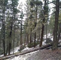
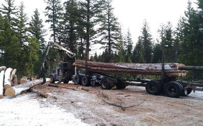
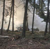
IDF Revitalization Blocks Williams Lake First Nation has been leading in Interior Douglas-fir management. Many of the stands around Williams Lake are very dense and have too much competition for growing space, nutrients and water. The result are areas that are very susceptible catastrophic fire and forest pests such as Douglas-fir bark beetle. Williams Lake First Nation has started treating these stands on a forest landscape level with the objective of improving stand health, increasing biodiversity, reducing risk of catastrophic wildfire, and reducing our carbon footprint. These projects also create employment for the community. The last component of the treatments is an understorey burn which will further reduce the fine fuels and helps return nutrients to the soil. We have started treatments on two blocks, one at Bond Lake and one by the racetrack and SPCA. Williams Lake First Nation (at the Bond Lake Block) was featured in the Documentary “Capturing Carbon” that was filmed by Forestry For The Future. These blocks total 304.7ha of area treated forest near Williams Lake. We are continuing to develop these blocks to improve the Interior Douglas-fir landscape.
Fuel Management Williams Lake First Nation and Borland Creek Logging has been very active in Fuel Management around town. We were involved with projects on the community forest, at the airport, river valley, Fox Mountain, South Lakeside, Dog Creek, Bond Lake, Racetrack and on some woodlots. This is very labor-intensive work but rewarding as it helps to make our community safer. Beetle Management Unit Williams Lake First Nation has been actively managing Douglas-fir Bark Beetle for the past two years. The process starts in July when the Ministry of Forest flys the region marking on a map where red trees are seen. We then will go look at these sites on the ground and determine if there is beetle in the area and the best management for each site. These sites all have to be visited, developed and treated before mid march, which is a fast timeline. Last year we salvaged approximately 9000m3 of bark beetle infested trees. Beetle infestations have decreased greatly this year which shows our management is affective.
Fuel Management
Beetle Management Unit


