14 minute read
SRTS Planning Process


SRTS Overall Vision
Perham envisions a community connected by trails and sidewalks. Through the use of safety improvements, infrastructure, and education we will strive to increase the number of students walking and biking to school. We realize that by providing students a safe opportunity to walk/ bike to school we are helping to instill positive habits and create a culture of walking/ biking not just in schools, but also to help foster a healthy lifestyle of Perham residents.
SRTS Overall Goals
1) Recommendations for infrastructure solutions that will provide a safe route for walking and biking from the north end of town to the south end of town- allowing safe navigation through the perceived danger zones, i.e. crossing the railroad tracks, Main Street, and crossing 3rd Avenue (“Hwy 78”) 2) Explore development/expansion or walking/biking trails that connect school and after school activities; i.e. Boys and Girls Club and Perham Community Center (PACC). Longrange plan needed regarding sidewalk installation, up keep and expansion. 3) Recommendations regarding changes needed in bus and family vehicle drop off spots that will promote a safer environment for bike and pedestrian traffic. 4) Leverage community assets to help accomplish our goals 5) Increase education and encouragement to create a culture that supports walking and biking to school 6) Recommendations for effective bike and pedestrian ordinances and policies 7) Create a plan for improving infrastructure (such as sidewalks, trails, and crosswalks) to help foster to safety and mobility of students and community members
Planning Process – Kick-off Meeting
On Monday October 1st, 2012 a Kick-off Meeting was held. It was attended by 15 persons who form the core of the Safe Routes Planning Team. At this meeting the team discussed the purpose of Safe Routes to School, shared strengths and discussed initial issues, and identified some “quick wins”
Strengths/ Opportunities New Interchange has improved safety- fewer trucks going through town Active service clubs Cooperative bus company Innovative thinking by community leaders Lots of different opportunities for the kids Downtown is walkable- can build off this shopper/visitor traffic Considering a Complete Streets Policy Capitalize on wide streets/existing infrastructure
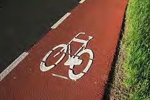
Active stakeholders Lots of Jobs in town-more jobs then residents Railroad keeps the town grid system intact In town residentially located school Walk to school day is observed Bike safety program/Bike rodeo held yearly City is proactive with bike trails -New trail on CR34 -Wildflower trail -Cal Miller bike route Healthy living activities in school School wellness committee Good infrastructure in many places -Could build additional connections PACC and the Boys/Girls Club
Concerns/ Issues Making existing routes safer -Specific examples of streets were given Lots of kids on other side of road and railroad from school -need safe crossing -perception and reality -lack of safe crossing points Large geography for school district- up to 30miles away Lack of continuous sidewalk- especially near school Parental Concerns about walking/biking to school Some kids cross busy streets Lots of commercial traffic Separate bike routes from driving routes/barriers 4 way stop (9th and 2nd Ave SW) Culture isn’t conscious of pedestrians Cars passing on right (especially at intersections) Pedestrian education Additional entrance on Fox could separate vehicles and bikes/peds Lack of funding
Quick Wins Identify and apply for infrastructure project Annual bike rodeo in May Contest x versus x (An example would be school versus school, or 5th versus 6th grade) Walking school bus International walk to school day (being observed) Add bike racks
Pass Complete Streets Policy Education -Pedestrian and bike safety
Planning Process – School Observation
School observation was held on Thursday Oct 11th, 2012. On this day volunteers observed students arriving to all four schools in the morning and leaving in the afternoon. Volunteers were placed at several locations around all of the schools in order to observe students who were truly walking and biking to school and not just walking to or from a vehicle. The conditions on this day, according to weather.com were partly sunny with a high of 50 F and a Low of 21F.
Observations at Heart of the Lakes Elementary. Heart of the Lakes Elementary had the largest number of walkers and bikers. There were some conflicts reported from parents about the parent drop-off/pick-up loop. However, on this day the presence of multiple adults in bright green safety vests certainly influenced the situation. Students who might otherwise have cut between vehicles followed the sidewalks to the corner and made perfect right turns. Understanding this we rely on parent testimony as well as our own knowledge of how kids are likely to behave. With this in mind the safety of the parent drop-off and pick-up loop is recommended to be improved. Making it one direction would help as well as making sure parents assist children so that they do not cut in front of vehicles. A large number of walkers was observed crossing at the edge of the parking lot (to where to bike rack is) and going up past the bike rack area to 2nd Avenue, from there they mostly continued down 2nd Avenue. Some walkers also used a trail that comes out towards the back of school unto 9th St SW. Although this path will no longer be available due to new construction. This is being addressed as part of the SRTS infrastructure grant that was submitted February 15th.
The most surprising thing that was observed at Heart of the Lakes was the crossing of children from the school across 2nd Avenue to get to the Perham Area Community Center (PACC). This is a favorite after school location and roughly 80 students crossed the road at this location. It was observed that parents were parking with in feet of the crosswalk and severely obstructing the views of on-coming traffic to see the children crossing, and of the children to see the on-coming traffic. In addition to parent traffic, the entrance and exit for the bus chute is located very close to the crosswalk, increasing the conflicts at this location. Pending additional improvements it was recommended that a no parking zone be implemented on either side of the cross walk to improve visibility. It was also recommended that an engineering solution such as bulb-outs be installed as soon as practicable. This is being addressed in the SRTS infrastructure grant that is attached to this plan. It should also be noted that the efforts of SRTS to get kids walking and biking to school will also help improve this situation because a large portion of the “on-coming” traffic is in fact parents who are picking-up/dropping-off their children.
Observations at Prairie Wind Middle School. At Prairie Wind no walkers or bikers were observed. The SRTS team extrapolated that this was due to its location. It could also be that walkers came past the elementary school, and could not be discerned from students being bussed in or dropped off. Overall, Prairie Wind is a more challenging location to walk or bike to for children,
unless they come via the elementary school. This is because the majority of the neighborhoods are not located in close proximity to the Prairie Wind Middle School and to get to the school via the majority of 2nd street and Coney Street is not something that is safe or enjoyable for students at this time.
Observations at St. Paul’s Lutheran School. At St. Paul’s 3 children were observed walking; they cut across the grass from the school to 7th St SW. They then crossed the road at the tintersection of 7th St. SW and 6th Ave SW. This intersection currently has no cross walk and it would be recommended that they be added at this location. There are also several partial sidewalks around this location, however nothing that would lead children from school to another location. Once they crossed these students walked in the street along 7th St. SW. The drop-off and pick-up of students appears to be relatively free of conflicts. For the purposes of Safe Routes to School no immediate changes to the pick-up/drop-off procedure are recommended, other than to continue to observe and make changes where needed.
Observations at St. Henry’s Catholic School. On the day of the observation the majority of the school’s 95 students were dropped off with cars parking along 2nd street and then taking 3rd avenue to leave. Over this observation period 2 students were observed walking to school; one was accompanied by a parent. Other possible conflicts included a number of rolling stops at the corner of 2nd street and 3rd avenue. Also parents backing out of parking spaces are not only in the way of busses but the action of backing up inherently creates additional risk. However, their current conditions do include a school patrol to make sure students crossing the road do so safely. There are also many sidewalks in this area because of it’s proximity to downtown. The entire school block has sidewalk around it and many of the connecting streets have sidewalk as well.
Data collection Process
One of the important steps in this process was getting input from parents about the concerns or barriers they saw that needed to be addressed to help encourage kids walking and biking to school. To do this a survey was sent home with students in Grades k-8. In the case of St. Henry’s and St. Paul’s grades k-6 were targeted because they do not serve children older then that. In addition we also asked teachers to conduct a “tally survey” using the form provided on the National Safe Routes to School Website. For the tally survey students were asked to raise their hand indicating how they arrived and departed from school each day. A total of 3 consecutive days was preferred; however the majority of the teachers completed it over a 2 consecutive day period. A summary of the results is located in the Findings and Data Subsection below, as well as a complete report of the data located in the Attachments section.
Crash and Ticket Data
Safe Routes to School is about more than just building new sidewalks. We wanted to look into the current safety conditions for pedestrians and bicyclists within the City of Perham. Chief of Police Jason Hoaby provided our team with data regarding accidents and police service calls
from 1/1/2011 to 12/31/2011. There were no fatalities due to accidents in the City of Perham during this period, but police noted 54 calls related to accidents culminating in property damage, 11 accidents with personal injury, and 7 reports of hit and run. Additional data was not available from 2011-2012 but a pedestrian death was confirmed in December 2012. This was a result of a pedestrian trying to cross the road in an area without a crosswalk at the 100 block of West Main Street. He was hit by an oncoming vehicle. Accounts state that weather conditions that day were favorable with clear roads, clear skies, and high visibility.
Mark Fenton Visit
As part of the Safe Routes to School planning initiative in the State of Minnesota several state agencies arranged for national walking and active living expert Mark Fenton to visit the area and speak on the topic of Safe Routes to School. West Central Initiative chose to host him in Battle Lake. As part of his visit Mr. Fenton hosted a 2-day workshop at the school in Battle Lake. While the first day of the workshop consisted of a walking audit specifically focused on Battle Lake, day two was open to the public and those in attendance discussed why SRTS is important. Ideas discussed ranged from healthy living to community connections. The day ended with ideas being brainstormed for next steps in the Safe Routes process. A team from Perham attended the meeting and participated in the brainstorming session. The notes from this brainstorming session, provided by Mark Fenton along with Jill Chamberlin from Blue Cross/Blue Shield of Minnesota, are as follows: 1) Big issue is Main Street and high frequency rail. Lots of development on one side of town, and school on the other. 2) Engineering: Really need overpass or underpass to cross 3) Encouragement: Have a challenging horseshoe driveway with tons of messy traffic. a. Goal: Create a remote pick-up/drop-off area on Coney street to create 5 minute walk b. Do a trial remote drop-off for a week, then do a focus group with the students to learn what they liked, what could be better c. Community planning workshop, with full 5E plan (engineering, education, encouragement, enforcement, evaluation) d. Submit infrastructure grant application to build remote drop.
Team Meetings
Throughout this process, Safe Routes to School team meetings were held on a nearly monthly basis. The input of the team was paramount in the formation of this plan. At the meetings the team discussed visioning, proposed projects, next steps, and priorities for Safe Routes to School in the community of Perham.
Community Meeting
On Wednesday February 6th, 2013 a SRTS community input meeting was held. The purpose of this meeting was to receive community input related to the SRTS planning effort and hear what types of improvements residents of Perham would like to see made. At this meeting a short presentation was given explaining Safe Routes to School and the participants were divided into small groups, each with a map, to discuss the strengths, weaknesses, opportunities and challenges that they saw in Perham. Here is the feedback that was received at the meeting; 18 were in attendance.
As part of this meeting the 2013 proposal for the Safe Routes to School Infrastructure Grant solicitation was presented for public comment. Below is a map of proposed project, see the attachment for the grant application. There was 100% support shown at the meeting for this project with many favorable comments and no one voicing opposition.
The following page contains the notes from the Public meeting
SAFE ROUTES TO SCHOOL PERHAM COMMUNITY MEETING February 6, 2013
The group likes the current (2013) plan for the infrastructure grant.
Challenges Need a safe way from north to south Railroad tracks-in center of town; no right-of-way for separate grade Intersections o Crossing Main Street and County Hwy 51 o lack of crossing at 3rd other than at signals o Limited crossings with signals o Pedestrian fatality on Main Street this past December; lack of use of crossings at intersections o County 80/34 intersection-dangerous/high traffic; wide intersection/close to railroad crossing o No stop or yield signs Industry Lack of sidewalks, city-wide Some increased hospital traffic Industrial traffic, trucks Speed of traffic; young drivers at high school Lots of county highways/high traffic, speed West Wind neighborhood; Prairie Acres: lots of kids, growth area Funding: cost of sidewalk installation Snow removal on sidewalks is somewhat a problem Maintenance of sidewalks Want crossing guards; St. Henry’s has them Walking vs. school bus
Strengths In general, good path system; Trails and routes that we have: Coney Street Trail, Arvig, Cal Miller Bike Path o New bike path on 34; plan to extend down Coney Street o Future connection to Hospital park Wide streets Wide right-of-way; room to add facilities within right-of-way Schools located in close proximity; on same side of tracks, close to residential areas Athletic fields are also in close proximity PACC is close to schools for travel to/from

Education Traffic needs to learn to stop for pedestrians; pedestrians to use sidewalks, crossings We seem addicted to our vehicles-how do we change the culture? How do we reverse the “Jacob Wetterling” scare? According to the parent surveys, 16% listed crime as a deterrent to allowing children to bike or walk to school. There has been some increase in bikers in Arvig Park and others but not enough around town and to school. Education in schools
Opportunities More paved paths Opportunity when streets are rebuilt to add sidewalks Improve Main Street crossing-maybe do bump outs Pedestrian crossings at all railroad crossings Uncontrolled intersections Wide streets; room in right-of-way New development near school o Could tie in o Make more ped/bike friendly Land available near middle school for possible future high school Trail to PAC Establish a corridor to school Need updated map system of the bike trails Create a large public display of the map Smaller maps at the Chamber Give out prize coupons to people walking and biking Weekly newspaper info about pedestrian/biking information Make path to PACC curve easier for bikes; not a 90◦ angle. The new development will be able to use the infrastructure.