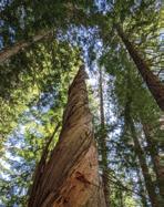
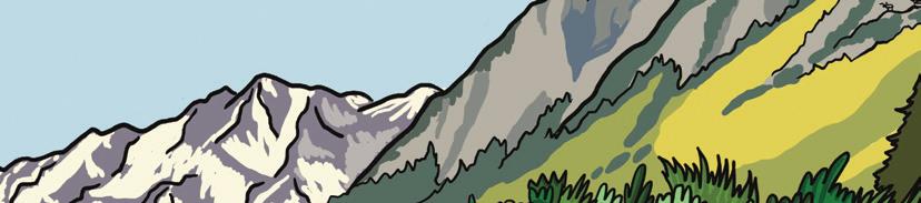
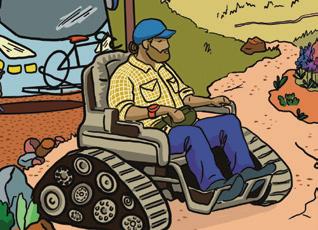
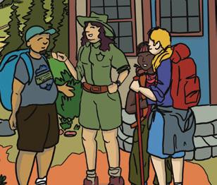
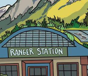
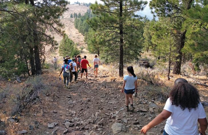
Celebrate Washington Trails Day with a game of bingo. Complete any five consecutive squares (row, column or diagonal) to get a bingo. Use the QR code or wta.org/bingo to submit your card by June 30 for a chance to win trail-themed prizes.
washington trails day
Sign up for Trail News, wta.org/ trailnews
Read a WTA blog post, wta.org/ signpost
Stay on trail
Pick up litter
Hike a trail WTA worked on (Hint: Visit the Hiking Guide!)
Sign up for a free My Backpack account at wta.org
Hike with all the Ten Essentials
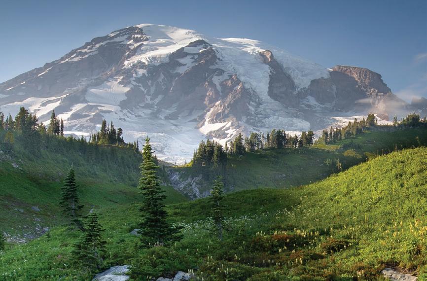
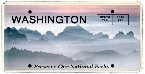
Visit a national park
Hike with family
Recall a memorable time outdoors with a loved one
Take a photo of something in nature that brings you joy
Hug a tree
Get a treat in a trail town Wish someone a “Happy Washington Trails Day”
Check the weather before your hike
PLAY WASHINGTON TRAILS DAY BINGO!
Sign up for action alerts, wta.org/tan or tell a friend
Visit a city park
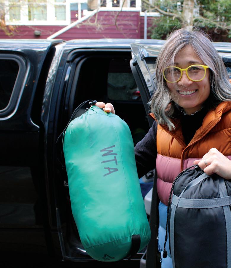
Carpool to a trailhead
Read and/or post a trip report
Pause and listen to the birds
Learn a new hiking skill
Visit a state park
Hike with a friend
Post about #WATrails Day2026
Washington Trails Day June 27, 2026 — is a state holiday to celebrate the many trails that connect us to Washington’s outdoors. From city neighborhoods to the backcountry, trails benefit our health, support local economies and help protect the landscapes they pass through. Thanks, trails!
Join Us As We Dream Big
This month, we celebrate Washington Trails Day with hikers across the state. As summer arrives in the Pacific Northwest, it’s an opportunity to come together and show our appreciation for the trails that connect us to the beauty of the outdoors and to trails that matter to us, to our communities and to our state as a whole.
We have an unique opportunity here in Washington to create a new approach to sustaining trails and public lands. We know our state has a powerful trail community. We’ve seen hikers step up, over and over again, to defend trails and wild spaces — including last year when public lands and the agencies who care for them faced unprecedented challenges. The threats to public lands are real, but, as a community, we know we can face them.
One of WTA’s priorities in the coming years is to help build a broader outdoors movement in Washington. This means coming together to find better, more sustainable ways to fund public lands. It means expanding the work we’ve done in areas like Snoquera, near Mount Rainier, and on the Mountain Loop Highway to invest in trails at the landscape level. And it means helping more people understand how trails are essential not only for recreation but for public health, climate resilience and Washington’s economy.
As we celebrate 60 years of WTA, and look ahead to the
next 60 years, we’ve been dreaming about what trails could look like in 2086. We share that hopeful vision — one where trails are accessible, sustainable and welcoming to everyone — in our story on page 10.
As a member, you’re already helping us make that future a reality. Your support powers our work, and powers the broader outdoors movement. We hope these stories inspire you to find new ways to get involved. Maybe that means joining a trail work party for the first (or second, or 60th) time. Maybe that means writing a letter to your representatives, telling them what trails mean to you and encouraging them to protect public lands. If you work with youth, maybe it means joining an Outdoor Leadership Training workshop and learning how to get outside with kids. (Read about one leader’s journey with WTA on page 22.)
If you want more ideas of how to get outside and care for trails, take a look at the bingo card on the facing page. We hope it encourages you to try something new or meaningful this summer!
Jessi Loerch | Washington Trails editor | jessi@wta.org
by
Photo
Colton Miller
As we look out to the future, we see a bright future for trails and public lands.
Features
Cover story
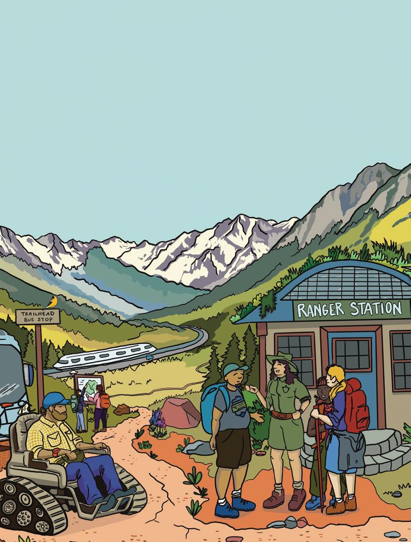
60 years from now
This vision of public lands in 2086 is speculative fiction — for now. There’s work to be done, but we see a path to this bright future.
By Linnea Atherly
2 towns tied to trails
How these communities thrive — and struggle — alongside nearby public lands.
By Melani Baker
On the cover 16
Getting youth outside
How WTA and community partners are empowering adults to inspire the next generation of outdoor enthusiasts.
By Erin McQuin
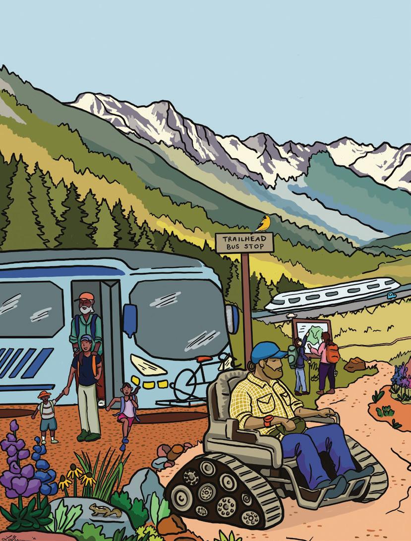
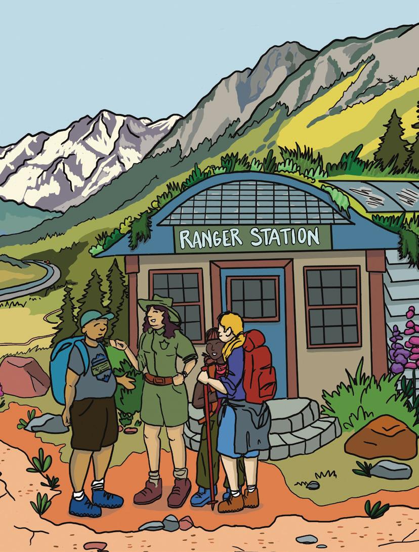
Artist Latasha Greene, jitterbugart.com, created this stunning illustration of our vision for the future of trails.
Photos by Lee Wang, Tim Benjamin, Vanessa Story
Washington
Online to on trail
How a request for a hiking buddy on social media sparked a nearly decade-long friendship.
By Tiffany Chou
8
When a tree falls in the woods ...
How to stay safe around trees when it’s windy in the backcountry.
By Loren Drummond
28
Growing up as a trip reporter
By Terrence Digel
Stunning
Some of our judge’s favorites from last year’s photo contest.
Lighten up
How to balance safety, comfort and weight when you’re preparing for a backpacking trip.
By Sandra Saathoff
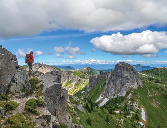
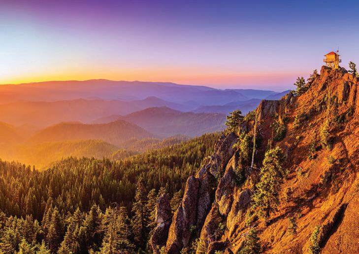
Long days ... ... mean more time for hiking! We have hike suggestions to help you make the most of summer.
Summer 2026 | Volume 61, Issue 2
Washington Trails (ISSN 1534-6366) is published four times per year by Washington Trails Association, 705 2nd Avenue, Suite 300, Seattle, WA 98104. An annual subscription for a physical copy of Washington Trails magazine is $20. Single copy price is $4.50. Periodicals postage paid at Seattle, WA, and at additional mailing locations.
POSTMASTER: Send address changes to Washington Trails Association, 705 2nd Ave., Suite 300, Seattle, WA 98104.
WTA was founded by Louise B. Marshall (1915–2005). Ira Spring (1918–2003) was its primary supporter. Greg Ball (1944–2004) founded the volunteer trail maintenance program. Their spirit continues today through contributions from thousands of WTA members and volunteers.
A Publication of Washington Trails Association
Washington Trails Association is a nonprofit supported by hikers like you. We connect people to the outdoors and are building a community that gives back to trails and public lands. Trails for everyone, forever.®
Trail team | Joseph Gonzalez, Susan Saul, Holly Weiler
Washington Trails Association
General information | wta@wta.org
Membership & donations | membership@wta.org
Editorial submissions | jessi@wta.org
Phone | 206-625-1367
Website | wta.org
Perspectives
A New Hiking Buddy
Making new friends can be hard in the city, but hiking brings people together. By Tiffany Chou
It was an ordinary Tuesday in May of 2018.
I had moved to Seattle a couple of years prior and fallen in love with hiking, often going solo. I was newer to hiking and my friends weren’t too interested.
I was browsing Facebook, where I followed more hiking groups than people. I used the groups along with sites like wta.org for hiking inspiration. One post caught my eye:
“I’m going to head out to Enchanted Valley this weekend and my friend bailed. Anyone want to join me?”
What luck! I’d been seeking new hiking friends — backpacking companions specifically — because I was new to it. I didn’t even have a tent; I’d shared one with folks the few times I’d gone. And I hadn’t yet explored the Olympic peninsula!
But also, what a bummer … I was a software engineer at the time and on call, so I needed to have internet 24/7. I couldn’t exactly head 14 miles into the Olympic backcountry.
I left a comment on the post, asking the poster to let me know “if you’re ever looking for a backpacking buddy another weekend.”
“I’ll keep you in mind for future trips!” was the reply. “If you want, message me, and we can stay connected.”
You have one new message
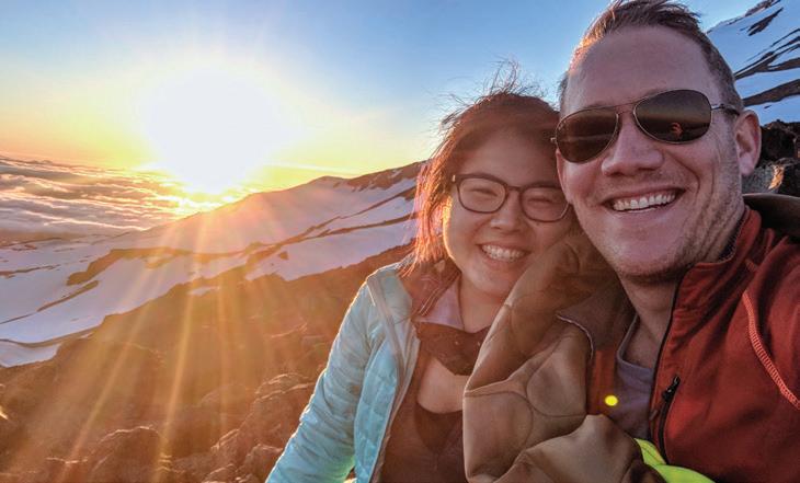
A few weeks later, Matt messaged, asking if I’d want to summit Mount Adams. I immediately said yes. Although I’d never done a hike this hard, Matt had just climbed Adams the previous month. His knowledge of the trail made me feel more comfortable attempting it.
Arguably, when making new friends, it’s good to hedge your bets and try to make your first outing a low-stakes activity, in case things don’t go well.
Instead, Matt and I decided to make a whole 3-day, 2-night trip out of it. We did met up before the trip to make sure the other person was a) real, and b) who they said they were.
We left Seattle Friday evening and drove to an Airbnb near Trout Lake to be near the trailhead for a Saturday start. We bonded while we discussed rough days at work and how much we loved hiking.
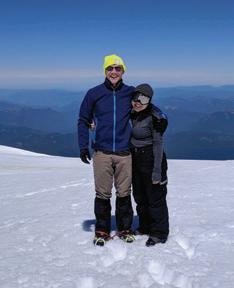
Tiffany and Matt on their first trip together, when they summited Mount Adams.
I could hardly sleep that night from excitement and anxiety. This was going to be tough, but I was glad to have a new friend to do it with.
A brutal climb
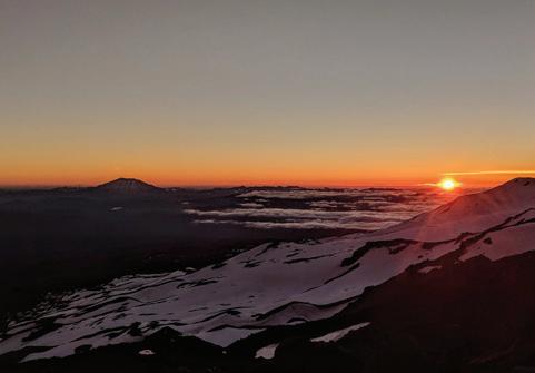
We spent the first day hiking/slogging up to the halfway point — Lunch Counter — where we made camp and watched a vivid sunset above Mount St. Helens while we ate dinner. We went to bed soon after so we could get an early start.
The next day was the hard(er) part. I’d never hiked that high up, and the altitude took it out of me. The climb from Lunch Counter to Pikers Peak, Mount Adams’ infamous false summit, is unrelenting, and from there, there’s still another mile to go.
Matt was a faster hiker than me, and I told him to go ahead; I’d catch up. When I got close to the summit, I saw him lying in the snow.
“What are you doing?” I asked.
“I was waiting for you!” he said. “I wanted to summit together.”
On top of the world
We took the final steps together. It was tough to breathe, largely because we were at 12,000 feet — higher than I’d ever been! — and partially because we both burst into tears upon seeing Mount Rainier from the summit.
(Our glasses were apparently well-tinted because someone asked us to take their picture a few seconds later.)
We stayed at the summit for a while, which was quiet since it was later in the day. Quiet, beautiful and magical.
The climb was type 2 fun, but the descent was pure type 1. Matt helped me get the hang of glissading, so we slid back to camp. It took us hours to summit, but merely an hour to return to camp. We packed up and made our way back to the trailhead.
Changed hikers, same friends
In the years following, Matt and I have done everything from full-day excursions to low-key urban treks. We’ve climbed up Aasgard Pass and descended the same day (much cursing was done). We’ve climbed Mount
St. Helens together twice: once in summer, once in winter. We were lucky enough to enjoy a full rainbow at Rattlesnake Ledge on a post-work hike.
Today, we catch up regularly. We’re not the same hikers we were in 2018 — ones that hike twice a weekend and most days after work. Now, we more often do brunch than scale mountains. We talk about how much we enjoy our jobs (not the case when we met) and share silly pictures of our cats.
But it was trails and mountains that sparked our friendship. And our shared love of the outdoors still comes up — Matt sends me his
favorite shots from his wildlife photography (especially owls!) and we sometimes go for an urban Seattle walk.
Who would’ve thought a simple 19-word online post would bring the two of us so many unforgettable memories over 8 years of friendship?
Here’s to the next 8 (and beyond)!
Looking for friends to hike with but not sure where to start? Check out our list of hiking groups and resources: wta.org/hikinggroups.
Photos courtesy Tiffany Chou and by Vince Rhodes
Tiffany and Matt still catch up regularly, but it’s more often in town than on top of a mountain.
When a Tree Falls in the Woods
How to gauge the danger from wind when you’re hiking or backpacking. By
Loren Drummond
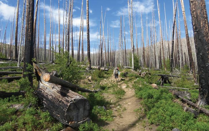
Have you ever approached an old wildfire scar and hesitated before stepping out among the standing snags? You’re not wrong to take a moment of caution on the threshold. And that goes double if the wind has picked up.
It’s incredibly unlikely that a branch or tree will fall on you while you hike. If one does, however, the consequences could be quite serious. If you know the factors that make trees a risk and attune your senses to wind speeds, you can mitigate the danger. Because if a tree falls in the woods, you don’t want to be anywhere near it.
A growing risk
We’re entering peak hiking season in the midst of drought and several years of record-breaking temperatures. Scientists who pay close attention to how our forests are holding up in a changing climate agree that Pacific Northwest trees are stressed.
Old, fire-damaged or sick trees are more likely to become what are
known as hazard trees — those that could fall or drop branches and injure someone. In windy conditions, hazard trees are the primary thing for hikers to watch out for. Complicating things, there are fewer people on the ground studying, inspecting and removing hazard trees after decades of defunding and massive cuts to staff on national public lands by the federal government.
When to worry about wind
A steady breeze can keep black flies at bay, cool your neck on a blazing day or carry the heady scent of sun-warmed pine across a meadow. Wind turns from trail friend to foe when the speed picks up, bringing down dead or weak branches, or even entire trees. Unless you hike with a wind gauge, you’ll have to use other clues to know when to be alert.
• Once the wind starts picking up small branches, you’re looking at wind speeds of 13–18 miles an hour, which is strong enough that you
Trees damaged by fire are more of a risk in high winds. As climate change increases the severity of fires, it will be an increasing issue for hikers.
should move away from dead trees and falling rocks and wait for the wind to subside.
• Once fresh branches start breaking and you can press your whole body into a wind, you’re talking about wind speeds between 19–25+ miles an hour. If branches are coming down around you, it’s time to clear out.
“Stay out of the forest when there are strong winds that could blow down trees. If you are already in the forest when winds kick up, head to a clearing out of reach of any potential falling trees,” advises the Forest Service.
Assess and prevent risk
Check forecasts: Go beyond the risk of rain and pay attention to wind speeds and prevailing directions. Be aware of high winds or strong gusts. Winds blowing in directions that aren’t typical can stress trees used to growing in one direction.
Read the terrain: Wind can be highly localized, so expect stronger winds in landscapes that funnel it — think valleys, mountain passes or narrow river gorges — even when
there are no storms in the forecast. Steep ridges and coastal shorelines, where airflow makes sudden changes, also create wind.
Learn to spot dead trees: While your eye may be drawn to the towering majesty of a healthy western red cedar, it pays to notice where the dead or sick trees are when you pause on trail or set up a tent. Avoid dense patches of dead trees, and be on alert near trees with cracks or splits in the trunk.
“Trees without needles, bark or limbs may indicate structural defects. Trees with conks, broken tops, basal scars, numerous downed limbs, ants or an abundance of woodpecker holes may have internal rot,” according to the Forest Service. Be especially wary of dead branches high in a tree’s crown; they can fall without warning.
How old is that wildfire scar? Besides feeling a little spooky, newer burns contain plenty of hazards. But in older burns, where the tree roots and structures have rotted away, a lot of trees will start to come down 6 or 7 years after a burn.
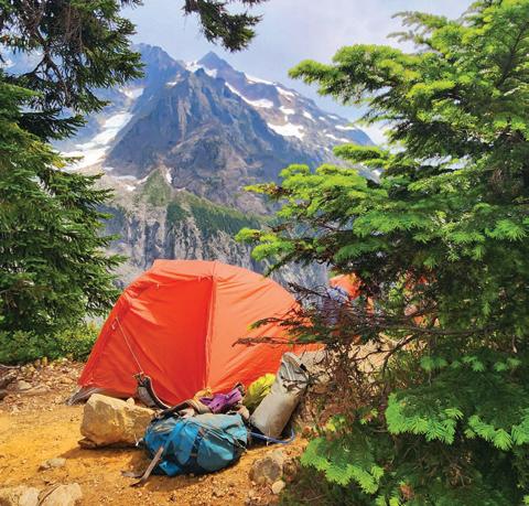
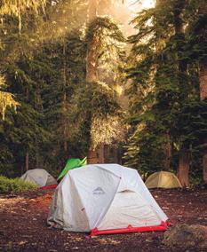
Before picking a campsite, take a moment to look for trees that could be hazardous.
How intensely managed is the space you are hiking? In places where a lot of people spend a lot of time — think established campgrounds or picnic areas in state or national parks — agency staff are more likely to regularly inspect and take care of hazard trees. However, hikers shouldn’t expect that hazard trees have been inspected or removed along wilderness or backcountry trails, even in more intensely managed lands like national parks. “Visitors are expected to know that they are responsible for their safety in such areas,” according to the National Park Service guidelines for tree removal.
Look up! When you pause for a snack or a picnic, glance up before settling down. When placing a tent, look up and see if there are any hanging branches or dead trees around you, especially if the wind is blowing. This kind of situational awareness is safety rule number one for trail maintenance crews, and building it into your hiking habits can keep you safer.
Photos by Susan Kostick, Kim Levin, Joshua Fawcett
What’s Possible What’s Possible What’s Possible
Illustration by Latasha Greene
A story from 2086 by Linnea Atherly
If we get it right together, what could trails and public lands be like in another 60 years?
Your alarm, Your alarm,
a gentle piano melody, emanates from your comms terminal and signals you that it’s time to wake up. You open your eyes and see the faint pink glow of sunrise around your curtains.
“What time is it?” you grumble, half asleep. Your comms terminal projects a holographic clock, calendar and weather report, and speaks to you in a friendly voice.
“Good morning! The time is 06:20. Today is Saturday, June 15, 2086. The current temperature is 20°C, with clear skies. You will be glad to hear the first and only item on your calendar today: Hiking.”
Glad is right! Buoyed by the prospect of forest air, sunshine and hours of conversation with a good friend, you spring into action. You layer up, grab the travel mug of coffee already brewed for you based on your wake-up time, swing your prepacked day pack over your shoulder and head out the door.
The nearest stop for the free trailhead shuttle is a quick walk from your place and you enjoy the smell of pastries from the neighborhood bakery as you stroll. Your hiking companion approaches from the opposite direction, and you chuckle as you do the awkward dance of waving to each other until you’re in hugging range. Perfect timing — the shuttle stop screen says your ride will arrive in 4 minutes.
You’re already deep in conversation with your friend when the silent electric shuttle bus nearly sneaks up on you. You find a seat and take your comms terminal out of your pocket. It projects a holographic map of the shuttle route, complete with links to each trail’s entry in Washington Trails Association’s Hiking Guide. You tap your chosen hike and the projection shows a video that the most recent trip reporter took at the summit.
“This is where we’re going,” you tell your friend, who grins with anticipation.
A voice on the speaker says, “Thank you for choosing Washington Trailhead Shuttles, putting the outdoors in
reach for over 40 years. We’re here because people like you spoke up to say that access to trails is essential and shouldn’t depend on owning a car. Thanks to riders like you, car traffic to trails across the state has been lowered by half. Welcome aboard.”
You’re heading to a popular mountain trail you’ve hiked before. It’s beloved for a reason — it winds through dense forest and ends with a sweeping view. Your friend had requested “a half-day hike with mountain views,” so like most hikers, you searched WTA’s Hiking Guide and checked out recent video trip reports on your virtual reality goggles to find the perfect match.
The shuttle zooms to the trailhead in less than 30 minutes, thanks to a bus-only lane, then arcs into its dedicated spot in the parking lot. There’s plenty of space for personal vehicles, but shuttle use is such a norm that less than half of the lot is full. A multigenerational family with large backpacks hops off the bus and into a smaller shuttle van, destined for a multiday backcountry adventure. A nimble, all-terrain backpack bot carries the grandparents’ gear.
As you hop off the bus, you see hikers of all different ages, genders, races and body types chatting and lacing up their boots. The energy is so welcoming and fun that you can’t help but smile. The positive, supportive culture among
hikers is a big reason why you love getting outside, and one of the reasons you love to introduce friends to new trails. You use one of the five self-cleaning, individual restrooms. Thanks to the year-round force of maintenance rangers, it’s always stocked — not only with soap and toilet paper, but also with free sunscreen and smell-proof, compostable bags for packing out dog waste and trash.
This trail, This trail,
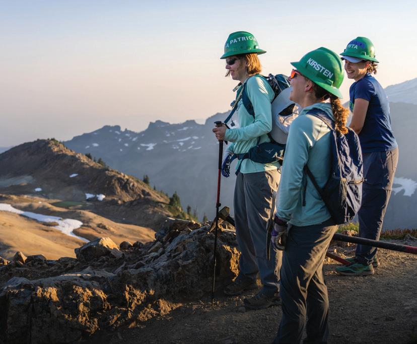
like most popular trails, has a ranger station that’s occupied from sunup to sundown. Rangers offer hiking advice, old-fashioned paper maps and information on local flora and fauna. Plus, you can borrow a bear canister, GPS, portable charger or all-terrain wheelchair for free. Today, the ranger is joined by a WTA ambassador, also a familiar presence since volunteering in the outdoors is among the most popular forms of community service in the state. On busy summer weekends like this one, ambassadors join rangers in answering questions and helping hikers prepare for a great day on trail. Some days, they wear a classic green hard hat, one of the antique models without built-in AC or a two-way radio.
A ranger tips her broad-brimmed hat, greets you with a warm smile and asks if you’d like to add your names to the trailhead register. It’s optional, but you always opt to log your presence in case emergency responders need to find
you. With a quick tap of your hand terminal, the station logs your information and the time you started your hike.
“You chose a special day to go for a hike. Did you know it’s Washington Trails Day?” the ambassador says.
“Oh, cool! That sounds like my kind of holiday. But … what is it?” you ask, curiosity piqued.
“For over 70 years, it’s been proclaimed by the governor as a day to celebrate our state’s trails,” the ambassador says.
“And this year, we’re also celebrating the 120th anniversary of our friends at Washington Trails Association!” the ranger chimes in, smiling as she gestures to her colleague. She turns her attention to help another hiker.
“Wow! 120 years? I use their Trailblazer app on my comms terminal all the time but didn’t realize WTA had been around for so long. I bet things were a lot different back then,” you say.
The ambassador leans in, eager to chat with curious hikers.
“That’s for sure. WTA was founded in 1966 by Louise Marshall as a publication called Signpost. The trip reports we use now started out as part of this newsletter, which Louise wrote on a typewriter,” the ambassador says.
“A typewriter! My grandpa had one in his basement — but he always told me he hadn’t seen anyone use it since his grandfather,” you laugh.
“That wasn’t the only thing that was different! It’s hard to imagine now, but back in the day, public lands agencies didn’t have the funding they needed. Access to nature wasn’t seen as the essential public good we now know it to be. Hikers had to pay for passes, and still, there were barely enough resources for essential repairs — let alone the annual maintenance trails receive nowadays. WTA trail crews helped bridge the gap, but by the mid-2020s, disastrous budget and staffing cuts had put agencies like this one in pretty dire straits,” the ambassador sighed with dismay.
“Wow. I remember learning about that era in history class, but didn’t realize it had been that bleak for the trails. How did we get from there to here?” your friend asks.
“I know, right? In short, it took ‘people power’,” says the ambassador, gesturing to you and your friend.
“As more folks fell in love with the outdoors, they were inspired to protect public lands and spoke up in numbers that couldn’t be ignored. WTA and a coalition of outdoor groups came together to make sure people’s voices were heard loud and clear. Seeing that Washington’s landscapes helped them recruit top talent, even corporations began to push for better funding,” the ambassador smiles.
“Yessss!” you say, almost involuntarily, pumping your fist once in the air.
“Did it work? It seems like it worked!” your friend says, looking around at the well-maintained trailhead around you.
“It took time, but yes! Calls to sell or develop public lands became wildly unpopular and came to a halt. Funding and staffing returned to the levels agencies had needed for years. After working through a long maintenance backlog, they were finally able to build the infrastructure that was needed to support the growing number of recreators.
“More states began to look to Washington as an example, creating their own trail organizations to build and maintain a strong network of trails that now span the entire country. That trail system was a driving force behind the conservation of vast swaths of land, which helped mitigate some of the worst impacts of climate change in the past few decades.”
The ranger, having returned to listen to the end of the ambassador’s story, chimes in again.
“All these years later, WTA continues to be our trusted partner in trail maintenance and helping hikers recreate responsibly. I have no doubt that as long as trails need care and people want to get outside, WTA will be there, helping everyone experience the joys of nature,” she says.
“What an amazing transformation. I’m feeling really grateful for those folks 60-some years ago,” you say.
“Yeah. I am not going to take this hike for granted,” your friend laughs.
You both thank the ranger and ambassador and embark on your hike.
After you depart trailhead,the After you depart trailhead,the
you enter a lush forest. The trail itself is wide enough for you and your friend to walk side-by-side and smooth enough that hikers using all-terrain wheelchairs can traverse without issue. Every so many meters, there’s a divot to facilitate water drainage, preventing mud buildup in the rainy season.
Soon, you’re surrounded by the sounds of birdsong, rustling leaves and the staccato squeaks of Douglas squirrels. When the trail parallels the river, you see salmon swimming upstream. You and fellow hikers smile and greet one another as you pass. Among them are an older couple speaking Spanish, a family of five speaking Chinese and a group of friends in their 20s speaking Hindi, reflective of the diversity of hikers you are used to seeing on trail.
You and your buddy get into the best conversation you’ve had in months, sharing the kind of rambling stories that only emerge when you have plenty of time together. Sometimes you stay quiet, enjoying the sounds of the forest and the feeling of your heart pounding in your chest.
At the summit, the trees open up to a lookout bathed in sunlight. You stop and take a deep breath of sweet, mid-morning air. As you had hoped, it’s a bluebird day, and the view is crystal clear. The mountain is out, and you can see it hovering in the distance, its remaining glaciers white with snow.
You and your friend approach an open bench where you can enjoy the view. As you unzip your day pack, you notice an early 21st-century bronze plaque on the back of the bench. It reads:
In memory of Louise Marshall (1915–2005), founder of Washington Trails Association.
It all started with one woman, a typewriter and an idea.
You recognize that name from the ambassador’s story. As you munch on your PB&J, you think about what life and hiking were like 120 years ago when Louise printed that first newsletter. It’s clear to you that the work she — and generations of caring people between then and now — undertook changed Washington’s public lands, and countless lives, for the better. And it was all possible because everyday people believed their actions could make a difference. Now, you’re determined to be part of it.
“I want to do something to give back to places like this,” you say after a few quiet minutes spent admiring the mountain view.
“Want to sign up for a trail work party together?” your friend asks.
“And wear one of those retro green hard hats? Oh, heck yeah.”
Small Towns, Big Challenges
How the futures of two small trail towns depend on the fates of their neighboring national public lands. By Melani Baker and Jessi Loerch
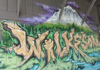
Approaching Mount Rainier National Park from the northwest, you pass through the towns of Burnett, Wilkeson and Carbonado and into the lush Carbon River valley. From there, you can reach a number of hikes, including to the Carbon Glacier, the lowest-elevation glacier in the Lower 48 states, and the Wonderland Trail, which wraps all the way around Mount Rainier.
At least you could until the spring of 2025, when the aging Fairfax Bridge closed due to safety concerns. The Fairfax Bridge crossed the Carbon River, connecting gateway communities like Wilkeson with the national park. It provided public access to an entire side of Mount Rainier National Park (including Mowich Lake, Spray Park and Tolmie Peak) and the popular Summit Lake hike on nearby U.S. Forest Service lands. Currently, the only way to get to this corner of the park is a long hike from other park entry points, such as Sunrise (13 miles).
Those who love spending time outside in this area are feeling the loss
of the closure. For people who live behind the closed bridge and in the town of Wilkeson, the loss goes deeper.
“Outdoor recreation is central to Wilkeson’s identity,” said Mayor Jayme Peloli. “It drives our local economy, strengthens community connections and supports mental well-being. When access is reliable and well-managed, it brings stability to both our economy and quality of life. Without that consistency, it has the potential to do the exact opposite.”
Public lands and rural towns
Small towns each have unique characters and communities, and face their own challenges. They can often struggle financially. For some towns, money spent by folks visiting as they head outside to enjoy public lands provides a positive boost. And when public lands aren’t accessible, towns lose that revenue.
When the Fairfax Bridge (left) was closed for safety reasons, it cut off access to a number of trails northwest of Mount Rainier, including Summit Lake (bottom left). That closure has been challenging for nearby towns like Wilkeson that rely on the economic boost of visiting hikers.
For decades, public lands haven’t had the investment they need for infrastructure or staffing. That means forest roads degrade and there’s not enough staff to care for trails or other resources. That problem was exacerbated in 2025 by the Trump administration’s massive cuts to the Forest Service. When there aren’t safe roads and trails for people to get outside, we all miss out on outdoor experiences — and rural towns miss out on that economic support.
Even for small towns where outdoor recreation is a smaller part of their economy, the outdoors are still important to their culture and community. For instance, in Darrington, near the Mountain Loop Highway, access to public lands can help students learn about future careers and give them a way to stay in rural communities if they want to. But those programs need funding.
In Darrington, the nonprofit Glacier Peak Institute (GPI) has lost much of the funding it needs to get kids outside. Additionally, in late 2025, heavy rains triggered a landslide that destroyed a section of the Suiattle River Road. It’s not the first time the road has washed out — flooding in the early 2000s closed the road for more than a decade. It
finally re-opened in 2015. Now it’s gone again.
The landslide means GPI can’t take kids to places like a seed orchard to talk about ecology and show kids pathways to potential careers. And it means that fewer visitors will stop in Darrington on their way to recreate along the Suiattle River Road.
“Outdoor recreation keeps our service industry going. It’s really amazing how much more people are getting outside since the pandemic,” Darrington Mayor Dan Rankin said. “They buy gas on their way. They stop at the brewery, picking up a beer and dinner. You’re seeing them at the Burger Barn. Those places are surviving winter because of the influx of summertime visitation.”
Small towns like Wilkeson and Darrington are part of what make Washington’s hiking so extraordinary and the community so strong. Ongoing federal and state investment in public lands, plus the business of hikers and other outdoor recreators, can help these small towns thrive.
Fewer summer visitors
In Wilkeson, the estimated timeline for rebuilding the Fairfax Bridge is at least 6 years, and that’s assuming there is funding for the project. The most recent budget passed by Washington’s Legislature includes $1 million for the town of Wilkeson’s immediate needs while the bridge is out. The Washington State Department of Transportation plans to use $7 million from their existing budget to begin design and environmental review for a new bridge this summer. Funding for the bridge’s construction is still to come.
Photos by
Joe Mabel (Wikimedia Commons), Keny Koo, Melani Baker
In the meantime, people who live in Wilkeson are rallying to gather support and finding creative ways to keep their community afloat amid uncertainty.
“Local businesses are facing the reality of multiyear timelines and what that means for their survival,” Jayme said. “At the same time, residents and business owners are asking a deeper question: whether we can keep our businesses open and continue supporting the community through it all.”
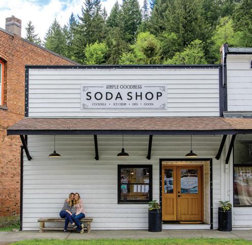
In 2020, Belinda Kelly and her sister opened Simple Goodness Soda Shop in Wilkeson. Their farm that grows ingredients to make the shop’s syrups is just a few miles down the road. Last summer, things changed for the business.
“The summer rush never came,” Belinda said. “Revenue dropped by half. We were incredibly sad and frustrated as owners and faced a whole new part-time job of campaigning for the bridge.”
They decide to close the shop, with the hope of reopening it someday. For now, they are using it as a wedding venue.
Losing the Fairfax Bridge changed things for Jayme, too. Before that, she was studying public health and had never considered politics. After the closure of the bridge, she pivoted to a new path that led her to become Wilkeson’s mayor.
“I was in a doctoral program in public health when this began but shifted to public administration,” Jayme said. Jayme, a fifth-generation resident whose grandfather was the last coal miner in town, was 14 years old when she fell in love with hiking. Her eighth grade teacher took her on a multiday backpack, starting at Mount Rainier National Park’s Carbon River entrance and hiking along the Wonderland Trail to Sunrise. A few years after that trip, the Carbon River Road washed out. That road is now a trail and the hike Jayme did as a teenager is much longer. That washout was a big change, but the impact of the Fairfax Bridge closure on Wilkeson is on a different scale.
For a bridge that accesses a national park and connects a community whose identity and economy are tied to Mount Rainier, the number of visitors who
crossed the Fairfax Bridge does not tell the whole story of the bridge’s importance.
“The way our government prioritizes projects will need to change,” Belinda said. “Without that (bridge), the Carbon River entrance to Mount Rainier National Park will be lost forever. They will have no reason to staff or maintain it. With no customers, a mountain town’s historic commercial district like ours will be lost too.”
Jayme and the other residents of the Wilkeson area see a way forward. They know outdoor recreation is key to their community’s future, so the town has raised a majority of the funds to acquire a parcel of land near the old Skookum Mine, which will eventually be a new park for visitors to enjoy. It may take 10 years to complete the park piece by piece, including a bridge and trails to access the mine, a nearby lake and a scenic viewpoint. There’s more hope on the horizon. The Foothills Rails-to-Trails Coalition, which is responsible for the Foothills Trail that runs from Puyallup to Buckley, recently
Belinda Kelly and Venise Cunningham were forced to close their soda shop after the closure of the nearby Fairfax Bridge meant way fewer visitors to Wilkeson.
secured an easement to complete a new section between Wilkeson and Carbonado. Open to cyclists, hikers and horseback riders, this paved trail will connect to the existing 22 miles of trail and offer views of Mount Rainier.
Though it’s not yet connected to the rest of the Foothills Trail, you can already walk or bike an unpaved section of trail from Wilkeson to Carbonado. Go visit and support the local businesses while you’re there. You can even make a full day of it. Use WTA’s Hike Finder Map to locate other trails and nearby towns you’d like to check out.
A vital part of the community Farther north in the Cascades, Darrington is the homebase for the Darrington Ranger District of the Forest Service, and it offers nearby access to the Pacific Crest Trail, breathtaking mountain views, and riverside hikes and campgrounds.
Dan Rankin, the mayor of Darrington, says Forest Service staff have been a vital part of the community and that losing them has had far-reaching effects. While he was growing up, many of Dan’s teachers were the spouses
of Forest Service workers. Those folks raised their families in Darrington and often stayed when they retired. But the number of employees kept declining, even as interest in outdoor recreation continued to grow.
“In the mid-90s, we had summertime employment through the Forest Service at 170 employees and year-round employment between 70 and 90. That is a huge hunk of the fabric of our community,” Dan said.
The steady erosion of Forest Service staffing, including in Darrington, was suddenly made worse when the federal administration conducted massive layoffs in 2025.
The Darrington district manages thousands of acres and hundreds of miles of roads and trails. It includes Glacier Peak and the Henry M. Jackson and Boulder River wilderness areas.
“This huge asset and huge ecosystem should be stewarded and fostered,” Dan said.
Some of the folks who were laid off in 2025 were rehired, after a lot of advocacy and public outcry, including from the WTA community. But many of those people ultimately left the Forest Service amid the uncertainty.
Sam Webster is one of those who chose to leave. Sam grew up in Moab, with parents who had stable jobs working for the National Park Service. In 2024, he was hired as a wilderness ranger in Darrington, but opted to commute to the city rather than live in town.
“It’s very difficult to live in those places and find a stable career that supports me and a partner and a family,” he said.
Sam Webster was a ranger in the Darrington district until last year, when he left for a new job after major staffing cuts.
Photos courtesy Belinda Kelly and Sam Webster
Sam opted to leave the Forest Service last year. He now lives in Seattle with his wife.
“I love rural towns; until a few years ago, I’d spent nearly my whole life in them. But I’ve found it harder and harder to keep growing and building a future in places like that,” Sam said.
He now works for the Pacific Crest Trail Association as the regional manager for the North Cascades region. He still works closely with the Forest Service, including his former district in Darrington, but in a different role.
Benefits and challenges
Adrienne Hall arrived in Darrington in 1983 and never left. Prior to that, she worked for the Forest Service in the ranger station on the way to Mount Baker. But when ranger districts combined, she was transferred to Darrington. At the time, the district had about six wilderness rangers and a trail crew of eight to 10 people.
Adrienne remembers how closely the Forest Service was integrated into the community. Local kids worked for the Forest Service over the summer. Residents were likely to bump into Forest Service staff around town or play baseball with them in summer tournaments.
Over time, the scene in Darrington began to change as logging declined. Several small logging companies in Darrington closed and more people started commuting outside of Darrington to work. The challenges for the town were exacerbated as federal funding was repeatedly cut for the Forest Service and the agency continued to consolidate.
The Forest Service sold off housing in Darrington, which made it harder for employees to live there. New employees often had to live elsewhere and commute. The system for hiring changed, too, and was managed remotely. It became harder for local kids to apply for summer jobs, in part because of timing and in part because applications moved online and not everyone in town had reliable internet. Challenges continue — 60 percent of the students in town are low income and 4 percent are homeless. Teens are often stuck in town because there is limited public transit. And while the high school students have access to a mental health counselor, there’s only one available, and only online.
Adrienne knows the challenges, but she loves living in Darrington, so close to the mountains. She has a home with acreage and mountain views. She loves the people, whom she often sees at community
by
Miners Ridge Lookout is one of the locations that is now much harder to access due to a washout on the Suiattle River Road.
Photo
Russ Dalton
events. She appreciates that so many people, especially older folks, are so willing to help out, including at the school.
“That’s the biggest need I see,” she said, “to invest more locally in our youth.”
The future of rural towns
The nonprofit Glacier Peak Institute (GPI), a longtime WTA partner, supports young people in the Darrington and Concrete area. The institute has had to hold back on hiring and reduce its programming in the last year.
In 2025, as massive cuts were made through the Department of Government Efficiency (DOGE), GPI was no longer able to work with interns through AmeriCorps VISTA program. Additionally, the state Legislature made cuts in 2025 to the No Child Left Inside (NCLI) program, which was already getting more requests for funding than it had funds. The institute did not get NCLI funding in the most recent round of grants, which means it hasn’t been able to hire people to run as many programs for kids in the community.
Samantha Chang, the institute’s interim executive director, says that just because kids grow up in areas like Darrington, that doesn’t necessarily mean they have easy access to the outdoors. And it does not mean they’ll be familiar with job options.
“Research shows that if kids don’t know about a career by junior high, they are less likely to pursue it,” Samantha said.
GPI introduces kids to a variety of professional options in the
outdoors, including biology, entomology, firefighting, horticulture and forestry.
“It’s easier for kids to visualize themselves having that future if they’ve seen it,” Samantha said.
But GPI’s work requires access to places like the Suiattle River Road, and it needs funding.
No quick fix
There’s not one easy solution to the complex challenges facing rural towns. But supporting the people and infrastructure of our public lands is key across Washington. As a hiker, you can help out by speaking up.
Tell your members of Congress that it’s important that the Forest Service is adequately funded. Ask your state lawmakers about budgets for public lands and the infrastructure, like bridges, that gets us there.
Not sure where to start? Through our email action alerts, WTA makes it easy for you to highlight these points with your elected officials. Sign up at wta.org/tan.
If you’re not a resident of a trail town, be sure to stop by on your way to trailheads. Grab a coffee or dinner at a local cafe or restaurant. Write a trip report about your hike that mentions the local businesses you enjoyed, and it can encourage others to do the same. Stay in or near trail towns. And remember that these small towns are vital to our state and to the outdoor experiences we all love.
PARKS
Portia Riedel is one of 649 leaders who have been trained through WTA’s Outdoor Leadership Training program.
Even though I felt comfortable backpacking with my own family, OLT gave me the confidence to take responsibility for other people’s children.
Confidence and Skills To Take Kids Outside
Portia Riedel, who has partnered with WTA’s Outdoor Leadership Training program almost from the beginning, has seen the program grow over time. By Erin McQuin
More than a decade ago, Portia Riedel was looking for a way to get outside with the youth she worked with through her job at Pacific Science Center. She was planning a camping trip with Discovery Corps, a Pacific Science Center program that offered educational programs for high school students from backgrounds that were underrepresented in STEM fields. The students needed gear, and Portia reached out to WTA for help.
“I initially signed up because I wanted access to the gear library, which required attending an orientation,” she said. “From there, I was encouraged to attend an OLT workshop, and that ended up being a turning point for me.
“Even though I grew up hiking and camping and felt comfortable backpacking with my own family, OLT gave me something completely different — the confidence to take responsibility for other people’s children. It helped me think through safety, group management and the responsibility of leading youth in outdoor spaces in a much more intentional and structured way.”
Portia was one of 71 leaders trained through OLT workshops in 2015. Portia attended a camping workshop where she and the other eight leaders learned how to facilitate a successful trip for school-aged youth. Using items from the WTA gear library, they practiced outdoor skills like how to set up a tent and cook chili for dinner. They also organized and led a group hike as a practice camp activity.
Portia said that, during that workshop, she learned everything she needed to know about leading an overnight trip, including information on camp hygiene and preparing meals.
“What stood out most, though, was the combination of practical skills and community-building,” Portia said. “We shared trail games, camp activities and team-building — all through the lens of working with youth.”
Photo by Erin McQuin
Empowered to lead trips
Over the years, the OLT program has changed to meet the needs of our community, but aspects have stayed the same. We still make our famous chili on camping workshops, but now it’s for lunch rather than dinner because the trips have been shortened to make it easier for educators to attend.
Most importantly, workshop participants continue to make connections to each other and, after a workshop, feel empowered to lead trips.
Since we started offering workshops, WTA has trained over 600 leaders across the state to hike, camp, snowshoe and backpack with youth and their community.
Over the years, 77 percent of the organizations who send people to our workshops have gone on to borrow gear from our gear libraries.
After completing her workshop, Portia
started borrowing gear immediately to support her work with youth at Pacific Science Center. At the time, in 2015, the Seattle gear library was near the Mount Baker Link Light Rail Station.
“I remember being completely impressed — neatly stacked sleeping pads, walls of backpacks, shelves of boots sorted by size and, later, rows of snowshoes hanging in order,” she said.
In 2021, Portia started a new role as dean of expeditions for Summit Atlas, a tuition-free public charter school in West Seattle serving grades 6–12. Portia coordinates expeditions, 2-week special sessions at the school in which middle and high school students take themed classes and participate in field experiences. Students get a chance to explore real career paths and see what life after high school can look like.
For those trips, gear was once again a challenge. But Portia knew that WTA could help.
As she started to build out programming at Summit Atlas, Portia trusted OLT to provide quality gear and supportive staff.
Having access to gear is critical to ensuring students are able to participate in outdoor activities. Summit Atlas has been able to tell students that gear is available, so no student ends up feeling that their lack of boots or a sleeping bag means they can’t participate.
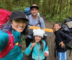
Portia enjoys backpacking with her family (below) and supports programs to get kids outside, like with the Pacific Science Center (above).
Thanks to Portia’s coordination, Summit Atlas has borrowed gear for environmental science trips for the past 5 years. The OLT program has supported 59 days outside for students at Summit Atlas and we look forward to continuing our partnership and helping even more youth get outside.
The power of partners
WTA is grateful for community partners like Portia. Her dedication to providing quality outdoor education has positively impacted thousands of students. For many youth attending camping trips, it’s their first experience sleeping in a tent. It’s also a great opportunity to build community and friendships. Those moments of connection often happen during those “in-between” periods when there isn’t any structured activity, such as hanging around camp after dinner. Portia loves those moments.
“I know I’m preaching to the choir,” she said, “but tech-free outdoor time is very underrated!
“The most valuable piece (of working with OLT) has been a combination of accessible resources, practical skills and a community of leaders who are all working toward similar goals,” Portia said. “I hope OLT continues to
expand access and build a strong network of leaders who are equipped to bring safe outdoor experiences to young people from all backgrounds. The ripple effect of that work is huge. Some of the students from my time at Pacific Science Center are now adults who are working in youth development roles.”
At WTA, one of our key goals is inspiring the next generation of outdoor leaders. The ripple effect of OLT is one of the ways we’re doing that. Every new educator who learns how to get outdoors could inspire many young people. Some of those youth will go on to do the same.
The OLT program is continuing to grow — we recently started a co-instructor program that will help us train more leaders. And we’re working on opening another gear library.
Get more info about OLT, including how to sign up for one of our workshops, at wta.org/olt
WTA is planning for a third gear library. If you’d like to discuss the opportunity to have a financial impact on that work, contact Andrea Michelbach, development director, at amichelbach@wta.org.
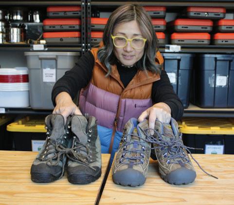
Portia Riedel picks up gear from the WTA gear lending library for Summit Atlas students to use on a trip.
What is OLT?
The OLT program gets school-age youth outside by empowering teachers and youth group facilitators with the skills and resources they need to lead safe and fun outdoor experiences. Through hands-on workshops, participants gain skills in hiking, camping, backpacking and snowshoeing.
Once trained, leaders have access to free gear libraries where they can borrow gear including boots, raincoats, tents and snowshoes. Our first gear library opened in Seattle in 2014 and our second, in Puyallup, opened in 2021.
Our Seattle gear library can support up to 175 youth at any given time and the South Puget Sound gear library can support 125.
We are in the process of planning for a third gear library.
Continuing to grow
The growth of the OLT program and our gear libraries has been staggering, especially in the last 5 years. Each time a youth goes outside with one of our community partners, we count that as a “youth experience.”
In 2026, we hit a major milestone — we have now supported more than 20,000 youth experiences since the start of our program. In 2025 alone, we supported 4,473 youth experiences. And through mid-May this year, we have supported 87 outings and 3,258 experiences.
Thank you to the funders and members who have helped OLT grow over the past 13 years.
Photos courtesy Portia Riedel and by Erin McQuin
Tribal Perspectives
Uniting Around a Shared Goal
Stretching from the mouth of the Strait of Juan de Fuca all the way down to the Puget Sound, the Salish Sea region is one of the world’s largest and most ecologically vibrant landscapes.
The region’s stunning beauty and accessibility have fueled a population boom and a surge in outdoor recreation, and this growth — including in the Snoqualmie and I-90 corridor area — has increasingly impacted resources vital to Indian Tribes, including ancestral lands and sacred sites of spiritual significance. The wildlife, fisheries and flora that rely on these lands are culturally important to Tribes, who have relied on these resources for generations.
For this reason, the Snoqualmie Tribe Ancestral Lands Movement (STALM) seeks to spread awareness of the Snoqualmie people who have lived in the southern Salish Sea region since time immemorial. STALM aims to share the significance of these lands and provide information on how people can help the Tribe in respecting, restoring and protecting these lands.
Beyond education, STALM challenges human-centered mindsets that prioritize convenience and consumption over ecological balance. It invites everyone to rethink their interactions with nature, asking how to coexist with wildlife, reduce harm and contribute positively rather than extractively. Ultimately, the movement is a call to awareness and a call to action, uniting people around the shared goal of protecting, respecting and restoring the lands and waters that sustain all life.
We encourage supporters and allies to incorporate mindfulness into their recreation activities. STALM hopes to inspire change through opportunities for learning, relationship-building and reciprocity. We want to help all people reduce harm, restore balance and honor Indigenous values in how they interact with the environment.
We invite all supporters to help raise awareness and learn from STALM by using the Tribe’s website while planning their trips to hike, bike and visit waterfalls and other recreation spots along the
How to hike mindfully and respectfully on Snoqualmie lands. By The Snoqualmie Tribe Ancestral Lands Movement
I-90 corridor — such as Mount Si, Rattlesnake Lake or Snoqualmie Falls. Everyone can also follow STALM through social media; we share content about educational topics, wildlife, restoration and seasonal activities in the Snoqualmie Valley.
Here are simple steps everyone can take while recreating on Snoqualmie Tribe Ancestral Lands to practice respect and help the Tribe in protecting and restoring these lands for generations to come:
• Treat the lands with the respect they deserve by picking up your own trash, and that of others that you see, properly disposing of pet waste and staying on designated trails.
• Commit to experiencing the lands in a way that is centered in mindfulness, rather than conquest.
• Learn more about the Snoqualmie Tribe and its history and deep connection to these lands, and support the work the Tribe does today to continue stewarding these lands.
• Acknowledge that you are recreating on Snoqualmie ancestral lands through both written acknowledgment and through practice.
• Help the Tribe spread its message by encouraging others to learn more and practice land acknowledgment both on and off the trails.
A key priority is staying on legal trails while recreating. Many unsanctioned trails created without oversight pose challenges for land managers, who
We want to help all people reduce harm, restore balance and honor Indigenous values in how they interact with the environment.
aim to plan trails with wildlife in mind. Adequate monitoring, enforcement and removal of these illegal trails is critical to ensuring respectful and responsible recreation planning. Increased human activity impacts wildlife significantly, disrupting animals’ foraging and causing them to use unnecessary energy, which can threaten their survival.
STALM encourages curiosity! Visitors can learn from STALM about the Tribe’s history, Lushootseed place names and the cultural meaning of familiar landmarks. We aim to introduce people to the idea that Snoqualmie ancestral lands are living, culturally significant places and not just tourist destinations. STALM’s website, social media, ArcGIS StoryMaps, and other educational materials are available to the public to learn about respectful recreation and deepen their understanding.
STALM helps connect visitors with volunteer or restoration opportunities, community events and ways to stay informed. By visiting the Tribe’s resources, people can move beyond sightseeing and toward reciprocity, learning how to give back to the land and how to support the Tribe’s priorities.
Learn more about the Snoqualmie Tribe and how to respectfully visit Tribal ancestral lands at go.wta.org/stalm, on Facebook at Snoqualmie Tribe Ancestral Lands Movement and Instagram @snotribeancestrallandsmovement.
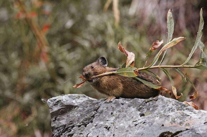
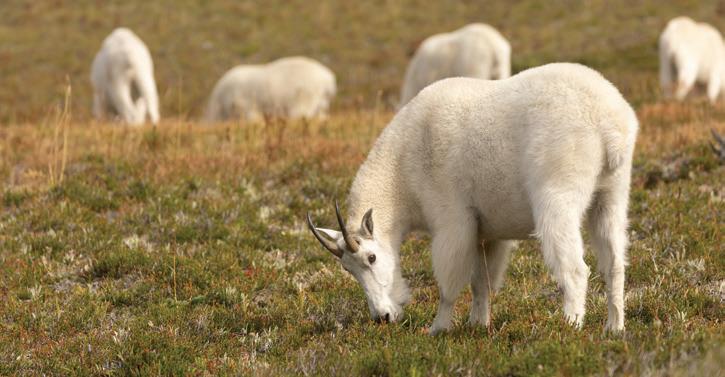
Many wildlife, including pika and mountain goats, call Snoqualmie Tribe Ancestral Lands home.
Photos by Alycia Scheidel, funded by the State of Washington Tourism
Terrence (17 at the time) on a hike in the Goat Rocks Wilderness.
A Story to Share
Trip reports helped me find a love of writing that has been so valuable to my hiking and to my life.
By Terrence Digel
When I was 8 years old, my father took me to Pratt Lake off I-90 near Seattle. The hike turned out to be twice as long as he said, we didn’t bring enough water and I stubbed my bare toe on a rock in the lake. Despite this, I was hooked.
The simple, goal-oriented aspect of hiking, combined with the beauty of nature, resonated with me. It fulfills me like nothing else. Hiking also led me to writing, through recording WTA trip reports, and that has influenced my path in life.
My father first introduced me to Washington Trails Association after he began writing trip reports in 2015.
My first trip report was on the same location as my dad’s first trip report, Red Mountain via Commonwealth Basin. I hiked it in 2016 with my brother Nathan and my father. It was a hot August day when we scaled the crimson rocks that define the peak.
Following our successful summit, my brother and I clambered over to my dad’s computer and had him type our words onto the screen. In retrospect, our dad should’ve done some better quality control. Our early trip reports said things like “Red Pond is a nice place to soak your soar feet.”
Looking back, I’m not quite sure what motivated me to start writing about my hikes. I always enjoyed reading, but writing was something I mostly stayed away from as a child. Honestly, I think if you really love something, you’ll want to embrace all aspects of it: read about it, write about it, talk about it and, of course, do it.
And so my brother and I began to write. As our hikes increased in difficulty, our writing also improved. We did Aasgard Pass, Navaho Peak, Mount Pilchuck, Camp Muir, Vesper Peak and the Brothers all within the following years, writing about each under the name Lil Mountain Goats on WTA.
Writing allows one to reflect. In the modern age, everything is fastpaced and moments get saved in your photos app, rather than your memory. Writing about your experiences forces you to slow down and remember. Since I began writing trip reports, I catch myself looking closely at forests to figure out whether it’s new or old growth, taking note of the plants and flowers around me, learning the names of the small creeks I pass and observing the specific types of terrain I walk through. Writing allows me to focus on living in the moment, and I can re-enter those moments when I begin typing.
As I wrote more, I read more. I read Fred Beckey’s “Challenge of the North Cascades,” John Krakauer’s “Into Thin Air,” Peggy Goldman’s “Washington Scrambles” and so many more that furthered my love for hiking and writing. They helped inspire me to begin working on writing my first book, which I’m still working on and hope to complete within the next 5 years.
Following senior year, I packed my bags and made the short journey from Seattle to Bellingham to study at Western Washington University in the fall of 2025. Ever since my dream of becoming a pro athlete died at the hands of reality, I had planned to major in history and become a teacher. But as I walked around campus, I felt lost, mentally and physically. When lost in life, think about what you love. What had started as a one-off trip report on Red Mountain had grown into a writing obsession. I wrote 75 trip reports over the next decade. Writing those WTA trip reports improved my writing. But it also built my confidence, thanks to the community’s constant support, including many kind comments and the “Outstanding Trip Reporter” badge WTA gifted me. And so I switched my major from history to English.
Now here I am, 10 years after writing my first trip report for WTA, writing my first magazine article for WTA. I still write a trip report for every hike I go on, and every day I check the most recent trip reports to see what others are up to. So do what you love: write about it, talk about it and share the experience with others! As always, thanks for reading and happy hiking!
To keep a record of your own hikes, while also helping other hikers, share trip reports after your hikes this summer. It only takes a few minutes, but it’s a valuable gift to the hiking community. wta.org/tripreport
Nathan and Terrence (10 and 8 at the time) on their first camping trip. They climbed Aasgard Pass the next day.
Photos courtesy Terrence Digel
The Beauty of Trails
A Moment of Rest
by Laura Min
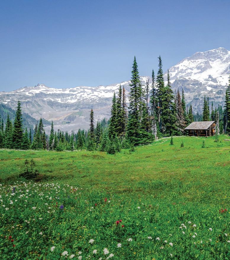
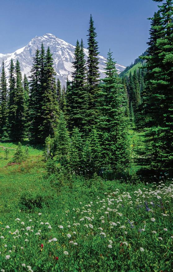
Color, composition and subject combine to make this a magical photo of Indian Henry’s Hunting Ground. The central subject is the historic patrol cabin, and the foreground flowers, the taller trees on each side of the cabin and Mount Rainier above create a frame that focuses attention on the weathered shelter. Most importantly, the photo evokes a feeling of serenity, inviting the viewer to leave the frenzy of daily life and rest a bit in this lovely setting. — Doug Diekema
Photo
Walking on the Sun
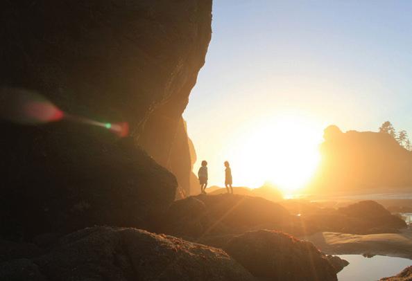
The warmth and joy captured in this photo really stood out to me. The sun flare is a fun addition and the shadow of the two figures just ahead leaves enough mystery that it feels like some long-lost summer memory. Well-composed and authentic, those are the images that really stand out to me.
— Victoria Obermeyer
Near and Far
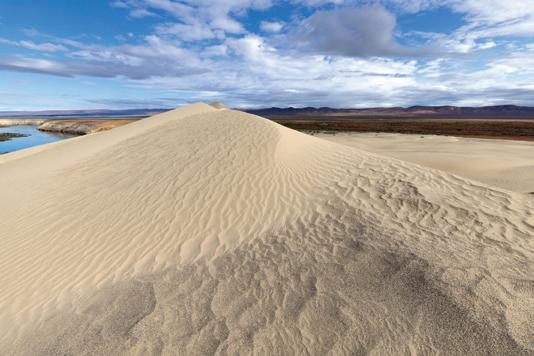
I feel like I could step into this image. I love how well the photographer captured the intricate detail of the sand dune, while still managing to show it in the larger landscape. The careful composition and focus really bring the scene to life.—Jessi Loerch
Photo by Cameron Oliva
Photo by Jennifer Nguyen
A Sense of Wonder
Photo by Kevin Thompson
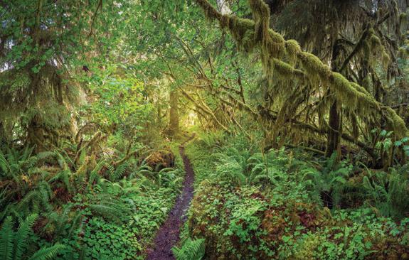
This image transported me back to my first visit to Olympic National Park as a teenager. After moving from Texas, we drove through the Southwest, California and Oregon, but none of the national parks compared to the lush rainforests I witnessed here. This photo captures that same sense of wonder. The leading line of the trail draws the viewer in, while the varied textures and shades of green create depth. The photographer perfectly captured sunshine filtering through the canopy, challenging the perception of rainforests as constantly wet and mossy.
— Archana Bhat
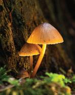
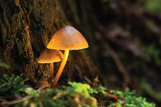
I’m captivated by this image. Yes, the photo has a nice compositional balance to it. And yes, it has a narrow depth of field, which brings tight focus to the two subjects. But it’s the well-exposed lighting that gives this Pacific Northwest scene such pop, coming in low from the side, spotlighting the duo, creating the illusion that the light is coming from within the larger mushroom cap like a miniature lampshade. Exquisitely captured! — Buff Black
Share your own: This year's photo contest opens Aug. 10. wta.org/photocontest
A Tiny Light
Photo by Vanessa Story
Photo by Scott Kranz
$25,000+
$10,000+
$5,000+
$2,500+
WTA is proud to partner with companies that share our commitment to protecting trails and getting people outdoors. If your business is interested in connecting with outdoor enthusiasts through supporting our work, email corporate@wta.org.
Alpine Exploratory Cascade Crest 100-mile Endurance Run
Cold Soaking Tips & Tricks
Soaking your food is a great way to save weight, money and time on trail — if you’re OK with eating cold food.
By Joseph Gonzalez
Cold soaking, sometimes referred to as “no cook,” is a method of preparing food on trail without the use of a stove or flame. You simply combine water and your dehydrated meal in a sealed container then carry it in your backpack until your food is soft enough to eat. Rehydration time varies, but the result should be a filling meal without the hassle and heat that come with a stove.
Why it’s worth it
Hikers hoping to be more conscious of their pack weight should consider cold soaking. Not only will you save weight by not fussing with a stove, fuel and a metal cookpot, you’ll also avoid tediously resupplying and disposing of fuel canisters.
Cold soaking is a nice alternative when fire danger is high too. Fire bans, which sometimes include the open flame of a stove, are a seasonal reality. The cold-soak method has a smaller footprint and eliminates the risk of starting a fire.
Finally, your food is ready to eat once it’s been soaked. No hassle, no staring at water, willing it to boil, and no problem.
Cold soaking challenges
If hot food or drink is a highlight of your trip, then cold soaking might not be for you. It depends on access to reliable water sources, and you’ll have to treat your water before you use it. This method also requires some planning ahead — if the food isn’t removed from the water at the right time, your meal can have an unpleasant texture. Finally, without a stove, you won’t have a way to warm up food or drink in case of an emergency.
This is how we do it
Cold soaking is best when supplemented throughout the day with a variety of nutritious grab-and-go snacks. That way, you have immediate calories to tide you over until your cold soak is ready. So, what kinds of foods can you cold soak? The short answer: any food that you would normally cook with water on a stove, but with a twist.
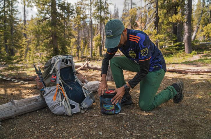
Simply find an appropriate cold soak jar (see recommendations below), add your food and water, then put the jar in the kangaroo pouch of your backpack (the stretchy, sometimes webbed pouch on the outermost layer of your pack) while you hike. That way, the sun has the chance to warm your food a bit before you eat. If you don’t have a kangaroo pouch, put the jar in a water bottle slot on the side of your pack. Placing your jar on the outside of your pack also helps protect the precious innards of your backpack in case your jar leaks.
Testing cold soak recipes can take trial and error. Consider trying a cold soak meal at home to avoid a snafu on trail. Also, keep in mind that similar foods can have different soak times depending on the ingredients and brand. For example, items like split pea soup will technically rehydrate very quickly but might not be very appetizing without heat, which helps the ingredients thicken. Raw lentils, on the other hand, can take hours to rehydrate before they are soft enough to eat.
What to look for in a cold soak jar
Your cold soak jar can make or break your system. The jar should be wide and shallow enough for utensil mobility. It should also have a sealable lid to prevent leakage. Avoid glass and metal containers to keep the weight down. Finally, the container must have enough volume to accommodate your dish but be compact enough to fit in the pouches of your pack.
Cold soaking isn’t just an art form. For some pack-weight-conscious hikers who are mindful of their footprint, it’s a way of life. Just be sure to check your water access, think ahead for when you want to eat and pack a great cold soaking jar. With these techniques you can enjoy a lighter pack, be less constrained by fire limitations and leave a smaller footprint while on your journeys. Bon appétit!
Jar ideas
Talenti gelato jars: They’re compact and wide. Plus, you get to eat the gelato before taking the jar on your trip. The jars don’t hold a ton of volume and can leak, so be mindful when you soak.
Peanut butter jars: Their seals inspire more confidence than the gelato jars, plus they come in a variety of sizes depending on your appetite and how much food you want to carry.
Kool-Aid powdered drink canisters: They seal great and provide ample volume. The best part? When unscrewed, the lid can be used as a cup or second bowl.
Photos by Joseph Gonzalez
Ramen is a beginner-friendly cold soak option.
Pack Light, Hike
Far
The art of being prepared without being weighed down on trail
By Sandra Saathoff
There’s a sweet spot in backpacking that every hiker is searching for. It’s a magical configuration with everything you truly need for days on trail, nothing you don’t and enough room for the one small indulgence that makes the whole trip worthwhile. The magic happens when all of that comes together at the perfect weight. Find it and the miles open up. Miss it in either direction and you may be miserable.
Of course, your “sweet spot” weight will be determined by the parameters of the trip you’re taking. An overnight 3 miles out requires vastly different gear than a 7-day climbing trip in the heart of the Cascades. The goal isn’t to suffer through minimalism or to haul your entire closet into the backcountry. The goal is to carry what serves you — and to carry it as lightly as possible.
Start with what you actually need
Before you can cut weight, you need a baseline. Experienced backpackers organize their kit around the Ten Essentials:
• Navigation — paper map/compass/phone/apps
• Hydration — water filter and/or other purification options, water carrier(s)
• Nutrition — food
• Insulation — clothing for the conditions (puffy, fleece, down pants, sleep clothes, etc.), sleep system (sleeping pad, sleeping bag or quilt, extra sleeping clothing like booties), rain gear (jacket, pants or skirt)
• Fire starter — lighter/matches, other as needed
• First-aid kit — customized for the conditions
• Tools — knife/blade, duct tape, needle/thread, etc.
• Illumination — headlamp
• Sun protection — hat, gloves, sunblock
• Shelter — tent/tarp/bivy
These aren’t suggestions; they’re the foundation for a safe journey. Once you know your nonnegotiables, the real work begins.
Weigh everything — seriously
A $20 kitchen scale is one of the best investments a backpacker can make. You can’t make informed decisions about what to carry without knowing what things weigh. Manufacturer specs are often optimistic and your gut is almost always wrong. If you pair that scale with a simple spreadsheet listing every item you plan to bring — and its weight — you’ll suddenly see your pack
A carefully considered packing list can make your backpacking trips easier and more comfortable.
If you’re covering a lot of miles, the benefits of a lighter pack really add up.
in a whole new way. The heavy-duty rain jacket you haven’t updated since 2012? Nearly 2 pounds. The Crocs you brought to wear at camp? Another pound. Numbers can help clarify priorities, especially when you’re packing for several nights.
Where to focus your energy
Most of the weight in a pack lives in four systems:
• Your pack itself.
• Your shelter.
• Your sleep setup.
• Your cook kit.
These are the places where upgrading — or getting creative — pays the biggest dividends. A lighter tent, more efficient quilt, smaller stove — any one of these changes can shave off meaningful weight without touching safety margins. If you’re going to invest in gear upgrades, start with the big stuff.
Share the load
Backpacking with a buddy opens up a simple, underrated strategy: split the gear. One tent shared between two people cuts the per-person shelter
The goal is to carry what serves you — and to carry it as lightly as possible.
weight almost in half. You may need a bigger tent, but the weight per person will still be decreased. The same goes for the cook stove, a pot, a first aid kit, sunscreen, bug spray and even toothpaste. On a multiday trip, those shared ounces add up fast. A little coordination before you hit the trail can take real pounds off both your backs.
Look for gear that does double duty
Multi-use gear is the backpacker’s secret weapon. Trekking poles that double as tent poles mean you’re not carrying dead weight all day. A stuff sack filled with a puffy jacket can be a perfectly serviceable pillow at night. A bandana or buff can be a sun shield, a pot holder, a prefilter for silty water or a first-aid wrap. The more tasks a single item can perform, the more items you get to leave at home — and over multiple days, that simplicity is a luxury.
Speaking of, don’t forget your luxury item
Here’s the thing about going lighter — it’s not supposed to be a punishment. There’s almost always room in a well-organized pack for one or two small indulgences — the things that make evenings in the backcountry feel like gold. For some hikers, that’s a few pieces of paper to journal or a Kindle to read a favorite book. For others, it’s a small sketchbook and a few watercolor pencils, or a proper coffee kit for slow mornings at camp. These extras often weigh just a few ounces. If they make your trip memorable, they are worth every ounce.
Going lighter doesn’t have to cost a fortune
There’s a version of ultralight backpacking that costs thousands of dollars — titanium cookware, DCF shelters, carbon fiber stakes. But there’s also a version that costs almost nothing. Aluminum cookware is nearly as light as titanium at a fraction of the cost. Gear can be borrowed, rented or bought secondhand. The real investment isn’t money — it’s the mindset of paying attention to what you’re carrying and asking, with each item, whether it’s truly deserving of a place in your pack.
Test before you trek
Before committing to any major change in your kit — dropping an item, swapping in new gear, trying a new shelter system — test it close to home before heading to the backcountry. An overnight in the backyard or a short trip near the trailhead is a low-stakes way to find out if your new setup actually works before you’re 15 miles deep in the Cascades. Discovering a mistake after a long day of hiking is a very different experience than discovering it in your driveway.
In the end, a lighter pack isn’t just about physical comfort — though your knees and back will definitely thank you. It’s about mental freedom. When you’re not grinding through every mile, you start noticing things: the way afternoon light moves through the trees, the sound of a creek you almost missed, the temptation of a ridgeline you hadn’t planned to explore. That’s what all this fussing over ounces is really about.
The multiday backpacking checklist
Use this as a starting point for packing.
Pack and organization
Backpack (sized for trip length)
Stuff sacks
Food storage
Shelter system
Tent, tarp or bivy
Stakes and guylines
Trekking poles (if doubling as tent poles)
Sleep system
Sleeping pad
Sleeping bag or quilt rated for conditions
Cook system
Stove and fuel
Pot and utensils
Mug or bowl
Lighter/matches
First aid
Customized for your trip length and conditions
Any personal medications
Insulation and clothing
Base layers
Insulating layer (fleece/puffy jacket)
Rain jacket and rain pants or skirt
Sleep clothes
Warm hat/gloves
Sun hat/gloves
Navigation
Topographic map (paper)
Compass
Phone with offline maps downloaded
Hydration
Water filter or purification tablets
Water bottles or reservoir (capacity for your route needs)
Nutrition
Meals planned per day — plus one emergency day
Snacks and trail food
Bear canister or hang kit (required in many wilderness areas)
Illumination
Headlamp and spare batteries
Sun and bug protection
Sunscreen
Sunglasses
Insect repellent
Tools and repair
Knife or blade
Duct tape
Needle and thread
Trowel, TP and waste bags
Your luxury item
Whatever makes it feel like YOUR trip
by
Photos
Clyde Cannon, Lan Wen
While lightening your pack is great, don’t forgot to bring something just for the joy of it.
Generosity comes in many forms. Help ensure the trails you love will be there for generations to come by including WTA in your will or estate plans. Leave a legacy for trails
Our fondest memories from many, many adventures involve getting outdoors and doing something physical. We want future generations to be able to do the same, so WTA’s commitment to saving and maintaining public lands fits our desire perfectly. By adding WTA to our will, we are giving back to a community that has given to us over many years.
— Lis
Faulstich
and Gene
Frogge, WTA
Legacy
Circle members
Protect trails for the future at wta.org/legacy
Photo by Courtney Owens
Pacific Crest Trail. Photo by Beth Schaeffer
Divide Camp
Hike a quiet trail to the northwest side of Mount Adams and enjoy deep forests, subalpine wildflower meadows and in-your-face mountain views.
A hike to Divide Camp offers stunning views of Mount Adams.
Mount Adams area
Length: 5.8 miles roundtrip to the Pacific Crest Trail
Elevation gain: 1,400 feet
Permit: No parking permit, self-issued wilderness permit at trailhead
Dogs: Leashed
To know: Mosquitoes are fierce in July, no restrooms at trailhead
Highlights: Meadows, wildflowers and mountain views
Starting in dense forest, climb 2 miles to a large subalpine meadow with dramatic Mount Adams views and colorful wildflowers. Follow a signed spur trail to the right to historic Divide Camp, in the forest beside a clear spring and under a lava ridge.
Staying on the main trail and hiking uphill another scant mile through subalpine forests and wildflower meadows, often within earshot of raging glacial Adams Creek, drops you at a T-junction with the Pacific Crest Trail (PCT) at 6,100 feet.
From here, you have options to extend your hike: Go right or left for more Mount Adams views. For a long hike or multiday openjaw trip with a car shuttle or key swap, use the PCT to link to the Riley Camp or Killen Creek trails. Be sure to pack enough water on your hike, as the creeks in this area, such as Adams Creek, can be silty and may clog your filter.
During the summer, consider bringing treats to share with PCT thru-hikers you may meet at the PCT trail junction. —Susan Saul
More nearby hikes
Killen Creek
Alpine meadows, wildflowers, magnificent Mount Adams views. 10 miles roundtrip • 2,300 feet of gain
Riley Camp
Shimmering lakes, wildflowers and a recovering burn area. 10 miles roundtrip • 2,280 feet of gain
Takh Takh Meadow, Takhlakh Lake Loop
Figure-eight loop with a lake, meadow and lava flows with fantastic vistas. The lake-only loop is shorter and more level. 3 miles for full loop • 500 feet of gain
Explore more
Takhlakh Lake Campground
Quite popular; reservations recommended. Stunning sunset views of Mount Adams. Nonmotorized watercraft allowed on the lake.
Killen Creek Campground
Nice base camp for day hiking on the north side of Mount Adams.
Mt. Adams Pizza and The Station Cafe
Tasty post-hike pizza and burgers. Located in Trout Lake.
Roxy’s Roadhouse
Burgers and brews. Located in Randle.
Takhlakh Lake
Mountain bog gentian near Divide Camp and a marmot near Killen Creek.
Photos by Todd Folsom, Steven Clarence Robinson, Susan Saul, Dan Hassler
Pacific Crest Trail
This section of the Pacific Crest Trail offers spectacular views and plenty of room to extend your trip, if you want to.
Amble along lush meadows and subalpine lakes through the William O. Douglas Wilderness and Mount Rainier National Park. White Pass to Chinook Pass
Oregon Butte
Southeast Washington
Experience the Blue Mountains’ signature geography and wildflowers, plus a historic fire lookout. The area is perfect for a summer day hike or the start of a multiday adventure on nearby trails.
Stunning views and plentiful wildflowers await hikers to Oregon Butte.
Length: 6 miles roundtrip
Elevation gain: 987 feet
Permit: Northwest Forest Pass
Dogs: Leashed
To know: This trail is used by equestrians. The area may be used by hunters during hunting season.
Highlights: Wildlife, majestic views, wildflowers
Atrip up Oregon Butte in the Wenaha-Tucannon Wilderness should be on every hiker’s bucket list, with the 11th essential being a pair of binoculars for the views, and the 12th being a wildflower guidebook. The views begin immediately from the parking lot, perched on the edge of the East Butte Creek drainage.
The hike quickly enters the forest, heavily impacted by the 2021 Green Ridge Fire. Many of the trees didn’t survive the blaze, but the understory erupts in blooms in a wide variety of colors in the early summer.
Enjoy traipsing along wildflowers until the final ridge, where it is possible to look across the unique geography of the Blue Mountains and gaze into Idaho’s Seven Devils and Oregon’s Wallowas in the distance. On a clear day, even the southern Cascades are visible from this vantage point.
Oregon Butte is the high point of the Wenaha-Tucannon Wilderness and is home to a staffed fire lookout tower. Both Smooth Ridge and Mount Misery trails intersect the Oregon Butte Trail near the summit, offering multiday backpacking options. — Holly Weiler
More nearby hikes
East Butte Creek and West Butte Creek
Both trails start high before dropping into the Wenaha-Tucannon’s canyons. They offer wildlife, views, wildflowers and campsites. Link the trails together for a longer hike. Up to 20 miles • up to 3,100 feet of gain
Sawtooth Ridge
Best hiked as an out-and-back, along the ridgetop. (The far end of the trail has fire damage.) Enjoy the wildflowers, wildlife and mountain views. You’re more likely to see a herd of elk than other people.
Two-story cabin, sleeps eight and has propane lights, heat, cookstove and refrigerator. No indoor plumbing but vault toilet outside. Reservations at recreation.gov.
Historic Dayton
Explore a fun small city. Self-guided walking tour brochure available online or from Dayton Historic Depot courtyard.
Photos by Holly Weiler and Donna Hahn
Oregon Butte is one of the few lookouts in Washington that is still staffed.
Behind the lens
Hope & Healing
I’ve taken many images over my lifetime. This one is very special to me.
First of all, just to be a witness to that afternoon, with the rain, light and rainbows was unspeakably cool. To have managed to capture images of the spectacle was an unbelievable bonus.
For me, the image has a deeply spiritual meaning. It represents freedom and hope after darkness. At the time, I had just tested negative for cancer after long treatments.
Photography adds immensely to my enjoyment of the outdoors. I go slower. I look more. I’m totally tuned to where I am. My mostly futile efforts to capture the majesty of it all keep me humble and sure to come back.
Thank you to photographer Andy Porter for sharing the story behind this beautiful photo, taken at Steptoe Butte State Park Heritage Site, for last year’s photo contest. If you’d like to share your own photos, learn how at wta.org/photocontest.