Bay of Island Walking Festival for good old fashioned Russell hospitality
New Zealand Walks: Opotiki Trails beyond the tourist tracks
Walk : Orewa Seawall shared pathway now open
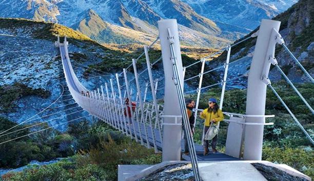
Hooker Valley suspension bridge now open
New Zealand Walk: Mt Robert Circuit: from panoramic views to an alpine fault line
Walking Festival Learn, explore and connect at the Wairarapa Walking Festival
New Zealand Walk: Hokitika Gorge a walk through one of the most beautiful natural wonders
New Zealand Walk
New Zealand
Zealand Walks: Opotiki Trails walks beyond the tourist track
Weather: Weather prediction for September
Auckland Walks: Point View Reserve for stunning vistas
New Zealand Walk: Mt Robert Circuit from panoramic views to an alpine fault line 17 New Zealand Walk: Hooker Valley supension bridge now open 18 New Zealand Walk: Hokitika Gorge: a walk through one of the most beautiful natural wonders
20 New Zealand Walk: Waitatari/Harts Creek Track reopens near Leeston 21 Nutrition: What walkers should ask before choosing a supplement
New Zealand Monthly Photo Contest
Shared Pathway: Orewa Seawall Project complete: shared pathway open
26 NZ Walking Festival: Bay of Islands Walking Weekend - for good old fashioned Russell hospitality 29 Cultural: Native Nations Indigenous Native Youth Exchange to create partnerships
30 Walking Tours: Walking Leaven for 2027
34 New Zealand Walk: Tutaenui Reservoir Reserve provides a popular walk
36 Walking Festival: Learn, explore and connect at the Wairarapa Walking Festival
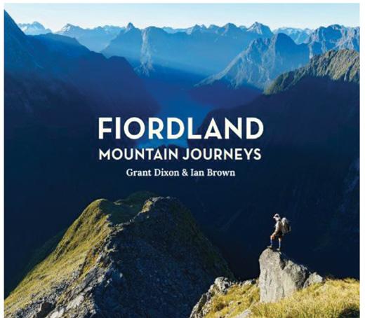
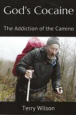
38 Subscription Page 39 Books: Fiordland Mountain Journeys, All the Skies We See
New Zealand Country Breaks 50 Index of previous 15 issues 51 Walking New Zealand Shop
52 Pak A Roo Walking Jackets
PUBLISHER/EDITOR: Frank Goldingham MNZM: Phone, 027-274-0726
CONTRIBUTORS: Jim Richards, Ken Ring, Phillip O’Donnell, David Scoullar, Steph Godstiff, Patrick Tooher
ADVERTISING MANAGER: Frank Goldingham - 0800 walking (925-546) 027-274-0726
Email: walkingnz@xtra.co.nz
COMING EVENTS ADVERTISING: Frank Goldingham 0800-walking (925-546)
The information and views expressed by contributors are not necessarily agreed to by the editor or publisher, and while every effort will be made to ensure accuracy, no responsibility will be taken by the editor or publisher for inaccurate information.
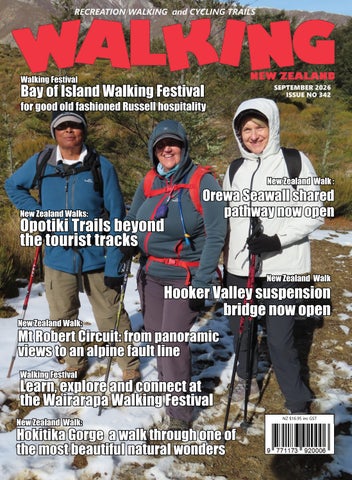
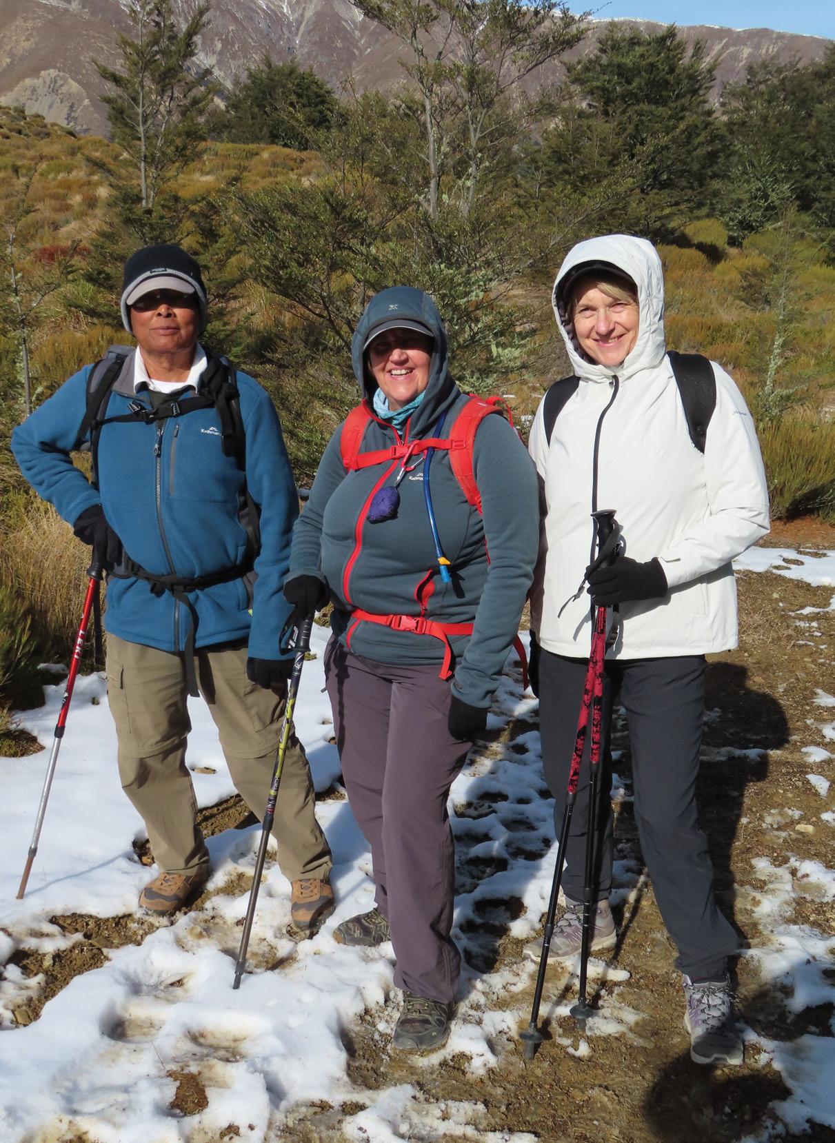
Cover photo: Yvonne van Eerden’s tramping group at the beginning of the snow and bush line when they walked the OLd Coach Stream Track last year. Photo by Yvonne van Eeden. Issue 342 SEPTEMBER 2026 24 18 17 26
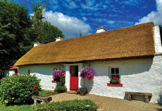
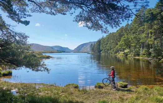
Connect with nature at Keenaghan Cottage
Beside the shores of Keenaghan Lough in County Fermanagh, Keenaghan Cottage is an example of slow travel with an authentic experience that resonates with today’s experience-led traveller.
This is a restored retreat that combines heritage charm with modern comfort, sustainability and nature-based tourism. Guests are encouraged to reconnect with nature through lakeside walks, complimentary bicycles, wildlife experiences and locally sourced produce, while the owners continue to prioritise biodiversity and lowimpact hospitality practices.
Recently gaining attention as a sought- after location for romantic escapes, creative retreats and even film and photography hire, the cottage offers an alternative to conventional luxury accommodation.
Guests receive a complimentary local produce welcome hamper on arrival. Other features include free wifi, Netflix, fire-pit and secure parking. keenaghancottage.com info@keenaghancottage. com
Great Taste Trail route sparks public access debate
A storm-damaged section of the Great Taste Trail in the Nelson-Tasman region has put public access firmly in the news. An unformed legal road has been proposed as the new route, but the proposal has raised concerns among farmers whose land it adjoins.
The commission’s regional advisor, Ange van der Laan, has acknowledged that landowners adjoining paper roads generally provide “excellent” maintenance of the land and benefit from its unchallenged and free use. “Neither of these confers a right of occupation or ownership.”
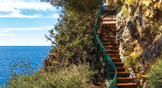
New Monaco City walk Guide
Monaco has launched Visit Monaco City Walk, a new digital walking guide that encourages visitors to explore the principality at their own pace, revealing iconic landmarks alongside lesser-known neighbourhoods through a series of walking routes.
The initiative reflects Monaco’s commitment to sustainable tourism and digital innovation, encouraging visitors to slow down, explore on foot and discover the many layers of the principality. visitmonaco.com/en/explore/trails-walks/visitmonaco-city-walk
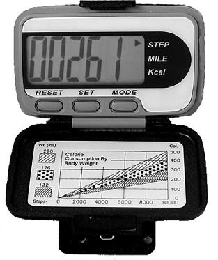
A great little Pedometer that you can carry in your bag or pocket or clip on a belt!
Three function Pedometer with a hi-tech system that you can carry in your bag, pocket, clip on a belt, or as an arm band, and accurately records your activity through its G Sensor technology.
* Step - Counts steps up to 999,999 steps
* Total Steps - It can cumulative number of steps of each activity
* Exercise time - The effective time will be accumulated as the walking is kept going
* Comes with a lanyard if you want it to hang it around your neck, and an additional clip if you want to attach it to a belt!
Only $59.95 plus shipping $6.00
Walk talk
Te Araroa Trust now an independent organisation
After six years of working closely together under a memorandum of understanding, the Outdoor Access Commission and Te Araroa Trust are beginning a new chapter in their relationship.
From 1 July 2026, Te Araroa Trust moves to a more independent operating model, taking full responsibility for its own staffing and operations and relocates from the commission’s offices to join Sport NZ.
The timing marks the start of a new financial year and a natural milestone for an organisation that has grown significantly since the two groups first formalised their partnership.
The commission’s Chief Executive, Dr Dan Wildy, says the change reflects the trust’s maturity and readiness to stand on its own feet. “This isn’t a weakening of the relationship — it’s a sign of how far Te Araroa Trust has come. We’re proud of what we’ve built together, and we’re confident in what they’ll do from here.”
The commission will continue to provide funding to the trust over the next three financial years, along with access to expertise and some shared services where agreed. Both organisations remain committed to supporting Te Araroa walkers and keeping the trail safe, well-maintained, and backed by quality data.
Above: Don Cameron (Chair of the Outdoor Access Commission Board) and John Birch (Chair of Te Araroa Trust) sign a new Memorandum of Understanding and Agreement to Grant.
Slow and easy in County Donegal
With quiet beaches and miles of coastal scenery, County Donegal in Ireland’s North West enables clients to reconnect with nature and find downtime from the interruptions of a busy life.
Visitors can walk on a beach with nobody else around, linger over a coffee with an uninterrupted view of the Atlantic or simply wander the back roads.
They can take a casual stroll or choose a strenuous hike to witness the sunrise at the county’s highest peak, Errigal.
Other options include a family cycle through the second largest national park in Ireland, Glenveagh National Park, delving into Donegal’s rich history, or experiencing the living Irish language in the Gaeltacht or islands.
govisitdonegal.com/ info@govisitdonegal.com
You could win a book
Due to rising costs Walking New Zealand magazine will go up in price from 1st August 2026. The single copy will be $16.95, 12 months $169.00, 6 months $99.00, 3 months $49.00, Digital one issue $6.95 and 12 months $79.00.
The new price for existing subscribers renewing will not go up until September 1 2026.
From 1st August till 31 August when you subscribe or renew the printed copy you are automatically in the draw where you could be the winner of the book “Survive Aotearoa”
A copy of the printed and digital magazine can be purchsed through our website: www.walkingnewzealand.co.nz. at $17.95, posted.
Your favourite walk could win you a free subscription
We are looking for readers’ favourite New Zealand walks. Many of us go out regularly walking on a route which we class as our favourite, for a number of reasons. Perhaps because for it’s scenery, it’s safe, it’s challenging, it’s flat, it’s hilly, it’s varied, or for whatever reason.
We would like you to tell us in your own words what is you favourite walk and why. Email us a story from say 250 up to 1200 words including a photo or photos.
We will now give you a FREE subscription (six months or more, depending on the article), or extension to Walking New Zealand magazine for walks published.
You can also post an article to Walking New Zealand, Freepost 78863, P O Box 1922, Palmerston North, or fax 06-358-6864.
If sending a photo by email please make sure photos are in high resolution.
Our email address is: walkingnz@xtra.co.nz.
Please put “My Favourite Walk” in the subject line and include your name and postal address.
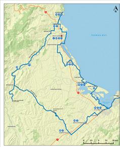
Ōpōtiki trails: walks beyond main tourist track
beyond the
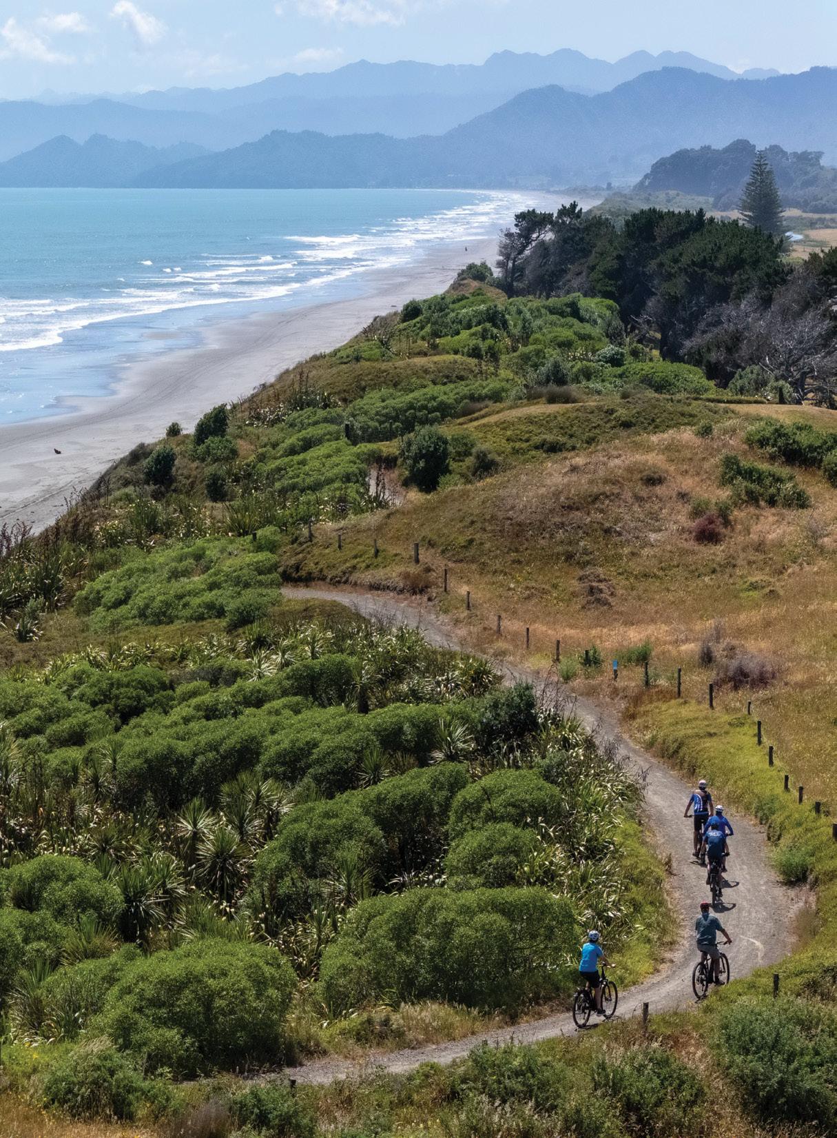
Dunes Trail from the air showing cyclists on the trail. Photo Jamie Troughton.
Ōpōtiki
trails: walks beyond the main tourist track
By Jim Richards
In the relaxed pace of New Zealand’s eastern Bay of Plenty, the town of Ōpōtiki offers stunning coastal and forest trails, beyond the visitor crowds.
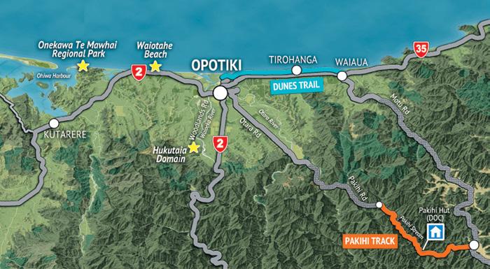
Ōpōtiki is gateway to Motu Trails, one of the 23 Great Rides of Ngā Haerenga New Zealand Cycle Trails [https://www.nzcycletrail.com].
While Motu Trails is headlined as a neat set of cycle trails, both the Dunes Trail and Pakihi Track sections are equally impressive when
experienced on foot. In fact, both these trails see as many people walking as biking.
Ōpōtiki also offers several shorter walks, alongside the spectacular Pacific Ocean coast and exploring pockets of massive, lush coastal ngāhere (forest). Hukutaia Domain and Onekawa Te Mawhai Regional Park are two of the finest.
These trails are all free to use. The drive from Tauranga and Rotorua is just over 130km, and from Whaka-
tane it’s a handy 44km. Ōpōtiki trails make an ideal stopover attraction if you’re aiming to road-trip State
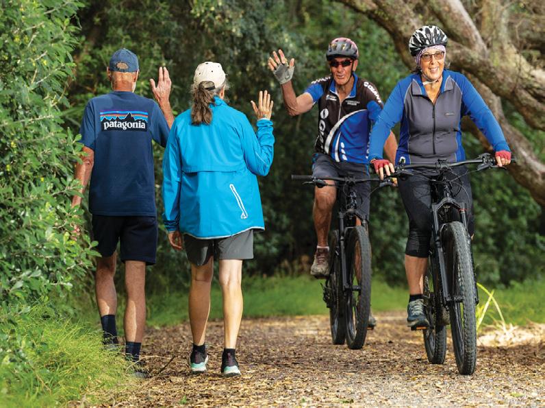
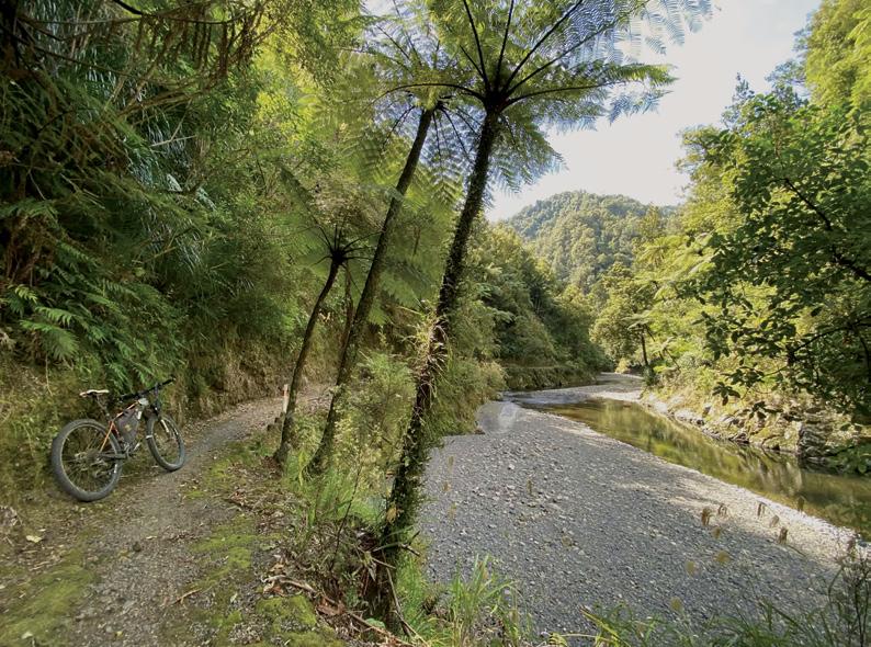
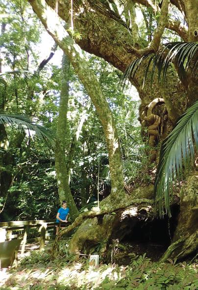
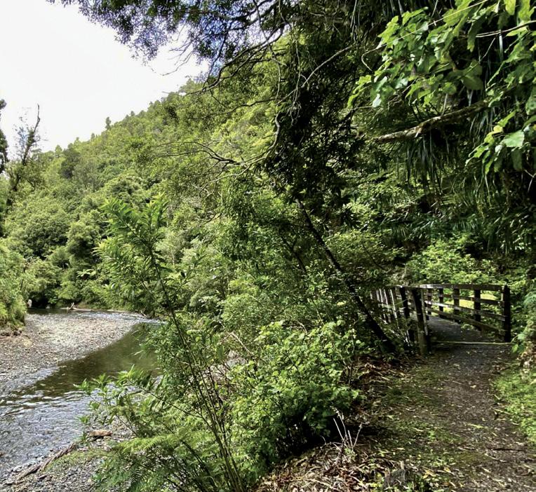
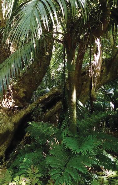
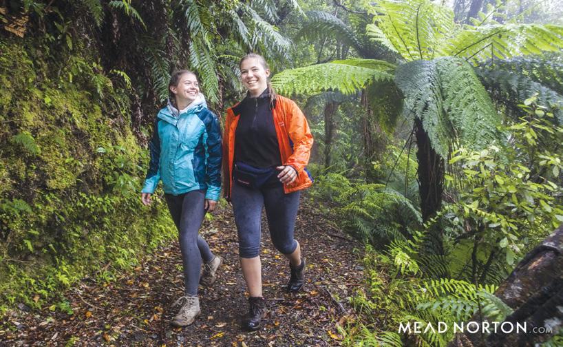
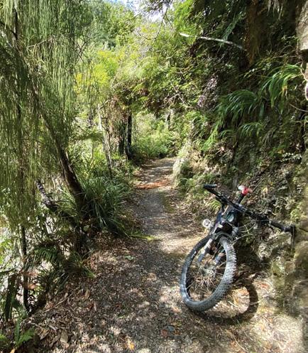
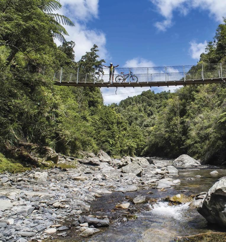
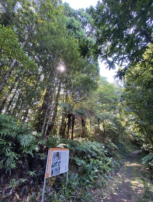
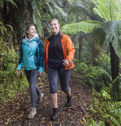
Above left: Walkers and bikers happy to share the track. Above right: The track alongside the Pakihi Stream. Below left: Palms enhance the view besdie the Pakihi Stream Below: Taketakerau the giant puriri in the Hukutaia Domain.
Jim Robinson.
Below right: Walking the Pakihi Track Photo by Mead Norton
Photo
Highway 35 or State Highway 2 Waioweka gorge to Tairāwhiti Gisborne.
Pakihi Track
Pakihi Track is the forest adventure section of Motu Trails. The track first opened around 1906 and since the early-1990s has been known as an iconic New Zealand mountain bike ride. Once a gnarly effort, the track was fully restored in 2011-12 with the addition of 25 bridges. It is enthusiastically maintained by Motu
Trails Charitable Trust.
For mountain biking, Pakihi track is rated grade four/advanced, largely reflecting numerous exposed drops to the side, and the general isolation. However, for hiking, the track is well-formed, with no steps or steep pitches. It’s a popular family outing.
Still, the track is in remote and dynamic backcountry with no mobile coverage, so to walk any distance, it is important to be prepared, especially in winter (talk to Ōpōtiki isite
for advice).
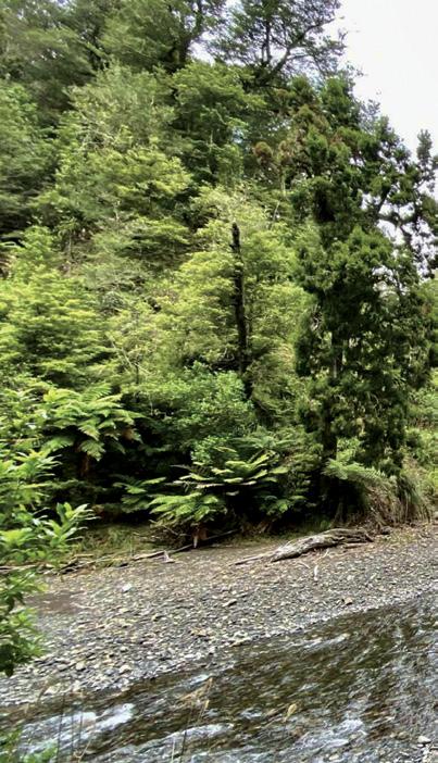
The forest is stunning. The lower 9km of the track follows Pakihi Stream, the upper 11km is high in the hills, but there are many sidestreams; this is rainforest with ferns and mosses all the way.
Pakihi Track has a trapping programme to remove rats, stoats and weasels, supporting the native manu (birds) you may see: North Island robin/toutouwai, North Island tomtit/miromiro, whitehead/pōpokotea, longtailed cuckoo/koekoeā and, if you are lucky, blue duck/whio.
Walking or running, the track is two-way. You can get a drop-off at the top and walk the whole 20.3km, a day trip that can be split into a relaxed overnighter, by staying at Pakihi hut.
Most commonly, walkers start at Pakihi Road end, 23km from Ōpōtiki (a 35-minute drive with gravel road). From the road end, walk up to the hut and back (18km return), or simply walk up as far as you choose. For fit and prepared trail runners, a blast to the track top and back is almost an exact marathon distance.
Dunes Trail
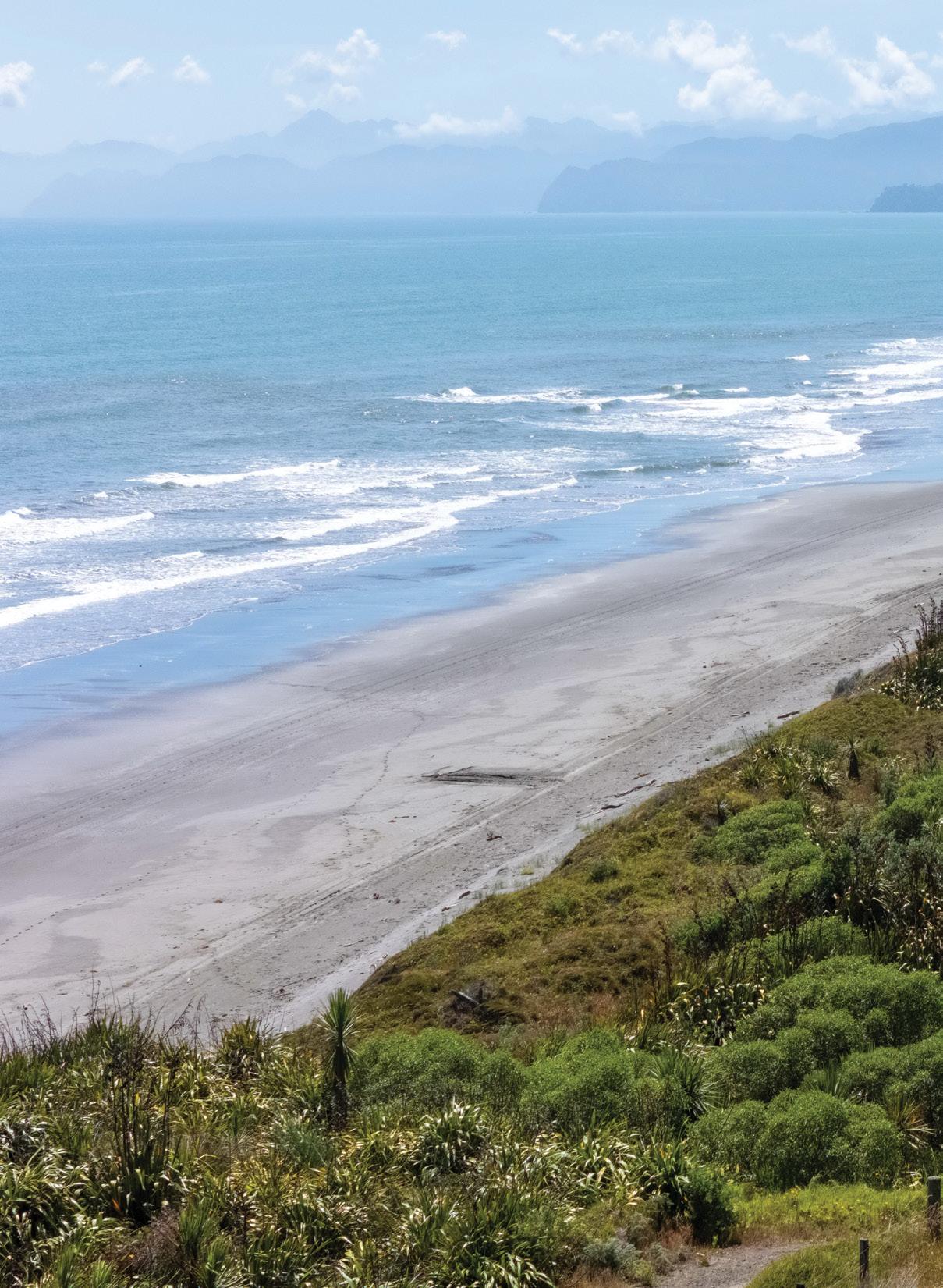
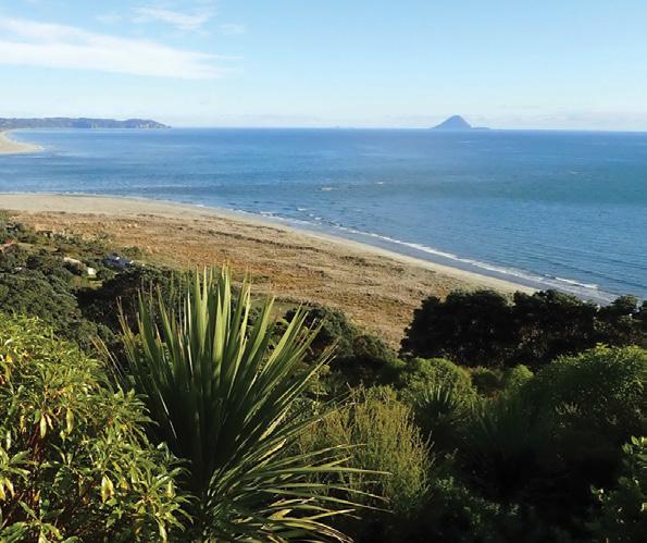
Starting in Ōpōtiki, the Dunes Trail is an easy, wide trail along the coastal dunes. From almost every rise, you are rewarded with expansive Pacific Ocean views. Much of the duneland benefits from extensive planting and
Ōpōtiki trails:
walks beyond the tourist track
trapping.
The Dunes Trail can be accessed from multiple points off SH35. For a short wander, head to Hukutaia Beach or Tirohanga Beach, from where the trail runs very close to, or even over, the beach.
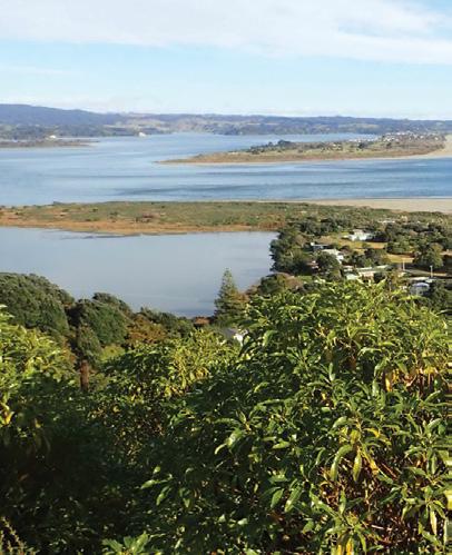
Close to Ōpōtiki, Pākihikura Harbour Trail is a short side-trip out to a new seawall, from where you can enjoy sweeping sea views in all directions.
Hukutaia Domain
Just 8km south of Ōpōtiki, Hukutaia Domain is a five-hectare protected remnant of magnificent lowland forest. At the heart is Taketakerau, a 2000-year-old pūriri tree of monumental proportion — not especially high but the girth is over 20 metres.
Hukutaia is wāhi tapu (sacred) for the people of Te Ūpukorehe. Care of the forest is in partnership with local conservationists.
The domain can be explored on short, well-formed walking trails. You can walk right around in 10 minutes so slow down instead and feel the presence of trees that have been standing for lifetimes. Ideal on a hot day as the soaring forest offers shade and cool.
Onekawa Te Mawhai Regional Park
Onekawa Te Mawhai Regional Park is 15km from Ōpōtiki and has several walking tracks, with the option of forming loops through the coastal forest and along Waiōtahe beach.
You can easily spend half a day here, the views from the pa sites of Onekawa and Te Mawhai are simply spectacular.
Above left: Two bikes on the Pakihi Track.. Above: A swingbridge croess the Pakihi Stream Photo by Neil Hutton Above right: Interpretation sign to add to the experience of the trail. Below left: Pakahuri Harbour from the seawall. Below right: A view of Ohiwa Harbour from Onekawa Pa site in Te Mawhau Regional Park. Photo by Jamie Throughton.
For more information, maps, accommodation bookings, hire bikes, contact Ōpōtiki isite Visitor Information Centre [https://www.isite.nz/find-an-isite/listing/opotiki-i-sitevisitor-information-centre]. For latest trail conditions email Motu Trails Charitable Trust on [info@motutrails.co.nz]
www.motutrails.co.nz
Facebook/Instagram: Motu Trails Cycleway email jim@motutrails.co.nz to have a brochure mailed to you free (NZ only)
SEPTEMBER Weather prediction
(Weather is an inexact science, like medicine. Dates given are to be regarded as focus points. Please allow 3-4 days leeway for all forecasts)
2nd Very strong winds in the southwest of the South Island and the Wairarapa.
3rd-5th A depression crosses the country. Unusually warm in the Auckland region.
4th Chance of heavy rain in the Clevedon-Kawakawa Bay causing possible slips in the area as well as in the New Plymouth area of Taranaki.
5th Chance of thick fog in Auckland which may cause disruptions to air traffic for a time. Later in the day, fog may also cause problems in the Wellington airport area.
5th-7th A depression crosses the country. This may bring a spell of heavy rain and possible surface flooding in North Canterbury, disruptions to infrastructure and transport systems and stock losses in Kaikoura, Hanmer Forest, Marlborough and in the lower North Island. This may also bring unusually warm maximums through the central parts of the South Island from the West Coast to Canterbury, with daily maximas possibly reaching into the low 20’s in some districts.
6th Chance of flooding in the north Auckland area and hail in Christchurch.
7th Further risk of damage to infrastructure in the Wellington region due to storms.
8th Chance of flooding in the Masterton district.
8th-9th Chance of fog patches in the Christchurch area.
9th-10th A large anticyclone moves onto the country.
10th Further storm activity around this time may cause damage to the power infrastructure affecting both the North and South Islands.
Over the next four weeks, weather conditions should become more settled due to the passage of more anticyclones east of New Zealand extending their ridges back across the country, with more northerlies than normal as a consequence. Nevertheless, there should still be up to seven depressions extending their wet fronts over the country. Rainfall likely to be below average in Northland, Auckland, the Waikato, Coromandel and all eastern coastal districts of the North Island with only
around half their usual rainfall for this time of year. In contrast, rainfall is likely to be much higher than average in Wellington, Nelson, and Central Otago, where up to 50% more to twice as much above the average is expected. Most other parts of the country can expect average rainfall. This period may still see further snow events in the fourth week of September and second week of October, particularly in the South Island, mostly Otago and Southland.
Christchurch region, possibly resulting in the cancellation of some flights.
21st Scattered thunderstorms likely in Northland to the Waikato, and later in Otago and Southland.
22nd Very heavy rain in Fiordland. Unstable winds in Taranaki may develop into tornado systems and cause some damage to property and power infrastructure.
by Ken Ring
The sun for this next four weeks should be above average for most of the North Island by around 25%, except in the Kapiti and Wellington regions which should be cloudier by around 10%. Similarly, North Canterbury and South Otago can expect around 25% more sunshine than normal, while Tasman, North and Central Otago and western Southland around 10% cloudier.
Temperatures over the next four weeks, should be warmer than normal by up around 0.5-1°C over most of the country, but up to 1.5°C warmer in South Canterbury and Central Otago.
11th-14th A series of intense wet and blustery fronts cross the country.
12th Heavy rain with chance of flooding in parts of Auckland.
14th-16th Heavy rain in the South Island, later spreading northwards throughout the country, before contracting to the North Island and clearing the South Island.
15th-17th Cold spell throughout most of the country. Some parts of Southland and Otago may have extreme overnight frosts during this period. Fog patches possible in the northern half of the North Island.
16th-18th A high pressure system crosses the South Island while low pressure eases over the North Island.
19th-22nd A depression crosses the country. Unstable winds and widespread rain over the North Island, but mostly dry with lighter winds over the South Island.
20th-21st Chance of thick fog in the
23rd-25th While high pressure ridges over the North Island, a wet trough ahead of the ridge crosses the South Island over the next couple of days, with light winds to a mostly calm air prevailing throughout.
23rd Scattered thunderstorms likely in the West Coast.
24th Chance of fog in the Christchurch area.
25th Cool overnight in the southwest of the South Island.
25th-26th High pressure weakens as it lingers over the country. Patches of fog likely in Auckland to the Waikato, and some showers in the northern half of the North Island and western and southern parts of the South Island.
26th-27th A wet front moves up from the Southern Ocean towards the South Island, but remains mostly blocked by high pressure for a couple of days.
26th-27th Unusually warm maximum temperatures in the far northwest of the South Island and in North Canterbury. In contrast, minimum temperatures may be unusually cool in the south of the South Island.
28th A weak front crosses in a light westerly flow. Chance of fog in Wellington.
29th-30th A high pressure system in the northern Tasman Sea begins to exert its influence over the country with only lingering rain activity over the North Island and mostly dry with a calm atmosphere over the South Island.
30th Fog possible in Christchurch.
Point View Reserve for stunning vistas
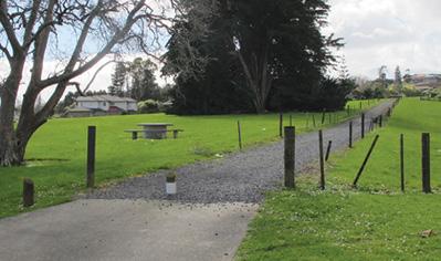
Ready to escape the hustle and bustle? Discover the hidden gem of Point View Reserve, a serene oasis offering stunning vistas and a breath of fresh air just a short drive from Auckland’s energetic urban heart.
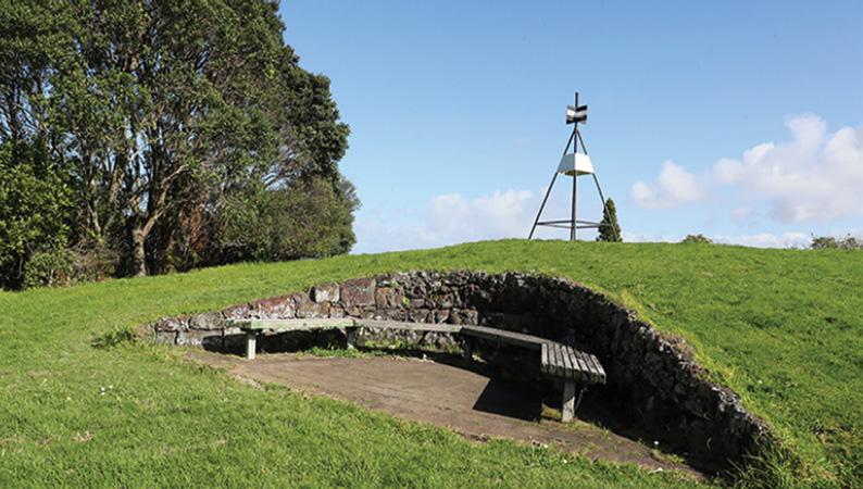
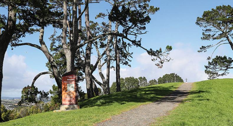
The Point View Reserve Loop in East Auckland is roughly 3.1 to 3.3 km long and takes about 45 to 60 minutes to complete. It features a moderate to challenging climb with over 700 steps leading to the summit, Nestled on Auckland’s outskirts, the reserve is your perfect spot to unwind and reconnect with nature. Wander through lush greenery, where native flora surrounds you, and enjoy panoramic views of the city, Rangitoto Island, the Hauraki Gulf on a clear day
This reserve isn’t just about the views; it’s a slice of tranquillity begging to be explored. Whether you’re keen on a peaceful stroll along its enchanting trails or you’re a photography enthusiast eager to capture the perfect sunset, Point View Reserve delivers a rewarding experience. Feel the gentle breeze as you hike uphill, with birdsong accompanying your every step. This is more than a reserve—it’s a sanctuary for the soul.
Families, couples, and solo adventurers alike are drawn to its breathtaking beauty and peaceful ambiance. Pack a picnic and savour a meal al fresco style, soaking in the serene surroundings. Come see why Point View Reserve is fast becoming one of Auckland’s favourite spots to relax and recharge. Let your stress melt away as you absorb the spectacular views that this charming corner of Auckland proudly offers.
How to get there
Address: The main parking area and trailhead are located at the corner of Caldwells Road and Point View Drive in East Tamaki / Dannemora.
Driving: The reserve is roughly a 20 km drive from the Auckland CBD. Travel southeast on the Southern Motorway (State Highway 1), take
the exit toward Highbrook Drive, and continue onto Ti Rakau Drive. Turn onto Botany Road and then into Point View Drive.
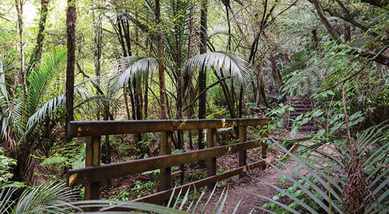
Above right: The trig on top of the hill.Middle right: A well formed path to the top. Below right: The track through bush.
Mount Robert Circuit -
from panoramic views to an alpine fault line.
Words and photos by Michael Henriks
The small village of St Arnaud lies at the entrance to the Nelson Lakes National Park, some 90 minutes south of Nelson.
From the village, it is a short walk to the lake and the DOC information centre. The information centre is an essential place to visit prior to undertaking any walks. It gives you an overview of the park’s history and its unique geology along the Alpine Fault line, which cuts through the surrounding area. The information centre will have the latest up-todate weather, and it is important to recheck the forecast before you start your walk.
For our long weekend at Lake Rotoiti, we have planned several walks in the park, and they are going to take us from a waterfall on the bush-fringed Lake Rotoiti, to the tussock and alpine herb fields of Mt Robert over the next few days.
The Mount Robert Circuit is one of the most popular day walks in the Nelson Lakes National Park. It blends a steep forest track with a tussock ridge line, along with spectacular views and bush covered slopes that plunge steeply into the lake.
Our previous day’s walk had
taken us up to Whiskey Falls while we patiently waited for the weather to clear for our Mount Robert Walk.
The following day, the weather had cleared, and we could see the top of Mount Robert from our accommodation.
With a clear view of the summit, we packed our gear and headed out of the village. We turned west on
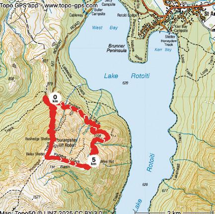
State Highway 63 for 2km before turning off onto Mount Robert Road. After crossing the one-lane bridge, the road narrows onto a winding and rutted gravel road for another 4.5 km to the first car park. From the lower car park, it is a further 600 metres
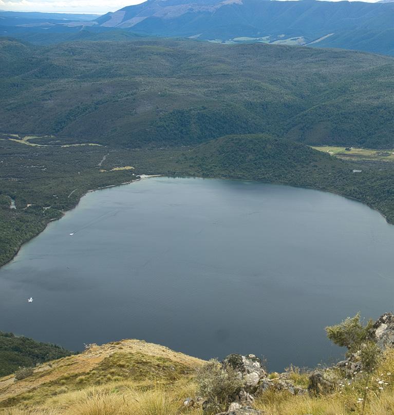
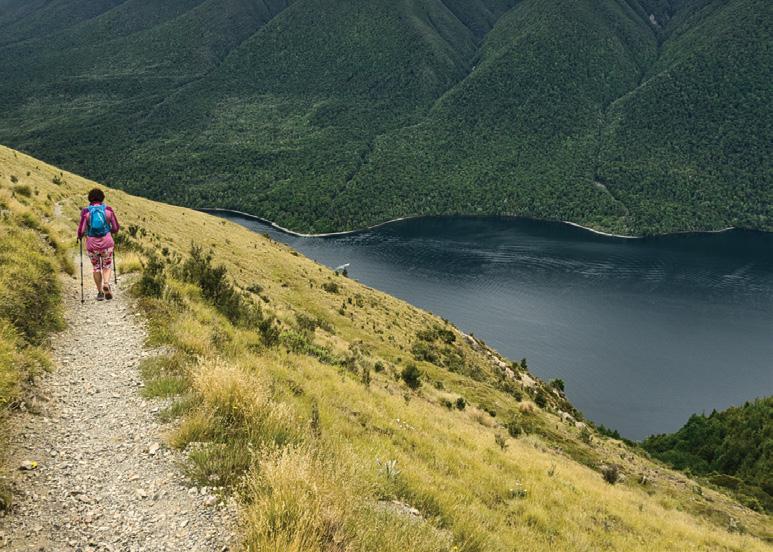
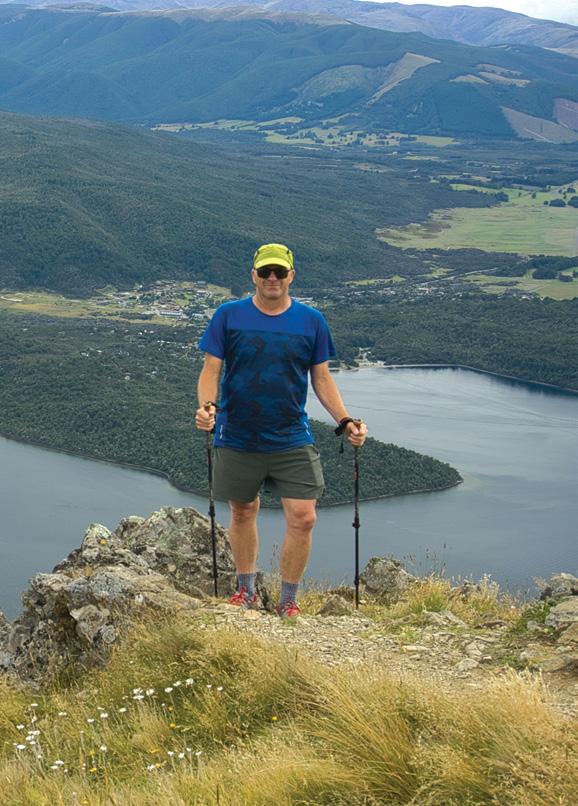
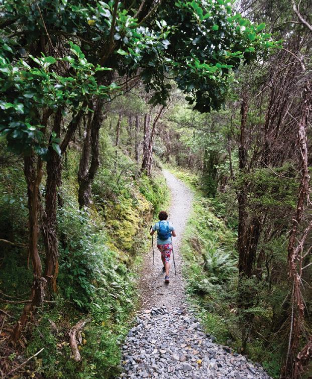
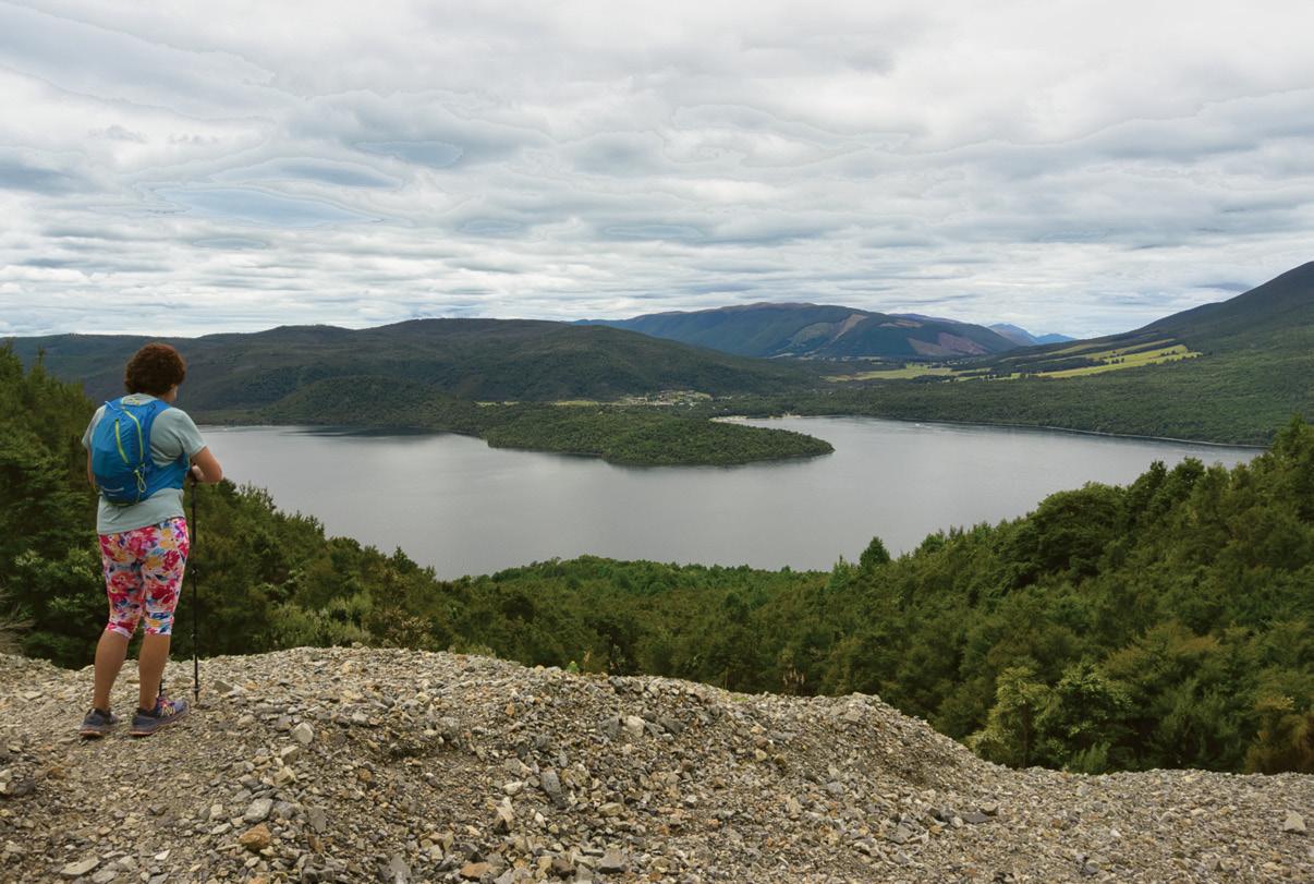
Above right: Author at view point overlooking Lake Rotoiti. Below left: Fellow walker on lake side track.
walk to the upper car park, along with toilets and the start of the Mount Robert Circuit.
At the entrance, the aptly named Pinch Gut Track zigzags relentlessly through beech forest as the track weaves between the trees, and then out onto the scarfaced lower slopes of Mount Robert, offering spectacular views of Lake Rotoiti far below. I could now see why Mt Robert’s first climber, Julius von Haast, was so inspired by the view that he forgot the time and had to make his way back to his camp in the dark.
Looking down at the lake, it is also hard to imagine that a major Alpine Fault runs east-northeast through the park, from the head of Lake Rotoroa, across Lake Rotoiti, and down into the Wairau Valley.
After gaining 400 metres in less than an hour, the trees thin out and the track emerges onto an open tus-
Your favourite walk could win you a free subscription
We are looking for readers’ favourite New Zealand walks. Many of us go out regularly walking on a route which we class as our favourite, for a number of reasons. Perhaps because for it’s scenery, it’s safe, it’s challenging, it’s flat, it’s hilly, it’s varied, or for whatever reason.
We would like you to tell us in your own words what is you favourite walk and why. Email us a story from say 250 up to 1200 words including a photo or photos.
We will now give you a FREE subscription (six months or more, depending on the article), or extension to Walking New Zealand magazine for walks published.
You can also post an article to Walking New Zealand, Freepost 78863, P O Box 1922, Palmerston North, or fax 06-358-6864.
If sending a photo by email please make sure photos are in high resolution.
Our email address is: walkingnz@xtra.co.nz.
Please put “My Favourite Walk” in the subject line and include your name and postal address.
www.walkingnewzealand.co.nz
right:
Above
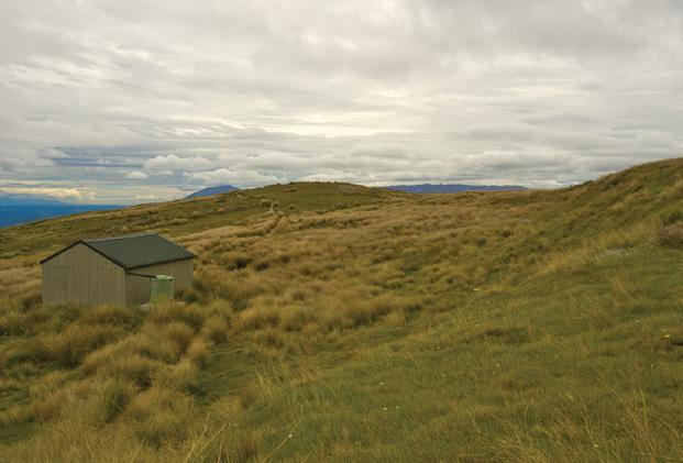
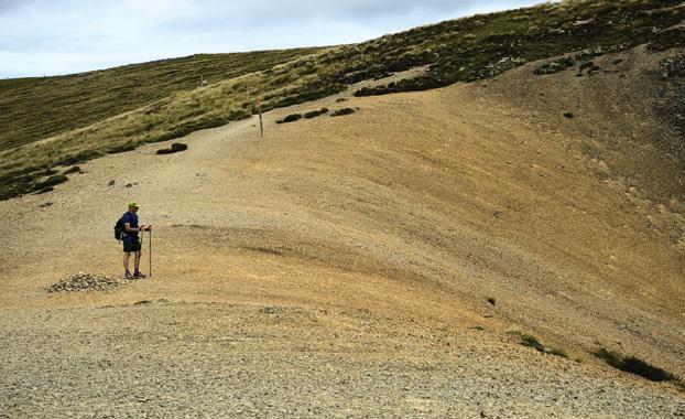
View over Relax Shelter Hut. Middle right: Fellow walker on lower lake side track. Below right: Walking in shingle scree.
New Zealand Walk
Mount Robert Circuitfrom
panoramic views to an alpine fault line.
sock ridge as you make your way to Relax Shelter. Inside there are two small windows framing views of the surrounding ranges. From the shelter, it is only a short walk to the summit at 1421m. From the summit, the track makes its way to the junction of Paddy’s Track.
The track now slowly descends the eastern side of the lake over several small scree slopes and through
tussock, passing a private hut as the track re-enters the bush line.
After entering the bush line, it is a short walk to the Bushline Hut. With no wind, we enjoyed lunch at the outdoor picnic table, which gave us a spectacular view of the lake far below, with the contrasting colours of the tussock, green bush and blue lake.
From the hut, Paddy’s Track continues its slow and winding descent down and around the lower eastern tussock slopes as it passes point 1098m. The track continues to wind
its way in and out of numerous small gullies, crossing several shingle fans before descending into the beech forest as you make your way back to the car park.
Above: A fellow walker crossing shingle scree.
Fact file
Mount Roberts Circuit
Distance and time: 9 km circuit, allow three to five hours.
Check the weather before setting out, as this is an alpine environment.
feet
Cushion
and blisters.
New Hooker Valley suspension bridge now open .
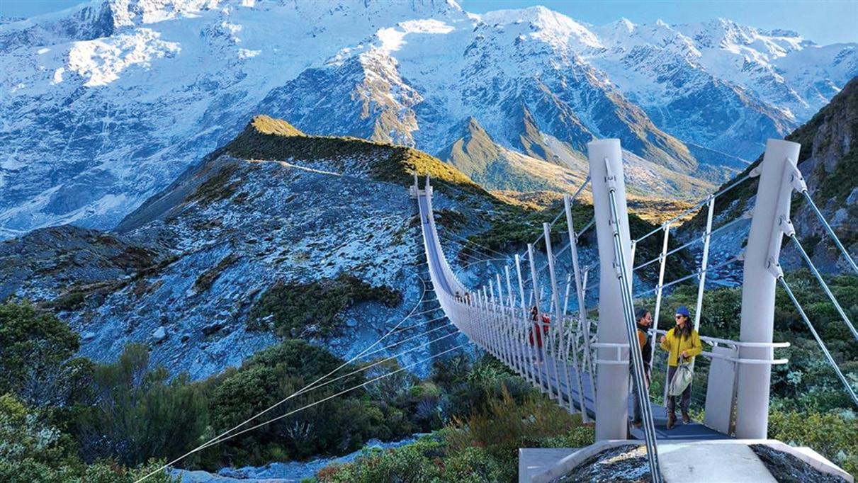
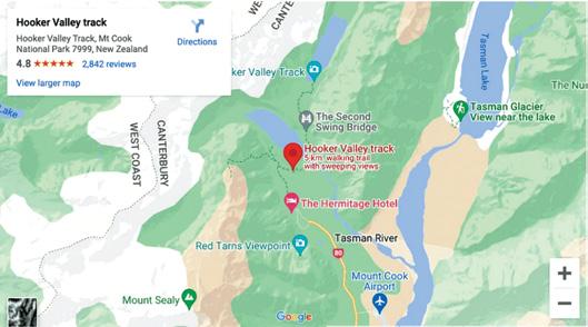
The eagerly anticipated new suspension bridge up the Hooker Valley at Aoraki/Mount Cook National Park opened to the public on the afternoon of Tuesday July 28.
It’s the longest suspension bridge which spans 189 metres across the Hooker River is an impressive feat of engineering and construction skill.
Aoraki/Mount Cook District Operations Manager Sally Jones says the opening of the new bridge is an incredibly special moment.
“The completion of this project is a significant milestone for Aoraki and a testament to the dedication, skill and commitment of everyone who has helped make this happen,” she says.
The project has cost $4.85 million. The new bridge replaces a much smaller one which closed last April after rainfall and storms caused riverbank erosion.
Construction of the new bridge began in August 2025 and since then mother nature has thrown everything at the building team. Working in a sub-alpine environment, the Abseil Access team and contractors battled 180 km winds and multiple un-seasonal snowfalls.
“Building something of this scale in such extreme conditions is no small achievement, and I am incredibly proud of what our contractors, partners and staff have achieved together. They have created a safer, more resilient crossing that will enhance the visitor experience for generations to come. I hope we haven’t put them off bridge building!” Sally says.
The engineer and architect behind the unique bridge design, Dan Crocker of DC Structures Studio, says seeing the bridge finally open is exhilarating.
“It’s not just the longest suspension bridge in New Zealand; it’s the longest single span footbridge of any kind in the country. Getting the opportunity to design a bridge
like this in one of our most iconic locations was an amazing experience. I can’t wait to see people crossing it,” he says.
The track up the Hooker Valley is the one of the most popular day hikes in the country attracting hundreds of thousands of visitors each year. It’s estimated the new bridge will bring around $167 million in revenue to the Mackenzie District over the next ten years.
Sally Jones says it’s very important to remind people of the winter conditions at Aoraki at this time of year and to check forecasts and conditions before heading out naturing.
“The reality at this time of year is that the track can be very icy and it can also be extremely cold. People need to be prepared for sub-alpine conditions. You need good solid walking boots or shoes, warm winter clothing, hats and gloves,” she says.
“The views are awe inspiring, but the weather and the environment can be brutal. The best part of the day in winter is often around late morning to mid-afternoon when the sun has warmed things up a bit.”
Above The new Hooker Valley suspension bridge, the longest in New Zealand.
Hokitika Gorge – a walk through one of our most beautiful natural wonders
TBy Patrick Tooher
here are some walks that stay with you long after you have returned home, and the Hokitika Gorge Walk is certainly one of them.
Located in the foothills east of Hokitika on the West Coast of the South Island, this spectacular walk may be relatively short, but it delivers scenery that rivals some of the country’s finest wilderness destinations.
From brilliant turquoise water to ancient native forest and dramatic swing bridges, every step offers another reason to pause and admire the surroundings.
The journey begins in Hokitika, a welcoming West Coast town famous for its pounamu (greenstone), wild beaches and relaxed atmosphere. From the town centre, I drove approximately 33 kilometres inland along Kokatahi Road before turning onto Hokitika Gorge Road. The sealed road winds through peaceful farmland with magnificent views of the Southern Alps in the distance. The drive takes around 30 to 40 minutes and is well signposted, making it easy to find the car park at the start of the walk.
The facilities at the entrance are excellent, with a large car park, modern toilets, picnic tables and information panels explaining the history and geology of the gorge. Before setting off, I took a few minutes to study the information boards and appreciate how this beautiful landscape has been shaped by thousands of years of
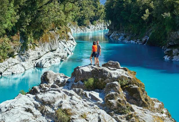
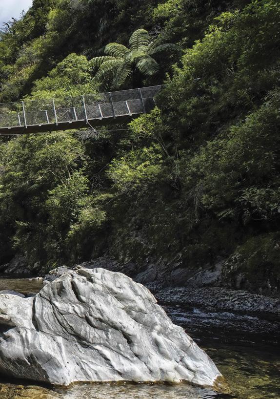
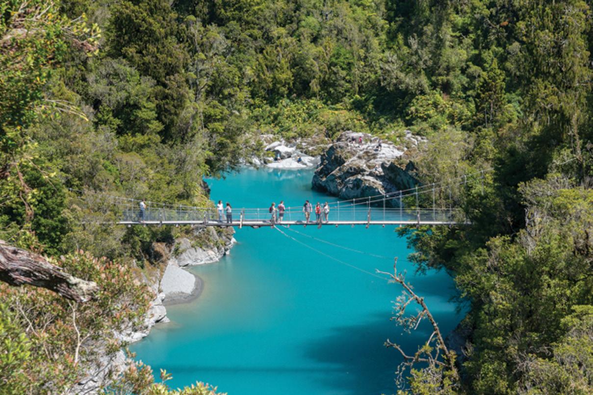
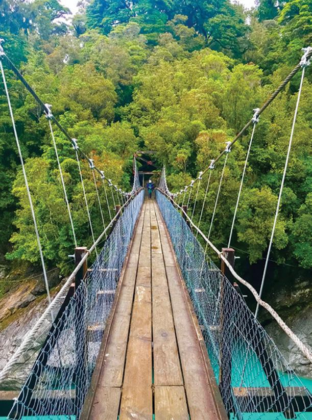
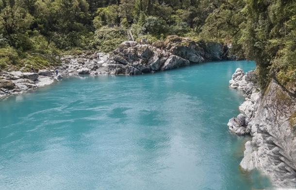
Above top and below left: The swing bridge over the blue waters of the Hokitika River.
glacial activity.
The Hokitika Gorge Walk is approximately 2 kilometres return, taking around 45 minutes to one hour at a leisurely pace. Although the distance is short, you’ll probably spend much longer here because there are countless opportunities to stop for photographs and simply admire the remarkable scenery.
The well-formed gravel track immediately enters magnificent native forest. Towering rimu, kahikatea, mataī and beech trees create a shady canopy overhead while tree ferns line the edges of the path. Moss-covered logs, native shrubs and birdsong complete the magical atmosphere. The forest feels untouched and ancient, reminding visitors of what much of New Zealand once looked like before European settlement.
The path is easy to follow, with only gentle climbs and well-maintained steps. Families with children and walkers of average fitness will have no difficulty completing the track, although care should always be taken on the steps and viewing platforms, especially after rain.
As I continued through the forest, the sound of rushing water gradually became louder. Soon I caught my first glimpse of the Hokitika River, and it was absolutely breathtaking. The river is famous for its extraordinary colour that is a brilliant turquoise blue that almost seems unreal. The vivid colour comes from finely ground rock flour created by glaciers high in the Southern Alps. Suspended in the water, these tiny particles reflect sunlight to produce the striking blue-green appearance.
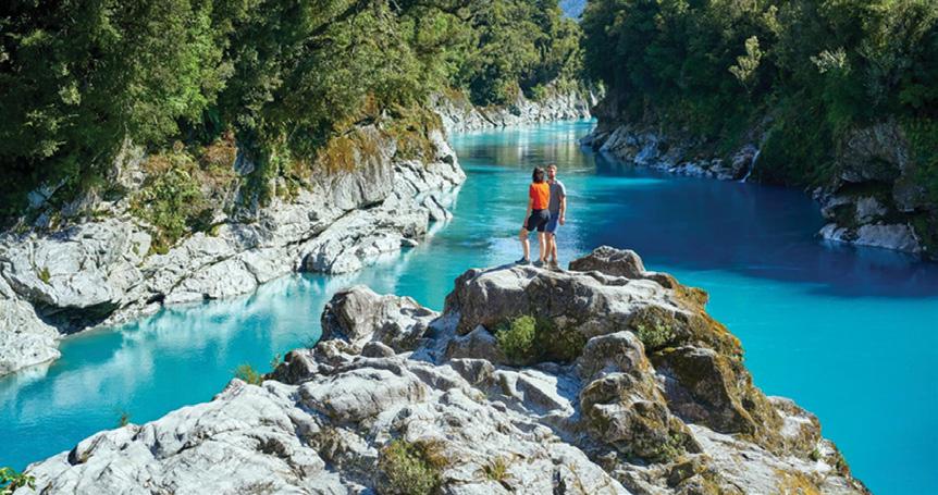
The first viewing platform offers magnificent views downstream through the narrow gorge. Massive grey rock walls frame the river while dense native forest clings to the surrounding hillsides. The contrast between the white rocks, green forest and vivid blue water creates one of New Zealand’s most photographed landscapes.
Continuing along the track, I soon reached the impressive swing bridge stretching across the gorge. Walking across the bridge was one of the highlights of the visit. Suspended high above the river, the bridge gently sways beneath your feet, adding a little excitement without ever feeling unsafe.
Halfway across, I stopped to absorb the incredible panorama. Looking upstream, the river twisted through
the narrow gorge beneath towering cliffs. Looking downstream, the turquoise water flowed peacefully through pools before disappearing into the surrounding forest. It was impossible not to stop for photographs from every angle.
After crossing the bridge, another short section of track leads to an elevated viewing platform that provides perhaps the finest view of the entire gorge. From here, the full beauty of the Hokitika Gorge unfolds before you. The river appears almost tropical in colour, yet the surrounding rainforest and rugged mountain backdrop remind you that this is unmistakably the wild West Coast of New Zealand.
Several visitors stood quietly alongside me, each taking in the remarkable scene. Some were busy photographing the landscape while others simply sat on nearby seats enjoying the peaceful atmosphere. It is one of those special places where people naturally lower their voices as they appreciate nature’s beauty.
The history of the area is closely connected with the Hokitika River, which has long been significant to Māori travelling between the West Coast and the Southern Alps. During the gold rush era of the 1860s, prospectors explored many nearby rivers and valleys in search of gold. Although the gorge itself remained
Above right: Walkers on a rocky outlook view the blue waters of the Hokitika River.
Ideal for walkers, hikers, golfers, sailors and all those who love or work in the great New Zealand outdoors.
Hokitika Gorge – a walk through one of our most beautiful natural wonders
largely untouched due to its steep terrain, the surrounding district played an important role during the West Coast gold boom.
Today, the gorge is protected and carefully managed by the Department of Conservation, ensuring visitors can enjoy its beauty while preserving the surrounding native ecosystem for future generations.
The return journey follows the same track back through the forest. Walking in the opposite direction provides entirely different views, and I found myself stopping once again at the swing bridge and viewing platforms. Changing sunlight constantly altered the colour of the river, with the turquoise appearing even more vibrant whenever the sun broke through the clouds.
Native birds were active throughout the forest. I heard the cheerful calls of tūī and bellbirds while several fantails darted around the trees searching for insects. The peaceful surroundings made the walk feel far removed from the busy pace of everyday life.
Back at the car park, several families were enjoying picnics while others prepared to begin their own walk. The facilities make this an ideal place to relax before driving back to Hokitika.
If time allows, it is well worth spending the remainder of the day exploring Hokitika itself. The town offers attractive cafés, galleries, greenstone carving studios and the popular Hokitika Beach, famous for its driftwood sculptures and spectacular West Coast sunsets. A visit to the National Kiwi Centre is another worthwhile attraction for visitors wanting to learn more about New Zealand’s iconic bird.
The Hokitika Gorge Walk demonstrates that you don’t always need to complete a long or difficult hike to experience unforgettable scenery. In less than an hour of walking, visitors are rewarded with one of the most spectacular river landscapes anywhere in New Zealand. The combination of pristine native forest, dramatic geology, crystal-clear turquoise water and excellent walking facilities makes this a destination suitable for walkers of all ages.
Whether you’re touring the West Coast or specifically seeking one of New Zealand’s finest short walks, Hokitika Gorge deserves a place on your itinerary. It is a walk that perfectly captures the rugged beauty, tranquillity and natural wonder that make the West Coast such a special part of New Zealand.
Waitatari/Harts Creek Track reopens near Leeston
The Waitatari/Harts Creek Track near Leeston has reopened, with access secured through a variablewidth esplanade and two easements under the Walking Access Act — made possible with Enhanced Access Grant funding from the commission. It’s a tidy outcome that shows how the right tools and funding can bring a community track back to life.
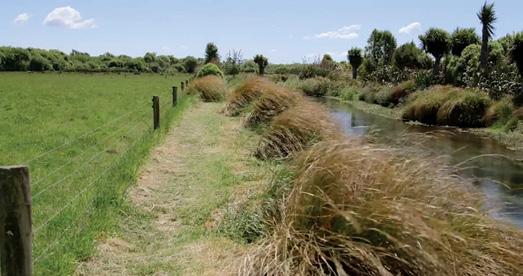
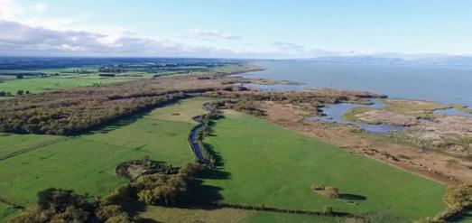
The Waitatari/Harts Creek Track is a leisurely walk along the creekside to a bird hide overlooking Te Waihora/Lake Ellesmere. The track is very easy and suitable for all ages and abilities, but there are a couple of boardwalks to navigate. The track is completely flat and takes about 20 minutes each way depending on how fast you walk.
Walkers will enjoy spotting several bird species on Waitatari/Harts Creek and from the hide itself. There is a small sheltered area near the car park that is ideal for a picnic. To get there, follow the signs towards the Lakeside Domain on Timber Yard Road and follow the yellow signpost from the road marked “Bird Hide”.
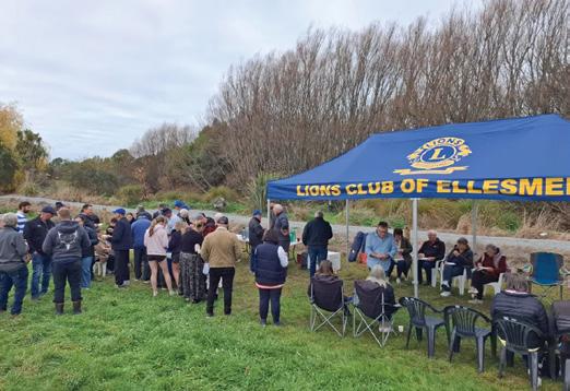
Above right top: The reopening ceremony at Leeston..
Above right: The track beside the strea.
Below right: An aerial view of the area.
What walkers should ask before choosing a supplement
Walking is one of the simplest ways to support health and wellbeing. It keeps us active, gets us outdoors and can become a routine we carry through many stages of life.
For regular walkers, looking after the body may include supportive shoes, hydration, balanced meals, stretching, recovery and, for some people, supplements. Yet supplement labels and claims can be difficult to compare. Before buying, pause and ask a few practical questions.
What am I actually trying to support?
Start by identifying your goal. Are you looking to support joint comfort, muscle function, sleep, energy, bone health, recovery or general wellbeing?
A clear reason helps you avoid choosing something simply because it is popular. If your goal is only “to feel better”, first consider the basics, including food, sleep, hydration, stress, movement, medication review and general health checks. Is the label clear?
active compounds. Doubling up is not always harmful, but it may mean you are taking more than you realise. A pharmacist or other qualified health professional can review your products together.
Does it fit with my medication or health conditions?
Natural does not automatically mean suitable for everyone. Supplements and herbs may interact with
ing distance too quickly? Allowing enough recovery?
Supplements may have a place, but they should not replace good nutrition, appropriate movement, rest or a health check when symptoms are new or unexplained.
Can I take it consistently?
A supplement is only useful if it suits your routine and is appropriate for you. Consider whether you prefer capsules, tablets, powders or liquids, how often it must be taken and whether the serving size is realistic.
The product with the longest ingredient list is not necessarily the best choice. A simpler option that fits your day may be more practical than one that stays unused in the cupboard.
When should I ask for help?
You should be able to see the active ingredients, amount per serve, suggested daily dose and relevant warnings. Products may use similar phrases such as “joint support”, “mobility” or “energy”, while providing very different ingredients and amounts.
If a product lists a blend without showing how much of each important ingredient it contains, comparison becomes harder. If you cannot understand the label, ask for more information before buying.
Am I doubling up on ingredients?
People who use several supplements can unknowingly repeat the same nutrients. A multivitamin, magnesium product, joint formula and sleep product may all contain overlapping ingredients.
Check for repeated nutrients such as magnesium, zinc, vitamin D and vitamin C, as well as herbs and other
medicines or be unsuitable for people preparing for surgery or managing certain health conditions. Check before starting a new supplement if you take regular medication, particularly blood-thinning, heart, blood pressure, diabetes, thyroid, sleep or mood-related medicines. The aim is not to be fearful, but to make an informed choice. Are the claims realistic?
Be cautious with products promising fast, dramatic or guaranteed results. Walking reminds us that most benefits come from steady habits over time, rather than one big effort. Supplements should usually be considered as one possible part of a wider routine, not a shortcut or cure. A responsible product should help you make a clear decision without pressuring or frightening you. Is this replacing something more important?
Tiredness, soreness, poor sleep or difficulty walking may be a sign to look at the wider picture. Are you eating enough protein and varied foods? Drinking enough water? Wearing supportive shoes? Increas-
Seek professional advice if you have a medical condition, take medication, are preparing for surgery, have new or unexplained symptoms, or are choosing a supplement for someone else.
A pharmacist can help check interactions, while a doctor can investigate symptoms. A qualified nutrition or natural health practitioner may also help you consider whether a product fits your wider wellbeing plan.
A simple checklist before buying
Ask yourself:
What am I trying to support? Do I understand the label? Am I already taking the same ingredients elsewhere? Is it suitable with my medicines and health conditions? Are the claims realistic? Have I considered food, sleep, hydration and recovery first? Can I take it consistently? Do I need professional advice?
Walking is a steady, practical habit. Supplement choices can be approached in the same way, calmly, clearly and without rushing. The goal is not to take more products, but to make better choices for your body, routine and stage of life.
Article provided by the formulation team at Puraz and Gold Health
We are looking for the best digital photos each month depicting walking
Now the time to get your digital camera out or look through your digital images and enter the
Walking New Zealand Digital Photo Contest
The image could be a scenic scene, a walk on the beach with the dog, a bush walk, a street walk or anything walking that takes your fancy.
The rules are simply: there must be a person or persons walking in the picture either front, side or back on, and can be in the distance. We require an emailed image in high resolution mode, in jpeg format as an attachment, and NOT embedded in Word or in the email, and NOT a link to a website to be downloaded. The subject line must have the words “Walking New Zealand Photo Contest” and the email must include the NAME, POSTAL ADDRESS and phone number of the person who took the photo and a small caption. In this contest ONLY ONE emailed photo accepted per month. Entry in the contest automatically allows us to print the image. The person who has their photo published will receive a six month subscription or a renewal to Walking New Zealand magazine of six months. If a picture is chosen for the cover page the person will receive a 12 month subscription or renewal Email your entries to: walkingnz@xtra.co.nz with subject line “Walking New Zealand Photo Contest” Only EMAILED entries will be accepted.
PHOTO CONTEST
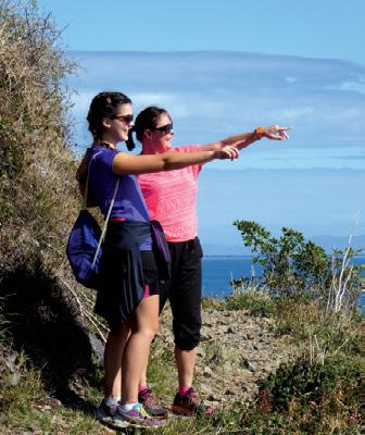
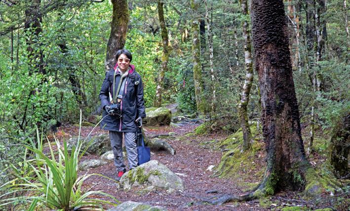
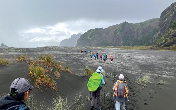
Above top: Nicole on Black Stream Track at Lake Rotoiti Nelson Lakes National Park looking for fungi to photograph. Photo by Rebecca Bowater Nelson
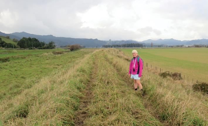
Above: Emma is walking a section of the Te Araroa Trail between Mangatawhiri and Mercer, Waikato region. The Mangatawhiri River Track follows the stop bank through farmland for 6.5 kms to the McIntyre Road end. Photo by Marlene Lynam, Pokeno, Waikato. Below: Track to Pararaha campsite and back through. Tunnel Point Camp to Karekare beach. Photo by Lesley Farmer, Glenfield.
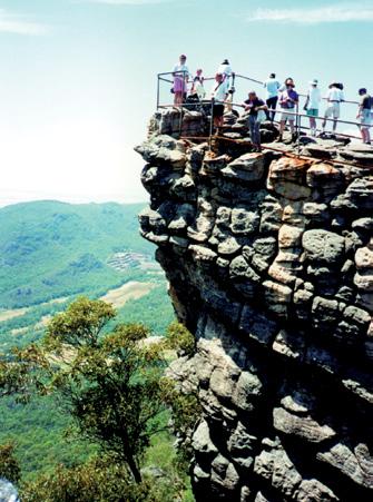
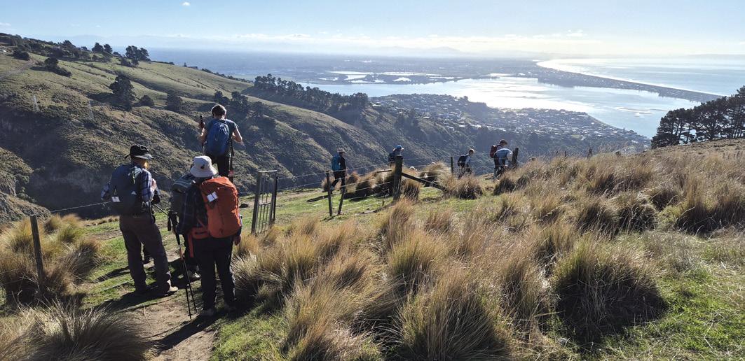
Above: Members of the Bishopdale Tramping Club enjoying the view of the Avon Heathcote Estuary / Ihutai.as they descend Eastenders Track to Barnett Park, Redcliffs. The morning had been spent doing volunteer tree planting on the Port Hills, Christchurch. Photo by Marie-Therese McRae, Papanui,
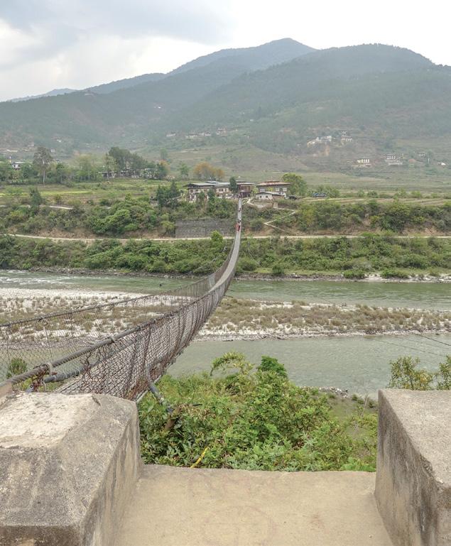
Below left: Hikers on the Punakha Suspension Bridge, which crosses over the Po Chhu River in Bhutan. At around 180 metres, it is the longest suspension bridge in the country. Photo by Claire Woodhall, Pandora, Napier.
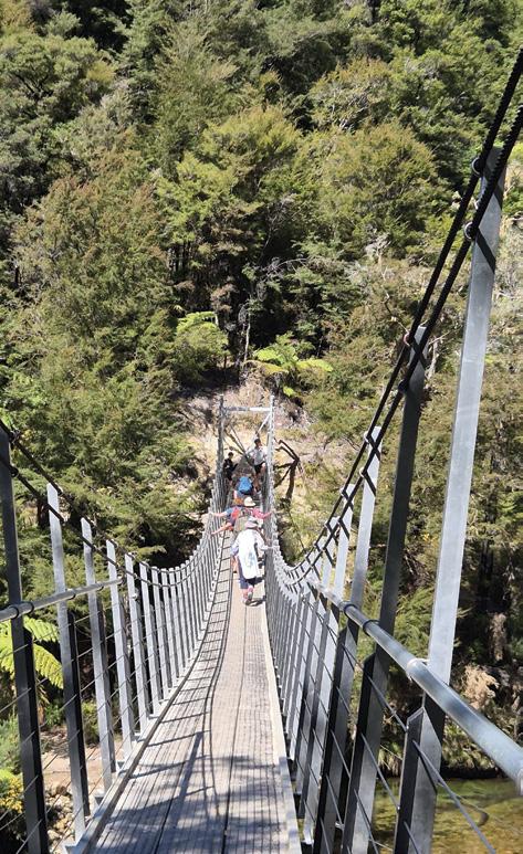
Below right: Members of the Upper Hutt Walking & Tramping Club walked the Abel Tasman in March, here crossing a suspension bridge on the section from Medlands Beach to Anchorage. Photo by Sharon Dunstan, Whitby, Porirua.
Ōrewa seawall shared pathway now open
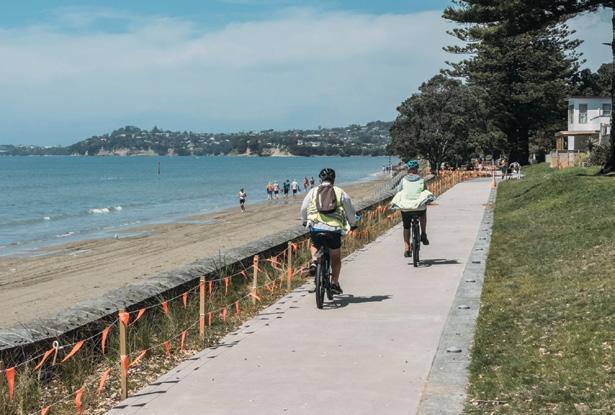
The new seawall and shared pathway at the northern end of Ōrewa Beach is complete and open to the public.
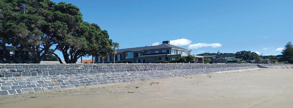
The seawall provides increased protection for the foreshore from erosion and coastal processes while also improving access along this part of the coastline for locals and visitors.
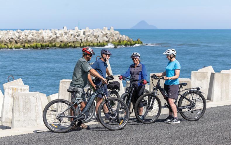
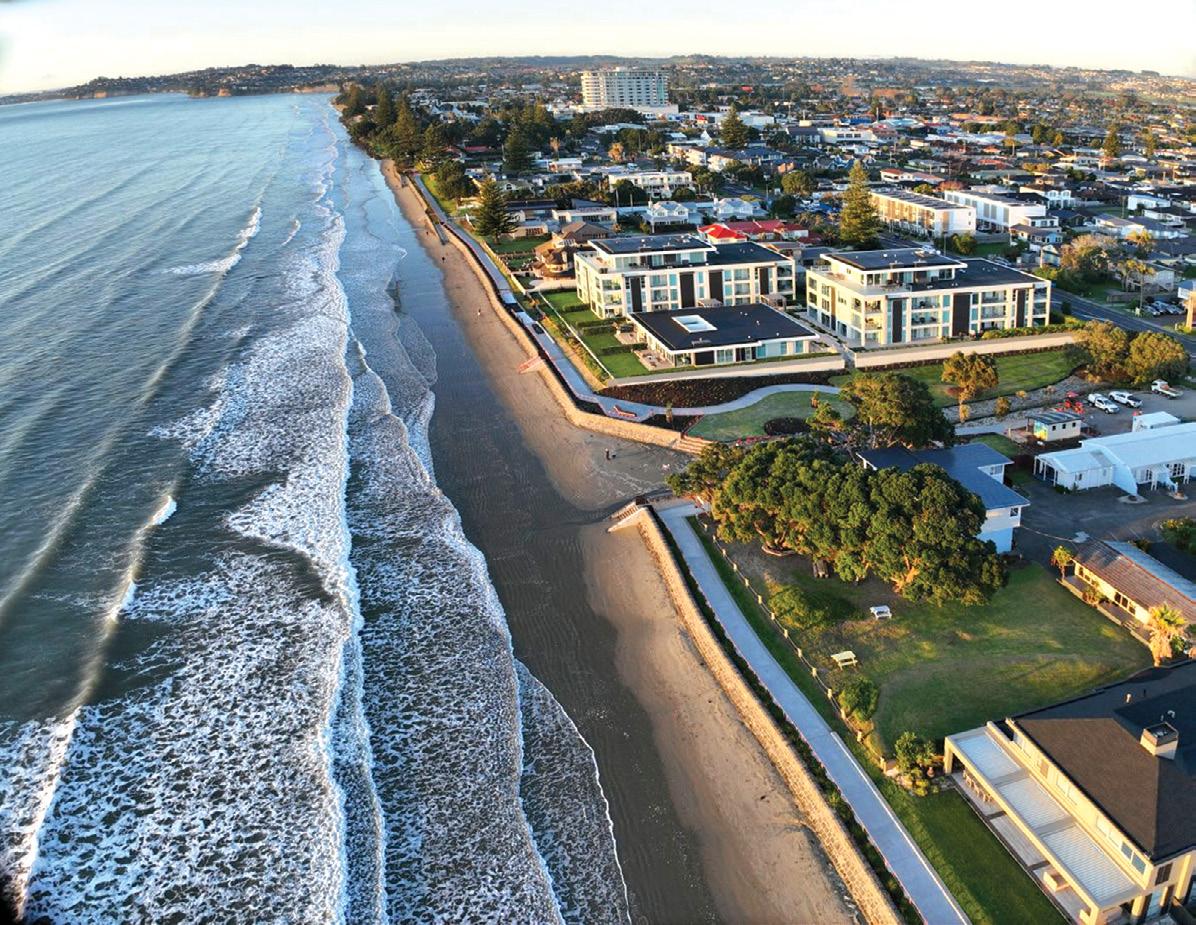
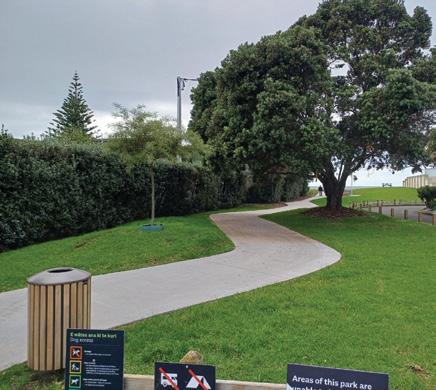
The Ōrewa walkway and seawall is a 600m-long seawall and shared path, between Marine View and Kohu Street, as well as a shared space and beach enhancements at Kinloch Reserve. The total budget for this project was $21.6 million.
Along with the seawall and shared pathway, the project included planting along the walkway and in Kinloch and Kohu street reserves, inground lighting, three ramps and five sets
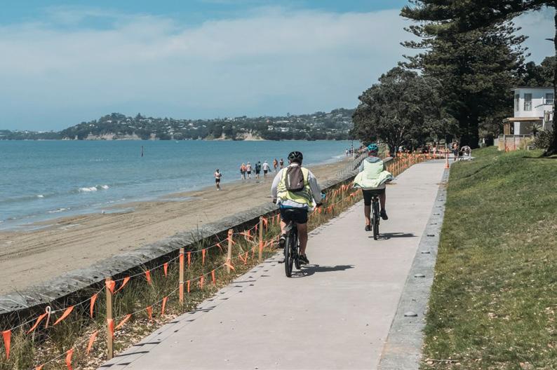
Above: An aerial view of the Orewa showing the seawall project. Below left: Cyclists on the shared pathway.
of stairs to improve accessibility to the beach. The design sought to minimise impact to existing vegetation and protect pōhutukawa trees currently at threat from erosion.
The project went through extensive consenting processes, including hearings and Environment Court appeals. The Environment Court granted resource consent for the seawall in August 2020, including direction on the final design to minimise impacts on the coastal environment. This was achieved with funding from Hibiscus and Bays Local Board’s One Local Initiative.
The construction started in October 2024 and project completion was in June 2026.
Ward Councillor John Watson said at the opening “Ōrewa Beach is one of the most popular beaches in the entire Auckland region. As a yearround attraction, it is always in high use by the community. It’s one of the
Boots Packs Rainwear
All your tramping essentials
One shop ~ Since 1988
jewels in the crown of the Hibiscus Coast.
“This has been a complex project that required significant investment, planning and perseverance, but it’s created a long-term asset that will help protect the Ōrewa beachfront and maintain public access for future generations.
“It’s also important to recognise this is a unique solution for a specific part of the coastline. Projects like this are extremely expensive, aren’t easy to deliver and can’t simply be replicated elsewhere, so we need to take a site-by-site approach to managing coastal erosion.
“The funding was achieved only because it became our local board’s priority one project. The local board of the day recognised the rate that erosion was occurring meant there
would be no reserve land left to achieve a walking connection for all abilities,” says member Parfitt.
. Above top: Looking at the seawall from the beach.
Above right: The new shared pathway for residents and visitors to use and enjoy.
Bay of Islands Walking Weekendfor good old fashioned Russell hospitality
There are few better ways to discover the Bay of Islands than on foot—especially when someone else has planned the route, arranged the transport, found the hidden tracks and organised something delicious for the finish.
The Bay of Islands Walking Weekend returns 9, 10, and 11 October 2026, bringing together a wonderfully varied programme of guided walks, local experiences and good old-fashioned Russell hospitality.
This is walking made easy.
Choose the experiences that appeal to you, book your place and arrive at the Russell Bowling Club, where your guide and fellow walkers will be waiting. Local people take care of the details and share the stories, history and places that visitors might otherwise never discover.
Much More Than a Walking Weekend
Despite its name, this is not a weekend designed only for serious trampers.
There are walks for different interests, budgets and fitness levels, from gentle heritage experiences and garden visits to coastal tracks, island adventures and challenging full-day hikes. You can book one walk, fill all three days, or build your own weekend around a mixture of walking, food, wine, sailing and sightseeing.
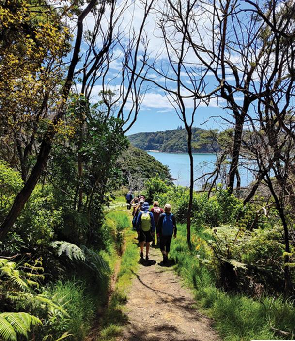
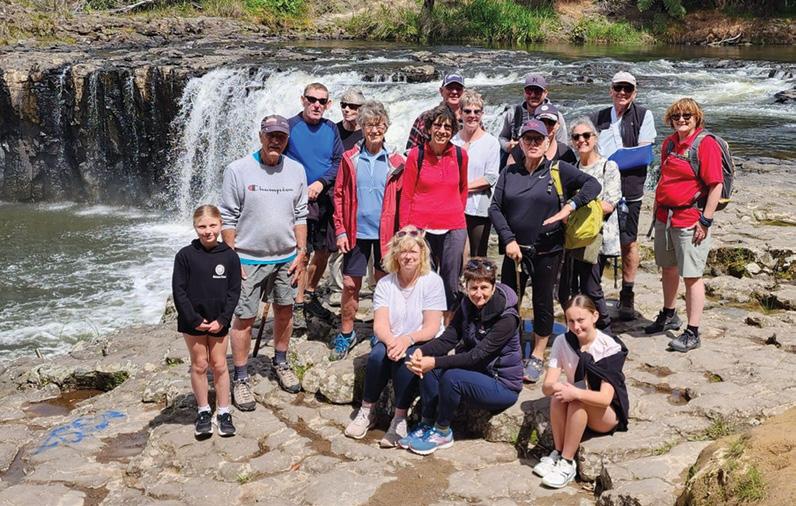
You could kayak along the Waitangi River towards the horseshoe-shaped Haruru Falls before returning on foot through native bush. You might complete The Full Circle, travelling from Russell to Paihia by ferry and following coastal pathways, boardwalks and bush tracks before crossing back to the Russell Peninsula.
For walkers who enjoy a challenge, Four Walks in One combines 21 kilometres of forest, coastal tracks, lookouts and ferry crossings into one satisfying day.
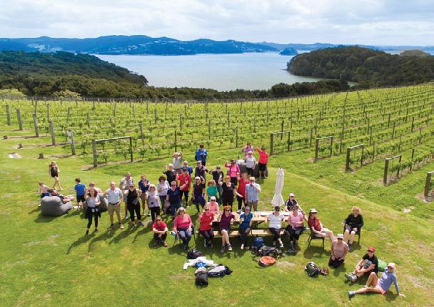
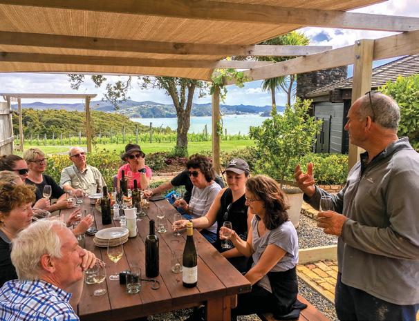
Those who prefer their exercise with a generous serving of food and wine can walk through private land to Pāroa Bay Vineyard or follow the coastline to Omata Estate, where wine and wonderful food await.
Other experiences combine walking with a visit to
iconic swordfish club, beautiful private gardens and places not normally accessible to the public.
“We came for the walks, but it was the people and the atmosphere that made us book again. By the end of the weekend, it felt as though we had known everyone for years.”
Islands, Wildlife and Extraordinary Views
The Bay of Islands contains 144 islands, and the Walking Weekend offers opportunities to explore some of the most beautiful.
A launch takes walkers across the bay to Moturua Island, where regenerating native bush, abundant birdlife, sheltered beaches and remnants of the island’s fascinating human history sit alongside panoramic coastal views.
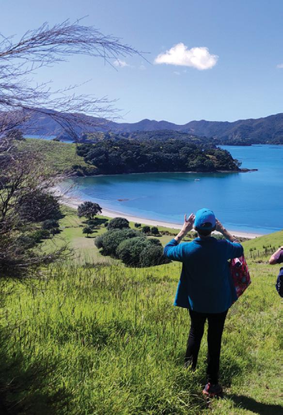
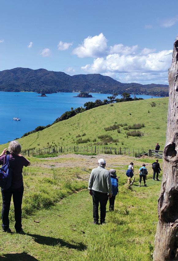
On Urupukapuka Island, the Ultimate Loop explores the largest island in the Bay. The route passes historic pā sites, former settlement areas, native bush and some of the region’s most spectacular bays and viewpoints.
Back on the mainland, new experiences for 2026 include the Te Wahapu Loop Bush Walk and Elliot Bay Magic.
It is this local access that makes the weekend so
Above right: Walking on Urupukapuka Island.
Below left: Wine tasting at Omata Estate VIneyard.
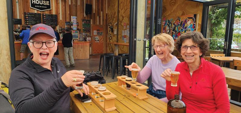
PhatHouse Brewery, Russell’s colourful history, local clubs such as the
special. Knowledgeable guides do far more than lead the way. They share the stories, personalities, natural features and history connected to each place, allowing walkers to experience the Bay rather than simply pass through it.
Come Alone—You Won’t Walk Alone
One of the loveliest things about the event is how easy it is to join.
Some people arrive with a whole walking group. Others bring a partner or friend. Many come by themselves, knowing they will quickly become part of a friendly group.
Walk numbers are kept manageable, making it easy to chat along the way. There is always someone to share a view with, help take a photograph or join for a drink afterwards.
The range of accommodation available in Russell also makes the weekend suitable for different budgets. Visitors can choose from holiday parks and cabins, motels, apartments, holiday homes and boutique waterfront accommodation.
The Heart of the Weekend
The Russell Bowling Club is the welcoming headquarters of the Bay of Islands Walking Weekend and an important part of its character.
It is where walkers gather before setting out, meet their guides and compare stories at the end of the day. Boots are swapped for comfortable shoes, strangers become
Bay of Islands Walking Weekend
friends and tales of hills, weather, wildlife and unexpected adventures grow more entertaining with each retelling.
On Saturday evening, walkers come together at the Russell Bowl-
ing Club for dinner before the everpopular prize giving. While we call it a prize giving, it’s really an evening of laughter and celebration. There are prizes for all sorts of things—from travelling the furthest to attend, spotting the most wildlife, mastering a kiwi call, or the funny
moments that happened out on the trails. You never quite know what you’ll be recognised for, which is all part of the fun.
It’s a wonderfully relaxed way to finish the day, with plenty of laughs, stories shared between old and new friends, and a real sense of community. There are no winners or losers—just people celebrating a fantastic weekend in one of New Zealand’s most beautiful places.
“Everything was organised, but it never felt overly organised. We could relax, enjoy the scenery and have fun— and the Saturday night dinner was an absolute highlight.”
Why Walkers Keep Returning
The Bay of Islands Walking Weekend has been running since 2013, and its many returning participants are a testament to the event’s enduring appeal.
Some come back to revisit a favourite walk in a different season. Others choose completely new experiences each year. Many return because there is still so much to discover—and because they know they will receive a warm welcome when they arrive.
No two walks are quite the same. One may involve a peaceful stretch of native bush and birdsong; another could include a ferry crossing, a vineyard lunch, local history, a hidden garden or a table full of food at the end.
Whether you walk for the scenery, the stories, the food, the challenge or simply the fun of it, this weekend offers something special.
Bring your boots, bring your friends—or come on your own.
The Bay of Islands will take care of the rest.
Details
Bay of Islands Walking Weekend 9–11 October 2026
Bookings are essential. Walkers should check the distance, duration and grading of each experience before booking.
bayofislandswalkingweekend. co.nz
Above left: A group in front of a beautiful waterfall.
Middle left: Tasting at PhatHouse Brewery.
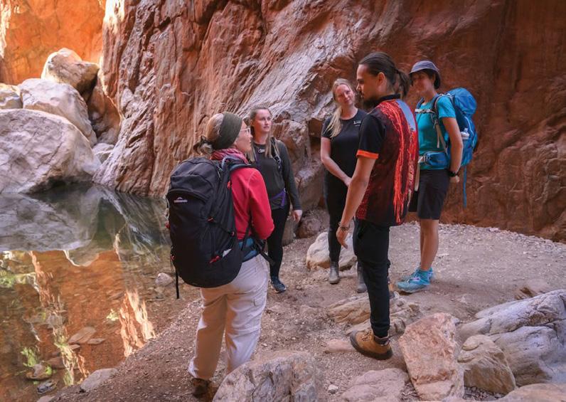
Below left: It;s cheers at Paroa Bay.
Native Nations Indigenous Youth Exchange to create partnerships
Twenty Indigenous young leaders from Aotearoa New Zealand and Central Australia will come together this August for the 2026 Native Nations Indigenous Youth Exchange, a life-changing cultural and leadership programme supported by Australian Walking Holidays and the World Expeditions Foundation.
The initiative will create opportunities for Indigenous youth to strengthen cultural identity, build confidence and leadership skills, and connect with peers from other Indigenous nations while walking in the footsteps of their ancestors.
Now entering its fourth year, Native Nations has become one of the Southern Hemisphere’s leading Indigenous-led youth leadership initiatives.
Since launching in 2023, the programme has connected Indigenous youth from Australia, Aotearoa New Zealand, Canada and Vanuatu, providing many participants with their first passport, first flight and first international cultural exchange experience. The programme has also fostered Indigenous tourism partnerships, leadership pathways and regenerative tourism initiatives that continue to benefit communities long after each exchange concludes.
The 2026 exchange, themed Ngā Ara Tūpuna – The Ancestral Pathways , will bring together 10 Indigenous youth from Aotearoa and 10 Indigenous youth from Central Australia alongside Elders, educators and community leaders. The exchange will begin in Aotearoa from 1–11 August before continuing through Alice Springs, Uluru and Central Australia from 20–30 August.
A highlight of this year’s programme will see participants camp on Country before undertaking a 16-kilometre return walk to the summit of Ruwi (Mount Sonder), one of Central Australia’s most significant cultural landscapes. Guided by Aboriginal cultural knowledge holders, participants will walk through the darkness to reach the summit at sunrise while learning the stories, histories, cultural traditions and deep connection to Country that make this place so significant.
Native Nations Founder Nadine ToeToe said the programme continues to create transformational opportunities for Indigenous young people.
“Many of our rangatahi experience
their first passport, first flight and first Indigenous international connection through Native Nations. What starts as a journey often becomes a turning point in their lives,” Ms ToeToe said.
“Every year we watch young people return home standing taller. They leave with stronger cultural identity, greater confidence, lifelong friendships and a deeper understanding that Indigenous peoples around the world share many of the same strengths, challenges and aspirations.”
Australian Walking Holidays General Manager Philip Wyndham said the programme demonstrated the power of travel to create meaningful social impact.
“Travel has the power to change lives, but some journeys leave a far deeper legacy. Native Nations gives Indigenous young people the opportunity to connect with culture, Country and one another in ways that build confidence, leadership and pride in who they are,” Mr Wyndham said.
“We are proud to support a programme that places Indigenous voices, leadership and lived experience at its centre while creating meaningful opportunities for young people to learn from one another. This is reconciliation in action.”
The World Expeditions Foundation, which supports community-led projects that deliver long-term social, environmental and cultural benefits, is partnering with Australian Walking Holidays to help ensure more Indigenous young people can access opportunities that expand horizons, strengthen cultural connection and create pathways for future leadership.
A key partner in this year’s exchange is Arrernte and Ngangiwumirri woman,
Aunty Rayleen Brown, Chair of the Northern Territory Aboriginal Tourism Council (NTATC) and founder of Kungkas Can Cook. Aunty Rayleen is a cultural educator and long-time advocate for Indigenous enterprise, cultural preservation, and community-led development across Central Australia.
“When young people walk together, learn together and share their stories, they realise they are not alone. That is incredibly powerful,” Aunty Rayleen said.
“Bringing young people together through culture, leadership and shared experiences is one of the most important investments we can make.”
Beyond the exchange itself, Native Nations has become a catalyst for Indigenous tourism development, helping create Indigenous-led regenerative tourism trails and strengthening relationships between communities across Australia, Aotearoa New Zealand and the Pacific.
This opportunity is being made possible through the support of valued partners such as Paddy Pallin, Northern Territory Tourism & Events, Voyages, as well as Charles Darwin University (CDU).
-About Native Nations
Native Nations is an Indigenous-led charitable initiative connecting Indigenous youth through cultural exchange, leadership development and regenerative tourism. Operating across Australia, Aotearoa New Zealand, Canada, Vanuatu and the Pacific, the programme creates opportunities for young people to strengthen cultural identity, expand horizons and build lifelong connections.
Above left A group on a previous experience in Central Australia
By
Walking Leaven for 2027
Phillip Donnell explores the Geography of the Rise: How Short Walks Leaven the Human Spirit
Just as a dense lump of dough relies on the quiet power of leaven — a fermenting agent like yeast or sourdough starter that releases gases — to transform, a heavy mind often finds its expansion by stepping into the open air.
In breadmaking, this biological catalyst works unseen, breathing life into flat flour and water by weaving tiny pockets of carbon dioxide into the gluten matrix, forcing the entire mass to swell and rise against gravity.
Walking outdoors serves as a psychological and emotional leaven,
where the expansive sky, the rhythm of steps, and the sensory richness of nature gently permeate a compressed spirit. Both processes require time, patience, and exposure to the right environment to work their magic. Ultimately, just as leavening rescues dough from remaining a hard, unyielding cracker, a walk in the wilderness can break up internal stagnation or brittleness.
Footsteps is New Zealand’s national walking club, and welcomes the participation of all walkers who want to venture further and expand their horizons.
The Footsteps programme for 2027 is now finalised, with all dossiers downloadable from www. footstepswalkingclub.com (click on the “Activities” tab). There is a great range of “ingredients” in next year’s
mix, guaranteed to add some “leaven” to your walking ambitions.
Short Walks In Six
Outstanding Regions of New Zealand
New Zealand’s landscapes act as a geographic leaven, elevating the traveller’s spirit with every step. For those seeking maximum scenic reward with relatively little physical strain, Footsteps will offer walks in six distinct regions. Here we mention just a handful of the trails in each case.
At the very anchor stone of New Zealand lies Stewart Island (Rakiura) (27 Jan – 4 February). This remote paradise consists of vast, untouched ecosystems where native birds far outnumber humans.
For a brief but deep immersion into this pristine realm, the Fuchsia Walk in
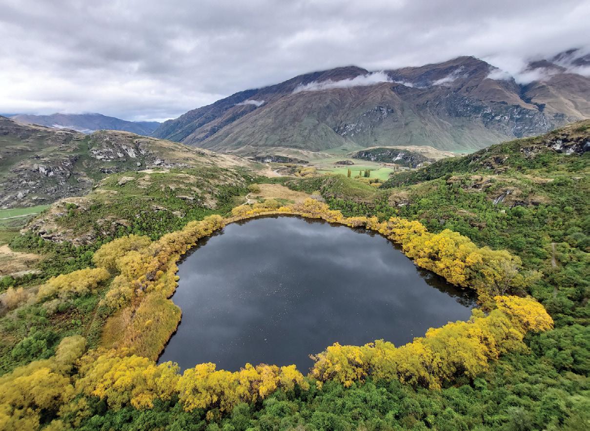
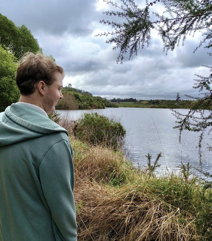
Above: Diamond Lake near Wanaka.
Phillip Donnell
Oban is an absolute treasure. Taking just 30 minutes, this easy trail cuts through a lush, regenerating reserve dominated by kōtukutuku (tree fuchsia) — the largest fuchsia in the world.
Under a dense canopy of orange, papery bark and pendulous purple flowers, walkers are treated to a vibrant sensory chorus of tūī, kererū, and bellbirds feasting on nectar. It is a brief escape that perfectly encapsulates the raw, primeval peace of the far south.
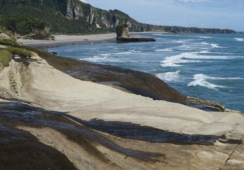
Buller (7-13 February) and Westland (14-20 February) feature coastal splendour and glacial waters. In the northern Buller region, the Truman Track near Punakaiki provides a dramatic 15-minute journey. It weaves through an untouched, sub-tropical forest of nīkau palms before abruptly emerging onto a rugged, wave-battered Tasman Sea littoral.
Further south, moving from Greymouth toward Haast along the Westland highway, the Blue Pools Track serves as an essential stop.
A short 30-minute stroll through mature beech forests leads to suspension bridges over the Makarora River, revealing deep, crystal-clear pools of pure glacial water.
In the Southern Lakes region (21-27 February), we will experience panoramic heights. It swaps dense rainforest for expansive alpine basins. Surrounding Lakes Wakatipu, Wānaka, and Dunstan, a standout short trek is the Mount Iron Track just outside Wānaka township. This glacier-carved rocky knoll requires an easy 1.5-hour loop.
Ascending through fragrant kānuka shrubland, walkers are rewarded at the summit with a spectacular 360-degree panorama of the Upper Clutha Basin and the jagged peaks of the Southern Alps.
Taupō/Tongariro (14-20 March) and Eastland (4-10 April) combine coastal grandeur with volcanic power. The volcanic heart of the North Island beats fiercely in the Taupō and Tongariro zone.
The Huka Falls Walkway provides a front-row seat to nature’s raw energy. A gentle path traces the Waikato River to a viewing platform where New Zealand’s longest river violently
www.walkingnewzealand.co.nz
constricts, forcing 220,000 litres of brilliant turquoise water per second over a roaring ledge.
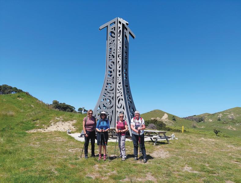
Our journey through the Eastland region tracks the Pacific Coast Highway from Whakatāne, around the remote East Cape, to Napier. Here, the Cooks Cove Walkway offers a highly scenic, 5.8-kilometre out-andback track that masterfully blends dramatic coastal geography with rich cultural history.
It includes The Beacon of Light sculpture, the Cove lookout, the Hole in the Wall, and the Cook memorial.
Above right: Cook’s Cove Monument in the East Cape.
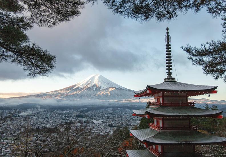
Below right: Mt Fujiyama in Japan.
Short Walks in Six Outstanding Overseas Destinations
Nature also acts as a global geographic leaven, using the open air to lift the weight of routine from our minds. Across six diverse corners of the earth, Footsteps will take you to top trails tailor-made to initiate internal expansion. Just one example is described from each tour.
Our first excursion is to the whispering alps of central Honshu in Japan (8-30 May). Nestled high in the mountains, the alpine sanctuary of Kamikōchi feels like a watercolour painting come to life.
The Myōjin Ike Pond Loop is a
Walking Leaven for 2027
gentle, velvet path that traces the ribbon-blue Azusa River. Walking beneath a delicate canopy of larch and willow trees, the trail yields to wooden boardwalks over wetlands, culminating at Myōjin Pond. Here, the mirror-flat, glassy water reflects the towering, jagged granite teeth of the Hotaka mountain range — a silent, sacred meeting of water and stone that instantly quietens the mind.
In Southeast Alaska (10-24 July), the Horseshoe Lake Trail is one of the
premier short walks in Denali National Park, offering immense visual reward for minimal effort. This 3.2 km loop winds through a lush forest of aspen and spruce before dropping down to encircle a brilliant, glacier-fed oxbow lake.
Along the flat shoreline, hikers frequently spot active beaver dams, massive moose wading through the shallows, and sweeping views of the Nenana River.
It is a highly accessible, scenic trek
that perfectly captures the park’s vibrant wilderness in under two hours.
Our trip to the Canadian Rockies (25 July – 8 August) will include a famous limestone choral. While Banff National Park is famous for its towering alpine giants, its valley floors hold
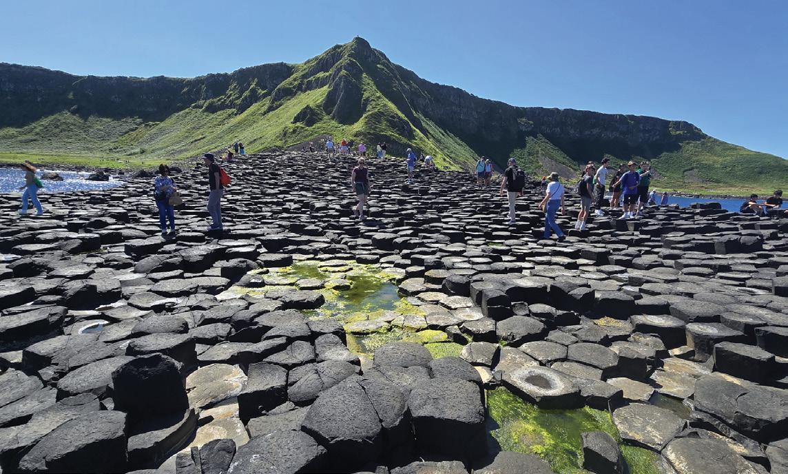
Above: left: The Giant;s Causeway in Ireland.
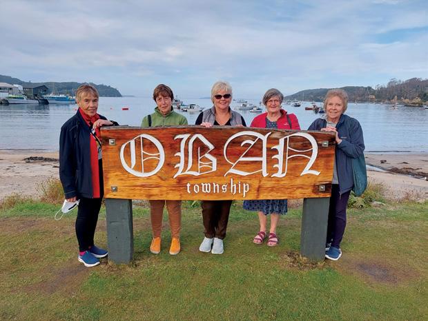
Below left: A group behind the Oban township sign on Stewart Island.
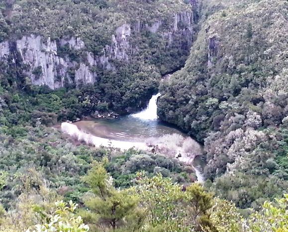
Below right: Tieke Falls on the Waihaha River on the western shores of Lake Taupo.
intimate secrets.
The Johnston Canyon Lower Falls Trail is a dramatic short walk along a cantilevered steel catwalk bolted directly into deep limestone walls. Walking mere metres above the frothing turquoise waters of the canyon, you are drawn into the earth.
The trail culminates in a short, dark rock tunnel that bursts open directly in front of a crashing waterfall, where the cold, thundering spray washes away worldly worries.
Ireland abounds with emerald cathedrals. Just south of Dublin, the ancient glacial valleys of County Wicklow pulse with an old, mossy magic.
The Poulanass Waterfall Trail in Glendalough is an invigorating, brief ascent alongside a rushing, teacoloured stream. Winding through a dense, primeval forest of native Irish oak, where every trunk is wrapped in a vibrant coat of green, the path feels like a temple of leaves.
It rewards the climber with a serene viewpoint overlooking the dark, brooding waters of the Upper Lake before descending past the silent stone ruins of a medieval monastery.
Iceland’s dramatic volcanic landscapes (11 September-3 October) offer high-impact poetry with minimal effort. A case in point is the frozen symphony of the south coast. In the heart of Skaftafell, the trail to Svartifoss (Black Falls) is a captivating 45-minute loop.
A gradual uphill path through lowlying, wind-bent birch scrub opens suddenly into a sharp ravine. Here, a slender veil of water plunges into the abyss, framed entirely by a sweeping, dark amphitheatre of hexagonal basalt columns.
These hanging pillars of volcanic stone look like a frozen pipe organ, playing a silent song of geological time and volcanic power.
The year concludes with the pale giants of Western Australia (6-21 November ). South of Perth, the Margaret River region trades the sun-baked outback for an enchanted forest of giants.
The Boranup Karri Forest Walk is a brief, ethereal loop through a grove of pale-barked Karri trees — some of the tallest living hardwoods on Earth. Walking through this quiet, sun-
dappled understory of vibrant green ferns, the massive white trunks stretch upward like pillars holding up the sky.
The air smells intensely of fresh eucalyptus and rain, offering a deeply grounding, tranquil breath of life unique to the southwest coast.
Ultimately, these brief journeys prove that the human spirit behaves much like bread dough. Left to the heavy confinement of routine and the compression of modern life, our minds
Above: On the Truman Track, Paparoa National Park.
and hearts can become flat, dense, and unyielding. Yet, when we expose ourselves to the gentle leaven of the open air, a quiet “fermentation” begins. The sights, sounds, and rhythms of the trail act as an invisible catalyst, weaving pockets of space, wonder, lightness and fresh oxygen into our internal landscapes.
We return from these short walks altered by the wilderness, rising against the gravity of our daily worries to feel significantly uplifted. We warmly invite you to come and join our mix and feel your mood rise.
FOOTSTEPS
WALKING AND TRAVEL CLUB OF AOTEAROA NEW ZEALAND
Day walks in 20 regions of NZ and overseas. We cover the whole of NZ in a 4-year cycle.
3-4 walking trips overseas each year.
Trips are inexpensive and best value.
Phone: 021 172 3244, 07 544 9509
Email: footstepsanz@gmail.com or www.footstepswalkingclub.com
Tūtaenui Reservoir provides a popular walk
Ouch! Sore feet while walking?
Hikers Wool is 100% New Zealand wool. Cushion your feet to prevent pain, rubbing and blisters.
Buy online or at selected stockists
For more info visit www.hikerswool.co.nz
By Dave Scoullar
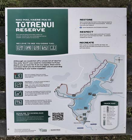
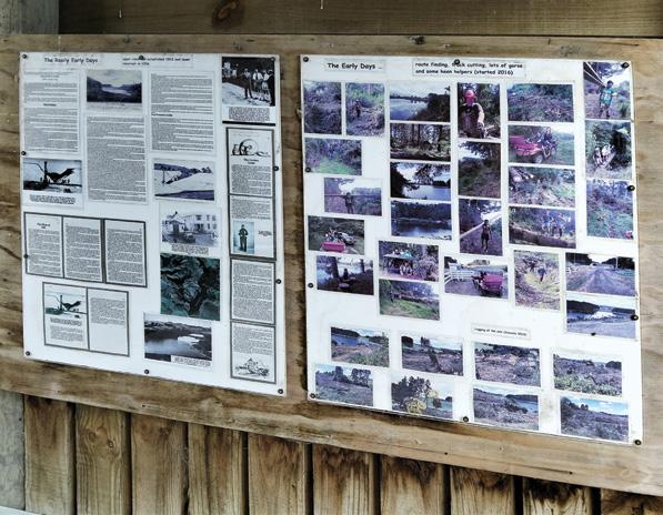
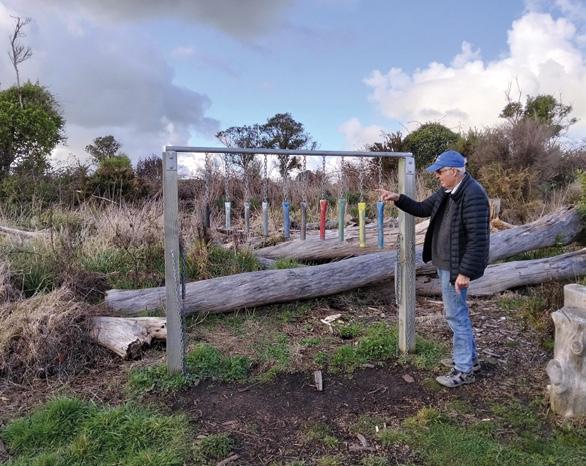
After years of hard work beginning with cutting a path through thick gorse and wading through mud, the Tūtaenui Stream Restoration Society and Rangitīkei District Council celebrated opening the Tūtaenui Reservoir (also known as Marton B & C Dams) as a public reserve in 2022.
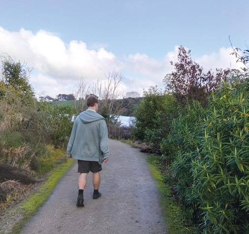
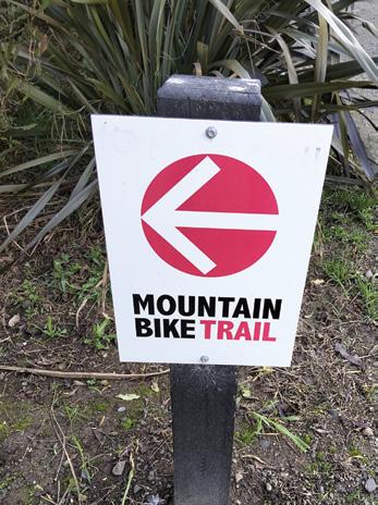
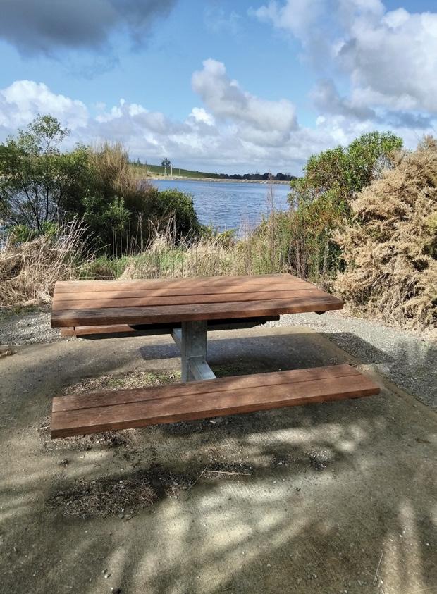
.The 4km loop track near Marton in the Manawatū-Whanganui region is proving to be a popular community asset for walking, running and mountain biking. The easy-grade and mostly flat shell-rock track takes about 45–60 minutes to complete. It offers scenic picnic spots with seating and glimpses of native birds like tui, piwakawaka, riroriro as well as finches, cormorants, black swans and duck. For mountain biking there are designated trails that offer more challenging elevation gains and scenic viewpoints.
As well, a permanent orienteering course provides easy, moderate and hard routes with maps that can be downloaded or printed. Perch and rainbow trout are present with fishing spots marked around the reservoir.
Above left: Viewing a dam. Above right: The track is wide and mud-free. .Below right: Separate mountain biking trails.
Reserve
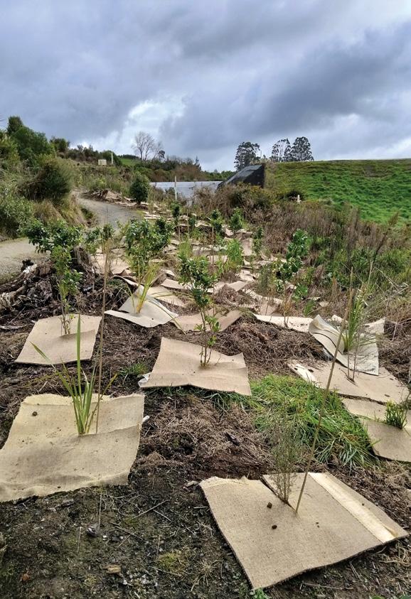
Removing pine trees changed the entire landscape of the dams and allowed the potential to be seen and planting to begin. Over the years thousands of trees have been planted, many by the council and during community planting days and this remains an ongoing restoration project.
The well-signposted track has
been improved greatly and there is progress on making it even better. A trapping programme has made a massive difference to the ecosystem with regular visits by volunteers to exterminate pests and encourage the return of native wildlife.
Open year-round, the area is suitable for pushchairs, is dog-friendly (on-lead), allows horse riding and there is limited overnight self-contained camping. Toilets are available and a kiosk provides information on
the reservoir’s history.
Getting there: Drive north from the centre of Marton on Wellington Road (which becomes Tūtaenui Road). Cross the one-way bridge and the car park is immediately on your left.
Above left: History display in kiosk. Above right: Admiring an art installation. Below left: Planting is ongoing. Below right: Plenty of seats
Learn, explore and connect at the Wairarapa Walking Festival
The Wairarapa Walking Festival returns for its sixth year from 6th - 15th November.
Participants are invited to discover the region’s varied landscapes and rich heritage through a curated programme of guided walks.
From coastal panoramas and regenerating forests to working farmland and historic townships, participants will have the opportunity to encounter native flora and fauna, explore active farms, learn from local experts, and enjoy experiences that celebrate the region’s wine, rich stories and fantastic scenery.
The festival is grounded in the principles of ako, hōpara, and hono— learning, exploring, and connecting.
Each walk is designed to reflect these values, developing a deeper appreciation of local ecosystems, cultural and historical narratives, and community connections.
With more than 20 walks on offer, the programme caters to a wide range of interests and abilities.
Thanks to the commitment of a
dedicated team of volunteers, the majority of walks are free of charge, though advance registration is required.
Some of the 2026 highlights include:
Rangitumau Maunga
Connection with whenua: A steady climb up this iconic landmark north of Masterton will bring walkers to an amazing 360 degree view.
The ascent is made possible by local landowners Dawn, Craig & the Bunny Family and will be attended by local writer, researcher and storyteller Joe Potangaroa (Ngati Kahungunu, Rangitane, Tuhoe, English).
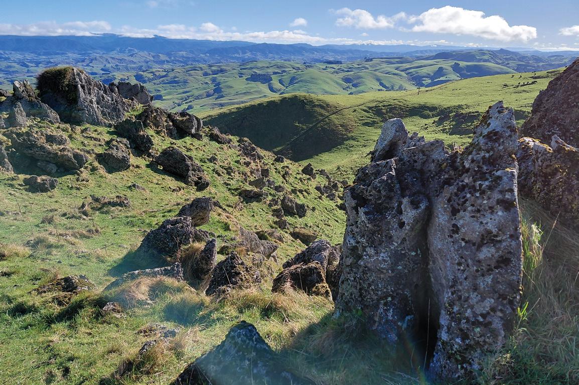
Along the way Joe will share his knowledge of tikanga, taiao and Wairarapa history linked to Maunga Rangitumau. Walkers will learn about the connection with the whenua / land. The trail climbs through working farmland with most of the walk a gentle grade, and a bit “steeper at the top” Dawn says. Reaching the towers and limestone rocks at the top, you have com -
manding views in all directions. The Tararua Ranges, Pukaha hills stand out on the skyline and on a clear day Ruapehu Maunga is visible.
Stella Bull Park ABC 123
Walking and Learning: This urban walk gives participants the opportunity to discover shapes, numbers, colours, letters and wonderful things to talk about.
The activities and walk times are designed for parents and grandparents to join in and pick up fun ways for encouraging curiosity and chatter with the children they care for. Teachers, carers and home-schoolers may also find the oral and numeracy learning from Rachel Solomon and Alice Horsham support learners. This walk will finish in Stella Bull park with morning tea and a story reading.
Other numeracy and literacy events during the 2026 Wairarapa Walking Festival: Storybook Stomp and Sausage Sizzle in Carrington Park, Carterton. A Masterton based walk around a quiet area of town discover-
Above: Limestone rocks and the view on Rangitumau Maunga.
ing shapes, numbers, colours, letters. There will also be a Teddy Bears Picnic, Songs and Storytime.
Pig Ridge Track, Aorangi Forest Park
Exploring the regenerating forest ridges: This walk begins at the northern side of the Aorangi Forest Park and follows a tramping track to the west branch of the Tūranganui River.
The track has been recently maintained by the Greater Wellington Backcountry Network, GWBN and The Aorangi Restoration Trust). Suitable for fit trampers, the walk climbs 150m up to the Pig Ridge before descending 200m elevation to the River. The route is an out-n-back and covers approximately 8km travel through regenerating forest.
To make the most of the day, walkers will be transported from Martinborough up the Haurangi Road to the bush edge.
Twilight Nordic Walking
A new walking experience for 2026: Discover the magic of Nordic Walking at twilight in the beautiful surroundings of Carrington Park.
This relaxed one-hour guided walk offers a unique opportunity to experience the benefits of walking with specially designed Nordic poles, which engage the whole body while improving balance, posture and fitness.
As daylight fades, enjoy the peaceful atmosphere of the park, listen for the evening birds, and experience nature in a different light. Whether you’re an experienced walker or trying Nordic Walking for the first time, this friendly and welcoming event is suitable for most fitness levels.
Poles and basic instruction will be provided, making it easy for everyone to join in and discover why Nordic Walking is one of the world’s fastest-growing outdoor activities.
Registering for walks
The dates: 6th – 15th November 2026 Search “Wairarapa Walking Festival” on eventfinda to book your spot! Most walks are free of charge, some have a small fee to cover transport costs or as koha to the community group leading them. Registrations and tickets available from 3pm 30 th August 2026. Www.facebook.com/wairarapawalkingfestival
Above right: The 5 metre cabbage tree sculpture in Greytown’s Stella Bull Park by Carterton artist Niko Thomsen. Below left: : View of the Aorangi Forest Park.
Fiordland Mountain Journeys
By Grant Dixon & Ian Brown
Fiordland is New Zealand’s largest wilderness – a vast maze of mountains, sheer-sided valleys, dense forest, and dauntingly high rainfall, that presents some of the most challenging tramping and transalpine terrain in this country.
These challenges did not deter Grant Dixon and Ian Brown, two hardened Australian adventurers who, over decades, traversed the length of Fiordland, almost always off-track and on the tops, braving the steepest routes and ferocious storms while climbing numerous mountains along the way.
“It was in the late summer of 1977. I stepped onto the tourist bus to Piopiotahi/Milford Sound, wondering what the windows in the roof were for.
When we came around the corner into the Hollyford Valley and the Darran Mountains, tourists and climbers alike, agog as one, pushed their faces against the misty windows to gape up the valley walls, and then up through the roof to find the mountain tops,” says Brown.
“Kea crying through the rain in high basins. Resting out the storm in a flapping tent. Squeezing delectable rock against a blue sky, fingertips worn to crying point. A rock wren hopping over boulders. Battling an ice wind and stinging, horizontal rain. Fresh snow on the summits. Strolling over alpine turf and daisies with jagged peaks all around, yellowtipped at sunset. Sniffing out a passage through an unknown steepness. The magical beauty of the streams, forests and meadows.”
“This informal vision provided the planning context for repeat visits to the greater Fiordland region over the subsequent 15 years..”
Both Dixon and Brown are outstanding photographers, and Fiordland: Mountain Journeys is a stunning portrait of wild Fiordland, country most people never experience from the ground. With essays describing the highlights of their journeys, the book provides a unique perspective on what makes our largest national park so outstanding in a country already brimming with extraordinary backcountry. It will have great appeal to trampers, hunters and mountaineers, as well as armchair adventurers who prefer to experience epic journeys vicariously
All the Skies We See
All the Skies We See is a lyrical picture book that takes readers on a journey through one full day as told by the ever-changing sky.
From the blush of dawn to the burning red of bushfire, the deep calm of onyx night to the shimmering technicolour of the aurora, each page captures a new mood, colour and landscape of our shared world. Through rich imagery and poetic language, the book celebrates the beauty, power and rhythm of nature, and our quiet place within it.
Older or more advanced readers will be able to unpack deeper meanings and literary techniques such as personification, simile, metaphor, alliteration and the use of fragments. As the final page closes, we are reminded that while every day ends, the sky will always begin again. The book All the Skies We See is by Harry Ebert, with Illustrations by Nicholas Rix is to be released in October 2026.
Ideal for walkers, hikers, golfers, sailors and all those who love or work in the great New Zealand outdoors. Baselayer MOVE and ULTIMATE available now in New Zealand
WALKING
NORTH ISLAND
NORTHLAND
BAY OF ISLANDS
BAY OF ISLANDS WALKERS: Saturday (AM), Jacqui Watson 022-6019741, Roz Whittaker 021-063-1455
DARGAVILLE
DARGAVILLE TRAMPING GROUP: Last Sunday of month (AM), Lynley Thompson 021-102-3974, colvilleestate1@gmail.com
WHANGAREI
CARDIAC CARE WALKING GROUP: Wednesday (AM or PM), Jo or Hugh Knight 09-438-7976
BARRIER TRAMPING& BEER LOVERS CLUB: Sunday, John Brock 09-429-0211
AUCKLAND
AUCKLAND GLOBAL TREKKERS: Sundays (BIA), Auckland walks and one overseas walk, auckland.global.trekkers@gmail.com, https:// heylo.group/aucklandglobaltrekkers
BLUE TOP WALKERS: Henderson, Tuesday, Thursday (AM), Terry Wilson 09-814-9523 or 021-266-1071, terryandsheena@gmail.com, www. bluetopwalkers.weebly.com
FIA OLA WOMEN’S DEVELOPMEMT WALK GROUP: Monday to Saturday, Anne, 09-813-0021
FIT4LIFE: Glenfield, Monday (PM), Friday (AM), Sarah 021 534 649 FOOTSTEPS: Saturday (AM), John 09-410-2995
EAST COAST BAYS WALKERS: Browns Bay, Tuesday, Friday (AM), Pam Mattson 09-302-4882 or 021-268-4154, pam_4882@yahoo.co.nz
GREENHITHE WALKING GROUP: Greenhithe, Tuesday (AM), Marjorie Andrew 09-413-9065
HIGHBURY COMMUNITY HOUSE: Highbury, Thursday, Friday (AM), Judy Mayn 09-480-5279
MAIRANGI WALKING NETWORK: Mairangi Bay, Everyday (AM), Paula Cole 09-444-6435
MILFORD MALL WALKERS: Greenhithe, Tuesday, Thursday, (AM), Carol Mosedale 09-443-2054
MILFORD MENS PROBUS: Ian Hall 09-479-4259
NORTH SHORE DIABETES SUPPORT GROUP: Every second Sunday (AM), Dave or Panny 09-476-7447
NORTH SHORE SOCIAL WALKING GROUP: Every second Wednesday, Rosamonde Johnson 022-308-8975, rsmndj@gmail.com
NORTH SHORE TRAMPING CLUB: president@nstc.org.nz, www. nstc.org.nz
NORTHCOTE WALKING GROUP: Northcote, alternative Tuesdays, Brucilla Wright 09-480-0150, brucilla.wright@xtra.co.nz
LEGEND
Fitness levels: “B” beginner, ”I” intermediate, “A” advanced. (AM) denotes morning walk, (PM) denotes an afternoon or evening walk. Group co-ordinators are asked to please advise us of any updates by fax 06-358-6864 or email walkingnz@xtra.co.nz.
If you notice there that the times, names or contact numbers etc on the list of Walking Grroups in the Directory on these pages needs updating please email us at walkingnz@xtra.co.nz. These are are free listing.
LEGEND
Fitness levels: “B” beginner, ”I” intermediate, “A” advanced. (AM) denotes morning walk, (PM) denotes an afternoon or evening walk. Group co-ordinators are asked to please advise us of any updates by fax 06-358-6864 or email walkingnz@xtra.co.nz.
GOLDEN BAY ALPINE AND TRAMPING CLUB: Regular day and overnight tramps, Gaylene Wilkinson, Club President , beachgums@gmail.com
WEDNESDAY WALKERS GROUP: Weekly day walks, Richard English 03-525-6179 rsenglish@xtra.co.nz
CANTERBURY
CHRISTCHURCH
ACTIVE CHRISTCHURCH SUNDAY WALK: Sunday (AM) (BI), 03-9418999
AVONSIDE KIWI SENIORS: Wednesday (AM), (BI), Jan 03-389-2755
AVONHEAD KIWISENIORS: Friday (AM), (BI), Bess 03-342-7647 AFTER WORK WALKING CLUBS: around Christchurch, (BI), for all ages and fitness levels, recreation clerk, CCC 03-371-1778.
PIONEER TRAMPERS:Thursday (AM) (IA),4-5 hour tramps in Banks Peninsula and the hills and lower mountains from Mt Hutt to Mt Grey, pioneertrampers@gmail.com
ALEXANDRA HARRIER & WALKERS CLUB: Saturday (PM), April tOctober,
Notice to clubs and walking groups
If you notice there that the times, names or contact numbers etc on the list of Walking Grroups in the Directory on these pages needs updating please email us at walkingnz@xtra.co.nz. These are are free listing.
22 Flemington Mud Run, Lake Station, Central Hawkes Bay
22 Hobsonville Half Marathon, Hobsonville
28 Rockys Backyard Ultra, McLaren Falls, Tauranga
29 Ōmaha Half Marathon, Omaha, Auckland
29 The OxMan, Oxford, Canterbury DECEMBER 2026
4-5 The Spectacle, Nelson
5 The Kepler Challenge & Luxmore Grunt, Lake Te Anau
6 Whanganui 3 Bridges Marathon, Whanganui
10-12 Crush the Cargill, Bethune’s Gully, Dunedin
12 Valley Ultra, Craigeburn Valley, Canterbury
13 Wicked Christmas Rogaine, Governors Bay, Allandale
Boots Packs Rainwear
All your tramping essentials One shop ~ Since 1988
REST OF WORLD
AUGUST 2026
30 TCS Sydney Marathon, Sydney, NSW, Australia
SEPTEMBER 2026
27 BWW Berlin Matahon, Berlin Germany, OCTOBER 2026
11 Bank of America Chicago Marathon, Chicago, USA NOVEMBER 2026
1 TCS New York Marathon, New York, USA
29 Shanghai Shanghai Marathon Shanghai, China MARCH 2027
7 Tokio Marathon, Tokio, Japan APRIL 2027
25 TCS London Marathon, London England MAY 2027
23 Salam Cape Town Marathon Cape Town South Africa
The ULTIMA UT-608 is the pedometer of choice for walkers/ joggers who want more individual and detailed feedback on their daily exercise.
Its MVPA system is fully customizable and its 7-day memory lets you review a week’s worth of data including total steps, calories consumed, distance travelled, time spent active and time spent in your MVPA zone.
Its advanced G-sensor technology lets you wear the ULTIMA UT-608 around your neck, in a pocket or in a bag while still providing outstanding accuracy.
Features:
* Two-row easy to read and clear display
* Advanced G-sensor technology
* Easy fits in pocket, bag or around your neck
* Calculates number of steps taken, distance travelled and calories consumed
* Calculates average speed (both steps/minute and km/h)
* Customizable MVPA system
* 7-day memory with automatic reset at midnight memory, mode and reset keys
Only $64.95 plus $5.50 P&P Contact us for group discounts
Order-on-line: www.walkingnewzealand.co.nz/ PEDOMETERS WALKING NEW ZEALAND Ltd P O Box 1922, Palmerston North, 4440 Phone 06-358-6863: fax 06-358-6864 or freephone 0800-925-546
HAWKES BAY
HAWKES BAY
CONTENTS for previous 15 issues
AUGUST 341 20262026
3 Contents 4 Walk Talk
6 New Zealand Walk: The trig walk from Waihi Beach
9 Auckland Walks: Five ways to embrace Winter with Auckland boardwalks and bush walks
12 Weather: Weather prediction for August
14 New Zealand Walks: Steam, Springs, and Blossom Rotorua’s best Springtime strolls
18 New Zealand Walk: Forest of Tawa Walk a hidden forest escape above Tawa
20 New Zealand Walk: Wairere Stream walk - a Tongariro gem
22 Walking New Zealand Monthly Photo Contest
24 Overseas Walks: Walking in the Petrifed Forest Parks of America
28 New Zealand Walk: A week of walking around Orewa
30 New Zealand Walk: Kelvin Heights Peninsula Trail beside Lake Whakatipu
32 New Zealand Walk: Whakamaharatanga Walkway through a working farm
35 New Zealand Walk: Makara Walkway for spectacular sea views
36 Overseas BikeTrail: Big upgrade to Hadrian’s Cycle Trail.
37 Book’s: Australia’s Best 50 Multi-day Walks - Survive Aotearoa
38 Subscription Page
39 Nowell’s Lakes Walkway a hidden wetland near Hawera
40 Directory of New Zealand Walking Groups
42 Coming Events: New Zealand
46 Coming Events: Australia
48 New Zealand Country Breaks
50 Index of previous 15 issues
51 Walking New Zealand Shop
52 Pak A Roo Walking Jackets
JULY 340 2026
3 Contents 4 Walk Talk
6 New Zealand Walk: Walking the beautiful Beachlands to Maraetai Walkway
10 New Zealand Walk: Early walking magic on the Kea Point Track
12 Weather: Weather prediction for July
13 News: Award for landmark Auckland walking and cycling route
14 New Zealand Walk: Walking Wellington’s spectatular coastal pathway
18 New Zealand Walk: Three popular Waitakere Range tracks now reopen
21 New Zealand Walk: Bridle Path was first link from port to city
22 Walking New Zealand Monthly Photo Contest
24 New Zealand WalkDiscovering nature’s beauty on Dunedin’s Sandymount Track
26 New Zealand Walk: The Pakihi Walk - a walk above the wetlands, Okarito
28 New Zealand Walk: Tutukaka Lighthouse Walk for stunning coastal views
30 New Zealand Walks: Great Barrier Island a stunning off-shore odessay to kick off
34 New Zealand Walk: Whakapapaiti Valley Walk - enjoy the solitude of the wilderness
38 New Zealand Walk: Kuirau Park for geaothermal activity
40 Directory of New Zealand Walking Groups
42 Coming Events: New Zealand
48 New Zealand Country Breaks
51 Walking New Zealand Shop
JUNE 339 2026
3 Contents
4 Walk Talk
6 New Zealand Walk: Pouakai Circuit - a loop track on Mt Taranaki
12 Weather: Weather prediction for June
13 New Zealand Walk: Pokemokemoke Reserve boasts over 300 native plants
14 New Zealand Walks:The Benefits of Walking Part 2
17 Book: Where to go when Hiking
18 New Zealand Walk: Whiskey Falls Walk - a waterfall named after an illicit still
20 New Zealand Walk: Eastern Bays Pathway officially opened
23 Walking New Zealand Monthly Photo Contest
24 New Zealand Walks: Two Rangitikei tracks offer rewarding experiemces
26 England’s Coast to Coast a classic reborn as a National Trail
30 New Zealand Walk: New walking experience opened in North Canterbury
32 New Zealand Walk: Plenty of variety on Branch Walkway
34 Walking Festival: Waiheke Island Walking Festival shows off its history, tracks and birdsong
39 New Zealand Walk: Lake Wombat Walk an enchanting forest trail
42 Coming Events: New Zealand
46 Coming Events: Australia
47 Coming Events: Rest of World
48 New Zealand Country Breaks
51 Walking New Zealand Shop
52 Pak A Roo Walking Jackets
MAY 338 2026
3 Contents 4 Walk Talk
6 New Zealand Walk: The Benefits of Walking Part 1
10 Weather: Weather prediction for May
11 New Zealand Walk: Eves Valley Walk for the family
12 New Zealand Walk: Te Otamanui Walkway, Te Kowhai, has four trail entrances
15 Book: High Country Huts and Homesteads
16 New Zealand Walk: Walk the wild west on the spectacular west Auckland track
18 New Zealand Walk: Ohangaturuturu Track showcases park
21 New Zealand Walk: Te Whau Pathway section opened
22 Walking New Zealand Monthly Photo Contest
24 New Zealand Walks: Seals a feature of walks in the Cape Foulwind area
26 Australian Walks: Eleven great hikes for all ages in New South Wales
30 New Zealand Walk: Giant totara feature of Montgomery Peak Track
32 New Zealand Walk: Lake Okareka - a bird lover’s paradise
35 Book: The only way is up on foot to Rome
36 New Zealand Walk: A visit to Auckland’s first re-gional park 60 years on
38 Need2know: Discover your wild backyard - Why use iNaturalist?
39 Need2know: Waipoua Forest embarks on bold expansion
42 Coming Events: New Zealand
48 New Zealand Country Breaks
51 Walking New Zealand Shop
52 Pak A Roo Walking Jackets APRIL 337 2026
3 Contents 4 Walk Talk
6 New Zealand Walk: A day on foot along Auckland’s Waterfront from Downtown to St Heliers
9 New Zealand Walk: Bledisloe Park to Old West Road Walk
10 Weather: Weather prediction for March
11 Overseas Walks: Lochs, Munros,
Bens and Braes!
18 New Zealand Walk: Waitahinga Trails
20 New Zealand Walk: Walking up Mt Tauhana an iconic Taupo landcape
22 Walking New Zealand Monthly Photo Contest
25 Australian Walk: Explore the Murray River with the experts
28 New Zealand Walk: Children’s Bay Rhino Farm Walk
30 New Zealand Walk: The walk to Dickeys Flat in Kaimai Forest Park
33 New Zealand Walk: Bridal Veil Falls a short walk with a big impact
34 New Zealand cycle Tour: Ride, Sip, and Enjoy Hawkes Bay Uncorked
36 New Zealand Walk: New Plymouth’s Coastal Walkway from the port to Bell Block
38 New Zealand Walk: Stanfield Hut an ideal place for lunch
42 Coming Events: New Zealand
46 Coming Events: Australia
47 Coming Events: Rest of World
48 New Zealand Country Breaks
51 Walking New Zealand Shop
52 Pak A Roo Walking Jackets MARCH 336 2026
3 Contents
4 Walk Talk
6 New Zealand Walk: Switch off at Port Jackson
10 Weather: Weather prediction for March
11 New Zealand Walk: Wairoa Loop Track in Hunua Regional Park
12 News: NZ city ranks globally as bicycle-friendly city
12 Walking Group: Auckland Global Trekkers offer walks with sublime views
17 New Zealand Walk: Lake Waikareiti Walk
18 New Zealand Walk: Atene challenges and rewards
19 Overseas Tours: Meet you at Grand Central
23 New Zealand Pathway: Take a day out along the City to Sea Pathway
24 Walking New Zealand Monthly Photo Contest
26 New Zealand Walk: Rapurapu Stream - a perfect walk on a hot day
28 New Zealand Walk: Omahu Bush, Christchurch from tussock to totara
31 New Zealand Walk: Smith’s Bush Path an easy loop walk
32 New Zealand Walk: Greytown to Woodside a popular walk or bike
36 New Zealand Walks: Seven walks on Mt Somers
38 New Zealand Walk: Hobson Bay East Path a short interesting walk:
40 Directory of New Zealand Walking Groups
42 Coming Events: New Zealand
48 New Zealand Country Breaks
51 Walking New Zealand Shop
52 Pak A Roo Walking Jackets FEBRUARY 335 2026
3 Contents 4 Walk Talk
6 New Zealand Walk: Red Rocks Coastal Walk - a wild south coast experience
9 Weather: Weather prediction for February
10 Walking Festival: Walking the landscapes: ECHO Walking Festival
12 New Zealand Walks: Taihape offers a hill and river walk
15 Overseas Walks: Walking the Greek Islands in Spring
16 Overseas Walks: From seething surf to mountain marvels
21 New Zealand Walk: Walking the walk from Palmerston North to Linton
24 Walking New Zealand Monthly Photo Contest
26 New Zealand Walk: Walking on the edge of the world in the Chatham Islands
29 New Zealand Walk: Walking the four Whangarei Falls tracks - my day out at Otuihau
32 New Zealand Walk: Rangitoto Island walk to the summit
36 New Zealand Walk: Wrights Hill Lookout Walk
38 New Zealand Walk: Muriwai Gannets Walk to spectacular bird life
40 Directory of New Zealand Walking Groups
42 Coming Events: New Zealand
48 New Zealand Country Breaks
51 Walking New Zealand Shop
52 Pak A Roo Walking Jackets
JANUARY 334 2026
3 Contents
4 Walk Talk
6 New Zealand Walks; Eight Taupo nature walks
11 Overseas Walk: Handcrafted journey along the Camino de Santiago
12 Overseas Walks: The delights of the Dolomites
17 Need2Know:: Explore safe this Summer
18 Weather: Weather prediction for January
19 New Zealand Walk: Nydia Track from D’Urville Island to Pelorus Sound
24 Walking New Zealand Monthly Photo Contest
26 New Zealand Walk: Walk to Blyth Hutt - popular Tongariro National Park walk
30 New Zealand Walk: Okere Falls Walk for natural beauty and history
34 New Zealand Walks: Three walks to explore in Tunnel Gully Recreational Area
37 New Zealand Walks: Two relazed beachside strolls in the Eastern Bay of Plenty
42 Coming Events: New Zealand
48 New Zealand Country Breaks
52 Pak A Roo Walking Jackets
DECEMBER 333 2025
3 Contents 4 Walk Talk
6 New Zealand Walk; Hamilton Hidden Gems
9 News: Dallington Bridge officially opened over Avon River
10 Walking Tours: Top Walks in the top of the South
15 Manawatu Striders Super Seven Series
16 New Zealand Walk: Native forest giants just off highway:
18 Weather: Weather prediction for December
19 New Zealand Walk: Taking the Green Route from Devonport to Takapuna 22 New Zealand Walk:The Hull’s farm track to Mangatiti Falls
24 Walking New Zealand Monthly Photo Contest
26 New Zealand Walk: A winter walk on the Old Coach Stream Track
32 New Zealand Walk: Dog Stream Waterfall Walk
35 New Zealand Walk: Mercer Bay Loop Track for great sea views
36 New Zealand Walk: Walking the Kereru Track from Days Bay for greats harbour views
39 New Zealand Walks: Walk the Chatham Islandswonderfully remote
40 Directory of New Zealand Walking Groups
42 Coming Events: New Zealand
48 New Zealand Country Breaks
51 Walking New Zealand Shop
52 Pak A Roo Walking Jacke NOVEMBER 332 2025
3 Contents 4 Walk Talk
6 New Zealand Walk; Pakihi to Motu - a walking or cycling trail
10 Book: Emilie walks Te Araroa
10 News: Cape Palliser paper road bylaw to allow pedestrian and cycling access
11 Australian Walk: Witton Bluff Base Trail complete!
12 New Zealand Walk: CopperMine Trail - Nelson
14 NZ Walking Tour: Tantalising Taranaki from a volcanoe to coastal walk and in between
18 Weather: Weather prediction for November
20 Memories: Walking the Waikaremoana Track - 38 years ago.
24 Walking New Zealand Monthly Photo Contest
26 New Zealand Walk: Walking the Pahi Coastal Track -at the edgae of the Coromandel
30 New Zealand Walks Little River Trail - hike it, bike it, like it!
34 High Achiever: At nearly 80the melee of different walks in my life
37 Australian Walks: Alice Springs
- gorges, water holes and red dessert landscapes
40 Directory of New Zealand Walking Groups
42 Coming Events: New Zealand
48 New Zealand Country Breaks
51 Walking New Zealand Shop
52 Pak A Roo Walking Jackets OCTOBER 331 2025
3 Contents 4 Walk Talk
6 New Zealand Walk; An Autumn walk on the Otago Rail Trail
10 New Zealand Walks: Wonderful walks from Wel-lington to Whanganui
14 Overseas Walk: Morton Bay Fig trees a feature of Norfolk Island walk
15 New Zealand Walk: The Great Dripping Loop walk
18 Weather: Weather prediction for October
19 New Zealand Walk: Seals, camping and short walks on SH1 journey through Kaikoura
20 New Zealand Walk: Rangiwahia Hut murals makes this walk so special
22 New Zealand Walk: Discover Mangati Walkway: New Plymouth’s peaceful shared pathway
24 Walking New Zealand Monthly Photo Contest
26 New Zealand Walk: Katikati Haiku Pathway unique outside Japan
26 Overseas Tours: NZ walking company offers walks in Italy with Pleasure
30 New Zealand Walks: Heaphy Track and Oparara Arches
33 New Zealand Walk: Lou’s Lookout Walk
34 New Zealand Walks: Wandering along the Waika to River Trail from the dam to Jones Landing
38 New Zealand Walk: A’Deanes Bush Walk through an original existing forest
42 Coming Events: New Zealand
46 Coming Events: Australia
48 New Zealand Country Breaks
52 Pak A Roo Walking Jackets SEPTEMBER 330 2025
3 Contents 4 Walk Talk
6 New Zealand Walk; Short walks at Lake Brunner
8 New Zealand Walking Festival: Wairarapa Walking Festival has over 25 walks
10 New Zealand Walk: Makotuku Track has wide appeal
13 Need2know: 7000 steps a day now achievable for most people
14 New Zealand Walk: A wander along the Karangahake Gorge
18 Weather: Weather prediction for September
19 New Zealand Walk: Track repair confirmed for Waimata Gemstone Bay
20 New Zealand Walk: Cape Saddle Walk: A valley to valley walk in Craigieburn Forest Park
24 Walking New Zealand Monthly Photo Contest
26 High Achiever: Raukumara Hikoi to view work done on the ranges
29 Australian Walks: Forest Sky Pier, Orara East State Forest offers great coastal views
30 Te Araroa Trail: How walkers donation have helped the Te Araroa Trail
32 News: 100 years of history with the Auckland Natural History Walking Group
34 New Zealand Walks: Walks in Winsome Wairarapa
36 New Zealand Walk: Walking fron the Woodville end to Ashhurst to first lookout
40 Directory of New Zealand Walking Groups
42 Coming Events: New Zealand
48 New Zealand Country Breaks
52 Pak A Roo Walking Jackets AUGUST 329 2025
3 Contents 4 Walk Talk
6 New Zealand Shared Pathway: Te Ahu a Turanga Manawatu to Tararua a journey from Ashhurst to Woodville
10 New Zealand Shared Pathway: Build the Path 11 New Zealand Walk: St Leonard’s
52 Pak A Roo Walking Jackets
The ULTIMATE is Zerofit’s flagship product and perfect for hiking, golf, sailing or any outdoor activities when it’s cold. But if you are more active it is complemented by the Heatrub MOVE.
Twice as warm as a standard base layer, the material regulates tempertures as you move, so you won’t suffer from cold sweat, if your are running or cycling.
Please visit the Walking New Zealand Shop: https://walkingnewzealand.co.nz/productcategory/apparel/ for more details and to order.