COMING EVENTS ADVERTISING: Frank Goldingham 0800-walking (925-546) Email: walkingnz@xtra.co.nz SUBSCRIPTIONS: Phone 0800-925-546 SUBSCRIPTION RATES: New Zealand Residents;
$39.95, 12 issues
NEWSAGENT DISTRIBUTION: Are Direct NZ Limited
WALKING NEW ZEALAND LTD, 47 Lincoln Terrace, Hokowhitu Palmerston North, 4410 Telephones 06-358-6863 - 027-274-0726
E-Mail: walkingnz@xtra.co.nz Website: www.walkingnewzealand.co.nz The information and views expressed by contributors are not necessarily agreed to by the editor or publisher, and while every effort will be made to ensure accuracy, no responsibility will be taken by the editor or publisher for inaccurate information.
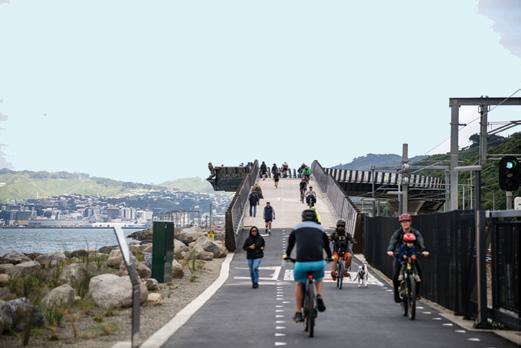
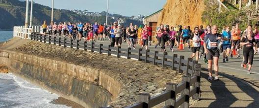
Thousands try out Wellington’s new shared pathway
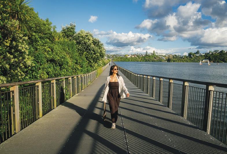
Over the opening weekend, of Te Ara Tupua, NZTA has recorded more than 10,000 journeys on the new shared pathway from Petone to Ngauranga followed by over 18,000 in the first few weekdays.
Since then, more than 85,000 walking and cycling trips have been counted, with an average of 1,653 on weekdays and 5,205 on weekends.
NZTA also has seen the seawall that the shared path sits on to protect State Highway and the rail line, from some pretty wild weather, which is also a win and shows the value of this piece of infrastructure.
NZTA thanks everyone who’s been out exploring, commuting and making the most of this safe shared path. They say to remember, a little awareness goes a long way in keeping the path safe and enjoyable for everyone.
When walking or cycling the shared path: keep left and stick to your side of the path and slow down in busy areas, and be ready to stop and signal your approach (with a ding of your bell or friendly ‘on your right’)
NZTA asks folk to be aware of other users, that means going single file in groups when approaching others or giving plenty of room when passing.
You could win a book
Due to rising costs Walking
New Zealand magazine will go up in price from 1st July 2026. The single copy will be $16.95, 6 months $99.00, 12 months $169, 24 months $325, Digital one issue $5.95 and 12 months $59.00. The new price for existing subscribers renewing will not go up until August 1 2026. From 1st July till 31 August when you subscribe or renew the printed copy you are automatically in the draw where you could be the winner of the book “Survive Aotearoa”
A copy of the printed and digital magazine can be purchsed through our website: www.walkingnewzealand.co.nz. at $16.95, posted.
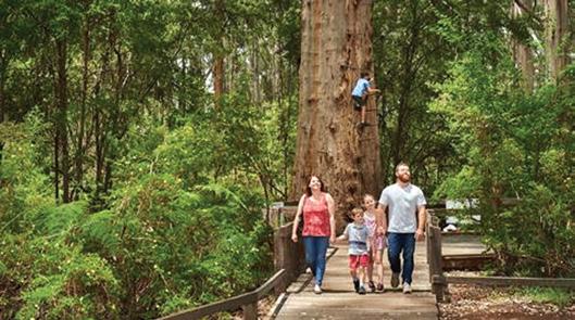
Iconic Gloucester Tree reopens in Pemberton after major works
Western Australia’s towering Gloucester Tree has officially reopened, marking the return of one of the South West’s most iconic nature experiences. In a milestone moment for visitors and locals alike, the Minister for Environment relaunched the 58-metre karri giant in June following significant upgrades. Located in Gloucester National Park near Pemberton, the heritage-listed climbing tree once again invites adventurers to scale its famous steel spikes and take in sweeping forest views.
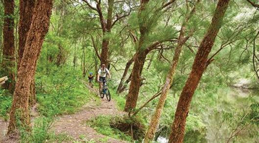
New Arboretum Trail puts Pemberton on the map for world-class riding
Pemberton is cementing its reputation as a must-visit outdoor destination with the opening of the Arboretum Trail Network. This new network of nature-based trails offers immersive experiences through towering forests and tranquil landscapes, catering to walkers, runners and cyclists alike. Located just minutes from town, the trails complement the region’s growing adventure offering and provide another reason to explore the South West. Pemberton is fast becoming a hub for immersive forest experiences.
Walk talk
Rooftop bar takes guests on a sensory ‘Walk through the Woods’
As Melbourne’s leaves turn amber and gold, Fleet rooftop bar invites guests on a Walk Through the Woods with its new seasonal cocktail menu, inspired by Victoria’s spectacular outdoor trails and crafted with local distilleries and ingredients.
The Walk Through the Woods cocktail menu features warming spirits, spiced liqueurs, and autumnal produce - think smoky whiskies, aged agave, spiced rum and rye, layered with stone fruit, apple, quince, and plum. Cinnamon, star anise, chai, ginger, and maple bring gentle warmth, while touches of smoke, toasted marshmallow, vanilla and chocolate echo crackling campfires and fallen leaves. And as Melbourne’s ‘four seasons in one day’ weather comes into play, Fleet’s retractable roof over veranda seating keeps things cosy throughout the cooler months. Fleet’s Food & Beverage Manager, Claire More, says the ten craft cocktails featured on the menu, bring a taste of the regional Victoria to the CBD with some must-try winter warmers as Melbourne’s winter chill sets in.
Record numbers at two big city marathons
A cold southerly blast failed to hold back entrants at the Gazley Volkswagen Wellington Marathon held on the last Sunday in May, said event organisr Michael Jacques. Over 4000 entrants from a record 27 countries,in this year’s 39th Gazley Volkswagen Wellington Marathon made this a record-breaking year even before the gun fired.
The Christchurch Marathon’s biggest event to date brought the central city streets alive in April, with a record 8,479 participants across all race categories and a projected $3 million boost to the local economy. Runners, walkers and wheelers took to the course as early drizzle cleared to reveal near-perfect running conditions, with strong spectator support lining the route.
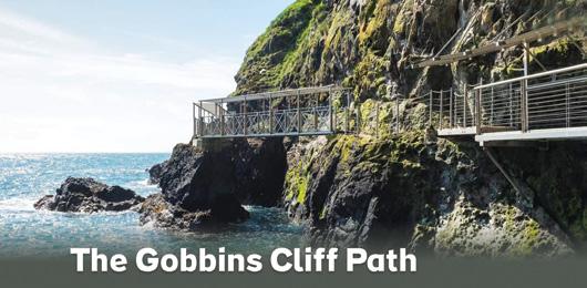
The Gobbins Cliff Path – one of Northern Ireland’s premier visitor attractions and a big hit with international visitors – is the one ‘hidden gem’ that clients may be missing off their Ireland itinerary and is rated as a must visit for 2026, having now opened for the new season. Situated 30 minutes’ drive from Belfast, the Gobbins takes visitors on a walk via a guided tour along the purpose-built path carved into the cliff face where the rugged Antrim coastline fronts on to the Irish Sea. The Gobbins Cliff path offers an unique experience that combines the best of history, nature and mythology, as an expert guide regales stories of the path and the myths and legends of the land. The walk is a 2023 Traveller’s Choice award winner with a 4.5/5 overall rating. Tours are bookable online – advance bookings are essential. www.thegobbinscliffpath.com
www.walkingnewzealand.co.nz
Race Director Chris Cox says the fact that the event has more than doubled in size in the past three years can be put down to the growing reputation of the Christchurch Marathon as a world-class running and spectator event.
“We’ve seen incredible growth over the past few years, and that comes down to the experience we’re delivering. It’s a fast, accessible course, but it’s also an event that people genuinely enjoy being part of, whether they’re chasing a personal best or just taking part.”
This year’s event featured participants from 36 countries (up from 22 in 2024 and 24 in 2025), with 40% travelling from outside Christchurch City. The event was expected to generate more than $3 million in visitor spending.
You can’t beat Christchurch in Autumn. The course, the conditions, the scenery. It’s been incredible to watch the city come to life as runners, walkers and wheelers take to the streets,” says Cox.
The course featured a mix of iconic Christchurch landmarks, including One New Zealand Stadium at Te Kaha, Te Pae and the Bridge of Remembrance.
You can now view and enjoy the latest issue of Walking New Zealand magazine online for $3.95 at http://www.walkingewzealand.co.nz
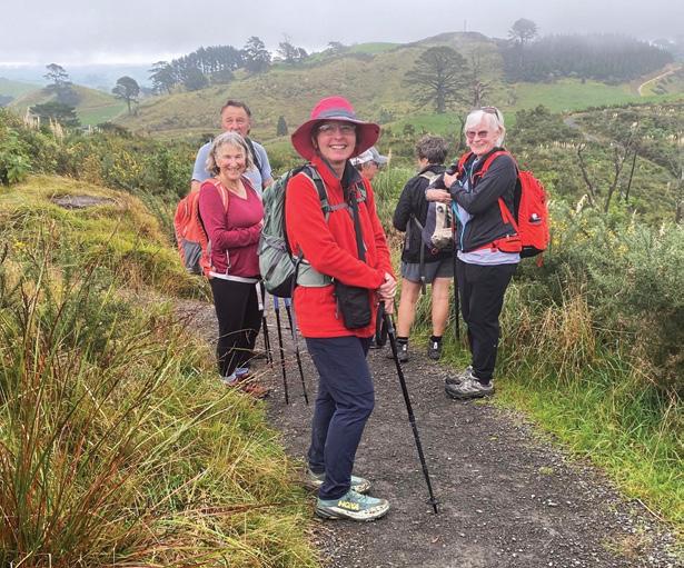
The trig walk from Waihi Beach
W
hen you go to spend a day at Waihi Beach, try venturing into the hills behind, where there is a delightful variety of short walks.
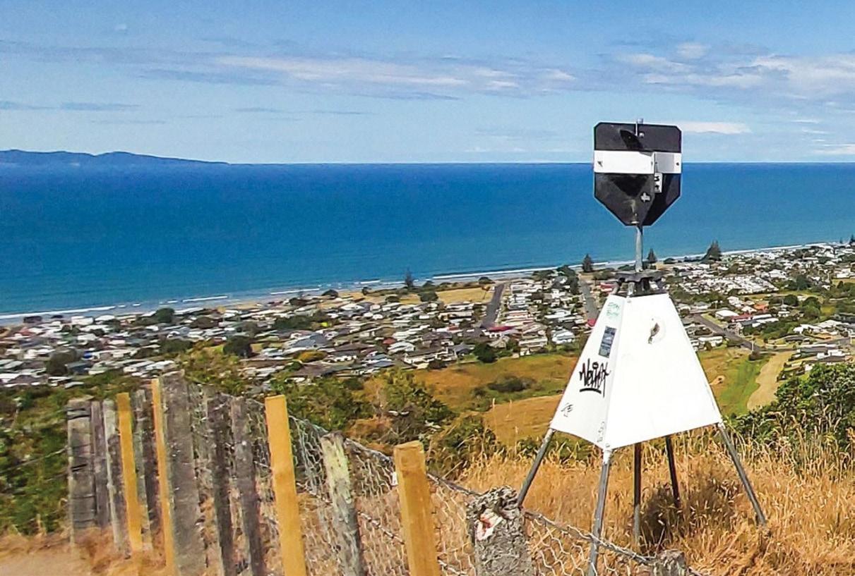
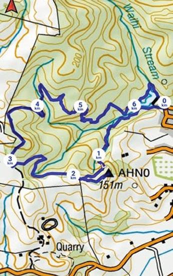
A half hour wander takes you around the dam above the reservoir, 45 minutes will take you to a trig point, or a forest walk, or you can spend one to two hours combining all three.
By Barbz Lowther
To access these walks, drive up Pacific Road behind the Surf Club. There is a large car park, toilets and drinking water.
We started our walk from the lower end of the car park (on the right facing towards the sea.) Although the gravel track is wide and well drained, it’s a bit of
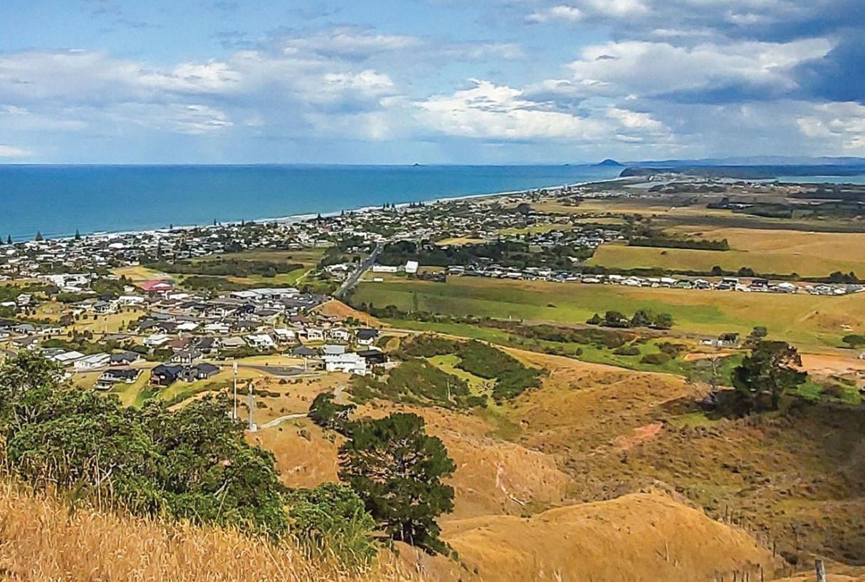
Above: The view from the trig looking over Waihi Beach and the east coast.
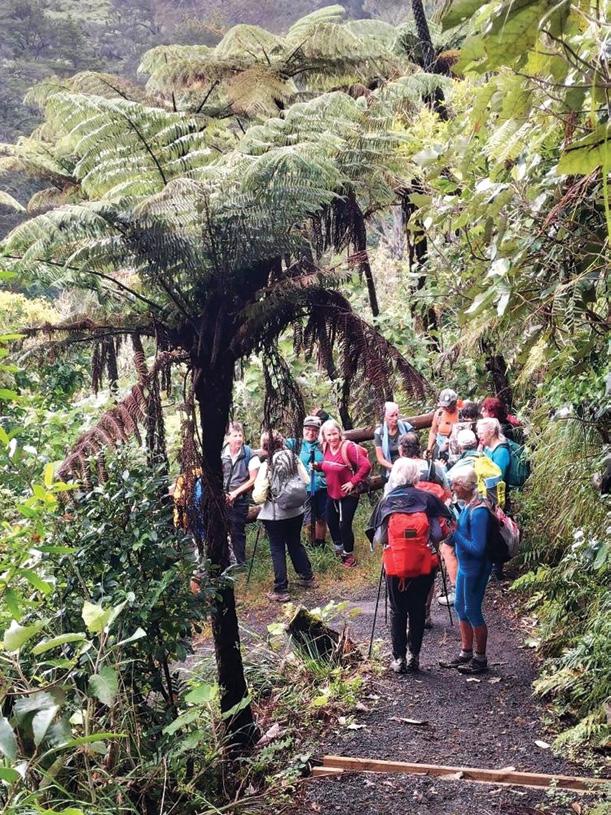
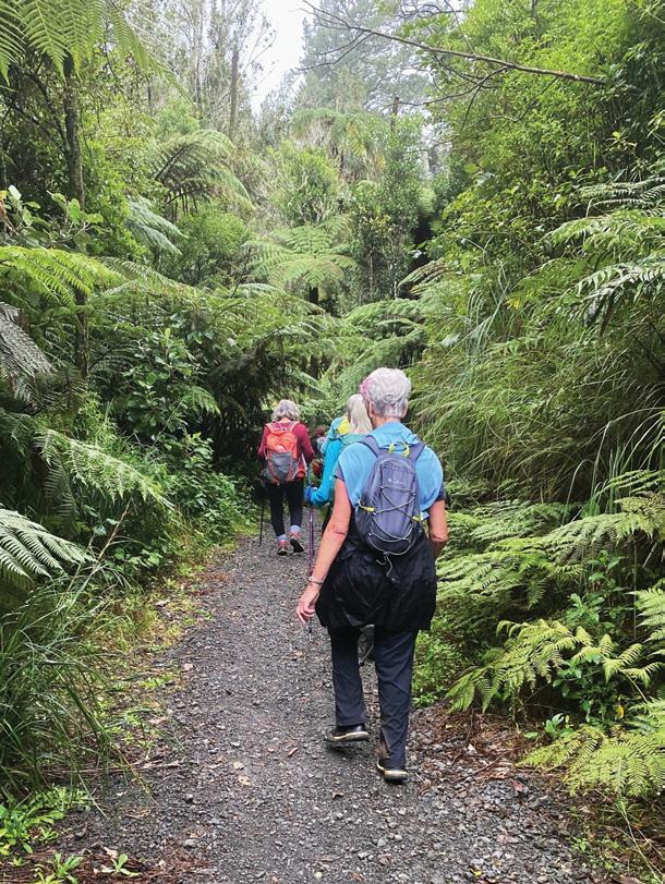
Below left: The group heading down steps in the forest. Opposite page below left: Signs along the way showing our location. Right: The trail was bordered with ferns and pungas, often forming a canopy to walk under..
a challenge because there are many many steps, which some found a bit daunting.
Pine trees which provided shade, have been removed and natives planted, so it will be beautiful in a few years. Now there are awesome wide views over countryside, with glimpses of sea, which improved the higher we climbed.
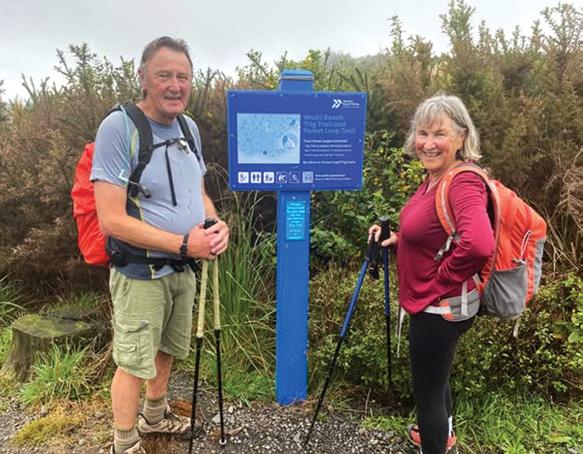
About half way to the trig a little side track led up to a lookout point with seats. We continued on up to a map, showing our location and pointing the way to the trig.
The trig walk from Waihi Beach
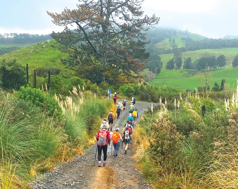
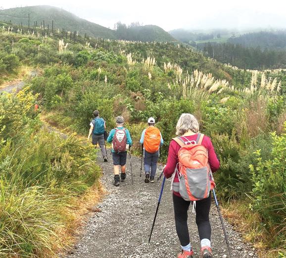
Near there, is another lookout spot with seats. From the trig, there is a choice of returning back down the steps, or continuing along the tops to meet up with the forest loop. We chose to continue. After a picnic and a rest to take in the views - from Waihi Beach to Coromandel and the Bay of Plenty, we headed along a wide gravel road, towards the forest. This area was easy walking and offered lovely views of open farmland and hills beyond.
We soon reached a narrower trail through bush. It had been raining earlier, so the trees were exceptionally green with little droplets shimmering. We walked under tall pohutukawas, puriri and kauri,
with pungas, nikaus and ferns lining the track. In places the tall pungas leaned across the trail forming a canopy over us. It is a really beautiful patch of bush. The forest trail emerged onto the dam trail at the top of the carpark and we wandered back down to the car in less than two hours.
All the tracks are well marked, graded and maintained and remarkably dry. You can choose to walk as far as you like, and there’s an ice cream shop just down the hill when you finish.
It’s a lovely addition to a day at Waihi Beach.
Above left: Lovely open views across the tops.
Below left: Heading along the tops towards the forest track.
Below right: Walking down a wide gravel path towards the forest.
Five ways to embrace winter with Auckland boardwalks and bush walks
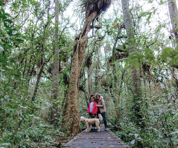
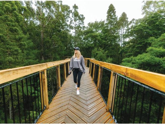
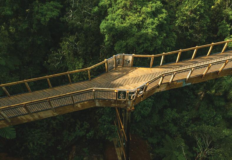
Treetop walk at Kauri Glen Reserve allows visitors to explore native kauri forest, while protecting the trees from kauri dieback disease.
The coldest months of the year are upon us, and curling up on the couch to binge-watch a new series is tempting. But before you do, try getting outside and experiencing a winter walk to lift the spirits.
You don’t need to go full Arctic explorer and do a six-hour tramp (although feel free!) you can embrace the elements with many short walks
and boardwalks scattered across Tāmaki Makaurau Auckland.
1. Rain just smells so good
When rain falls on dry soil, plants release compounds like geosmin, ozone and plant oils. This earthy smell was named petrichor by Australian scientists in the 1960s, and geosmin has even been used as a perfume ingredient. The next time it rains, consider your nearest bush track as a natural perfumery.
Smiths Bush Path in Northcote’s Onewa Domain is a great option, and it takes just 25 minutes to walk along
the elevated boardwalk. Or breathe in the scent of tōtara in the rain (now there’s a name for a Kiwiana scent!) at Tōtara Puhinui Creek Path in Manurewa. With two playgrounds, the kids will be eager to join you, and dogs will love the off-leash dog area whatever the
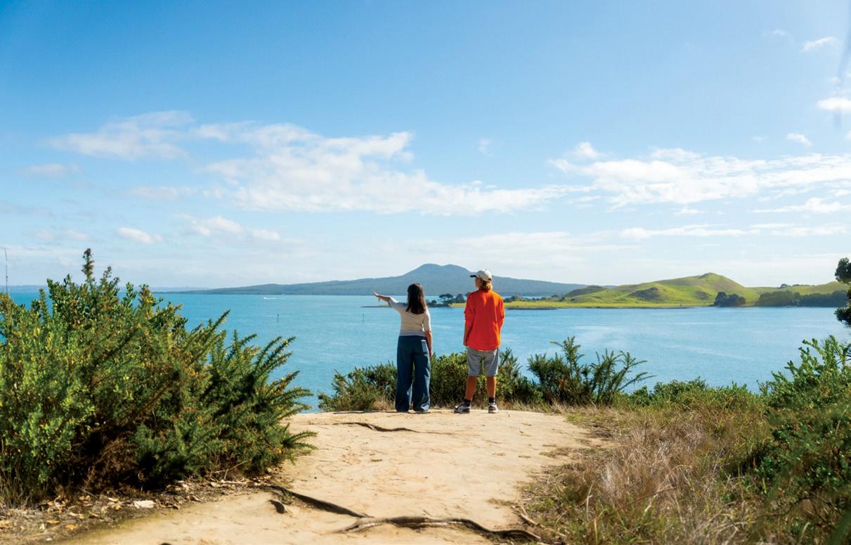
Above: looking out towards Rangitio from Musick Point.Below left: Take a moment during the colder months to stroll through the native beauty of Smiths Bush Reserve.
Below right: Treetop walk at Kauri Glen Reserve.
Five ways to embrace winter with Auckland boardwalks and bush walks
Above left: : A group walking in Totara Park. Above middle: From the lookout on Āwhitu Hatton Road Path you can watch the waves in Manukau Harbour, or look across to the Coromandel Peninsula and back to Auckland city.
Above right: A board walk wander in Auckland is the one on Ōrākei Basin.
Below left: The impressive Kauri Glen Reserve board walk.
Opposite page below right: The board walk at Āwhitu Regional Park.
weather.
2. Everchanging vistas
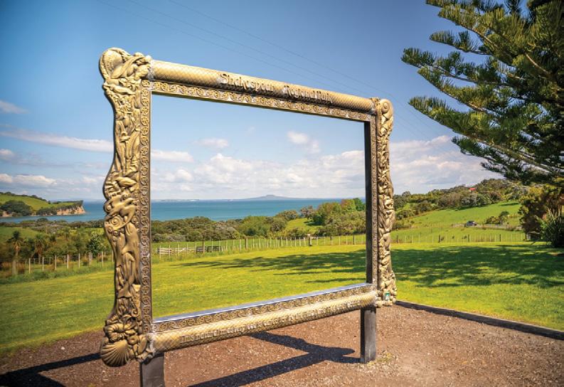
Rain or shine, boardwalks and mountainside views are all available at Shakespear Regional Park. Clear blue skies are definitely uplifting, but fine weather can be overrated. Overcast, wet weather can alter familiar views, creating an air of mystery. Head to Shakespear Regional Park on a rainy day and watch the central city drifting in and out of view in the distance while you enjoy a wild walk across farmland on the tip of Whangaparāoa Peninsula. Or enjoy watching the waves in
Manukau Harbour, looking across to the Coromandel Peninsula and back to Auckland city from the lookout on Āwhitu Hatton Road Path.
3. Get positive with negative ions
Putting on your winter jacket and walking in wet weather is a good boost because colliding water droplets produce more negative ions in the air, which improves our sense of wellbeing.
If you think this sounds a bit “woo woo”, the US government’s National Library of Medicine did a review of
research on the topic and found that while there is still more to learn, negative ions have been associated with improving sleep, reducing stress and boosting immunity.
4. Blow away the cobwebs
The Dutch expression uitwaaien means “outblowing” but refers to walking in the wind, based on the idea that experiencing windy weather is a great way to reduce stress.
One great spot in Auckland to practise uitwaaien and blow away the cobwebs is Musick Point Path, which treats you to stunning views of Rangitoto, Motukorea / Browns, Motuihe and Waiheke islands.
5. Unmissable boardwalks
It's time to tread the boards! When rain clouds are on the horizon or a deluge has left puddles in your favourite park, there’s no need to let the weather stop you from enjoying the best of the region’s outdoor environments.
Auckland has many great walking trails designed to adapt to our rainy climate.
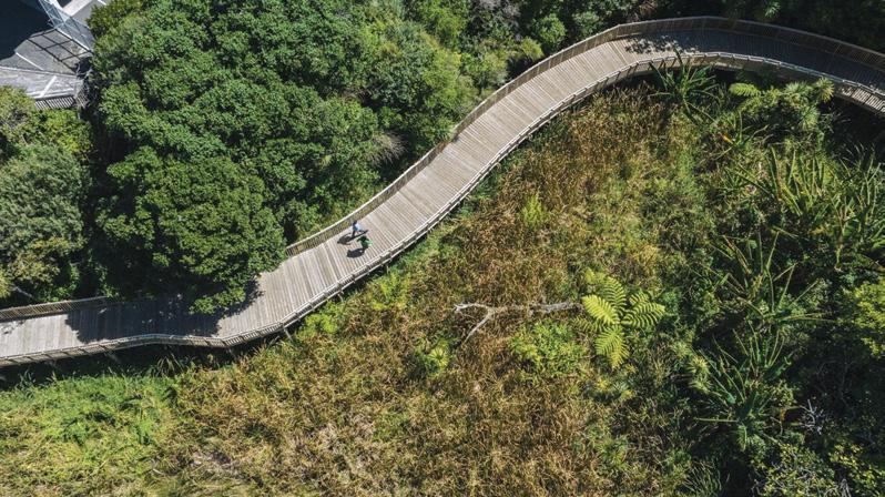
Boardwalks also improve accessibility, allowing wheelchair and pram access to parts of our parks, meaning more Aucklanders can enjoy nature. Boardwalks also protect our vulnerable environments to diseases such as kauri dieback.
The Auckland City Council encourage visitors to enjoy these walks but remember to respect te taiao
Auckland Walks
(the environment) and staff at these locations.
Here’s a selection of beautiful boardwalks that will keep your shoes dry:
Kauri Glen Reserve boardwalk
Just 10km north of Auckland’s city centre (or a 20-minute journey on public transport from the Sky Tower), you can leave the skyscrapers behind and walk in the canopy of some precious tree giants.
The new 60m-long treetop boardwalk and three-span glulam (laminated timber) bridge at Kauri Glen Reserve is 18m above the ground, allowing a birds-eye view of this pocket of the North Shore.
The reserve features mature kauri and tānekaha, including some trees that are between 300 and 400 years old. The canopy walk showcases these natural treasures and reduces the risk of spreading kauri dieback, a fungal disease affecting trees through their root systems.
There are also shoe cleaning stations at the walk entrances to combat kauri dieback.
Please note that there is limited street parking and no toilet facilities.
The boardwalk at Āwhitu Regional Park
The protected wetlands and salt marshes at Āwhitu Regional Park in southwest Auckland are one of the region’s biodiversity treasures. The
two wetland areas, which transition from freshwater to saltwater, are home to the largest population of mātātā (fernbird) within Manukau Harbour, as well as mioweka (banded rail), pūweto (spotless crake) and the camera shy and vulnerable matuku-hūrepo (Australasian bittern).
Enjoy this unique environment as part of the 45-minute Brook Homestead Walk, which also passes Kauritūtahi Beach and the historic Brook Homestead.
This is a nature wonder tucked behind suburbia.
If you want to hear birdsong right in the heart of the ‘burbs, try the Weona-Westmere Path. This 30-min-
ute walk runs along the edge of Western Springs Creek estuary and meanders through magnificently tall mangroves as well as pōhutukawalined foreshore and a bush track with nīkau, kōwhai and cabbage trees.
The southern portion has a boardwalk which runs beside the Western Springs Creek through the mangroves. The southern section features a grand boardwalk, which is particularly impressive at high tide. Patuone walkway.
Explore the unique mangrove environment of Auckland’s North Shore on the newly improved $2.6 million Patuone Reserve Walkway. The project features an extensive boardwalk as well as concrete paths.
Continued on page 13.
Auckland Walks
AUGUST Weather prediction
(Weather is an inexact science, like medicine. Dates given are to be regarded as focus points. Please allow 3-4 days leeway for all forecasts)
1st-3rd A severe storm crosses the country.
1st Chance of hail showers in the lower North Island, including in Wellington.
2nd Strong and unstable winds along the western half of the North Island from Auckland to Taranaki may see some damage to local property, as well as the chance of developing small tornadoes in the Taranaki region.
3rd Windy with gusts prevail through the Hauraki Gulf and Manukau Heads, as well as down through the Waikato to the Bay of Plenty. Heavy rain and thunderstorms with the chance of patches of localised flooding likely in the West Coast.
4th-5th Static air over Canterbury with passing thunderstorms possible.
6th-7th Another intense depression crosses the country. Very strong and blustery winds across the northern half of the North Island, particularly in Northland and around Cape Reinga, with the possibility of wind gusts causing damage to property and the power infrastructure.
6th Heavy snow likely in the central North Island, with the closure of the Desert Road likely, as well as the roads between Napier to Taihape. Chance of light snow in Canterbury including in Christchurch for a time.
8th-9th A brief respite between storms as a weak high pressure ridge crosses the country. Light breezes in Canterbury with chance of fog in the Christchurch area.
9th-11th A period of widespread storm activity across the country, with periods of heavy rain in numerous districts over these few days. Rain may be particularly heavy from Auckland to the Waikato and Bay of Plenty to Rotorua and east to Gisborne and including in the Coromandel around the 9th.
10th Heavy rain in the Nelson-Marlborough districts around this time may cause widespread surface flooding in the region. Storm activity may also cause some damage further north across the Cook Strait into the Wellington and Picton areas.
10th-11th Unstable and strong winds through the central North Island from Taranaki to the Bay of Plenty with the potential to form tornado activity.
Over the next four weeks there may only be around six to nine days sprinkled throughout the period when high pressure may be the major influence, with storm depressions and wet fronts dominating the lookout period. Overall, it may be a very wet and stormy period for most of the country, with extremes and contrasting weather patterns. Most of the lows
coming up may lie just east of the North Island, and direct a stormy westerly flow over the North Island and strong southeasterlies over the South Island. Despite the frequency of these depressions, the Hawkes Bay and Gisborne regions, some parts of the Southern Alps, Central Otago, and Fiordland may only see around 80% of their normal amount of rainfall for this time of year, whereas some parts of Marlborough may see up to three times more rainfall than normal for this time of year.
and south of the South Island and in the central North Island.
16th Heavy rain likely in the Waikato, which may cause river levels to overflow their banks, particularly along the Waikato River south of the Bombay Hills.
18th Chance of heavy rain around this time causing some slips in the Lower Hutt region, resulting in the chance of some road closures in the region.
by Ken Ring
The remainder of the country can expect around 150-200% more rainfall than average. Further snow into the ski fields and ranges may accompany at least three of the storms during this outlook period. Surprisingly, sunshine levels may be up to 10-25% more than normal for this time of year in coastal parts of Gisborne and the East Cape, Northland, eastern Bay of Plenty, Hawkes Bay, north Canterbury, Southland, and Fiordland. In contrast, Taranaki, the Manawatu, Westland, southern Canterbury and coastal Otago regions may be around 10% cloudier than average.
Most other parts of the country can expect near normal sunshine levels. Temperatures may be within half a degree of the average across the North Island, while most of the South Island may be at least one degree below their average for this time of year.
11th Heavy snow falls likely in inland Canterbury districts, including in Temuka.
12th Chance of hail in the lower North Island including in Wellington and heavy rain in Otago with possible pockets of localised flooding in Dunedin.
13th-14th Depression crosses the country bringing stormy westerly winds over the North Island and southeasterlies over the South Island. Chance of heavy rain in the Waikato to the south of the North Island causing some road closures and damage to property, including in Wellington. Winds may be particularly gusty in Northland.
15th Very strong and unsettled winds in the lower North Island with the chance of creating a tornado in some areas, particularly in the Levin region.
15th-17th The passage of a cold system may bring snow to low levels in the east
19th-21st Another depression crosses the country bringing further stormy conditions and a very strong southwest flow. Winds may be very gusty at times, particularly in the south of the Otago region. Chance of further snow in Canterbury and including in Christchurch.
20th-23rd Very cold spell across the country, with particularly low minimum temperatures and severe frosts in many parts of the South Island.
21st The passage of a storm system may bring snow on the Rimutaka Hills and later onto the Desert Road, possibly causing the closures of both roads in the districts.
21st-23rd Possible fog patches in the east of the South Island.
23rd Very strong and unsettled winds in the Bay of Plenty. Possible thunderstorms in the lower North Island including in Wellington.
23rd-24th Heavy rain with pockets of possible flooding in the West Coast.
24th-27th Another major depression crosses the country. Thunderstorms likely over the northern half of the North Island and in the west of the South Island.
24th-31st A depression tracks through central New Zealand bringing unsettled conditions through the North Island and into northern parts of the South Island. Heavy rain and stormy winds during this period may cause damage to property, infrastructure, and stock losses, as well as possibly cause landslides and road closures, particularly in districts from Waitomo to Wellington.
25th South Island passes, including Lewis Pass and Arthurs Pass, and the Milford Road may be closed due to snow, as well as snow likely around this time in Queenstown, and the North Island National Park. A passing storm system over Auckland to the Waikato may produce thunderstorms and lightning strikes in the region, while unstable weather in Wellington may also bring thunderstorms and torrential rain. Chance of snow in the Rimutaka Ranges.
26th Very strong and blustery winds likely in Northland. Possible fog in Christchurch.
26th-28th A deep low brings very cold
throughout the South Island, with many districts barely rising out of frost level temperatures. This system is also likely to bring heavy snow to the Southern Alps and the western and northwestern ranges of the South Island, including in the ranges behind Buller and Nelson. Arthurs Pass may be closed for a time as a result of the heavy snow in the area. Chance of power outages and road closures.
27th Very cold in the Otago region. Very strong wind gusts likely in the Manawatu to Wellington regions. Chance of severe snow warnings being issued for the West Coast of the South Island.
28th Chance of snow causing the closure of the Desert Road once more.
28th-31st Snow likely in Otago.
29th-30th A very cold southerly flow brings very cold overnight minimum temperatures and frosts in western districts from Taranaki to the West Coast. Further snow is likely at this time in the central North Island to the Rimutakas and Tararua Ranges, including the likelihood of road closures of the Desert Road and other major highways.
Heavy snow likely on Mt Ruapehu, as well as snow possibly observed in such places as Featherston, as well as down to sea-level possible, for example around Paekakariki. In the South Island, large volumes of snow during this spell may see serious avalanche risks develop in the Southern Alps, as well as cause the road closures of several mountain passes.
30th Chance that snow and ice causes problems and road closures in the lower North Island districts. Severe frosts likely in the central to lower North Island including heavy frosts likely in the Wellington and Hutt districts. Strong winds causing some damage in the Bay of Plenty region, including the possibility of tornado formations. In the South Island, snowfalls at this time may cause the closure of roads in the Christchurch hills to Banks Peninsula, as well as in Southland and Otago.
31st Very cold with severe frosts likely in the Arthurs Pass region.
Extracted from 372-page 2026 New Zealand Weather Almanac, by Ken Ring. The 2026 book is available in soft cover and hardback, and as e-version from www.predictweather.com
Extracted from the 2026 New Zealand Weather Almanac.
Availlable in soft cover and hardback, and as e-version from www.predictweather.com
www.walkingnewzealand.co.nz
Five ways to embrace winter with Auckland boardwalks and bush walks
It also involved significant replanting of more than 1500 native trees and plants to support birds and other wildlife.
This gentle walk is a cycleway too, starting at Esmonde Road and following the edge of the estuary north to Auburn Reserve.
Orakei Basin Path
Another boardwalk wonder in Tāmaki Makaurau is Ōrākei Basin, a tidal lagoon and extinct volcanic crater which is a hub for watersports such as waterskiing (check the flushing schedule).
The Ōrākei Basin Path is a 45-minute walk around the basin with views of the city. The impressive boardwalk section snakes its way to the Meadowbank stream bridge, a great spot for a selfie.
When on the The Path of Land and Sea /Te Ara ki Uta ki Tai which is the boardwalk, always keep left and be aware that it is popular with cyclists.
A note on accessibility: This path does feature some steep stairs, including the entrance near Lucerne Road behind the Auckland Water Ski Club. This may be a challenge to some less experienced walkers and is not accessible to wheelchairs.
So don’t let a showery day put you off. Get out on our city’s paths, boardwalks and beaches and breathe in the negative ions.
Above right: Meander among the mangroves on the Patuone walkway. Below right:The frame makes a pretty picture at Shakespear Regional Park.
Auckland Walks
By Phillip Donnell
Steam, Springs and Blossom Rotorua’s best Springtime strolls
Spring in Rotorua is a multisensory symphony. By October, the Southern Hemisphere’s shoulder season blankets the volcanic plateau in vibrant green brushstrokes, accented by the sweet aroma of flowering gorse and crisp, sulphurtinged air.
The region’s formidable geothermal pulse throbs violently beneath this fresh spring growth, sending magnificent plumes of ivory steam roaring into the sky.
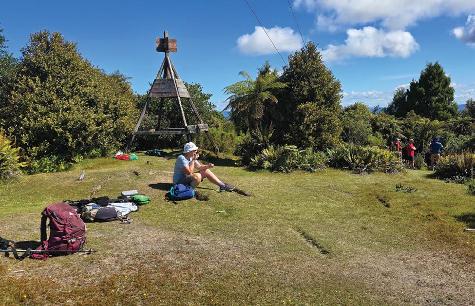
Above left:Time for break at the trig on Whakapoungakau at Lake Otakana..
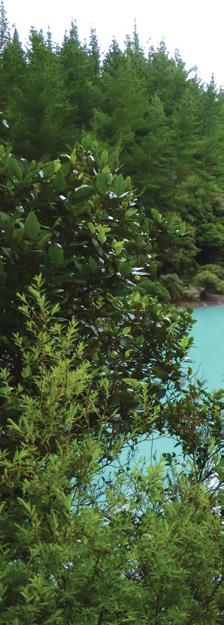
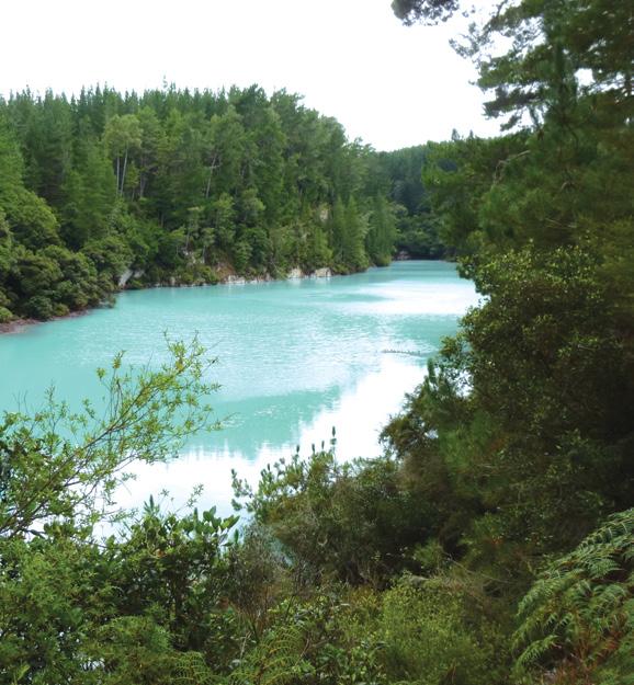
Above right: A hidden gem Echo Lake at Waiotapu.
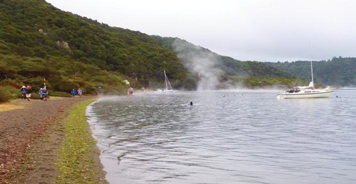
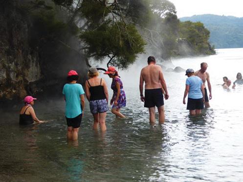
Below left: The Hot Water Beach at Lake Tarawera..
Below right: Enjoying the hot waters .
For the intrepid walker, the spectacular landscapes surrounding Rotorua and its sprawling lake system are best digested in brief, concentrated bites.
Ranging from lakeside meanders to dramatic volcanic craters, these shorter walks distill millennia of violent geology and rich Māori heritage into a highly accessible network of trails.
�� The Liquid Mirror: Lakeside Strolls
Lake Tikitapu (Blue Lake) Track
This 5.5km loop takes roughly 90 minutes to conquer, wrapping tightly around a collapsed volcanic caldera. In October, Tikitapu dresses in its finest garments. The water glows a dazzling, opaque turquoise, caused by sunlight refracting off the shallow, pumice-rich lakebed.
The path weaves past fresh native ferns and exotic pines, accompanied by the musical, metallic ping of the tūī. Culturally, the lake remains a site of immense reverence; its name references a sacred greenstone ornament lost in its depths by a high-born chieftain’s daughter.
Lake Tarawera: The Outlet Track
While the gruelling, fullday Tarawera Trail is legendary, an exceptional shorter alternative is the walk near the lake’s outlet. Walking a portion of this shaded pathway reveals a crystal-clear, deep-blue body of water framed by the imposing, jagged crown of Mount Tarawera.
In October, the lake edge is a haven for spawning trout and newly hatched waterfowl, with the track meandering under a lush canopy of
native rātā and giant ponga ferns.
Lake Okataina: Te Koutu Track
Fringed by a massive, untouched amphitheatre of native forest, Lake Okataina exudes a profound, ancient stillness. The short Te Koutu Track (roughly 45 minutes return) leads down to a secluded, sandy beach. Other short ambles take you to the magical Te Auhaki Cascades and Twin Lakes.
For the Ngāti Tarāwhai iwi, this lake is incredibly sacred, containing submerged archaeological remains and ancestral pā (fortified village) sites drowned by historical shifts in the earth’s crust.
Lake Rotoiti: Hinehopu / Hongi’s Track
Steeped in tribal warfare lore, this short, historic walk spans just 2km near the shores of Lake Rotoiti. The trail follows the route where the famous warrior chief Hongi Hika hauled his heavy war canoes across the land in 1823 to launch a surprise attack on Mokoia Island.
Walking beneath the massive tawa and pukatea trees in October feels like stepping back in time, culminating at the sacred Hinehopu/Hongi’s Track, where a revered rātā tree stands as a living guardian of the pathway.
Lake Ōkāreka Loop
The relatively new Lake Ōkāreka Loop Track (tentatively named Te Ara o Tūkonohi) is a diverse 9km loop trail located about 15 minutes southeast of Rotorua. It takes roughly two to two and a half hours to complete, connecting previously separate paths into a single circuit around the lake.
The trail features changing landscapes, tracking through dense native bush, quiet farmland, and a wetland boardwalk complete with a birdwatching hide. �� The Living Earth: Thermal Adventures Kuirau Park and Sulphur Point
You do not need to leave the town boundaries to witness Rotorua’s tempestuous heart. A stroll through
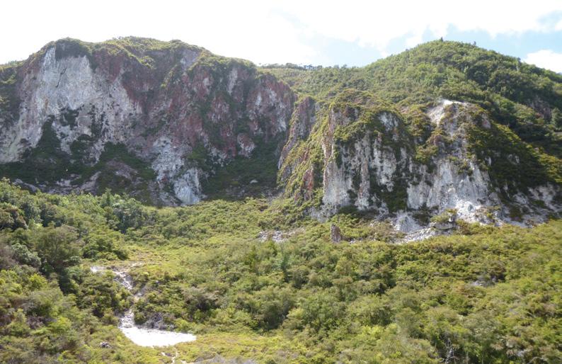
Above right: The lookout that looks down at Haumoana Springs.
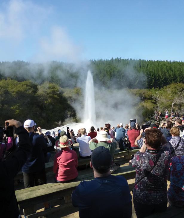
Below right: Crowds watch the geyser erupt at Rotorua.
Rotorua’s best Springtime strolls
the free public Kuirau Park takes you along sturdy wooden boardwalks hovering directly above violent, bubbling mud pools that splutter like grey porridge. October mornings here are ethereal; the brisk spring air causes geothermal steam to condense into heavy, ghost-like drapes across the landscape. Continuing down to Sulphur Point , the earth turns a bleached, skeletal white, where acidic waters meet Lake Rotorua and the sharp scent of brimstone fills the air.
Waiotapu Forest and Thermal Wonderland Loop
Located slightly south of the city,
the Waiotapu Thermal Wonderland Loop (an easy 3km trail) provides an unforgettable journey through New Zealand’s most colourful geothermal ecosystem. While the surrounding Waiotapu pine forest whispers softly in the spring breeze, the park itself screams with colour. Walkers will marvel at the iconic Champagne Pool — a boiling, 62-metre-deep cauldron ringed by a vibrant, neon-orange border of antimony and arsenic. Nearby, surreal neon-green volcanic craters and the morning eruption of the Lady Knox Geyser showcase the sheer, untamed fascination of the Earth.
The Waimangu Volcanic Valley
This extended rift is the world’s youngest geothermal system, located 15 minutes south of Rotorua. It was created entirely by the devastating
volcanic eruption of Mount Tarawera on June 10, 1886. Visitors explore a mostly downhill, 4km eco-trail woven through a unique geothermal ecosystem and regenerating native forest. Highlights are Frying Pan Lake, Inferno Crater, and Lake Rotomahana, which drowned the legendary Pink and White Terraces �� The Cathedral of Timber: Forest Sanctuaries
Whakarewarewa Redwood Memorial Grove Track
A mere five-minute drive from Rotorua’s urban hub lies a soaring cathedral of living wood. The Memorial Grove Track is an easy, 30-minute communion beneath towering Californian Redwoods planted at the turn of the 20th century. The forest floor is insulated by a thick, copper-coloured carpet of needles that deadens all sound, leaving you in a vacuum of silence broken only by the wind in the canopy. October brings a vibrant, lime-green flush of new fronds to the native silver ferns growing beneath these exotic titans, creating an enchanting, biophilic contrast.
Hamurana Springs Riverside Walk
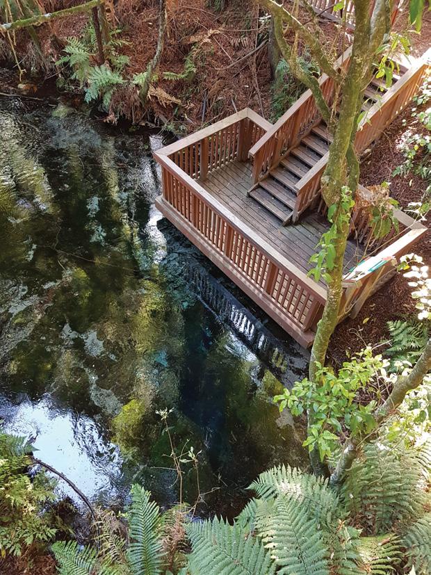
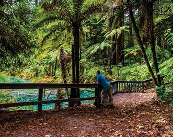
On the northern shores of Lake Rotorua, the Hamurana Springs Walk (a gentle 45-minute loop) follows a river of pure, liquid crystal. Fed by a deep underground aquifer, the water emerges at a freezing, constant temperature from the Hangarua Spring. The water is so impossibly clear that fish appear to float mid-air above the vibrant green riverbeds.
The trail winds beneath a grove of towering redwood trees, leading to a viewing platform where visitors traditionally throw coins into the cavernous, deep-blue spring.
Okere Falls Track
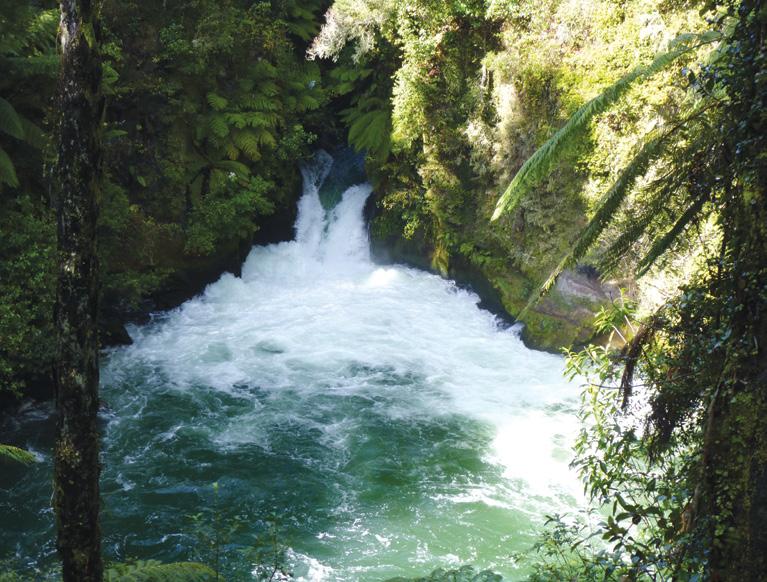
For an auditory assault of the best kind, the Okere Falls Track is a 1.2km bush walk that hugs the roaring Kaituna River. In October, spring rain swells the river, turning it into a churning, frothing ribbon of white water.
The short walk yields spectacular
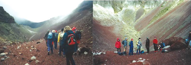
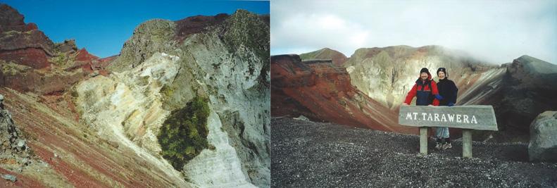
Above left: The multicoloured cliffs at Rainbow Mountain..
Below left: Images of a group that walked up Mount Tarawera.
New Zealand Walks
viewing platforms over Tutea Falls — the highest commercially rafted waterfall in the world. Along the path, historic information boards detail the remains of New Zealand’s first commercial hydro-electric power station, built here in 1901.
�� Touching the Sky : Mountain Assents
Mount Tarawera: The Crater Walk
Mount Tarawera represents the apex of Rotorua’s volcanic narrative. Its catastrophic eruption in 1886 tore a 17km rift through the earth, destroying the legendary Pink and White Terraces. Because the mountain is sacred to the Ngāti Rangitihi iwi, access to the summit is strictly controlled via guided eco-tours.
However, the short walk along the raw, deep-red volcanic craters at the top is an unmissable October experience. Standing on the scree slopes, looking out over the entire lakes district as spring clouds cast shifting shadows across the chasm, is a profoundly humbling experience.
Rainbow Mountain (Maunga Kākaramea) Crater Lake Trail
Maunga Kākaramea translates literally to the “mountain of coloured earth,” and it lives up to its title elegantly. While the full summit track takes longer, the short walk to the Crater Lake Outlook takes just 20 minutes.
The trail reveals a landscape painted in spectacular shades of red, ochre, and yellow clay, deeply scarred by geothermal activity. At the base of the cliffs sits a striking, steaming lake of intense, milky-turquoise water, framed beautifully by hardy, heat-tolerant native vegetation reviving in the October sun.
Mount Ngongotahā: The Nature Loop
Guarding the western flank of the city, Mount Ngongotahā is a ancient volcanic dome wrapped in rich Māori folklore regarding the Patupaiarehe (fairy folk). The Mt Ngongotahā Nature Loop Track is a gentle 2.5km, one hour circular walk through pristine, unlogged native bush.
Ouch! Sore feet while walking?
Hikers Wool is 100% New Zealand wool. Cushion your feet to prevent pain, rubbing and blisters.
Buy online or at selected stockists For more info visit www.hikerswool.co.nz
The undisputed jewel of this forest sanctuary is a colossal, ancient rātā tree nicknamed “Pat,” one of the largest specimens in the Bay of Plenty region. In October, the surrounding forest canopy comes alive with the calls of kākā, tūī, and bellbirds feasting on the early spring nectar.
It can be seen that visiting Rotorua in October offers an ideal backdrop for a walking holiday, as the fresh spring air beautifully complements the region’s active geothermal phenomena.
Walkers can explore the vibrant, steaming geothermal trails while the majestic forests provide crisp, shaded canopy walks under towering trees. October also brings the brilliant bloom of native flora and exotic gardens, adding bursts of seasonal colour to your treks. With fewer crowds than the peak summer season and generally mild, refreshing weather, an October walking trip combines active exploration with the soothing reward of Rotorua’s famous natural hot springs at the end of the day.
You can enjoy all of this by participating in the Footsteps “Best Day walks of Rotorua Lakes” excursion, scheduled for 3-10 October 2026. For details go to www.footstepswalkingclub.com or contact Footsteps 021 172 3244, footstepsanz@gmail.com. They welcome your enquiry.
Above left: Looking down at Tutea Falls.
Forest of Tawa Walk –a hidden forest escape above Tawa
On a fine autumn morning I decided to explore the Forest of Tawa Walk, one of Wellington’s lesser-known walking gems, known by its Māori name Te Ngahere-o-Tawa.
Tucked away on the western hills above Tawa, this delightful bush walk offers a peaceful escape into nature while remaining surprisingly close to the city.
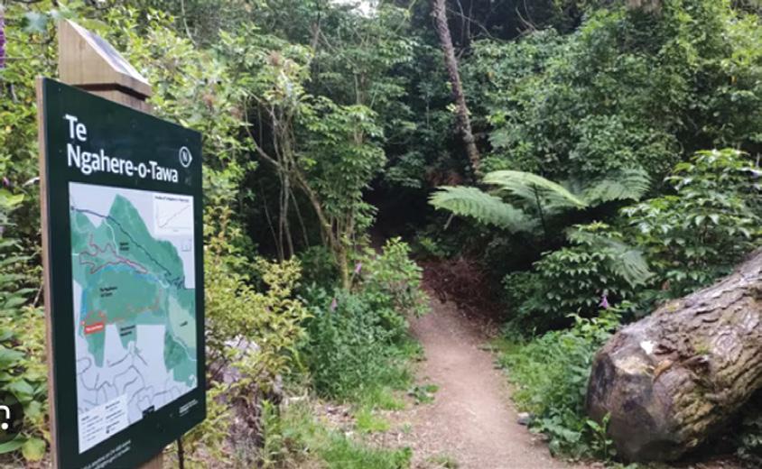
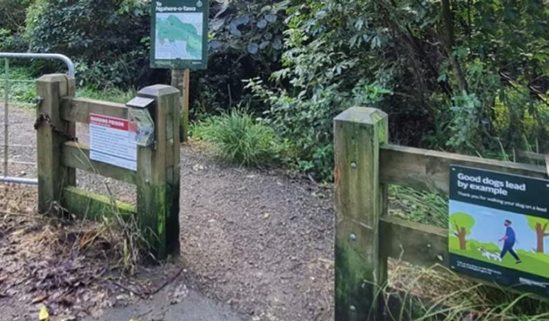
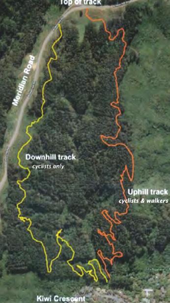
The walk begins from Kiwi Crescent in Tawa, where a clearly marked entrance leads into the 36-hectare reserve. The reserve was renamed Te Ngahere-o-Tawa, meaning “The Forest of Tawa”, reflecting both its ecological significance and its connection to the local community. The modern track was completed in 2021 and provides a much gentler route
than the original steep access track.
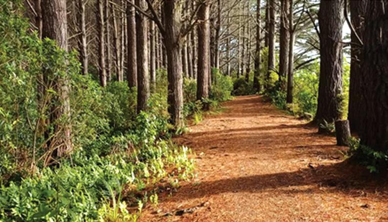
From the moment I entered the reserve I felt removed from suburban life. The well-formed gravel path winds steadily uphill through a mixture of regenerating native bush and mature pine forest. The track is approximately 2.2 kilometres long one way and takes around 35 minutes to reach the upper section, although I spent considerably longer enjoying the scenery and stopping for photographs.
The gradual zig-zag climb makes the walk accessible to a wide range of walkers. Unlike many steep Wellington hill tracks, the gradient here is manageable and the surface is generally firm and well maintained. As I climbed higher, the sounds of Tawa gradually faded and were re-
placed by birdsong and the rustling of leaves in the breeze.
One of the highlights of the walk is the diversity of vegetation. Beneath the towering pines there is abundant native regeneration, while elsewhere the reserve contains remnants of original native forest. I spotted tawa trees, kohekohe, rewarewa and mahoe growing among an understory of ferns and native shrubs. The track feels surprisingly wild given its urban location.
Birdlife was another rewarding feature. Pīwakawaka (fantails) darted through the trees, while kererū could be heard and occasionally seen feeding in the canopy. The reserve provides valuable habitat for native species and offers an excellent opportunity for walkers to experience Wellington’s recovering bush environment.
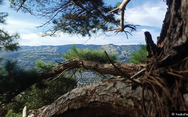
As the climb continued, occasional openings in the forest revealed impressive views across Tawa and towards Porirua. Near the ridgeline, these views become even more expansive. Looking down over the suburban landscape framed by forest was a reminder of how much green space exists within the Wellington
Above left: The narrow path through the bush.
Below left: The entrance to the Forest of Tawa Walk off Kiwi Crescent.
region.
The track eventually reaches the upper area near Spicer Forest, where walkers can choose to return the same way or continue onto other connecting tracks. Those seeking a longer adventure can link into the wider network of trails that extend through the surrounding hills.
Getting to the walk is straightforward. Drivers can use the limited on-street parking available on Kiwi Crescent, while public transport users can travel by train to Tawa or Redwood Station and walk approximately 25 minutes to the trailhead. The reserve can also be accessed from the Spicer Road side.
After completing the walk, I headed into Tawa township for a well-earned coffee. Good nearby options include Café El Porteño, Urban Eatery, and Streetwise Coffee Tawa, all located on Main Road and only a few minutes’ drive from the reserve. For those wanting something more substantial, The Borough offers meals and refreshments in a relaxed setting.
The Forest of Tawa Walk may not be one of New Zealand’s famous Great Walks, but it delivers an enjoyable combination of native forest, birdlife, gentle exercise and rewarding views. For Wellington walkers looking for a half-day outing close to home, this hidden forest reserve is well worth discovering.
Fact file
Location: Ngahere-o-Tawa Reserve. Lower track starts at 56A Kiwi Crescent. Upper entrance off Meridian Road.
Distance: 2.2 km one way (approximately 4.4 km return)
Time: Around 35 minutes uphill, one to one hour fifteen minutes return allowing for stops
Difficulty: Easy to moderate
Surface: Well-formed gravel and dirt track
Highlights: Native bush , birdlife, panoramic views over Tawa and Porirua, regenerating forest, peaceful atmosphere.
Above right: A smooth flat track through bush. Middle right: Looking over the Porirua area.
The spectacular Taranaki Falls is deservedly a major drawcard in Tongariro National Park.
The well-graded two hour loop track to the falls from Whakapapa Village is a favourite for many visitors who unwittingly pass by another gem which is appreciated by few.
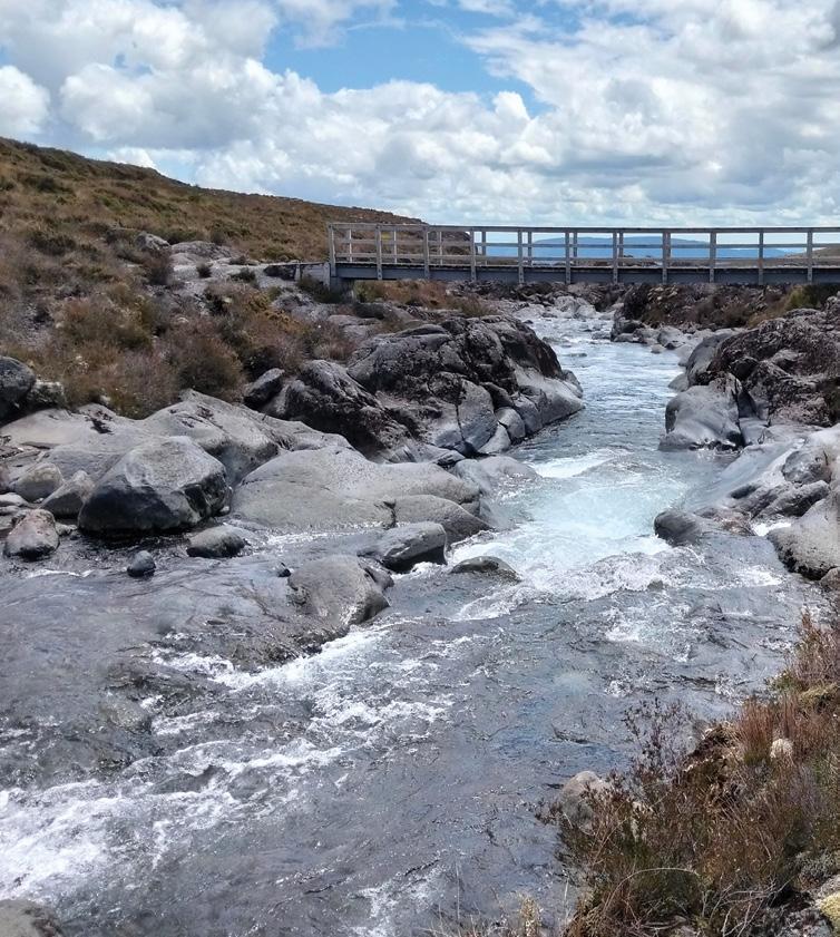
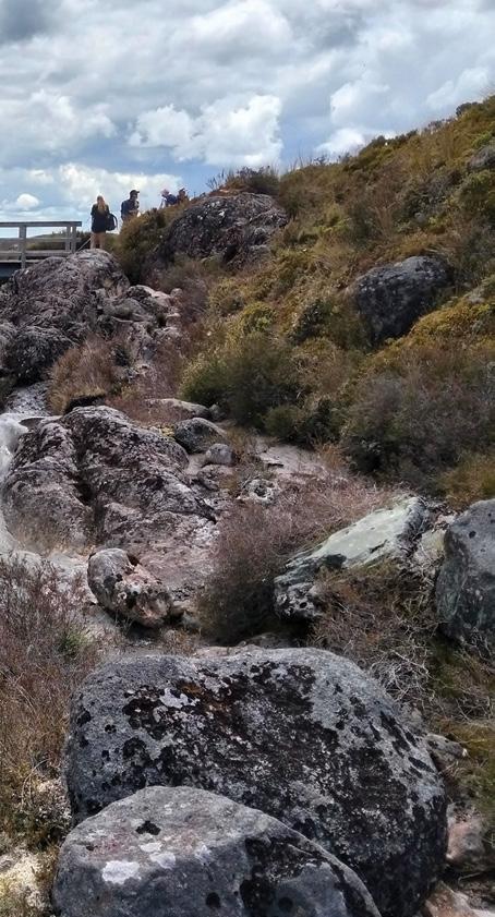
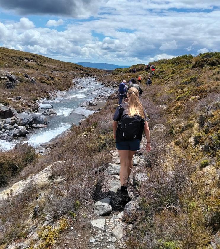
This is the Wairere Stream which is the source of the Taranaki Falls. Starting at the bridge above the falls, an unmarked rough and sometimes muddy track goes up the true right bank of the Wairere Stream.
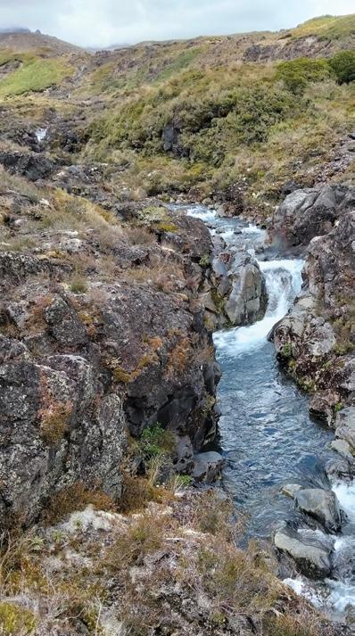
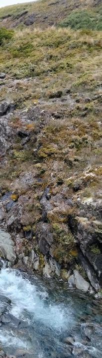
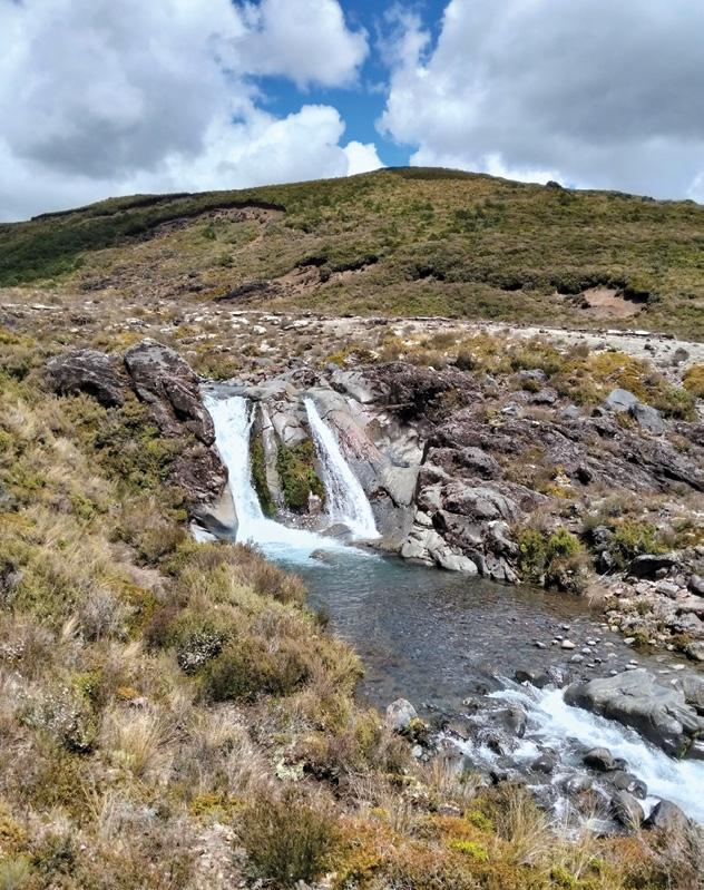
Those who follow this track, whether for a short distance or for several kilometres as it heads towards Mt Ruapehu, are rewarded with a series of spectacular chasms, water-carved rocky shutes and small but busy waterfalls.
As well, they enjoy breath-taking vistas and a diversity of colourful alpine plants which flourish despite the harsh climate.
The Taranaki Falls were initially known by early tourists as the Wairere Falls. By the 1920s the name seems to have shifted to the Taranaki Falls.
According to the Department of conservation, this was possibly due to a case of mistaken identity as some maps from this time mislabelled the Wairere Stream as the Taranaki Stream. The latter flows down an adjacent valley further to the north.
With a degree of agility, solid footwear and a sense of adventure, those who explore the Wairere Stream will find their efforts wellrewarded.
Above left: The figures on the bridge are at the start of the Wairere Stream track.
Above right: Walkers on the track beside the stream.
Below right: Twin waterfalls, examples of many on display.
Below left: Stunning scenery a short distance up the track.
We are looking for the best digital photos each month depicting walking
Now the time to get your digital camera out or look through your digital images and enter the
Walking New Zealand Digital Photo Contest
The image could be a scenic scene, a walk on the beach with the dog, a bush walk, a street walk or anything walking that takes your fancy. The rules are simply: there must be a person or persons walking in the picture either front, side or back on, and can be in the distance. We require an emailed image in high resolution mode, in jpeg format as an attachment, and NOT embedded in Word or in the email, and NOT a link to a website to be downloaded. The subject line must have the words “Walking New Zealand Photo Contest” and the email must include the NAME, POSTAL ADDRESS and phone number of the person who took the photo and a small caption. In this contest ONLY ONE emailed photo accepted per month. Entry in the contest automatically allows us to print the image. The person who has their photo published will receive a six month subscription or a renewal to Walking New Zealand magazine of six months. If a picture is chosen for the cover page the person will receive a 12 month subscription or renewal Email your entries to: walkingnz@xtra.co.nz with subject line “Walking New Zealand Photo Contest” Only EMAILED entries will be accepted.
PHOTO CONTEST
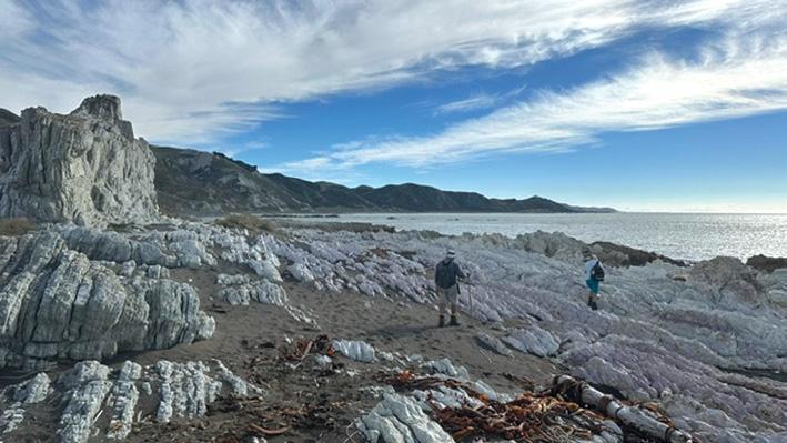
Above: It was a beautiful day when the Trampers of Kaikoura walked along Ward Beach to the Chancet Rocks. The rock and cloud formations had us fascinated. Photo by April Anstis, Kaikoura.
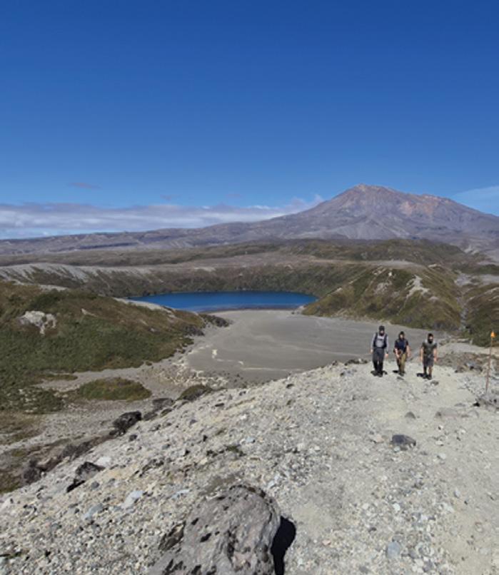
Below: What a magnificent view coming down from the Upper Tama Lake getting this amazing vista of both Mount Ruapehu and the Lower Tama Lake. 100% worth the effort to get up to the top! On a nice day the scenery just blows your mind - This is one of the most special places in our wonderful NZ.... Photo by Gail Francis, Ohauiti, Tauranga.
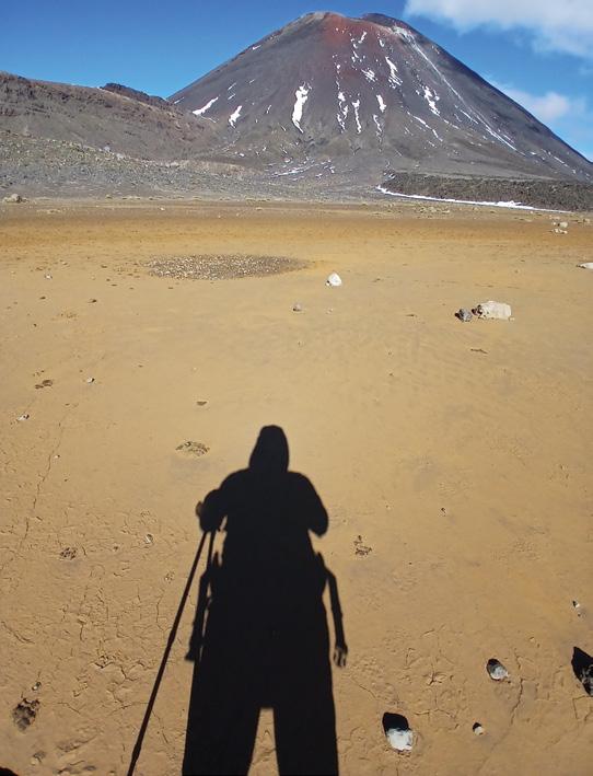
Below left: It shows my shadow on the Tongariro Crossing on a fine day in April 2026. It feels a bit as if it could be on the moon .I was able to catch a moment where there were no people around.
Photo by Martin Kostrewa, Rotorua.
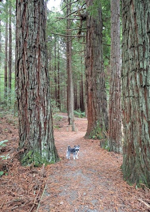
Below right: Barney enjoying a walk at Mt Lee’s Reserve. Manawatu. Photo by Dianne Cable, Feilding.
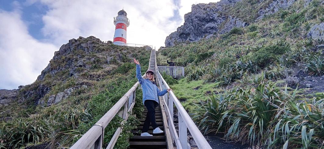
Above: This photo was taken on a perfect Autumn day 2026 at Cape Palliser, east coast Wairarapa. After climbing the 253 steps to the lighthouse, we were rewarded with great views north and south, and also of the many seals basking in the sun on the beach below.
Photo taken by Edwin Perry, Paraparaumu.
You can now view and enjoy the latest issue of Walking New Zealand magazine online for only $2.50 at http://www.walkingnewzealand.co.nz
Walking in the petrified forest parks in America
By Daniel Haddock
Another year, another journey into the American Southwest landing in Phoenix, Arizona. I met John, a high school mate there, for what has become an annual expedition.
Arizona is the only state that contains at least part of all four North American deserts – the Mojave, the Sonoran, the Chihuahuan and the Great Basin. https://www. goworldtravel.com/arizona-petrified-
forest
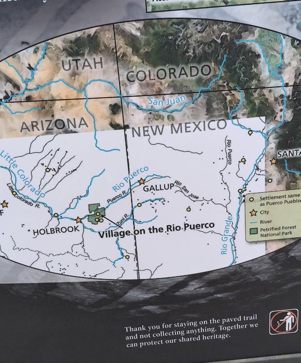
Holbrook, Arizona was a 298-kilometre drive from Phoenix. This is the gateway town to the Petrified Forest National Park and Painted Desert Wilderness Area which was only 45 kilometres away.
The park occupies 221,390 acres (approx. 346 square miles or 896 square kilometres.) “The National Park is one of the best places in the world to see the fossil record from the Late Triassic Period 225 million years ago.” (National Park Service brochure).
Being an International Dark Sky Park and containing a section of Route 66 of “Get your kicks” fame adds to its aura.
US National Parks often have a paved road across the key areas of the park. At Petrified Forest this road is 45 kilometres long and provides easy
access to lookout points, visitor centres and eight tar-sealed trails from .5km to 4.5km
There are also eight “Off the Beaten Path Hikes” which require route-finding skills. Ranging from 3.4 km to 13.7 km., you have to pick up the guides at either of the Visitor Centres. One of the longer tramps was in the Painted Desert Wilderness. Unfortunately, we were driving to Gallup, New Mexico that day so were unable to tackle any of the longer treks. Maybe next time! Permits are needed for Wilderness Camping but they are free from the Painted Desert Visitor Centre or the Rainbow Forest Museum. There are no designated camping sites in the Wilderness area.
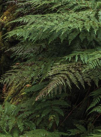
Hard to believe it now in this desert landscape but the area was a tropical landscape with a range of ferns, horse
Ouch! Sore feet while walking?
Hikers Wool is 100% New Zealand wool. Cushion your feet to prevent pain, rubbing and blisters.
Buy online or at selected stockists For more info visit www.hikerswool.co.nz
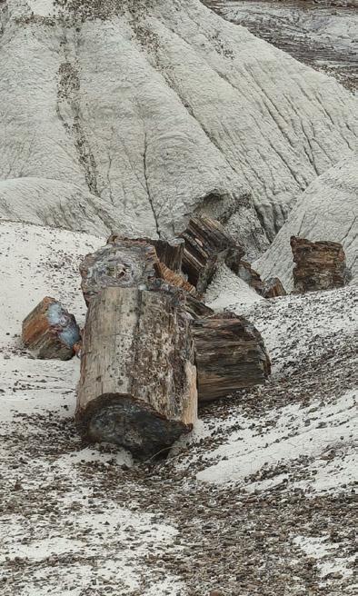
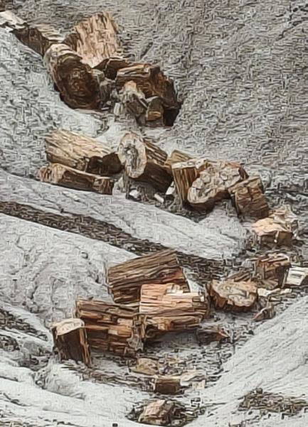
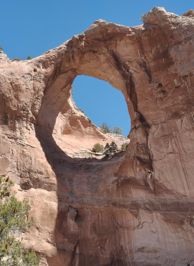
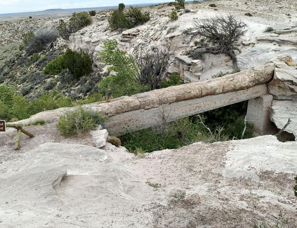
Opposite page above left: Window Rock is a separate Navajo Nation within the USA. It has its own leaders and courts. Above right: Petrified logs in a gully. Below left: John on the Blue Mesa Trail gully. Above left: John is closeup and personal with one of the creatures that lived in the area 200 milliion year ago. Below right: a gully filled wiyh petrified log pieces.
Walking in the petrified forest parks in America
tails, cycads and 180-foot conifers. Early dinosaurs and reptiles roamed alongside a river system larger than anything on earth today. (National Park Service brochure).
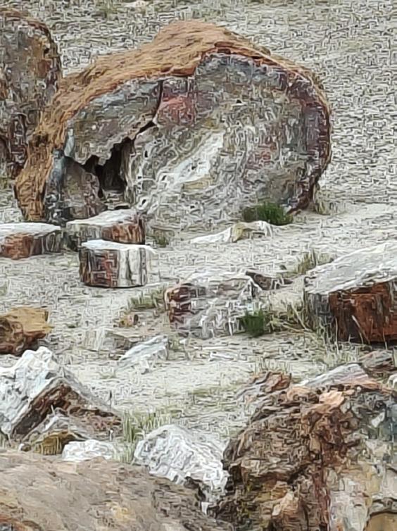
This prehistoric rainforest left an amazing legacy through the petrification process. The landscape is spectacular with petrified logs of different sizes and colours strewn across the landscape. Dead trees or those knocked over by the wind or water were buried in deep sediment. Then the logs soaked up groundwater and silica from volcanic ash and crystallized into quartz. The rainbow of colours around the park echoes the various minerals in each area.
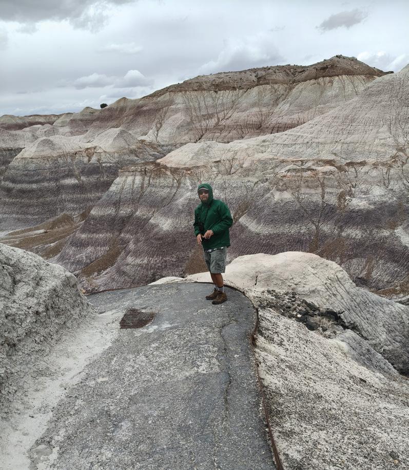
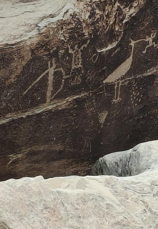
We were there in early April, 2026 and fierce winds made walking difficult on some of the trails until you dropped down into the canyons. Highlights were the Puerco Pueblo ruins of a 100 + room village occupied 1250-1380 CE, the Blue Mesa featuring blue, purple and grey bad lands, Newspaper Rock with a range of petroglyphs and Agate Bridge, a 34 m petrified log across a gully.
Despite the recent down-sizing of the National Park staff, the whole setup was user friendly, with knowledgeable officers and brilliant displays. There were plenty of rangers working on trail improvements and keeping toilet facilities clean, etc.
We would like to go back and spend some time camping in the Painted Desert Wilderness Area.
Opposite page above left: Window Rock is the striking natural sandstone arch that serves as the capital of the Navajo Nation in northeastern Arizona. Named for the 47-foot circular “window” carved by erosion. Below left: The 34 metre petrified log spanning a gully filled with petrfied log pieces. Below right: A reminder that you are in Native American country.
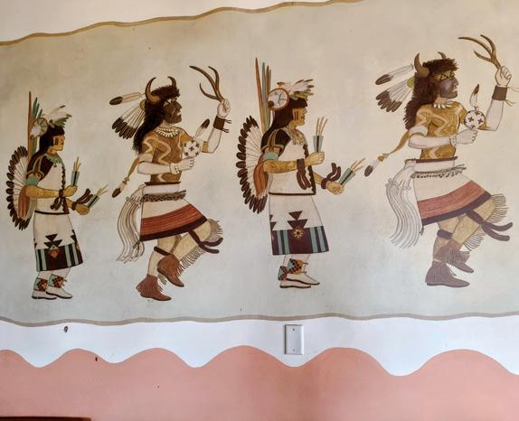
Above left: Holbrook is the gateway to the Petified Forest National Park. The sign is bordered by petrified wood sections. Above right: There are plenty of reminders that you are in Native American country when tribes have lived for thousands of years Below left: Once they were trees but now crystalized rocks.
The new VeryFitPro ID205L is an intelligent smart looking Sports Watch and activity tracker that ticks all the boxes.
* Strong and durable 3cm clear glass touch screen display
* Skin friendly soft and comfortable wristband strap
* Nine exercise modes walking, running, hiking, cycling, treadmill, fitness, mountain climbing, spinning bike and yoga
* Many functions: step monitoring function, heart rate monitoring, sleep monitoring, calorie monitoring, call reminder, message reminder, sedentary reminder, alarm reminder, stopwatch, timer, music control, looking at mobile phone, breathing training, time and date display, multi-sport mode (step, calories, speed, distance, active time), daily goal
* Raise your hand and the screen will light up.
* Customize the face of your Smart Watch to fit your needs.
* IP68 Deep Waterproof
* Magnetic charging with USB charging cable takes about 2.5 hours for around 10 days usage.
* Uses VeryFitPro app Compatible with smart phones that use IOS 8.0/Android OS 4.4 or later, and Bluetooth 4.0 or later
* Colours available: Black
$115.00 plus $8.00 P&P
47 Lincoln Terrace, Palmerston North - Phone 027-274-0726
We were exploring Orewa for a week and our first adventure was the Orewa Estuary walk (approx 8 km). The day was sunny and perfectly still so we left early.
This is an easy walk for the whole family with runners and cyclists sharing the track. The Estuary was
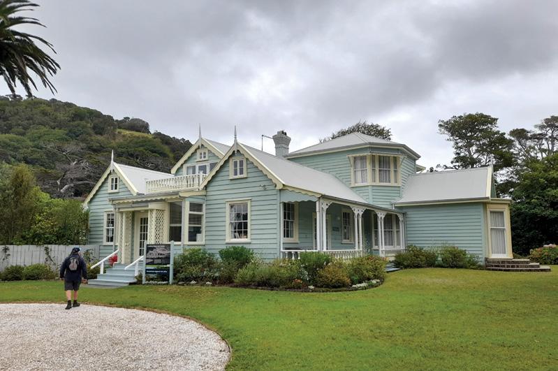
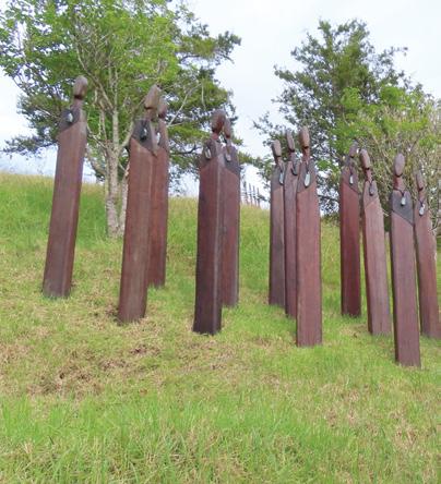
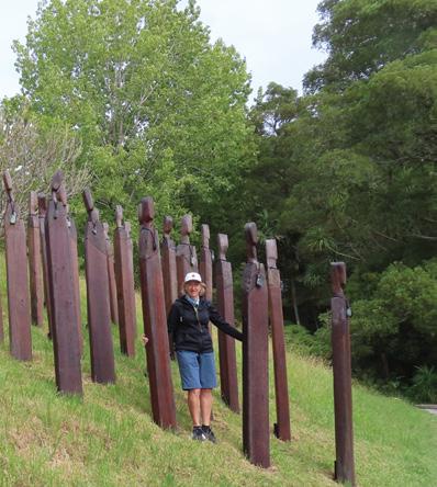
Above: Looking out into the estuary. Below left: Couldrey House in Wenderholm Regional Park. Below right: A interesting exhibit in the sculpture park.
shimmering with the sunlight and we had a most enjoyable time.
Wenderholm Regional Park
Waiwera (7.8 km from Orewa)
The day was cloudy with strong winds and the sea was rough but we still took the opportunity to walk in the park which is at the end of the Puhoi River.
We knew once we headed up the Maungatauhoro Te Hikoi Track we would be protected from the wind and that was exactly what happened. The bush was so green in every shade and the boardwalk continued up to the lookout.
As this was our first time to visit
Orewa and as we were from Christchurch, everything was new to us.
Then we came to the KaKaha Pa site, an amazing part of history. We continued onto a couple of other tracks and knew that we would eventually end up back at Couldrey House and the car park.
Here we met other walkers enjoying the park as well.
Shakespear Regional Park
The Whangaparaoa Peninsula has plenty of stops and views of beautiful bays on the way to Shakespear Regional Park (approx 20 km from Orewa) which is a pest free sanctu-
ary for the bellbird and kiwi and endangered New Zealand dotterei. It was sunny with no wind. We parked the car and then went through the cleaning station for the protection of the kauri trees.
We went straight to a waterfall (Waterfall Gully) which was tucked in the bush where we took photos and then went further slowly climbing out of the bush (which had plenty of bird song) to a huge pohutukawa tree standing all by itself in a green grass area.
We had no idea what to expect at the top but we had spectacular views of the Huraki Golf and to our amazement we saw the Auckland skyline. There were plenty of tracks to choose from so we just made a circuit. This was a very peaceful area to enjoy.
Brick Bay Wines and Sculpture Trail
We walked around the Brick Bay
Wines and Sculpture park (35km from Orewa) soaking in all the views and sculptures along a 2km trail which took us a couple of hours stopping for many photos as there was a lot to see.
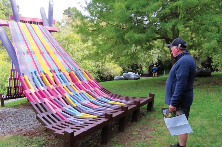
It was so beautiful with the kauri forest, totara and nikau palms plus much more native bush and of course the amazing sculptures. We walked on many boardwalks on the well marked tracks. This is such a lovely place to explore and you did not know what kind of sculpture you would come to next. We had a great walk. NB: There is an entry fee charge at the park.
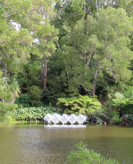
Above left: The colourful sculpture at the sculpture park. Above right: Looking across the lake from the sculpture trail.
Middle right: A view from the lookout. Below right: On the Estuary walk.
New Zealand Walks
Kelvin Heights Peninsula Trail beside Lake Whakatipu
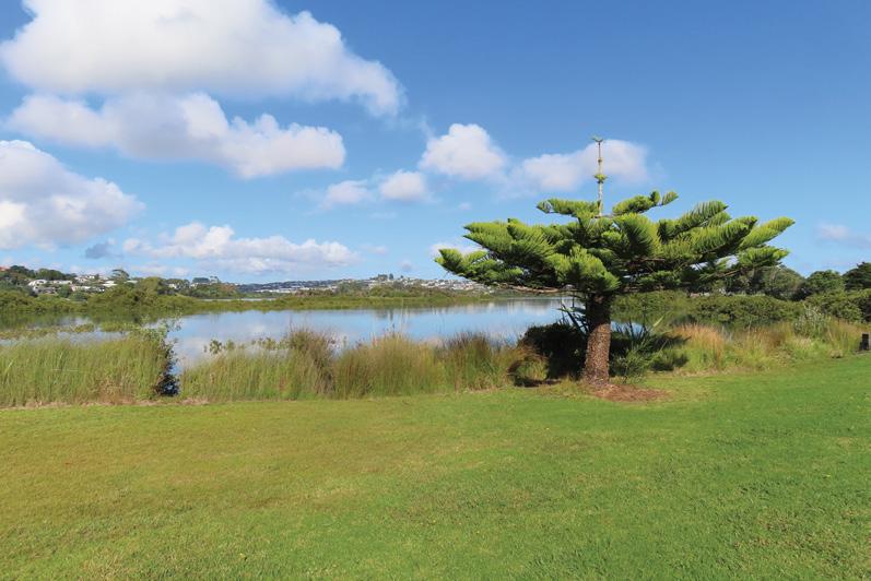
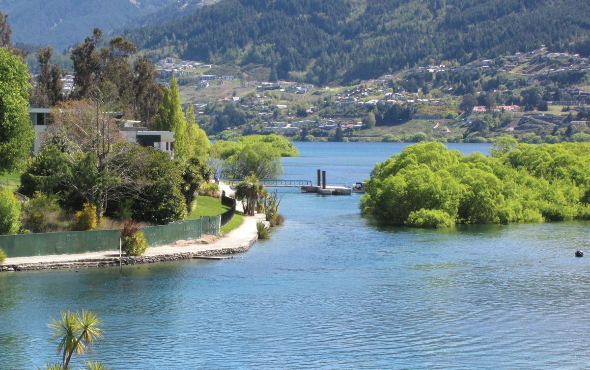
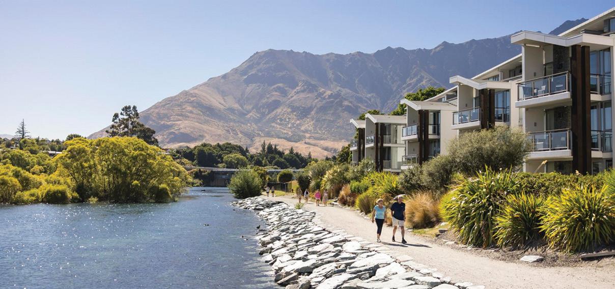
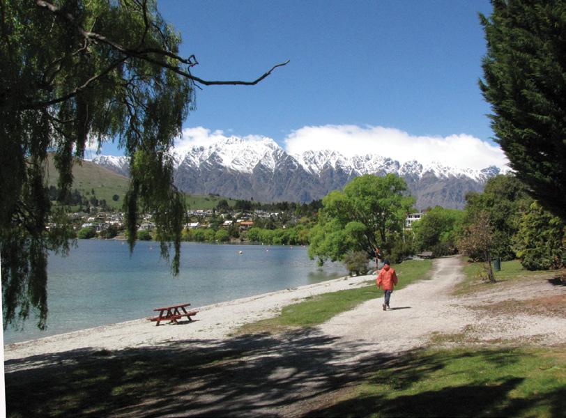
The Kelvin Heights Peninsula Trail is a loop walk beside Lake Whakatipu and around the Queenstown Golf Course at Kelvin Heights with spectacular views across to Walter Peak and back towards Queenstown across the Frankton Arm.
The trail is a continuation of the Frankton Arm Walkway, an easy 10 km stroll from Queenstown. The
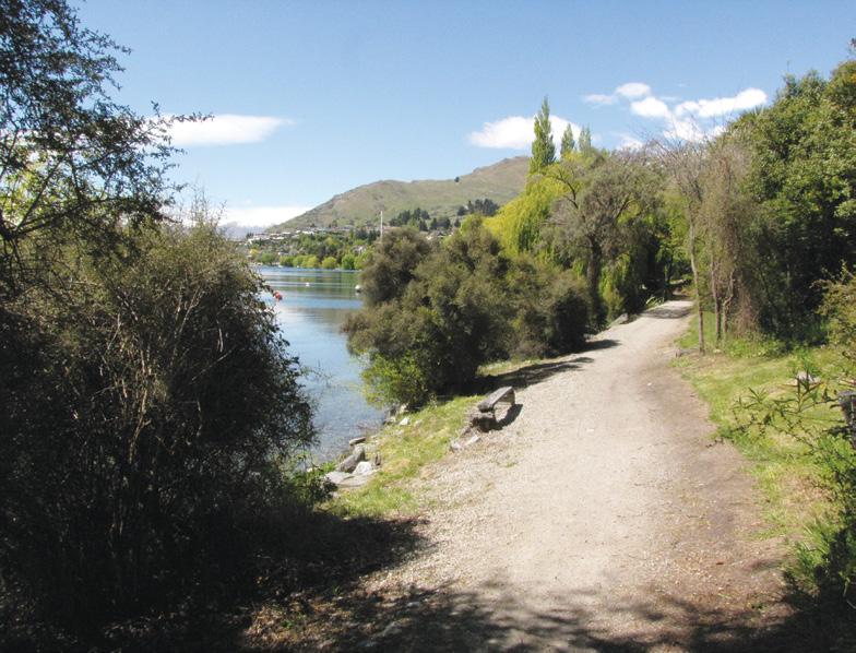
Kelvin Heights Peninsula Trail is a 3.5km easy trail that runs in and out of woodland alongside the lake beside the golf course and takes about an hour and is good all year round. It’s a shared trail with bikers and golfers, who have right of way.
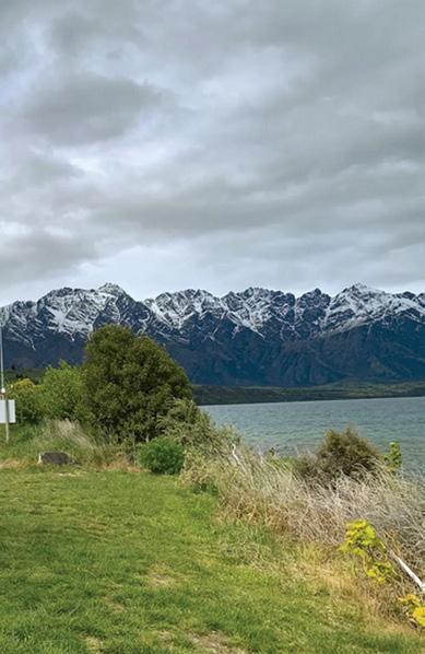
If you head around the peninsula in a clockwise direction, the trail offers you superb views across Lake Wakatipu to the Remarkables. Then
when the trail curves north, you’ll be gazing back towards Queenstown across the Frankton Arm.
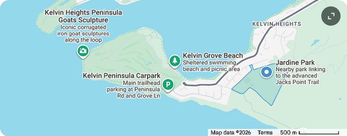
The start and finish of the walk is Junction of Peninsula Road and Grove Lane about 10km from the Queenstown CBD.
At Terry’s Cove there is a quiet beach inlet providing a framed viewpoint of Cecil Peak and Walter Peak across the water. It is a great place to
stop and have a picnic lunch.
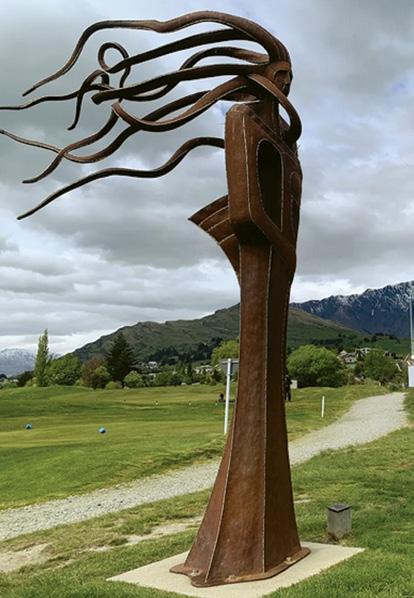
This trail is known for its sculptures by New Zealand artists, donated to the local community by a generous anonymous art lover. Look out for Wakatipu Kuikui by Mark Hill, Thru Link to Peak by Shane Woolridge, The Kelvin Peninsula Goats by Jeff Thompson, and Presence, also by Mark Hill.
Stop at the golf clubhouse for a refreshing drink before heading back to Queenstown.
Fact f ile
How to get there: The main trailhead and parking are located at the junction of Peninsula Road and Grove Lane, or near Jardine Park.
Water Taxi: For a scenic alternative, catch a water taxi from Queenstown’s Steamer Wharf directly to the golf course jetty
Trail length: 3.5km
Time: Allow one hour
Dogs: Permitted on the trail but must remain on a leash.
Opposite page above: Looking back toward Queenstown with the track to the left. Below left: A seat to rest and enjoy the view. Below middle: One of the sculptures on the trail. Above right: Looking back towards the start of the trail. Below right: Looking to the suburb of Franklin on the right with the snow capped hills of Remarkables in the background.
Whakamaharatanga Walkway through a working farm
By Marlene Lynam
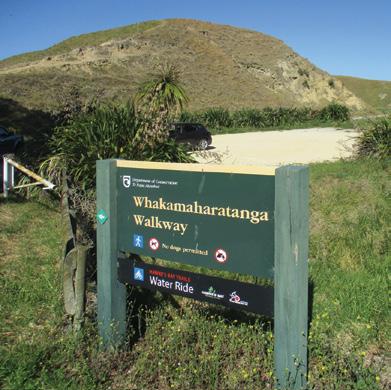
Agem worth doing in Hawkes Bay. In early June, we stayed in the Napier Beach Top 10 Holiday Park, situated at Bayview, just 10 kms north of Napier. Our goal was to cycle the short
distance from the Holiday Park to the start of the walkway, about 1 km down Onehunga Road at Bayview.
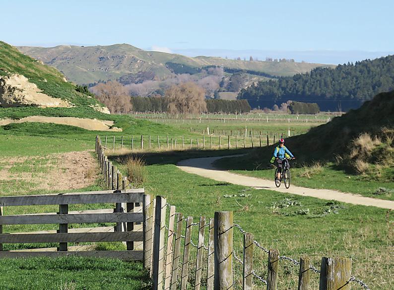
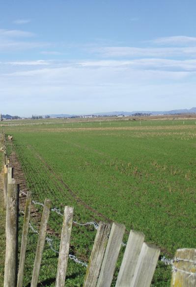
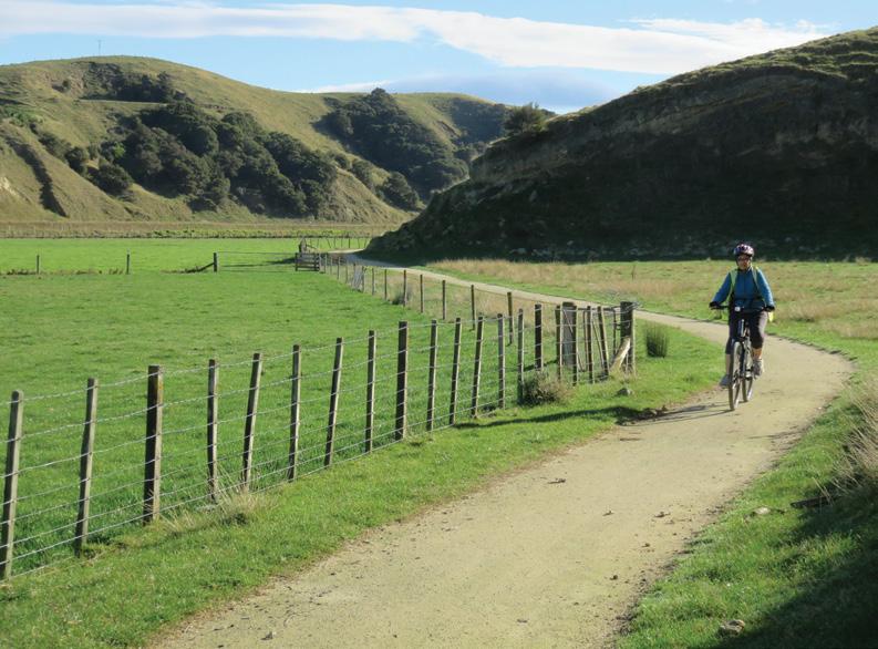
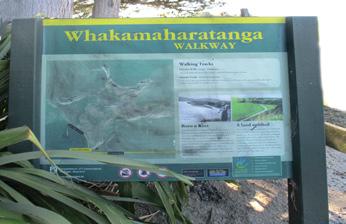
The DOC managed Whakamaharatanga Walkway takes you through a working farm on a flat lime sand
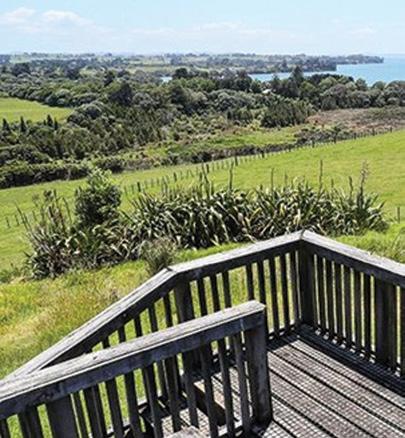
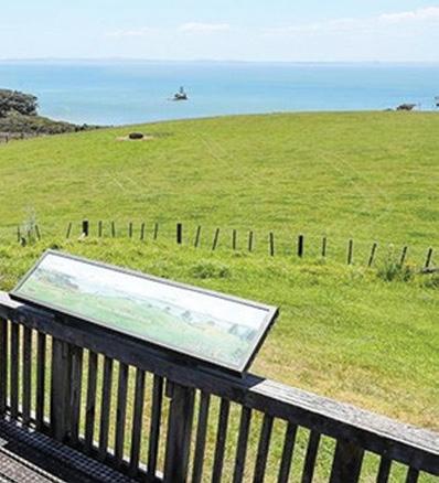
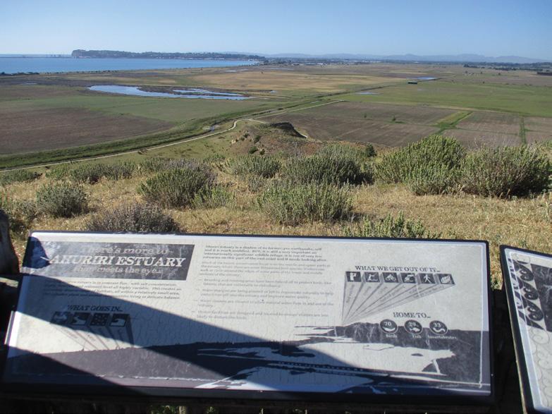
Above A great view looking towards Napier and the cliffs at Cape Kidnappers in the distance.
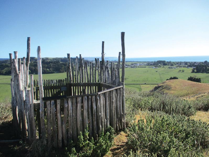
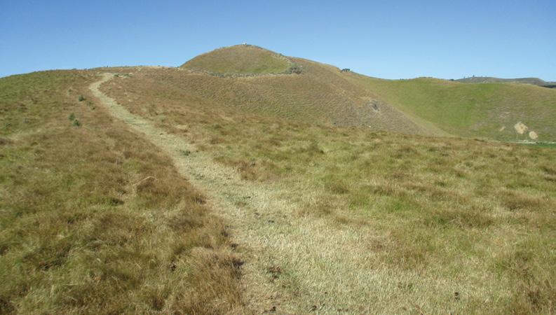
Below left and right: The track around the hill is flat.
trail which weaves its way around the base of Rorookuri Hill and past Otiere Pa on the Rorookuri Loop Track.
The hill is surrounded by grazed farmland and wetlands. While the hill is a prominent landmark in the area, it does merge with a backdrop of hills. The track is a shared trail ideal for walkers and cyclists.
It’s geological history states that Rorookuri Hill was once an island in the Ahuriri Lagoon, a vast tidal estuary and wetland which occupied the area between the hill and Napier, until the devastating 7.8 magnitude Napier earthquake of 1931 which dramatically uplifted the land, draining the surrounding water and thereby creating the now fertile farmland.
The shift in the landscape transformed the former island into a landlocked hill. The hill is rich in Maori
history and describes the island as having two historic and strategic pa sites with terraces, defensive pits and middens which can still be seen today.
The lagoon was a vital food source for early Maori. The “octopus” shaped island had many headlands, peninsulas, inlets, bays and beaches. Prior to the earthquake, the sheltered bays and beaches were a popular destination for sailing and picnics.
From the carpark at the walkway entrance, enter through the gate and head right to follow the trail anti clockwise with the hill on your left and lush rural landscapes on the right.
As we cycled around, we were
rewarded with different views as we circumnavigated the hill, with many curious sheep watching as we cycled by or running ahead of us.
It was impossible to dodge the sheep droppings all over the trail! A notable outcrop, Maori Head, was once thought to be a part of the island but it collapsed during the earthquake.
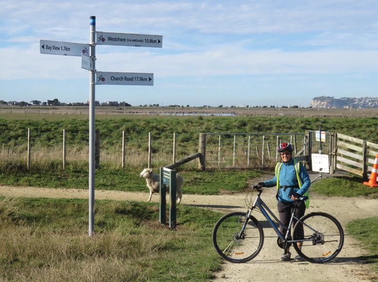
We reached a trail signpost where you can branch off to your right and continue to cycle on the Hawkes Bay Trails Water Ride which leads you past Napier Airport and the Ahuriri
Above right The start of the track is off Otahuhu Road. Below right: The track goes through a private farm.
Whakamaharatanga Walkway through a working farm
Estuary to connect with Napier, if you are wanting a longer ride. We had a short break and a photo stop at the signpost, then turned left to continue on the loop trail back to the start after our most enjoyable ride.
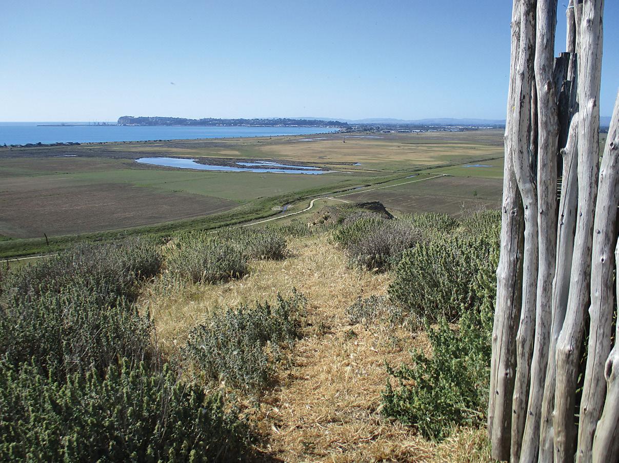
Here, there is a very worthwhile walking option to climb Rorookuri Hill on the Summit Track, a steady but easy climb to the top at approximately 71 metres. The summit lookout offering magnificent and panoramic views of Hawkes Bay - Ahuriri Estuary, Bluff Hill and beyond to Cape Kidnappers.
You can return via the same track or continue to cross over the top of the hill and walk back on the loop track below.
It is recommended to take water, have sun protection and wear sturdy footwear if walking as the whole walkway and hill is open and exposed, with no shade.
In summer, it can get very hot. Be aware, the walkway is closed for lambing from 1 August to 30 September and at other times for farming operations. As this area is active farmland, dogs are strictly prohibited.
The Whakamaharatanga Walkway and Rorookuri Hill are both a great place for a leisurely and tranquil exploration of this historic and scenic landscape. Let your thoughts go back in time and imagine the island that it once was.
Approximate Walking Times: Start: Onehunga Road at Bayview Loop Track 3 km. Easy one hour. Summit Track. Easy, 25 minutes return.
Summit Track, Otiere Pa and return on loop track, 45 minutes.
Above left: The view from inside the Rorookuri Hill lookout. Middle left: the Rorookuri Hill lookout.
Below left: The track up the hill.
Makara Walkway for spectacular sea views
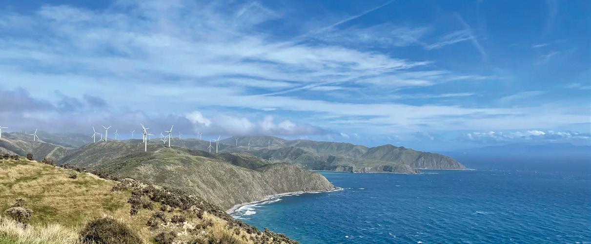
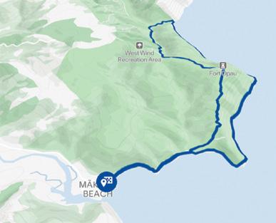
Mākara Walkway is a popular half-day trail that soars above the rocky shorelines of Mākara Beach in Wellington exhilarating views.
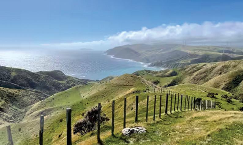
The 7.4km walk takes about three to four hours on a single track that is rated as an advanced tramping track, You’ll start by weaving along the beach, then uphill to the highest point over grassy farmland to clamber up the cliffs.
Once you’re at the top at 195m, you’ll find spectacular views of Mana, the Kāpiti coastline, and the South Island.
You can walk back down the same trail or complete the loop around the coast and enjoy the fresh Wellington wind along Mākara Beach.
At the top of the trail, you’ll find West Wind farm’s 62 wind turbines, and sheep and cattle farmland.
In pre-European times Māori populated the area because of its strategic position and access to plentiful
.seafood. There are many historic sites in the area, including pā , ngakia , and urupā . Gold mining took place in the area between the 1860s and the early 20th century. During WWII, gun emplacements and structures were built on the cliffs overlooking the Cook Strait.
Getting to Mākara Beach
To reach Mākara Beach, drive from Central Wellington, head west to connect with Karori Road. This takes you through the suburb of Karori to the intersection with Makara Road. Head north on Makara Road and follow this to the beach. The 17 km drive takes about 35 minutes.
Part of the track is closed in August and September due to lambing. No dogs are allowed.
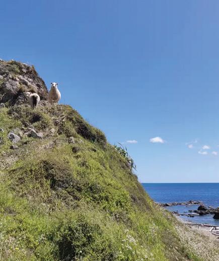
Above: What a great view into Cook Strait from the top of the Makara Walkway. Above right: The track up to the top. Below right The start of the walk from the beach.
Big upgrade to Hadrian’s Cycleway
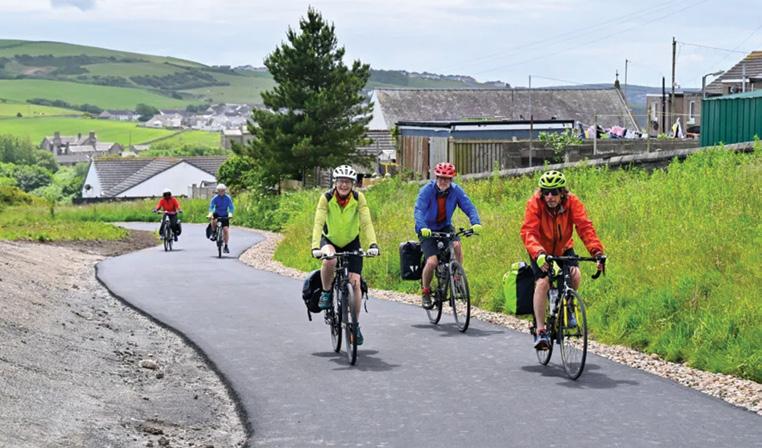
Anew $1.3 million cycle path as part of Hadrian’s Cycleway in England has been built in a coastal village to improve accessibility and safety
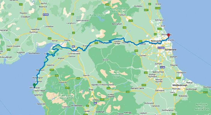
The off-road path in Lowca, near Whitehaven in Cumbria, is part of Hadrian’s Cycleway connecting Cumbria and north-east England.
National Highways, which provided the funding, said the off-road path alongside Foundry Road and High Lowca replaced a section of cycle path which previously took people on to a road with “challenging junctions”.
Restrictive barriers which previously prevented wheelchair users and prams from accessing the track have also been removed.
Head of customer journeys at National Highways Freda Rashdi said the path was a “vital link” for residents.
She said: “These improvements help to give more people in the
area the choice to use the route on short journeys and reduce traffic pressures on the A595 between Workington and Whitehaven.”
Hadrian’s Cycleway, also known as Route 72, connects Ravenglass in Cumbria to South Shields in Tyne and Wear.
It follows the line of the Roman frontier for 174 miles (280 kilometres), with hundreds of cyclists completing the full route every year.
The work in Lowca, carried out by Cumberland Council and Walk Wheel Cycle Trust, included widening some sections of the existing path and creation of new crossings.
The Labour council’s executive member for sustainable places, Denise Rollo, said the work made it easier for people of all abilities to get around.
She said: “This scheme builds on our wider work to improve connections along Hadrian’s Cycleway and supports safer everyday journeys to school, work and local services.
Survive Aotearoa
- 16 unexpected misadventures, spanning the Hokianga in the Far North to Antarctica
Survive Aotearoa is a page-turning collection of 16 true stories, spanning the Hokianga in the Far North to Antarctica. These unexpected misadventures took place along our coastlines, in our forests, on our mountains and deep under the ground. Each celebrates the courage, compassion and teamwork that can lead to survival and helps us learn more about the grit and determination that define New Zealand outdoorsmen and women.
This books is a sequel to our award-winning title Explore! Aotearoa.
The author, Bronwen Wall’s dynamic narrative has made these wonderful New Zealand adventurers approachable and exciting. Bronwen is a regular contributor to the Ministry of Educations’ Junior Journal, School Journal and the Connected series. She has also edited and written several adventure books, including Harry Watson: the Mile Eater and the Tararua Adventure Guide.
The award-winning illustrator, Kimberly Andrews, has researched and painted stunning watercolours of the adventures, helping capture the excitement, and sometimes desperation, of their adventures. Kimberly’s picture book illustrations have been widely acclaimed, winning multiple awards. She also writes and illustrates her own children’s books – most recently Moose the Pilot and Goose the Artist.
Evocative illustrations, maps, photographs and paintings add a rich visual layer to the stories. Survive Aotearoa is engaging for all readers.
‘It was the most remarkable event I’ve ever been part of.’ – Sir Edmund Hillary
‘Team survived by eating penguins’ – N.Z. Press Association
‘We are three skeletons, just alive.’ – Alphonse Barrington
‘I was high as a kite the day we found him.’ – Constable Cunningham
‘Never, ever had I yearned for sleep so much.’ – Penny Hazard
‘She was a bossy old cow … I knew she wouldn’t enjoy me hanging onto her, but I wasn’t letting go.’ – Kim Riley
‘I had to face my greatest fear, and my greatest fear was dying.’ – Rob Hewitt
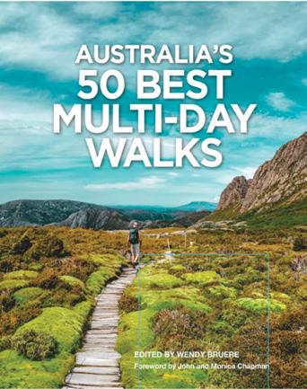
Australia’s 50 best multi-day walks
Australia contains a vast wealth of magnificent long distance walks . Each ensure to create memories that will ,last a lifetime.
Whether you seek to gaze at profound mountain views or experience a living green cathedral, be awed by some of the worlds best coastal scenery or thrilled by an unexpected wildlife encounter, there is something out there for you.
Some of Australia’s most experienced guidebook writers, including John and Monica Chapman, have come together with editor and writer Wendy Bruere to showcase the very best of Australia’s multi-day walks, from two-day hops to major multiweek challenges.
Evocative descriptions, vivid photography, essential planning information and easy-to-grasp maps will both inspire you and help you to decide on which trail will be the right one for your party’s next adventure.
Freephone
months and
Subscribe today as prices increase from August 1 2026
Nowell’s Lakes Walkway –A Hidden Wetland
Gem Near Hāwera
Just a few kilometres south of Hāwera lies one of South Taranaki’s most delightful short walks.
The Nowell’s Lakes Walkway combines peaceful countryside, restored wetlands and native planting into a rewarding outing that is suitable for walkers of most fitness levels. Although only a short distance from town, the walkway feels wonderfully secluded and offers a chance to experience one of the region’s important freshwater ecosystems.
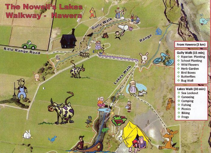
The main walkway is approximately 3 kilometres return, taking around 45 minutes to complete at a leisurely pace. The track is graded moderate, mainly because sections can become muddy after rain, particularly during winter, so sturdy walking shoes are recommended.
The walk begins at the end of Rifle Range Road, just off Manawapou Road, about a five-minute drive south of Hāwera. A small parking area marks the entrance, and from there well-signposted tracks lead through a gently sloping gully before emerging alongside the lakes.
One of the most fascinating aspects of the reserve is its history. The walkway passes through a gully that was once a third freshwater lake. Over time this lake filled naturally, creating today’s fertile valley. Beyond the gully are Nowell’s Lakes, two pristine, ground-fed freshwater lakes covering around seven hectares.
These lakes were formed when coastal sand dunes trapped freshwater, creating an important wetland habitat that supports native fish, birds and aquatic life. Walking through the reserve, visitors are surrounded by flourishing native plantings.
Thousands of trees, shrubs and swan plants have been established by local schools, community groups, conservation volunteers and busi-
nesses over many years. The restoration has transformed what was once farmland into an attractive environmental showcase.
Between February and April, the swan plants become alive with Monarch butterfly caterpillars before clouds of brilliant orange butterflies emerge, making this one of the best times of year to visit.
Along the route are seats and picnic tables, providing ideal places to stop and enjoy the peaceful surroundings. Birdlife is plentiful, and keen observers may spot kingfishers, pukeko, waterfowl and other wetland species.
The crystal-clear lakes also provide habitat for fish, including eels, reflecting the excellent water quality maintained through ongoing conservation work. The walkway itself has an inspiring story.
It was developed in 2006 through a remarkable partnership involving local volunteers, schools, conservation groups, Fonterra, Rotary and the wider Hāwera community. Since then, thousands of native plants have been added, helping restore the wetlands while creating an educational and recreational destination for visitors of all ages.
The project has even received environmental recognition for its outstanding community involvement. For anyone visiting South Taranaki, Nowell’s Lakes Walkway offers far more than a simple stroll.
It is a journey through a successful community conservation project where native wildlife, tranquil scenery and local history come together, making it one of Hāwera’s hidden natural treasures.
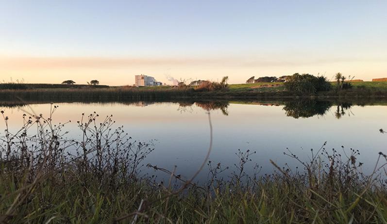
Above right: One of the lakes..
NORTH ISLAND
NORTHLAND
BAY OF ISLANDS
BAY OF ISLANDS WALKERS: Saturday (AM), Jacqui Watson 022-6019741, Roz Whittaker 021-063-1455
DARGAVILLE
DARGAVILLE TRAMPING GROUP: Last Sunday of month (AM), Lynley Thompson 021-102-3974, colvilleestate1@gmail.com
WHANGAREI
CARDIAC CARE WALKING GROUP: Wednesday (AM or PM), Jo or Hugh Knight 09-438-7976
BARRIER TRAMPING& BEER LOVERS CLUB: Sunday, John Brock 09-429-0211
AUCKLAND
AUCKLAND GLOBAL TREKKERS: Sundays (BIA), Auckland walks and one overseas walk, auckland.global.trekkers@gmail.com, https:// heylo.group/aucklandglobaltrekkers
BLUE TOP WALKERS: Henderson, Tuesday, Thursday (AM), Terry Wilson 09-814-9523 or 021-266-1071, terryandsheena@gmail.com, www. bluetopwalkers.weebly.com
FIA OLA WOMEN’S DEVELOPMEMT WALK GROUP: Monday to Saturday, Anne, 09-813-0021
FIT4LIFE: Glenfield, Monday (PM), Friday (AM), Sarah 021 534 649 FOOTSTEPS: Saturday (AM), John 09-410-2995
EAST COAST BAYS WALKERS: Browns Bay, Tuesday, Friday (AM), Pam Mattson 09-302-4882 or 021-268-4154, pam_4882@yahoo.co.nz
GREENHITHE WALKING GROUP: Greenhithe, Tuesday (AM), Marjorie Andrew 09-413-9065
HIGHBURY COMMUNITY HOUSE: Highbury, Thursday, Friday (AM), Judy Mayn 09-480-5279
MAIRANGI WALKING NETWORK: Mairangi Bay, Everyday (AM), Paula Cole 09-444-6435
MILFORD MALL WALKERS: Greenhithe, Tuesday, Thursday, (AM), Carol Mosedale 09-443-2054
MILFORD MENS PROBUS: Ian Hall 09-479-4259
NORTH SHORE DIABETES SUPPORT GROUP: Every second Sunday (AM), Dave or Panny 09-476-7447
NORTH SHORE SOCIAL WALKING GROUP: Every second Wednesday, Rosamonde Johnson 022-308-8975, rsmndj@gmail.com
NORTH SHORE TRAMPING CLUB: president@nstc.org.nz, www. nstc.org.nz
NORTHCOTE WALKING GROUP: Northcote, alternative Tuesdays, Brucilla Wright 09-480-0150, brucilla.wright@xtra.co.nz
LEGEND
Fitness levels: “B” beginner, ”I” intermediate, “A” advanced. (AM) denotes morning walk, (PM) denotes an afternoon or evening walk. Group co-ordinators are asked to please advise us of any updates by fax 06-358-6864 or email walkingnz@xtra.co.nz.
If you notice there that the times, names or contact numbers etc on the list of Walking Grroups in the Directory on these pages needs updating please email us at walkingnz@xtra.co.nz. These are are free listing.
LEGEND
Fitness levels: “B” beginner, ”I” intermediate, “A” advanced. (AM) denotes morning walk, (PM) denotes an afternoon or evening walk. Group co-ordinators are asked to please advise us of any updates by fax 06-358-6864 or email walkingnz@xtra.co.nz.
GOLDEN BAY ALPINE AND TRAMPING CLUB: Regular day and overnight tramps, Gaylene Wilkinson, Club President , beachgums@gmail.com
WEDNESDAY WALKERS GROUP: Weekly day walks, Richard English 03-525-6179 rsenglish@xtra.co.nz
CANTERBURY
CHRISTCHURCH
ACTIVE CHRISTCHURCH SUNDAY WALK: Sunday (AM) (BI), 03-9418999
AVONSIDE KIWI SENIORS: Wednesday (AM), (BI), Jan 03-389-2755
AVONHEAD KIWISENIORS: Friday (AM), (BI), Bess 03-342-7647 AFTER WORK WALKING CLUBS: around Christchurch, (BI), for all ages and fitness levels, recreation clerk, CCC 03-371-1778.
PIONEER TRAMPERS:Thursday (AM) (IA),4-5 hour tramps in Banks Peninsula and the hills and lower mountains from Mt Hutt to Mt Grey, pioneertrampers@gmail.com
ALEXANDRA HARRIER & WALKERS CLUB: Saturday (PM), April tOctober,
Notice to clubs and walking groups
If you notice there that the times, names or contact numbers etc on the list of Walking Grroups in the Directory on these pages needs updating please email us at walkingnz@xtra.co.nz. These are are free listing.
22 Flemington Mud Run, Lake Station, Central Hawkes Bay
22 Hobsonville Half Marathon, Hobsonville
28 Rockys Backyard Ultra, McLaren Falls, Tauranga
29 Ōmaha Half Marathon, Omaha, Auckland
29 The OxMan, Oxford, Canterbury
REST OF WORLD
AUGUST 2026
30 TCS Sydney Marathon, Sydney, NSW, Australia
SEPTEMBER 2026
27 BWW Berlin Matahon, Berlin Germany, OCTOBER 2026
11 Bank of America Chicago Marathon, Chicago, USA
NOVEMBER 2026
1 TCS New York Marathon, New York, USA
29 Shanghai Shanghai Marathon Shanghai, China
MARCH 2027
7 Tokio Marathon, Tokio, Japan
APRIL 2027
25 TCS London Marathon, London England MAY 2027
23 Salam Cape Town Marathon Cape Town South Africa
HAWKES BAY
HAWKES BAY
CONTENTS for previous 15 issues
JULY 340 2026
3 Contents
4 Walk Talk
6 New Zealand Walk: Walking the beautiful Beachlands to Maraetai Walkway
10 New Zealand Walk: Early walking magic on the Kea Point Track
12 Weather: Weather prediction for July
13 News: Award for landmark Auckland walking and cycling route
14 New Zealand Walk: Walking Wellington’s spectatular coastal pathway
18 New Zealand Walk: Three popular Waitakere Range tracks now reopen
21 New Zealand Walk: Bridle Path was first link from port to city
22 Walking New Zealand Monthly Photo Contest
24 New Zealand WalkDiscovering nature’s beauty on Dunedin’s Sandymount Track
26 New Zealand Walk: The Pakihi Walk - a walk above the wetlands, Okarito
28 New Zealand Walk: Tutukaka Lighthouse Walk for stunning coastal views
30 New Zealand Walks: Great Barrier Island a stunning off-shore odessay to kick off
34 New Zealand Walk: Whakapapaiti Valley Walk - enjoy the solitude of the wilderness
38 New Zealand Walk: Kuirau Park for geaothermal activity
40 Directory of New Zealand Walking Groups
42 Coming Events: New Zealand
46 Coming Events: Australia
48 New Zealand Country Breaks
50 Index of previous 15 issues
51 Walking New Zealand Shop
52 Pak A Roo Walking Jackets
JUNE 339 2026
3 Contents
4 Walk Talk
6 New Zealand Walk: Pouakai Circuit - a loop track on Mt Taranaki
12 Weather: Weather prediction for June
13 New Zealand Walk: Pokemokemoke Reserve boasts over 300 native plants
14 New Zealand Walks:The Benefits of Walking Part 2
17 Book: Where to go when Hiking
18 New Zealand Walk: Whiskey Falls Walk - a waterfall named after an illicit still
20 New Zealand Walk: Eastern Bays Pathway officially opened
23 Walking New Zealand Monthly Photo Contest
24 New Zealand Walks: Two Rangitikei tracks offer rewarding experiemces
26 England’s Coast to Coast a classic reborn as a National Trail
30 New Zealand Walk: New walking experience opened in North Canterbury
32 New Zealand Walk: Plenty of variety on Branch Walkway
34 Walking Festival: Waiheke Island Walking Festival shows off its history, tracks and birdsong
39 New Zealand Walk: Lake Wombat Walk an enchanting forest trail
42 Coming Events: New Zealand
46 Coming Events: Australia
47 Coming Events: Rest of World
48 New Zealand Country Breaks
51 Walking New Zealand Shop
52 Pak A Roo Walking Jackets MAY 338 2026
3 Contents
4 Walk Talk
10 Weather: Weather prediction for May
11 New Zealand Walk: Eves Valley Walk for the family
12 New Zealand Walk: Te Otamanui Walkway, Te Kowhai, has four trail entrances
15 Book: High Country Huts and Homesteads
16 New Zealand Walk: Walk the wild west on the spectacular west Auckland track
18 New Zealand Walk: Ohangaturuturu Track showcases park
21 New Zealand Walk: Te Whau Pathway section opened
22 Walking New Zealand Monthly Photo Contest
24 New Zealand Walks: Seals a feature of walks in the Cape Foulwind area
26 Australian Walks: Eleven great hikes for all ages in New South Wales
30 New Zealand Walk: Giant totara feature of Montgomery Peak Track
32 New Zealand Walk: Lake Okareka - a bird lover’s paradise
35 Book: The only way is up on foot to Rome
36 New Zealand Walk: A visit to Auckland’s first re-gional park 60 years on
38 Need2know: Discover your wild backyard - Why use iNaturalist?
39 Need2know: Waipoua Forest embarks on bold expansion
42 Coming Events: New Zealand
46 Coming Events: Australia
47 Coming Events: Rest of World
48 New Zealand Country Breaks
51 Walking New Zealand Shop
52 Pak A Roo Walking Jackets APRIL 337 2026
3 Contents
4 Walk Talk
6 New Zealand Walk: A day on foot along Auckland’s Waterfront from Downtown to St Heliers
9 New Zealand Walk: Bledisloe Park to Old West Road Walk
10 Weather: Weather prediction for March
11 Overseas Walks: Lochs, Munros, Bens and Braes!
18 New Zealand Walk: Waitahinga Trails
20 New Zealand Walk: Walking up Mt Tauhana an iconic Taupo landcape
22 Walking New Zealand Monthly Photo Contest
25 Australian Walk: Explore the Murray River with the experts
28 New Zealand Walk: Children’s Bay Rhino Farm Walk
30 New Zealand Walk: The walk to Dickeys Flat in Kaimai Forest Park
33 New Zealand Walk: Bridal Veil Falls a short walk with a big impact
34 New Zealand cycle Tour: Ride, Sip, and Enjoy Hawkes Bay Uncorked
36 New Zealand Walk: New Plymouth’s Coastal Walkway from the port to Bell Block
38 New Zealand Walk: Stanfield Hut an ideal place for lunch
42 Coming Events: New Zealand
46 Coming Events: Australia
47 Coming Events: Rest of World
48 New Zealand Country Breaks
51 Walking New Zealand Shop
52 Pak A Roo Walking Jackets MARCH 336 2026
3 Contents 4 Walk Talk
6 New Zealand Walk: Switch off at Port Jackson
10 Weather: Weather prediction for March
11 New Zealand Walk: Wairoa Loop Track in Hunua Regional Park
12 News: NZ city ranks globally as bicycle-friendly city
12 Walking Group: Auckland Global Trekkers offer walks with sublime views
17 New Zealand Walk: Lake Waikareiti Walk
18 New Zealand Walk: Atene challenges and rewards
out along the City to Sea Pathway
24 Walking New Zealand Monthly Photo Contest
26 New Zealand Walk: Rapurapu Stream - a perfect walk on a hot day
28 New Zealand Walk: Omahu Bush, Christchurch from tussock to totara
31 New Zealand Walk: Smith’s Bush Path an easy loop walk
32 New Zealand Walk: Greytown to Woodside a popular walk or bike
36 New Zealand Walks: Seven walks on Mt Somers
38 New Zealand Walk: Hobson Bay East Path a short interesting walk:
40 Directory of New Zealand Walking Groups
42 Coming Events: New Zealand
46 Coming Events: Australia
47 Coming Events: Rest of World
48 New Zealand Country Breaks
51 Walking New Zealand Shop
52 Pak A Roo Walking Jackets FEBRUARY 335 2026
3 Contents
4 Walk Talk
6 New Zealand Walk: Red Rocks Coastal Walk - a wild south coast experience
9 Weather: Weather prediction for February
10 Walking Festival: Walking the landscapes: ECHO Walking Festival
12 New Zealand Walks: Taihape offers a hill and river walk
15 Overseas Walks: Walking the Greek Islands in Spring
16 Overseas Walks: From seething surf to mountain marvels
21 New Zealand Walk: Walking the walk from Palmerston North to Linton
24 Walking New Zealand Monthly Photo Contest
26 New Zealand Walk: Walking on the edge of the world in the Chatham Islands
29 New Zealand Walk: Walking the four Whangarei Falls tracks - my day out at Otuihau
32 New Zealand Walk: Rangitoto Island walk to the summit
36 New Zealand Walk: Wrights Hill Lookout Walk
38 New Zealand Walk: Muriwai Gannets Walk to spectacular bird life
40 Directory of New Zealand Walking Groups
42 Coming Events: New Zealand
46 Coming Events: Australia
47 Coming Events: Rest of World
48 New Zealand Country Breaks
51 Walking New Zealand Shop
52 Pak A Roo Walking Jackets JANUARY 334 2026
3 Contents 4 Walk Talk
6 New Zealand Walks; Eight Taupo nature walks
11 Overseas Walk: Handcrafted journey along the Camino de Santiago
12 Overseas Walks: The delights of the Dolomites
17 Need2Know:: Explore safe this Summer
18 Weather: Weather prediction for January
19 New Zealand Walk: Nydia Track from D’Urville Island to Pelorus Sound
24 Walking New Zealand Monthly Photo Contest
26 New Zealand Walk: Walk to Blyth Hutt - popular Tongariro National Park walk
30 New Zealand Walk: Okere Falls Walk for natural beauty and history
34 New Zealand Walks: Three walks to explore in Tunnel Gully Recreational Area
37 New Zealand Walks: Two relazed beachside strolls in the Eastern Bay of Plenty
42 Coming Events: New Zealand
46 Coming Events: Australia
47 Coming Events: Rest of World
6 New Zealand Walk; Hamilton Hidden Gems
9 News: Dallington Bridge officially opened over Avon River
10 Walking Tours: Top Walks in the top of the South
15 Manawatu Striders Super Seven Series
16 New Zealand Walk: Native forest giants just off highway:
18 Weather: Weather prediction for December
19 New Zealand Walk: Taking the Green Route from Devonport to Takapuna 22 New Zealand Walk:The Hull’s farm track to Mangatiti Falls
24 Walking New Zealand Monthly Photo Contest
26 New Zealand Walk: A winter walk on the Old Coach Stream Track
32 New Zealand Walk: Dog Stream Waterfall Walk
35 New Zealand Walk: Mercer Bay Loop Track for great sea views
36 New Zealand Walk: Walking the Kereru Track from Days Bay for greats harbour views
39 New Zealand Walks: Walk the Chatham Islandswonderfully remote
40 Directory of New Zealand Walking Groups
42 Coming Events: New Zealand
46 Coming Events: Australia
47 Coming Events: Rest of World
48 New Zealand Country Breaks
51 Walking New Zealand Shop
52 Pak A Roo Walking Jacke
NOVEMBER 332 2025
3 Contents
4 Walk Talk
6 New Zealand Walk; Pakihi to Motu - a walking or cycling trail
10 Book: Emilie walks Te Araroa
10 News: Cape Palliser paper road bylaw to allow pedestrian and cycling access
11 Australian Walk: Witton Bluff Base Trail complete!
12 New Zealand Walk: CopperMine Trail - Nelson
14 NZ Walking Tour: Tantalising Taranaki from a volcanoe to coastal walk and in between
18 Weather: Weather prediction for November
19 Subscription page
20 Memories: Walking the Waikaremoana Track - 38 years ago.
24 Walking New Zealand Monthly Photo Contest
26 New Zealand Walk: Walking the Pahi Coastal Track -at the edgae of the Coromandel
30 New Zealand Walks Little River Trail - hike it, bike it, like it!
34 High Achiever: At nearly 80the melee of different walks in my life
37 Australian Walks: Alice Springs - gorges, water holes and red dessert landscapes
40 Directory of New Zealand Walking Groups
42 Coming Events: New Zealand
48 New Zealand Country Breaks
51 Walking New Zealand Shop
52 Pak A Roo Walking Jackets
OCTOBER 331 2025
3 Contents
4 Walk Talk
6 New Zealand Walk; An Autumn walk on the Otago Rail Trail
10 New Zealand Walks: Wonderful walks from Wel-lington to Whanganui
14 Overseas Walk: Morton Bay Fig trees a feature of Norfolk Island walk
15 New Zealand Walk: The Great Dripping Loop walk
18 Weather: Weather prediction for October
19 New Zealand Walk: Seals, camping and short walks on SH1 journey through Kaikoura
20 New Zealand Walk: Rangiwahia Hut murals makes this walk so special
22 New Zealand Walk: Discover Mangati Walkway: New Plymouth’s peaceful shared pathway
24 Walking New Zealand Monthly Photo Contest
26 New Zealand Walk: Katikati Haiku Pathway unique outside Japan
Whakatane’s Coastal Trail Classic
30 New Zealand Walks: Heaphy Track and Oparara Arches
33 New Zealand Walk: Lou’s Lookout Walk
34 New Zealand Walks: Wandering along the Waika to River Trail from the dam to Jones Landing
38 New Zealand Walk: A’Deanes Bush Walk through an original existing forest
42 Coming Events: New Zealand
46 Coming Events: Australia
48 New Zealand Country Breaks
52 Pak A Roo Walking Jackets SEPTEMBER 330 2025
3 Contents 4 Walk Talk
6 New Zealand Walk; Short walks at Lake Brunner
8 New Zealand Walking Festival: Wairarapa Walking Festival has over 25 walks
10 New Zealand Walk: Makotuku Track has wide appeal
13 Need2know: 7000 steps a day now achievable for most people
14 New Zealand Walk: A wander along the Karangahake Gorge
18 Weather: Weather prediction for September
19 New Zealand Walk: Track repair confirmed for Waimata Gemstone Bay
20 New Zealand Walk: Cape Saddle Walk: A valley to valley walk in Craigieburn Forest Park
24 Walking New Zealand Monthly Photo Contest
26 High Achiever: Raukumara Hikoi to view work done on the ranges
29 Australian Walks: Forest Sky Pier, Orara East State Forest offers great coastal views
30 Te Araroa Trail: How walkers donation have helped the Te Araroa Trail
32 News: 100 years of history with the Auckland Natural History Walking Group
34 New Zealand Walks: Walks in Winsome Wairarapa
36 New Zealand Walk: Walking fron the Woodville end to Ashhurst to first lookout
40 Directory of New Zealand Walking Groups
42 Coming Events: New Zealand
46 Coming Events: Australia
47 Coming Events: Rest of World
48 New Zealand Country Breaks
52 Pak A Roo Walking Jackets
AUGUST 329 2025
3 Contents 4 Walk Talk
6 New Zealand Shared Pathway: Te Ahu a Turanga Manawatu to Tararua a journey from Ashhurst to Woodville
10 New Zealand Shared Pathway: Build the Path
11 New Zealand Walk: St Leonard’s Beach dog friendly
14 New Zealand Walk: Kurow Hill Walk an unique experience
18 Weather: Weather predictiofor August
19 Viewpoint: Reinstate the competitive walking section: Why Auckland Marathon must listen to walkers
20 New Zealand Walking Festival: Bay of Islands Walking Weekend
23 Living Streets Aotearoa: Do you do this?
24 Walking New Zealand Monthly Photo Contest
26 Walking Tours: What’s in the mix for 2026
29 High Achiever: Northland engineer wins Outdoor Access Champions Award
30 New Zealand Walk: Hinehopu Bluffs for lots of native trees and birdlife
33 New Zealand Walk: The Terrace Walk at Franz Josef
34 New Zealand Walk: Karituwhenua Stream Walk a short family walk
36 New Zealand Walk: Omarama’s Clay Cliffs has an unique landscape
39 Auckland Walk: A walk or bike ride through Logan Park Reserve:
42 Coming Events: New Zealand
48 New Zealand Country Breaks
52 Taupo
48 New Zealand Country Breaks
52 Pak A Roo Walking Jackets DECEMBER 333 2025
26 Overseas Tours: NZ walking company offers walks in Italy with Pleasure
6 New Zealand Walk: The Benefits of Walking Part 1
19 Overseas Tours: Meet you at Grand Central
23 New Zealand Pathway: Take a day
3 Contents 4 Walk Talk
28 Event: Toi’s Challenge:
The ULTIMATE is Zerofit’s flagship product and perfect for hiking, golf, sailing or any outdoor activities when it’s cold. But if you are more active it is complemented by the Heatrub MOVE.
Twice as warm as a standard base layer, the material regulates tempertures as you move, so you won’t suffer from cold sweat, if your are running or cycling.
Please visit the Walking New Zealand Shop: https://walkingnewzealand.co.nz/productcategory/apparel/ for more details and to order.