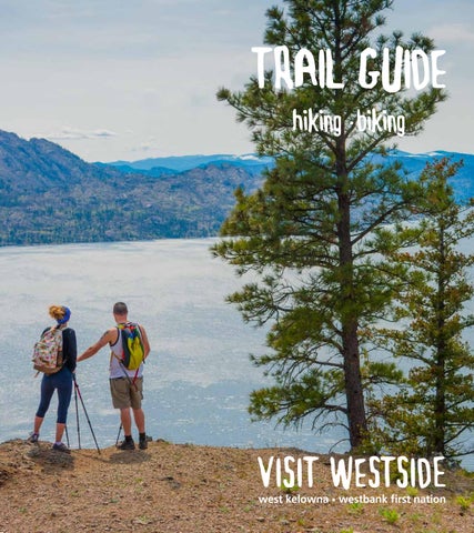
TRAIL GUIDE hiking biking
Trail Tips & Etiquette 1. Stay on the trails and keep dogs on leash to help preserve the natural elements of the park. 2. Trails are for non-motorized users only. Many trails are multi-use (walking, biking, hiking, horseback riding), so please be aware of other user groups. 3. Bag and dispose of dog poo in garbage cans: don’t leave it on the trail. 4. Respect adjoining property owners and do not trespass. 5. Cell phones may not work in all areas. 6. Dress in layers, bring water and wear sunscreen as our trails can get hot.
4
7. Be aware of poison ivy, rattlesnakes and brittle prickly pear cactus along some of the trails.
8
8. You may encounter wildlife along the trails, as well as tics, when they are in season.
7
How hard is the trail? Trails are rated by a green/blue/black system that is based mainly on the slope and distance of the trail. The ratings apply to both hiking and biking trails.
6
Easy - Well maintained compact trails, which are relatively flat with some gentle climbs. There may be some obstacles such as rocks, roots and potholes.
9 5
3
Moderate - Trails are usually maintained and you will find some moderately steep climbs either directly on the paths or through the use of stairs.
Find Your Park!
Difficult - Trails are not always maintained. Only the moderately fit and experienced hikers and mountain bikers should use these trails. You will also find steep and difficult terrain.
2 1
1. Goats Peak Regional Park 2. Glen Canyon Regional Park 3. Kalamoir Regional Park 4. Bear Creek Provincial Park 5. Boucherie Rush Trail
Legend
6. Smith Creek Trail
Parking
Trailhead
7. Rose Valley Regional Park 8. McDougall Rim 9. Shannon Lake Regional Park
1 #visitwestside
GLEN CANYON REGIONAL PARK SOUTH The park features rustic raised wooden paths, as well as a series of bridges and stairs. You can cross over Powers Creek Falls bridge to see the waterfall. The trees and canyon walls offer shade on many parts of the trail.
ak & Glen Canyon
@telinahull
Access: Main parking lot is at 4262 Gellatly Road. Access also via Herbert Road and Brown Road.
1 Glen Canyon Greenway | n ucklípm Moderate | 2.2 km | Elevation: 80 m
Easy | 0.8 km | Elevation: 25 m
Birds to watch for:
97
2
Glen Canyon Regional Park South
Doe Trail | nq qlxwaqa s sta
Hw y
Turkey Vulture Golden-crowned Kinglet Cedar Waxwing
GOATS PEAK REGIONAL PARK 2
The 52-hectare park offers two trails for hikers to explore. Ge tly
lla
Access: Seclusion Bay Road, parking lot can be found at the Big Sagebrush Trailhead. Access can also be found at the end of Whitworth Rd.
Rd S
3
1
Big Sagebrush Trail | nq qlxwaqa s cqwasqlstn Moderate | 1.3 km | Elevation: 75 m
The point-to-point multi-use trail runs along a mountain ridge with views of Okanagan Lake along the way. The trail path is wide and users should note that on a hot summer day the trail can get very hot as there is minimal shade.
4
Mountain Goat Trail | nq qlxwaqa s sxw i Difficult | 1.27 km | Elevation: 235 m
4
Hw
y9
7
The point-to-point, narrow hiking trail zig-zags up the mountain to a viewing platform at the peak. Parts are difficult and trail footwear is advised.
3 Birds to watch for: Northern Flicker Canyon Wren House Finch
visitwestside.com 2
City On The Edge Of Forever
KALAMOIR REGIONAL PARK Daze Of Roses Jabbarocky
Thacker Dr
Cattywumpuss
Boucherie Rd
Bear Bones
Mr Toads
Enjoy a leisurely hike along the lakeshore, stop for a Reservoir Road swim at one of the swimming stops, or challenge yourself Lake Loop with one of the hillside trails. In the spring, experience the beauty of the Arrowleaf balsamroot as the hillside RSVP explodes with brilliant yellow flowers. During the summer RSVP Rock Rolls and fall, theTourism_Trails_WGS84_Final delicate sagebrush mariposa lily can be Sideshow Bob found, as well as the Flintbrittle Man prickly pear cactus. Dogs Swamp Donkey are permitted on-leash only. Much of the hillside trail is Boucherie Rush Trail exposed, so be sureThe to Elevator bring water and wear sunscreen Kalamoir Park during the hot summer months. Bunchgrass Trail Big Sagebrush Trail Access: 3088 CollensYellow Hill RdBell Loop Trail Mountain Goat Trail Forest Trail Loop |Trail nqTrail qlxwaqa s ya cín 1 WaterfrontInformal Bitterroot Loop Trail Easy | 1.5 km | Elevation: 20 m Canyon Rim Trail Rose Valley Lake Mid Canyon Trail w nq qlx aqa s kwlink Access| Road 2 Sunnyside Trail Loop Trail Moderate | 0.63 km | Elevation: 30 m Slik50 Smith Creek Trails
4
1
3 @life_of_ki
2
w 3 Upper Rim Trail | nq qlx aqa s tqltikn
Birds to watch for:
Moderate | 1.4 km | Elevation: 60 m Tourism_Trails_WGS84_Final
4
Hill Coll ens
Ogden Rd
Rd
All Tourism Trails - from Mike
Red-necked Grebe Spotted Sandpiper Red-tailed Hawk
Mcdougall Rim
Mike Passmore Trail | nq qlxwaqa s txwilm Bear Bones
Difficult | 0.64 km | Elevation: 200 m Cattywumpuss City On The Edge Of Forever Daze Of Roses
BEAR CREEK PROVINCIAL PARK Jabbarocky Mr Toads
This trail has threeReservoir well-marked Road loops that begin at a common trailhead. The easiest is the quick 15 minute Lake Loop Loop Trail. For those looking for a slightly longer trail, the RSVP 1.4 km Mid Canyon Trail is for you, but please note there are no washroom RSVP facilities Rockalong Rolls this loop. The longest is the 2.5 km Canyon Rim Trail. Features of this trail include Sideshow Bob some considerable stairs, lookout points and there are Swamp Donkey washroom facilities.
5
Bitterroot Loop Trail 90 m Moderate | 2.5 km | Elevation: Rose Valley Lake
6
w Loop Trail Access | nq qlx aqa s qax Road
Easy | 0.4 km
Slik50
3 #visitwestside Regional_Park_Trails Glen Canyon South
5 Birds to watch for: Great Blue Heron Lewis’s Woodpecker Violet-green Swallow
6
tsi
Forest Loop Trailqlxwaqa s n ucklípm Trail | nq 5 Canyon Rim
W es
Yellow Bell Loop Trail
de
Rd
The Elevator Access: Turn onto Westside Road from Hwy 97. Follow Westside Road for approx. 5 km. Bunchgrass TrailParking area is well marked with signage.
Tourism_Trails_WGS84_Final
MCDOUGALL RIM TRAIL
BOUCHERIE RUSH TRAIL
Flint Man
Boucherie Rush Trail Kalamoir Park
Big Sagebrush Trail
The McDougall Rim trail starts with a long, steady, and Mountain Goat Trail intense climb of 30-60 minutes before it levels off. The trails Informal Trail are marked by usage with little signage. Canyon Rim Trail
Mount Boucherie is an extinct volcano that is 50-60 million years old. A series of switchbacks will lead you up the mountain where stunning views of the valley can be seen. Unique rock formations and streams of ancient solidified lava rock can be seen while exploring the mountain.
Mid Canyon Access: TurnTrail onto Bartley Road, then left on Shannon Lake Road LoopBartley Trail and Rd will continue on your right. Follow this along Smith past a Creek small Trails gathering of private properties. Continue along this narrow winding gravel road. Parking area is just past the Tourism_Trails_WGS84_Final cattle guard.
Access: 2775 East Boundary Rd
Mcdougall Rim
Difficult
Moderate to Difficult
Distance: 20+ km | Elevation: 855 m
Distance: 6 km round trip | Elevation: 275 m
Bear Bones
Cattywumpuss
City On The Edge Of Forever Daze Of Roses
Bartley Rd
Jabbarocky Mr Toads Reservoir Road Lake Loop RSVP RSVP Rock Rolls Sideshow Bob Swamp Donkey
Rd
The Elevator
Bitterroot Loop Trail Rose Valley Lake
und t Bo
Forest Loop Trail
Eas
Yellow Bell Loop Trail
ary
Bunchgrass Trail
Access Road Slik50
visitwestside.com 4
All Tourism Trails - from Mike Tourism_Trails_WGS84_Final Flint Man Boucherie Rush Trail Kalamoir Park Big Sagebrush Trail Mountain Goat Trail Informal Trail Canyon Rim Trail Mid Canyon Trail Loop Trail Smith Creek Trails
Tourism_Trails_WGS84_Final Mcdougall Rim Bear Bones Cattywumpuss City On The Edge Of Forever Daze Of Roses
SMITH CREEK (sanctioned mountain biking trail area) Jabbarocky Mr Toads
Reservoir Road This is primarily a mountain biking area but you may see Loop hikers on the trails. Lake There are some beginner trails in the lower elevations and as you go higher up so does the RSVP fitness level and technical difficulty.
1
RSVP Rock Rolls
The trail network consists primarily cross country trails and Sideshow Bob offers a fast flowy descent with jumps, ladders and easy Swamp Donkey log rides.
3
The Elevator
1
Trail Holy Pail UpBunchgrass (uphill bike)
2
Feel the Love (downhill bike)
2
Yellow Trail -23 m 6.6 km | Climb: 365Bell m |Loop Descent: Forest Loop Trail
Bitterroot Loop Trail
5
4
3.01 km | Climb: 26 m | Descent: -410 m Rose Valley Lake
Access Road 3 Travellin’ Man (downhill bike)
Slik50 2.55 km | Climb 25 m | Descent: -292 m
4
2
Santa’sRegional_Park_Trails Revenge (downhill bike) .975 km | Climb: m | Descent: -104 m Glen4Canyon South Glen Canyon South
bike)South 5 FOMO (downhill Glen Canyon
.842 km | Climb: 1 m | Descent: -129 m Glen Canyon South @sovereigncycle
5 #visitwestside
ROSE VALLEY REGIONAL PARK The park has an extensive trail network that is marked by usage rather than signage and it is a multi-use park with hikers and bikers enjoying the trails. It is recommended for the moderately fit as there are some steep climbs and one should be aware there are some sudden steep drop-offs. Access: Parking lots at 2040 Westlake Rd or at 1949 Rosealee Lane.
Birds to watch for: Ruffed Grouse Rufous Hummingbird Osprey
HIKING TRAILS 5
1
3
@jasonpettyjohn
2
3
Yellow Bell Loop | qax s marata 3.1 km | Elevation 90 m Bunchgrass Trail | styi qax 0.6 km | Elevation 55 m
4
Multi-Use Hiking & Biking Trails w 3 Lake Loop | qax tik t
10
6.1 km | Elevation 324 m
w 4 Swamp Donkey (climb) | n a x t
8
2.2 km | Climb: 133 m | Descent: -103 m
7
5
City on the Edge of Forever (downhill bike) | cxilsm 1.4 km | Climb: 33 m | Descent: -313 m
6 Forest Loop | qax ćlćal d
2.0 km | Elevation 40 m
7 Bitterroot Loop | qax’ sp’i m 2.8 km | Elevation 88 m
Pa rki
1
6
nso
nR
6
9
9
Ro
sew
oo
dD
We st
2
lak
eR
d
8
10
Daze of Roses (uphill bike) | skw skwwi p 4.1 km | Climb: 449 m | Descent: -101 m Bear Bones (downhill bike) | scim í skmxist 2.5 km | Climb: 141 m | Descent: -312 m Cattywumpuss (downhill bike) 2.2 km | Climb: 57 m | Descent: -142 m
visitwestside.com 6
r Rosewood Dr
Did you know, nsyilxc n (n-see-yeel-x-sen) is the language of the syilx/Okanagan people? Many of our parks and trails on the Westside have trail markers that feature nsyilxc n language and stories about the plants and animals that inhabit the area. Stories are an important part of knowledge sharing in the syilx/Okanagan community as nsyilxc n is traditionally oral in its entirety. When hiking on the Westside, make sure you stop at the trail markers to learn more about the people who have inhabited these lands since time immemorial.
EASY WALKS Looking to stretch your legs for an easy stroll or for stroller/wheelchair friendly paths? The following parks have flat walking paths with either pavement or hard crushed gravel.
Gellatly Nut Farm Regional Park • 2375 Whitworth Rd Shannon Lake Regional Park • 2375 Swite Rd Gellatly Bay Waterfront • Gellatly Rd
WATERFALLS Powers Creek Falls Bridge, located in Glen Canyon Regional Park (South) Bear Creek Falls, a two tiered waterfall found at Bear Creek Provincial Park, Westside Rd (These trails are closed until further notice) Fintry Falls, Fintry Provincial Park Westside Rd Hardy Falls, an easy 15 minute stroll leads you to a viewing platform for this Peachland waterfall, Hwy 97
Stop by the Visitor Centre, where we can help with your accommodation needs, information on local wineries and restaurants, as well as directions to all of our trails and attractions. West Kelowna Visitor Centre | 2372 Dobbin Rd (Hwy 97) | 250.768.2712
Visit Westside is a partnership between CITY OF
Special thank you to the following local trail groups who work to maintain our trails: The West Kelowna Trail Crew The Gellatly Bay Trails and Parks Society Photo credits: Darren Hull, Grant Robinson
Give us a follow! @visitwestside and be sure to use #VisitWestside when posting your photos!