ACKNOWLEDGEMENTS
This project was made possible by the great contributions from City leaders, staff and stakeholders, as well as thought leaders, advisors and developers from throughout the City of Georgetown and beyond. The development of a shared vision and series of goals has been paramount to the success of the collaborative project process. The diverse perspectives, voices and viewpoints of all involved only made the project more dynamic and rich.
City of Georgetown
City Leadership & Staff
• David Morgan - City Manager
• Laurie Brewer - Assistant City Manager
• Nick Woolery - Assistant City Manager
• Kim McAuliffe - Project Manger, Downtown & Tourism Director
• Sofia Nelson - Planning Director
• Maddison O’Kelley - Preservation & Redevelopment Program Manager
City Council & Steering Committee
• Mayor - Josh Schroeder
• Amanda Parr - District 1
• Shawn Hood - District 2
• Mike Triggs - District 3
• Ron Garland - District 4
• Kevin Pitts - District 5
• Jake French - District 6
• Ben Stewart - District 7
Stakeholders & Partners
• Historic Architecture & Review Commission (HARC)
• Main Street Advisory Board
• Old Town Neighborhood Association
• Planning & Zoning Commission
• Preservation Georgetown
• Williamson County
• TRG Neighborhood Association
Consultant Team
Design Workshop
• Chris Geddes - Principal-in-Charge
• Nicholas Wester - Project Manager
• Ishita Ghosh - Urban Planner
• Neo Geng - Urban Planner
• Sonny Sin - Urban Planner
• Eric Krohngold - Economic Strategist


GEORGETOWN DOWNTOWN MASTER PLAN
1CHAPTER ONE
INTRODUCTION
In 2014, the City of Georgetown adopted the previous Downtown Master Plan, which was an update to the original Downtown Master Plan adopted in 2003. Over the last 10 years, the City of Georgetown has experienced over 60% population growth. With meteoric growth of this nature comes many benefits to the City of Georgetown, but also a number of potential challenges. It is not by chance that Downtown Georgetown is a destination for residents and visitors alike. Through concentrated efforts and careful planning, the heart of Georgetown continues to improve and thrive, growing each year as the bustling town center it was intended to be. The purpose of this plan is to build on the success of the heart of the Georgetown community and ensure it grows into the future in a sustainable and responsible way.
PLAN PURPOSE AND REGIONAL CONTEXT
San Gabriel River
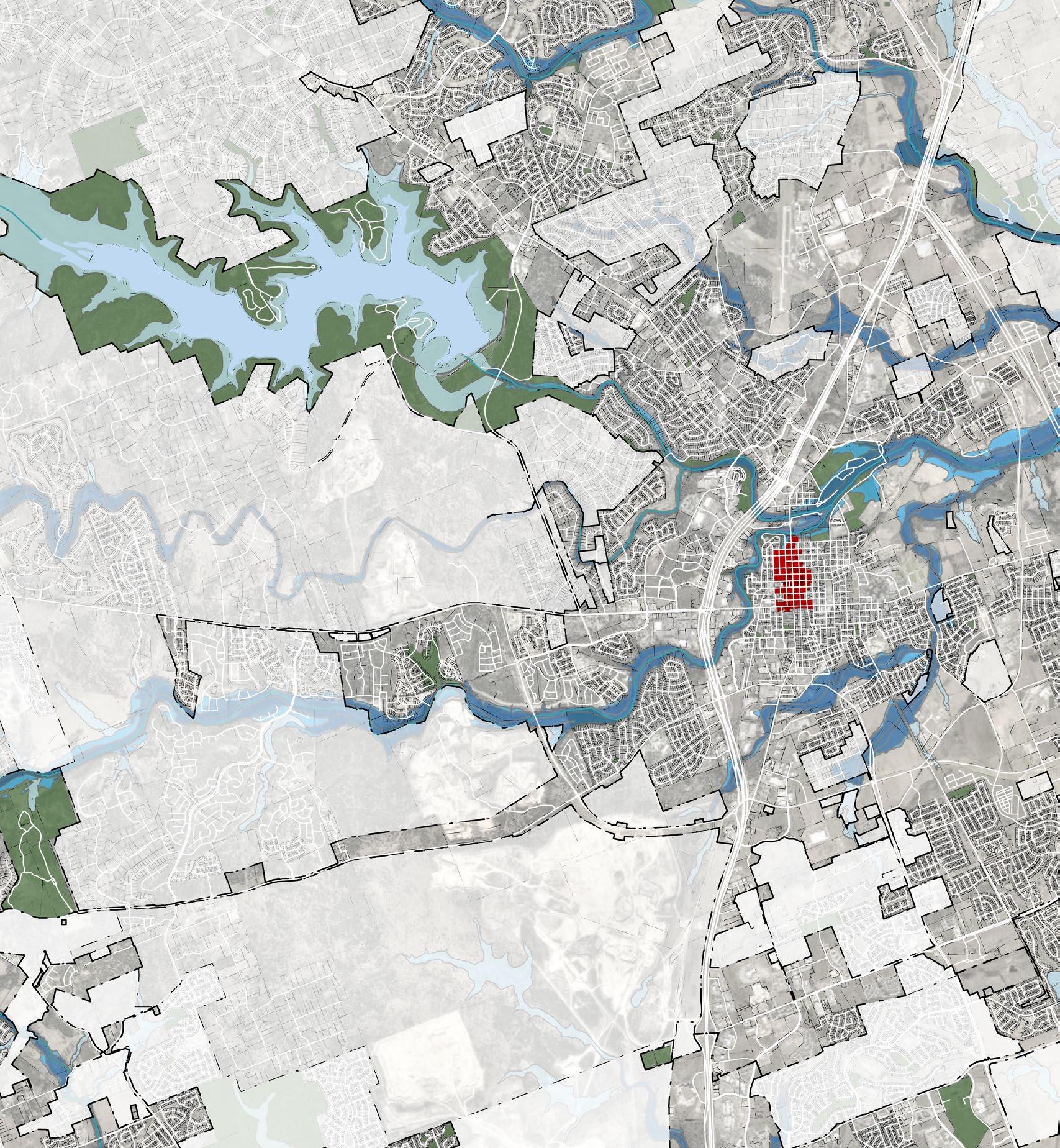
Figure 1.1 - Regional Context Map
Purpose of the Plan
The Downtown Georgetown Master Plan establishes a planning framework for the future of the Downtown District. It covers crucial aspects such as preserving historic resources, improving the pedestrian experience, determining the scale of future development, and enhancing navigation in the area. This plan reflects a community-driven vision aimed at ensuring continued prosperity for Georgetown.
Context
Downtown Georgetown is the historic core of the county seat of Williamson County built on local commerce, social engagement, and civic pride. Williamson County presently occupies a significant portion of the Downtown District. The northern edge of Downtown Georgetown lies at the banks of the San Gabriel River, and is bordered on the western, eastern and southern sides by the Old Town and Historic TRG neighborhood - which contain some of the oldest homes in Georgetown. Southwestern University sits prominently to the east and is the oldest university in Texas. The future of Downtown will continue to invite all Georgetown residents and visitors to a place that exudes the Central Texas way of life, while providing opportunity for recreation and social gathering to all who call Georgetown home.
Georgetown City Limits
Downtown Georgetown
Open Space/Park
Lake/Water body
Floodplain
THE STUDY AREA
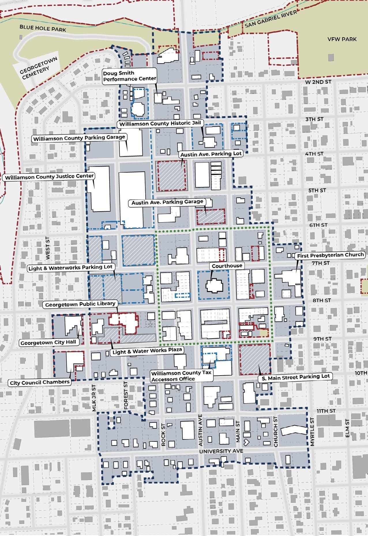
Williamson County Courthouse Historic District
Downtown Overlay District
Figure 1.2 - Georgetown Downtown Overlay District
Challenge & Opportunity
Georgetown, similar to other Texas cities that are located near rapidly expanding metropolitan areas, is confronted with the challenge of pursuing responsible growth to preserve its historical and cultural essence while maintaining a thriving local economy. As Georgetown finds itself on the periphery of the bustling Austin Metropolitan Area, it is confronted with the task of managing growth in a thoughtful and sustainable manner. The city aims to strike a delicate balance between progress and preservation, recognizing the importance of preserving its rich heritage and distinctive culture while responding to unprecedented growth pressures. The community envisions a future that embraces modernization and development while safeguarding the cherished landmarks, traditions, and identities that have shaped Georgetown over time.
Georgetown’s geographic and political context further distinguish it from its counterparts in the region. Serving as the county seat of Williamson County, the city assumes an integral role in the governance and administration of the County. This distinction adds an additional layer of responsibility to Georgetown’s growth strategy, as it must consider the broader implications of its decisions on the county as a whole.
The City of Georgetown recognizes that responsible growth is vital to ensure a robust and sustainable local economy. Inherent in this plan is the opportunity to build on the “small town charm” that so many residents find appealing. By fostering an environment that encourages business innovation, attracts investment, and supports entrepreneurship, the community aims to create opportunities for its residents and businesses alike. This approach to growth is underpinned by a commitment to maintaining a healthy economic ecosystem that benefits both current and future generations. Focusing on creating a curated Downtown experience through the integration of form, aesthetics and materials, this plan has the potential to result in a more cohesive and synergistic Downtown District.
ACTIVATED PUBLIC REALM
PRIVATE INVESTMENT PUBLIC INVESTMENT HIGH QUALITY DEVELOPMENT
CATALYTIC DEVELOPMENT
INCREASED REVENUE
Catalytic Development
As land uses and ownership inevitably change over time, there is an opportunity to identify key sites that can be re-visioned to instill and inspire infill that respects the historic scale of the downtown core while providing economic and social prosperity to those living in and visiting Downtown. These catalyst sites present opportunities for the city, property owners, business owners, and residents to work together to bring to market enhancements that build appropriately on the character of Downtown Georgetown.
The programming of street level activities and enhanced architectural treatment of the first and second floors of new buildings can aid in the activation of the pubic realm. By concentrating on building quality in ways that enhance local prosperity and the quality of the built environment, this can create the catalytic effect of noticeable transformation of the site itself and beyond. Strategically identifying the viable catalytic sites was one of the critical tasks of this Master Plan.
THE PLANNING PROCESS
A Plan for Success
One of the key components of the planning process was continuous stakeholder and public outreach that was carried on through the life of the project. The dynamics of Downtown Georgetown mean that a variety of different groups and organizations must be brought to the table to understand their collective wants and needs, and how their individual visions play into the overall community vision. In the same way, the public’s constant feedback throughout all phases of the planning process was critical to achieving a plan which captured a community vision and had public backing and buy-in.
The discovery phase of the project involved collecting data and information from which a successful planning process was built. A critical aspect of that phase was analyzing local economics in order to understand local supply and demand, and if there were any components lacking. Finally, the formal master planning process was carried out, which involved taking all data collected from the discovery period and various community and stakeholder engagement and crafting a plan that reflects a positive and informed vision for the downtown overlay district. This involved mapping and authoring goals/ objectives which function as a framework and road map to guide the Downtown District responsibly into the future.
PROGRESS OVER THE YEARS
One of the advantages to conducting a Downtown Master Plan is the ability to focus on improvements and implementation at a distinctive scale. With these focused efforts can come streamlined results as it relates to reaching implementation goals for a city or municipality. Since the original Georgetown Downtown Master Plan, a substantial amount of goals have been reached from this original document, which include a longawaited Courthouse renovation, the design and construction of the state-of-the-art Library on 8th Street, various public artwork installations on the Square, and pedestrian and streetscape projects on Austin Avenue, Main Street and Church Street.
There were also significant wins related to private investment and redevelopment, including Monument Cafe, El Monumento, the Golds Building, the Watkins Building, residential housing provided on Main Street and the 6th St. and Austin Ave. parking garage.
Part of the strategy in this planning effort is crafting a plan with realistic goals and expectations, while also including a reasonable level of visioning and long-term aspirations for Downtown Georgetown. This plan acknowledges the significant success and healthy current state the Downtown overlay district is in, while intentionally crafting visions for areas of Downtown that are in-step with the pulse of the community, the City and the well-being of future Georgetown.
PREVIOUS PLANS
Summary of Previous Plans
In recent years, the City of Georgetown has undertaken various planning studies in and around the Downtown Georgetown area. These studies have yielded valuable recommendations and implementation strategies that align with the objectives of this Master Plan. By consistently applying key principals, goals and tenets
2030 Comprehensive Plan
Arts and Culture Strategic Plan
throughout Downtown, efforts can be more synergistic and exponentially more effective than isolated or mutually exclusive plans. These principles include viewing the community through a comprehensive lens, considering arts and culture when making decisions, economic development and parking.
City of Georgetown TRG Neighborhood Plan
As one of the oldest neighborhoods in Georgetown, the TRG Neighborhood is located on the west side of the Downtown District and contains a highly diverse populace. This Neighborhood Plan was commissioned with the intent to preserve and aid the TRG Neighborhood to flourish now and into the future. Recommendations were established that relate to Housing, Historic Preservation, Youth Programming, Greenspaces and Land Use. Some of the components of this plan are directly used and referenced in the present Downtown Master Plan, and inform its direction in a variety of ways.
City of Georgetown 2030 Comprehensive Plan
The most recent comprehensive plan adopted focuses on key topics like balanced land use, reinvestment, creating a framework for development, historic preservation, housing, infrastructure, partnerships in land-use, integrating greenspace and ensuring high quality services through growth. The plan, which has an emphasis on implementation, is divided into several sections which address themes common to the City: distinct identity, intentional infrastructure, transitions, complete neighborhoods, balance of commercial/residential and housing diversity. Aligning the current Downtown Master Plan with this plan is instrumental to its process and central to its success.
City of Georgetown Arts and Culture Strategic Plan
The purpose of this arts-focused plan is to enhance the quality of life for the city by fostering programs that enhance cultural enrichment and by actively seeking to promote public art and support public access to art. This plan, which was updated for 2020-2025, sets a variety of goals, objectives and strategies which furthered the previously established goals. In this plan, implementation and potential collaborations with various groups and organizations are expanded upon to help make these goals and visions a reality. Some notable goals include leveraging the Georgetown Art Center as a major component of the Cultural District, establishing a Performing Arts Center as a major component of the Cultural District, and continuing to develop and expand the Georgetown Public Art Program.
TRG Neighborhood Plan
City of Georgetown 2023-2026 Public Library Strategic Plan
One of the central civic buildings and beloved community gathering places within the downtown overlay district is the Georgetown Public Library. This study explores the different ways the public library can run more efficiently and maximize its potential. Some of the objectives of the study include expanding outreach efforts to those with mobility challenges, enhancing digital/non-book material, enhancing library access through marketing strategies, decreasing patron wait time, maintaining a book collection that meets national standards, including things that interest teens/adults, and providing a formal gathering space in the library. The future of the Library and the prominent role it plays in the Downtown overlay district is important to this planning study.
City of Georgetown Economic Development Strategic Plan
The Economic Development Strategic Plan, which is currently being updated, aims to establish a business-friendly environment in Georgetown that attracts companies and promotes the retention of existing businesses. The purpose of this economically focused study is to devise a plan to create a business-friendly environment that attracts companies to Georgetown and encourages existing businesses to stay. The general strategies are to support existing businesses and industries, enhance targeted recruitment of identified industries, diversify workforce development and recruitment initiatives, and encourage speculative development. The report elaborates on each strategy with a quantifiable metric to measure progress and success. Case study examples are utilized to illustrate best practices for each strategy; including were Kansas City, MO, Richmond, VA, Miami, FL and Nashville, TN, among others. Economic vitality of Downtown Georgetown is critical to this planning study.
City of Georgetown 2015 Downtown Parking Study
As identified in the 2014 Georgetown Downtown Master Plan, structured parking is critical to the continued growth and success of the downtown overlay district. This study looked at the Town Square Area (9 square block around the Courthouse) and determined that existing parking was effectively maximized. A lack of parking enforcement was also determined to be a factor in the issues related to the parking situation downtown. Other issues that contributed to the need for more parking options were the physical layout of existing City lots, lack of parking information in the branding/marketing City material (both print and online) and enhanced parking management needed during large events. Historical parking challenges of the Downtown overlay district and beyond have been a story of the past, and continue to be a theme of this planning process.
Economic Development
Public Library Strategic Plan
ONGOING PLANS
An Opportunity for Collaboration
One of the advantages of this planning effort is the several concurrent and similar planning studies being conducted within Georgetown. Through these multiple planning efforts occurring in tandem, this presents a prime opportunity to integrate and synergize the plans. Throughout the planning process, regular check-in meetings with the other planning study teams were key to ensuring that creative collaboration was being cultivated between the respective efforts.
Austin Avenue Corridor Study
Being the main north/south connection through Downtown Georgetown, Austin Ave. receives a large amount of traffic and use on a daily basis. Many of the components of this Downtown Master Plan are directly or tangentially influenced by Austin Ave., and great synergy was accomplished through these two simultaneous plans.
Austin Avenue Bridge Study
The Austin Ave. Bridge study is analyzing the future of this key overpass at the San Gabriel River and Austin Ave. As part of this plan, a pedestrian bridge is considered which may present a key northern pedestrian connection into the Downtown District.
Unified Development Code Update
One of the bigger opportunities of this planning study is the revision of the current Unified Development Code. While occurring after this Downtown Master Plan is complete, this means that many of the recommendations made can be strategically codified to ensure stability and increase the chances of implementation and lasting change into the future.
Wayfinding Master Plan
Wayfinding in Downtown Georgetown relates to this planning endeavor in a variety of ways, including the improvement of the public realm experience. Understanding the improved wayfinding strategies downtown will increase the impact and efficacy of the Downtown Master Plan.
GEORGETOWN DOWNTOWN MASTER PLAN
CHAPTER TWO
APPROACH & VISION
Central to the fundamental approach and vision of this planning process is a steady foundation of community and stakeholder engagement. By having an ear to the community, this builds public consensus and buy-in - a critical component to a successful plan. In addition to this, truly understanding community existing conditions and needs is the foundation to building recommendations that are specially tailored to the Georgetown community.
APPROACH STRATEGY
A Framework That Fits Georgetown
The following key topics serve to focus this planning process and give it clear direction via a thematic structure. In connecting with the community though the execution of this planning process, these emerging trends help define and guide the effort moving forward. It is important to note that each topic exists within a spectrum and not in isolation from one another, and does not solely exist within a single category. This integrated approach results in a comprehensive and intentional set of recommendations that fit the Georgetown community.
Plans That Can Become Reality
To make the recommendations in this Downtown Master Plan come to fruition, a comprehensive strategy for setting and accomplishing implementation goals must be established. This action strategy, outlined at length in Chapter 5, divides the recommendations of this plan in short, medium and long term projects, outlines tailored steps to take to successful implement and explores funding strategies to maximize success.
As was summarized previously, much has been accomplished in Downtown Georgetown over the years, and this Downtown Master Plan will strive to build on this success to ensure the prosperity and success of this distinction Central Texas community.
Implementation Strategies
PROJECTS POLICIES PROGRAMS
PARTNERSHIPS
FUNDING
Dilemma
As the Central Texas region experiences unprecedented growth, the City of Georgetown is challenged with keeping up with and managing this dynamic phase of change – which may threaten the long-term health of the community. Through the region’s rapid growth over the last few decades, how can Georgetown strategically evolve its downtown core to take advantage of the astounding economic growth of the region, while maintaining its cultural heritage and natural resources that so many use and love? Through this dynamic change and evolution, how can the pedestrian experience of downtown be capitalized on while providing an enhanced interface with local business?
Thesis
Downtown Georgetown has a unique opportunity to capitalize on its existing history and character. It can attract appropriately-sized mixed-use growth and enhance the public realm, thereby improving the Downtown District and the city as a whole.
To achieve this, we aim to leverage Georgetown’s natural resources, maintain its historic character, and accommodate its diverse population. This will be done through a comprehensive framework that considers public realm activation, transportation, parking, pedestrian access, open space, parks, connectivity, density, land use, historic and cultural assets, as well as events and programming.
The result of implementing this Downtown Master Plan will be a distinctly Georgetown atmosphere. The plan will provide tailored recommendations and solutions, ensuring tangible and meaningful results for the community.
VISION STATEMENT
In order to preserve Downtown Georgetown as a cultural, historic and economic gem of the Georgetown community – both now and into the future - it is imperative to build on its success and plan for future growth through protecting the historic integrity of the Square, prioritizing pedestrian and business-friendly public space, enhancing the image and experience of Downtown, thoughtfully transitioning underused properties, improving connections to and through Downtown, and leveraging natural resources in and around the Downtown overlay district.
PROJECT THEMES
Theme 1
Protect the Historic Integrity of the Square Theme 2
Prioritize Pedestrian and BusinessFriendly Public Space
Theme 3
Enhance the Image and Experience of Downtown
Theme 4
Thoughtfully Transition Underused Properties
Theme 5
Improve Connections To and Through Downtown Theme 6
Leverage Natural Resources In and Around Downtown
• Ensure community culture & heritage is preserved
• Plan for a growing community
• Plan for an active pedestrian realm
• Encourage social interaction and a sense of community
• Maximize pedestrian space within the right-of-way
• Promote business and public realm interactions
• Promote and expand existing art and artrelated programs
• Expand the “feel” of the Square to other areas of Downtown
• Strategize the future use of potential properties for redevelopment
• Enhance gateways leading into Downtown
• Provide enhanced pedestrian and bicycle circulation that connects key spaces to natural resources
• Leverage Blue Hole Park as a green gateway into Downtown
PROCESS & KEY FINDINGS
Process & Key Findings
The planning process lasted over a year and built momentum and excitement through multiple public participation events, stakeholder meetings, and workshops with City Council and City leadership. The plan incorporates both qualitative and quantitative research in order to create a visionary and practical plan. The action plan provided in Chapter 5 will be used as a guidebook to achieve the vision and goals outlined in the plan.
Implementation Items
Implementation items are steps for the City of Georgetown and its partners to take in order to achieve the project goals. Listed in Chapter 5 of this plan, they are organized in a matrix with priority, costing, and estimated time line. The matrix is meant to be a living document, updated by the City as projects are completed, new funding becomes available, and priorities shift.
Defining Downtown Georgetown
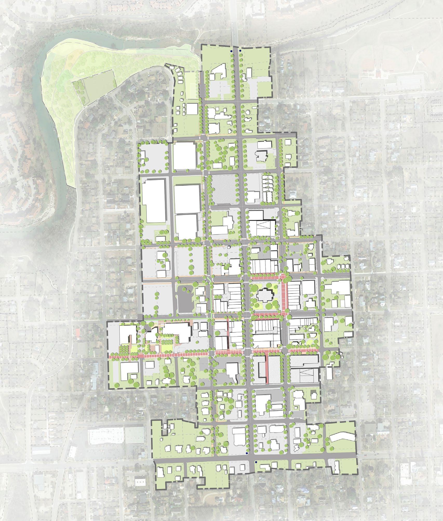
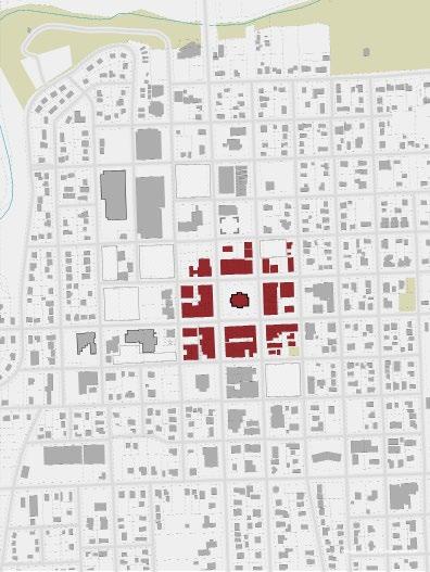
Presently, Downtown Georgetown is located in the relative heart of the City of Georgetown, roughly bordered by University Ave. to the South and the San Gabriel River to the North. The Downtown District is broken into two areas: Area 1 (the nineblock square) and Area 2 (all other portions of the Downtown District beyond Area 1). Area 1 is generally defined as having historic, low-rise buildings on square blocks, while Area 2 has more of an eclectic mix of historic buildings, new development, commercial and residential.
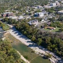
Blue Hole Park and the San Gabriel River lie in proximity to the northern end of Downtown, and act as a primary recreational space for the Downtown District – functioning essentially as an extension of Downtown. Having such a high-quality natural amenity in proximity to a Downtown District is a great opportunity for Georgetown, and leveraging this asset in the future will benefit Downtown and its residents as it grows into the future.
RECOMMENDATIONS FRAMEWORK
The following recommendations in Chapter 4 are organized according to the components of this plan, as established in Chapter 1:
Public Realm Activation
To elevate the pedestrian experience and the public connections to business/commerce, activating the public realm will ensure Georgetown stays walkable through future growth. It also helps ensure that businesses see Downtown Georgetown as an active, attractive place to locate and conduct business.
Density + Land Use
Ensuring compatible land uses are adjacent to one another is the cornerstone of a modern, healthy community. As Georgetown grows into the future, careful planning to allow appropriately-sized growth and height will ensure community character is retained while promoting modest growth.
Open Space, Parks + Connectivity
With abundant open spaces and natural resources, such as Blue Hole Park, making sure Downtown Georgetown stays an active, vibrant community means ensuring connectivity and access to parkland. Facilitating equal access to alternative transportation also helps ease traffic and parking requirements, while allowing for a healthy community.
Historic + Cultural Assets
Essential to the success of this plan is protecting Georgetown’s timeless historic and cultural assets. Ensuring the longevity of these key buildings and features in the face of growth requires a comprehensive planning perspective with retaining character as a driving principle.
Events + Programming
Events define Georgetown’s identity and heritage, and function as a source of its annual revenue. Ensuring that local events are accommodated by providing adequate amenities and infrastructure is key - and that plans are in place to ensure their future success.
Transportation, Parking + Pedestrian Access
Planning for equal access for the visitors and residents of Downtown helps ensure that this City continues being a social and cultural beacon shining brightly on the Central Texas Landscape. There is a reciprocal and dependant relationship between the parking and transportation provided to support the activity in Downtown, and the vitality of those activities themselves.
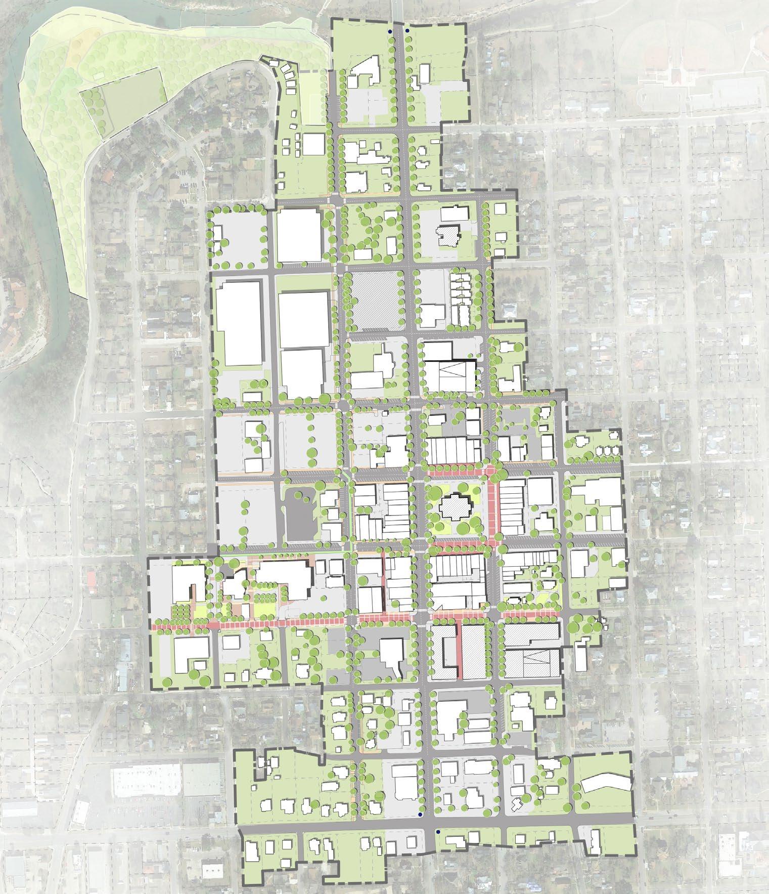
PRIORITY PROJECTS
SanGabrielRiver
Gateways (South Austin Ave., North Austin Ave.)
The north and south gateways along Austin Ave. are improved in order to create a welcoming and grand entrance into the Downtown District that is fitting of Downtown Georgetown.
Blue Hole Park Enhancements
Presently, Blue Hole Park is heavily used by visitors and residents of Downtown Georgetown. Improvements to Blue Hole Park must coincide with the enhancements in the Downtown District.
Rock Street Promenade
Through the possibility of the Justice Center site being vacated in the future, this potential redevelopment makes possible enhancing Rock Street into a strong pedestrian promenade that connects City Center and the municipal complex to Blue Hole Park.
Bike and Pedestrian Connections
Main and Rock St. are designated as being primary bike connections to and through Downtown, and connect residents and developed areas to the excellent parks and natural resources adjacent to and around the Downtown District.
Historic Square Enhancements
The existing right-of-way within the historic Square are reallocated in order to accommodate a larger pedestrian dedicated space. In doing so, street trees, elevated material and furnishings, and exterior space for dining are made possible.
9th Street Art Walk
The County Tax Office site and Red Poppy Lot are envisioned to redevelop into mixeduse facilities that are appropriate to the community. Through this catalytic change, 9th street is improved as an art-themed, pedestrian-oriented street which connects the Georgetown Arts Center to City Center and the municipal complex.
Catalyst Sites
The S. Main Street Parking Lot, Williamson County Tax Office, the Historic County Jail, the Austin Ave. Parking Lot and the Justice Center site serve as potential redevelopment sites in the future, and act as the catalytic for transformative change in the Downtown District.
GEORGETOWN DOWNTOWN MASTER PLAN
CHAPTER THREE
COMMUNITY ENGAGEMENT
Public engagement is a critical component of any successful planning endeavor. Public support, investment and buy-in are essential to creating a plan that the community supports and is proud of. The City of Georgetown has a highly engaged and informed populace whose preferences and interests, to a large extent, drove and molded the direction of this Downtown Master Plan. The following chapter of this document outlines the major public engagement events as part of this Downtown Master Plan.
ENGAGEMENT STRATEGY
Methodology
In order to engage a passionate and diverse populace, this planning process employed a variety of engagement tools to reach all voices.
Our virtual engagement strategy consisted of running a project website that contained information related to the plan, with the intent of keeping the public informed and up-to-date. Additionally, we facilitated an initial online survey to develop a baseline understanding of public opinion. Having these all-inclusive and farreaching virtual tools meant that a larger collective of voices in Georgetown and beyond were engaged.
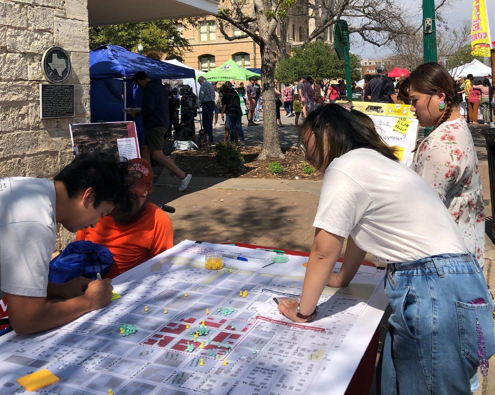
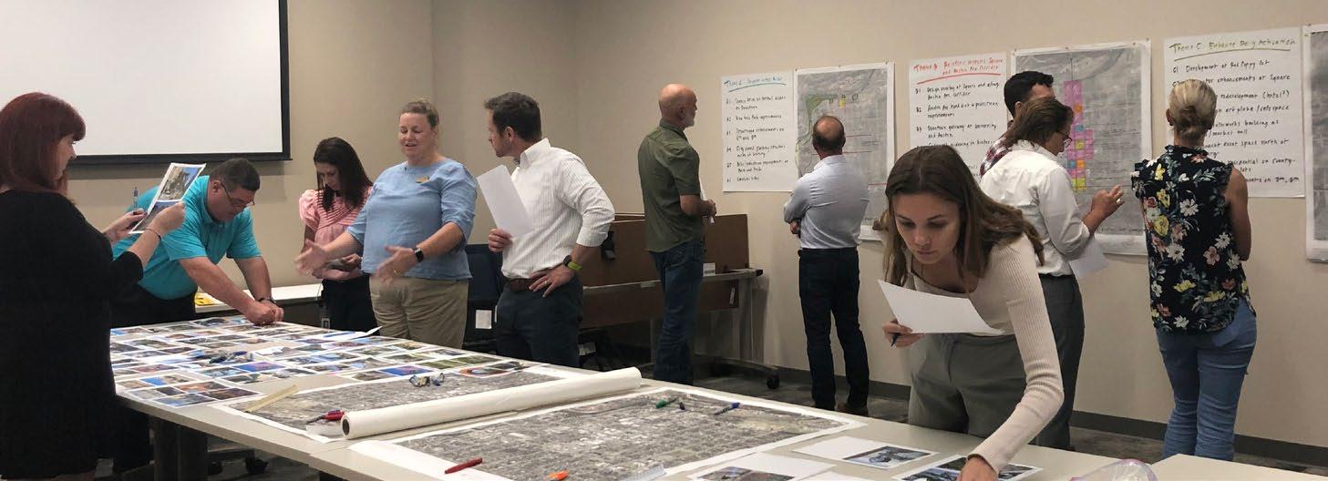
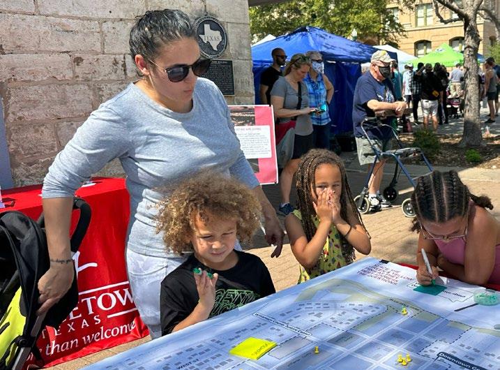
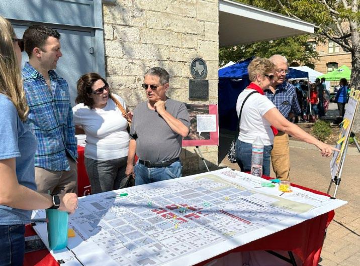
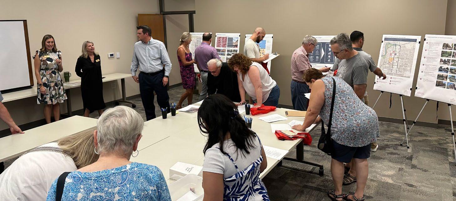
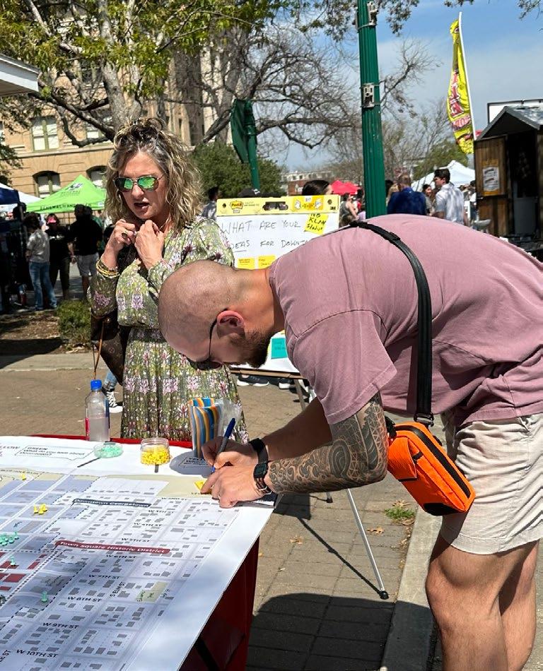
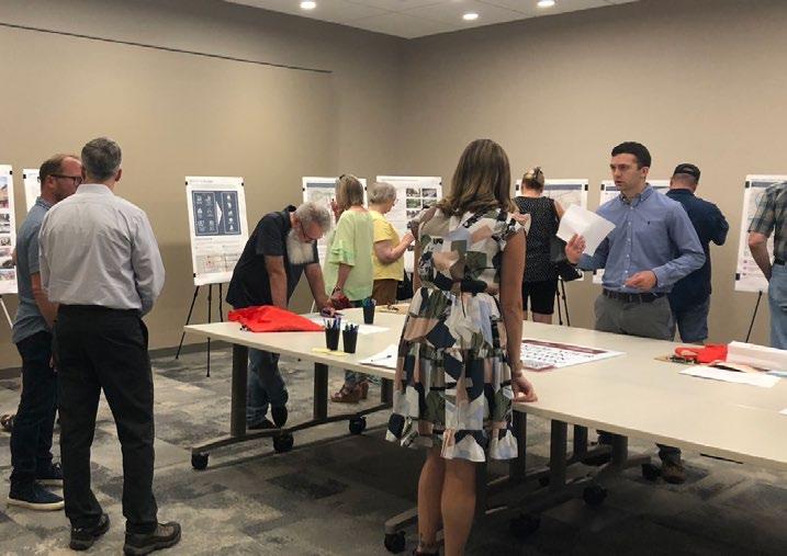
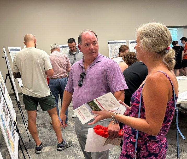
In-person engagement is central to any planning process as well. We utilized a robust strategy that consisted of focus groups, in-person surveys, activities and public events that exposed our plan to a wide variety of Downtown users. Our direct, in-person presence at two major events within the Downtown Overlay District - Williamson County’s 175th Celebration and the Red Poppy Festival meant that our plan gained visibility and we were able to reach a highly diverse audience. Our presence at the Gather ‘Round Georgetown Expo and Art Stroll also enhanced the projects visibility.
COMMUNITY MEMBERS
3.2 -Engagement Targets
PRIMARY ENGAGEMENT TARGETS LOCAL STAKEHOLDERS & BUSINESS-OWNERS
REGIONAL USERS
Figure
COMMUNITY SURVEY
Overview
The first online survey extended from March 9th through April 12th of 2023, and was delivered in both English and Spanish. A total of 2,738 combined survey respondents were reached. The purpose of this survey was to gauge general feedback and generate a baseline of public opinion for this planning process. The graphic below summarizes the general information gleaned from this online survey, along with key takeaways that helped to direct the planning process.
70%
live in or near City of Georgetown are frequent visitors of downtown 54% 50% 90%
Reason to Visit
Primary reasons to visit are shoping / dining / attending events.
Mode of Transportation
74% drive, 14% walk, 7% bike and 5% use other mode of transportation to downtown
Access to Downtown
cite high traffic speeds, lack of bike lanes/ sidewalks and lack of existing trail connections as the biggest barrier to accessing downtown
Figure 3.3 - Online Survey Summary
Key Takeaways
Majority of respondents live within the Downtown Overlay District or nearby.
Majority of respondents frequent the Downtown Overlay District several times per week / month.
Downtown Georgetown should place a priority on its residents
Lack of connectivity pose significant access challenges getting to the Downtown Overlay District.
Majority of community supports Historic Preservation within the Downtown Overlay District.
Most of the respondents visit Downtown to dine and attend events.
The community supports diversity of retail and dining spaces Downtown.
Parking in Downtown, specifically during events, is a notable concern of the community.
WILLIAMSON COUNTY’S 175TH ANNIVERSARY CELEBRATION
Overview
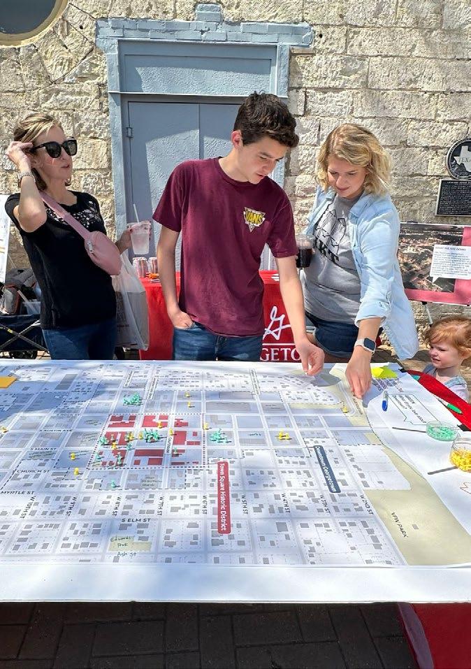
In honor of Williamson County’s 175th anniversary, a celebratory public event was held in the heart of Georgetown around the historic County Courthouse on March 10th and 11th of 2023. The purpose of our presence here was to elicit feedback from all community members and visitors on the future direction and vision of Downtown Overlay District.
Key Takeaways
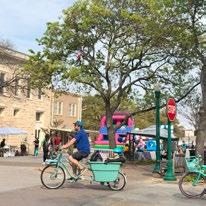
Improvements to Blue Hole Park are desired.
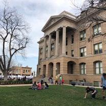
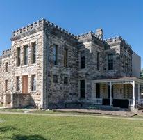
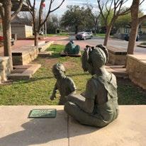
The community loves the Courthouse Square Creative improvements to the Historic Jail are desired
The Public Library is a beloved space.
Better pedestrian access management at key intersections.
Blue Hole
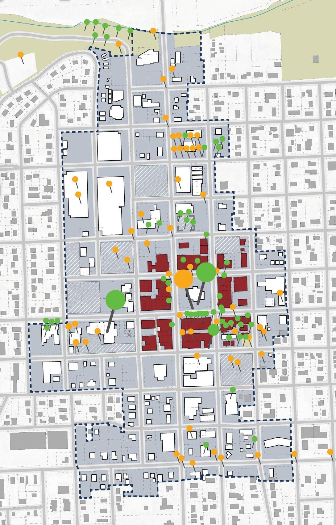
Figure 3.4 - Downtown Exercise Map
Figure 3.5 - Williamson County’s 175th Anniversary Celebration Summary
Pedestrian Accessibility + Alternative Transportation
Wayfinding + Signage
Public Realm + R O W
Improvement
Parking
Retail + Commercial Use
Others
Events + Festivals
Family Friendly Environment
Parks & Open spaces + Recreation
Historic + Cultural Preservation
This diagram illustrates the most talked about themes surrounding the Downtown Overlay District captured at Williamson County’s 175th anniversary celebration.
RED POPPY FESTIVAL
Overview
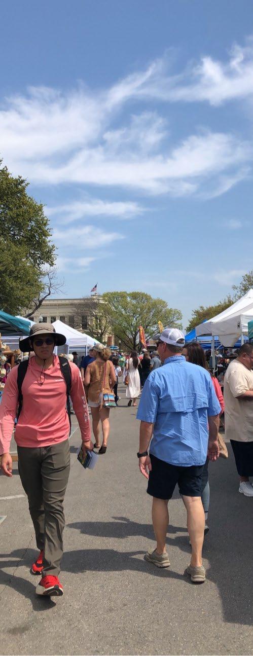
The Red Poppy Festival, which occurred on April 29th and 30th of 2023, was an opportunity to start exploring deeper into communities preferences. At this point in the process, several ideas and themes were beginning to take shape which were presented to the public. Presence at the Red Poppy Festival was also critical because not only is this the largest annual event in Downtown Georgetown, but a large proportion of the Georgetown community and surrounding areas attends this festival.
In this exercise, the Downtown Overlay District was divided into different zones where different themes were proposed within each.
Area A : Nine Block Square
Area B : South
Area C : Central West
Area D : North
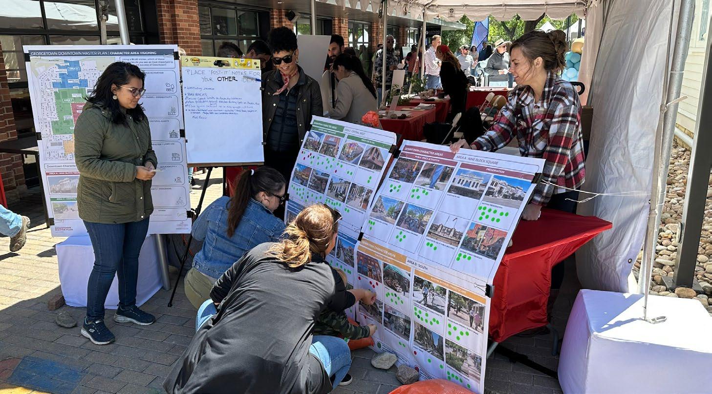
Figure 3.6 - Downtown Character Areas
Community Preferences:
Area A | Nine Block Square
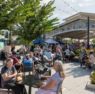
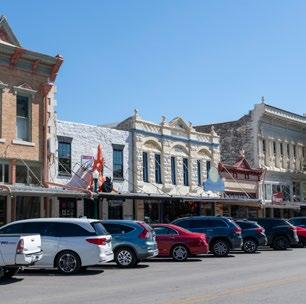
Top Choices
Area B | South
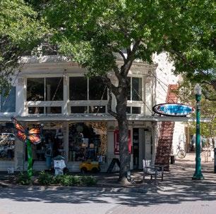
Targeted In-Fill Preservation Austin Avenue Street scape
Top Choices
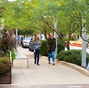
Area C | Central West
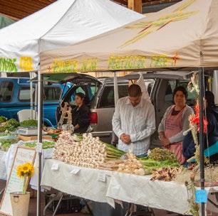
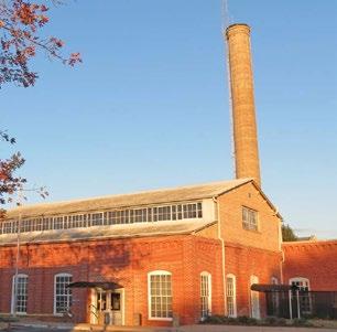
Top Choices
Area
D | North
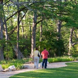
Top Choices Bodega
Art Gallery Space
Top Choices
Ped. Connections to Downtown and the River Street Trees
Curated Retail / Restaurants Connection to River / Park Mixed Use In-fill Building Character
Top Choices
Art-Oriented MU
Adaptive Re-Use
Top Choices
Leisure Space by the River
Art as a River Destination
Top Choices
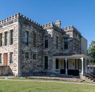
Creative use for the Jail
Destinations that Capitalize on the River
Figure 3.7 - Top Community Preferences
GATHER ‘ROUND GEORGETOWN EXPO EVENT
Overview
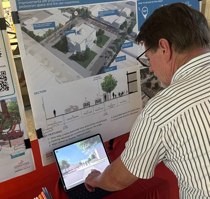
The Gather ‘ Round Georgetown Expo event was an opportunity for the community to engage and respond to the “Big Ideas” for Downtown Master Plan Framework. There were three themes that contained some of the big ideas that were generated from previous community engagement. Additionally, engagement materials were available virtually for the community to respond to who were not able to attend this event.
Attendees were asked to select the top five ideas they liked the most. This process helped to prioritize and frame the preliminary Downtown Master Plan.
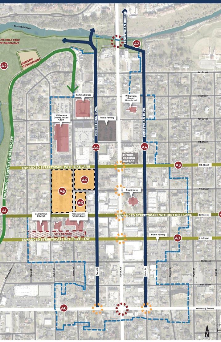
Theme A
Focused on initiating improvements to Blue Hole Park and connecting Historic Downtown to the San Gabriel River through bike and pedestrian connections.
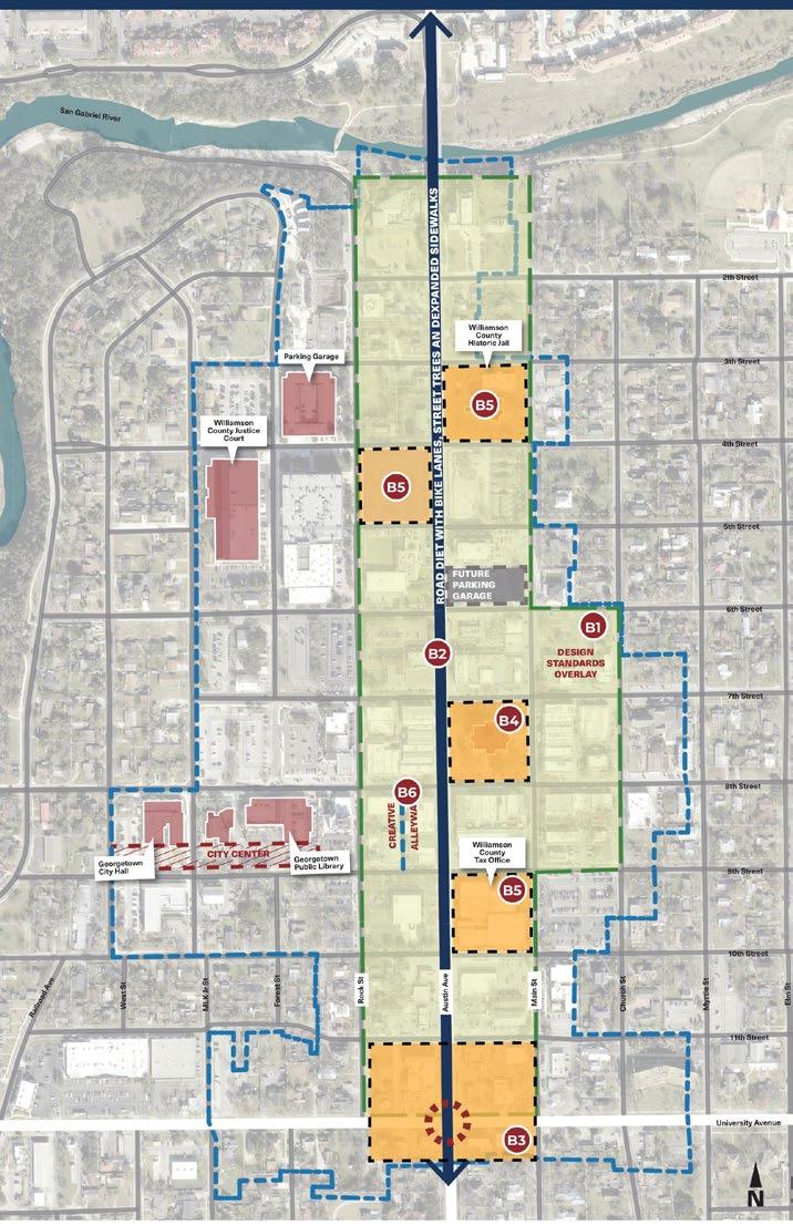
Theme B
Focused on reinforcing the architectural aesthetics of the Historic Square along Austin Avenue through redevelopment of underutilized properties and encouraging alternative transportation to and through Downtown.
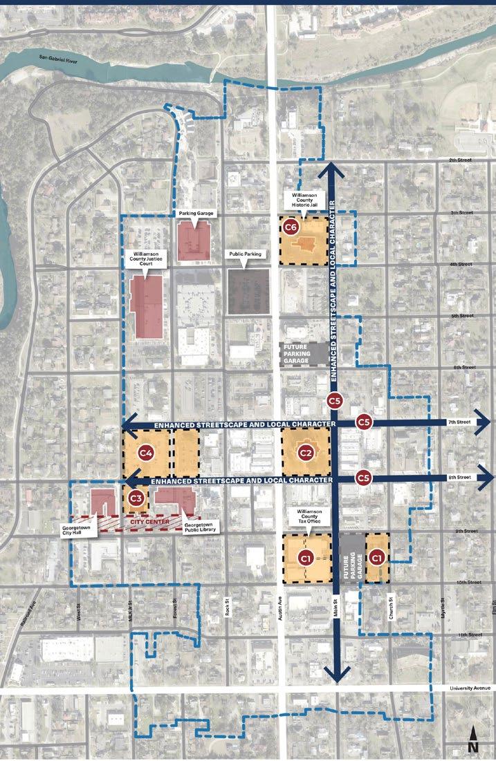
Theme C
Focused on activating civic spaces by way of streetscape enhancements, and encouraging the redevelopment of key underutilized properties to promote activation.
Theme A Theme B
Community Feedback - Ranked Preferences
• Sidewalk widening in Historic Square
• Reuse of Waterworks Building as food or market hall
Public realm Square enhancements / reuse of historic Courthouse
Park system improvements along the river
Main and Rock St. as pedestrian boulevards
Streetscape improvements along 6th, 8th & 9th St.
Streetscape improvements along 7th, 8th & Main St.
Redevelop Red Poppy Lot and County Tax office site
Prominent downtown gateway at University Ave. and Austin Ave.
Austin Ave. lane reduction and enhanced streetscape
• Improved sidewalks along University Ave.
Utilize existing alleyways as activated public space
Adaptive reuse of Historic Jail
• Catalytic site development at the Tax Office and the Red Poppy lot
• Streetscape improvements on Scenic Dr. to help control traffic
• Redevelopment of parking north of Library as mixed use
• Catalytic mixed-use development bound by Rock, MLK and 8th St.
GEORGETOWN ART STROLL
Overview
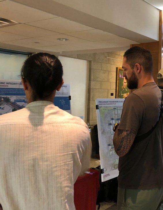
During the Georgetown Art Stroll that occurred on October 19th 2023, the community had the opportunity to provide feedback on the preliminary perferred framework for the Downtown Master Plan. The themes for Downtown improvements were derived from the inputs received from the community and City Council.
The themes presented mainly focused on enhancing better pedestrian accessibility and experience. The effort to enhance the iconic gathering space at the Historic Square and developing 9th Street as an art-themed corridor were presented. A high-level vision was presented for Blue Hole Park which is a signature destination for Georgetown residents.
Preliminary Downtown Master Plan Framework
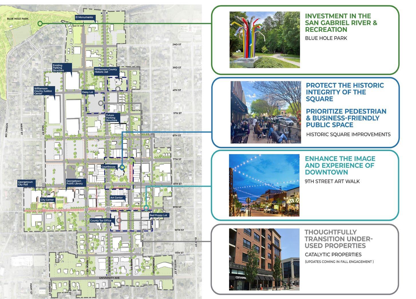
GEORGETOWN DOWNTOWN MASTER PLAN
CHAPTER FOUR
RECOMMENDATIONS
The discovery and analysis stages of this Downtown Master Plan established that Downtown Georgetown is primed for continued prosperity and success. The local economy and civic pride evident within the Downtown Overlay District are healthy, and the following recommendations set out in this chapter are intended to further strengthen these and ensure their future success. A series of recommendations have been made which respond to the feedback generated throughout the entire planning process, and are intended to be the actionable outcomes of this Downtown Master Plan.
PUBLIC REALM ACTIVATION
Activating the Public Realm
The look and feel of the Downtown Overlay District directly influences its social vibrancy and economic vitality. Well curated downtowns are the result of, in part, a deliberate and thoughtful approach to creating places that encourage people to gather and congregate. Curation also involves the intentional use and integration of hardscape and landscape materials to achieve a unified look that has the support of the community and is consistent with the sense of place of the area.
Through careful consideration and concerted efforts over the last 40 years, Downtown Georgetown has been able to create a desirable destination for residents and visitors alike. To continue building upon this success, prioritizing the pedestrian experience should start with providing infrastructure and amenities that create safe pedestrian spaces and facilitate comfortable mixed-mode circulation that helps build a successful and active downtown. Giving the community the opportunity to shape the downtown canvas in a way that is artful and memorable helps to instill cultural and social meaning into the fabric of a Downtown Overlay District.
To have a vibrant and engaging public realm experience, it is important to provide adequate space within the right-of-way for pedestrians to navigate and traverse easily, with space to rest and engage socially with one other, as well as peruse local stores and businesses. The curation of highquality public spaces is the conduit for the creation and proliferation of an active Downtown. This type of public experience not only allows for a healthier more walkable community, but also helps to bolster the local economy and creates an environment that is attractive to local business and commerce.
While the Square itself, and other locations around Downtown, have distinctly-Georgetown characteristics, there are opportunities to better connect these areas and expand upon the pedestrian activation to extend their vibrancy and impact. Making recommended improvements to the Square can also serve as a catalyst for planning, executing and ultimately implementing larger improvements within the larger Downtown Overlay District.
Source: Design Workshop
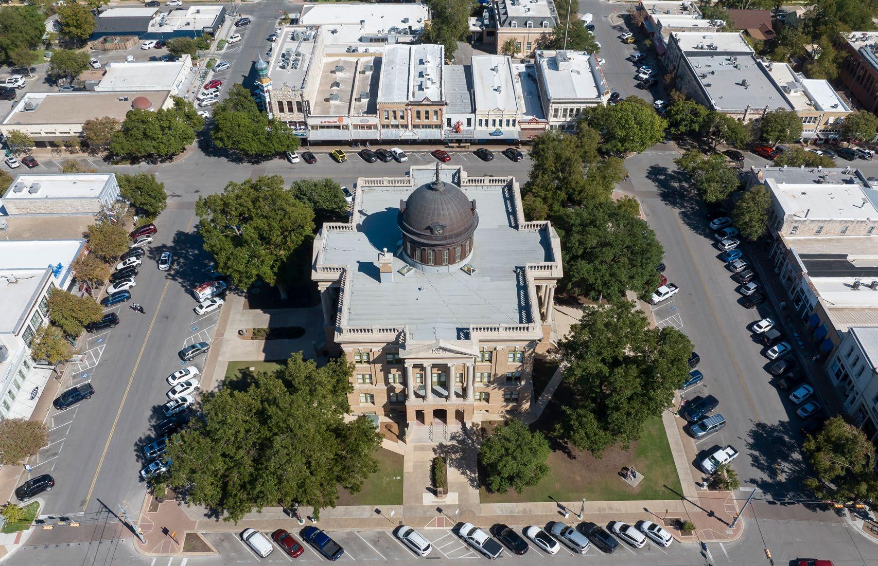
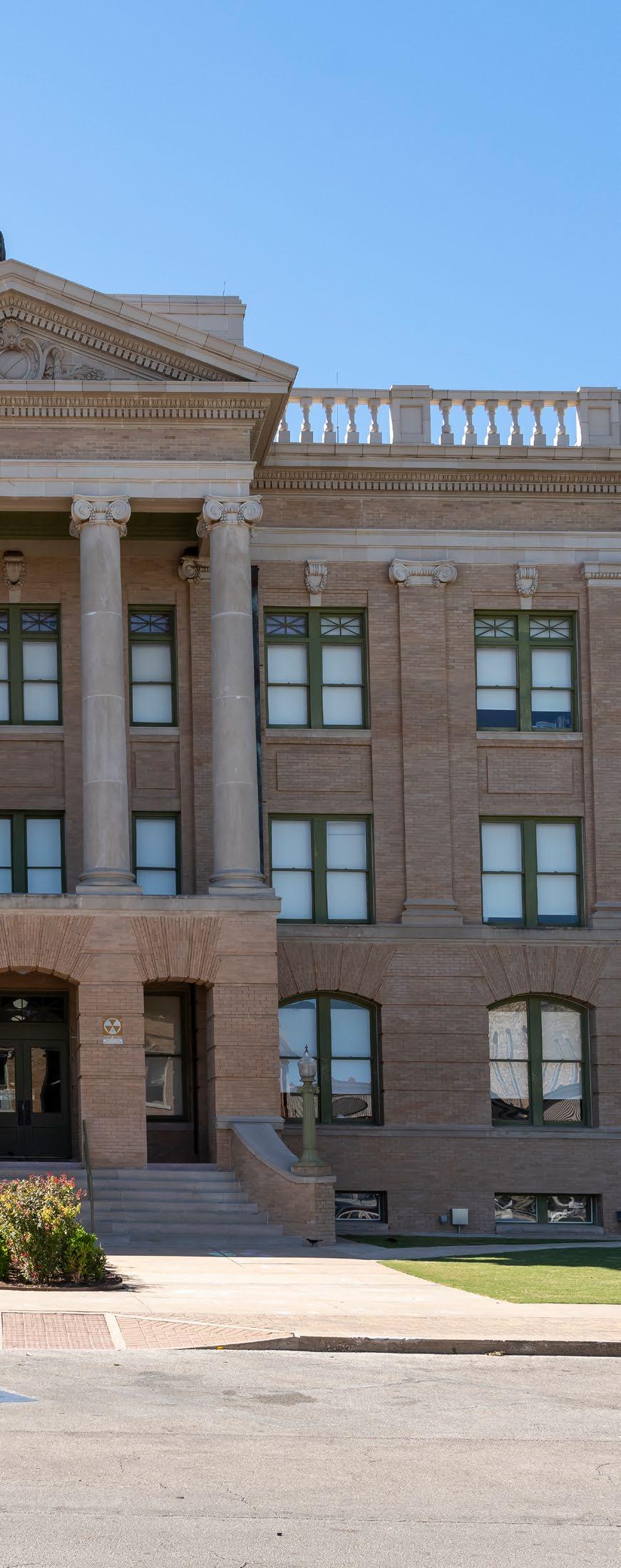
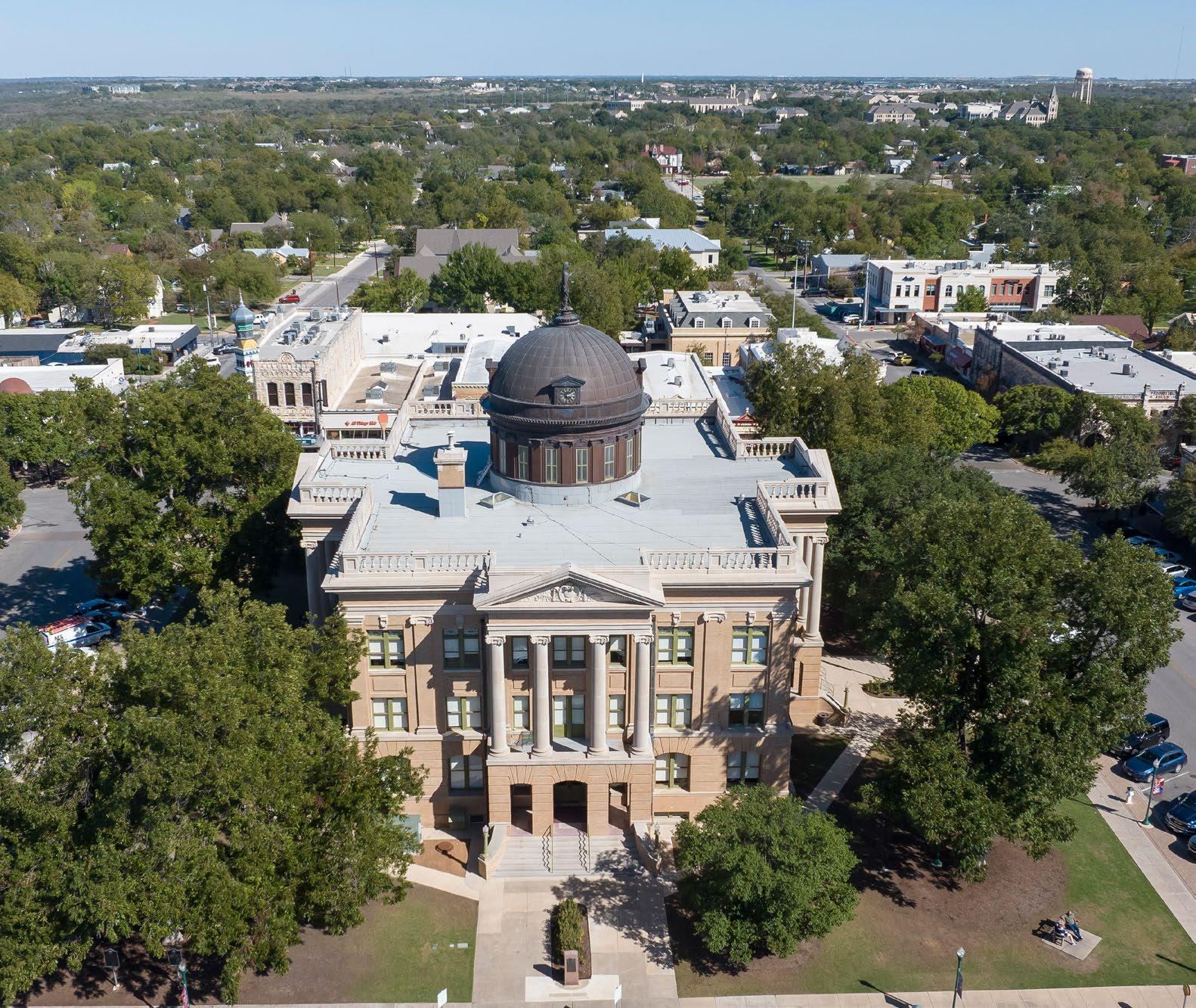
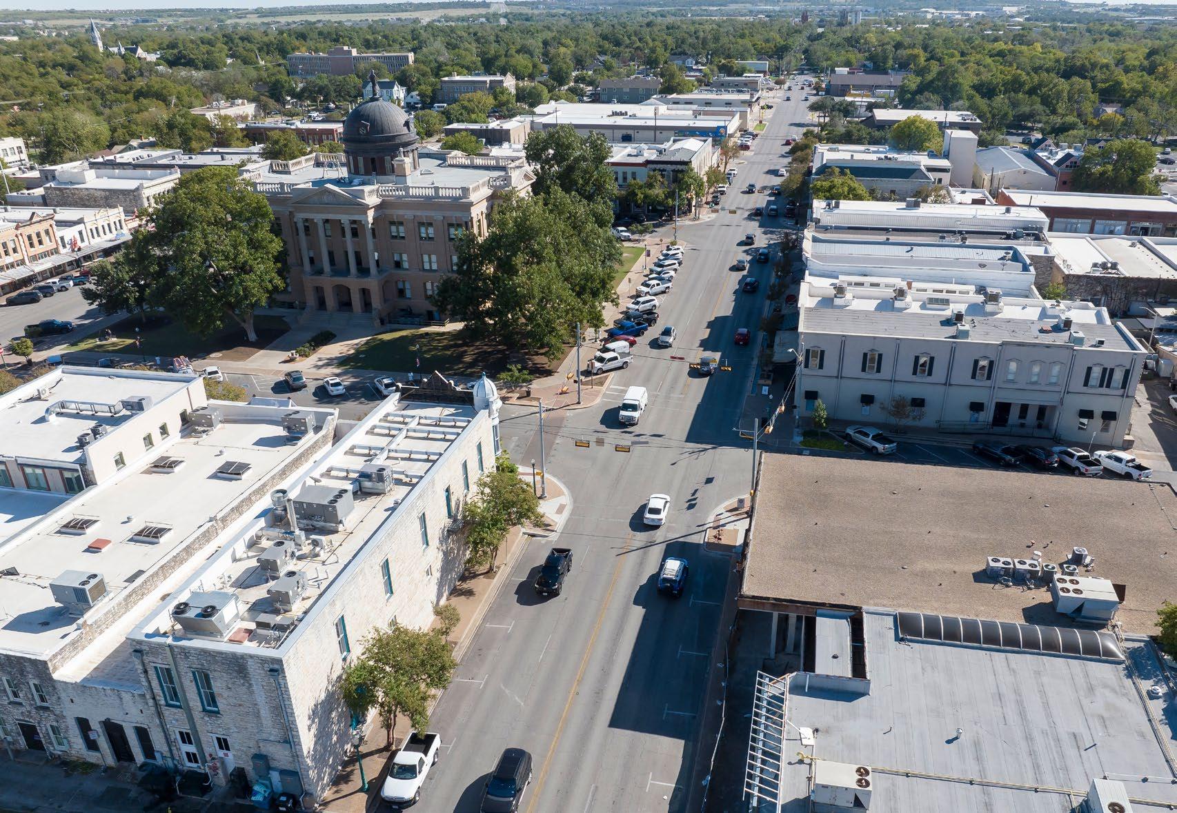
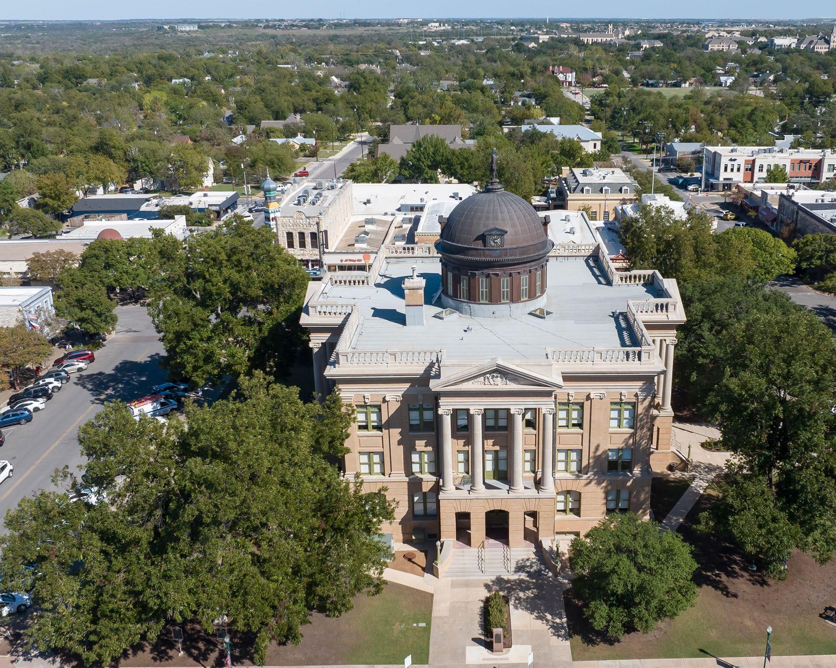
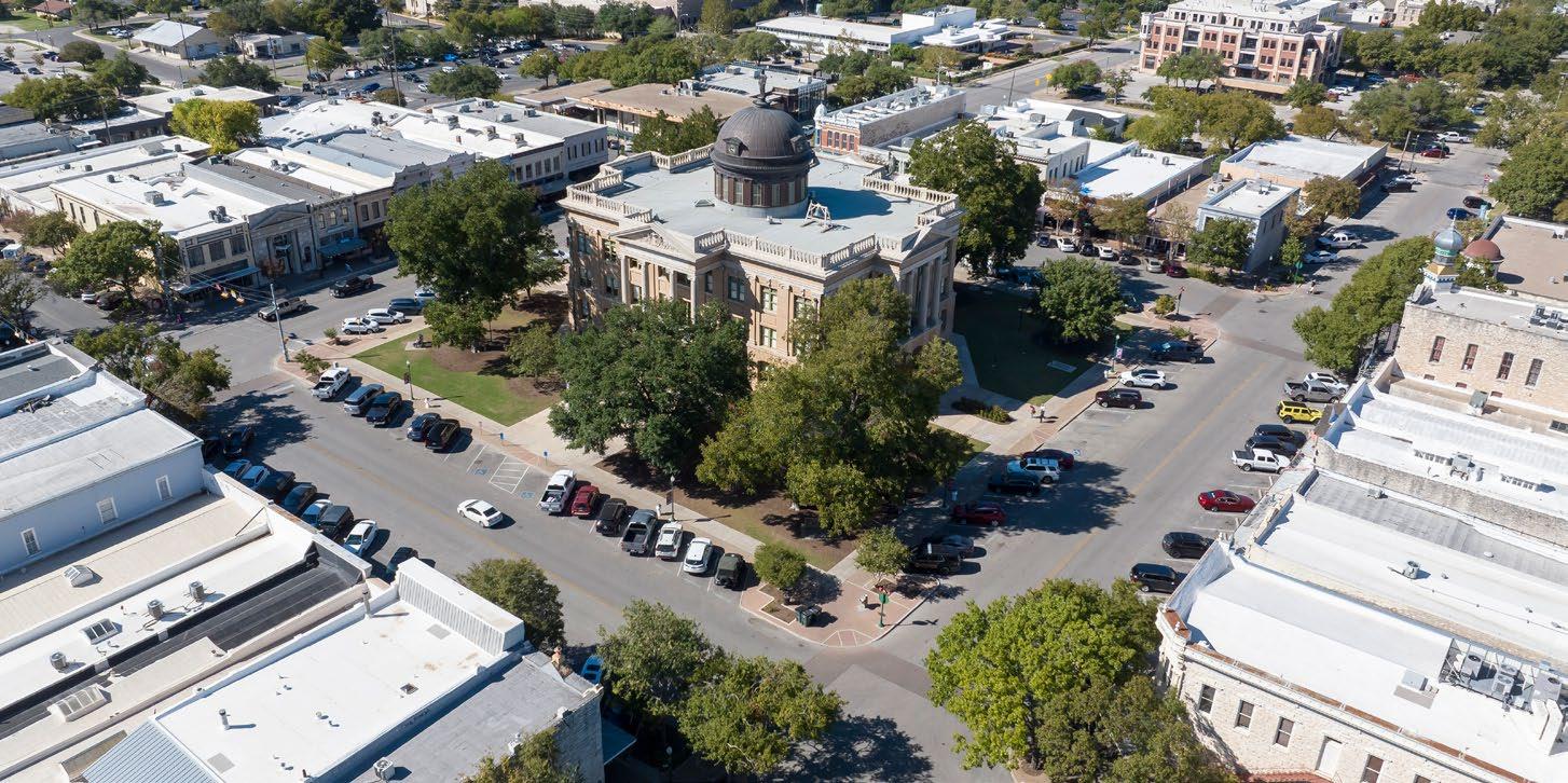
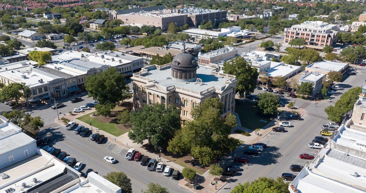
A contemporary view of the Williamson County Courthouse surrounding by the Historic Nine-Block SquareGeorgetown’s historic central gathering space for generations.
Priority Projects
Figure
PUBLIC REALM ACTIVATION
Goals & Recommendations
Public Realm Activation Goal 1
Enhance the pedestrian experience and activation on the Square.
1.1 - Reduce vehicle lane widths and remove parking from the outside perimeter of the Square (on 7th, Main and 8th St.) to allow for expansion of sidewalks and the overall pedestrian realm. Reference the Austin Ave. Corridor Study for lane width guidance.
1.2 - Reorient vehicle direction to oneway (2 lanes traveling clock-wise) from 7th Street to Main Street to 8th Street.
1.3 - Utilize upgraded paving materials and furnishings to enhance the user experience that also allows for minimal maintenance needs and provides optimal accessibility where feasible.
1.4 - Introduce a nuanced lighting scheme that creates an attractive pedestrian environment, promotes safety, and contributes to the activity and vitality of the Historic Square.
1.5 - Encourage café/dining space and outdoor vending areas to activate the Historic Square and support businesses.
1.6 - Provide street trees for pedestrian comfort and a reduction in ambient street-level temperatures in the summer months.
1.7 - Reduce the amount of in-ground planting within the Square and provide seasonal planting in raised planters or planter pots that minimize water and maintenance needs.
1.8 - Study the potential removal of the additional vertical step(s) around outer sidewalks surrounding the Historic Square to improve pedestrian access, promote accessible design and facilitate positive drainage. Where feasible, preserve and reuse historic limestone curbing.
1.9 - Provide adequate and conveniently placed bike parking areas around the Square to promote alternative transportation and less reliance on vehicle travel.
1.10 - Reference the Austin Avenue Corridor Study for recommendations specific to the Austin Avenue Downtown Corridor.
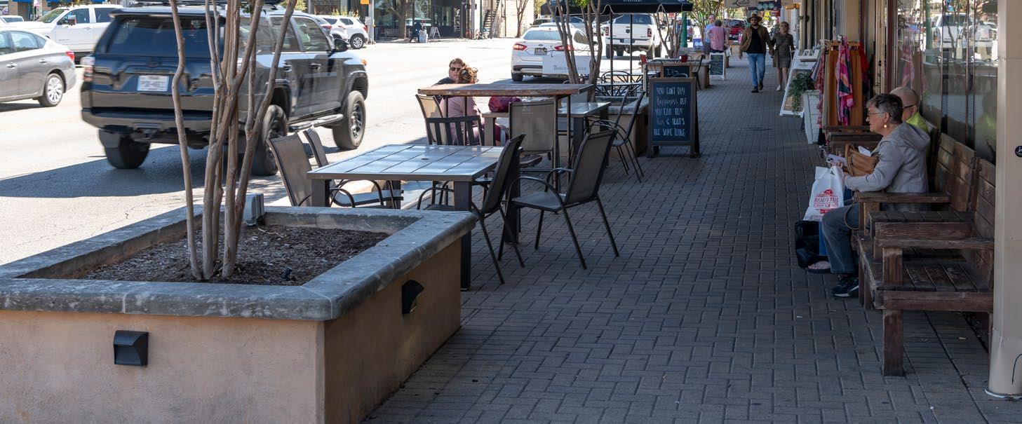
Source: Design Workshop
Existing pedestrian space adjacent to retail uses along Austin Ave. at the Historic Square.
Historic Square Enhancements
Street Trees, Cafe Space & Wider Pedestrian Realm
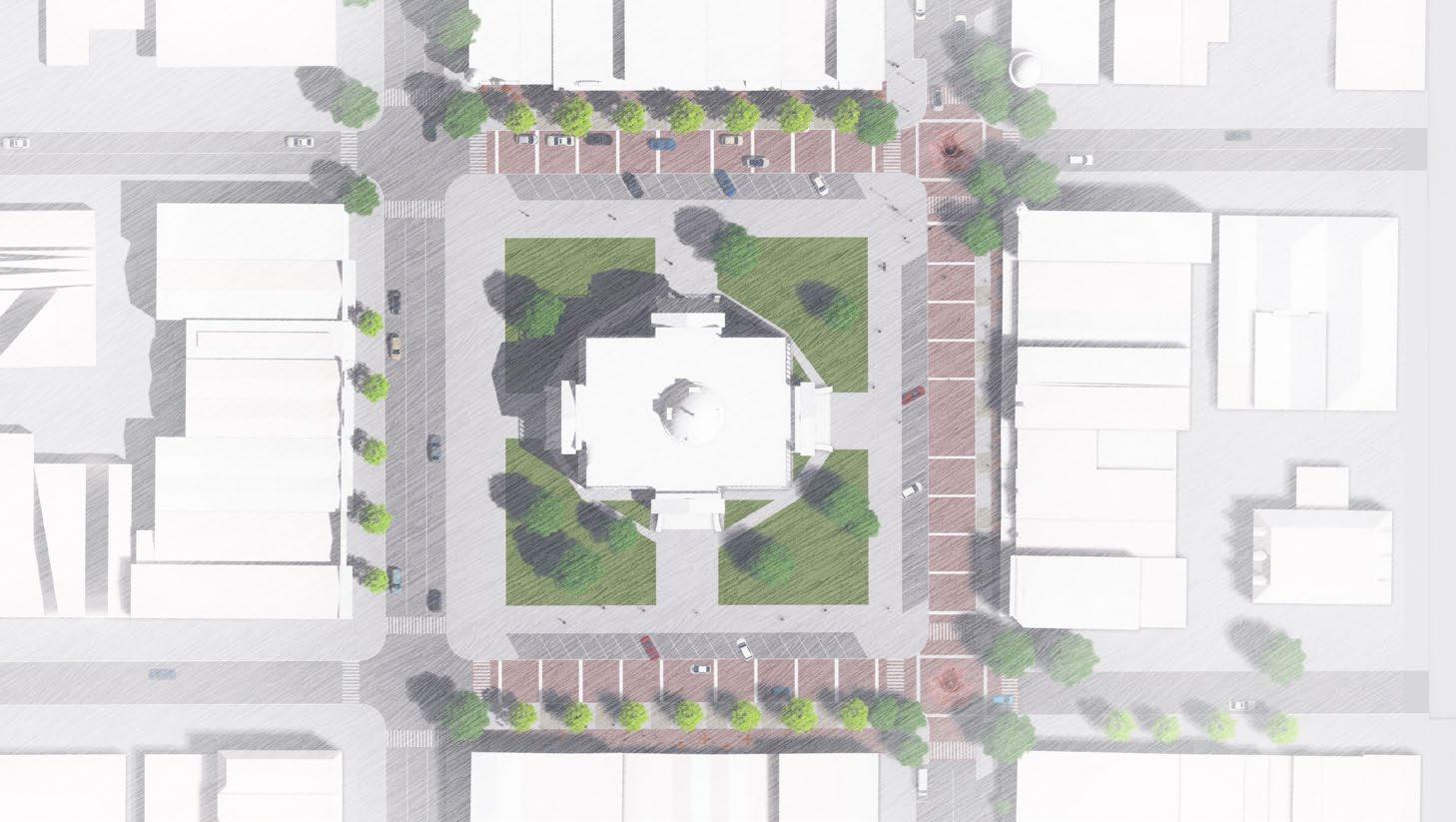
Proposed improvements on the Historic Square demonstrating one-way clockwise traffic circulation, reduction of parking on the outside of 7th, Main and 8th St. and the provision of elevated materiality.
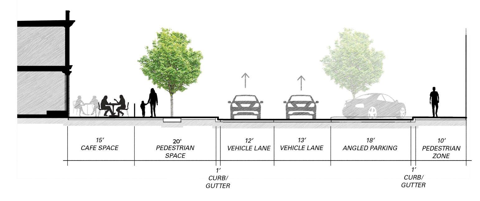
Proposed typical cross section along 7th, Main and 8th Street at the Historic Square demonstrating vehicle lane reductions, retained angled parking on the County-side and an expanded pedestrian realm.
Historic Square Enhancements
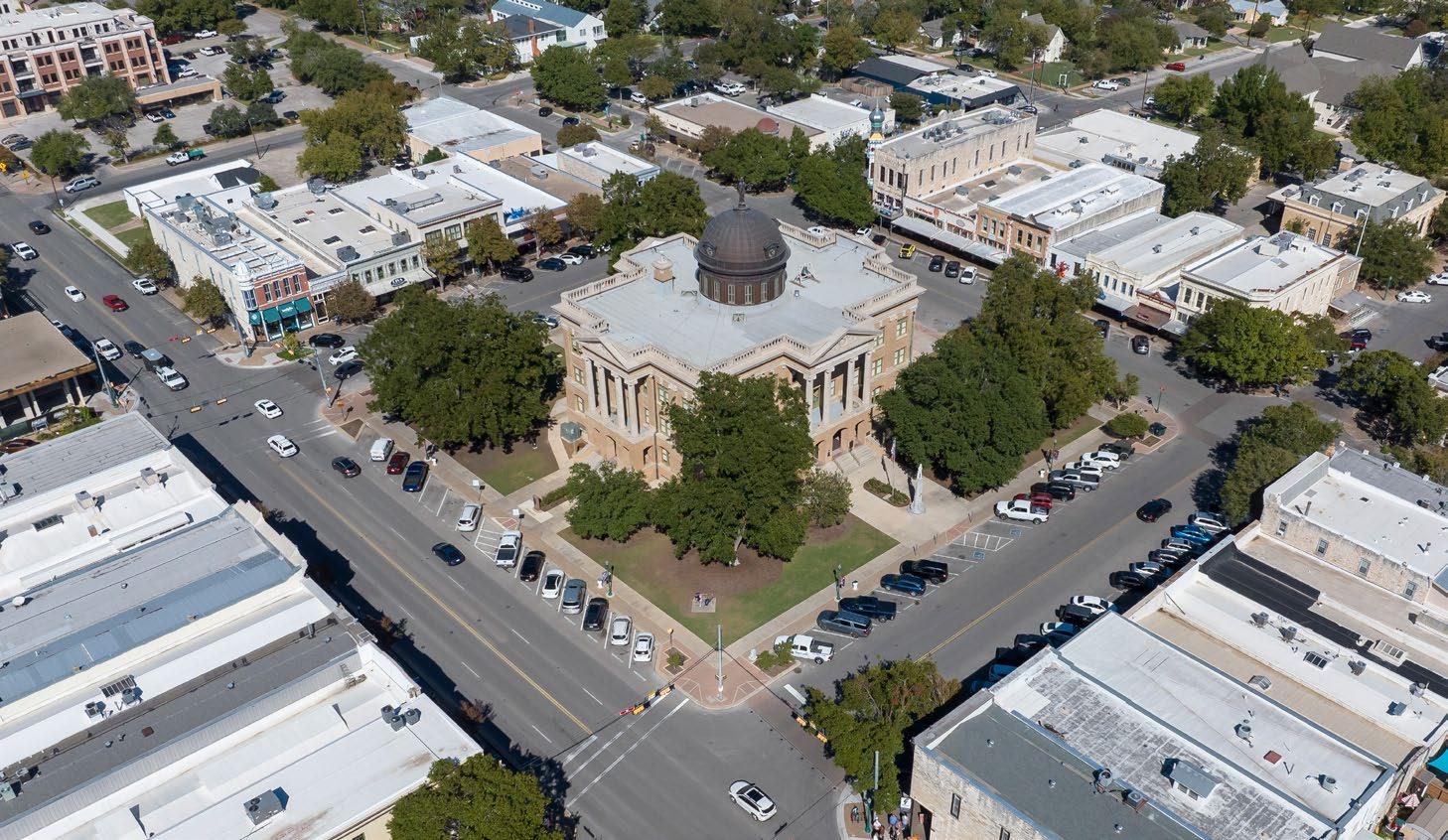
Existing conditions at the Historic Square.
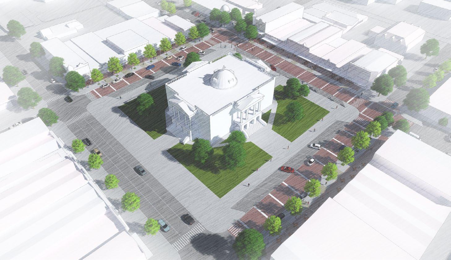
Proposed enhancements at the Historic Square.
Street Pavers
Wider Pedestrian Zone
Street Trees
Cafe Space
PUBLIC REALM ACTIVATION
Goals & Recommendations
Public Realm Activation Goal 2
Foster a street experience that links public space to civic buildings and private businesses to promote pedestrian activity and interaction.
2.1 - Generally, require new infill along key streets (see Figure 4.2) to have active ground floor uses where appropriate. Consider on a case-bycase basis, with special sensitivity when in proximity to existing residential areas.
2.2 - Where right-of-way is less than 70’, establish appropriate building setbacks for redeveloping properties along key streets (Rock and 9th St., reference Public Realm Activation Goal 3 and Open Space, Parks + Connectivity Goal 2 for additional detail) to allow for expansion of walkable pedestrian space.
2.3 - Explore the opportunity to bury overhead power lines with potential future infrastructure improvements along the University Ave. corridor to enhance the public realm experience.
Source: Design Workshop
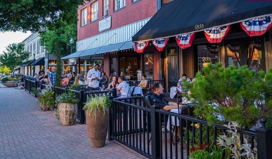
Active ground-level uses along a street (as is shown here in Downtown McKinney, Texas) activates the pedestrian realm and creates an interface between retail venues and the pedestrian zone. Key to the success of these spaces is adequate pedestrian space from the back of curb to the property boundary within the R.O.W.
Active Ground-Floor Uses on New Infill Development
Old County Jail
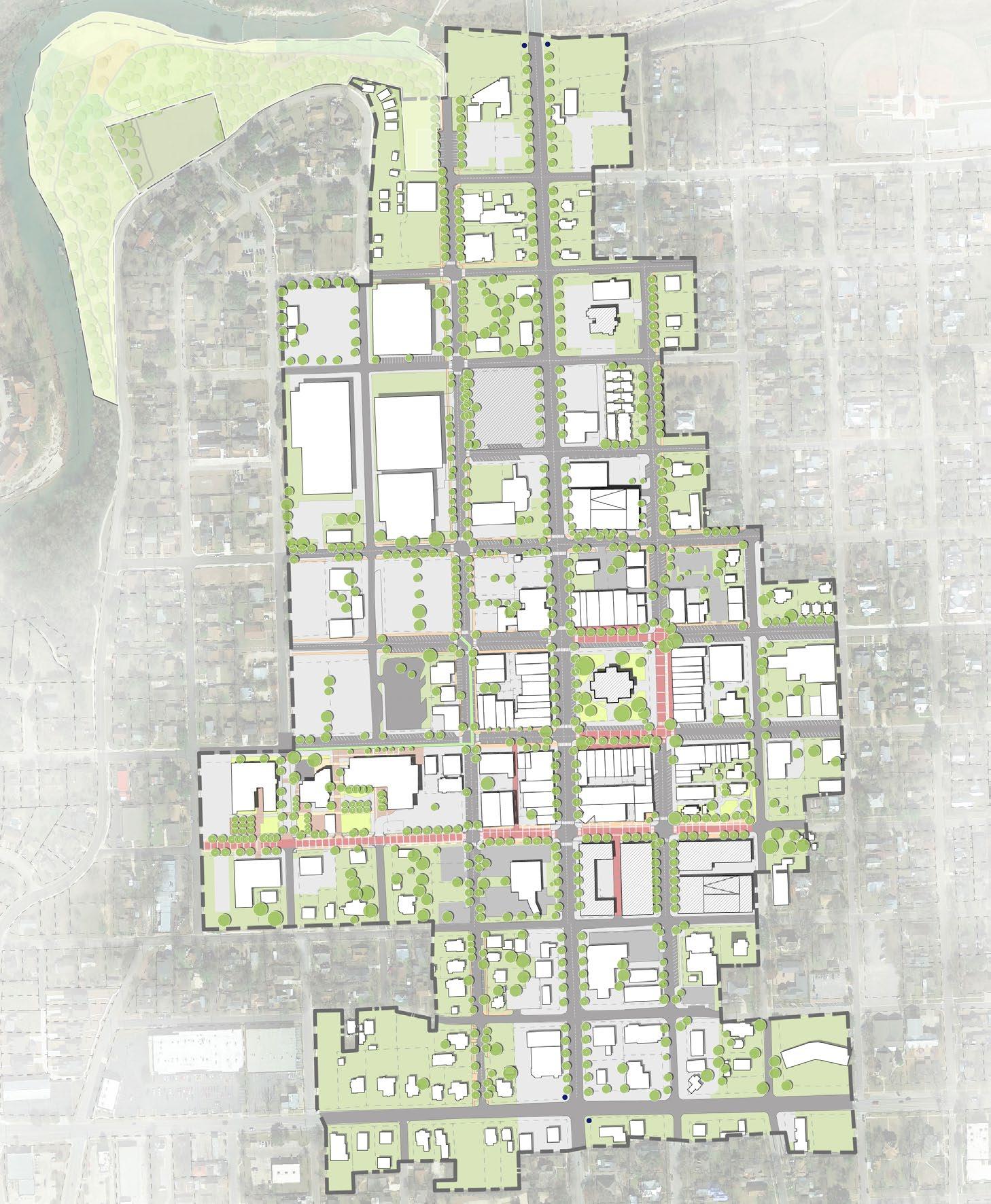
Figure 4.2 -
PUBLIC REALM ACTIVATION
Goals & Recommendations
Public Realm Activation Goal 3
Reimagine 9th Street as an Art Walk connecting the Nine-Block Square and the Light and Water Works District across Austin Avenue, to extend the aesthetic and vibrancy of the Historic Square outward to other portions of the Downtown Overlay District.
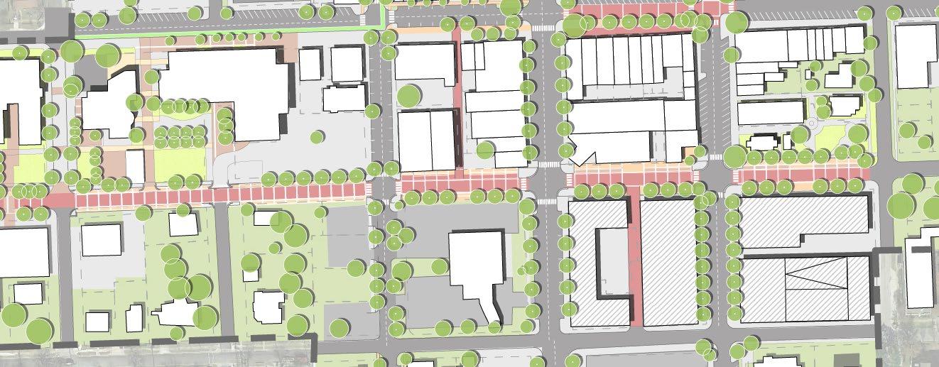
3.1 - Enhance the pedestrian street experience with trees, lighting, seating, bollards and convenient bike parking along the 9th Street corridor.
3.2 - Implement art installations along the 9th St. corridor in order to promote local art and build community pride.
3.3 - Utilize viable existing building faces for mural art opportunities.
3.4 - Utilize elevated materials and furnishings to create a distinct sense of place.
3.5 - Consider the design of a curbless street to allow the corridor to be comfortably used for events and elevate the pedestrian character of the street.
3.6 - Implement a traffic signal at the intersection of Austin Avenue and 9th Street to promote pedestrian connectivity from Light and Water Works District to the existing Georgetown Arts Center.
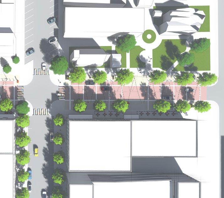
The improvements on 9th St. extend the look and feel of Downtown, and the enhanced pedestrian character outward beyond the Square.
9th Street Art Walk
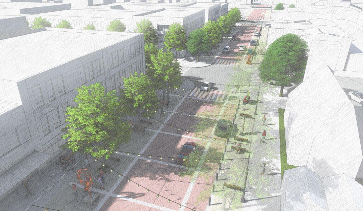
Cafe Seating and Expanded Pedestrian Environment
Existing On-Street Parking Retained on North Side
Proposed enhancements on 9th Street showing some level of mixed-use redevelopment of the Red Poppy Lot and the County Tax Office.
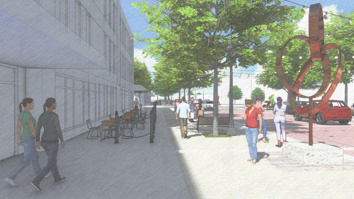
The extension of the public realm, as with the Historic Square enhancements, creates spaces for pedestrians and retail venues to interact.
10’ to Expand Pedestrian Realm
Festoon Lighting Street Art
Street Trees
Art Walk
PUBLIC REALM ACTIVATION
Goals & Recommendations
Public Realm Activation Goal 4
Enhance gateways leading into the Downtown Overlay District that are consistent with the Georgetown brand and promote an impressive and safe entry experience for both pedestrians and vehicle operators, in coordination with the Wayfinding Master Plan.
4.1 - Provide an enhanced major gateway along Austin Ave. at University Ave that builds on the success of the recently installed streetscape on the west side of Austin Ave. through the expanded use of pavers, elevated materiality, and monument signage (see Figure 4.3).
4.2 - Provide an enhanced major gateway along Austin Ave. south of the San Gabriel River.
4.3 - Seek to relocate, bury or improve existing above-ground infrastructure to create a visually appealing entry into Downtown.
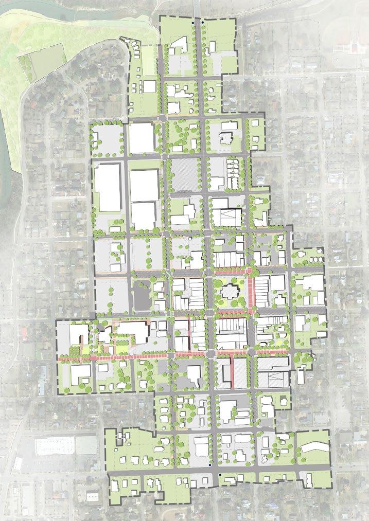
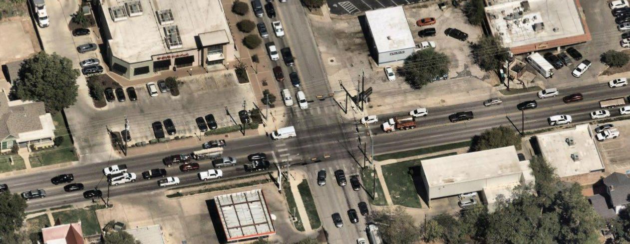
Figure 4.3 - Proposed Major Downtown Gateways
The existing condition of the Southern Gateway, the main vehicular route into Downtown Georgetown.
CVS Pharmacy
Source: Near Map
Gateway at Austin Avenue at University Avenue and Austin Avenue near San Gabriel River
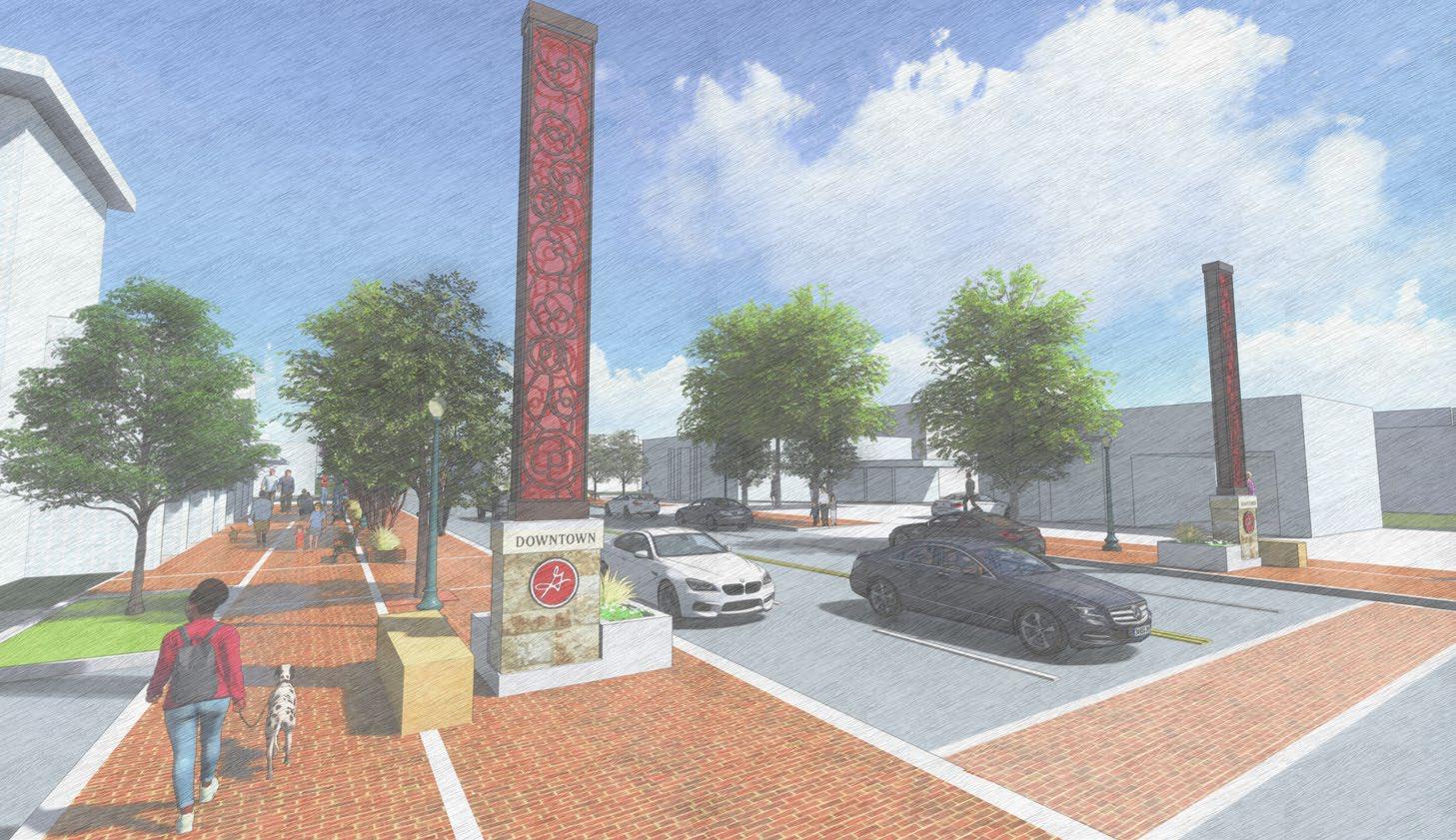
Proposed enhancements to the southern gateway.
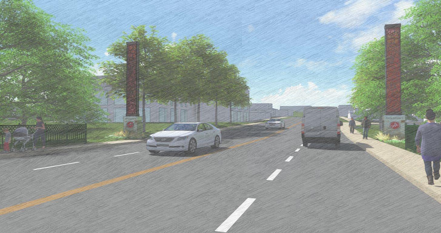
Proposed enhancements to the northern gateway.
Seating & Street Trees
Signage
PUBLIC REALM ACTIVATION
Goals & Recommendations
Public Realm Activation Goal 5
Maximize the potential of activating select alleyways within the Downtown Overlay District.
5.1 - Elevate the form and function of existing alleyways to enhance the service to adjacent buildings and businesses, such as the one running between Austin Ave. and Main St. located between 6th St. and 7th St., and the one running between 7th and 8th St. between Main St. and Church St (see Figure 4.4).
5.2 - Enhance Tin Barn Alley with mural art, lighting, and seating to create infill amenity space.
5.3 - Consider future opportunities to improve the function and elevate the aesthetics/creative use of existing alleyways around the Downtown Overlay District.
5.4 - Update current Design Guidelines to require that largerscale redevelopment projects (onehalf block or larger) incorporate pedestrian pass-throughs or paseos to increase access to activated public realm.
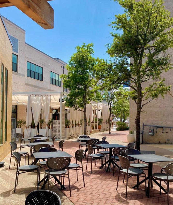
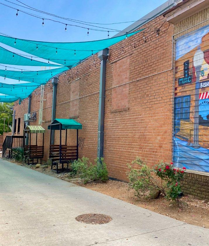
An urban paseo in Bishop Arts District helps break up density and create pedestrian spaces.
An amenitized alleyway in Bishop Arts District makes use of functional space for pedestrians.
Source: Design Workshop
Source: Design Workshop
Existing Alleyways with Potential for Improvement
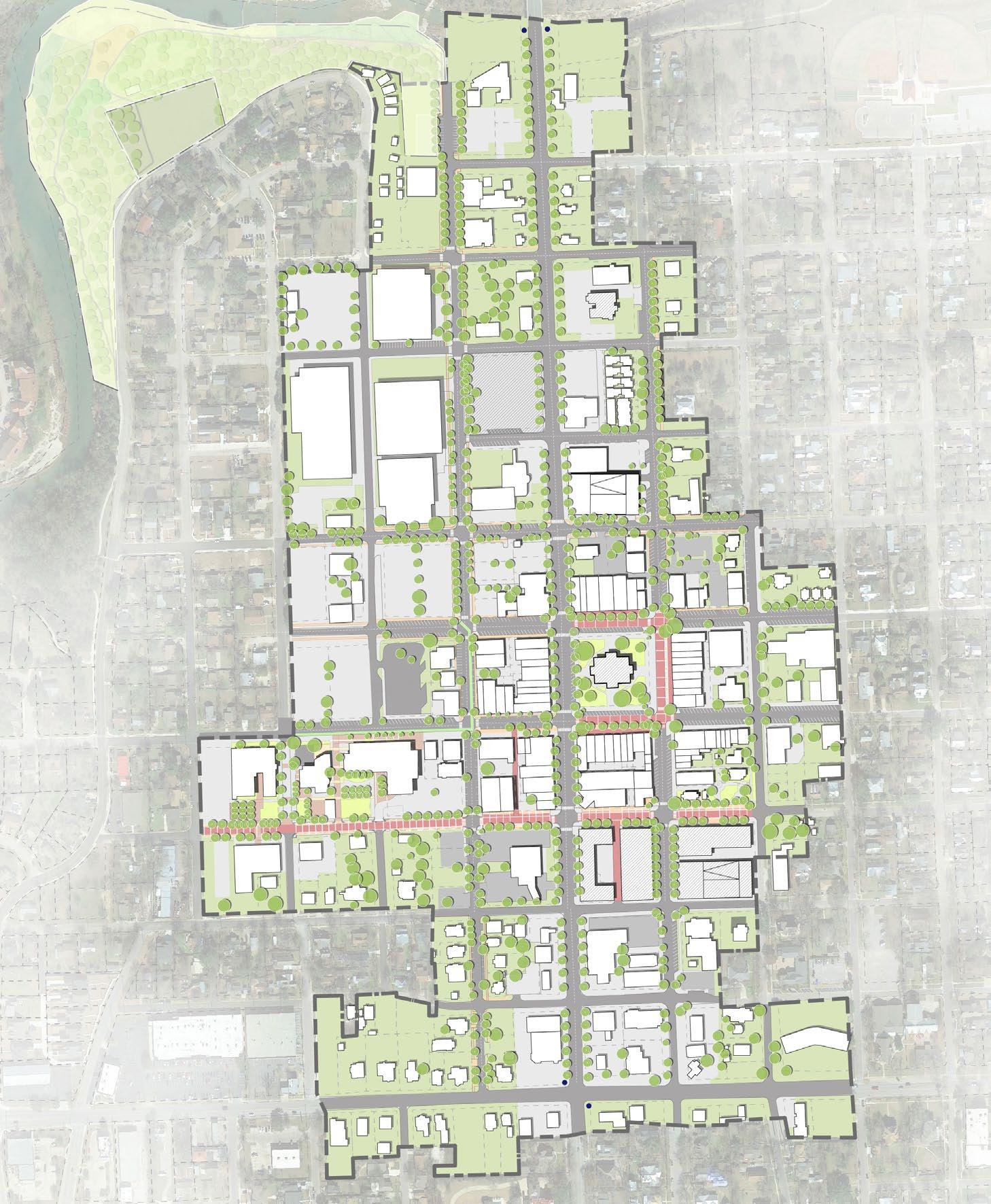
Existing alleyways with potential for improvements/ enhancements
Tin Barn Alley (at Block 50)
Existing Alleyway at Block 38
Figure 4.4 - Existing Alleyways with Potential for Improvement
Existing Alleyway at Block 40
DENSITY + LAND USE
Growth that Complements Georgetown
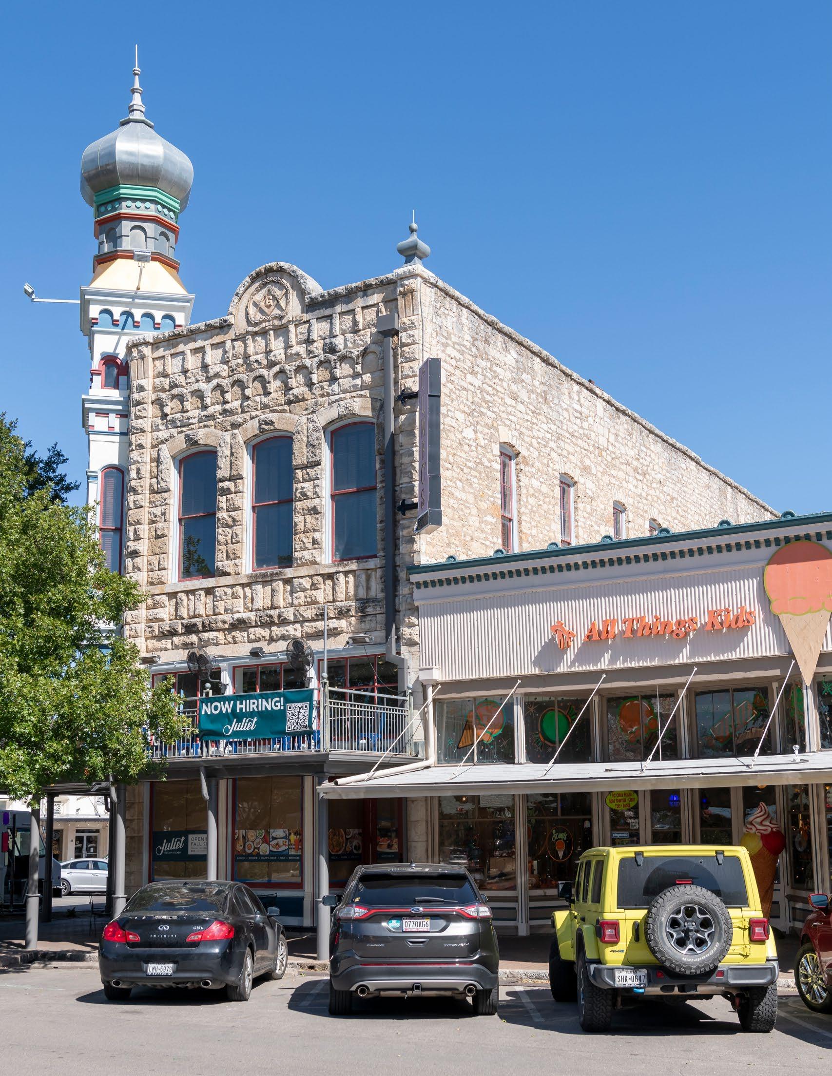
Georgetown has experienced an influx of population and development growth at a rate rarely seen before in its long history, as evidenced by its ranking as the fastest growing city in the U.S. in the 2022 census. Since the 2014 Downtown Master Plan, many new developments have occurred, including the new City Hall Building, the planning and design of a parking garage on 6th & Austin Ave., the planning and development of the new Light and Water Works District, the construction of the Watkins Building on Main St., the River Bluff Townhouses, the River Place Lofts and the R Bank Building. It is critical as new development occurs that it is consistent with the historic guidelines that define Downtown Georgetown to ensure that the Downtown Overlay District can grow into the future.
The City has taken several steps over the years to help preserve Downtown Georgetown’s character. Recently, the City embarked on updating the Downtown and Old Town Design Guidelines, which were adopted in September 2021. Likewise, in 1984 the original Historic Resource Survey was commissioned which surveyed and documented all pre-1935 historic buildings and features within the entire Georgetown city limits and ETJ – nearly
900 total properties. Both in 2007 and 2016, this mapping effort was updated, the most recent update focused on capturing, through an intensive survey, the properties within the Downtown District Overlay.
Throughout the process of this plan, engaging the community on the topic of height and density was pursued. Promoting appropriate and compatible land uses in areas in proximity to existing residential areas and providing vertical step-downs in density and activity are some of the strategies that have received support from the community throughout this process. Maintaining and allowing mixed-use development within the Downtown Overlay District will ensure the area is economically prosperous and socially active. Many of the wonderful amenities that are present Downtown that so many use and enjoy (retail venues, restaurants, etc.) can only be possible through a steady user base that is best supported by adjacent residential and employment uses. Encouraging appropriately scaled mixed-use development ensures growth and economic vitality are present, which is critical to a vibrant and active community.
Source: Design Workshop
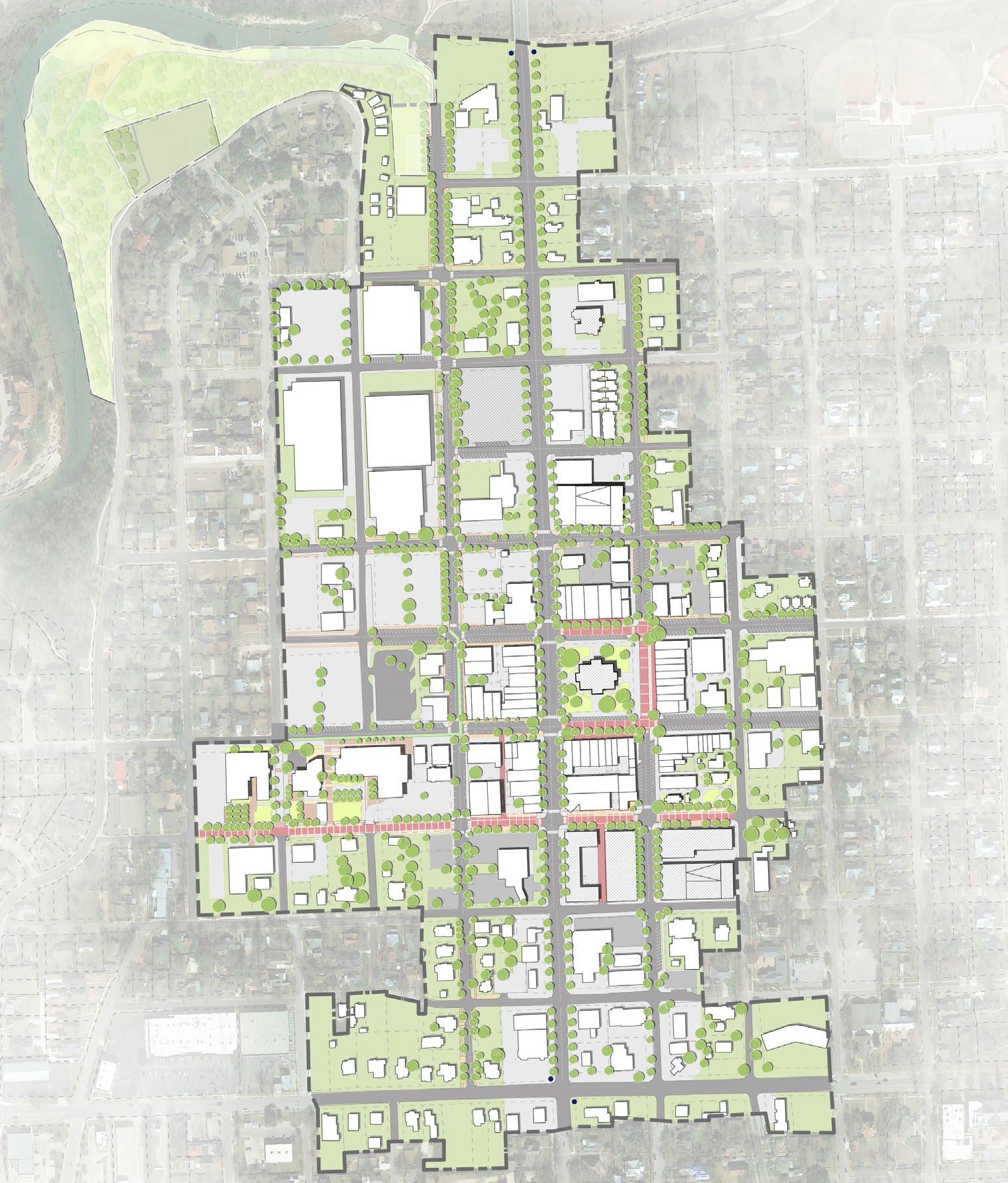
Proposed Catalytic Sites and Future Opportunity Areas in Downtown
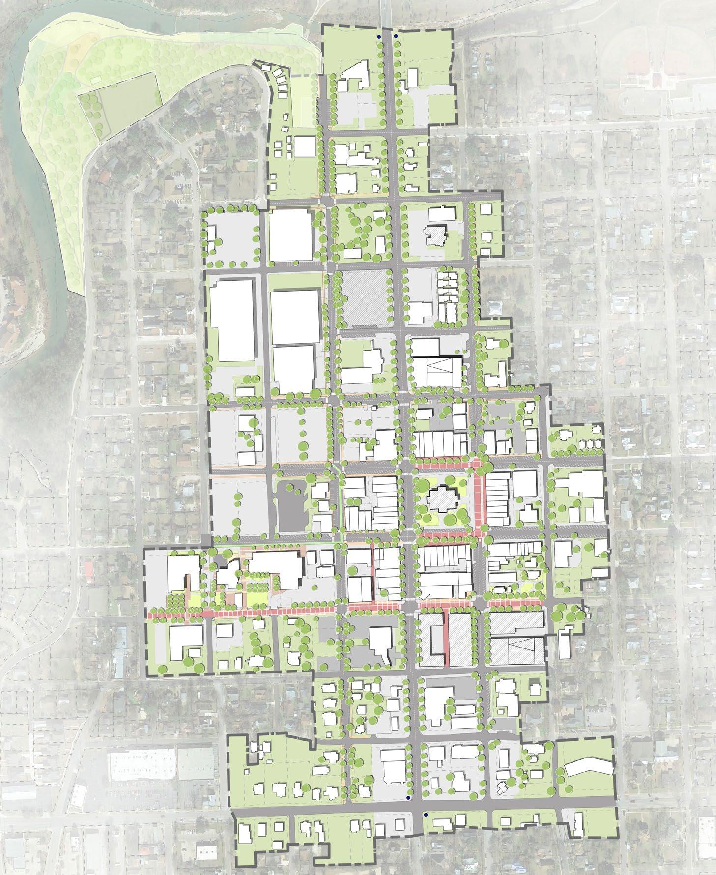
Figure
DENSITY + LAND USE
Goals & Recommendations
Density + Land Use Goal 1
Leverage underutilized publicly-owned sites to encourage infill development appropriate in scale and character to Downtown Georgetown.
1.1 - Explore public/private venture opportunities and partnerships to encourage appropriately-scaled growth Downtown.
1.2 - Partner with Williamson County to pursue redevelopment of the Williamson County Tax Office site (Block 2).
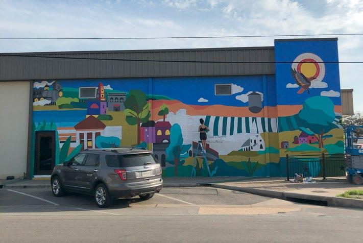
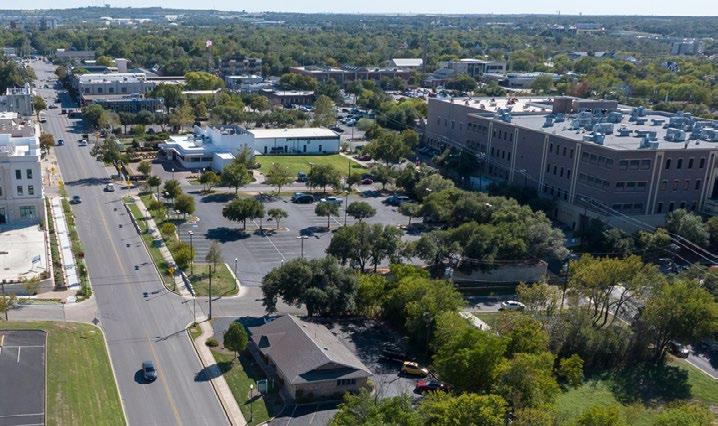
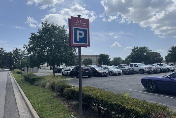
1.3 - Consider future redevelopment of the City-owned Red Poppy (Block 1 - via a publically solicited RFP/Q) and Daisy (Block 23) parking lots to include a mix of uses, potentially including City-owned parking structure(s).
1.4 - Explore potential future redevelopment opportunities of the Red Poppy Lot and the Justice Center site (including adjacent County properties) if Williamson County vacates land Downtown.
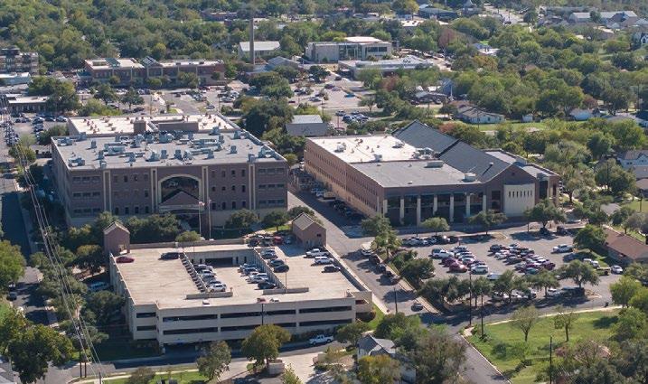
Williamson County Tax Office
Red Poppy Parking Lot
Daisy Parking Lot
Williamson County Justice Center
Source: Design Workshop
Source: Design Workshop
Source: Design Workshop
Source: Community Impact
Goals
& Recommendations
Density + Land Use Goal 2
Establish a strategy to address height and density within the Downtown Overlay District at the appropriate scale.
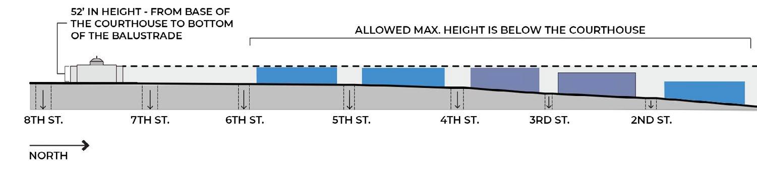
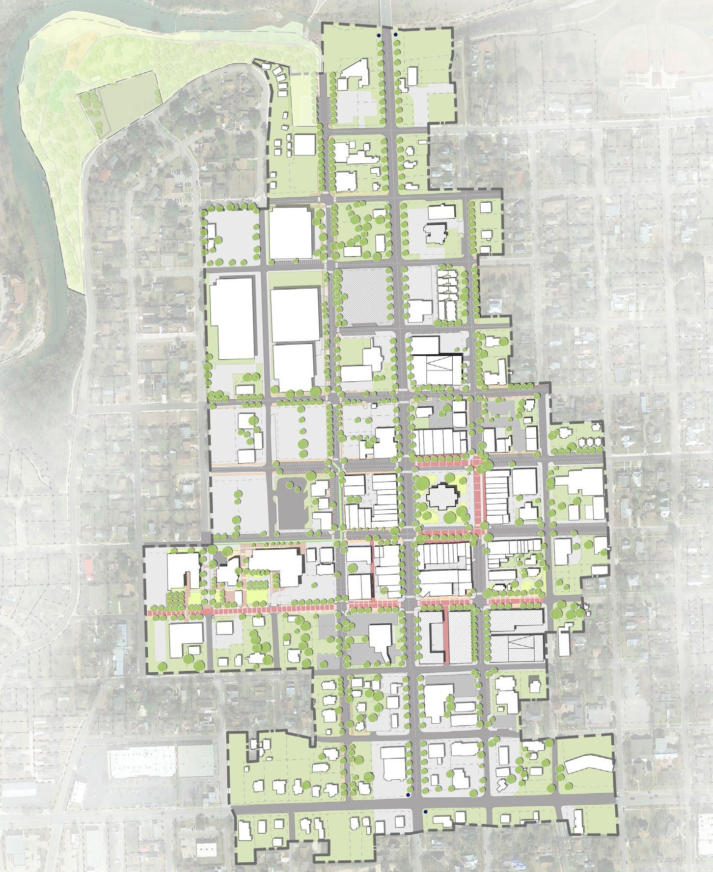
2.1 - Establish a maximum building height not to exceed the height of the bottom of the balustrade of the County Courthouse (see Figure 4.6).
2.2 - Establish a maximum allowable height for all new development within the Downtown Overlay District, in an effort to preserve certain existing view corridors and Downtown character as outlined in the UDC (see Table 4.1 and Figure 4.7).
2.3 - Update the UDC to remove the administrative variance allowing a 10% increase in maximum building height within the Downtown Overlay District.
2.4 - Update the UDC to remove the existing B2 Courthouse View Corridor located along North Austin Ave. and South of the Courthouse within the Downtown Overlay District.
Establishing a New Height Metric in a Manner that fits Georgetown
In order to ensure future height and density is carried out in a way that fits Georgetown, a new maximum height metric is established outside of the NineBlock Square based on the two following reference points:
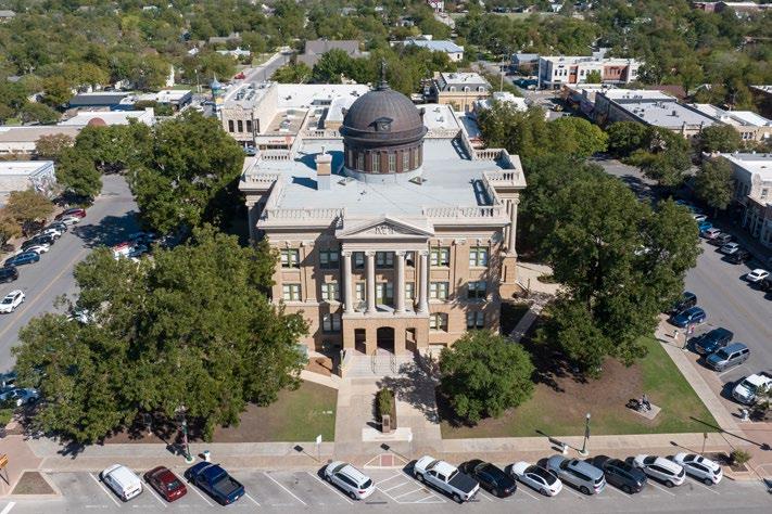
Williamson County Historic Courthouse
The cultural/visual beacon of Downtown Georgetown
• Maintain as the Highest Point on the Horizon
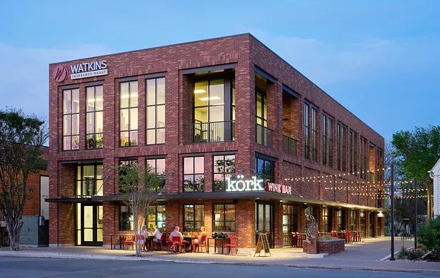
Watkins Building
• Represents new construction that the community likes.
• Executed in a style and aesthetic that fits Georgetown.
Source: City of Georgetown
Williamson County Courthouse.
Watkins Building on Main & 9th Street.
Source: Design Workshop
DENSITY + LAND USE
Preserving the Prominence of the Courthouse
The height of the Courthouse has traditionally been the maximum height that other buildings cannot rise above within the Downtown overlay district. As Georgetown grows into the future, there lies an opportunity to redefine this height benchmark in a way that allows for future growth in a way that fits Georgetown and preserves the County Courthouse as the highest point on the Downtown landscape.
Height/Density in the Downtown Overlay District
1
The inner half-block within the NineBlock Square facing the County Courthouse Strict architectural standards in place without exceptions
2 The outer half-block within the NineBlock Square not facing the County Courthouse Strict architectural standards in place without exceptions
3 Transition zones between areas of the Historic District Overlay and adjacent residential land-uses
4 Areas of increased height outside of the Nine Block Square
5 Properties north of the Nine Block Square of exceptional value or status that may allow additional height pending municipal review
6 Properties along University Ave . between MLK Jr St and Myrtle Street .
** Maximum vertical height allowed is measured from finished floor elevation of the proposed building to the top of the structure .
- Height/Density in the Downtown
Figure 4.6 - Defining Maximum Allowed Height Downtown
Table 4.1
Overlay District
DENSITY + LAND USE
Goals & Recommendations
Density + Land Use Goal 3
Consider updates to the UDC that ensure allowable land uses are consistent with the desired character of Downtown.
3.1 - To ensure compatibility between residential uses and potential redevelopment, amend the UDC so any live music and/or entertainment venue is minimum 100’ set back from any residential use.
3.2 - Amend the allowed/restricted uses in MU-DT district to restrict certain uses such as payday loans, pawn shops, tattoo parlors, smoke shops, drive-through restaurants and laundromats within the Downtown Overlay District.
3.3 - Create a set of approval criteria for requests to expand the Downtown Overlay District in the UDC to accomodate the future expansion of the Downtown Overlay District.
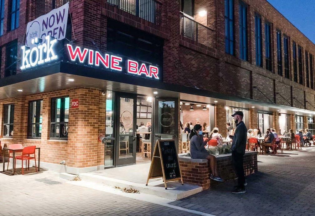
Active entertainment uses in the Downtown Overlay District are important in supporting local business and maintaining an active district, but should be reasonably limited and controlled to ensure compatibility with the historical and cultural ambience of Downtown Georgetown.
Source: City of Georgetown
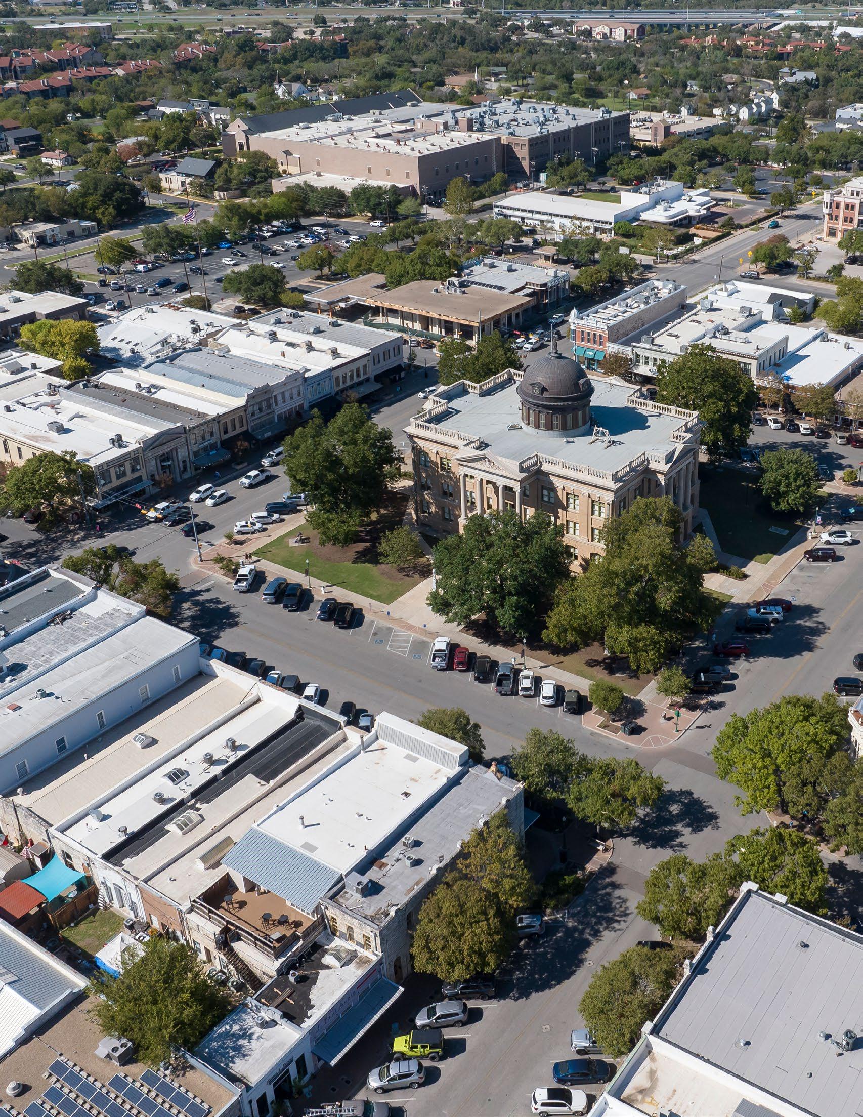
OPEN SPACE, PARKS + CONNECTIVITY
Leveraging Open Space in and around Downtown
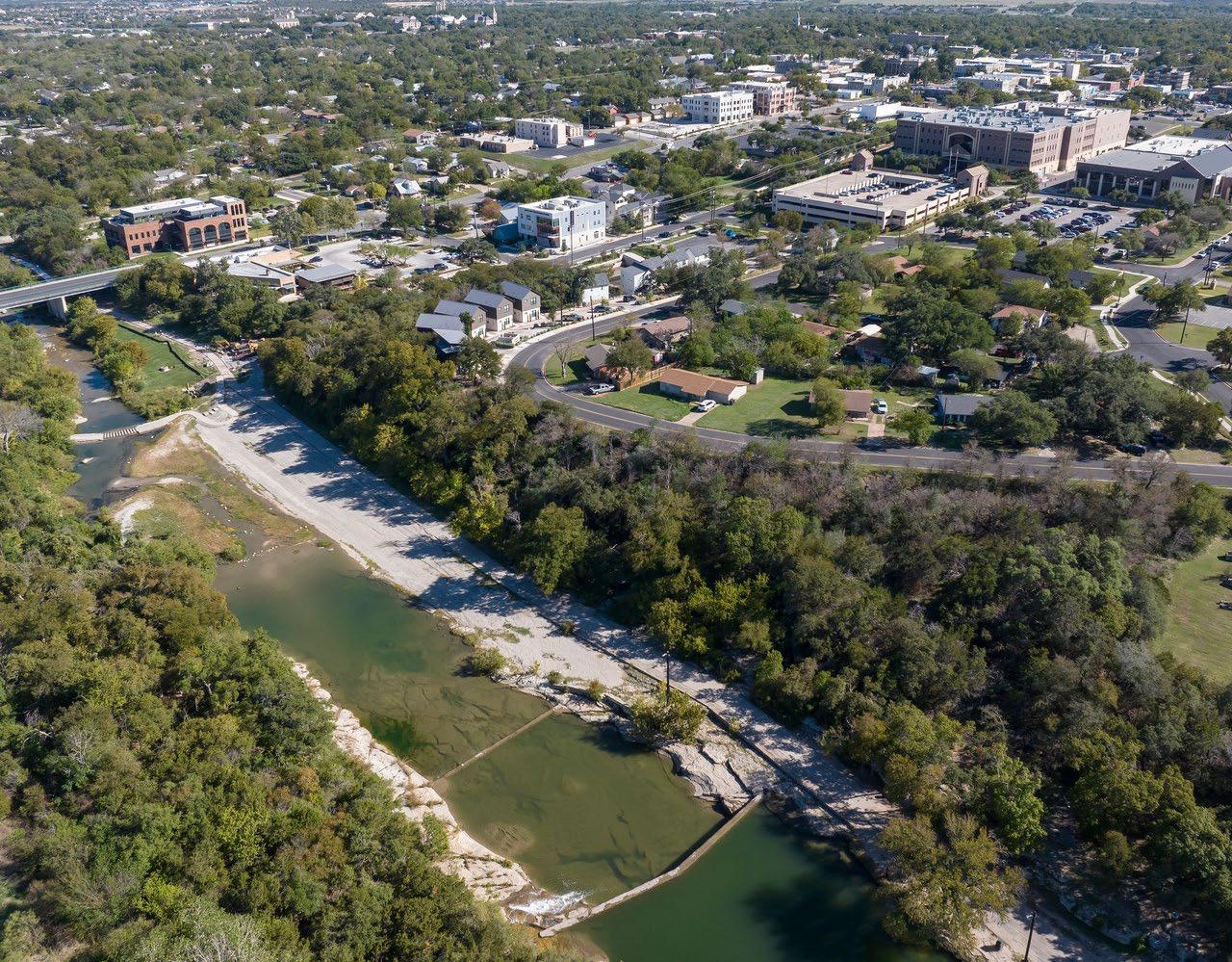
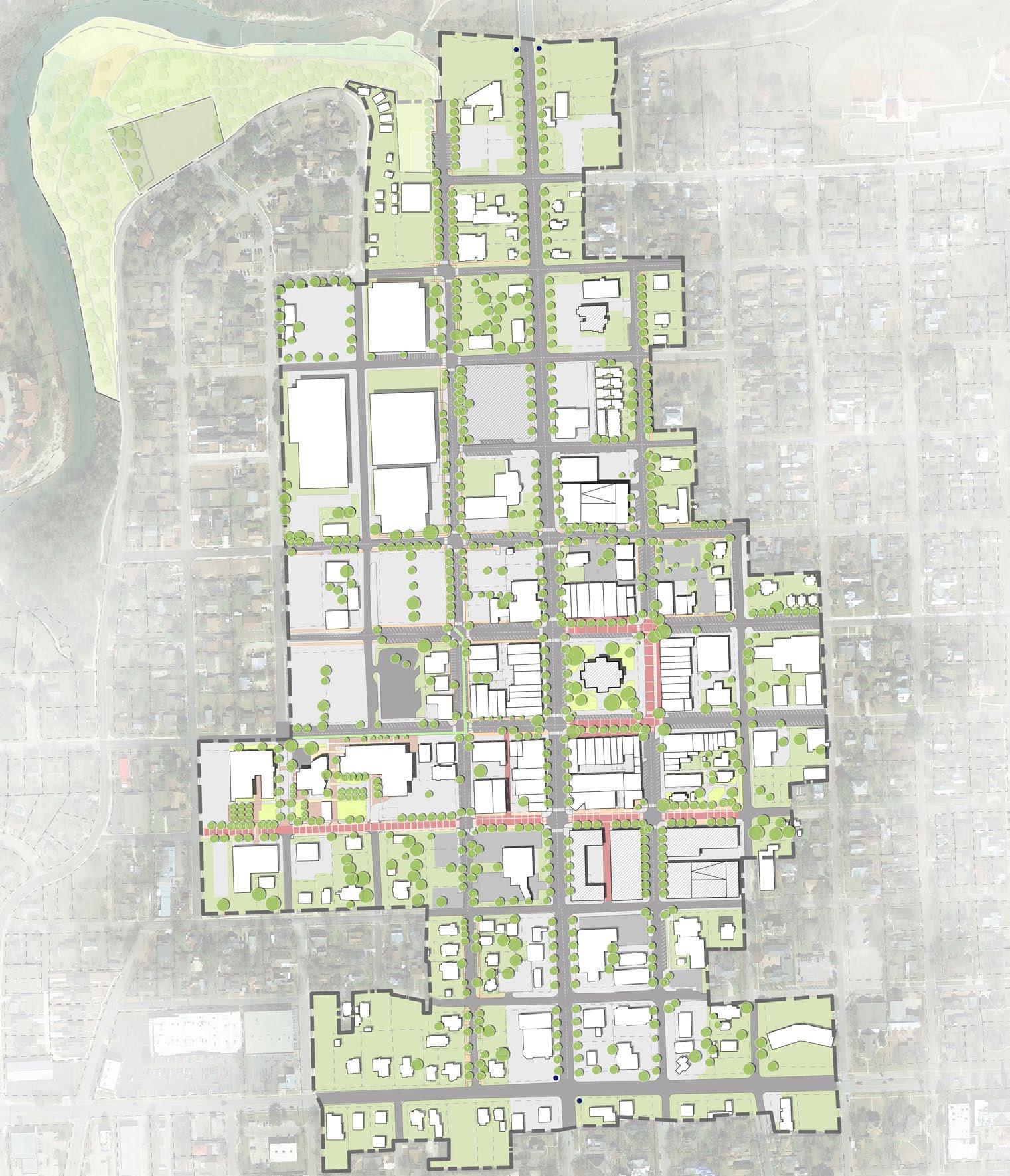
In Georgetown, park space is limited within the Downtown Overlay District. While there is extensive park space adjacent to and beyond downtown, it often feels disconnected from the downtown experience due to topography, lack of visibility, and other factors. Because access to quality open space is critical to the health, vitality, and quality-of-life for a community, this plan aims to better connect downtown visitors, workers and residents to outdoor amenities both within the Downtown Overlay District and throughout the region.
There is a tremendous opportunity in this plan to enhance connections and access from park space to the existing Georgetown trails system to improve connections to and through the Downtown Overlay District. Synergy also exists between these improvements and the Austin Ave. pedestrian bridge study in an effort to be intentional about pedestrian connectivity Downtown.
Blue Hole
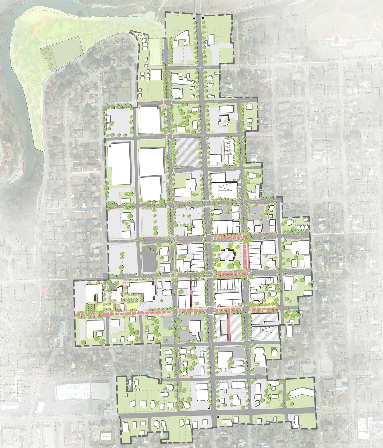
Figure 4.8 - Priority Projects for Open Spaces,Parks and Connectivity
OPEN SPACE, PARKS + CONNECTIVITY
Goals & Recommendations
Open Space, Parks + Connectivity Goal 1
Transform Blue Hole Park into a true destination and a recreational gateway to the Downtown Overlay District.
1.1 - Commission an updated vision plan and begin phased park improvements within 3 years of the approval of this plan.
1.2 - Develop a funding strategy for phased park improvements.
1.3 - Consider exploring options to preserve the area in and around the cemetery and the former Marshall-Carver High School as a cultural heritage site.
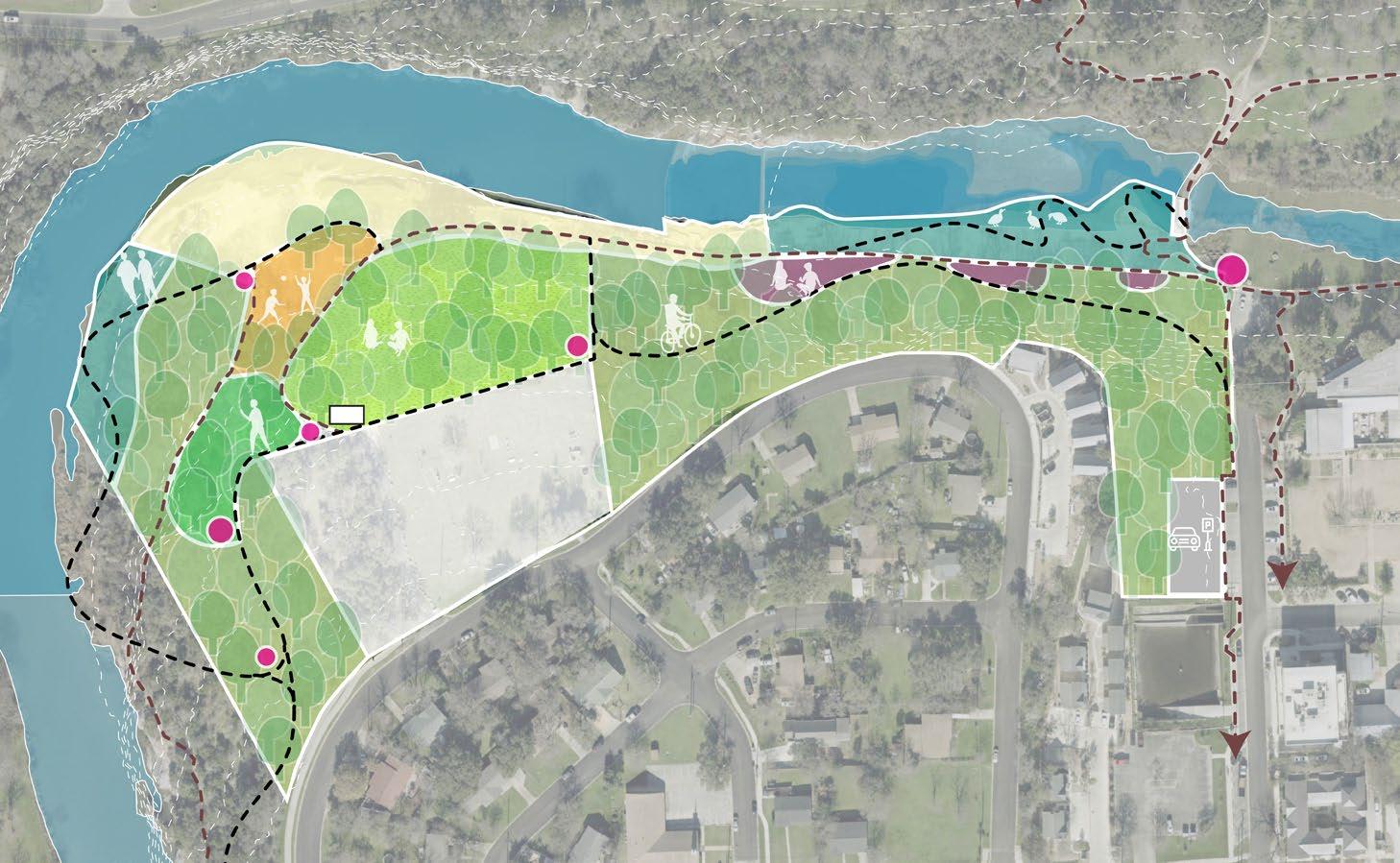
Blue Hole Park - Proposed Enhancements
Figure 4.9 - Blue Hole Park Proposed Enhancements
OPEN SPACE, PARKS + CONNECTIVITY
Goals & Recommendations
Open Space, Parks + Connectivity Goal 2
Reimagine Rock Street as a mixed-mode promenade connecting Blue Hole Park to Downtown Georgetown and the County/Municipal Complex.
2.1 - If the County vacates or redevelops its properties at and surrounding the Justice Center, consider acquisition of additional ROW on the west side of Rock Street from 2nd Street to 7th Street to allow for the expansion of the pedestrian environment and the creation of a promenade that connects to Blue Hole Park.
Blue Hole
Rock Street
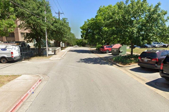
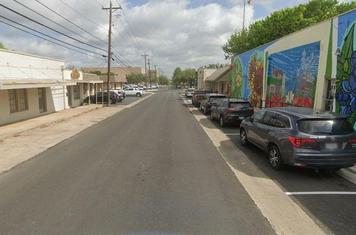
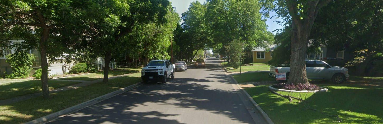
Section C - South of 9th Street. Lower density and commercialized.
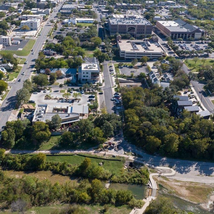
Section A - North of 7th Street. More dense, urbanized and adjacent to County properties.
Section B - Between 7th & 9th Street. Constrained R.O.W. and close adjacency of existing buildings.
Source for all: Google Streetview
Rock Street Existing Conditions
Rock Street Promenade | Section A, North of 7th Street
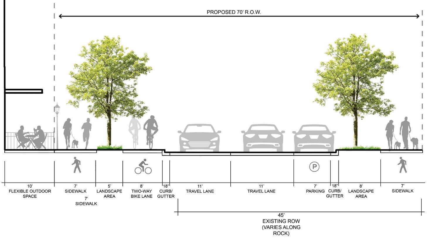
The concept of the Rock Street Promenade is made possible by the potential future redevelopment of the County Justice Center to grow the R.O.W. as space for pedestrians through an expanded public realm, on-street parking and continuous street trees.
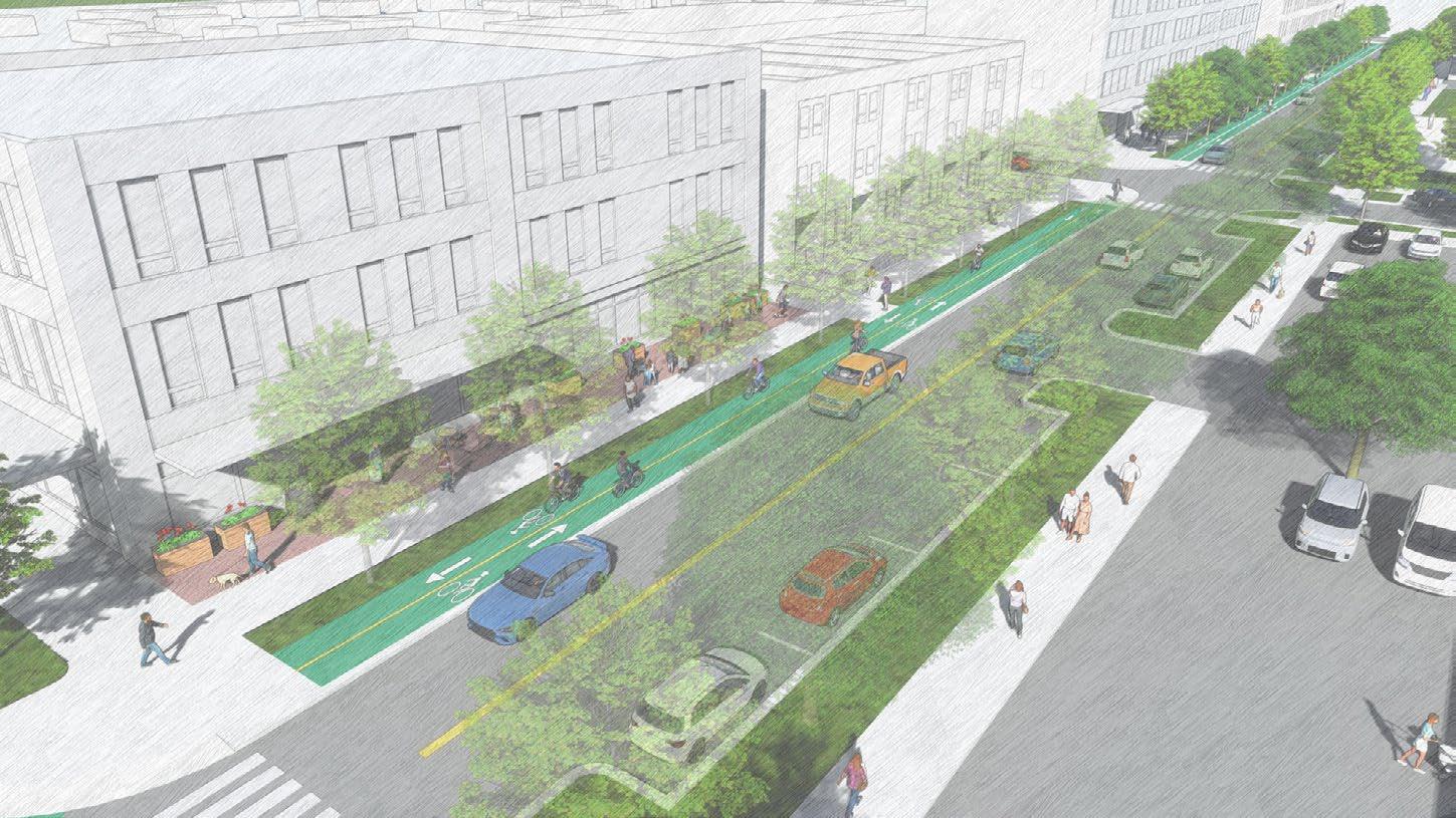
Through an expansion of the sidewalk/pedestrian way, space for street trees and bike lanes - this “green” promenade extends from the Light and Water Works District and the Municipal Complex all the way to Blue Hole Park – creating a welcoming recreational gateway into Downtown Georgetown.
Two-Way, Off Street Bike Lane
Rock Street Improvements | Section B, between 7th and 9th Street
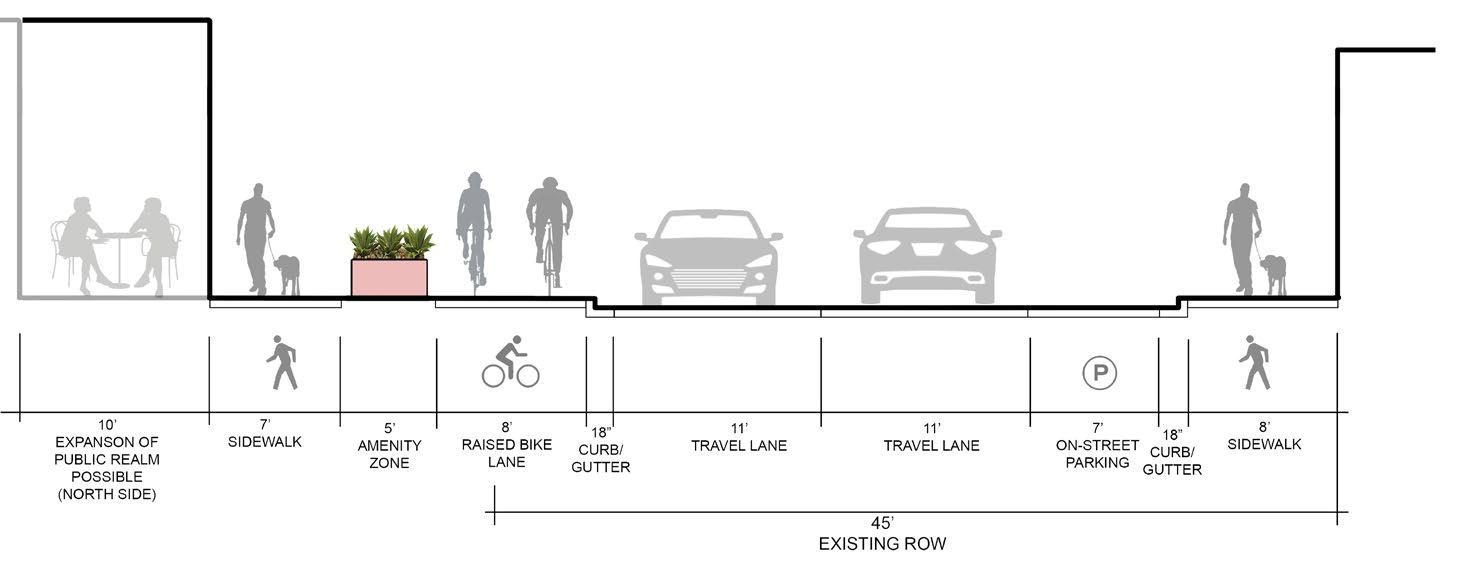
This constrained section of Rock Street contains a raised bike lane, expanded pedestrian zone, raised planting areas and retained on-street parking. This key section of Rock St. connects the Rock St. promenade to the section of Rock St. south of 9th St.
Rock Street Section C | Section C, south of 9th Street
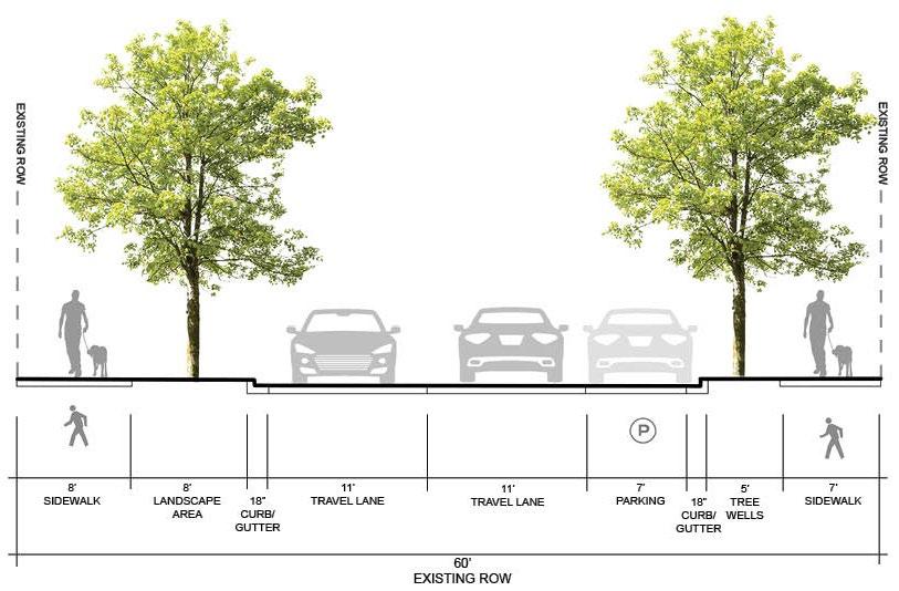
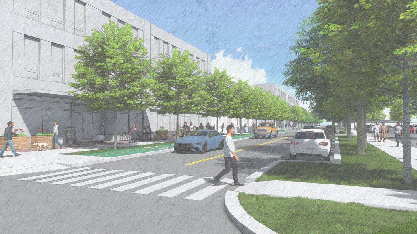
In this more generous R.O.W. condition, large existing trees (particularly the Pecan trees on the west side) are prioritized, along with on-street parking and an expanded pedestrian realm. In the case of when constrained space conditions for street trees are 5’ in width or less, soil cells are recommended.
Rock Street Promenade | Section A, north of 7th Street
By leveraging the potential opportunity of Williamson County vacating the Justice Center, this allows for a wide, pedestrian-oriented promenade extending from central Downtown and the City Hall area to Blue Hole Park.
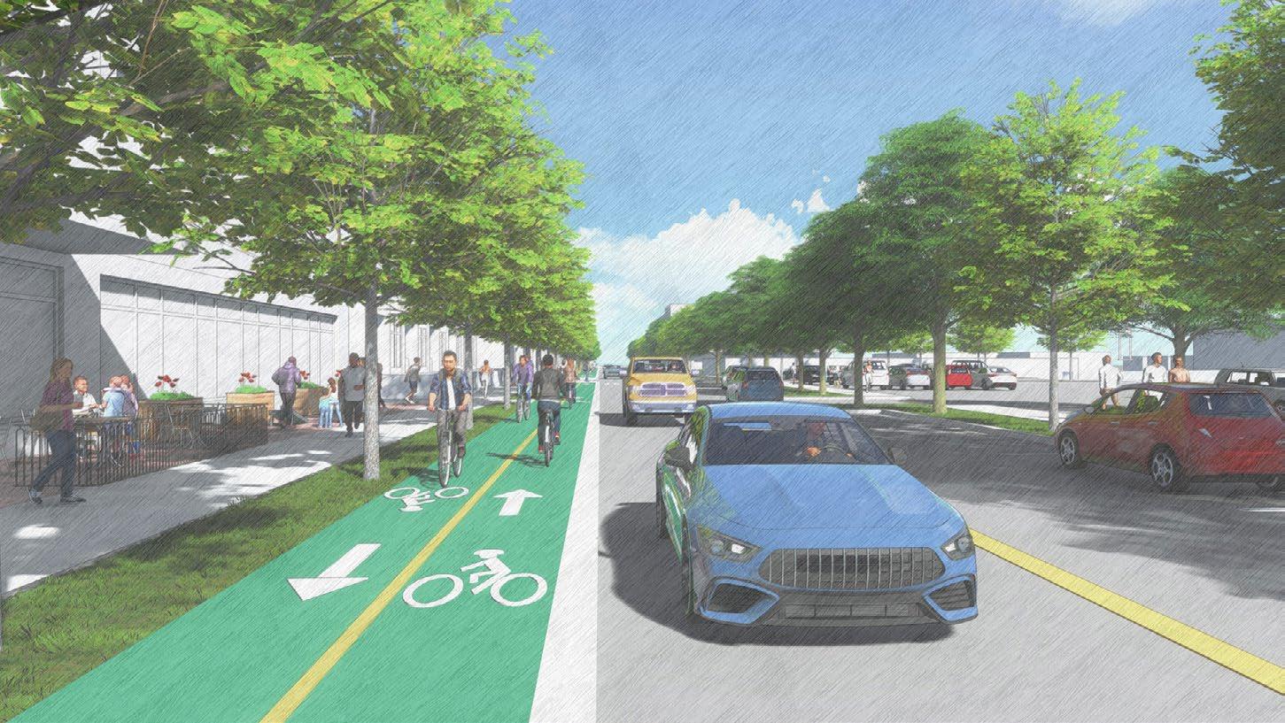
Providing an off-street bike lane along Rock St. encourages active recreation for residents and visitors of Downtown.
Activated Pedestrian Realm
Activated Pedestrian Realm
Two-Way, Off Street Bike Lane
Two-Way, Off Street Bike Lane
OPEN SPACE, PARKS + CONNECTIVITY
Goals & Recommendations
Open Space, Parks + Connectivity Goal 3
Enhance access to quality parkland for visitors/residents of the Historic Downtown Overlay.
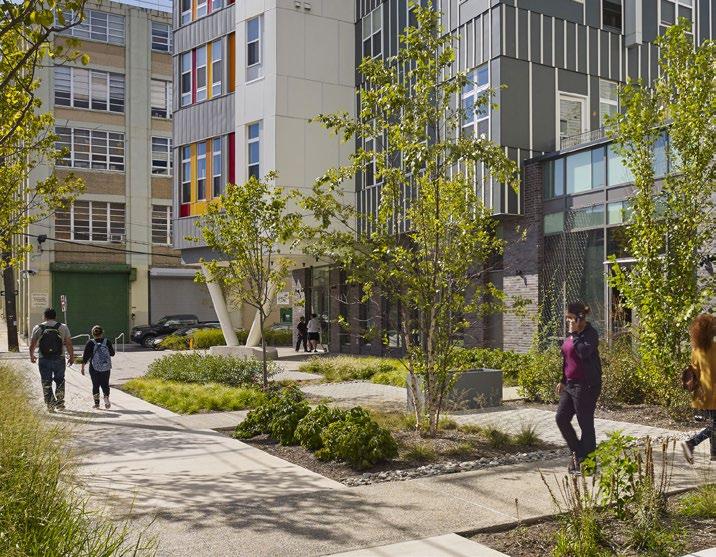
3.1 - Encourage the incorporation of pocket parks, paseos and other types of publicly-accessible open spaces into the redevelopment of publiclyowned properties.
Open Space, Parks + Connectivity Goal 4
Enhance bike and pedestrian facilities connecting to and through the Historic District Overlay.
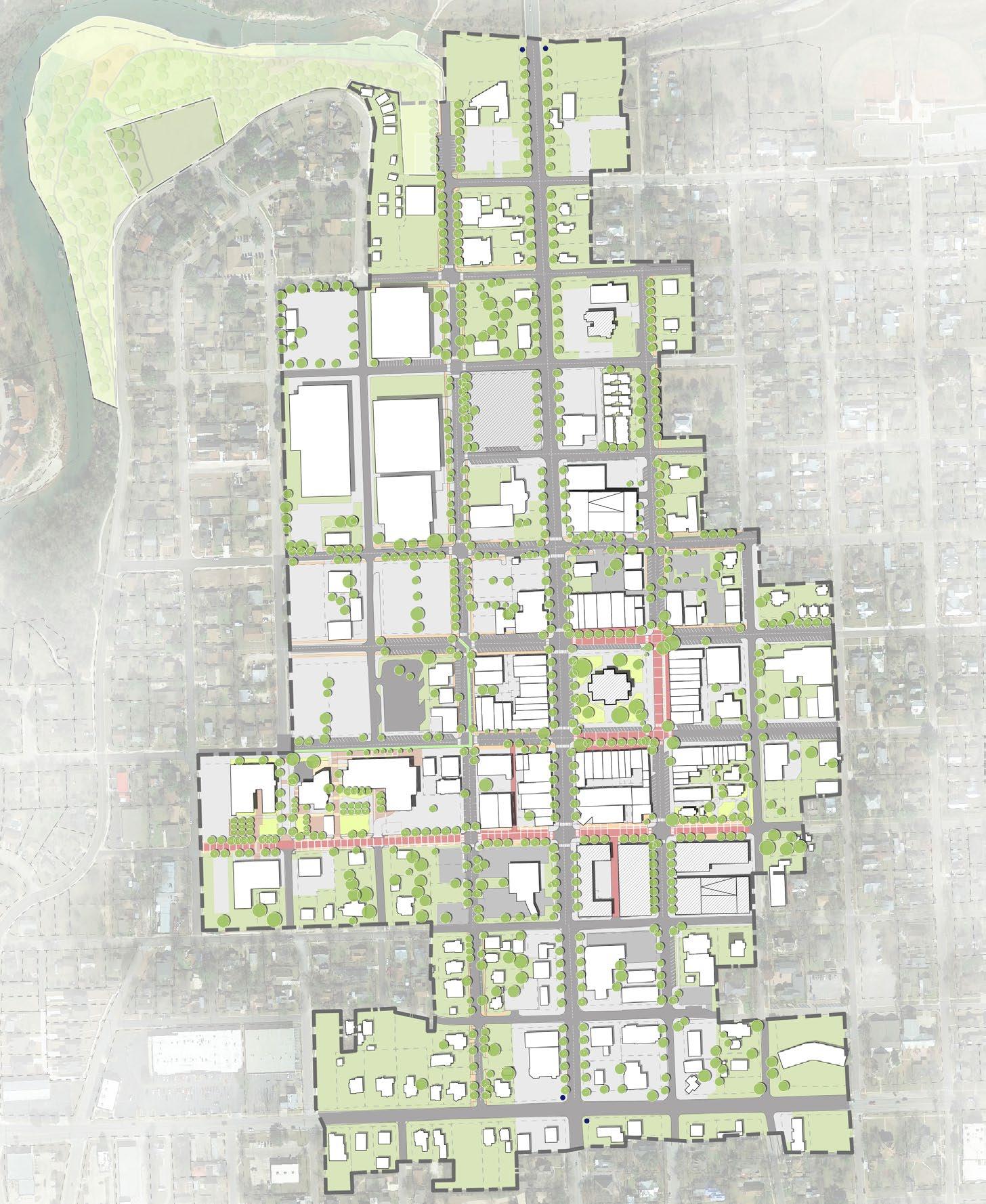
4.1 - Improve pedestrian connections into Downtown that are consistent with the Sidewalk Master Plan (2024) (wherever possible connecting disjointed segments of sidewalk and prioritizing sidewalks on both sides of the street), including 7th St. west of Austin to the TRG Neighborhood, along Austin Ave. north of 7th St. and south of 9th St., 4th St. between Church St. and West St.
4.2 - Integrate bike facilities on 8th Street from Chautauqua Park to Rock St.
4.3 - Integrate raised, off-street bike facilities as part of the Rock St. Improvements extending from 8th St. to Blue Hole Park.
4.4 - Integrate bike facilities on Main Street extending from 6th St. to connect to the San Gabriel Trail.
Source: WRT
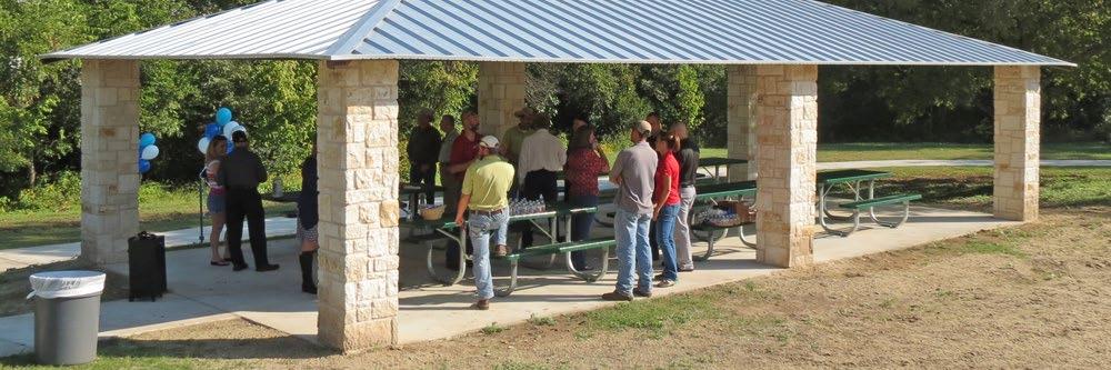
Providing pedestrian connections to adjacent green spaces like Chautauqua Park is critical to enhanced connections to and through Downtown.
Paseos and pedestrian-oriented open spaces, like those pictured above in the Bishop Arts District, showcase how density can be broken up and amenity space added in new development.
Bike Connections
Off-Street Bike On-Street Bike
Enhanced Pedestrian/ Bike Crossing
Signalized Intersection
OPEN SPACE, PARKS + CONNECTIVITY
Goals & Recommendations
Open Space, Parks + Connectivity Goal 4
Enhance bike and pedestrian facilities connecting to and through the Historic District Overlay.
4.5 - Integrate bike facilities on 6th St. from Rock St.
4.6 - Implement traffic calming measures and pedestrian crossing improvements at the intersection of Scenic Dr. and 8th St. to ensure safe cyclist and pedestrian crossing.
4.7 - Establish enhanced pedestrian/ bike crossings at 7th and Rock, 6th and Rock, and 6th and Main so as to promote safe pedestrian connectivity within the Downtown Overlay District.
4.8 - Locate and establish bike corrals at enhanced pedestrian/bike crossing locations to facilitate bicycle use and decrease the use of vehicles in the Downtown Overlay District.
Source: Design Workshop
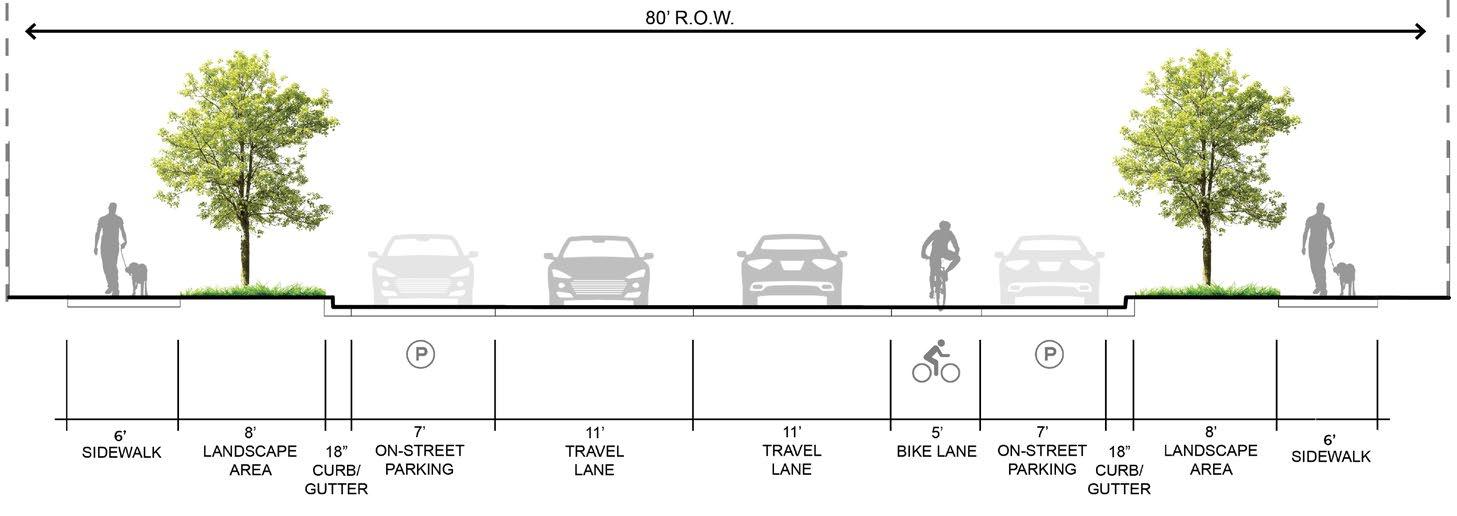
North Main Street improvements include expanded sidewalks on both sides, on-street parking and on-street bike facilities providing a pedestrian connection to the San Gabriel River Trail.
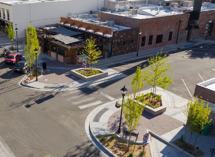
Traffic calming measures like bulb outs at 8th St. and Scenic Dr. can direct and slow traffic, facilitating safe pedestrian crossing.
Pedestrian & Crosswalk Facilities
OPEN SPACE, PARKS + CONNECTIVITY
Goals & Recommendations
Open Space, Parks + Connectivity Goal 4
Enhance bike and pedestrian facilities connecting to and through the Historic District Overlay.
4.9 - Integrate a hierarchy of sidewalk and crosswalk design within the Downtown streetscape (see Figure 4.12) to ensure connectivity and visual cohesion.
Downtown Sidewalks
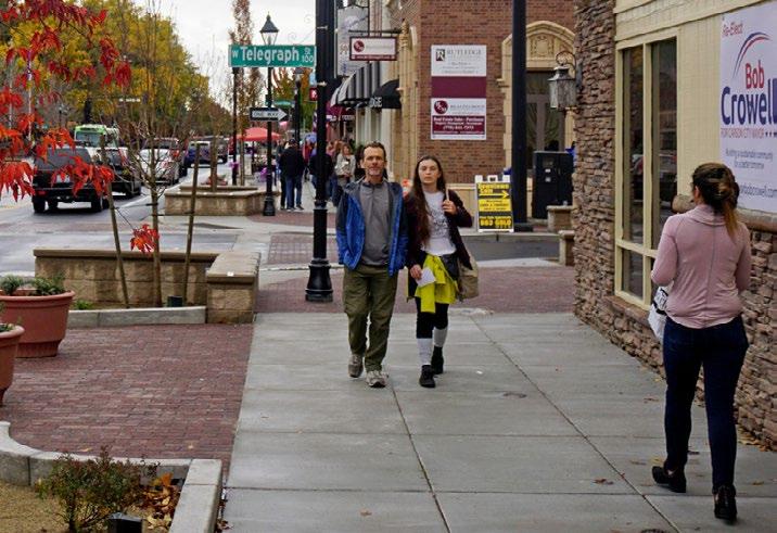
Level 1 Sidewalk - Level 1 sidewalks are found within the Nine-Block Square and key connecting streets, as well as the proposed 9th Street Art Walk.
• Min. 6’ clear pedestrian zone.
• Where space is available, first add amenity zone adjacent to the curb. Where the amenity zone can be min. 5’ wide, provide street trees (reference Figure 4.13).
• Where sidewalk width exceeds 11’, provide transition zone. Where transition zone may exceed 4’ in width, additional space may be added to either the transition or amenity zone.
• Sidewalk section (ratio of sidewalk, amenity and transition zones) to be consistent along complete block faces.
• Paving materials in sidewalk zone to be unit paving. Paving materials in amenity and transition zones may include combination of concrete and unit pavers, provided they are used in a consistent cadence along a block face. TRANSITION ZONE
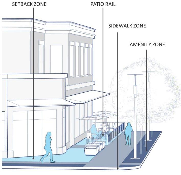
Designating zones for amenities, pedestrian travel and retail/cafe seating space helps encourage a pedestrianaccommodating R.O.W. and streetscape.
A level one sidewalk would typically be located within the Nine-Block Square and along other key streets, like this section of Main & 8th Street.
Source: Design Workshop
Figure 4.13 - Pedestrian Right-of-Way Zones
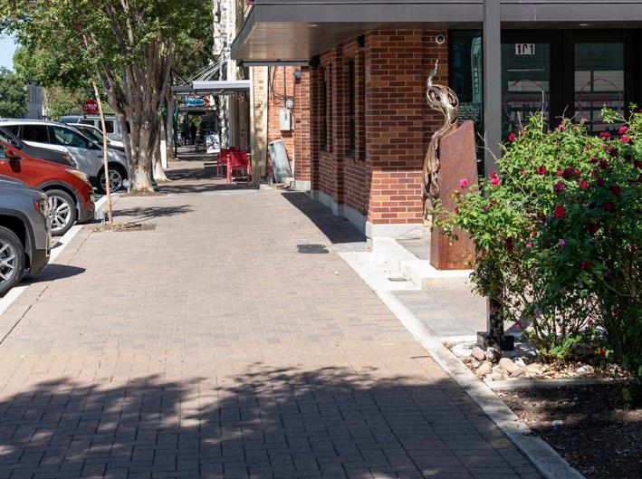
Level 2 Sidewalk - This sidewalk type is found in active pedestrian zones, and where some level of trees and amenity space can be accommodated.
• Minimum 6’ sidewalk zone to be measured from the property line.
• Amenity zone (to back of curb) may consist of amenitized hardscaped areas or traditional tree lawn.
• Trees required along all block faces at typically 25’ O.C.
• Paving materials in sidewalk zone to be an approved combination of unit paving and concrete.
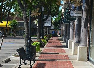
Level 3 Sidewalk - This sidewalk type is found on typical streets where additional space does not exist or is limited.
• Minimum 6’ sidewalk zone to be measured from the property line.
• Trees or planting area required along all block faces if min. 5’ space between back of curb and sidewalk edge exists.
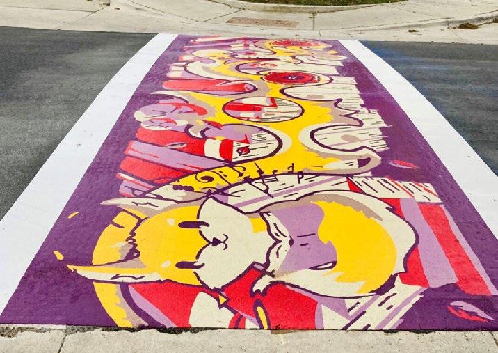
Artistic crosswalks can be commissioned by a local artist or organization, and contribute to the theme and visual presentation of the 9th Street Art Walk.
Level two sidewalks are found in and along prominent pedestrian spaces but where space may be more limited.
Level three sidewalks are found in typical situations to promote positive pedestrian flow and access where space may be more constrained.
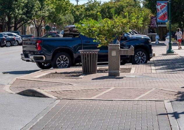
Enhanced crosswalks contain pavers that are consistent with existing Downtown standards, and are featured at key intersections.
Source: Design Workshop
Source: Concrete Decor
Source: Design Workshop
Source: City of Georgetown
OPEN SPACE, PARKS + CONNECTIVITY
Goals & Recommendations
Open Space, Parks + Connectivity Goal 5
Ensure streetscapes are well designed, furnished and consistent within the Downtown Overlay District.
5.1 - Utilize consistent paver materials, colors, and concrete finishes, for streetscape elements throughout Downtown.
5.2 - Define distinct zones within right-of-way for public space amenities, clear pedestrian travel, and transition uses (patios, outdoor merchandising, public art) within the streetscape zone (see Figure 4.13).
5.3 - Update the preferred street tree list to reflect species that will achieve a consistent canopy at maturity and create more canopy diversity within the Downtown (see Table 4.1).
5.4 - Locate pedestrian-scale lighting within the amenity zone where feasible to enhance visibility and safety.
5.4.1 - Within the 9-block square, provide 4 pedestrian-scale lights per block face, equally-spaced.
5.4.2 - Outside of the 9-block square, provide pedestrianscale lights at 60’ - 75’ spacing (depending on existing conditions).
5.5 - Consistently utilize standard furnishings (benches, trash/recycling receptacles, bike racks, planter pots) within the amenity zone.
5.6 - Encourage the use of consistent, high-quality furnishings, railings, and other treatments within the transition zone, while also allowing businesses to extend their unique identity into the public realm within an existing approved palate.
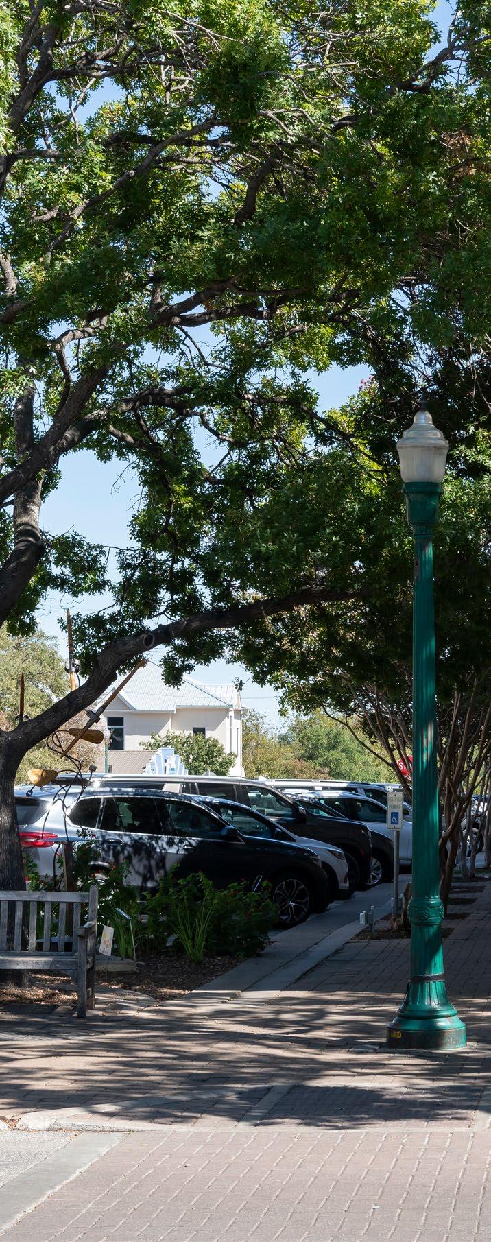
Source: Design Workshop
Nine-Block Square
PREFERRED DOWNTOWN TREE SPECIES
Post Oak (Quercus stellata )
Street tree, large mature size, adequte summer shade, native/adaptive to the region
Ornamental tree, flowering in the spring, native to the region
Big Tooth Maple (Acer grandidentatum )
Texas Redbud (Cercus canadensis Var. mexicana )
Mexican Plum (Prunus mexicana )
Primary street tree where space is not constrained. Prioritize use on the Historic Square. Resistent to oak wilt.
Primary street tree where space is more constrained, can be planted nearer the road when nessessary. Prioritize use along street corridors, such as along Main St. and Austin Ave. Good fall color.
Prioritize use at intersections for visual interest. Single trunk variety perferred. Utility compatible.
Outside of the Nine-Block Square
Street tree, large mature size, more limited spread, adequte summer shade, native/adaptive to the region
Street tree, moderate mature size, adequte summer shade, native/adaptive to the region
Ornamental tree, flowering in the spring, native to the region
Chinquapin Oak (Quercus stellata )
Big Tooth Maple (Acer grandidentatum )
Mexican Sycamore (Platanus mexicana )
Texas Redbud (Cercus canadensis Var. mexicana )
Mexican Plum (Prunus mexicana )
Table 4.2 - Preferred Downtown Tree Species
Primary street tree with less spread, can be planted nearer the road when nessessary.
Primary street tree where space is more constrained, can be planted nearer the road when nessessary. Good fall color.
Utilized when street tree is needed in more constrained spaces
Prioritize use at intersections for visual interest. Single trunk variety perferred. Utility compatible.
H - 30-50,
OPEN SPACE, PARKS + CONNECTIVITY
Street Furniture
Existing Conditions
Presently, there are two main furnishing styles in Downtown Georgetown - one found within the Nine-Block Square and one found outside of the Nine-Block Square. The furnishings within the Nine-block Square are composed of wooden benches and trash receptacles, with acorn-style lighting and banners. Outside of the Nine-Block Square are metal black painted benches and trash receptacles, with acorn-style lighting without banners. In an effort to enhance cohesion of the street aesthetic to Downtown Georgetown, and extend the aesthetic of the Historic Square, a new strategy can be employed.
Unifying Downtown (Palette 1)
In order to provide a unifying furnishings palette that is also low maintenance, traditional-style painted metal benches and trash receptacles should be used throughout Downtown. Acorn lights with banners should continue to be used throughout the Downtown Overlay District as well. Raised planters should also be utilized wherever possible to reduce maintenance needs and provide some verticality and safety buffer from pedestrians to traffic lanes.
Special Focus Areas (Pallette 2)
Where street furnishings should differ from the overall furnishings palette in the Downtown Overlay District is within Special Focus Areas, which are defined as areas with a distinct character and identify from the more typical areas of Downtown. Special Focus Areas include the Light & Water Works District, the 9th Street Art Walk, and the Rock St. Promenade. As more areas of Downtown develop and evolve, these Special Focus Areas may change over time. The specific nature of these furnishings don’t necessarily need to be the same for all Areas, and may have flexibility depending on where the Area is and how it is themed.
Public Art
The use of street art in the Downtown overlay district as a way of elevating local art expression and highlighting cultural and historic significance should continue (see Historic + Cultural Asset Goal 3).
Themed Art Efforts
The 9th St. Art Walk (see Public Realm Activation Goal 3) is an opportunity to showcase local art is a focused and thematic way as part of the streetscape improvements along this corridor.
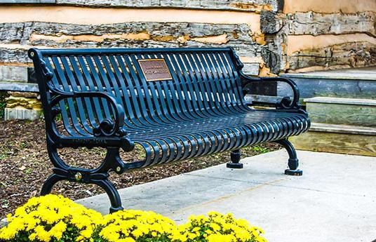
Source: Keystone Ridge Designs
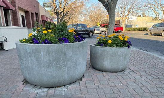
Source: Turlock Journal
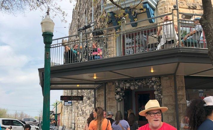
Source: Design Workshop
Painted metal benches and trash receptacles offer a timeless look while being easy to maintain.
Above-ground planters provide a vertical element in the street, an opportunity for green and a barrier to traffic.
Acorn lights fit with Georgetown’s heritage and fit well in the Downtown overlay district.
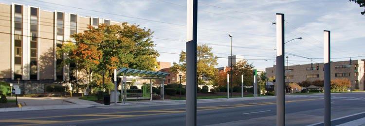
Source: Forms + Surfaces
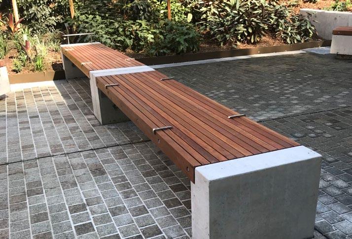
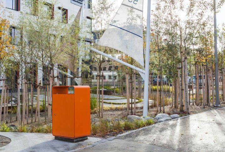
The location and theme of the particular Special Focus Area should dictate the speciifc style of furnishings in that area, but generally a more modern design approach may be a desirable contrast to the more classical materials pallete found in Downtown.
Source: Design Workshop
Source: Newcastle Street Furniture
Source: Vestre
Street Furniture, Lighting and Art Strategy
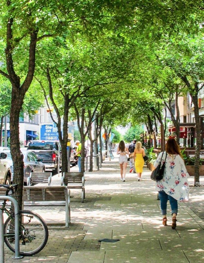
Appropriate application of street trees create a more inviting pedestrian environment and help to support an active Downtown overlay district.
Source: Great Streets Development Program, City of Austin Housing & Planning
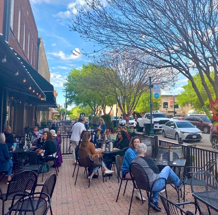
Required transition zones ensure adequate space for comfortable pedestrian movement and social spaces.
Source: Design Workshop
Distinct paving creates visual cues for different public space zones, including walkways, travel, and transition uses.
Source: City of Georgetown
EVENTS + PROGRAMMING
Cultivating an Active Downtown
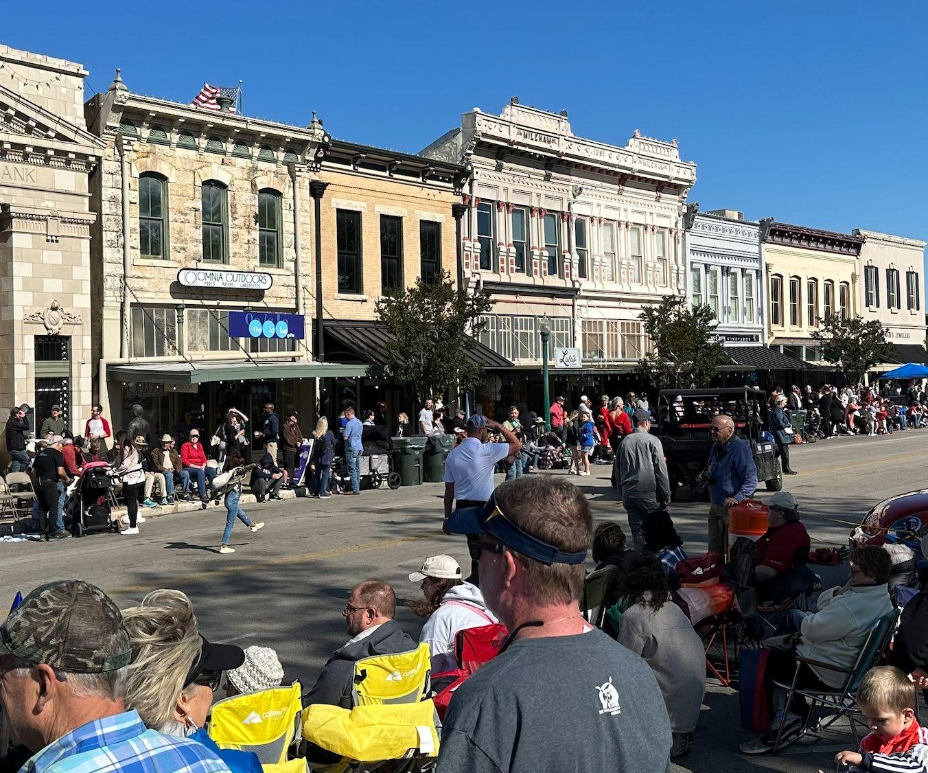
One of the cornerstones of the City of Georgetown are the many annual events held at the Historic Square and surrounding areas of Downtown that help to enrich the Downtown experience. From the Second Saturday Market Days and the Red Poppy Festival, to the Christmas Stroll, a robust annual schedule of events elevates the local morale, maintains community character, and reinforces the values that Georgetown residents hold dear. With the growth of Georgetown and the region comes the need to update the City’s approach to events to ensure the City has the future capacity to accommodate these successfully.
Part of being able to adequately accommodate annual events involves proper expenditure and allocation of City resources. In some cases, engaging the private sector to collaborate on events or enlisting the help of additional resources may be necessary. Improving the system by which events and gatherings are planned for, organized, and ultimately implemented will only serve to contribute to the on-going success of Downtown Georgetown.
Goals & Recommendations
Events + Programming Goal 1
Strengthen and expand the City’s capacity to manage maintenance and operations within the Downtown Overlay District.
1.1 - Consider expanding City maintenance staff to manage and serve larger annual events Downtown, either on an annual or semi-annual basis.
1.2 - Hire a dedicated, full-time Downtown Operations Manager whose responsibilities involve managing both the day-to-day and long-term operations of Downtown to increase efficiency and elevate its growth.
1.3 - Consider supplementing police presence Downtown with additional security for public spaces like garages, parks, public spaces, etc.
Events + Programming Goal 2
Continue regular investment in annual events within the Downtown Overlay District that elevate the City’s brand, highlight culture and diversity, and support local businesses.
2.1 - Continue collaboration with programs like the Downtown Georgetown Association (DGA) on supporting events in Downtown Georgetown.
2.2 - As Georgetown grows and evolves, investigate new methods and opportunities for supporting existing events, including potential collaboration with Southwestern University, the Sun City Texas Community Association, and/ or Georgetown Cultural District organizations.
2.3 - Conduct a feasibility study on potential new partners to fund, help organize and facilitate Downtown public events.
2.4 - Leverage the improved Historic Square and street enhancements proposed in this plan (9th St. and Rock St.), along with the Light and Water Works District, to host existing events in these new venues.
2.5 - Work with the historic TRG Neighborhood Association to increase existing events and programming at the Shotgun House and other public spaces in Downtown.
Events + Programming Goal 3
Improve waste collection and disposal services in the Downtown Overlay District, especially centered around public events.
3.1 - Consider establishing a Public Improvement District (PID) within the Downtown Overlay District to fund waste collection services.
3.2 - Consider the development of a concierge waste removal service for the Nine Block Square for improved waste management Downtown.
TRANSPORTATION, PARKING + PEDESTRIAN ACCESS
Facilitating Connection and Access
Ensuring visitors and residents of Downtown Georgetown are able to access the Downtown Overlay District and its diverse facilities and amenities is critical to a curated Downtown experience able to be enjoyed by all. Due to varied right-of-way widths and development patterns, many streets within downtown lack adequate space for pedestrian movement, street tree planting, and pedestrian amenities. By promoting these local streets to be more pedestrian-friendly and accessible, the City can realize a more active and dynamic community.
The long-term success of the Downtown Overlay District is predicated on, in part, adequate provision of vehicle parking, both on and off-street. While available parking in Downtown Georgetown serves current needs, desired future growth will require additional parking supply to maintain the viability of downtown businesses and support new residential development. Given the growth trajectory of Downtown Georgetown, providing additional centralized parking improvements will help promote right-sized growth, and accommodate parking needs now and into the future.
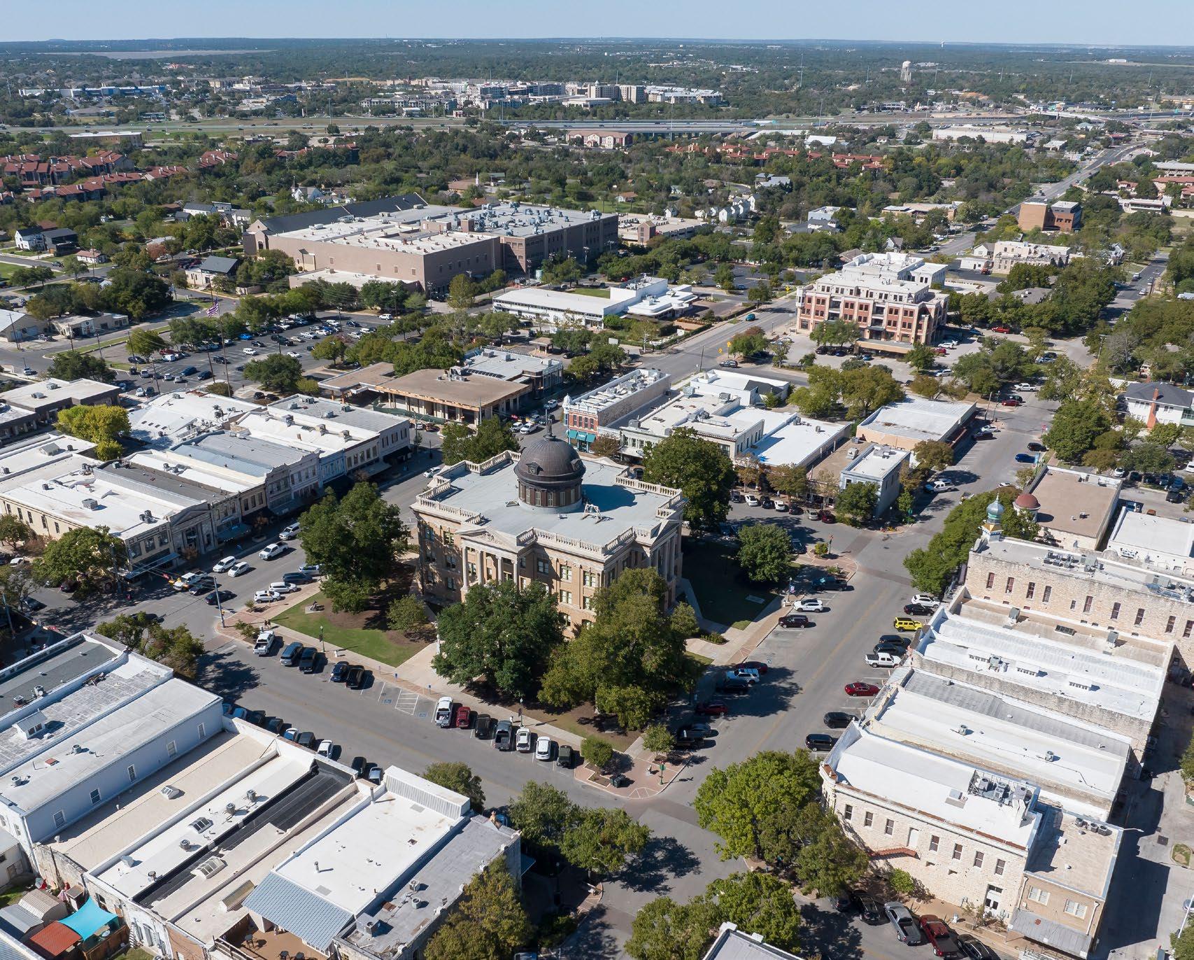
Priority Projects
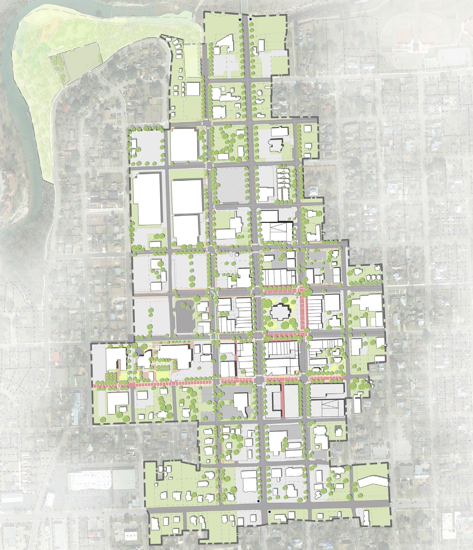
Traffic Signal
Traffic Signal
Figure
TRANSPORTATION, PARKING + PEDESTRIAN ACCESS
Goals & Recommendations
Transportation, Parking + Pedestrian Access Goal 1
Elevate Downtown Georgetown by enhancing the pedestrian experience of Austin Ave.
1.1 - Ensure the proposed improvements to Austin Avenue align with the current Austin Avenue Corridor Study, the Austin Avenue pedestrian bridge study and vehicular bridge rehabilitation projects.
1.2 - Consider a study to implement traffic lights at the intersections of Austin Ave. with 6th Street and 9th to enhance pedestrian safety for those crossing Austin Ave.
1.3 - Explore a realignment and reprogramming of Rock St. if the adjacent County properties vacate and become potentially developable in the future. (For more on this, see the Open Space, Parks + Connectivity recommendations section).
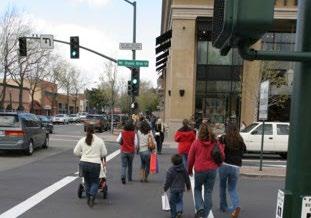
Source: pedsafe.com
Transportation, Parking + Pedestrian Access Goal 2
Improve the pedestrian experience and visual quality of University Ave. between Scenic Dr. and Ash Street.
2.1 - Study existing signalized intersections of Main St., Austin Ave., and Scenic Dr. to ensure pedestrian crossing and connectivity is optimized and prioritized, and improved where necessary.
2.2 - Plant street trees where feasible along University Ave.
2.3 - Widen and, where feasible, realign sidewalks away from University Ave. in order to create a safe walking zone and better pedestrian experience.
2.4 - Consider the application of enhanced lighting, bollards and other street elements to increase pedestrian safety.
2.5 - Consider studying existing driveways to improve access management along the corridor.
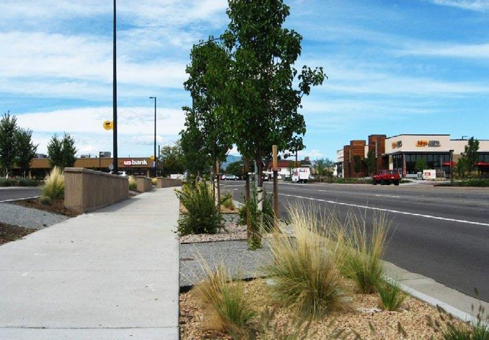
Transportation, Parking + Pedestrian Access Goal 3
Provide adequate public parking in and around the Downtown Overlay District as infill development occurs, while balancing the goals of an urban built environment.
3.1 - Consider future discussions with property owners to allow shared-use parking in private parking lots located in strategic locations for weekday use within the Downtown Overlay District.
3.2 - Enhance Georgetown’s wayfinding to clearly indicate where parking is located – including dynamic signage at structured parking facilities.
3.3 - Develop a plan for the future expansion of structured parking facilities in Downtown Georgetown, including identification of development triggers that would warrant additional investment.
3.4 - Consider utilizing residential parking permits on the selected streets on the periphery of the Downtown overlay district.
3.5 - Consider implementing a parking district in Downtown to ensure adequate parking is provided for the residents and visitors of Downtown and that future parking improvements can be adequately funded.
3.6 - Outside of Area 1, update the parking requirements for retail/ restaurant uses to reflect the policy of no parking requirements in cases where there is public or shared parking supply within two blocks of the proposed development.
3.7 - Study a fee-in-lieu scenario within Area 2.
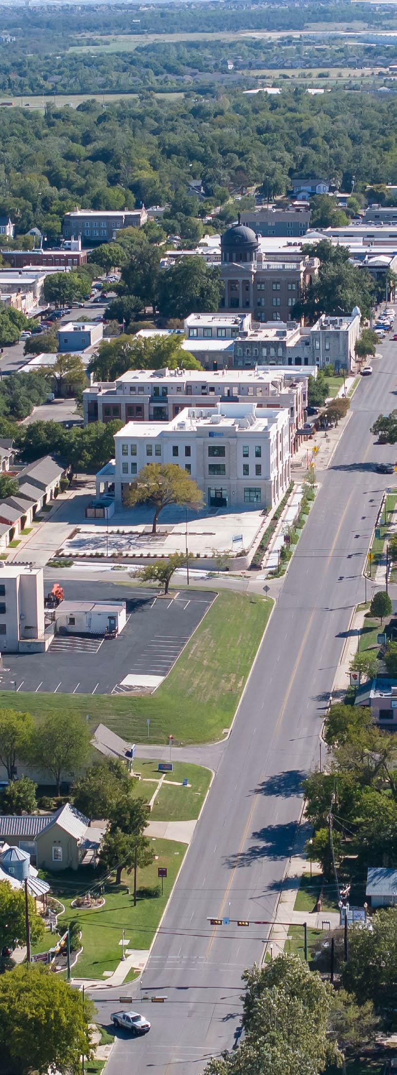
TRANSPORTATION, PARKING + PEDESTRIAN ACCESS
Goals & Recommendations
Transportation, Parking + Pedestrian Access Goal 4
Improve alternative transportation access to and through Downtown Georgetown
4.1 - Consider exploring a shuttle system moving users into and around the Historic District Overlay.
4.2 - Explore public transportation options for moving people to and from the south and eastern portions of Downtown and Blue Hole Park.
4.3 - Facilitate the expansion and continued funding and support for transportation services serving the Historic District Overlay, especially services targeting accessibilitychallenged groups, such as GoGeo and Faith in Action Georgetown.
4.4 - Consider providing additional accommodations/incentives for ridesharing services for use within the Historic District Overlay.
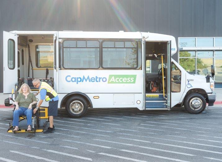
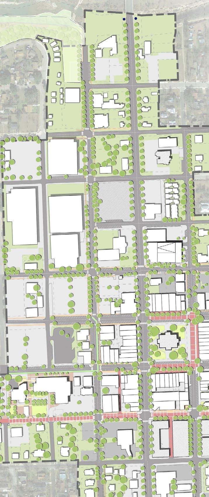
Exploring public transportation options from Blue Hole Park to Downtown will facilitate a healthy, active Downtown and decrease parking needs.
A shuttle system can be a way to move people around in an ecologically-friendly manner and increase access to and through Downtown Georgetown.
Blue Hole Park
Light & Water Works District
Figure 4.16 - Proposed Public Transportation
Source: Cap Metro Austin
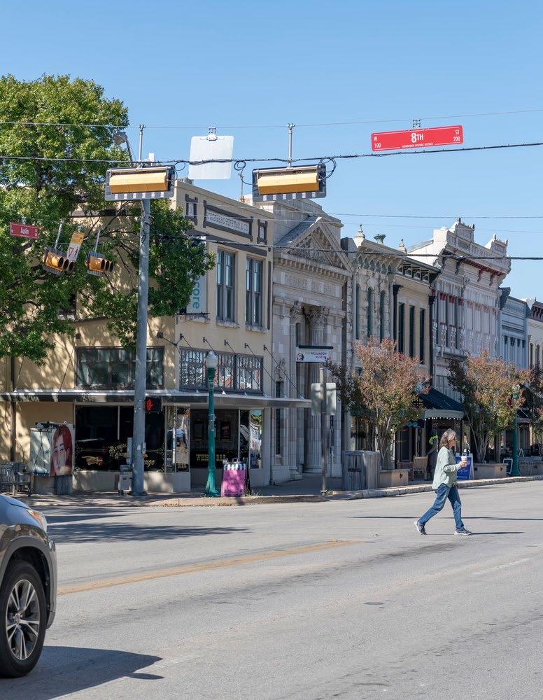
HISTORIC + CULTURAL ASSETS
Rich Community History
Being the County seat of Williamson County, Downtown Georgetown has served as a gathering place and home to generations of settlers and citizens of Texas and beyond. History and western heritage are the origins of, and continue to be the cornerstones of this successful community. Ensuring this history and character are preserved while also allowing appropriately-sized growth is a core tenet of this Downtown Master Plan, and arguably one of the City’s greatest challenges and opportunities for the future.
Aside from the Nine-Block Square, the area around downtown contains excellent social and cultural assets. Southwestern University is located approximately one-third mile east of Downtown, and many of the students, faculty and staff live in or near Downtown and frequent the local shops, cafes, and restaurants. The Old Town Neighborhood, which contains some of the oldest homes in Georgetown, lies adjacent to the south and eastern side of the Downtown Overlay District. Flanked to the west is the historic TRG Neighborhood, a culturally diverse community that plays a significant part in the unique character of Downtown. Finally, a historic cemetery with colonial roots, sits near Blue Hole Park – an homage to the generations of Texan’s who called this place home.
Today, Downtown Georgetown has an impressive number of surviving historic buildings and features that residents place great value in. Devising a plan to preserve and reinforce this history is a core goal of this plan and an important step in ensuring the Downtown Overlay District perseveres into the future. While the City has taken steps to ensure preservation, such as the recently adopted Historic District Design Guidelines and the Historic Resource Survey, additional recommendations are needed to help ensure the history and heritage that Georgetown holds dear persists while the community and regional advances into the future.
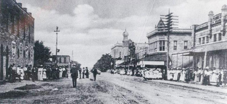
Source:
Downtown Georgetown circa the early 20th century.
HISTORIC + CULTURAL ASSETS
Goals & Recommendations
Historic + Cultural Asset Goal 1
Build upon existing historic sites within the Downtown Overlay District to strengthen local heritage and appreciation of local history.
1.1 - Continue planning/ implementing public art on the west side of the Downtown Overlay District to reflect on and tell the story of the Historic TRG Neighborhood.
1.2 - Coordination with the TRG Neighborhood to implement a cultural heritage trail to provide residents with an easy-to-follow path connecting neighborhood landmarks.
1.3 - In coordination with the Wayfinding Master Plan study, implement storytelling through interpretative signage at strategic locations around the Downtown overlay district (Founder’s Park, Chisholm Trail, the historic cemetery at Blue Hole Park and the Austin Avenue Bridges as potential locations).
1.4 - Develop an interpretive installation that reflects important historical moments, people, buildings, and events that helped shape the Downtown Overlay District.
1.5 - Enhance the historic cemetery at Blue Hole Park with landscaping, perimeter control, and historic interpretive signage.
Expanding art around Downtown, namely in collaboration with the TRG Neighborhood, would highlight and benefit Georgetown’s diversity.
Source: City of Georgetown
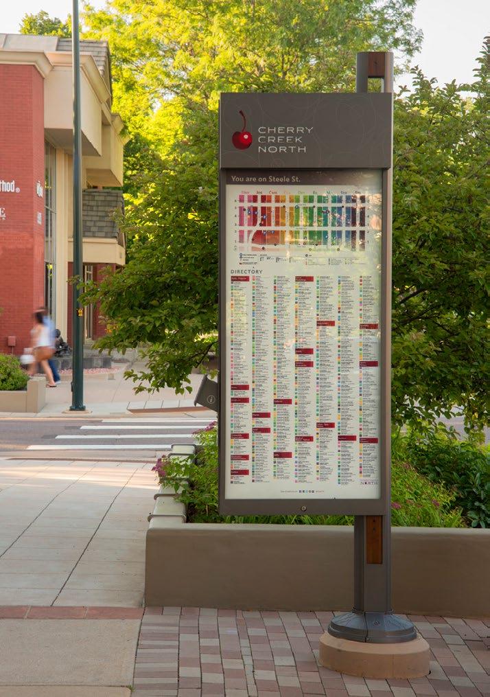
Source: Design Workshop
Interpretative signage highlighting historical features and other Downtown amenities would benefit the image and experience of Downtown.
HISTORIC + CULTURAL ASSETS
Goals & Recommendations
Historic + Cultural Asset Goal 2
Consider future strategic leveraging of publicly-owned historic structures within the Downtown Overlay District.
2.1 - Consider partnering with Williamson County to reuse and/ or rehabilitate County-owned properties within the Downtown Overlay District.
2.2 - Consider a feasibility study on the potential reuse of the Georgetown Light and Waterworks building as a destination use that activates and complements the Light and Water Works District and other surrounding spaces.
Historic + Cultural Asset Goal 3
Continue to Expand the Art Program Downtown
3.1 - Continue collaboration with the City of Georgetown Arts & Culture Board for opportunities to expand public art.
3.2 - Continue leveraging the Georgetown Commercial Mural Guidelines to seek artistic opportunities as new development/ in-fill development occurs.
3.3 - Look for opportunities to expand art related facilities, such as the Georgetown Arts Center.
3.4 - Partner with the adjacent neighborhood organizations (TRG, Old Town, etc.) to collaborate on Downtown art that is focused on acknowledging the history, diversity and richness of these neighborhoods.
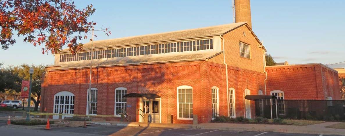
The Light & Waterworks Building presents an opportunity for synergy with the new Light & Water Works District. Source: City of Georgetown
SELECT HISTORIC + CULTURAL ASSETS
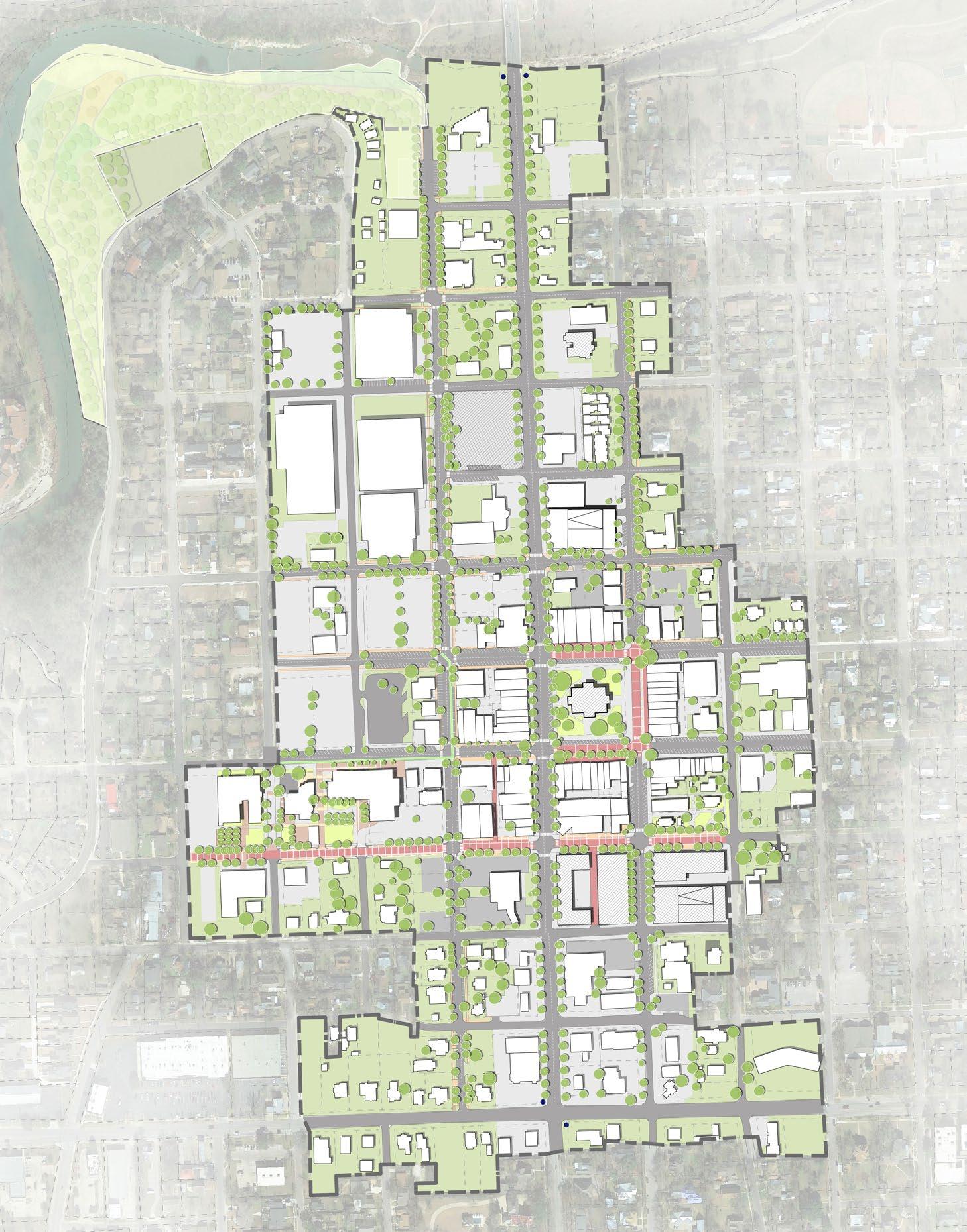
Old Williamson County Jail
County Museum
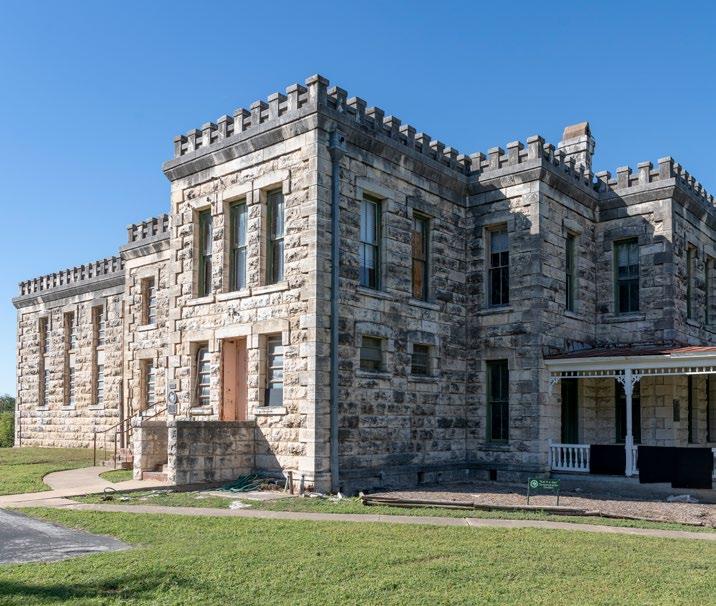
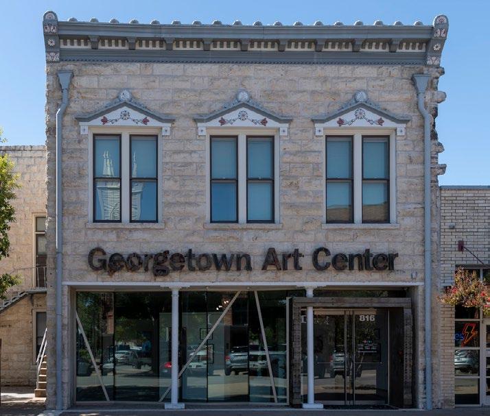
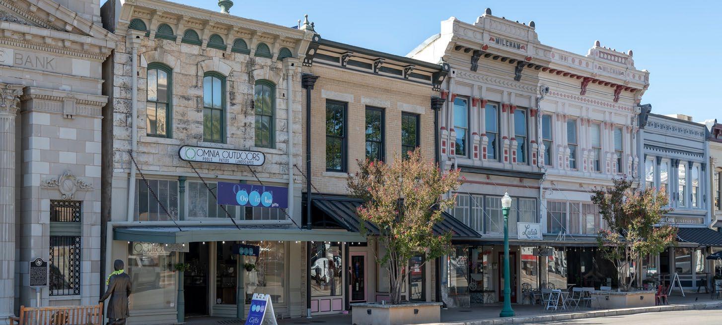
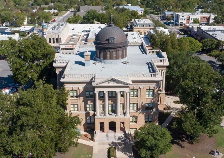
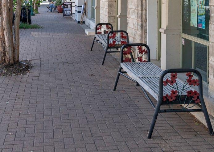
Source: All images from Design Workshop
Georgetown Historic Jail
Georgetown Art Center
Historic County Courthouse
Art- oriented public amenities.
Classic historic street frontage on the Historic Square along Austin Ave.
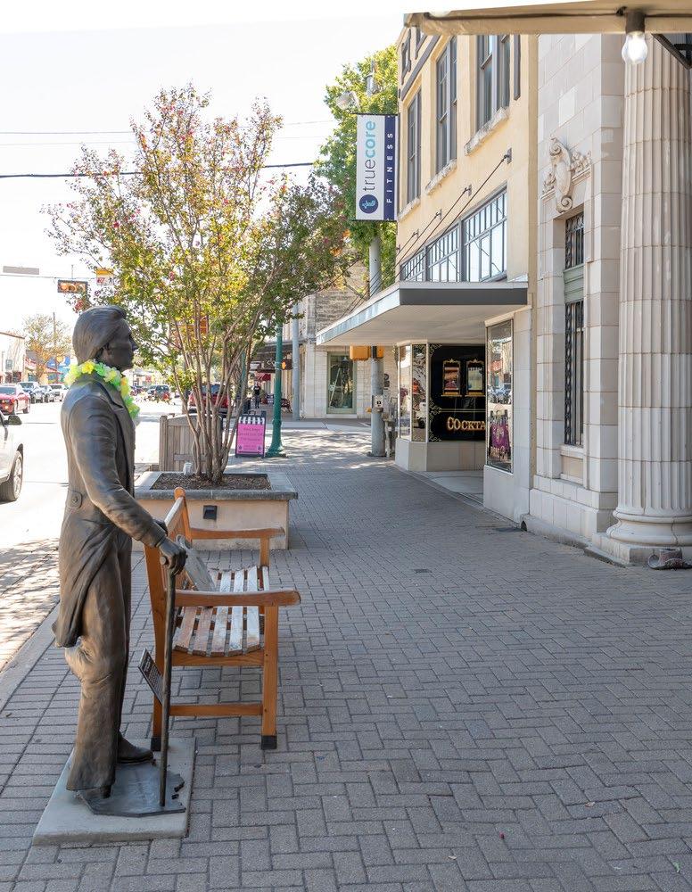
GEORGETOWN DOWNTOWN MASTER PLAN
CHAPTER FIVE
ACTION PLAN
In order to begin implementing the recommendations established in this plan, it is critical to pursue funding in creative ways. A combination of public and private funding sources are available and should be pursed to ensure actions are taken and the momentum of this plan is maintained. Many of the aforementioned goals required diverse City departments working in tandem to accomplish the goals of this plan.
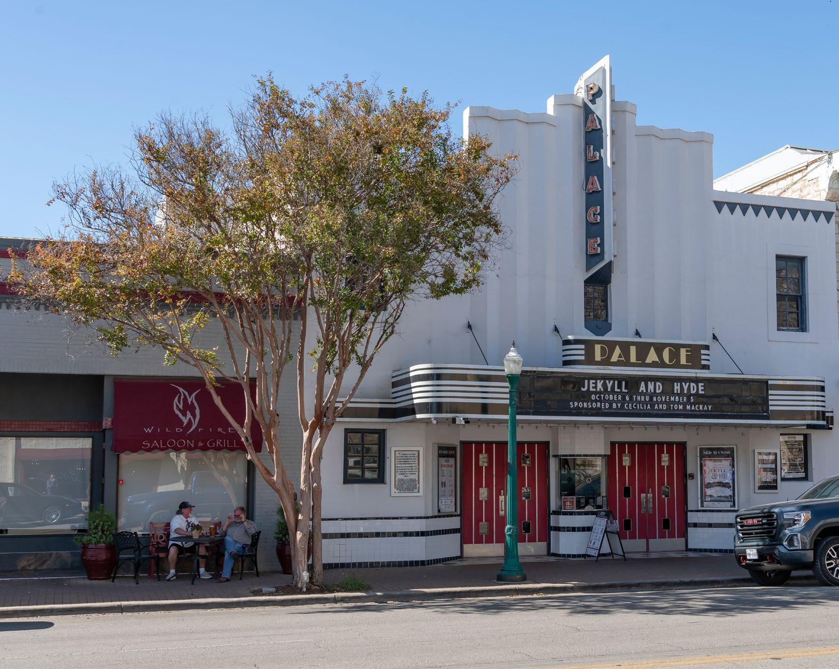
ACTION PLAN
From Planning to Action
The community of Georgetown has outlined a clear vision for the future of its downtown and this action plan provides a set of actionable steps to create real growth and measurable outcomes in Downtown Georgetown. In order to affect meaningful change, a plan of action must be established that clearly outlines recommendations, priorities, time lines and funding sources.
A key step to aid the City in accomplishing the goals of this plan are to take a two fold approach: focusing on both near-term, more easily attainable goals, and longer-term goals for the future that require more logistics to accomplish. Many of the recommendations in this document rely on ordered coordination between multiple municipal entities to plan and execute. So that the momentum this plan has generated is maximized to the fullest, sequential action should begin immediately and should act as an initial catalyst for more complex recommendations and projects later one.
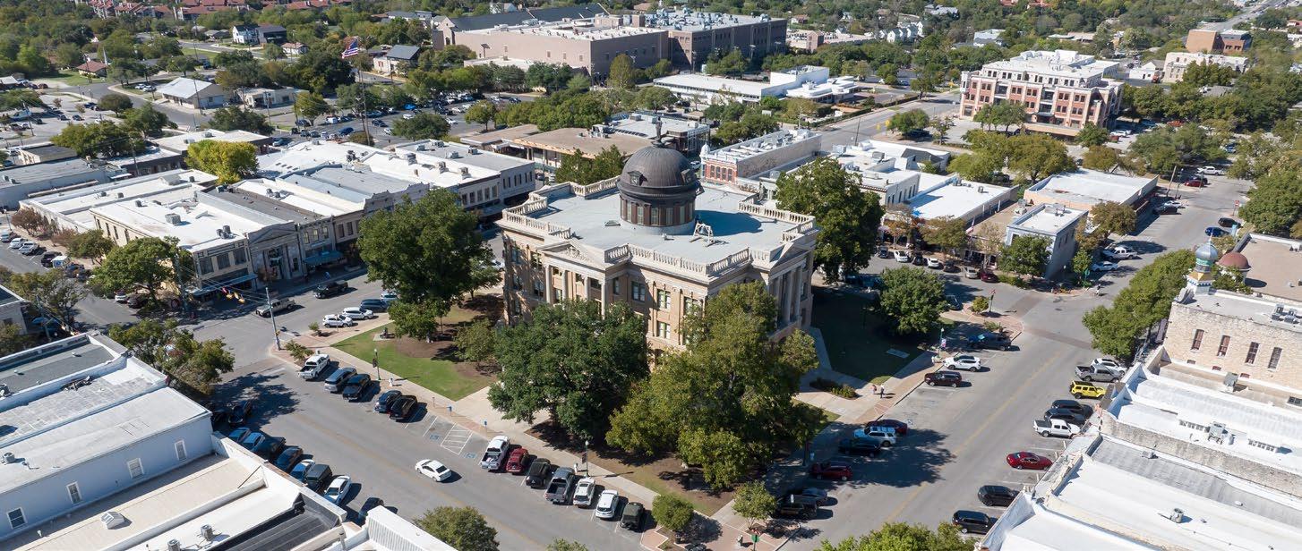
Improvements associated with the Courthouse Square can serve as a catalyst for other changes throughout the Downtown overlay district.
Public Realm Activation
Historic Square Enhancements
Being the most high-profile and visible recommendation areas in Downtown Georgetown, improvements made to the Historic Square have the potential to generate excitement and support for other recommendations made in the plan.
Downtown Gateways
The current work of redesigning the gateway signage elements in the Wayfinding Master Plan mean that synergy in redesigning the gateways areas of Downtown is possible, and can act as a catalyst for other pedestrian-realm enhancements in Downtown.
9th Street Art Walk
Downtown Georgetown’s vibrant arts scene can be enlivened, leveraged and potentially provide funded for this key public realm improvement that extends the “feel” of the Historic Square outward.
Open Space + Parks + Connectivity
Blue Hole Park Master Plan
Improvements to Blue Hole Park will benefit the whole of Downtown Georgetown, and will help the City grow into the future by providing residents of Downtown and the surrounding area with a high-quality recreational experience. An updated master plan for this key park should be considered a “day one” implementation item to come from this plan.
Rock Street Promenade
Many of the Rock Street improvements described in this document hinges on the future of the Williamson County Justice Center, making this a longer term but crucial goal in the Downtown Master Plan in creating a beautiful recreational gateway into the Downtown Overlay District.
Bike & Pedestrian Connections
Improving streets, adjacent sidewalks and bicycle facilities are relatively simple implementation steps to make with regard to achievable projects with the least amount of complex funding involved.
Priority Projects
Out of all the recommendations made in this plan, several have emerged as priories from an implementation standpoint. These main projects serve to drive momentum and forward progress in this plan, and have a catalytic effect in their implementation. Its important to note that these priority projects are on different timelines, based on complexity.
PRIORITY PROJECTS
SanGabrielRiver
Gateways (South Austin Ave., North Austin Ave.)
The north and south gateways along Austin Ave. are improved in order to create a welcoming and grand entrance into the Downtown District that is fitting of Downtown Georgetown.
Blue Hole Park Enhancements
Presently, Blue Hole Park is heavily used by visitors and residents of Downtown Georgetown. Improvements to Blue Hole Park must coincide with the enhancements in the Downtown District.
Rock Street Promenade
Through the possibility of the Justice Center site being vacated in the future, this potential redevelopment makes possible enhancing Rock Street into a strong pedestrian promenade that connects City Center and the municipal complex to Blue Hole Park.
Bike and Pedestrian Connections
Main and Rock St. are designated as being primary bike connections to and through Downtown, and connect residents and developed areas to the excellent parks and natural resources adjacent to and around the Downtown District.
Historic Square Enhancements
The existing right-of-way within the historic square was reallocated in order to accommodate a larger pedestrian dedicated space. In doing so, street trees, elevated material and furnishings, and exterior space for dining was made possible.
9th Street Art Walk
The County Tax Office site and Red Poppy Lot are envisioned to redevelop into mixeduse facilities that are appropriate to the community. Through this catalytic change, 9th street is improved as an art-themed, pedestrian-oriented street which connects the Georgetown Arts Center to City Center and the municipal complex.
Catalyst Sites
The S. Main Street Parking Lot, Williamson County Tax Office, the Historic County Jail, the Austin Ave. Parking Lot and the Justice Center site serve as potential redevelopment sites in the future, and act as the catalytic for transformative change in the Downtown District.
ACTION PLAN
Funding Sources
In order to accomplish the recommendations as established in this plan, funding should be diversified and, at times, creatively sought. The following are different types and sources of funding that may be strategically pursued to accomplish the goals of the Downtown Master Plan. The potential funding sources listed here include both from the public and private sector - while these should be explored, this is not an exhaustive list and other funding sources should be considered when pursuing the recommendations established in this plan.
Public Funding
Public funds include any monies that come from the public treasury, and are primarily tax-payer funded through taxes or bonds.
General Obligation Debt
General Obligation Debt is the primary source for major capital projects within the City and are usually intended to fund projects that would benefit the community at-large. These types of projects are typically found in the right-of-way or publics lands, including street/road projects, parks, gateways and/or wayfinding. They can also be utilized in tandem with other privately funded projects or to supplement other sources of funding.
Downtown Tax Increment Redevelopment Zone (TIRZ)
Presently, Downtown Georgetown has a TIRZ in place with the purpose of funding public improvements primarily related to development and redevelopment of a mixed-use, pedestrian oriented environment that is in keeping with the vision of the Downtown Master Plan. Any prospective projects seeking TIRZ funding must be approved by the Downtown Georgetown TIRZ Board who facilities and manages the TIRZ.
Hotel Occupany Tax (HOT) Funding
Hotel Occupancy Tax is collected within Georgetown from visitors staying at hotels and short-term rentals within the City limits. Texas
law allows HOT to be utilized for arts, historic and promotional purposes that attract visitors to Georgetown to stay in local hotels and short-term rentals.
Georgetown Transportation Enhancement Corporation (GTEC)
As the City’s Type B Economic Development Corporation, GTEC is an available funding source to support transportation-related improvements throughout the City that support the expansion of economic activity.
Municipal Management District (MMD)
Although not used previously in Georgetown, a MMD would be a viable option for Downtown Georgetown in the future as they provide a broader array of options than a PID and provide greater say in decisions to property owners. Commercial property owners create management districts to enhance a defined business area by financing facilities, infrastructure, and services beyond those provided by the local municipality, county, or state. Public improvement projects and services may be paid for by a combination of self-imposed property taxes, special assessments, or impact fees upon those properties that benefit from the improvements and services.
Georgetown Main Street Program
The main goal of this program to Downtown Georgetown is to enhance the vibrancy and historic preservation of Downtown by implementing guidelines established by the National Main Street Center’s Four Point Approach, mainly within the area of revitalization. Qualified projects under this program typically have a focus on the physical elements of downtown such as storefronts, signs, landscaping, and public spaces; targets infrastructure and building improvements that lay the groundwork for a physical transformation that will be both functional and attractive.
Any public-facing projects that contribute to the character or heritage of Downtown would be good candidates for this type of funding. The Main Street
Facade & Sign Grants are for private businesses only, and not able to fund public projects.
Parks Bond
In 2023, Proposition B, part of the 2023 Georgetown Bond Election, passed which allocated funds for a renovation/expansion of the Georgetown Recreational Center on Austin Ave. Future Park Bonds should be tracked for funding of various park and green space-related recommendations as part of this document.
Texas Commission on the Arts Cultural District Project Grants (TCA)
This type of funding targets projects that stimulate investment into the community, namely those that use the arts to diversify local economies, generate revenue and attract visitors. This program focuses on projects that are aimed at significant cultural tourism through arts programming, aesthetic improvements to the cultural district, signage/ wayingfinding, promotion of the district and organizational support for the management of the district.
City Operating Budget
A significant portion of a municipal budget includes compensation for public servants and employees of the City. Additionally, as part of the overall capital budget, the operating budget accounts of personal costs and operations/ maintenance cost for its facilities. Any staff or personnel related expenditures would fall within the operating budget for funding.
Public Improvement District (PID)
Public Improvement Districts (PID) are special taxing entities created to fund certain property improvements that could not otherwise be constructed or provided and be paid by those who most benefit from them. Georgetown currently has three active PID’s in Georgetown Village PID, Cimarron Hills PID and Parks at West Haven PID. A centralized PID may be sought to fund certain improvements Downtown.
Private Funding
Privately funded projects can constitute any funding source that is not derived from public tax dollars.
Public-Private Partnerships (PPP)
A public-private partnership is a collaboration between private and public investment for the betterment of a community development, amenity or asset. This type of funding vehicle is becoming more used in the modern day. This contractual relationship usually involves private capital initially funding a project, with long term revenue coming from taxpayers or users in the long-term life of the contract.
Local Sponsorship
Certain businesses or private entities may opt to fund a Downtown improvement project for the betterment of the community or if it benefits their interest. Local sponsors may be established businesses or corporations in the area, and/or those with a vested interest in the continued success of Downtown Georgetown.
Tax Credits
Tax credits function to provide tax relief for a specified period of time for either the taxpayer or government entity. These can be used to encourage private investment by helping offset developer costs in funding a project.
Private Funds
Private funding, either from an individual or company, can fund either a project in its entirety or in park.
ACTION PLAN
MAIN PRIORITY PROJECTS
PROJECT 1 Historic Square Enhancements X
PROJECT 2 Downtown Gateways (North & South) X
PROJECT 3 9th Street Art Walk X
PROJECT 4 Blue Hole Park Master Plan X
PROJECT 5 Rock Street Promenade X
PROJECT 6 Bike & Pedestrian Connections X
PROJECT 7 Catalytic Sites X X X
PROJECT 8 Downtown Parking Garage (second) X
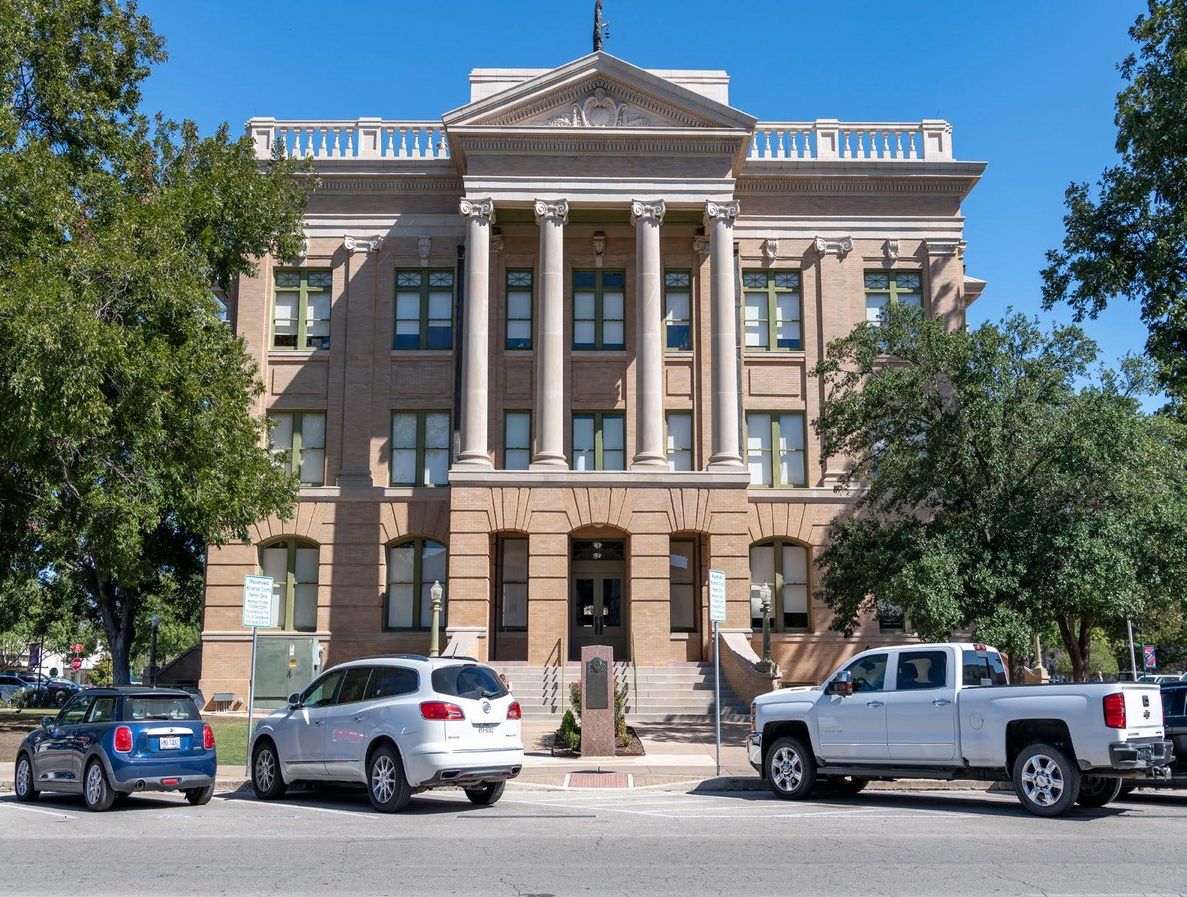
1 Enhance the pedestrian experience and activation on the Square. 1.1
Reduce vehicle lane widths and remove parking from the outside perimeter of the Square (on 7th, Main and 8th St .) to allow for expansion of sidewalks and the overall pedestrian realm Reference the Austin Ave Corridor Study for lane width guidance
1.2
1.5
Reorient vehicle direction to one-way (2 lanes traveling clock-wise) from 7th Street to Main Street to 8th Street
Utilize upgraded paving materials and furnishings to enhance the user experience that also allows for minimal maintenance needs
Introduce a nuanced lighting scheme that creates an attractive pedestrian environment, promotes safety, and contributes to the activity and vitality of the Historic Square
Encourage café/dining space and outdoor vending areas to activate the Historic Square and support businesses
1.6
1.7
Provide street trees for pedestrian comfort and a reduction in ambient street-level temperatures in the summer months
Reduce the amount of in-ground planting within the Square and provide seasonal planting in raised planters or planter pots that minimize water and maintenance needs
1.8
1.9
Study the potential removal of the additional vertical step(s) around outer sidewalks surrounding the Historic Square to improve pedestrian access, promote accessible design and facilitate positive drainage Where feasible, preserve and reuse historic limestone curbing
Provide adequate and conveniently placed bike parking areas around the Square to promote alternative transportation and less reliance on vehicle travel
1.10
GOAL 2
Reference the Austin Avenue Corridor Study for recommendations specific to the Austin Avenue Downtown Corridor
Foster a street experience that links public space to civic buildings and private businesses to promote pedestrian activity and interaction.
2.1
Generally, require new infill along key streets (see Figure 4 2) to have active ground floor uses where appropriate Consider on a case-by-case basis, with special sensitivity when in proximity to existing residential areas
2.2
2.3
Where right-of-way is less than 70’, establish appropriate building setbacks for redeveloping properties along key streets (Rock and 9th St , reference Public Realm Activation Goal 3 and Open Space, Parks + Connectivity Goal 2 for additional detail) to allow for expansion of walkable pedestrian space
Explore the opportunity to bury overhead power lines with potential future infrastructure improvements along the University Ave corridor to enhance the public realm experience
3.1
3
Reimagine 9th Street as an Art Walk connecting the Nine-Block Square and the Light and Water Works District across Austin Avenue, to extend the aesthetic and vibrancy of the Historic Square outward to other portions of the Downtown Overlay District.
Enhance the pedestrian street experience with trees, lighting, seating, bollards and convenient bike parking along the 9th Street corridor
3.2
3.3
3.4
Implement art installations along the 9th St corridor in order to promote local art and build community pride
Utilize viable existing building faces for mural art opportunities
Utilize elevated materials and furnishings to create a distinct sense of place
3.5
3.6
Consider the design of a curb-less street to allow the corridor to be comfortably used for events and elevate the pedestrian character of the street
Implement a traffic signal at the intersection of Austin Avenue and 9th Street to promote pedestrian connectivity from Light and Water Works District to the existing Georgetown Arts Center
4
4.1
4.2
4.3
Arts and Culture Board Grant
Private Funds (Local Artists) HOT MMD
Future Bond Election GTEC
Private Funds (with new development) Engineering/ Transportation
Enhance gateways leading into the Downtown Overlay District that are consistent with the Georgetown brand and promote an impressive and safe entry experience for both pedestrians and vehicle operators, in coordination with the Wayfinding Master Plan.
Provide an enhanced major gateway along Austin Ave at University Ave that builds on the success of the recently installed streetscape on the west side of Austin Ave through the expanded use of pavers, elevated materiality, and monument signage (see Figure 4 . 3) .
Provide an enhanced major gateway along Austin Ave south of the San Gabriel River
Seek to relocate, bury or improve existing above-ground infrastructure to create a visually appealing entry into Downtown
Future Bond Election
Downtown TIRZ MMD
GOAL 5
5.1
Maximize the potential of activating select alleyways within the Downtown Overlay District.
Elevate the form and function of existing alleyways to enhance the service to adjacent buildings and businesses, such as the one running between Austin Ave and Main St located between 6th St . and 7th St , and the one running between 7th and 8th St between Main St and Church St (see Figure 4 4)
5.2
5.3
5.4
Enhance Tin Barn Alley with mural art, lighting, and seating to create infill amenity space
Consider future opportunities to improve the function and elevate the aesthetics/creative use of existing alleyways around the Downtown Overlay District
Update current Design Guidelines to require that larger-scale redevelopment projects (onehalf block or larger) to incorporate pedestrian pass-throughs or paseos to increase access to activated public realm
1.1
1.2
Leverage underutilized publicly-owned sites to encourage infill development appropriate in scale and character to Downtown Georgetown.
Explore public/private venture opportunities and partnerships to encourage appropriately-scaled growth Downtown
Partner with Williamson County to pursue redevelopment of the Williamson County Tax Office site (Block 2)
Consider future redevelopment of the City-owned Red Poppy (Block 1 - via a publically solicited RFP/Q) and Daisy (Block 23) parking lots to include a mix of uses, potentially including Cityowned parking structure(s)
1.4
2.3
Explore potential future redevelopment opportunities of the Red Poppy Lot and the Justice Center site (including adjacent County properties) if Williamson County vacates land Downtown
2.4
Establish a maximum building height not to exceed the height of the bottom of the balustrade of the County Courthouse (see Figure 4 .6)
Establish a maximum allowable height for all new development within the Downtown Overlay District, in an effort to preserve certain existing view corridors and Downtown character as outlined in the UDC (see Table 4 1 and Figure 4 7)
Update the UDC to remove the administrative variance allowing a 10% increase in maximum building height within the Downtown Overlay District
Update the UDC to remove the existing B2 Courthouse View Corridor located along North Austin Ave and South of the Courthouse within the Downtown Overlay District
3
Consider updates to the UDC that ensure allowable land uses are consistent with the desired character of Downtown.
To ensure compatibility between residential uses and potential redevelopment, amend the UDC so any live music and/or entertainment venue is minimum 100’ set back from any residential use
Amend the allowed/restricted uses in MU-DT district to restrict certain uses such as payday loans, pawn shops, tattoo parlors, smoke shops, drivethrough restaurants and laundromats within the Downtown Overlay District
Create a set of approval criteria for requests to expand the Downtown Overlay District in the UDC to accomidate the future expansion of Downtown
Commission
Consider exploring options to preserve the area in and around the cemetery and the former Marshall-Carver High School as a cultural heritage site
2 Reimagine Rock Street as a mixed-mode promenade connecting Blue Hole Park to Downtown Georgetown and the County/Municipal Complex. 2.1
If the County vacates or redevelops its properties at and surrounding the Justice Center, consider acquisition of additional ROW on the west side of Rock Street from 2nd Street to 7th Street to allow for the expansion of the pedestrian environment and the creation of a promenade that connects to Blue Hole Park
3.1
4.1
Enhance access to quality parkland for visitors/residents of the Historic Downtown Overlay.
Encourage the incorporation of pocket parks, paseos and other types of publicly-accessible open spaces into the redevelopment of publiclyowned properties
4 Enhance bike and pedestrian facilities connecting to and through the Historic District Overlay.
Improve pedestrian connections into Downtown that are consistent with the Sidewalk Master Plan (2024) (wherever possible connecting disjointed segments of sidewalk and prioritizing sidewalks on both sides of the street), including 7th St west of Austin to the TRG Neighborhood, along Austin Ave north of 7th St and south of 9th St , 4th St between Church St and West St
4.2
4.3
4.4
4.5
Integrate bike facilities on 8th Street from Chautauqua Park to Rock St
Integrate raised, off-street bike facilities as part of the Rock St Improvements extending from 8th St to Blue Hole Park
Integrate bike facilities on Main Street extending from 6th St to connect to the San Gabriel Trail
Integrate bike facilities on 6th St from Rock St
4.6
4.7
Implement traffic calming measures and pedestrian crossing improvements at the intersection of Scenic Dr and 8th St to ensure safe cyclist and pedestrian crossing
Establish enhanced pedestrian/ bike crossings at 7th and Rock, 6th and Rock, and 6th and Main so as to promote safe pedestrian connectivity within the Downtown Overlay District .
4.8
4.9
Locate and establish bike corrals at enhanced pedestrian/bike crossing locations to facilitate bicycle use and decrease the use of vehicles in the Downtown Overlay District
Integrate a hierarchy of sidewalk and crosswalk design within the Downtown streetscape (see Figure 4 12) to ensure connectivity and visual cohesion
GOAL 5
5.1
Ensure streetscapes are well designed, furnished and consistent within the Downtown Overlay District.
Utilize consistent paver materials, colors, and concrete finishes, for streetscape elements throughout Downtown
5.2
5.3
Define distinct zones within rightof-way for public space amenities, clear pedestrian travel, and transition uses (patios, outdoor merchandising, public art) within the streetscape zone (see Figure 4 13)
Update the preferred street tree list to reflect species that will achieve a consistent canopy at maturity and create more canopy diversity within the Downtown (see Table 4 1)
5.4
5.5
Locate pedestrian-scale lighting within the amenity zone where feasible to enhance visibility and safety
5.6
Consistently utilize standard furnishings (benches, trash/recycling receptacles, bike racks, planter pots) within the amenity zone
Encourage the use of consistent, high-quality furnishings, railings, and other treatments within the transition zone, while also allowing businesses to extend their unique identity into the public realm within an existing approved palate
1.1
1
Strengthen and expand the City’s capacity to manage maintenance and operations within the Downtown Overlay District.
Consider expanding City maintenance staff to manage and serve larger annual events Downtown, either on an annual or semi-annual basis
1.2
2.1
2
Hire a dedicated, full-time Downtown Operations Manager whose responsibilities involve managing both the day-to-day and long-term operations of Downtown to increase efficiency and elevate its growth
Consider supplementing police presence Downtown with additional security for public spaces like garages, parks, public spaces, etc
Continue regular investment in annual events within the Downtown Overlay District that elevate the City’s brand, highlight culture and diversity, and support local businesses.
Continue collaboration with programs like the Downtown Georgetown Association (DGA) on supporting events in Downtown Georgetown
Georgetown Main Street Program Local Sponsorship 2.2
2.3
As Georgetown grows and evolves, investigate new methods and opportunities for supporting existing events, including potential collaboration with Southwestern University, the Sun City Texas Community Association, and/ or Georgetown Cultural District organizations
Conduct a feasibility study on potential new partners to fund, help organize and facilitate Downtown public events
2.4
Leverage the improved Historic Square and street enhancements proposed in this plan (9th St . and Rock St ), along with the Light and Water Works District, to host existing events in these new venues
2.5
3.1
3
Work with the historic TRG Neighborhood Association to increase existing events and programming at the Shotgun House and other public spaces in Downtown .
3.2
TRG Neighborhood Association Arts and Culture Board Grant
Improve waste collection and disposal services in the Downtown Overlay District, especially centered around public events.
Consider establishing a Public Improvement District (PID) within the Downtown Overlay District to fund waste collection services
Consider the development of a concierge waste removal service for the Nine Block Square for improved waste management Downtown
Public Improvement District (PID) or Municipal Management District (MMD)
1.2
Ensure the proposed improvements to Austin Avenue align with the current Austin Avenue Corridor Study, the Austin Avenue pedestrian bridge study and vehicular bridge rehabilitation projects
1.3
Consider a study to implement traffic lights at the intersections of Austin Ave with 6th Street and 9th to slow traffic and enhance pedestrian safety for those crossing Austin Ave
Explore a realignment and reprogramming of Rock St if the adjacent County properties vacate and become potentially developable in the future (For more on this, see the Open Space, Parks + Connectivity recommendations section)
GOAL 2
Improve the pedestrian experience and visual quality of University Ave. between Scenic Dr. and Ash Street. 2.1
Study existing signalized intersections of Main St , Austin Ave , and Scenic Dr to ensure pedestrian crossing and connectivity is optimized and prioritized, and improved where necessary
2.2
2.3
Plant street trees where feasible along University Ave
Widen and, where feasible, realign sidewalks away from University Ave in order to create a safe walking zone and better pedestrian experience
2.4
3.1
3
Consider the application of enhanced lighting, bollards and other street elements to increase pedestrian safety .
Consider studying existing driveways to improve access management along the corridor
Provide adequate public parking in and around the Downtown Overlay District as infill development occurs, while balancing the goals of an urban built environment.
Consider future discussions with property owners to allow shared-use parking in private parking lots located in strategic locations for weekday use within the Downtown Overlay District .
3.2
3.3
Enhance Georgetown’s wayfinding to clearly indicate where parking is located – including dynamic signage at structured parking facilities
Develop a plan for the future expansion of structured parking facilities in Downtown Georgetown, including identification of development triggers that would warrant additional investment
3.4
3.6
Consider utilizing residential parking permits on the selected streets on the periphery of the Downtown overlay district
Consider implementing a parking district in Downtown to ensure adequate parking is provided for the residents and visitors of Downtown and that future parking improvements can be adequately funded
Outside of Area 1, update the parking requirements for retail/restaurant uses to reflect the policy of no parking requirements in cases where there is shared parking supply within two blocks of the proposed development
4.4
Consider exploring a shuttle system moving users into and around the Historic District Overlay
Explore public transportation options for moving people to and from the south and eastern portions of Downtown and Blue Hole Park
Facilitate the expansion and continued funding and support for transportation services serving the Historic District Overlay, especially services targeting accessibilitychallenged groups, such as GoGeo and Faith in Action Georgetown
Consider providing additional accommodations/incentives for ridesharing services for use within the Historic District Overlay
HISTORIC + CULTURAL ASSETS
GOAL 1
1.1
Build upon existing historic sites within the Downtown Overlay District to strengthen local heritage and appreciation of local history.
Continue planning/implementing public art on the west side of the Downtown Overlay District to reflect on and tell the story of the Historic TRG Neighborhood
1.2
1.3
Coordination with the TRG Neighborhood to implement a cultural heritage trail to provide residents with an easy-to-follow path connecting neighborhood landmarks .
In coordination with the Wayfinding Master Plan study, implement storytelling through interpretative signage at strategic locations around the Downtown overlay district (Founder’s Park, Chisholm Trail, the historic cemetery at Blue Hole Park and the Austin Avenue Bridges as potential locations)
1.4
1.5
Develop an interpretive installation that reflects important historical moments, people, buildings, and events that helped shape the Downtown Overlay District
Enhance the historic cemetery at Blue Hole Park with landscaping, perimeter control, and historic interpretive signage
Arts and Culture Board Grant
TRG Neighborhood Association
Budget Georgetown Main Street Program
2.1
2
3.1
Consider future strategic leveraging of publicly-owned historic structures within the Downtown Overlay District.
Consider partnering with Williamson County to reuse and/or rehabilitate County-owned properties within the Downtown Overlay District
Consider a feasibility study on the potential reuse of the Georgetown Light and Waterworks building as a destination use that activates and complements the Light and Water Works District and other surrounding spaces
3.2
Continue collaboration with the City of Georgetown Arts & Culture Board for opportunities to expand public art
3.3
Continue leveraging the Georgetown Commercial Mural Guidelines to seek artistic opportunities as new development/infill development occurs
3.4
Look for opportunities to expand art related facilities, such as the Georgetown Arts Center
Partner with the adjacent neighborhood organizations (TRG, Old Town, etc ) to collaborate on Downtown art that is focused on acknowledging the history, diversity and richness of these neighborhoods