
7 minute read
STUPENDOUS MOUNTAIN FLYING.

Literally .
by John Bullock & Camille Angus
Are you a PPL wondering if you should take VFC's Mountain Flying Course? Or, having checked that box, are you still looking for a stretch mission to use it?
I have three responses for you: Highest Mountain, Highest Waterfall, and Highest Airport. Oh, and glaciers! Clearly three words are not enough. Just know that amazing things are possible after your mountain training.
Our Mission
Port Hardy (CYZT) eastward to Knight Inlet, northward up the inlet to the edge of the Chilcotin Plateau, then eastward for a first landing at Anahim Lake (CAJ4).
After refueling (W&B permitting!) go west retracing part of the earlier track but continue westward for the long descent into Bella Coola (CYBD).
On the ground, assess fuel and weather again before continuing westward for a full stop at Campbell Island's airport called Bella Bella (CBBC).
Finally, proceed southward back to Port Hardy.
Mission Prep
Key to the mission were the following: preparation, preparation, preparation.
Preparation cannot be overstated. In the mountains the ever-present threats of wind and clouds are magnified. But mountains also force us to deal with density altitude, something rarely faced by us PPLs based in Victoria.
Factors to consider for this type of mission:
Timing
• Summer is likely the only time all legs will be VFR—plus passengers want visual conditions for the sights
• Fly the mountain legs earlier in the day—summer heat means high density altitude (thin air, poor performance)
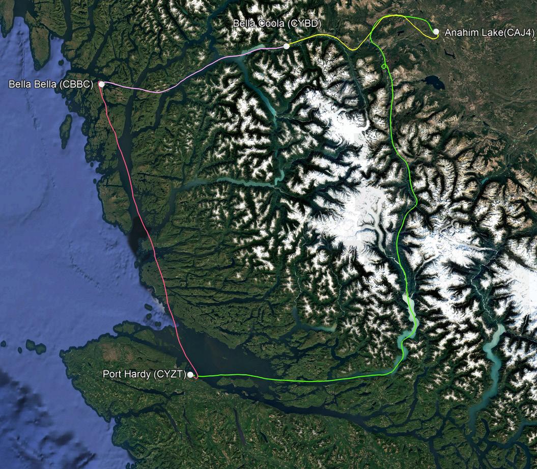
Our four flight tracks.
Routing
• Fly VFR routes if possible—most of BC is remote and rugged, and published routes generally give the best combination of emergency landing options and places to be found
• Overfly the route multiple times beforehand — Foreflight™ and other tools provide simulated views at altitude WEIGHT & BALANCE
• W&B is always important, but weight is especially critical when mountain flying
• Leave behind any gear you can— assumes a base such as car and/or hotel
SAFETY GEAR & SERVICES
• Life jackets — large portions of this mission have water as the only emergency landing option
• Shoes/boots (not sandals)—in case you need to walk out of an off-airport landing
• Emergency locator beacons—Zoleo™ or Garmin InReach™can provide an extra option to be found via satellite
• Remember the survival gear mantras: "If you don't have it on you, you won't have it with you" (egress time may be limited) and "Two is One and One is None" (redundancy, e.g. have at least two ways to make a fire as one may fail)
• Capture weather and flight info beforehand —phone service and Wi-Fi are non-existent en route and may also be unavailable at remote airports
• Take sufficient water & proteinrich snacks as they could be difficult/ impossible to obtain at remote airports
Other
• Paper map(s) are highly recommended because they: 1) have open and continuously know where you are — it is easy to take a wrong turn at a valley fork, making an emergency canyon turn necessary 2) are immune to overheating and battery failure
• A blood pulse oximeter is a cheap/ easy way to periodically check for hypoxia
• Extra battery packs& cables—a safety item for your personal nav/comm devices but also consider them for keeping cameras going. But beware of battery duplication between passengers and crew (the weight adds up).
Cyzt Base
Prior to mission day we flew to Port Hardy (CYZT) and checked into our favourite hotel, the Kwa'lilas. While still at CYZT we also picked up a rental car. I can’t comment on service at other National locations (main website touts catering to general aviation), but whenever we have rented in Port Hardy the manager, Hyder, always goes out of his way to meet us at our non-airline arrival times.
Base camp established we then had our favourite Port Hardy supper… pizza from Mo's Restaurant.
MISSION DAY & HIGHLIGHTS
We left all non-essential items in the hotel and car. Then I triple checked the weight & balance and captured all relevant weather information.
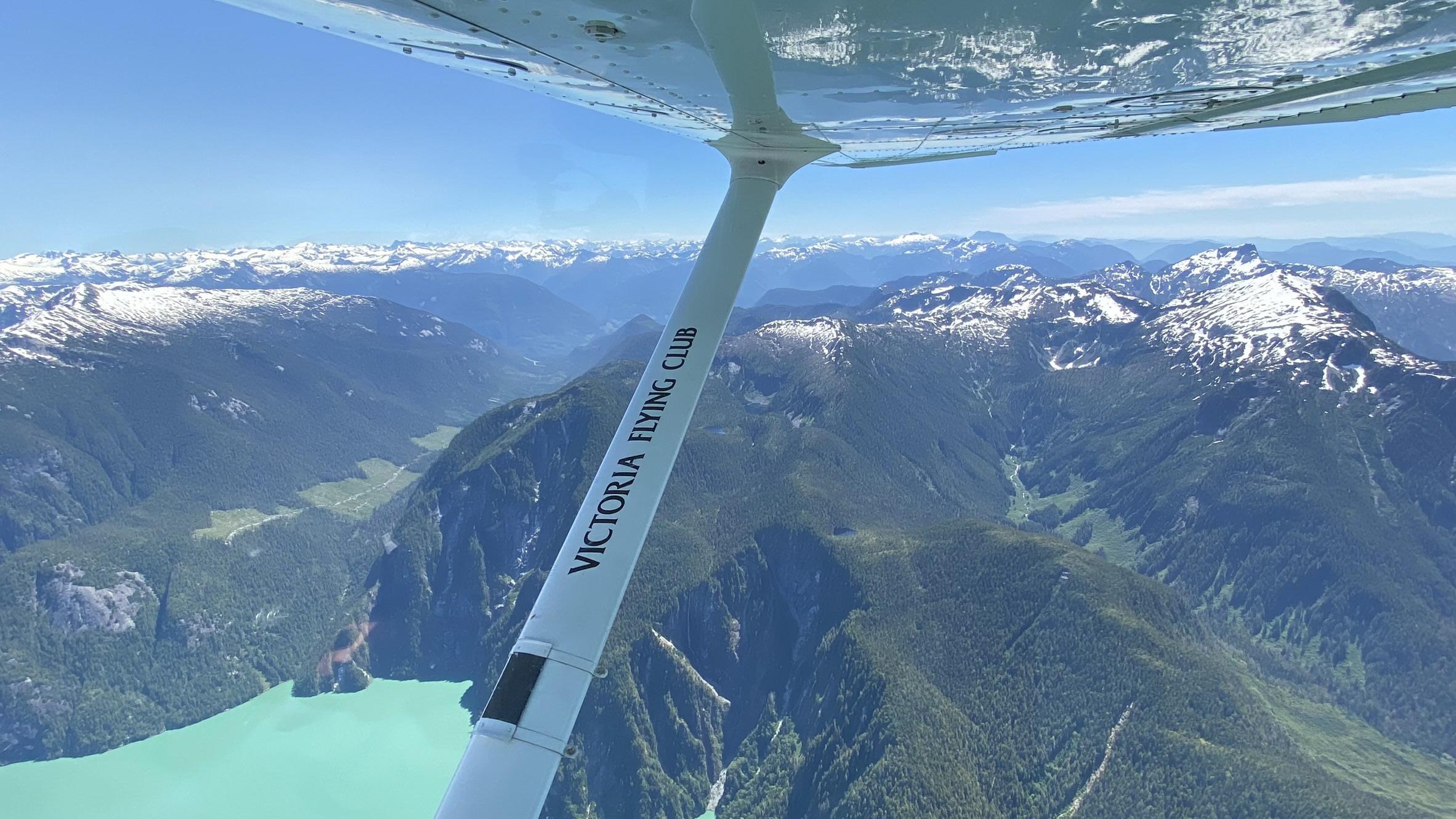
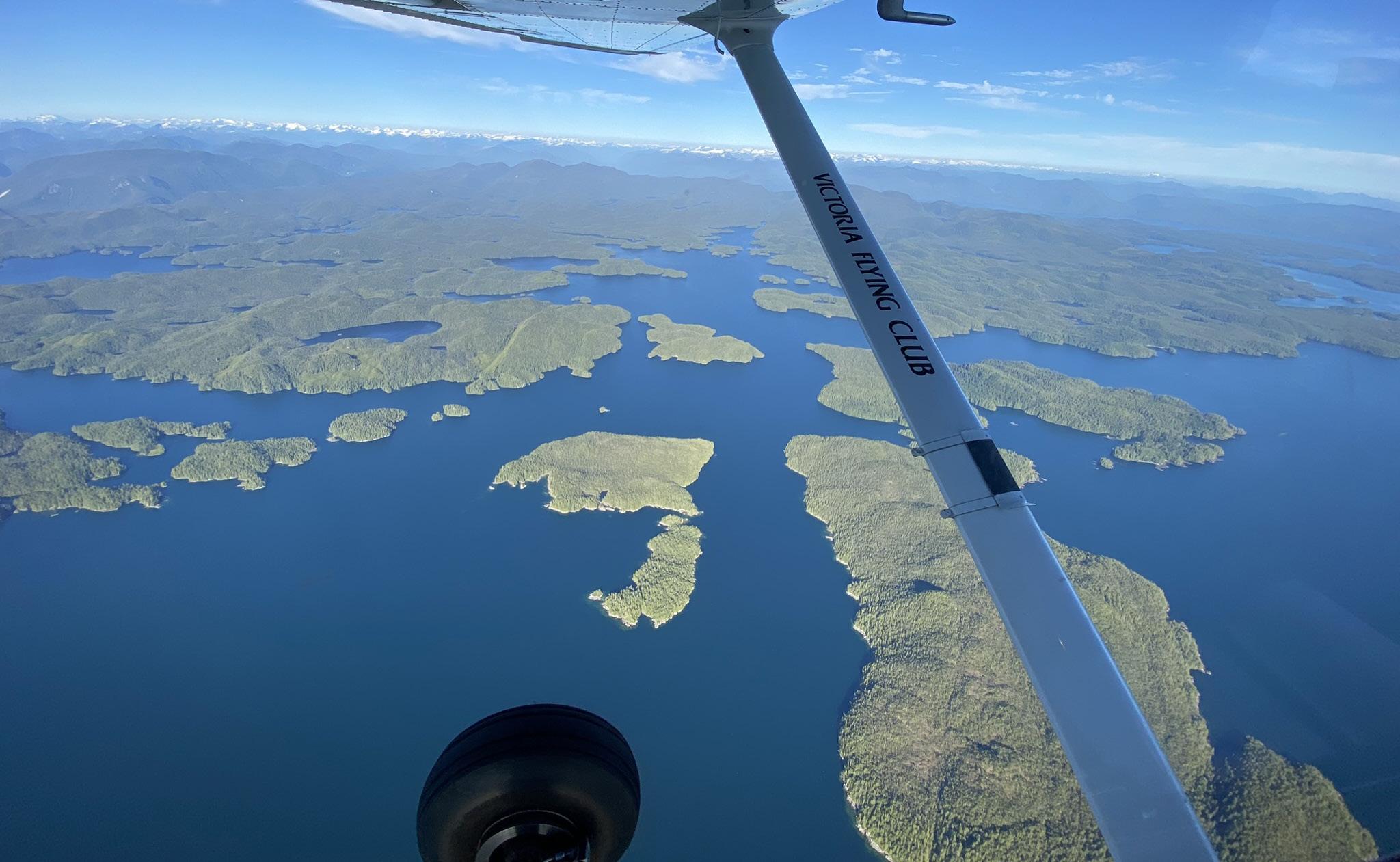
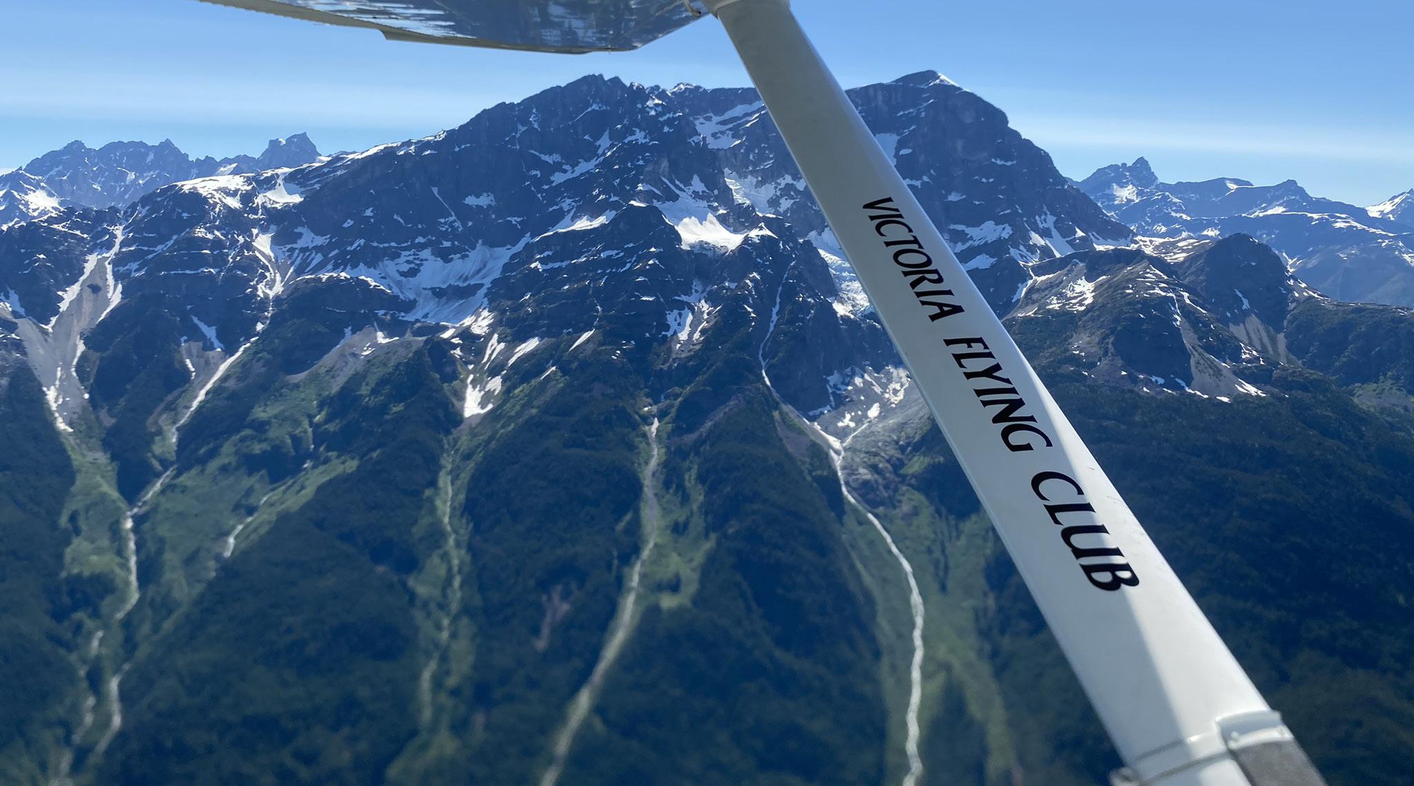
Finally,we departed following the Vancouver Island shoreline due east toward Knight Inlet. Yes, we tend to forget that the island is not lined up north-south and in fact the top part of the island has an east-west orientation. After turning left at Knight Inlet, we proceeded northward on a climb to 6500 ft..
Moving upstream, towards the mouth of the inlet, the water became increasingly milky green in appearance due to the glacial run-off.
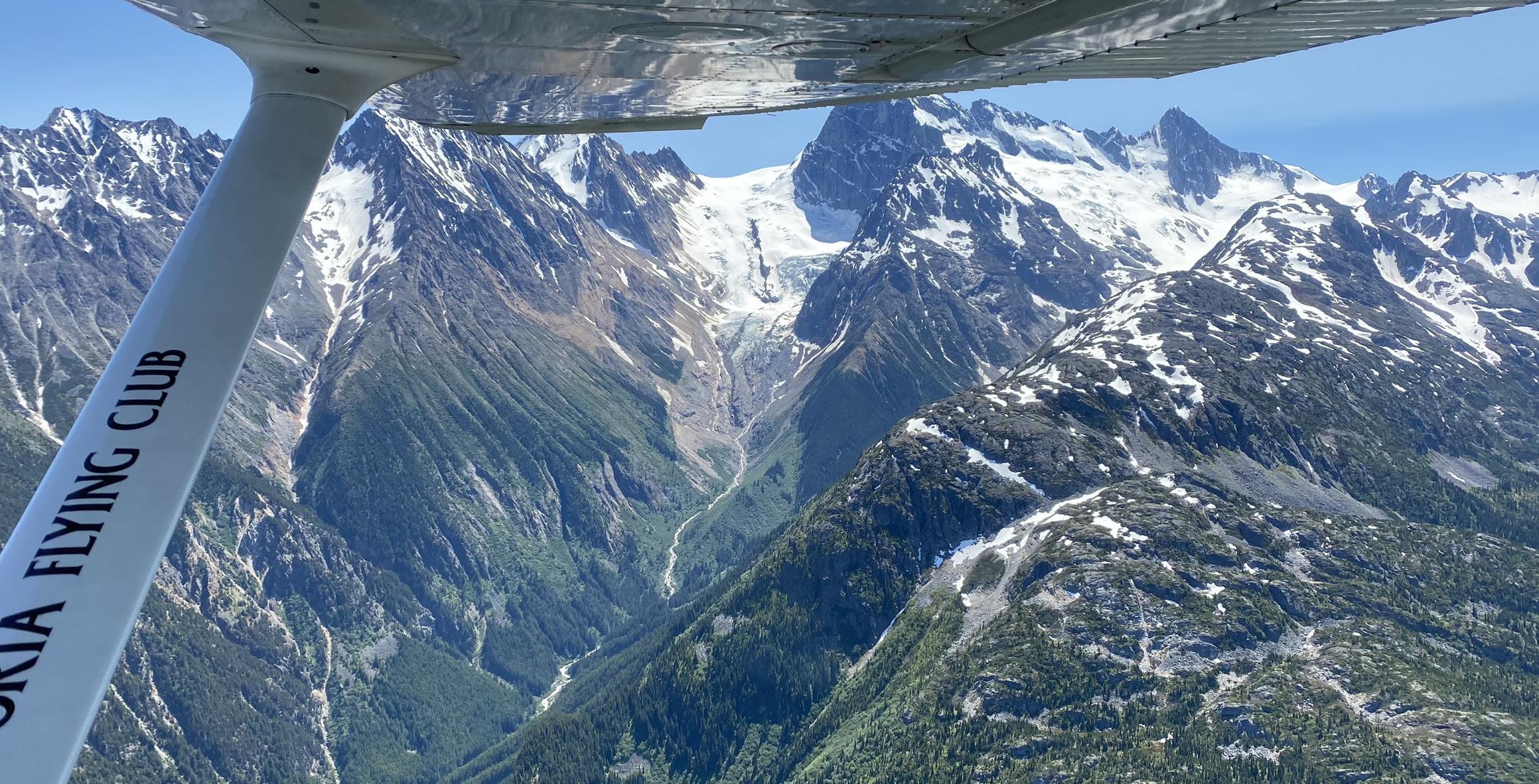
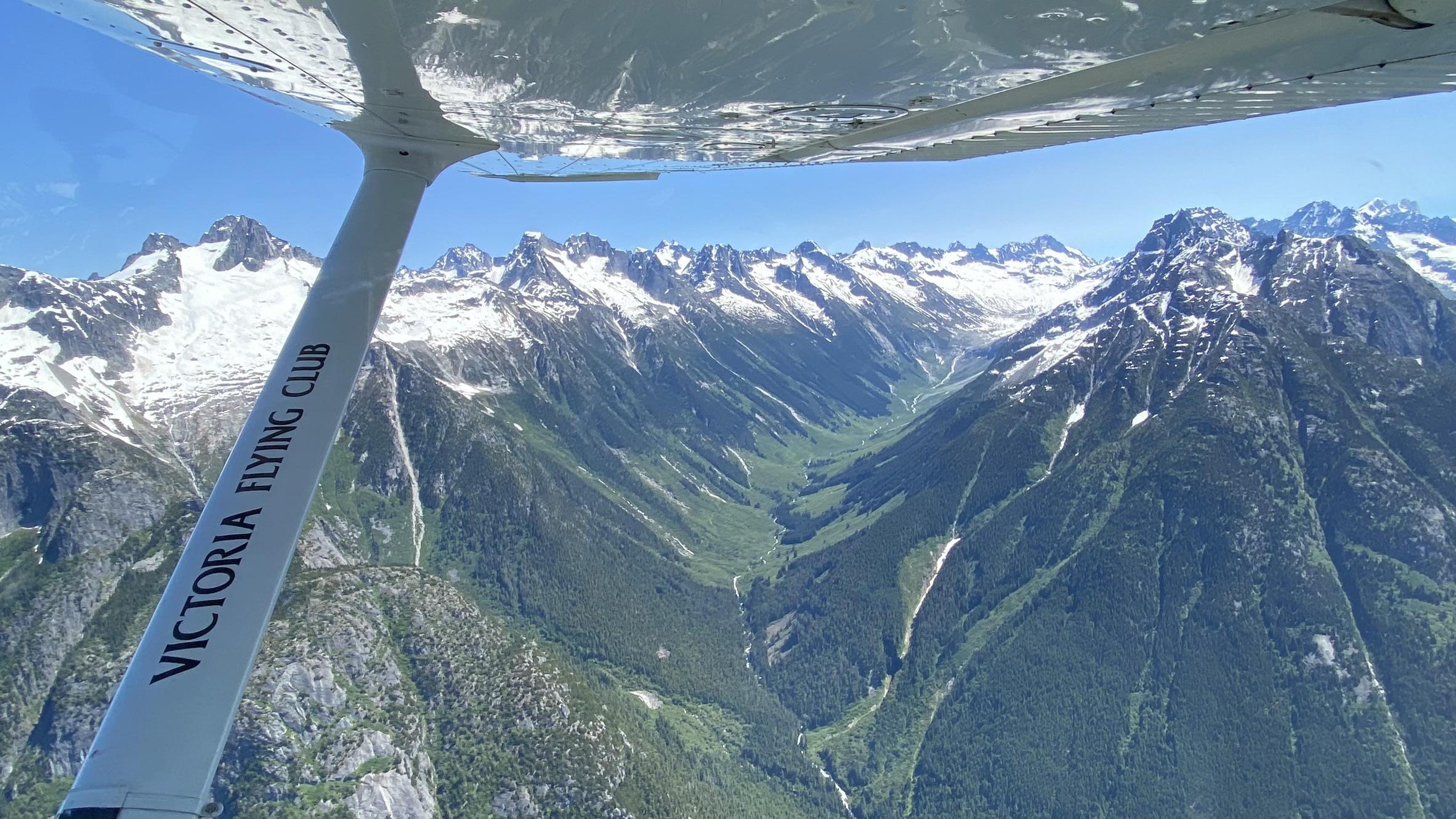
Then we started passing by a series of stunning mountains and glaciers. So many glaciers!
Highest Mountain
Further along, on the starboard side,we were treated to views of Mount Waddington. At 13,186 ft.. it is the highest British Columbia mountain peak that lies entirely within the province.
Highest Waterfall
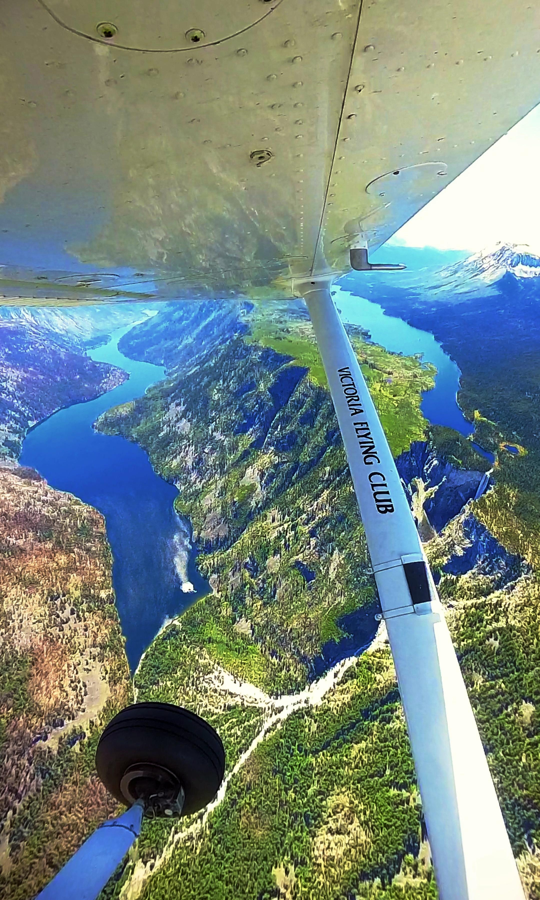
Nearing the top of our northbound track we came to Hunlen falls. It is

Another glacier in Waddington Range.
Canada's highest free falling waterfall, depending on which free falling definition is used. Water from Turner Lake above drops vertically 850 ft.. at the start and in total cascades 1,316 ft. down to Lonesome Lake . We flew one orbit around the falls (small loop in the green track above — video clips at johnbullock.net/mountain-flying) and then continued north to the Atnarko waypoint and the start of the Chilcotin Plateau.
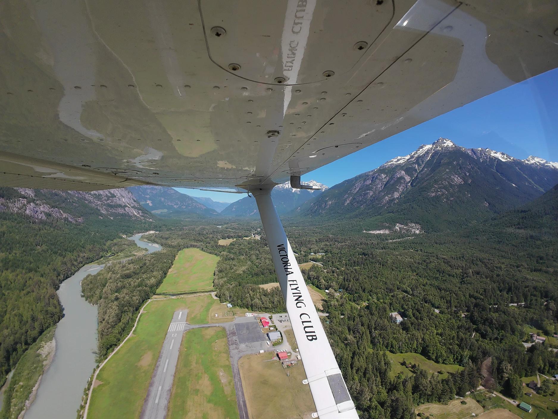
Next, we headed east over the infamous Bella Coola Road — 18% grades but, you know, … we’re flying :) After only a few minutes flying we were over strangely flat terrain and preparing for the quick descent to Anahim Lake (CAJ4).
Highest Airport
At 3644 ft. MSL Anahim Lake is Canada’s highest airport with commercial traffic. Temperature on mission day was 31°C so density altitude calculations and awareness were crucial.
After landing we took on a small amount of fuel and then departed for our third leg of the day. We retraced our path over the crazy switchback highway. This time however, we continued westward and prepped for the long descent into Bella Coola (CYBD).
Just prior to the descent we passed Stupendous Mountain, an impressive snow-covered peak with an awesome name (see cover photo).
least it makes the winds line up nicely with runway 23.
After departing Bella Coola,we followed a westward track to Bella Bella (CBBC). There, after landing, I had my first experience at being marshalled to a stop. This probably only happened because the ground crew was already out prepping for departure of the twice- daily Pacific Coastal flight to Vancouver.
Landing at Bella Coola was gusty as expected. Early afternoon heating causes surface winds to channel through the narrow valley, concentrating them near the airport. At
Finally, we began our fourth and final leg back to Port Hardy. The day was so clear that during the one-hour flight we imagined we could somehow see Japan off the starboard wing :)
Debrief
We encountered no traffic on the first three flight legs and saw no people on the ground at the first two airports. We also heard no radio calls other than a couple far away position reports. After departing Port Hardy,the first real sign of life was the marshaller at Bella Bella.
• On a remote mission like this, be prepared to be selfsufficient for the duration
On the take-off roll at Anahim Lake I went full rich out of habit. Wrong! I caught it on the roll but that is not the time.
• Document/flag any nonroutine density altitude procedures you’ll need — from the POH:above 3000 feet, LEAN to obtain maximum RPM
• Our departure for next day’s return to CYYJ was delayed by 6 hours due to a heavy marine layer over CYZT.
• Marine fog at Port Hardy is common. Carefully plan your alternates going into CYZT. And stay in touch with dispatch if your return to CYYJ is delayed
CAPTAIN'S LOG: SUPPLEMENTAL
This mission was two years in the making. Aircraft availability along with several days of near-perfect weather can take a while to line up, plus we had a string of personal scheduling conflicts. If this happens to you,consider a shorter mission that covers most of the highlights. Either way, your preparation and persistence will be rewarded stupendously.
Now that's a Stupendous Mountain.
