
50 minute read
Utah Historical Quarterly, Volume 84, Number 4, 2016

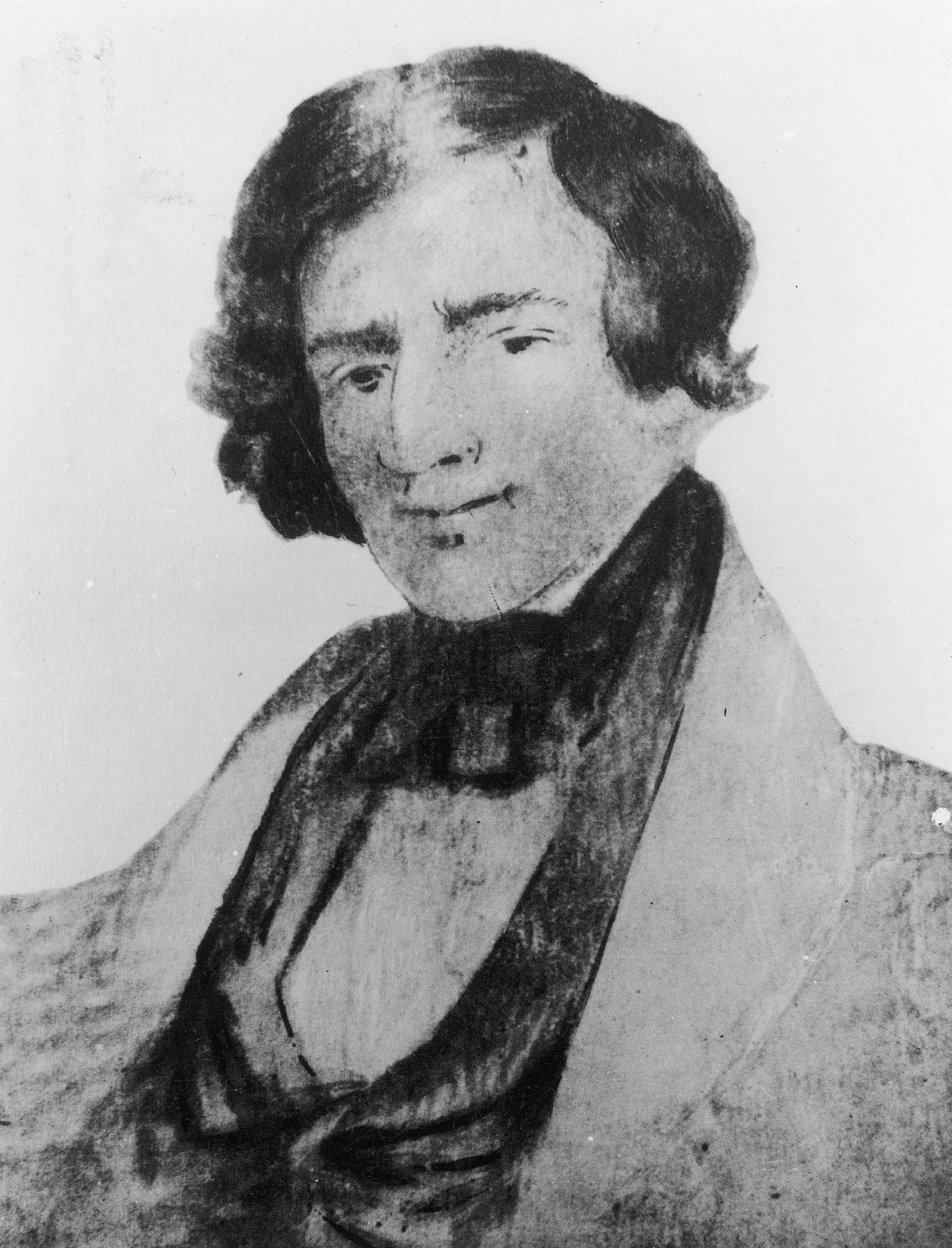
Earliest known image of Jedediah Smith, circa 1835. This sketch is said to have been done from memory by an acquaintance after Smith’s death.
USHS
Rethinking Jedediah S. Smith’s Southwestern Expeditions
BY EDWARD LEO LYMAN
The first American explorer of central and southern Utah was Jedediah Strong Smith, perhaps responsible more than anyone of his generation for opening the West to settlement. The historian and Smith biographer Dale Morgan wrote that while Smith was not professionally trained like his two admired predecessors, Meriwether Lewis and William Clark, and exploration was not his primary purpose, “he saw more of the West than they did.” And although “he entered the West when it was still largely an unknown land; when he left the mountains, the whole country had been printed on the living maps of his and his fellow trappers’ minds. Scarcely a stream, a valley, a pass or a mountain range but had been named and become known for good or ill.” Smith’s travels influenced mapmakers, especially John C. Frémont, whose maps and reports informed Mormon settlement in the Great Basin. 1 Yet due to his early death, Smith was little appreciated until publication of Morgan’s biography in 1953 elevated Smith in the pantheon of western figures. 2
Despite recent interest in Jed Smith and other mountain men, historians and “buffs” have generally ignored the 1977 publication of a year-long journal covering Smith’s most important early travels, including exploration of the territory that would became Utah. Except in Edward A. Geary’s excellent book, The Proper Edge of the Sky, this journal has gone almost unmentioned in Utah histories until fairly recently. 3 The most important study to utilize the journal was a biography of Smith by the Boise State University professor Barton H. Barbour, though this, too, has not received much attention in Utah. 4 This essay seeks to rectify this, reminding and reacquainting readers with the role of a truly important figure in the exploration and thus, indirectly, the settlement of Utah and the West. In particular, I detail Smith’s encounter with what was likely the largest band of Southern Paiutes residing in present-day Utah, the Tonequints, along the Santa Clara River. When Smith returned a year later, the village areas were abandoned and only the telling remains of burned wickiups remained. The following recounts the probable series of events involving a brigade of American fur trappers from Taos, New Mexico, that may explain the destroyed Paiute village. James O. Pattie, a member of the Taos trappers, acknowledged attacking that year a Native American band situated somewhere in the greater region. Although no historians have previously suggested this, several of Smith’s journal entries lend credence to the possibility that the victims of the attack were likely members of this Tonequint band.
In February 1822 William H. Ashley, the former first Lieutenant Governor of Missouri and founding partner with Andrew Henry of the Missouri Fur Company, placed an advertisement in a St. Louis newspaper offering employment to enterprising young men seeking to make their fortunes trapping beaver in the Rocky Mountains. Smith answered the notice, as did several others who would likewise gain fame in the American fur trade. 5 One of Smith’s early notable feats, with Thomas Fitzpatrick, was the more practical rediscovery of South Pass across the Continental Divide in southeastern Wyoming. 6
Within two years of being hired by Ashley, the twenty-four-year-old New Yorker became a partner in the fur trade company after Henry retired. The next year the Ashley-Smith Company devised the rendezvous system to trade the beaver pelts for essential merchandise and liquor brought from St. Louis by Ashley-sponsored trade caravans. This allowed trappers to stay at their hunting grounds year round. The second of these gatherings was held at Cache Valley, near the future location of Hyrum, Utah. 7 Just prior to that gathering, Ashley sold his majority share in the company to Smith, David E. Jackson (an experienced company trapper and namesake of Jackson Hole, Wyoming), and William L. Sublette (a foreman of a trapping brigade called a booshway). These new partners took over the firm named Smith, Jackson and Sublette. 8
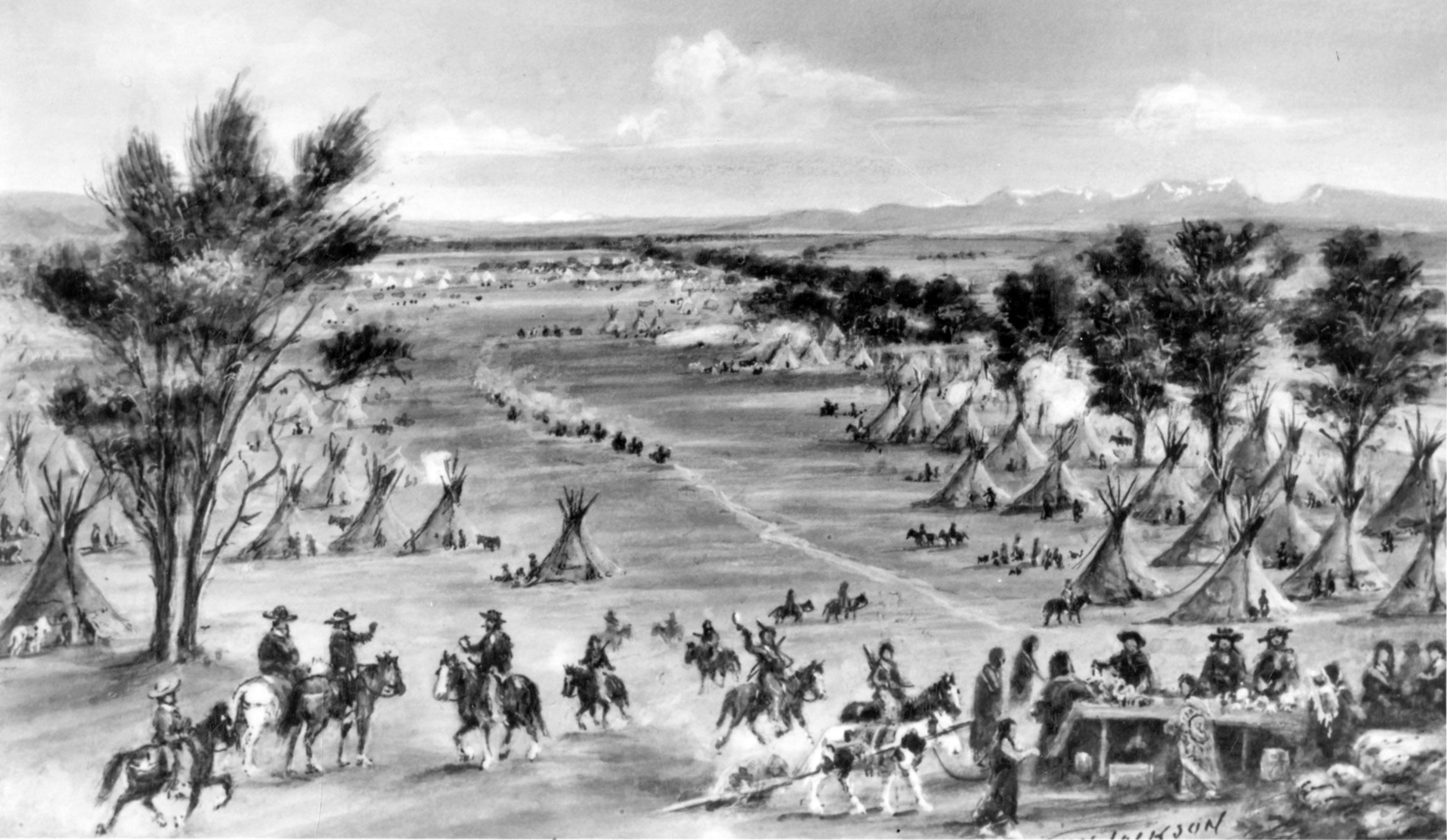
“Trappers Rendezvous,” taken from a print of a William Henry Jackson painting. A celebrated photographer, Jackson painted this and nearly one hundred other works in his later years.
USHS
On August 7, 1826, one of the last days of the rendezvous, the new partners discussed dividing the forty-two trappers employed by the company into two groups. The larger group, led by Sublette and Jackson, would seek beaver in the Snake River country. The other, led by Jed Smith, would travel southwest into a little-known region in search of new trapping areas. Smith enthusiastically embarked on this expedition, acknowledging that he did not know “what that great and unexplored country might contain” but that he hoped to “find parts of the country as well stocked with Beaver as the waters of the Missouri which was as much as we could reasonably expect.” Besides this logical commercial desire, Smith also admitted a personal compulsion: “in taking charge of our southwestern expedition, I followed the bent of my strong inclination to visit this unexplored country and unfold those hidden resources of wealth and bring to light those wonders which I readily imagined a country so extensive might contain.” He then added a revealing confession that “I wa[nted] to be the first to view a country on which the eyes of white man had never gazed and to follow the course of rivers that run through a new land.” 9
Smith and his men embarked southward from the rendezvous at Cache Valley in mid-August 1826, making their way past Utah Lake into Spanish Fork Canyon in search of one of the primary Ute chiefs, apparently Conmarrowap. When they met somewhere between Diamond Fork and Soldier Summit, Smith inquired about beaver trapping locations and was directed to a place farther east, probably on the White or Price River, which after two days of trapping did not impress the experienced fur hunters. 10 Subsequently, after looking east from a high mountain ridge and not seeing anything promising in the direction of the Green River, they embarked southward through a mountainous portion of later Carbon and Emery Counties and emerged into the western segment of Salina Canyon. At the site of Salina, Sevier County, Smith’s fur brigade encountered a group of Native people who fled as Smith and his men came into view. An elderly woman who did not flee 11 told the new arrivals that the Sevier River coursed south to north through the bottom of the adjacent valley and that the local people called themselves Sanpach (Sanpitch Utes). 12 Smith appears to have conflated these Ute band members with the Southern Paiute, whose lands extended from near that point to several hundred miles farther south. The Southern Paiute owned fewer horses than many of the more mobile and aggressive Ute bands. The term horseless Ute later became synonymous with Paiute or for those of mixed Ute and Paiute blood.
Smith observed that Paiute timidity and presumed “wildness” was actually a reasonable fear of outsiders stemming from previous Ute and New Mexican slave trader raids in the vicinity. 13
These raiders were notorious for brutally killing and mutilating Paiute men who defended their people. Numerous women and children had been forcibly taken to New Mexico and sold as slaves or indentured servants. Smith noted that each group of families had a stack of combustible material nearby ready to burn in the event of an approach by strangers so that their fellow tribesmen would be warned. Smith reported that the alarm fires spread “over the hills in every direction with the greatest rapidity” and that the same individuals quickly took their possessions and hurried away into the hills for refuge from the perceived danger. 14 This was corroborated in the next decade by Father Pierre Jean de Smet. 15
According to Smith’s account, the Paiutes ate roots—probably a variety of the parsnip or sego lily—that they baked in pits under a bed of coals, then mashed for consumption or storage for winter. They also consumed venison and rabbit meat, as well as other foods. Smith considered these Indians to be better fed than most commentators have assumed, and he was also more positive about their dress, although he did not consider them nearly as clean as the Utes he had previously encountered. Still, Smith exhibited a certain bias toward these Native peoples; like most of his contemporaries, he favored the Utes and considered the Paiutes to be of inferior intelligence. 16

The Southwest Expedition of Jedediah S. Smith, published in George R. Brooks, ed., The Southwest Expeditions of Jedediah S. Smith: His Personal Account of the Journey to California, 1826–1827.
The fur trapping party sought beaver pelts in the Sevier where Smith had noted sign of their habitation, but after several days they concluded that their intended prey was scarce and unusually wild. Smith decided to move on. At this juncture the Smith party crossed the western extension of the Wasatch Mountains by way of Clear Creek Canyon and the summit ridge to Cove Creek Canyon. From a high mountain point, after traveling out of the south end of Cove Creek Valley, Smith looked southward and reported “the [Indian] smoke telegraph was seen on the hills [toward later Beaver] during the day as usual.” 17 Upon arriving in the vicinity of Beaver, they encountered two Native Americans who remained to observe the brigade members after the rest of their Paiute band had fled. Smith learned little from the frightened men but began the process of establishing friendship by giving the two Paiute men who remained gifts, probably a knife and some glass beads. Once again the brigade tested the river coursing from the relatively high mountains to the east but was not encouraged by the prospects of trapping in the area, and after two more days the group continued southward. 18
Smith and his brigade went south along the western foot of the adjacent mountains, following what would become Interstate 15, and struggled down the lava rock-strewn Black Ridge beyond the rim of the Great Basin into far southwestern Utah. Narrowly missing the Parusits band village (later headed by Chief Toquer) on lower Ash Creek by keeping west, they cut southward to the Quail Lake area, after which they followed the Virgin River a short distance. In that vicinity they saw an abandoned corn field, which much surprised them, although had they stayed longer on Ash Creek they would have seen another even better-developed field. The brigade followed the river banks through potential farmland, where in 1854 Mormon explorers would find Paiute cornfields and Native American men and women busily clearing brush and cottonwood trees to plant even more crops. The Mormons would do the same after taming the flood-prone river and sowing the productive Washington and St. George fields. 19
The group then traveled up the adjoining Santa Clara River tributary a short distance. There, on about September 22, 1826, they spotted several cautious Native Americans and finally encountered one willing to communicate with them. This member of the large Tonequint band of Paiutes offered a rabbit as a token of friendship and after Smith responded with like gestures of cordiality, several other tribesmen appeared and each presented corn ears as tokens of peace. The brigade traded some trinkets and bits of iron, popular for making arrow points and knives. Although they enjoyed antelope meat while crossing Beaver and Iron counties, the trappers had only their own horse meat to eat since passing the Black Ridge.
Smith was particularly impressed with the dam and irrigation ditch adjacent to the Santa Clara River and with the nearby corn and squash fields, more carefully developed than anything he had seen since the Mandan Indian fields on the Missouri River in Dakota Territory approximately a thousand miles away. This aspect of Tonequint and Moapa band Paiute culture was truly impressive in its sophistication compared to virtually any other tribal group in the American West. The visitors, with considerable elation, acquired a good supply of vegetables in trade from their hosts. Smith was so impressed with the clouded green marble (from the Grand Canyon) fashioned into smoking pipe bowls by many of the men that he later sent one to his friend William Clark. Many of the Paiute men wore caps fashioned from the skull hide and fur of antelope or mountain sheep, with the ears still attached, something almost never noted elsewhere in the ethnographic literature regarding these people. Because of previous losses of women and children to slaver attacks, Smith’s men saw only male Tonequints on this visit—the others would have been in hiding since the first smoke signal. While most of the trapping party rested, others went southwestward to determine their future travel route. 20
The chosen route proved to be one of the most difficult in the region, taking the brigade through the Virgin River Gorge of the later Arizona Strip. In at least one place, the men were compelled to unload their horse packs and swim the animals and equipment across the river, which featured a good number of narrow canyons and impressively high rock walls. After exiting the Virgin River Gorge into the Littlefield, Arizona area, the party encountered signs of beaver. The habitable area appeared insufficient for long term productivity, and thus the brigade moved on down the Virgin River. 21
While visiting other Paiutes in the farming areas of the Moapa band on the Muddy River, Smith and his men encountered two visiting Native Americans whom Smith and his later journal editor George R. Brooks agreed were members of the Mohave tribe, partly because they claimed to reside on the lower Colorado River. These men stated that there were many beaver on the Colorado and adjacent tributary streams and that their people had numerous horses to trade. Along with his wanderlust, this convinced Smith to shift the journey in that direction, even though he had intended to head elsewhere.
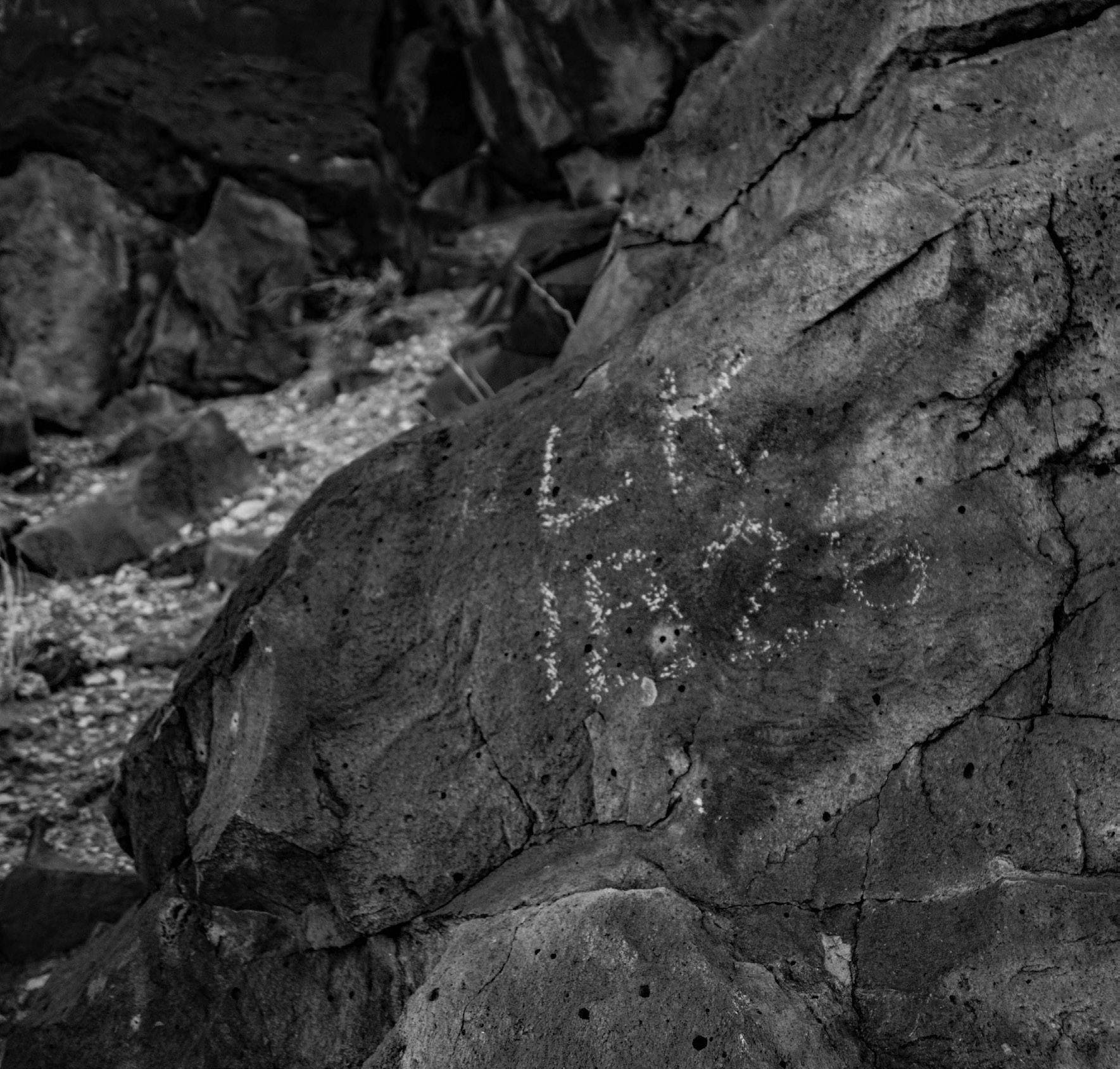
This rock inscription, dated 1826 and located in Washington County, Utah, may well have been made by a member of the Smith party and is likely the oldest Euro American marking in the entire region.
After a difficult journey along the Colorado and a brief visit and some trade with the Mohaves in the Needles, California, area, Smith determined that the good beaver trapping areas were actually considerably farther downstream near the Arizona tributaries of the Colorado. He also realized that the availability of horses had been overstated. Accordingly, the Smith brigade and two Desert Serrano Native American guides made their way across the East Mojave Desert westward and headed into the populated portion of Mexican southern California. 22
Reaching southwestern California, Jed Smith had achieved another great accomplishment: he was the first American to travel overland from the Missouri River to the Pacific Coast of California. Along with his crossing of the entire Great Basin from north to south and trailblazing of the long middle segment of the Old Spanish Trail—linking the two previously explored sections and completing a transcontinental pack mule trade route from the Pacific to the United States—Smith had achieved three of his greatest accomplishments. 23
The Americans were not made welcome in the Mission San Gabriel–Los Angeles area and had difficulty obtaining permission from Mexican governmental authorities to leave. They finally secured an exit visa by promising to immediately vacate California, which they did not do. Instead, the brigade made its way northwest to the beaver-rich streams of the San Joaquin Valley. Smith left all but two of his men in that great valley to trap, while he traveled toward the Sierra Nevada. After initial difficulty and the loss of two horses, Smith and two of his men, Robert Evans and Silas Goble, successfully crossed the formidable range, the first Americans to have done so. They then crossed the dry expanses of Nevada from west to east and traveled northeast through west-central Utah, traversing the Great Basin for the first time in that direction as well.
Upon reaching the southeastern corner of the Great Salt Lake, the three men encountered the mouth of the Jordan River at flood stage. Since Evans and Goble could not swim, they fashioned a raft and Smith guided them through yet another obstacle. Incredibly, they reached the third annual fur trade rendezvous at Bear Lake, Idaho, just a few days after Smith had promised his partners that he would return after a journey of no less than 1,400 miles.
After holding business meetings with company officials and spending time trapping, Smith recruited another eighteen trappers to follow the same general route to reunite with his men in California. Historians have generally assumed that the party would then travel to the mouth of the Columbia River in Oregon, a longtime objective of Jedediah Smith, then back toward the Rockies in time for the 1828 rendezvous. In midsummer, after the trading was completed, Smith, the new recruits, and Goble hurried toward Utah Lake. They encountered more Ute headmen, who told Smith that another party of American trappers from New Mexico had recently traveled through southern Utah. 24
Because this stopover of other American trappers ultimately proved fateful to Smith’s men and a large Utah Paiute band, it is important to discuss in detail this group of rival trappers. 25 Some six months after Smith’s first visit to the Colorado River in the autumn of 1826, American-born Ewing Young led a brigade including James Ohio Pattie and other naturalized Mexican citizens towards the Mohave villages from the south. By this time the Mohave people were much more apprehensive about such visitors, illustrated by the crying of some children and women as recorded by Pattie. 26 Pattie’s biographer, Richard Batson, has suggested that Mexican officials at Los Angeles, disturbed by Smith’s earlier semi-legal incursion into California from the east, had convinced the Mohaves to discourage other trappers from entering the province from that direction. Batson also asserted, with some documentary evidence, that Smith, whose second expedition over the same route would suffer terribly later that year, expressed similar suspicions. 27
After Ewing Young’s brigade passed through the upper Mohave village, it continued upstream several miles and pitched camp. Immediately thereafter, about a hundred Mohaves followed what Pattie described as a “dark and sulky” Indian, presumed to be their chief, into their camp; by sign language, this Indian demanded a horse. When Young refused, the chief indicated through gestures, pointing at the Colorado River and then at the full packs on the horses and mules, that the horse was assumed to be legitimate payment because the visible beaver pelts had been trapped in the Indians’ domain. This would have been considered a fair proposition between white bargainers, as the Mohaves doubtless understood. 28 But the Americans firmly refused this proposal. Pattie correctly inferred that the chief meant that the river, its tributaries, and all resources taken therefrom belonged to the Mohave tribe, that they should be paid for the valuable beaver pelts, and that a horse was reasonable compensation.
After the Americans again refused, the chief stood with what was described as “a stern and fierce air,” made “a peculiar yell,” and “immediately shot one of his arrows into a tree” some distance away. Ewing Young aimed his own rifle and dramatically shot the warning arrow in two, which Pattie said bewildered the angry Indians. After these expressions of hostile intent, the Mohaves withdrew from the campsite area. The chief later reappeared with the same demand and Young ordered him to leave with a harsh tone of voice and demeanor so that the chief could understand his message. As the chief departed, urging his horse to a quick gallop, he thrust a spear through one of the nearby horses, and four trappers promptly shot him. 29
Awaiting the inevitable attack, the entrenched trappers prepared their main advantage, which was that each of some twenty men had a second rifle or musket loaded and ready for use. When the Mohave finally attacked it was through a huge shower of arrows fired from a surprisingly far distance, inflicting no known casualties. The Mohaves then charged and the trappers fired their first volley from over a hundred yards away. With their secondary firearms, the trappers mounted a countercharge as the Mohaves fled. Pattie claimed that sixteen Native Americans were killed in the battle. 30 There is a reasonably reliable account of the same conflict recorded from Mohave oral tradition that essentially agrees with the chain of events leading to the conflict, including the battle. This part of the account simply states that “some of the Mohaves were killed.” There is no way to ascertain which version is more accurate. 31
When Jed Smith’s second brigade visited the same village a few months later, they became the surprised victims of the altered Mohave attitude toward visitors. 32 The conflict with Pattie and his fellow trappers established precedent for subsequent interaction between the Mohave and Euro Americans. 33 Maurice Sullivan, who located and edited the longer known portion of Smith’s diary, quoted a segment he called a “brief sketch,” wherein Smith charged that “the governor” of California, Jose Maria de Echendia, “had instructed the Muchaba [Mohave] Indians not to let any more Americans pass through the country on any conditions whatever.” Sullivan correctly concluded that Smith overreacted by attributing the massacre of his men on the Colorado River to the governor’s unfair treatment. Sullivan later pointed to evidence suggesting other possible causes for the tragedy, but the material he included gives some credence to Smith’s allegations. 34
Barton H. Barbour has more reasonably suggested that “it seems far more probable that the Mohaves’ recent conflicts with other ‘American’ trappers persuaded them to punish the next ones that came their way.” He reinforced this by stating that “a [Mohave] tribal tradition suggests that the violence may have been sparked by disagreements over payment for the Mohaves’ assistance,” which likely referred to the Mohave claims that they had provided the Americans with good beaver trapping opportunities on the Colorado River. 35 Indeed, when these additional facts are known, it becomes clear that the primary cause of the new animosity was due to the Young-Pattie group’s exploitation of fur resources without proper compensation for beaver pelts that the Mohaves reasonably believed belonged to them.
Pattie’s account corroborates that of the Mohaves—that after the first exchange of fire, he and his men promptly packed their camp and headed up the Red (Colorado) River. 36 For three nights the trappers remained vigilant, expecting another attack. On the fourth night, March 12, 1827, by Pattie’s reckoning, the men were so exhausted that they did not erect their protective fortifications. At eleven o’clock that night the Native Americans unleashed a huge shower of arrows that killed two and wounded two others and escaped with no casualties. Pattie stated that one of the dead had been sleeping at his side and that his own bed bristled with sixteen Mohave arrows. In the morning, the eighteen men pursued their attackers and according to Pattie killed “the greater part of that band” and suspended some of the bodies of the dead from nearby trees. 37
Thereafter, Pattie’s trappers traveled north to relative safety. 38 They returned to their accustomed occupation, trapping beaver, with plenty of sentries on guard. Pattie’s account suggests that they did this in the vicinity of present Lake Mead, which even then was so arid that there would have been no vegetation to support beaver. The Grand Canyon to the east, where the trapper’s account stated they went, would not have been any better for their purposes if they could have traveled through it, which was impossible. A number of scholars, mainly anthropologists, have attempted to solve the mysteries raised by Pattie’s controversial account regarding the expedition. The source is seen as particularly unreliable during this segment of their journey. 39
According to the admittedly unreliable Pattie narrative, a week after their skirmishes with the Mohave, the group, still on the Colorado, came to a village of what he called Shuena Indians—a group unrecognizable in known literature on Native Americans. Some have speculated, with no known supporting evidence, that this was a Shivwits Paiute village on the northwest rim of the Grand Canyon in extreme northwestern Arizona or westward toward Lake Mead. Pattie stated that as his men approached, the Native Americans “came out and began to fire arrows upon us. We gave them in return a round of rifle balls.” The ruthless Pattie, who had participated in the killing of sixteen Mohaves the previous week, recorded that his men laughed heartily as the Indians tried to dodge the rifle balls, having never before heard the report of a rifle. In the diary account, the victorious trappers then “marched through the village without seeing any inhabitants, except the bodies of those we had killed.” Immediately thereafter, Pattie claimed, they divided the party; half of them trapped while the others kept up vigilant guard duty. He stated that trapping in this region was productive. 40
There is no beaver stream close to the Shivwits domain, including the Colorado River itself in the Grand Canyon gorge. Pattie also stated they encountered snow up to eighteen inches deep. His probable route in April was along the canyon rim, a region devoid of beaver. But just what his route was is not clear; other scholars have judged this segment of Pattie’s narrative to be unreliable. 41 It is doubtful that there was ever even one central village on the north rim or elsewhere with any significant population in the entire Shivwits territory. The band was never particularly numerous and their homeland possessed virtually no water sources other than a few invaluable seeps and springs that could not sustain a large population.
Another irreconcilable portion of the account is that just after the battle with the Paiutes, the men observed the river coursing north, “flowing through a rich valley, skirted with high mountains, the summits white with snow.” 42 Mount Dellenbaugh, just east of most Shivwits lands, might have had snow in April, but beaver trapping areas on a north-flowing river through a rich valley do not even come close to fitting the topography of that region. 43 Anthropologists have speculated that Pattie’s narrative must have occurred along the Colorado River because there seemed to be no other possible explanation for the account.
Smith’s diary provides information to support a far more logical—if not yet proven—alternative explanation for these baffling events. According to Smith, at Utah Lake the Utes informed him that such men had traveled through southern Utah: “The Utas had told me of some men that came from this direction [south] last spring and passed through their country on their way to Taos.” The members of this group, according to the Utes, had “nearly starved to death.” 44 The Smith diary does not describe his second brigade’s route for the hundred miles beyond Utah Lake, but it is unlikely that they would have again detoured up Spanish Fork Canyon. They probably followed the west slope of the Wasatch Mountains as Smith, Sublette, and Jackson employee Daniel Potts had done the previous year. Somewhere near the Joseph, Sevier County, area he observed the hoof prints of horses and mules. In Smith’s words: “I saw tracks of horses and mules which appeared to have passed in the spring when the ground was soft. These tracks were no doubt made by the party the Indians spoke[n] of [while still among the Utes at Utah Lake].” 45
The Smith brigade then crossed over the chain of mountains at Clear Creek as their predecessors had the year before. Smith led them into the Beaver, Utah, area to the stream he had named the Lost River. Here, Smith and his men encountered numerous Paiutes, who had almost all fled upon his arrival during his earlier journey. This time, Smith reported “they came to me by dozens. Every little party told me by signs and words so that I could understand them, of the party of white men that had passed there the year [season] before, having left a knife and other articles at the [then-abandoned] encampment when the Indians had run away.” Smith offered the Paiutes some small presents before continuing on the route. 46 After following the future course of Interstate 15, the group went up the Santa Clara River where the previous year Smith had visited and traded with the Tonequint Paiutes. This time they discovered that the village was abandoned. As the trappers examined the area they found burned-out wickiups; as Smith wrote, “Not an Indian was to be seen, neither was there any appearance of their having been there in the course of the summer. Their little lodges were burned down.” 47

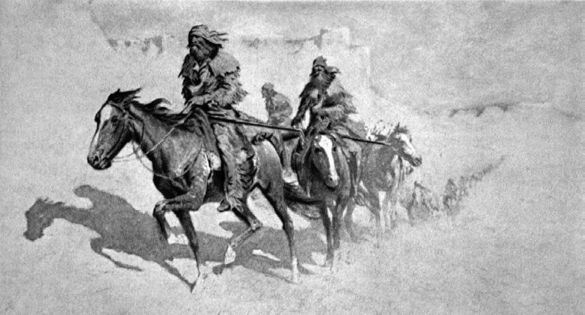
“Mountain Men,” by William Henry Jackson.
Reconsideration of the actions of the Young-Pattie brigade sheds light on this tragic mystery. We might surmise that Pattie’s group continued up the Muddy-Virgin River tributary to the Colorado and headed farther north instead of following the barren and beaver-scarce Colorado River toward the Grand Canyon. These men were primarily fur trappers, preoccupied with finding better beaver-hunting habitat. The Colorado River above the Mohave villages was a very poor location, at least until its junction with the Virgin, since that area was—and is— almost completely desert. On the other hand, the lower Virgin River was fine beaver habitat, as another group of American trappers that included Pegleg Smith and George C. Yount discovered just two years later. 48 The Pattie trappers might have looted, assaulted, and destroyed the village of the Tonequint Paiutes. Pattie even acknowledged in his account that his men had attacked some Native Americans. Hopefully further relevant source materials will eventually be located, but in the meantime, this should be considered the most likely chain
Farther upstream the adjacent Virgin River curved to the north and coursed through the fertile valley later known as the St. George and Washington Fields, fitting Pattie’s narrative of a northern flowing river and a rich fertile valley. Just to the northwest, the often-snow-capped (even in April) Pine Valley Mountains stand prominently against the skyline. This area fits the Pattie narrative’s description of landforms far better than any other in the greater region. If the fighting encounter occurred near the Virgin, which is a far more probable location after a week of travel and trapping, it would much more likely have been a fight between the trappers and the Tonequint Paiutes instead of with the Shivwits band. Admittedly, the matter cannot be entirely proven either way, though Smith’s diary offers substantial corroborating evidence for the present scenario. 49
Other pieces of evidence pointing to the Pattie group traveling through Utah into Colorado is that Smith saw horseshoe tracks likely belonging to Pattie on the bank of the Sevier River. Two months earlier Smith had heard from Utes that a group from Taos had passed through the region, and it seems plausible that the tracks belonged to Pattie as he passed through the Wasatch by way of Salina Canyon. This is bolstered by the fact that even in Pattie’s narrative the group is said to have traveled to near the confluence of the Green and Colorado rivers. As Joseph J. Hill of the Bancroft Library argued in 1923, the Green River closely fits Pattie’s description of “another part of the river [the Green], emptying into the main river [the Colorado] from the north.” 50 The party then trapped on this river for two days and encountered a band of Indians—probably Southern Utes but possibly a smaller segment of the “large party of Shoshones” whom they met and quarreled with several days later. It is entirely unlikely that the Western Shoshones (from northern Utah, Idaho, or Wyoming) would have ventured south of the Colorado River anywhere remotely close to Navajo country (then exclusively in New Mexico and Arizona) where the Pattie narrative places some of these events. Since the Shoshones had recently attacked a company of French trappers on the headwaters of the Platte River, probably in the vicinity of Longs Peak, it is more likely that the Green River was the actual location of the route. This is particularly likely since the Pattie group reportedly then traveled in the same direction to Longs Peak. 51
The second Smith party arrived at the northern Mohave villages in the late summer, probably August 1827, and traded for several days. The Mohave concealed their violent intent and awaited the proper opportunity. That occasion came on the third day of the stopover as nine of the trappers pushed cane grass rafts loaded with goods into the Colorado. The Mohave attacked with their war clubs, quickly killing ten on the east bank, while also attacking Smith and his remaining men in the river. The severely wounded Thomas Virgin, along with the other eight, were able to reach the far bank. The remaining men expected to meet the same fate as their slain companions, given that they only had five rifles between them and some Mohaves were crossing the river. Smith ordered the survivors to gather against the river and gave his best marksmen the guns. When the Mohaves on the west side indicated that they were ready to approach the survivors, the marksmen killed two and wounded one at a long distance, discouraging further attacks. After nightfall, with no horses, the remaining men headed west across the desert with their goods on their backs. They arranged to locate water each day and, in less than a week, reached another “inconstant” stream—the Mojave River.
Following the dry streambed southward, they soon encountered several friendly Paiutes with whom they traded cloth, knives, and beads for two horses, some water containers, and a little food. Continuing down the Mojave—which Smith knew would lead the group toward the southern California population center—they finally descended Cajon Pass into the San Bernardino Rancho area, a satellite property of the more distant San Gabriel Mission. Smith knew several of the mission priests, and he allowed several steers to be killed without permission, with most of the meat dried for travel.
Leaving Thomas Virgin with an attendant to recuperate from his wounds, the brigade returned up the Cajon, ignoring the law that all incoming foreigners report to the Mexican government. Upon reaching the top of the pass, they turned west toward the Stanislaus River in the San Joaquin Valley. By September 18, the date Smith had promised to return by, the brigade had rejoined Smith’s other trappers. To help with the lack of supplies, a friendly chief and some other members of the Mokelumne Indians provided food; the group still had sufficient traps, gunpowder, and lead. After Smith had reorganized his fur trapping groups, he set out with several Indians for the San Jose Mission, hoping to persuade the priests to assist him with Governor José María de Echeandía. 52
The governor soon issued a warrant for Smith’s arrest, believing the American to have insurrectionary intentions. Arrested and jailed, Smith appealed for prompt attention to his case but waited in discomfort for a month before his first hearing. Fortunately, Echeandía trusted Smith’s English translator—William Hartnell—as much as he distrusted Smith. Smith had also engaged four American sea captains willing to back him; they persuaded the governor to let them assume responsibility for Smith until he had left California. This won Smith his freedom, and as soon as the former governor Luis Antonio Argüello approved the route Smith proposed to take upon departure, he was released.
Upon release, Smith sold most of his beaver pelts for a low price and generated $4,000 with which to resupply and acquire some sixty horses, plus mules and cattle. As the time for departure approached Smith selected eighteen men from the remaining employees to accompany him to the mouth of the Columbia River in Oregon Country. This journey took from early January to late June 1828, mainly because there was no trail through the wilderness throughout the north, and thus Smith had to blaze the route—another major achievement. Along the trek, he noted that “some of the cedar [redwood] were the noblest trees [he] had ever seen, extremely tall and with trunks measuring 15 feet diameter.” This was in the area of what would later become the Jedediah Smith State Park, north of Crescent City, California, near the Oregon border. 53
Later, faced with crossing the Umpqua River near present-day Reedsport, Oregon, Smith sought a fording place for the cattle they had driven with them to avoid the difficult boggy lands adjacent to the riverbanks. He, two companions, and an Indian guide borrowed a canoe and explored along the river. As Smith departed, he warned the man he left in charge—Rogers—not to allow any Umpqua Indians to enter their camp. There had already been several conflicts with local Native Americans, including one rather serious involving the loss of the last remaining axe, which resulted in severe punishment for the suspected thief. There were also earlier disputes due to trading. However, Rogers did not keep the Indians out of the camp, and on the fateful morning of July 14, 1828, some two hundred Native Americans gathered as the remaining sixteen exhausted trappers slept, cleaned their rifles, or ate breakfast.
The historian Barton Barbour writes that “the [surprise] attack came with lightning speed and staggering ferosity.” Fifteen of the trappers were killed quickly in terror and pain. One man, Arthur Black, escaped into the forest and would survive, despite injury. 54 The three river-bound trappers were returning to their camp when a Native American on the riverbank shouted something to their Indian guide, who immediately reached for Smith’s rifle and capsized the canoe. The three trappers swam for the opposite shore “amidst a hail of musket balls and arrows.” After surveying the campsite from a safe distance and seeing no movement, they escaped toward the Pacific shoreline to the west, then north to Fort Vancouver, the British Hudson Bay Company headquarters at the mouth of the Columbia River. Black had gotten there before them. The company chief, Dr. John McLoughlin, and his men assisted Smith in retrieving much of their equipment, horses, and furs from more friendly Native Americans. Most of this was purchased by the British, who also allowed the survivors to remain at the headquarters until the following spring, when Smith and Black reunited with his partners in Idaho. The company had prospered since he had left, but within another year the partners were all prepared to sell their company shares. 55
At that time, at only thirty-one years old, Jed Smith attempted to retire and purchased a farm in Ohio. He clearly intended to rewrite his diaries for publication and hired a man to copy and edit his maps. He also planned to write a book about his experiences in the West and on the region itself. However, a year later, likely bored with the inaction of retirement, he became involved with a commercial venture hauling freight over the Santa Fe Trail from Missouri to New Mexico. This demonstrated that, in Barbour’s words, the retired mountain man’s economic security “had not eclipsed his love for exploration.” Dale Morgan speculated that, since Smith knew the majority of the West well, such a venture would fill in the last gap in Smith’s knowledge of the geography of the region he intended to write about. During this time Smith considered in the future taking a job as a guide to one or more of the government’s planned topographic expeditions. 56
Smith’s caravan departed St. Louis on April 10, 1831, with twenty-two mule-pulled freight wagons. About a month later, in dry country, the wagon train came to the Cimarron Cutoff, which if sufficient water could be found would save valuable time getting the goods to market. Naturally, Jed Smith was one of those selected to venture out ahead, along with seasoned mountain man Thomas Fitzpatrick to locate water sources. When they found a depression in the terrain, they decided to dig a well. Smith moved on to investigate farther west. He was last seen through Fitzpatrick’s spy glass from about three miles away. According to secondhand information from traders and associates of the Comanche warriors who encountered Smith alone at a waterhole, the warriors surrounded him and, when his horse nervously whirled around, shot him in the back. Still able to shoot, the fearless Smith is said to have killed the Indian chief before himself being killed. His body was never recovered, but eventually his firearms turned up in New Mexico and were obtained by family members. This was a tragic but not unexpected end for one who had spent much of the last eight years in danger. Still, it was a tragedy for the nation to lose one of its greatest explorers when he was so young and had yet to write about what he had discovered. He died at age thirty-two. 57
Jedediah S. Smith’s two main biographers have emphasized his major accomplishments, yet no one has sufficiently addressed the breadth of knowledge he recorded on the lands and peoples of what would become Utah. When John C. Frémont’s main biographer, Allan Nevins, was ready to publish his work, he planned to entitle it “Frémont: The Great Pathfinder.” But like many other Americans at that time, he belatedly commenced to discover the extent of Jed Smith’s initial discoveries. After the man had been then almost completely forgotten for several generations, Nevins instead titled his work Frémont: Pathmarker of the West. This tacitly acknowledged that the expedition’s guides, primarily Kit Carson, would have first learned about much of the West from Smith, who had been dead and almost forgotten for most of a century prior to publication of Nevin’s biography. Although Smith had prepared his diaries and a map of his travels for publication, he died before completing that project. “It is now clear that had his map of the West been published shortly after it was drawn,” surmise Dale Morgan and Carl Wheat, “it would have advanced public understanding and appreciation of this vast and complex area by at least fifteen years, and in some portions by even more.” 58

A. H. Brue’s 1834 map of the northern reaches of Mexico. This map clearly shows information derived from Jedediah Smith, including Smith’s southern route in 1826. It is “noteworthy as the earliest attempt by a cartographer to display Jedediah Smith’s actual route on a map,” according to Dale L. Morgan and Carl I. Wheat, Jedediah Smith, 18.
Another aspect of Smith’s exploration that deserves more recognition is his role in opening the so-called Old Spanish Trail from Santa Fe to Los Angeles in 1829. Smith blazed the longest part of the trail—from Salina Canyon in east-central Utah through the southwest portion of Utah, Arizona, and Nevada, to Needles, California. LeRoy R. Hafen wrote that prior to Smith, who proved the route to be practicable, “no party would have set out with an organized pack horse train of goods to barter in California” because the route was unknown. As word-of-mouth news of Smith’s journey reached the New Mexico province, caravans began to head for California. 59
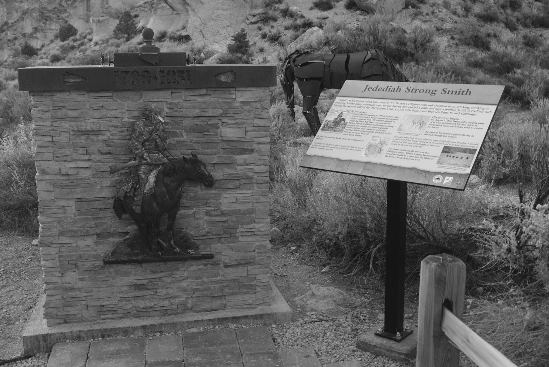
Jedediah Smith monument, Frémont Indian State Park.
Except for a few comments a half century earlier by Padres Dominguez and Escalante, Jedediah Smith was the first Euro American to offer any details regarding the life ways and challenges of Utah Southern Paiutes, including insights into the impact of the New Mexican slave trade in their region. His record also helps to resolve the perplexing question of what happened to the Tonequint village on the Santa Clara River first visited by Smith and his men in 1826 but then abandoned the year following. In his travel account, James O. Pattie admitted that he and his men attacked and killed an undetermined number of Native American men somewhere in the Colorado River region, and it seems probable based on Smith’s corroborating evidence that Pattie was responsible for destroying the Tonequint village. It was only a temporary abandonment, though; in 1854, when the first Mormon missionaries came to settle on the Santa Clara, the village was again flourishing with up to eight hundred residents. Unfortunately, in the 1860s and 1870s, tragedy returned when the population was devastated by several smallpox epidemics to which few Native Americans had much immunity. Two decades later, the neighboring Shivwits Paiutes were offered and moved to the former Tonequint lands on the Santa Clara.
— Edward Leo Lyman, a contributor to the Quarterly for over forty years, taught high school and college history classes in California. For the past dozen years he has been semiretired, residing with his wife, Brenda, and daughter, Genevieve, in Silver Reef, Utah. He continues to research and write western history, while teaching upper-division courses at Dixie State University each semester. He is currently writing a history of the Southern Paiute Tribe.
—
WEB EXTRA At history.utah.gov/uhqextras, we produce an interactive map—with diary excerpts and images—of Jedediah Smith’s southwestern expedition.
1 Dale L. Morgan, Jedediah Smith and the Opening of the West (1953; Lincoln: University of Nebraska Press, 1964), 8–9. Dale Morgan and Carl I. Wheat contend that “though no original map drawn by him has yet been located, it has long been known that certain contemporary maps were directly influenced by his efforts, and the recent discovery of what amounts to a direct copy of a map of the West drawn by him near the close of his brief but adventurous career has afforded much new light on his travels and achievements.” Wheat had discovered an early map of John C. Frémont’s, who had notes on many portions of the map—apparently drawn from information indirectly contributed by Jedediah Smith, who had by then been deceased almost twenty years. Experts have since concluded that after Lewis and Clark, Smith was indeed still, in his way, among the first great map makers of the West. See Dale L. Morgan and Carl I. Wheat, Jedediah Smith and His Maps of the American West (San Francisco: California Historical Society, 1954), 2–3.
2 Biographies of Smith’s contemporaries published in the mid-twentieth century include LeRoy R. Hafen and W. J. Ghent, Broken Hand: The Life Story of Thomas Fitzpatrick, Chief of the Mountain Men (Denver: Old West Publishing, 1931); Stanley Vestal, Jim Bridger, Mountain Man: A Biography (1946; Lincoln: University of Nebraska Press, 1970); Elinor Wilson, Jim Beckwourth: Black Mountain Man, War Chief of the Crows, Trader, Trapper, Explorer, Frontiersman, Guide, Scout, Interpreter, Adventurer, and Gaudy Liar (Norman: University of Oklahoma Press, 1972); Sardis W. Templeton, The Lame Captain: The Life and Adventure of Pegleg Smith (Los Angeles: Westernlore Press, 1965); Harvey L. Carter, “Dear Old Kit”: The Historical Christopher Carson (Norman: University of Oklahoma Press, 1968).
3 George R. Brooks, ed., The Southwest Expeditions of Jedediah S. Smith: His Personal Account of the Journey to California, 1826–1827 (Glendale, CA: Arthur H. Clark, 1977; reprint, Lincoln: University of Nebraska Press, 1989), 38–78; Edward A. Geary, The Proper Edge of the Sky: High Plateau Country of Utah (Salt Lake City: University of Utah Press, 1992), 28–32. At a conference of the Missouri Historical Society in 1967, Dale Morgan appealed for citizens to search the attics of St. Louis for the portion of Smith’s diary that until then had long been lost to researchers and others. It was found four months later. Not only is this document the key source for this entire piece, it also lends several insights into Smith’s motives as an explorer.
4 Barton H. Barbour, Jedediah Smith: No Ordinary Mountain Man (Norman: University of Oklahoma Press, 2009).
5 In Smith’s second year of trapping he survived an Indian attack near the confluence of the Grand River with the Missouri, where fifteen of Ashley’s other men were killed by Arikara Indians. See Barbour, Jedediah Smith, 22–24.
6 Morgan, Jedediah Smith, 7, 90–92.
7 For more on the typical rendezvous system, see Bernard DeVoto, Across the Wide Missouri (Boston: Houghton Mifflin, 1947).
8 The sales agreement stipulated that the new partners would purchase Ashley’s remaining stock of merchandise for $6,000 after Smith’s share was deducted. This would be paid in beaver fur at $3.00 per pound.
9 Brooks, Southwest Expedition of Jedediah S. Smith, 36– 37.
10 Ibid., 40–47. This is the invaluable diary—rediscovered in 1967 but not published until 1977—that covers the first Smith expedition to the San Joaquin Valley to trap beaver in 1827.
11 Ibid., 47–48. Smith asked the woman to approach their camp, and one of the men offered her a badger, which she cooked. When finished eating, the men offered her other small presents and sent her to inform her people that the visitors were friends who wished to converse with their men.
12 Brooks, Southwest Expedition of Jedediah S. Smith, 48–49. Smith observed that these Indians were larger than average in stature but “in the mental scale lower than any [he had] yet seen” in the intermountain region. He described their dress as leggings and shirts made of deer, antelope, and mountain sheep skins, also noting that in “appearance and actions they were strongly contrasted with the cleanliness of the [other] Uta’s.”
13 Ted J. Warner, The Domínguez-Escalante Journal: Their Expedition Through Colorado, Utah, Arizona, and New Mexico in 1776 (Salt Lake City: University of Utah Press, 1995), 91–107. The diarists noted a dozen times that the Paiutes were timid or cowardly. Antonio Armijo, who followed a portion of their trail over half a century later, stated when he came to one Paiute village near later Pipe Springs, Arizona, that they were “a gentle and cowardly nation.” See LeRoy R. Hafen and Ann W. Hafen, Old Spanish Trail: Santa Fé to Los Angeles (Glendale, CA: Arthur H. Clark, 1954; reprint Lincoln: University of Nebraska Press, 1993), 158–69.
14 Brooks, Southwest Expedition of Jedediah S. Smith, 50– 53.
15 Father Pierre Jean De Smet, a Jesuit missionary, stated that “since one seldom sees more than two, three or four of them [the Paiutes] at the same time, it is impossible to know how many of them there are. They are so timid that a stranger would have difficulty in approaching them. As soon as they see someone, be he white or Indian, they raise an alarm.” He continued that up to four hundred persons might be observed “running to hide in inaccessible rocks at this signal, it may be presumed that they are very numerous.” De Smet’s estimate, drawn from other eyewitnesses, was probably too high due to years of incursions by slave trade raiders. See Robert C. Euler, Southern Paiute Ethnohistory in University of Utah Anthropological Papers no. 78 (April 1966): 45–46, for a full copy of the comments first published in R. J. P. DeSmet, Voyages aux Montag Rocheuses (Lille, Paris, 1845), which proves to be most difficult to locate in this country, and Reuben G. Thwaites, Early Western Travels, 1748–1846 (Cleveland: Arthur H. Clark, 1906), vol. 27, “De Smet’s Letters and Sketches,” 2:165–68. See also Sondra Jones, Trial of Don Pedro Leo Lujan: The Attack against Indian Slavery and Mexican Traders in Utah (Salt Lake City: University of Utah Press, 2000), and idem, “‘Redeeming’ the Indian: The Enslavement of Indian Children in New Mexico and Utah,” Utah Historical Quarterly 67 (Summer 1999): 220–41.
16 Brooks, Southwest Expedition of Jedediah S. Smith, 48– 49.
17 Ibid., 53.
18 Ibid., 54.
19 Juanita Brooks, ed., Journal of the Southern Indian Mission: Diary of Thomas D. Brown (Logan: Utah State University Press, 1972), 52. See also Brooks, Southwest Expedition of Jedediah S. Smith, 54–55.
20 Brooks, Southwestern Expedition of Jedediah S. Smith, 56–64.
21 San Francisco Bulletin, October 26, 1866.
22 Brooks, Southwestern Expedition of Jedediah S. Smith, 64–65, 72–77.
23 Ibid., 68–72. Smith had blazed the huge middle segment of the subsequently named Old Spanish Trail, linking the two portions blazed exactly a half-century earlier by fathers Atanasio Domínguez and Sylvestre de Escalante from Santa Fe to Utah Lake, and that of their Franciscan counterpart, Father Francisco Garcés, from Needles, California, to the Pacific Coast. Smith’s segment covered well over half the distance.
24 Maurice S. Sullivan, The Travels of Jedediah Smith: A Documentary Outline, Including His Journal (Santa Ana, CA: Fine Arts Press, 1934; reprint, Lincoln: University of Nebraska Press, 1992), 27, containing the 1827–1828 segment of his journal.
25 Sullivan, Travels of Jedediah Smith, 29–30; Morgan, Jedediah Smith, 239–41. See also William H. Goetzmann, ed., The Personal Narrative of James O. Pattie (Philadelphia: J. B. Lippincott, 1962, a replication of the 1831 unabridged ed.), 85.
26 David J. Weber, The Taos Trappers: The Fur Trade in the Far Southwest, 1540–1846 (Norman: University of Oklahoma Press, 1968, 1970), 92–93, 96–97, 125–26. This might also have been because the Mohaves had heard of the party having previously killed Papago Indians on the Gila River and some of their own people had been killed as well. See also, Goetzmann, Narrative of James O. Pattie, 85.
27 Richard Batson, James Pattie’s West: The Dream and the Reality (Norman: University of Oklahoma Press, 1981), 175. Batson argues that the fright of the women and children upon seeing Pattie indicates that someone had been spreading “horror stories among the Mohaves.” See Goetzmann, Narrative of James O. Pattie, 23.
28 Batson, James Pattie’s West, 175–77; Goetzmann, The Personal Narrative of James O. Pattie, 85–86.
29 Pattie confessed apprehension during the night of a possible arrow attack. No further action came even early next day, giving the trappers time to erect some “hasty fortification.” Goetzmann, The Personal Narrative of James O. Pattie, 86.
30 Ibid., 86.
31 Cultural Systems Research, Inc., “Mojave,” Joshua Tree: The Native American Ethnography and Ethnohistory of Joshua Tree National Park—An Overview (2002), accessed September 9, 2016, nps.gov/parkhistory/ online_books/jotr/history7.htm. See also A. L. Kroeber and C. B. Kroeber, A Mohave War Reminiscence, 1854–1880, University of California Publications in Anthropology, vol. 10 (Berkeley: University of California Press, 1973), 52, which offers little on the subsequent killing of the Smith men but treats general Mohave warfare in the era.
32 Barbour, Jedediah Smith, 162–167.
33 As more travelers began to come through their domain, Native Americans in the far West devised methods of exacting payment from those who refused to pay for livestock feed, water, use of trails, and other resources. Many adopted stealing and wounding passing travelers’ livestock, and this became the general method of exacting tolls along several travel routes from at least 1848 to the 1860s, including through southern Utah. See Edward Leo Lyman, “Relations Between Native Americans and Anglo-Americans on the Western Half of the Old Spanish Trail, 1825–1870: A Study in Contrasts,” Spanish Traces 15 (Winter 2009): 15–19.
34 Sullivan, Travels of Jedediah Smith, 173, n. 97. The editor’s argument against Smith’s allegation stated: “No contrary testimony of provocation has come to light [as it did in the even more horrible massacre in the following year in Oregon]. Mexican civil authorities may have sent presents to the Mohaves and asked them not to allow any more aliens [to] pass through their territory; but it is doubtful if they were ‘instructed to kill all Americans.’” Sullivan continued, arguing that if Mohaves were indeed taking orders from the California authorities, there would have been no stolen horses and truant mission Indians among them. However, other fragments of information within the same documents are more favorable to Smith’s viewpoint. Francisco, a Serrano who initially led the Smith expedition into the San Gabriel area, was later sentenced to execution for having piloted Euro Americans into southwestern California. Thomas Virgin, who stayed in southern California to recuperate, was later imprisoned solely for being a part of the Smith party (Sullivan, 29, 47). Both men reported to Smith what they had learned while residing among the governor’s subject Californios. Thus some basis existed for his conclusion that the Mohaves had been instructed to “kill all Americans coming from that direction.”
35 Barbour, Jedediah Smith, 165.
36 The Mohaves’ version unaccountably stated that the attacking Americans then headed south, which would have taken them through several other concentrations of hostile Native Americans.
37 Goetzmann, Narrative of James O. Pattie, 86–87.
38 As Jedediah Smith and his men struggled down the Colorado the first time, they came to rough hills where the river coursed through a steep ravine. Smith, apprehensive about taking the horses down, had little choice since man and beast desperately needed water. With difficulty all eventually made it to the river and beyond, finding a growth of grass to pasture the horses. Later, Smith noted in his diary that “it was at this place a party from Taos saw my track.” George Brooks concluded that according to presently known source materials, this could only refer “to the Ewing Young party which passed north along the Colorado after leaving the Mohave villages in the winter of 1827,” probably meaning February or March of that year. See Brooks, Southwest Expedition of Jedediah S. Smith, 69– 70.
39 Clifton B. Kroeber, ed., “The Route of James O. Pattie on the Colorado in 1826: A Reappraisal by A. L. Kroeber,” Arizona and the West 8 (Winter 1964): 135–36. Robert Euler’s important final conclusion included in Kroeber’s article stated “it may not at all be possible to analyze the Pattie account in an ethno-historical sense after he left the Mohave villages” (135).
40 Goetzmann, Personal Narrative of James O. Pattie, 85– 88.
41 Kroeber, “Route of James O. Pattie,” 120, states that “many of his experiences appear extravagant and erroneous.” Robert G. Cleland, This Reckless Breed of Men: The Trappers and Fur Traders of the Far Southwest (New York: Knopf, 1950), 186, argues that Pattie’s narrative becomes “almost worthless” from where the Mohave conflicts end. Goetzmann’s introduction to the Lippincott Keystone edition of Pattie narrative terms his travel route “conjectured,” xiii. And Batson, previously cited, stated that during this segment of the account, “the confused geography in this part of the narrative makes it difficult to follow Pattie’s wanderings after he left the Mohave villages,” 178.
42 Goetzmann, Personal Narrative of James O. Pattie, 88.
43 Ibid., 88.
44 Sullivan, Travels of Jedediah Smith, 27. Smith reported no other information on this situation, but this is circumstantial evidence of another possible reason for the brutal attack on the Tonequint Paiute village a few weeks earlier.
45 Ibid., 27. These were likely the tracks of shod animals, which Native Americans almost never used.
46 Ibid., 27–28.
47 Ibid., 28.
48 San Francisco Bulletin, October 26, 1866, a Pegleg Smith obituary. See also Hafen, Old Spanish Trail, 136. They proved so successful, acquiring beaver pelts by midseason, that Smith and a companion were dispatched with full mule packs of pelts to Los Angeles to sell their fur harvest. When the Mormons arrived at the Tonequint lands twenty years later, Thomas D. Brown noted beaver dams situated in the immediate proximity to the main Tonequint village on the Santa Clara. See Brooks, Journal of the Southern Indian Mission, 55.
49 Kroeber, “Route of James O. Pattie,” 129 and n. 21.
50 Joseph J. Hill, “Ewing Young in the Fur Trade of the Far Southwest,” Oregon Historical Quarterly 24 (March 1923): 17–18. Hill wrote that “the Grand-Green confluence [w]as the only neighborhood corresponding to Pattie’s descriptions and permitting of the activities that occurred in the vicinity.”
51 Lewis R. Freeman, The Colorado River Yesterday, Today and Tomorrow (New York, 1923), cited in Kroeber, “Route of James O. Pattie,” 132n29. This source agrees with Hill that Pattie’s account best describes this to be the confluence of the Grand and Green rivers, making the Colorado River in the eastern extremity of southcentral Utah. See also Goetzmann, Personal Narrative, 81–91.
52 Smith’s men had experienced excellent success trapping over the past season, which was evidence their leader had located the kind of hunting grounds he had previously aspired to discover.
53 Morgan, Jedediah Smith, 256–65; Barbour, Jedediah Smith, 190–224.
54 Barbour, Jedediah Smith, 219–26.
55 Barbour, Jedediah Smith, 241, 247–49; Morgan, Jedediah Smith, 320–21. In August 1830, the company dissolved by selling its assets to five fellow trappers, Thomas Fitzpatrick, Jim Bridger, Milton Sublette, Jean Baptiste Gervais, and Henry Fraeb, who organized Rocky Mountain Fur Company. That winter, William Ashley sold the former partners’ large stock of furs at Philadelphia for $84,500, before he took out his substantial commission. When the debts were liquidated and all accounts finalized, each of the three partners received at least $17,500.
56 Barbour, Jedediah Smith, 252; Morgan, Jedediah Smith, 325, 320–21.
57 Barbour, Jedediah Smith, 258–59, 267–70.
58 Morgan and Wheat, Jedediah Smith and His Maps, 17.
59 Hafen and Hafen, Old Spanish Trail, 156, 169, 171, 177–92.
